HIKING THE APPALACHIANS AND BEYOND
  • Home
  • Trail Reports
    • Best Hikes
    • Hikes with Scenic Views
    • Hikes with Water Features
    • Alabama
    • Georgia
    • Florida
    • North Carolina
    • South Carolina
    • Tennessee
    • Vermont
    • Virginia
  • Map
  • Hike List
  • Testimonials
  • Resources
  • Contact Us
  • Southeast Nature Society
    • Our Team
  • Georgia Waterfalls Database

Appalachian Trail: Jones Meadow to Whiterock Cliff, Blackstack Cliffs, and Big Firescald Knob Views, Greeneville, Tennessee

6/30/2018

2 Comments

 
Picture
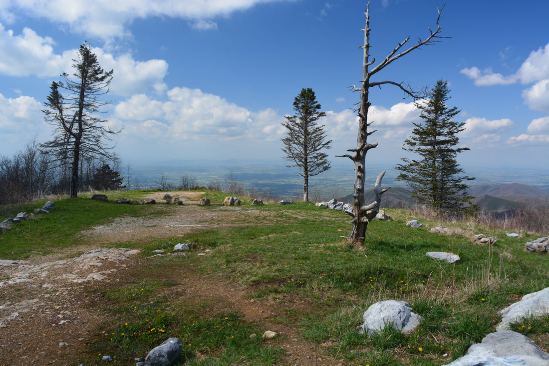
The scenic crest of the Bald Mountains that straddles the Tennessee/North Carolina border south of Greeneville, TN, features a set of spectacular vistas in the vicinity of the Appalachian Trail. The views actually begin even before you leave your car as you arrive at the beautiful Jones Meadow with a panoramic vista of Camp Creek Bald and Blackstack Cliffs. Two excellent vistas are accessed by a very short, easy walk from the parking area: Whiterock Cliff facing south into North Carolina and Blackstack Cliffs facing north into Tennessee. The Appalachian Trail then continues onto a new section, which scrambles along the knife-edge ridge-crest for over a mile across Big Firescald Knob, affording several outstanding 360-degree panoramic vistas. On your return trip, you may choose to follow the alternate bad-weather AT route, a little-used pathway on the north flanks of Big Firescald Knob that adds variety to the hike. This hike occurred on Friday, April 27th, 2018. My plan was to hike the Appalachian Trail from Jones Meadow over Big Firescald Knob, taking side trails to Whiterock Cliff and Blackstack Cliffs along the way. Rather than retracing my steps along the Big Firescald Knob ridge-crest, I would return along the AT bad-weather bypass. This hike was the third of six hikes that I did during a four-day trip to the mountains of northeast Tennessee and northwest North Carolina. 

Summary

R/T Length of Trail: 4.7 Miles
Duration of Hike: 2:20 plus 1 hours and 40 minutes of stopping and sunset photography
Type of Hike: Lasso
Difficulty Rating: 4 out of 10
Total Elevation Gain: 1056 Feet
Pros: Easy to moderate trail to all views; several spectacular vistas
​Cons: None 
​Points of Interest: Whiterock Cliff Views - 6 stars; Blackstack Cliffs Views - 7 stars; Big Firescald Knob Views - 10 stars
Trail Blaze Colors: Appalachian Trail - White; AT Bad-Weather Bypass - Blue; Side Trails to Jones Meadow, Whiterock Cliff, and Blackstack Cliffs - Blue
Best Seasons to Hike: Winter
Fees: None
Beginning Point: Jones Meadow Trailhead
Directions from Greeneville, TN: From the intersection of US 321/Main Street and TN 107/70 Asheville Highway on the southwest side of Greeneville, follow TN 107/70 South for 9.4 miles. Then, stay straight on TN 70 as TN 107 leaves right. In another 5.8 miles, turn left onto Viking Mountain Road. Follow Viking Mountain Road for 8.3 miles to the dead-end parking area at Jones Meadow (ignore the rough road that leaves right to the towers atop Camp Creek Bald). Part of Viking Mountain Road is unpaved, but it's suitable for all passenger vehicles. 

Map

Picture
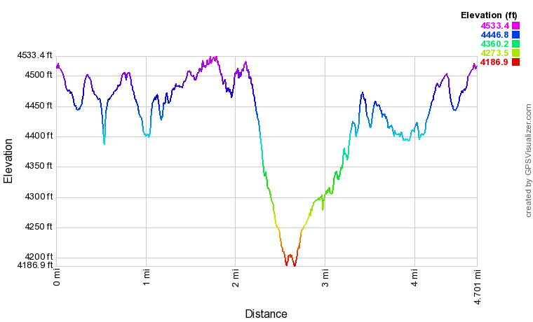
Click the link below to download a .GPX file with a track of this hike. 
appalachian_trail_to_whiterock_cliff_blackstack_cliffs_and_big_firescald_knob.gpx
File Size: 208 kb
File Type: gpx
Download File

Details

The Big Firescald Knob area was pretty high on my list for my northeast Tennessee trip, as it was known to have some of the region's most spectacular views. I had a tough time deciding how to approach it, however. I could've hiked a 10-mile loop from the Big Creek area on the North Carolina side, or I could've hiked an even longer loop from the Dry Creek area on the Tennessee side. The loop from the TN side could've let me bag Margarette Falls and Bailey Falls on the same hike. Ultimately though, I decided to split the day up into two hikes. I went to Margarette Falls and Bailey Falls first, and then, I chose the shortest and easiest version of the hike to Big Firescald Knob - starting from the high-elevation Jones Meadow Trailhead. 

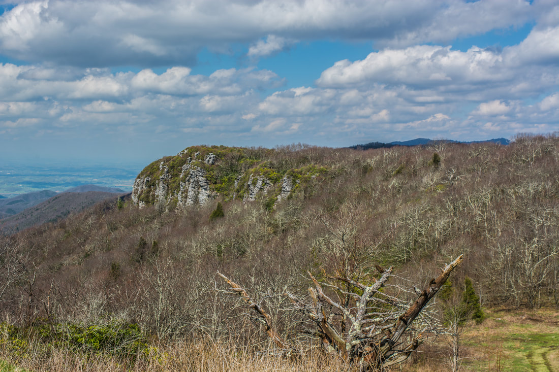
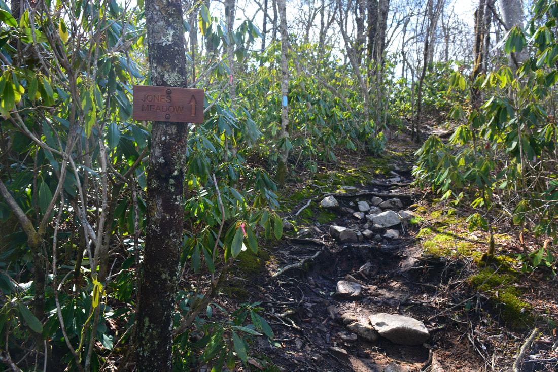
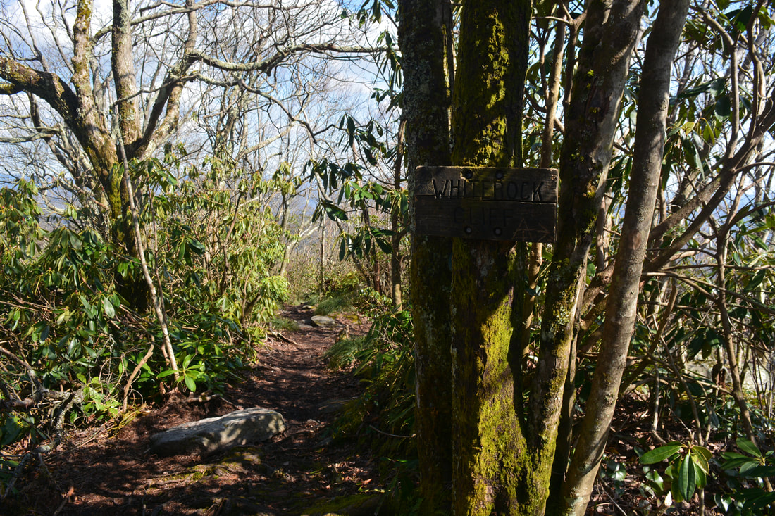
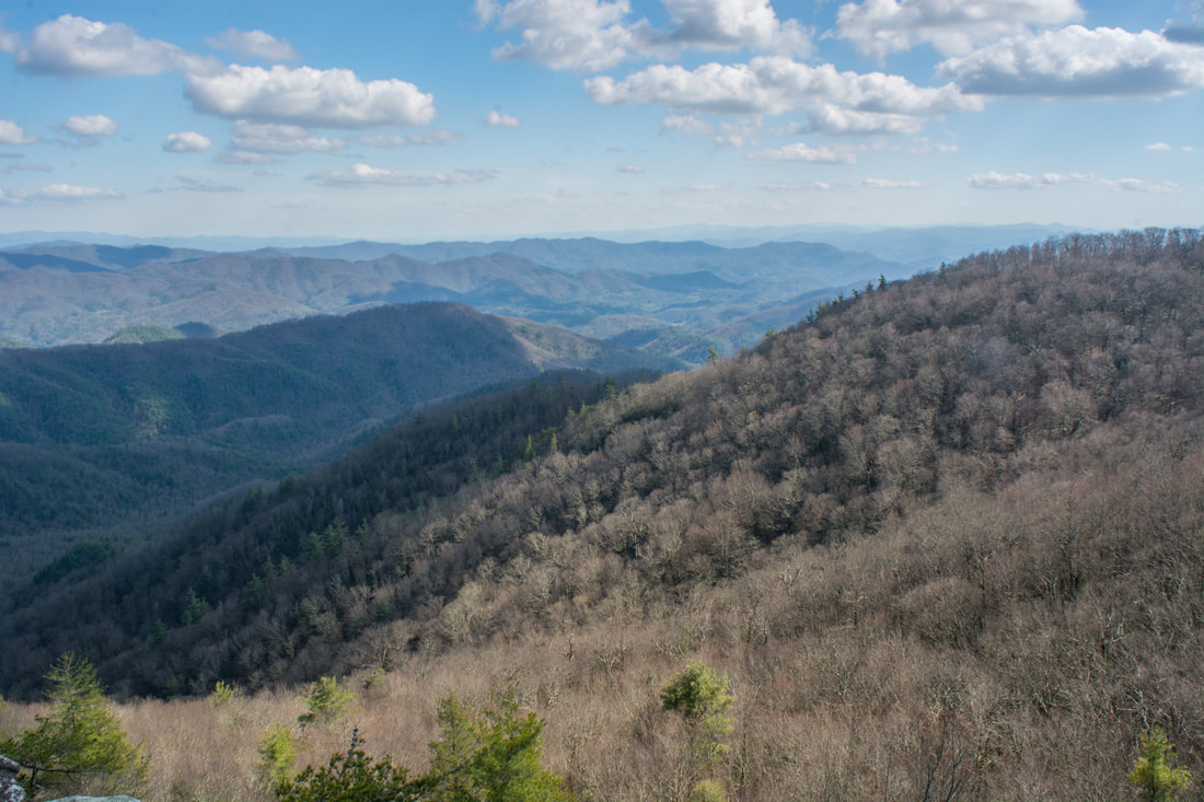
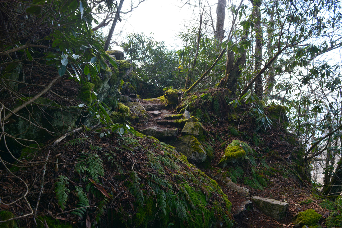
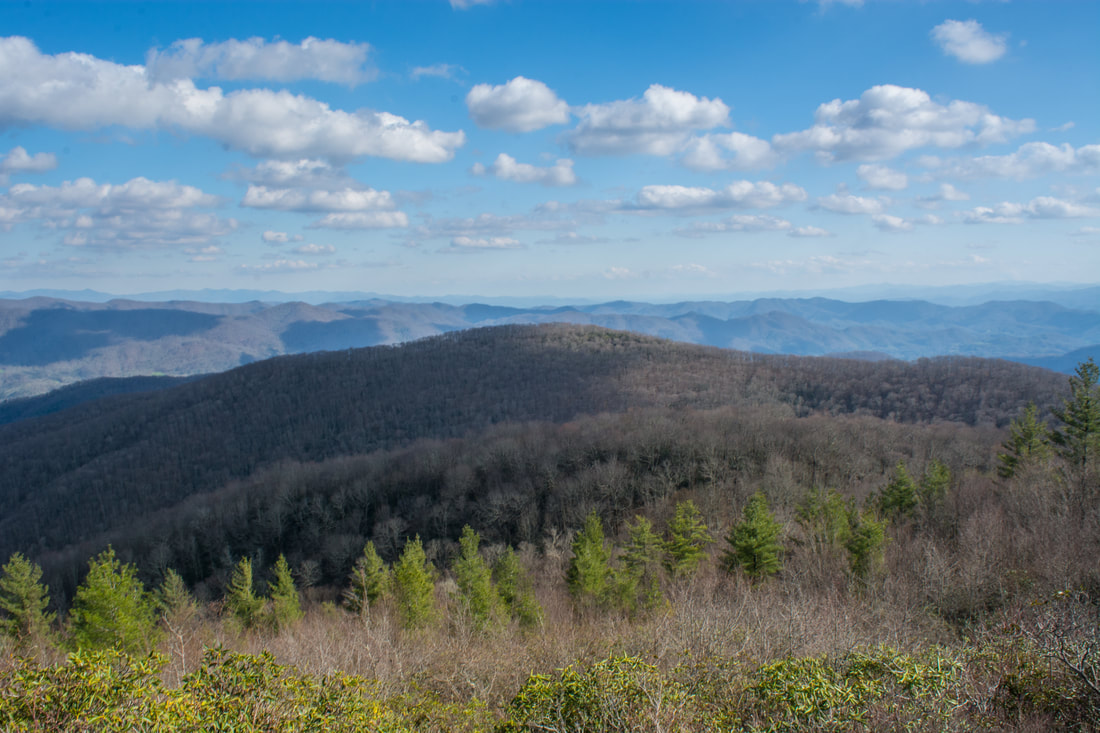
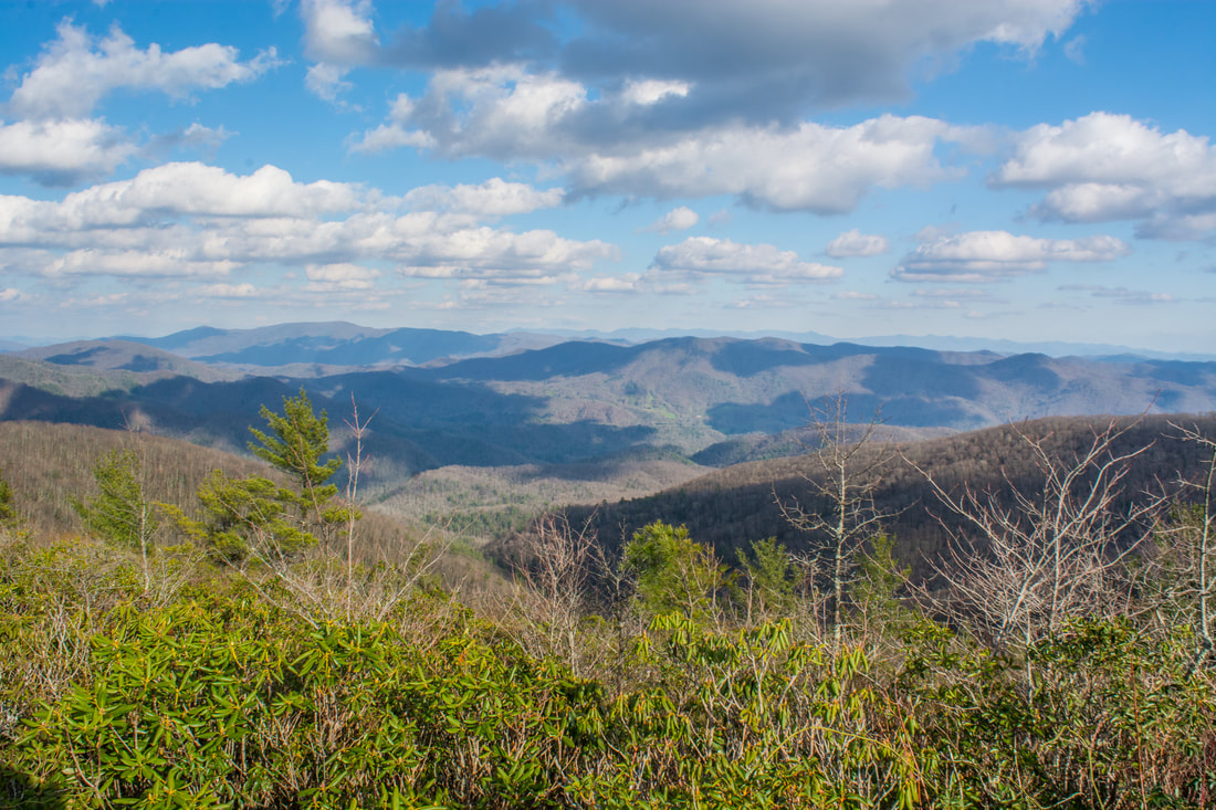
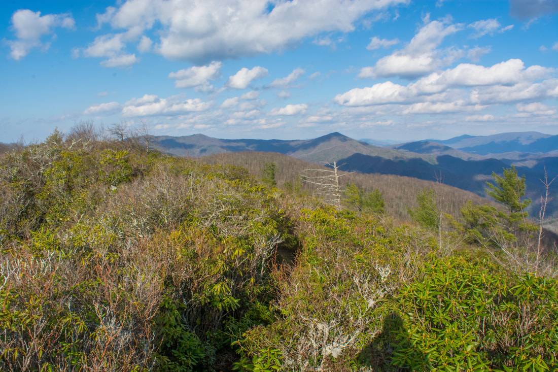
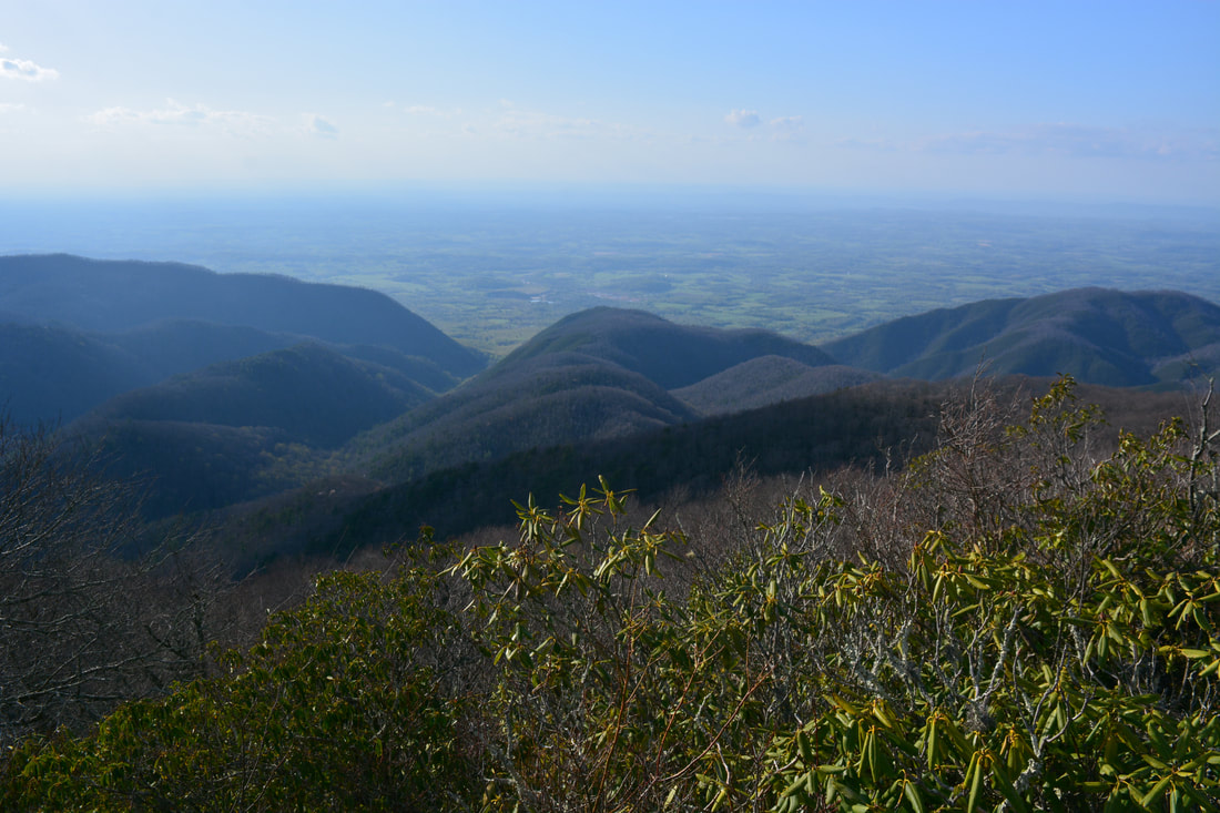
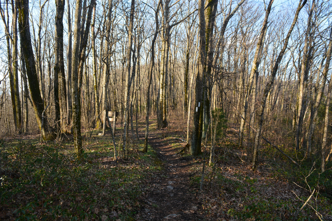
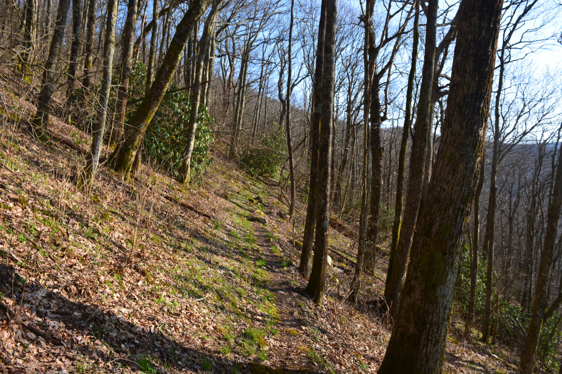
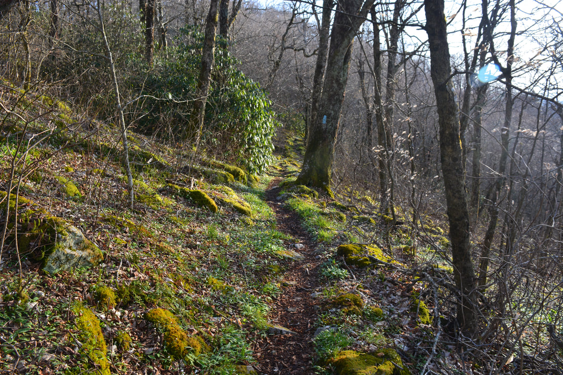
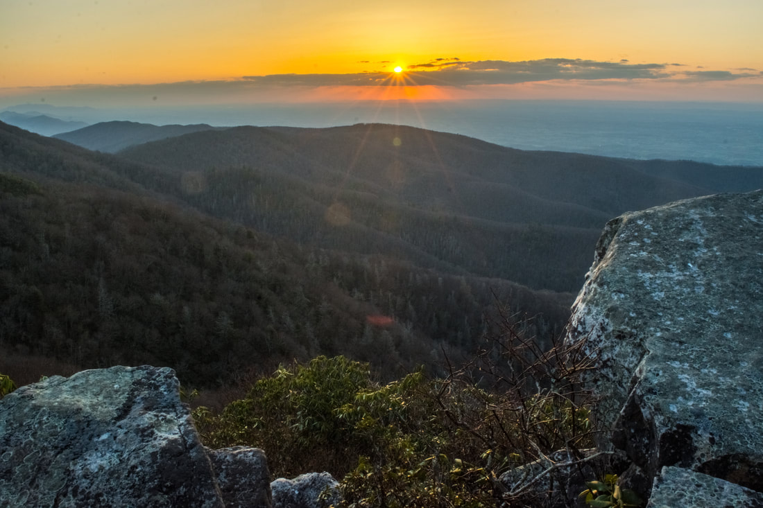
The Jones Meadow parking area is at the meadow's highest point, which has nice views of the Greeneville valley to the north and Blackstack Cliffs just to the east. To reach the trail, begin walking back along the access road. In 400 feet, turn left on a jeep road, blue-blazed as an AT access trail. The road drops below the meadow and makes a short but steep climb to the top of Little Firescald Knob. Just past the top is a small clearing - one access path goes straight and one goes right. Assuming that Whiterock Cliff is your first destination, turn right on the first blue-blazed access path. Reach the Appalachian Trail at 0.4 miles. While you'll later follow the AT to the left, turn right (southbound) onto it for now to see Whiterock Cliff. Just a tenth of a mile later, reach the usually-signed spur trail to Whiterock Cliff on the left. The spur path descends steeply for 250 feet to Whiterock Cliff at 0.55 miles. The sheer drop-off at Whiterock Cliff provides a really nice view down the East Prong Hickey Fork valley and southward into North Carolina. Several lines of mountains are in the view, including the Black Mountains on the horizon. 

Return to the Appalachian Trail from Whiterock Cliff and begin following it northbound toward Big Firescald Knob. You'll pass the two side trails to Jones Meadow and reach the signed Blackstack Cliffs side trail shortly thereafter at 0.75 miles. The 250-foot side trail climbs briefly reaching before suddenly popping out of a rhododendron tunnel at the spectacular panoramic view from Blackstack Cliffs. To the left is Jones Meadow (with your car still visible at the parking area) and Camp Creek Bald with its towers. Straight ahead, the Bald Mountains slope down to the broad flatland of the Nolichucky River valley, extending toward Greeneville at the horizon. A neat feature of the Blackstack Cliffs view is the rock pillars rising out of the brush to the left. Blackstack Cliffs is a great sunset-viewing spot. Due to its proximity to the parking lot, you could watch the sunset here and yet still manage to get back to your car before dark. 
Picture
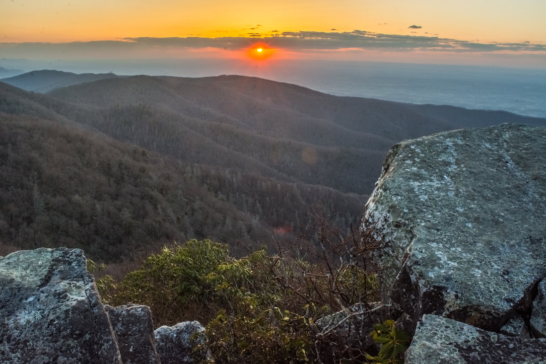
Blackstack Cliffs is a superb sunset-watching location.
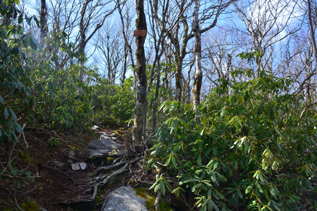
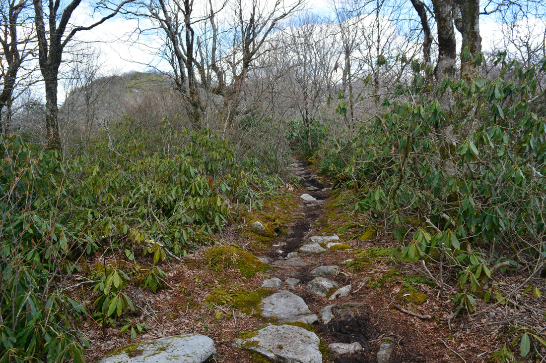
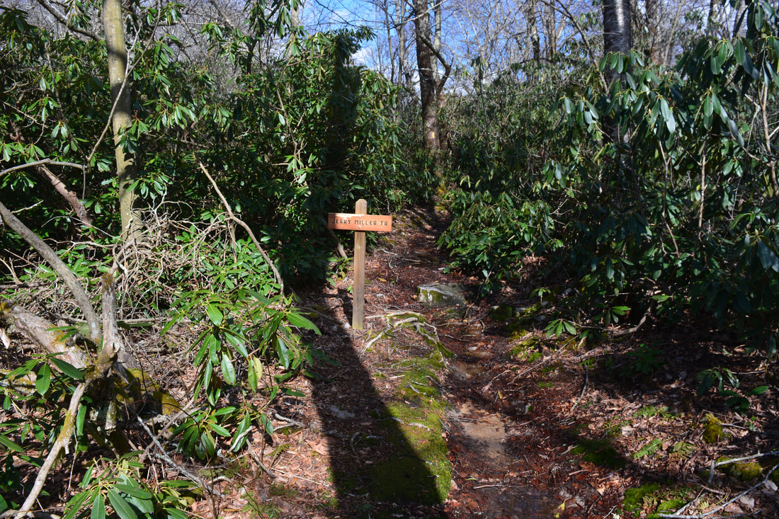
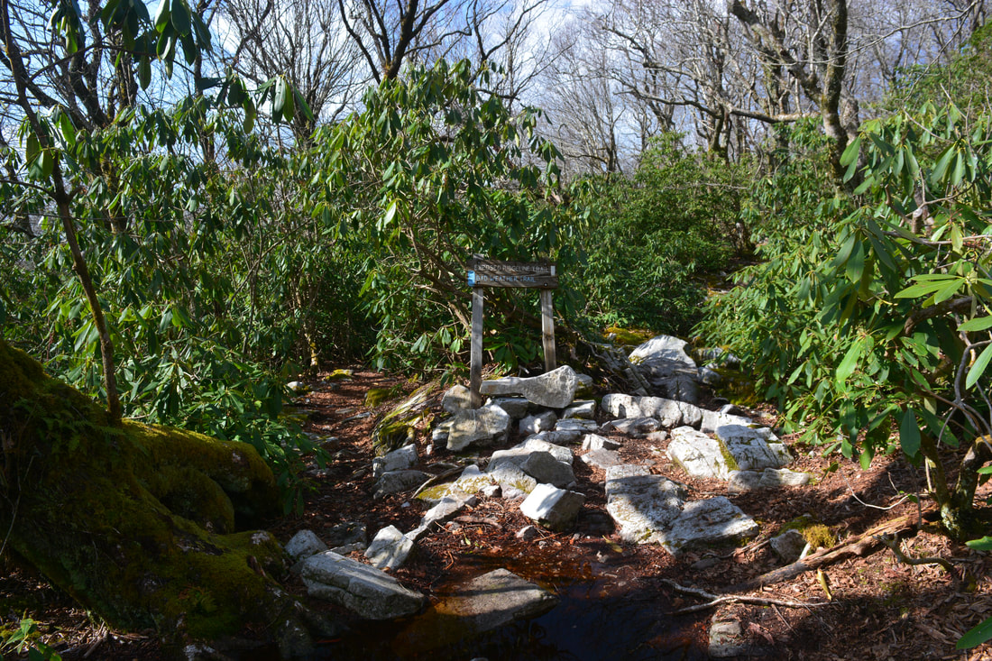
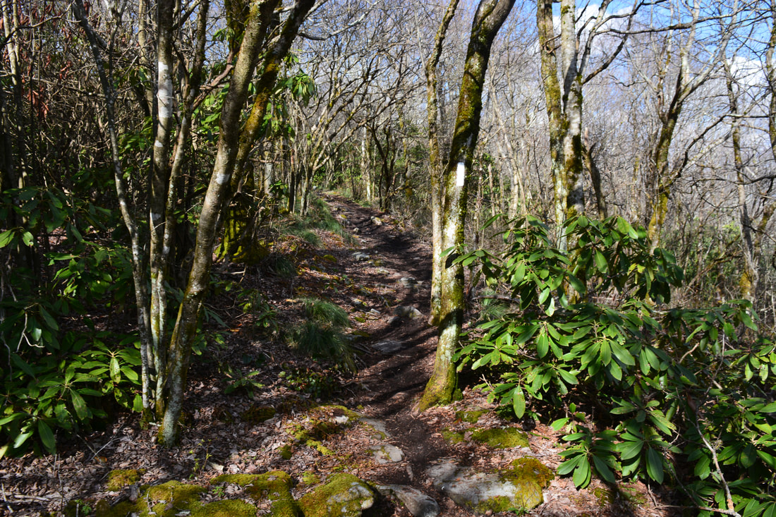
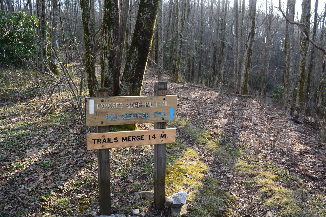
Return to the AT and keep following it northbound. Stradding the TN/NC state line, the trail descends through a particularly muddy section and reaches Bearwallow Gap at 1.0 miles. To the right, the Jerry Miller Trail departs into the Shelton-Laurel Backcountry Area on the right and reaches a trailhead on FR 111 at Big Creek in 4.5 miles. The Jerry Miller Trail, combined with the Fork Ridge Trail, makes for a great loop access to Big Firescald Knob. This hike bears left on the Appalachian Trail, reaching a junction with the blue-blazed alternate route in 200 feet. The alternate route used to be the actual Appalachian Trail, until a new trail was blazed along the very scenic ridge. The alternate route, which bears left, is used during times of bad weather, when it would be dangerous to remain on the exposed ridgeline of Big Firescald Knob. This hike bears right on the white-blazed Appalachian Trail and later returns along the alternate route. 

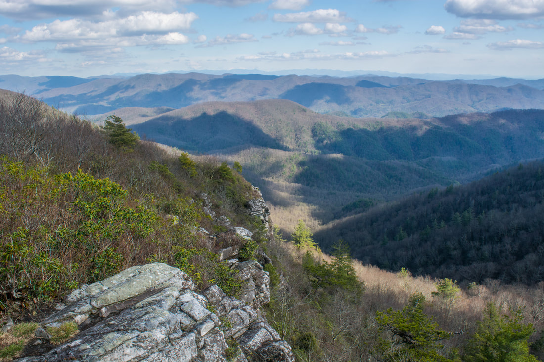
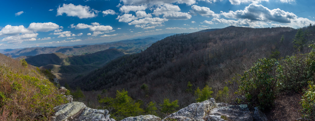
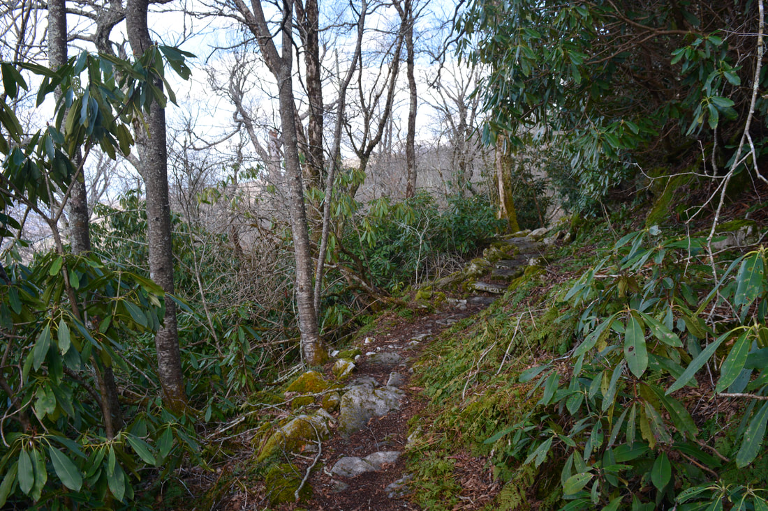
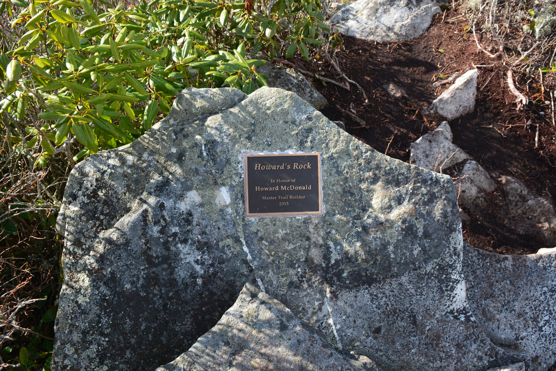
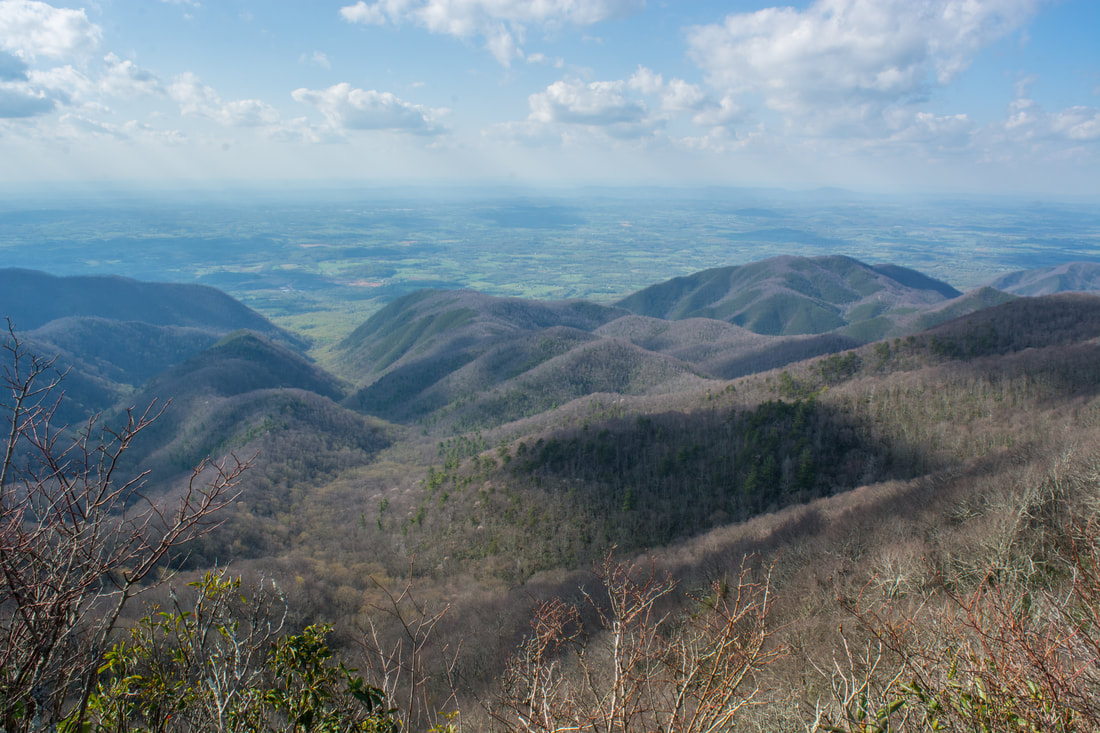
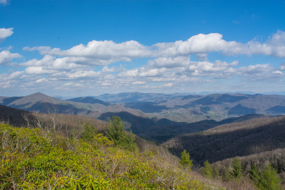
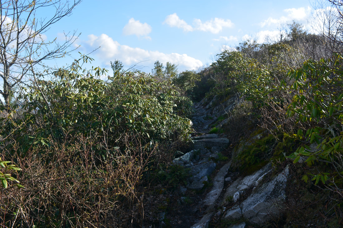
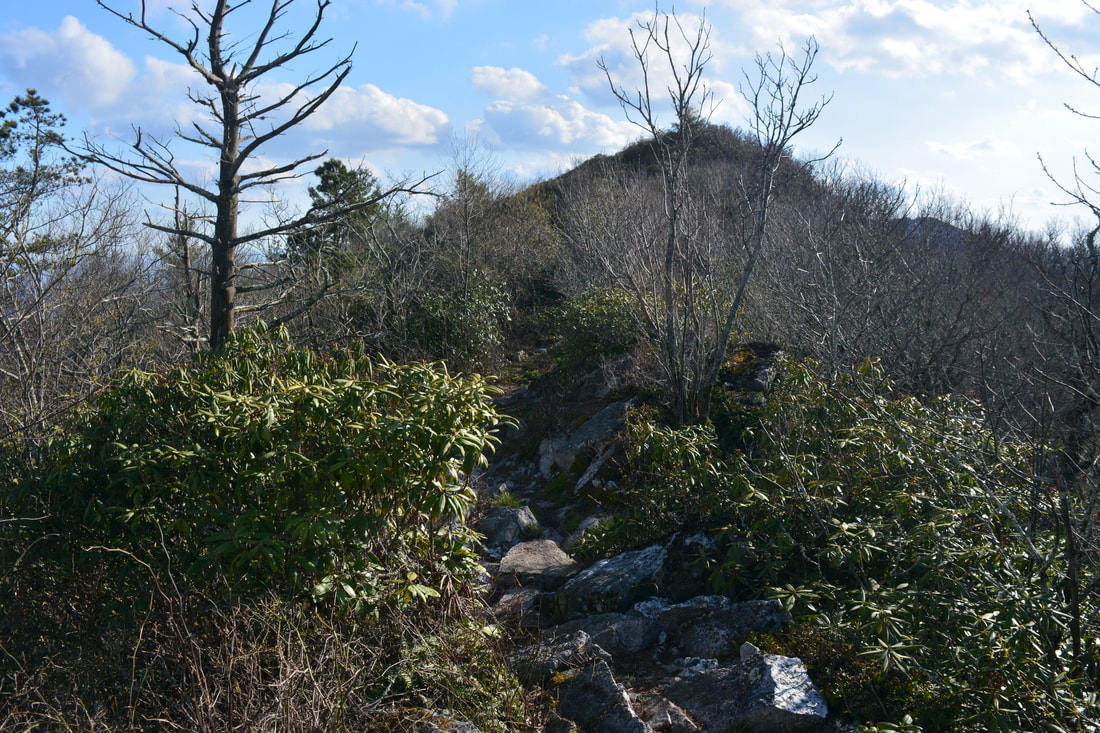
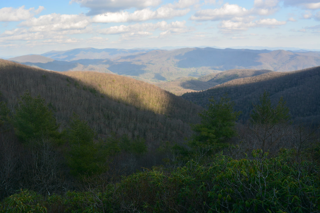
The Appalachian Trail begins an easy ascent to Big Firescald Knob, mostly staying near the ridge. There are a couple short rocky stretches. At 1.7 miles, the Appalachian Trail suddenly starts to break out into the open, right away passing a stunning panoramic view. Only 250 feet farther is the summit of Big Firescald Knob at 1.75 miles. The rock outcrop at the top is known as Howard's Rock, honoring master trail builder Howard McDonald. Howard's Rock has outstanding views both north toward the Greeneville flatlands and south into the heart of the North Carolina mountains. Once again, the Black Mountains can easily be traced along the horizon on a clear day. 

Past Howard's Rock, the Appalachian Trail continues to trace the rocky ridgeline, passing several more views - though none are as spectacular as the Howard's Rock view. This trail section features several mild rock scrambles and short climbs. Around 2.2 miles, the trail re-enters the woods and starts descending moderately toward Fox Cabin Gap. At 2.6 miles, reach the other end of the alternate AT in Fox Cabin Gap. The AT continues north toward more views around Big Butt Mountain and Buzzard Rock in Rocky Fork State Park. However, if you're here for just the short hike that I did, turn sharply left on the blue-blazed alternate AT.
Picture
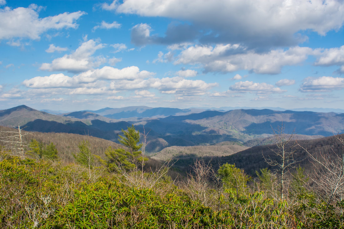
The Big Firescald Knob crest at Howard's Rock provides outstanding panoramic views in all directions, including south into North Carolina toward the Big Creek valley and the Black Mountains in the distance.
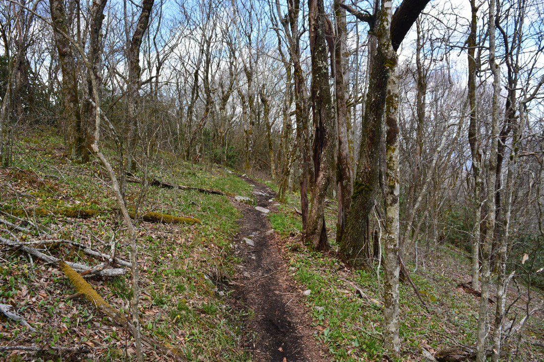
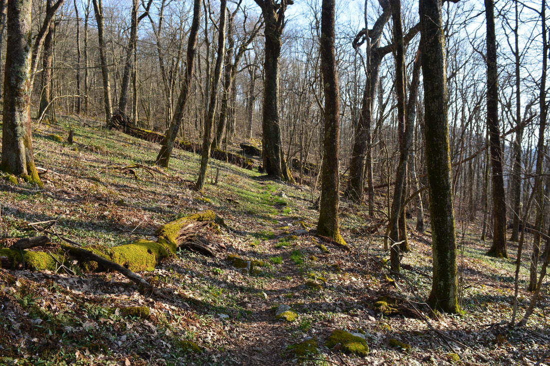
Most of the alternate Appalachian Trail is gentle uphill, interrupted by occasional level stretches. However, it's still a very easy and pleasant trail that meanders along the slopes of Big Firescald Knob. There are nice seasonal views northward in places. On my visit, the alternate trail was considerably less muddy than the primary route of the AT. You'll reach the end of the alternate route at 4.05 miles in Bearwallow Gap. Stay straight - it's simply a matter of retracing your steps to Jones Meadow from here. You may use the second access path to Jones Meadow. You'll return to the Jones Meadow parking area at 4.7 miles, concluding the hike. 

Mileage

0.0 - Jones Meadow
0.55 - Whiterock Cliff
​0.8 - Blackstack Cliffs
1.0 - Bearwallow Gap
1.75 - Howard's Rock
2.6 - Fox Cabin Gap
4.05 - Bearwallow Gap
4.7 - Jones Meadow

Variations

Hike out and back from Jones Meadow to just Whiterock Cliff and Blackstack Cliffs - 1.4 Miles
Hike just out and back from Jones Meadow to Whiterock Cliff, Blackstack Cliffs, and Big Firescald Knob (Howard's Rock) - 3.2 Miles

Bonus Stops

Consider combining the Big Firescald Knob hike with a hike to Margarette Falls on West Fork Dry Creek the same day. 

Pictures & Videos

2 Comments
Tim Watson
7/9/2018 02:07:12 am

Thanks for sharing this Mark. Your pictures are always great!! I look forward to doing this hike soon and definitely when the leaves turn color in the Fall.

Reply
Will Skelton link
3/2/2022 10:09:54 pm

This is a quite outstanding trail description, one of the best I've ever seen. I hiked the lollypop loop today and it is one of the best anywhere, such great views. Although of course somewhat difficult, especially for a 79 year old like me. But I made it in about 5.5 hours with some detours like going down the Jerry Miller trail about .5 mile to see if there was water/campsite for future trip (NO). Thanks.

Reply


Leave a Reply.

    About Me

    Mark Oleg Ozboyd
    I'm an avid outdoor explorer and a hobbyist landscape photographer. I'm 21 years old and have been hiking since 2011. Originally based out of Atlanta, Georgia, I started out by occasionally hiking short trails throughout well-known Georgia State Parks. During 2012 and 2013, I began to expand my trips into adjacent states, as well as into the wilder National Forest areas rather than just State Parks. Throughout the years that followed, as I slowly ran out of popular hiking trails in my area, I began to search for and hike in more seldom-visited areas. Today, you can find me out in the woods every weekend, whether it's on an official trail or bushwhacking through cross-country terrain without any paths. I now attend Washington & Lee University and am exploring Virginia and West Virginia. My other hobbies include chess, science, old music, and meteorology. I have 3 years of amateur weather forecasting experience, having studied a lot of meteorology basics over the years. I am also a student at European School of Music where I learned that music and nature have a lot in common. Listening to good music inspires me to capture nature's beauty on the camera in different aspects that also make me recall many beautiful music pieces that I've heard.​


    Dear readers: I have invested a tremendous amount of time and effort in this website and the Georgia Waterfalls Database the past five years. All of the work that has gone in keeping these websites updated with my latest trip reports has almost been like a full-time job. This has not allowed me to pick up a paid job to save up money for college, and therefore, I I've had to take out loans. If you find the information on this website interesting, helpful, or time-saving, you can say "thanks" and help me out by clicking the button above and making a contribution. I will be very grateful for any amount of support you give, as all of it will apply toward my college tuition. Thank you! 

    Enter your email address to subscribe for trail reports:

    Delivered by FeedBurner


    Picture
    Coming in 2022-2023?

    Other Hiking Websites

    DWHike's Adventures
    Florida's Natural Wonders
    Florida Trailblazer
    Meanderthals
    Mountain Images
    by Bernie Boyer

    North Carolina Waterfalls with
    ​Kevin Adams
    Take-a-Hike!
    Tennessee Landforms
    Waterfall Page
    Waterfall Adventurer
    Zach's Mild Adventures

    Miles Hiked

    Year 1: 540.0 Miles
    Year 2: 552.3 Miles
    ​Year 3: 518.4 Miles
    Year 4: 482.4 Miles
    Year 5: 259.9 Miles

    Archives

    March 2021
    February 2021
    January 2021
    November 2019
    October 2019
    September 2019
    August 2019
    July 2019
    June 2019
    February 2019
    January 2019
    December 2018
    November 2018
    October 2018
    August 2018
    July 2018
    June 2018
    May 2018
    April 2018
    March 2018
    February 2018
    January 2018
    December 2017
    November 2017
    October 2017
    September 2017
    August 2017
    July 2017
    June 2017
    May 2017
    April 2017
    March 2017
    February 2017
    January 2017
    December 2016
    November 2016
    October 2016
    September 2016
    August 2016
    June 2016
    May 2016
    April 2016
    March 2016
    January 2016
    December 2015
    November 2015
    October 2015
    September 2015
    August 2015
    July 2015
    June 2015
    May 2015
    April 2015
    March 2015
    February 2015
    January 2015
    December 2014
    November 2014
    October 2014
    September 2014
    August 2014
    July 2014
    June 2014
    May 2014
    April 2014
    March 2014
    February 2014

    Categories

    All
    Adel
    Adirondack Park
    Alabama
    Alfred A. Ring Park
    Allegheny Trail
    Amicalola Falls State Park
    Anniston Area
    Apalachicola Bluffs And Ravines Preserve
    Apalachicola National Forest
    Apalachicola/Port St. Joe Area
    Apopka
    Appalachian Trail
    Appling
    Art Loeb Trail
    Aska Trail System
    Bakersville
    Balm-Boyette Scrub Preserve
    Balsam Lake Recreation Area
    Bankhead National Forest
    Bartow County Parks
    Bartram Trail
    Basinger
    Beersheba Springs
    Benton
    Benton Mackaye Trail
    Berry College Trail System
    Best Hike
    Big South Fork National Recreation Area
    Black Bear Wilderness
    Black Rock Mountain State Park
    Blairsville
    Blakely
    Blood Mountain Wilderness
    Blowing Rock
    Blue Ridge
    Blue Ridge Parkway
    Boone
    Bradenton
    Bradenton Beach
    Brasstown Bald
    Brasstown Wilderness
    Brevard
    Bryson City
    Buchanan
    Bucks Pocket State Park
    Bulow Creek State Park
    Bulow Plantation Ruins State Park
    Caesars Head State Park
    Caladesi Island State Park
    Calhoun
    Camel's Hump State Park
    Cashiers
    Caspersen Beach Park
    Catfish Creek State Park
    Caves
    CC Putnam State Forest
    Cedar Point Environmental Park
    Chatsworth
    Chattahoochee National Forest
    Chattanooga
    Chattanooga Valley
    Chattooga National Wild And Scenic River
    Cheaha Wilderness
    Cherohala Skyway
    Cherokee
    Cherokee National Forest
    Chiefland Area
    Chillhowee Recreation Area
    Chipley
    Chunky Gal Trail
    Circle B Bar Reserve
    Citico Creek Wilderness
    Citrus Wildlife Management Area
    Clarkesville
    Clayton
    Cleevland
    Cleveland
    Cloudland Canyon State Park
    Cohutta Wilderness
    Collier-Seminole State Park
    Cordele
    Cornelia
    Covington
    Crestview Area
    Crew-land-and-water-trust
    Cullowhee
    Cumberland Trail
    Dahlonega
    Dalton
    Dawson Forest Wildlife Management Area
    Dawsonville
    Dayton
    De Soto National Memorial
    DeSoto State Park
    Dillard
    Double Springs
    Ducktown
    Duncan Ridge Trail
    Dunlap
    Eagle's Rest Park
    Eastpoint
    Econfina Creek Wildife Management Area
    Eglin Air Force Base
    Elizabethton
    Elkins
    Elk Knob Game Lands
    Elk Park
    Ellicott Rock Wilderness
    Ellijay
    Emerson Point Preserve
    Englewood Area
    Enota Retreat
    Erwin
    Falling Waters State Park
    Fayetteville
    Fires Creek Recreation Area
    Fire Tower
    Flint River
    Florence Area
    Florida
    Florida Caverns State Park
    Florida Trail
    Foothills Trail
    Fort Mountain State Park
    Fort Myers Area
    Fort Payne
    Fort Payne Area
    Fort Yargo State Park
    Franklin
    Franklin Delano Roosevelt State Park
    Franklin-Marion State Forest
    Frozen Head State Park
    Gainesville
    Gainesville Area
    Gatlinburg
    George Washington National Forest
    Georgia
    Georgia Veterans Memorial State Park
    Glasgow
    Gorges State Park
    Grandfather Mountain State Park
    Great Smoky Mountains National Park
    Greeneville
    Green River Game Lands
    Gruetli-Laager
    Grundy Forest State Natural Area
    GTM Reserve
    Guana River Wildlife Management Area
    Hayesville
    Helen
    Hiawassee
    High Falls State Park
    Highlands
    Highlands Scenic Highway
    Hillsborough River State Park
    Hinson Conservation & Recreation Area
    Historic Sites
    Honeymoon Island State Park
    Hot Springs
    Huntington
    Inverness Area
    Jackson
    Jasper
    Jefferson National Forest
    Joan M. Durante Park
    Jonathan Dickinson State Park
    Jones Gap State Park
    Joyce Kilmer Slickrock Wilderness
    Joyce Kilmer - Slickrock Wilderness
    Juniper Prairie Wilderness
    Kelly Park
    Keown Falls Recreation Area
    Kolomoki Mounds State Park
    LaFayette
    Lake City Area
    Lake George Wild Forest
    Lake June-in-Winter State Park
    Lakeland Area
    Lake Placid
    Lake Russell Wildlife Management Area
    Lake Wales Ridge State Forest
    Laurel Fork North Wilderness
    Leffis Key Preserve
    Leon Sinks Geological Area
    Lexington
    Lineville
    Linville
    Linville Gorge Wilderness
    Lithia Springs
    Little Frog Wilderness
    Little Manatee River State Park
    Little River Canyon National Preserve
    Longboat Key
    Long Trail
    Lookout Mountain
    Lookout Mountain Battlefield
    Lovingston
    Lula Lake Land Trust
    Lumpkin
    Maggie Valley
    Manatee Springs State Park
    Marianna Area
    Mark Trail Wilderness
    Marlinton
    Mccaysville
    McMinville
    Mentone
    Middlesex
    Mistletoe State Park
    Monongahela National Forest
    Montreat
    Mountain Bridge Wilderness Area
    Mountain City
    Mountains To Sea Trail
    Mountains-to-Sea Trail
    Mount Rogers National Recreation Area
    Myakka River State Park
    Myron B. Hodge City Park
    Nantahala National Forest
    Naples
    Naples Area
    Natural Bridge State Park
    Neal Preserve
    New Castle
    Newport
    New River Gorge National Park
    New York
    North Carolina
    Ocala Area
    Ocala National Forest
    Ocean-to-Lake Trail
    Oconee State Park
    Oconee Station Historic Site
    Okaloacoochee Slough State Forest
    Oldsmar
    Oneida
    Orlando Area
    Ormond Beach
    Oscar Scherer State Park
    Oxford
    Palatka
    Palmetto Trail
    Panama City Area
    Panthertown Valley
    Parrish
    Paynes Creek Historic State Park
    Peaks Of Otter Recreation Area
    Pigeon Crockford Mountain Wildlife Management Area
    Pigeon-Crockford Mountain Wildlife Management Area
    Pigeon-Crockford Wildlife Management Area
    Pine Mountain
    Pinhoti Trail
    Pinnacle Park
    Pisgah Civitan Park
    Pisgah National Forest
    Pittman Center
    Pond Mountain Wilderness
    Ponds/Lakes
    Prentice Cooper State Forest
    Providence Canyon State Park
    Pumpkintown
    Quick Point Nature Preserve
    Raven Cliffs Wilderness
    Reed Bingham State Park
    Reliance
    Rice Creek Conservation Area
    Riverview Pointe Preserve
    Robbinsville
    Robinson Preserve
    Rock Creek Gorge Scenic Area
    Rock Island State Park
    Rome
    Rosman
    Sale Creek
    Salem
    Salt Springs
    Saluda
    Santa Rosa Beach
    Sarasota
    Sarasota Area
    Savage Gulf State Natural Area
    Scenic Views
    Scottsboro Area
    Sebring Area
    Sewanee
    Sheltowee Trace Trail
    Shining Rock Wilderness
    Signal Mountain
    Sipsey Wilderness
    Sky Valley
    Smithgall Woods State Park
    Snowbird Backcountry Area
    Soddy Daisy
    Soddy-Daisy
    Sopchoppy
    South Carolina
    South Cumberland State Park
    Southeastern Cave Conservancy
    Southern Nantahala Wilderness
    Sparta
    Sprewell Bluff Park
    Spring City
    Spring Hill
    Springs
    Spruce Pine
    Standing Indian Backcountry Area
    St. Augustine
    St. George Island State Park
    St. Joseph Bay State Buffer Preserve
    St. Marks Area
    St. Marks National Wildlife Refuge
    Stone Mountain
    Stone Mountain Park
    Suches
    Sumatra
    Sumter National Forest
    Suwannee River
    Swallow Creek Wildlife Management Area
    Sweetwater Creek State Park
    Sylva
    Talladega National Forest
    Tallahassee Area
    Tallulah Falls
    Tallulah Gorge State Park
    Tampa Bay Area
    Tate City
    Tate's Hell State Forest
    Tea Creek Wildlife Management Area
    Tellico Plains
    Tennessee
    Thomaston
    Toccoa
    Topsail Hill State Park
    Torreya State Park
    Townsend
    Tracy City
    Tray Mountain Wilderness
    Trenton
    Triple Creek Preserve
    Troutdale
    Unaka Mountain Wilderness
    Upper Tampa Bay County Park
    Venice
    Vermont
    Virgin Falls State Natural Area
    Virginia
    Virginia Outdoors Foundation
    Vogel State Park
    Wakulla Springs State Park
    Waleska
    Walhalla
    Wartburg
    Water Features
    Waynesville
    Weedon Island Preserve
    Weeki Wachee Preserve
    Wekiwa Springs State Park
    West Palm Beach Area
    West Virginia
    Whitehall
    White Springs
    Winder
    Withlacoochee State Forest
    Young Harris

    RSS Feed

TRAIL REPORTS

Hikes in Alabama
​Hikes in Florida
Hikes in Georgia
Hikes in North Carolina
Hikes in South Carolina
Hikes in Tennessee
Hikes in Virginia

Hiking Resources

Alabama Resources
​
Florida Resources
Georgia Resources
North Carolina Resources
​South Carolina Resources
​
Tennessee Resources

Other

Contact
Map of Hikes
Alphabetical List of Hikes
Southeast Nature Society
© COPYRIGHT 2014-2018
​ALL RIGHTS RESERVED.
Important: I disclaim any responsibility for any damage or personal injury that may occur as a result of the activities and information found on this website. All outdoor activities, especially off-trail hiking, are done at your own risk. Never hike or head into that area that may be above your fitness or experience level.
  • Home
  • Trail Reports
    • Best Hikes
    • Hikes with Scenic Views
    • Hikes with Water Features
    • Alabama
    • Georgia
    • Florida
    • North Carolina
    • South Carolina
    • Tennessee
    • Vermont
    • Virginia
  • Map
  • Hike List
  • Testimonials
  • Resources
  • Contact Us
  • Southeast Nature Society
    • Our Team
  • Georgia Waterfalls Database