
Situated just east of the town of Stowe in Northern Vermont, the Worcester Range is an elongated ridge of rocky peaks that seems to stay under the radar as a hiking destination for two very simple reasons: it isn't part of the famous Long Trail's route, and there are no 4000-foot peaks, which are frequently the primary focus of New Englanders' outdoor explorations. The Skyline Trail runs along the spine of the range and connects its two most prominent peaks: Mount Worcester and Mount Hunger. Not having the time for an ambitious exploration of the full ridge, I settled for a hike that looped around the south end, visiting Mount Hunger and its impressive subpeak Whiterock Mountain. Featuring multiple rock scrambles and 360-degree panoramic views that include some of Vermont's most iconic landmarks like Camel's Hump and Mount Mansfield, this is an incredible hike that has definitely stayed underappreciated. This hike occurred on Saturday, September 21st, 2019. My plan was to climb Mount Hunger via the Middlesex Trail and then descend via the Bob Kemp Trail, making the side trip to Whiterock Mountain along the way.
Summary
R/T Length of Trail: 6.0 Miles
Duration of Hike: 3:50 plus 45 minutes of stopping Type of Hike: Lasso Total Elevation Gain: 2,105 Feet Difficulty Rating: 6 out of 10 Pros: Stunning views all throughout the hike, including continuous views on upper portion of Middlesex Trail; fun rock scrambles to Mount Hunger and Whiterock Mountain Cons: Some of the rock scrambling on this hike is technical and makes it not a great choice for novices, despite its relatively short distance Trail Blaze Colors: Middlesex Trail - Blue; Whiterock Trail - Blue; Bob Kemp Trail - Blue; Whiterock Mountain Spur Trail - Blue Best Seasons to Hike: Summer, Fall Fees: None Beginning Point: Middlesex Trailhead off North Bear Swamp Road Directions from Middlesex, VT: From Exit 9 along I-89, follow Center Road northward for 4.2 miles (the road turns unpaved after 1.2 miles). Then, turn left to stay on Center Road along with Brook Road. In another 0.2 mile, turn right again to continue following Center Road. Then, in 0.6 mile, turn left on Molly Supple Hill Road. Continue for 1.9 miles (the road actually turns paved in the meantime) to a slightly disorienting double left intersection; take the second left onto Story Road (unpaved again). Bear left onto Nellie Chase Road in 0.5 mile at a Y-split, and take another left onto North Bear Swamp Road in another 0.2 mile. Finally, follow North Bear Swamp Road for 1.6 miles to a turnaround area. An inconspicuous trailhead sign directs you to bear left on a much narrower gravel road. Follow this slim road for another 0.3 mile to the parking area for Middlesex Trail on the right - there is space for approximately 15 cars. The last 0.3 mile of the road are a bit rough with a number of potholes and a rutted spot at the entrance to the parking area; therefore, regular passenger vehicles will need to be cautious and go slow. Map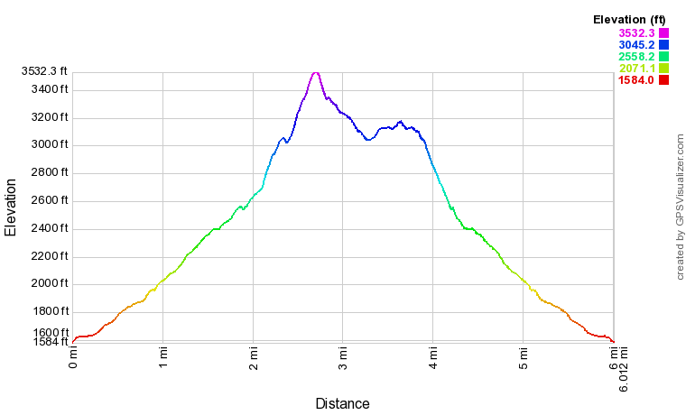
Click the link below to download a .GPX file with a track of this hike.
Details
To many of you, it might be very big and surprising news that I moved to Middlebury, Vermont at the beginning of September, to start out my college studies. Having never traveled outside the Southeast before, it is incredibly exciting to be exploring entirely new-to-me mountains and trails. Unfortunately, there are still plenty of hikes I did in the Southeast over the past year that I'm afraid I'll never have the time to post trip reports for. I'm not certain how much time I will have to continue posting new trip reports for my future hikes here, but I definitely plan to be sharing some now and then. The trail report I'm writing here - for my third hike since moving to Vermont - is particularly important to me, as it's almost a bit unfair how underrated the Mount Hunger hike is given its beauty, and how little information there is about it online.
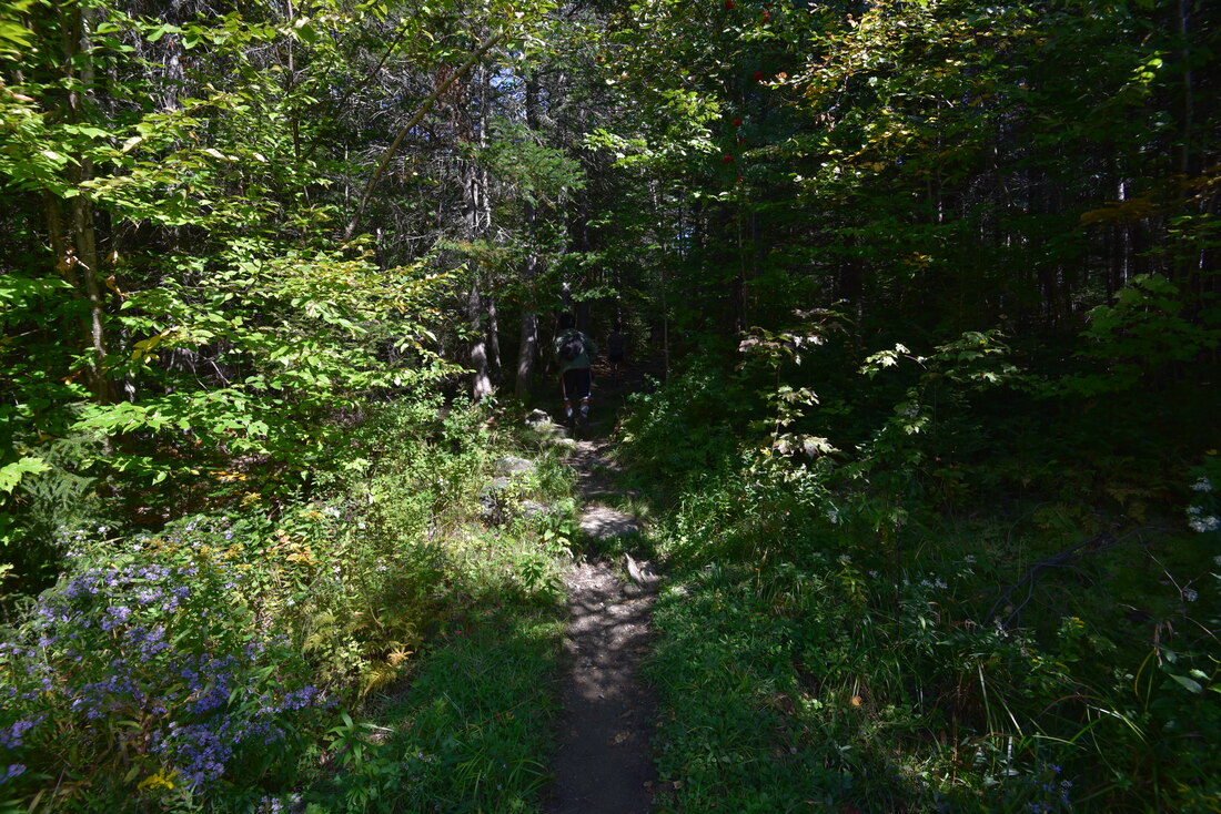
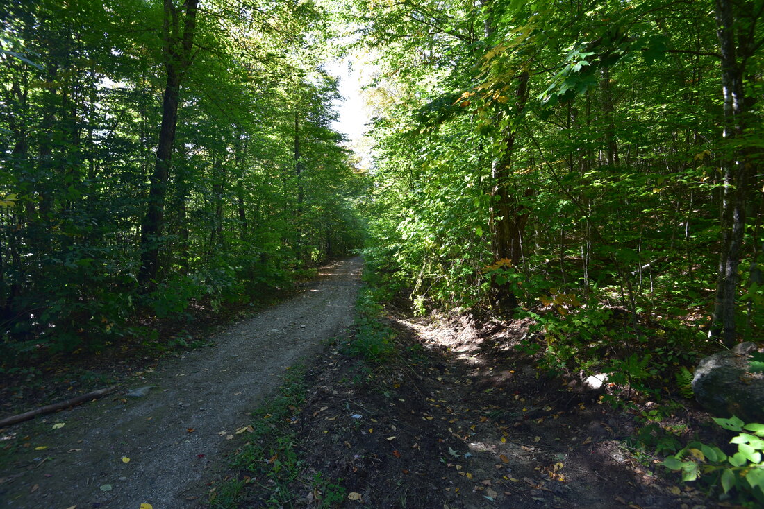
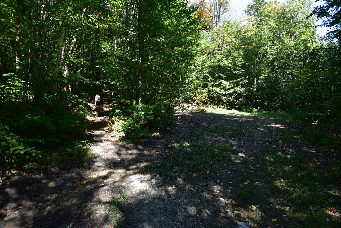
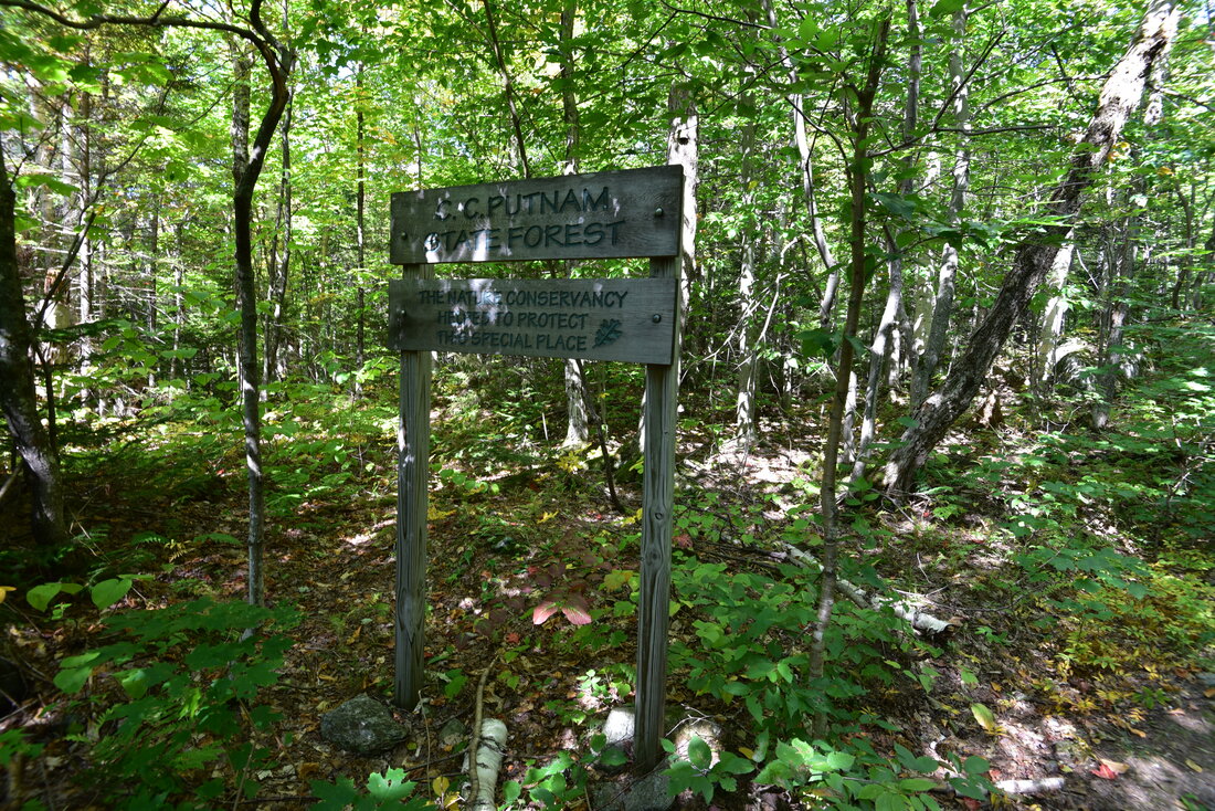
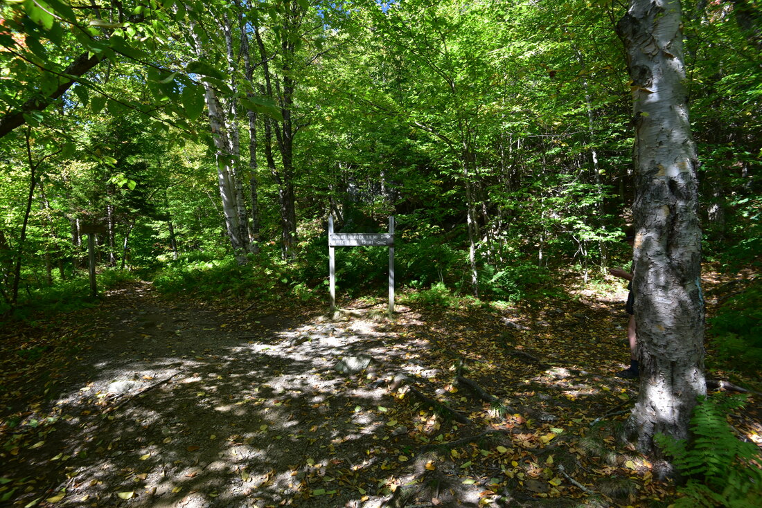
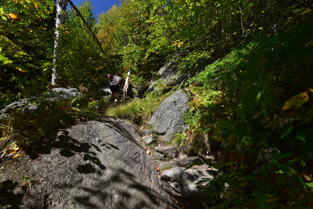
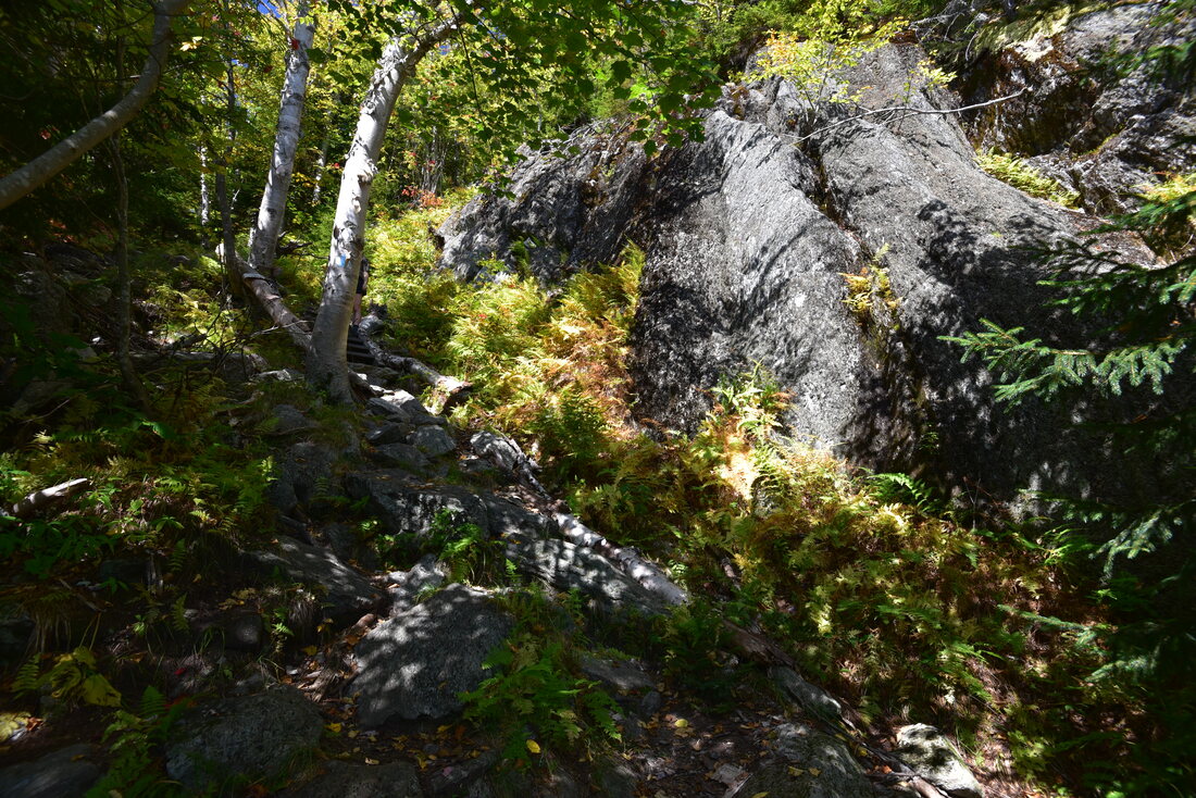
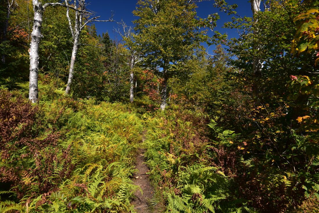
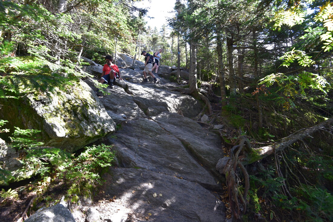
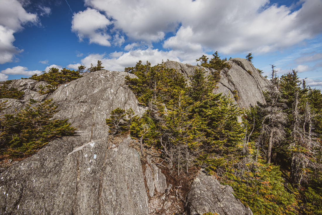
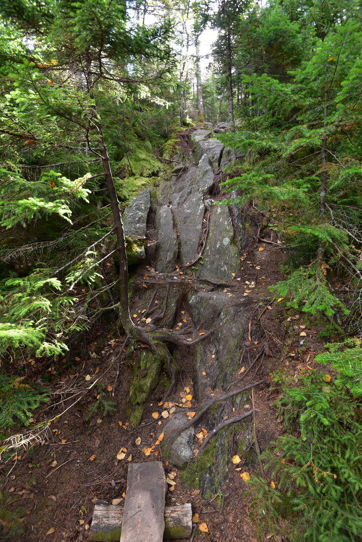
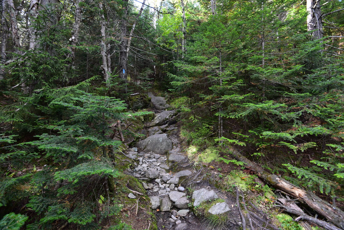
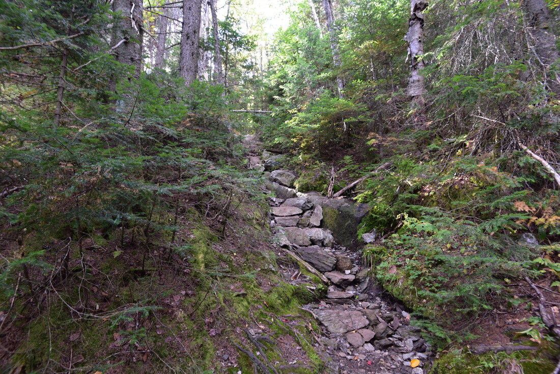
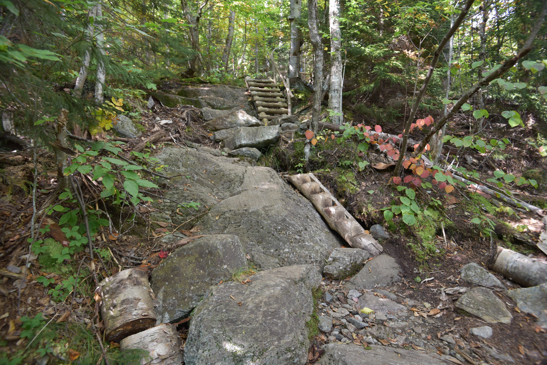
Start out the hike on the Middlesex Trail by the trailhead kiosk. After following the well-trodden pathway for 0.1 mile, the trail turns left onto a broad forest road and begins an easy to moderate ascent up the lower slopes of Mount Hunger through a hardwood forest. At 0.8 mile, the trail leaves the forest road and turns left, beginning a steeper ascent that is only briefly interrupted at 0.9 mile by a small stream crossing. Although the ascent is rather steep, the dirt pathway remains - for now - without any rock scramble obstacles and easy to hike. It is only here, around 1.1 miles, that the trail actually enters CC Putnam State Forest, the public land parcel through which the Worcester Range Skyline has been conserved. Up to this point, the trail had been meandering through private land under conservation easement. The Trust for Public Land and Stowe Land Trust are working on ensuring that this becomes public land and the important watershed areas on the south and east sides of Mount Hunger are conserved forever, but they still need the public's help to complete this. After a second rock hop across a small stream at 1.4 miles, the trail levels out somewhat. Reach the start of the hike's loop section at 1.65 miles. The Bob Kemp Trail heads straight and Middlesex Trail turns right. Both lead to Mount Hunger, but Middlesex Trail takes the more direct approach, while Bob Kemp Trail swings by Whiterock Mountain forest. I recommend hiking the loop counter-clockwise like I did and like it is described here, because the Middlesex Trail near-vertical rock scrambles are much more fun when going up than down. Thus, turn right. After staying as a level, rocky path for a bit, the Middlesex Trail makes an abrupt left turn at 1.95 miles and begins a very steep ascent. Over the next 0.7 miles, the trail gains 900 feet in elevation! Much of this is in the form of clambering up upon rock faces that make up most of Mount Hunger's eastern face. The initial portion of the ascent remains generally forested, but you'll notice differences in the type of trees that show up: less oaks and more birches and spruces, a sure sign that you're gaining elevation. In addition, jagged rock formations will start popping up here and there, including one located on the trail's right as it passes through a scenic notch via a small ladder. 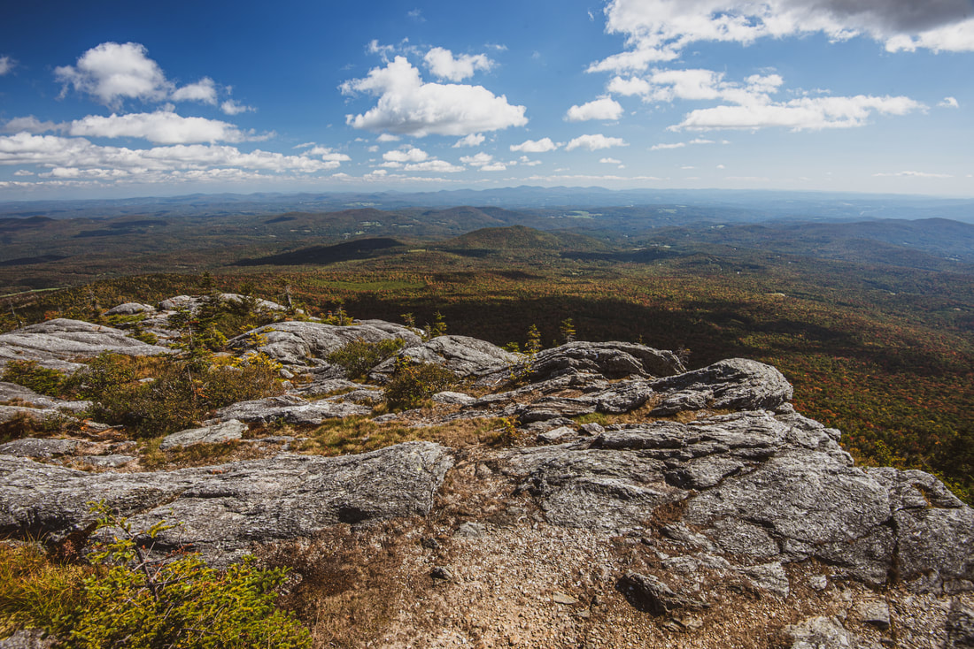
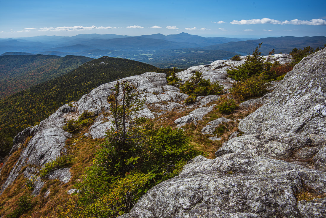
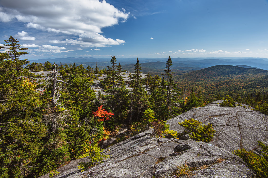
The entire Northeast Kingdom of Vermont spreads out under your feet from the plateau-like rock outcroppings on the east side of Mount Hunger's summit.
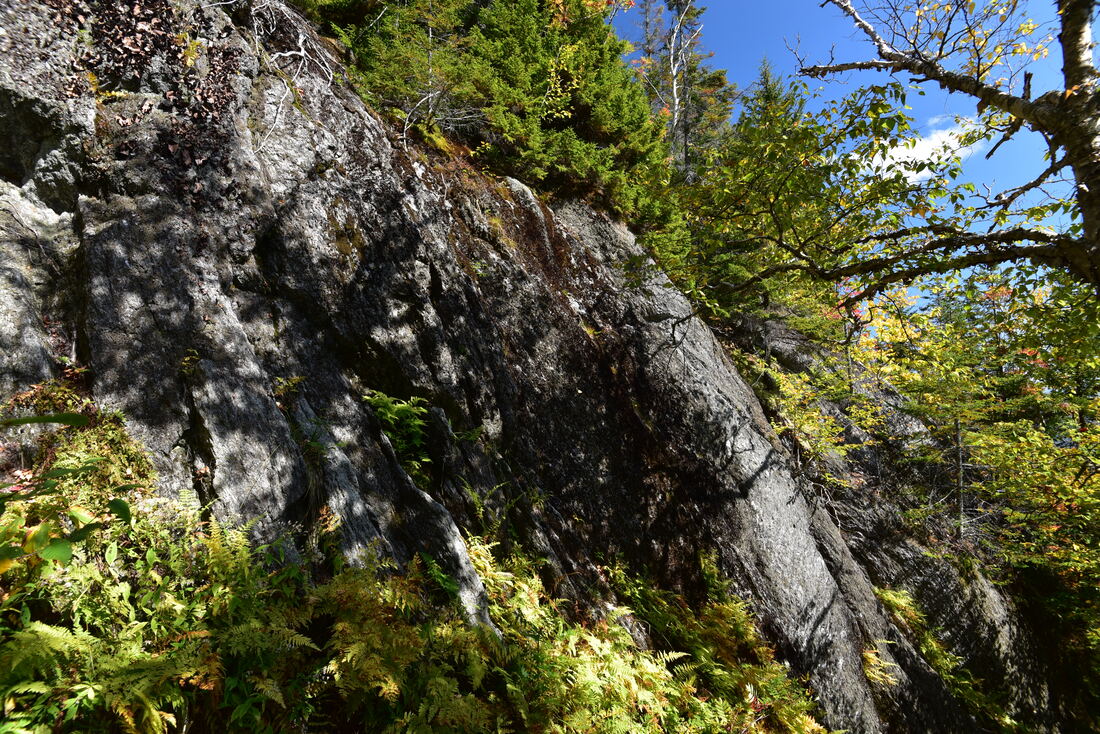
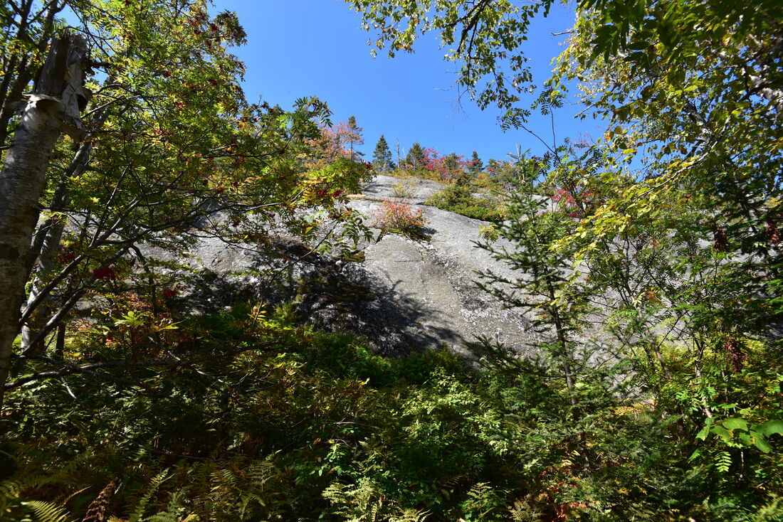
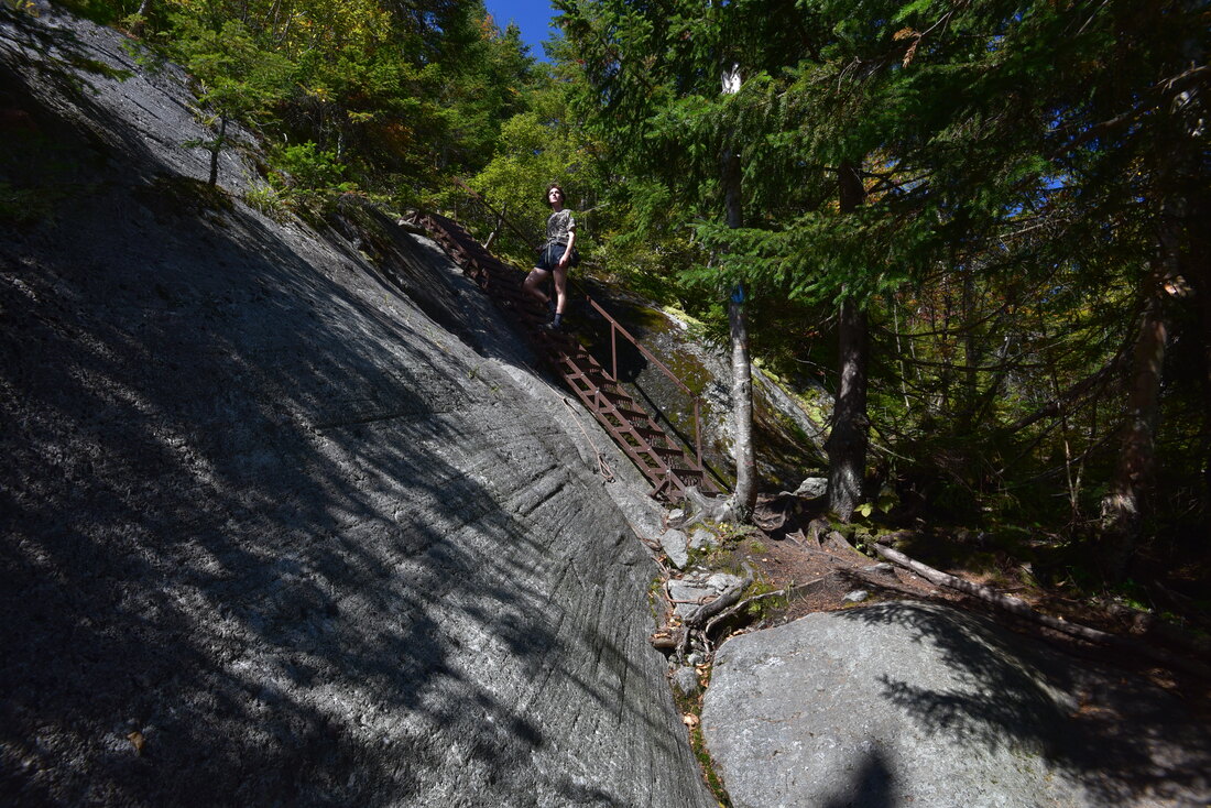
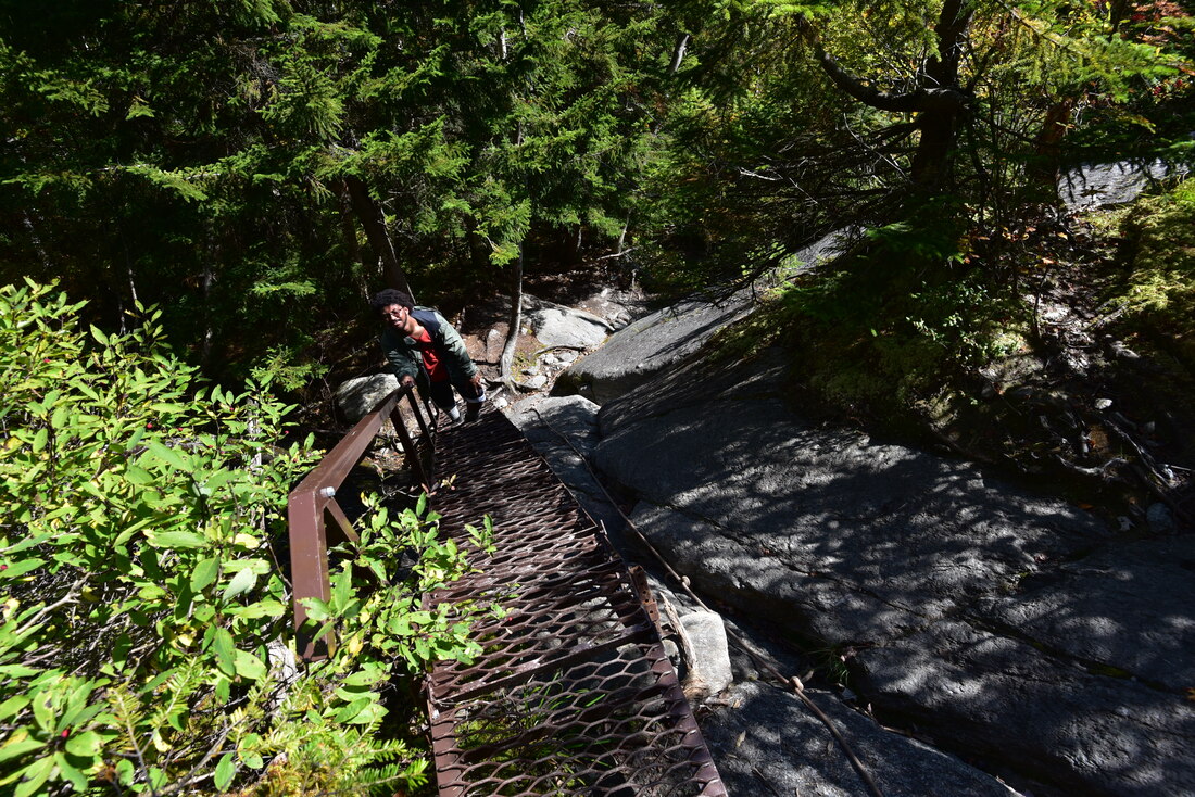
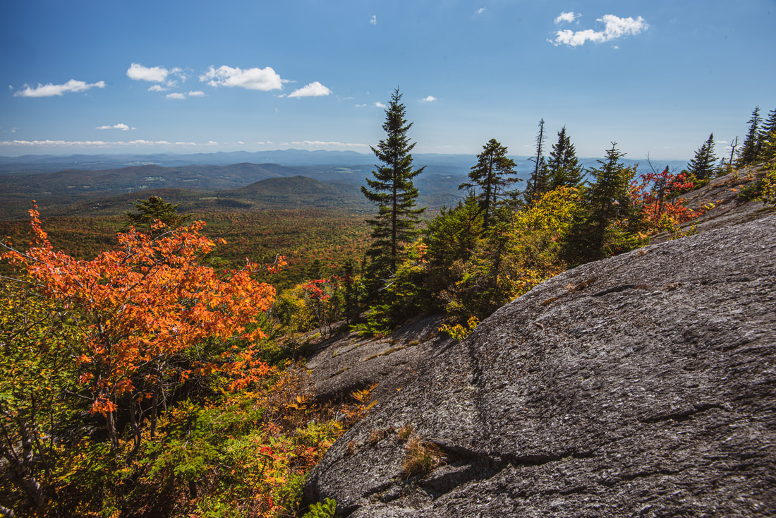
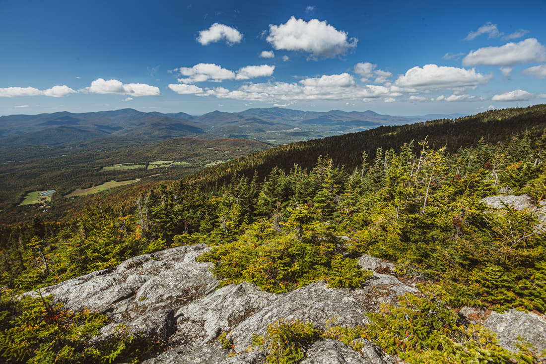
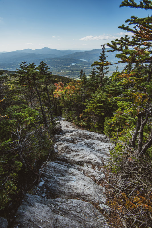
At 2.25 miles, the main trail turns left while a short side trail signed "Vista" leads right. In fact, the view here is essentially non-existent and not even worth mentioning compared to the views coming up along the trail, so don't waste your time. The trail then affords an obstructed view of Mount Hunger's eastern cliff faces and proceeds to parallel their base, even briefly losing elevation to circumnavigate the steeper bluffs. Then, at 2.4 miles, the trail climbs a steel ladder that deposits it onto the lower section of the cliff face itself. The next quarter-mile is entirely out on open cliffs, during which the trail climbs 400 more feet. The rock scrambling never is truly dangerous, and the route is well-marked via blue blazes, but it's still best if you hike this trail with some prior experience in rock scrambling and good agility/coordination. It is not a good choice for people with children or dogs, even though I personally witnessed a dog successfully scale the whole climb.
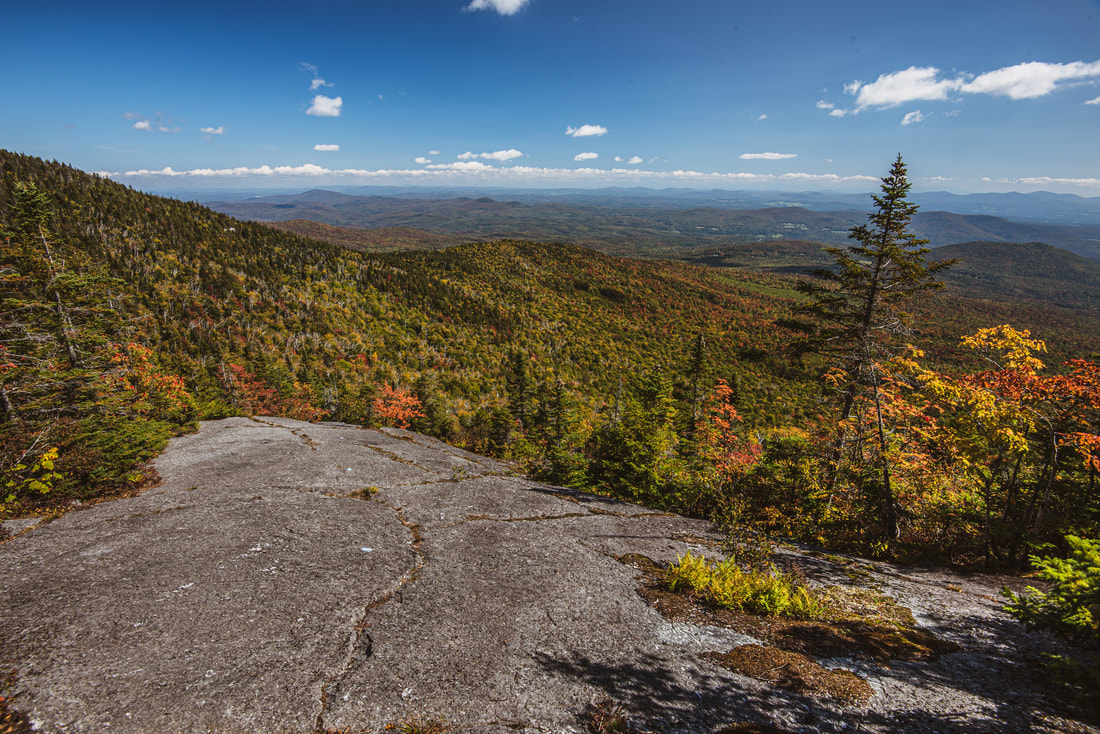
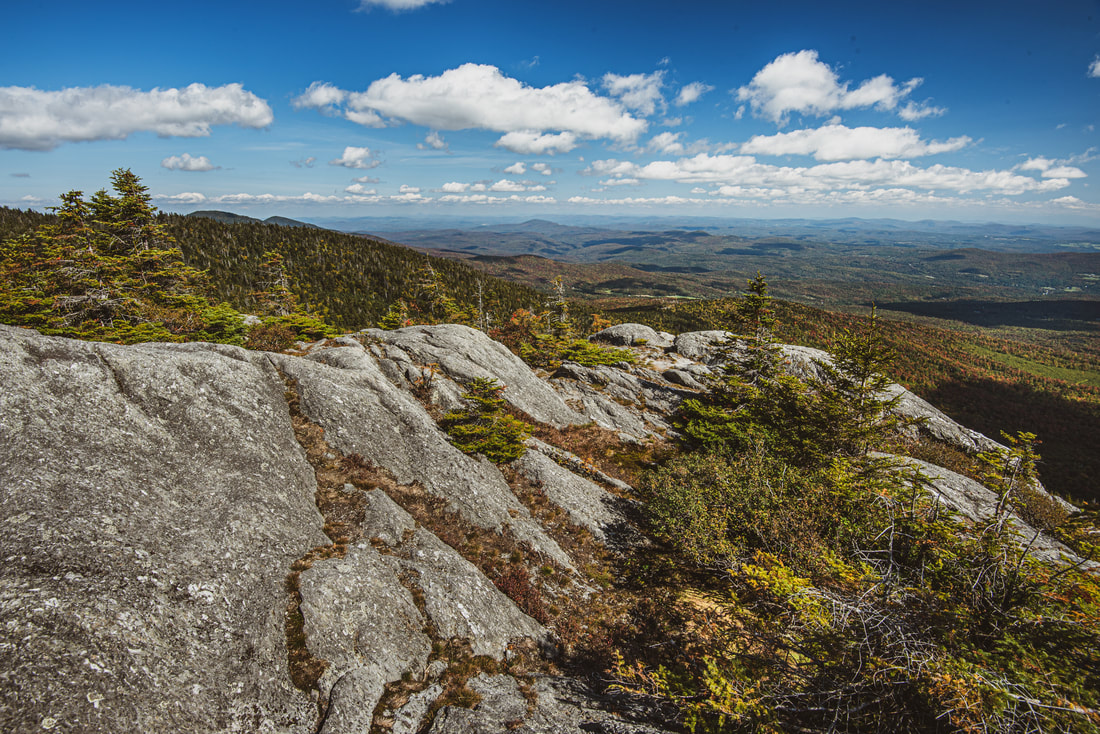
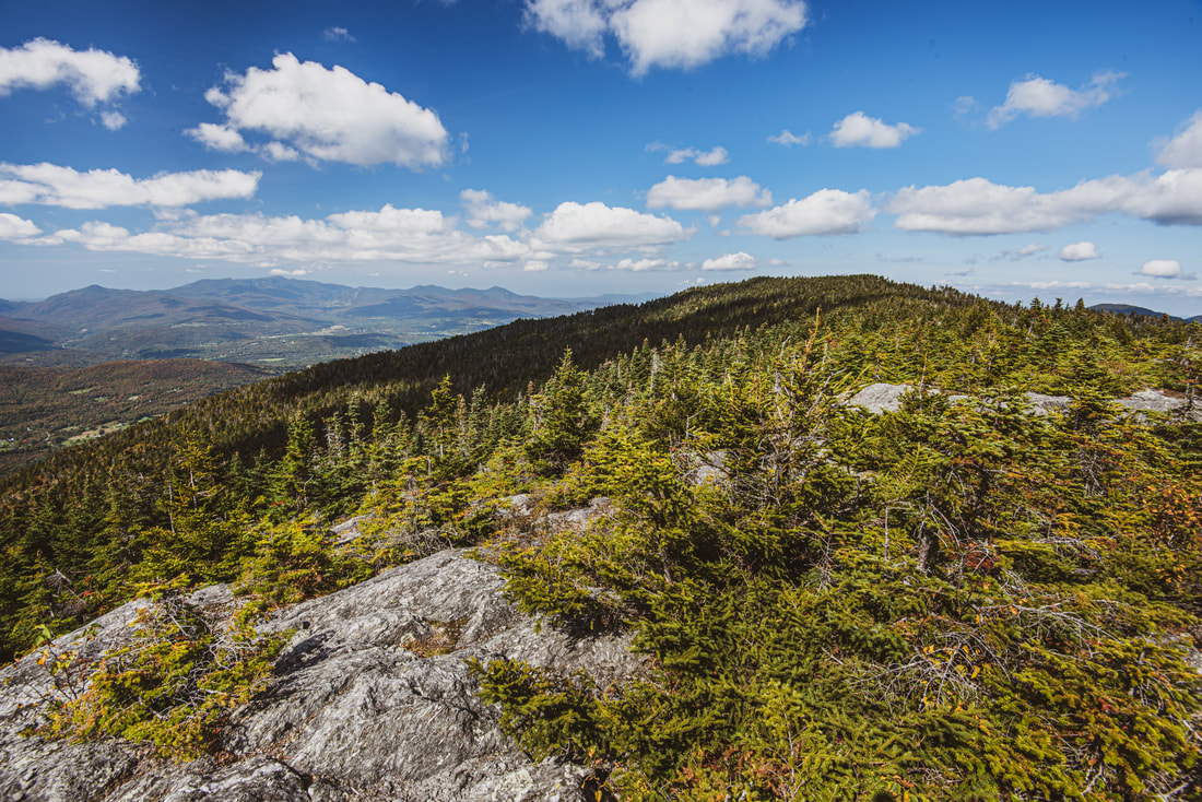
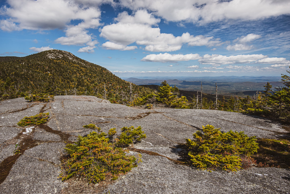
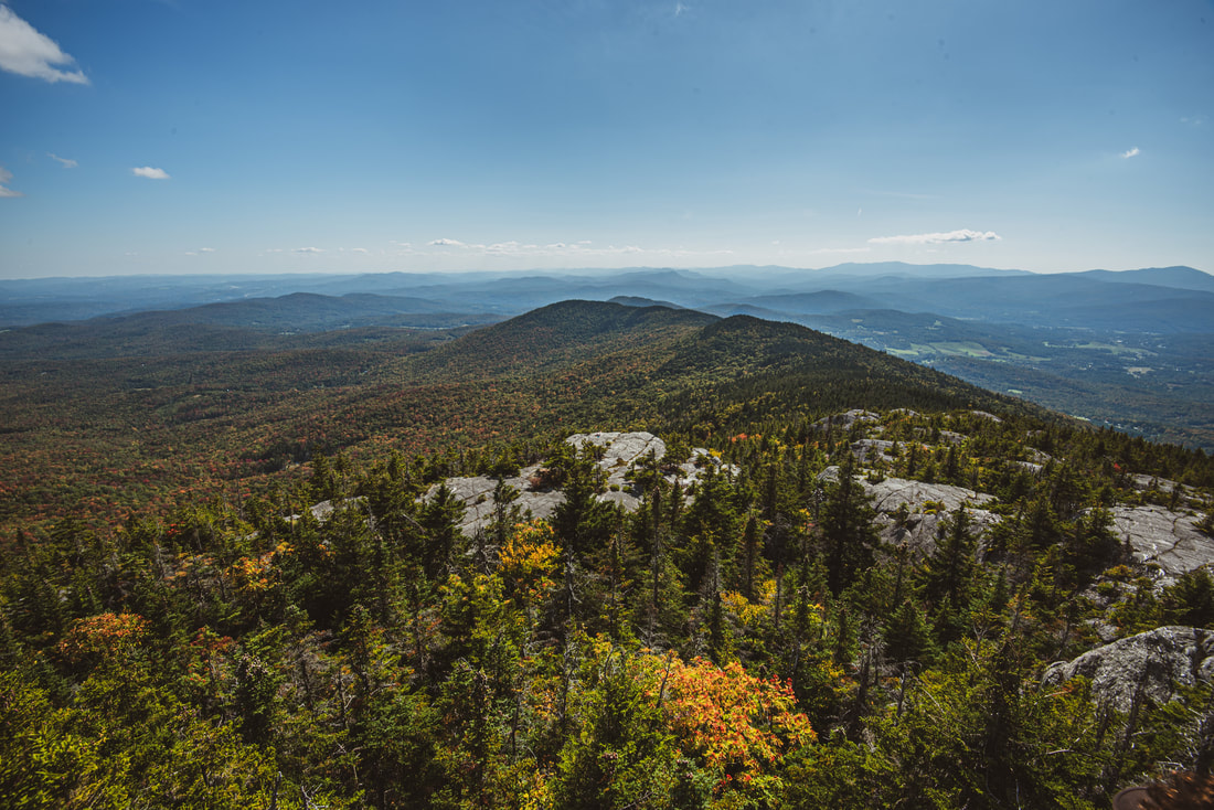
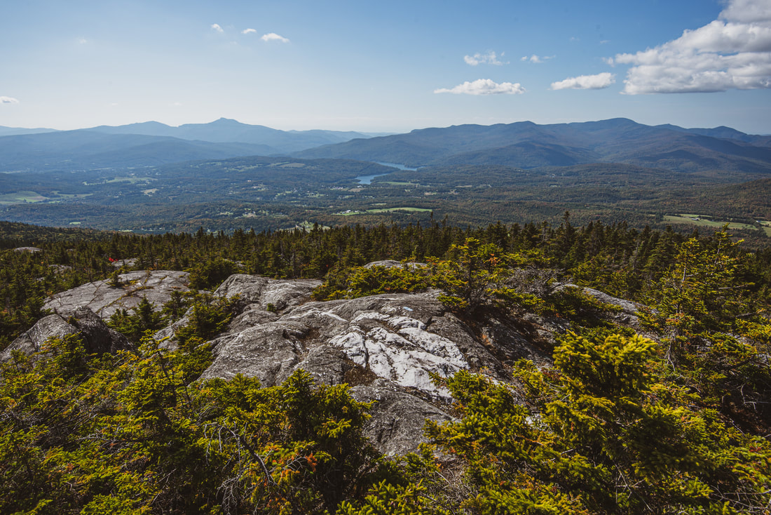
The further you ascend the cliffs, the better the views become. The initial views are mostly to the northeast, with the wooded north peak of Mount Hunger in close range. Over time, the view opens up to the east more, revealing the great and relatively flat expanse of the Winooski River valley. Even though you've hardly surpassed 3,000 feet at this point, the flatness of the terrain below makes you feel as if you're very high up! Note how the woods have transitioned to entirely conifers - no deciduous trees are found growing among these cliffs. Finally, at 2.7 miles, reach the rocky dome that is the summit of Mount Hunger. For a little-publicized 3,540-foot peak, Mount Hunger's views are astounding! The summit offers a 360-degree panoramic vista, though since the summit is flattened, you will need to walk around a bit to see the best of the views on each side. When exploring the summit, be very careful to step only on rocks and not any of the surrounding sensitive alpine vegetation, which is easily destroyed by foot tread. The views from Mount Hunger include lots of prominent Vermont landmarks. To the southwest, the pointed peak of Camel's Hump is in plain sight about 15 miles away. The central ridge of the Green Mountains can continue to be traced further to Mount Ellen and Mount Abraham. On a clear day, even the faint outline of the Adirondacks is visible. If you look closely to the south, you'll see a small rocky outcrop along the ridge just below Mount Hunger - this is Whiterock Mountain, and as you'll find it when you get there, it's much more impressive than it looks! Down in the valley to the right is Waterbury Reservoir, and just to the northwest, a series of distinct humped peaks signify Mount Mansfield, the tallest point in Vermont. Rotating to the east side of the view, the entire Northeast Kingdom of Vermont is spread out in front of you, characterized by its rolling hills and sparse development. The tall peaks faintly delineating the horizon are the White Mountains in New Hampshire. 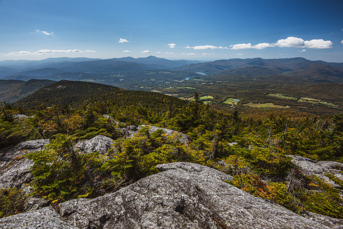
Camel's Hump and Waterbury Reservoir are just two of many landmarks seen looking southwest from Mount Hunger's open summit.
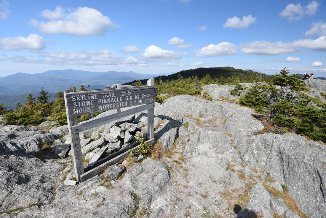
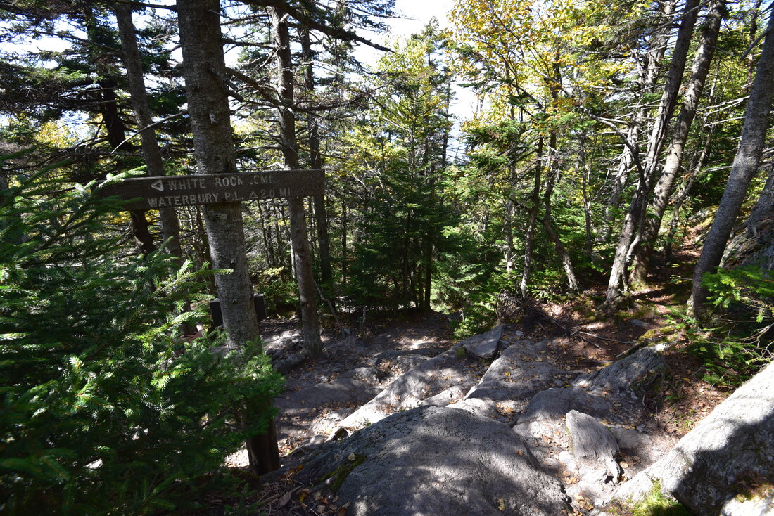
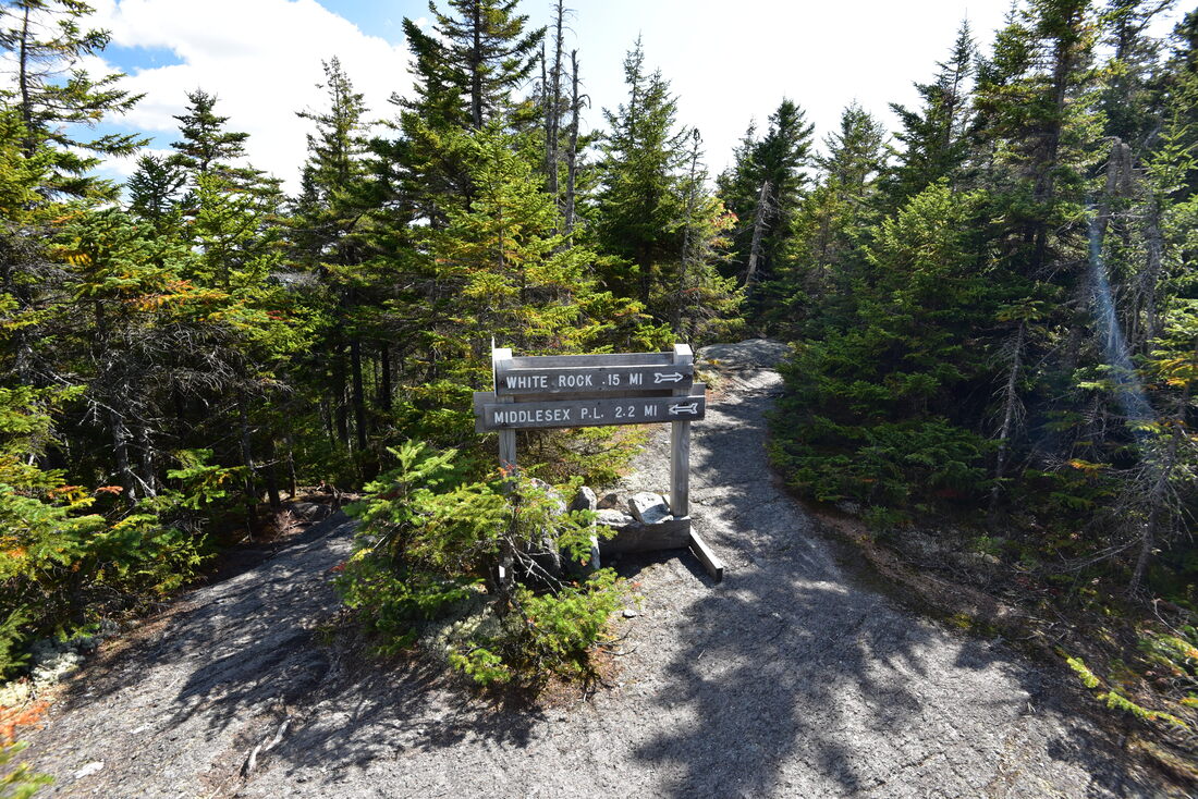
The west side of the Mount Hunger summit features a signed junction with several other trails. Although Mount Hunger is the best-known landmark in CC Putnam State Forest, the Worcester Ridge features a number of other peaks and views, such as Stowe Pinnacle and Mount Worcester. At this junction, the Skyline Trail turns right and follows the ridge for about five miles to Mount Worcester, passes the descending trail to Stowe along the way, and eventually drops down to Hampshire Hill Road. For those seeking a full-day hike and a larger challenge, the Skyline Trail would be well worth doing - especially with two cars - and it's on my list. However, this hike turns left on the Waterbury Trail in the direction of Whiterock Mountain. The Waterbury Trail wastes no time in promptly starting an extremely steep descent off the mountain's west shoulder. The trail quickly enters the spruce-fir forest but continues skipping down tall, slanted rock outcrops that make going downhill slow and laborious.
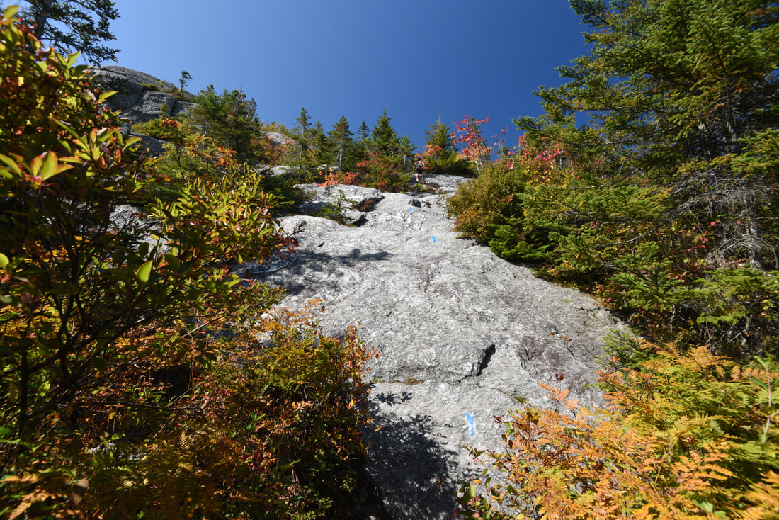
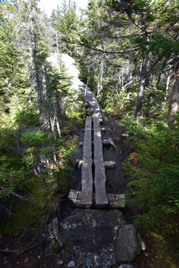
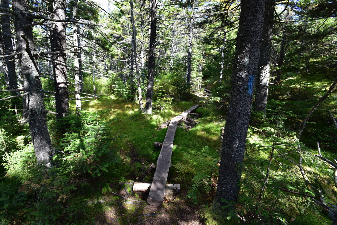
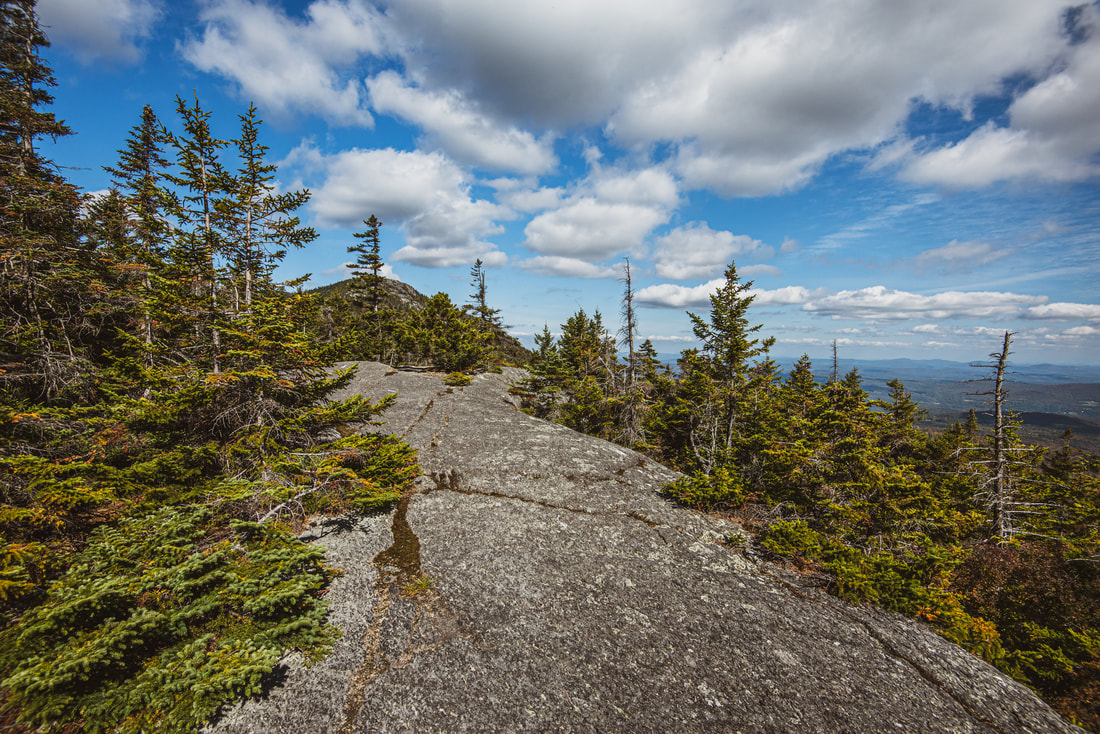
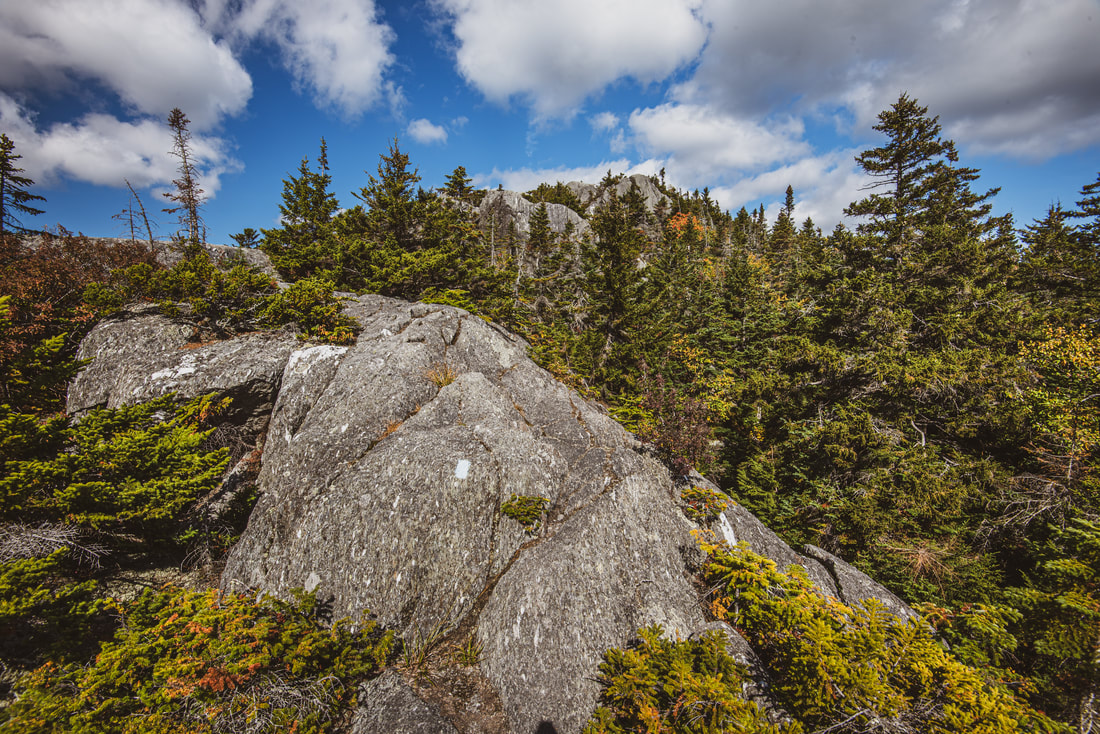
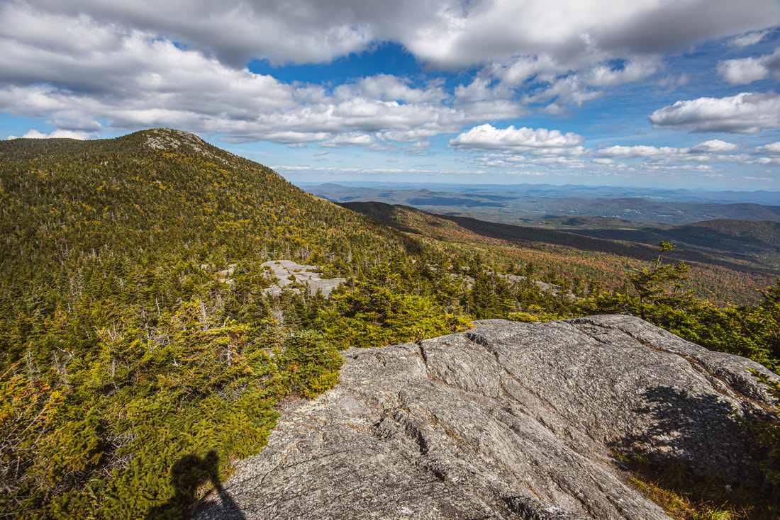
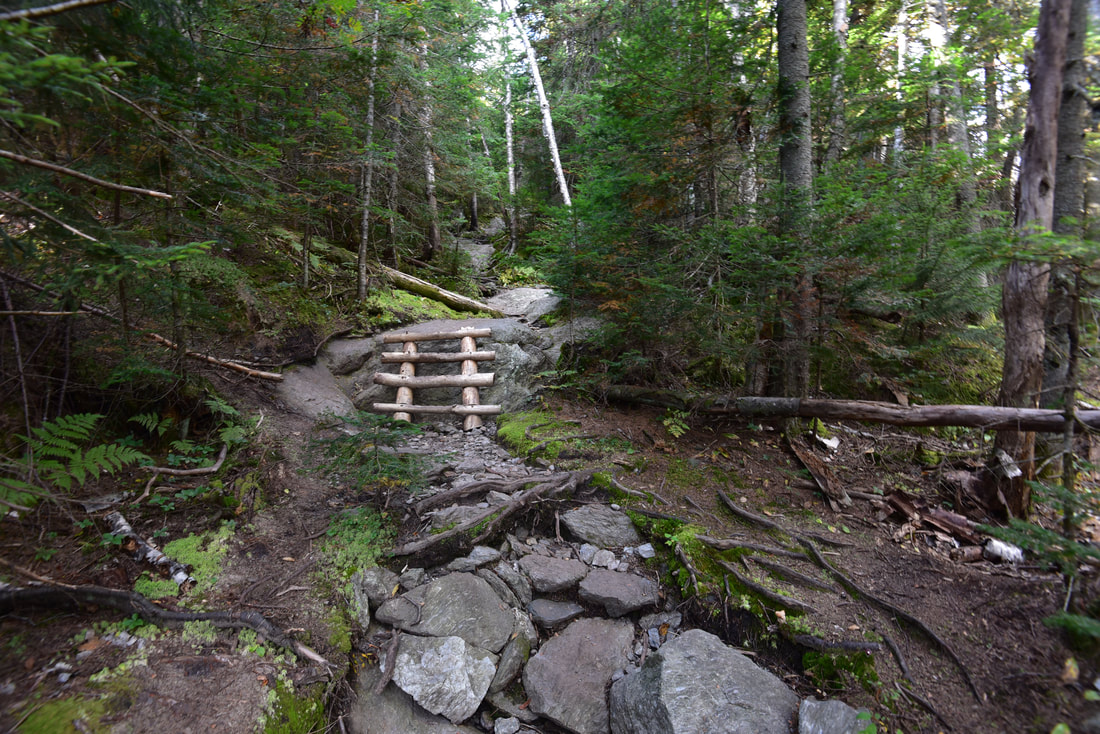
After 200 feet of descent, at 2.85 miles, meet the junction with the Whiterock Trail. The Waterbury Trail continues descending straight steeply for two miles to a trailhead not far off VT 100. However, this loop hike turns left on the much tamer Whiterock Trail, which provides a very welcome breather. The trail contours along the slope a bit before resuming the descent along the ridge that connects Mount Hunger and Whiterock Mountain. Therefore, the trail - while still rocky - is much gentler now. Take time to observe the beautiful spruce-fir forest around you, peppered with jagged, mossy granite outcrops. The trail drops down a slanted rock face into a gap at 3.3 miles where it crosses a muddy wet area via a plank boardwalk. It is followed by a short, moderate ascent up the shoulder of Whiterock Mountain. The trail exits the woods onto a flat rock expanse at 3.5 miles. To the left, there are great views of the towering Mount Hunger and its rocky dome - can you imagine that you were standing all the way up there less than an hour ago?! Just ahead, the Whiterock Trail ends at another signed junction. The 0.15-mile spur trail to the summit of Whiterock Mountain that leaves right is a must-do, as it provides expansive views in every direction that arguably even rival Mount Hunger's views. The spur trail does have additional rock scrambling of about the same difficulty as the Middlesex Trail scrambles, so be mindful of that. 
The open, rocky summit of Whiterock Mountain is a hidden gem concealed by Mount Hunger's towering shadow.
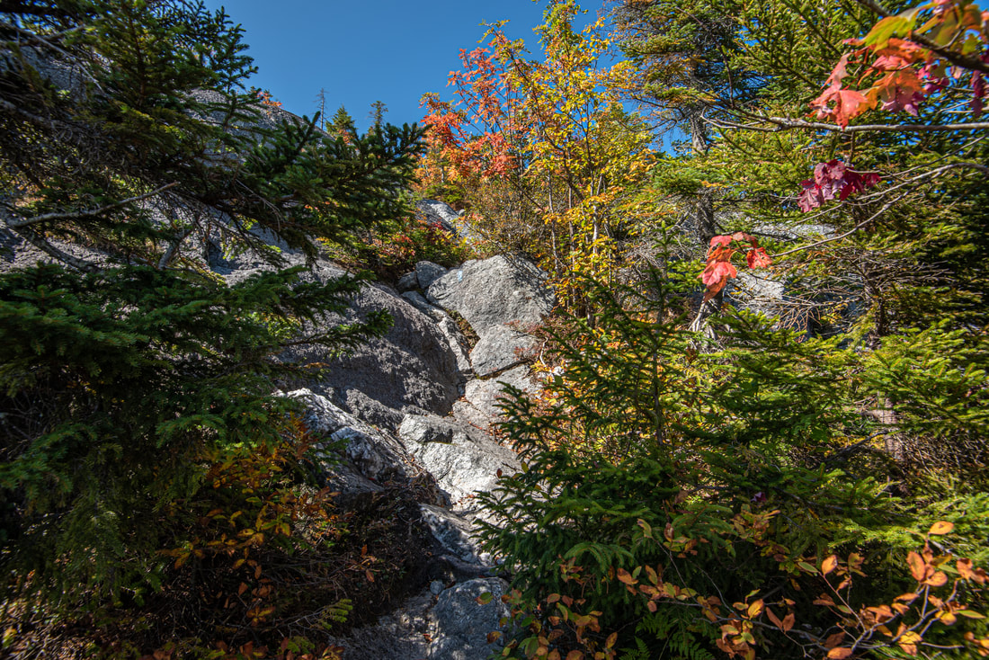
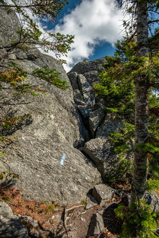
The spur trail initially circles around the east side of the summit along a long, flat ledge with continuous views eastward. Watch for a right turn as the trail briefly dips through a line of spruce and then makes the first of two tricky rock scrambles. The key is to tiptoe up the natural incised notch in this steep cliff. Once past this spot, watch for blue blazes painted on the bedrock as the trail moves up the open granite face before reaching the second tricky scramble spot. Here, you climb up a boulder jumble through a steep notch leading to the summit. There is an awkward spot in the middle where having long legs helps a lot to step to the next rock; if for some reason you don't feel comfortable making this final scramble, don't worry about it, because the views from the various rock faces just below the summit are essentially just as great.
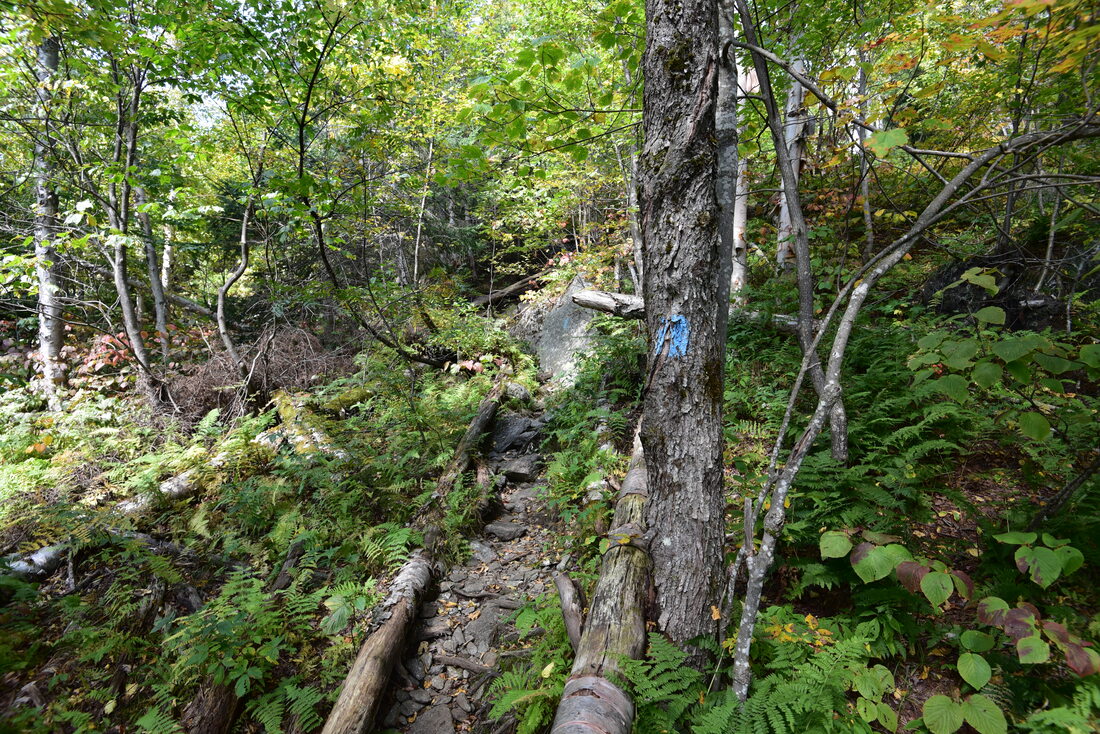
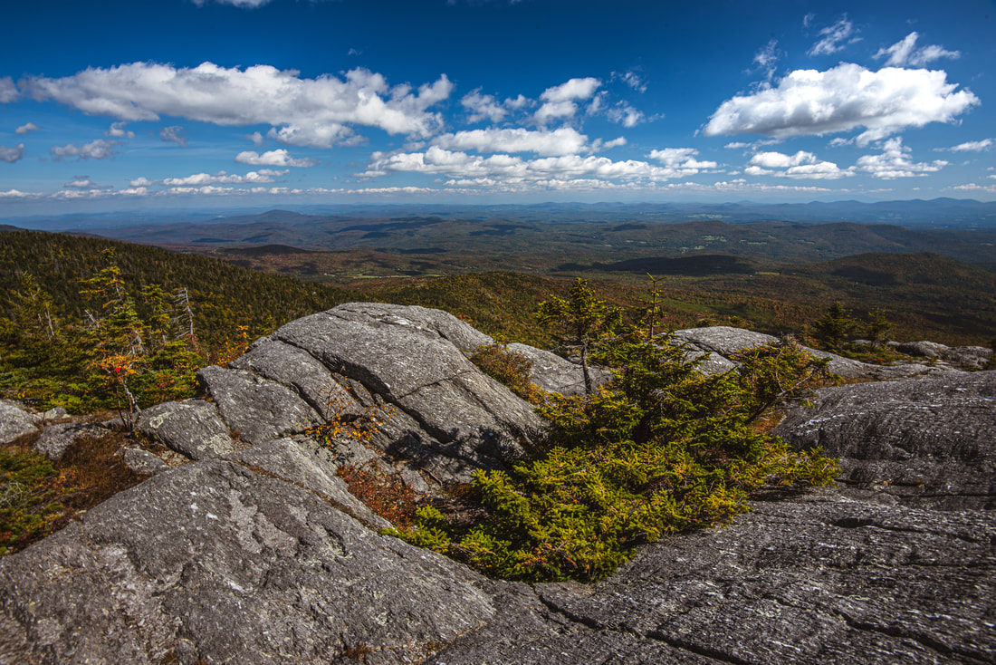
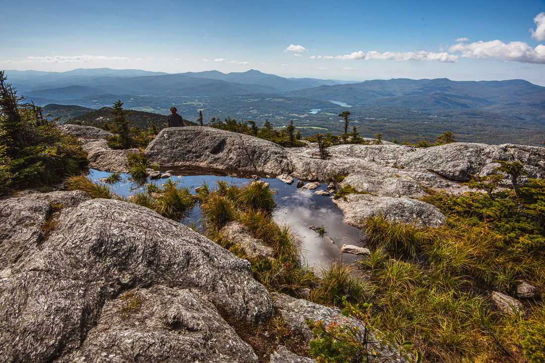
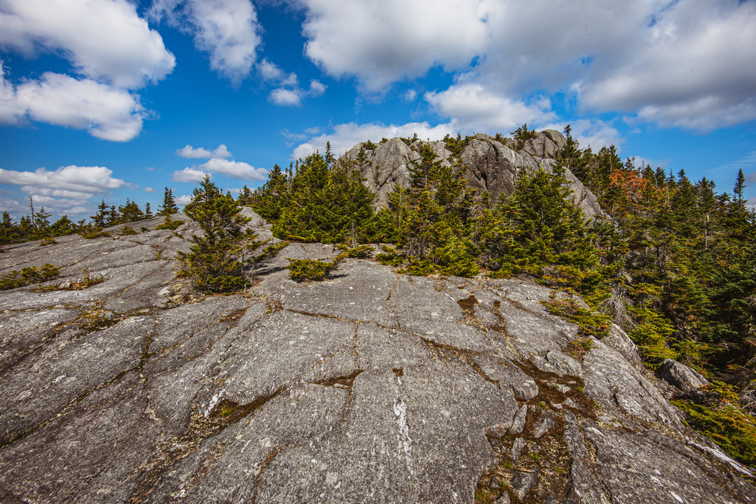
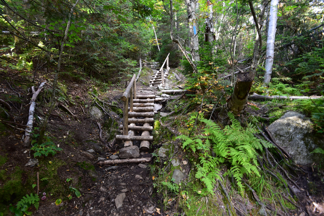
Arrive at the Whiterock Mountain summit at 3.65 miles. Like Mount Hunger, the views are 360 degrees here as well. However, the summit is actually smaller and sharper, so you get to see more views from any one spot. Considering that Whiterock Mountain is just 3,160 feet high, it's amazing that it features such prominent views in all directions. The bulky mass of Mount Hunger and its rocky crown adds a unique element to the view that was obviously absent from the view atop Mount Hunger itself. Also, the open rocky area that is suitable for walking and exploring Whiterock's summit area is actually even more expansive than the one atop Hunger. Once you've fully soaked in the views atop Whiterock Mountain, carefully make your way back to the main trail and pick up the Bob Kemp Trail as it begins descending back towards the Middlesex Trailhead. The descent is entirely wooded and doesn't contain anything technical, but it's a very rocky and slow trail - customary of most peakbagging trails in Vermont and New England at this elevation. You'll encounter plenty of small rock outcrops and wooden ladders to cautiously navigate, and you definitely won't have any opportunities to increase your pace until you return to the Middlesex Trail junction at 4.35 miles. From here, it's simply a matter of retracing your earlier steps along the Middlesex Trail, and this part of the descent is much more pleasant and will pass by quicker. You will return to the Middlesex Trailhead at 6.0 miles, concluding the hike. 
The summit area of Whiterock Mountain has many expansive rock slabs that beg for exploration.
To summarize, I think this is a wonderful hike that deserves more attention than it gets. Simply because there are no 4,000-footers along this hike, or that none of the mountains are along the Long Trail, does not mean at all that it's not a noteworthy destination. Not every mountain you'll climb will have such outstanding 360-degree views, and here, you get two such vista points in the time span of just one half-day hike, one that isn't super strenuous at that. I highly recommend this hike to all Vermont day hikers - conveniently located near I-89 makes it quite easy to access from Burlington!
Mileage
0.0 - Middlesex Trailhead
1.65 - Bob Kemp Trail Jct (Begin Loop) 2.4 - Begin Mount Hunger rock scrambles section 2.7 - Mount Hunger Summit 2.85 - Waterbury/Whiterock Trails Split 3.5 - Whiterock Mountain Spur Trail Jct 3.65 - Whiterock Mountain Summit 4.35 - Middlesex Trail Jct (End Loop) 6.0 - Middlesex Trailhead Pictures & Videos
0 Comments
Leave a Reply. |
About MeMark Oleg Ozboyd Dear readers: I have invested a tremendous amount of time and effort in this website and the Georgia Waterfalls Database the past five years. All of the work that has gone in keeping these websites updated with my latest trip reports has almost been like a full-time job. This has not allowed me to pick up a paid job to save up money for college, and therefore, I I've had to take out loans. If you find the information on this website interesting, helpful, or time-saving, you can say "thanks" and help me out by clicking the button above and making a contribution. I will be very grateful for any amount of support you give, as all of it will apply toward my college tuition. Thank you!

Coming in 2022-2023?
Other Hiking WebsitesMiles HikedYear 1: 540.0 Miles
Year 2: 552.3 Miles Year 3: 518.4 Miles Year 4: 482.4 Miles Year 5: 259.9 Miles Archives
March 2021
Categories
All
|
||


 RSS Feed