
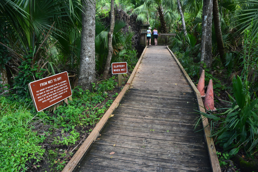
7000-acre Wekiwa Springs State Park is part of a ribbon of wild lands surrounding the St. Johns River on the northwest side of Orlando. The park's centerpoint is Wekiwa Springs, a second-magnitude spring that discharges 45 million gallons of water a day. However, there's a lot more to see in this park, which is crisscrossed by a series of single-track trails maintained by the Florida Trail Association. This hike follows the outermost White Trail all the way from Wekiwa Springs to the park's remote northern reaches. In the first half of the hike, you'll follow an elevated tramway through the wild Mill Creek Swamp and then immerse yourself into the palm hammocks of the Rock Springs Run floodplain, where you'll occasionally get your feet wet (particularly in the rainy season). A stark difference is found in the hike's second half, where you'll cruise through dry sandhills and pass sinkholes. Around the hike's midpoint, an inconspicuous connector path leads into Kelly park, where you can dip your toes in the refreshingly cool waters of the breathtaking, must-see Rock Springs before resuming your hike. This hike occurred on Wednesday, August 1st, 2018. My plan was to hike the White Trail counter-clockwise, starting out along the Wet-to-Dry Boardwalk by Wekiwa Springs.
Summary
R/T Length of Trail: 14.3 Miles
Duration of Hike: 6:10 plus 2 hours of stopping and photography Type of Hike: Lasso Difficulty Rating: 7 out of 10 Total Elevation Gain: Minimal Pros: Breathtaking springs; variety of ecosystems and scenery throughout the trail Cons: The northeastern section of the trail (roughly markers 18 through 21) can be pretty wet for extended periods, especially in the rainy season Points of Interest: Wekiwa Springs; Wet-to-Dry Boardwalk; Sand Pond; Mill Creek Swamp; Rock Springs Run floodplain and views; Rock Springs head; Large sinkhole Trail Blaze Colors: Main Trail/White Trail - White Best Seasons to Hike: Winter Fees: Wekiwa Springs State Park has an entry fee of $6 per vehicle. Beginning Point: Wekiwa Springs Directions from Apopka, FL: From the intersection of Orange Blossom Trail (US 441) and Park Avenue in downtown Apopka, follow Park Avenue north for 2.3 miles. Then, turn right onto Welch Road. Continue for 2.5 miles to Wekiwa Springs Road. Turn left. The Wekiwa Springs State Park entrance is on the left in another 0.5 miles. Once in the park, follow the signs to the springs parking area. Map
Click the link below to download a .GPX file with a track of this hike.
Details
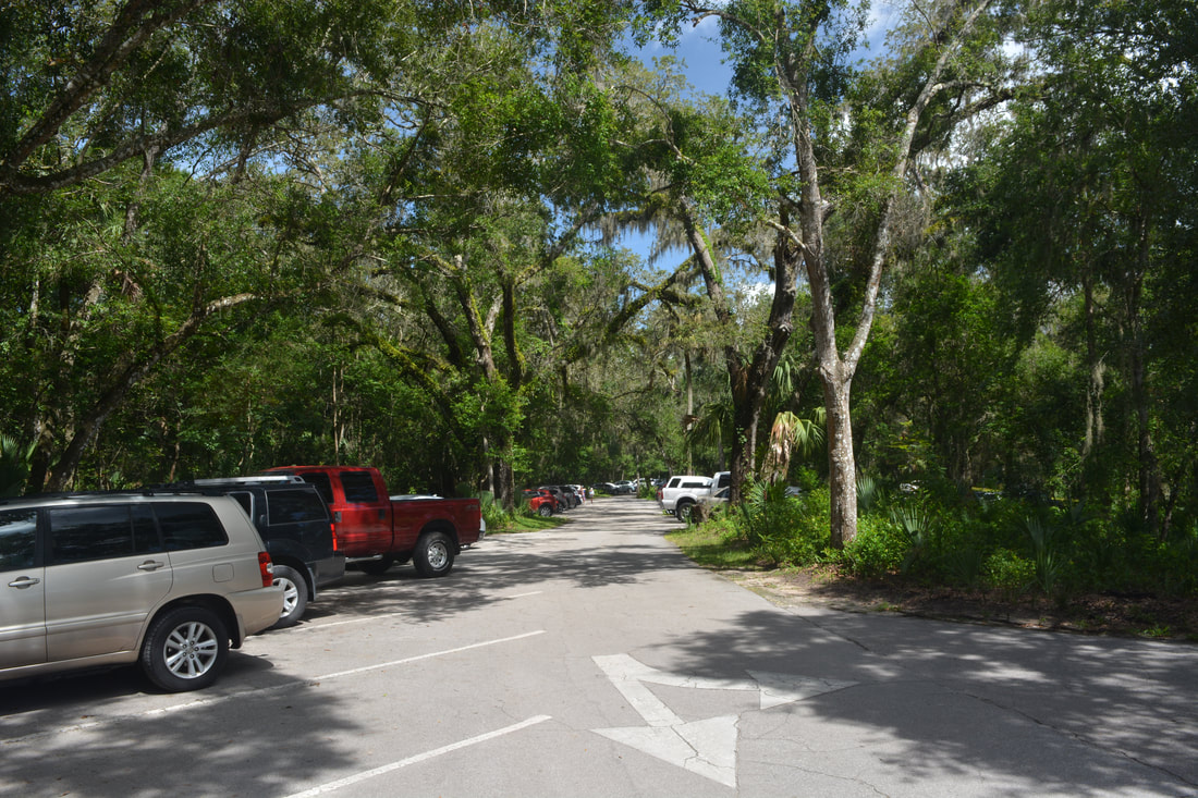
The toughest part of hiking in Wekiwa Springs State Park, particularly in the warmer months, is even getting into the park before it reaches capacity. The spring makes this one of Florida's most popular state parks. I've heard that on good summer weekends, the park is full by 10 AM! That's why I chose to go on a weekday. On summer weekdays, the park shouldn't reach capacity until past noon. The parking area near the springs, full of cars and people strolling in bathing suits, might appear as an odd start to a hike. You could start at the Sand Pond parking area, which is dedicated to hikers, but I recommend starting at Wekiwa Springs so that you could see the spring and experience the Wet-to-Dry Boardwalk - as well as rack up a few extra miles.
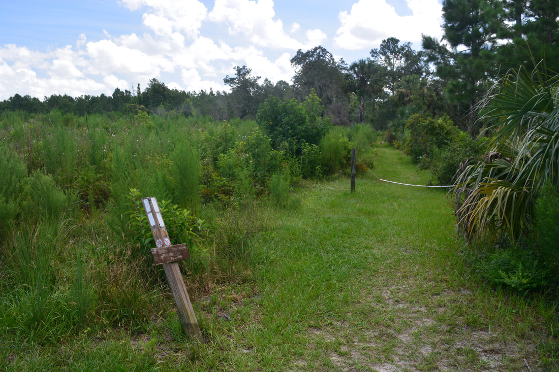
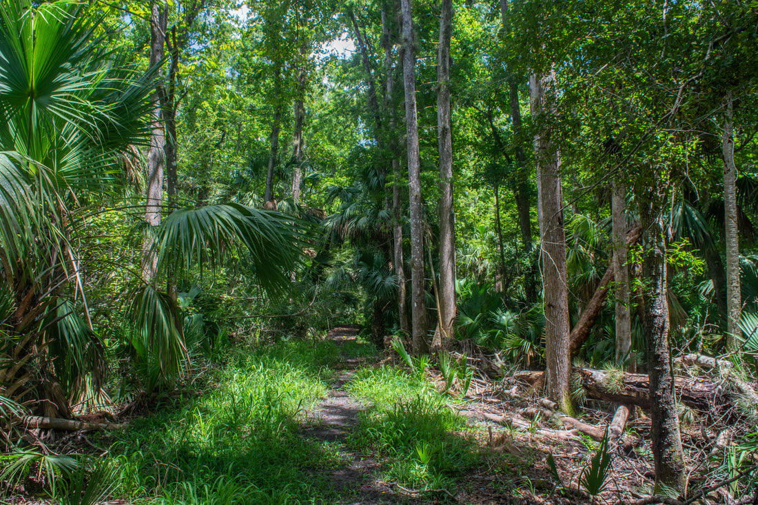
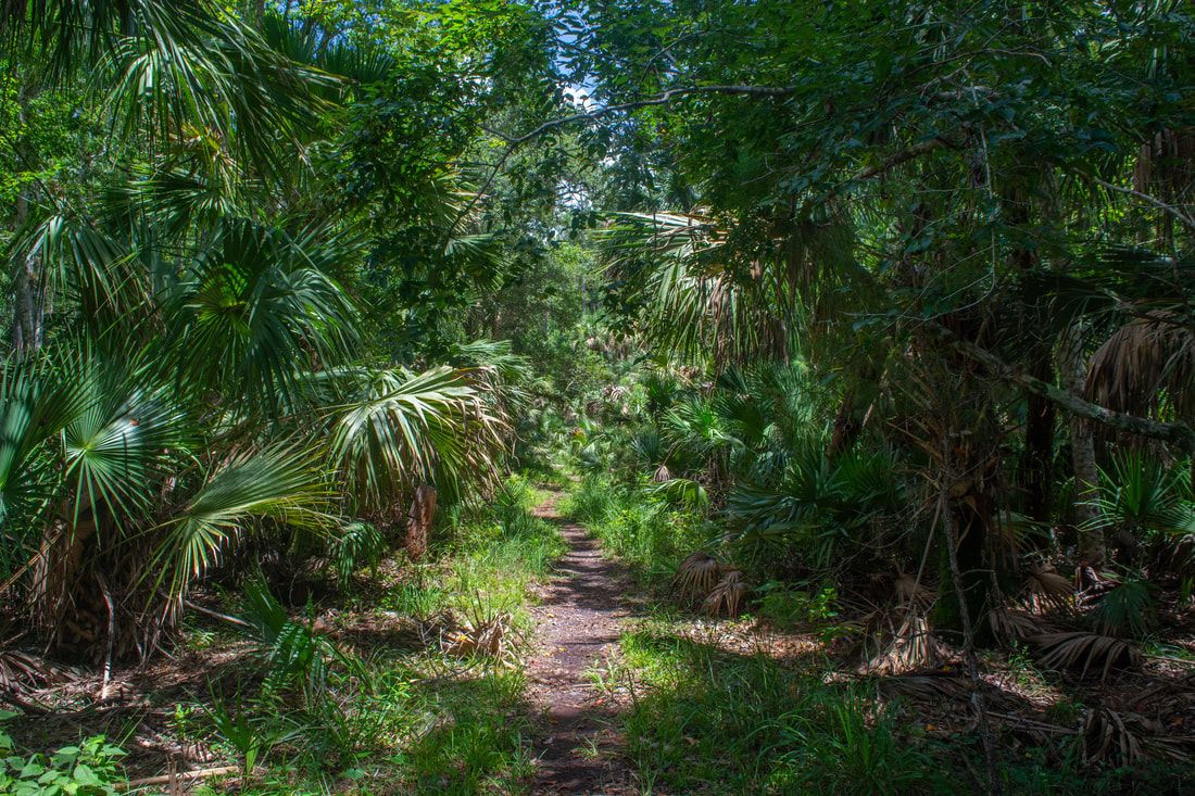
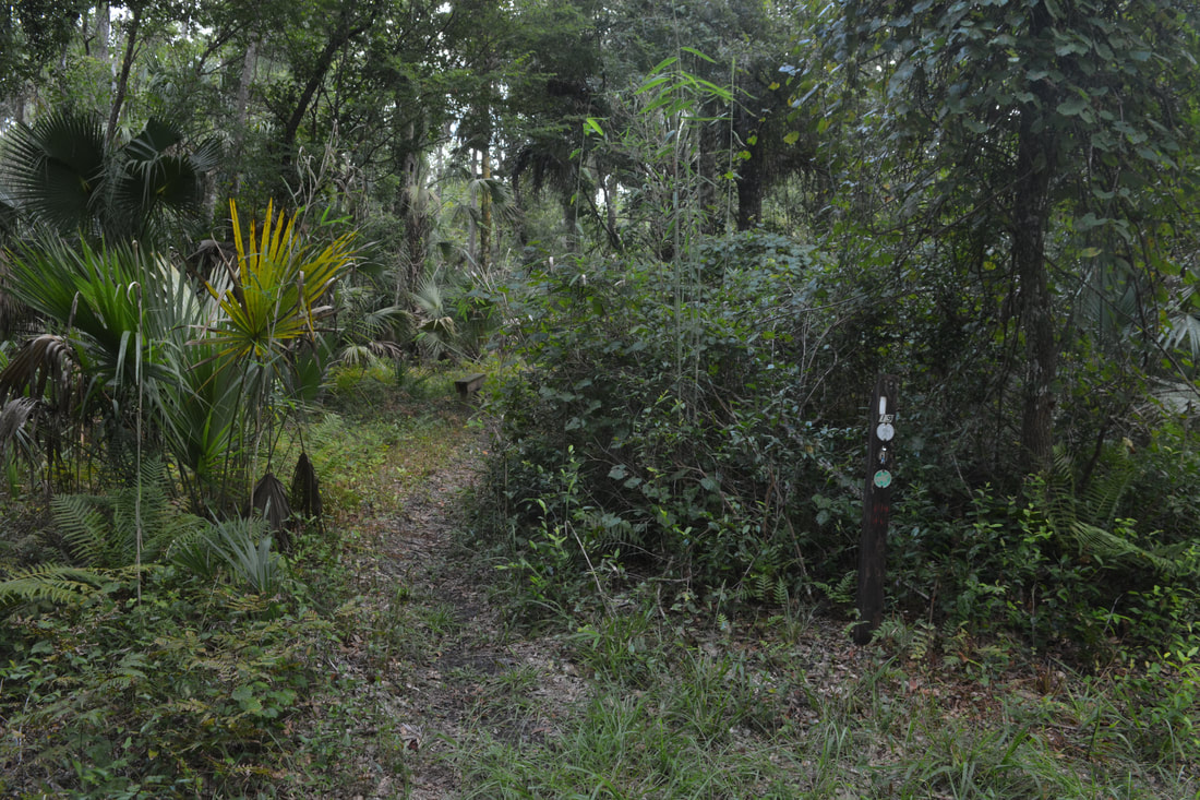
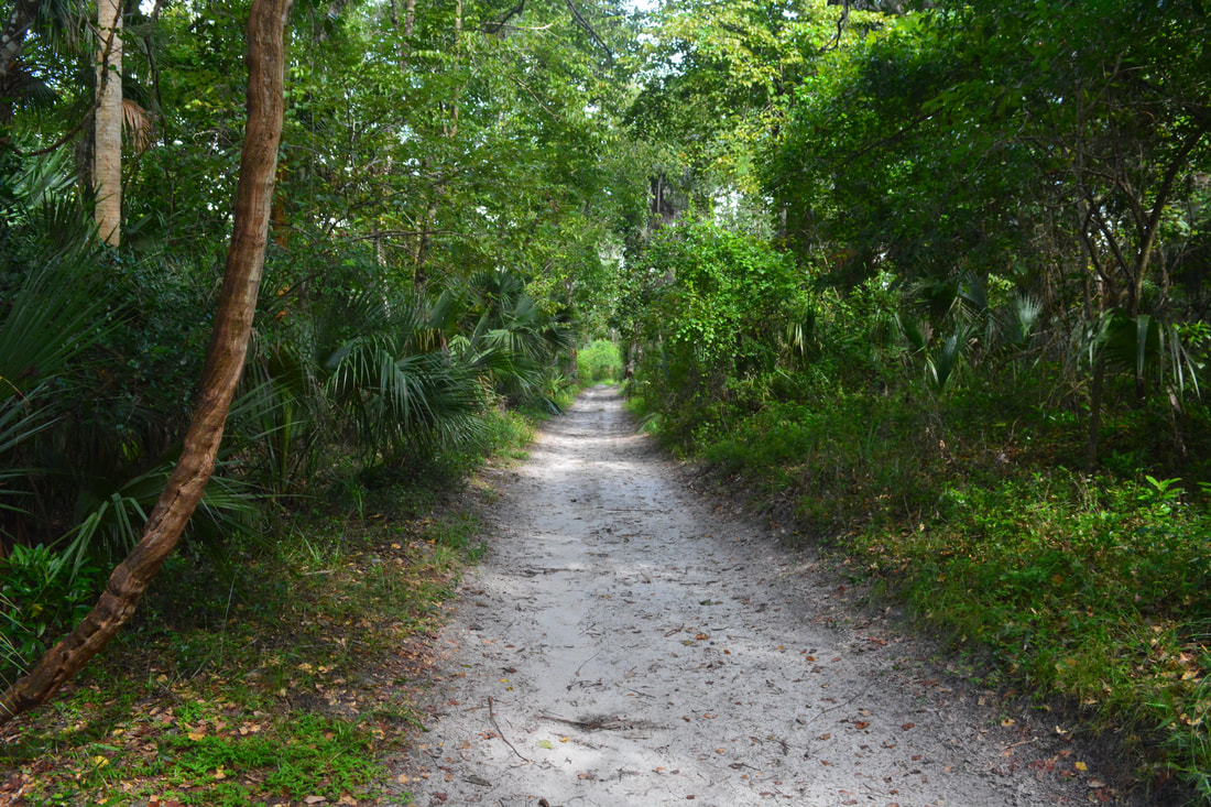
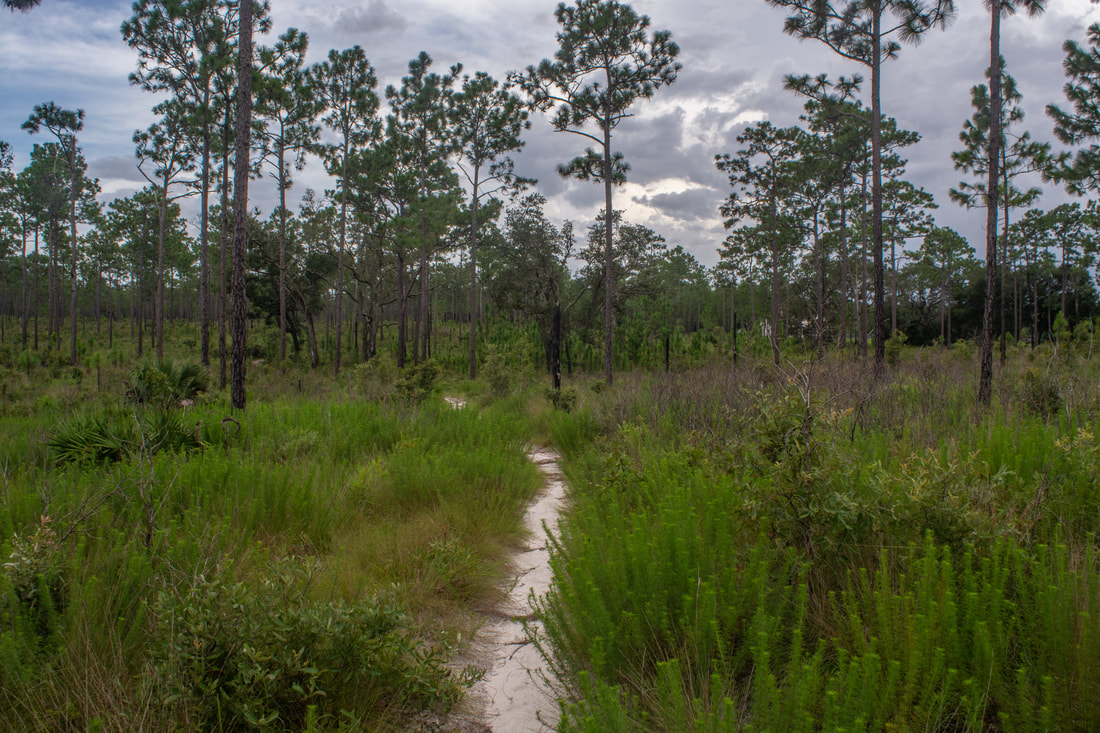
Walk down the boardwalk and steps to the springs. The spring head is lined by a concrete wall and is a 'developed' swimming area, so some of its natural beauty is taken away, but it's still nice. As you make your way through the throngs of people to the far side of the spring, gaze down at the crystal clear turquoise water. A little below the spring head, a wooden footbridge crosses Wekiwa Springs Run and provides great views of the spring's outflow - the start of the Wekiva River. The actual hike starts along the signed Wet-to-Dry Boardwalk just to the left of the aforementioned footbridge. The boardwalk instantly engulfs you into a small swamp near the river, full of ferns and palms. Turning south, the boardwalk gains a little elevation and terminates at the White Trail at 0.5 miles. A left turn will bring you back to Wekiwa Springs. Turn right to stay on the main trail. Note that this trail is blazed with both white and orange. Orange blazes mark a shorter hiking trail, the 5.3-mile Volksmarch Loop. This hike always follows the white blazes along the outer loop. For the next 0.7 miles, you'll be following the out-and-back section of the trail, which traces an ecotone between the piney sandhills and the lush Wekiwa River floodplain. The trail soon comes alongside the park's main road. Reach the start of the loop at 1.2 miles at Marker 2. My preference is to stay right and hike the loop counter-clockwise, so that the wetter section comes first. As the White Trail turns north, note the surprisingly steep slopes on the right. After a section of uplands, the trail drops into a depression at 1.9 miles, where a short boardwalk bridges a tannic stream under the shade of a palm hammock. Hiking under a canopy of sand oaks, reach a Y-split at 2.0 miles with a bench and Marker 24 in the middle. The path that bears left is the orange-blazed Volksmarch Trail. This hike bears right on the White Trail. For a quarter-mile, the narrow path closely parallels the park road for the last time. At 2.25 miles, the main trail turns right onto a grassy forest road, ignoring a spur path leading straight to the Sand Lake parking area. 
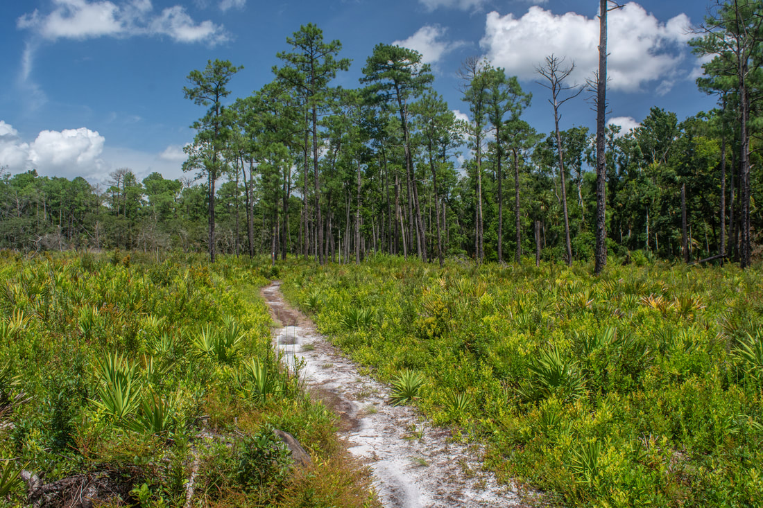
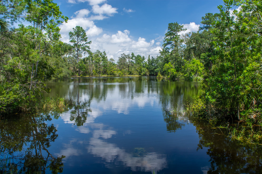
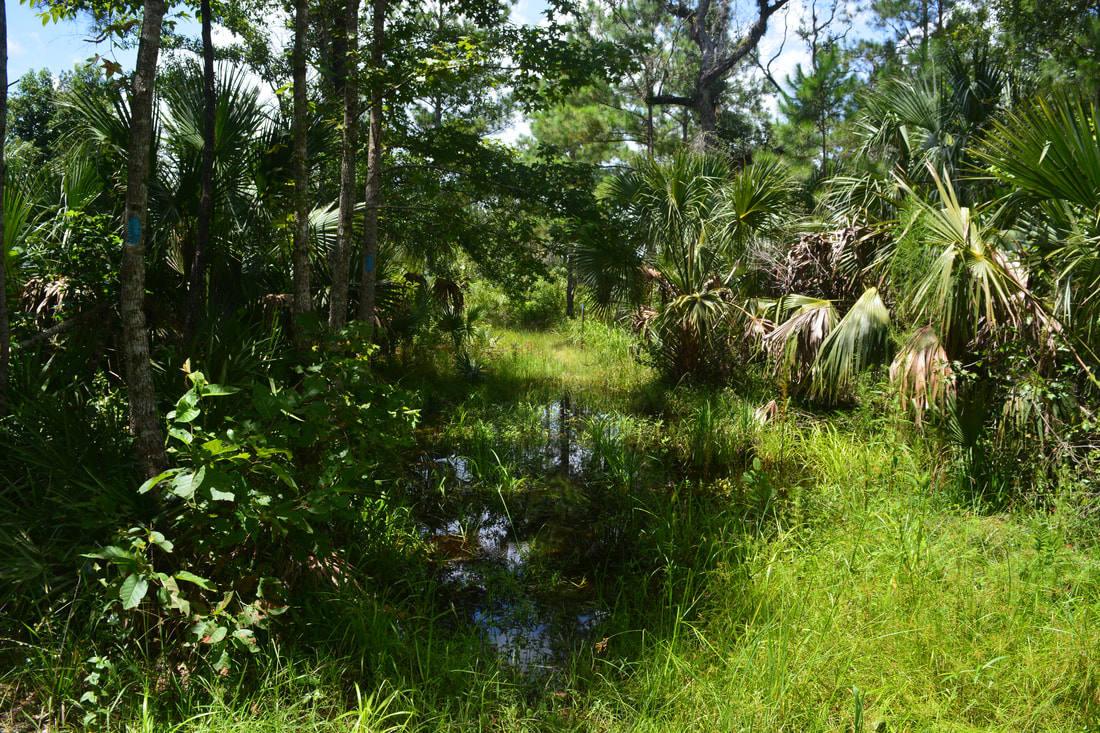
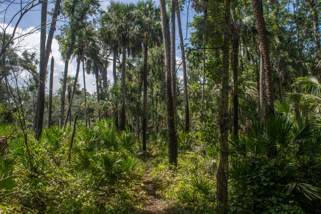
The pretty, pine-lined Sand Pond is just one of the many scenic sights found along the White Trail at Wekiwa Springs State Park.
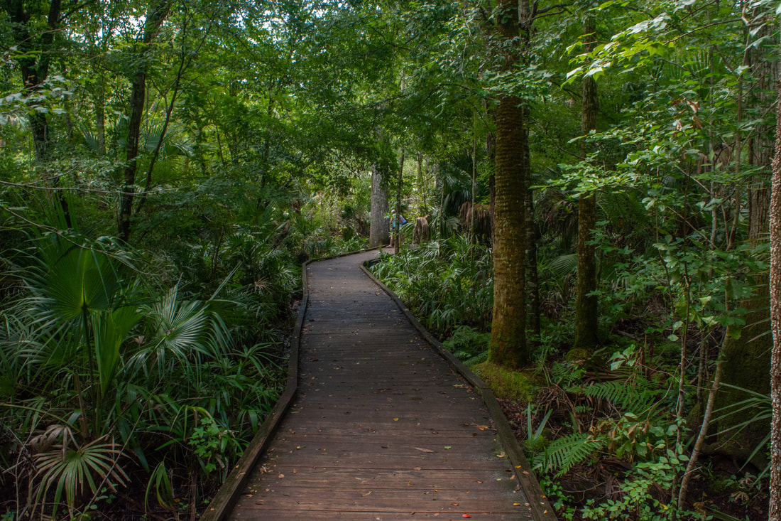
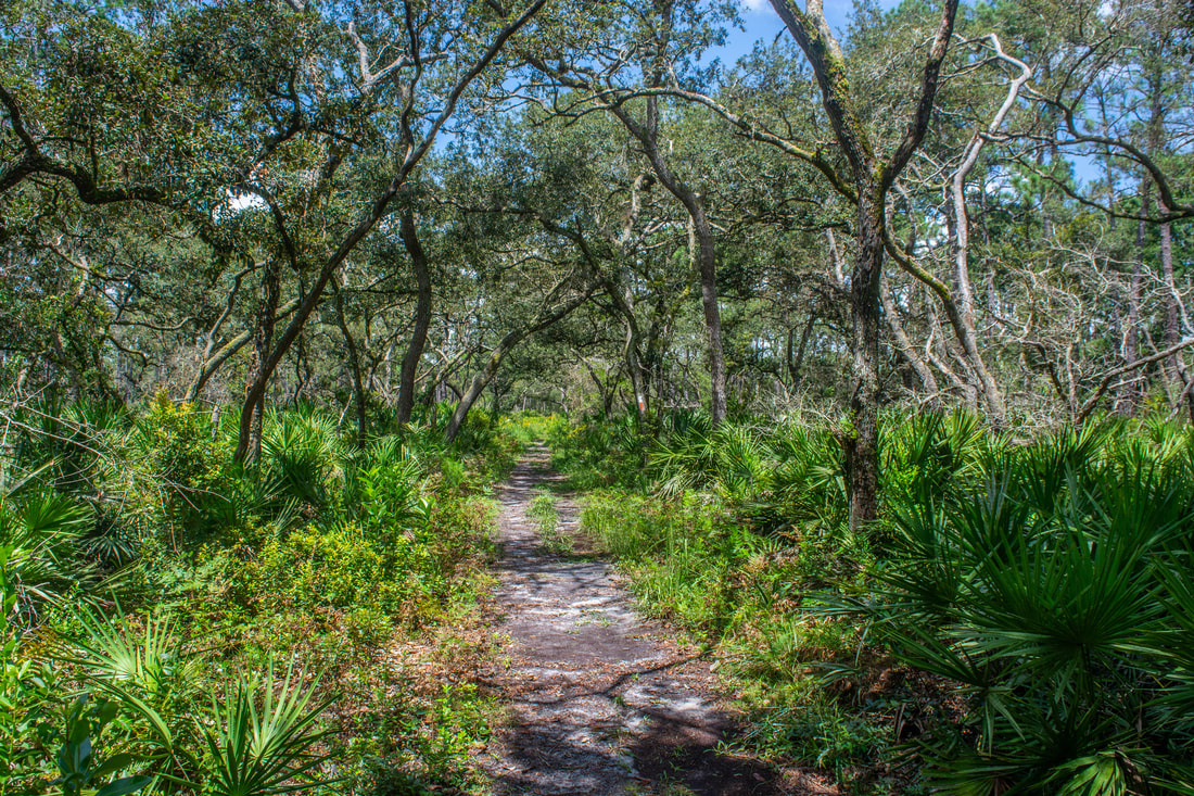
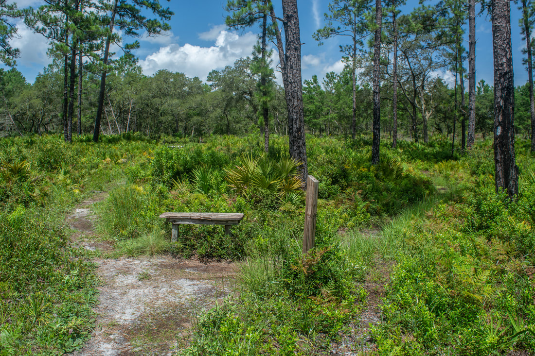
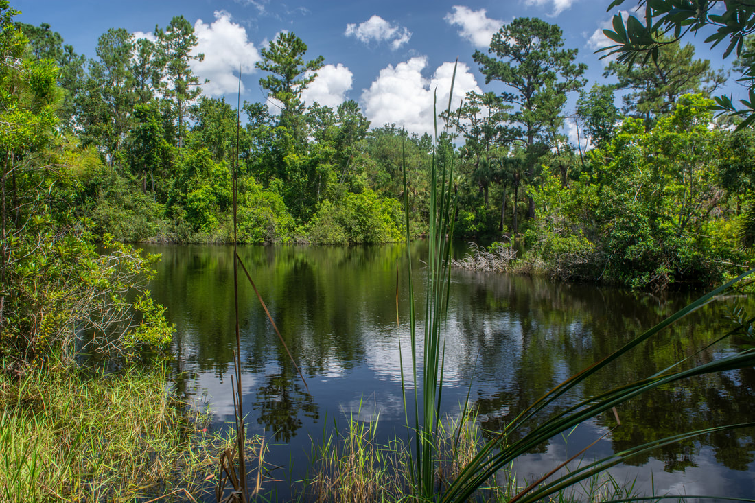
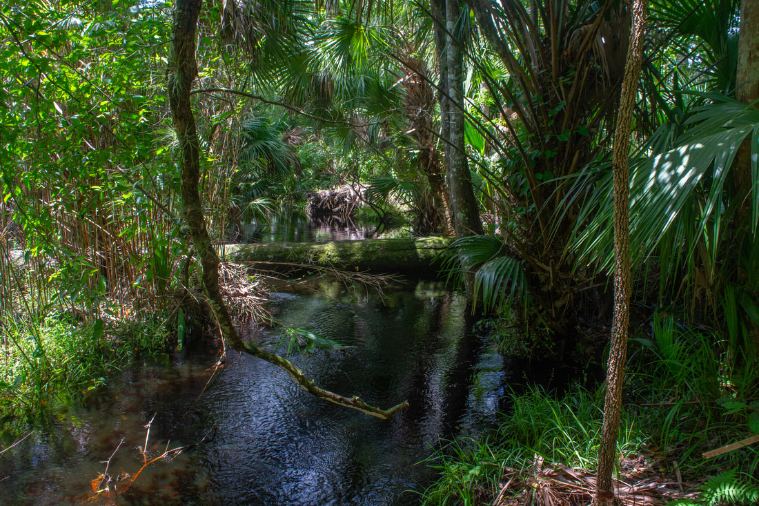
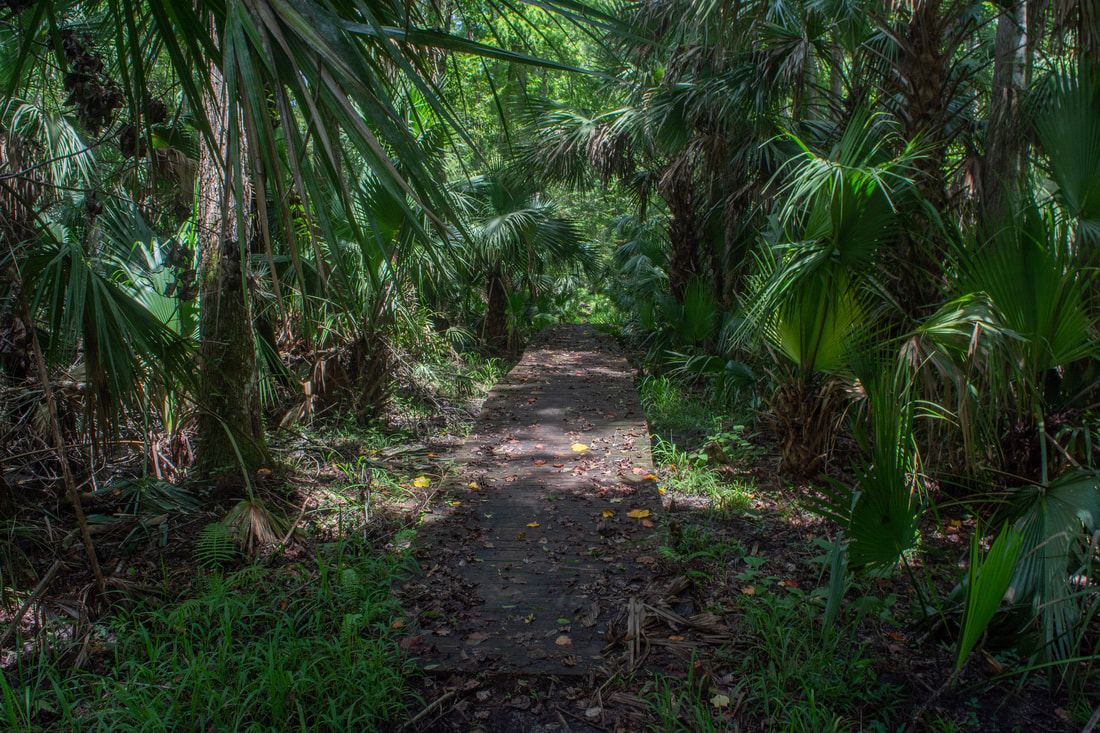
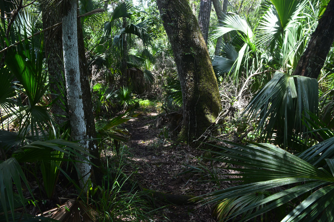
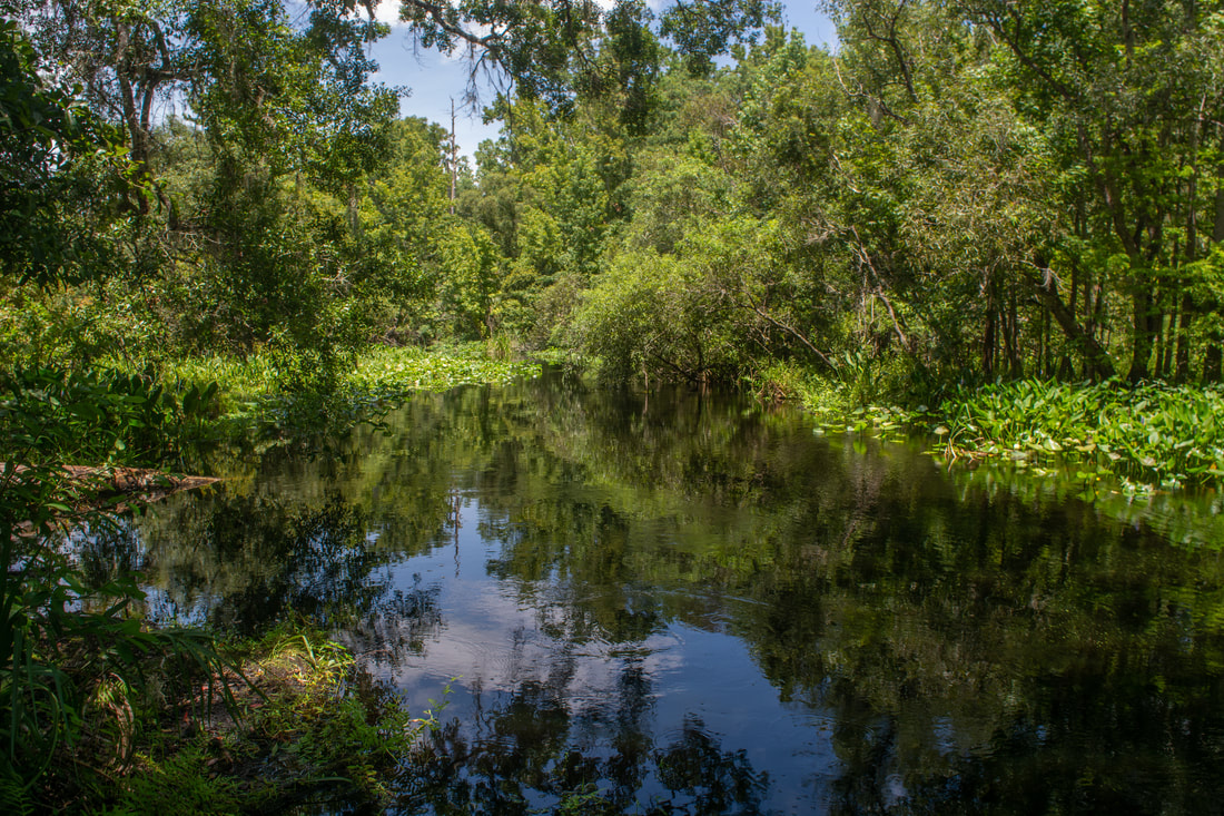
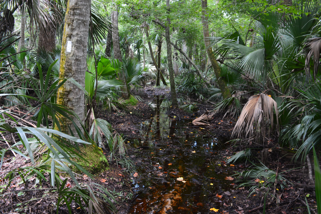
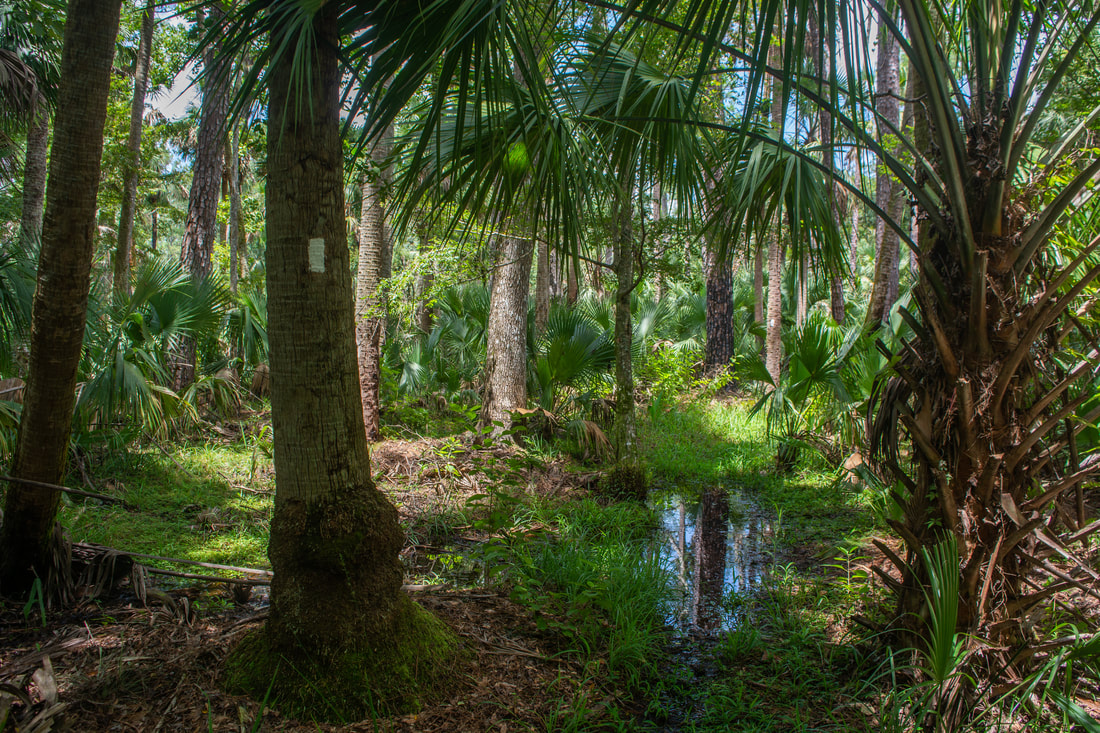
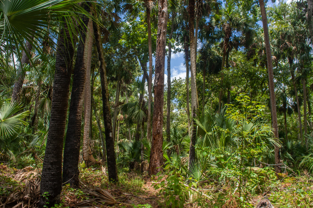
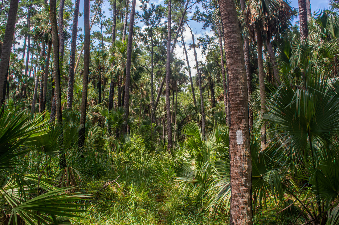
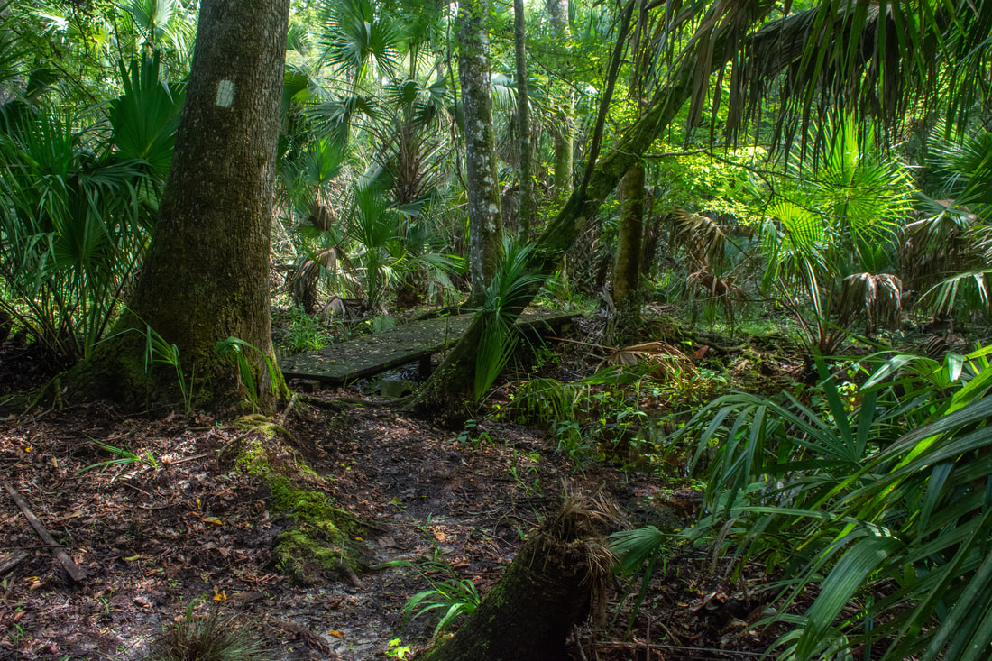
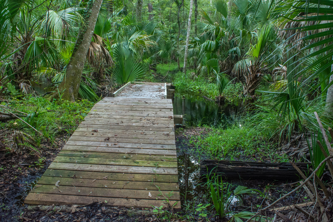
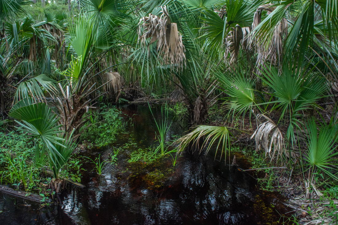
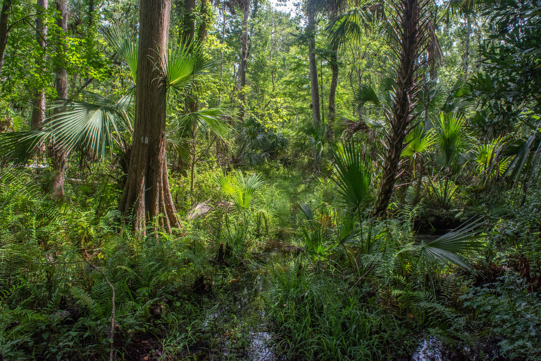
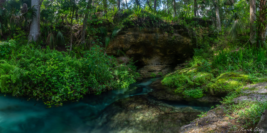
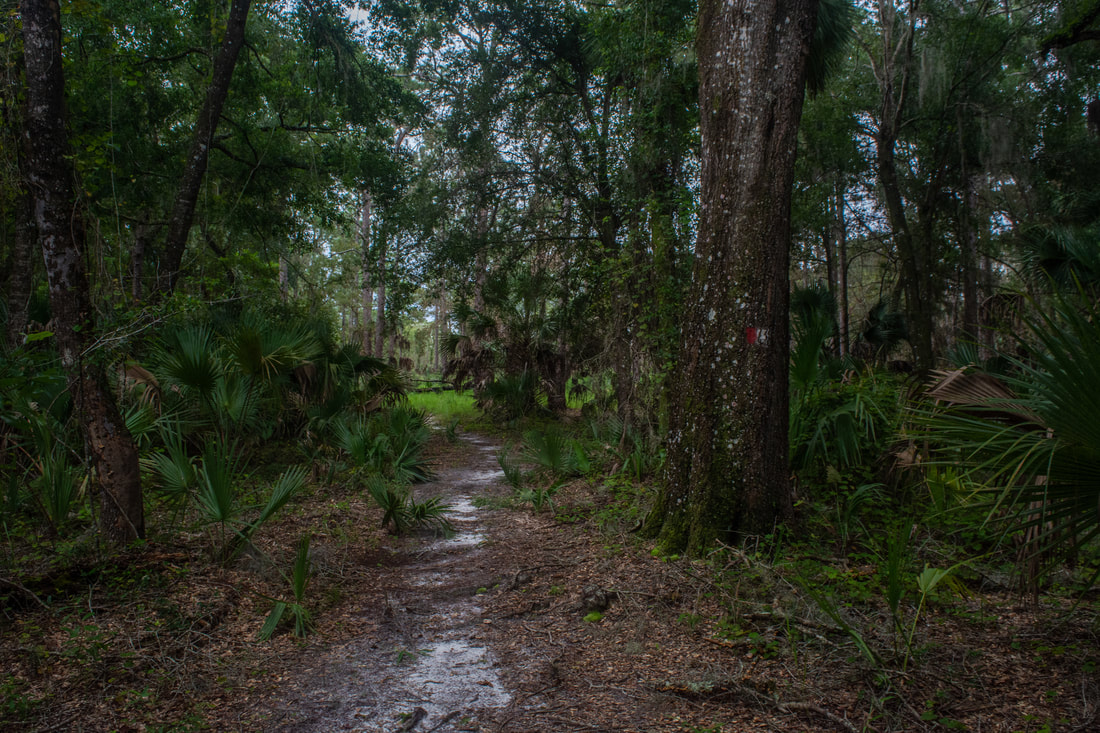
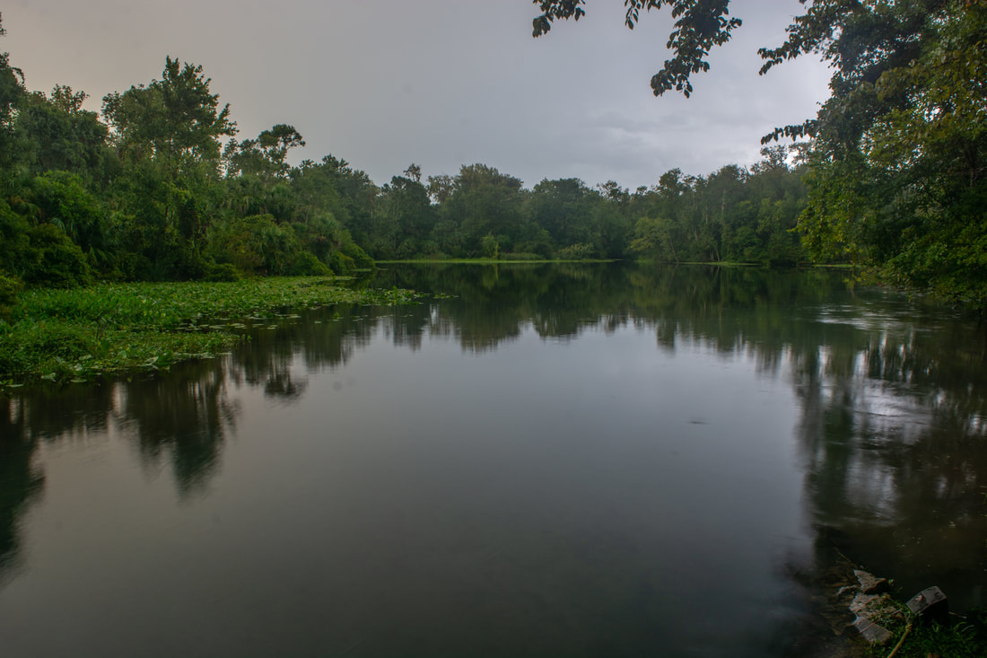
You'll approach the shore of Sand Lake at 2.3 miles, where a bench affords great views. Although this small lake is more like a pond, it's a picturesque scene. Pines and palmetto line the shoreline of the rippling water, and fluffy white clouds drift overhead. Keep following the trail as it circles the pond, passing a couple more viewpoints and picnic tables. At 2.6 miles, reach the start of the Mill Creek Loop. Both sides of the loop are blazed white. You'll want to take the east side through the heart of the Mill Creek Swamp, however, as it's more beautiful. In fact, the Mill Creek Swamp section of the white trail was one of my favorite parts of the hike. Thus, turn right onto the grassy pathway. You'll be following an old logging tramway through the swamp for the next 1.4 miles, so despite the wet nature of the terrain, you'll probably keep your feet dry (though there are occasional puddles in the wet season). At 3.0 miles, the trail reaches a low footbridge across Mill Creek, a clear-bottomed, blackwater stream snaking its way through the jungle. A few dozen yards later, the Blue Cross-Trail leaves left at a signed junction, leading 1.7 miles to the west side of the White Trail. At the time of my hike, the start of the Blue Trail was flooded, but the White Trail remained mostly dry in this area.
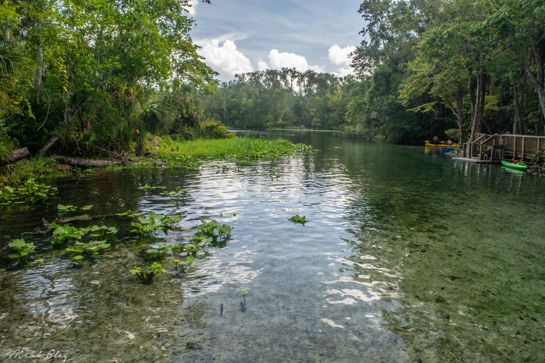
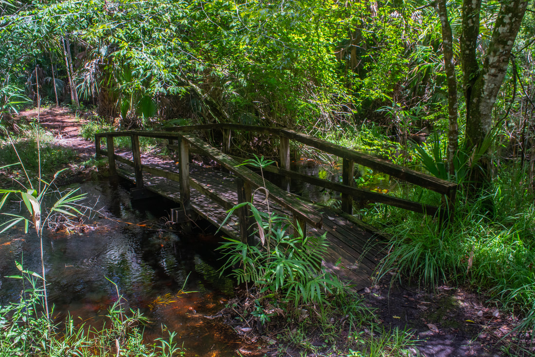
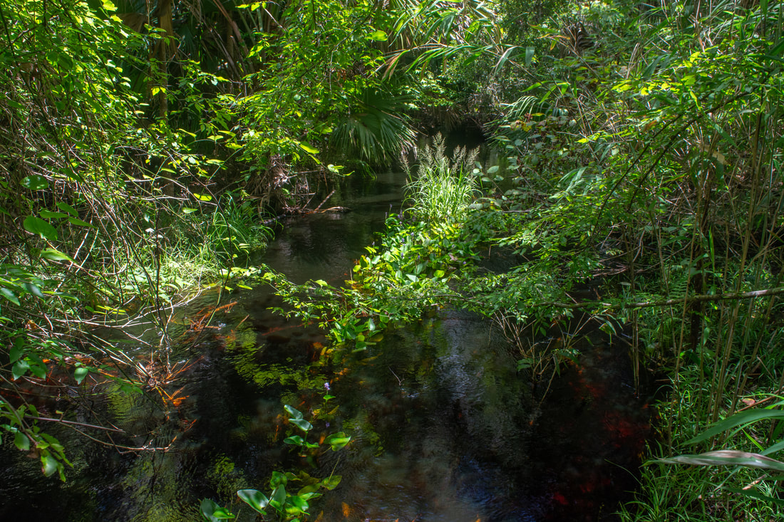
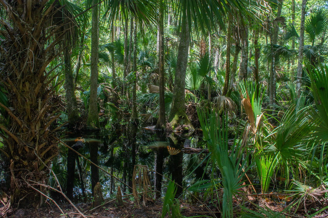
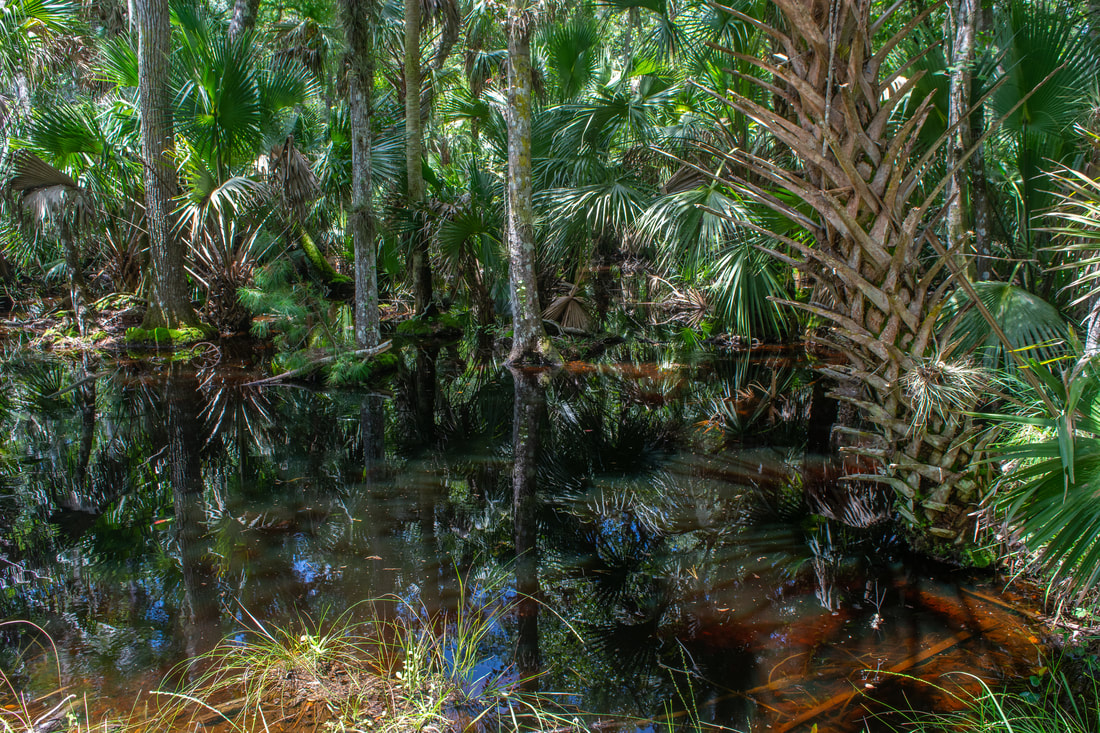
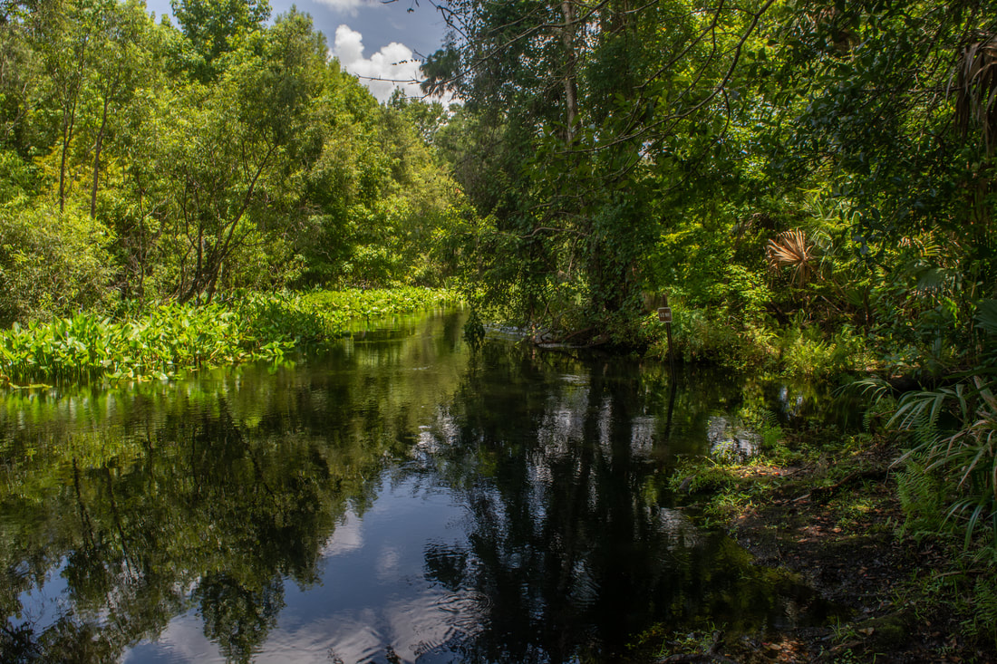
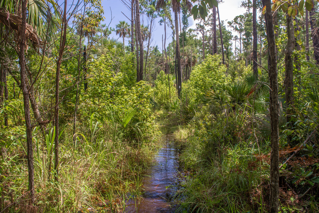
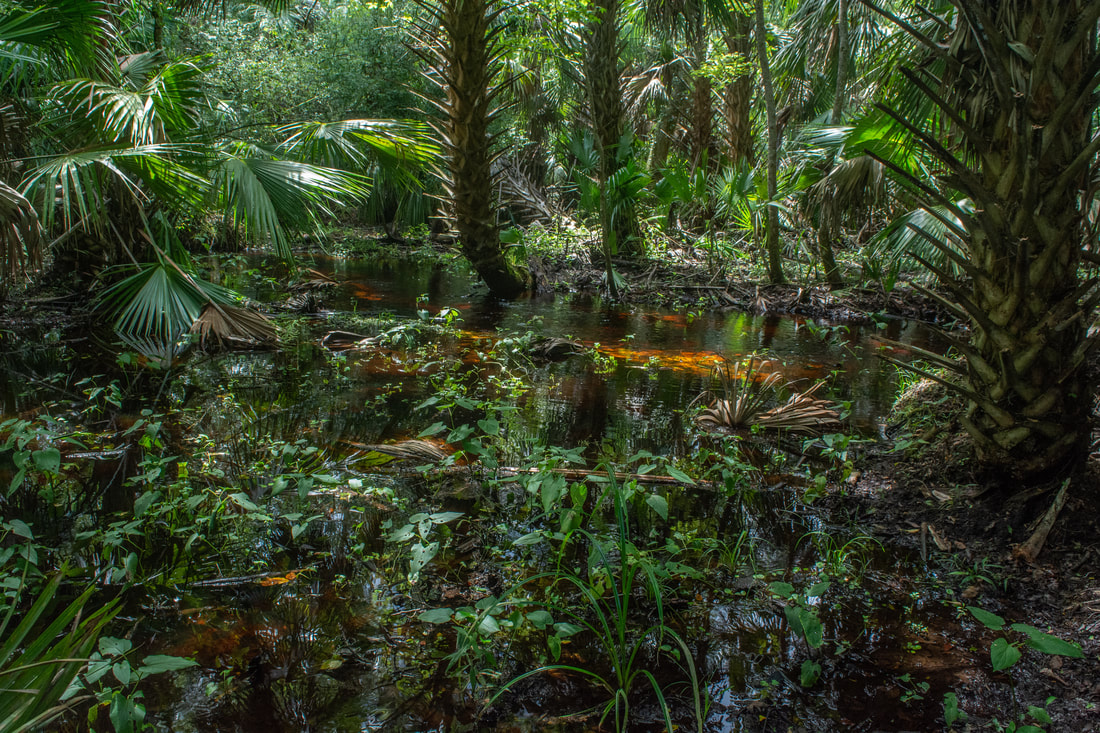
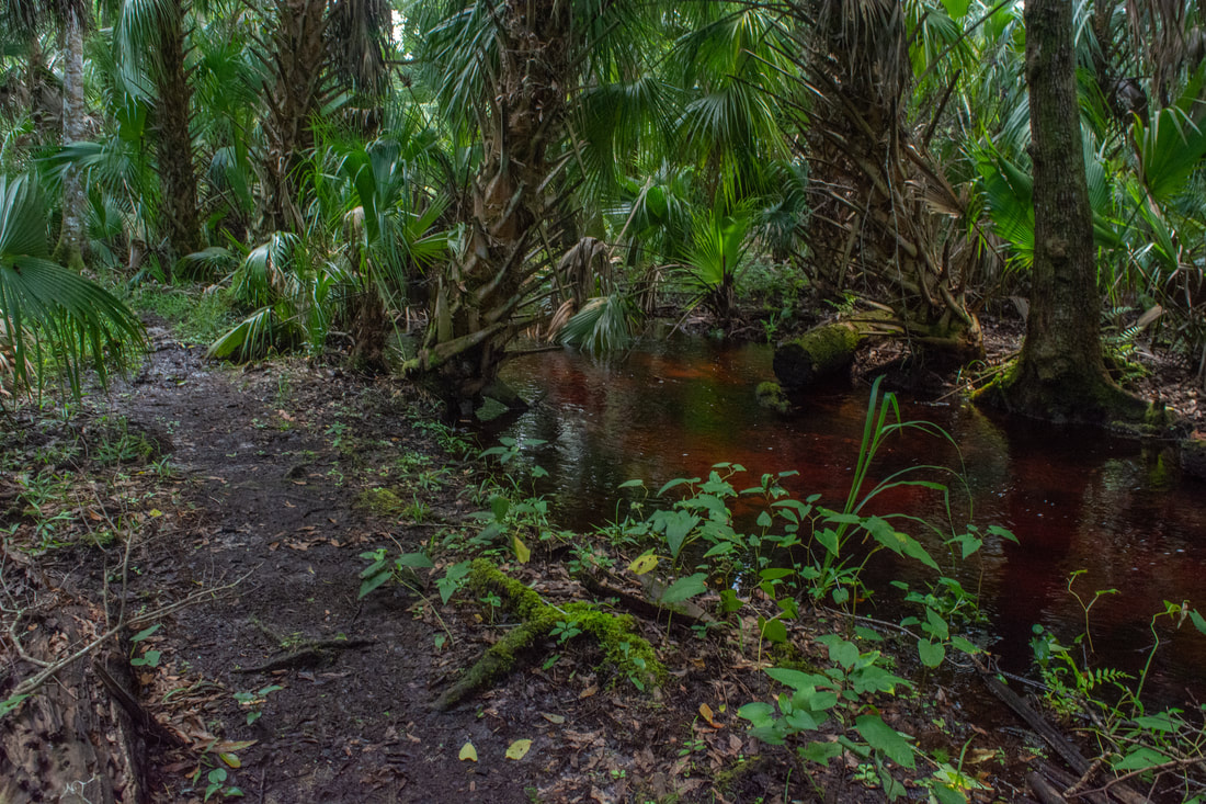
Past the Blue Trail junction, the White Trail enters the heart of the Mill Creek Swamp. The trail follows the narrow tramway into the dense forest, which is full of palmetto and cabbage palms. Swamp water surrounds the elevated pathway. Around 3.3 miles, the trail crosses a pair of footbridges - one broad, the other just a slim plank - across gaps in the tramway. Finally, as the forest briefly thins up, the trail crosses a forest road at 3.9 miles by Marker 21, leaving the Mill Creek Swamp. To the right, the forest road leads a half-mile to Otter Camp along Rock Springs Run, but on this day, the road was flooded. As a matter of fact, the White Trail is about to enter its seasonally wet section as well. I would say that about 80% of the trail from Marker 21 to Marker 18 is muddy or wet in summer. After leaving the old logging tramway, the trail approaches Rock Springs Run around 4.0 miles, turning damp and muddy. At 4.15 miles, reach a bench by the only clear view of Rock Springs Run along the White Trail. A "1/2 Way" sign is perched at the river's edge, signifying the halfway point between the spring head and the Wekiva River for kayakers. Marshy, tannic, and overflowing, this section of Rock Springs Run looked nothing like the crystal clear spring head area farther upstream. I've read that Rock Springs Run can be clear all the way to its confluence with the Wekiva River. However, that's not likely to be the case during the rainy season. At 4.9 miles, the trail crosses another forest road with Big Buck Camp to the left and Rock Springs Run to the right. The west side of the 3.4-mile Mill Creek Loop turns left, but this hike continues straight on the main trail. 
A marshy, tannic Rock Springs Run well downstream from the spring head.
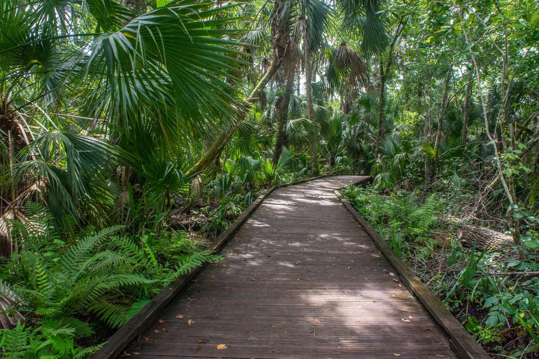
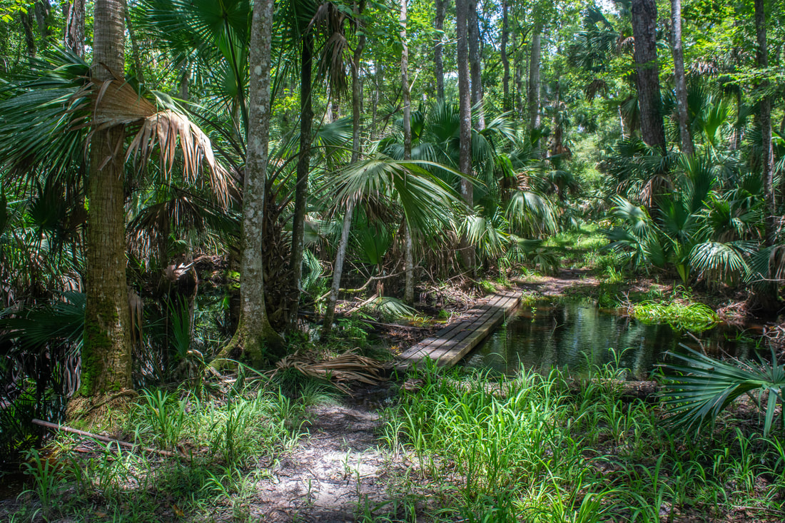
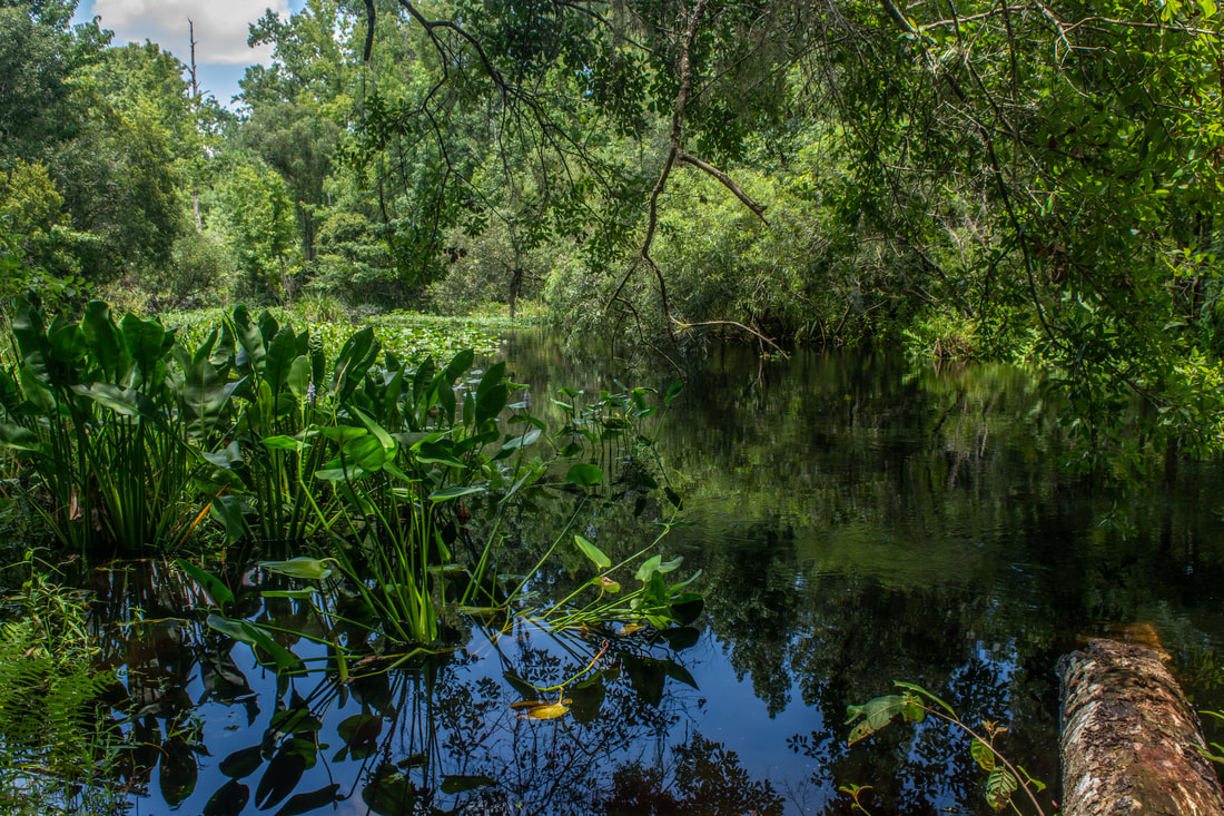
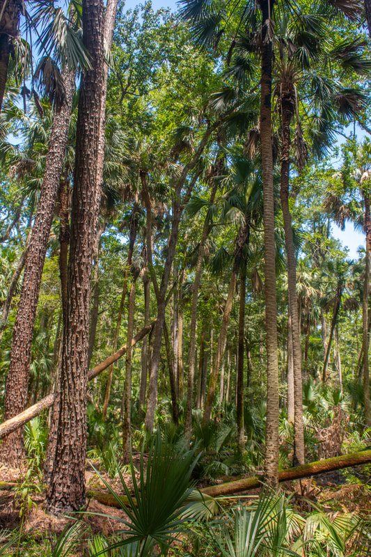
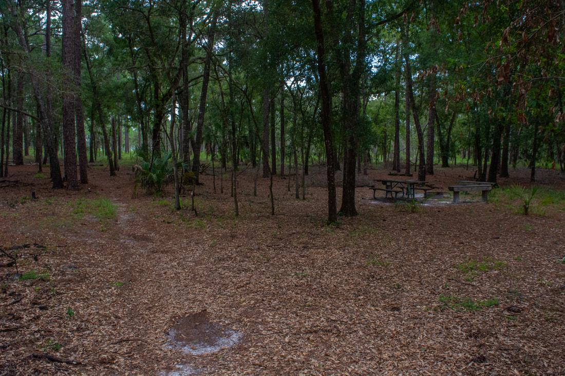
The trail section between Big Buck Camp and Camp Cozy was my least favorite - not only was it wet, but it was also extremely muddy. After heavy rainfall, water easily collects in these low areas near Rock Springs Run. At 4.8 miles, the trail suddenly pops out into dry uplands and reaches a forest road. Turn right, entering Camp Cozy 150 feet farther. Situated in a pocket of open uplands bordered by the Rock Springs Run floodplain, this campsite is really nice. Camp Cozy cnsists of a grassy opening with an assortment of benches and a campfire ring. Keep following the White Trail, which passes Marker 20 and curves through an open palmetto section, fringed by pines. The relaxation doesn't last long though. Past Marker 19D, the trail drops back into the Rock Springs Run floodplain, where the ground instantly turns damp. Between here and Marker 18, at the time of my wet season hike, the trail was essentially entirely wet. The water was primarily ankle-deep, but a few spots were knee-deep. However, during the dry season, most of this section will probably be dry. As the trail passes Marker 19C, it repeatedly tunnels into scenic palm hammocks. At other times, it follows the ecotone between the lush floodplain and dry uplands.
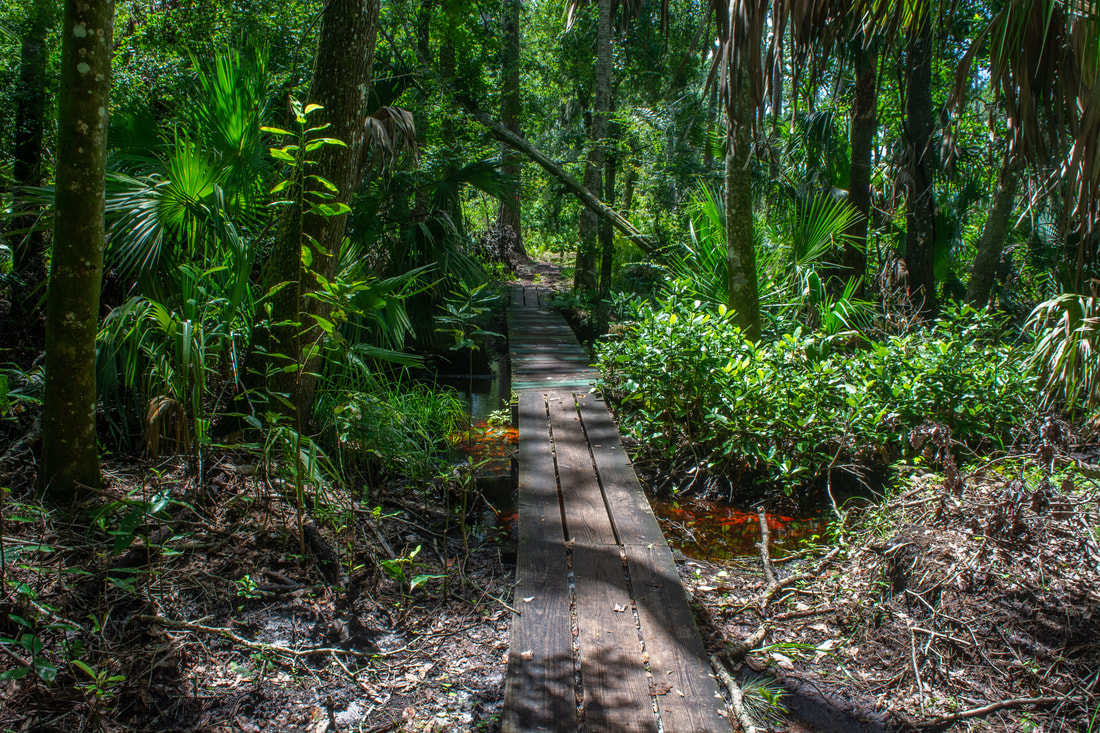
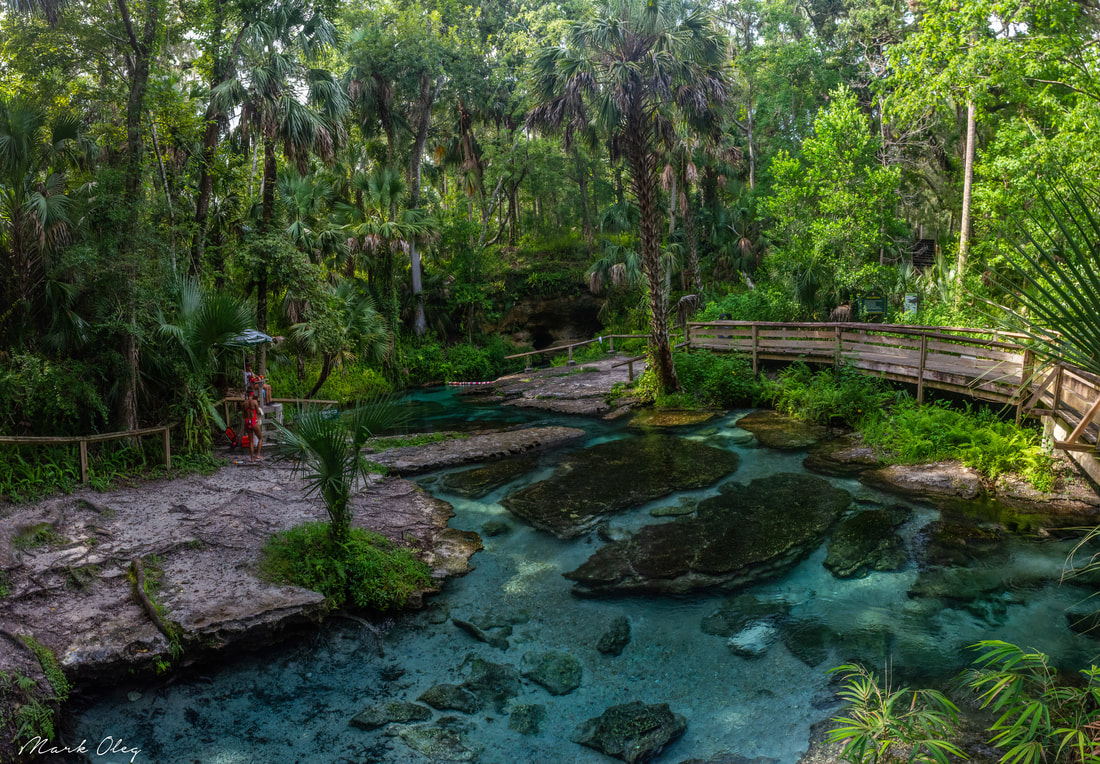
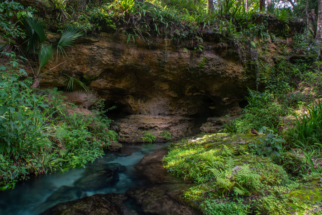
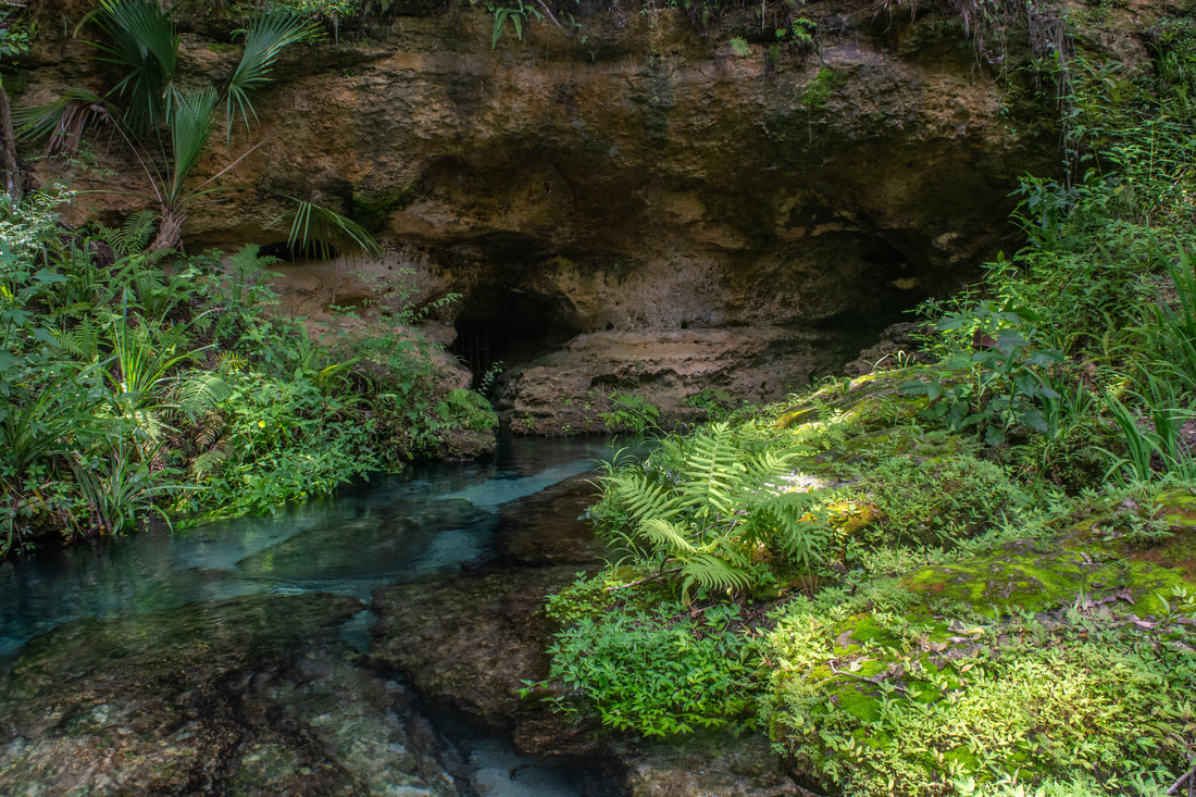
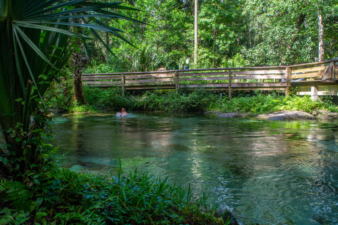
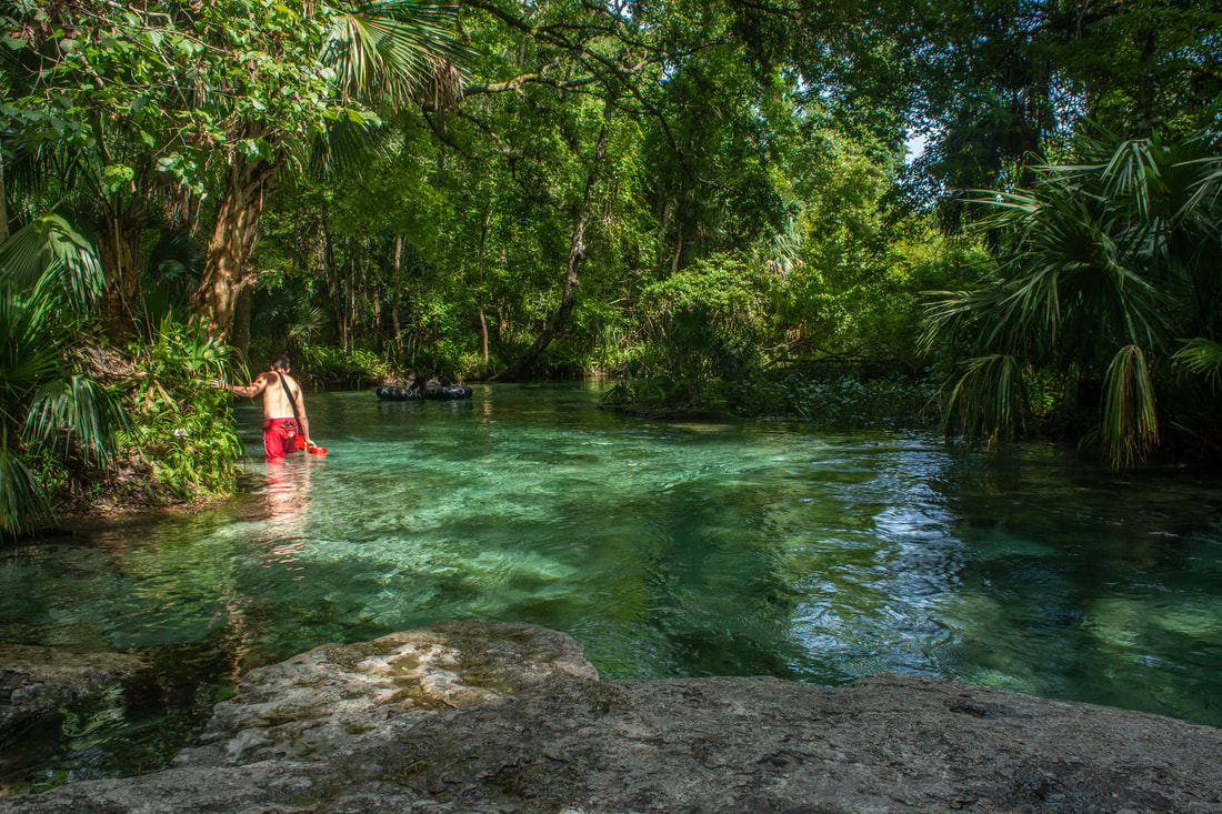
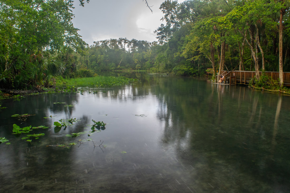
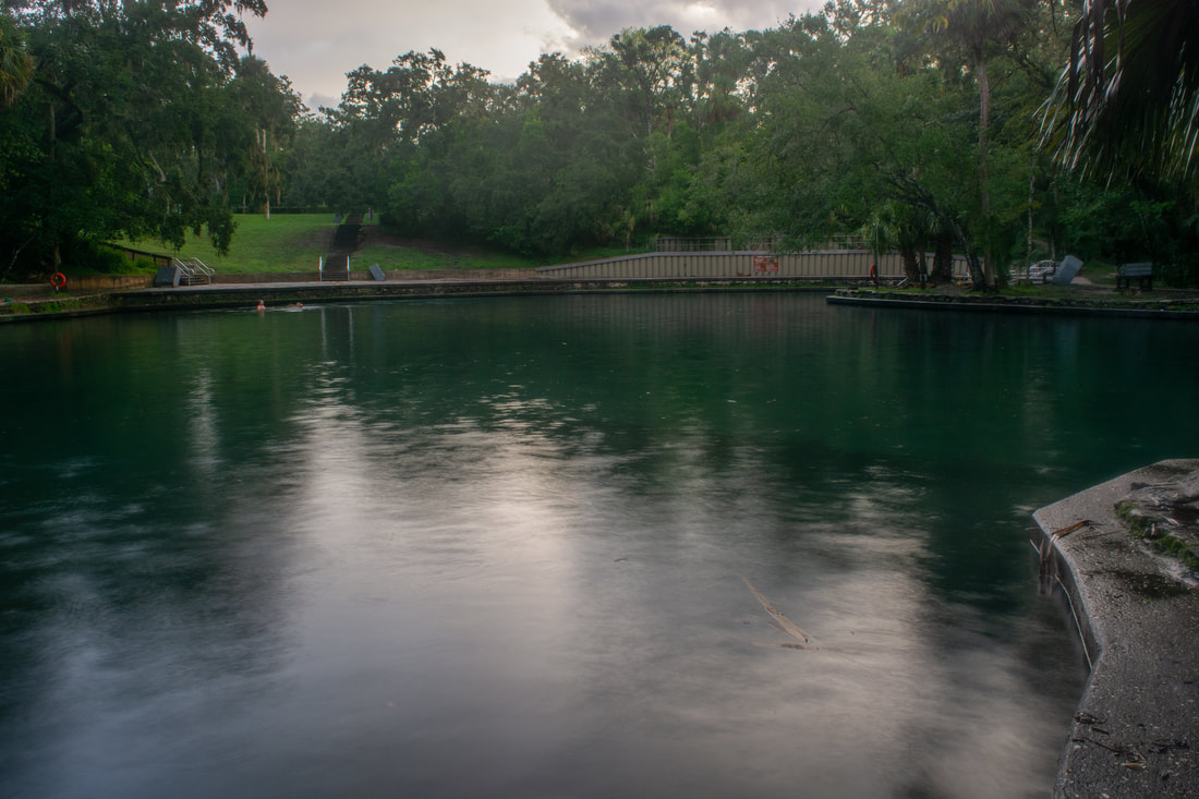
Around 6.8 miles, the loop finally reaches its northernmost point and turns south. The terrain dries a little as the trail passes Markers 19B and 19A in quick succession. Around Marker 19A at 7.2 miles, reach a scenic footbridge across a small stream in lush, jungle-like woods. The trail then briefly follows a swift, tannic tributary of Rock Springs Run, crossing the tributary via a broad wooden bridge. Just past the bridge, reach Marker 19, where there's a junction with the red-blazed bike trail and green-blazed equestrian trail running in conjunction along a forest road to the left. Both trails briefly join the White Trail straight ahead. The trail plunges through one final seasonally-wet area and suddenly emerges into pine flatwoods at Marker 18 at 7.65 miles. Marker 18 is the point where you'll want to leave the White Trail for a side trip to Rock Springs. While the White Trail turns left together with the red-blazed bike trail, you'll want to continue straight on the equestrian trail for about 200 feet to see Rock Springs. A fence on the right separates Wekiwa Springs State Park from Kelly Park (that is home to Rock Springs). Look for a low spot in the fence, making it easy to hop. Once on the other side, take the forest road that makes a gradual right turn (not the one that turns acutely right). In about 0.1 mile, turn sharply left onto one of the broad trails at Kelly Park. Follow it for 0.3 miles to Rock Springs, reaching the spring head at 8.1 miles. The Rock Springs head is one of Central Florida's greatest beauty spots. It's only a few yards from the main parking area in Kelly Park, rending it extreme popularity - even more so than Wekiwa Springs! Most Florida springs come in the form of large pools of water with vents underneath, but Rock Springs is unique. The crystal clear water flows out of two cave-like openings beneath a fern-covered bluff. The water then consolidates into small pools surrounded by gorgeous slabs of limestone. Numerous palm trees shading the scene form a tropical setting. Great views of the spring head abound from all the surrounding rocks, as well as from the footbridge just below. You'll definitely want to spend some time at Rock Springs. Depending on the season, you could even take a refreshing dip in the spring's year-round cool waters before resuming the hike. Additionally, Kelly Park has a 2.4-mile loop trail that access several other Rock Springs Run viewpoints (although I didn't have enough time to check them out on this day). 
Rock Springs is one of Central Florida's greatest beauty spots.
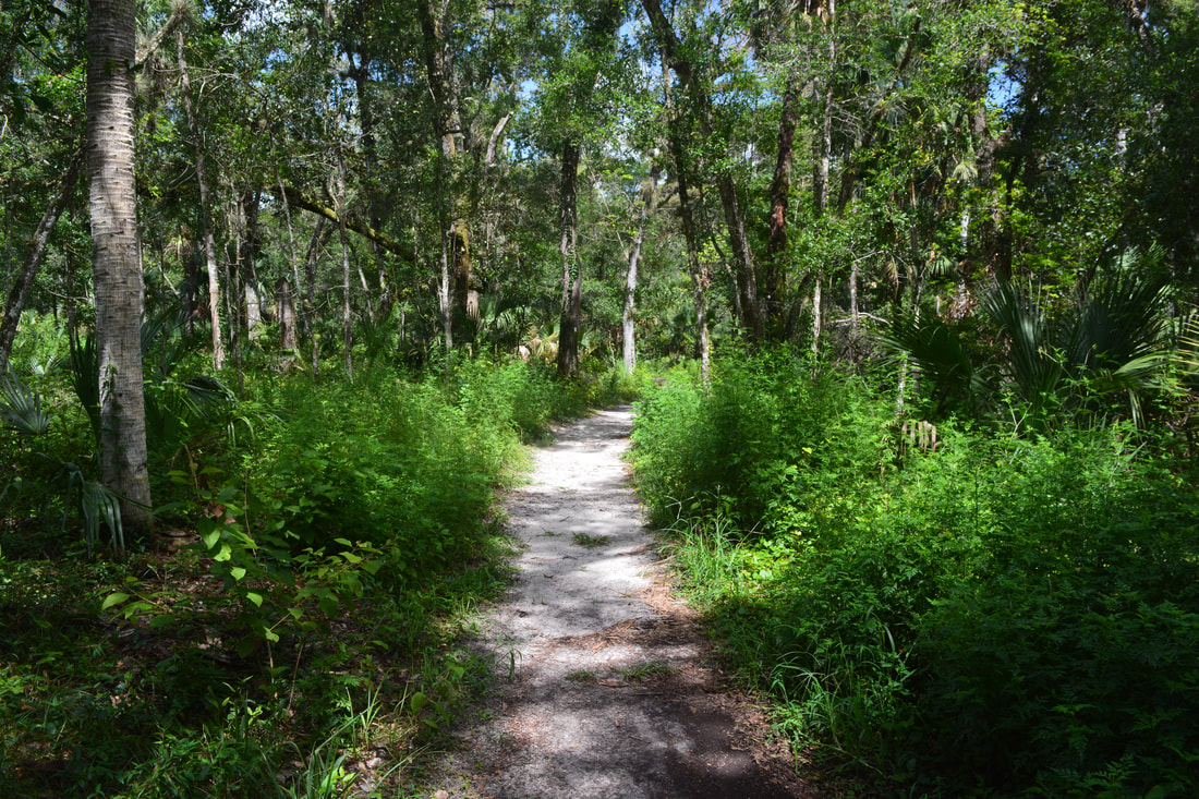
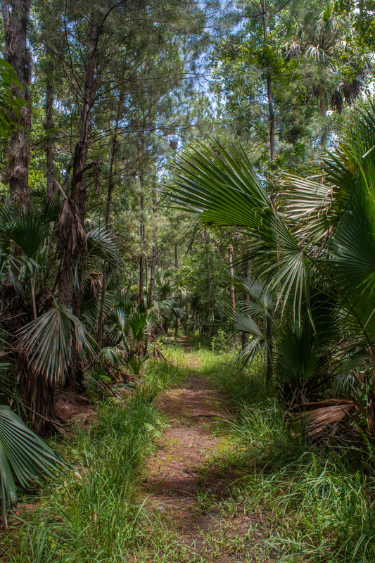
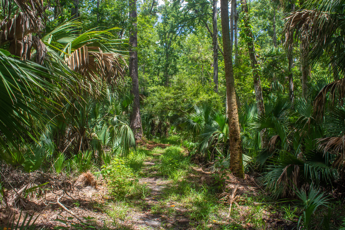
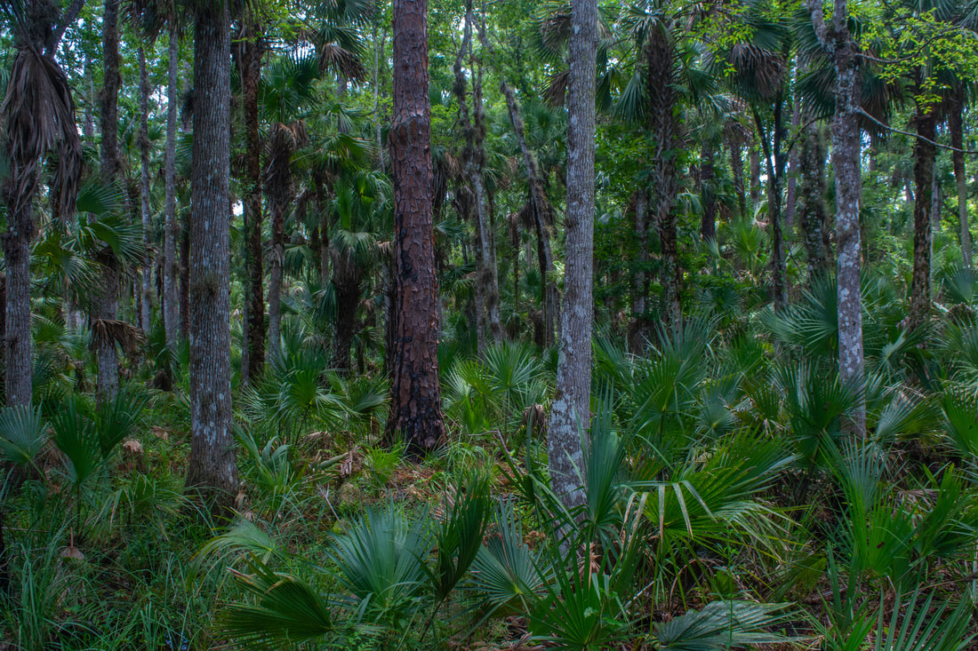
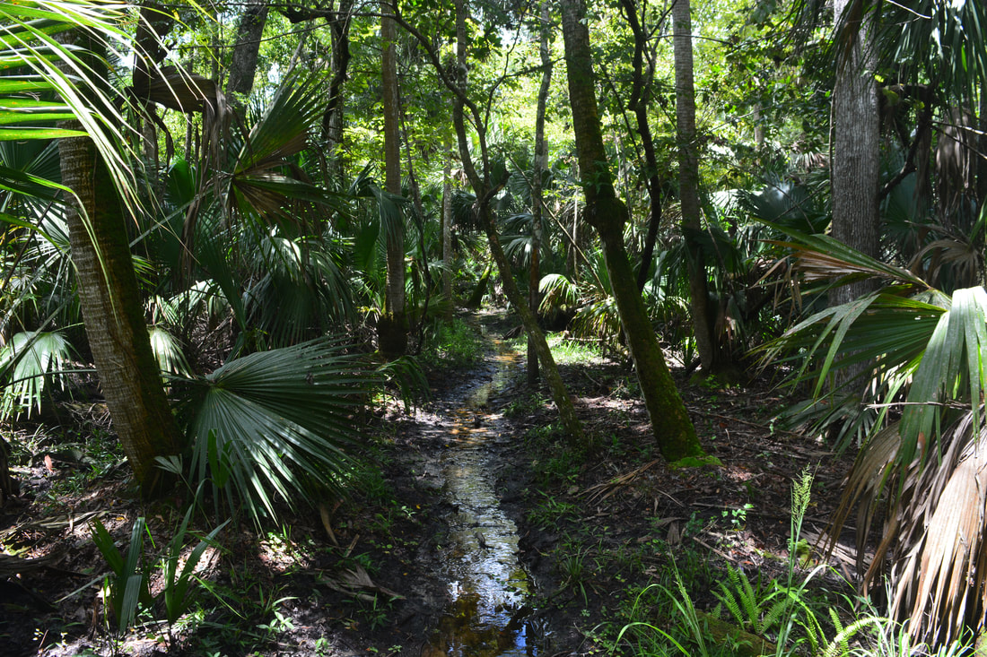
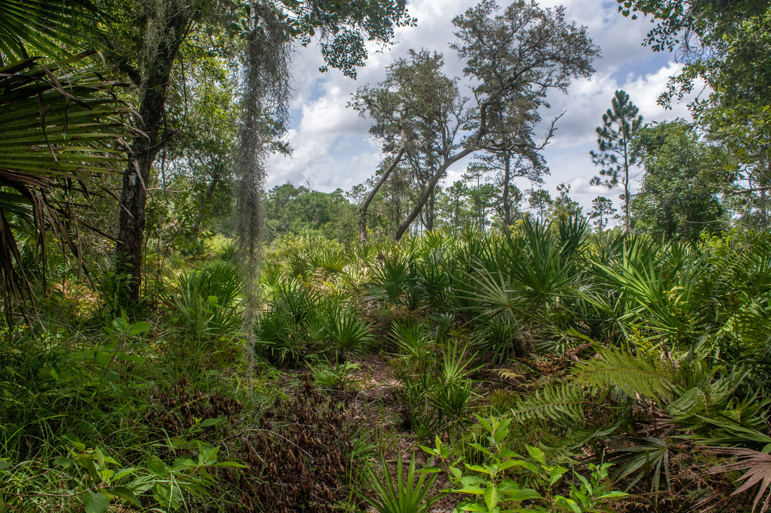
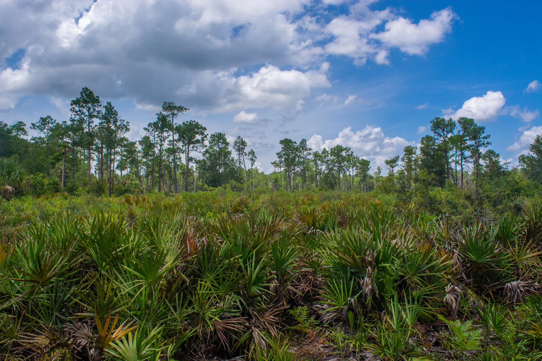
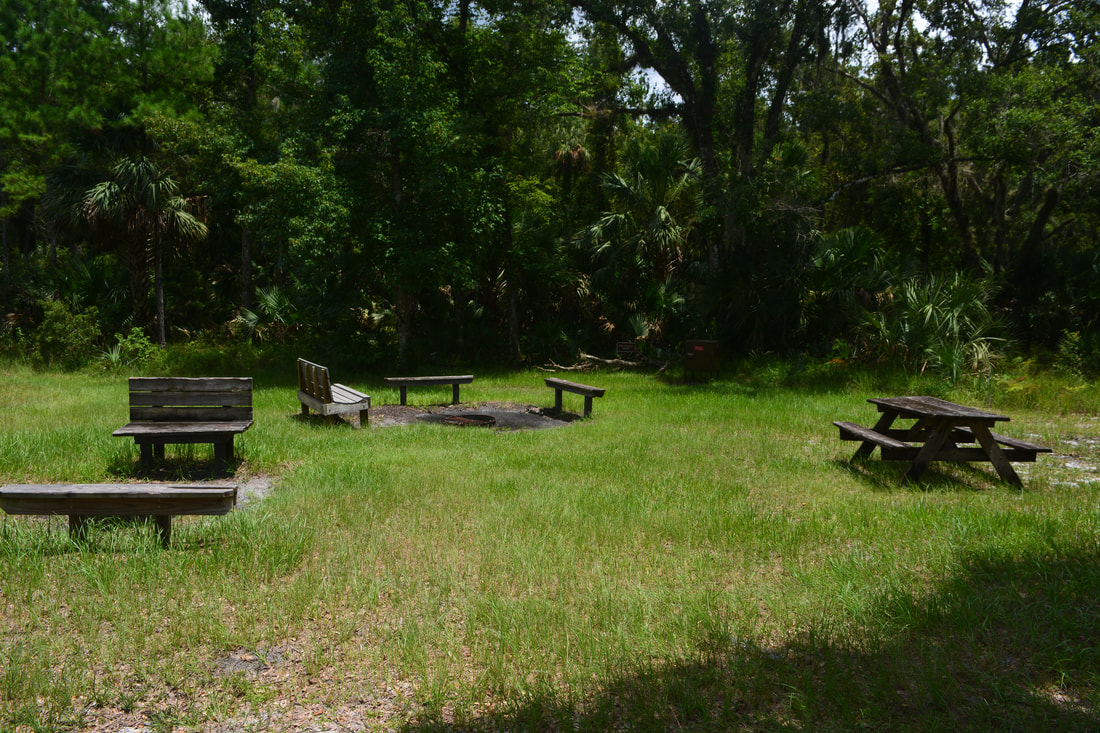
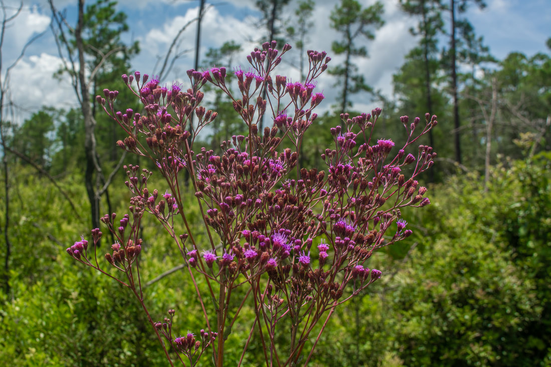
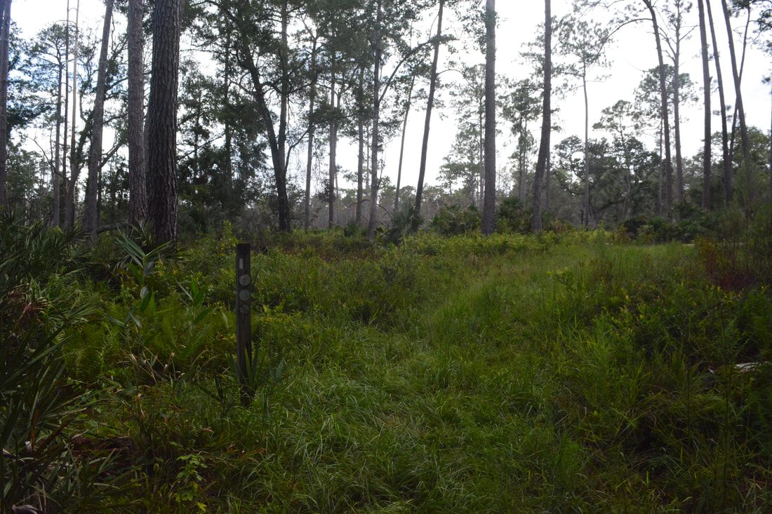
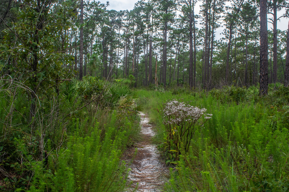
Once you've had a fulfilling rest at Rock Springs, return to the White Trail. The good news are that you won't get your feet wet again on the rest of the hike, regardless of season. However, the rolling sandhills along this section will bring some elevation change. The next few miles of the trail meander through pine-topped sandhills - this part is a bit monotonous and largely non-descript. The trail frequently crosses forest roads and passes more numbered posts. Occasionally, the trail approaches the park's west boundary, passing within sight of multiple houses. One notable feature of the sandhills is that they're home to a variety of wildflowers in fall, such as golden aster and blazing star. The trail passes a shady picnic area on the left in an oak hammock at 10.1 miles. At 11.2 miles, watch for an impressive dry sinkhole on the left. The sinkhole popped up as recently as 2001, but today, it's already home to numerous cabbage palms.
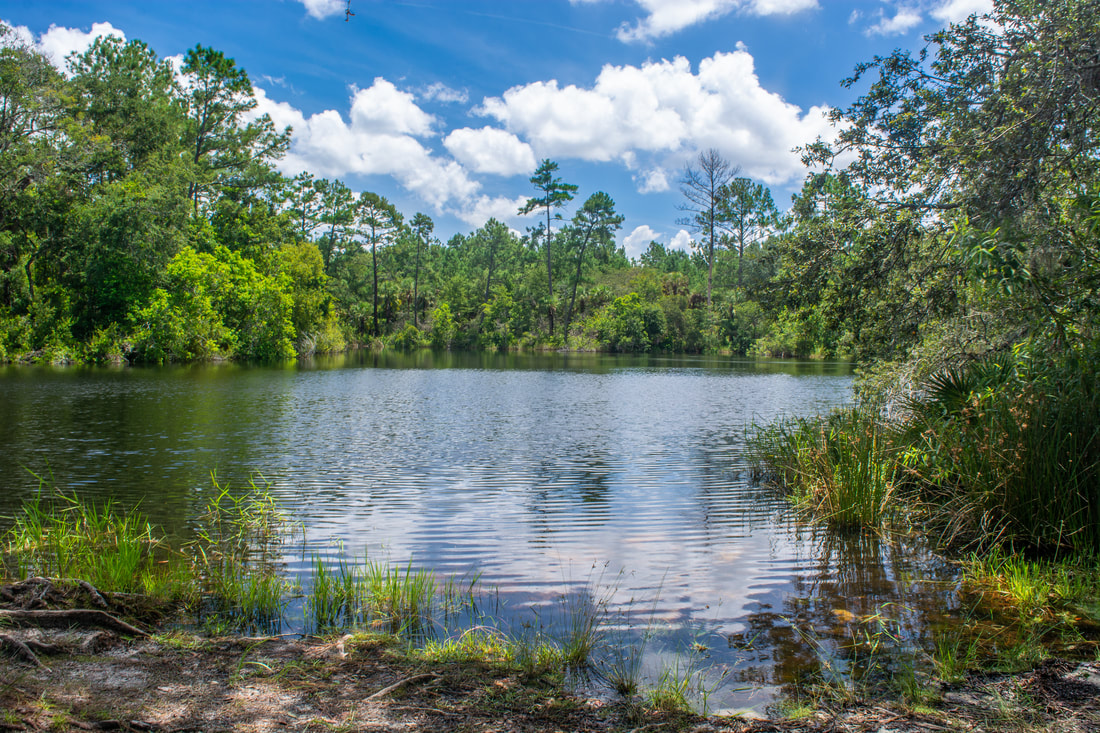
Just past the sinkhole, reach a notable junction by Marker 10 at 11.3 miles. The red-blazed bike trail finally leaves left. This is also the other end of the Blue Trail. Additionally, the orange-blazed Volksmarch Trail rejoins the White Trail here. Just keep following the white blazes, dipping into the small drainage of Carpenter Branch. Past Marker 9 at 11.6 miles, the White Trail enters a shady hammock on the north side of Lake Prevatt. Despite its proximity to the lake, the trail doesn't afford any clear views of the lake - only fleeting glimpses. It probably isn't difficult to bushwhack down to the lakeshore. Nevertheless, I didn't investigate this possibility, because I got caught in an intense 1-hour thunderstorm just past the big sinkhole. Leaving the Lake Prevatt hammock, the trail crosses the road to the park's Youth Camp at Marker 6 at 12.3 miles. After curving through a small scrub-like area, the trail crosses the paved road to the campground at Marker 3 at 12.8 miles. Finally, at 13.1 miles, you'll cross the main park road and reach the end of the loop. From here, it's simply a matter of retracing your earlier steps to Wekiwa Springs along the out-and-back section of the White Trail. You'll return to Wekiwa Springs at 14.15 miles. Cooling off in the spring is a great way to conclude the hike. If you're finishing later in the day, the spring could be less crowded too. Lastly, scramble back up the boardwalk to the parking area, concluding the hike at 14.3 miles. Overall, this is a well-rounded hike that samples a lot of Florida ecosystems. The seldom-grasped opportunity to see Rock Springs greatly enhances the White Trail as well. Although the White Trail doesn't really have any outstanding sights, you'll find it to have a nice mix of different scenery and trail sorts along single-track pathways. Mileage
0.0 - Wekiwa Springs Parking
0.15 - Wekiwa Springs 1.2 - White Loop Start 2.3 - Sand Lake 3.0 - Mill Creek 4.15 - Rock Springs Run 4.8 - Camp Cozy 7.65 - Marker 18/Kelly Park Cross-Over 8.1 - Rock Springs 11.2 - Big Sinkhole 13.1 - White Loop End 14.15 - Wekiwa Springs 14.3 - Wekiwa Springs Parking Variations
The hike described here is the longest possible hike in Wekiwa Springs State Park. Numerous cross-trails allow many ways to shorten this hike to suit your needs and abilities. See the Wekiwa Springs Trail Map.
Pictures & Videos
1 Comment
Cliff Rahl
8/15/2018 08:46:10 am
Kudos to you being there this time of year . . . I can't imagine the heat, humidity and mosquitoes there. Leave a Reply. |
About MeMark Oleg Ozboyd Dear readers: I have invested a tremendous amount of time and effort in this website and the Georgia Waterfalls Database the past five years. All of the work that has gone in keeping these websites updated with my latest trip reports has almost been like a full-time job. This has not allowed me to pick up a paid job to save up money for college, and therefore, I I've had to take out loans. If you find the information on this website interesting, helpful, or time-saving, you can say "thanks" and help me out by clicking the button above and making a contribution. I will be very grateful for any amount of support you give, as all of it will apply toward my college tuition. Thank you!

Coming in 2022-2023?
Other Hiking WebsitesMiles HikedYear 1: 540.0 Miles
Year 2: 552.3 Miles Year 3: 518.4 Miles Year 4: 482.4 Miles Year 5: 259.9 Miles Archives
March 2021
Categories
All
|
||


 RSS Feed