HIKING THE APPALACHIANS AND BEYOND
  • Home
  • Trail Reports
    • Best Hikes
    • Hikes with Scenic Views
    • Hikes with Water Features
    • Alabama
    • Georgia
    • Florida
    • North Carolina
    • South Carolina
    • Tennessee
    • Vermont
    • Virginia
  • Map
  • Hike List
  • Testimonials
  • Resources
  • Contact Us
  • Southeast Nature Society
    • Our Team
  • Georgia Waterfalls Database

Apalachicola National Forest: Leon Sinks Geological Area Trail System, Tallahassee, Florida

1/9/2018

2 Comments

 
Picture
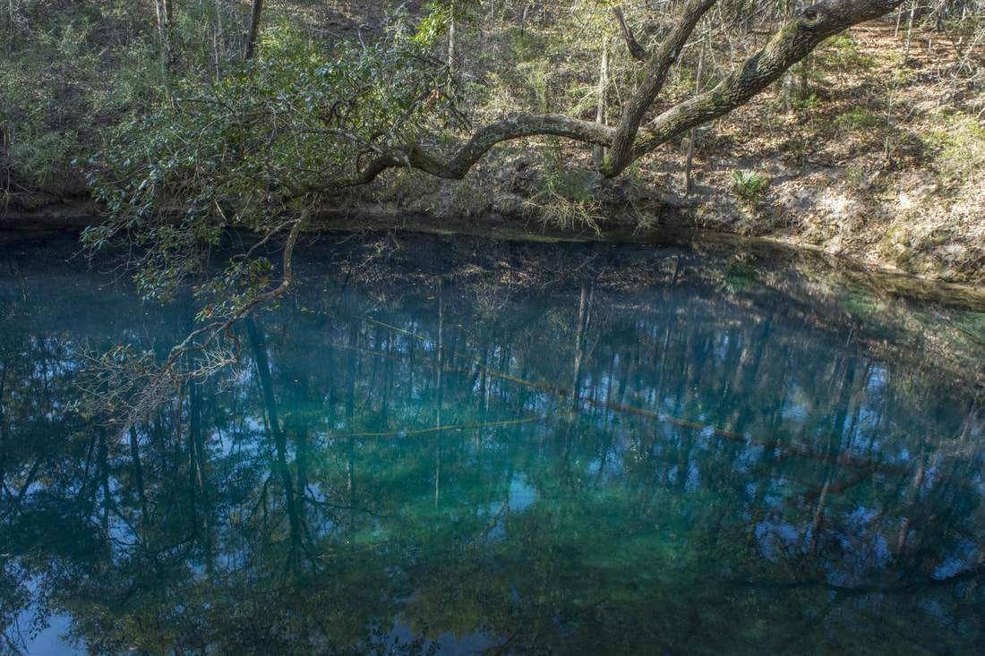
The Leon Sinks Geological Area is in the northeast corner of Apalachicola National Forest near Tallahassee. This fascinating area is home to over a dozen sinkholes, many of which have water in them. Particularly Hammock Sink is one of the most beautiful and photogenic natural sights in the region. The trail system at Leon Sinks also visits a disappearing stream with a natural bridge as well as a series of cypress swamps. Numerous points of interest are spaced throughout the 4.5-mile loop to keep your attention focused the entire hike. This hike occurred on Saturday, January 6th, 2018. My plan was to hike a counter-clockwise loop with the Sinkhole Trail and Gum Swamp Trail. 

Summary

R/T Length of Trail: 4.5 Miles
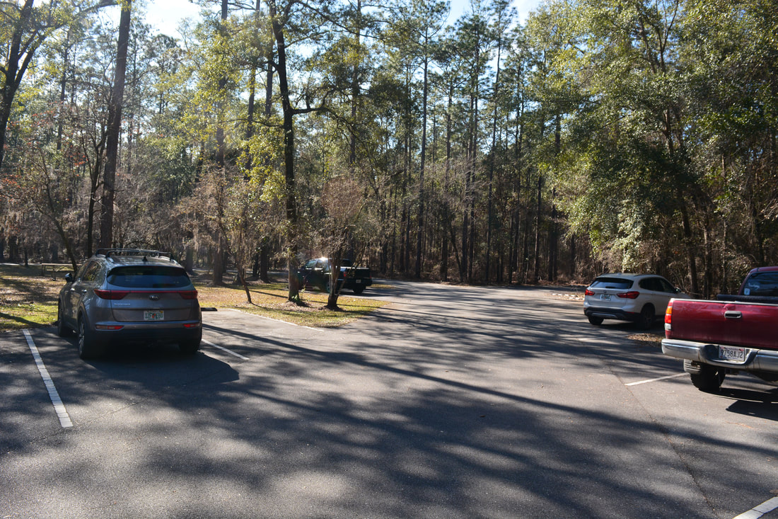
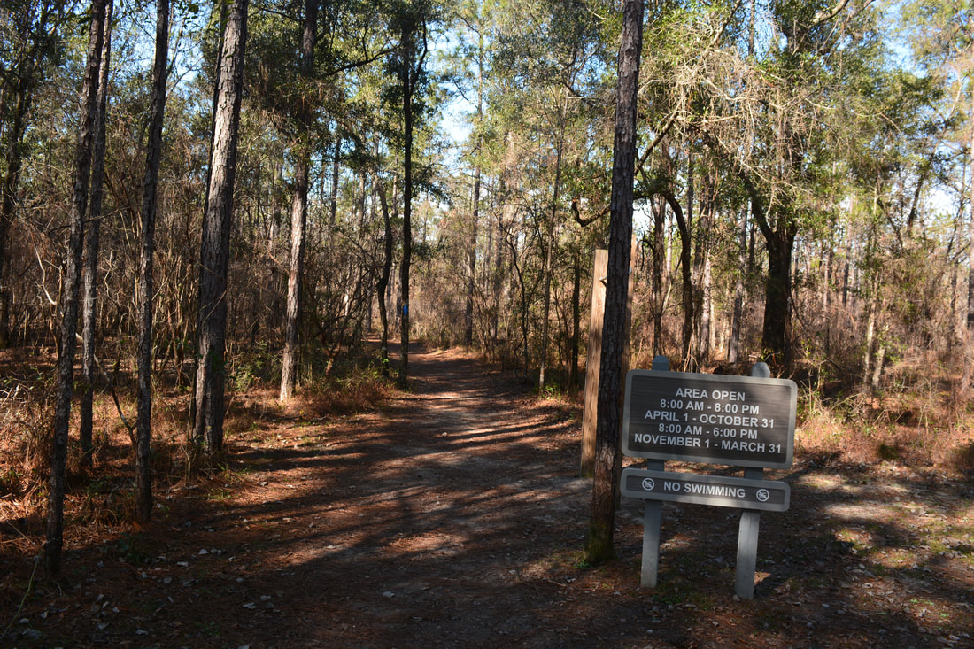
Duration of Hike: 2:00 plus 40 minutes of stopping 
Type of Hike: Loop 
Difficulty Rating: 2 out of 10 
Total Elevation Gain: Minimal (333 Feet) 
Pros: Numerous points of interest scattered throughout the hike
Cons: The trail can get a little crowded 
Points of Interest: Hammock Sink; Big Dismal Sink; Black Sink; Lost Stream Overlook and Fish Creek Natural Bridge; South Swamp (and two other swamps); Gopher Hole Sink; Numerous other dry sinkholes 
Trail Blaze Colors: Sinkhole Trail - Blue; Gum Swamp Trail - Green; Connector Trail - White 
Best Seasons to Hike: Winter; Spring 
Fees: There's a $3 entry fee per vehicle for Leon Sinks Geological Area 
Beginning Point: Leon Sinks Geological Area Parking
Directions from Tallahassee, FL: From the intersection of Capital Circle (FL 263/US 319 North) and Crawfordville Road (FL 61/US 319 South), follow Crawfordville Road South (US 319 South). Stay right where FL 61 South splits off to the left. 5.8 miles from Capital Circle, turn right onto the entrance road to Leon Sinks Geological Area and reach the parking area in 0.2 miles. 

Map

Click the link below to download a .GPX file with a track of this hike. 
leon_sinks_geological_area_trail_system.gpx
File Size: 195 kb
File Type: gpx
Download File

Details

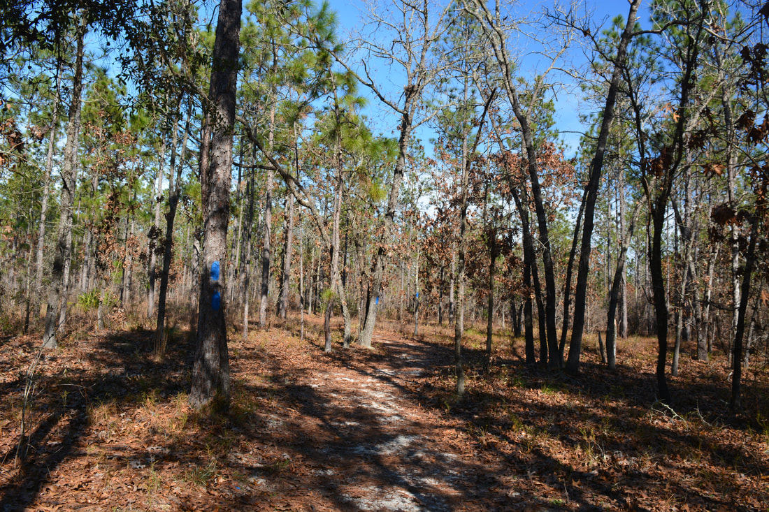
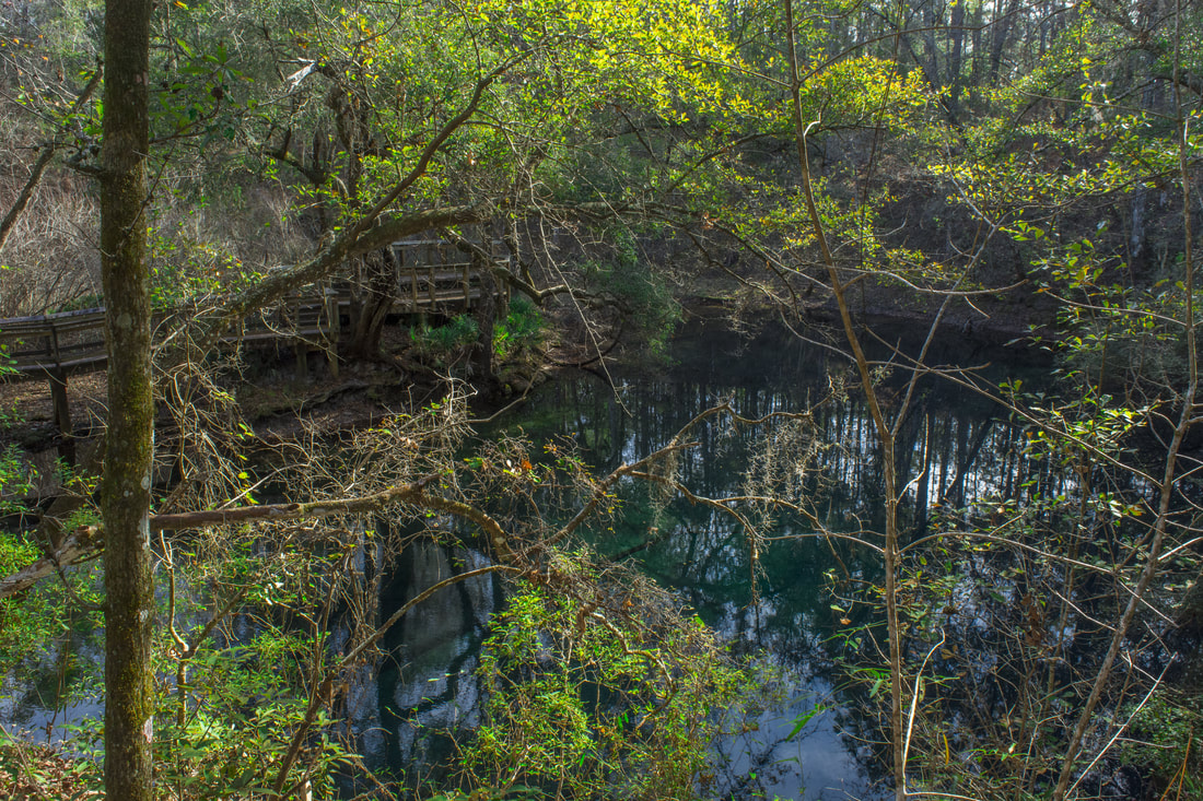
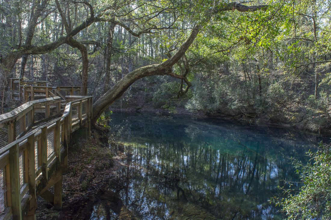
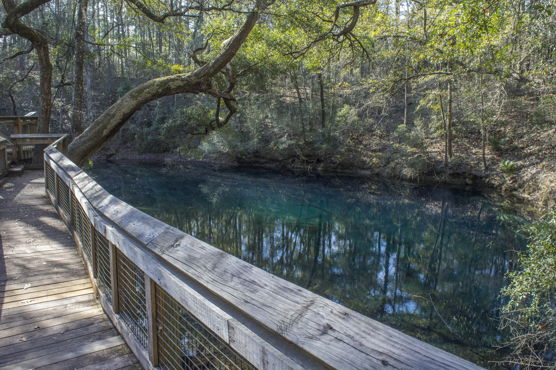
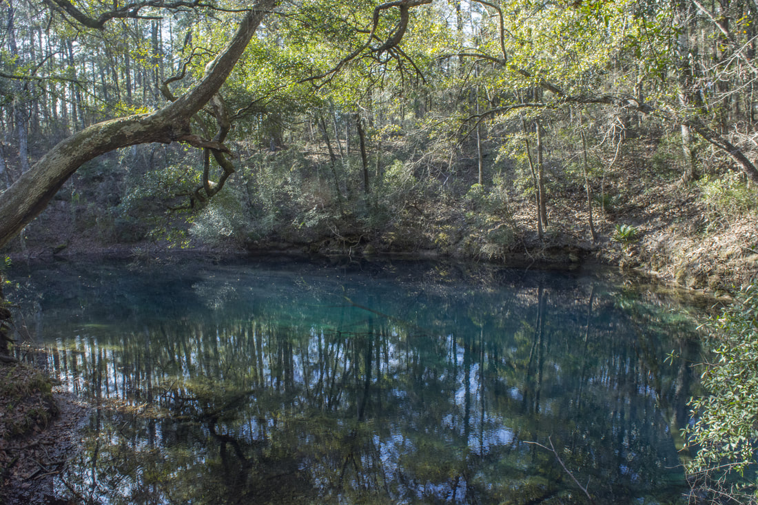
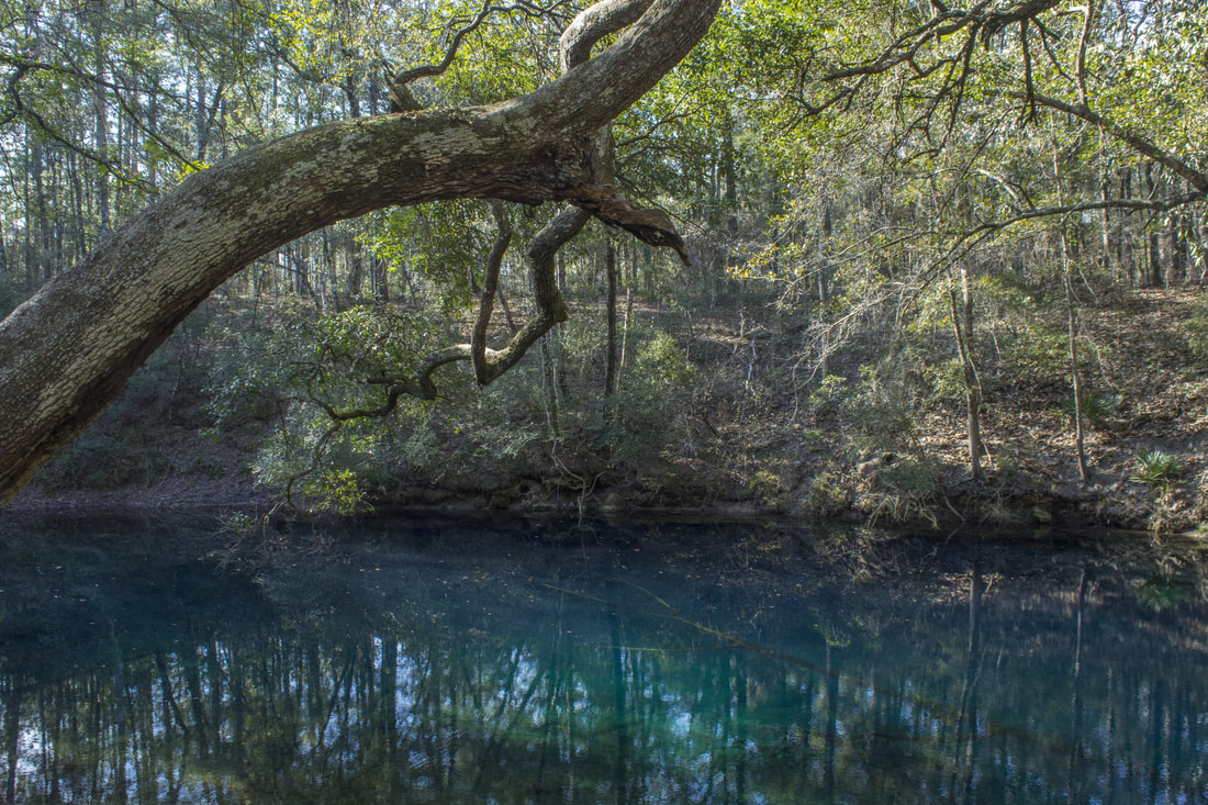
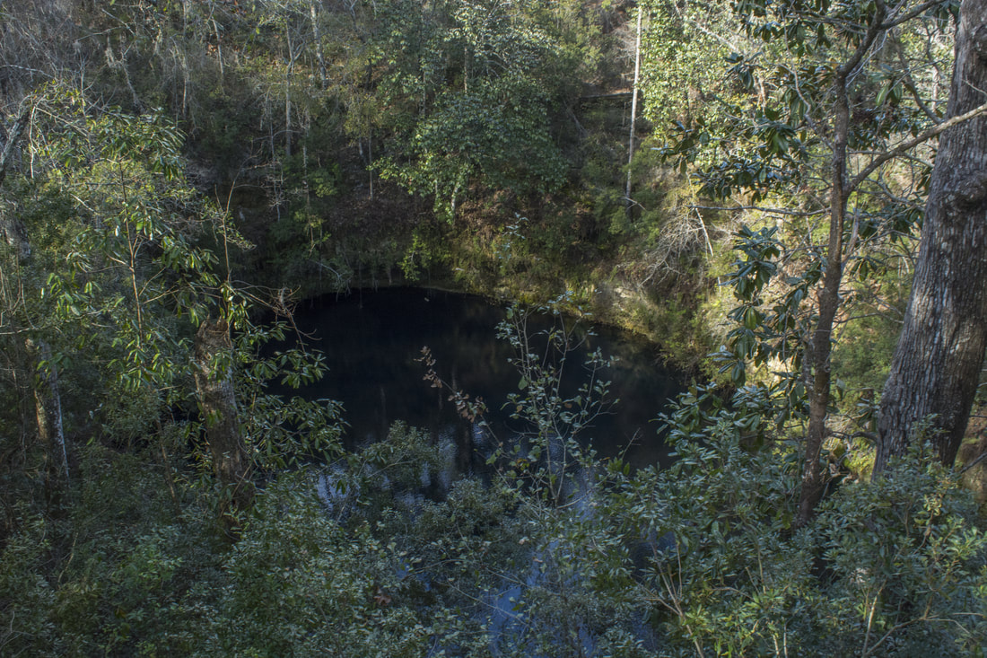
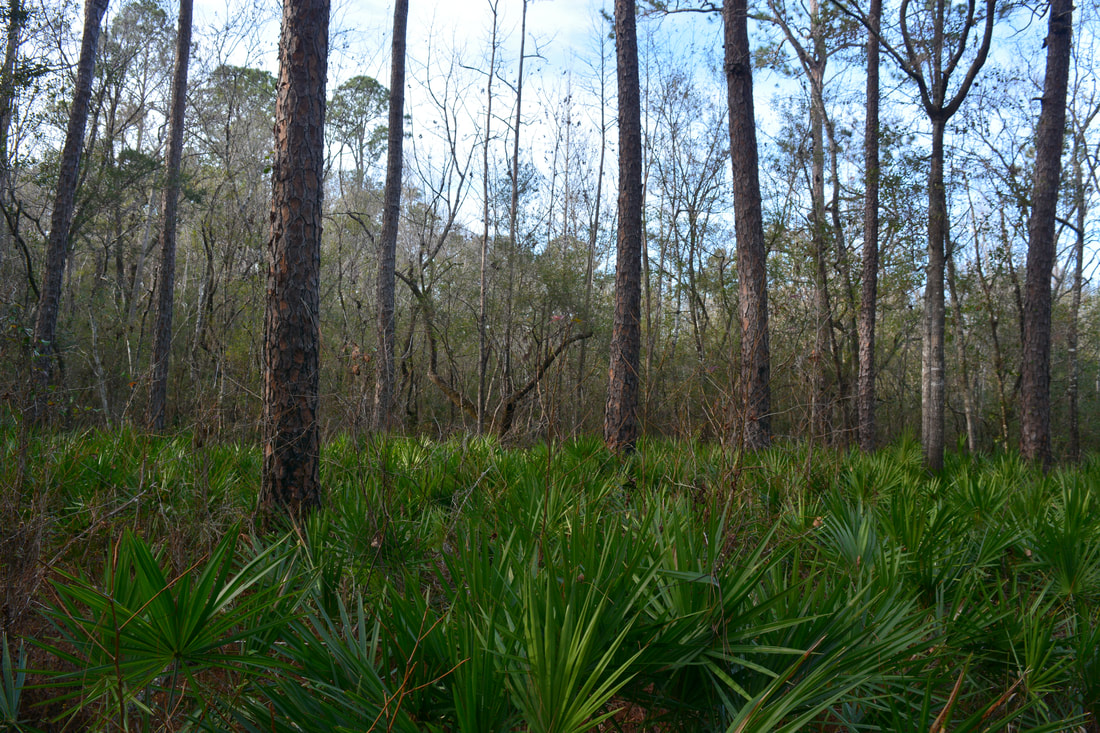
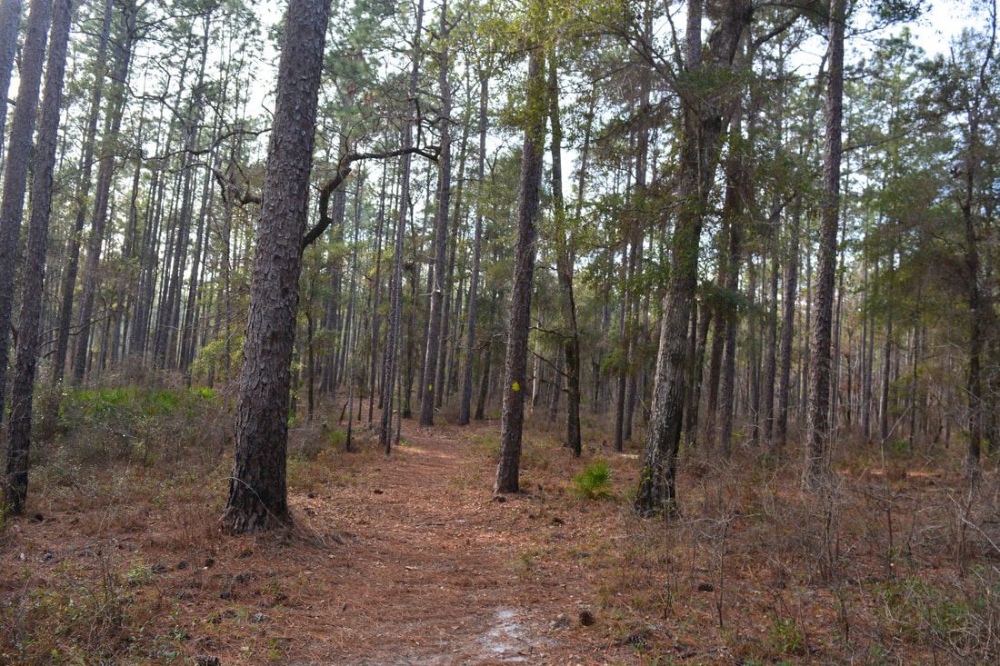
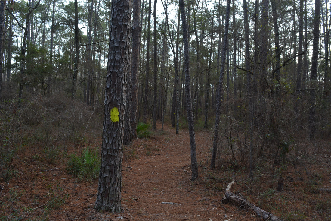
Leon Sinks Geological Area is one of the most popular hikes in the Florida Panhandle and for good reason. The well-manicured trail passes through a variety of ecosystems and past over a dozen sinkholes. Hammock Sink is one of the most gorgeous natural sights in the area and a photographer's delight. The short access trail to Leon Sinks begins by the kiosk near the center of the spacious parking area. In 350 feet, reach the start of the loop at the Sinkhole Trail. To hike it counter-clockwise and see most of the sinkholes first, turn right. The blue blazes take you past five dry sinks in the first half-mile. The trail actually passes through the bottom of the first one, Dry Sink. Turner Sink on the left - the second dry sink - is fairly large but overgrown. All sinks are signed (the others are Palmetto, Far, and Back Sinks). At 0.6 miles, the trail reaches Hammock Sink, the first wet sink along the hike. Coincidentally, this is also the most beautiful sink at Leon Sinks. A boardwalk with several different views follows the edge of the sink. I love the way the large overhanging tree spreads its limbs above the sink, almost touching its blue waters. When the water is clear, you can see small branches floating just below the surface. It doesn't get much better than this for Florida nature photographers. 

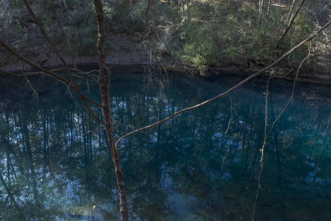
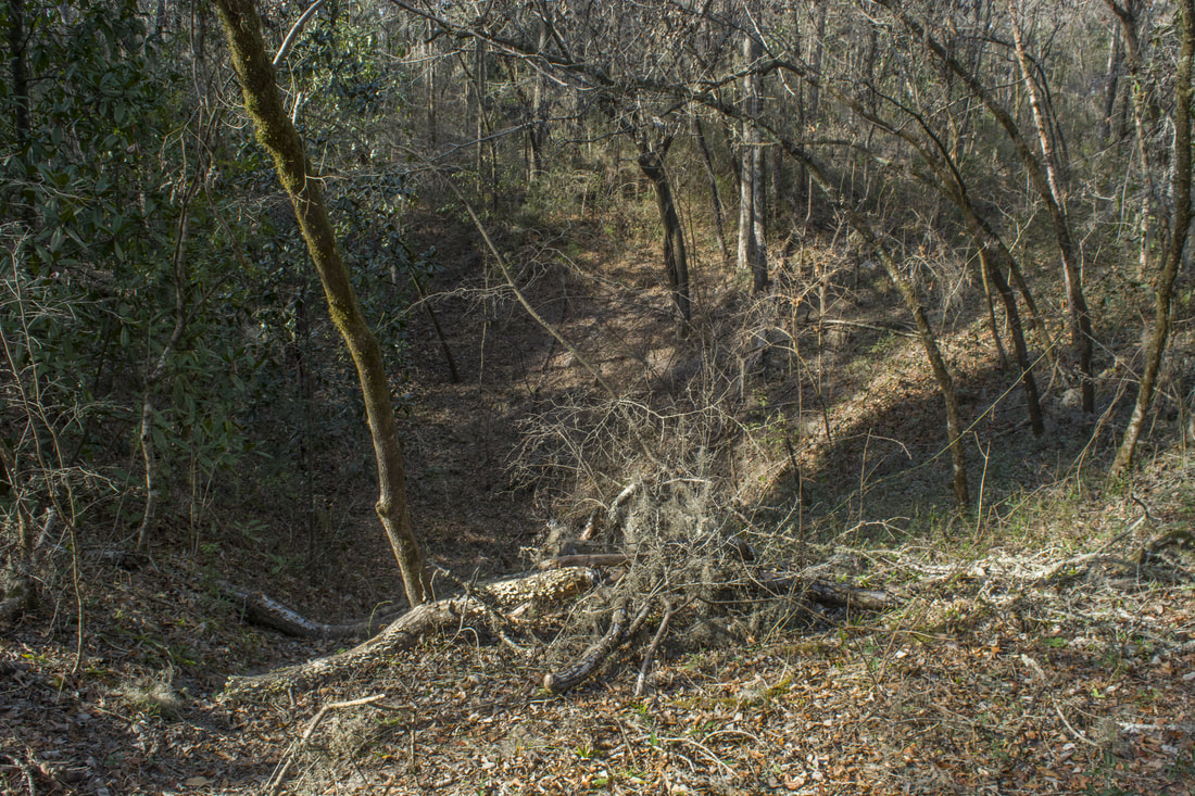
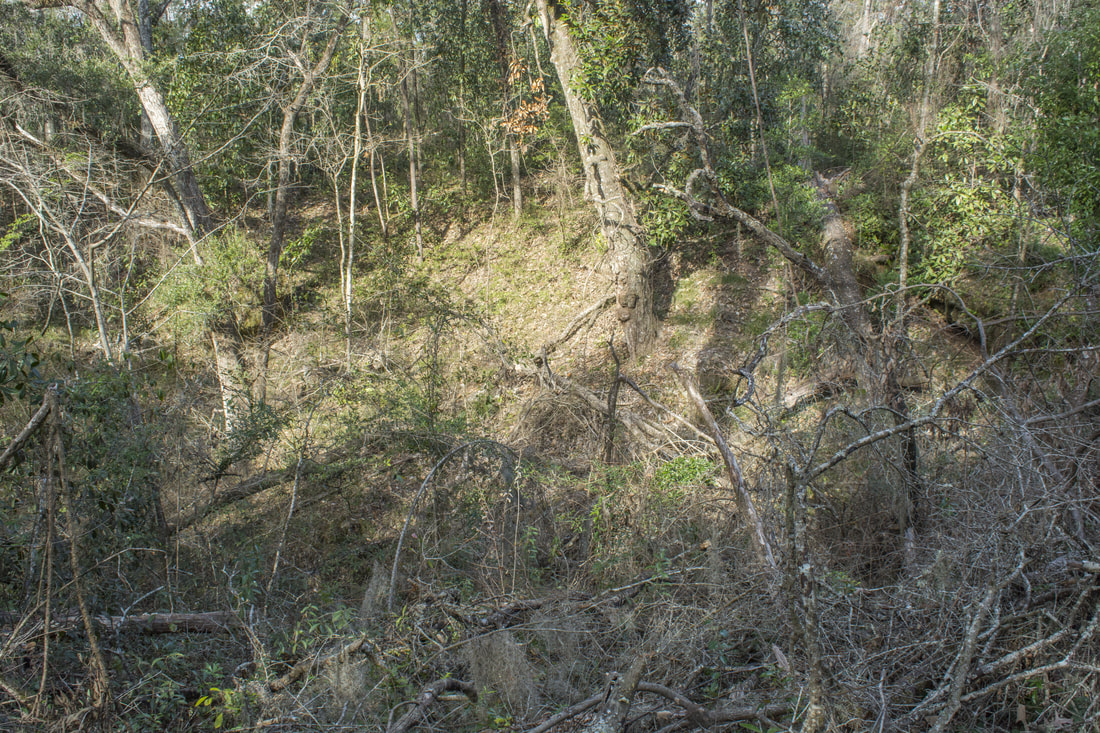
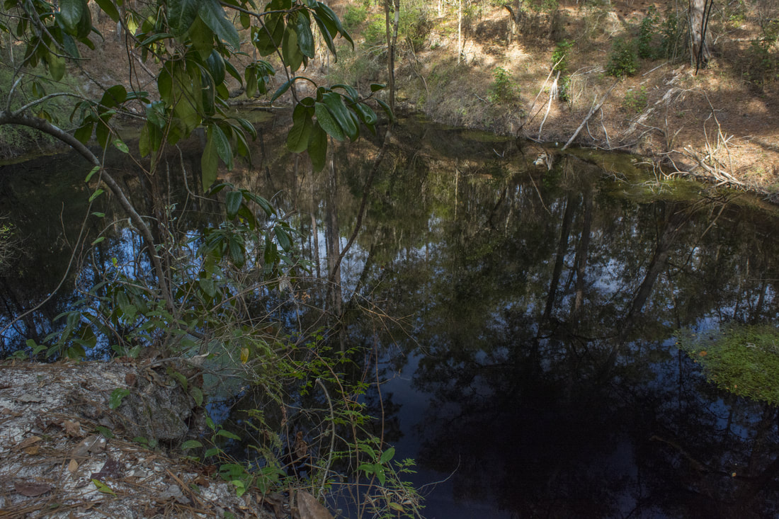
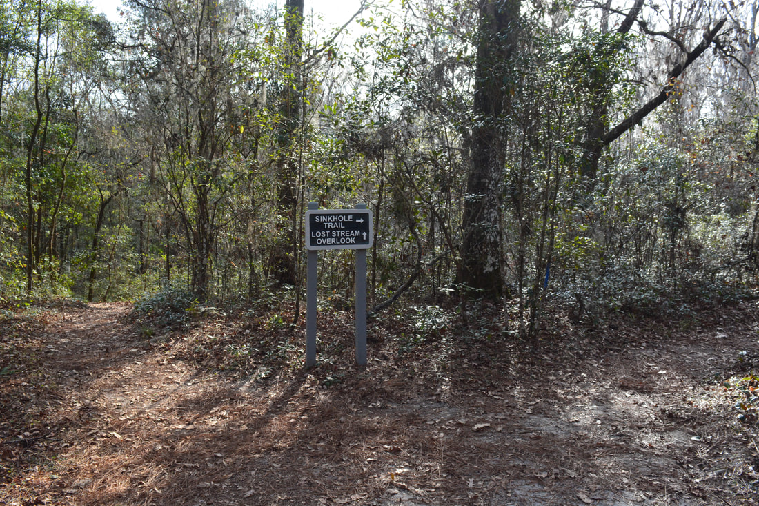
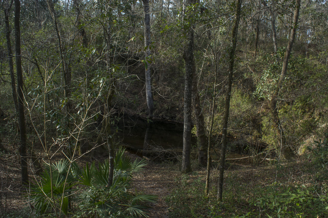
Stay on the blue-blazed trail, passing the dry Tiny Sink on the left at 0.8 miles. At 1.05 miles, the observation area for Big Dismal Sink is on the right just across from the terminus of a forest road. Big Dismal Sink is the largest sink along the hike, but the only view of it is far above. The eroded paths to the bottom have been closed due to safety concerns. Still, this is an impressive view. Big Dismal Sink's water drops 130 feet below the surface where it can connects with a watery underground cave system. The water's surface was constantly covered in ripples at the time of my visit, indicating instability down below. Also, note the neat trickles of water falling into the sink from the bluff at its far end.

The Sinkhole Trail curves north after Big Dismal Sink. A sign marks Field Sink to the left, although I had trouble finding the actual sink. At 1.3 miles, the trail reaches Big Eight Sink, a large and steep dry sink. The next sink is Magnolia Sink is at 1.45 miles. Although the map marks this as a wet sink, there was essentially no water in it at the time of my hike. At 1.85 miles, a 100-foot side trail leaves left and steeply drops down to Black Sink. The dark waters of this moderate-sized wet sink contrast greatly with the blue waters of Hammock Sink. At 2.15 miles, the Sinkhole Trail turns right while a 150-foot side trail leads straight to Lost Stream Overlook. The overlook provides a view of a unique wet sink - Lost Stream Sink - to the right. Lost Stream Sink is the site of Fisher Creek's entry into the underground. Unlike a spring where a stream typically begins, this sink is the "end" of the stream. If you explore the paths around Lost Stream Sink, you can gain a few  glimpses of Fisher Creek upstream. You'll also see a small wet sink called Duckweed Sink to the east of Lost Stream Sink.
Picture
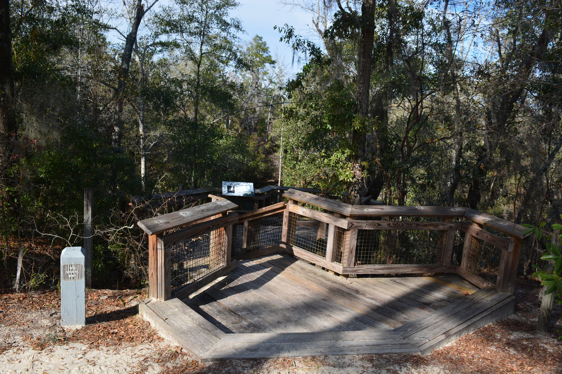
Viewed from an elevated observation deck, Big Dismal Sink is the deepest and (arguably) wildest sink in Leon Sinks Geological Area.
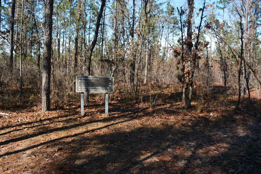
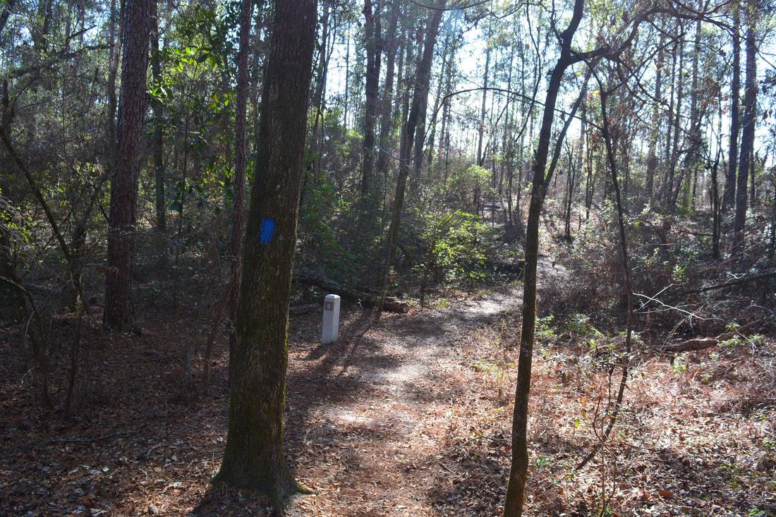
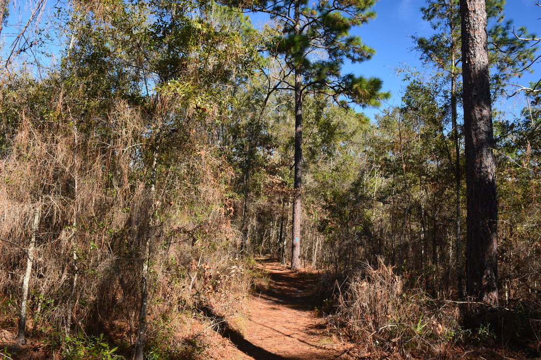
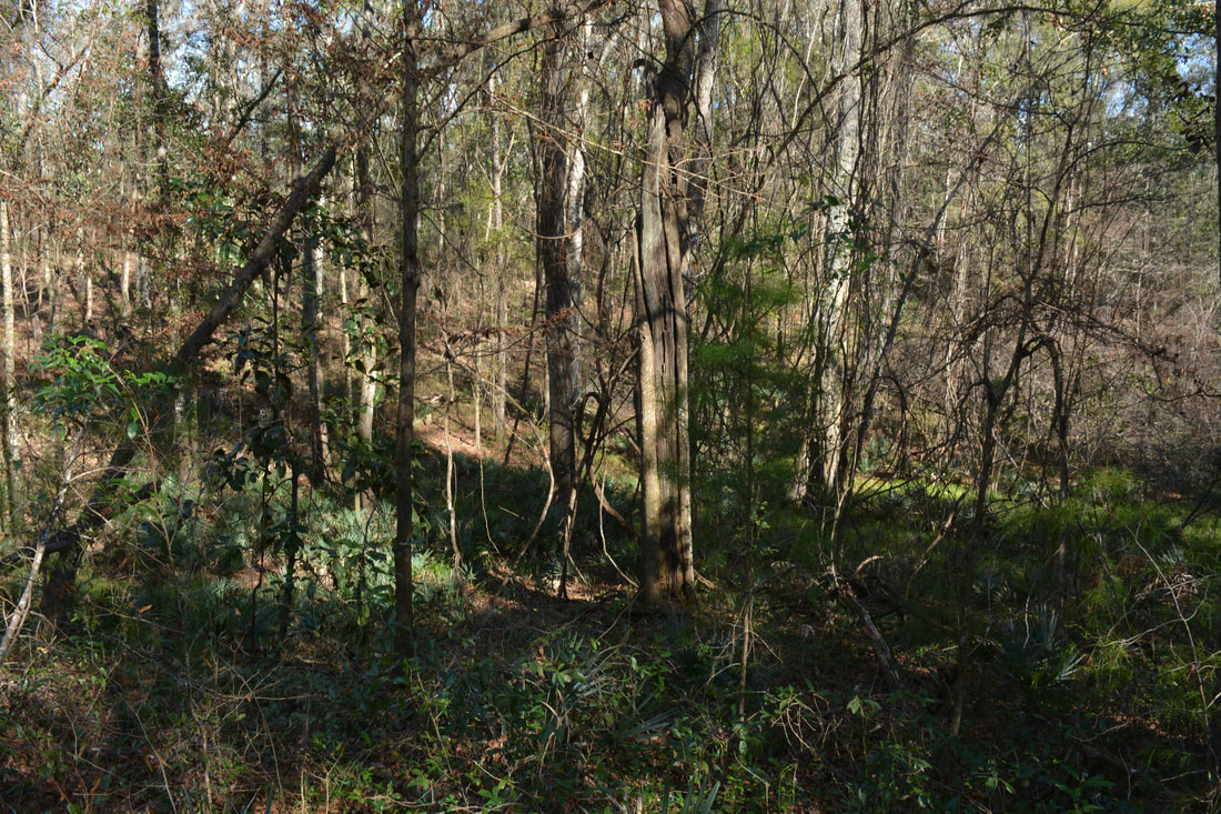
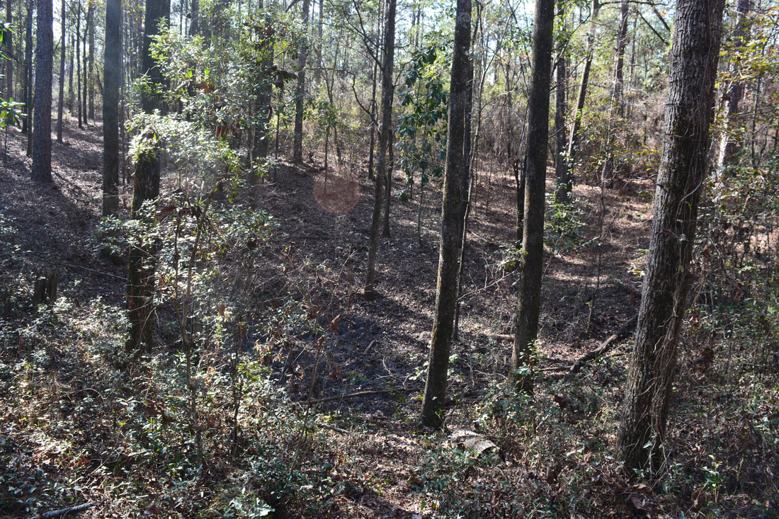
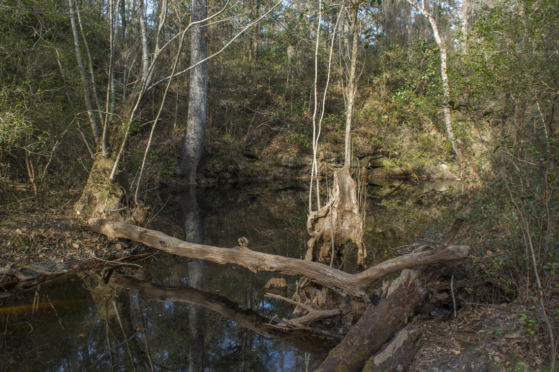
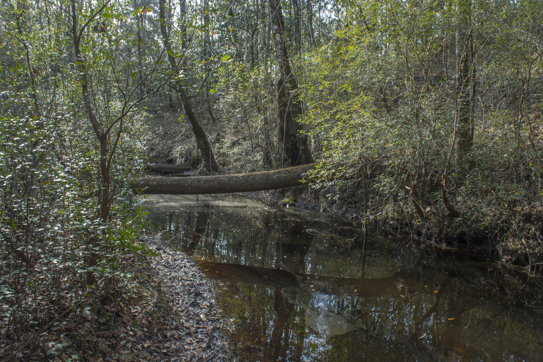
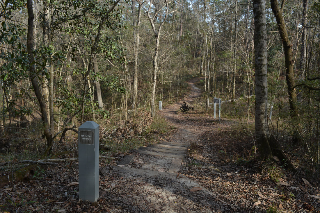
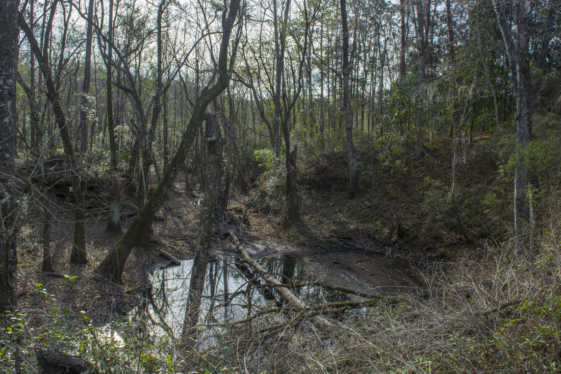
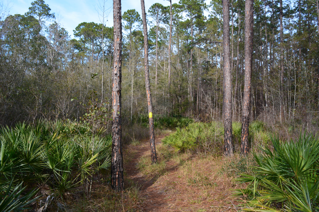
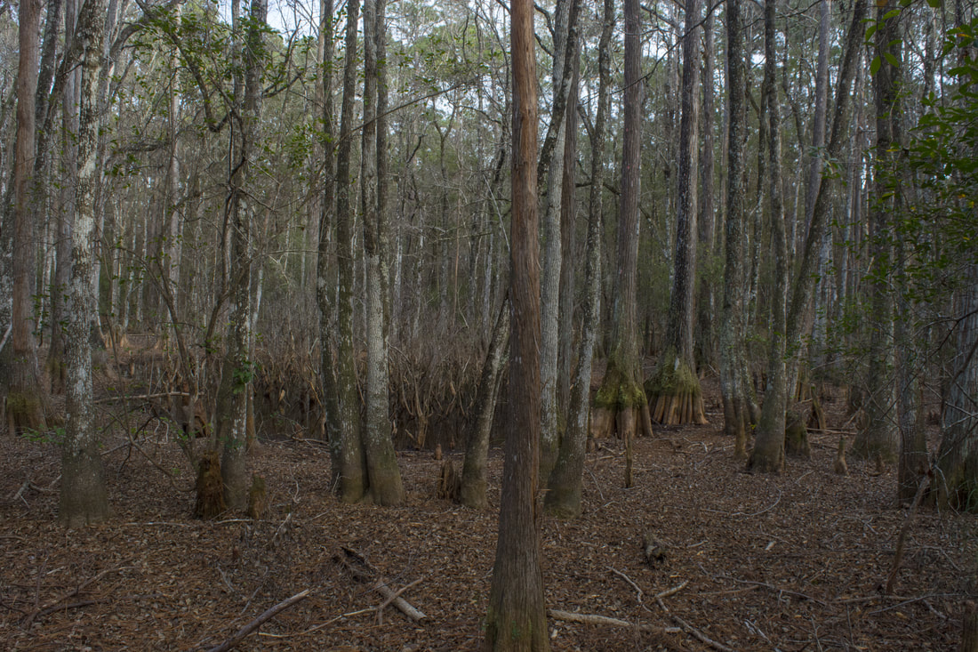
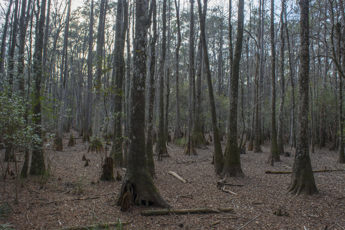
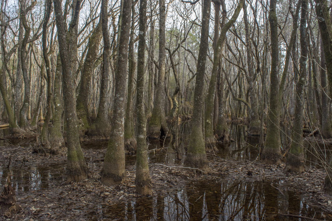
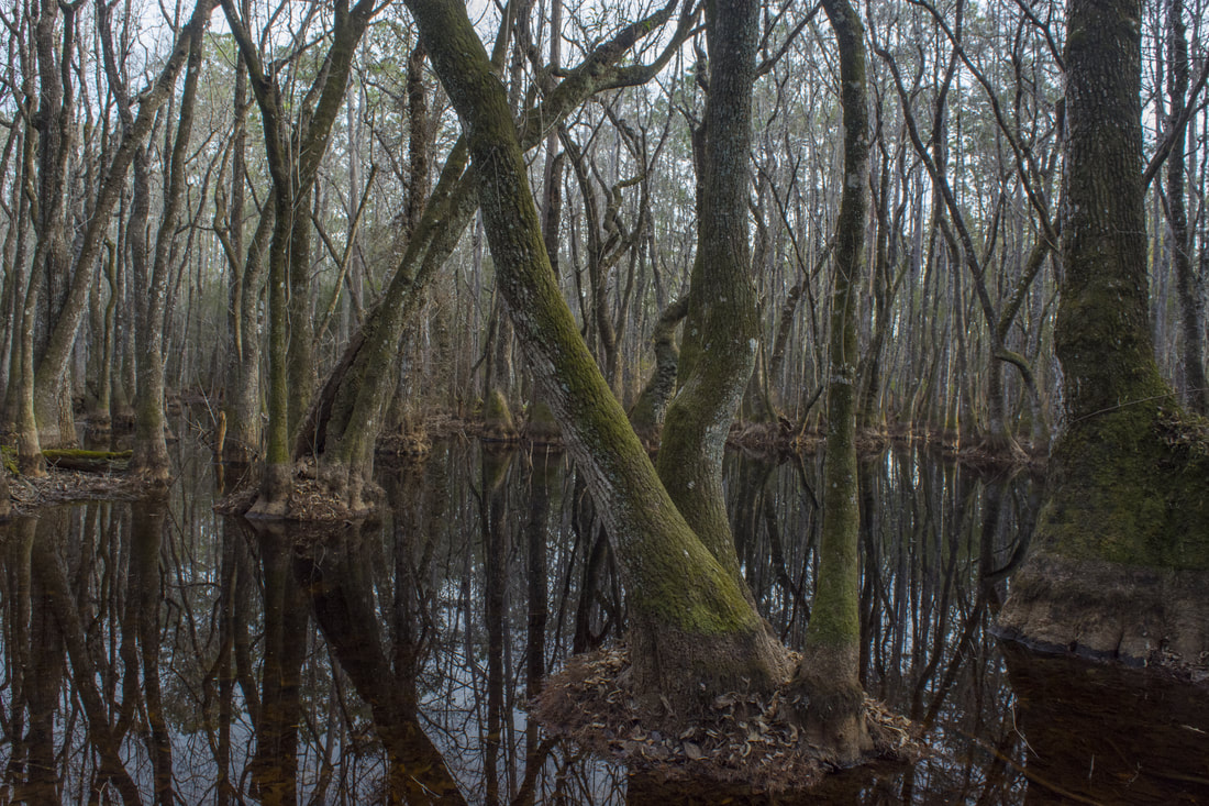
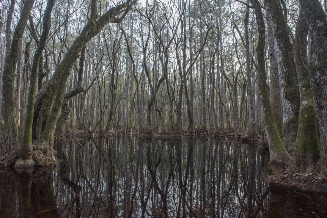
Return to the Sinkhole Trail and follow it to the next point of interest at 2.45 miles: the Natural Bridge. Fisher Creek briefly disappears underground at this spot before re-emerging a hundred feet away, although during low water, the sight isn't impressive since parts of the creekbed can be dried up. Just past the Natural Bridge is a junction where the Sinkhole Trail ends. Straight ahead is the Connector Trail, a shortcut back to the parking area. This hike turns right on the green-blazed Gum Swamp Trail. This part of the hike is less-traveled and is likely to bring more solitude than the Sinkhole Trail. The trail initially parallels Fisher Creek before it curves away and passes through several palmetto corridors. After a section of pine flatwoods, the trail reaches the first of three areas of cypress swamp at 3.35 miles: Bear Scratch Swamp. This one was dry during my visit. The trail skirt's the swamp's edge and reaches the next one, South Swamp, at 3.65 miles. With it being the only swamp with water in it during my visit, I was impressed by South Swamp. The rows of twisting cypress trees form beautiful reflections on the dark water. It's interesting how every cypress has its own unique look.

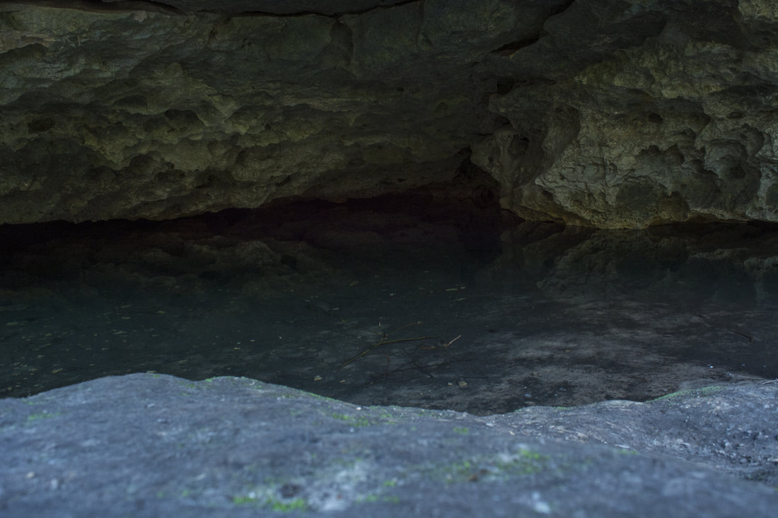
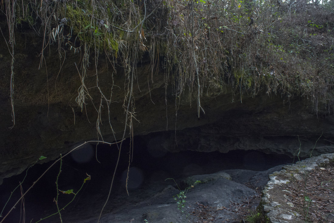
At 3.9 miles, the trail passes Shadows Swamp, which is the least scenic of the three swamps (it may be a little better with water). As with the previous two swamps, the trail skirts the edge and stays dry. At 4.15 miles, the Gum Swamp Trail ends at the other end of the Connector Trail. Stay straight on the Sinkhole Trail. The parking area is close by, but wait! There is one more sink to see: the Gopher Hole Sink. The signed spur trail (aka Hutchison's Spur) to Gopher Hole Sink leaves right at 4.2 miles and reaches the sink in 400 feet. Gopher Hole Sink is different from the other sinks on the hike. It's actually a water-filled cavern. Clear, blue water leads up all the way to the mouth of the low cave. The cave entrance slightly resembles the hole of a gopher tortoise, the sink's namesake. 

Return to the main trail and follow it to the end of the loop at 4.45 miles. Turn right on the access trail and return to the Leon Sinks Parking Area at 4.5 miles, finishing the hike. 
Picture
South Swamp along the Gum Swamp Trail is full of mysterious twisting cypresses and dark reflections

Mileage

0.0 - Leon Sinks Trailhead
0.65 - Hammock Sink
1.05 - Big Dismal Sink
1.85 - Black Sink 
2.15 - Lost Stream Overlook 
2.45 - Natural Bridge
3.35 - Bear Scratch Swamp 
3.65 - South Swamp 
3.9 - Shadows Swamp 
4.25 - Gopher Hole Sink
4.5 - Leon Sinks Trailhead

Variations

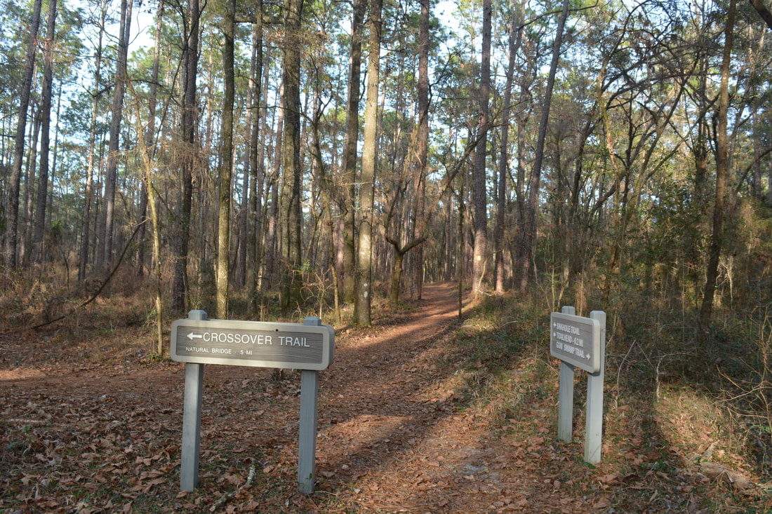
Hike just the Sinkholes Trail and Crossover Trail - 3.3 Miles

Bonus Stops

Only a mile from Leon Sinks is a little-known hike with more sinkholes known as Wakulla River Sinks. Leon Sink sand Wakulla River Sinks make for a good combination to fill up the day. 

Pictures & Videos

2 Comments
RENEE JONES
1/22/2023 10:16:44 am

This article is wonderful. One of my favorite trails.

Reply
Chris Stinnett
3/1/2023 02:52:58 pm

Things to note as of March 1, 2023:
1. There is currently no boardwalk/overlook at Hammock Sink. Dangerous condition of the timbers required complete removal. Rebuilding is in planning/approval process.
2. The boardwalk in Gum Swamp Trail has been permanently removed and trail re-routed to permit year-round hiking without deterioration issues of the boardwalk.
3. The true hours of the park are 8 AM to 8 PM from April 1 to October 31; 8 AM to 6 PM from November 1 to March 31. False information has resulted in some big disappointment to hikers arriving as the park is closing during winter months.
4. The entrance fee is $5 per vehicle. Those with National Park passes are reduced 50% to $2.50. An Apalachicola National Forest annual pass can be purchased to allow free entrance to this and other day-use sites in ANF.
5. This remains a fantastic hike, with birding and wildlife sighting opportunities. Come on the first Saturday of each month and hike with Friends of Leon Sinks! You'll get high-quality professional information and they do it all for free!

Reply


Leave a Reply.

    About Me

    Mark Oleg Ozboyd
    I'm an avid outdoor explorer and a hobbyist landscape photographer. I'm 21 years old and have been hiking since 2011. Originally based out of Atlanta, Georgia, I started out by occasionally hiking short trails throughout well-known Georgia State Parks. During 2012 and 2013, I began to expand my trips into adjacent states, as well as into the wilder National Forest areas rather than just State Parks. Throughout the years that followed, as I slowly ran out of popular hiking trails in my area, I began to search for and hike in more seldom-visited areas. Today, you can find me out in the woods every weekend, whether it's on an official trail or bushwhacking through cross-country terrain without any paths. I now attend Washington & Lee University and am exploring Virginia and West Virginia. My other hobbies include chess, science, old music, and meteorology. I have 3 years of amateur weather forecasting experience, having studied a lot of meteorology basics over the years. I am also a student at European School of Music where I learned that music and nature have a lot in common. Listening to good music inspires me to capture nature's beauty on the camera in different aspects that also make me recall many beautiful music pieces that I've heard.​


    Dear readers: I have invested a tremendous amount of time and effort in this website and the Georgia Waterfalls Database the past five years. All of the work that has gone in keeping these websites updated with my latest trip reports has almost been like a full-time job. This has not allowed me to pick up a paid job to save up money for college, and therefore, I I've had to take out loans. If you find the information on this website interesting, helpful, or time-saving, you can say "thanks" and help me out by clicking the button above and making a contribution. I will be very grateful for any amount of support you give, as all of it will apply toward my college tuition. Thank you! 

    Enter your email address to subscribe for trail reports:

    Delivered by FeedBurner


    Picture
    Coming in 2022-2023?

    Other Hiking Websites

    DWHike's Adventures
    Florida's Natural Wonders
    Florida Trailblazer
    Meanderthals
    Mountain Images
    by Bernie Boyer

    North Carolina Waterfalls with
    ​Kevin Adams
    Take-a-Hike!
    Tennessee Landforms
    Waterfall Page
    Waterfall Adventurer
    Zach's Mild Adventures

    Miles Hiked

    Year 1: 540.0 Miles
    Year 2: 552.3 Miles
    ​Year 3: 518.4 Miles
    Year 4: 482.4 Miles
    Year 5: 259.9 Miles

    Archives

    March 2021
    February 2021
    January 2021
    November 2019
    October 2019
    September 2019
    August 2019
    July 2019
    June 2019
    February 2019
    January 2019
    December 2018
    November 2018
    October 2018
    August 2018
    July 2018
    June 2018
    May 2018
    April 2018
    March 2018
    February 2018
    January 2018
    December 2017
    November 2017
    October 2017
    September 2017
    August 2017
    July 2017
    June 2017
    May 2017
    April 2017
    March 2017
    February 2017
    January 2017
    December 2016
    November 2016
    October 2016
    September 2016
    August 2016
    June 2016
    May 2016
    April 2016
    March 2016
    January 2016
    December 2015
    November 2015
    October 2015
    September 2015
    August 2015
    July 2015
    June 2015
    May 2015
    April 2015
    March 2015
    February 2015
    January 2015
    December 2014
    November 2014
    October 2014
    September 2014
    August 2014
    July 2014
    June 2014
    May 2014
    April 2014
    March 2014
    February 2014

    Categories

    All
    Adel
    Adirondack Park
    Alabama
    Alfred A. Ring Park
    Allegheny Trail
    Amicalola Falls State Park
    Anniston Area
    Apalachicola Bluffs And Ravines Preserve
    Apalachicola National Forest
    Apalachicola/Port St. Joe Area
    Apopka
    Appalachian Trail
    Appling
    Art Loeb Trail
    Aska Trail System
    Bakersville
    Balm-Boyette Scrub Preserve
    Balsam Lake Recreation Area
    Bankhead National Forest
    Bartow County Parks
    Bartram Trail
    Basinger
    Beersheba Springs
    Benton
    Benton Mackaye Trail
    Berry College Trail System
    Best Hike
    Big South Fork National Recreation Area
    Black Bear Wilderness
    Black Rock Mountain State Park
    Blairsville
    Blakely
    Blood Mountain Wilderness
    Blowing Rock
    Blue Ridge
    Blue Ridge Parkway
    Boone
    Bradenton
    Bradenton Beach
    Brasstown Bald
    Brasstown Wilderness
    Brevard
    Bryson City
    Buchanan
    Bucks Pocket State Park
    Bulow Creek State Park
    Bulow Plantation Ruins State Park
    Caesars Head State Park
    Caladesi Island State Park
    Calhoun
    Camel's Hump State Park
    Cashiers
    Caspersen Beach Park
    Catfish Creek State Park
    Caves
    CC Putnam State Forest
    Cedar Point Environmental Park
    Chatsworth
    Chattahoochee National Forest
    Chattanooga
    Chattanooga Valley
    Chattooga National Wild And Scenic River
    Cheaha Wilderness
    Cherohala Skyway
    Cherokee
    Cherokee National Forest
    Chiefland Area
    Chillhowee Recreation Area
    Chipley
    Chunky Gal Trail
    Circle B Bar Reserve
    Citico Creek Wilderness
    Citrus Wildlife Management Area
    Clarkesville
    Clayton
    Cleevland
    Cleveland
    Cloudland Canyon State Park
    Cohutta Wilderness
    Collier-Seminole State Park
    Cordele
    Cornelia
    Covington
    Crestview Area
    Crew-land-and-water-trust
    Cullowhee
    Cumberland Trail
    Dahlonega
    Dalton
    Dawson Forest Wildlife Management Area
    Dawsonville
    Dayton
    De Soto National Memorial
    DeSoto State Park
    Dillard
    Double Springs
    Ducktown
    Duncan Ridge Trail
    Dunlap
    Eagle's Rest Park
    Eastpoint
    Econfina Creek Wildife Management Area
    Eglin Air Force Base
    Elizabethton
    Elkins
    Elk Knob Game Lands
    Elk Park
    Ellicott Rock Wilderness
    Ellijay
    Emerson Point Preserve
    Englewood Area
    Enota Retreat
    Erwin
    Falling Waters State Park
    Fayetteville
    Fires Creek Recreation Area
    Fire Tower
    Flint River
    Florence Area
    Florida
    Florida Caverns State Park
    Florida Trail
    Foothills Trail
    Fort Mountain State Park
    Fort Myers Area
    Fort Payne
    Fort Payne Area
    Fort Yargo State Park
    Franklin
    Franklin Delano Roosevelt State Park
    Franklin-Marion State Forest
    Frozen Head State Park
    Gainesville
    Gainesville Area
    Gatlinburg
    George Washington National Forest
    Georgia
    Georgia Veterans Memorial State Park
    Glasgow
    Gorges State Park
    Grandfather Mountain State Park
    Great Smoky Mountains National Park
    Greeneville
    Green River Game Lands
    Gruetli-Laager
    Grundy Forest State Natural Area
    GTM Reserve
    Guana River Wildlife Management Area
    Hayesville
    Helen
    Hiawassee
    High Falls State Park
    Highlands
    Highlands Scenic Highway
    Hillsborough River State Park
    Hinson Conservation & Recreation Area
    Historic Sites
    Honeymoon Island State Park
    Hot Springs
    Huntington
    Inverness Area
    Jackson
    Jasper
    Jefferson National Forest
    Joan M. Durante Park
    Jonathan Dickinson State Park
    Jones Gap State Park
    Joyce Kilmer Slickrock Wilderness
    Joyce Kilmer - Slickrock Wilderness
    Juniper Prairie Wilderness
    Kelly Park
    Keown Falls Recreation Area
    Kolomoki Mounds State Park
    LaFayette
    Lake City Area
    Lake George Wild Forest
    Lake June-in-Winter State Park
    Lakeland Area
    Lake Placid
    Lake Russell Wildlife Management Area
    Lake Wales Ridge State Forest
    Laurel Fork North Wilderness
    Leffis Key Preserve
    Leon Sinks Geological Area
    Lexington
    Lineville
    Linville
    Linville Gorge Wilderness
    Lithia Springs
    Little Frog Wilderness
    Little Manatee River State Park
    Little River Canyon National Preserve
    Longboat Key
    Long Trail
    Lookout Mountain
    Lookout Mountain Battlefield
    Lovingston
    Lula Lake Land Trust
    Lumpkin
    Maggie Valley
    Manatee Springs State Park
    Marianna Area
    Mark Trail Wilderness
    Marlinton
    Mccaysville
    McMinville
    Mentone
    Middlesex
    Mistletoe State Park
    Monongahela National Forest
    Montreat
    Mountain Bridge Wilderness Area
    Mountain City
    Mountains To Sea Trail
    Mountains-to-Sea Trail
    Mount Rogers National Recreation Area
    Myakka River State Park
    Myron B. Hodge City Park
    Nantahala National Forest
    Naples
    Naples Area
    Natural Bridge State Park
    Neal Preserve
    New Castle
    Newport
    New River Gorge National Park
    New York
    North Carolina
    Ocala Area
    Ocala National Forest
    Ocean-to-Lake Trail
    Oconee State Park
    Oconee Station Historic Site
    Okaloacoochee Slough State Forest
    Oldsmar
    Oneida
    Orlando Area
    Ormond Beach
    Oscar Scherer State Park
    Oxford
    Palatka
    Palmetto Trail
    Panama City Area
    Panthertown Valley
    Parrish
    Paynes Creek Historic State Park
    Peaks Of Otter Recreation Area
    Pigeon Crockford Mountain Wildlife Management Area
    Pigeon-Crockford Mountain Wildlife Management Area
    Pigeon-Crockford Wildlife Management Area
    Pine Mountain
    Pinhoti Trail
    Pinnacle Park
    Pisgah Civitan Park
    Pisgah National Forest
    Pittman Center
    Pond Mountain Wilderness
    Ponds/Lakes
    Prentice Cooper State Forest
    Providence Canyon State Park
    Pumpkintown
    Quick Point Nature Preserve
    Raven Cliffs Wilderness
    Reed Bingham State Park
    Reliance
    Rice Creek Conservation Area
    Riverview Pointe Preserve
    Robbinsville
    Robinson Preserve
    Rock Creek Gorge Scenic Area
    Rock Island State Park
    Rome
    Rosman
    Sale Creek
    Salem
    Salt Springs
    Saluda
    Santa Rosa Beach
    Sarasota
    Sarasota Area
    Savage Gulf State Natural Area
    Scenic Views
    Scottsboro Area
    Sebring Area
    Sewanee
    Sheltowee Trace Trail
    Shining Rock Wilderness
    Signal Mountain
    Sipsey Wilderness
    Sky Valley
    Smithgall Woods State Park
    Snowbird Backcountry Area
    Soddy Daisy
    Soddy-Daisy
    Sopchoppy
    South Carolina
    South Cumberland State Park
    Southeastern Cave Conservancy
    Southern Nantahala Wilderness
    Sparta
    Sprewell Bluff Park
    Spring City
    Spring Hill
    Springs
    Spruce Pine
    Standing Indian Backcountry Area
    St. Augustine
    St. George Island State Park
    St. Joseph Bay State Buffer Preserve
    St. Marks Area
    St. Marks National Wildlife Refuge
    Stone Mountain
    Stone Mountain Park
    Suches
    Sumatra
    Sumter National Forest
    Suwannee River
    Swallow Creek Wildlife Management Area
    Sweetwater Creek State Park
    Sylva
    Talladega National Forest
    Tallahassee Area
    Tallulah Falls
    Tallulah Gorge State Park
    Tampa Bay Area
    Tate City
    Tate's Hell State Forest
    Tea Creek Wildlife Management Area
    Tellico Plains
    Tennessee
    Thomaston
    Toccoa
    Topsail Hill State Park
    Torreya State Park
    Townsend
    Tracy City
    Tray Mountain Wilderness
    Trenton
    Triple Creek Preserve
    Troutdale
    Unaka Mountain Wilderness
    Upper Tampa Bay County Park
    Venice
    Vermont
    Virgin Falls State Natural Area
    Virginia
    Virginia Outdoors Foundation
    Vogel State Park
    Wakulla Springs State Park
    Waleska
    Walhalla
    Wartburg
    Water Features
    Waynesville
    Weedon Island Preserve
    Weeki Wachee Preserve
    Wekiwa Springs State Park
    West Palm Beach Area
    West Virginia
    Whitehall
    White Springs
    Winder
    Withlacoochee State Forest
    Young Harris

    RSS Feed

TRAIL REPORTS

Hikes in Alabama
​Hikes in Florida
Hikes in Georgia
Hikes in North Carolina
Hikes in South Carolina
Hikes in Tennessee
Hikes in Virginia

Hiking Resources

Alabama Resources
​
Florida Resources
Georgia Resources
North Carolina Resources
​South Carolina Resources
​
Tennessee Resources

Other

Contact
Map of Hikes
Alphabetical List of Hikes
Southeast Nature Society
© COPYRIGHT 2014-2018
​ALL RIGHTS RESERVED.
Important: I disclaim any responsibility for any damage or personal injury that may occur as a result of the activities and information found on this website. All outdoor activities, especially off-trail hiking, are done at your own risk. Never hike or head into that area that may be above your fitness or experience level.
  • Home
  • Trail Reports
    • Best Hikes
    • Hikes with Scenic Views
    • Hikes with Water Features
    • Alabama
    • Georgia
    • Florida
    • North Carolina
    • South Carolina
    • Tennessee
    • Vermont
    • Virginia
  • Map
  • Hike List
  • Testimonials
  • Resources
  • Contact Us
  • Southeast Nature Society
    • Our Team
  • Georgia Waterfalls Database