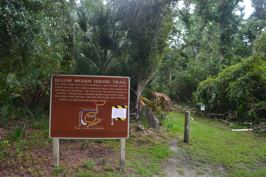
A slice of wilderness along Florida's Atlantic coastline, Bulow Creek State Park conserves several thousand acres of salt marshes and old-growth tropical hammocks in the Bulow Creek watershed between Ormond Beach and Flagler Beach. Traversing the park is the linear Bulow Woods Trail, a linear pathway over 6 miles long that takes you past several salt marsh views and through a tropical jungle with many old-growth palms and oaks. One of the hike's bigger highlights is a gorgeous palm-lined stream flowing toward Bulow Creek encountered along the north part of the trail. Between the magnificent 400-year old Fairchild Oak at the south end and the ruins of the largest sugar mill ever operated in Florida (the Bulow Sugar Mill & Plantation Ruins) at the north end, the Bulow Woods Trail has attractions even at its edges. This hike occurred on Saturday, August 11th, 2018. My plan was to hike out and back from the Fairchild Oak to the Bulow Plantation Ruins, hiking the Bulow Creek Loop counter-clockwise along the way. I would also stop at Boardman Pond.
Summary
R/T Length of Trail: 13.3 Miles
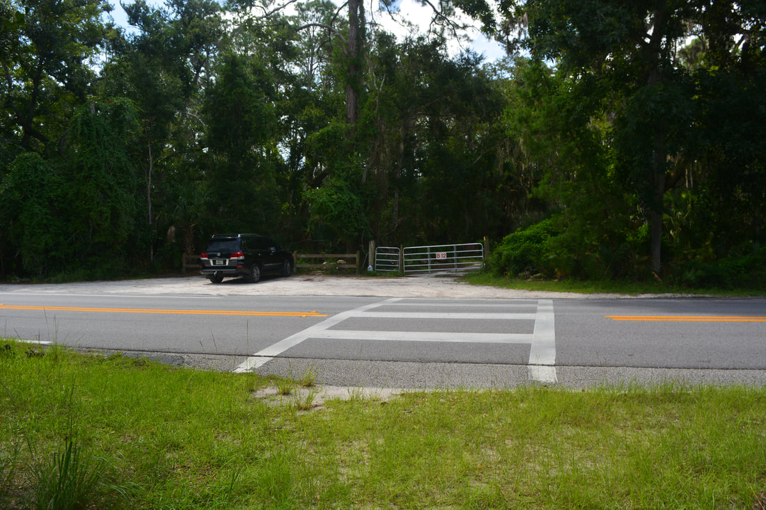
Duration of Hike: 5:45 plus 2 hours of stopping and photography Type of Hike: Out and Back with Loop Difficulty Rating: 7 out of 10 Pros: Lots of jungle and "Old Florida" scenery Cons: Mosquitoes can be extreme depending on rainfall and season; some sections are pretty muddy Points of Interest: Fairchild Oak; Cedar Creek Views; Boardman Pond; Bulow Creek Marsh Views; Bulow Creek Tributary; Bulow Plantation Ruins Trail Blaze Colors: Bulow Woods Trail - Yellow; Pine Hammock Shortcut - Aqua Best Seasons to Hike: Winter Fees: None at the Fairchild Oak entrance Beginning Point: Fairchild Oak Directions from Ormond Beach, FL: From the intersection of Granada Boulevard (FL 40) and Beach Street in downtown Ormond Beach, take North Beach Street. The road enters Tomoka State Park in 3.2 miles and turns into Old Dixie Highway. Continue another 8.9 miles along Old Dixie Highway (12.1 miles total from Granada Boulevard) to the Bulow Creek State Park/Fairchild Oak entrance on the right. Enter the park and follow the unpaved road 0.1 mile to the parking area and trailhead. Map
Click the link below to download a .GPX file with a track of this hike.
Details
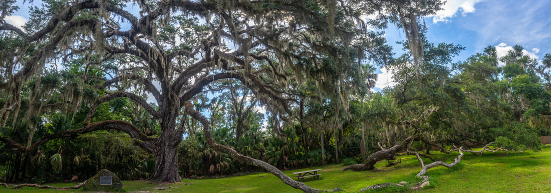
The woods of Bulow Creek State Park have been a popular destination for Northeast Florida hikers due to the unique, jungle-like forest, whose canopy used to be so thick that sunlight seldom penetrated through. Unfortunately, the old-growth forest became greatly thinned out thanks to the winds of Hurricane Matthew in 2016. Although the Bulow Woods today aren't what they used to be, they're still a scenic destination and a worthwhile hike. If you choose to start the hike at the Fairchild Oak like I did, you'll leave some of the densest and most interesting woods for later. The Fairchild Oak stands sentinel in the grassy clearing right at the parking area. This incredible, majestic live oak is over two thousand years old and is among the tallest and oldest oaks in Florida. The oak is dedicated to Dr. David Fairchild, a botanist who introduced various valuable foods to the United States, including the soybean.
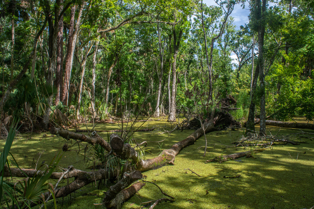
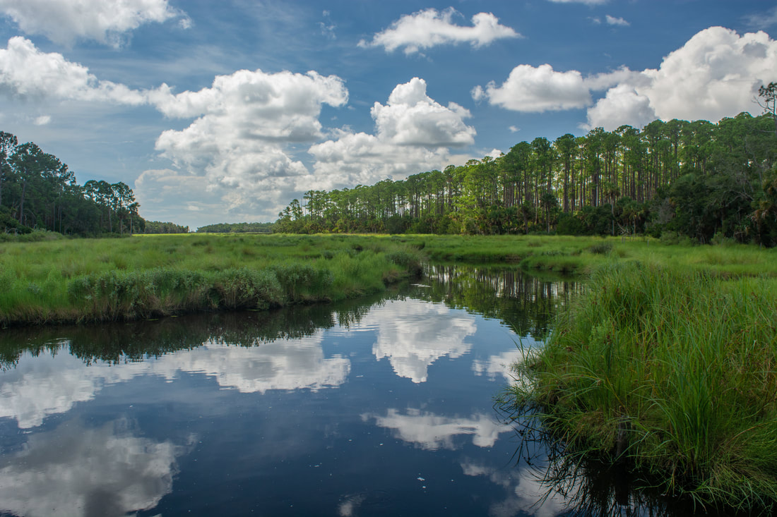
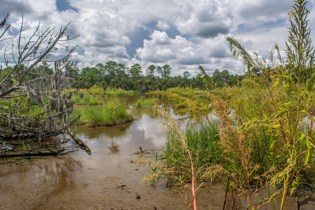
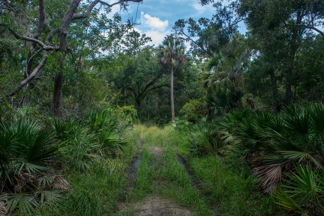
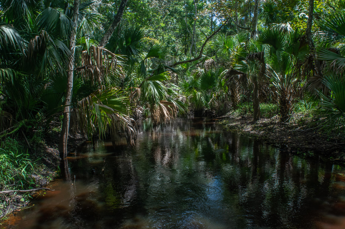
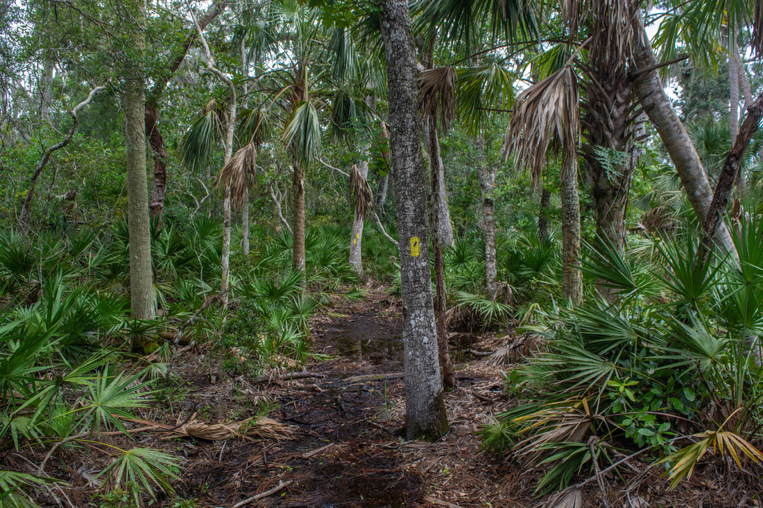
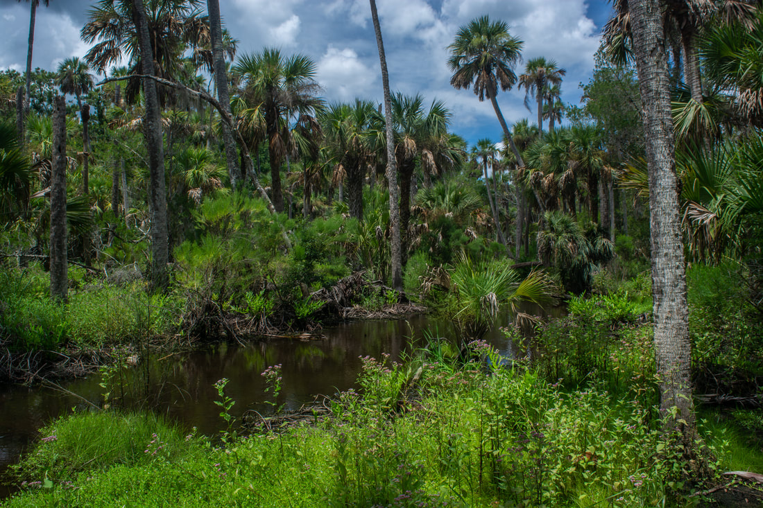
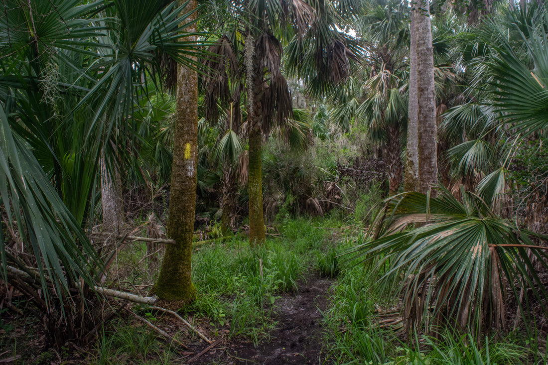
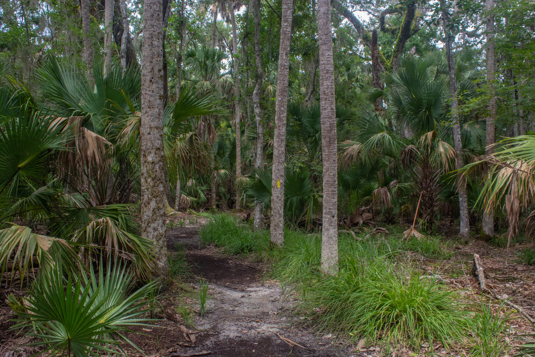
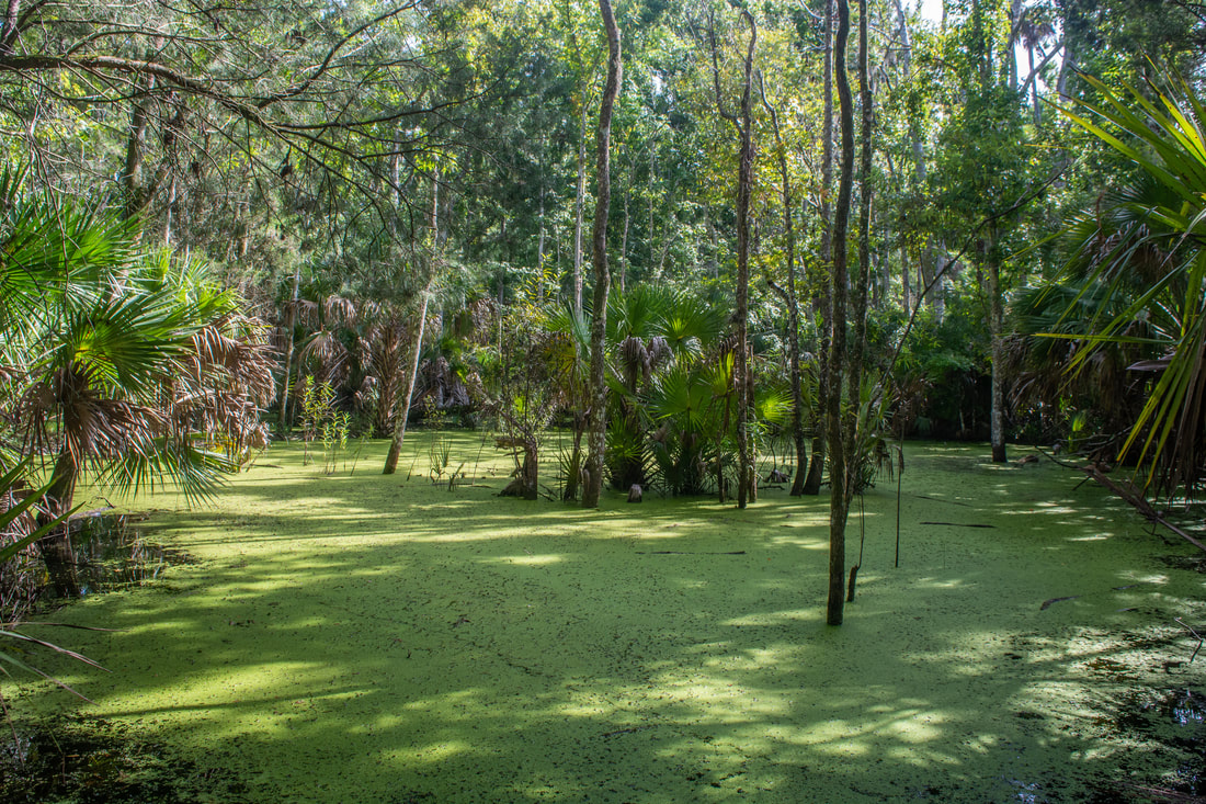
Two trails leave the parking: the Wahlin Nature Trail and the Bulow Woods Hiking Trail, also known as the Fairchild Oak Trail on this end. The Wahlin Nature Trail features a neat small spring, so it may be worth checking out. However, this hike heads straight onto the main trail - the Bulow Woods Trail. For its first 0.6 miles, the Bulow Woods Trail follows a nearly arrow-straight track north-northwest through a dense hammock with palms and oaks along the edge of a swamp. At 0.6 miles, the trail makes an abrupt right angle turn. The area around the turn can be very muddy or even a little wet in the wet season. The trail then takes a scenic palm-lined levee into the swampy area, providing several views of the dark, duckweed-strewn waters. As the forest suddenly thins out, the trail breaks out into open marshland and reaches a wooden footbridge at 1.35 miles. The bridge crosses the waters of Cedar Creek, a tidal tributary of Bulow Creek. I absolutely love the view of the marshy islands between which Cedar Creek twists, fringed by pines and palms. This is one of my favorite spots on the hike. 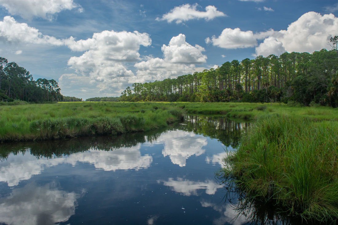
The Cedar Creek footbridge along the Bulow Woods Trail features scenic marsh views.
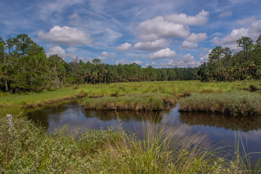
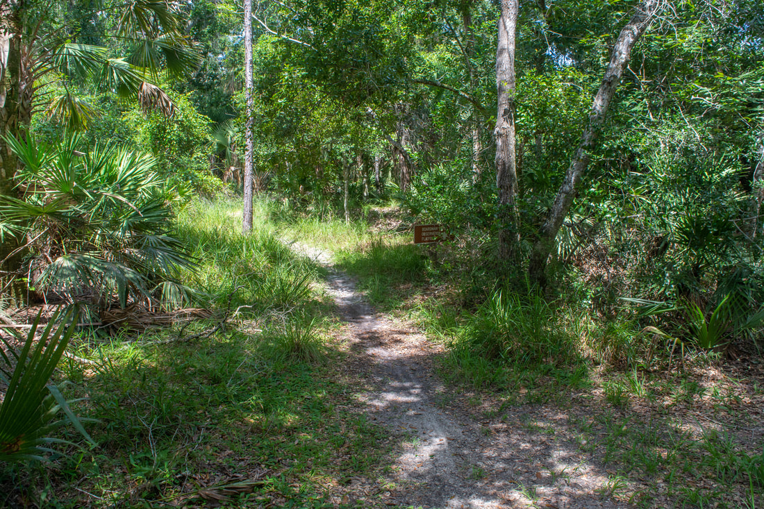
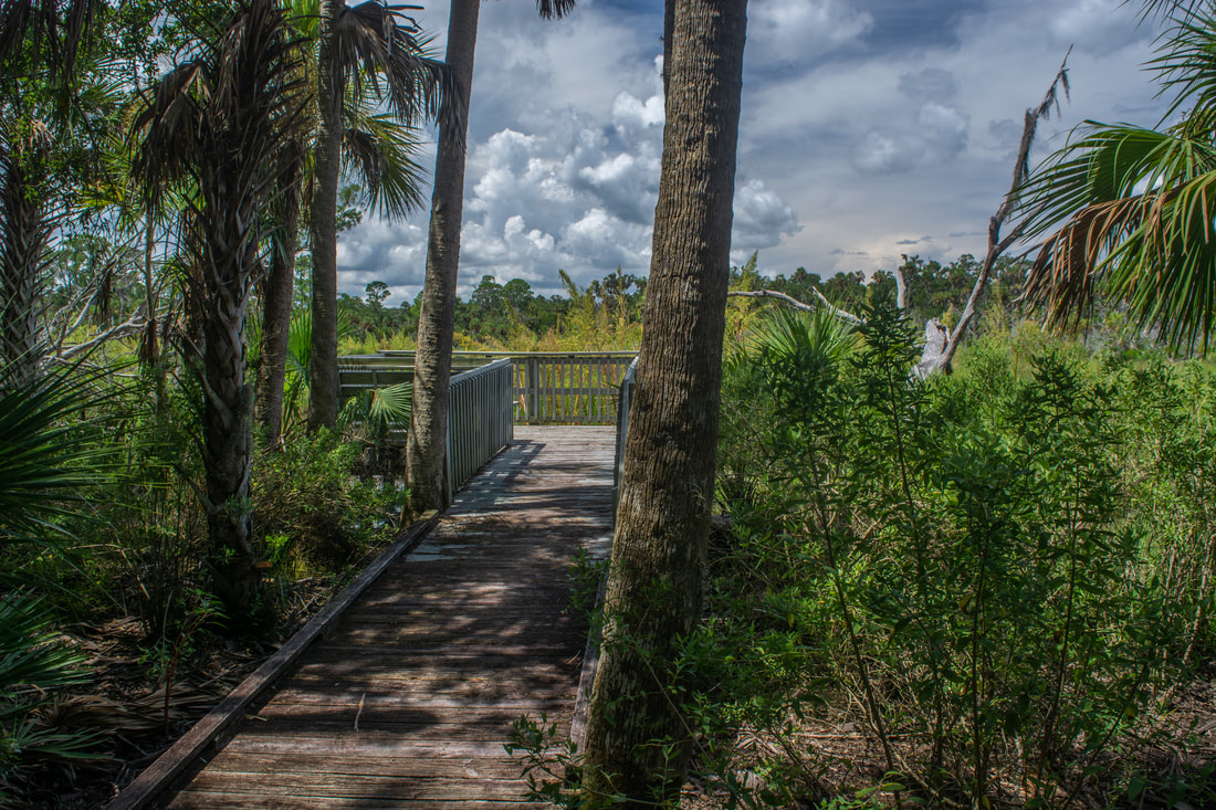
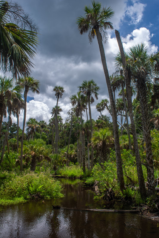
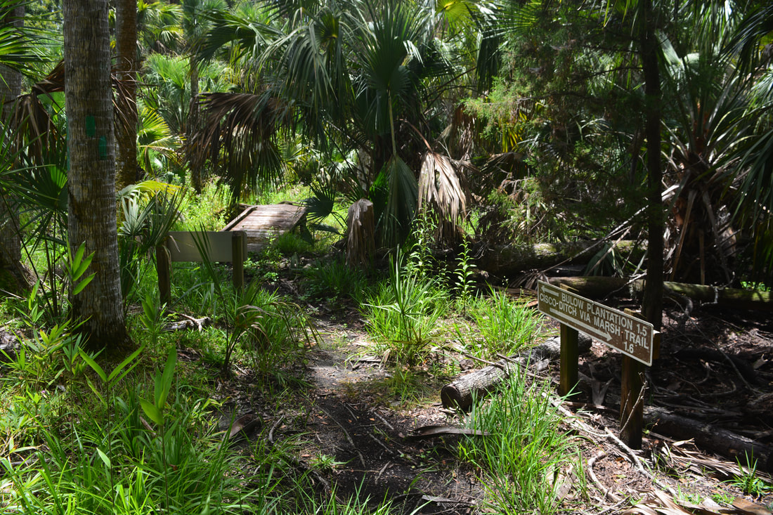
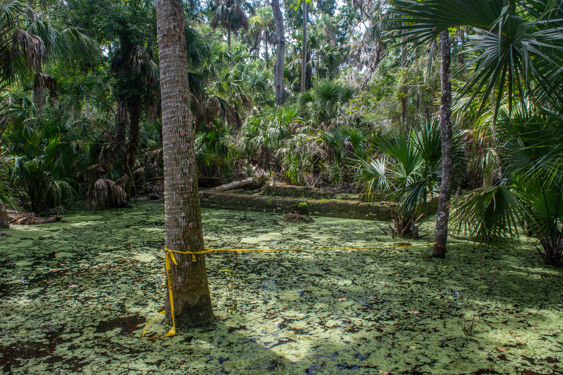
At 1.45 miles, the Bulow Woods Trail reaches a gate and turns left. Straight ahead is a red-blazed trail that loops through pine flatwoods and passes a mediocre view of Bulow Creek. I didn't hike the Red Trail, as it didn't sound worthwhile, but it could be a way to add a couple miles to the hike. Meanwhile, the main Bulow Woods Trail heads north-northwest along a double-track forest road through primarily featureless woods. The trail crosses Walter Boardman Lane at a parking area at 1.95 miles, instantly diving back into denser woods on the other side. At 2.15 miles, a marked, single-track side trail leads left from the forest road to Walter Boardman Pond. Be sure to follow the side path to the Boardman Pond observation deck at 2.3 miles. Even though Boardman Pond resembles a marsh more than a pond, it's a very scenic setting. The dozens of palm trees ringing the pond are particularly appealing.
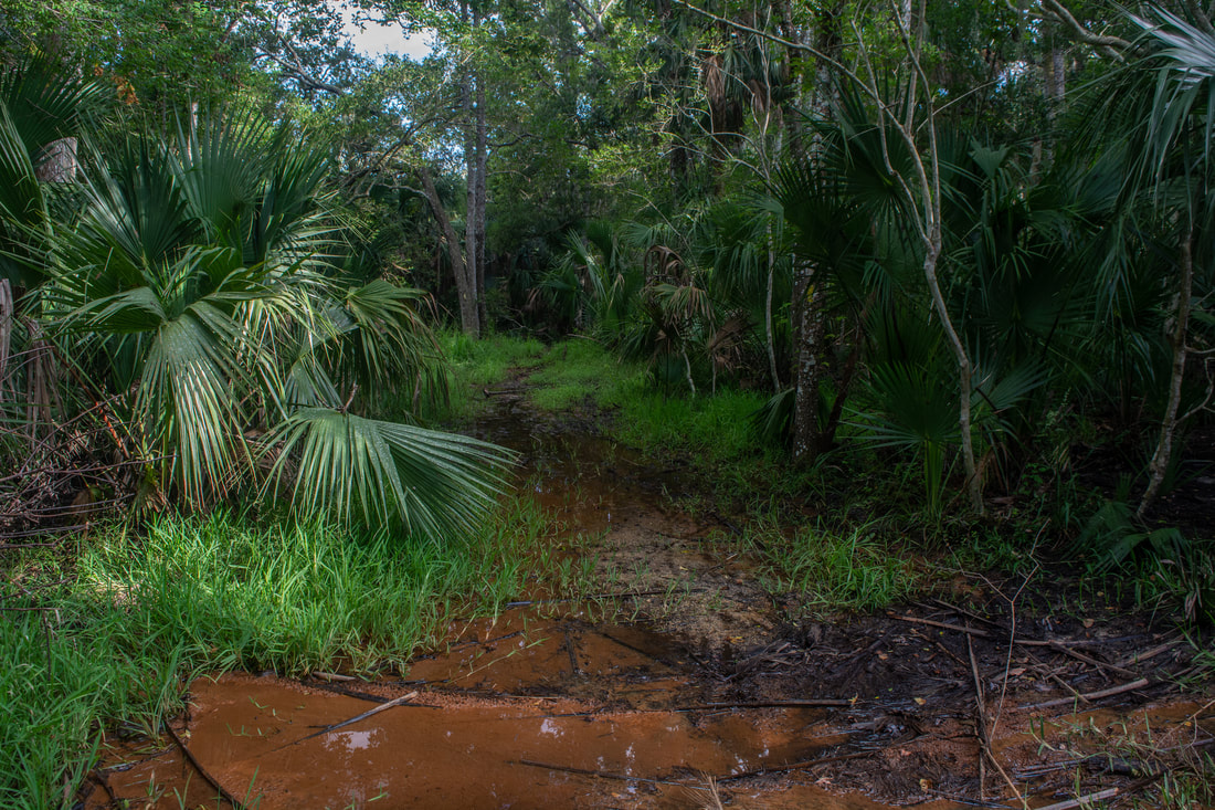
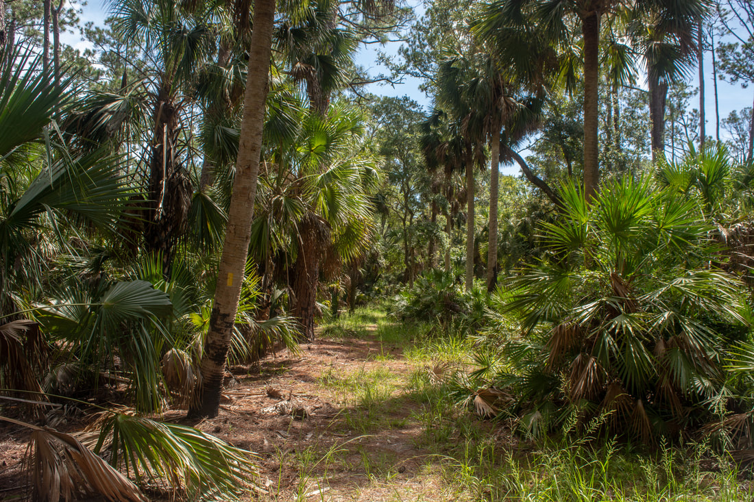
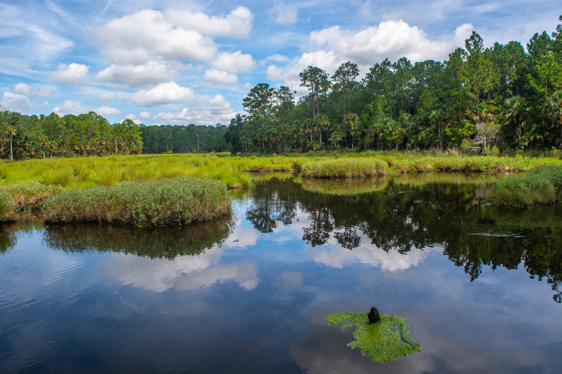
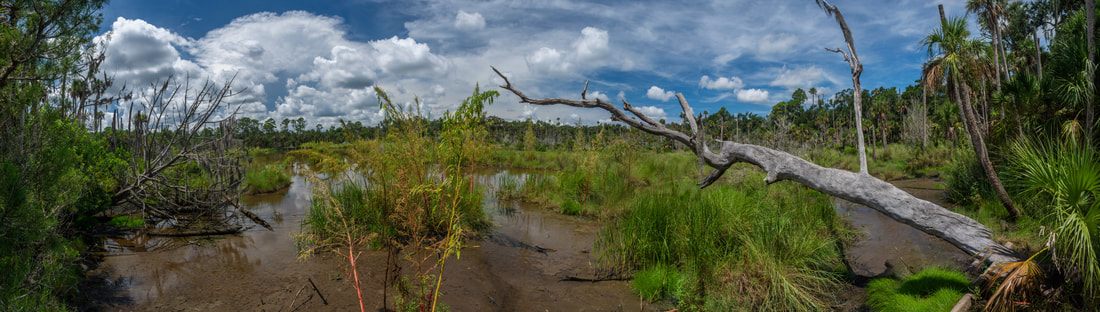
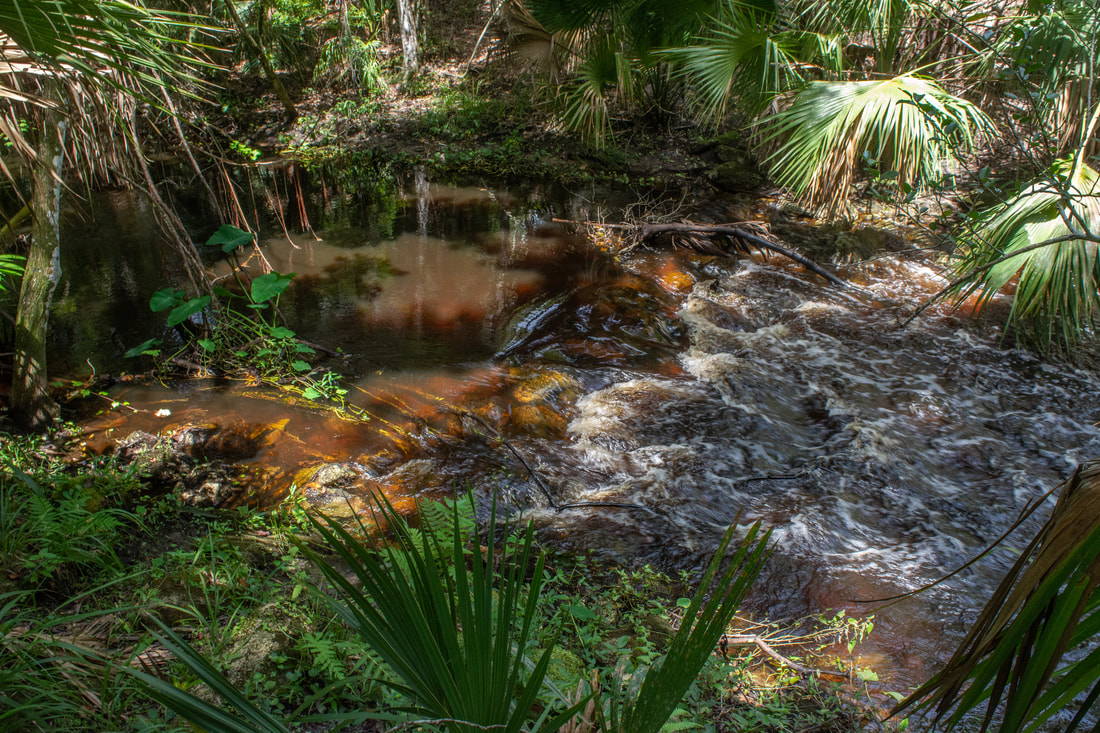
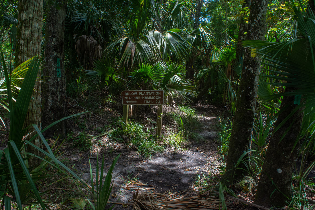
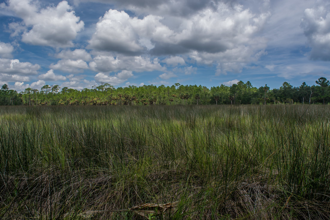
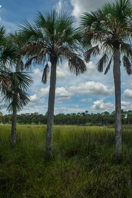
Past Boardman Pond, the trail stays with the grassy double-track forest road as it tunnels deeper into the Bulow Woods. At 3.1 miles, the Bulow Woods Trail turns left onto another forest road. Up to this point, the woods have been generally standard, but the forest gets wilder and more interesting from here. The surprising sound of rushing water greets you as you reach the 'Cisco Ditch Rapids' at 3.25 miles on the right. Cisco Ditch is a part man-made creek that appears to have been dredged. This uncovered the rocks that formed the rapids, so they're man-made too. The forest road abruptly ends in a muddy turnaround at 3.3 miles; a swamp lies off to the left. From here on, the Bulow Woods Trail is a single-track pathway. After crossing Cisco Ditch on a wooden footbridge, the trail reaches a junction with the Bulow Creek Loop at 3.4 miles. This hike continues straight on the outer part of the loop, which coincides with the Bulow Woods Trail. The shorter Pine Hammock Trail on the left will be your return route. The main trail briefly meanders over mounds from Cisco Ditch before veering away. As the trail makes its way toward the Bulow Creek marshes, the forest thins out and becomes predominantly oak and palmetto. However, the winding, wooded trail remains pleasant. Surprisingly, this trail section seems to stay dry even in the wet season. At 4.5 miles, the Bulow Woods Trail reaches a point that extends out into the Bulow Creek marsh. You won't be able to see Bulow Creek itself along the trail, but this is the best view of the extensive needlerush grass marshes. Unlike the Cedar Creek marsh, this marsh has a lot more palm trees around it. 
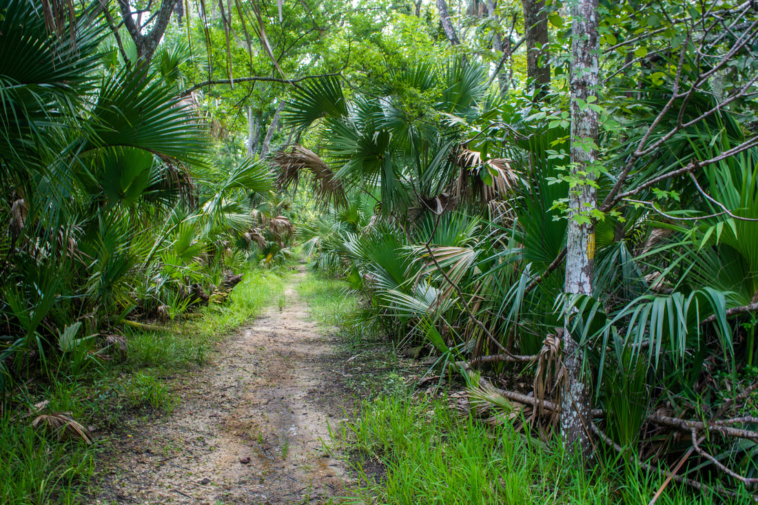
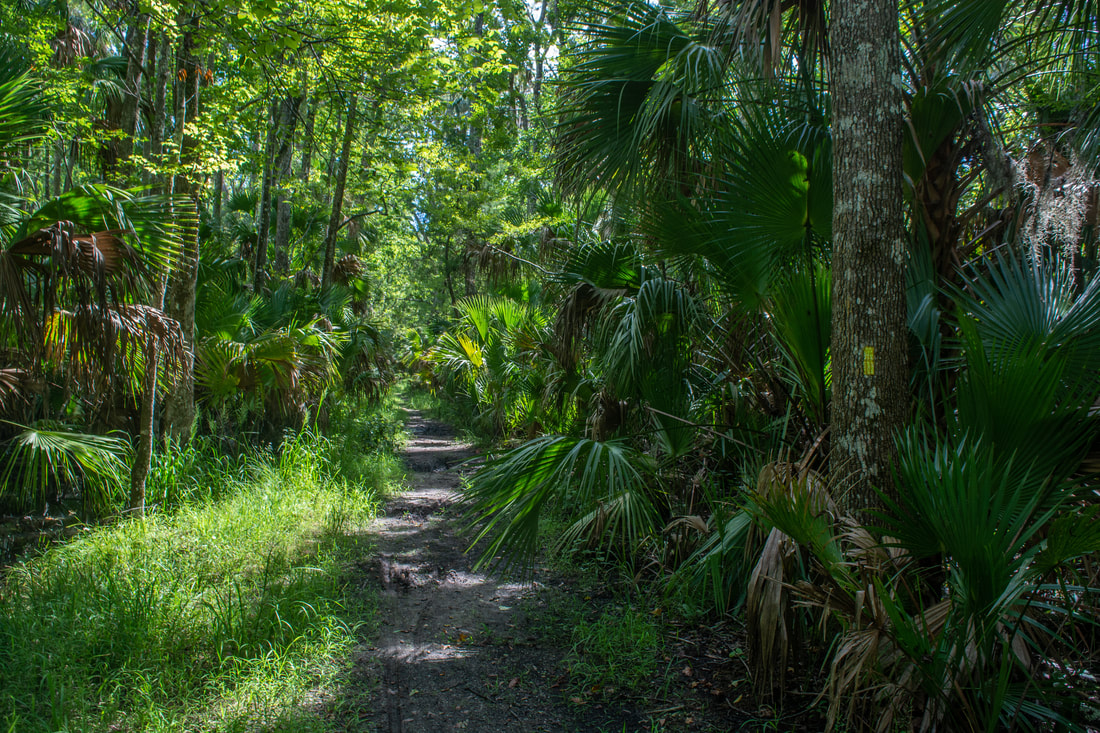
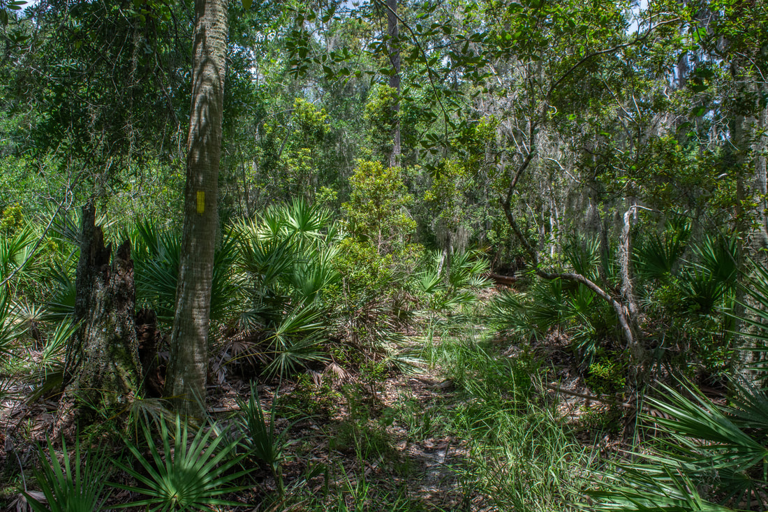
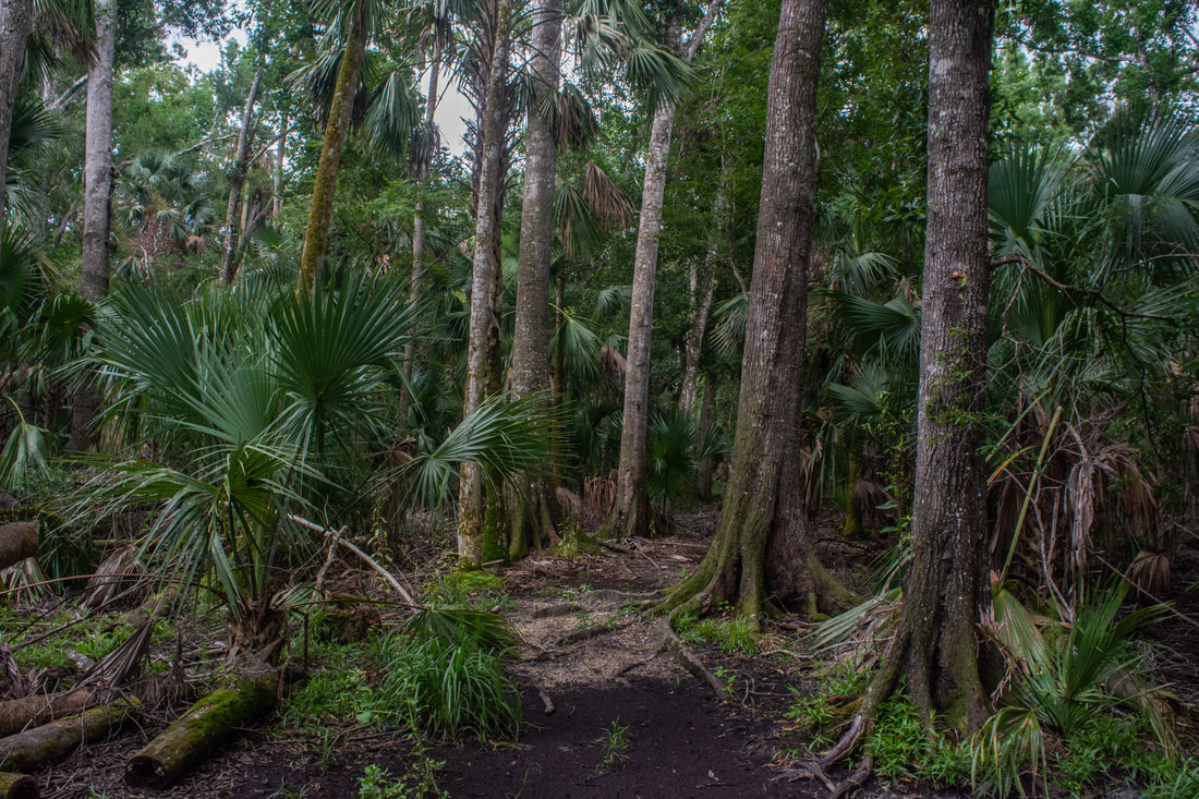
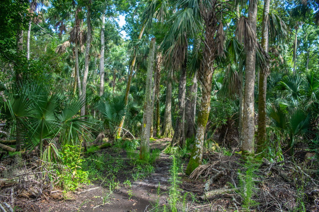
The Bulow Woods Trail frequently tunnels through dense tropical jungle reminiscing of "Old Florida".
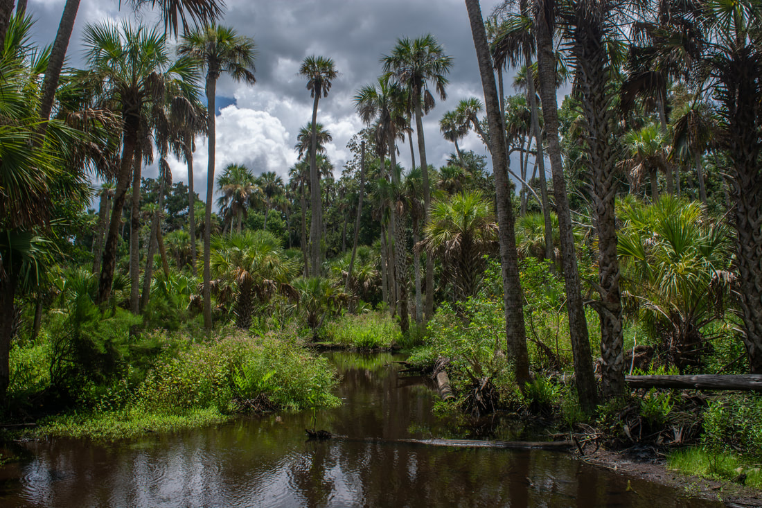
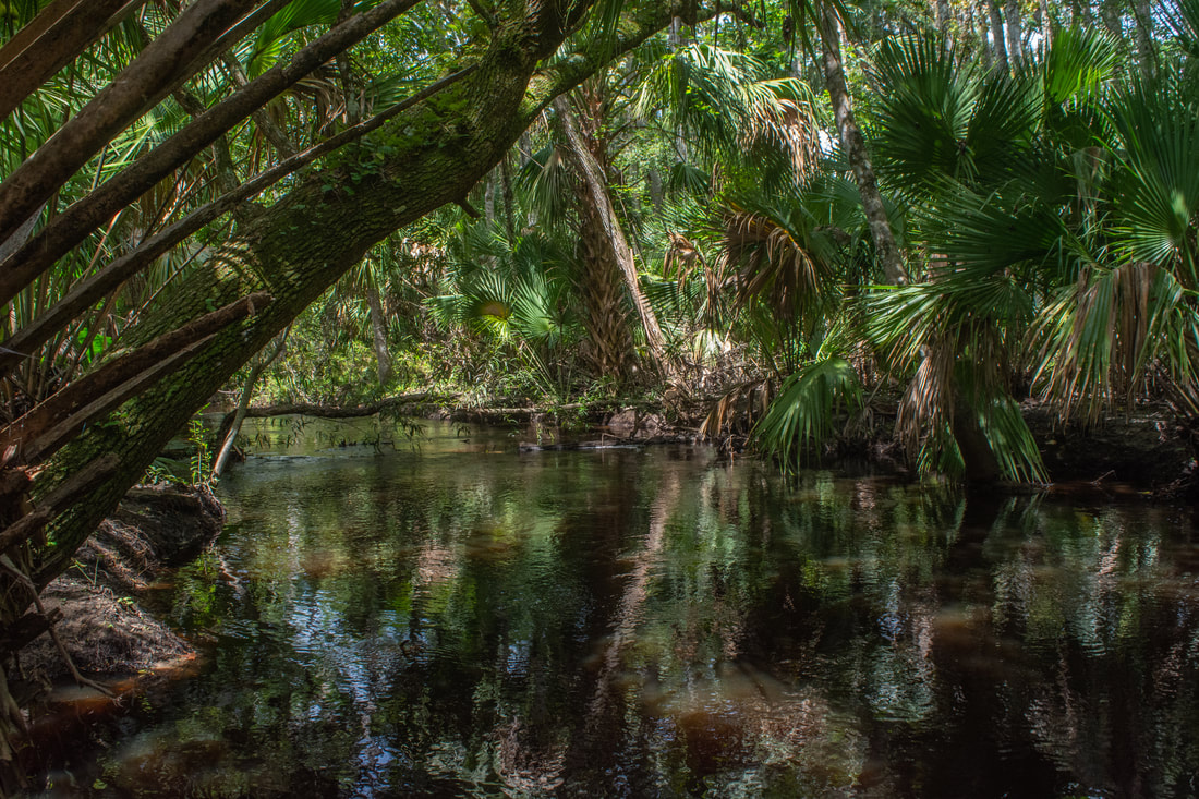
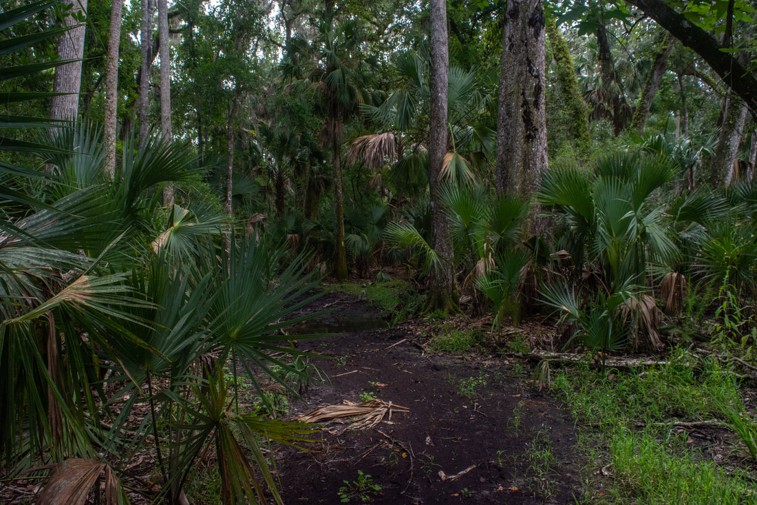
The Bulow Woods Trail turns southwest and starts paralelling the marsh. It's here that the trail starts getting squishy underfoot in the wet season. It's possible that you would have to do some minor wading in spots if it's rained a lot, especially from 4.8 miles to 5.0 miles. Around 4.85 miles, the trail comes alongside an unnamed Bulow Creek tributary. This small stream is incredibly scenic thanks to the grand royal palms that line its curves. This spot is another one of the hike's highlights. At 5.1 miles, the trail reaches the other end of the Pine Hammock Trail. From here to the north end, the trail is out and back.
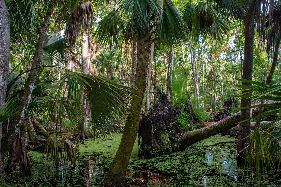
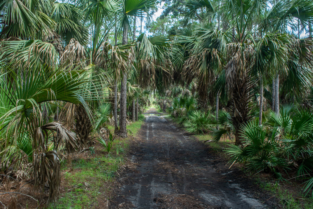
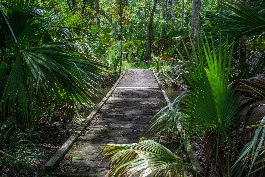
Continuing straight from the loop junction, you'll instantly cross a pair of small bridges over the unnamed stream. After this, the trail enters the heart of the Bulow Woods' infamous tropical hammock. Ancient palms and fern-covered live oaks surround the footpath that constantly twists through the jungle. Sadly, Hurricane Matthew in 2016 greatly thinned out the canopy of the Bulow Woods. Based on others' reports and photos, the forest doesn't feel as primordial and jungle-like as it used to. That's not to say it isn't pretty anymore - I still highly recommend this trail section for its scenery. The trail crosses three more footbridges across small tannic streams: at 5.35, 5.9, and 6.35 miles. The 1.2 miles of the trail between the loop junction and the last footbridge stay continuously muddy in the wet season, leading to a slower pace. It's certainly possible that you'll be wading in a few spots here if you're hiking in summer, although I did manage to keep my feet dry myself. However, in winter, the trail is normally dry. After the final footbridge at 6.35 miles, the trail exits the tropical jungle and broadens. Finally, at 6.65 miles, reach the northern terminus of the Bulow Woods Trail at the entrance to Bulow Plantation Ruins State Park. 
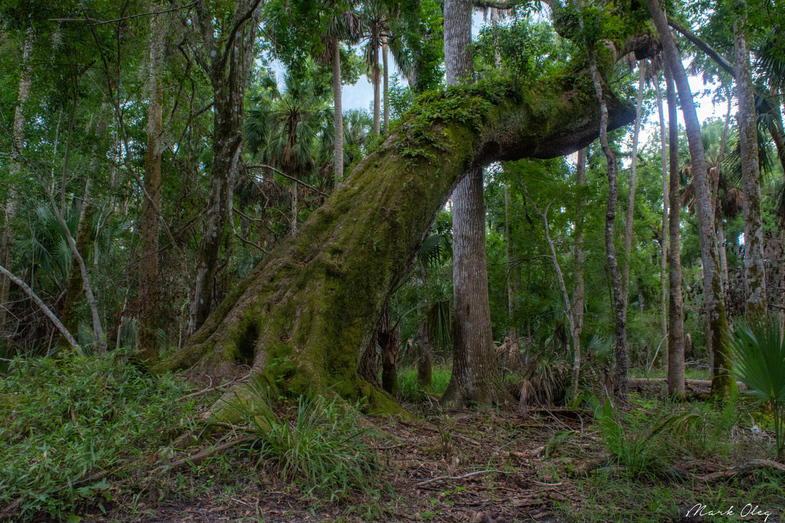
This giant live oak, coated with ancient moss and ferns, is one of many old-growth trees found in the Bulow Woods.
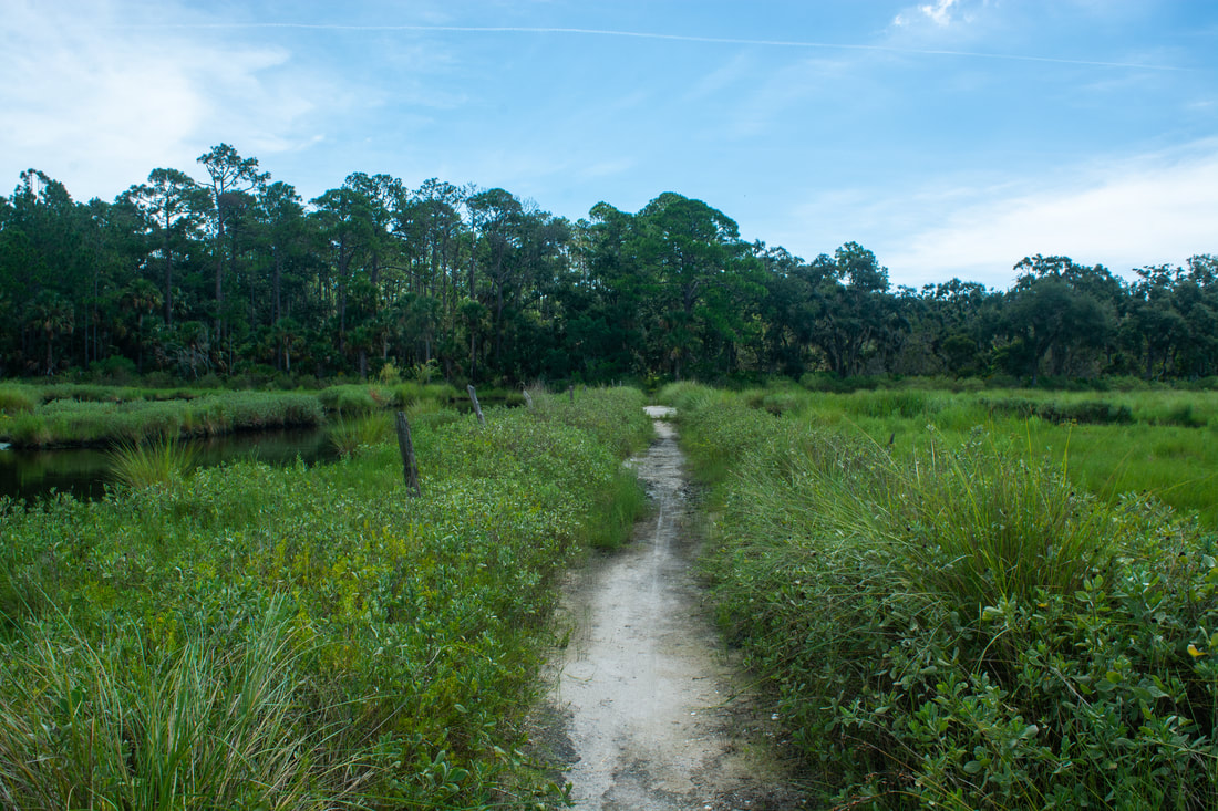
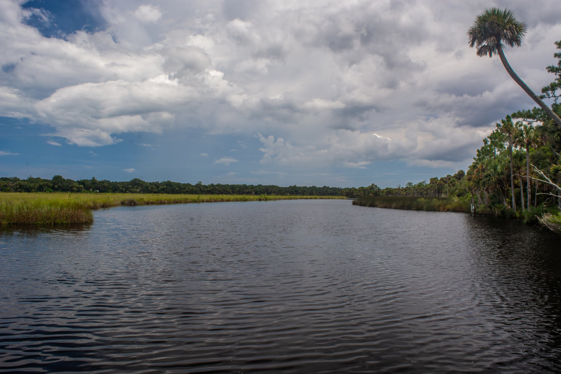
Although this is the end of the trail, I highly recommend following the dirt road on the right into Bulow Plantation Ruins State Park to see the ruins and a view of Bulow Creek. After a quarter-mile walk along the entrance road, reach a picnic area, observation deck, and kayak launch at 6.9 miles. The deck has nice views of Bulow Creek, a broad tidal creek winding through needlerush marshes. This is the only view of Bulow Creek that you'll find along this hike, despite the trail's proximity to it. Near the Bulow Creek observation area, look for a Nature Trail sign on the left, leaving toward the Bulow Sugar Mill Ruins between the two sides of the one-way loop road.
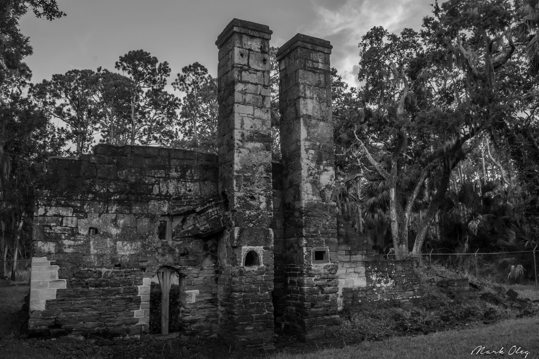
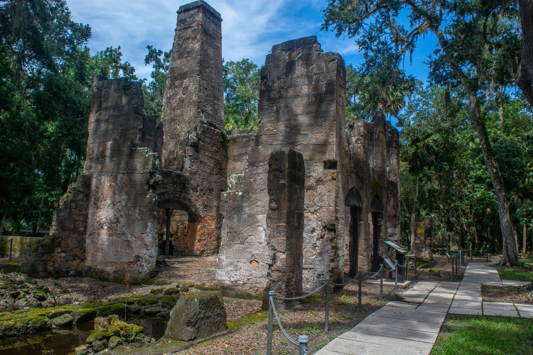
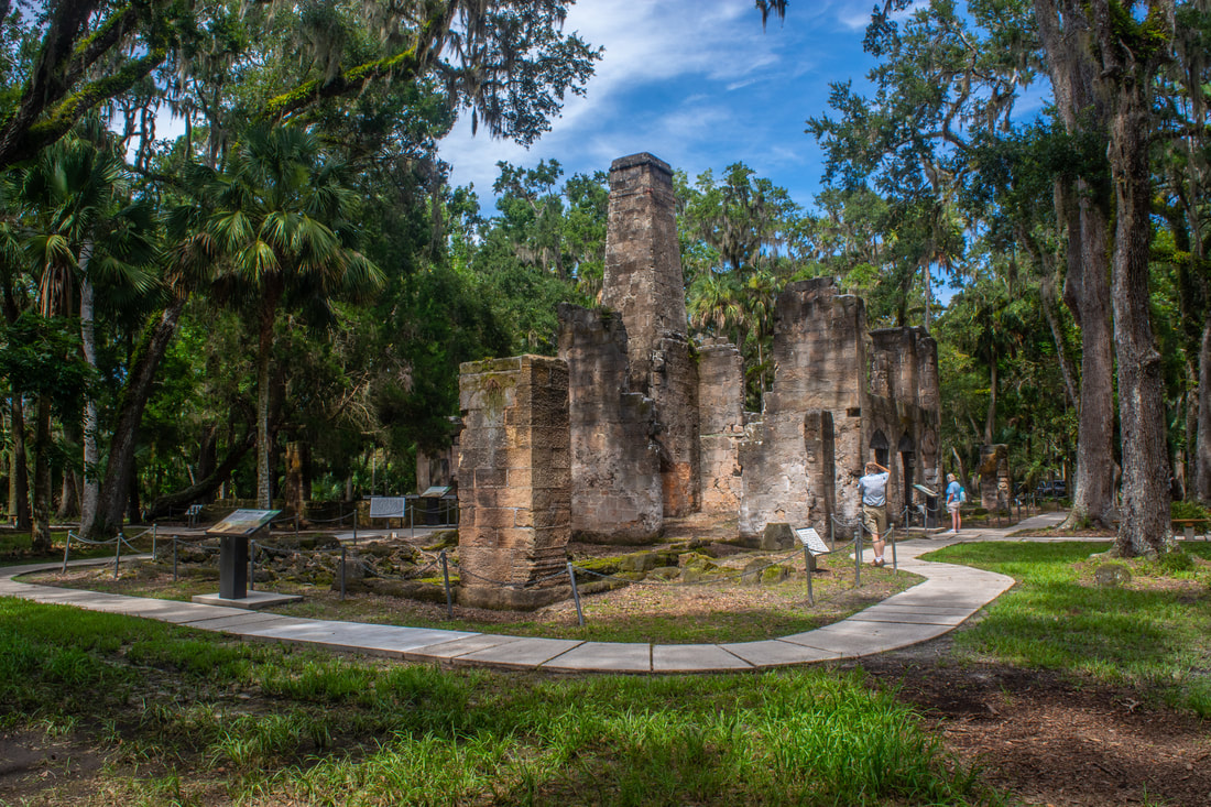
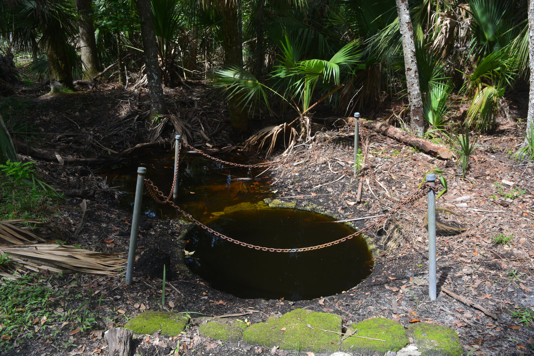
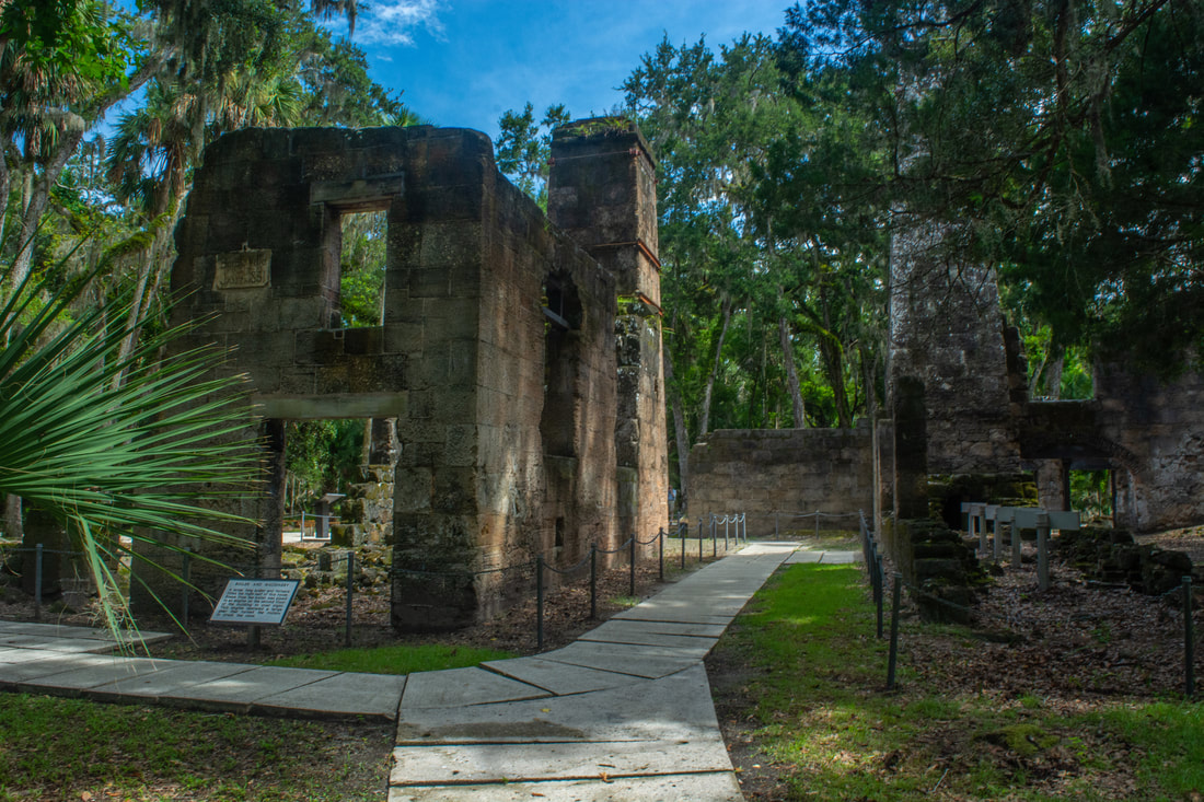
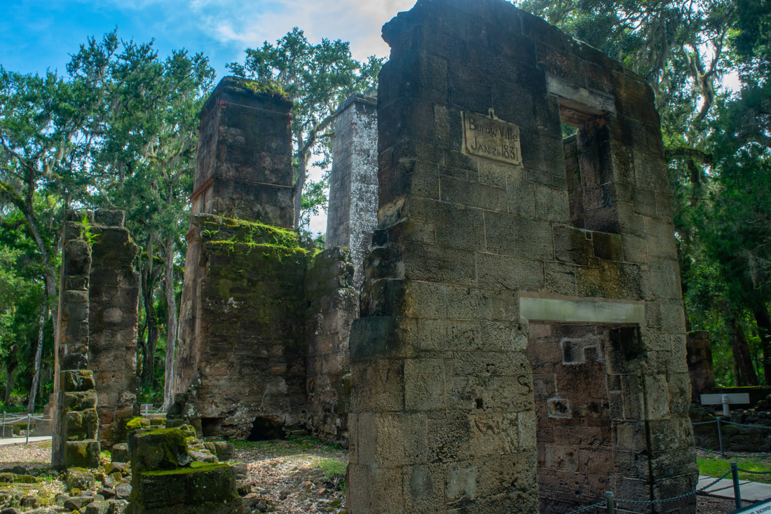
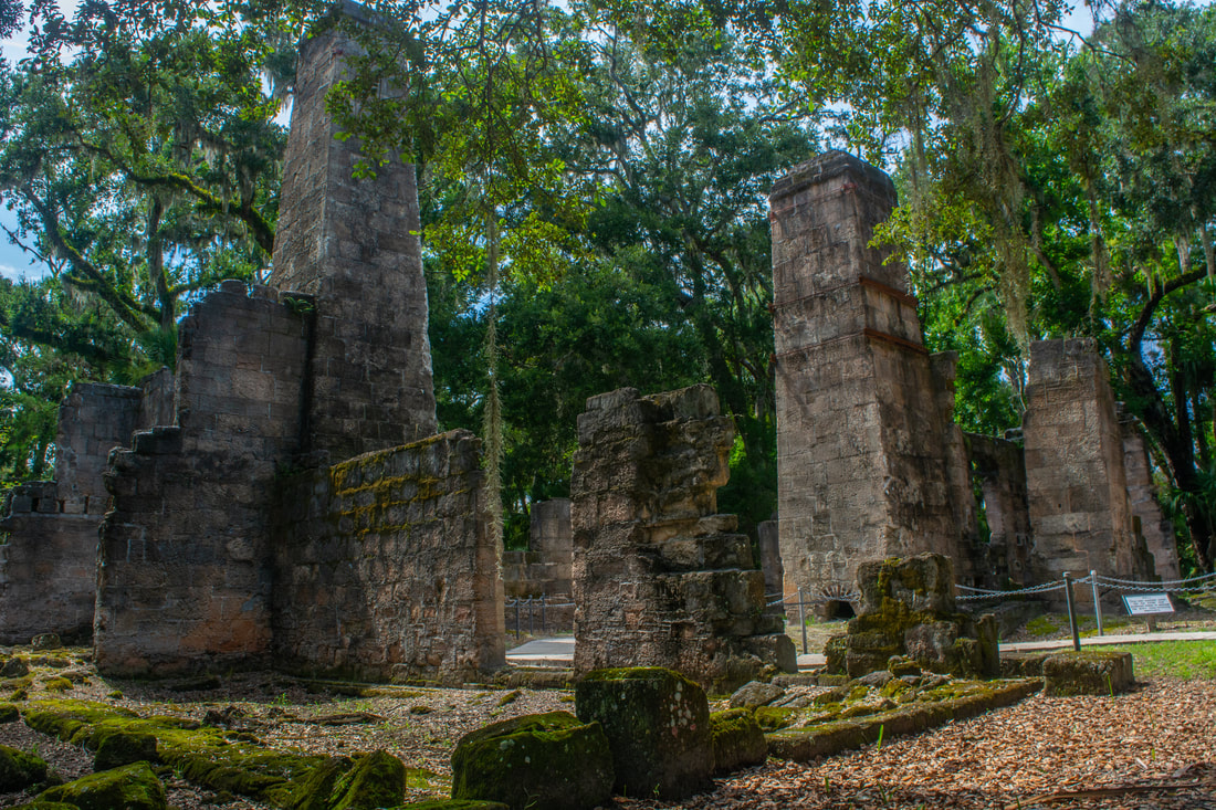
The nature trail leads 0.4 miles through featureless pine flatwoods to the sugar mill ruins, passing a slave quarters site from the former Bulow Plantation along the way. You'll reach the Bulow Sugar Mill Ruins around 7.35 miles. This impressive piece of history is well worth the time to explore. Operated from 1820 to 1836, Charles and John Bulow's sugar mill was part of the largest sugar plantation in East Florida. The plantation and mill were burned in 1836 by Seminole Indians at the start of the Second Seminole War. The ruins remain in remarkably great shape. A variety of interpretive signs surround the sugar mill ruins, detailing how it used to operate. As you walk around, take a close look at the old walls, which were constructed with coquina rock - the unique rock outcrops that you'll sometimes find along the Atlantic beaches in this area. One of the mill's walls features an old inscription that reads, "BulowVille - Jan 26, 1831". Please follow the paved paths through the ruins and avoid stepping past the fences, in order to leave this fascinating piece of history intact for future generations to enjoy. A signed path at the back of the ruins leads 0.15 miles to the remains of the plantation's springhouse, which was used for storage of food such as meat. The cool waters of the spring at the springhouse preserved the meats from spoiling. Retrace your steps from the sugar mill ruins back to the Bulow Woods Trail, which you'll arrive at at 8.15 miles (this includes some wandering around the ruins and the springhouse side trip). Continue retracing your steps to the Pine Hammock Trail junction at 9.7 miles. The Pine Hammock Trail leads 0.5 miles through a mixed, dense forest with pines, oaks, and palms. The trail approaches the unnamed stream that you saw earlier (the palm-lined tributary of Bulow Creek), but the stream isn't very scenic here. This part of the Pine Hammock Trail can also be very muddy or even a little wet during the rainy season. Rejoin the Bulow Woods Trail at 10.2 miles. Turn right here, and simply keep retracing your earlier steps all the way back to the Fairchild Oak. You'll return to the trailhead parking area and conclude the hike at 13.3 miles. 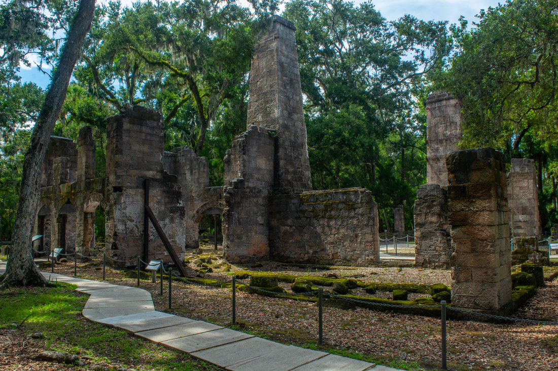
Once the largest sugar mill in East Florida, the ruins of the Bulow Sugar Mill are a fascinating piece of history near the north terminus of the Bulow Woods Trail.
Those who enjoy seeing old Florida jungle will find the Bulow Woods Trail to be a superb hike. Not only does this trail lead through several miles of dense, old-growth tropical hammocks, but it also features multiple views of coastal marshes and tidal streams. In addition, you'll visit a wonderful historic site, the Bulow Plantation Ruins, along this hike. Perhaps the only real drawback of this hike is that it can be very muddy and buggy in places, though this is less likely to be an issue during the dry season. At the time I did this hike, I was pestered by relentless clouds of mosquitoes nearly the entire 13 miles, with relief occurring only in open terrain and sparse woods. Nevertheless, this is still a jaunt I would recommend to area hikers for its wonderful scenery.
Mileage
0.0 - Fairchild Oak
1.35 - Cedar Creek 1.95 - Walter Boardman Lane 2.3 - Boardman Pond 3.25 - Cisco Ditch Rapids 3.4 - Pine Hammock Trail (South Jct) 4.85 - Palm-Lined Stream 5.1 - Pine Hammock Trail (North Jct) 6.65 - Bulow Plantation Ruins State Park 6.9 - Bulow Creek Views 7.35 - Bulow Sugar Mill Ruins 11.35 - Walter Boardman Lane 13.3 - Fairchild Oak Variations
Hike out and back to Cedar Creek from Fairchild Oak - 2.7 Miles
Hike out and back to Boardman Pond from Fairchild Oak - 4.6 Miles Hike the Bulow Creek Loop from Bulow Plantation Ruins Trailhead - 5.3 Miles Hike the Bulow Creek Loop plus to Boardman Pond from Bulow Plantation Ruins Trailhead - 7.5 Miles Bonus Stops
Pictures & Videos
0 Comments
Leave a Reply. |
About MeMark Oleg Ozboyd Dear readers: I have invested a tremendous amount of time and effort in this website and the Georgia Waterfalls Database the past five years. All of the work that has gone in keeping these websites updated with my latest trip reports has almost been like a full-time job. This has not allowed me to pick up a paid job to save up money for college, and therefore, I I've had to take out loans. If you find the information on this website interesting, helpful, or time-saving, you can say "thanks" and help me out by clicking the button above and making a contribution. I will be very grateful for any amount of support you give, as all of it will apply toward my college tuition. Thank you!

Coming in 2022-2023?
Other Hiking WebsitesMiles HikedYear 1: 540.0 Miles
Year 2: 552.3 Miles Year 3: 518.4 Miles Year 4: 482.4 Miles Year 5: 259.9 Miles Archives
March 2021
Categories
All
|
||||


 RSS Feed