HIKING THE APPALACHIANS AND BEYOND
  • Home
  • Trail Reports
    • Best Hikes
    • Hikes with Scenic Views
    • Hikes with Water Features
    • Alabama
    • Georgia
    • Florida
    • North Carolina
    • South Carolina
    • Tennessee
    • Vermont
    • Virginia
  • Map
  • Hike List
  • Testimonials
  • Resources
  • Contact Us
  • Southeast Nature Society
    • Our Team
  • Georgia Waterfalls Database

Oscar Scherer State Park: Yellow Trail, Osprey, Florida

8/23/2017

0 Comments

 
Picture
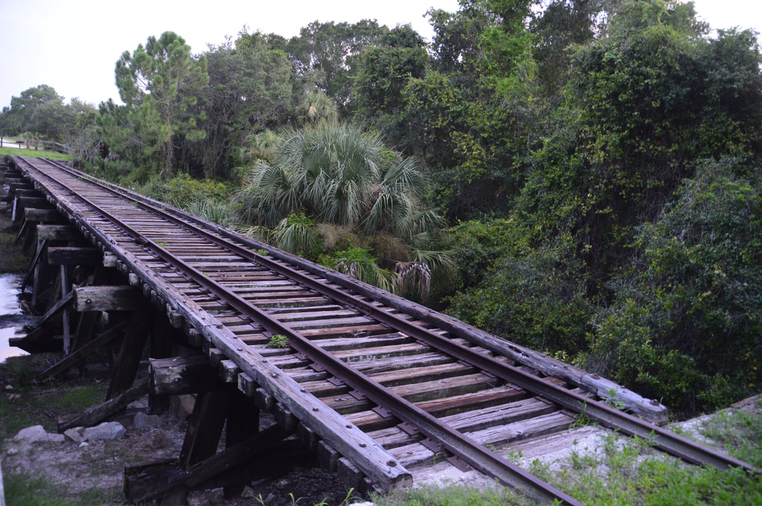
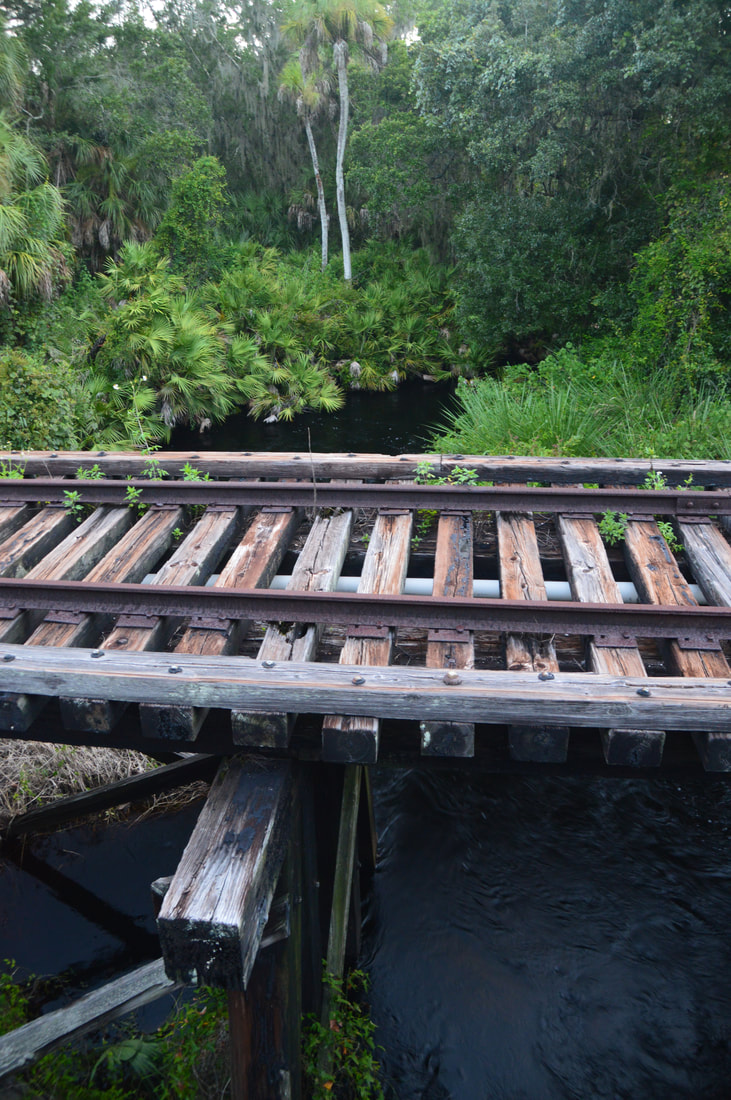
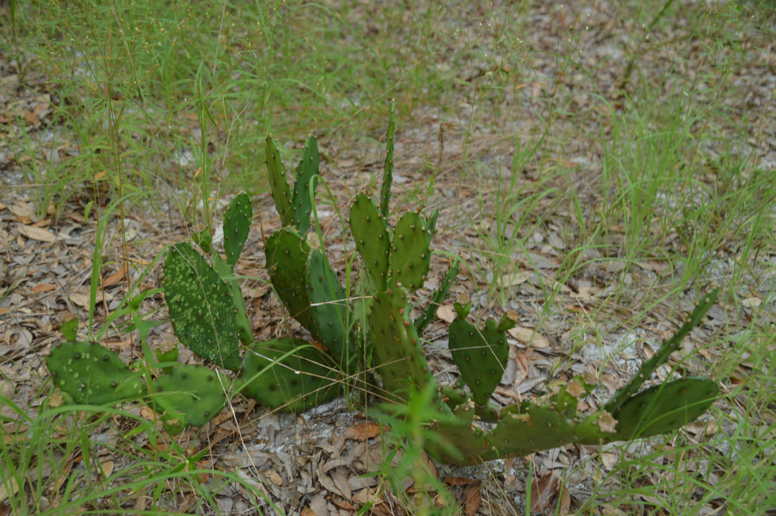
Nestled near the west Florida coastline between Sarasota and Venice, the underrated Oscar Scherer State Park is a haven for folks looking for a peaceful day hike in this part of southwest Florida. The park is known best as the home of the last remaining scrub jay habitat in southwest Florida, but it also has a superb color-coded trail system that introduces hikers to South Creek and its hammocks as well as the scrub and flatwoods nearby. In particular, the diverse Yellow Trail - part of the park's North Trail System - passes through a large range of ecosystems, crossing South Creek twice, passing a beautiful lake known as Big Lake, and travelling through a large section of the scrub. Hikers will even be able to see an old railroad trestle across South Creek. Thanks to its range of scenery and points of interest, the Yellow Trail at Oscar Scherer State Park has quickly turned into one of my favorite hikes in Southwest Florida. This hike occurred on Wednesday, August 2nd, 2017. My plan was to hike the Yellow Loop Trail counter-clockwise with a short detour to the Big Lake observation platform. 

Summary

R/T Length of Trail: 5.2 Miles
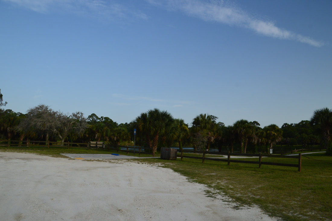
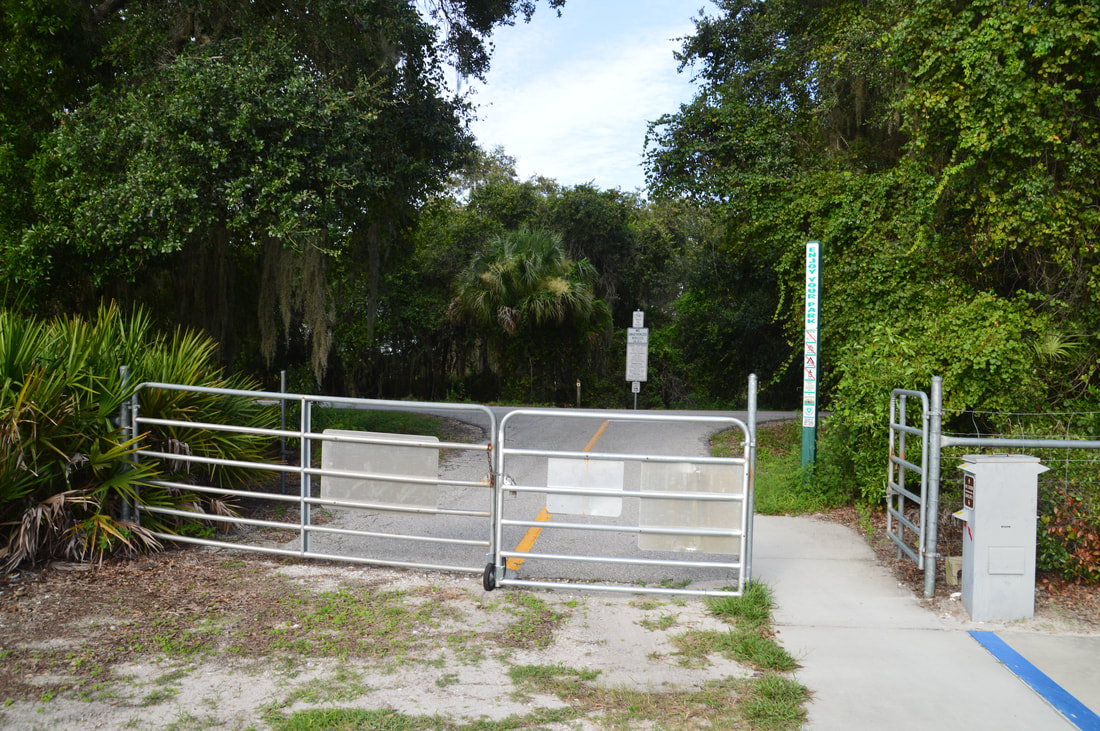
Duration of Hike: 2:05 
Type of Hike: Lasso 
Difficulty Rating: 3 out of 10 
Pros: Very diverse scenery throughout the hike 
Cons: A few short stretches of trail may be uncomfortably sandy 
Points of Interest: Oscar Scherer Scrub; Several views of South Creek; Big Lake; South Creek Railroad Trestle  
Trail Blaze Colors: Yellow Trail - Mostly Yellow (there are a few old white blazes as well) 
Best Seasons to Hike: Winter 
Fees: There is a $5 fee for vehicles with 2 to 8 people, and a $4 fee for vehicles with one person. 
Beginning Point: Yellow Trail Parking near the back of Oscar Scherer State Park Nature Center 
Directions from Osprey, FL:  Starting at the intersection of US Route 41 (Tamiami Trail) and Bay Street in Osprey, Florida, drive South on US 41 for 2 miles. Then, at a sign, turn left onto the Oscar Scherer State Park entrance road just before the South Creek bridge. After paying your fee at the entrance ranger station, continue on the road for a mile until a split at the Nature Center. Stay left, driving less than 0.1 mile farther to a parking area near the back of the visitor center, with the signed Yellow Trail beginning to the left. 

Map

Click the link below to download a .GPX file with a track of this hike. 
oscar_scherer_state_park__yellow_trail.gpx
File Size: 136 kb
File Type: gpx
Download File

Details

About one year ago, I hiked the South Trail System at Oscar Scherer State Park and really enjoyed the variety of scenery along and near South Creek. At the time, I picked the South Trail System over the North Trail System because the latter sounded less diverse and not as scenic. What was I thinking? While the hike along South Creek and on the Green Trail was great, the hike along the Yellow Trail a year later was even better. I would say that the Yellow Trail at Oscar Scherer State Park is one of the best hikes I've done in Southwest Florida. In just over five miles, the Yellow Trail passes through several sections of rare Florida scrub, crosses and follows South Creek several times with many views of this scenic waterway, enters a pretty hammock near the creek, and even passes the picturesque Big Lake. 

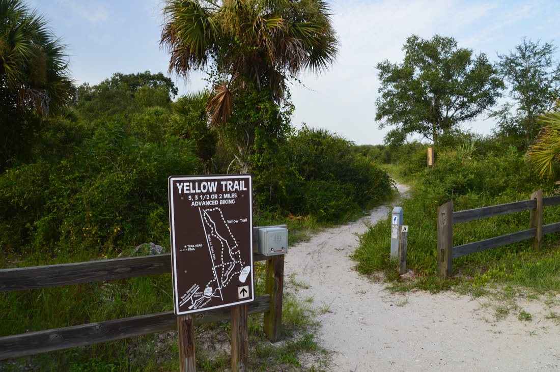
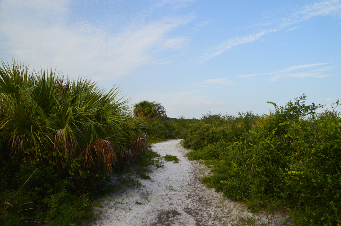
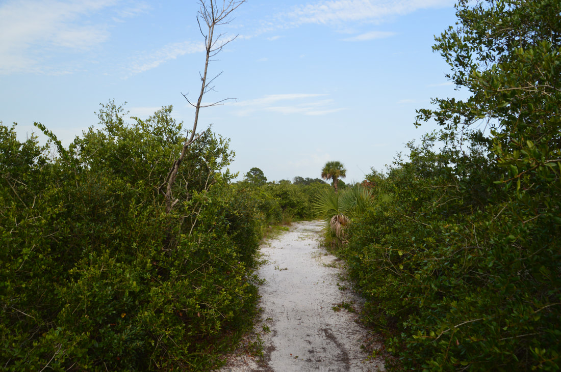
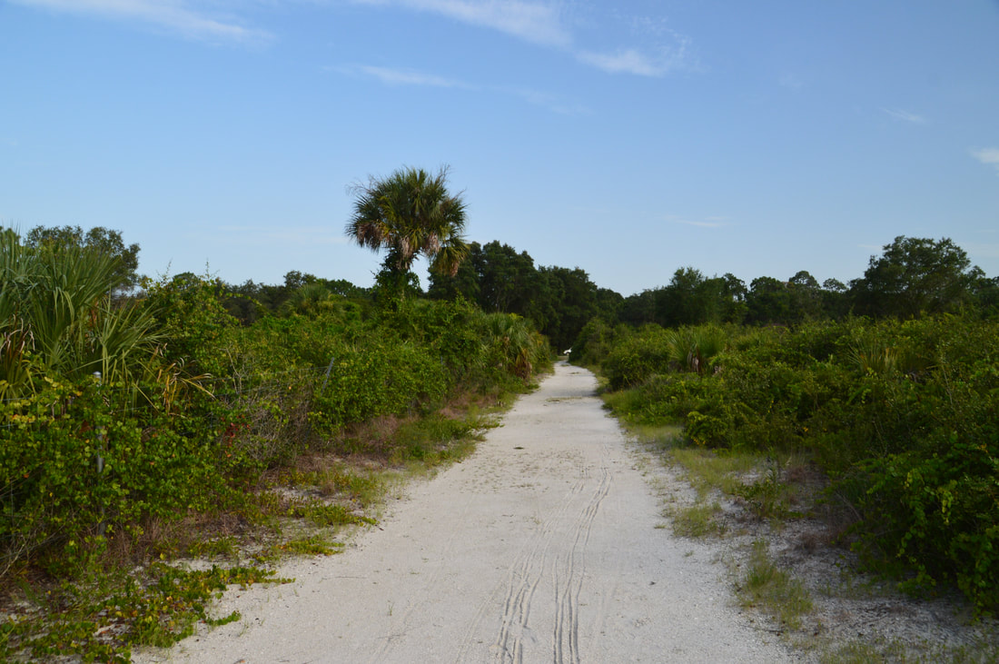
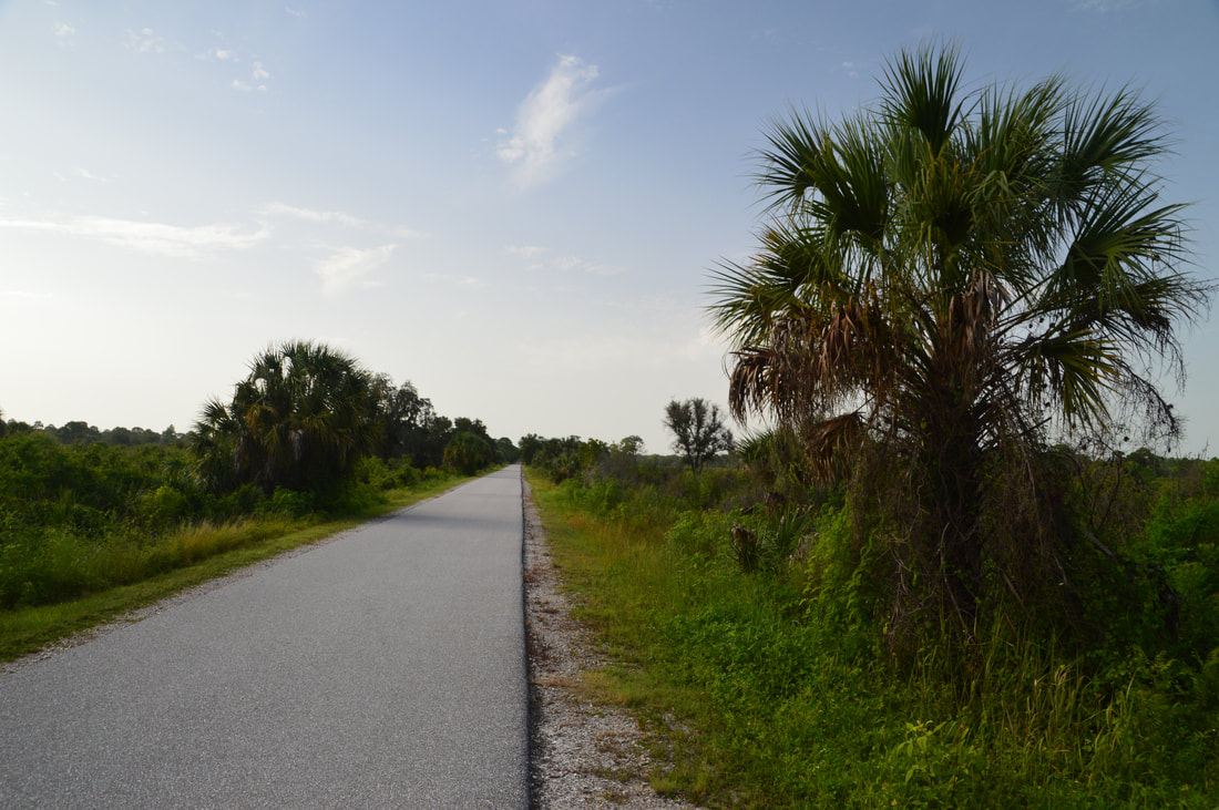
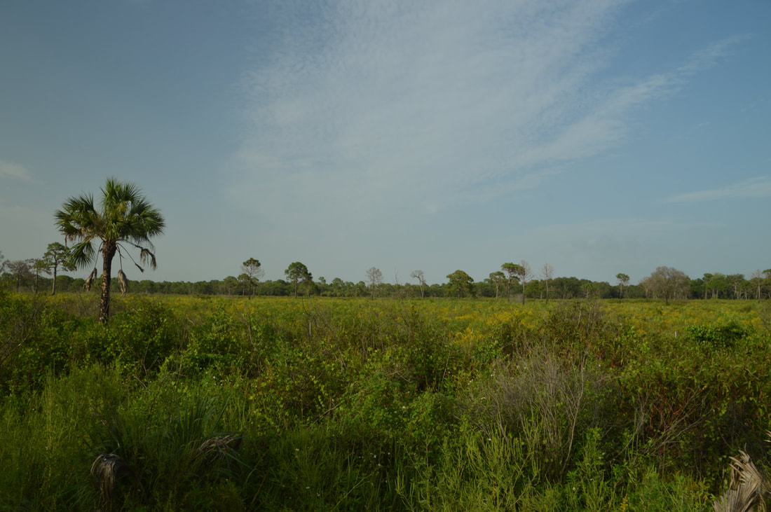
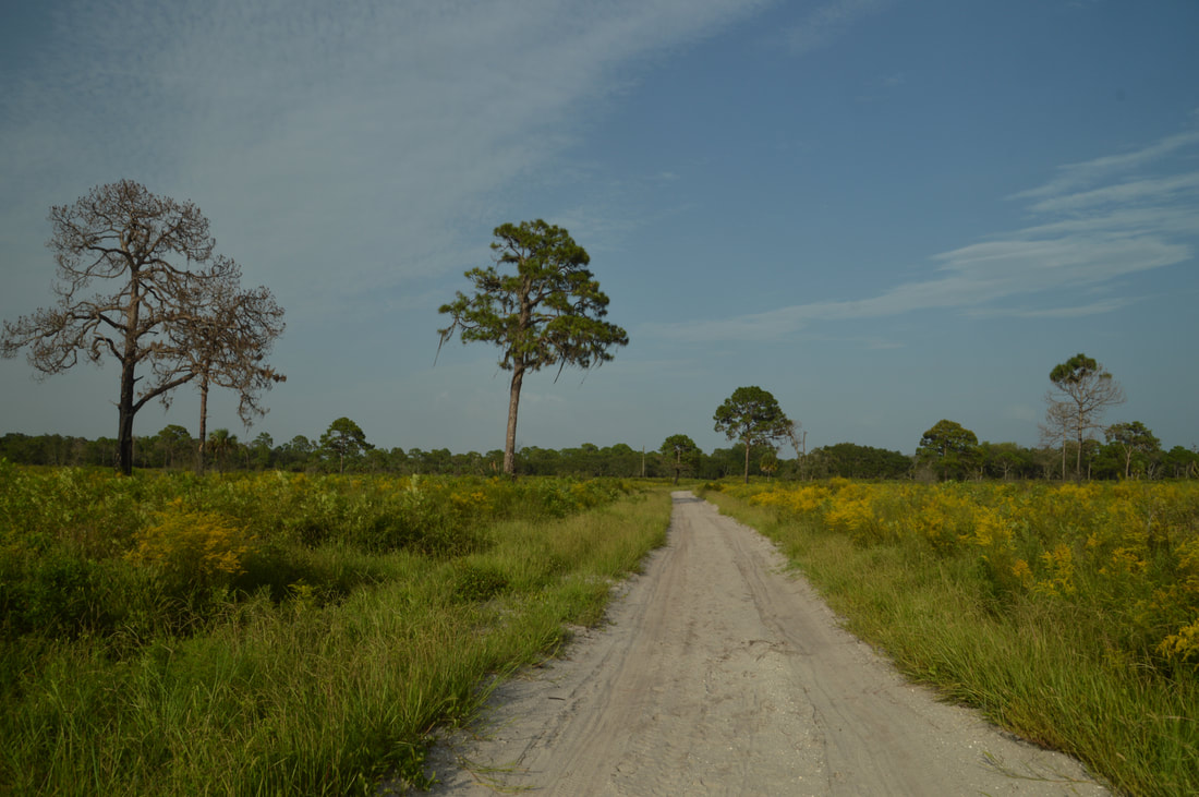
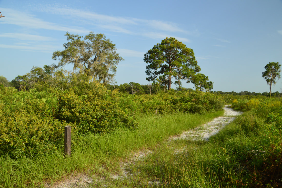
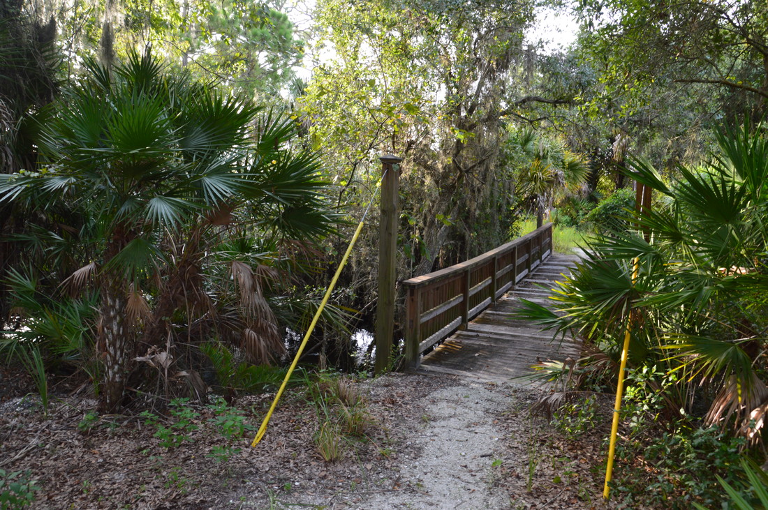
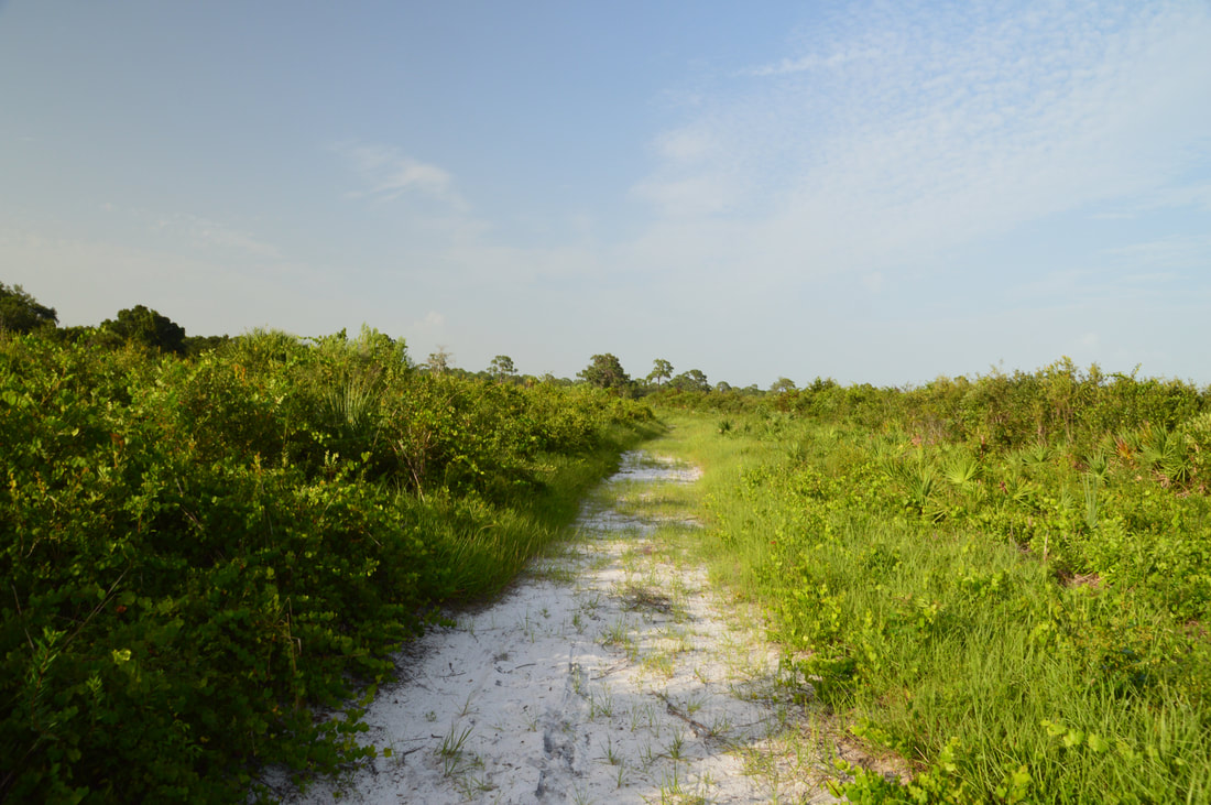
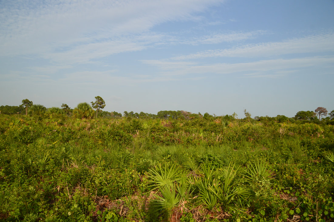
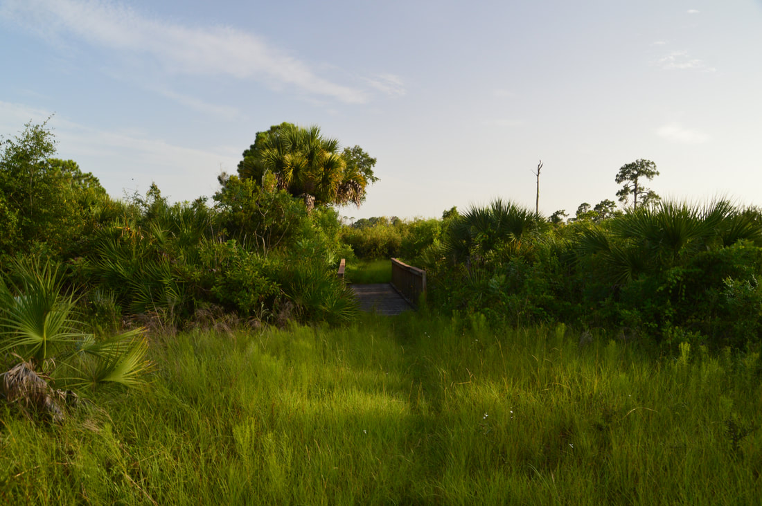
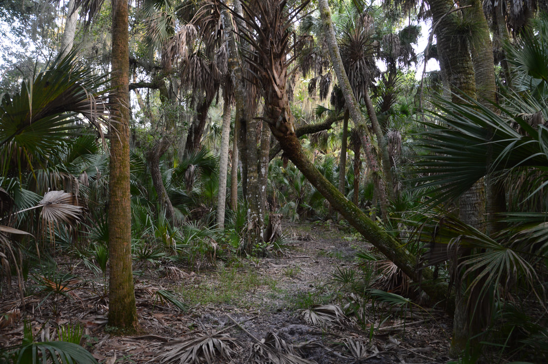
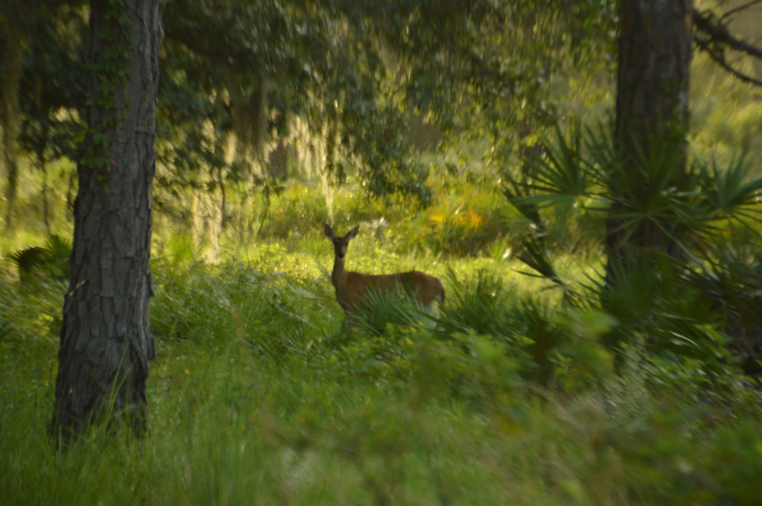
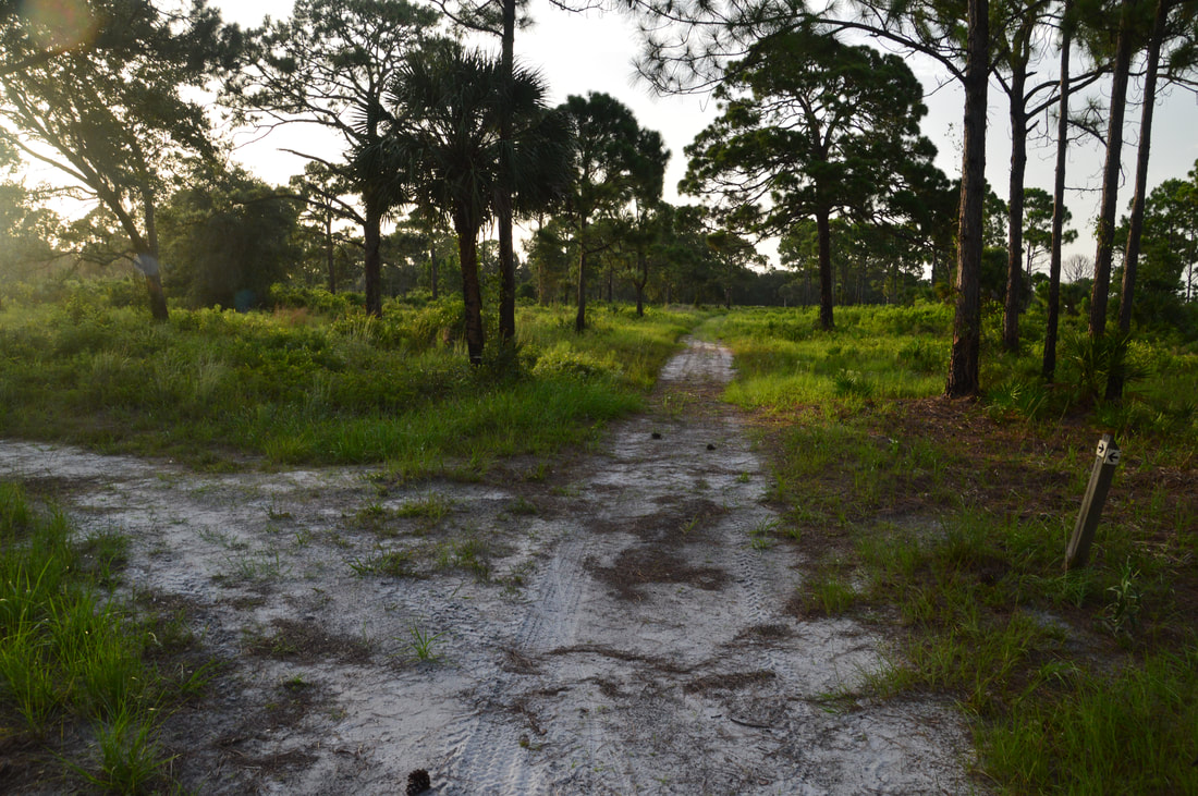
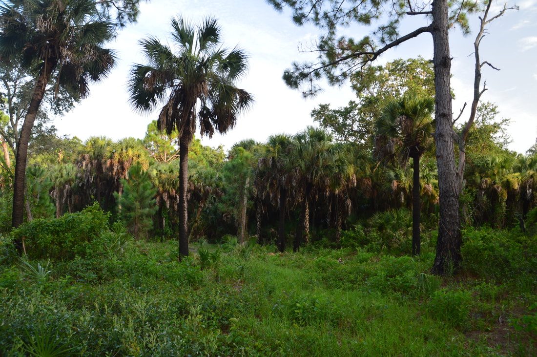
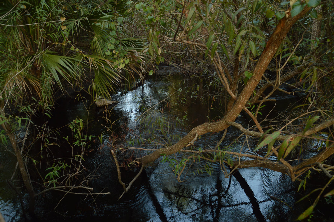
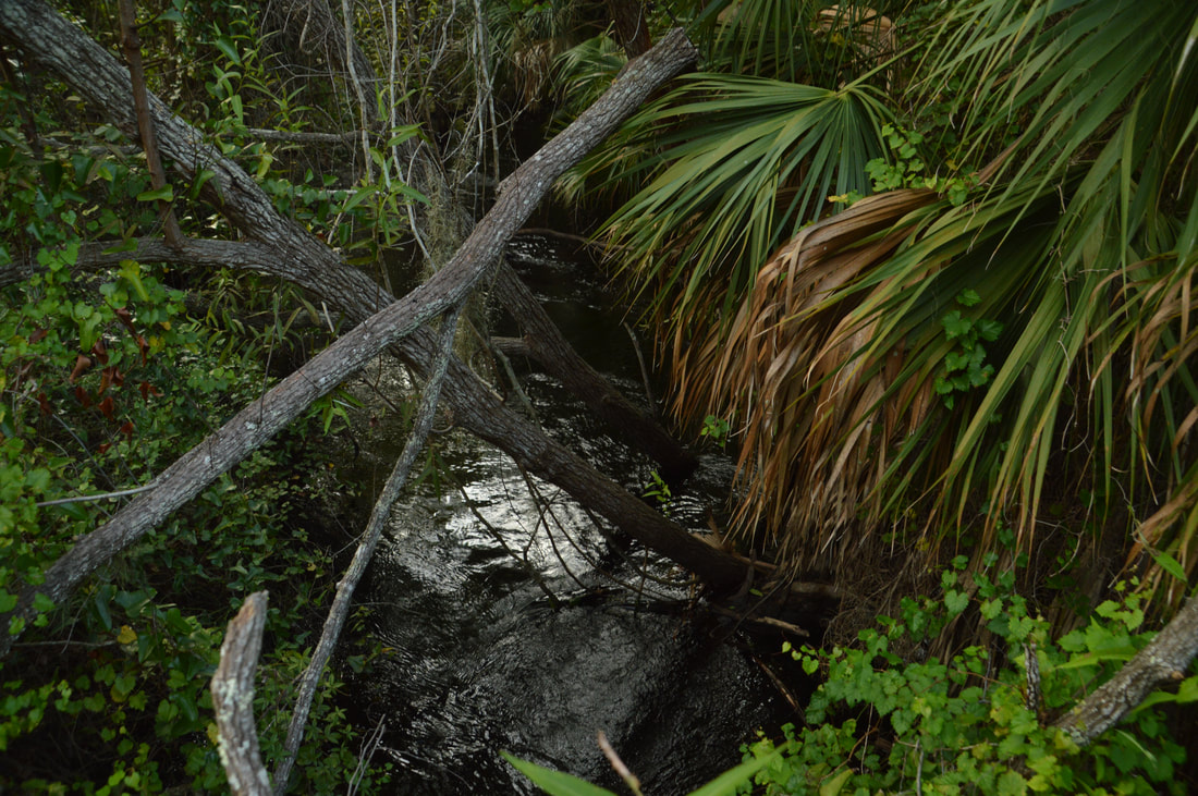
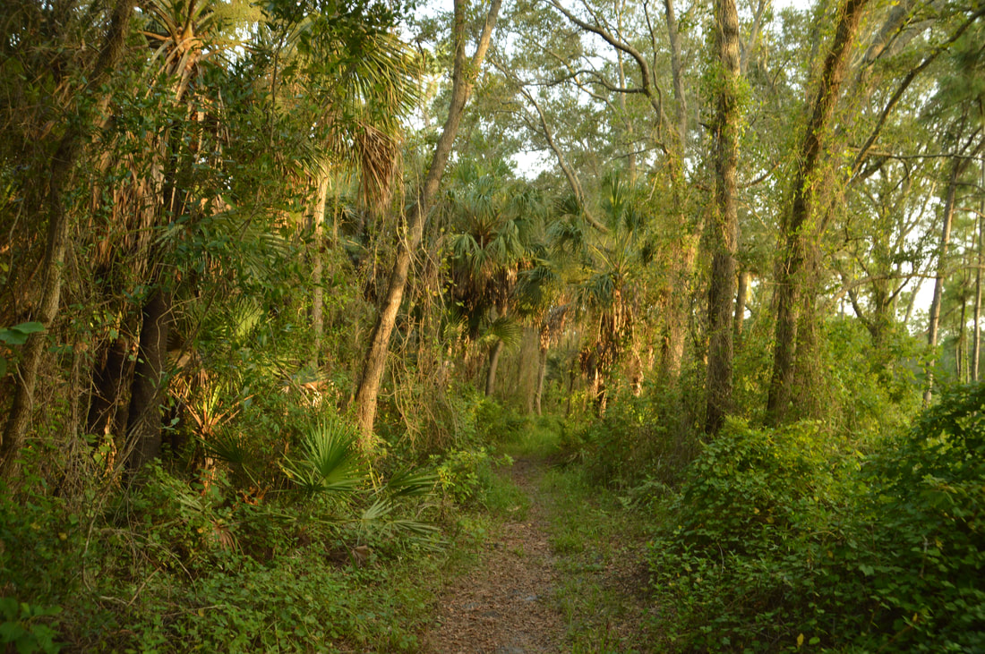
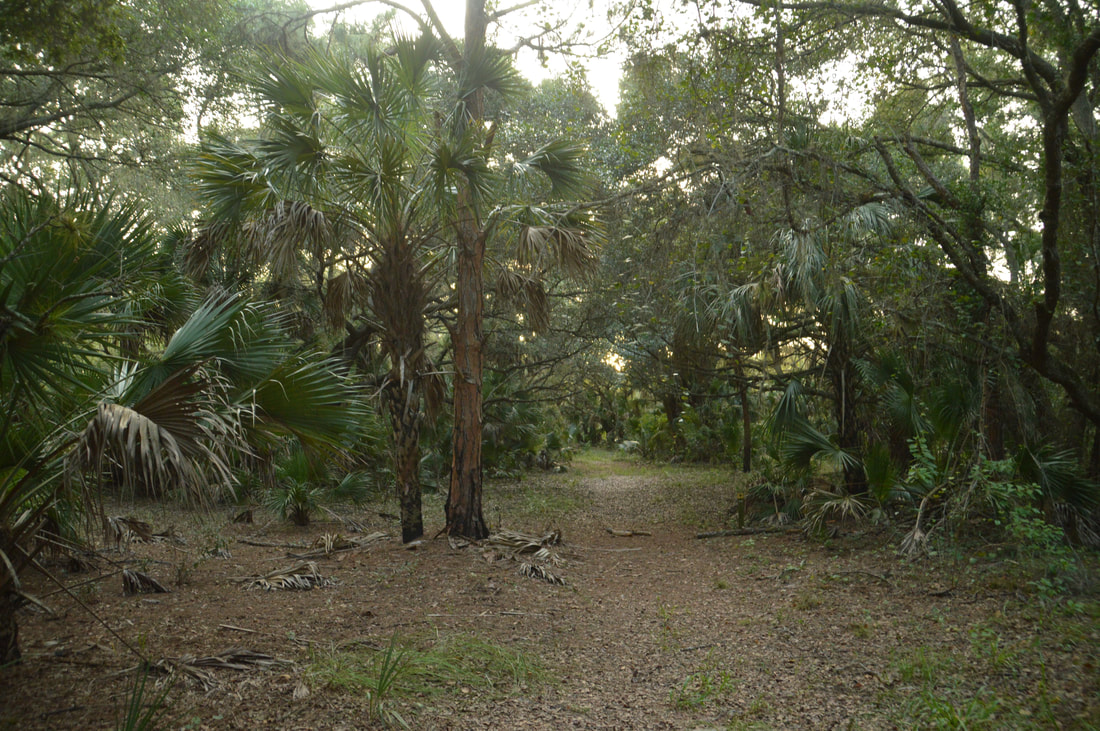
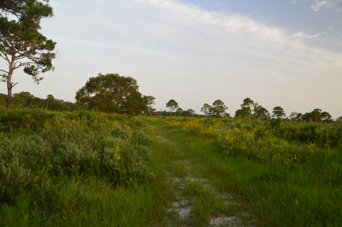
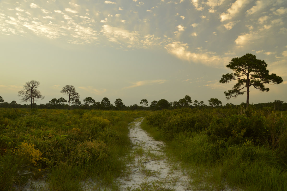
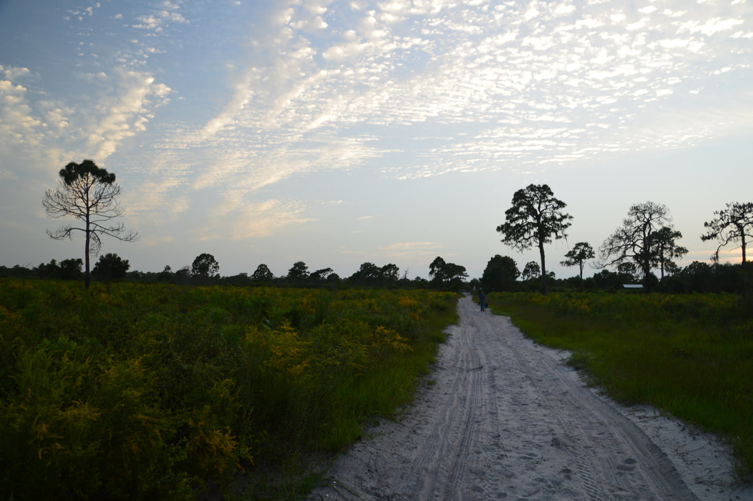
Begin the hike at the large sign and trail map for the Yellow Trail, with the small Lake Osprey behind you. Note that the Yellow Trail actually used to be known as the White Trail. The Scrub Jay Nature Trail initially runs in conjunction with the Yellow Trail as it enters the scrub. After a few twists amidst the open landscape, the trail makes a signed left at 0.25 miles and reaches a split a few yards farther. Here, the Scrub Jay Trail leaves left and connects to the Blue Trail and Red Trail, both of which are still on my list. Meanwhile, you must turn right onto the broad path to stay with the Yellow, which follows a fence line before reaching an alternate trailhead and parking at 0.3 miles. Turn left, walk around the gate, and reach a paved pathway: the multi-use Pioneer Trail, a fairly long greenway that traverses the Sarasota urban area. The Yellow Trail turns left onto the Pioneer Trail, but before you do so, walk a few feet to the right and take a look at the historic railroad trestle crossing South Creek. Then, return to the junction and follow the Yellow Trail along the elevated paved walkway northward. In this short segment, there are great views of the vast scrub in both directions. 

At 0.65 miles, just before a shaded bench, the Yellow Trail turns right off the paved path and onto a broad forest road, passing around another gate. A memorial for Mary Thaxton, who helped to secure public access to this part of the park as it is today, is located to the left of the trail. The trail is actually now entering the Mary Thaxton Memorial Preserve. After a short straight section along the forest road into the middle of the scrub, you'll reach a junction at 0.8 miles where the loop section of the hike begins. The Yellow Loop Cross-Trail continues straight, while the loop heads left and right. To hike it counter-clockwise like I did, turn right onto the sandy trail into the heart of the scrub. This is a beautiful section of trail, and it is also the toughest part of the hike as the sand is deep in places. Simply follow the arrows, reaching the distant tree line at 1.1 miles. That's where the trail turns left and crosses South Creek via a sturdy wooden footbridge. South Creek is a very pretty blackwater stream. It is quite overgrown, but all the vegetation around it only adds mystery to its dark waters. On the other side of South Creek, the Yellow Trail turns left at a junction with a forest road and re-enters the scrub, although the trail is a bit less sandy here. 
Picture
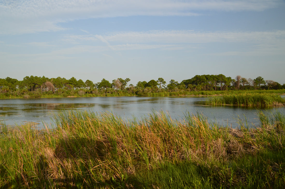
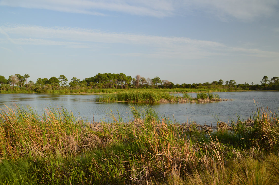
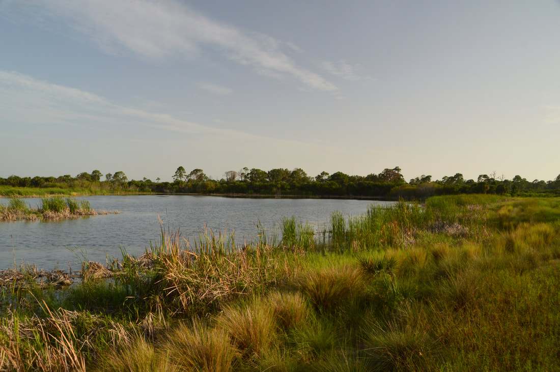
One of the highlights of the Yellow Trail is a beautiful grassy-lined lake known as Big Lake.
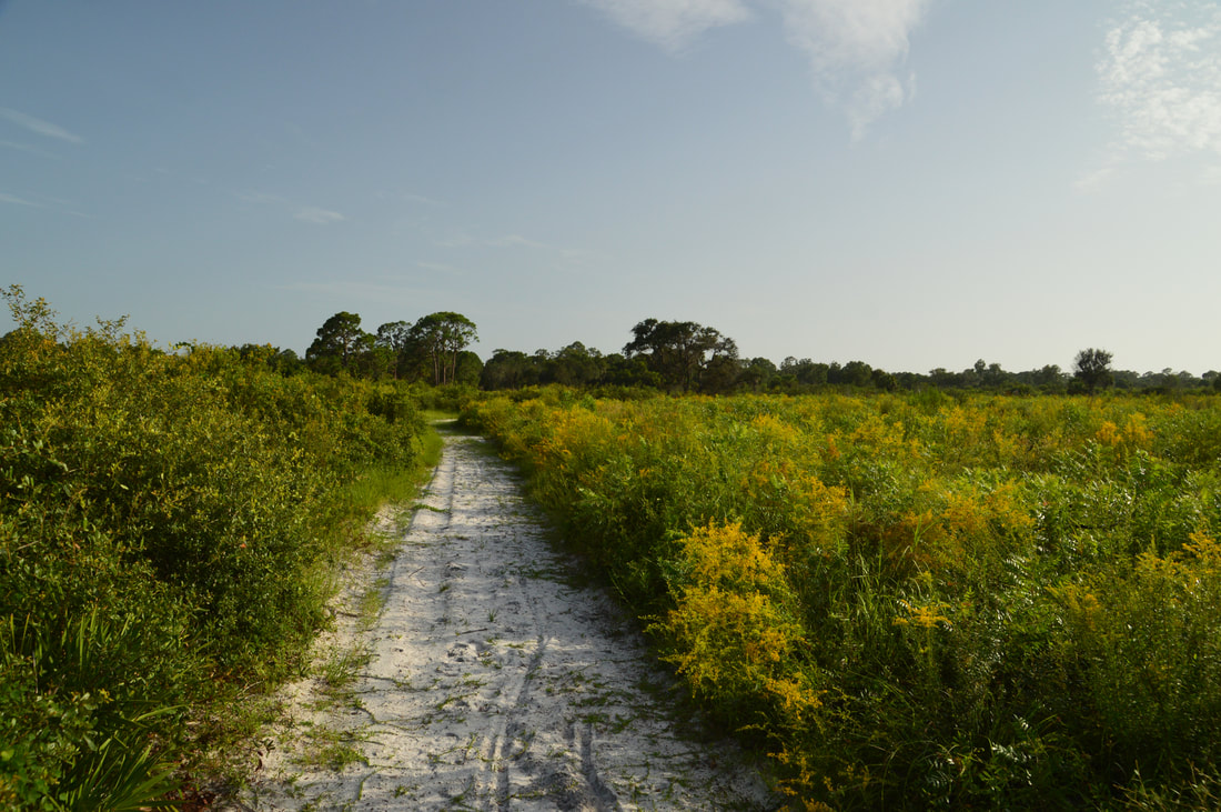
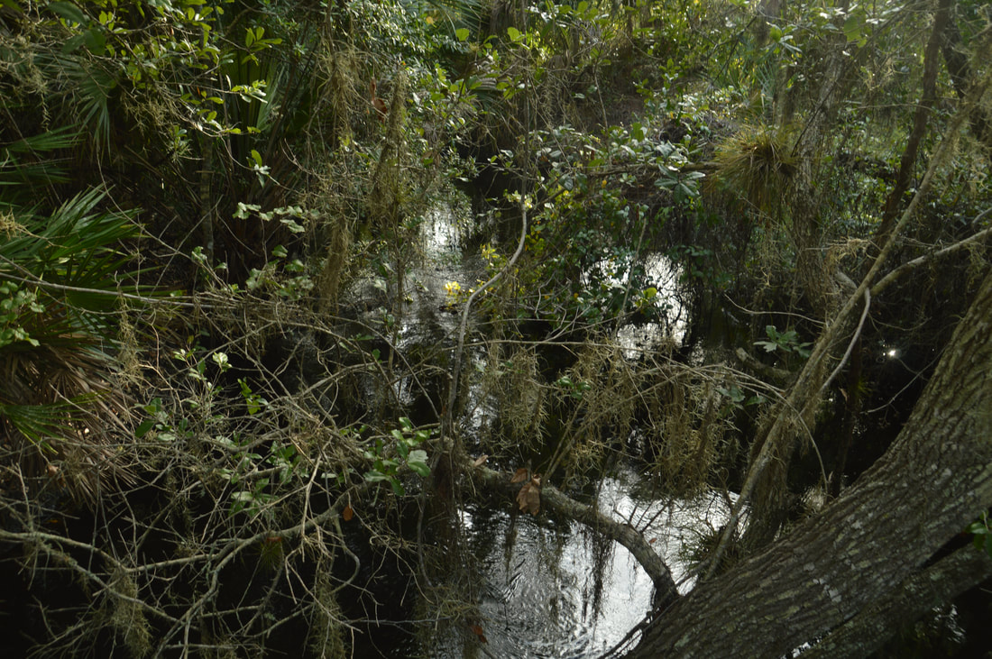
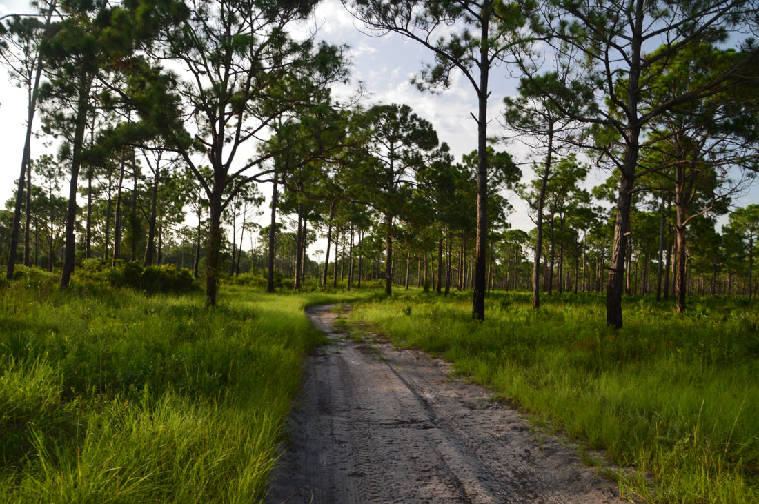
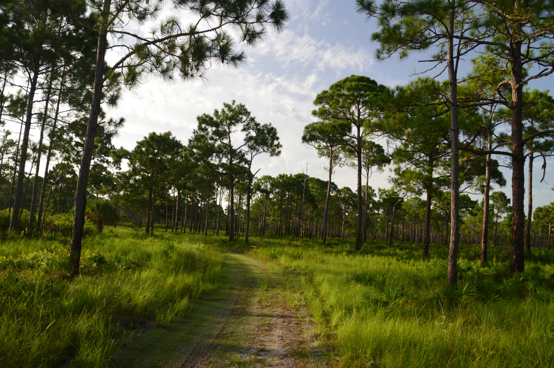
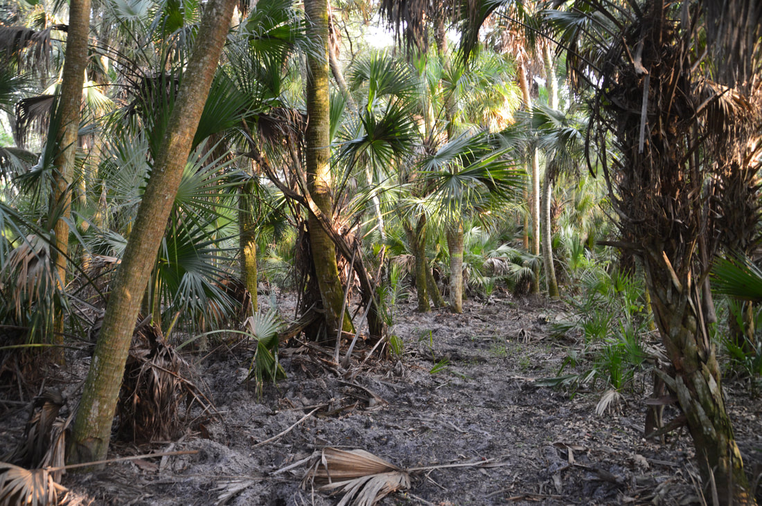
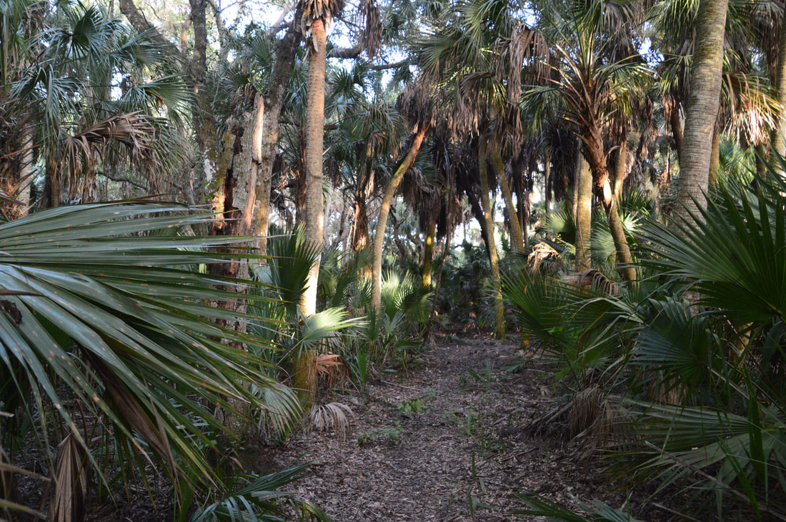
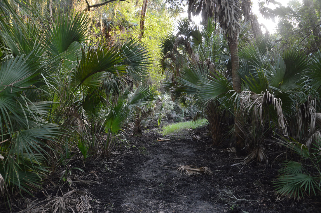
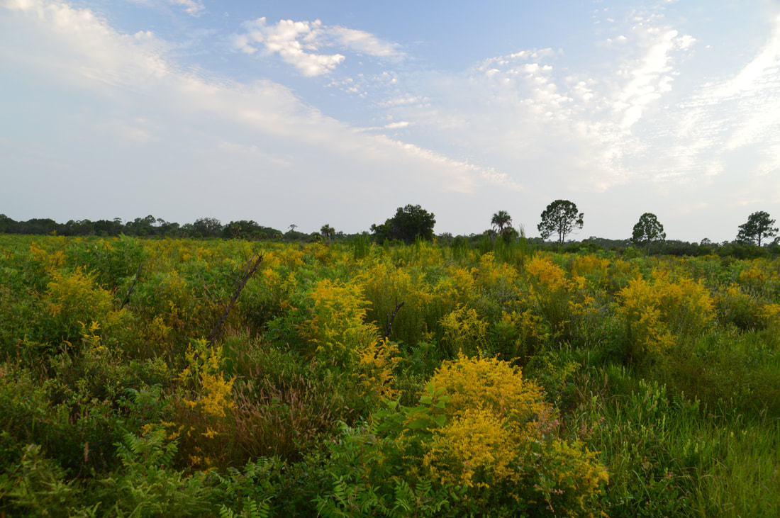
At 1.6 miles, the trail reaches the shore of Big Lake. A short side trail on the right leads to a shaded observation deck with a great elevated view of the lake. Big Lake is quite picturesque due to how open and grassy its shoreline and its surroundings are. The main trail briefly follows the shore of Big Lake before turning left and crossing a small stream via a footbridge. Then, at 1.75 miles, the Yellow Trail turns left onto another forest road as the Legacy Honore Connector Trail leaves right to the Scherer Thaxton Preserve - an outlying wild area adjacent to Oscar Scherer State Park. Meanwhile, the main trail leaves the scrub and enters scenic pine flatwoods with a grassy understory. At 1.85 miles, stay right to hike the main loop as the Yellow Cross-Trail bears left. After a piney stretch that can sometimes be inundated during the wet season, the Yellow Trail makes an abrupt left turn at an arrow at 2.05 miles, striking toward South Creek on a bee line. At 2.2 miles, the Yellow Trail enters a scenic palm hammock alongside South Creek - just another of this hike's many highlights. There were major signs of hog uprootings along this section of the trail. At 2.3 miles, just as the trail turns back east, there is a photogenic view of palmetto-lined South Creek to the left. This is one of my favorite spots on the trail - take a moment to linger and observe the dark yet swift waters. After leaving the creek, the Yellow Trail passes through an area that is often muddy and even sometimes wet. Then, the trail exits the hammock and turns left at 2.5 miles onto the same forest road that it followed earlier. 

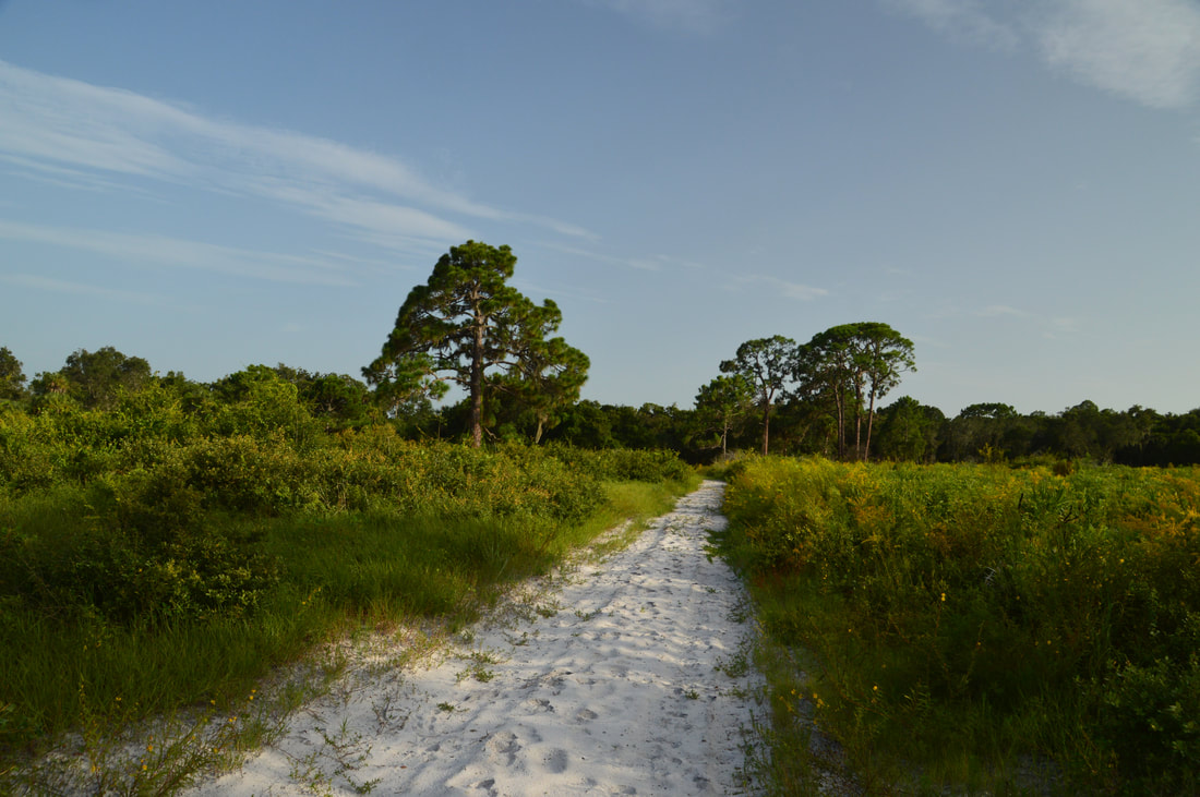
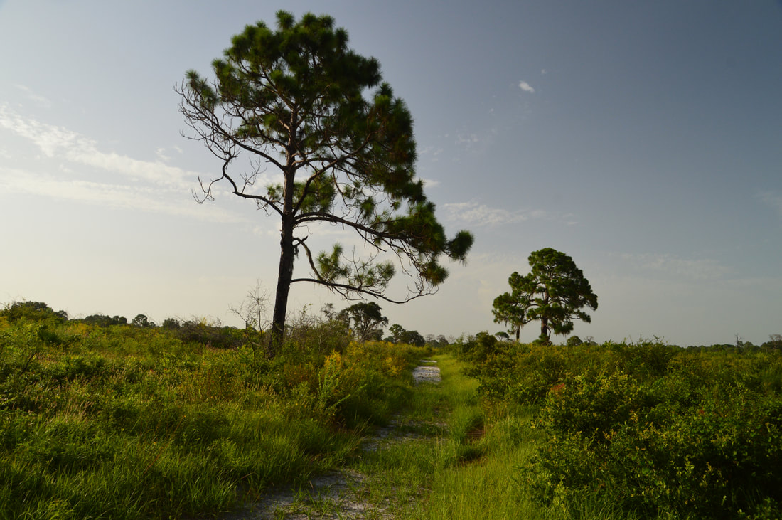
The following section of trail is a fairly monotonous pine flatwoods traverse, but just when you may start getting bored, the trail turns left at 3.2 miles and aims for South Creek once more. Just before another left turn at the edge of the hammock, note the wall of palms on the left. At 3.45 miles, the Yellow Trail crosses back to the west side of South Creek. The stream is still overgrown here, but it remains very scenic. A few feet past the footbridge, the trail curves left and travels south through the South Creek hammock, passing several live oaks of impressive size. Around 4.2 miles, the Yellow Trail leaves the hammock and re-enters the gorgeous sandy scrub. At the time of my hike, rows of yellow goldenrod blooms enhanced the beauty of the scrub. The Yellow Trail returns to the loop/cross-trail junction at 4.4 miles. Turn right here and retrace your steps from earlier, making the final 0.8-mile walk back to the trailhead. You'll reach your car and conclude the hike at 5.2 miles. 
Picture
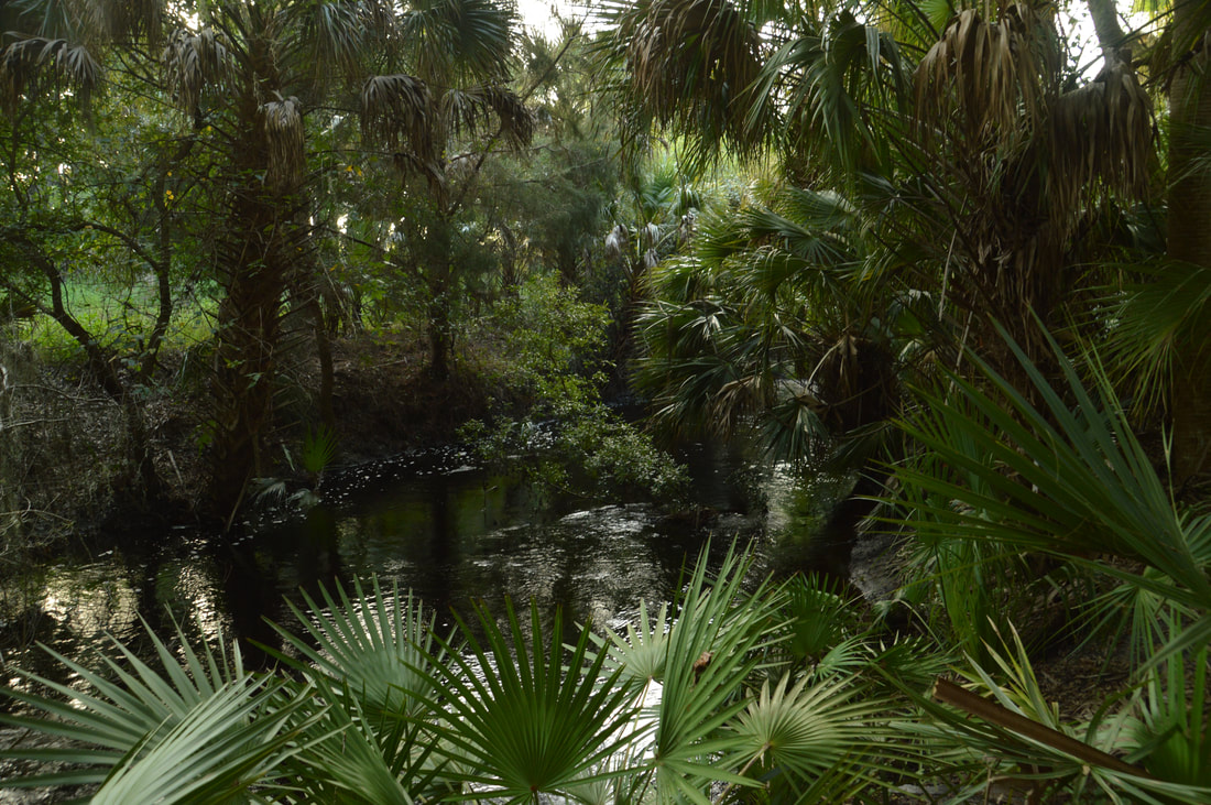
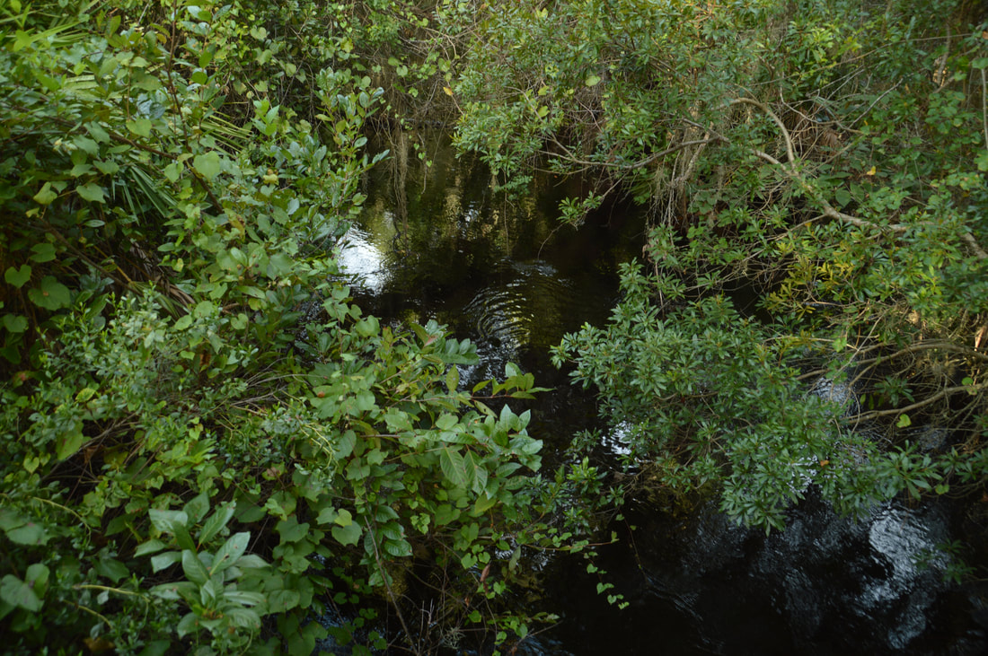
There are several views of South Creek's murky and vegetation-lined waters throughout the Yellow Trail.
I have decided to rate the Yellow Trail at Oscar Scherer State Park a "Best Hike". The ecological diversity and multiple scenic highlights of the hike make it one of the best choices available in Southwest Florida, and furthermore, the park and its trails are much less crowded than nearby Myakka River State Park (the most popular outdoor destination in the area). 
Best Hike!

Mileage

0.0 - Scrub Jay (Yellow Trail) Trailhead
​0.3 - Join Pioneer Trail 
0.65 - Leave Pioneer Trail 
0.8 - Begin Yellow Loop 
1.1 - South Creek Footbridge 1 
1.6 - Big Lake 
1.85 - Yellow Cross-Trail 
2.3 - South Creek View 
3.45 - South Creek Footbridge 2 
4.4 - End Yellow Loop 
5.2 - Scrub Jay (Yellow Trail) Trailhead

Variations

Hike just the South Yellow Loop - 3.0 Miles 
Hike just the North Yellow Loop - 4.5 Miles 

Bonus Stops

Consider adding on the park's South Trail System (Lester Finley Trail, South Creek Trail, and Green Trail) and/or the Red Trail and Blue Trail to turn this into a full day hike. 

Pictures

Videos

0 Comments


Leave a Reply.

    About Me

    Mark Oleg Ozboyd
    I'm an avid outdoor explorer and a hobbyist landscape photographer. I'm 21 years old and have been hiking since 2011. Originally based out of Atlanta, Georgia, I started out by occasionally hiking short trails throughout well-known Georgia State Parks. During 2012 and 2013, I began to expand my trips into adjacent states, as well as into the wilder National Forest areas rather than just State Parks. Throughout the years that followed, as I slowly ran out of popular hiking trails in my area, I began to search for and hike in more seldom-visited areas. Today, you can find me out in the woods every weekend, whether it's on an official trail or bushwhacking through cross-country terrain without any paths. I now attend Washington & Lee University and am exploring Virginia and West Virginia. My other hobbies include chess, science, old music, and meteorology. I have 3 years of amateur weather forecasting experience, having studied a lot of meteorology basics over the years. I am also a student at European School of Music where I learned that music and nature have a lot in common. Listening to good music inspires me to capture nature's beauty on the camera in different aspects that also make me recall many beautiful music pieces that I've heard.​


    Dear readers: I have invested a tremendous amount of time and effort in this website and the Georgia Waterfalls Database the past five years. All of the work that has gone in keeping these websites updated with my latest trip reports has almost been like a full-time job. This has not allowed me to pick up a paid job to save up money for college, and therefore, I I've had to take out loans. If you find the information on this website interesting, helpful, or time-saving, you can say "thanks" and help me out by clicking the button above and making a contribution. I will be very grateful for any amount of support you give, as all of it will apply toward my college tuition. Thank you! 

    Enter your email address to subscribe for trail reports:

    Delivered by FeedBurner


    Picture
    Coming in 2022-2023?

    Other Hiking Websites

    DWHike's Adventures
    Florida's Natural Wonders
    Florida Trailblazer
    Meanderthals
    Mountain Images
    by Bernie Boyer

    North Carolina Waterfalls with
    ​Kevin Adams
    Take-a-Hike!
    Tennessee Landforms
    Waterfall Page
    Waterfall Adventurer
    Zach's Mild Adventures

    Miles Hiked

    Year 1: 540.0 Miles
    Year 2: 552.3 Miles
    ​Year 3: 518.4 Miles
    Year 4: 482.4 Miles
    Year 5: 259.9 Miles

    Archives

    March 2021
    February 2021
    January 2021
    November 2019
    October 2019
    September 2019
    August 2019
    July 2019
    June 2019
    February 2019
    January 2019
    December 2018
    November 2018
    October 2018
    August 2018
    July 2018
    June 2018
    May 2018
    April 2018
    March 2018
    February 2018
    January 2018
    December 2017
    November 2017
    October 2017
    September 2017
    August 2017
    July 2017
    June 2017
    May 2017
    April 2017
    March 2017
    February 2017
    January 2017
    December 2016
    November 2016
    October 2016
    September 2016
    August 2016
    June 2016
    May 2016
    April 2016
    March 2016
    January 2016
    December 2015
    November 2015
    October 2015
    September 2015
    August 2015
    July 2015
    June 2015
    May 2015
    April 2015
    March 2015
    February 2015
    January 2015
    December 2014
    November 2014
    October 2014
    September 2014
    August 2014
    July 2014
    June 2014
    May 2014
    April 2014
    March 2014
    February 2014

    Categories

    All
    Adel
    Adirondack Park
    Alabama
    Alfred A. Ring Park
    Allegheny Trail
    Amicalola Falls State Park
    Anniston Area
    Apalachicola Bluffs And Ravines Preserve
    Apalachicola National Forest
    Apalachicola/Port St. Joe Area
    Apopka
    Appalachian Trail
    Appling
    Art Loeb Trail
    Aska Trail System
    Bakersville
    Balm-Boyette Scrub Preserve
    Balsam Lake Recreation Area
    Bankhead National Forest
    Bartow County Parks
    Bartram Trail
    Basinger
    Beersheba Springs
    Benton
    Benton Mackaye Trail
    Berry College Trail System
    Best Hike
    Big South Fork National Recreation Area
    Black Bear Wilderness
    Black Rock Mountain State Park
    Blairsville
    Blakely
    Blood Mountain Wilderness
    Blowing Rock
    Blue Ridge
    Blue Ridge Parkway
    Boone
    Bradenton
    Bradenton Beach
    Brasstown Bald
    Brasstown Wilderness
    Brevard
    Bryson City
    Buchanan
    Bucks Pocket State Park
    Bulow Creek State Park
    Bulow Plantation Ruins State Park
    Caesars Head State Park
    Caladesi Island State Park
    Calhoun
    Camel's Hump State Park
    Cashiers
    Caspersen Beach Park
    Catfish Creek State Park
    Caves
    CC Putnam State Forest
    Cedar Point Environmental Park
    Chatsworth
    Chattahoochee National Forest
    Chattanooga
    Chattanooga Valley
    Chattooga National Wild And Scenic River
    Cheaha Wilderness
    Cherohala Skyway
    Cherokee
    Cherokee National Forest
    Chiefland Area
    Chillhowee Recreation Area
    Chipley
    Chunky Gal Trail
    Circle B Bar Reserve
    Citico Creek Wilderness
    Citrus Wildlife Management Area
    Clarkesville
    Clayton
    Cleevland
    Cleveland
    Cloudland Canyon State Park
    Cohutta Wilderness
    Collier-Seminole State Park
    Cordele
    Cornelia
    Covington
    Crestview Area
    Crew-land-and-water-trust
    Cullowhee
    Cumberland Trail
    Dahlonega
    Dalton
    Dawson Forest Wildlife Management Area
    Dawsonville
    Dayton
    De Soto National Memorial
    DeSoto State Park
    Dillard
    Double Springs
    Ducktown
    Duncan Ridge Trail
    Dunlap
    Eagle's Rest Park
    Eastpoint
    Econfina Creek Wildife Management Area
    Eglin Air Force Base
    Elizabethton
    Elkins
    Elk Knob Game Lands
    Elk Park
    Ellicott Rock Wilderness
    Ellijay
    Emerson Point Preserve
    Englewood Area
    Enota Retreat
    Erwin
    Falling Waters State Park
    Fayetteville
    Fires Creek Recreation Area
    Fire Tower
    Flint River
    Florence Area
    Florida
    Florida Caverns State Park
    Florida Trail
    Foothills Trail
    Fort Mountain State Park
    Fort Myers Area
    Fort Payne
    Fort Payne Area
    Fort Yargo State Park
    Franklin
    Franklin Delano Roosevelt State Park
    Franklin-Marion State Forest
    Frozen Head State Park
    Gainesville
    Gainesville Area
    Gatlinburg
    George Washington National Forest
    Georgia
    Georgia Veterans Memorial State Park
    Glasgow
    Gorges State Park
    Grandfather Mountain State Park
    Great Smoky Mountains National Park
    Greeneville
    Green River Game Lands
    Gruetli-Laager
    Grundy Forest State Natural Area
    GTM Reserve
    Guana River Wildlife Management Area
    Hayesville
    Helen
    Hiawassee
    High Falls State Park
    Highlands
    Highlands Scenic Highway
    Hillsborough River State Park
    Hinson Conservation & Recreation Area
    Historic Sites
    Honeymoon Island State Park
    Hot Springs
    Huntington
    Inverness Area
    Jackson
    Jasper
    Jefferson National Forest
    Joan M. Durante Park
    Jonathan Dickinson State Park
    Jones Gap State Park
    Joyce Kilmer Slickrock Wilderness
    Joyce Kilmer - Slickrock Wilderness
    Juniper Prairie Wilderness
    Kelly Park
    Keown Falls Recreation Area
    Kolomoki Mounds State Park
    LaFayette
    Lake City Area
    Lake George Wild Forest
    Lake June-in-Winter State Park
    Lakeland Area
    Lake Placid
    Lake Russell Wildlife Management Area
    Lake Wales Ridge State Forest
    Laurel Fork North Wilderness
    Leffis Key Preserve
    Leon Sinks Geological Area
    Lexington
    Lineville
    Linville
    Linville Gorge Wilderness
    Lithia Springs
    Little Frog Wilderness
    Little Manatee River State Park
    Little River Canyon National Preserve
    Longboat Key
    Long Trail
    Lookout Mountain
    Lookout Mountain Battlefield
    Lovingston
    Lula Lake Land Trust
    Lumpkin
    Maggie Valley
    Manatee Springs State Park
    Marianna Area
    Mark Trail Wilderness
    Marlinton
    Mccaysville
    McMinville
    Mentone
    Middlesex
    Mistletoe State Park
    Monongahela National Forest
    Montreat
    Mountain Bridge Wilderness Area
    Mountain City
    Mountains To Sea Trail
    Mountains-to-Sea Trail
    Mount Rogers National Recreation Area
    Myakka River State Park
    Myron B. Hodge City Park
    Nantahala National Forest
    Naples
    Naples Area
    Natural Bridge State Park
    Neal Preserve
    New Castle
    Newport
    New River Gorge National Park
    New York
    North Carolina
    Ocala Area
    Ocala National Forest
    Ocean-to-Lake Trail
    Oconee State Park
    Oconee Station Historic Site
    Okaloacoochee Slough State Forest
    Oldsmar
    Oneida
    Orlando Area
    Ormond Beach
    Oscar Scherer State Park
    Oxford
    Palatka
    Palmetto Trail
    Panama City Area
    Panthertown Valley
    Parrish
    Paynes Creek Historic State Park
    Peaks Of Otter Recreation Area
    Pigeon Crockford Mountain Wildlife Management Area
    Pigeon-Crockford Mountain Wildlife Management Area
    Pigeon-Crockford Wildlife Management Area
    Pine Mountain
    Pinhoti Trail
    Pinnacle Park
    Pisgah Civitan Park
    Pisgah National Forest
    Pittman Center
    Pond Mountain Wilderness
    Ponds/Lakes
    Prentice Cooper State Forest
    Providence Canyon State Park
    Pumpkintown
    Quick Point Nature Preserve
    Raven Cliffs Wilderness
    Reed Bingham State Park
    Reliance
    Rice Creek Conservation Area
    Riverview Pointe Preserve
    Robbinsville
    Robinson Preserve
    Rock Creek Gorge Scenic Area
    Rock Island State Park
    Rome
    Rosman
    Sale Creek
    Salem
    Salt Springs
    Saluda
    Santa Rosa Beach
    Sarasota
    Sarasota Area
    Savage Gulf State Natural Area
    Scenic Views
    Scottsboro Area
    Sebring Area
    Sewanee
    Sheltowee Trace Trail
    Shining Rock Wilderness
    Signal Mountain
    Sipsey Wilderness
    Sky Valley
    Smithgall Woods State Park
    Snowbird Backcountry Area
    Soddy Daisy
    Soddy-Daisy
    Sopchoppy
    South Carolina
    South Cumberland State Park
    Southeastern Cave Conservancy
    Southern Nantahala Wilderness
    Sparta
    Sprewell Bluff Park
    Spring City
    Spring Hill
    Springs
    Spruce Pine
    Standing Indian Backcountry Area
    St. Augustine
    St. George Island State Park
    St. Joseph Bay State Buffer Preserve
    St. Marks Area
    St. Marks National Wildlife Refuge
    Stone Mountain
    Stone Mountain Park
    Suches
    Sumatra
    Sumter National Forest
    Suwannee River
    Swallow Creek Wildlife Management Area
    Sweetwater Creek State Park
    Sylva
    Talladega National Forest
    Tallahassee Area
    Tallulah Falls
    Tallulah Gorge State Park
    Tampa Bay Area
    Tate City
    Tate's Hell State Forest
    Tea Creek Wildlife Management Area
    Tellico Plains
    Tennessee
    Thomaston
    Toccoa
    Topsail Hill State Park
    Torreya State Park
    Townsend
    Tracy City
    Tray Mountain Wilderness
    Trenton
    Triple Creek Preserve
    Troutdale
    Unaka Mountain Wilderness
    Upper Tampa Bay County Park
    Venice
    Vermont
    Virgin Falls State Natural Area
    Virginia
    Virginia Outdoors Foundation
    Vogel State Park
    Wakulla Springs State Park
    Waleska
    Walhalla
    Wartburg
    Water Features
    Waynesville
    Weedon Island Preserve
    Weeki Wachee Preserve
    Wekiwa Springs State Park
    West Palm Beach Area
    West Virginia
    Whitehall
    White Springs
    Winder
    Withlacoochee State Forest
    Young Harris

    RSS Feed

TRAIL REPORTS

Hikes in Alabama
​Hikes in Florida
Hikes in Georgia
Hikes in North Carolina
Hikes in South Carolina
Hikes in Tennessee
Hikes in Virginia

Hiking Resources

Alabama Resources
​
Florida Resources
Georgia Resources
North Carolina Resources
​South Carolina Resources
​
Tennessee Resources

Other

Contact
Map of Hikes
Alphabetical List of Hikes
Southeast Nature Society
© COPYRIGHT 2014-2018
​ALL RIGHTS RESERVED.
Important: I disclaim any responsibility for any damage or personal injury that may occur as a result of the activities and information found on this website. All outdoor activities, especially off-trail hiking, are done at your own risk. Never hike or head into that area that may be above your fitness or experience level.
  • Home
  • Trail Reports
    • Best Hikes
    • Hikes with Scenic Views
    • Hikes with Water Features
    • Alabama
    • Georgia
    • Florida
    • North Carolina
    • South Carolina
    • Tennessee
    • Vermont
    • Virginia
  • Map
  • Hike List
  • Testimonials
  • Resources
  • Contact Us
  • Southeast Nature Society
    • Our Team
  • Georgia Waterfalls Database