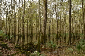
Florida Caverns State Park might be Florida's most famous state park, as it is the only state park with a show tour cave. Nestled in some of Florida's taller hills near the Chipola River, the park has a lot to offer in terms of outdoor recreation besides a public cave tour. The park is home to two trail systems: a smaller nature trail system east of the Chipola River and a longer trail system west of the river, and most people who visit the park to be guided through the cave are not aware of the beauty that awaits a short distance away on the park's trails. Along the short nature trail system, you will pass several limestone bluffs with great views of the Chipola River floodplain, and you will even hike through Tunnel Cave on Florida's only trail that passes through a cave. This hike occurred on Monday, January 2nd, 2017. My plan was to hike counter-clockwise the outermost loop in Florida Caverns State Park's nature trail system, by first hiking the Beech-Magnolia Trail, followed by the Floodplain Trail and Tunnel Cave.
Summary
R/T Length of Trail: 1.2 Miles
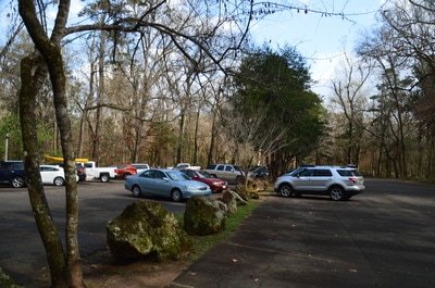
Duration of Hike: 1:00 Type of Hike: Loop Difficulty Rating: 1 out of 10 Total Elevation Gain: Minimal (although the trail is somewhat rugged by Florida standards) Pros: Unique sights along the trail that are uncommon in Florida; you're likely to have much of the trail mostly to yourself despite its shortness and proximity to a major tourist attraction Cons: None Points of Interest: Numerous bluffs, limestone rock formations, and views of Chipola River floodplain swamps; Tunnel Cave Trail Blaze Colors: None Best Seasons to Hike: Year-round Fees: There is a $5 park entry fee for all vehicles with 2-8 occupants, and a $4 fee for all vehicles with just one occupant. Additional fees apply if you wish to tour the cavern, which I recommend doing if you have the time. Unfortunately, I was in the middle of a 7-hour drive when I did this hike, so I did not have time to do the cave tour. I will be back. Beginning Point: Florida Caverns Visitor Center Directions from Marianna, FL: From the intersection of Lafayette Street and Jefferson Street in downtown Marianna, follow Jefferson Street North (FL Route 16 North) for 2.7 miles to the entrance to Florida Caverns State Park on the left. Enter the park, pay the entry fee, and continue straight for a mile. At a triangular intersection with a road to a shelter, bear right and shortly reach the large parking lot at the visitor center. Map
Click here for more information and to download this trail map to view in Garmin Basecamp.
Details
Unlike many states in the US that are not so flat, Florida is known for its sandy beaches and swamps rather than its caves. Thus, Florida Caverns and the scenery in the park is a bit of an anomaly. The formation of the caverns dates back to the time when much of Florida and the Coastal Plain was underwater. When sea levels fell, various materials such as shells that had accumulated on the ocean floor gradually hardened into limestone. Acidic groundwater then dissolved crevices just below the surface, creating caverns that were large enough to be walked in. The main cave in the park, simply known as Florida Caverns, can be accessed using a guided tour. However, even if you do not wish to take the tour, hiking the nature trail will open up a very unique world, full of tall limestone bluffs that line the edges of swamps near the Chipola River. In addition, one of the park's nature trails actually passes through a smaller cave called Tunnel Cave, requiring an interesting scramble through the dark passage.
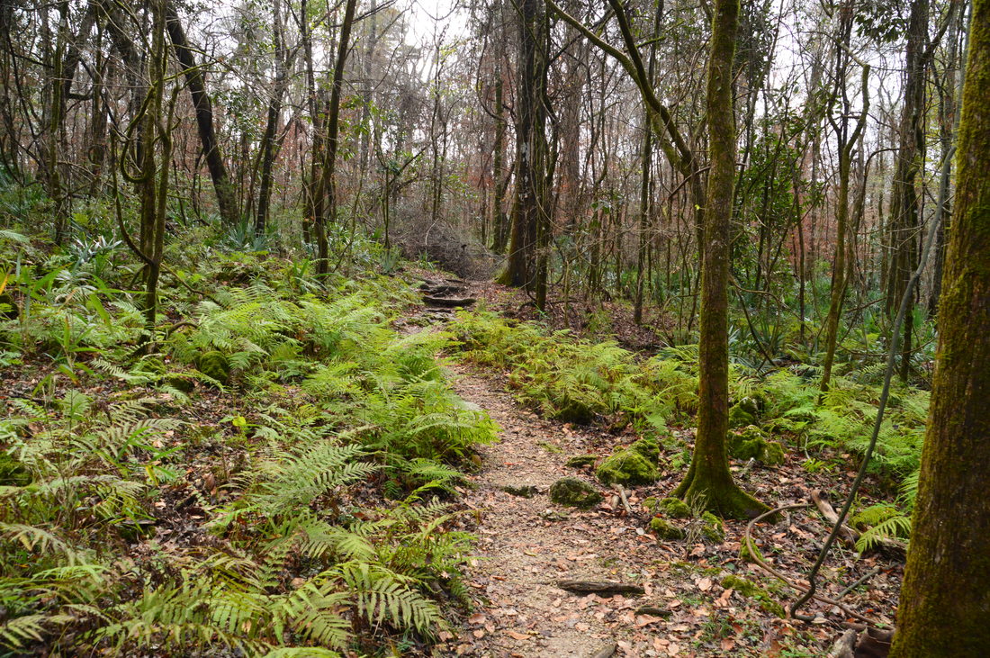
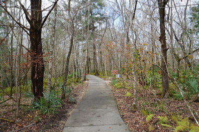
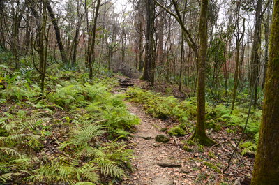
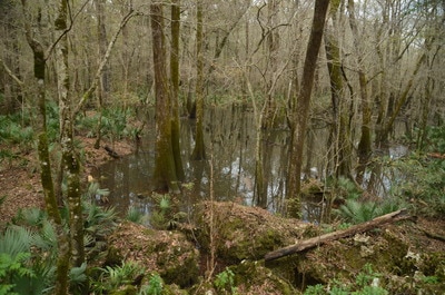
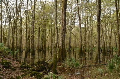
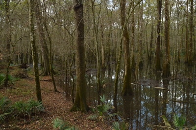
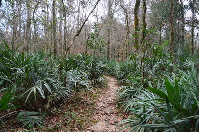
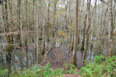
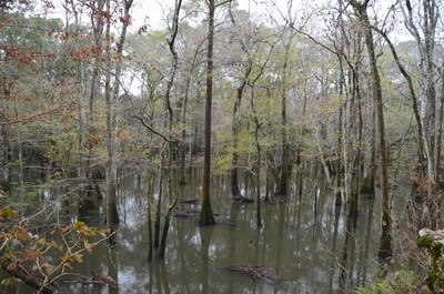
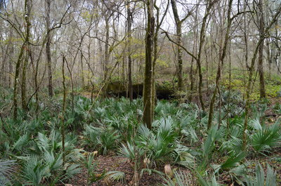
To hike the loop clockwise, begin the hike by heading north from the parking lot along a paved path to the visitor center. Along the way, you'll pass a Florida Torreya tree to the left, which is a small evergreen tree that is actually one of the rarest trees in the world! The Florida Torreya is only found among the bluffs and ravines around the Apalachicola River and Chipola River in Florida. At 0.1 miles, reach the Visitor Center. Inside, you can watch a show about the Florida Caverns. To reach the trail system, walk around the building to the right and continue up a paved path to a signed junction with the Magnolia-Beech Trail. You'll leave the crowds behind as you turn right onto this palmetto-lined footpath at the top of a small hill. The footpath shortly reaches the "National Champion Florida Elm" to the left. This elm is the largest Florida Elm that has ever been measured, with a height of 102 feet and a circumference of 120 inches! After the elm, the trail passes through a beautiful field of ferns before turning abruptly west. At 0.4 miles, the trail reaches the first bluffs, hugging the steep slope while to the right of and below the trail is a cypress swamp in the Chipola River floodplain.
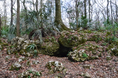
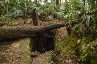
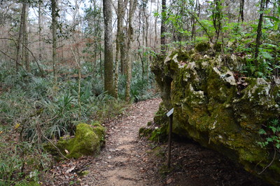
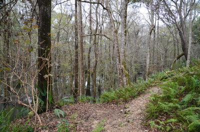
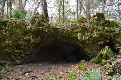
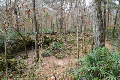
At 0.5 miles, the Magnolia-Beech Trail reaches the exit of the park's tour cave. The exit is gated, but it is still neat to see the cave opening. This is where the trail becomes paved again, but a few dozen feet past the cave, there is a junction. The paved trail continues to the visitor center, while the best part of the hike - the Floodplain Trail - turns off to the right. Take the Floodplain Trail, leaving the crowds behind once again. This trail also appears to be known as the Bluff Trail. The next stretch of trail is very scenic, as the trail winds among oddly-shaped limestone rock outcrops and atop bluffs, with the floodplain swamp often visible to the right. After passing a fenced-off area to the left that prohibits access to what looks like another cave entrance, the trail reaches a junction with the Shortcut Trail at 0.9 miles. The Shortcut Trail provides a quicker route back to the trailhead, but Tunnel Cave - a major point of interest on the hike - is still ahead, so I suggest continuing on the Floodplain Trail.
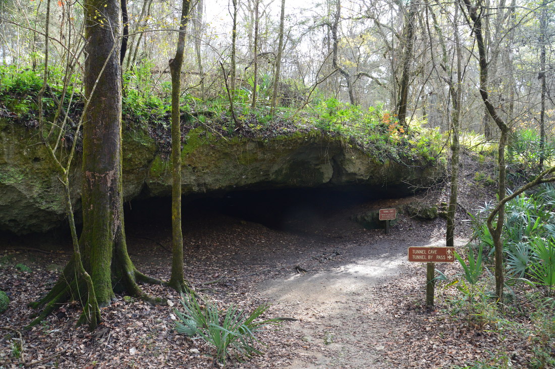
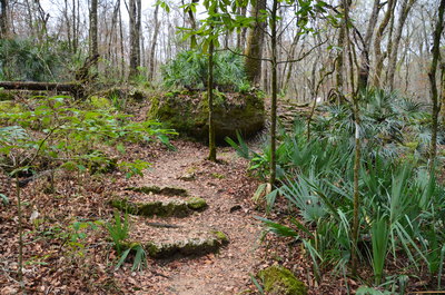
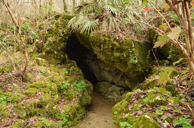
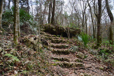
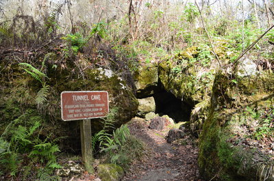
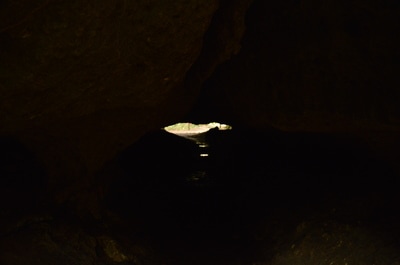
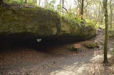
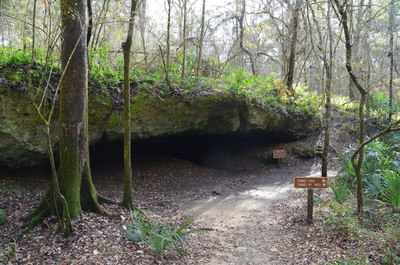
After the junction, the trail soon (briefly) leaves the edge of the floodplain swamp. Passing a large magnolia tree to the right, the trail descends into a small depression that is full of scattered mossy limestone rock outcrops. A rock shelter lies to the right. After the rock shelter, the trail ascends out of the depression using a stone staircase. This type of scenery is seriously out of place in Florida! Returning to the edge of the floodplain, the trail reaches another junction at 1.0 miles. Here, the Tunnel Cave Bypass Trail leaves to the left. If you're not comfortable walking through the cave, you can use the bypass to avoid the passage and still view the cave from the outside, but personally, I highly recommend continuing straight. At 1.05 miles, the trail makes a sharp left turn and reaches the signed entrance to Tunnel Cave. The floor of the cave passage is usually muddy and can be slippery. All warnings aside, the walk through Tunnel Cave was one of the neatest experiences that I've had while hiking in Florida. You will reach the other end of the cave at about 1.1 miles. Turn right onto the Floodplain Trail towards the trailhead. Passing a spruce pine to the right, the wide and level trail ends back at the parking area at 1.2 miles, concluding the hike. At this end, the trail is marked as the Bluff Trail, while all other signs along the trail mark it as the Floodplain Trail. Go figure!
To be honest, I was blown away by the unique beauty and features on this short nature trail. There are very few, if any other, places in Florida that exhibit the scenery found on Florida Caverns State Park's nature trail. I highly recommend doing this short hike if you're in the area, and thus, I have rated it as a "Best Hike".
Mileage
0.0 - Florida Caverns Nature Trailhead
0.1 - Florida Caverns Visitor Center 0.5 - Tour Cave Exit 1.05 - Tunnel Cave 1.2 - Florida Caverns Nature Trailhead Variations
Hike a shorter loop by cutting off the Magnolia-Beech Trail - 0.9 Miles
Bonus Stops
There is a second, longer trail system in Florida Caverns State Park, accessed from the Blue Hole area. It provides additional hiking opportunities for those who are looking to hike more than 1.2-mile nature trail.
PicturesVideos
0 Comments
Leave a Reply. |
About MeMark Oleg Ozboyd Dear readers: I have invested a tremendous amount of time and effort in this website and the Georgia Waterfalls Database the past five years. All of the work that has gone in keeping these websites updated with my latest trip reports has almost been like a full-time job. This has not allowed me to pick up a paid job to save up money for college, and therefore, I I've had to take out loans. If you find the information on this website interesting, helpful, or time-saving, you can say "thanks" and help me out by clicking the button above and making a contribution. I will be very grateful for any amount of support you give, as all of it will apply toward my college tuition. Thank you!
Coming in 2022-2023?
Other Hiking WebsitesMiles HikedYear 1: 540.0 Miles
Year 2: 552.3 Miles Year 3: 518.4 Miles Year 4: 482.4 Miles Year 5: 259.9 Miles Archives
March 2021
Categories
All
|


 RSS Feed