HIKING THE APPALACHIANS AND BEYOND
  • Home
  • Trail Reports
    • Best Hikes
    • Hikes with Scenic Views
    • Hikes with Water Features
    • Alabama
    • Georgia
    • Florida
    • North Carolina
    • South Carolina
    • Tennessee
    • Vermont
    • Virginia
  • Map
  • Hike List
  • Testimonials
  • Resources
  • Contact Us
  • Southeast Nature Society
    • Our Team
  • Georgia Waterfalls Database

Wakulla Springs State Park: Wakulla River Sinks Trail, Tallahassee, Florida

1/8/2018

2 Comments

 
Picture
Most hikers of the Tallahassee area have heard of or even been to Leon Sinks. How many have heard of Wakulla River Sinks though? Along with adjacent Apalachicola National Forest, the River Sinks Tract - a lesser-known parcel of Wakulla Springs State Park - holds nearly two dozen water-filled sinkholes. The sinks serve as a portal to the mysterious underground water-filled cave system that eventually connects to the Wakulla River to the southeast. An official trail called the Wakulla River Sinks Trail passes by several small sinks, including the photogenic Clearcut Sink. If one extends their hike along the unofficial pathway that splits off and leads to a series of bigger sinks, including Promise Sink and Upper River Sink, they are bound to be astounded! This hike occurred on Saturday, January 6th, 2018. My plan was to hike the official Wakulla River Sinks Trail clockwise. Along the way, I would make out-and-back side trips to Clearcut Sink and along an unofficial trail to a series of sinks to the south. 

Summary

R/T Length of Trail: 4.0 Miles
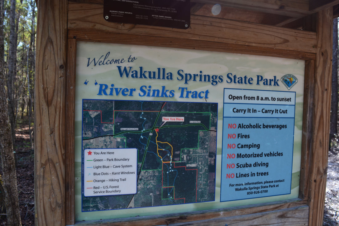
Duration of Hike: 2:10 plus 45 minutes of stopping 
Type of Hike: Lasso and Spur 
Difficulty Rating: 2 out of 10 
Total Elevation Gain: Minimal (120 Feet) 
Pros: Lots of beautiful sinkholes to see
Cons: The unofficial part of the trail has a few unmarked intersections that could be confusing 
Points of Interest: Venture Sink, Log Jam Sink, Trench Sink, Woods Sink, Cream Sink, Go Between Sink, Promise Sink, Cypress Knees near Promise Sink, Upper River Sink, Clearcut Sink
Trail Blaze Colors: Official Wakulla River Sinks Trail - Orange; Unofficial Wakulla River Sinks Trail - None 
Best Seasons to Hike: Spring 
Fees: A $4 entry fee is charged per car for the River Sinks Tract. 
Beginning Point: Parking area off C J Spears Road 
Directions from Tallahassee, FL: From the intersection of Capital Circle (FL 263/US 319 North) and Crawfordville Road (FL 61/US 319 South), follow Crawfordville Road South (US 319 South). Stay right where FL 61 South splits off to the left. 6.4 miles from Capital Circle, turn left onto C J Spears Road. In 100 feet, turn right onto the unpaved River Sinks Tract entrance road. Reach the dead-end parking area in another 200 feet. 

Map

Click the link below to download a .GPX file with a track of this hike.
wakulla_river_sinks_trail.gpx
File Size: 116 kb
File Type: gpx
Download File

Details

Before I delve into the trail report for the Wakulla River Sinks hike, I'd like to thank photographer Michael Riffle for guiding me to on this trail to most of the sinks. I had never heard about this hike prior to his telling me. Leon Sinks, only a mile away, is much more popular, and clearly, it overshadows Wakulla River Sinks. I did both sinks hikes on this day, and ultimately, I think that I preferred Wakulla River Sinks. The Wakulla River Sinks Trail is much less developed and more remote than Leon Sinks, although that's not to say that Leon Sinks doesn't have spectacular sinks such as Hammock Sink. 

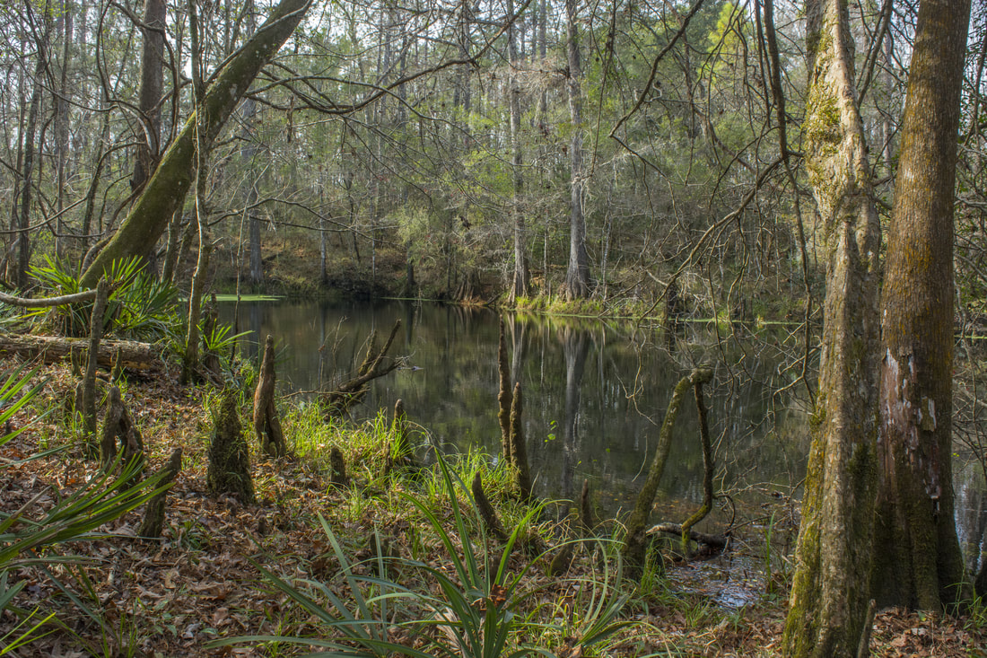
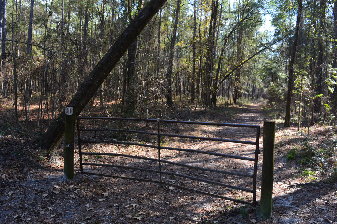
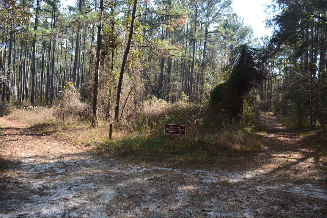
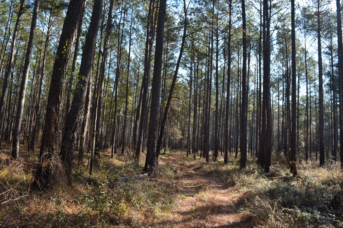
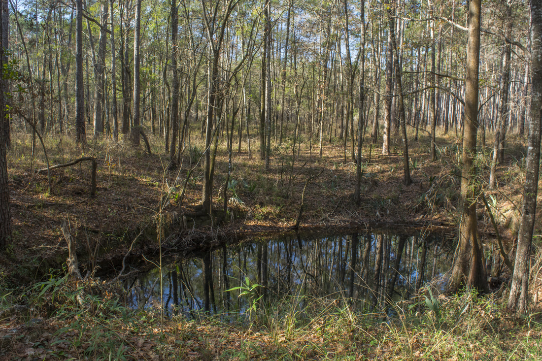
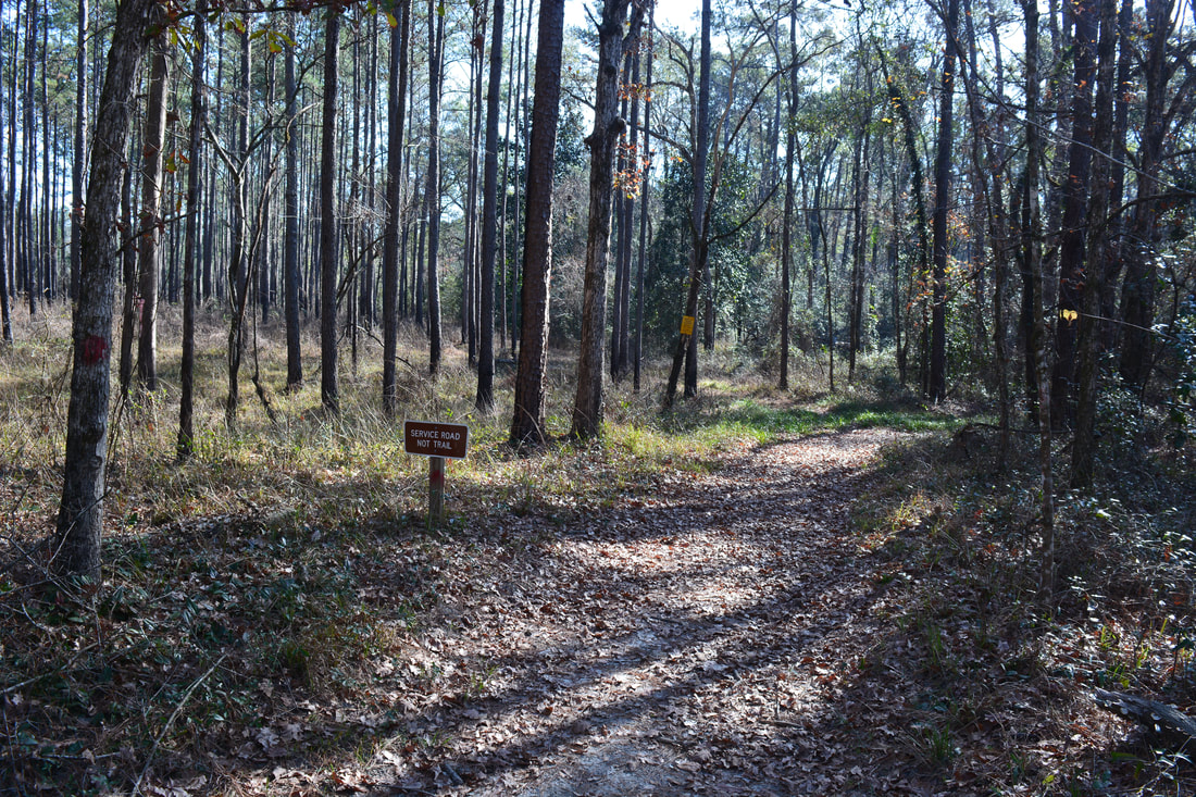
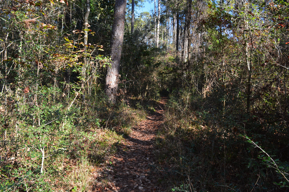
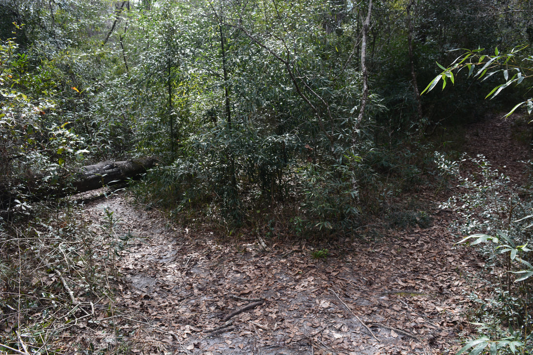
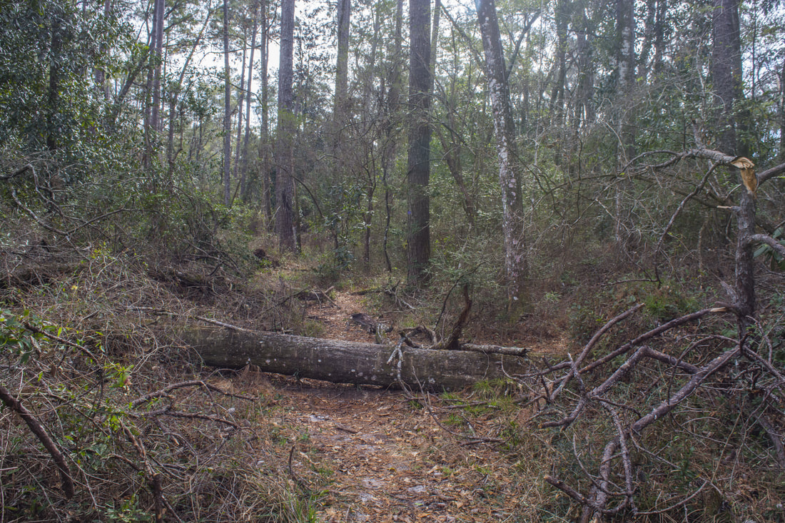
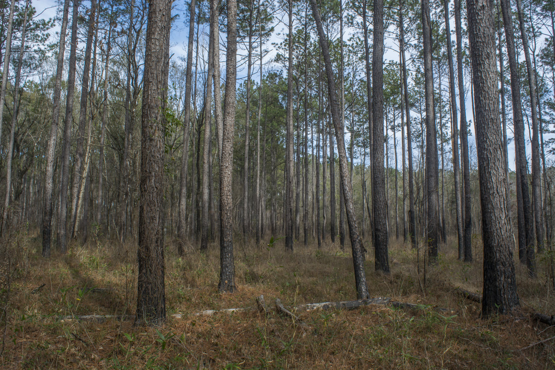
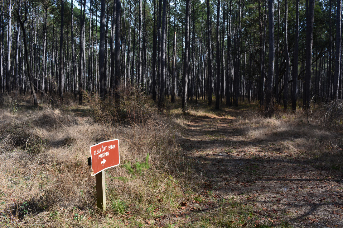
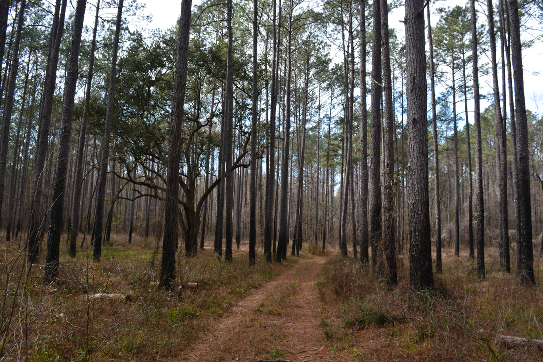
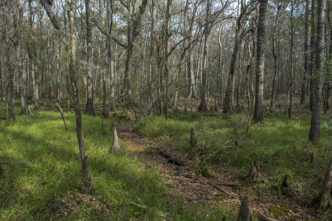
The hike begins at the trailhead kiosk and gate. Unfortunately, while the kiosk map shows all of the area sinks, it doesn't show the full trail system. It only shows the official 2-mile loop trail, but the most spectacular sinks are on the unofficial part of the trail. Pass around the gate and follow the broad forest road to the beginning of the loop at 0.25 miles. To hike the loop clockwise, stay left. The forest road's route mostly passes through pine flatwoods. These slash pines were once logged when this area was private property, but after the state acquired the tract, the pines were left to grow tall. Other forest roads leave left at 0.6 miles and 0.8 miles. Venture Sink - the first sink along the trail - is to the right at 0.85 miles. All of the sinks have very clear and blue water if there hasn't been a lot of rain in a while. Venture Sink is a medium-sized sink, and during low water, it can actually appear as two sinks with a small dry strip in the middle. The next sink is Log Jam Sink to the right at 0.9 miles. Log Jam Sink is smaller than Venture Sink but is a little more scenic. The water seems to have a bluer tone and one end of the oval sink is lined with small cypress knees.

There's an important intersection just past Log Jam Sink at 0.95 miles. The official trail turns right and heads in the direction of Clearcut Sink and the parking area. However, this hike continues straight on a narrower unofficial trail. Ironically, a brown sign reads "Service Road - Not Trail", but you should ignore it. As you start down the unofficial sinks trail, you'll see two unimpressive sinks - Woods Sink to the right and Trench Sink to the left. Trench Sink is usually covered in green duckweed. The unofficial trail leaves state property and temporarily enters Apalachicola National Forest here. Stay on the distinct trail to reach a short spur trail to Cream Sink on the right at 1.05 miles. Cream Sink is a pretty large sink that has a wild look unlike any other sink along the hike. Most of the sink's steep banks are enshrouded in tangles of vegetation. One benefit of hiking this trail in the spring is that most trees will have leaves on them by then, but yet, the temperatures should still be bearable and biting bugs should be absent. All the sinks are more scenic when they're lined with vivid greenery. 
Picture
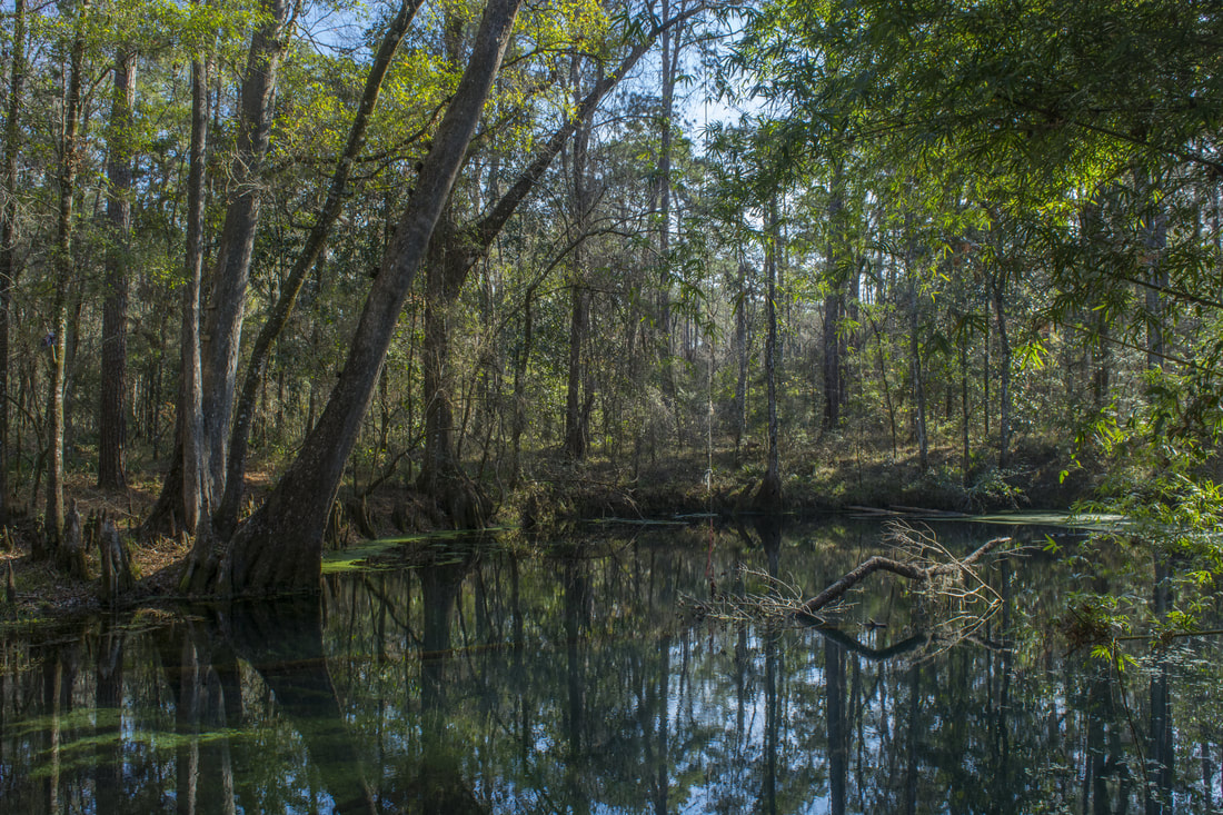
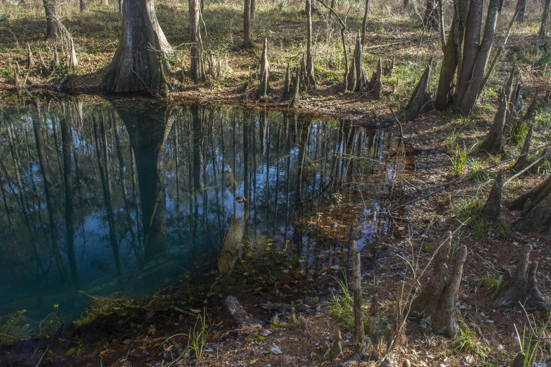
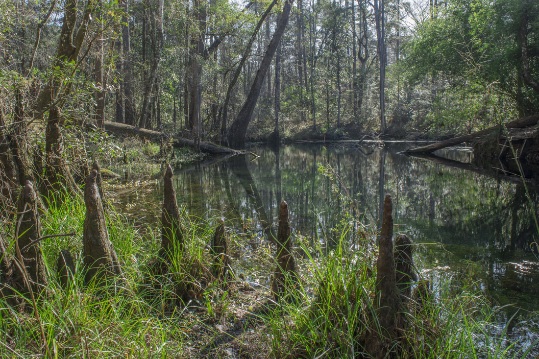
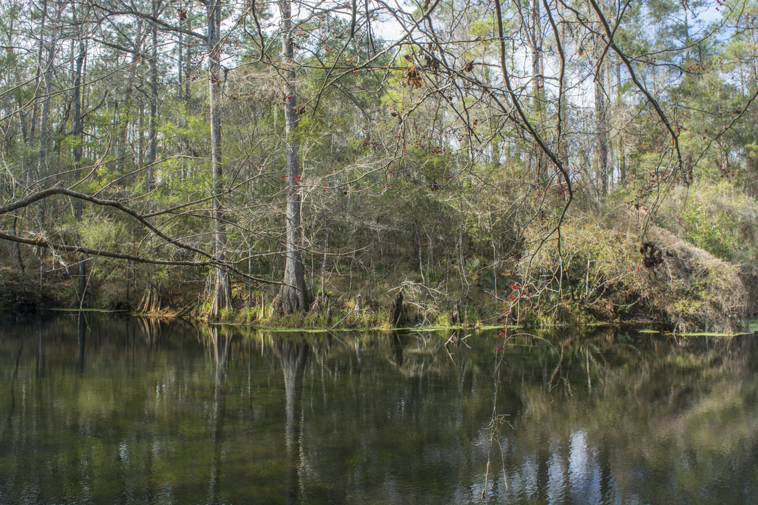
Promise Sink is one of the largest and most gorgeous sinks along the Wakulla River Sinks Trail.
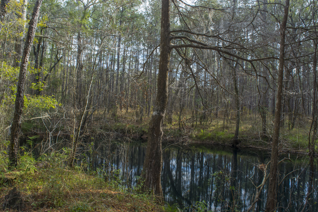
Come to a split in the trail at 1.15 miles. To the right is a bypass for Promise & Go Between Sinks that you'll take on the way back. Thus, stay left and drop down a small hill to reach the pair of sinks at 1.2 miles. Go-Between Sink is on the right. It's small, partially covered in duckweed, and overly not very scenic. On the left is elongated Promise Sink, a large and very beautiful sink. Unfortunately, the shores of Promise Sink are home to a population of thriving invasive plants. Bamboo and Cherokee roses were planted by the previous owners of this area (this used to be private property before it became part of Apalachicola National Forest). For the best view of Promise Sink, continue 100 feet on the main trail and take a short spur trail on the left to a small bluff above the sink. This is the best place to observe the sink's blue waters. Another reason to do this hike in the dry season (winter or spring) is that you have a better chance of seeing the sinks in their clearest state. If you look closely at the large overhanging cypress tree on the other side of the sink, you'll notice a makeshift wooden ladder on it. Yes, people actually jump into the sink from the tree! Even though the sink is deeper than it looks, it's still quite scary. 

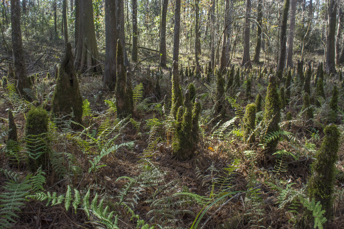
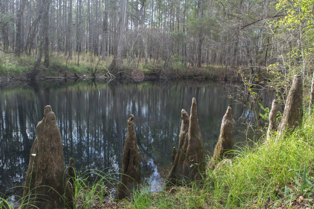
The next sight along the trail is a depression with a fascinating patch of mossy cypress knees on the left at 1.3 miles.  Part of the patch is even covered by a field of ferns that fill up the space between the cypress knees. Surprisingly, there's few actual cypress trees among the rows of gnome-like knees. After the cypress knee patch, the path becomes turns a little overgrown as it curves southwest before rejoining the bypass trail at 1.4 miles. Turn left on the trail to Upper River Sink. Shortly after re-entering state property, the path joins a broad forest road that comes in from private property to the west at 1.7 miles. Finally, at 1.9 miles, the trail ends at Upper River Sink. 

Upper River Sink is the grand finale. This is a very deep and huge sink! From the outcrop above the sink at the end of the trail, you can't even see the sink's far end due to the curve it makes in the distance. Furthermore, Upper River Sink is around 80 feet deep. Standing at its edge, you can see an underwater limestone drop-off that provides a small hint about the sink's amazing depth. Deep beneath the surface, Upper River Sink connects to an underground water-filled cave system just like all other sinks along the trail do, and eventually, the water reaches the Wakulla River. Paths lead down both sides of Kini Sink to different viewpoints. Upper River Sink also has its own tree to jump off from like Promise Sink does. Another name that's sometimes used for Upper River Sink is Kini Sink, although it seems that Upper River Sink is the officially-recognized name. 
Picture
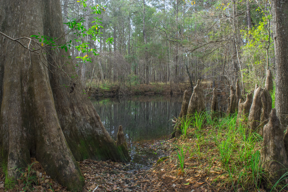
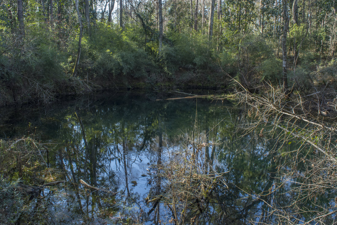
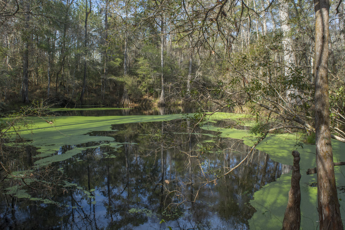
Clearcut Sink is one of many sinks along the Wakulla River Sinks Trail.
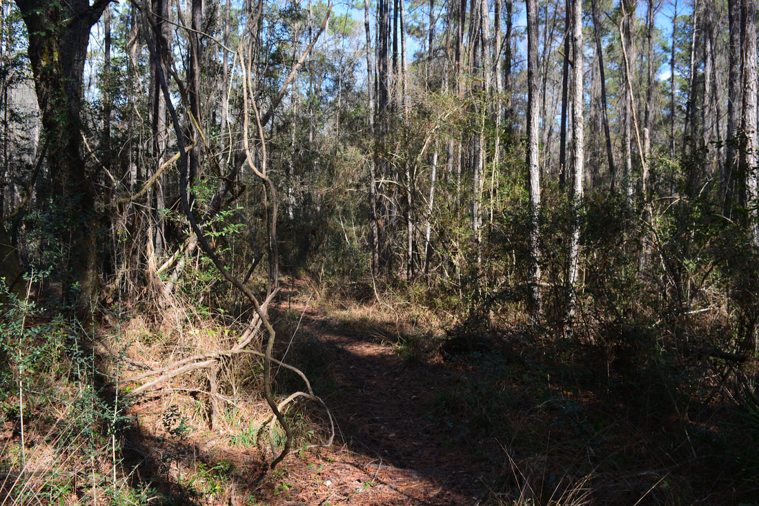
From Upper River Sink, retrace your steps back to the official trail. Stay left when you reach the Promise Sink bypass trail. The bypass passes near Fish Hole Sink to the west. Although it's a large sink, there's no visible side trail to it. Return to the official loop trail by Woods Sink and Trench Sink at 2.75 miles. Turn left to keep following the loop clockwise. Where there's no sinks, the trail is pretty monotonous in the pine flatwoods. At 3.25 miles, a signed side trail leaves right to the final sink of the hike: Clearcut Sink. The spur trail ends at the sink at 3.4 miles. This small oval-shaped sink is another photogenic one. Cypress knees line its left side, and at the far end is a massive cypress tree that guards the sink.

Return to the main trail and reach the end of the loop at 3.75 miles. Continue straight, retracing your first steps of the day, and conclude the hike at 4.0 miles. I decided to rate this hike as a "Best Hike" due to all the uniquely beautiful sinks. Although the Wakulla River Sinks hike is pretty short, it's still one of the most scenic hikes I've done in the Florida Panhandle. 
Best Hike!

Mileage

0.0 - Wakulla River Sinks Trailhead 
​0.85 - Venture Sink 
0.9 - Log Jam Sink 
1.05 - Cream Sink
1.2 - Go-Between & Promise Sinks
1.3 - Cypress Knees
1.9 - Upper River Sink 
3.4 - Clearcut Sink 
4.0 - Wakulla River Sinks Trailhead

Variations

Hike out and back to Clearcut Sink - 1.2 Miles
Hike just the Wakulla River Sinks Loop - 2.2 Miles
Hike the Wakulla River Sinks Loop with a side trip to Promise Sink - 2.7 Miles 

Pictures & Videos

2 Comments
Laurel
1/26/2018 05:17:50 pm

Thank you so much for this detailed report on this trail! I have hiked there 3 times but was always confused as to what sinks I was seeing. I agree with you on liking this better than the main Leon Sinks State Park up the road. I also have found that no one I've mentioned this trail to is aware of it. I moved to Tallahassee 2 years ago and fortunately found this trail pretty soon after. I am going to bike there tomorrow and use your report as my guide. Great work!

Reply
Mark Oleg
2/17/2018 05:43:51 pm

Thanks Laurel! Glad you found this trail report helpful. I must give credit to Matthew Bull, a professional cave diver and spring hunter, who told me all the sink names. He's an expert on the area for sure!

Reply


Leave a Reply.

    About Me

    Mark Oleg Ozboyd
    I'm an avid outdoor explorer and a hobbyist landscape photographer. I'm 21 years old and have been hiking since 2011. Originally based out of Atlanta, Georgia, I started out by occasionally hiking short trails throughout well-known Georgia State Parks. During 2012 and 2013, I began to expand my trips into adjacent states, as well as into the wilder National Forest areas rather than just State Parks. Throughout the years that followed, as I slowly ran out of popular hiking trails in my area, I began to search for and hike in more seldom-visited areas. Today, you can find me out in the woods every weekend, whether it's on an official trail or bushwhacking through cross-country terrain without any paths. I now attend Washington & Lee University and am exploring Virginia and West Virginia. My other hobbies include chess, science, old music, and meteorology. I have 3 years of amateur weather forecasting experience, having studied a lot of meteorology basics over the years. I am also a student at European School of Music where I learned that music and nature have a lot in common. Listening to good music inspires me to capture nature's beauty on the camera in different aspects that also make me recall many beautiful music pieces that I've heard.​


    Dear readers: I have invested a tremendous amount of time and effort in this website and the Georgia Waterfalls Database the past five years. All of the work that has gone in keeping these websites updated with my latest trip reports has almost been like a full-time job. This has not allowed me to pick up a paid job to save up money for college, and therefore, I I've had to take out loans. If you find the information on this website interesting, helpful, or time-saving, you can say "thanks" and help me out by clicking the button above and making a contribution. I will be very grateful for any amount of support you give, as all of it will apply toward my college tuition. Thank you! 

    Enter your email address to subscribe for trail reports:

    Delivered by FeedBurner


    Picture
    Coming in 2022-2023?

    Other Hiking Websites

    DWHike's Adventures
    Florida's Natural Wonders
    Florida Trailblazer
    Meanderthals
    Mountain Images
    by Bernie Boyer

    North Carolina Waterfalls with
    ​Kevin Adams
    Take-a-Hike!
    Tennessee Landforms
    Waterfall Page
    Waterfall Adventurer
    Zach's Mild Adventures

    Miles Hiked

    Year 1: 540.0 Miles
    Year 2: 552.3 Miles
    ​Year 3: 518.4 Miles
    Year 4: 482.4 Miles
    Year 5: 259.9 Miles

    Archives

    March 2021
    February 2021
    January 2021
    November 2019
    October 2019
    September 2019
    August 2019
    July 2019
    June 2019
    February 2019
    January 2019
    December 2018
    November 2018
    October 2018
    August 2018
    July 2018
    June 2018
    May 2018
    April 2018
    March 2018
    February 2018
    January 2018
    December 2017
    November 2017
    October 2017
    September 2017
    August 2017
    July 2017
    June 2017
    May 2017
    April 2017
    March 2017
    February 2017
    January 2017
    December 2016
    November 2016
    October 2016
    September 2016
    August 2016
    June 2016
    May 2016
    April 2016
    March 2016
    January 2016
    December 2015
    November 2015
    October 2015
    September 2015
    August 2015
    July 2015
    June 2015
    May 2015
    April 2015
    March 2015
    February 2015
    January 2015
    December 2014
    November 2014
    October 2014
    September 2014
    August 2014
    July 2014
    June 2014
    May 2014
    April 2014
    March 2014
    February 2014

    Categories

    All
    Adel
    Adirondack Park
    Alabama
    Alfred A. Ring Park
    Allegheny Trail
    Amicalola Falls State Park
    Anniston Area
    Apalachicola Bluffs And Ravines Preserve
    Apalachicola National Forest
    Apalachicola/Port St. Joe Area
    Apopka
    Appalachian Trail
    Appling
    Art Loeb Trail
    Aska Trail System
    Bakersville
    Balm-Boyette Scrub Preserve
    Balsam Lake Recreation Area
    Bankhead National Forest
    Bartow County Parks
    Bartram Trail
    Basinger
    Beersheba Springs
    Benton
    Benton Mackaye Trail
    Berry College Trail System
    Best Hike
    Big South Fork National Recreation Area
    Black Bear Wilderness
    Black Rock Mountain State Park
    Blairsville
    Blakely
    Blood Mountain Wilderness
    Blowing Rock
    Blue Ridge
    Blue Ridge Parkway
    Boone
    Bradenton
    Bradenton Beach
    Brasstown Bald
    Brasstown Wilderness
    Brevard
    Bryson City
    Buchanan
    Bucks Pocket State Park
    Bulow Creek State Park
    Bulow Plantation Ruins State Park
    Caesars Head State Park
    Caladesi Island State Park
    Calhoun
    Camel's Hump State Park
    Cashiers
    Caspersen Beach Park
    Catfish Creek State Park
    Caves
    CC Putnam State Forest
    Cedar Point Environmental Park
    Chatsworth
    Chattahoochee National Forest
    Chattanooga
    Chattanooga Valley
    Chattooga National Wild And Scenic River
    Cheaha Wilderness
    Cherohala Skyway
    Cherokee
    Cherokee National Forest
    Chiefland Area
    Chillhowee Recreation Area
    Chipley
    Chunky Gal Trail
    Circle B Bar Reserve
    Citico Creek Wilderness
    Citrus Wildlife Management Area
    Clarkesville
    Clayton
    Cleevland
    Cleveland
    Cloudland Canyon State Park
    Cohutta Wilderness
    Collier-Seminole State Park
    Cordele
    Cornelia
    Covington
    Crestview Area
    Crew-land-and-water-trust
    Cullowhee
    Cumberland Trail
    Dahlonega
    Dalton
    Dawson Forest Wildlife Management Area
    Dawsonville
    Dayton
    De Soto National Memorial
    DeSoto State Park
    Dillard
    Double Springs
    Ducktown
    Duncan Ridge Trail
    Dunlap
    Eagle's Rest Park
    Eastpoint
    Econfina Creek Wildife Management Area
    Eglin Air Force Base
    Elizabethton
    Elkins
    Elk Knob Game Lands
    Elk Park
    Ellicott Rock Wilderness
    Ellijay
    Emerson Point Preserve
    Englewood Area
    Enota Retreat
    Erwin
    Falling Waters State Park
    Fayetteville
    Fires Creek Recreation Area
    Fire Tower
    Flint River
    Florence Area
    Florida
    Florida Caverns State Park
    Florida Trail
    Foothills Trail
    Fort Mountain State Park
    Fort Myers Area
    Fort Payne
    Fort Payne Area
    Fort Yargo State Park
    Franklin
    Franklin Delano Roosevelt State Park
    Franklin-Marion State Forest
    Frozen Head State Park
    Gainesville
    Gainesville Area
    Gatlinburg
    George Washington National Forest
    Georgia
    Georgia Veterans Memorial State Park
    Glasgow
    Gorges State Park
    Grandfather Mountain State Park
    Great Smoky Mountains National Park
    Greeneville
    Green River Game Lands
    Gruetli-Laager
    Grundy Forest State Natural Area
    GTM Reserve
    Guana River Wildlife Management Area
    Hayesville
    Helen
    Hiawassee
    High Falls State Park
    Highlands
    Highlands Scenic Highway
    Hillsborough River State Park
    Hinson Conservation & Recreation Area
    Historic Sites
    Honeymoon Island State Park
    Hot Springs
    Huntington
    Inverness Area
    Jackson
    Jasper
    Jefferson National Forest
    Joan M. Durante Park
    Jonathan Dickinson State Park
    Jones Gap State Park
    Joyce Kilmer Slickrock Wilderness
    Joyce Kilmer - Slickrock Wilderness
    Juniper Prairie Wilderness
    Kelly Park
    Keown Falls Recreation Area
    Kolomoki Mounds State Park
    LaFayette
    Lake City Area
    Lake George Wild Forest
    Lake June-in-Winter State Park
    Lakeland Area
    Lake Placid
    Lake Russell Wildlife Management Area
    Lake Wales Ridge State Forest
    Laurel Fork North Wilderness
    Leffis Key Preserve
    Leon Sinks Geological Area
    Lexington
    Lineville
    Linville
    Linville Gorge Wilderness
    Lithia Springs
    Little Frog Wilderness
    Little Manatee River State Park
    Little River Canyon National Preserve
    Longboat Key
    Long Trail
    Lookout Mountain
    Lookout Mountain Battlefield
    Lovingston
    Lula Lake Land Trust
    Lumpkin
    Maggie Valley
    Manatee Springs State Park
    Marianna Area
    Mark Trail Wilderness
    Marlinton
    Mccaysville
    McMinville
    Mentone
    Middlesex
    Mistletoe State Park
    Monongahela National Forest
    Montreat
    Mountain Bridge Wilderness Area
    Mountain City
    Mountains To Sea Trail
    Mountains-to-Sea Trail
    Mount Rogers National Recreation Area
    Myakka River State Park
    Myron B. Hodge City Park
    Nantahala National Forest
    Naples
    Naples Area
    Natural Bridge State Park
    Neal Preserve
    New Castle
    Newport
    New River Gorge National Park
    New York
    North Carolina
    Ocala Area
    Ocala National Forest
    Ocean-to-Lake Trail
    Oconee State Park
    Oconee Station Historic Site
    Okaloacoochee Slough State Forest
    Oldsmar
    Oneida
    Orlando Area
    Ormond Beach
    Oscar Scherer State Park
    Oxford
    Palatka
    Palmetto Trail
    Panama City Area
    Panthertown Valley
    Parrish
    Paynes Creek Historic State Park
    Peaks Of Otter Recreation Area
    Pigeon Crockford Mountain Wildlife Management Area
    Pigeon-Crockford Mountain Wildlife Management Area
    Pigeon-Crockford Wildlife Management Area
    Pine Mountain
    Pinhoti Trail
    Pinnacle Park
    Pisgah Civitan Park
    Pisgah National Forest
    Pittman Center
    Pond Mountain Wilderness
    Ponds/Lakes
    Prentice Cooper State Forest
    Providence Canyon State Park
    Pumpkintown
    Quick Point Nature Preserve
    Raven Cliffs Wilderness
    Reed Bingham State Park
    Reliance
    Rice Creek Conservation Area
    Riverview Pointe Preserve
    Robbinsville
    Robinson Preserve
    Rock Creek Gorge Scenic Area
    Rock Island State Park
    Rome
    Rosman
    Sale Creek
    Salem
    Salt Springs
    Saluda
    Santa Rosa Beach
    Sarasota
    Sarasota Area
    Savage Gulf State Natural Area
    Scenic Views
    Scottsboro Area
    Sebring Area
    Sewanee
    Sheltowee Trace Trail
    Shining Rock Wilderness
    Signal Mountain
    Sipsey Wilderness
    Sky Valley
    Smithgall Woods State Park
    Snowbird Backcountry Area
    Soddy Daisy
    Soddy-Daisy
    Sopchoppy
    South Carolina
    South Cumberland State Park
    Southeastern Cave Conservancy
    Southern Nantahala Wilderness
    Sparta
    Sprewell Bluff Park
    Spring City
    Spring Hill
    Springs
    Spruce Pine
    Standing Indian Backcountry Area
    St. Augustine
    St. George Island State Park
    St. Joseph Bay State Buffer Preserve
    St. Marks Area
    St. Marks National Wildlife Refuge
    Stone Mountain
    Stone Mountain Park
    Suches
    Sumatra
    Sumter National Forest
    Suwannee River
    Swallow Creek Wildlife Management Area
    Sweetwater Creek State Park
    Sylva
    Talladega National Forest
    Tallahassee Area
    Tallulah Falls
    Tallulah Gorge State Park
    Tampa Bay Area
    Tate City
    Tate's Hell State Forest
    Tea Creek Wildlife Management Area
    Tellico Plains
    Tennessee
    Thomaston
    Toccoa
    Topsail Hill State Park
    Torreya State Park
    Townsend
    Tracy City
    Tray Mountain Wilderness
    Trenton
    Triple Creek Preserve
    Troutdale
    Unaka Mountain Wilderness
    Upper Tampa Bay County Park
    Venice
    Vermont
    Virgin Falls State Natural Area
    Virginia
    Virginia Outdoors Foundation
    Vogel State Park
    Wakulla Springs State Park
    Waleska
    Walhalla
    Wartburg
    Water Features
    Waynesville
    Weedon Island Preserve
    Weeki Wachee Preserve
    Wekiwa Springs State Park
    West Palm Beach Area
    West Virginia
    Whitehall
    White Springs
    Winder
    Withlacoochee State Forest
    Young Harris

    RSS Feed

TRAIL REPORTS

Hikes in Alabama
​Hikes in Florida
Hikes in Georgia
Hikes in North Carolina
Hikes in South Carolina
Hikes in Tennessee
Hikes in Virginia

Hiking Resources

Alabama Resources
​
Florida Resources
Georgia Resources
North Carolina Resources
​South Carolina Resources
​
Tennessee Resources

Other

Contact
Map of Hikes
Alphabetical List of Hikes
Southeast Nature Society
© COPYRIGHT 2014-2018
​ALL RIGHTS RESERVED.
Important: I disclaim any responsibility for any damage or personal injury that may occur as a result of the activities and information found on this website. All outdoor activities, especially off-trail hiking, are done at your own risk. Never hike or head into that area that may be above your fitness or experience level.
  • Home
  • Trail Reports
    • Best Hikes
    • Hikes with Scenic Views
    • Hikes with Water Features
    • Alabama
    • Georgia
    • Florida
    • North Carolina
    • South Carolina
    • Tennessee
    • Vermont
    • Virginia
  • Map
  • Hike List
  • Testimonials
  • Resources
  • Contact Us
  • Southeast Nature Society
    • Our Team
  • Georgia Waterfalls Database