The Florida Trail section in the Rice Creek Conservation Area a few miles outside Palatka is short but truly unique and special. This hike dives right into the Rice Creek Swamp, the headwaters of Rice Creek - a major tributary of the St. Johns River. Back in the 19th century, the Rice Creek headwaters were actually a rice and indigo plantation. But today, the area is heavily wooded, and the only remaining traces of the past are the numerous levees crisscrossing the swamp. The Florida Trail loop utilizes several of these levees to provide a first-hand swamp experience. At the same time, the levees and an extraordinary system of boardwalks and footlogs allows you to keep your feet dry onto your journey into the swamp. You might even see a few gators or otters if you're lucky. A particularly remarkable point of interest along the Rice Creek section of the Florida Trail is Hoffman's Crossing - a slim boardwalk, 1,886 feet long, that crosses a branch of the swamp. This hike occurred on Wednesday, August 22nd, 2018. My plan was to hike the Rice Creek Loop from the Highway 100 Trailhead. Along the way, I'd extend my hike along the Florida Trail to see Hoffman's Crossing.
Summary
R/T Length of Trail: 8.8 Miles
Duration of Hike: 4:00 plus 20 minutes of stopping Type of Hike: Lasso with Side Trip Difficulty Rating: 5 out of 10 Pros: Wonderful swamp views; neat boardwalks Cons: A couple sections of the trail could be muddy, even a bit wet, during the wet season Points of Interest: Numerous views of the Rice Creek Swamp; giant cypress tree; 0.4-mile rustic boardwalk at Hoffman's Crossing Trail Blaze Colors: Florida Trail - Orange; Cedar Swamp Trail - Yellow; Oak Hammock Trail - White Best Seasons to Hike: Spring Fees: None Beginning Point: Rice Creek Conservation Area Trailhead near Highway 100 Directions from Palatka, FL: From the intersection of FL 100 and FL 19 on the northwest side of Palatka, follow FL 100 West for 4.1 miles. Then, turn left onto the unpaved entrance road into Rice Creek Conservation Area (there is an entrance sign). Follow this unnamed road to a designated parking area at the dead-end in 0.2 miles. Map
Click the link below to download a .GPX file with a track of this hike.
Details
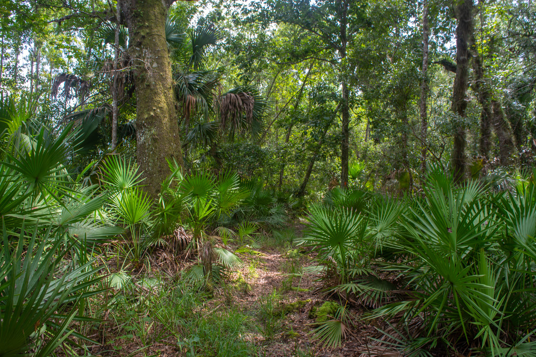
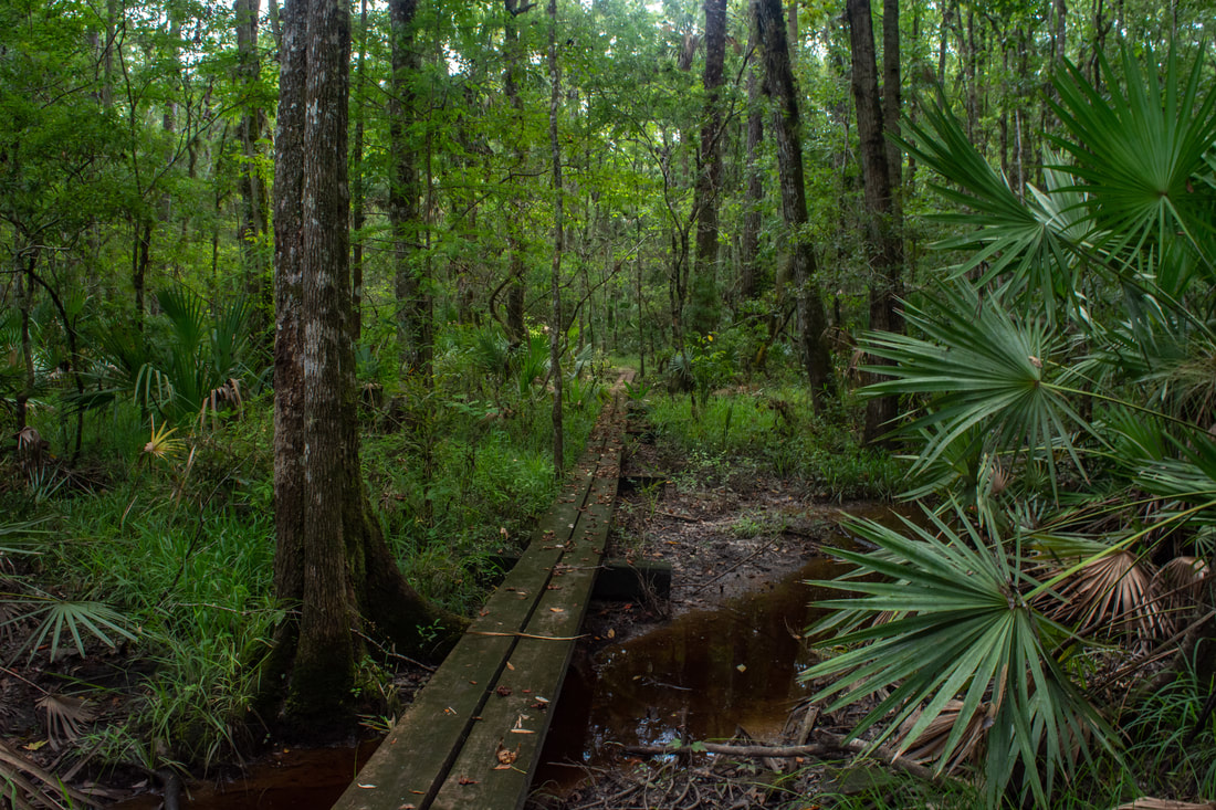
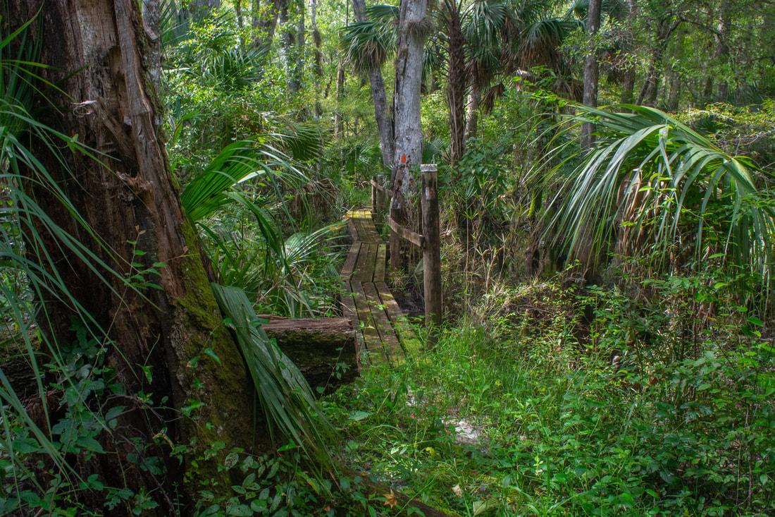
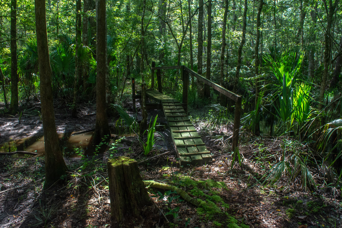
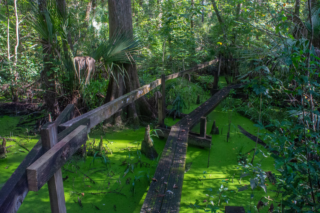
I'm a huge fan of boardwalks. Those rustic, narrow puncheons and footlogs in particular. I hiked the Cimarron Trail in the Florida Panhandle in December 2016, which I absolutely loved for the delightful series of tricky boardwalks near its end. So when I learned about another such hike in the area of Florida I was visiting, I instantly placed it on my wishlist. The Rice Creek section of the Florida Trail, along with the side trails that form the loop, has a whopping 48 footbridges and boardwalks. And they're all the same style - not those broad nature preserve boardwalks, but rickety, single-track, wooden passages. What's even more impressive is that the longest continuous boardwalk is nearly 0.4 miles long!
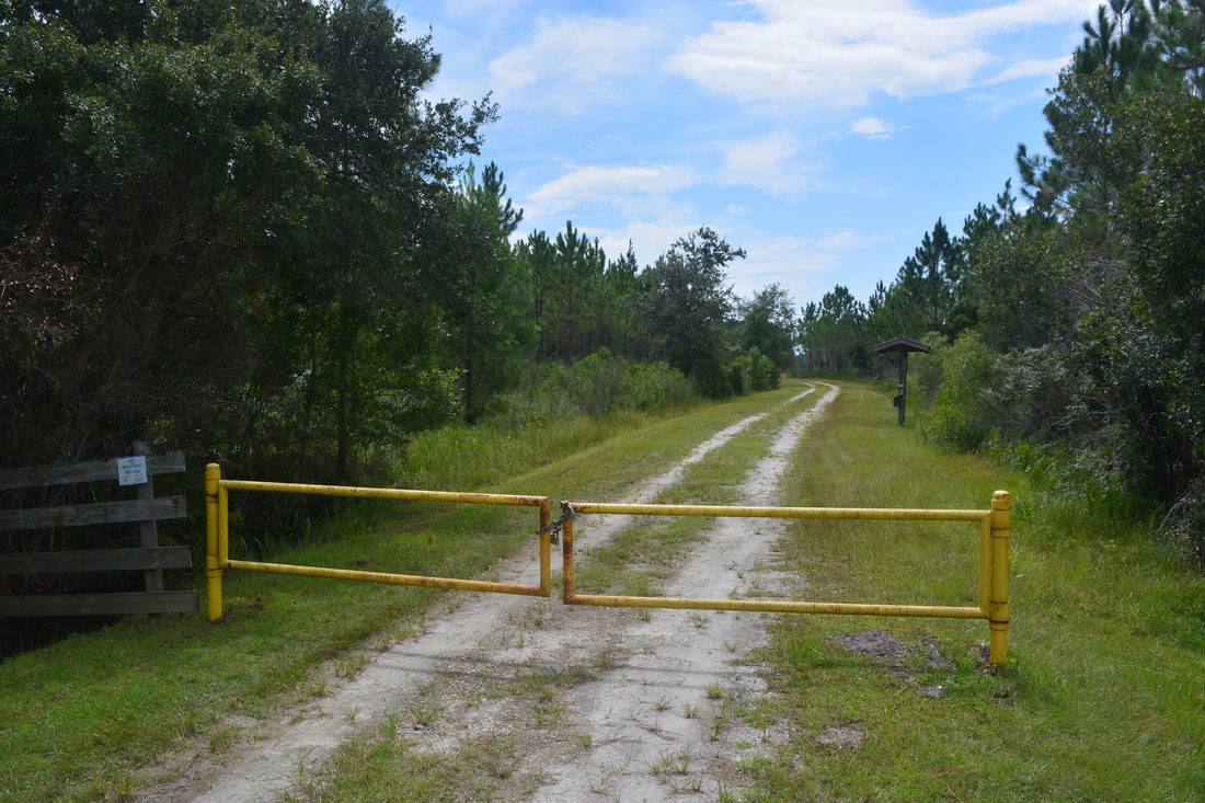
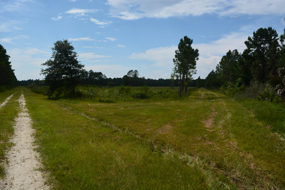
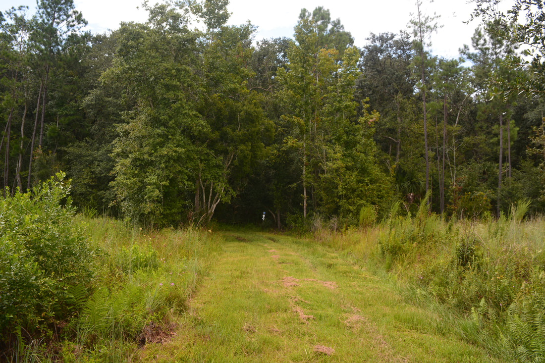
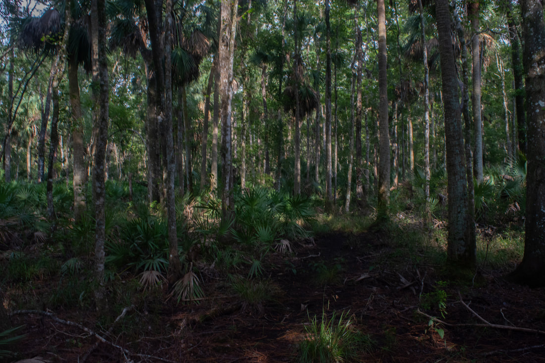
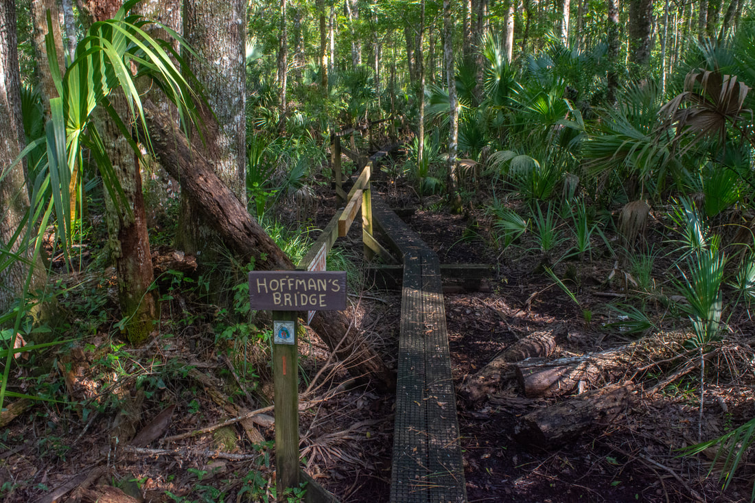
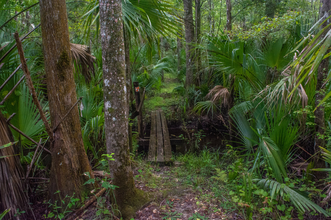
The hike starts at a surprisingly nondescript location along a broad, elevated forest road in the middle of pine flatwoods. Walk behind the gate and follow the road for a quarter-mile road. Then, a lower, grassier road leaves right, marked by a blue arrow. Turn onto this road, which aims for the tree line ahead as it crosses a field. The field has a couple low spots that could be soggy in the wet season. The road reaches the tree line at 0.7 miles - this is where the hike starts to get a lot more interesting. The road makes a sharp left turn. A few feet later, the hiking trail turns right at a sign, while the horse trail continues straight along the edge of the field. Turn onto the hiking trail and instantly reach a T-junction with the Florida Trail. A trail map is posted at the intersection. To the right, the Florida Trail leads a quarter-mile to Highway 100 (no parking). Turn left on the FT to head toward the Rice Creek Swamp. The Florida Trail quickly immerses you in a dense, jungle-like hammock full of gnarly live oaks and palms. Your surroundings steadily grow damper as well. Between 0.9 miles and 1.3 miles, the Florida Trail passes through a seasonally wet area. I got my feet a little wet and very muddy in this area on this day. You should be fine in the dry season though. Around 1.3 miles, the Florida Trail crosses a lengthy two-plank boardwalk without railings across a swampy stream and its floodplain. At 1.6 miles, cross a short footbridge, rise up onto the levee, and reach the start of the Rice Creek Swamp Loop. I hiked the loop counter-clockwise, heading into the heart of the swamp first. Thus, if you hike the loop the same direction that I did, continue straight. Much of the loop follows old levees that were built when this area was still a rice and indigo plantation. The levees will keep your feet dry in this section; every single gap in the levees is bridged. 
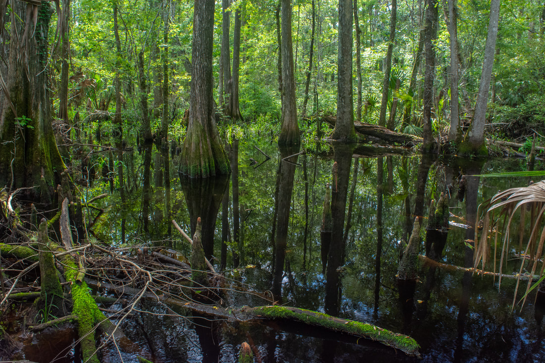
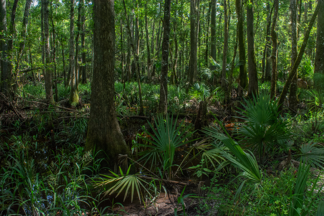
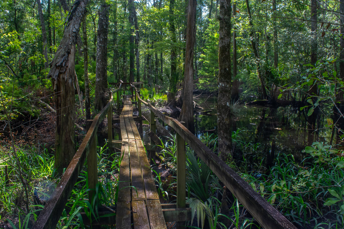
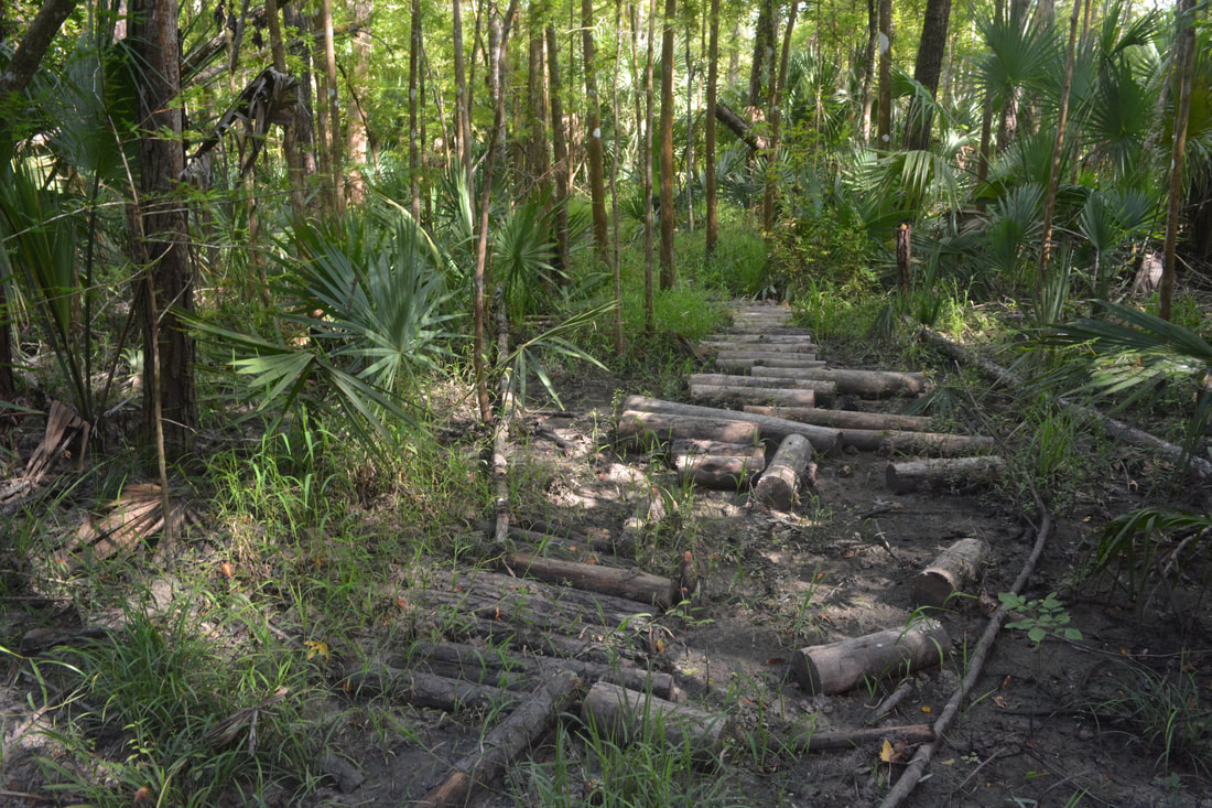
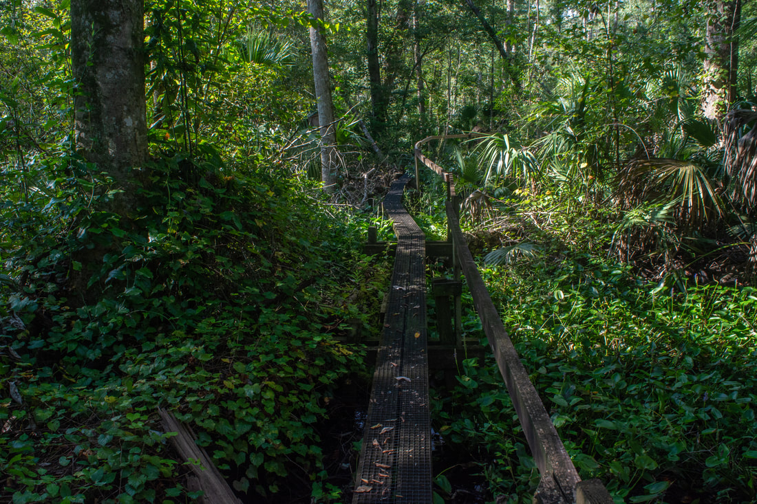
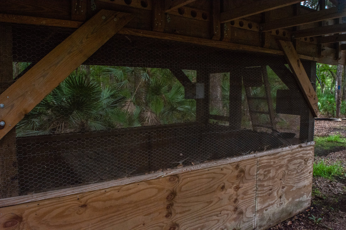
Boardwalks like this one immerse you into the lush jungle-like greenery of the Rice Creek Swamp section of the Florida Trail.
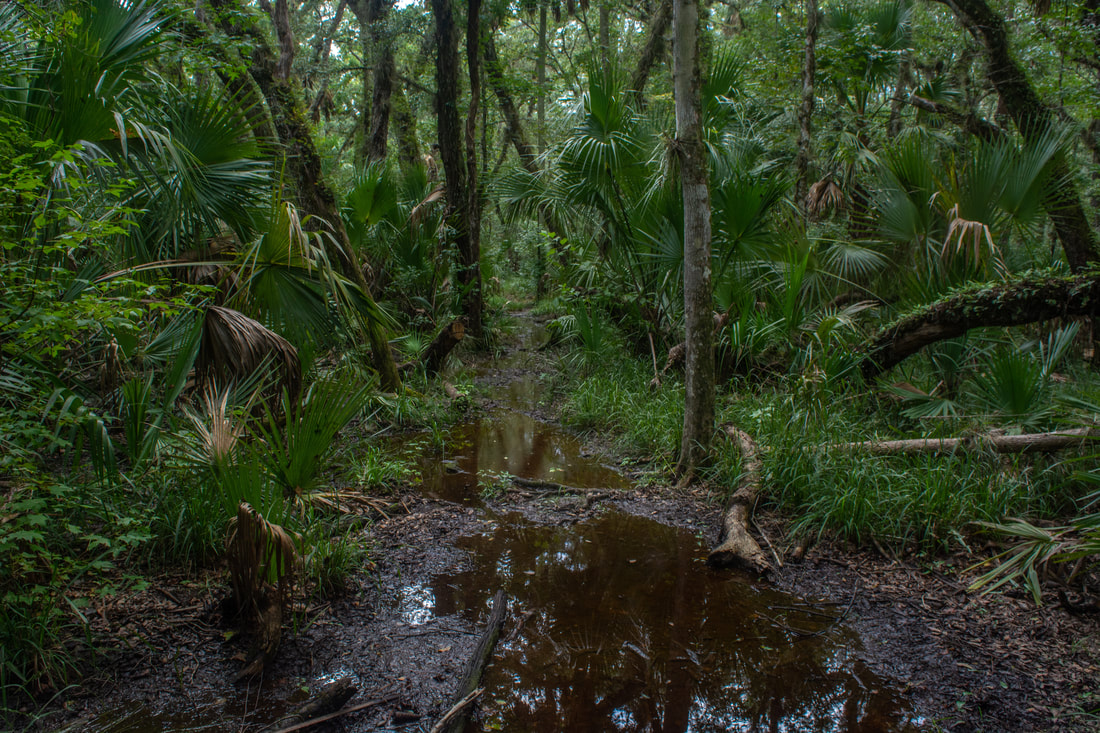
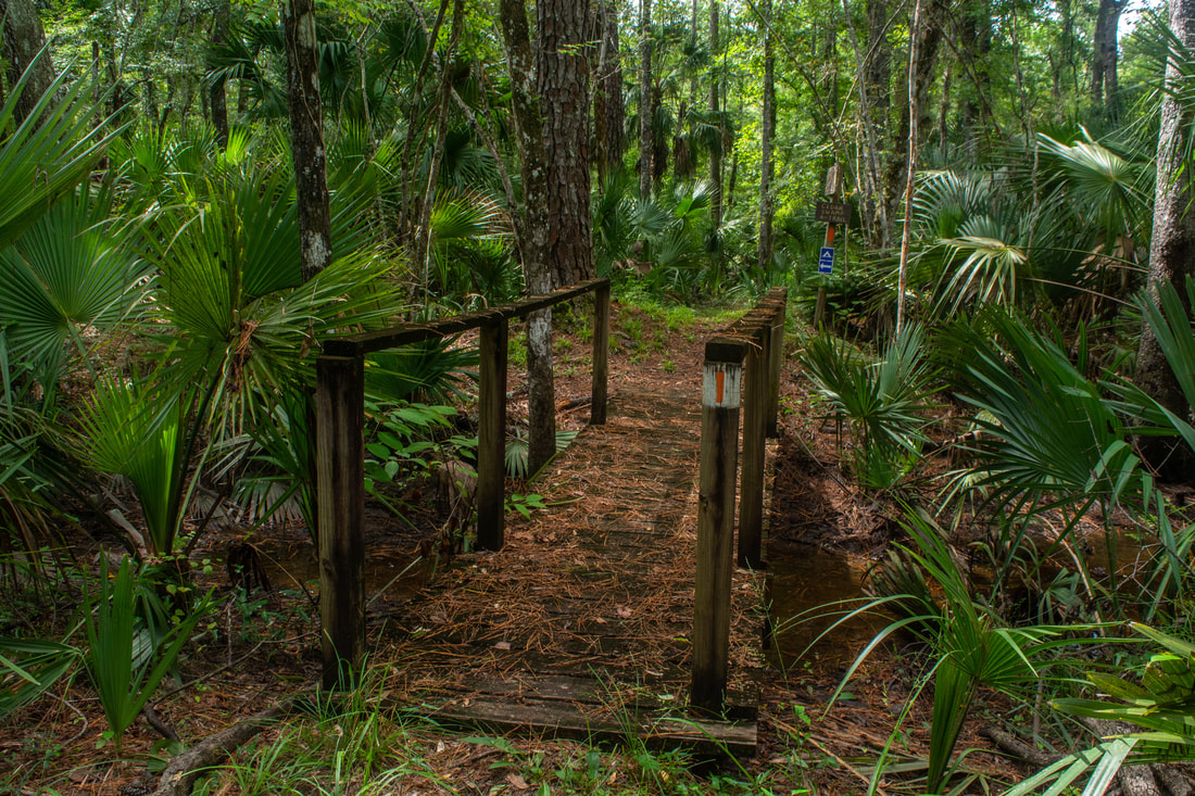
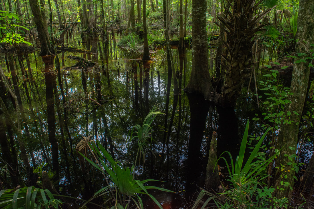
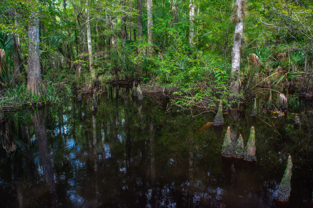
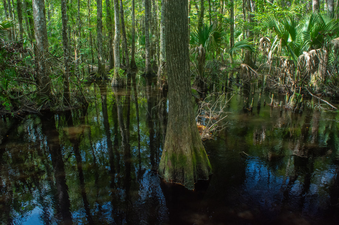
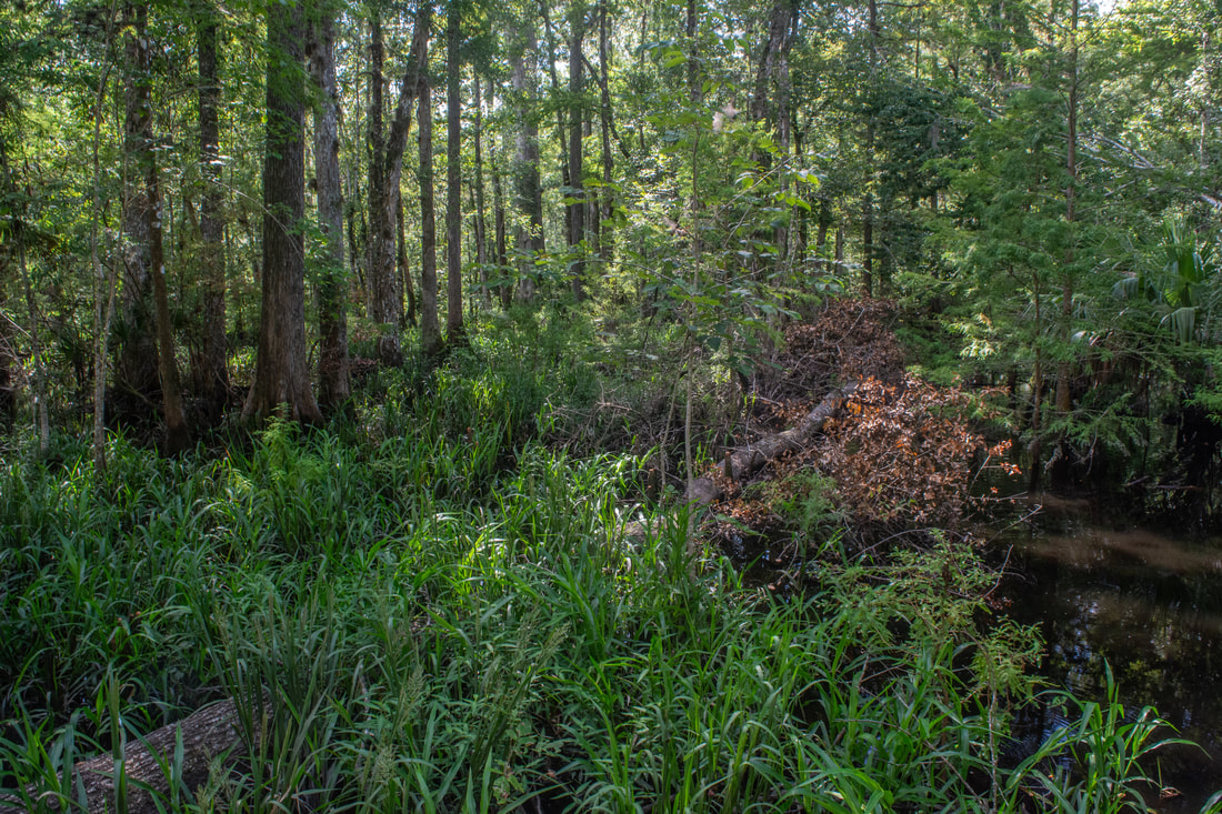
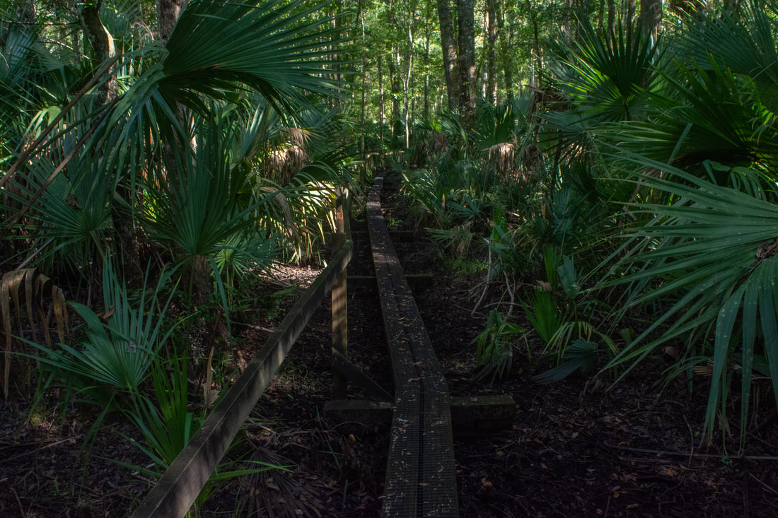
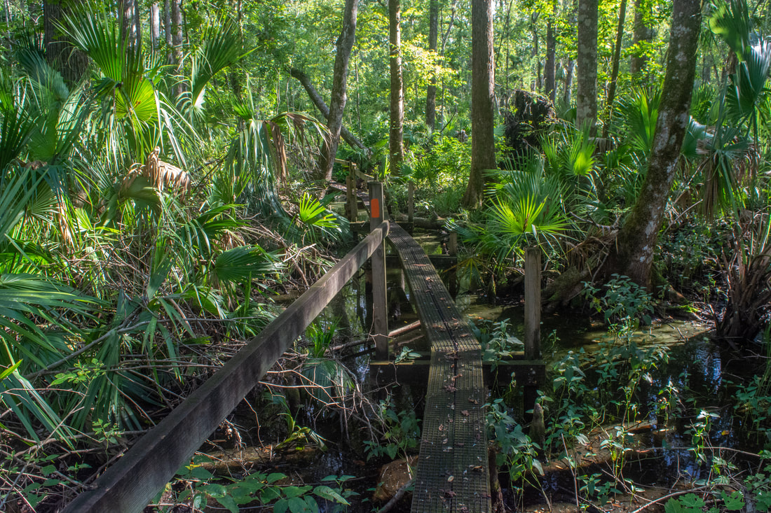
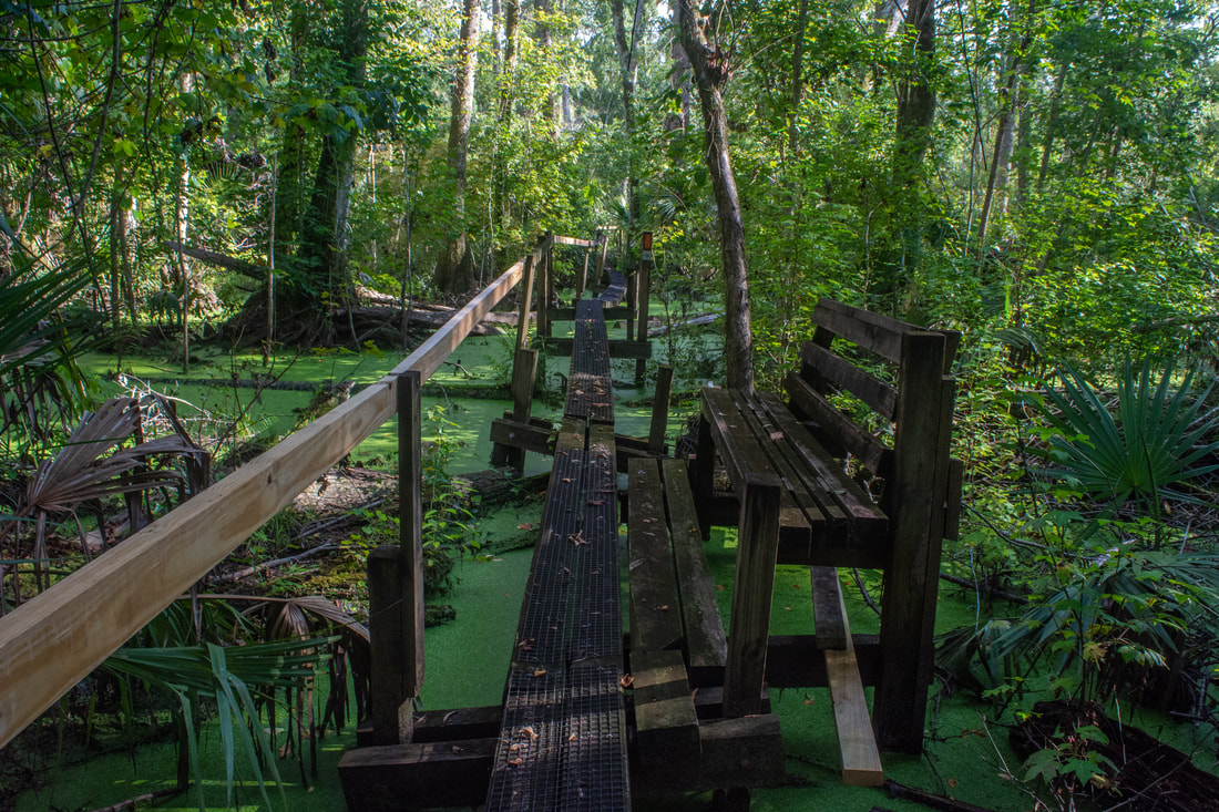
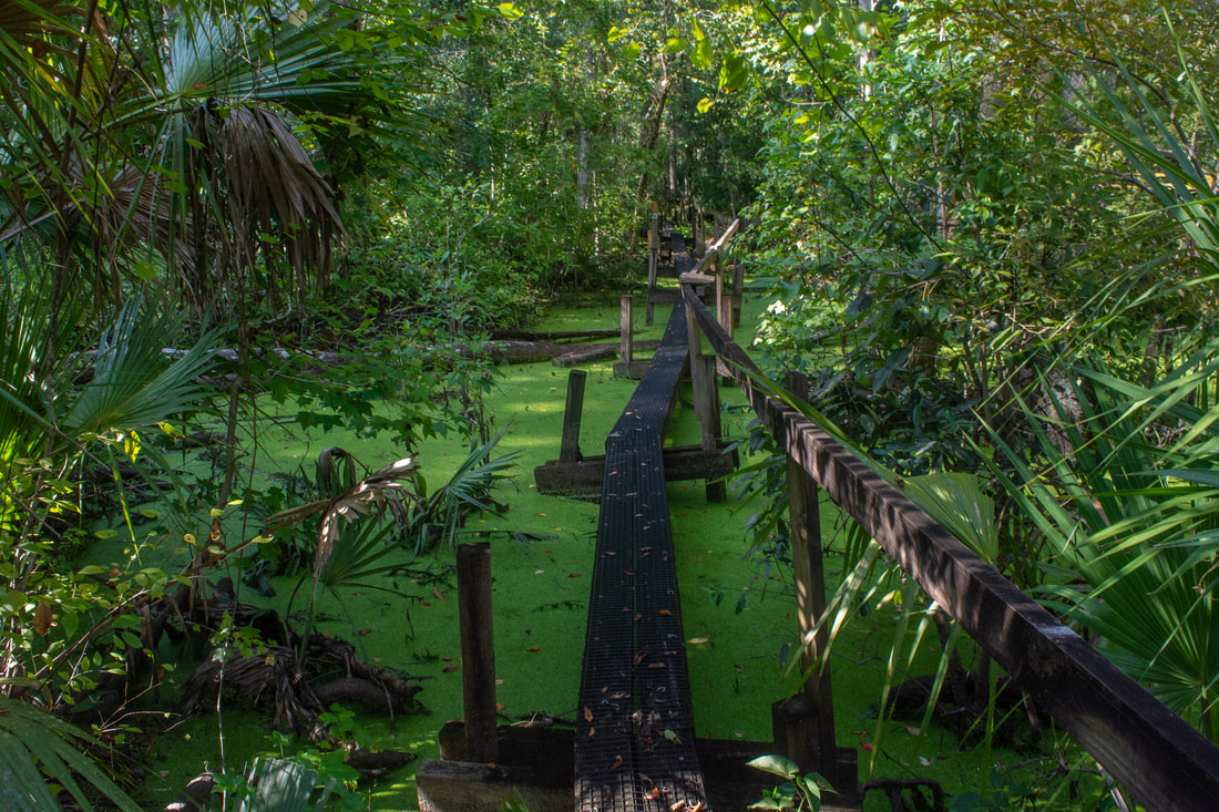
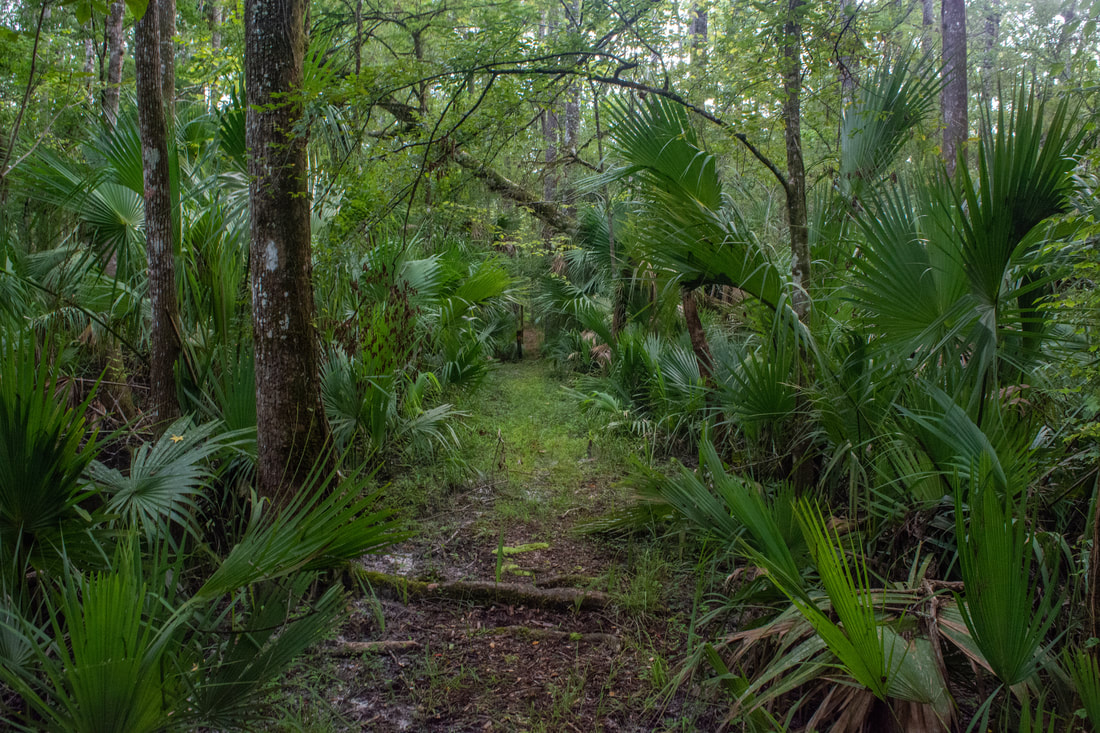
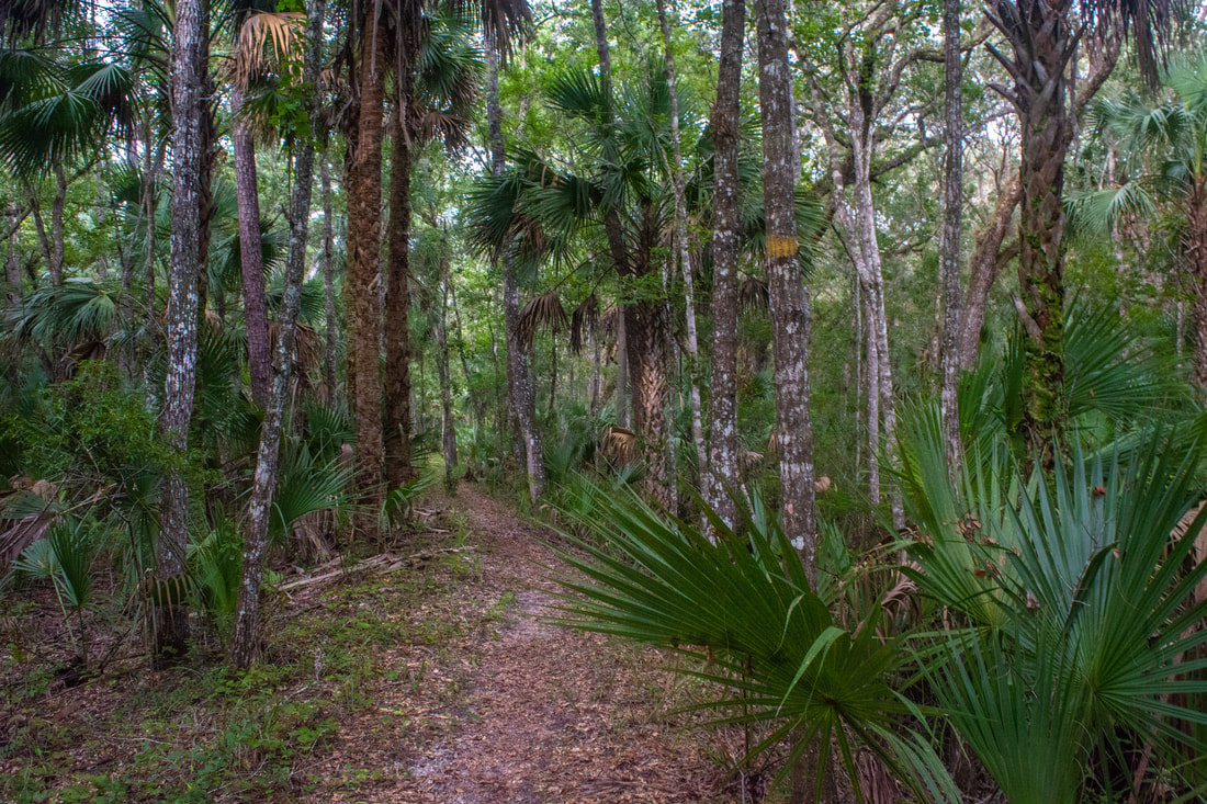
Around 1.7 miles, cross several boardwalks across areas of swamp and an elaborate wooden bridge over a slough. This is one of the most scenic spots on the hike you're engulfed well into the swamp, and aside from the elevated levee, there is very little dry ground in sight. Stately cypresses rise out of the mysterious, dark waters, and palms line their fringes. The trail turns abruptly west at 1.8 miles, entering a slightly drier section of the swamp. Still, there's always water within sight of the pathway. At 2.1 miles, the yellow-blazed Cedar Swamp Trail - a shortcut - leaves left. Continue straight, heading deeper into the old-growth section of the Rice Creek Swamp. The tight, single-track path twists between palm trunks and over roots as it navigates the narrow levee. You'll cross boardwalks after boardwalks of all shapes and sizes. Some are small bridges across seasonal streams draining the swamp, while others are lengthy two-plank walkways through the floodplain.
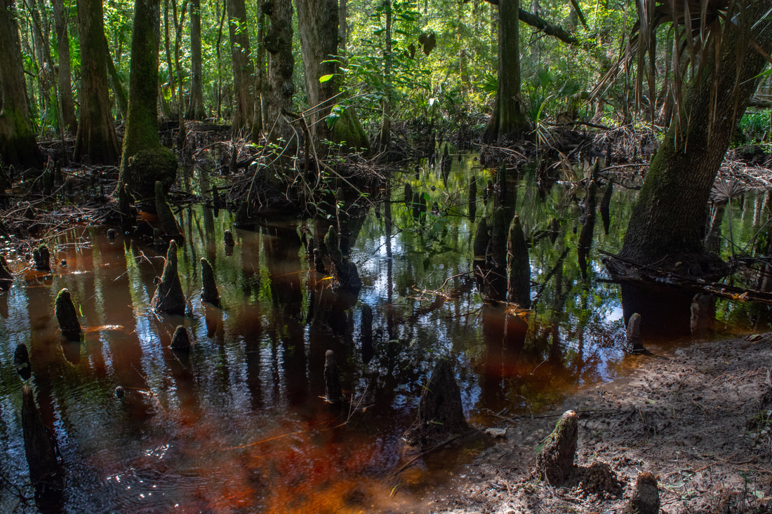
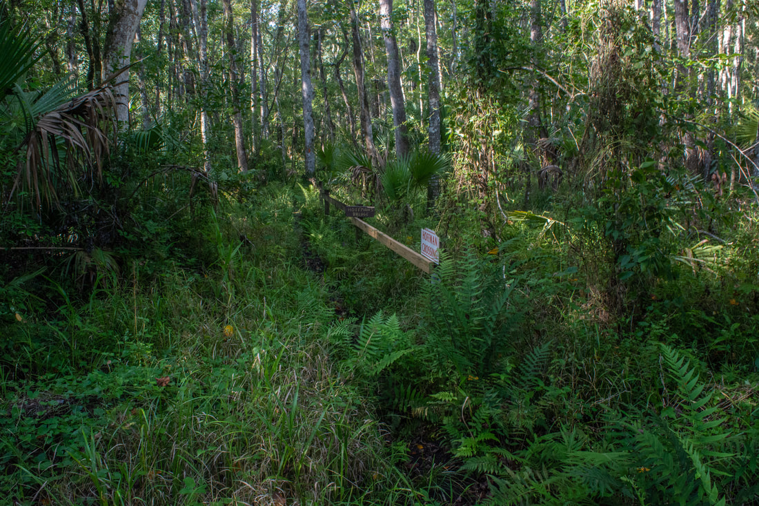
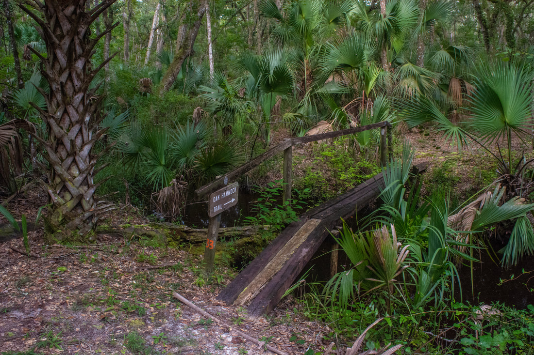
At 2.6 miles, a 150-foot side trail leaves right along a slim boardwalk with a beautiful V-shaped railing. Marked by a sign with a tree illustration, the side trail leads to an observation deck overlooking the seventh largest cypress tree in Florida. You can spot the tree in the distance if you look straight ahead from the deck, but only the lower part of the tree is visible. During the dry season, you might be able to walk closer to the tree. On this August day, however, the surroundings were solely swamp. The bench here is a great spot to take a short break and watch for gators, if you haven't seen any yet - that is, if the mosquitoes aren't too bothersome. The day I did this hike was sunny and even a bit breezy at times, so I didn't really have any trouble with mosquitoes. However, I have little doubt that there are times when the mosquitoes here are extreme; they got much worse as I was finishing out my hike about an hour before sunset under cloudy skies. Back on the main trail, the boardwalks continue. Shortly past the big cypress side trail, there's a scenic swamp on the right, peppered with cypress knees. Reach the far end of the Rice Creek Swamp Loop at 3.0 miles. The Florida Trail turns right toward Hoffman's Crossing and Highway 20, while the white-blazed Oak Hammock Trail continues straight in a northeasterly direction to close the loop. If you just continue following the loop, you'll end with a reasonable, scenic half-day hike. But if you're up to a longer hike, I highly recommend the side trip to Hoffman's Crossing. The swamp views there are among the best of the hike, and the boardwalk is an extremely impressive structural feat. 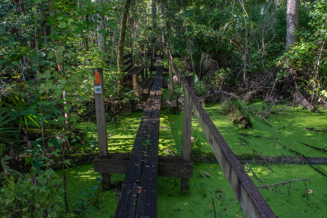
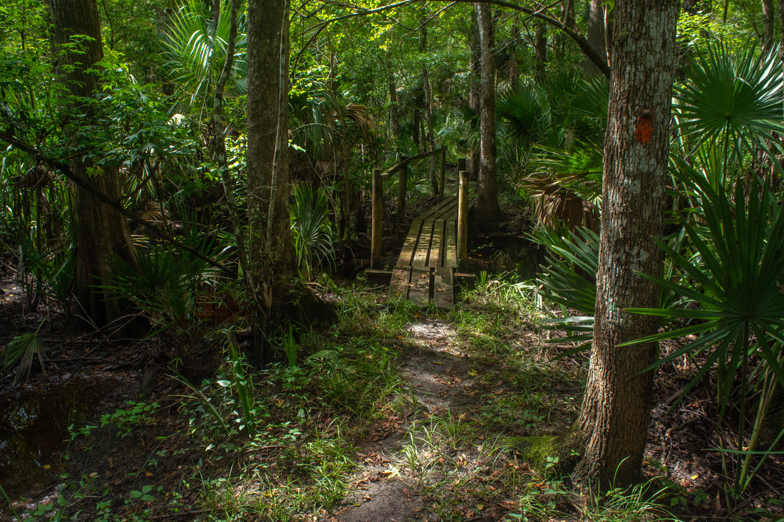
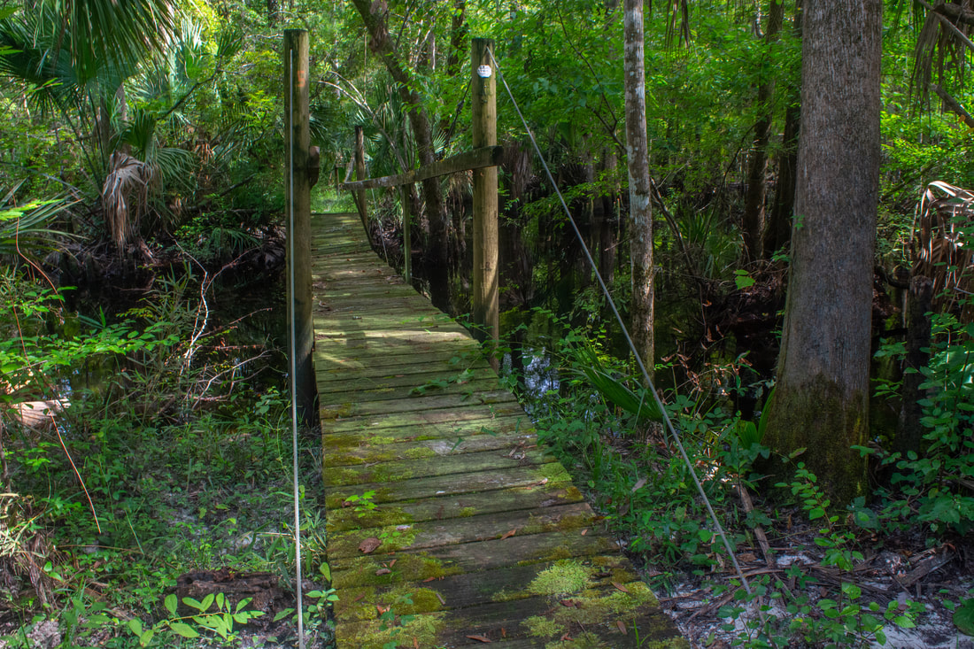
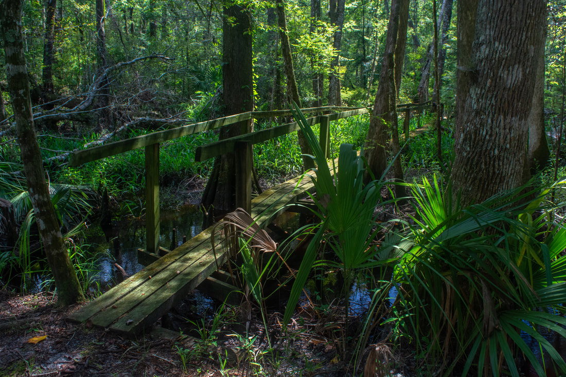
Nearly 0.4 miles long, the Hoffman's Crossing boardwalk that carries the Florida Trail over an arm of the Rice Creek Swamp is an extremely impressive structural feat.
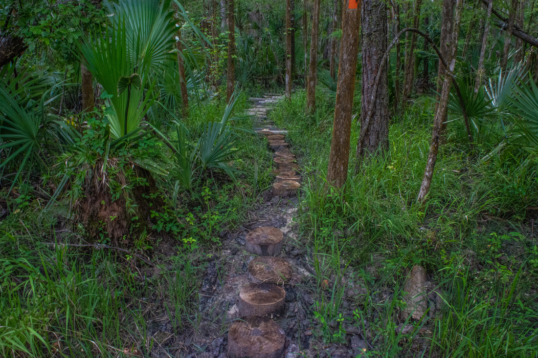
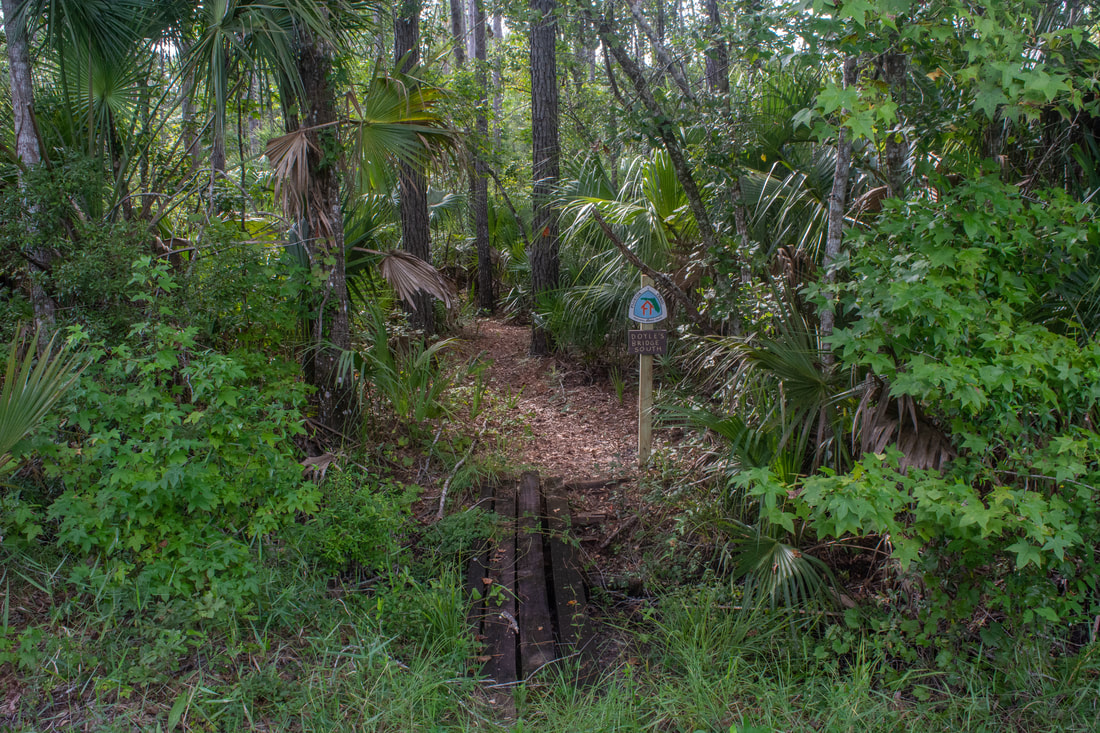
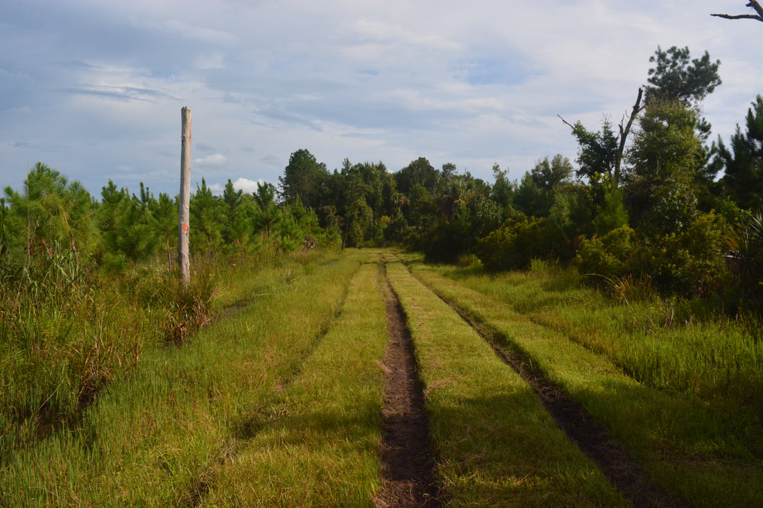
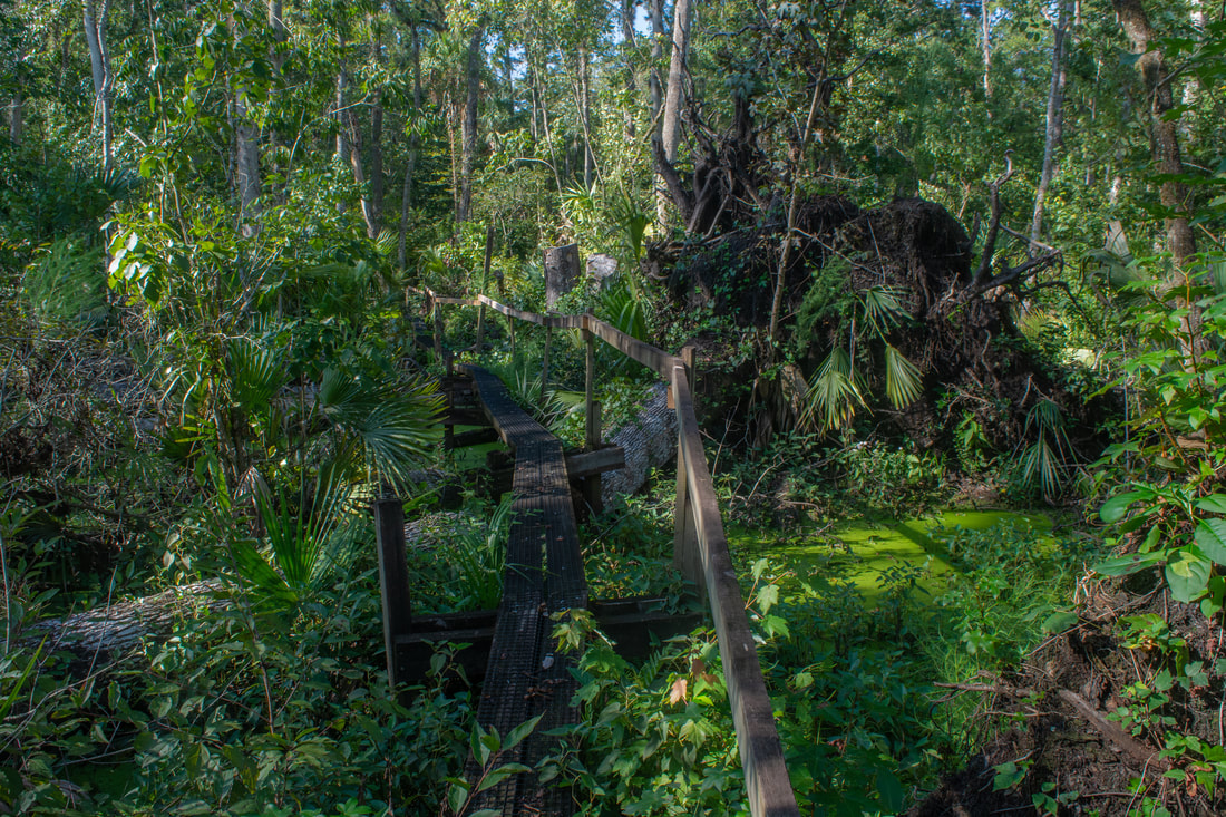
Following the Florida Trail southward from the loop junction, you'll reach a broad forest road in a few feet. Turn left on the elevated road, follow it about 200 feet, and then turn right, resuming your hike along a lovely, winding pathway. The woods here are dry and have more of an upland feel. At 3.2 miles, the trail passes through a muddy section, where an enormous collection of logs and stumps elevates the trail. That's one unique way to keep a trail dry! After this, the trail passes through a couple clearings that could be very overgrown if the trail hasn't been maintained recently. Crossing a tiny bridge signed as "Boyle's Bridge South", the Florida Trail reaches a four-way intersection with forest roads at 3.45 miles. Continue onto the grassy track straight ahead - the trail follows this shadeless road for the next half-mile. The road dead-ends around 4.0 miles; a single-track pathway resumes and dives back into the floodplain forest. The following trail section is the other place on this hike where you could very well get your feet wet during the rainy season. On my summertime hike, this area was extremely muddy and slightly wet in places. However, the woods, full of palms, are some of the most scenic on the hike.
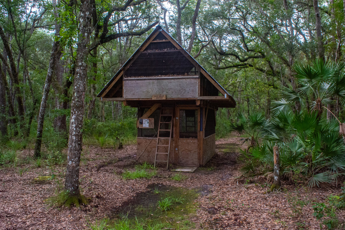
After winding along the edge of the swamp for surprisingly long, the trail makes an abrupt right turn and reaches the start of Hoffman's Crossing at 4.3 miles. This double-plank and single-rail boardwalk is 1,886 feet long (nearly 0.4 miles) and provides fantastic views of this remote, lush corner of the Rice Creek Swamp. The boardwalk honors Jake Hoffman, a Florida Trail Association volunteer, who identified the best route for the Florida Trail through the swamp and directed the project to build this incredible piece of boardwalk. As you walk the boardwalk, take a moment to think about all the effort that must've been put into its construction. As far as I know, there's no other boardwalk currently in existence in Florida that is so long and has such a rustic feel to it (if you know of one, please clue me in - I'd love to see it!). As you start down the boardwalk, the forest gradually transitions from a dry hammock to a moist floodplain forest. The boardwalk rises higher as the swamp's dark waters encapsulate it. A layer of duckweed at the swamp's surface lets the water appear green as you progress deeper into the swamp. At the boardwalk's halfway point, a single bench lets you rest and contemplate the pristine surroundings. This is the Real Florida for sure. The second half of the crossing is slightly less scenic, as there's lots of downfall from Hurricane Irma, but it's still a beautiful area. Finally, the boardwalk returns to the ground and penetrates into a wonderfully lush ferns and grass before coming to its end at about 4.65 miles. The end of Hoffman's Crossing is a good turnaround point for most day hikers. The Florida Trail continues for another two miles to Highway 20, but much of it follows forest roads and isn't very interesting. Retracing your steps along the boardwalk, you'll have a chance to get another good look at this wild (yet accessible) swamp. You'll return to the loop section and the Oak Hammock Trail at 6.3 miles. Turn right onto the Oak Hammock Trail to continue the loop. This trail is much drier than the rest of the hike, passing through primarily uplands. Initially, the trail follows a palmetto-lined levee alongside an old ditch. But at 6.7 miles, the trail makes a signed right turn, crosses the ditch, and enters the gorgeous live oak hammock that the trail is named for. At 6.75 miles, a short side trail leaves right to a two-story Florida Trail shelter christened the "Rice Creek Hilton". The shelter and adjacent campsite are in a very nice spot in the midst of the hammock, complete with a water pump. The shelter is protected by two sets of netting to keep out bears and biting insects. A ladder leads to a trapdoor entrance to the second floor, which is the sleeping area. The first floor has a picnic table. 
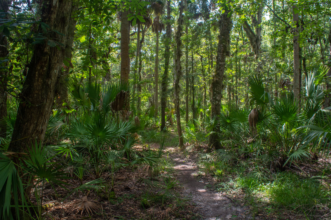
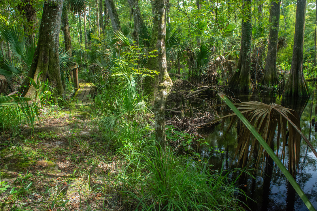
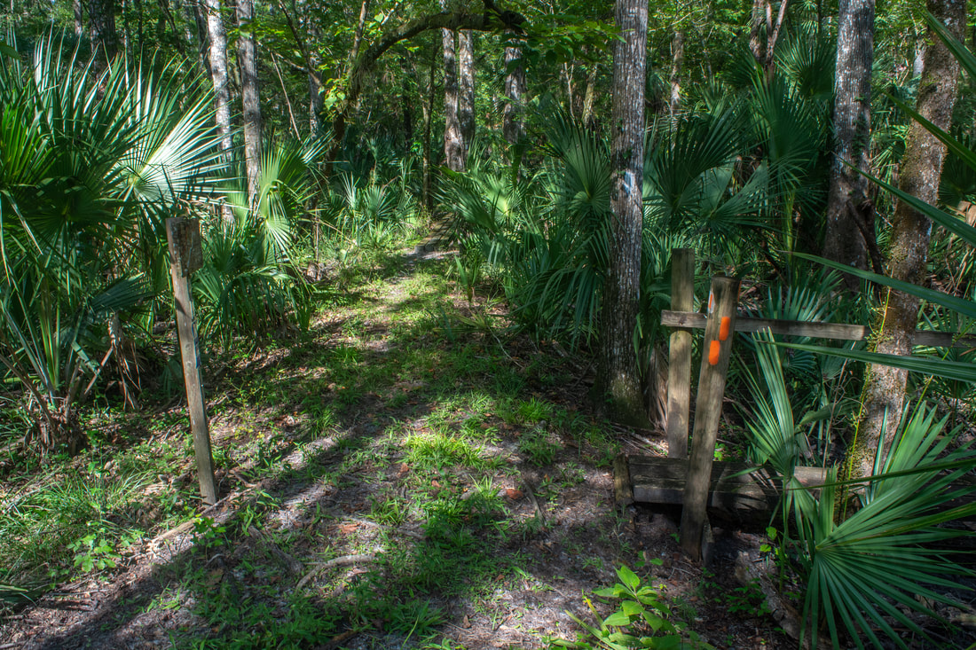
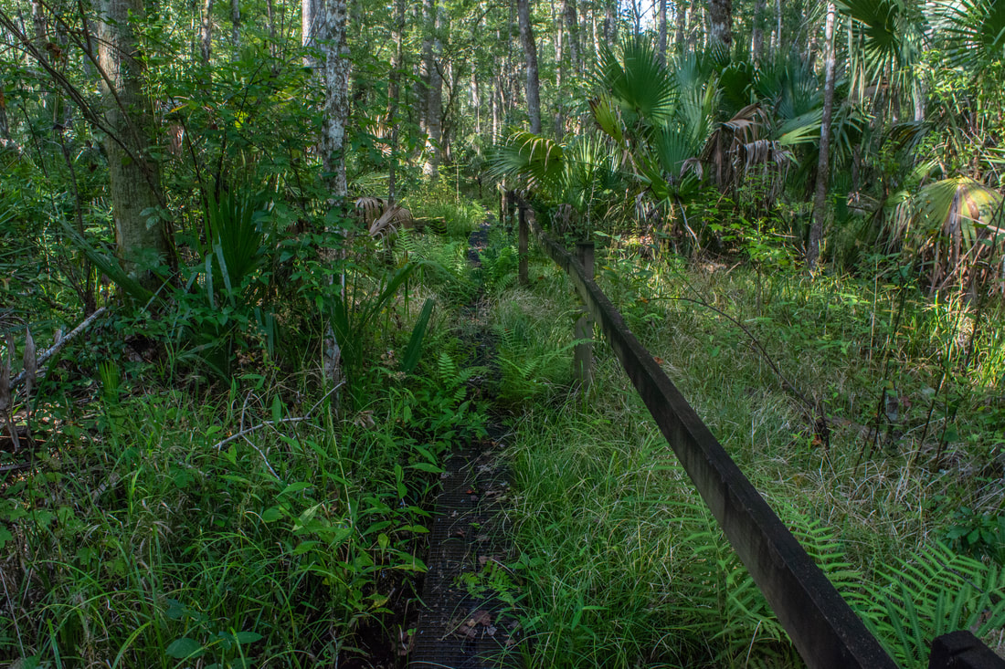
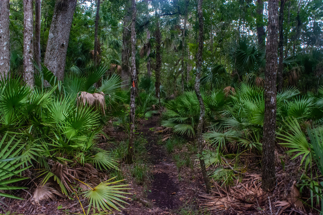
The Oak Hammock Trail passes through pleasant, dry uplands on the fringes of the Rice Creek Swamp.
The Florida Trail meanders through the oak hammock for a little while before emerging into a patch of pine flatwoods at 7.05 miles, where it briefly meets the horse trail. Turn left and join the forest road for a few feet - the trail shortly turns left again. Re-cross the earlier ditch and reach a T-junction with the other end of the Cedar Swamp Cross-Trail. Turn right to stay on the Oak Hammock Trail. The trail returns to the Florida Trail at 7.2 miles, closing the loop. It's a matter of retracing your earlier steps from here. Stay right on the Florida Trail back toward Highway 100, now on familiar ground. Be sure to turn right at the junction with the blue-blazed access trail three-quarters of a mile from the parking area. You'll return to the trailhead at 8.8 miles, concluding the hike.
To summarize, the Rice Creek Swamp hike is an old Florida classic that I'd highly recommend to everyone. This is some of the best swamp scenery you'll get anywhere in the state without immersing yourself into a full-blown swamp slog. Plus, the numerous are boardwalks are fun to hike, and wildlife sightings are a good possibility. This is a hike that all Florida nature lovers will enjoy. And photographers too, assuming you don't come in the middle of a harsh, sunny day like I did. Mileage
0.0 - Rice Creek Conservation Area Trailhead off Highway 100
0.75 - Florida Trail 1.6 - Begin Rice Creek Swamp Loop 2.6 - Big Cypress 3.0 - Junction Oak Hammock Trail 4.3 - Begin Hoffman's Crossing 4.65 - End Hoffman's Crossing 6.3 - Return to Oak Hammock Trail Junction 6.75 - "Rice Creek Hilton" Florida Trail Shelter 7.2 - End Rice Creek Swamp Loop 8.8 - Rice Creek Conservation Area Trailhead off Highway 100 Variations
Exclude Hoffman's Crossing from the hike - 5.5 Miles
Bonus Stops
A few miles to the southeast inside the Palatka city limits is Ravine Gardens State Park. It has several miles of surprisingly interesting trails through a fine sample of one of Florida's rarer natural ecosystems: the steephead ravine.
Pictures & Videos
2 Comments
2/28/2022 11:39:15 am
I am looking forward to hiking this trail. I am free lance photographer-wildlife and landscape photography. I have to spot an eagle and hopefully wil see one on my visit. Thanks for the elaborate and thorough review of the area. Any hiking groups you would recommend will be appreciated.
Allen
3/29/2022 09:07:13 pm
For anyone hiking this trail, be ready for what to do if you encounter a gator on the trail. There appears to be a female that has a nest in the area near the start of the loop. I'm assuming that since a year olds - 3 year olds were hanging out together. I would assume mother is around since they stay w/ mom the first few years. So enjoy watching them but be mindful ol mom. Leave a Reply. |
About MeMark Oleg Ozboyd Dear readers: I have invested a tremendous amount of time and effort in this website and the Georgia Waterfalls Database the past five years. All of the work that has gone in keeping these websites updated with my latest trip reports has almost been like a full-time job. This has not allowed me to pick up a paid job to save up money for college, and therefore, I I've had to take out loans. If you find the information on this website interesting, helpful, or time-saving, you can say "thanks" and help me out by clicking the button above and making a contribution. I will be very grateful for any amount of support you give, as all of it will apply toward my college tuition. Thank you!

Coming in 2022-2023?
Other Hiking WebsitesMiles HikedYear 1: 540.0 Miles
Year 2: 552.3 Miles Year 3: 518.4 Miles Year 4: 482.4 Miles Year 5: 259.9 Miles Archives
March 2021
Categories
All
|
||


 RSS Feed