
Just northeast of St. Augustine is a unique sliver of land stretching out between two estuarine bodies of water: the Tolomato River and the Guana River. The southern tip of the peninsula is occupied by the Guana Tolomato Matanzas (GTM) National Research Reserve, while the rest of it is protected by state-owned Guana River WMA. These two public land tracts are interconnected, both featuring an abundance of hiking trails surprisingly known little outside of the local community. The GTM Reserve trail system explores fairly dense woods with primarily oaks and pines, occasionally passing views of the Tolomato River. The character of the Guana River WMA trail system is vastly different. The west side of the WMA is uninteresting pine flatwoods, but it has a significant highlight: the Capo Creek observation tower. This tower provides breathtaking views of salt marshes along Capo Creek - a tidal creek feeding into the Tolomato River. The east side of the WMA features scenic hammocks along the shoreline of Guana Lake/River. The views from the Guana Lake observation tower don't quite match those of the Capo tower, but they're quite scenic as well. Regardless of whether visitors explore GTM Reserve, Guana River WMA, or both, they're likely to have a well-rounded hike with several scenic stops. This hike occurred on Saturday, August 18th, 2018. My plan was to hike a loop with the Purple Trail, Red Trail, and Blue Trail in GTM Reserve, followed by a loop to Capo Tower and Lake Tower in Guana River WMA.
Summary
R/T Length of Trail: 17.8 Miles
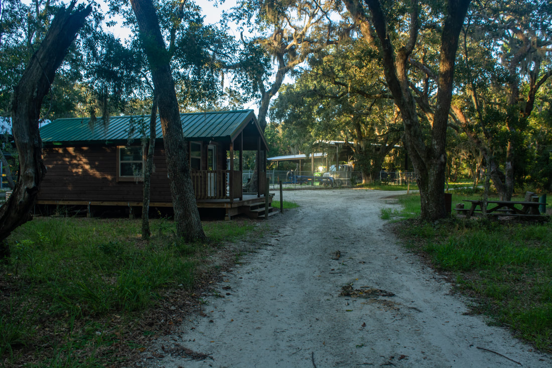
Duration of Hike: 7:00 plus 2 hours and 40 minutes of stopping and photography Type of Hike: Loop Difficulty Rating: 7 out of 10 Pros: Unique and outstanding views of salt marshes and coastal environs Cons: Portions of the hike follow boring trails, especially through the west side of Guana River WMA Points of Interest: South Point (south end of peninsula); Shell Point; Big Savannah Pond; Capo Tower; Lake Tower; Booths Pond Trail Blaze Colors: Trails are color coded in the GTM Reserve; trails aren't blazed in Guana River WMA but they are easy to follow Best Seasons to Hike: Winter Fees: GTM Reserve has a $3 day use fee at Guana River Dam Beginning Point: Guana River Dam Trailhead Directions from St. Augustine, FL: From the intersection of San Marco Avenue (US 1 Business) and Vilano Causeway (FL A1A North) just north of downtown St. Augustine, follow Vilano Causeway/A1A North for 1.8 miles. Then, in Vilano Beach, turn left onto Coastal Highway to stay on FL A1A North. In another 7.5 miles, turn left onto Guana River Road. Follow Guana River Road 0.5 miles to the trailhead at the far end of the dam. Be sure to park in the very last lot. Map
Click the link below to download a .GPX file with a track of this hike.
Details
Coastal trails have constituted some of my favorite hikes in Florida. These trails typically feature scenery unique to the Florida coastline. This is true of the trails in Guana River WMA & GTM Reserve, which are seldom more than a mile away from the Atlantic Ocean. The Capo Creek observation tower along the Savannah Loop features one of the best elevated tower views I've seen in Florida, featuring a colorful expanse of lush salt marshes and winding tidal creeks. And even though the woods the trails pass through are ordinary, you'll find an assortment of other interesting water views throughout the hike. Most people won't do this as a day hike, so I suggest focusing on either GTM Reserve or Guana River WMA for your hike. GTM Reserve has the more attractive trails, whereas Guana River WMA has the more spectacular views from its two observation towers. Biking this loop is also a reasonable choice - the more monotonous miles between the views will go by faster. Parts of the west side of the trail system in Guana River WMA aren't great for biking due to uneven ground, however.
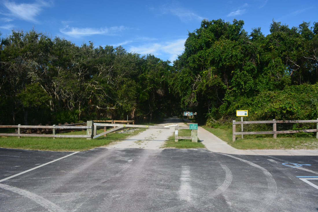
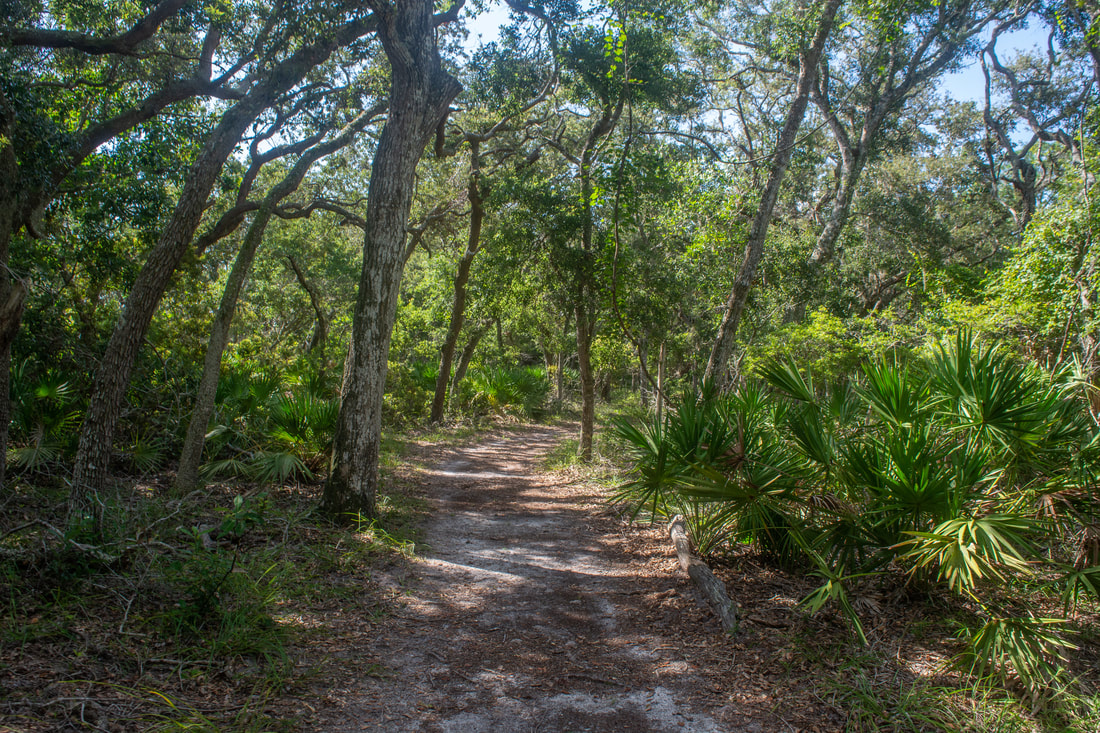
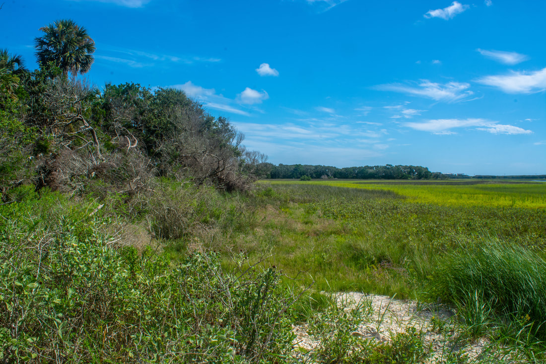
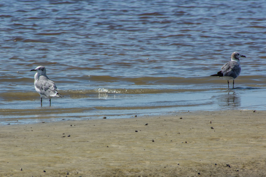
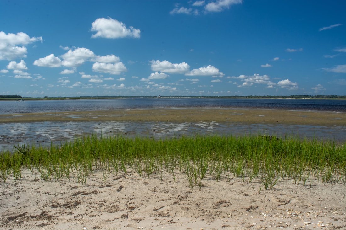
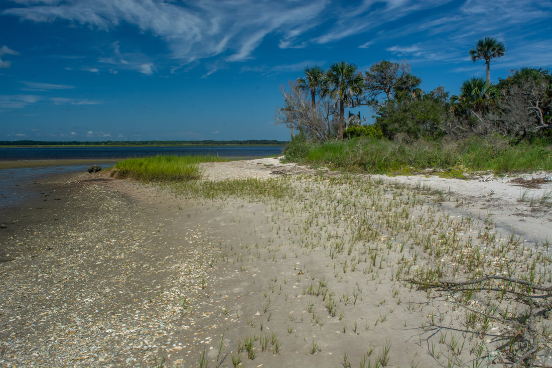
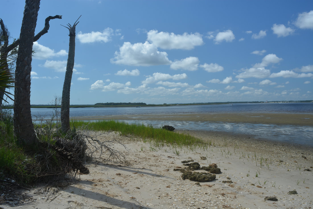
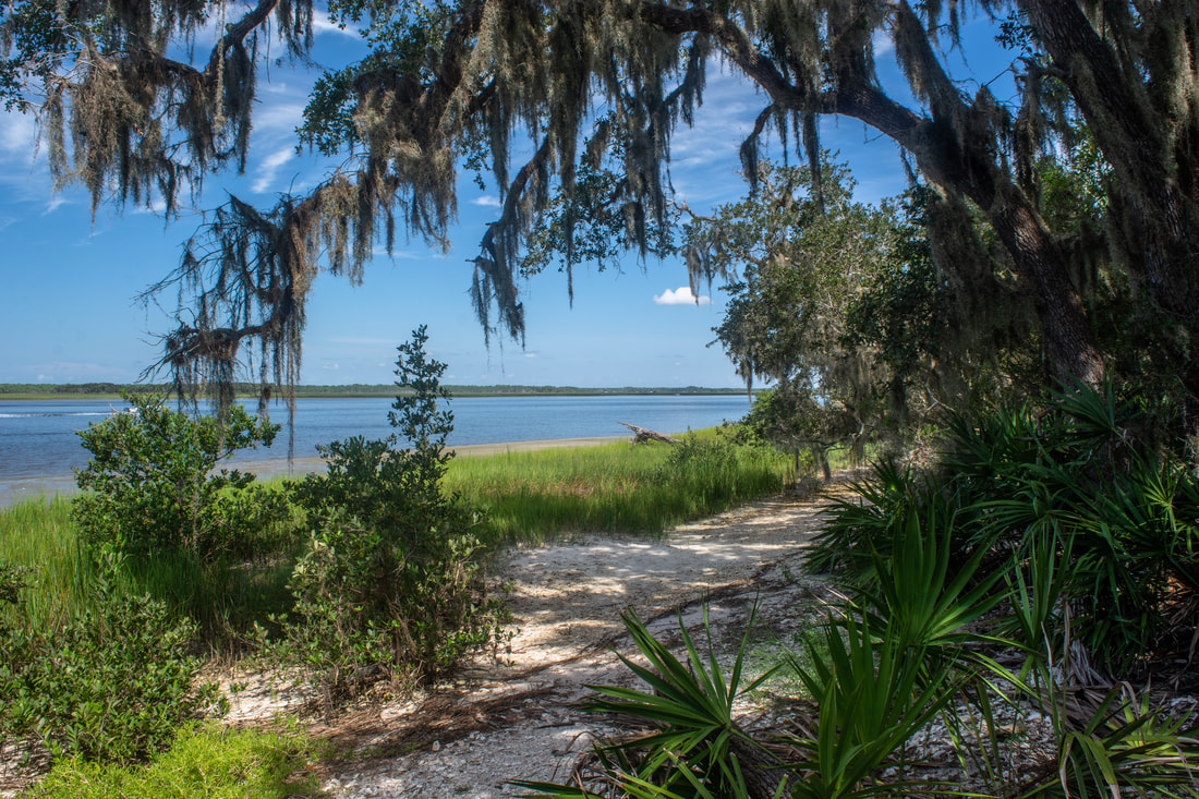
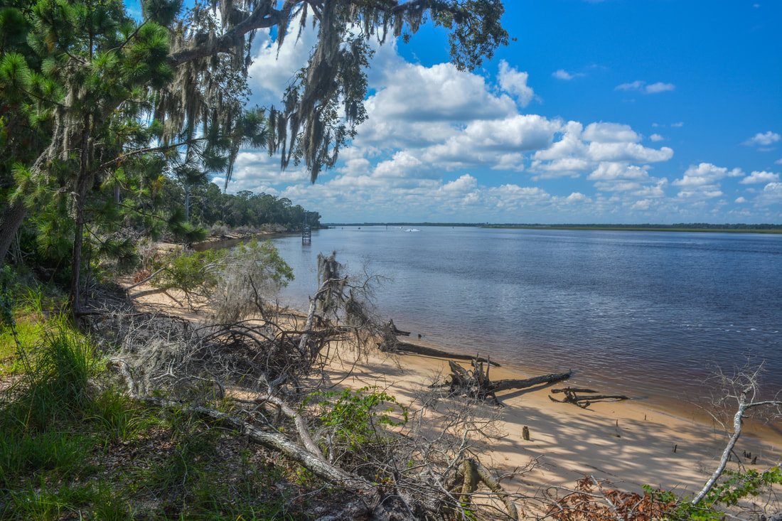
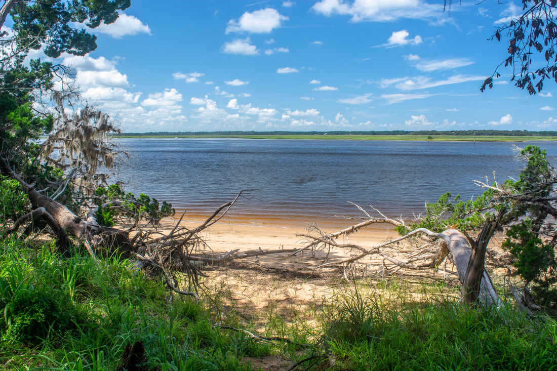
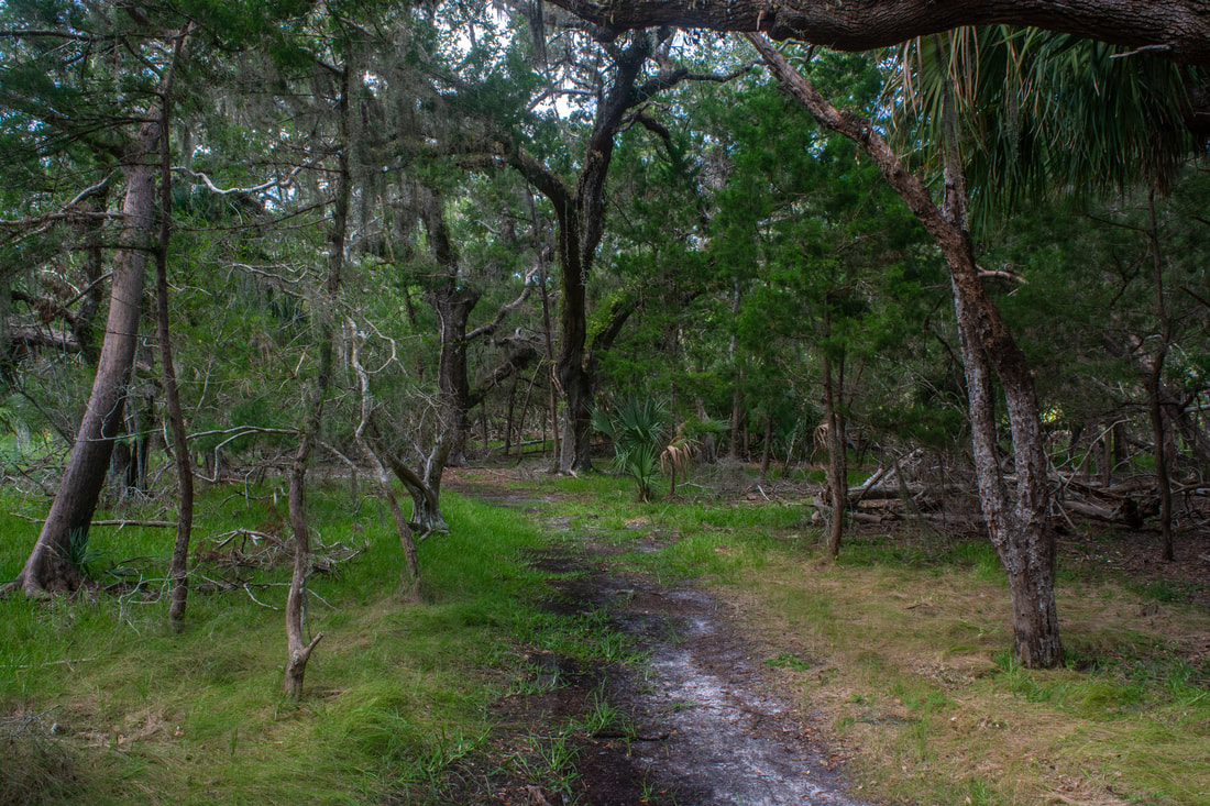
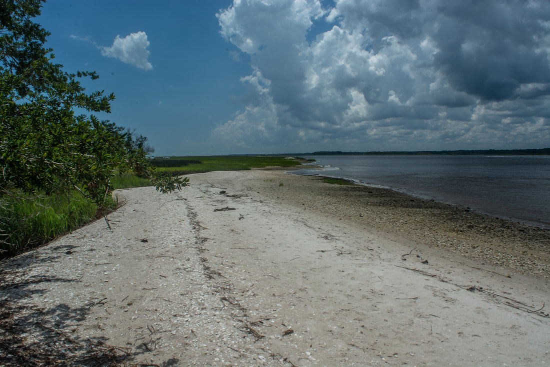
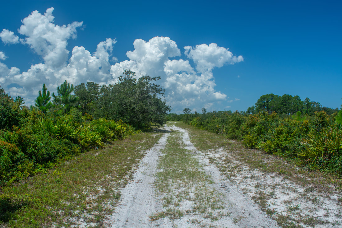
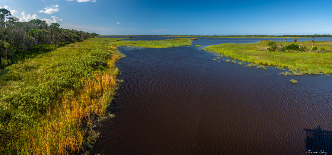
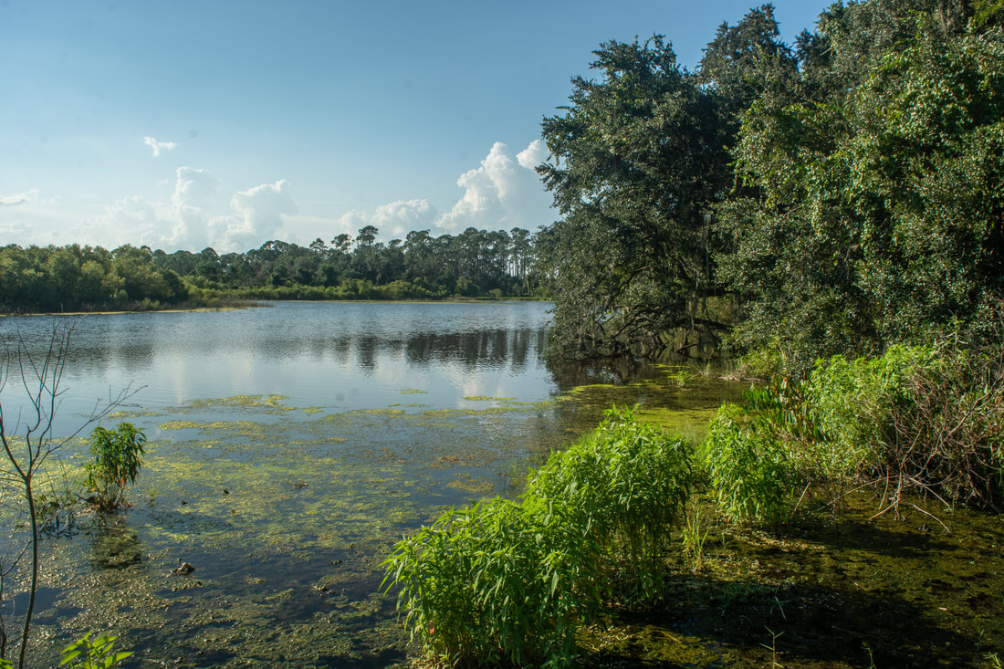
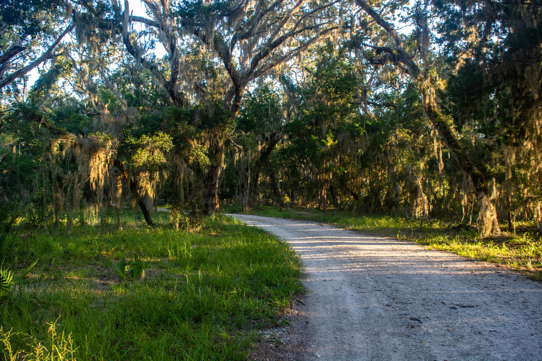
The hike begins in GTM Reserve along a broad shell road behind the wooden gate. Passing a kiosk where you can grab a trail map, reach a four-way junction where the loop starts at 0.15 miles. The Yellow Trail continues straight ahead, reaching Shell Point in a mile. That's the shortest route to Shell Point and the most popular trail in the reserve. The Orange Trail leaves right along the main road, heading toward the WMA boundary. That's your return route. This hike turns left on the Blue Trail, which leads south toward the tip of the peninsula (I informally refer to this spot as "South Point"). Like all trails along this hike, the Purple Trail is double-track and easy to follow. The woods are pretty scenic, featuring a palmetto understory with scattered live oaks. At 1.6 miles, the Purple Trail reaches the Red Trail. The Blue Trail turns right and acts a cross-trail. This hike bears left on the Red Trail toward the south end. I've read that near the junction are remains of the first Spanish mission in the New World, La Natividad de Nuestra Senora de Tolomato, but I wasn't able to locate the ruins. The character of the woods remains similar, and you'll start getting some views of the Guana River as the Red Trail draws closer to it. Reach a T-junction at 3.0 miles. The Red Trail turns right to follow the Tolomato River side of the peninsula. You'll get there soon, but in the meantime, be sure to take the side trail on the left to "South Point". The trail passes through a cedar-lined corridor and reaches a picnic table; keep walking out to the shoreline, reaching the tip of the peninsula at 3.2 miles. The exposed sandy beach has expansive views of both the Tolomato River and Guana River. The shoreline isn't the most scenic, as it doesn't have many palm trees, but it's still nice. This is also a great spot for birding. The only real drawback is the development visible on nearby shores. Also, motorboats and jet skis are likely to keep the area busy on weekends. 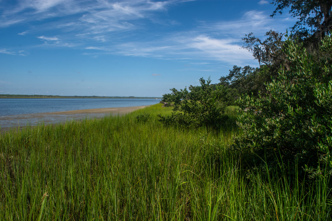
The south end of GTM Reserve features expansive views of the Tolomato River.
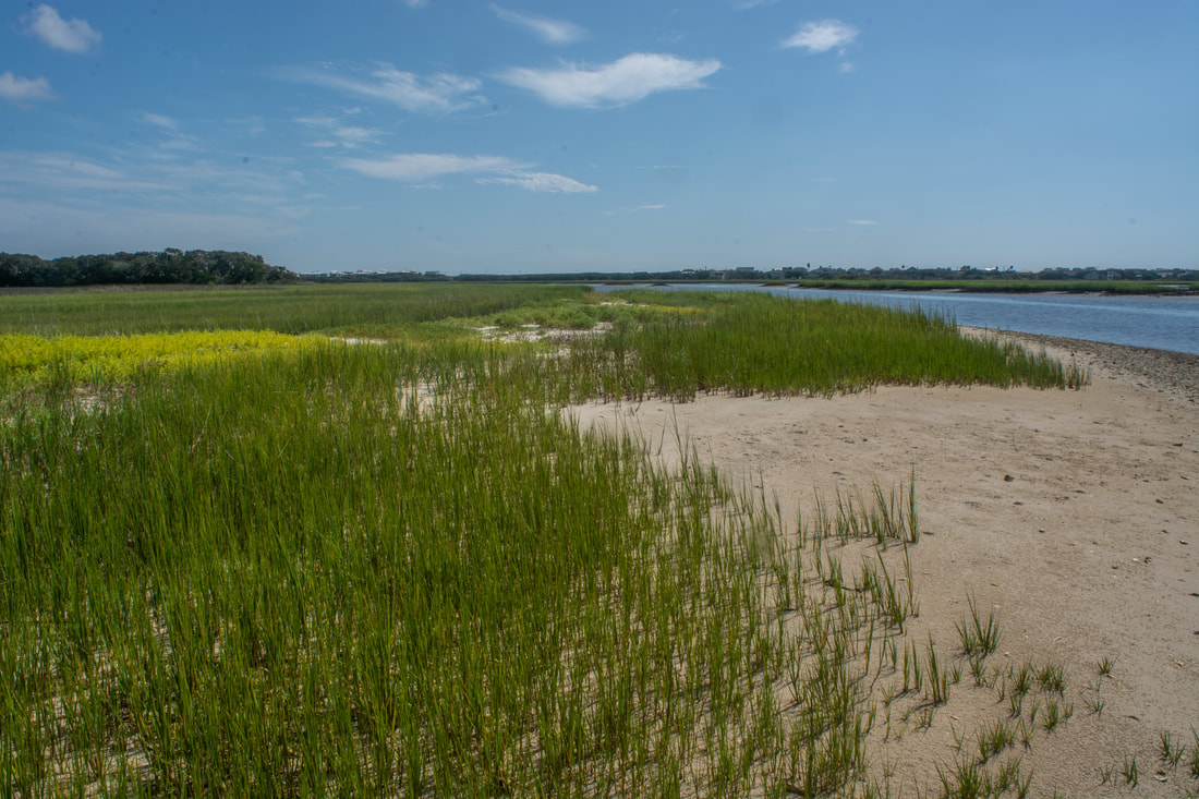
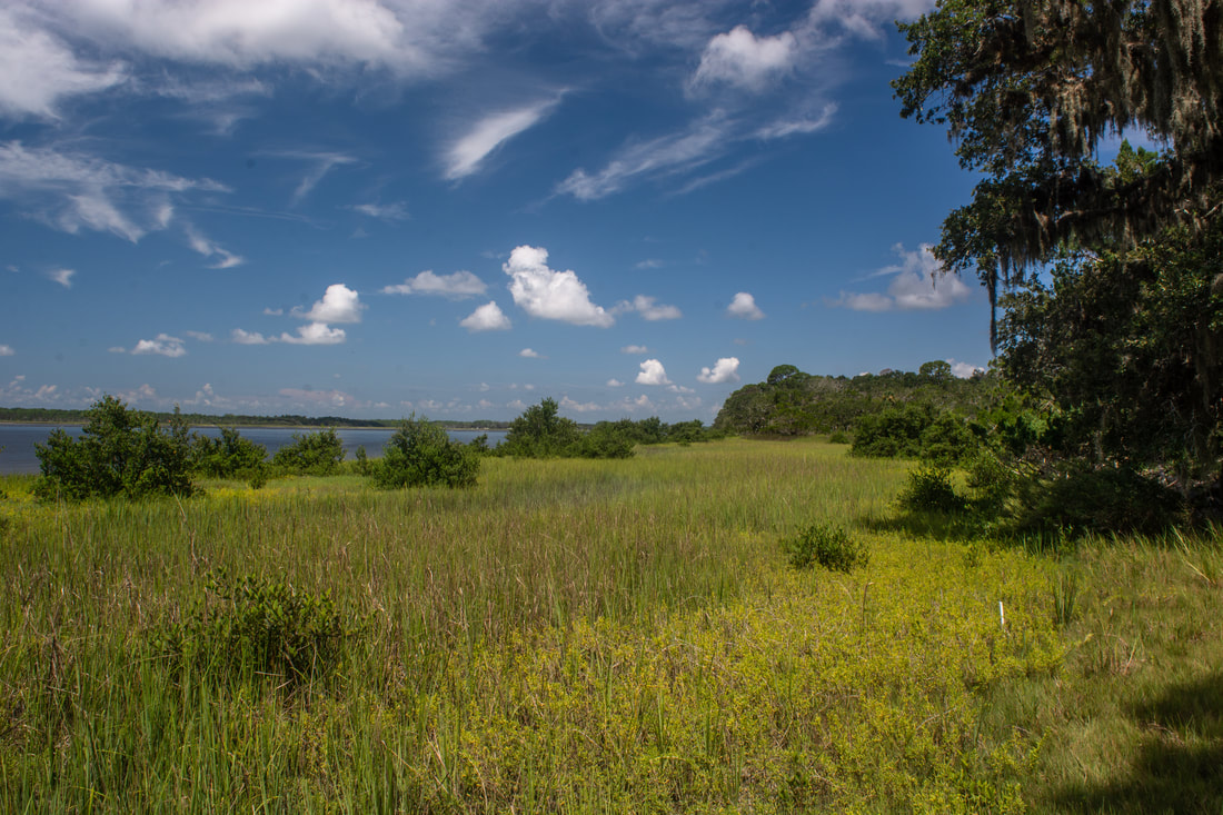
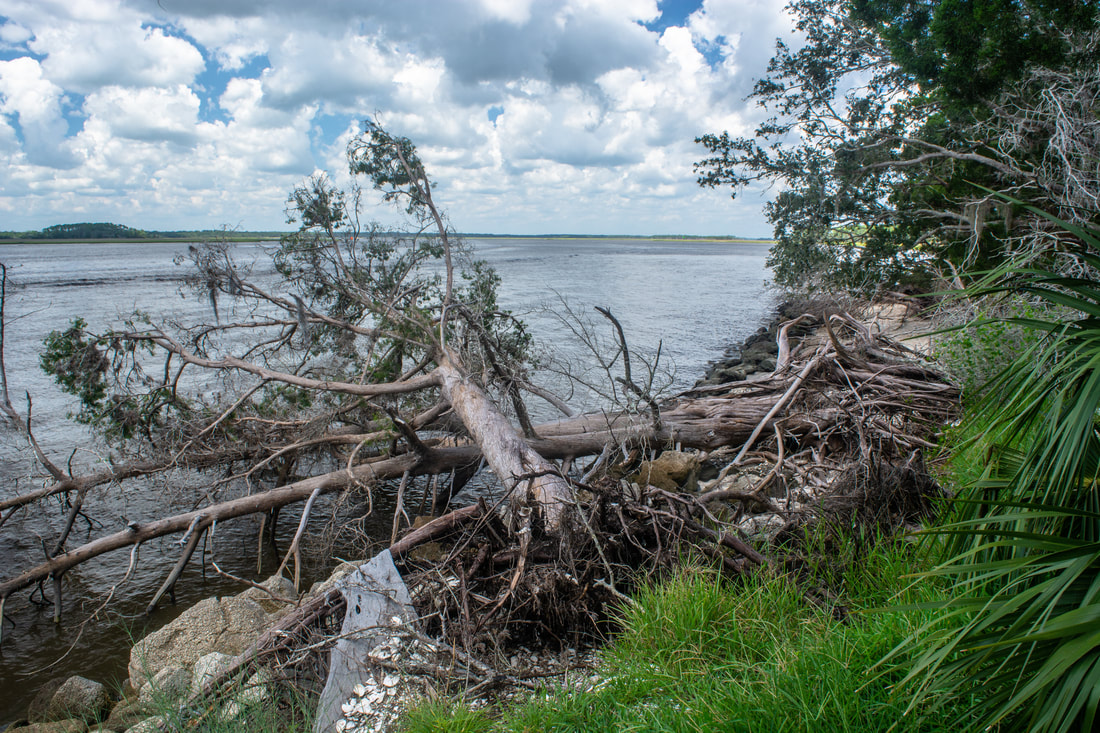
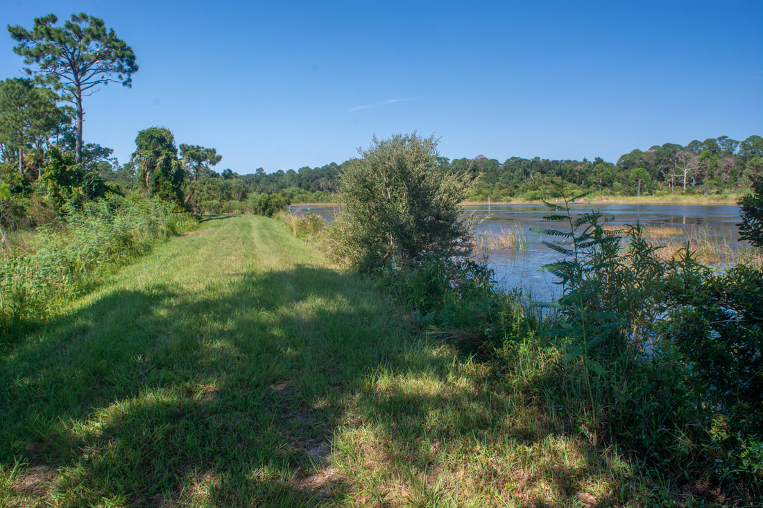
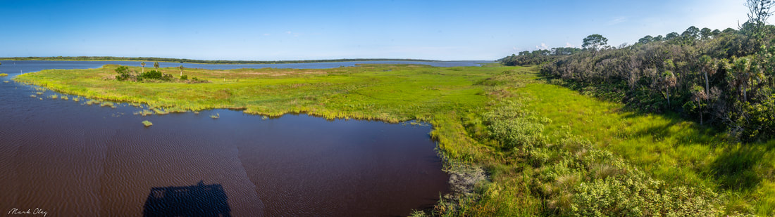
Return to the Red Trail and begin tracing it up the west side of the peninsula. This section of the trail closely follows the shoreline and features frequent views across the Tolomato River. Interestingly, even though it's called a river, this is really just a brackish bay that joins the Atlantic Ocean at St. Augustine Inlet a few miles to the south. The views are pretty but nothing spectacular. The shoreline primarily consists of grassy marsh areas and eroded sandy bluffs with cedars and pines growing atop. Pass a stretch of continuous, open views at 4.5 miles. The Red Trail ends at the other end of the cross-trail at 4.65 miles; stay left on the Purple Trail. A few yards ahead is a 200-foot side path to more Tolomato River views. These are the last of the views until Shell Point, however, as the Purple Trail bears inland into less scenic woods with an increasing pine spread. The Purple Trail terminates at the Yellow Trail at 5.9 miles. To the right along the Yellow Trail, it's only 0.6 miles to the parking area. This hike turns left toward Shell Point though. At 6.1 miles, your route to Guana River WMA - the Blue Trail - leaves right, but for now, keep heading straight. Reach Shell Point and its expansive views at 6.4 miles.
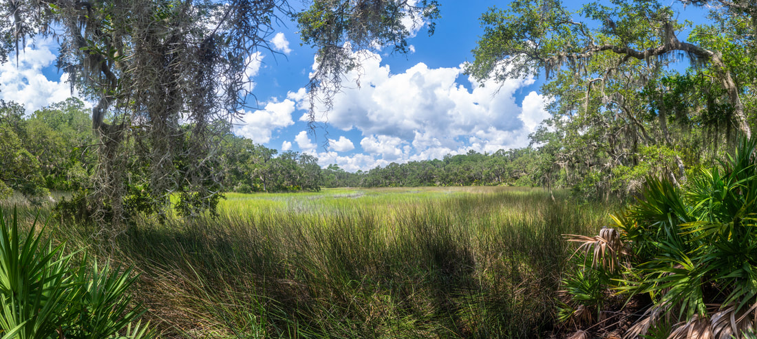
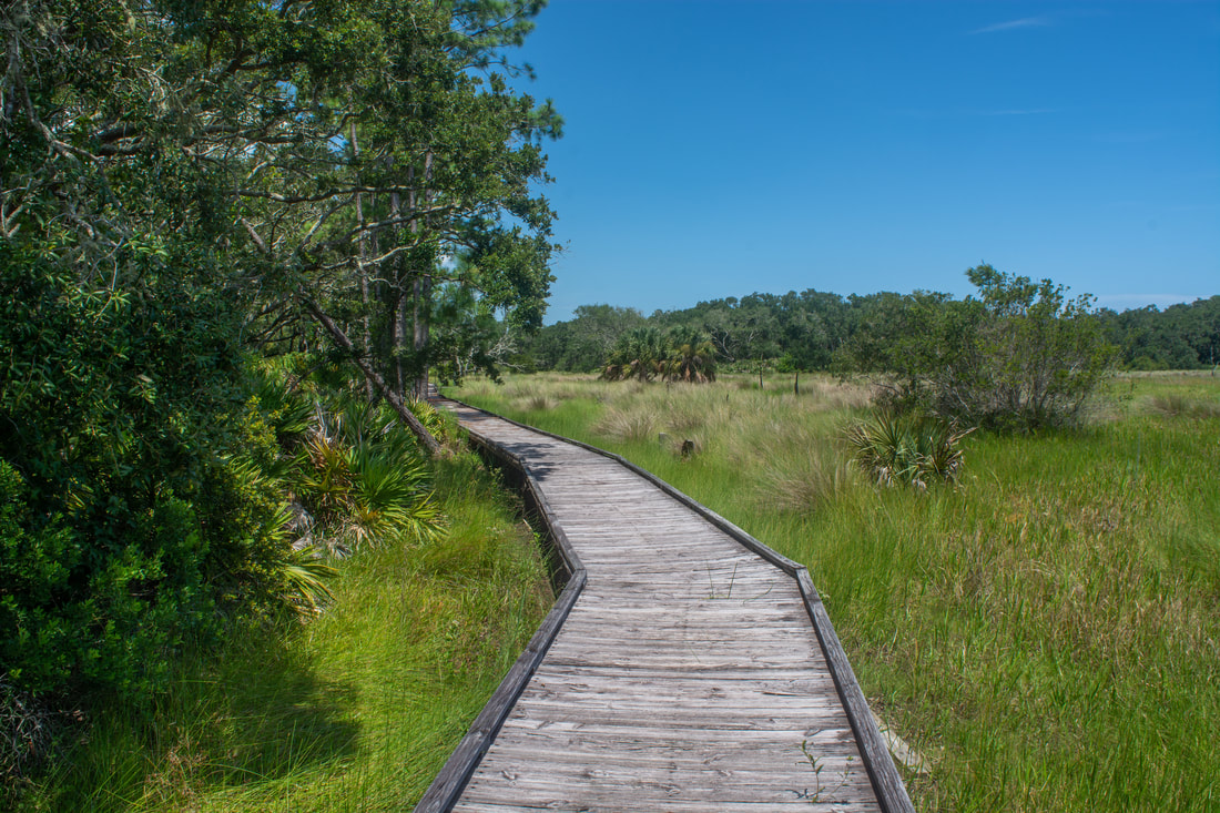
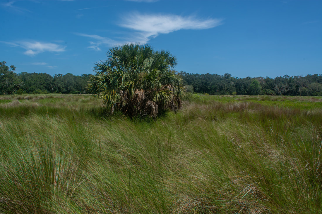
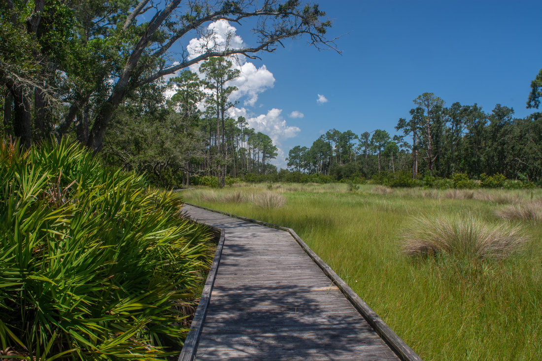
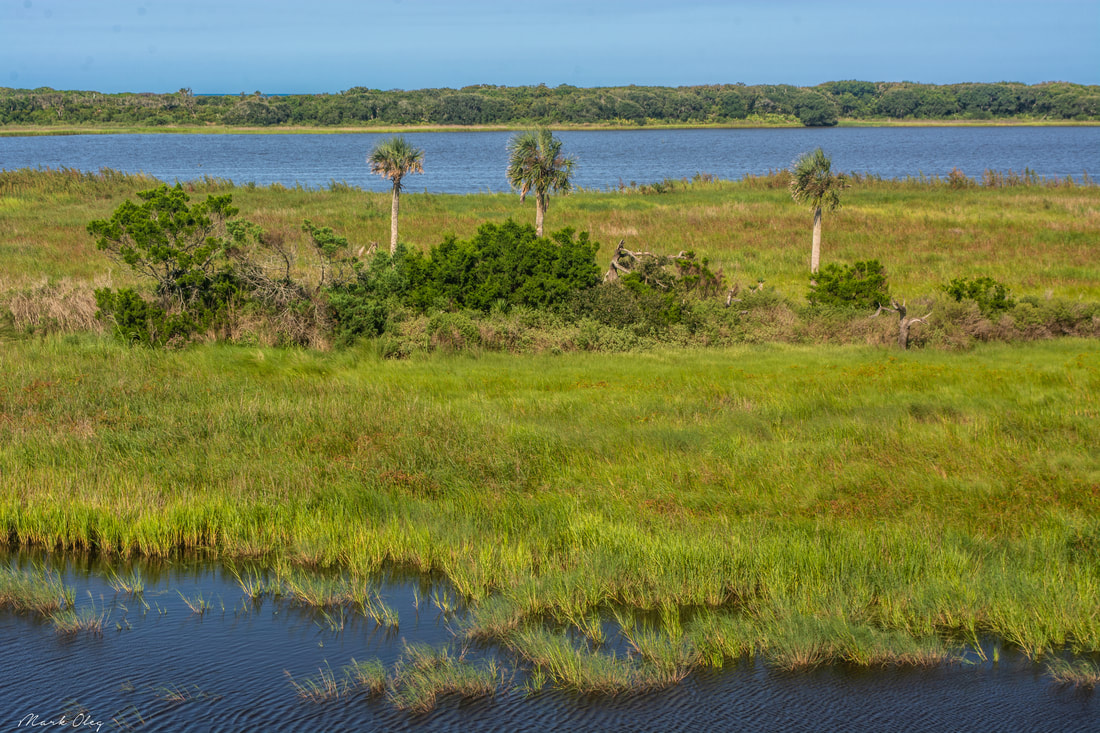
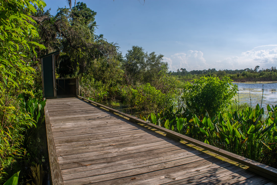
You're standing on an ancient Native American shell midden that's the size of an amazing 10.3 acres at Shell Point - imagine that! A large section of the Tolomato River is visible here, but the view remains a bit uninspiring largely due to the uninteresting shorelines. The bank right below Shell Point is full of stones placed for stabilization purposes. The best view is to the left (southward), where a thin sandy beach fades away into a shore of lush grass. Something you'll want to keep in mind is that, just like South Point, Shell Point is likely to be busy with boaters and fishermen on good weekends. Return to the last junction and pick up the Blue Trail. Even if you're not headed into Guana River WMA, I still suggest hiking the Blue Trail to complete the outermost loop in GTM Reserve and also to see the bonus wetland views. At 7.0 miles, a short side path leads left to a really nice needlerush grass marsh view, framed by palmetto and live oaks with overhanging Spanish moss. After briefly running in conjunction with the Orange Trail, the Blue Trail at 7.3 miles reaches the start of a quarter-mile boardwalk along the fringe of another needlerush grass marsh. The marsh oddly appeared entirely dry, something I don't see often when hiking in Florida during the wet season! The marsh is lined by mostly pines and oaks. A lone cabbage palm stands in the middle of the open expanse. I was baffled that the marsh was bone dry during the heart of what became one of Florida's wettest recent summers. At the boardwalk's end, cross the Orange Trail for a second time. The Orange Trail is actually a slightly longer loop, as it winds into the northwest corner of GTM Reserve, but it lacks the variety given by the Blue Trail's long marsh boardwalk. At this point, if you wish to conclude your hike, then you'll need to turn right onto the Orange Trail and follow it to the Guana River Dam parking area, less than a mile away. But if you've got some more energy, I highly recommend to extend your hike into Guana River WMA, where the breathtaking view from the Capo Creek Observation Tower awaits. 
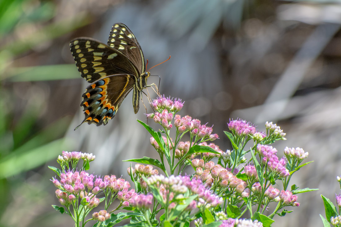
A Palamedes Swallowtail butterfly found along a trail in GTM Reserve.
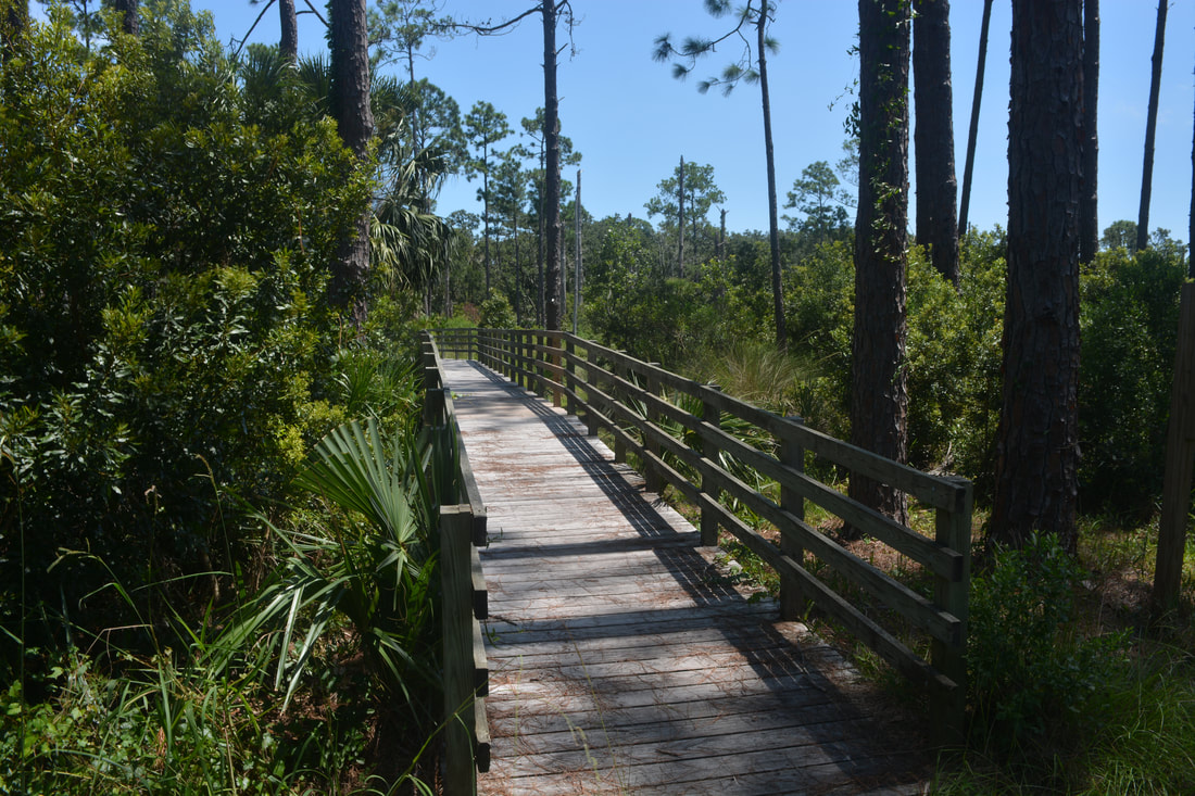
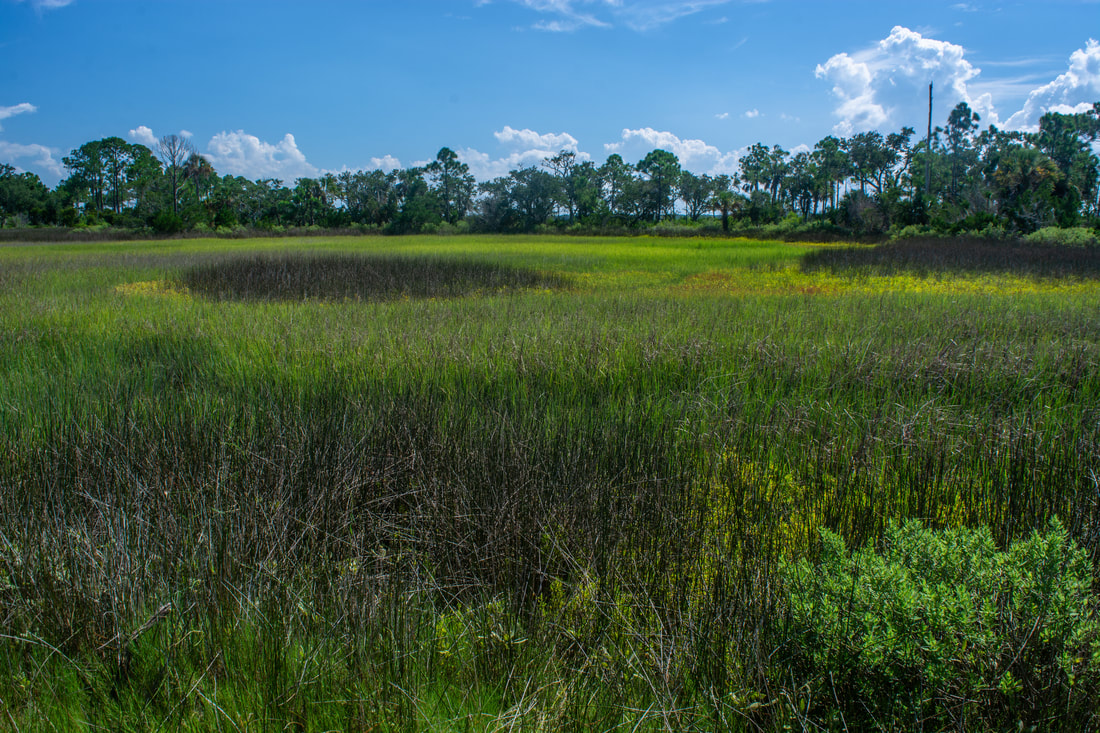
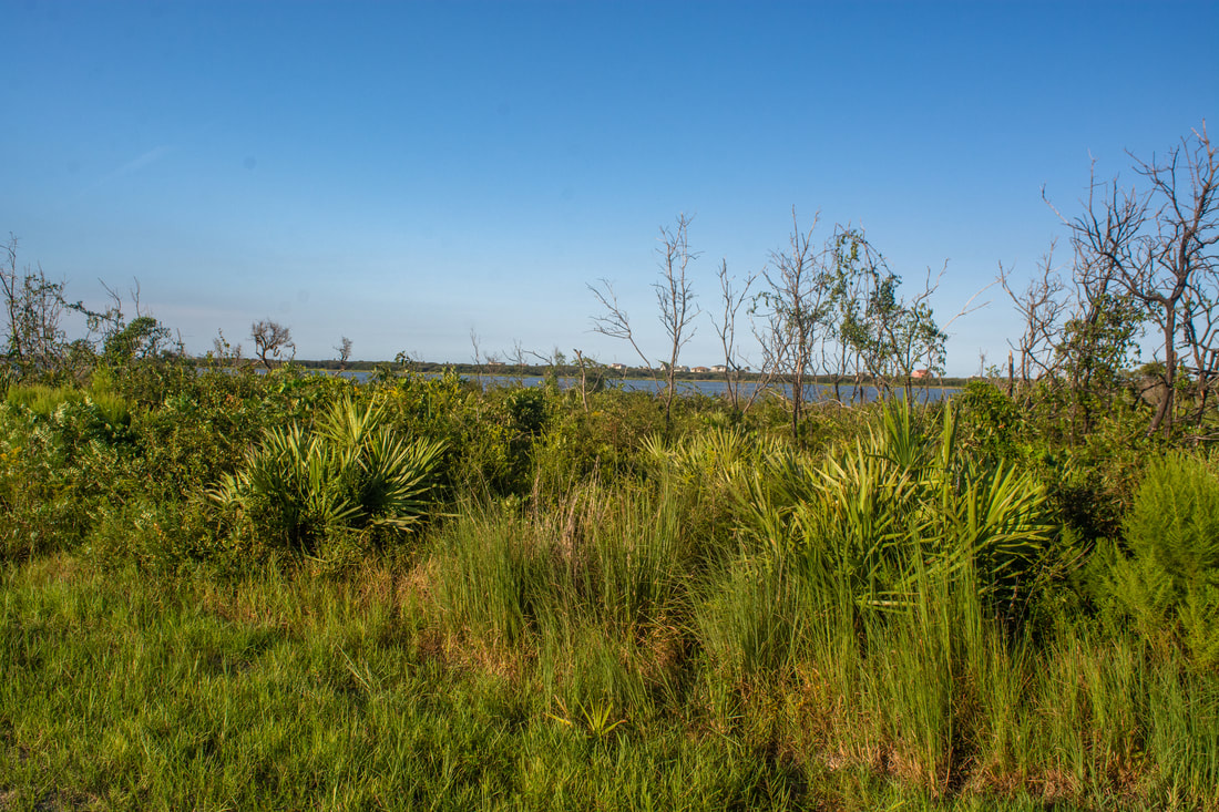
The Blue Trail continues straight ahead and reaches the Guana River WMA boundary in one-tenth mile at 7.65 miles. Leave GTM Reserve as you pass through the gate, remembering to close it behind you. You're no longer on the Blue Trail; the Savannah Loop starts here. To the right is the first of five cross-trails you'll encounter leading to the Guana River side of the peninsula. Additionally, a boardwalk on the right leads to an observation deck overlooking Big Savannah Pond, one of several man-made impoundments in the WMA. The 'pond' didn't have a single drop of water in it today, but it should be a nice, quick stop if it's full. The main reason that these artificial ponds and wetlands are noteworthy is they attract a broad variety of birds, ranging from roseate spoonbills to even bald eagles. You may view Guana River WMA's bird list here. The list outlines which birds you might see in each season.
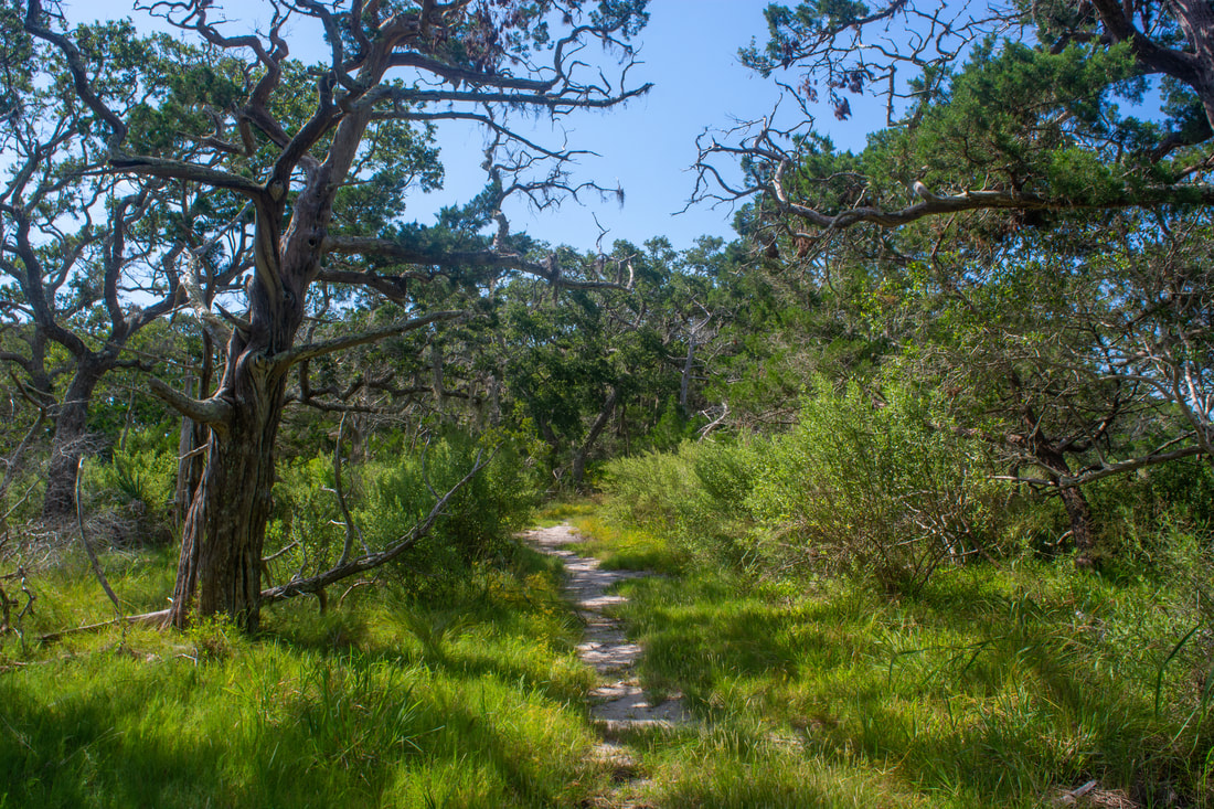
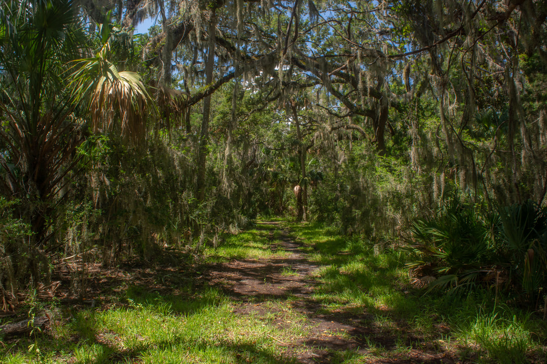
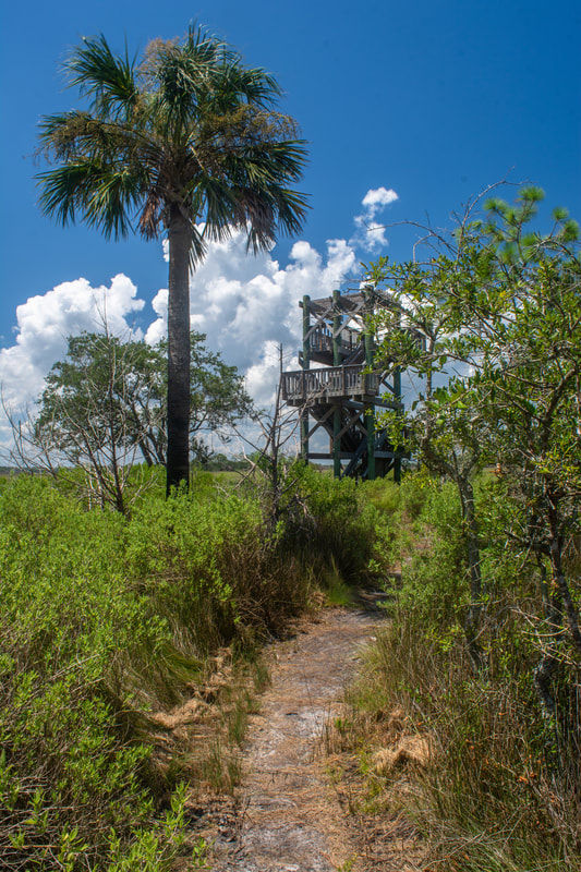
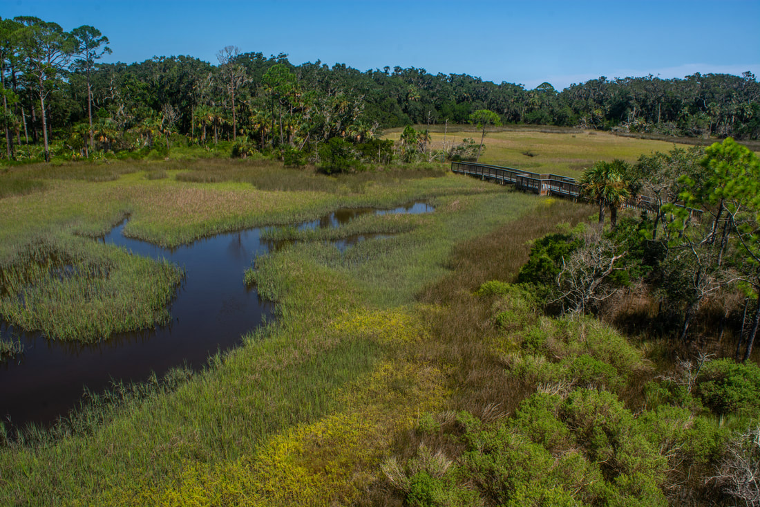
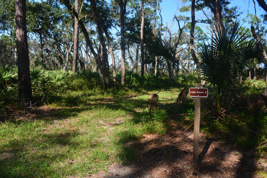
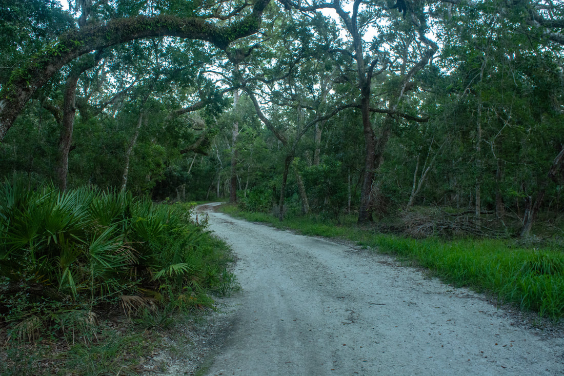
Continue straight on the west side of the Savannah Loop past Big Savannah Pond toward Capo Tower. The grassy, double-track trail emerges into a featureless open landscape, with nothing but shrubs, palmetto, and scattered pines. The trail has zero shade until the junction with the signed Capo Tower side trail at 8.75 miles. Turn left onto the side trail. This is also a double-track trail, but it's in the shade of a pleasant oak hammock. A quarter-mile later, the trail arrives at the edge of the vast salt marshes stretching out to the Tolomato River. The Capo Creek observation tower pops into view. A well-built footbridge takes the trail across a marshy tributary of Capo Creek. Reach the Capo Tower at 9.1 miles. A quick climb up three flights of wooden steps brings you to a truly stunning panorama. Directly in front, Capo Creek winds away in countless horseshoe bends. The smaller tidal tributary that you just crossed over joins on the right. To the left, Capo Creek makes a couple more horseshoe bends before tying into the Tolomato River, a vast watery expanse. Colorful sweeping salt marshes extend as far as one can see. The gorgeous patchwork of brown, green, and yellow, intermingled with the sparkling blue waters, is a sight for sore eyes. This really is among the most beautiful coastal views I've seen in Florida. The state simply couldn't have chosen a better location than this to build an observation tower. Return to the Savannah Loop. At this point, most hikers will probably want to return to Guana River Dam, especially those who hiked the GTM Reserve trails first. My hike turned left onto the Savannah Loop, heading deeper into Guana River WMA. I was seeking out two more points of interest: the Guana Lake observation tower, and Booths Pond. Both of these spots are worth seeing. The Lake Tower is actually pretty good competition to the Capo Tower in terms of views. However, here's a fair warning: the ~3 miles of double-track trail on the Tolomato River side of the peninsula between the Capo Tower junction and the Booths Pond area are very monotonous and featureless. Even though I continue to describe the trail system below in the direction I hiked it, my recommendation would be to access the Lake Tower and Booths Pond via the trails on the Guana Lake side of the peninsula. The east trail is still double-track, but it winds through attractive oak hammocks and scrub patches. The miles are certain to go by faster on the east side than the west side. 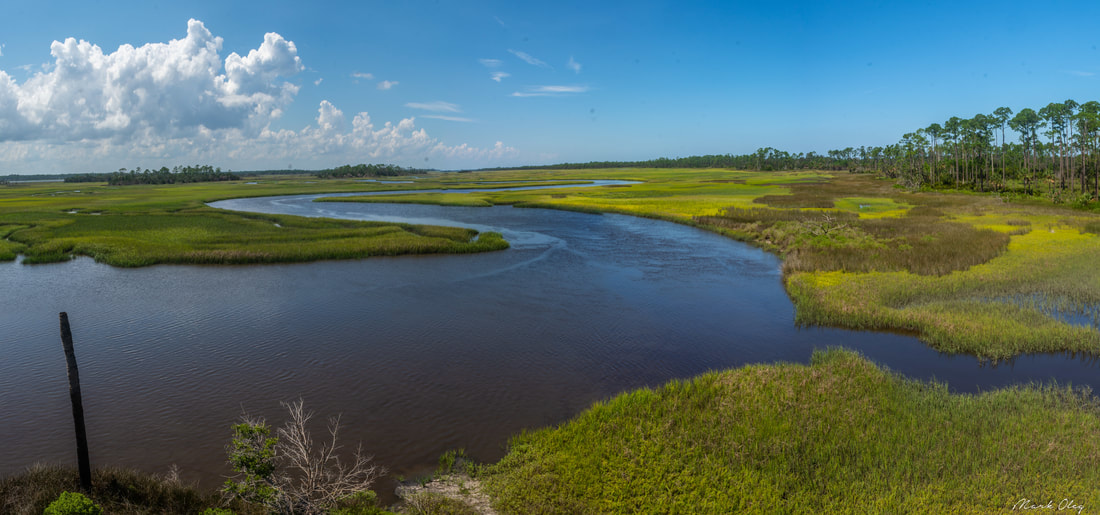
The Capo Tower in Guana River WMA has truly stunning views of the Tolomato River & Capo Creek marshes.
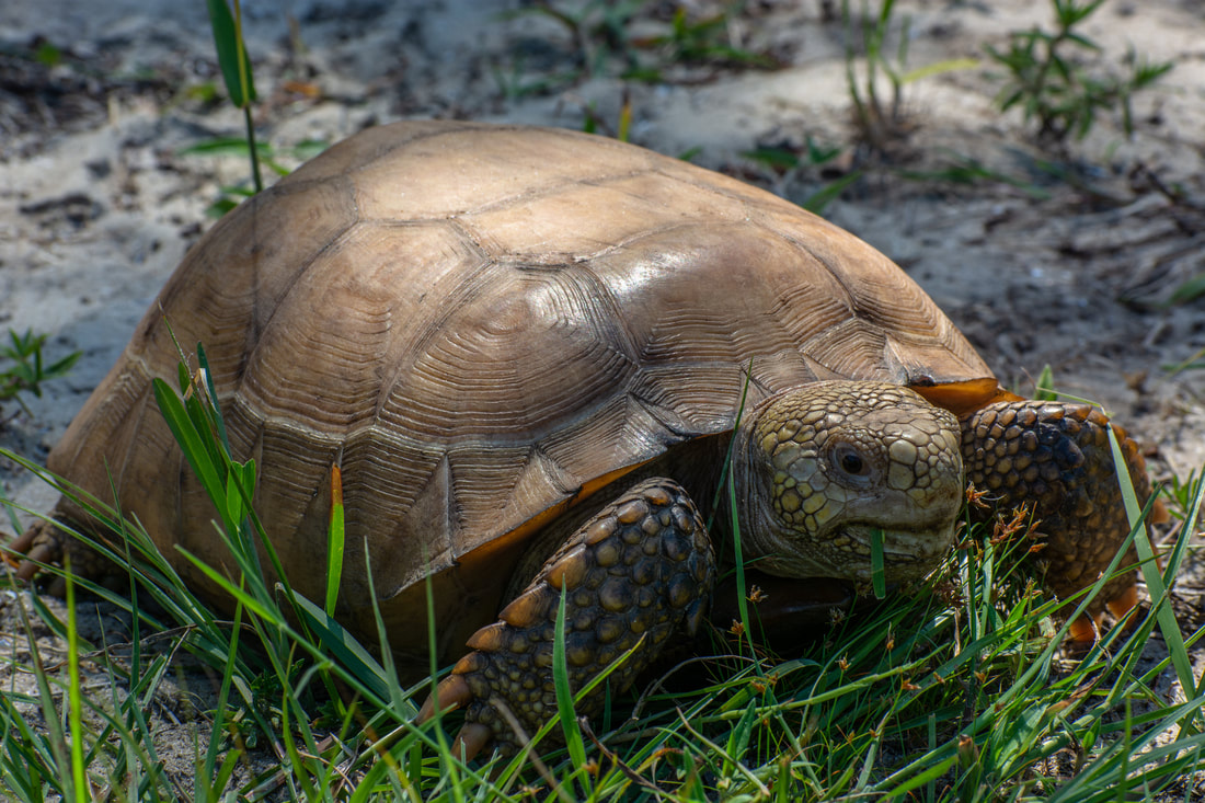
The second cross-trail leaves right at 9.5 miles; continue straight on the Capo Loop along a sandy road. At 9.9 miles, the third cross-trail continues ahead. Turn left onto the Hammock Loop to stay on the west side. The trail exhibits less signs of usage from this point on - the trail was a bit overgrown with grass when I went, and the ground was very uneven. The scenery remains largely uninteresting, with nothing much to see other than pines. If you're lucky, you might spot a gopher tortoise though - maybe even two like I did! You'll pass a couple wetlands on the right before reaching the fourth cross-trail at 11.9 miles. Stay straight (still on the Hammock Loop) as the trail curves toward the shoreline of Booths Pond. The trail crosses a grassy levee by the pond at 12.3 miles. The pond view is much more picturesque on the other side. As I walked across the levee, I startled a giant flock of roseate spoonbills on a nearby tree. Sadly, I didn't get photos as I didn't see them until they had already taken off. Reach the fifth cross-trail at 12.5 miles. While the trail continues several more miles to Jones Creek and eventually the Roscoe Blvd Trailhead, this hike turns right and makes its way toward Guana Lake.
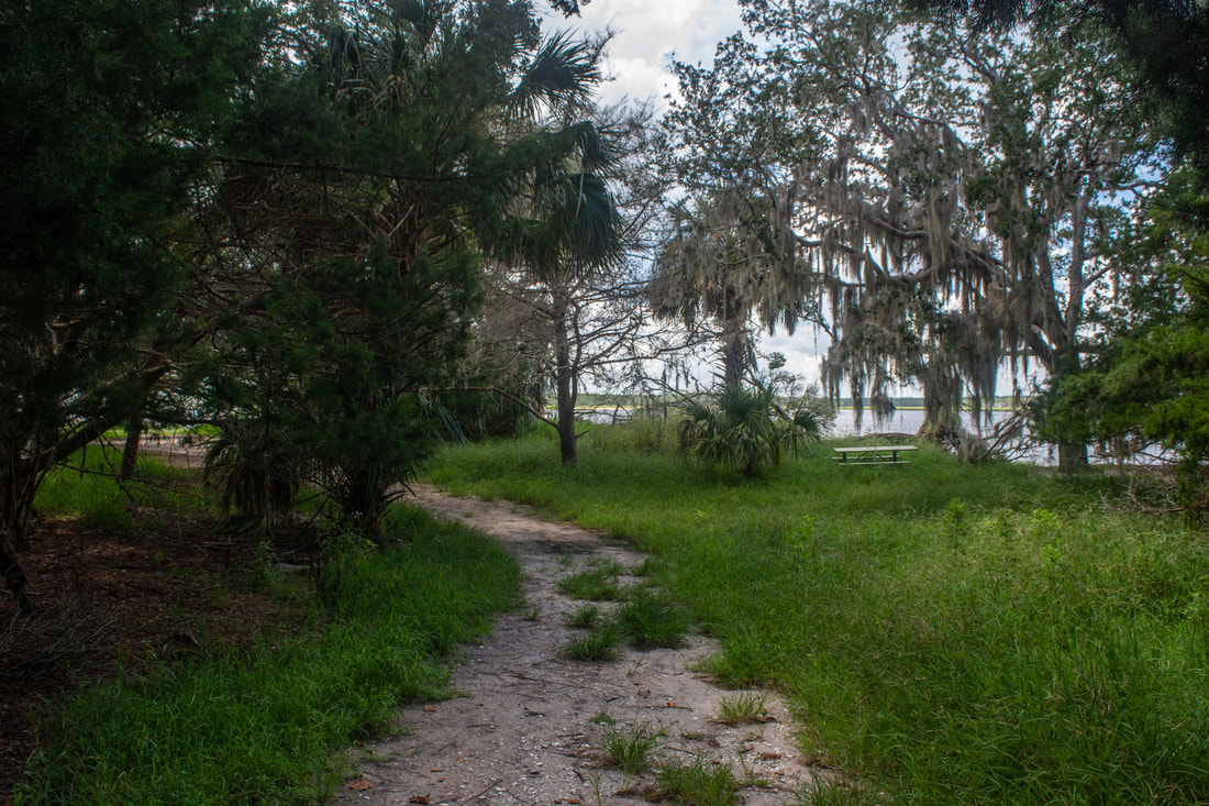
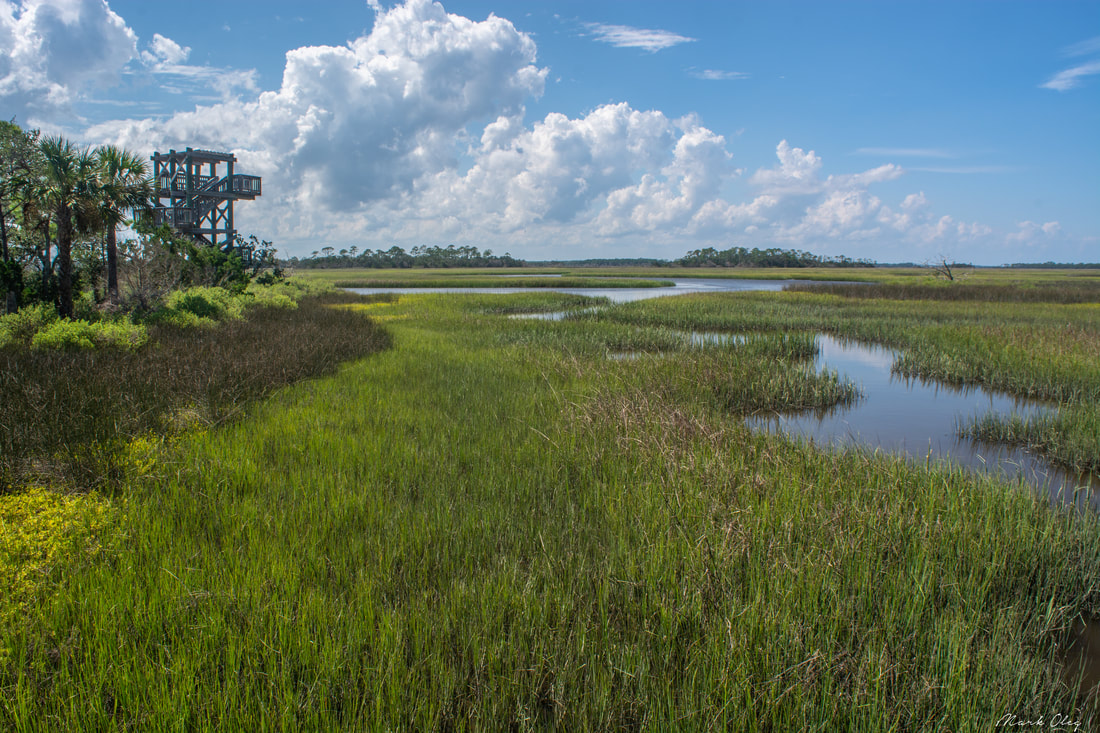
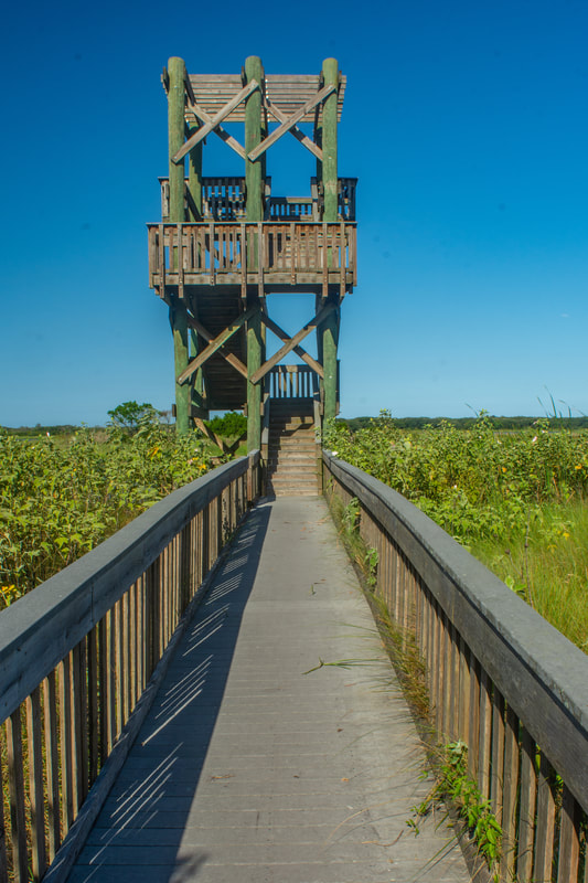
Passing a picnic table, you'll reach the other end of the cross-trail at 12.7 miles. The trail to the right is the route back to Guana River Dam. But you've come all this way for something though, right? Make sure to turn left first and take the short side trip to the Lake Tower. Two-tenths of a mile farther, the short side path to the Lake Tower turns right (the trail ahead also eventually leads to Roscoe Blvd). Reach the Guana Lake observation tower at 13.0 miles. The construction of this tower is nearly identical to the Capo Tower - a short, elevated boardwalk leads to the two-story tower (and also a kayak launch). Once again, the quick climb up the three flights of steps brings you to magnificent views. The Guana Lake observation tower features a 360-degree panorama that encompasses a vast section of the namesake lake. While the sign at the tower calls the lake Guana Lake, the Guana River WMA trail map calls it Lake Ponte Vedra. I'm not sure which name is correct. The lake is on the Guana River, which is dammed at the hike's starting point. But really, this isn't a river - it's a coastal bay just like the Tolomato River. That's why this lake is prettier than your average man-made lake. I love the lush green marshes that line the shorelines. My favorite part of the view is straight in front (eastward), where a picturesque grassy island sits smack middle. Three palms proudly rise from the island, encircled by the lake's sparkling blue waters. While you can't see it, the Atlantic Ocean is less than a mile away, just beyond the line of greenery on the far shore. 
The Guana Lake observation tower sits in front of a picturesque grassy island where three palm trees stand proud.
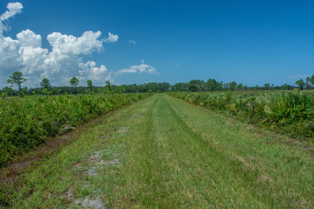
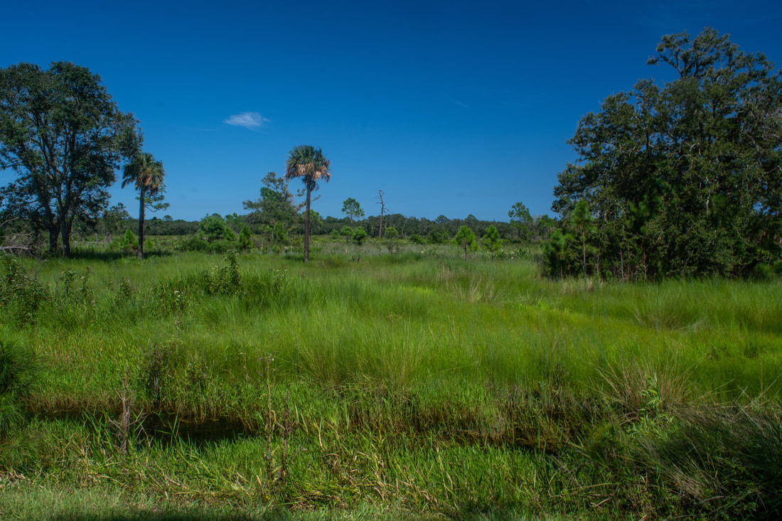
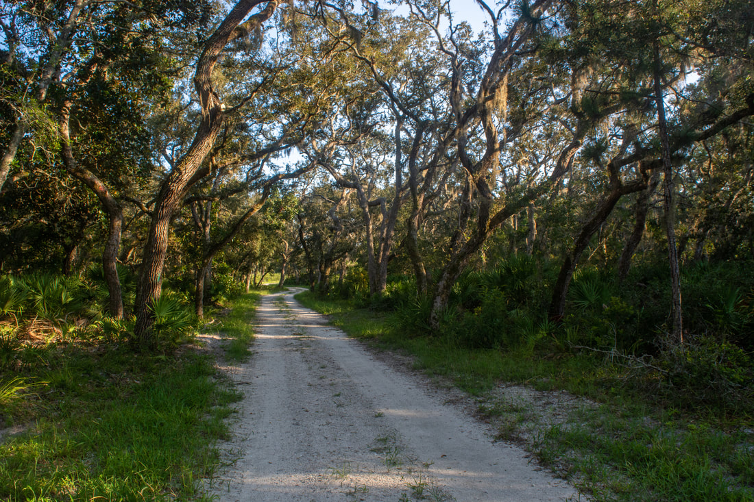
Return to the main trail, and turn left, finally heading south back toward Guana River Dam. Reach Booths Pond once again at 13.4 miles. A short boardwalk on the right leads to a viewing deck and bird blind at the pond's shore at 13.6 miles. The pond isn't anything special, but it's a scenic bonus stop. And I think that birders will love this spot, if they're here during the right season and time. The main trail continues heading south, slowly passing all the cross-trails. However, you'll quickly learn that there's a significant difference between the west side and east side. Even though the trail you're on follows a broad, sandy road, it's actually pretty scenic, passing through pleasant oak hammocks with occasional palms. There will be views of Guana Lake from time to time, though nothing as open as the tower view. The trail briefly enters an open scrub area at 15.5 miles. A lone oak stands along the sandy road. But the trail shortly dives back into the hammock, passing another cross-trail. Just keep going straight. A second, larger desert-like scrub area comes up at 16.4 miles - there's actually a really nice view of Guana Lake here. At the far end is an informative sign about Guana River WMA's coastal scrub.
As the trail enters another scenic hammock, it comes to an unexpected sight at 16.8 miles - a grouping of rangers' equipment, sheds, and maintenance structures. I'm not sure why such an odd location was chosen for this "ranger station", with the trailhead still a mile away. Just past the structures, bear left at a junction with the fourth cross-trail since the Lake Tower. The cross-trail leads to the Capo Tower area, but you need to stay on the main trail. At 17.3 miles, a flurry of signs greets the trail as it finally re-enters GTM Reserve. The final cross-trail leaves right back toward Big Savannah Pond; continue straight. The Orange Trail shortly comes in from the right and joins the shady road. At 17.65 miles, the road reaches the four-way junction with the Orange, Yellow, and Purple Trails, where you started your hike hours earlier. Turn left and continue the final 0.15 miles to the Guana River Dam parking area, concluding the hike at 17.8 miles. To summarize, this is a very nice Northeast Florida coastal hike, featuring rather unique scenery at times. I'll admit that lengthy sections of the trail are somewhat boring. But in my opinion, the rewards outweigh the monotonous parts. The 360-degree panoramas from Capo Tower and Lake Tower are some of the best coastal views you'll find anywhere in Florida. The other views of the Tolomato and Guana Rivers are more average but still beautiful. The only part of the hike I didn't really like is the west side of the peninsula between Capo Tower and Booths Pond, but one can avoid it if they want. Overall, I highly recommend the GTM Reserve/Guana River WMA hike. Both areas remains surprisingly unknown in Florida's hiking community; their wonderful observation towers and trails deserve more visitation. 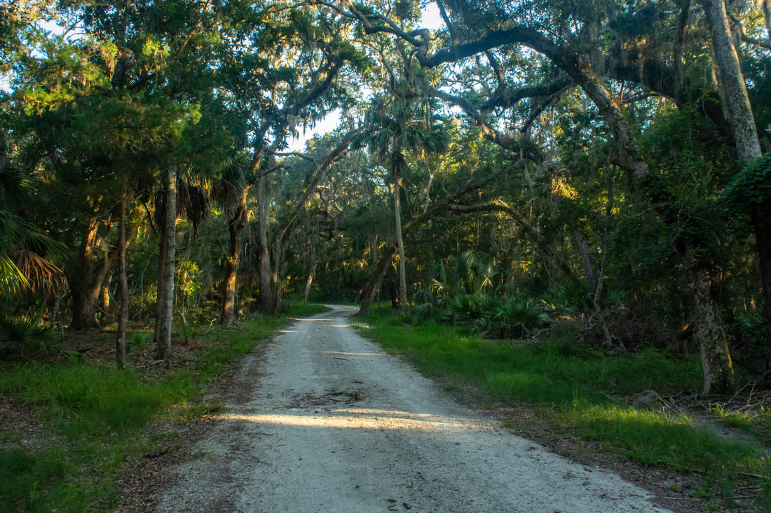
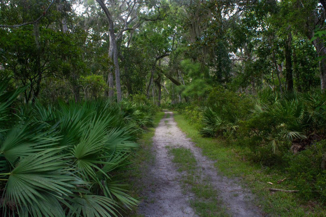
The trail along the Guana River side of the peninsula follows a broad sandy road through pleasant oak hammocks.
Mileage
0.0 - Guana River Dam
3.2 - South End 6.4 - Shell Point 7.3 - Marsh Boardwalk 7.7 - Guana River WMA Boundary & Big Savannah Pond 9.1 - Capo Tower 12.3 - Booths Pond 13.0 - Lake Tower 13.6 - Booths Pond Viewing Deck 16.8 - Maintenance Station 17.3 - GTM Reserve Boundary 17.8 - Guana River Dam Variations
Hike out and back to Shell Point - 2.2 Miles
Hike to South End and Shell Point - 7.5 Miles Hike GTM Reserve outer loop - 8.3 Miles Hike out and back to Lake Tower from Guana River Dam - 9.6 Miles Hike GTM Reserve outer loop plus Capo Tower - 11.3 Miles Pictures & Videos
0 Comments
Leave a Reply. |
About MeMark Oleg Ozboyd Dear readers: I have invested a tremendous amount of time and effort in this website and the Georgia Waterfalls Database the past five years. All of the work that has gone in keeping these websites updated with my latest trip reports has almost been like a full-time job. This has not allowed me to pick up a paid job to save up money for college, and therefore, I I've had to take out loans. If you find the information on this website interesting, helpful, or time-saving, you can say "thanks" and help me out by clicking the button above and making a contribution. I will be very grateful for any amount of support you give, as all of it will apply toward my college tuition. Thank you!

Coming in 2022-2023?
Other Hiking WebsitesMiles HikedYear 1: 540.0 Miles
Year 2: 552.3 Miles Year 3: 518.4 Miles Year 4: 482.4 Miles Year 5: 259.9 Miles Archives
March 2021
Categories
All
|
||


 RSS Feed