HIKING THE APPALACHIANS AND BEYOND
  • Home
  • Trail Reports
    • Best Hikes
    • Hikes with Scenic Views
    • Hikes with Water Features
    • Alabama
    • Georgia
    • Florida
    • North Carolina
    • South Carolina
    • Tennessee
    • Vermont
    • Virginia
  • Map
  • Hike List
  • Testimonials
  • Resources
  • Contact Us
  • Southeast Nature Society
    • Our Team
  • Georgia Waterfalls Database

Emerson Point Preserve: Portavant Mound Trail, South Restoration Trail, Terra Ceia Trail, Tower Trail, and North Restoration Trail, Palmetto, Florida

8/14/2017

0 Comments

 
Picture
Emerson Point Preserve is one of several beautiful Manatee County coastline preserves. This preserve on Snead Island is rich with history, as there are several historic Indian mounds scattered throughout the park. The preserve's diverse trail system traverses both the Tampa Bay and Manatee River sides of the island, with several views of both, as well as an observation tower that provides a bird's-eye panorama of the preserve and Tampa Bay, with the Sunshine Skyway Bridge in the distance. Also, the park's primary trail system provides access to the Portavant Temple Mound - the biggest mound of all in the preserve. This hike occurred on Wednesday, July 26th, 2017. My plan was to hike the Portavant Mound Trail from the Ranger Station, making a side trip to the Manatee River view. Then, I would make a clockwise loop with the South Restoration Trail, Terra Ceia Trail, Tower Trail, and North Restoration Trail, making side trips to each of the three Tampa Bay views as well as the observation tower. I would conclude the hike by following a connector back to the Ranger Station. 

Summary

R/T Length of Trail: 3.0 Miles 
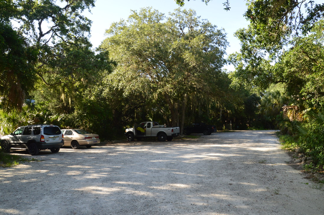
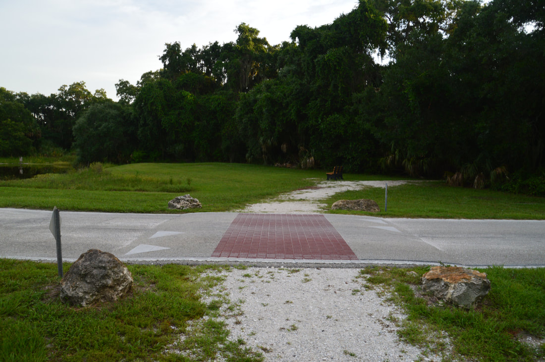
Duration of Hike: 1:45
Type of Hike: Double Loop 
Difficulty Rating: 2 out of 10 
Total Elevation Gain: Minimal 
Pros: The boardwalks and shell paths keep the preserve's trail system dry essentially all year; Many viewpoints of Manatee River and Tampa Bay 
Cons: None 
Points of Interest: View of Manatee River; Serpent Mound Compelex; Portavant Temple Mound; Three Views of Tampa Bay; Emerson Point Observation Tower; Several salt marshes and mangrove canals 
Trail Blaze Colors: None, but all trail junctions are marked by "You Are Here" maps 
Best Seasons to Hike: Year-round
Fees: None 
Beginning Point: Emerson Point Ranger Station 
Directions from Palmetto, FL: From the intersection of 10th Street and 8th Avenue (US 41 Business) in downtown Palmetto, follow 10th Street West - which turns into 13th Street West - for 2.5 miles. Then, turn right onto Tarpon Road. In another 0.2 miles, turn left onto 17th Street West. This road enters Emerson Point Preserve in 0.8 miles. Continue through and past the gate for another 0.1 miles, and then, stay left on the unpaved road to the ranger station and parking area, while the paved road curves right towards the preserve's beach area at its west end. Drive this unpaved road for 0.2 miles to its end at a small one-way loop with the parking area in front of the ranger station. 

Map

Click the link below to download a .GPX file with a track of this hike. 
emerson_point_preserve_trail_system.gpx
File Size: 103 kb
File Type: gpx
Download File

Details

Ever since I did an excellent hike at Robinson Preserve near Bradenton in 2015, the similarly-sounding Emerson Point Preserve has been on my list. I finally got to check it out on this late July 2017 visit and was not disappointed - the preserve is indeed as good as Robinson Preserve. I would say that Emerson Point Preserve trail system is actually more ecologically diverse than Robinson Preserve trail system, but there is one small drawback that the view from the observation tower at Emerson Point isn't quite as good as at Robinson due to the tower's lower height. 

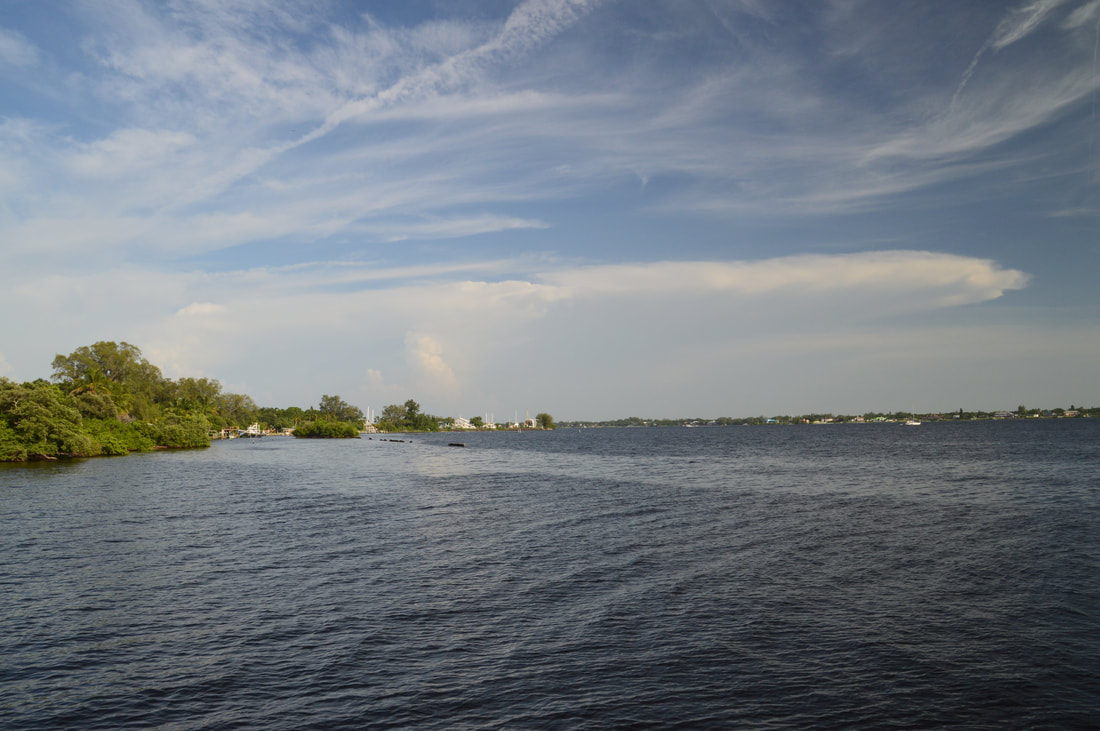
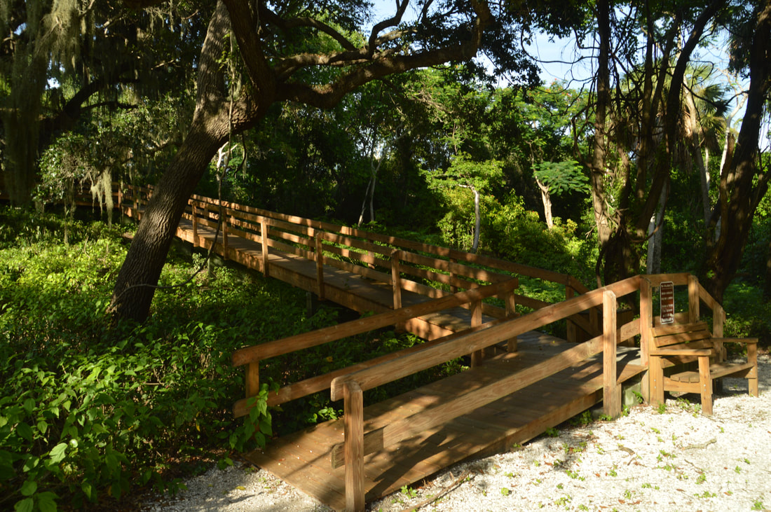
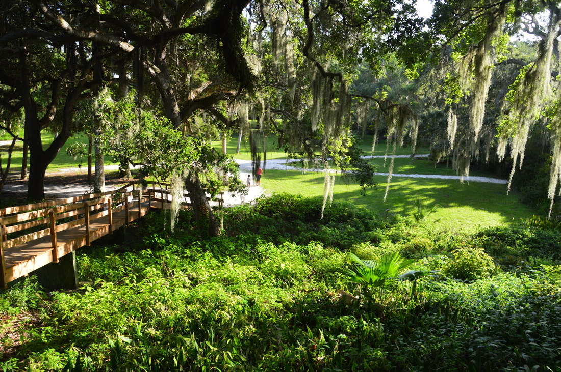
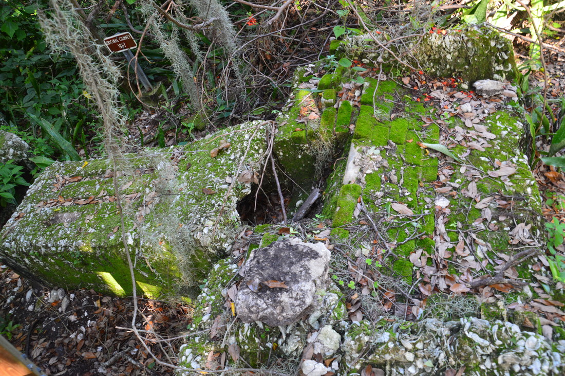
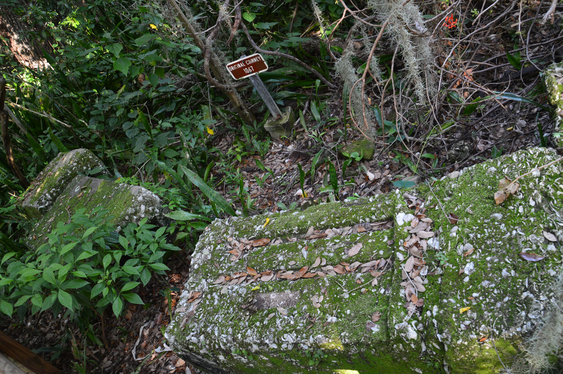
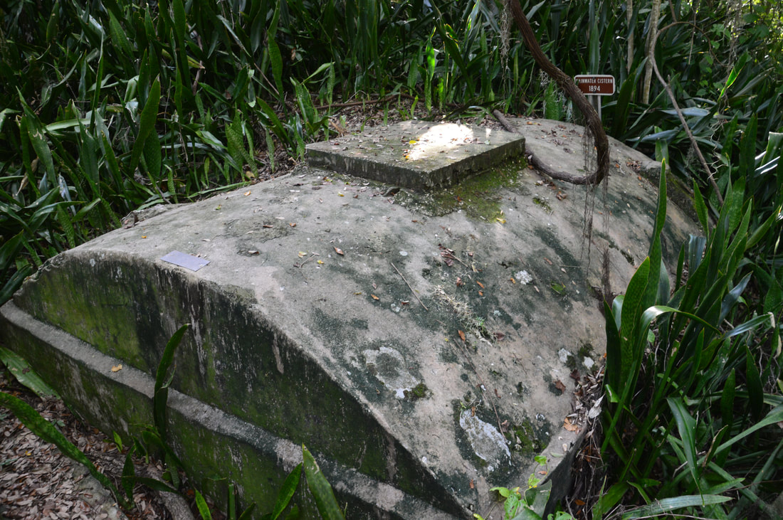
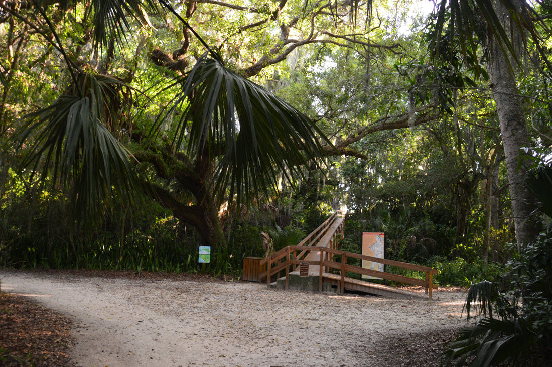
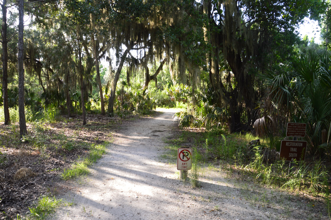
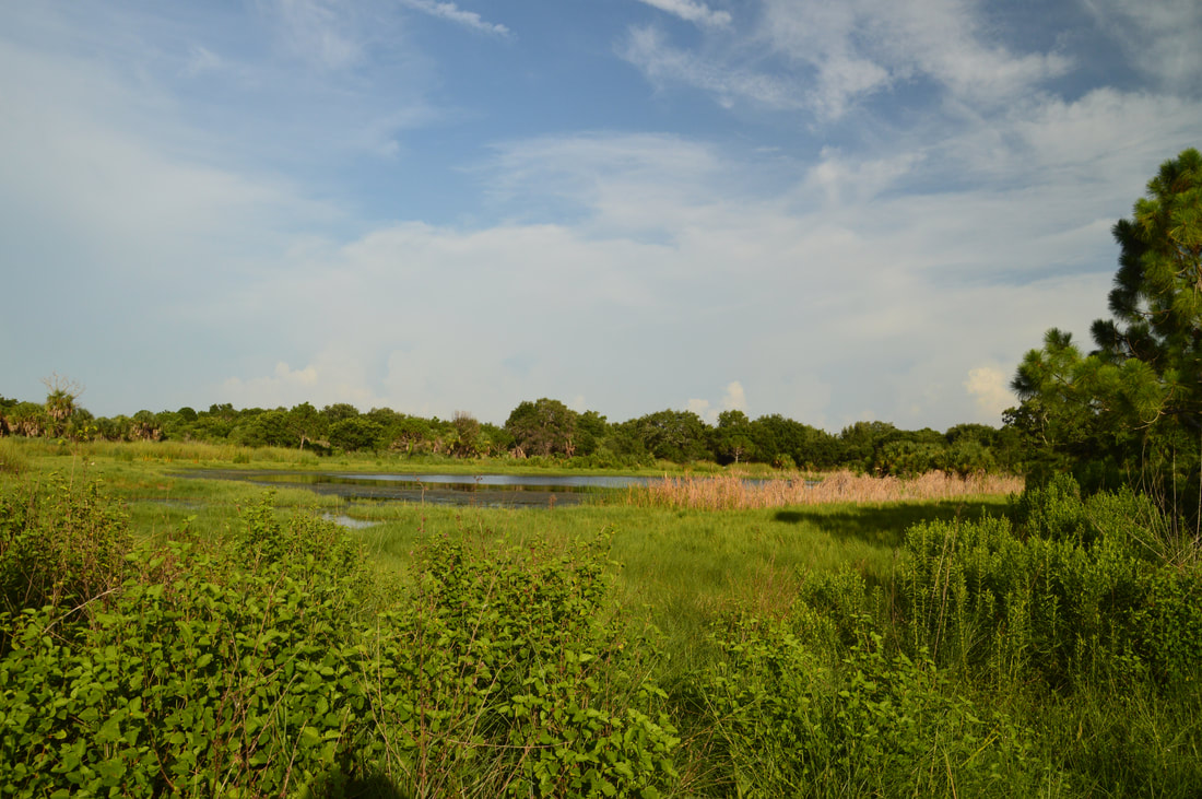
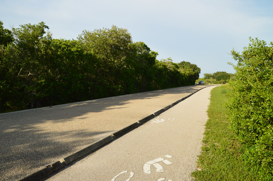
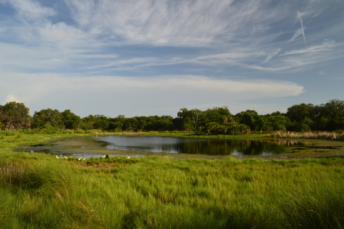
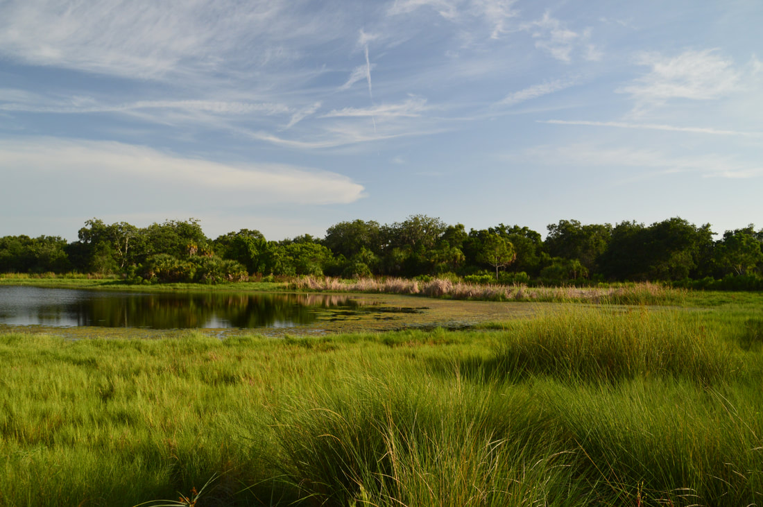
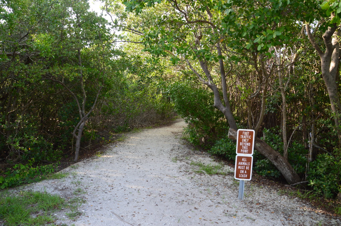
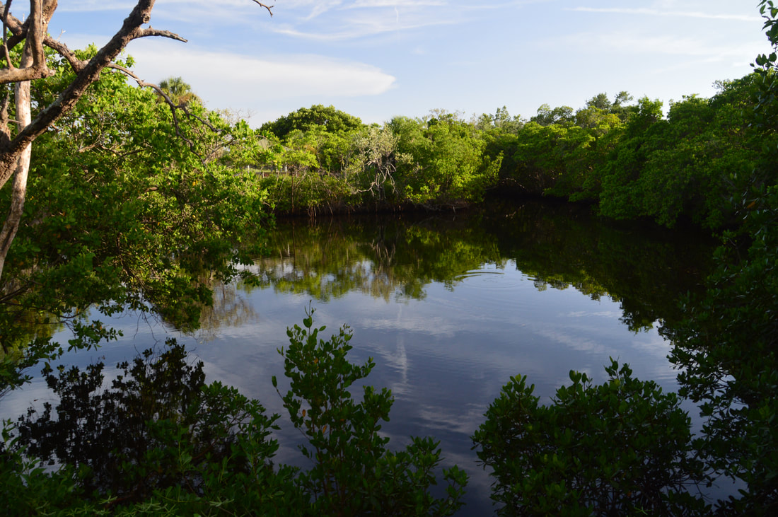
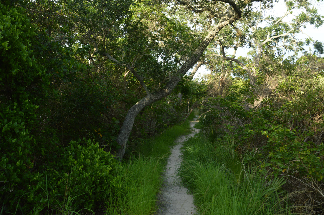
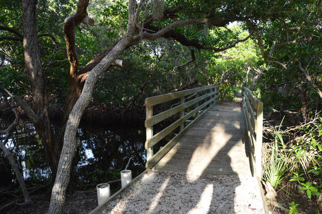
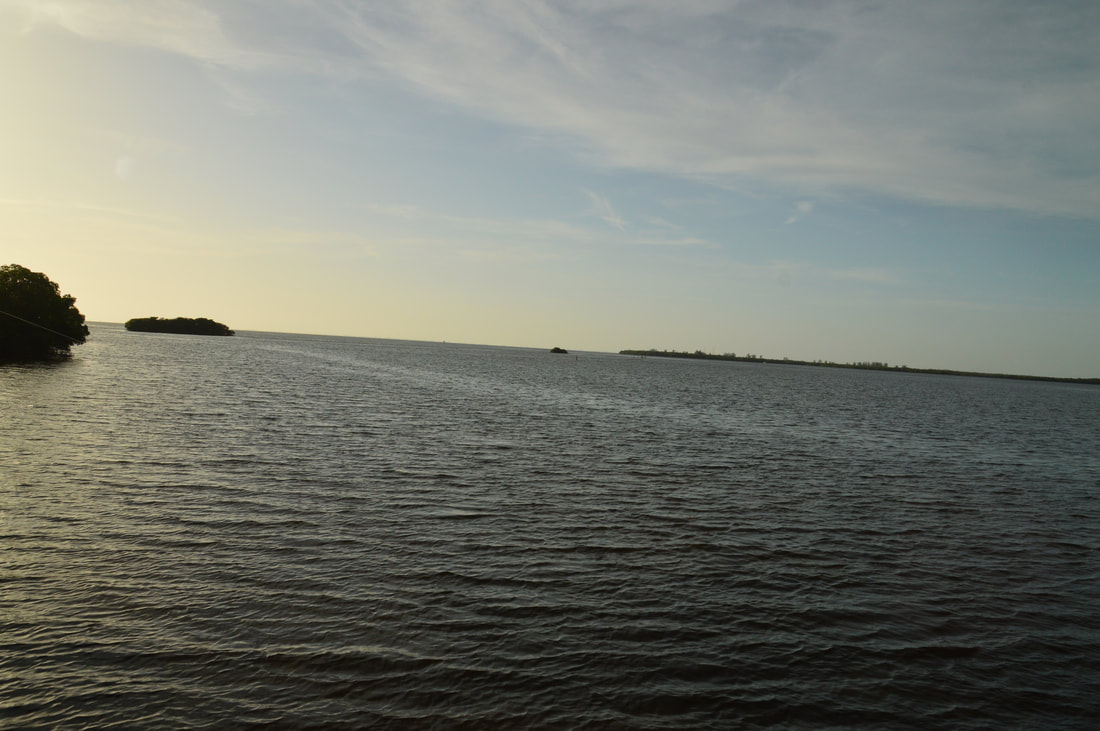
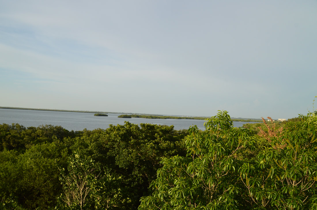
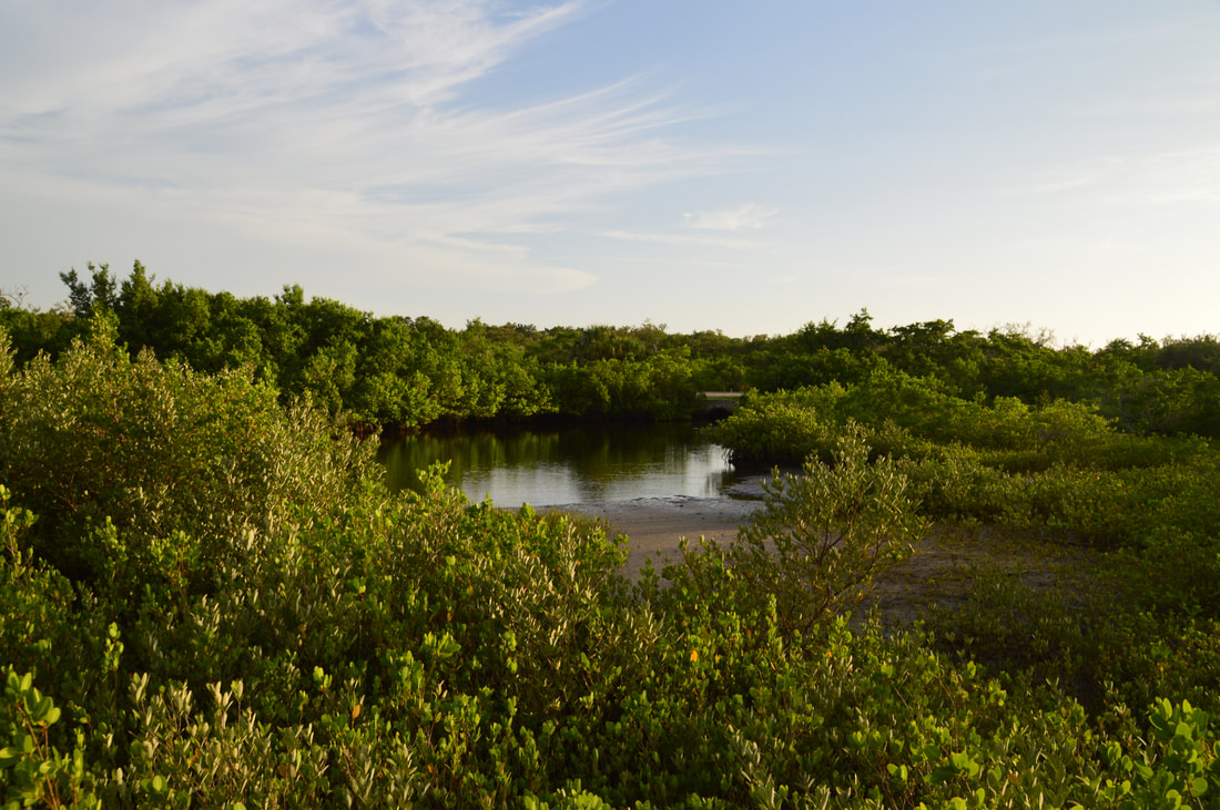
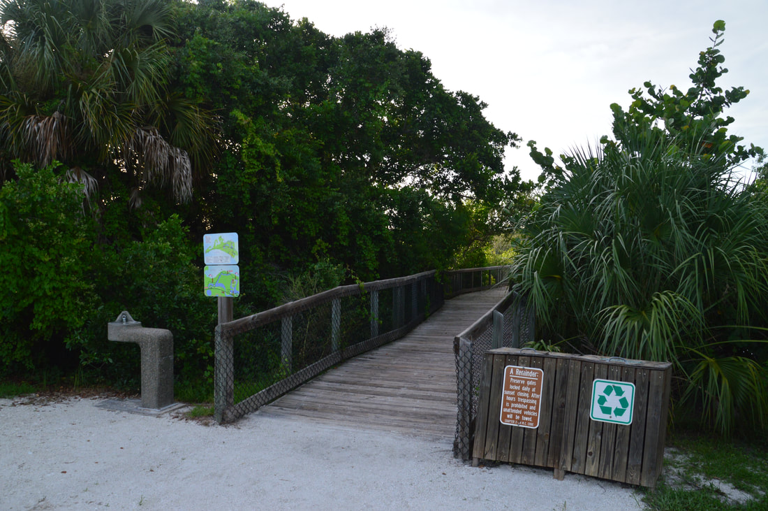
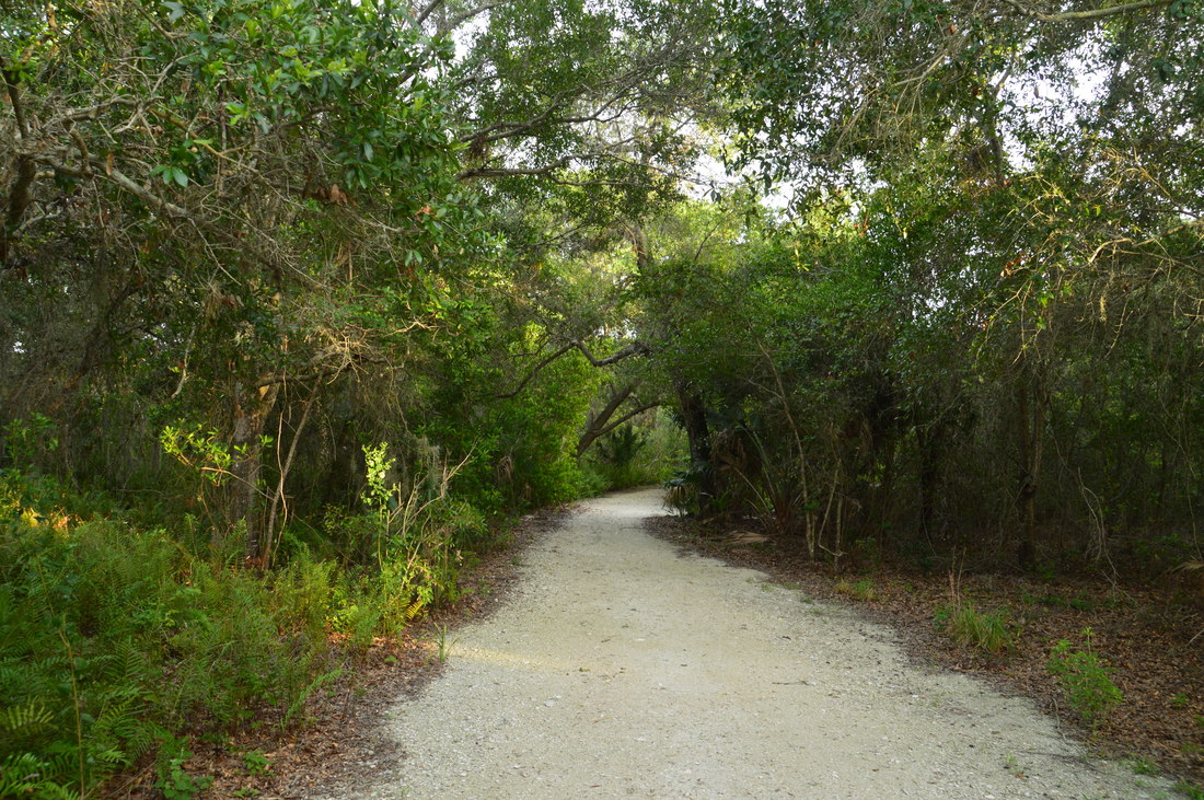
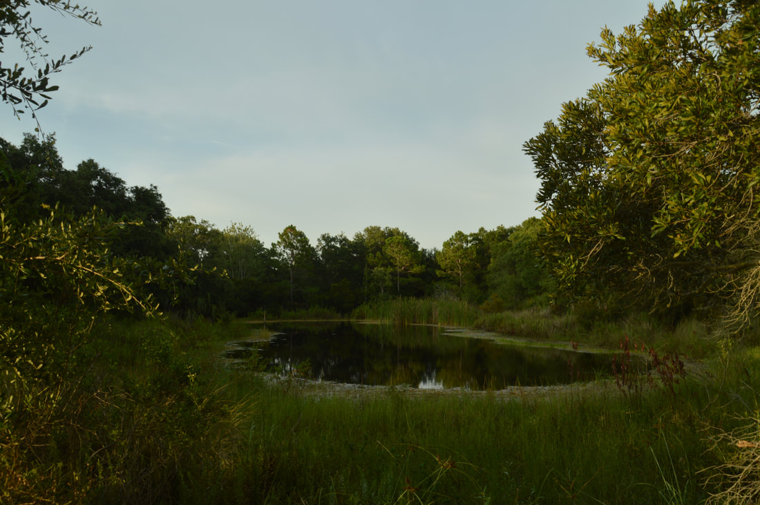
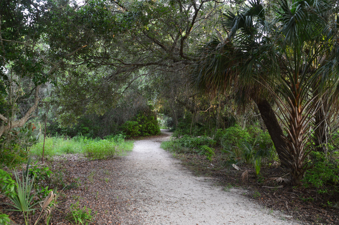
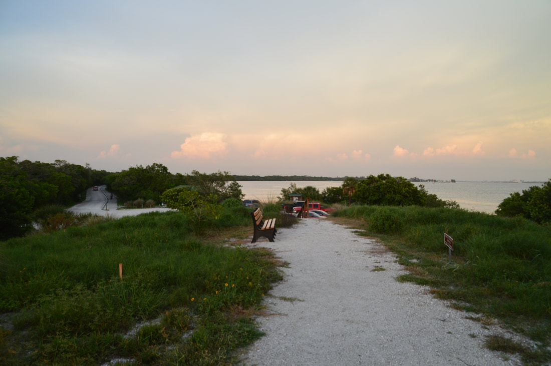
The most logical place to start the hike is the ranger station, as it's located at the head of the trail system. From the parking area, walk to the south side of the small one-way loop and look for the Temple Mound Trailhead on the right, marked with a "No Bikes" sign. At the first split, stay left on the narrow trail as it rises over a small mound that is part of the Serpent Mound Complex. As a pair of side trails leaves to the right, the main trail enters a large grassy clearing below the Portavant Temple Mound. While you'll go up the mound soon, it is best to first turn right onto the side path through the clearing and to an observation deck with views of the Manatee River estuary at 0.2 miles. The mouth of the Manatee River at Tampa Bay is only a short distance downstream to the right, and far in the distance, you can spot Anna Maria Island. From the observation deck, return to the clearing and walk up the wheelchair-accessible boardwalk that leads to the top of the Portavant Temple Mound at 0.3 miles. Unlike many historic Indian mounds, this one is completely grown up now, with massive live oaks at the top. A few signs at the top of the mound provide historical information about this site. As a spur boardwalk to a small viewing area leaves left, stay right on the main trail that descends down the other side of mound via boardwalk. On the way down from the mound, there are some original chimney ruins from 1867 on the right and a 1894 rainwater cistern on the left. These two historic relics are interesting signs of life that once flourished on Snead Island. 

At the base of the mound, continue straight as a path leaves left and right, circling the mound. The main trail shortly reaches a parking area at the trailhead for the mounds trail, which is signed as the Pioneer Trail. Stay left here, crossing the dirt road that you drove in on. On the other side of the road is the signed trailhead for South Restoration Trail at 0.4 miles. Begin following this multi-use trail as it winds through a mix of restored ecosystems. At 0.5 miles, a connector leaves left back to the parking. The trail rounds a wetland on the left at 0.75 miles and then begins circling a scenic pond on the right at 0.8 miles. The South Restoration Trail ends at the main park road (17th Street) at 1.0 miles near the northwest corner of the pond. Here, turn right on the paved bike path and follow it for about 250 feet along the road to the Terra Ceia Trailhead and parking area, passing the best view of the picturesque pond along the way. Turn left onto the Terra Ceia Trail at 1.05 miles, crossing the road. The Terra Ceia Trail is a hiking-only trail that access the north shore of Snead Island and provides several views of Tampa Bay. 
Picture
This picturesque pond is located near the Terra Ceia Trailhead in Emerson Point Preserve.
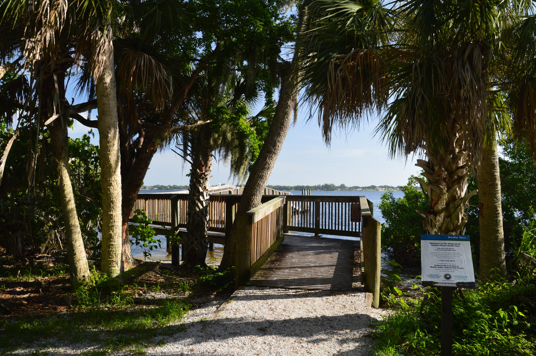
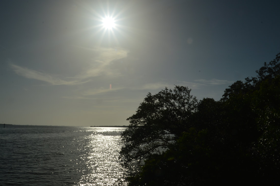
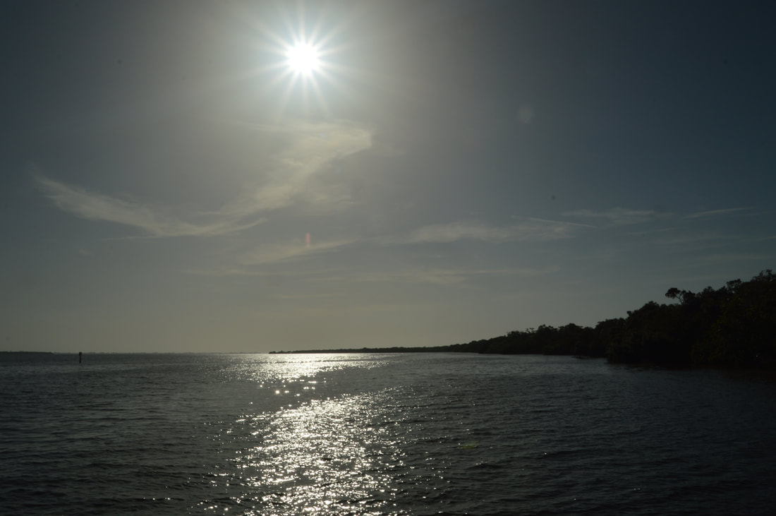
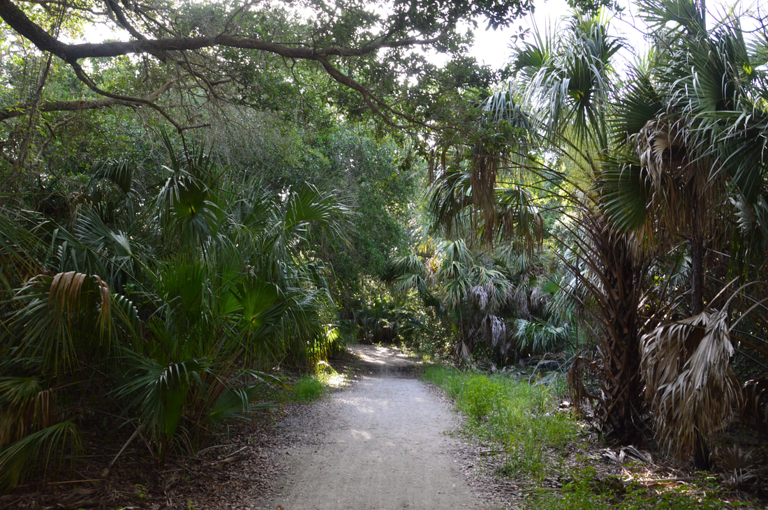
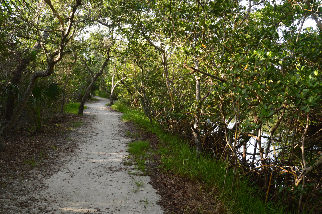
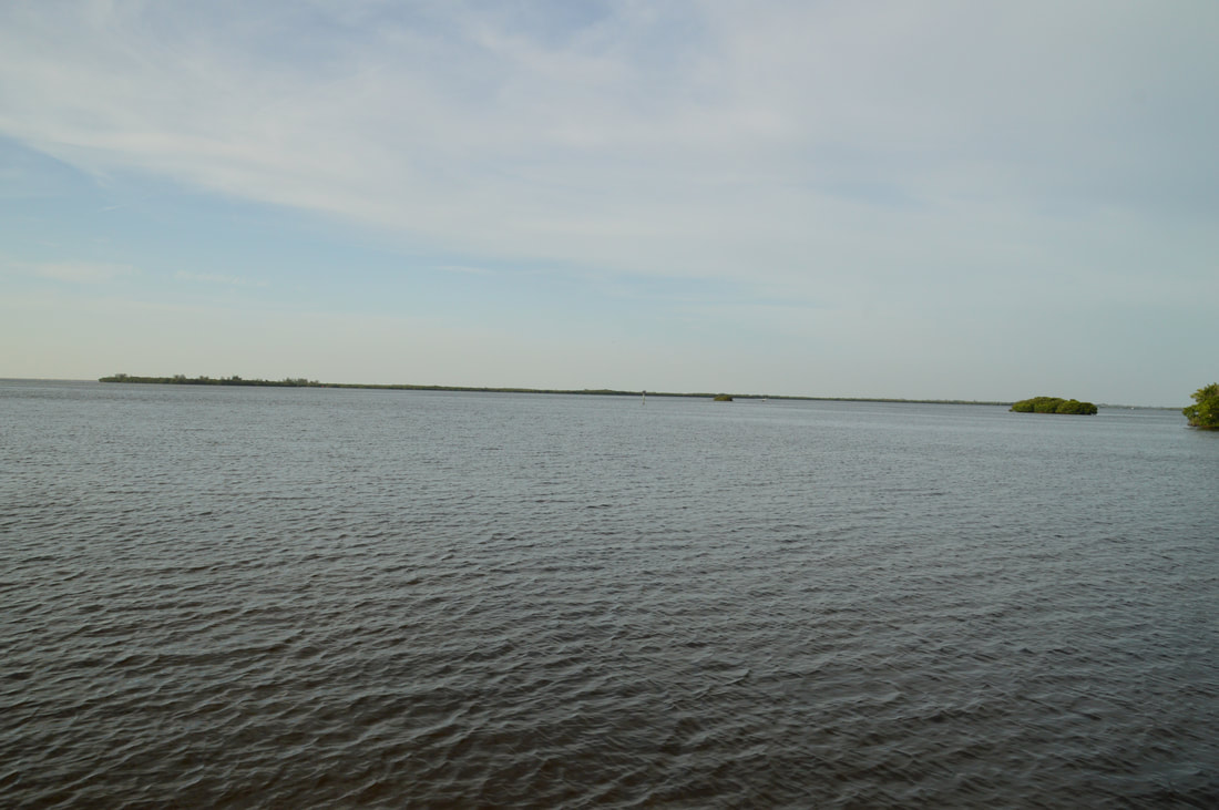
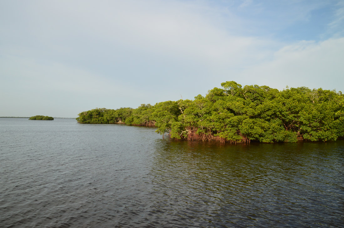
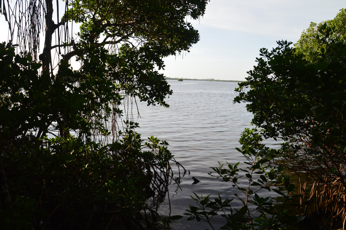
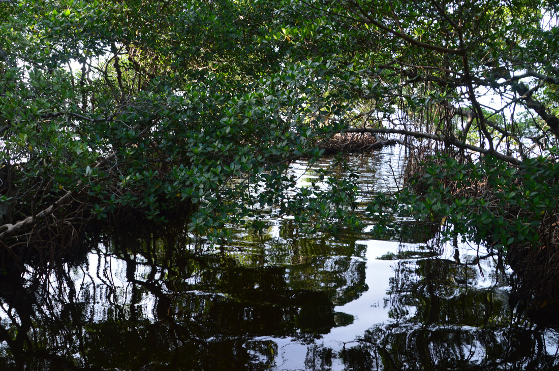
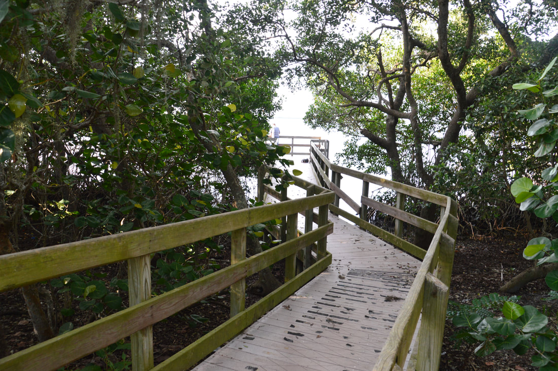
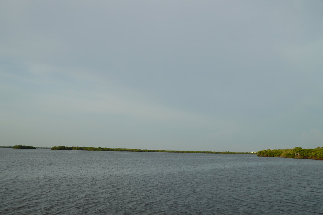
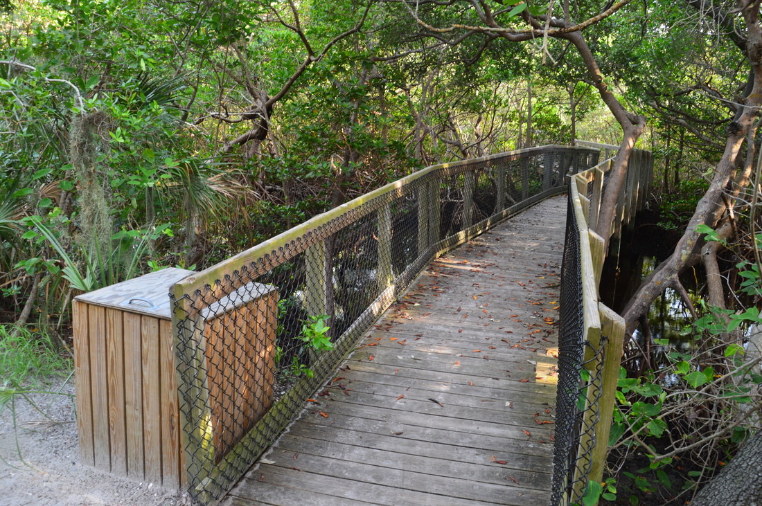
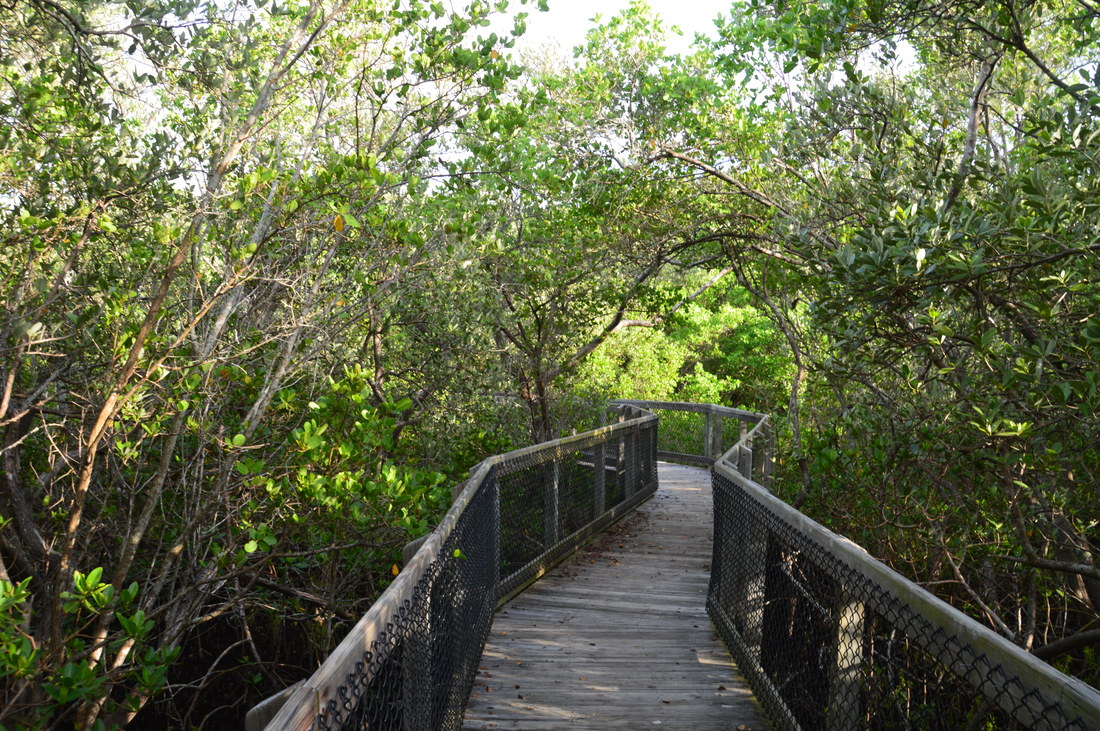
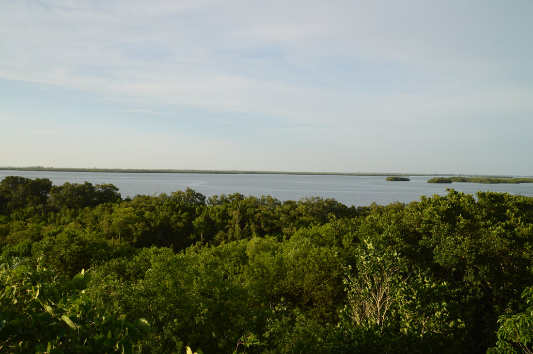
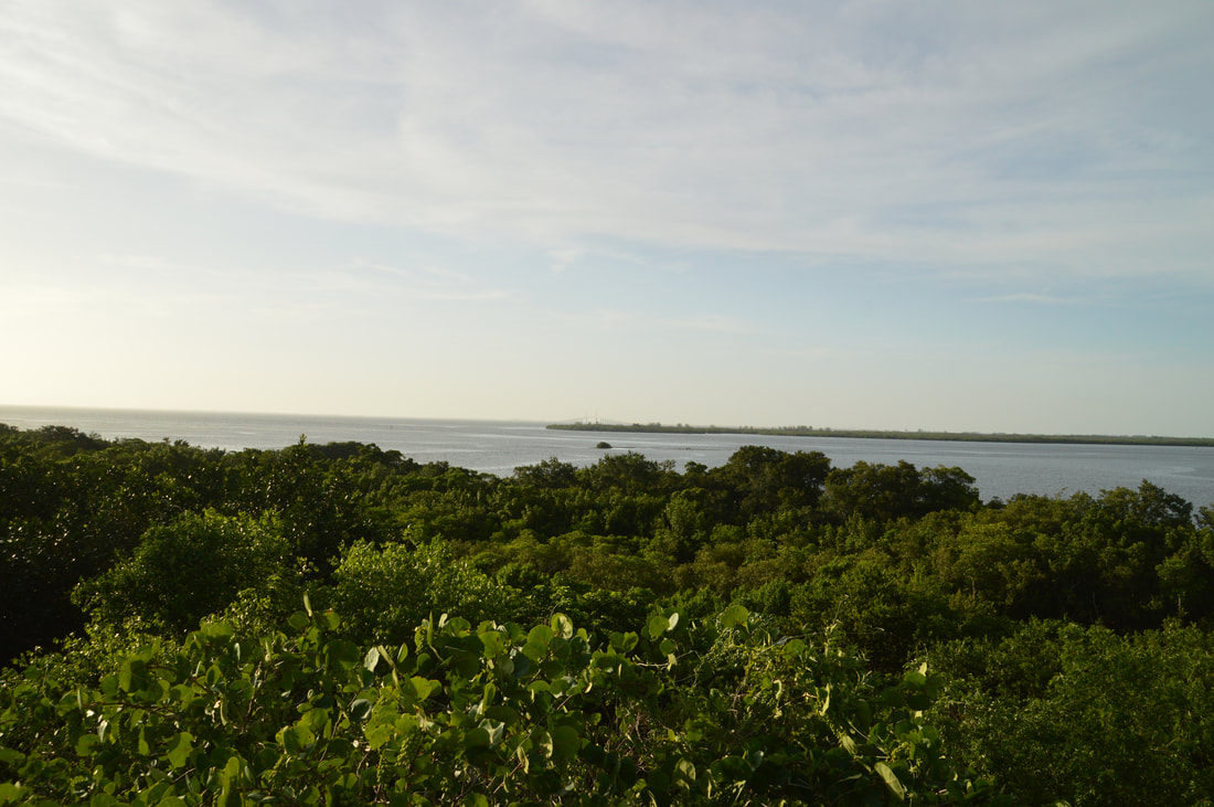
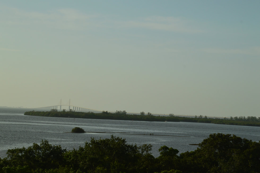
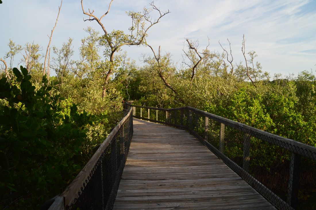
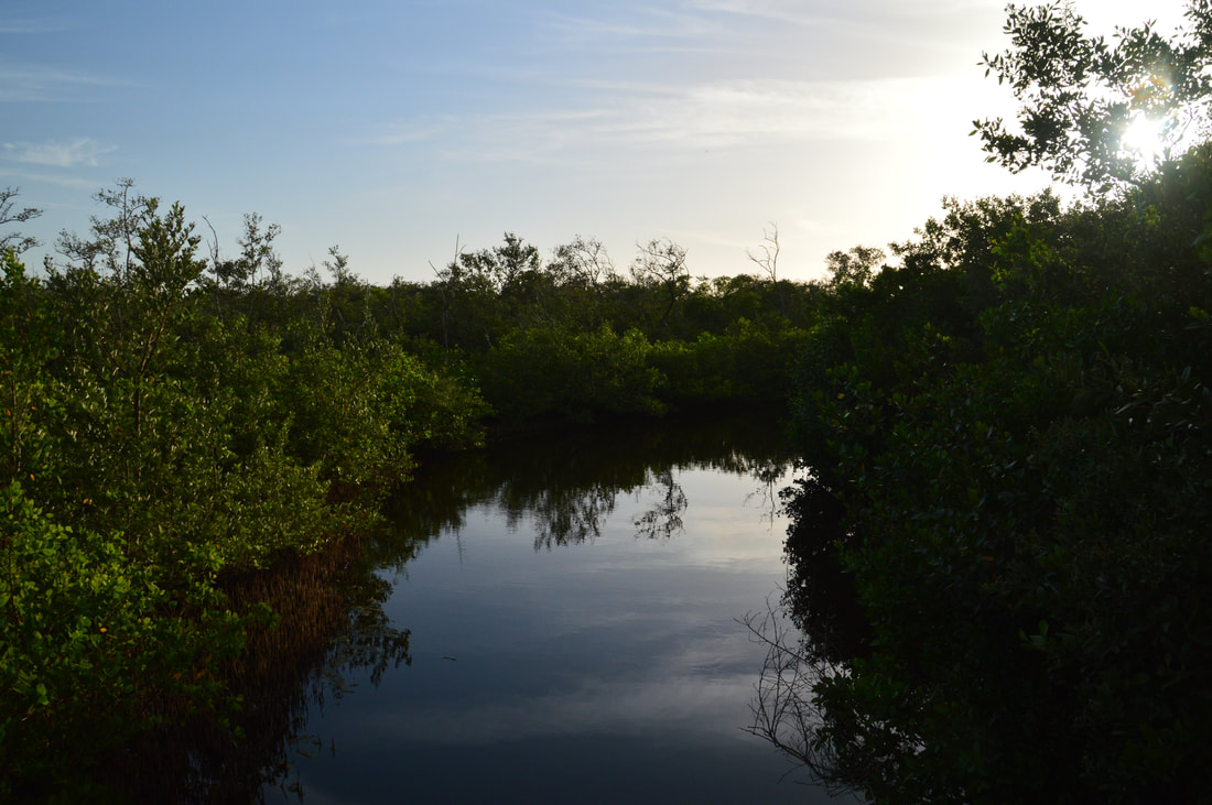
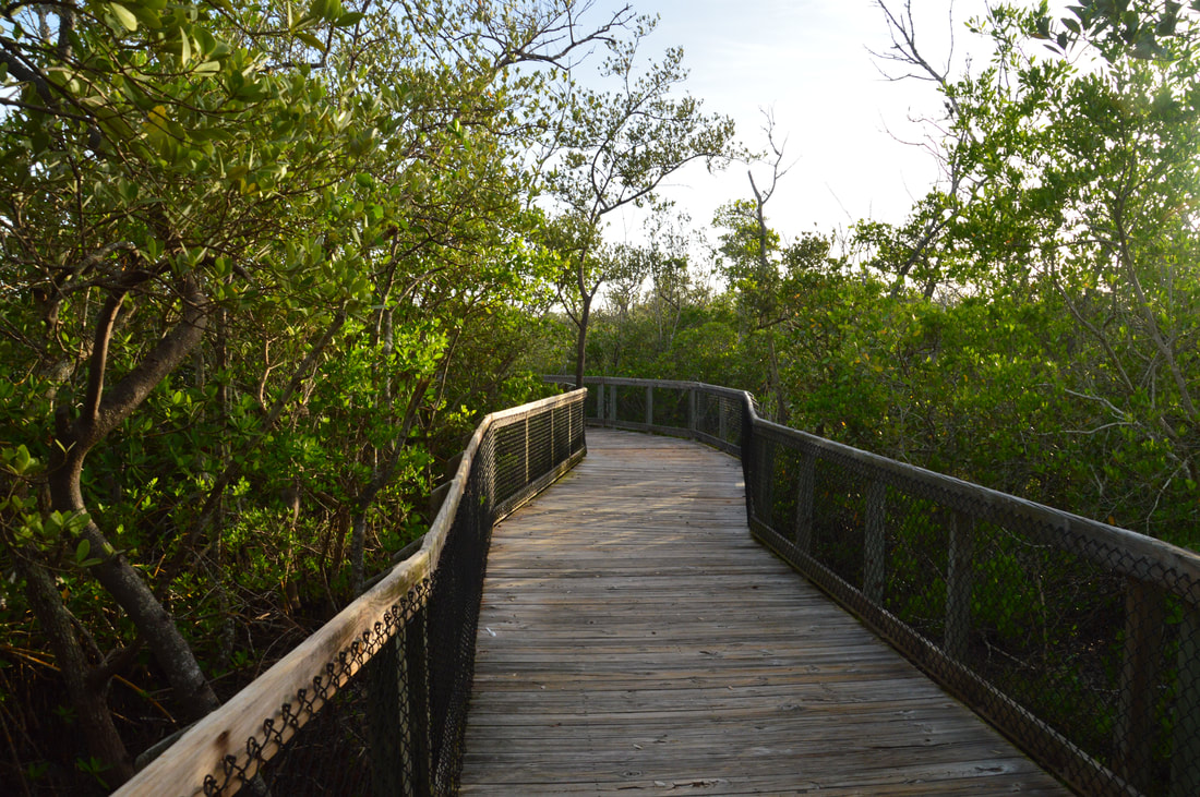
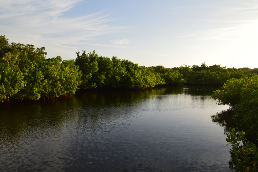
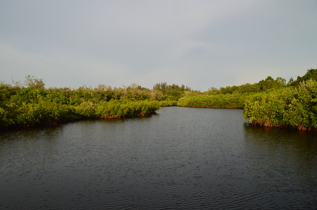
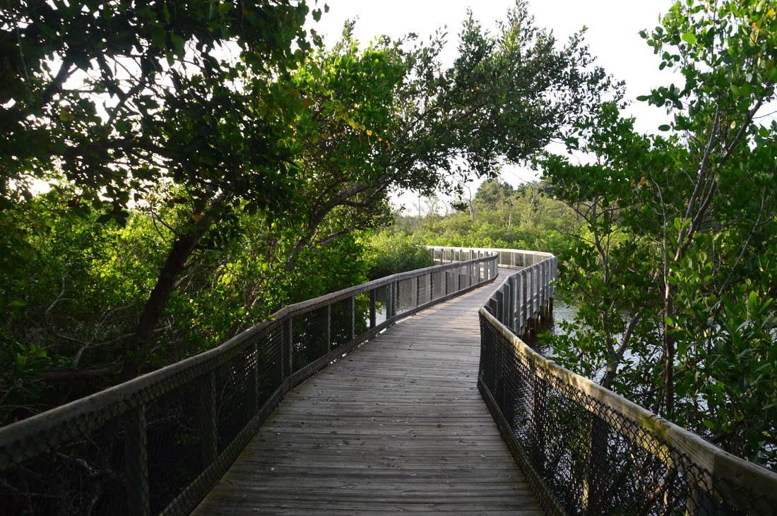
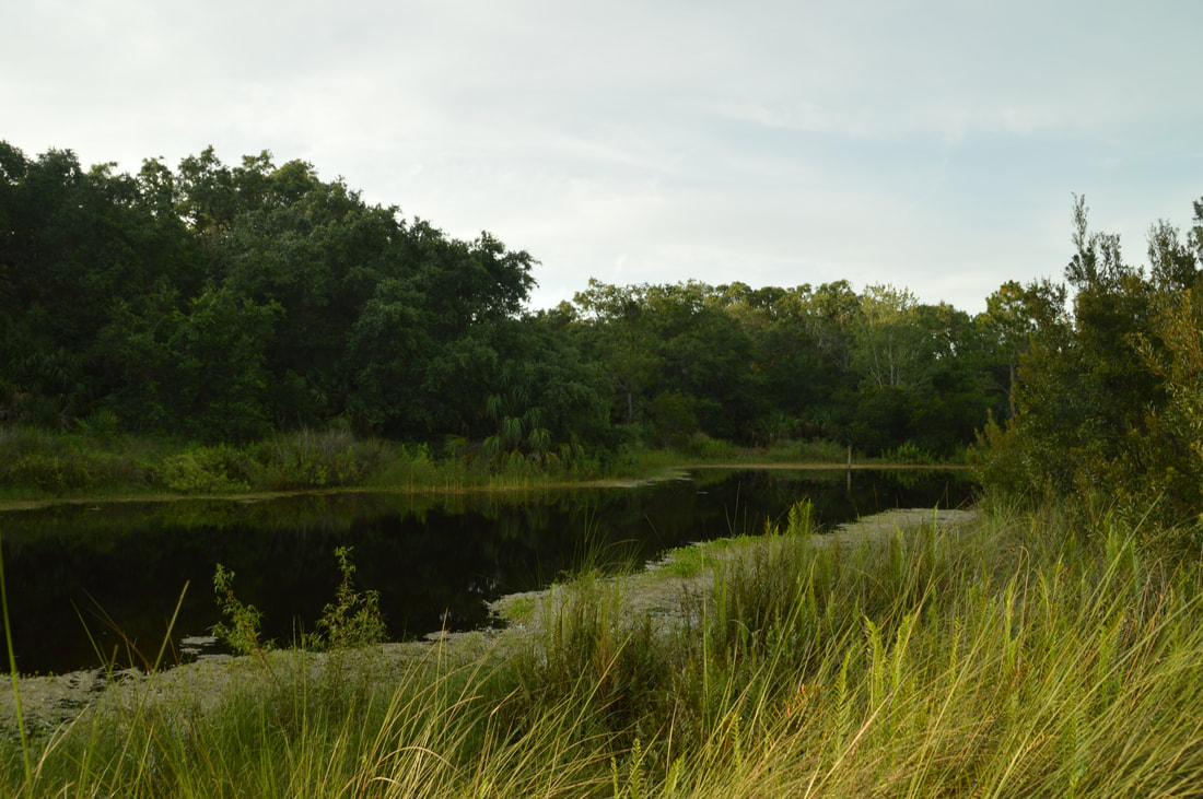
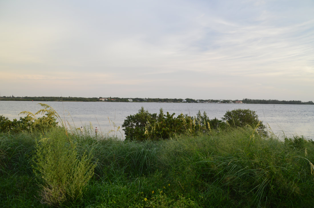
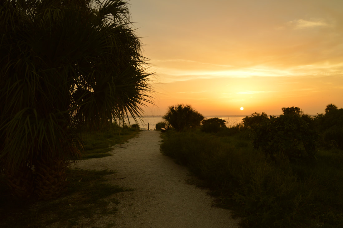
The Terra Ceia Trail begins following an elevated shell path surrounded, with a mangrove swamp on the left and a canal on the right. The trail soon approaches the shoreline and makes an east turn near it. After a short fence along the trail, reach a boardwalk on the left leading out to an observation deck for Tampa Bay at 1.15 miles. This observation deck provides great views of the bay with the Sunshine Skwyay Bridge in the distance. Continuing on the main trail, it turns into a narrower path that can get slightly overgrown with grass in places. The second observation deck will be on the left at 1.5 miles. This observation deck has the poorest view of the three, because it's placed just before the shoreline and not built in the water. Thus, it only provides a narrow viewing window. After this deck, the trail crosses a bridge across a mangrove canal and reaches a junction with the Tower Trail on the right at 1.55 miles. For now, continue straight to the third observation deck, reaching the boardwalk to it on the left at 1.6 miles. This observation deck has views of Tampa Bay as expansive as from the first deck, but it is further east so the angle is slightly different. You'll likely spot mullet jumping out of the water as you observe the view. From the third deck, return to the Tower Trail junction and begin following it southward, crossing another mangrove canal via boardwalk.

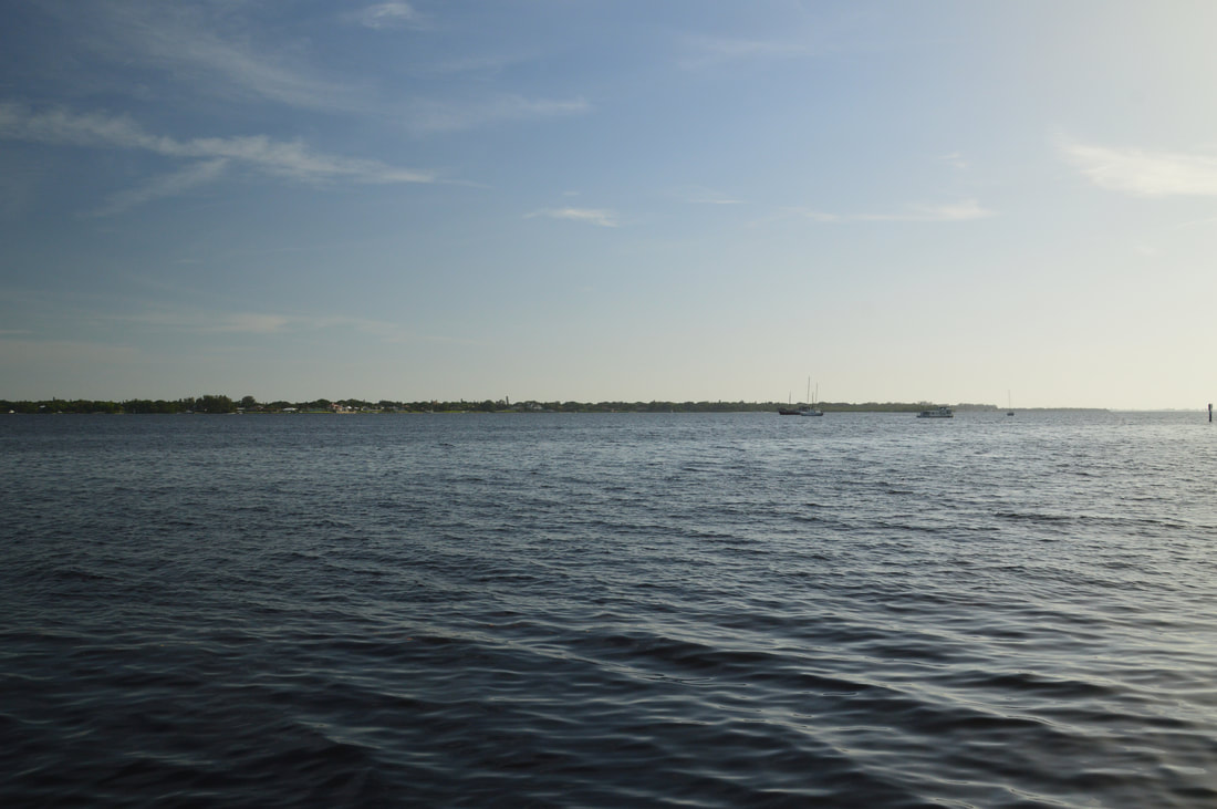
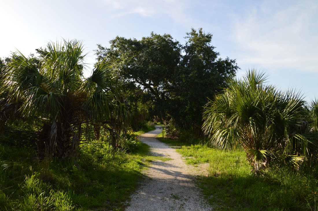
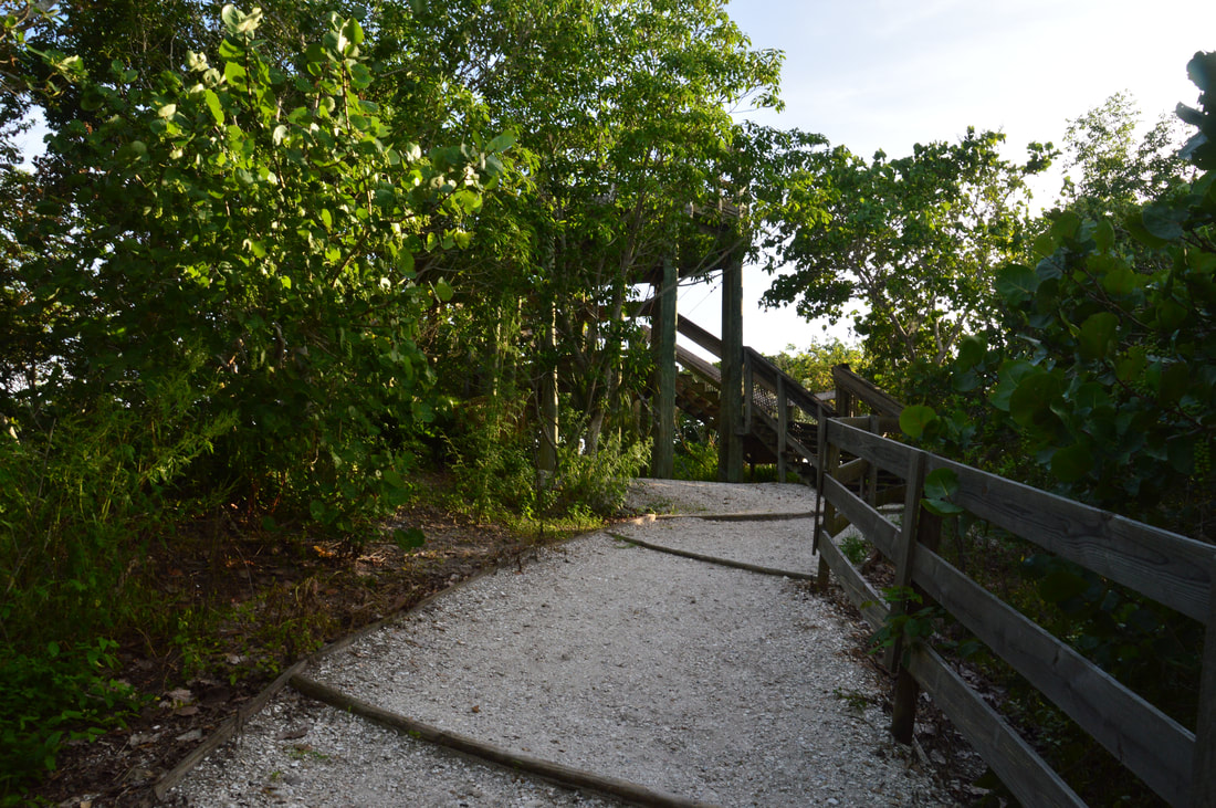
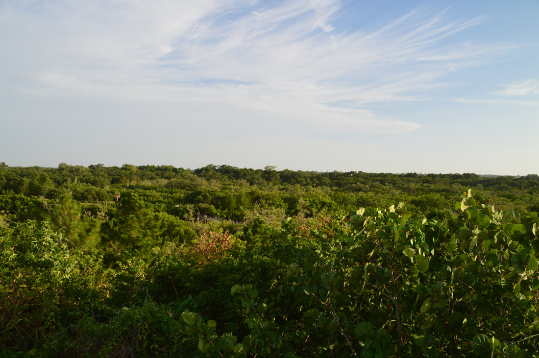
At 1.75 miles, there is a junction with a short loop around a hill with the tower. To access the tower, turn right at the junction, and in a few feet, stay left on a spur trail to the observation tower, ascending the small hill. The trail reaches the observation tower at 1.8 miles. Climb up the broad steps to the top of the tower, where an octagon-shaped observation deck provides a sweeping panoramic view of Tampa Bay and the near parts of Snead Island. Straight ahead, the Sunshine Skyway Bridge dominates the scene. To the left, you can see how Tampa Bay merges into the Gulf of Mexico with water stretching to the very horizon. Looking back into the heart of Emerson Point Preserve, you may spot a sliver of the the twisting Tower Trail boardwalk to the south. 

From the observation trail, return to the loop junction (that was at the 1.75-mile mark) and stay right to continue on the main trail as it bends around the hill. After the loop rejoins from the right, the Tower Trail reaches the beginning of a long broad boardwalk across a series of beautiful canals at 1.95 miles. The boardwalk ends at the Tower Trailhead and parking area at 2.05 miles. Continue past the parking area and onto a broad path on the same side of the road. This is the beginning of the North Restoration Trail. The trail briefly follows the road before plunging into a dry hammock with cabbage palms and live oaks. At 2.25 miles, a connector trail to the ranger station leaves right. While you will return to this spot, continue straight on the North Restoration Trail for now. The loop part of this trail begins at 2.3 miles. Stay left to hike the short loop clockwise. 
Picture
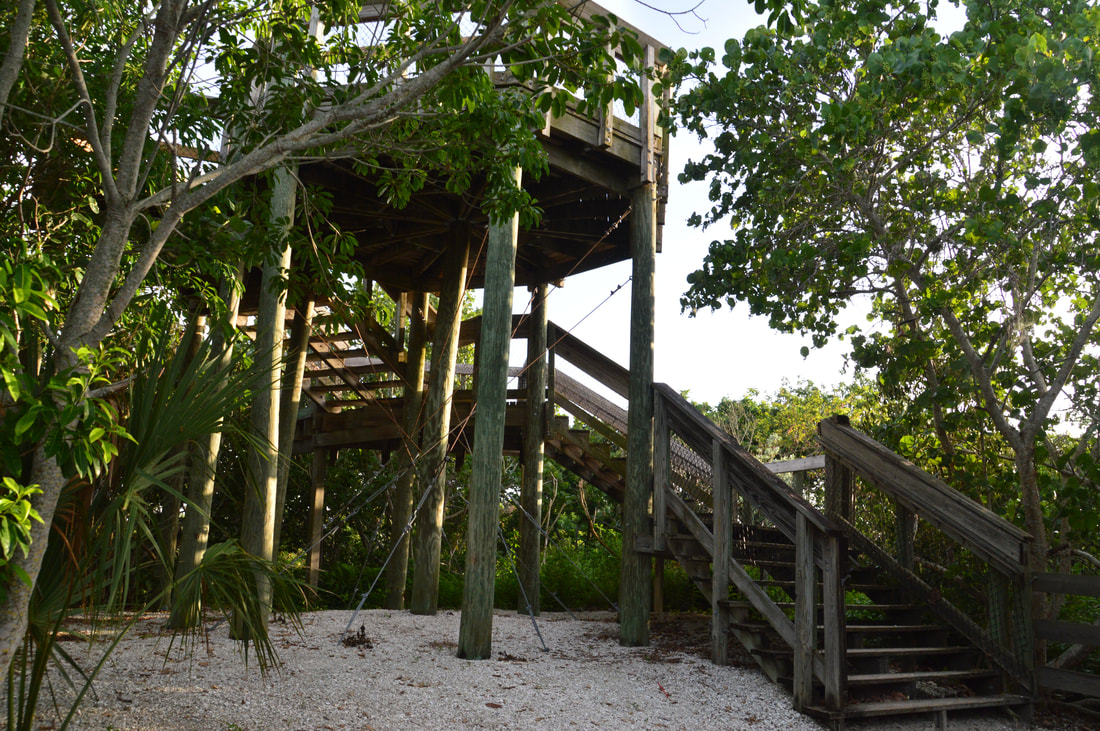
The Emerson Point observation tower is a magnificent construction that provides an elevated panoramic vista uncommon to Florida hiking trails.
A pond will be to the left of the trail soon after the loop junction. Near the junction with the other end of the Terra Ceia Trail at 2.45 miles, there is a beautiful sea of ferns alongside the trail. Then, as the trail curves back west, there is a side trail on the left to 17th Street. The trail passes a picturesque pond on the right at 2.6 miles near the preserve entrance - the most scenic spot on the North Restoration Trail. After concluding the loop, you'll return to the junction with the ranger station connector at 2.75 miles. Now, turn left onto the connector trail, shortly crossing the park road. After a brief immersion into the dense hammock, the connector trail ends at the trailheads for the Temple Mound Trail and South Restoration Trail at 2.85 miles. Remember this spot from earlier in the day? To get back to your car, simply turn left onto the unpaved access road that you drove earlier and follow it to the ranger station parking area, concluding the hike at your car at 3.0 miles. 

Mileage

0.0 - Emerson Point Ranger Station 
0.2 - Manatee River View 
0.3 - Portavant Temple Mound 
0.4 - South Restoration Trailhead
1.0 - 17th Street; Scenic Pond 
1.05 - Terra Ceia Trailhead 
1.15 - Tampa Bay View 1
1.5 - Tampa Bay View 2
1.6 - Tampa Bay View 3
1.8 - Emerson Point Observation Tower
2.05 - Tower Trailhead
​2.3 - North Restoration Loop
2.85 - South Restoration Trailhead
3.0 - Emerson Point Ranger Station

Variations

There are numerous ways to vary the configuration of a hike in Emerson Point Preserve thanks to its extensive trail system. Consult the Emerson Point Trail Map for possible variations. 

Bonus Stops

There is a separate small trail system at the west end of Emerson Point Preserve. The Beach Walk Trail follows the west shore of Snead Island for 0.4 miles to the island's northwest tip, and the Point Replica Mound Trail at the island's southwest end is just a short walk up another historic Indian mound with a scenic view of Tampa Bay and the Manatee River estuary. 

Pictures

Videos

0 Comments


Leave a Reply.

    About Me

    Mark Oleg Ozboyd
    I'm an avid outdoor explorer and a hobbyist landscape photographer. I'm 21 years old and have been hiking since 2011. Originally based out of Atlanta, Georgia, I started out by occasionally hiking short trails throughout well-known Georgia State Parks. During 2012 and 2013, I began to expand my trips into adjacent states, as well as into the wilder National Forest areas rather than just State Parks. Throughout the years that followed, as I slowly ran out of popular hiking trails in my area, I began to search for and hike in more seldom-visited areas. Today, you can find me out in the woods every weekend, whether it's on an official trail or bushwhacking through cross-country terrain without any paths. I now attend Washington & Lee University and am exploring Virginia and West Virginia. My other hobbies include chess, science, old music, and meteorology. I have 3 years of amateur weather forecasting experience, having studied a lot of meteorology basics over the years. I am also a student at European School of Music where I learned that music and nature have a lot in common. Listening to good music inspires me to capture nature's beauty on the camera in different aspects that also make me recall many beautiful music pieces that I've heard.​


    Dear readers: I have invested a tremendous amount of time and effort in this website and the Georgia Waterfalls Database the past five years. All of the work that has gone in keeping these websites updated with my latest trip reports has almost been like a full-time job. This has not allowed me to pick up a paid job to save up money for college, and therefore, I I've had to take out loans. If you find the information on this website interesting, helpful, or time-saving, you can say "thanks" and help me out by clicking the button above and making a contribution. I will be very grateful for any amount of support you give, as all of it will apply toward my college tuition. Thank you! 

    Enter your email address to subscribe for trail reports:

    Delivered by FeedBurner


    Picture
    Coming in 2022-2023?

    Other Hiking Websites

    DWHike's Adventures
    Florida's Natural Wonders
    Florida Trailblazer
    Meanderthals
    Mountain Images
    by Bernie Boyer

    North Carolina Waterfalls with
    ​Kevin Adams
    Take-a-Hike!
    Tennessee Landforms
    Waterfall Page
    Waterfall Adventurer
    Zach's Mild Adventures

    Miles Hiked

    Year 1: 540.0 Miles
    Year 2: 552.3 Miles
    ​Year 3: 518.4 Miles
    Year 4: 482.4 Miles
    Year 5: 259.9 Miles

    Archives

    March 2021
    February 2021
    January 2021
    November 2019
    October 2019
    September 2019
    August 2019
    July 2019
    June 2019
    February 2019
    January 2019
    December 2018
    November 2018
    October 2018
    August 2018
    July 2018
    June 2018
    May 2018
    April 2018
    March 2018
    February 2018
    January 2018
    December 2017
    November 2017
    October 2017
    September 2017
    August 2017
    July 2017
    June 2017
    May 2017
    April 2017
    March 2017
    February 2017
    January 2017
    December 2016
    November 2016
    October 2016
    September 2016
    August 2016
    June 2016
    May 2016
    April 2016
    March 2016
    January 2016
    December 2015
    November 2015
    October 2015
    September 2015
    August 2015
    July 2015
    June 2015
    May 2015
    April 2015
    March 2015
    February 2015
    January 2015
    December 2014
    November 2014
    October 2014
    September 2014
    August 2014
    July 2014
    June 2014
    May 2014
    April 2014
    March 2014
    February 2014

    Categories

    All
    Adel
    Adirondack Park
    Alabama
    Alfred A. Ring Park
    Allegheny Trail
    Amicalola Falls State Park
    Anniston Area
    Apalachicola Bluffs And Ravines Preserve
    Apalachicola National Forest
    Apalachicola/Port St. Joe Area
    Apopka
    Appalachian Trail
    Appling
    Art Loeb Trail
    Aska Trail System
    Bakersville
    Balm-Boyette Scrub Preserve
    Balsam Lake Recreation Area
    Bankhead National Forest
    Bartow County Parks
    Bartram Trail
    Basinger
    Beersheba Springs
    Benton
    Benton Mackaye Trail
    Berry College Trail System
    Best Hike
    Big South Fork National Recreation Area
    Black Bear Wilderness
    Black Rock Mountain State Park
    Blairsville
    Blakely
    Blood Mountain Wilderness
    Blowing Rock
    Blue Ridge
    Blue Ridge Parkway
    Boone
    Bradenton
    Bradenton Beach
    Brasstown Bald
    Brasstown Wilderness
    Brevard
    Bryson City
    Buchanan
    Bucks Pocket State Park
    Bulow Creek State Park
    Bulow Plantation Ruins State Park
    Caesars Head State Park
    Caladesi Island State Park
    Calhoun
    Camel's Hump State Park
    Cashiers
    Caspersen Beach Park
    Catfish Creek State Park
    Caves
    CC Putnam State Forest
    Cedar Point Environmental Park
    Chatsworth
    Chattahoochee National Forest
    Chattanooga
    Chattanooga Valley
    Chattooga National Wild And Scenic River
    Cheaha Wilderness
    Cherohala Skyway
    Cherokee
    Cherokee National Forest
    Chiefland Area
    Chillhowee Recreation Area
    Chipley
    Chunky Gal Trail
    Circle B Bar Reserve
    Citico Creek Wilderness
    Citrus Wildlife Management Area
    Clarkesville
    Clayton
    Cleevland
    Cleveland
    Cloudland Canyon State Park
    Cohutta Wilderness
    Collier-Seminole State Park
    Cordele
    Cornelia
    Covington
    Crestview Area
    Crew-land-and-water-trust
    Cullowhee
    Cumberland Trail
    Dahlonega
    Dalton
    Dawson Forest Wildlife Management Area
    Dawsonville
    Dayton
    De Soto National Memorial
    DeSoto State Park
    Dillard
    Double Springs
    Ducktown
    Duncan Ridge Trail
    Dunlap
    Eagle's Rest Park
    Eastpoint
    Econfina Creek Wildife Management Area
    Eglin Air Force Base
    Elizabethton
    Elkins
    Elk Knob Game Lands
    Elk Park
    Ellicott Rock Wilderness
    Ellijay
    Emerson Point Preserve
    Englewood Area
    Enota Retreat
    Erwin
    Falling Waters State Park
    Fayetteville
    Fires Creek Recreation Area
    Fire Tower
    Flint River
    Florence Area
    Florida
    Florida Caverns State Park
    Florida Trail
    Foothills Trail
    Fort Mountain State Park
    Fort Myers Area
    Fort Payne
    Fort Payne Area
    Fort Yargo State Park
    Franklin
    Franklin Delano Roosevelt State Park
    Franklin-Marion State Forest
    Frozen Head State Park
    Gainesville
    Gainesville Area
    Gatlinburg
    George Washington National Forest
    Georgia
    Georgia Veterans Memorial State Park
    Glasgow
    Gorges State Park
    Grandfather Mountain State Park
    Great Smoky Mountains National Park
    Greeneville
    Green River Game Lands
    Gruetli-Laager
    Grundy Forest State Natural Area
    GTM Reserve
    Guana River Wildlife Management Area
    Hayesville
    Helen
    Hiawassee
    High Falls State Park
    Highlands
    Highlands Scenic Highway
    Hillsborough River State Park
    Hinson Conservation & Recreation Area
    Historic Sites
    Honeymoon Island State Park
    Hot Springs
    Huntington
    Inverness Area
    Jackson
    Jasper
    Jefferson National Forest
    Joan M. Durante Park
    Jonathan Dickinson State Park
    Jones Gap State Park
    Joyce Kilmer Slickrock Wilderness
    Joyce Kilmer - Slickrock Wilderness
    Juniper Prairie Wilderness
    Kelly Park
    Keown Falls Recreation Area
    Kolomoki Mounds State Park
    LaFayette
    Lake City Area
    Lake George Wild Forest
    Lake June-in-Winter State Park
    Lakeland Area
    Lake Placid
    Lake Russell Wildlife Management Area
    Lake Wales Ridge State Forest
    Laurel Fork North Wilderness
    Leffis Key Preserve
    Leon Sinks Geological Area
    Lexington
    Lineville
    Linville
    Linville Gorge Wilderness
    Lithia Springs
    Little Frog Wilderness
    Little Manatee River State Park
    Little River Canyon National Preserve
    Longboat Key
    Long Trail
    Lookout Mountain
    Lookout Mountain Battlefield
    Lovingston
    Lula Lake Land Trust
    Lumpkin
    Maggie Valley
    Manatee Springs State Park
    Marianna Area
    Mark Trail Wilderness
    Marlinton
    Mccaysville
    McMinville
    Mentone
    Middlesex
    Mistletoe State Park
    Monongahela National Forest
    Montreat
    Mountain Bridge Wilderness Area
    Mountain City
    Mountains To Sea Trail
    Mountains-to-Sea Trail
    Mount Rogers National Recreation Area
    Myakka River State Park
    Myron B. Hodge City Park
    Nantahala National Forest
    Naples
    Naples Area
    Natural Bridge State Park
    Neal Preserve
    New Castle
    Newport
    New River Gorge National Park
    New York
    North Carolina
    Ocala Area
    Ocala National Forest
    Ocean-to-Lake Trail
    Oconee State Park
    Oconee Station Historic Site
    Okaloacoochee Slough State Forest
    Oldsmar
    Oneida
    Orlando Area
    Ormond Beach
    Oscar Scherer State Park
    Oxford
    Palatka
    Palmetto Trail
    Panama City Area
    Panthertown Valley
    Parrish
    Paynes Creek Historic State Park
    Peaks Of Otter Recreation Area
    Pigeon Crockford Mountain Wildlife Management Area
    Pigeon-Crockford Mountain Wildlife Management Area
    Pigeon-Crockford Wildlife Management Area
    Pine Mountain
    Pinhoti Trail
    Pinnacle Park
    Pisgah Civitan Park
    Pisgah National Forest
    Pittman Center
    Pond Mountain Wilderness
    Ponds/Lakes
    Prentice Cooper State Forest
    Providence Canyon State Park
    Pumpkintown
    Quick Point Nature Preserve
    Raven Cliffs Wilderness
    Reed Bingham State Park
    Reliance
    Rice Creek Conservation Area
    Riverview Pointe Preserve
    Robbinsville
    Robinson Preserve
    Rock Creek Gorge Scenic Area
    Rock Island State Park
    Rome
    Rosman
    Sale Creek
    Salem
    Salt Springs
    Saluda
    Santa Rosa Beach
    Sarasota
    Sarasota Area
    Savage Gulf State Natural Area
    Scenic Views
    Scottsboro Area
    Sebring Area
    Sewanee
    Sheltowee Trace Trail
    Shining Rock Wilderness
    Signal Mountain
    Sipsey Wilderness
    Sky Valley
    Smithgall Woods State Park
    Snowbird Backcountry Area
    Soddy Daisy
    Soddy-Daisy
    Sopchoppy
    South Carolina
    South Cumberland State Park
    Southeastern Cave Conservancy
    Southern Nantahala Wilderness
    Sparta
    Sprewell Bluff Park
    Spring City
    Spring Hill
    Springs
    Spruce Pine
    Standing Indian Backcountry Area
    St. Augustine
    St. George Island State Park
    St. Joseph Bay State Buffer Preserve
    St. Marks Area
    St. Marks National Wildlife Refuge
    Stone Mountain
    Stone Mountain Park
    Suches
    Sumatra
    Sumter National Forest
    Suwannee River
    Swallow Creek Wildlife Management Area
    Sweetwater Creek State Park
    Sylva
    Talladega National Forest
    Tallahassee Area
    Tallulah Falls
    Tallulah Gorge State Park
    Tampa Bay Area
    Tate City
    Tate's Hell State Forest
    Tea Creek Wildlife Management Area
    Tellico Plains
    Tennessee
    Thomaston
    Toccoa
    Topsail Hill State Park
    Torreya State Park
    Townsend
    Tracy City
    Tray Mountain Wilderness
    Trenton
    Triple Creek Preserve
    Troutdale
    Unaka Mountain Wilderness
    Upper Tampa Bay County Park
    Venice
    Vermont
    Virgin Falls State Natural Area
    Virginia
    Virginia Outdoors Foundation
    Vogel State Park
    Wakulla Springs State Park
    Waleska
    Walhalla
    Wartburg
    Water Features
    Waynesville
    Weedon Island Preserve
    Weeki Wachee Preserve
    Wekiwa Springs State Park
    West Palm Beach Area
    West Virginia
    Whitehall
    White Springs
    Winder
    Withlacoochee State Forest
    Young Harris

    RSS Feed

TRAIL REPORTS

Hikes in Alabama
​Hikes in Florida
Hikes in Georgia
Hikes in North Carolina
Hikes in South Carolina
Hikes in Tennessee
Hikes in Virginia

Hiking Resources

Alabama Resources
​
Florida Resources
Georgia Resources
North Carolina Resources
​South Carolina Resources
​
Tennessee Resources

Other

Contact
Map of Hikes
Alphabetical List of Hikes
Southeast Nature Society
© COPYRIGHT 2014-2018
​ALL RIGHTS RESERVED.
Important: I disclaim any responsibility for any damage or personal injury that may occur as a result of the activities and information found on this website. All outdoor activities, especially off-trail hiking, are done at your own risk. Never hike or head into that area that may be above your fitness or experience level.
  • Home
  • Trail Reports
    • Best Hikes
    • Hikes with Scenic Views
    • Hikes with Water Features
    • Alabama
    • Georgia
    • Florida
    • North Carolina
    • South Carolina
    • Tennessee
    • Vermont
    • Virginia
  • Map
  • Hike List
  • Testimonials
  • Resources
  • Contact Us
  • Southeast Nature Society
    • Our Team
  • Georgia Waterfalls Database