
Hiking in Florida typically means looking for certain highlights such as interesting woods, creeks, lakes, or historic sites. But what if you could fit all of that into one hike? That's something the north loop at the Arbuckle Tract of Lake Wales Ridge State Forest manages to accomplish. In under just 14 miles, this trail visits the shorelines of Lake Arbuckle and Lake Godwin, affords numerous views of both Reedy Creek and Livingston Creek, and passes through a variety of different woods and ecosystems that range from unique pine flatwoods full of cutthroat seep grass to open, sandy scrub areas. This hike is easily among the most scenic I've done in Central Florida. Not often do you find such a mix of beautiful scenery on a single trail in Florida, keeping your interest piqued and letting the miles roll by faster. This hike occurred on Saturday, August 4th, 2018. My plan was to hike the North Loop in the Arbuckle Tract counter-clockwise from McLean Cabin Trailhead.
Summary
R/T Length of Trail: 13.8 Miles
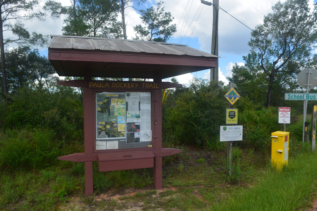
Duration of Hike: 6:45 plus 2 hours of stopping and photography Type of Hike: Loop Difficulty Rating: 7 out of 10 (may be easier in winter when grass is mowed) Pros: Great scenery all throughout the hike; trails stay dry even during the wet season (unless it's one of those rare cases when Lake Arbuckle is flooded) Cons: None Points of Interest: McLean Cabin; Lake Arbuckle Views; Reedy Creek at Creekside Campsite; Reedy Creek Views; Reedy Creek Bridge; Livingston Creek Bridge at Graves Island Campsite; Lake Godwin Trail Blaze Colors: Yellow Loop Trail (Paula Dockery Trail - Graves Island Trail - Wolly Piety Trail) - Yellow; Blue Cross-Trail (Lake Godwin Trail) - Blue Best Seasons to Hike: Fall; Winter Fees: The Arbuckle Tract of Lake Wales Ridge State Forest has an entry fee of $1 per person, with children under six free. Beginning Point: McLean Cabin Directions from Frostproof, FL: From the intersection of County Road 630 and Scenic Highway FL 17, follow FL 17 South for 2.6 miles to T. S. Wilson Road. Turn left and continue 3.8 miles. Then, turn right onto Lake Arbuckle Road. In another 1.5 miles, turn right onto Rucks Dairy Road, the entry road for Lake Wales Ridge State Forest. The pavement ends in 0.9 miles just past a bridge across Reedy Creek. After paying at the fee station, bear left on School Bus Road. Despite a few ruts, this dirt road should be suitable for most passenger vehicles. In 2.7 miles, turn right on the side road to McLean Cabin. You'll arrive at the trailhead parking area in 0.1 mile. Map
Click the link below to download a .GPX file with a track of this hike.
Details
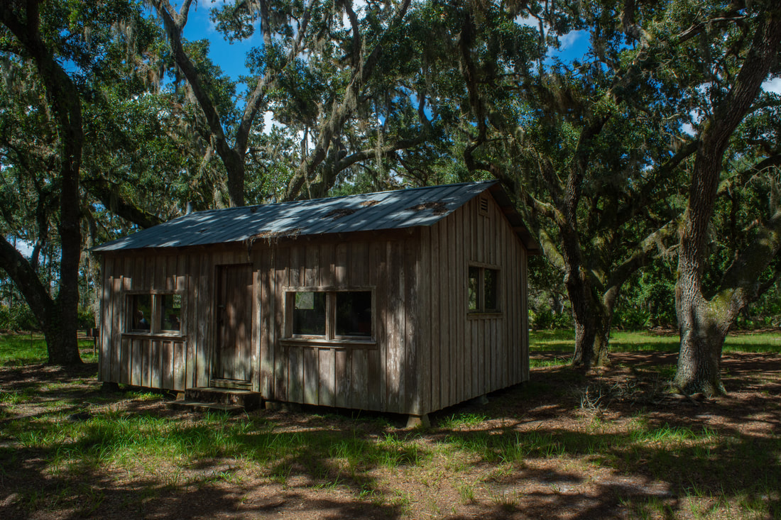
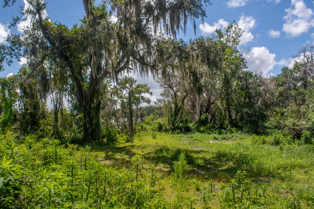
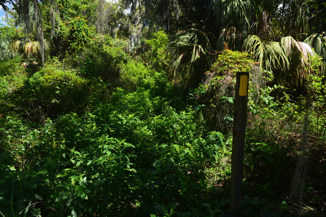
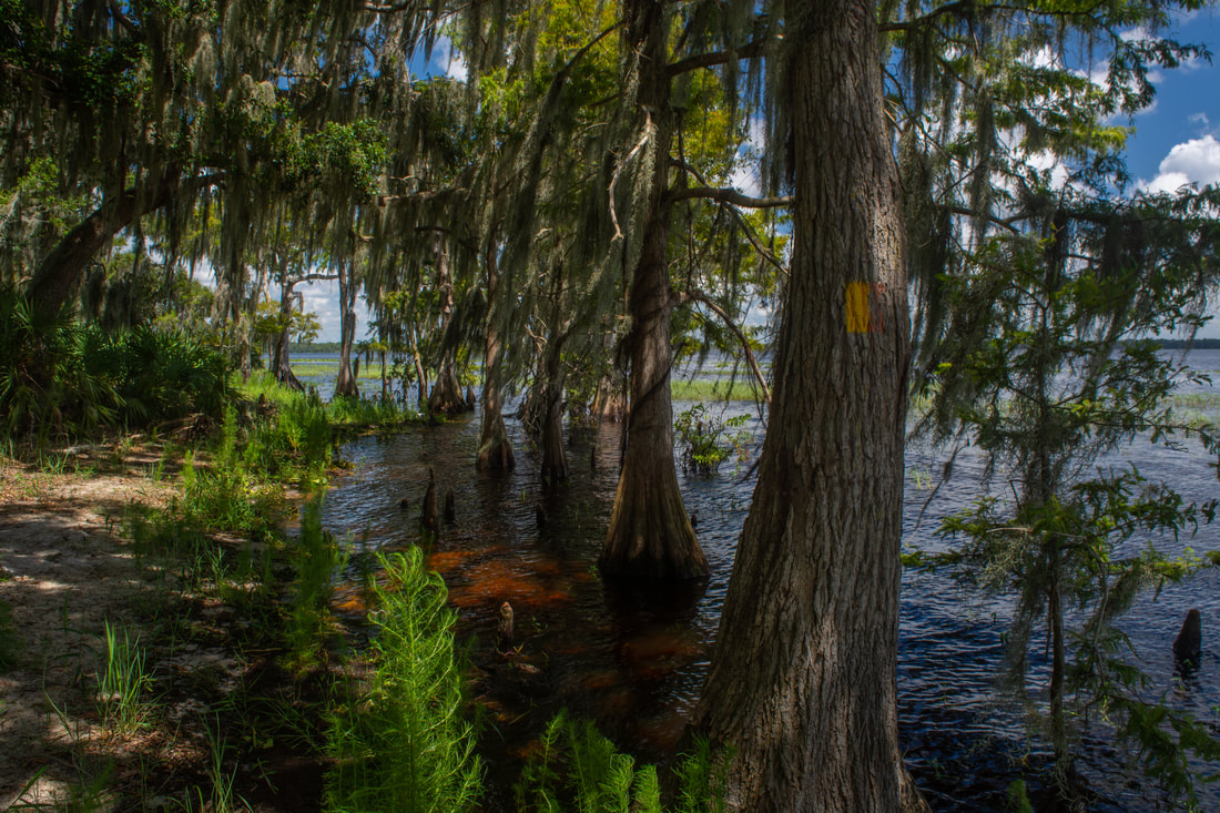
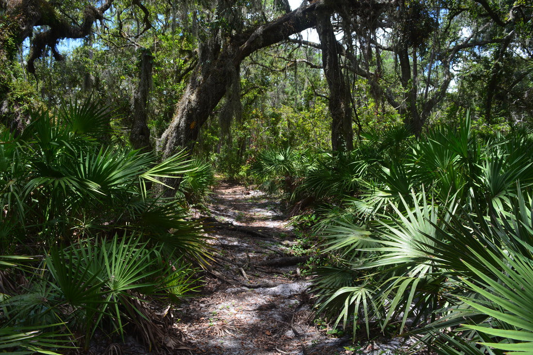
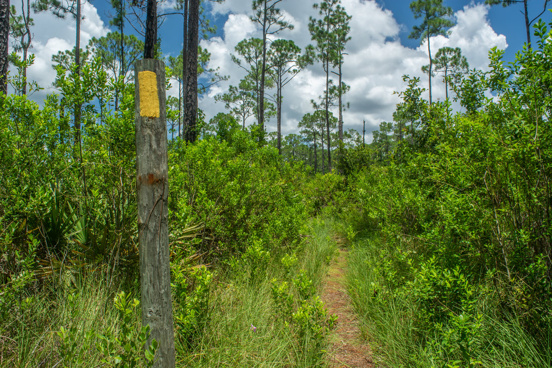
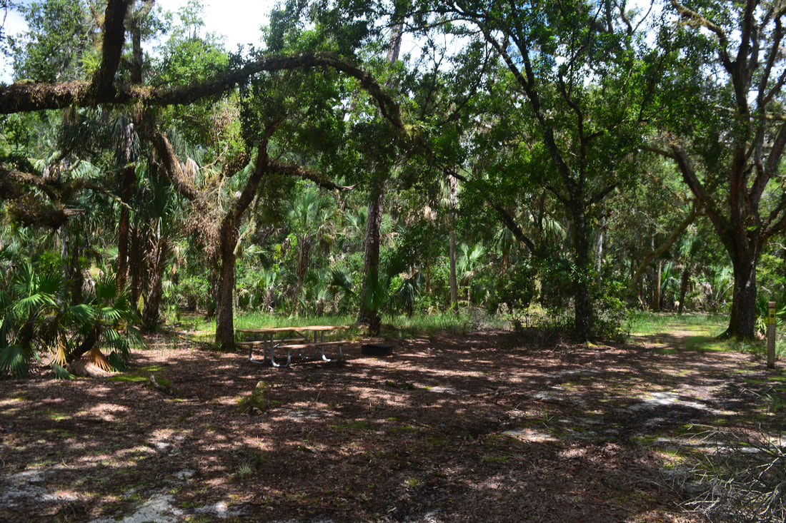
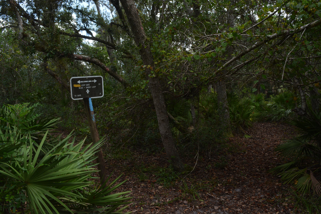
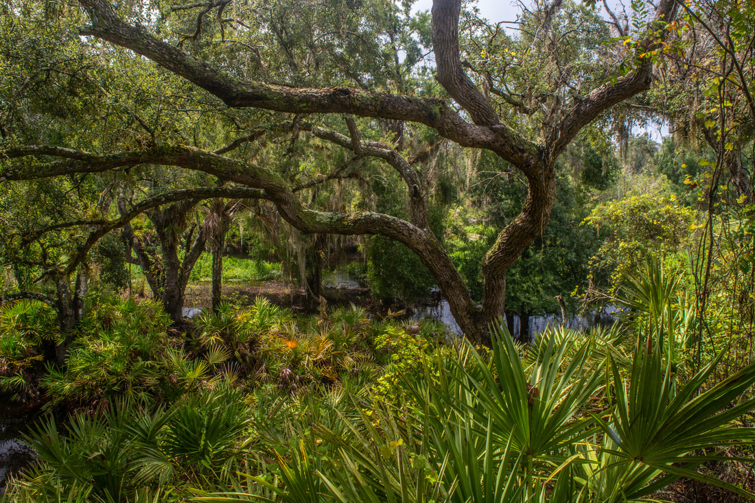
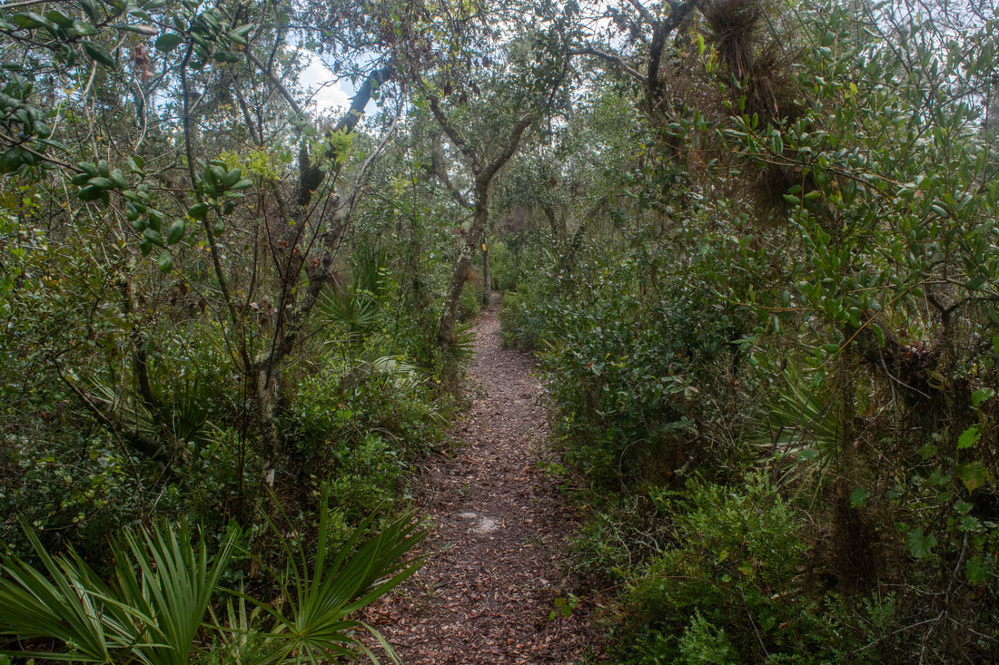
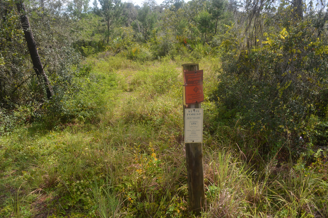
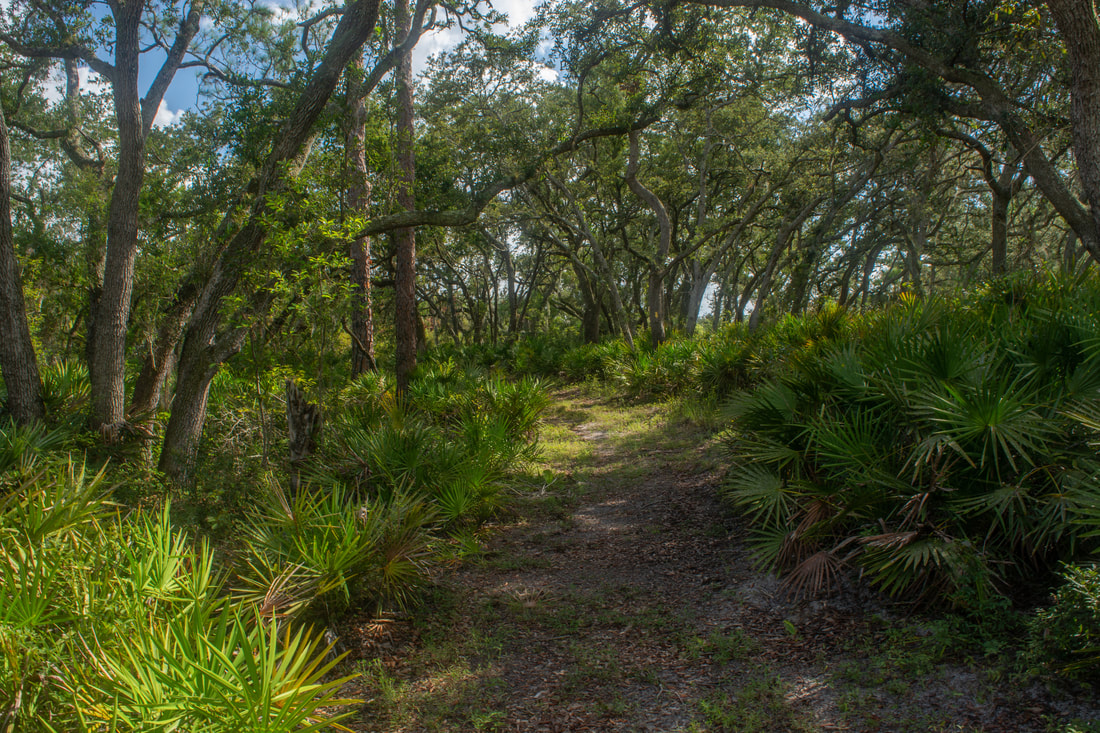
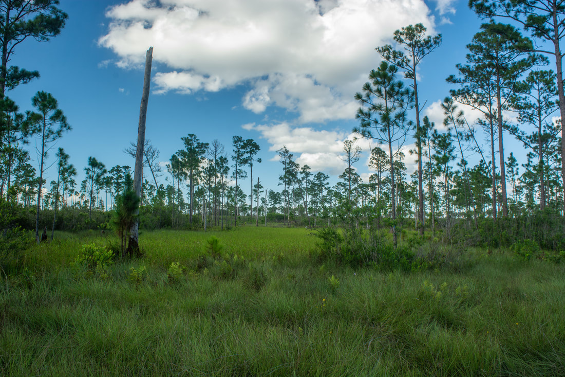
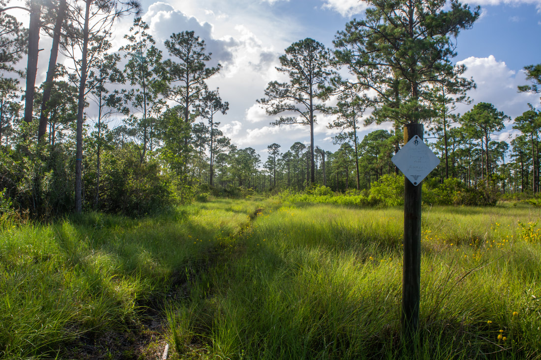
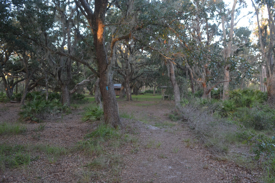
I typically try to do at least one hike on the Lake Wales Ridge during my summertime trips to Florida. Millions of years ago, the Lake Wales Ridge was the only section of Florida that had been above water. Today, it's an elevated, sandy strip of land stretching across the middle of the state. Most Lake Wales Ridge hikes tend to be dry even during the wet season, making them attractive choices when one wants to keep their feet dry. The North Loop in Arbuckle Tract lived up to its expectations - I managed to keep my feet dry all day, although a few muddy spots along the Lake Arbuckle shoreline were present. The hike starts by the historic, restored McLean Cabin. This small wooden cabin rests in a picturesque oak hammock. To hike the loop counter-clockwise, look for the eastbound Blue Trail on the far left (not the one by the kiosk, as that's the westbound Blue Trail). Although some of the Lake Wales Ridge State Forest trails tend to be overgrown, especially in the summer, they're always well-blazed.
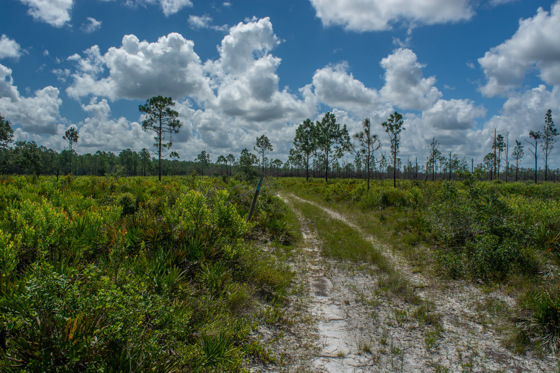
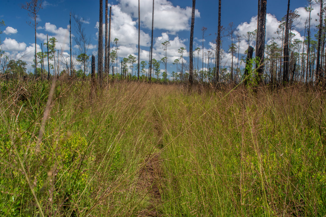
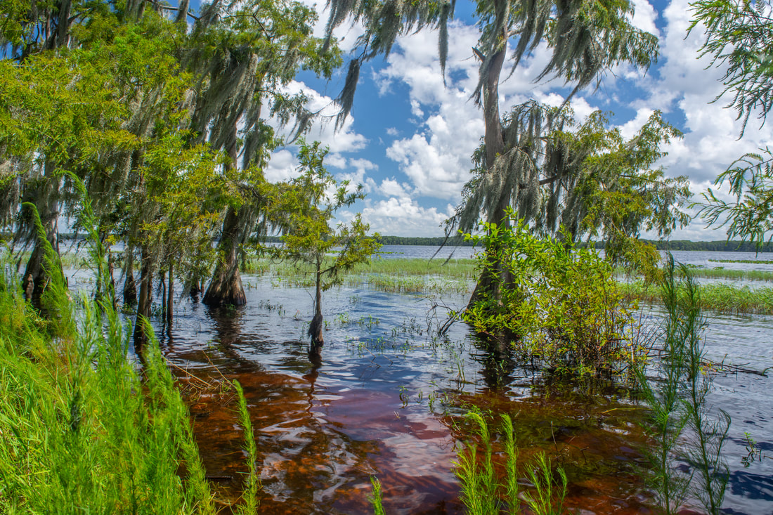
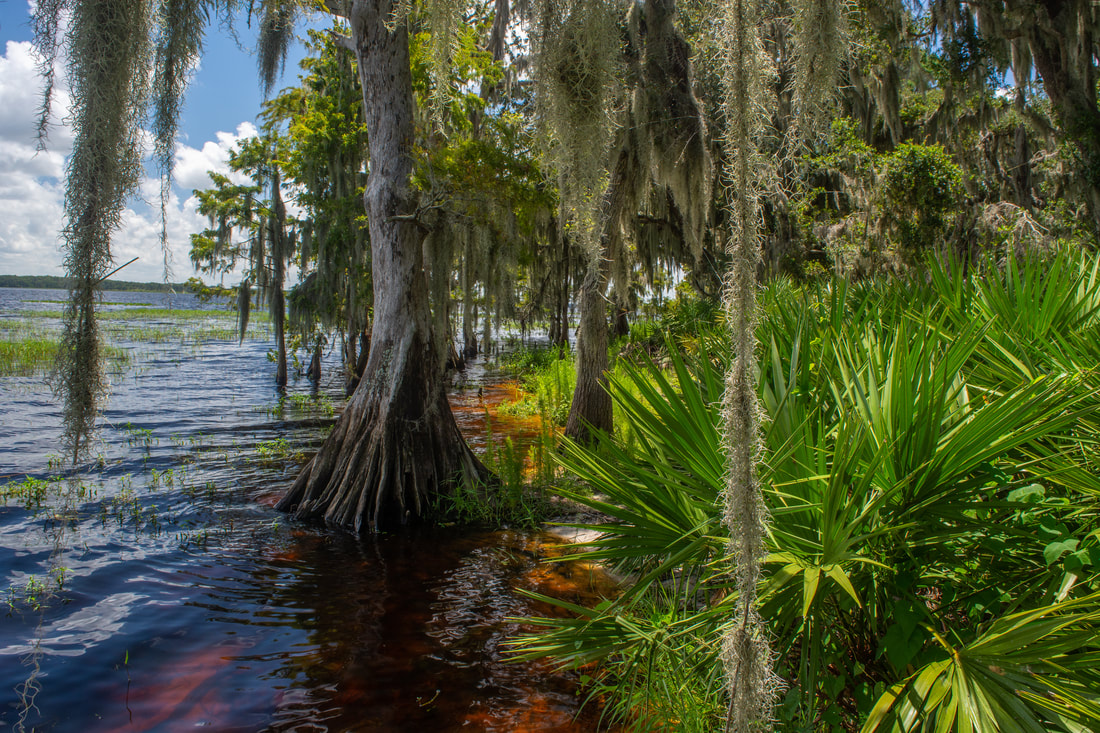
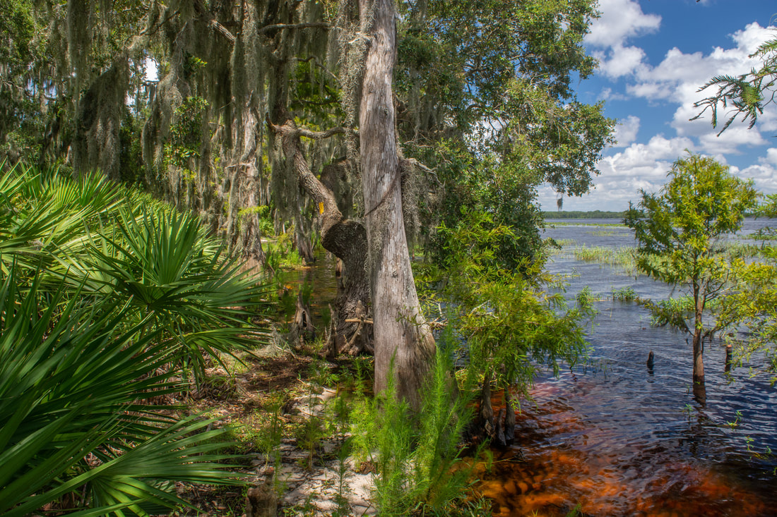
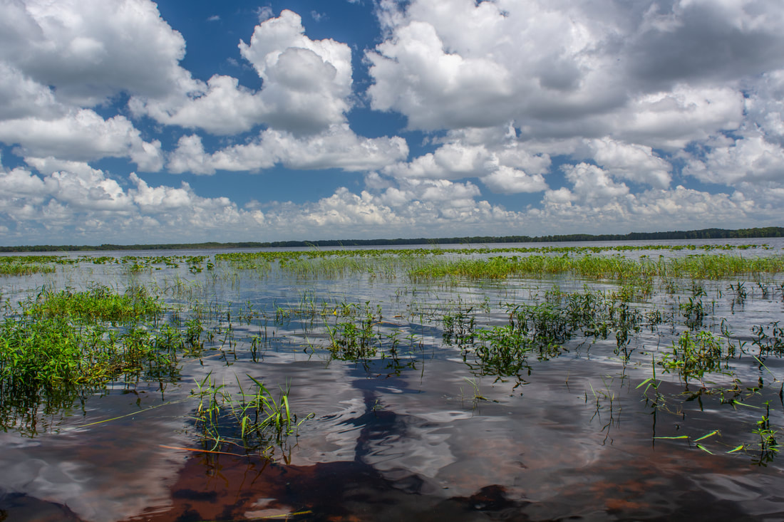
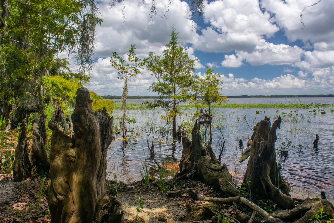
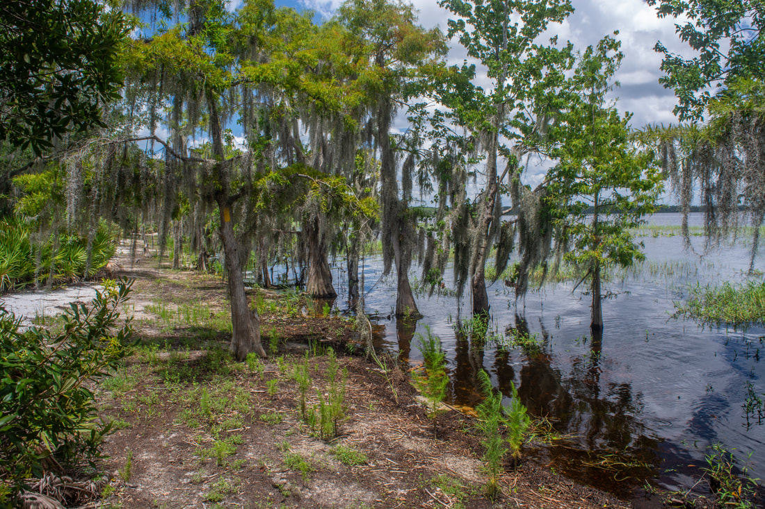
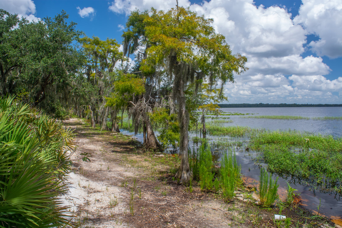
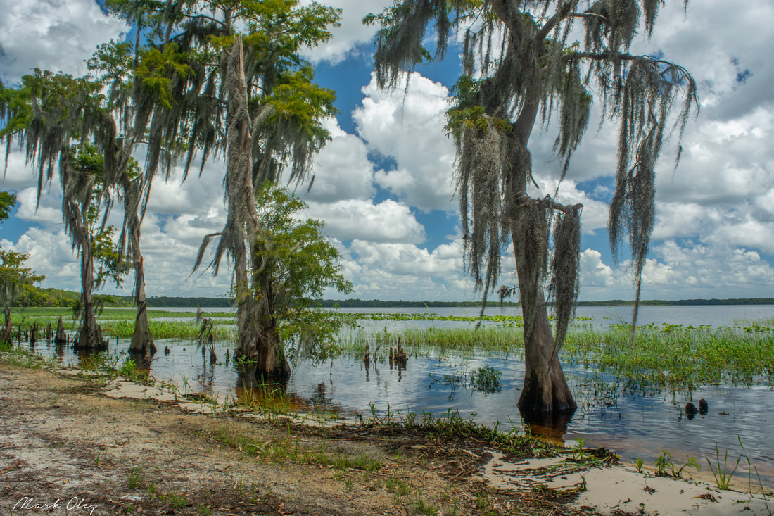
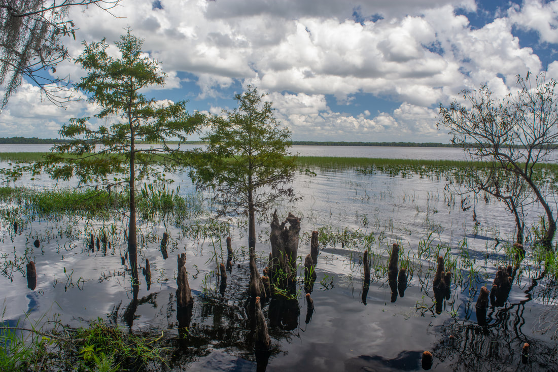
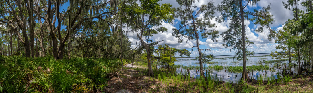
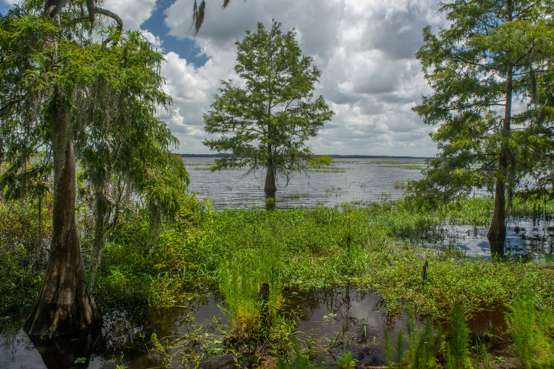
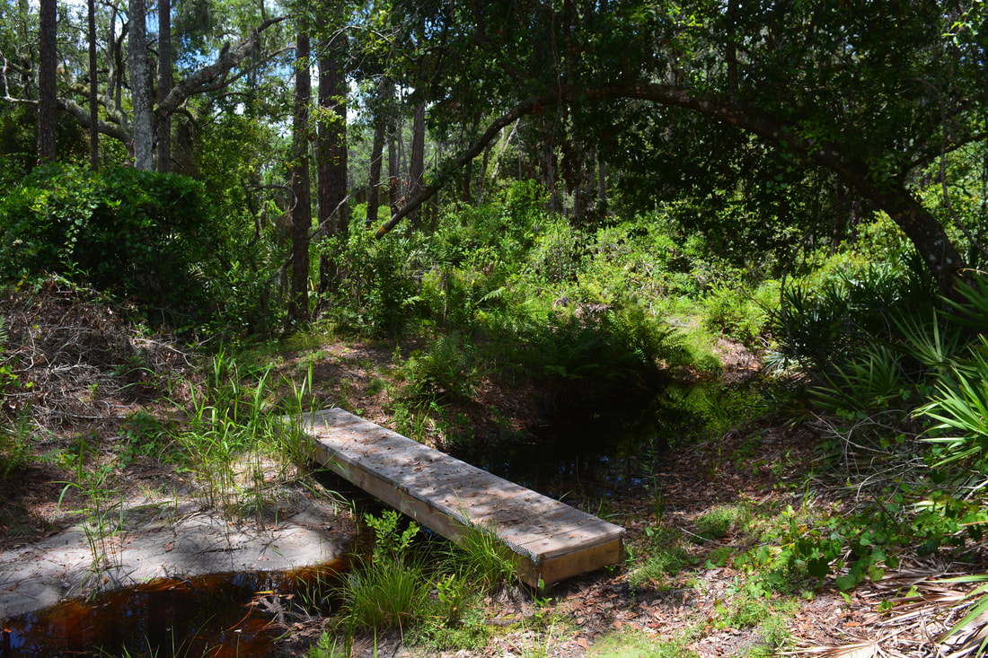
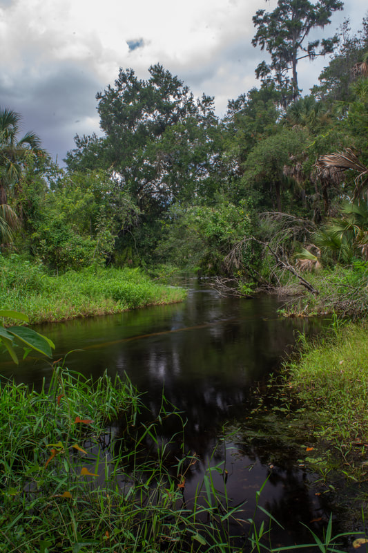
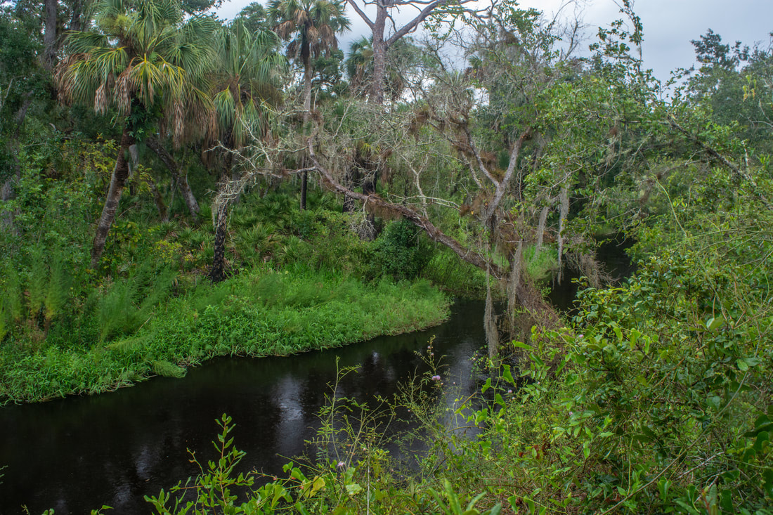
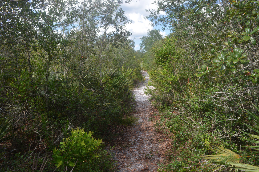
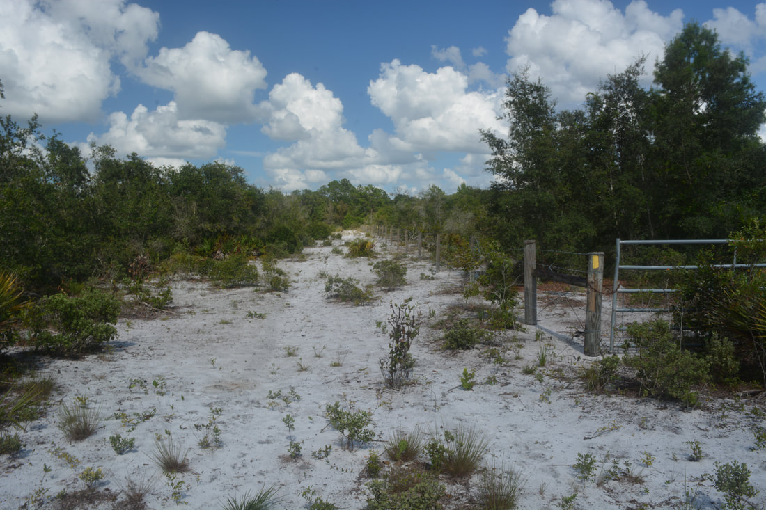
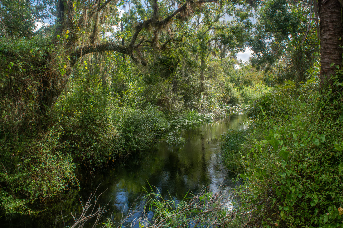
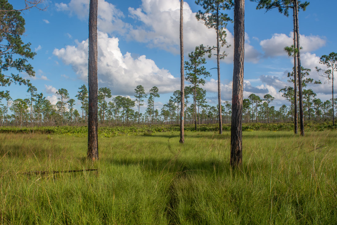
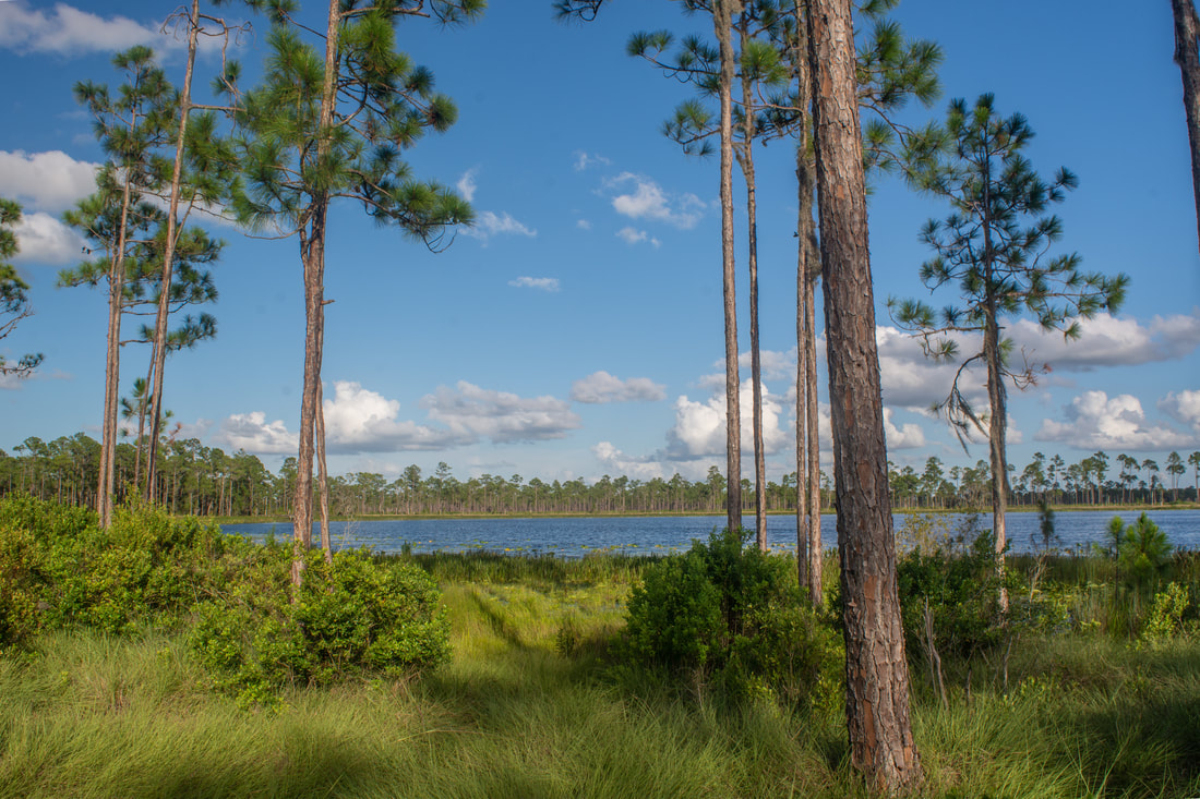
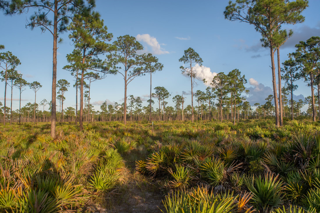
The trail initially follows a jeep road through open pine flatwoods, but it veers left on a slim path at 0.25 miles. Cross School Bus Road at 0.4 miles. The blue-blazed pathway meanders into a field of cutthroat seep grass among scant pines. Cutthroat grass is a unique, endangered kind of grass that is found nearly exclusively along the Lake Wales Ridge in Polk and Highlands Counties. Although less than 1% of the original cutthroat grass remains across Florida, you'll find plenty of it throughout this hike (particularly in the second half). At 0.75 miles, the Blue Trail ends at a signed junction with the Yellow Trail. The Yellow Trail heads right toward Hidden Hammock and the South Gate, as well as straight toward Lake Arbuckle. Continue straight to hike the north loop. After passing through an extended stretch of cutthroat grass, the trail joins a sandy forest road near the lake. Entering a dense oak hammock, the trail approaches the Lake Arbuckle shoreline at 1.4 miles in a large clearing. On the right is an ancient Native American shell midden. The trail turns left at an orange-blazed post, leaving the road and entering the dense hammock. At the time of my hike, the next 0.15 miles of the trail were nearly non-existent due to numerous shoulder-high weeds and shrubs. If not the frequent yellow blazes, I may have had a tough time finding where to go. However, given regular maintenance, this section should be easy to follow in winter. Once it leaves the overgrown section, the trail reaches the shore of Lake Arbuckle at 1.55 miles. No other lake shoreline I've seen in Florida is as gorgeous as that of Lake Arbuckle. The trail constantly follows the edge of the lake for 1.5 miles, providing expansive views of the open waters and the giant cypresses that guard the shore. The Lake Arbuckle section of the Yellow Trail is a true gem - a one-of-a-kind Florida pathway, per my experience. Between the 1.55-mile point and the 3.05-mile point at the Lakeside Campsite, the single-track pathway seldom leaves the shore, and the views are continuous. I encountered a few spots where I had to do some creative hopping in order to avoid water and mud due to the lake's proximity, but they weren't anything significant. I've read that the lake is farther from the trail in the dry season, when the lake level is several feet lower, but I would count on the trail being scenic even then. Several footbridges provide easy crossings of small tannic streams that drain into the lake. 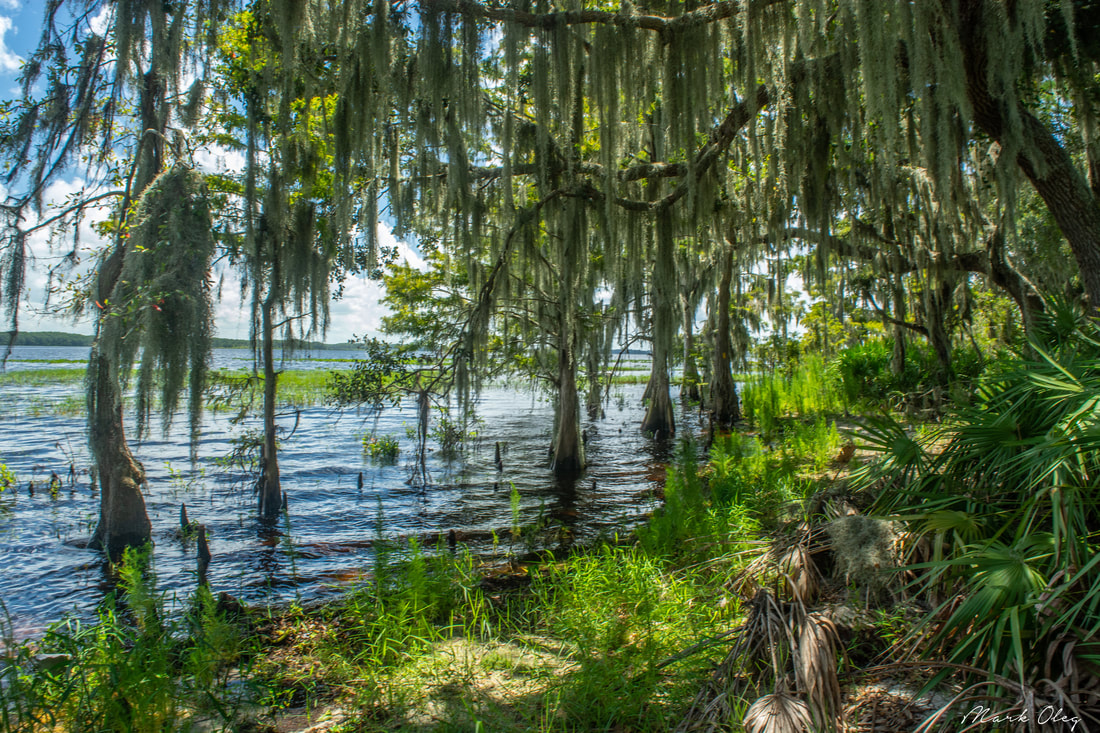
The Yellow Trail along the Lake Arbuckle shoreline is among the most scenic lakeside trails I've encountered in Florida.
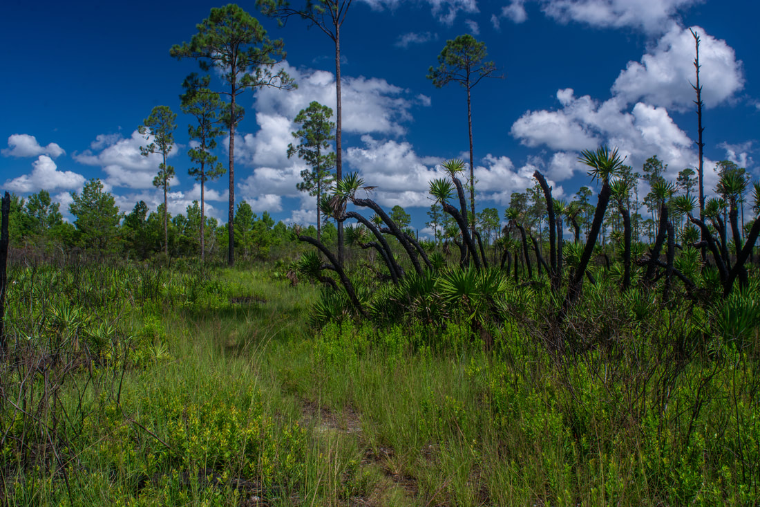
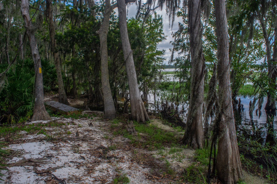
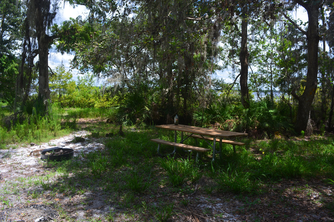
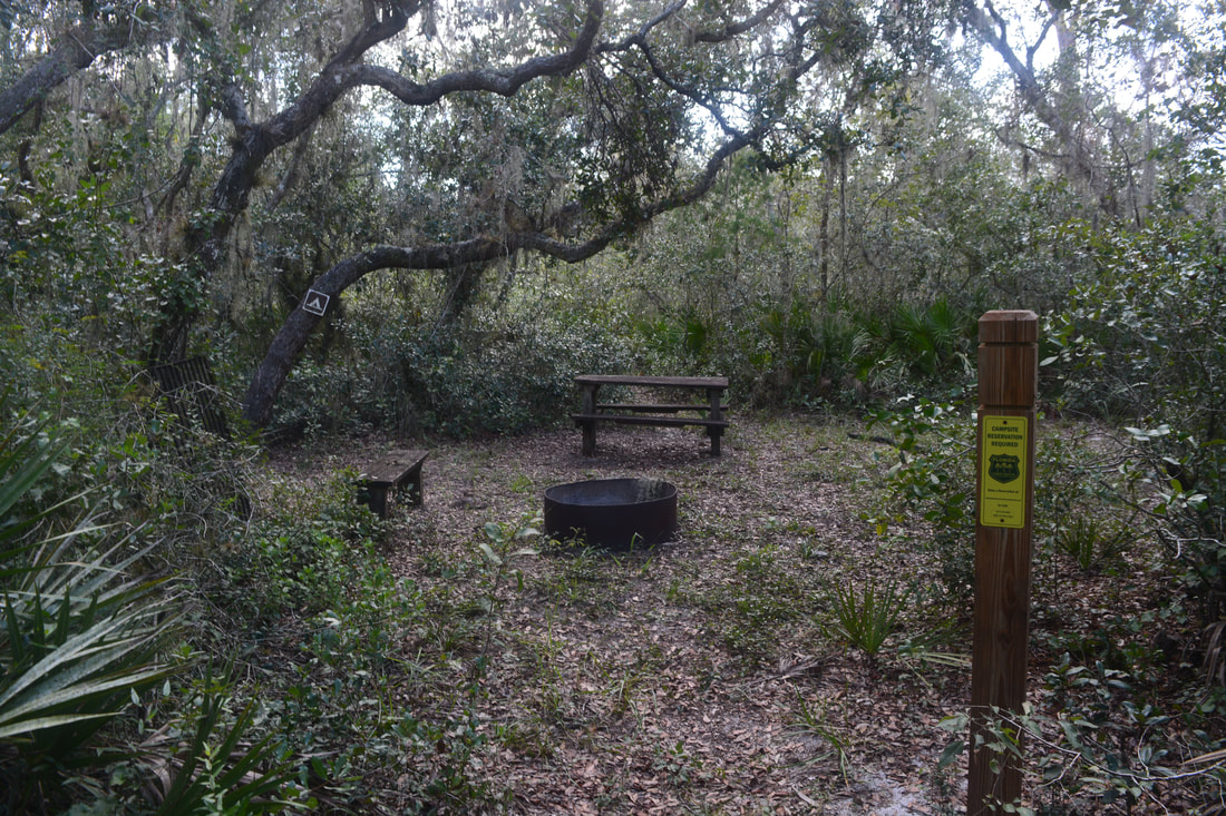
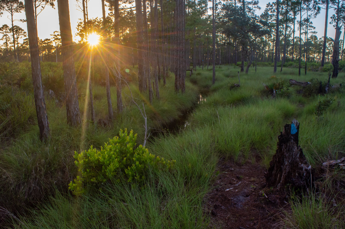
Reach Lakeside Campsite at 3.05 miles. This is a nice, dry site within sight of the lake (though the view isn't very clear). As with all Lake Arbuckle Tract campsites, advance reservations are required to stay. The trail leaves the lake here, having given you just the perfect amount of lake views before moving on to other ecosystems. After a couple footbridges spanning an unnamed stream, the trail follows a forest road into the uplands. Watch out for the abrupt right turn onto a single-track path at 3.5 miles. The sandy trail meanders through the open pine flatwoods and palmetto understory before suddenly reaching a bizarre sight at 4.1 miles: an old 1960s Chevrolet truck lying rusting away in the woods right along the path. The cab and engine are still largely intact! this unique historic sight adds even further interest to this hike.
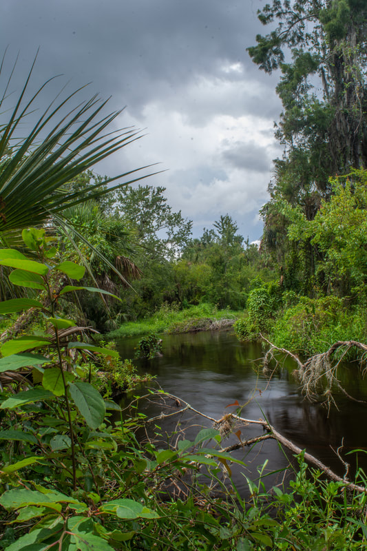
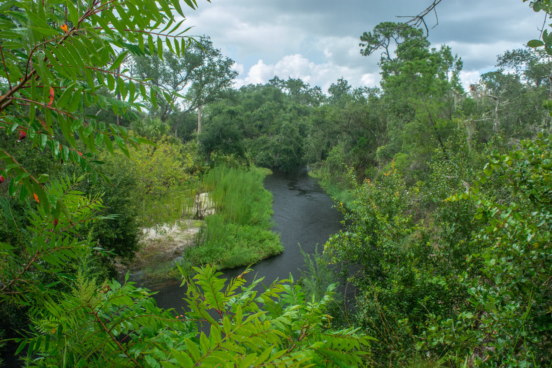
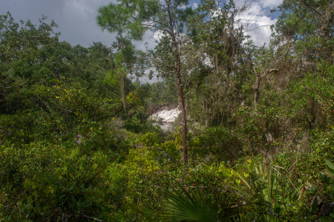
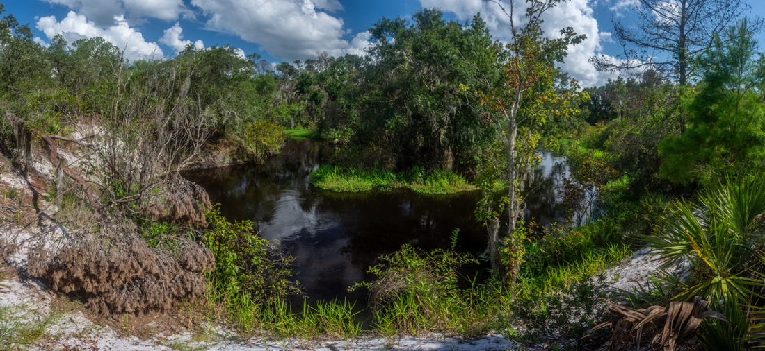
The trail turns right twice at the truck, briefly joining a forest road before entering another area of cutthroat seep grass. At 4.35 miles, a blue-blazed side trail leaves right and leads 0.35 miles to the Creekside Campsite. I recommend taking the side trail for its views of Reedy Creek at the end. The Creekside Campsite is a really nice spot in a shady hammock within sight of Reedy Creek. This part of Reedy Creek lacks the well-defined channel found further upstream, but the view is still very nice. Return to the main trail at 5.05 miles. The trail passes through a scrub area before reaching a blue-blazed shortcut at 5.5 miles. The arrow-straight shortcut cuts off a mile from the trail and avoids the winding nature of the main trail along Reedy Creek. However, I strongly recommend that you stay on the main trail, as it features some of the hike's best creek views. The trail comes alongside Reedy Creek at 5.75 miles, providing great views atop sandy 10- to 20-foot bluffs. At 5.9 miles, the trail reaches a breathtaking view of a horseshoe bend on Reedy Creek - a true beauty spot and one of my favorites along the hike. These types of open bluff-top views are quite uncommon across Central Florida. The views of Reedy Creek continue one after another. The trail itself is interesting too, often clinging to steep, thickly-wooded slopes just above the creek. Another of my favorite creek views is at 6.2 miles, where the trail pops out atop a sheer bluff of blindingly-white sand. Looking upstream, Reedy Creek makes a straight cut through the sandy banks before vanishing past another bend. When the trail reaches that bend, you'll have an open view back toward the sandy bluff. Finally, at 6.75 miles, the main trail reaches the other end of the blue-blazed shortcut. Just ahead is a trailhead kiosk by the School Bus Road/Rucks Dairy Road split. If you have the option of using two vehicles, shuttling from McLean Cabin to this parking area makes for a superb point-to-point hike. Those who wish to hike the full loop, as I did, should turn right and follow the trail along the main road, crossing Reedy Creek on a road bridge. A yellow-tipped post at 6.9 miles marks the trail's inconspicuous entrance back into the woods on the left. 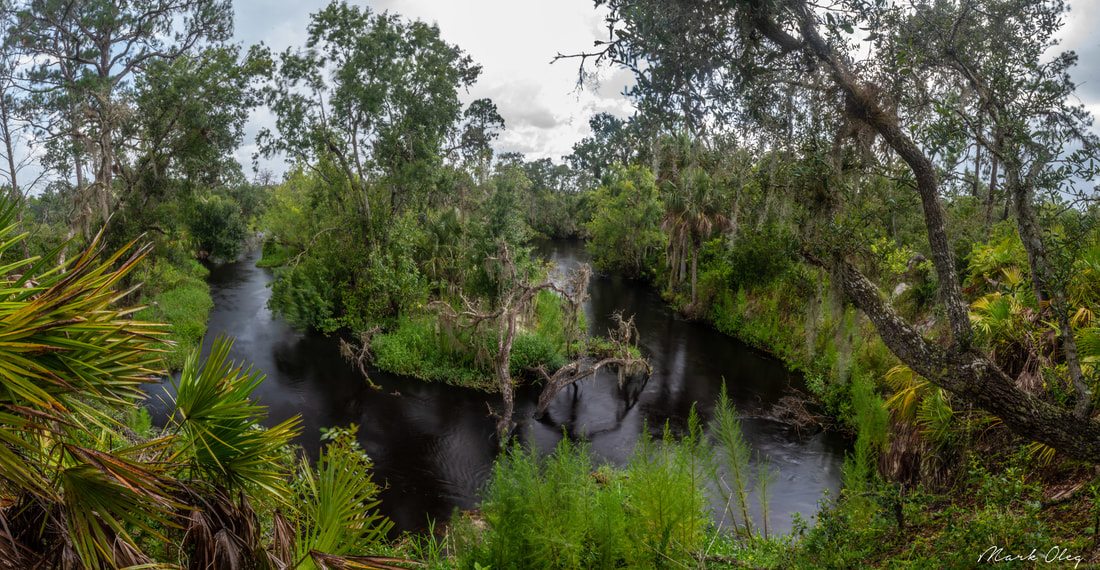
The Yellow Trail features frequent views of Reedy Creek, such as this iconic horseshoe bend panorama.
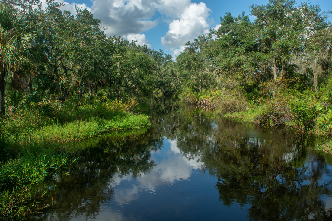
The character of the trail section past School Bus Road differs from anything thus far, once again. Most of the trail between the road and the Reedy Creek footbridge meanders through open, sandy scrub on the north side of the creek, crossing numerous forest roads. It's important to pay close attention to the yellow blazes here. The trail occasionally enters patches of oak hammock closer to the creek, but the majority of this segment is out in the open. At 7.7 miles, the trail comes alongside a fence that separates the State Forest from a private inholding to the south. As the trail draws close to the creek again, a short side path at 8.05 miles leads left to another great horseshoe bend view. Sloping sandy bluffs form a semicircle around the bend. The trail then enters a scenic palmetto corridor beneath ancient live oaks draped in Spanish moss. Reach the Reedy Creek footbridge at 8.35 miles. The bridge is pretty impressive for a little-known hiking trail not connected to the Florida Trail! It's a double-track wooden bridge with tall steel railings. The bridge provides more great views of Reedy Creek, which lacks notable bluffs this far upstream. A sign designates the bridge as the "Livingston Creek Walking Bridge". The confluence of Reedy Creek and Livingston Creek is only 0.1 mile upstream. I believe Reedy Creek remains the creek name from the confluence down to Lake Arbuckle. No name at all is shown on topo maps, but Reedy Creek seems to be the more widely-used name.
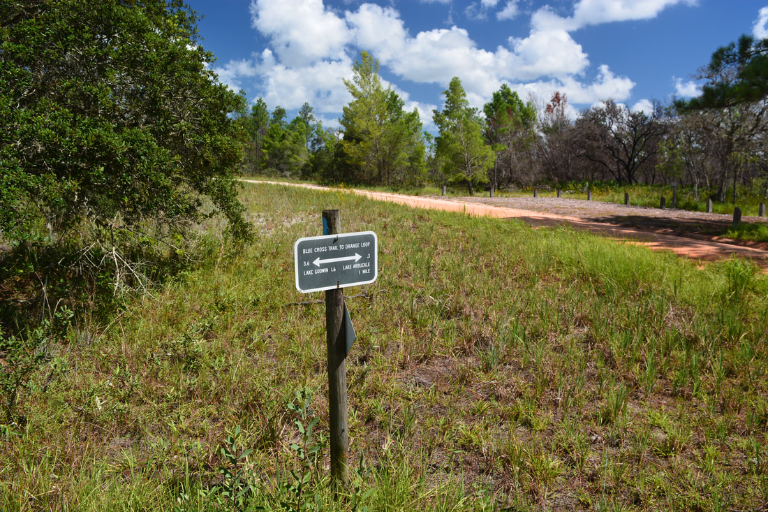
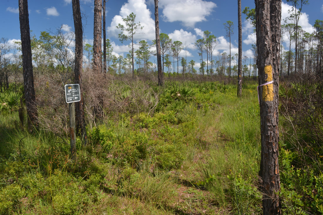
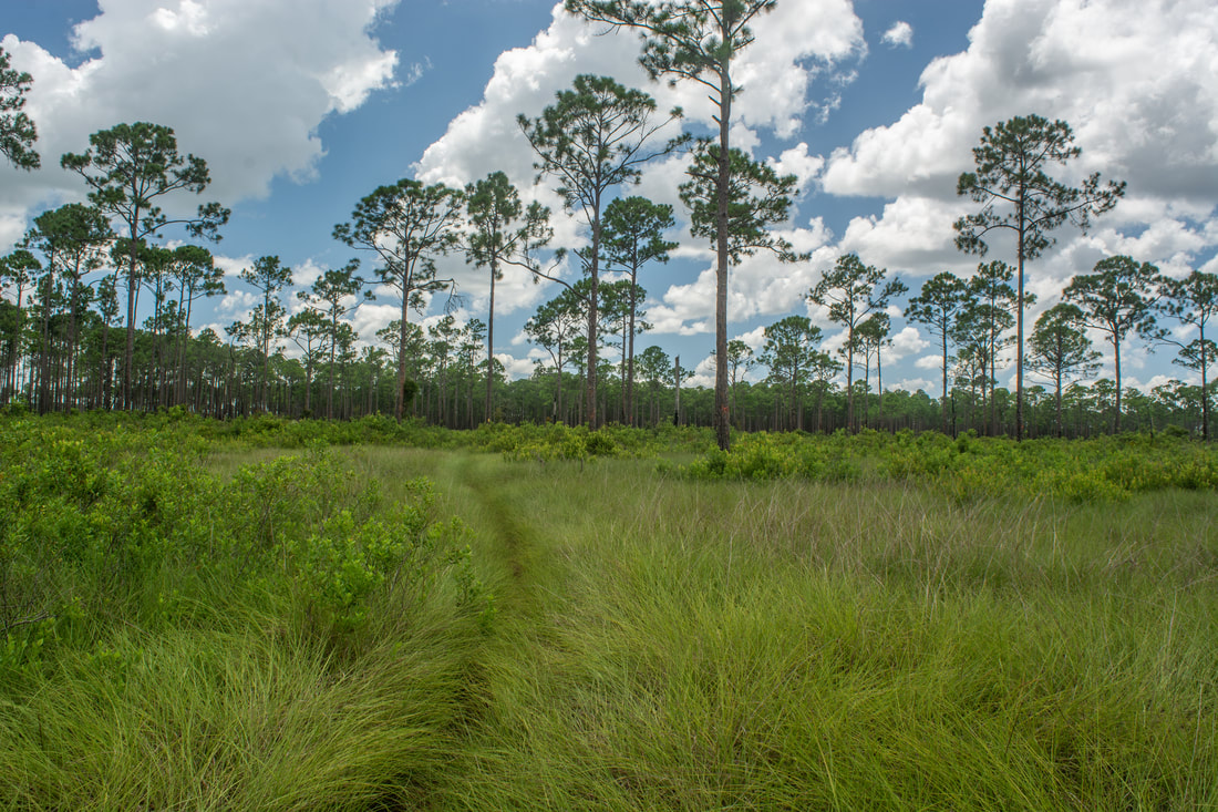
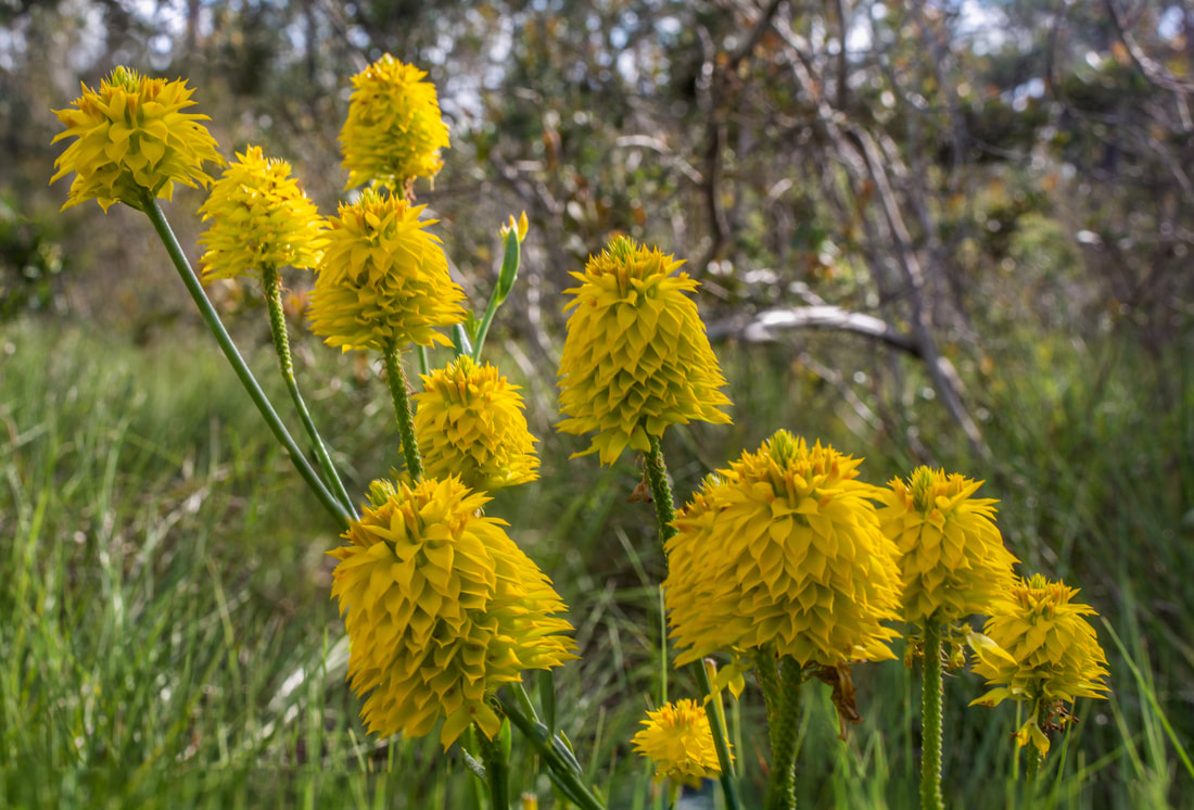
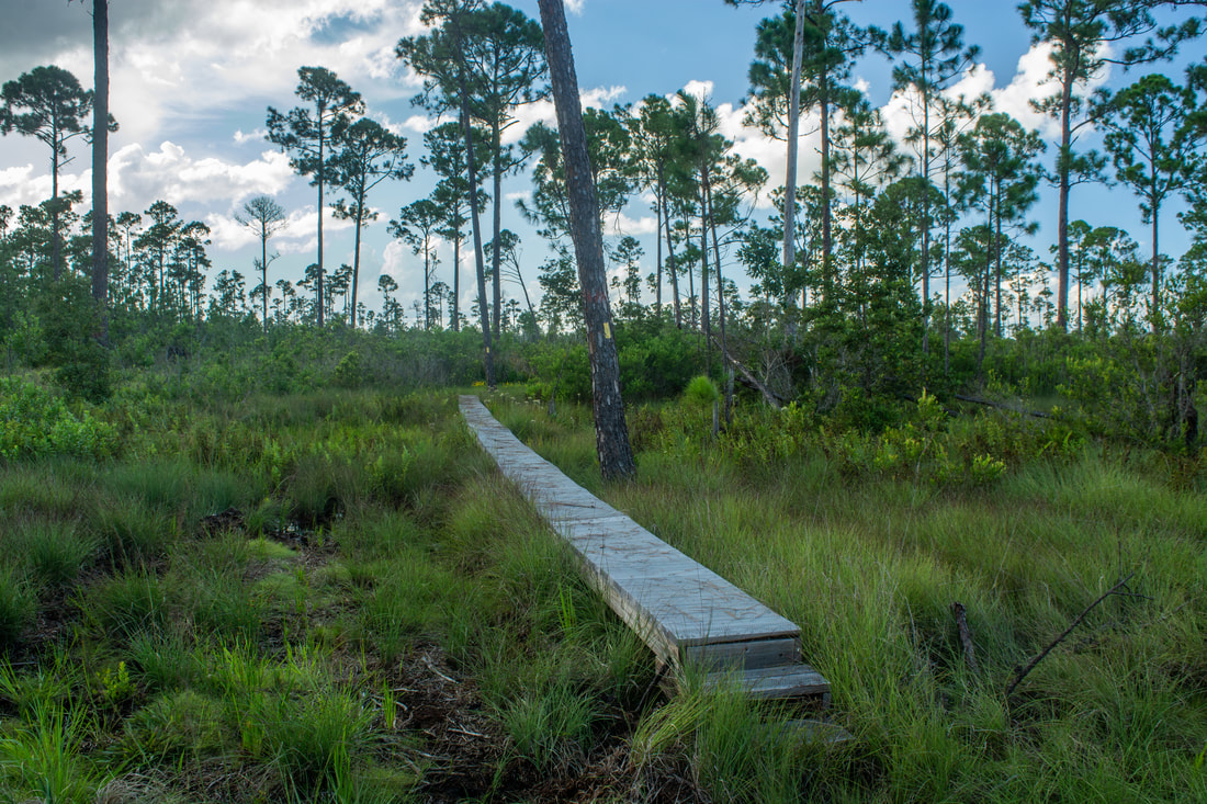
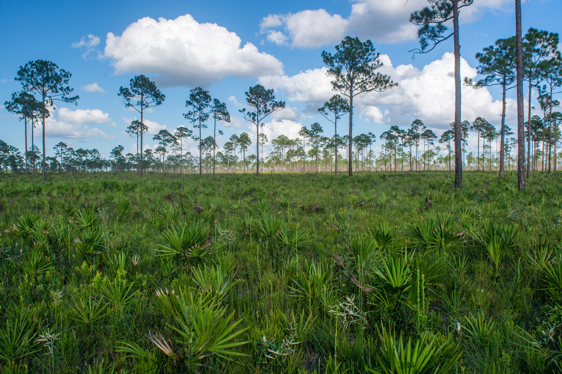
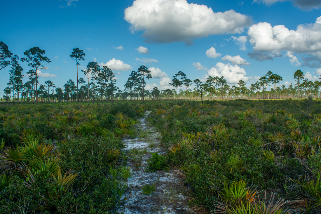
Beyond the bridge, the trail follows an ecotone between the creekside hammock and the piney uplands. At 8.9 miles, a blue-blazed side path on the right leads 0.1 mile to Graves Island Campsite. I suggest taking the side path for its views of Livingston Creek. At its midpoint, the side trail crosses Livingston Creek on another double-track footbridge. The campsite itself has a view too. To me, the creek is less attractive here than it is below School Bus Road, but it's still very nice. I like the lush feel that the creek is given by the profound ivy, shrubs, and weeds growing alongside it. These are the hike's final creek views. Beyond Graves Island Campsite, the trail enters the pine flatwoods and cutthroat seep grass prairies for good. Depending on how recently the grass has been mowed, you might find it surprisingly hard to push through the overgrown path. From spring to early fall, you may see yellow milkwort blooming along the trail. Another surprising aspect of this trail segment is the boggy nature of the woods. Well-placed boardwalks navigate the trail across marshes twice. At 10.25 miles, a blue-blazed side trail leaves right to Isabell Campsite, 0.4 miles away. I've heard that Isabell Campsite has nice views of Grassy Creek (a Livingston Creek tributary draining Lake Isabell). I didn't have time to add the extra mileage though, so it's not included in this write-up. A little farther, at 10.35 miles, the Yellow Trail reaches the west end of the Blue Trail (aka the Lake Godwin Trail). The Blue Trail is the cross-trail that will take you back to McLean Cabin, since the full yellow-blazed loop is significantly longer. Continue straight on the Blue Trail. Turn left onto a forest road at 10.5 miles. Between here and Lake Godwin, pay close attention to the blue blazes, as the trail frequently hops on, off, and across various logging roads spanning the forest. I really like the single-track sections of the Blue Trail, where the path fully immerses you into the boundless pine flatwoods. All around you is pine, palmetto, and cutthroat seep grass. Typically, I don't like trails that are predominantly pine, but this one is an exception. Not only are the pine flatwoods a nice change after all the other ecosystems seen thus far, but these specific pine flatwoods are prettier than most due to the presence of the scenic, tall cutthroat grass. The shimmering blue waters of Lake Godwin suddenly come into sight at 11.6 miles. The trail skirts the shore of the small lake for a while, but the best views are from an observation platform on the northeast side. At 12.0 miles, the side trail to the Lake Godwin observation deck leaves right by a small parking along a forest road that the trail briefly joins. 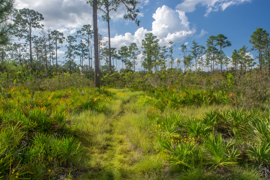
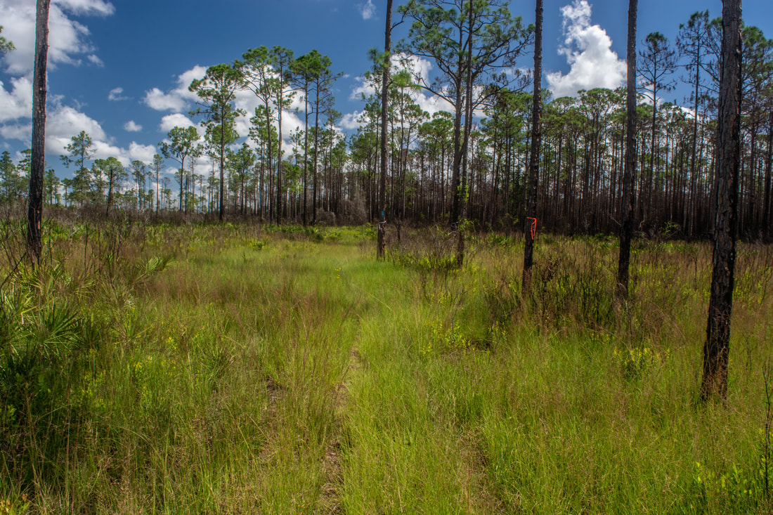
Hiking through pine flatwoods in the Arbuckle Tract means that you'll encounter the unique, endangered cutthroat seep grass.
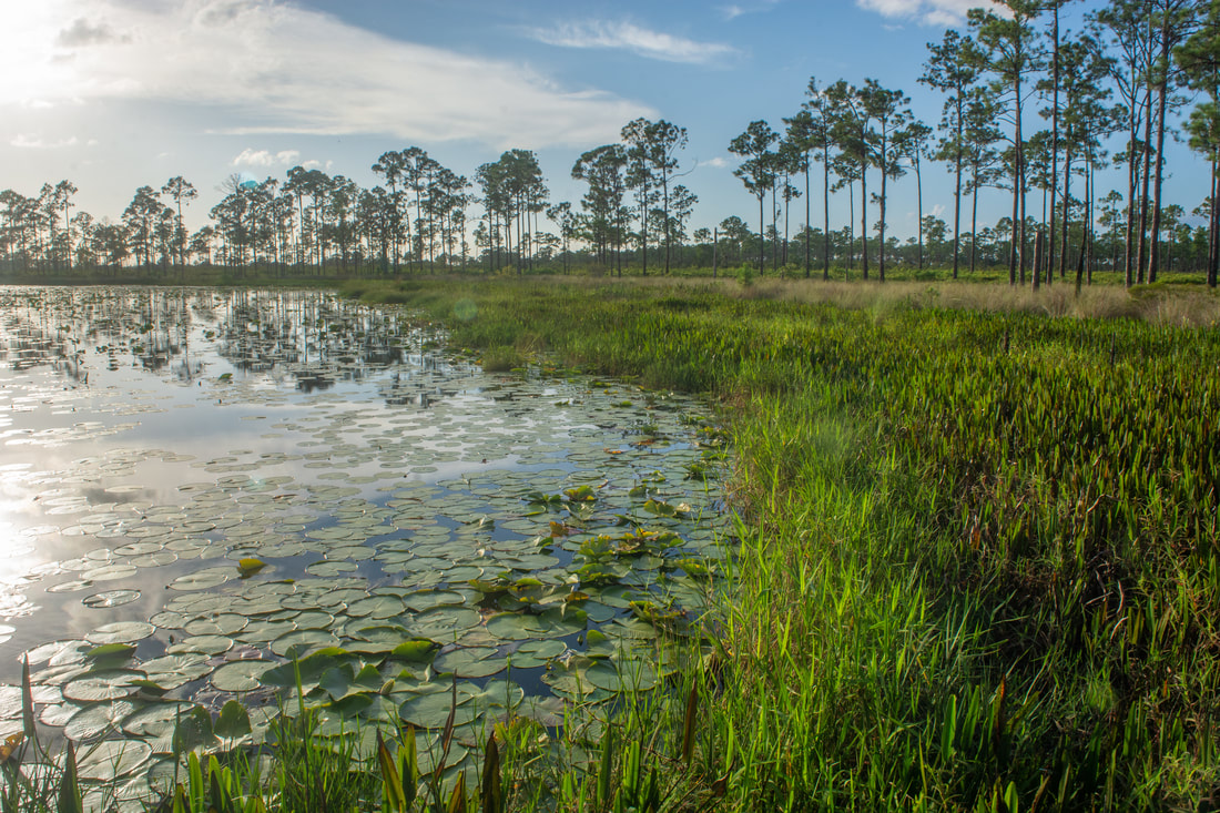
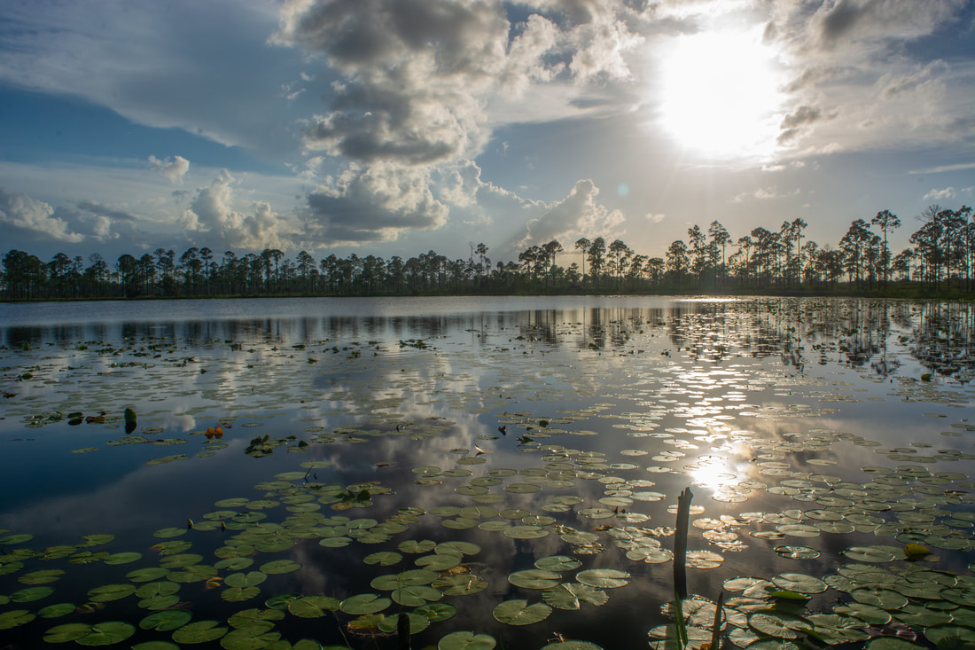
Lake Godwin isn't anywhere as gorgeous as Lake Arbuckle. It has its own scenic charm too, however. Rows of pines ring the circular Lake Godwin, which resembles a pond more than a lake. Lily pads saturated with green slowly drift through the water along the reedy lakeshore. Once you're back on the Blue Trail, you'll find that it resumes its meandering course through the pine flatwoods. Keep watching for the blue blazes - the trail crosses or follows a number of forest roads, and I can't describe every intricate detail. After an eternity, a tree line comes into view. As the trail enters thicker woods, it draws along a boggy stream around 13.2 miles. Soon, the white blazes of the 1-mile McLean Cabin Nature Trail join the Blue Trail, signaling that the end of the hike is near. As the trail re-enters the McLean Cabin oak hammock at long last, the trailhead parking area and kiosk finally draw into sight, leading you to conclude the hike at 13.8 miles.
The North Loop in the Arbuckle Tract is the definition of a perfect Florida hike. From lakes to creeks to history, this little-known hike has got it all. And you don't even have to retrace your steps anywhere! I highly recommend that all Central FL hikers try this one. You won't be disappointed. That's why I'm rating it a "Best Hike". Mileage
0.0 - McLean Cabin
0.4 - School Bus Road 0.75 - Yellow Trail 1.55 - Lake Arbuckle Shoreline 3.05 - Lakeside Campsite 4.1 - Old Truck 4.7 - Creekside Campsite 5.9 - Reedy Creek 1st Horseshoe Bend View 6.2 - Reedy Creek Sandy Bluffs View 6.75 - School Bus Road 8.05 - Reedy Creek 2nd Horseshoe Bend View 8.35 - Reedy Creek Footbridge 9.0 - Graves Island Campsite 10.25 - Isabell Campsite Side Trail 10.35 - Blue Trail 12.0 - Lake Godwin 13.8 - McLean Cabin Variations
Hike just the Reedy Creek Loop - 2.6 Miles
Hike point-to-point from McLean Cabin to North Gate - 6.75 Miles Pictures & Videos
2 Comments
8/21/2018 05:48:36 pm
Nice write up. I'm a trained Skywarn Spotter. Amateur Star Gazer and Amateur Radio Operator. I also help to maintain those trails at Arbuckle WMA.
Irek
9/6/2018 04:10:47 pm
Thanks for the maintenance. I live in Sarasota and love to go to the Lake Wales Ridge Forest for 2-5 days of backpacking every year. One of my favorite places in FL. Leave a Reply. |
About MeMark Oleg Ozboyd Dear readers: I have invested a tremendous amount of time and effort in this website and the Georgia Waterfalls Database the past five years. All of the work that has gone in keeping these websites updated with my latest trip reports has almost been like a full-time job. This has not allowed me to pick up a paid job to save up money for college, and therefore, I I've had to take out loans. If you find the information on this website interesting, helpful, or time-saving, you can say "thanks" and help me out by clicking the button above and making a contribution. I will be very grateful for any amount of support you give, as all of it will apply toward my college tuition. Thank you!

Coming in 2022-2023?
Other Hiking WebsitesMiles HikedYear 1: 540.0 Miles
Year 2: 552.3 Miles Year 3: 518.4 Miles Year 4: 482.4 Miles Year 5: 259.9 Miles Archives
March 2021
Categories
All
|
||


 RSS Feed