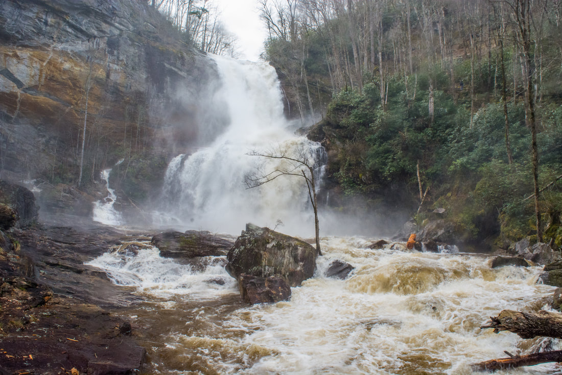
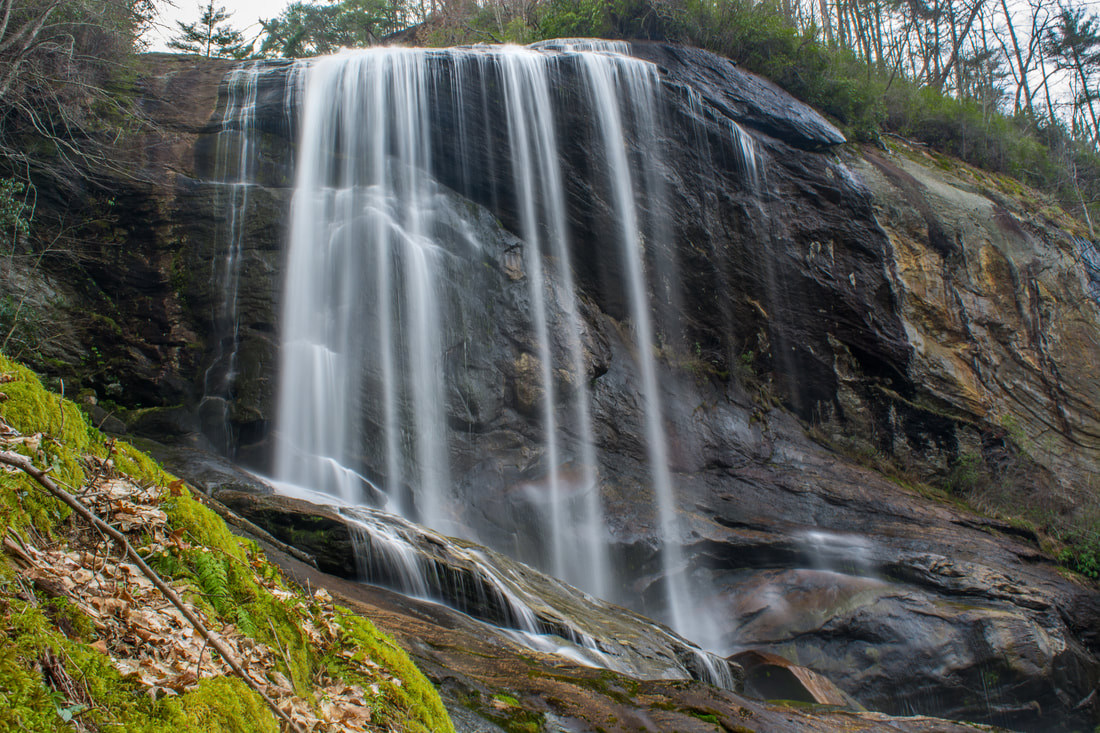
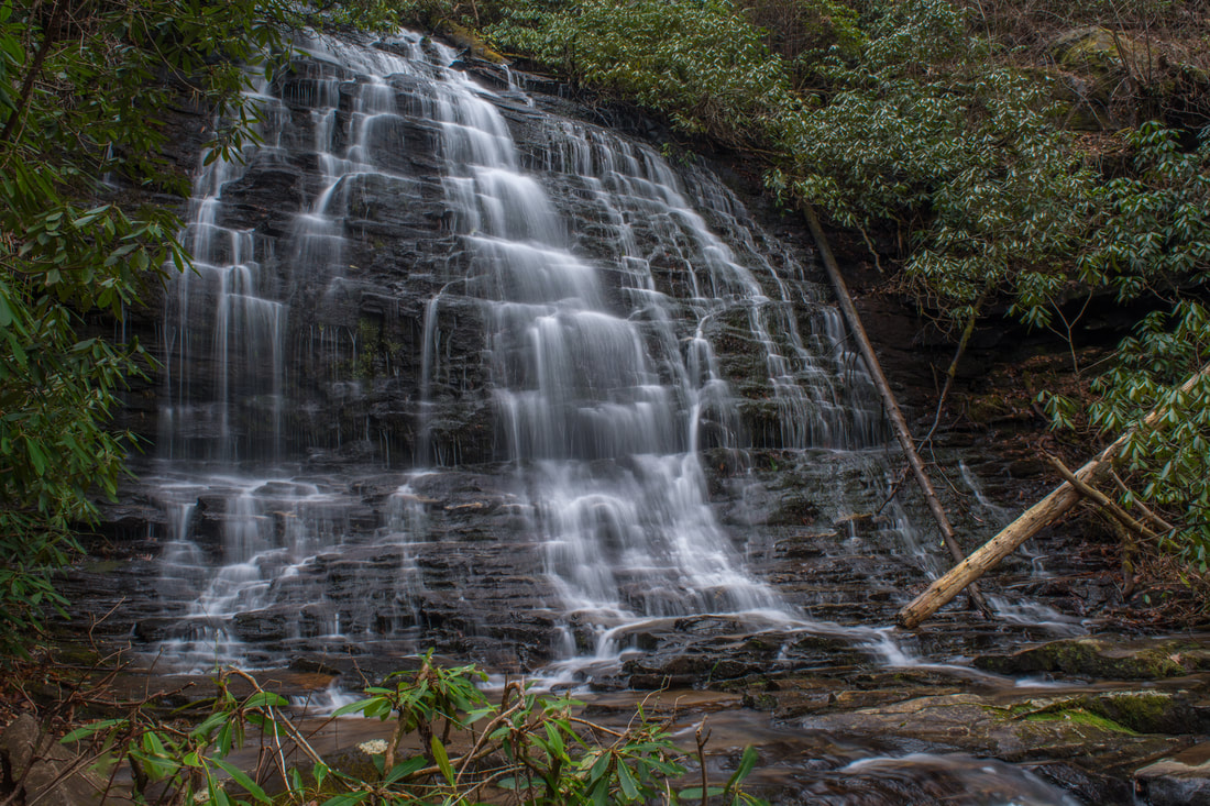
Below the Lake Glenville Dam, the West Fork of the Tuckasegee River comes over a mighty 100-foot cataract known as High Falls (locally as Cullowhee Falls). Most of the year, the dam severely restricts the watershed flow, reducing the water level at High Falls to only a few slim ribbons. But there's a few times in the year when High Falls is transformed into a monster. Several days a year, water is released from Lake Glenville down the West Fork Tuckasegee River for kayakers, and the water subsequently crashes over High Falls. Watching High Falls transform in mere seconds from a low-flow waterfall into one that's totally flooded out is an astounding experience! Two trails lead to the base of High Falls: a steep, official trail through Duke Energy land from The Pines Recreation Area by the shores of Lake Glenville to the south, and an easy, unofficial pathway through private land from Shoal Creek Mountain Road to the north. This trail report describes the Shoal Creek Mountain Road access, which the property owners have graciously opened to the public. Even though it's over twice longer, the north access is highly recommended due to the relaxing nature of the pathway, the better vantage points of High Falls, and a bonus waterfall called Rough Run Falls. This hike occurred on Saturday, April 7th, 2018. My plan was to hike out and back to High Falls from Shoal Creek Mountain Road, stopping by Rough Run Falls along the way.
2 Comments
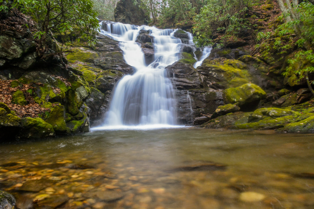
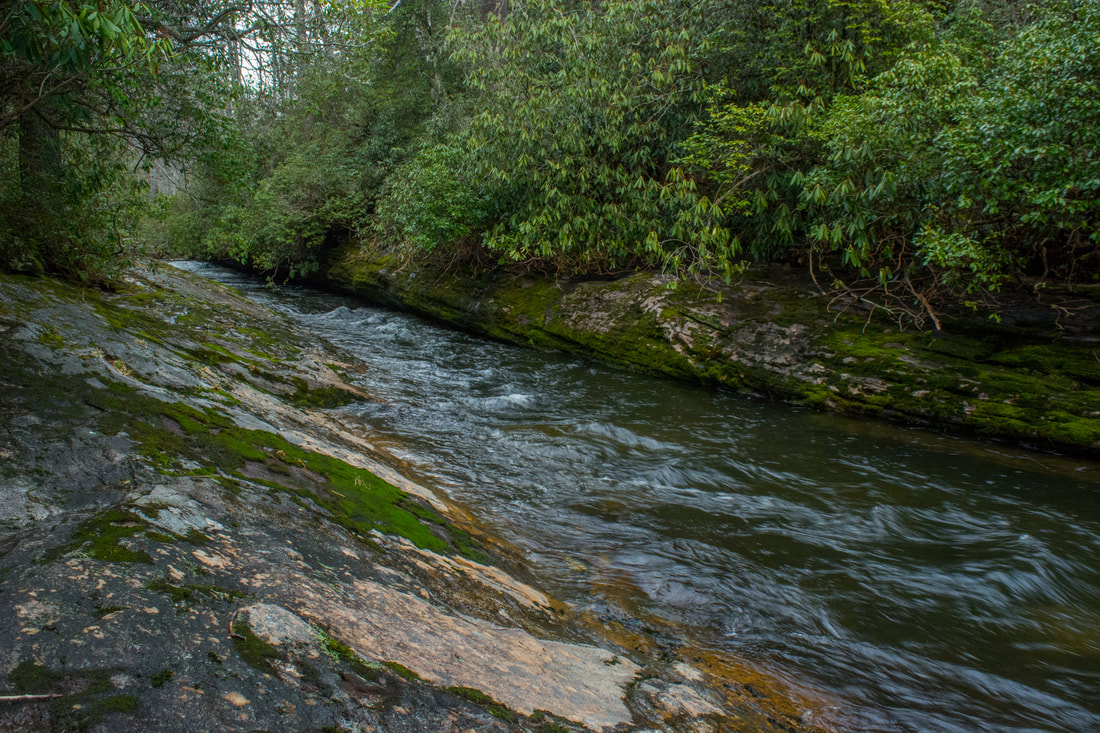
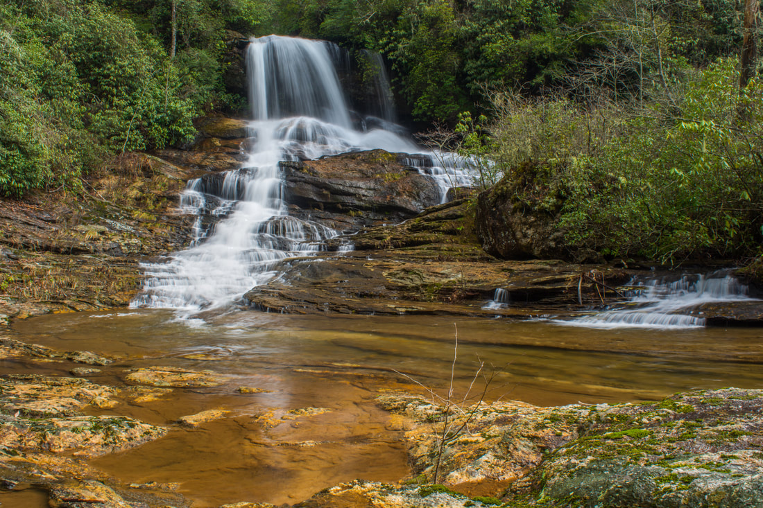
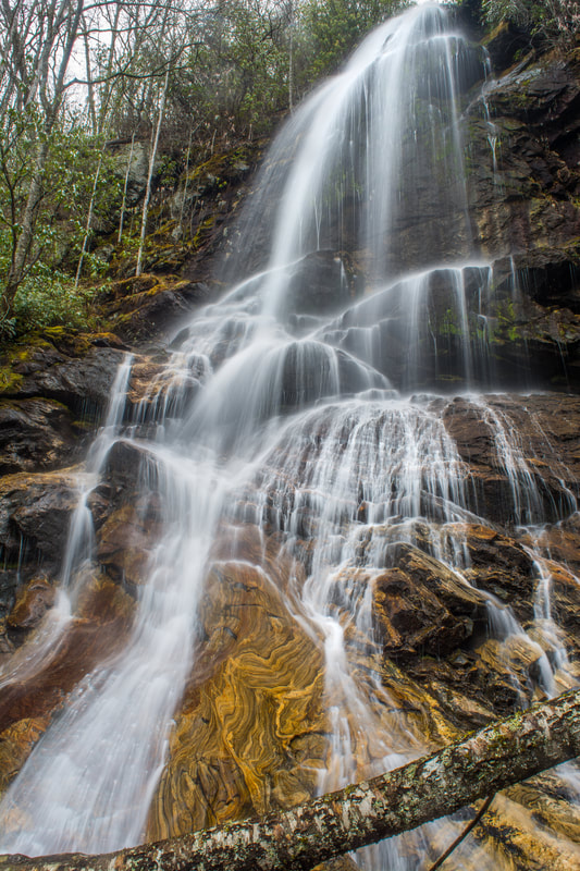
Southeast of the small college town of Cullowhee is the Caney Fork watershed, an area known little to most folks outside of locals. Although there aren't any notable waterfalls on the Caney Fork itself, many of its tributaries feature beautiful falls. Rough Butt Creek Falls is one of the nicer Caney Fork area falls, and it also happens to be fairly easy to access. Rough Butt Creek Falls is a gorgeous, picturesque cascade about 30 feet high that drops into a perfect, tranquil pool. Below the falls, you'll be treated to views of a particularly scenic section of the creek with numerous swift cascades and mossy rocks. This hike occurred on Saturday, March 24th, 2018. My plan was to hike out and back to Rough Butt Creek Falls along the shortest way.
Protecting a small gulch on the east side of Lake Guntersville, Bucks Pocket State Park is one of Alabama's most underrated state parks. Bucks Pocket features a small slice of beautiful, wild scenery typical to the Cumberland Plateau. Two scenic, cliff-lined gorges are found in the park: those of Little Sauty Creek and South Sauty Creek. The park's best-known trail, the Point Rock Trail, follows Little Sauty Creek through numerous mossy boulder fields and woods that feature an abundance of wildflowers in spring, passing a small but very scenic waterfall on the stream. The Point Rock Trail then ascends to the rim of the gorge and ends at its namesake rock outcrop, which features panoramic views from a point on the rim high above the confluence of Little Sauty Creek and South Sauty Creek. This hike occurred on Saturday, March 17th, 2018. My plan was to hike the Point Rock Trail out and back to Point Rock from the Bucks Pocket Campground.
Pisgah Civitan Park: Pisgah Gorge Trail and Little Bryant Creek Waterfalls, Pisgah, Alabama5/9/2018 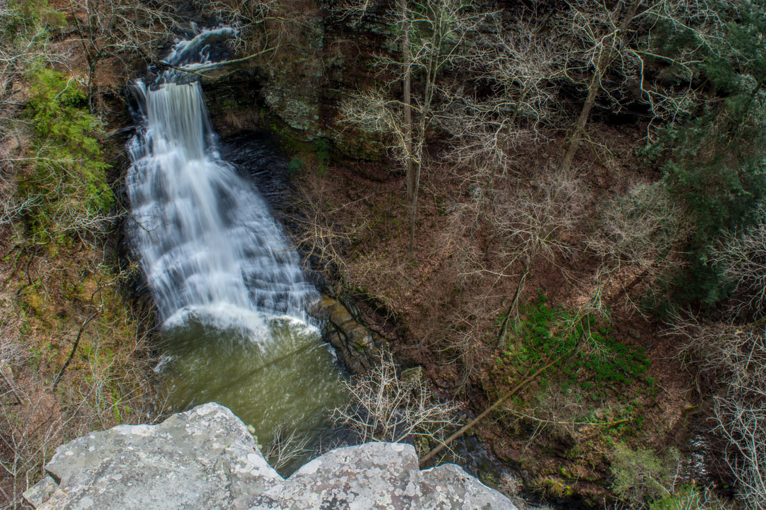
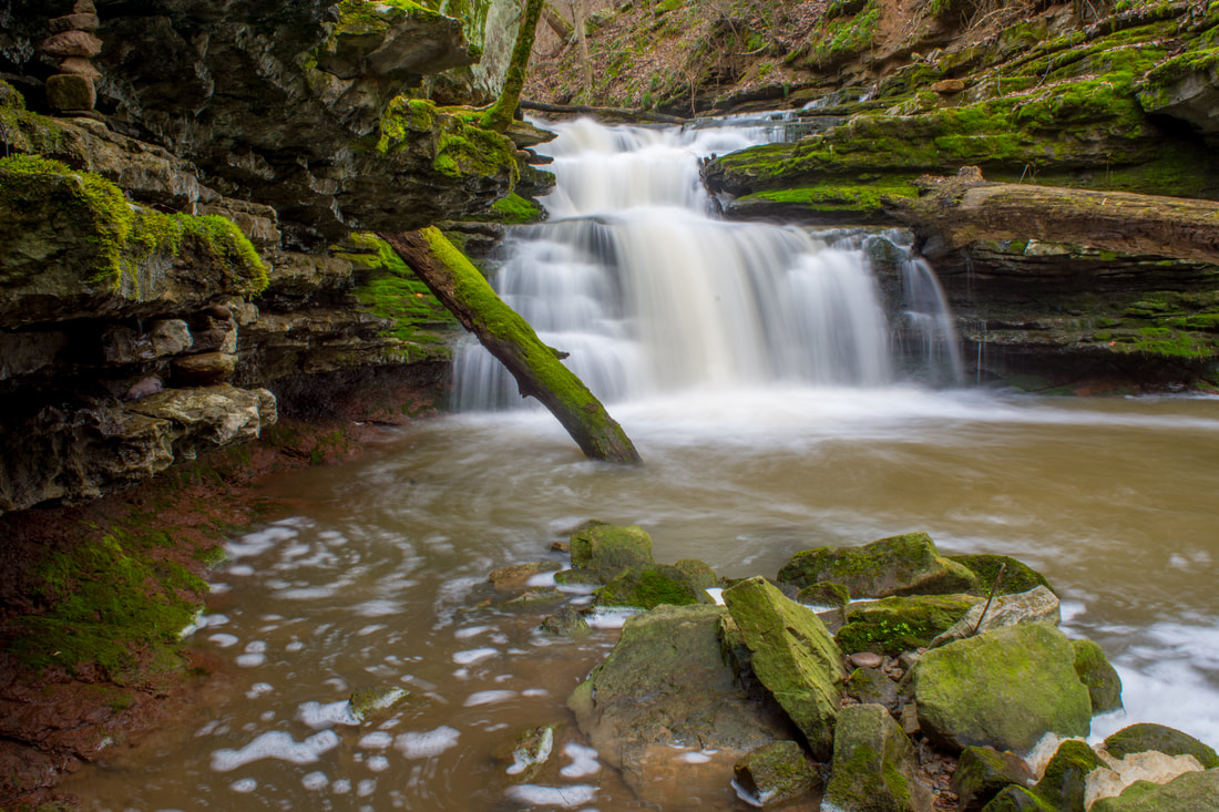
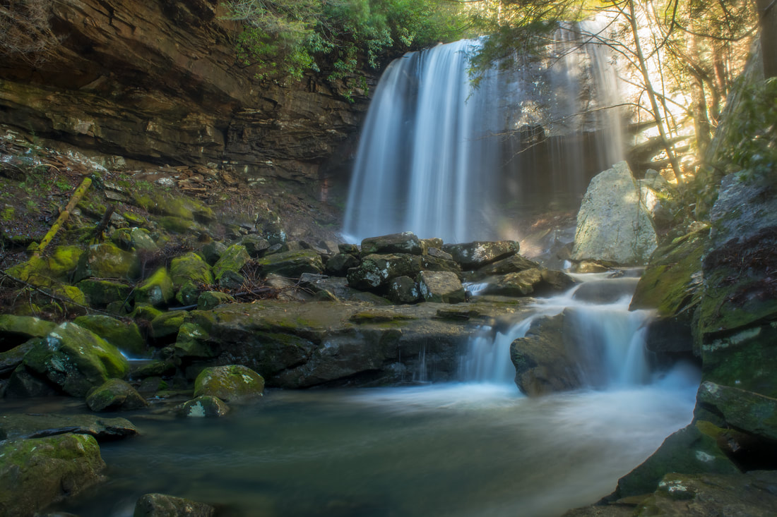
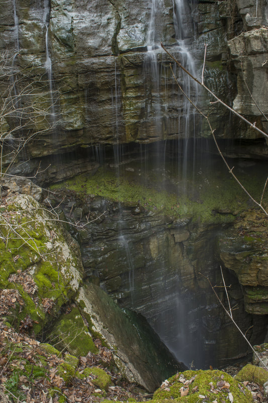
Inside the city limits of the quaint town of Pisgah in northeast Alabama is one of the area's most under-appreciated pieces of public land: the Pisgah Civitan Park. This small community park protects a section of the course of Little Bryant Creek through Pisgah Gorge that features three notable waterfalls - two of which are significant - and an extraordinary natural bridge. An easy trail follows the rim of the gorge, accessing several clifftop perches with sweeping birds-eye views of the gorge and its waterfalls. More adventurous hikers will find a faint, rugged pathway that drops into the gorge, accessing the base of Middle Little Bryant Creek Falls and the natural bridge. Pisgah Gorge features a sampling of some of Northeast Alabama's finest natural scenery and must not be missed! This hike occurred on Saturday, March 17th, 2018. My plan was to first hike the rim trail out and back to views of Upper Little Bryant Creek Falls, Middle Little Bryant Creek Falls, and the Pisgah Gorge downstream. I would then descend the trail into the gorge to get up-close and personal with the middle falls and the arch. In addition, I would check out a side trail leading to an old mill site at the top of the upper falls.
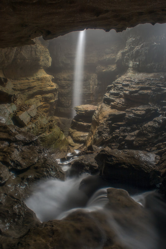
Have you ever wanted to see both a waterfall and a cave on one hike? Then Stephens Gap Callahan Cave Preserve is the place for you. Not only do you get to see a waterfall and a wild cave here, but they are both in the same place! The gloomy cavernous space of Stephens Gap Cave features an incredible waterfall that shoots out of an opening in the cave and free-falls over 100 feet into the pit underneath. What's more: you don't need any caving experience at all to get into the Stephens Gap Cave's primary chamber and to view the waterfall. As long as you're capable of scrambling steeply down a boulder field into the cave and don't mind getting dirty, you can easily tour this stunning natural feature. The short hike to the cave is pretty in its own right, especially in spring, when a mosaic of new, bright green ferns is seen among the area's boulder fields and rock outcrops. Access to Stephens Gap Cave is exclusively by a permit system. Only 25 people are allowed to visit the cave on any given day, so it's best to register for your free online permit from the Southeastern Cave Conservancy in advance to ensure your access to the cave. For the best experience, visit the cave after rainfall or during a wetter period - that's when the falls is the most impressive. This hike occurred on Saturday, March 17th, 2018. My plan was to hike out and back to Stephens Gap Cave via the access trail from County Road 30.
Above Ellicott Rock, the famous Wild & Scenic Chattooga River is wilder, steeper, and less-frequented. A separate stand-alone section of the Chattooga River Trail, not connected to the trail's main course from Ellicott Rock southward, travels several miles along the river between Whiteside Cove Road and Bullpen Bridge. This section of the Chattooga River Trail may actually be its most scenic, with numerous views of whitewater rapids interrupted by tranquil pools on the river. In addition, the trail passes near three unique sets of narrows on the river, one of which meets the definition of a true slot canyon. The trailside upper narrows are right by the confluence of Norton Mill Creek, featuring its own picturesque cascades. In addition, a series of spur paths and a short bushwhack leads more adventurous hikers to a scenic 25-foot waterfall on Cane Creek, another tributary of the Chattooga. This hike occurred on Saturday, February 24th, 2018. My plan was to hike the Chattooga River Trail out and back from Whiteside Cove Road to Cane Creek, from where I'd follow unofficial trails to Cane Creek Falls. This trail report additionally includes information about an alternate, short access to Cane Creek Falls, as well as about a seldom-visited waterfall on the Chattooga River itself called Corkscrew Falls.

The 244-acre Rock Creek Gorge Scenic Area in Polk County is one of Southeast Tennessee's most spectacular natural areas. The Rock Creek Gorge is home to a jaw-dropping sixteen named waterfalls, spread across Rock Creek and several of its tributaries flowing off Chilhowee Mountain. All are scenic and many are tall. The only easily-accessible waterfalls are Rock Creek Falls, Benton Falls, and arguably Chestnut Mountain Falls. All of the others involve various degrees of creek-walking and/or bushwhacking. While one could visit all sixteen falls in one day, it will require a high level of physical capability and off-trail experience. Folks who chose to visit the waterfalls in several different trips will still be well-rewarded. The best time of year to visit the waterfalls of the Rock Creek Gorge Scenic Area is winter or spring, when the waterfalls are flowing more boldly and when the area is less overgrown. This hike occurred on Saturday, April 14th, 2018. My plan was to hike the Scenic Spur Trail from Highway 30 to Rock Creek Falls. I would follow a scramble path to Chestnut Mountain Falls. From there, I would begin the off-trail section of the hike by first visiting the waterfalls on Laurel Branch and then walking up Rock Creek past several waterfalls to the Slickrock Branch confluence. Next, I would bushwhack alongside Slickrock Branch out to the Rim Rock Trail, visiting more waterfalls along the way. I would then follow the Clemmer Trail to Benton Falls, also bushwhacking to Elora Falls and Silvermine Branch Falls. Finally, I would return to Highway 30 along the Clemmer Trail.
Adjacent to the popular Panthertown Valley hiking area lies a much-lesser-visited valley: the Flat Creek watershed. This remote area is home to two very scenic waterfalls on Flat Creek. The massive Flat Creek Falls is among the most spectacular and stunning waterfalls in the Southeast. Dropping as much as 200 feet in a series of powerful cascades, slides, and a huge free-fall, Flat Creek Falls evokes a sense of amazement among anyone who finds their way to its base. Flat Creek features a much smaller but equally notable waterfall as well: Nellie's Falls. Located a couple of miles upstream, Nellie's Falls is a very picturesque double-drop waterfall. The lush, tropical-like setting of Nellie's Falls - the long moss-covered rock slabs near the base of the falls, in particular - help to make it a very scenic destination. Both waterfalls can be seen in the same hike, which utilizes mostly old roadbeds and unmaintained paths. Although the majority of the hike to both falls is fairly easy, getting to the base of Flat Creek Falls involves a steep off-trail descent. This hike occurred on Saturday, April 7th, 2018. My plan was to hike out and back from the end of Rock Bridge Road first to Nellie's and then to Flat Creek Falls.
A major tributary of the Chattooga River, Scotsman Creek runs alongside Bull Pen Road and drops over three waterfalls on its way to the river. The highlight is Scotsman Falls, an impressive 45-foot waterfall where the stream first free-falls over a sheer ledge and then cascades down a stairstep rock face. Near the base of Scotsman Falls, the creek splits around a densely-vegetated island. As the forks rejoin, Scotsman Creek tumbles swiftly out of sight, shortly coming over the less scenic Lower Scotsman Falls before dumping into the Chattooga. A steep path leads to Scotsman Falls from Bull Pen Road. The path is quite short and easy to follow, although visitors will need to make a rough, muddy scramble at the end. This hike occurred on Saturday, February 24th, 2018. My plan was to hike out and back to Scotsman Falls before embarking on a longer hike along the Chattooga River Trail later in the day.
 Dozens of streams flow off the slopes of the Plott Balsam Mountains, a high, rugged range of peaks near Sylva. Most of these streams form multiple waterfalls as they cascade into the valleys, but few are as impressive as the pair of waterfalls on Buff Creek. First, Buff Creek comes over a massive cliff to form Upper Buff Creek Falls, a remote and stunning part-free-fall waterfall over 100 feet high. Even taller, Lower Buff Creek Falls comes next as the creek slides steeply down a long, broad rock slab. While the lower falls can look skinny in dry periods, the upper falls is gorgeous in almost any condition! Upper Buff Creek Falls is among the most beautiful waterfalls in southwest North Carolina, but access to it presents problems. Shortly after dropping over the lower falls, Buff Creek enters private property as it comes alongside Buff Creek Road. The only legal way to see the waterfalls is a long hike along old logging roads from the trail to Blackrock Mountain. I visited both waterfalls on Saturday, March 24th, 2018. This is not a typical trail report as I do not have enough information to provide a step-by-step guide for the public route to the waterfalls. Instead, this report serves to acknowledge the existence and beauty of these waterfalls, as well as the possible options for accessing them.
One of three rocky gorges in the Savage Gulf State Natural Area sector of South Cumberland State Park, Collins Gulf features some of the most spectacular, wild scenery on the Cumberland Plateau in Tennessee. The true star of the Collins Gulf hike is Suter Falls, a majestic 40-foot waterfall on Rocky Mountain Creek (a tributary of the Collins River) surrounded by cliffs in an awe-inspiring setting. Beside Suter Falls, the hike features as many as four other waterfalls (two are largely ephemeral). As the Collins Gulf Trail treks through the rugged gorge carved out by the Collins River, it passes a small but powerful block-type waterfall on the river called Horsepound Falls, as well as set of remarkable sinks on Collins River and Fall Creek. The second part of the hike follows the Collins Rim Trail, where the trail provides nice seasonal views into the gorge as it crosses countless tumbling streams before re-entering the gorge and crossing the Collins River on a mighty suspension bridge at a particularly gorgeous boulder-strewn section of the river. This hike occurred on Sunday, February 18th, 2018. My plan was to hike the Collins Gulf Loop clockwise from the 55th Avenue Trailhead.
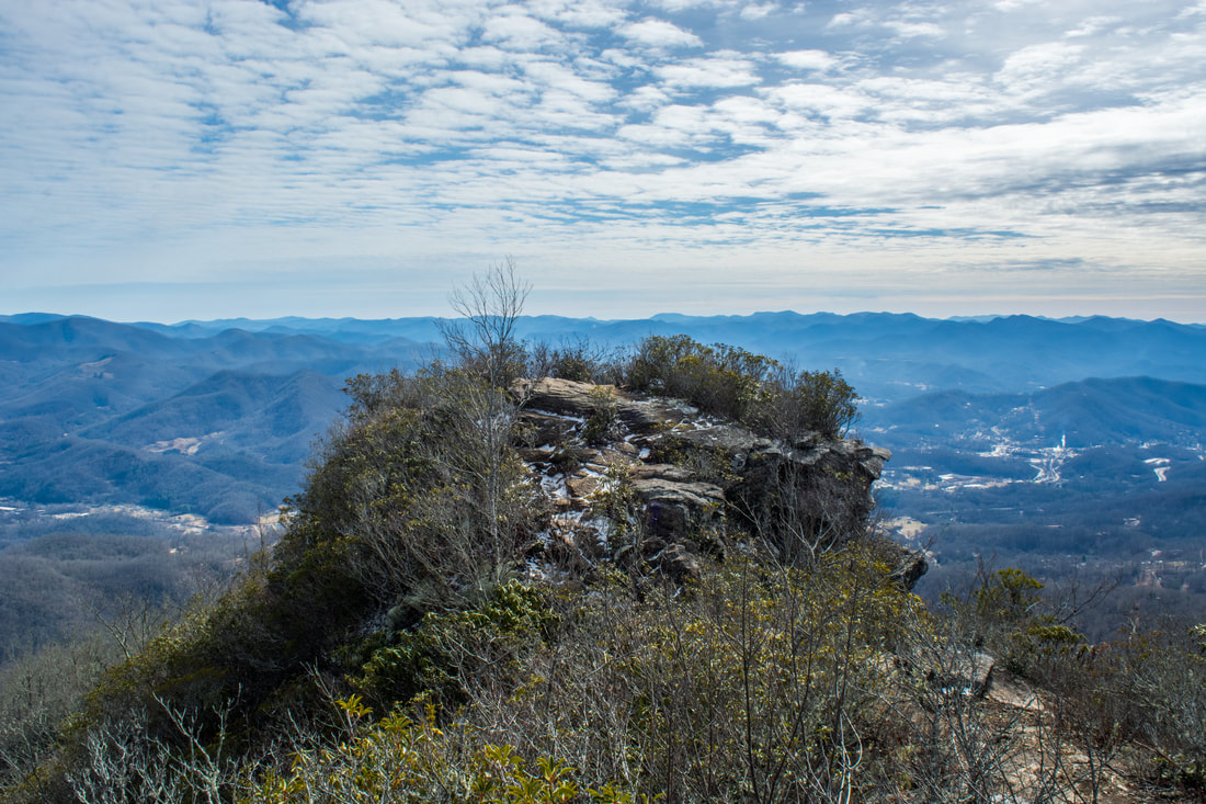
The Pinnacle, a famous rock outcrop that stands sentinel over the town of Sylva, is known well throughout the hiking community for its breathtaking views. The Pinnacle and Blackrock Mountain - a nearby peak with another stunning view - are part of the Plott Balsam Mountains, which are among the highest mountains in the Southeast. The area around The Pinnacle and Blackrock used to be a watershed that provided all of Sylva's drinking water and was strictly off-limits. However, as Sylva became in need of a better water supply, the watershed was transformed into Pinnacle Park. Later, the Blackrock Ridge Tract - an area of previously-private land that included Blackrock Mountain - was purchased, and today, a well-used network of trails connects The Pinnacle and Blackrock to the park's entrance off Fisher Creek Road and to the Blue Ridge Parkway. This hike occurred on Saturday, February 3rd, 2018. My plan was to hike the West Fork/East Fork Loop clockwise. Along the way, I would make side trips to The Pinnacle and Blackrock, and I would also bushwhack to Gina Falls and Fisher Falls.
The Ellicott Rock Wilderness Area covers over 8000 acres across Georgia, South Carolina, and North Carolina. The wilderness's namesake is Ellicott Rock, located in the very heart of the wilderness at the point where all three states come together. From Burrells Ford, one can follow the Chattooga River Trail north into the wilderness all the way to Ellicott Rock and beyond. Besides passing Spoonauger Falls, the Chattooga River Trail affords numerous views of the river that it closely follows all the time. The other waterfall in the vicinity of Burrells Ford, King Creek Falls, is also easily-accessed and is among the most breathtaking waterfalls of the region. Intrepid waterfall chasers can also pick up the Bad Creek Trail from Ellicott Rock and make a challenging bushwhack to a secluded and pristine waterfall on Fowler Creek. This hike occurred on Saturday, January 27th, 2018. My plan was to first hike the Foothills Trail from Burrells Ford Campground to King Creek Falls. Then, I'd take the King Creek Trail and connect to the Chattooga River Trail. I'd follow the Chattooga River Trail north into the Ellicott Rock Wilderness all the way to Ellicott Rock, making the side trip to Spoonauger Falls along the way. From Ellicott Rock, I would follow the Bad Creek Trail and bushwhack down to Fowler Creek Falls. I would retrace most of my steps from Fowler Creek Falls, but when I would return to the vicinity of Spoonauger Falls, I would take the Foothills Trail straight to Burrells Ford Campground.
Caesars Head State Park/Mountain Bridge Wilderness: Naturaland Trust Loop, Cleveland, South Carolina1/25/2018 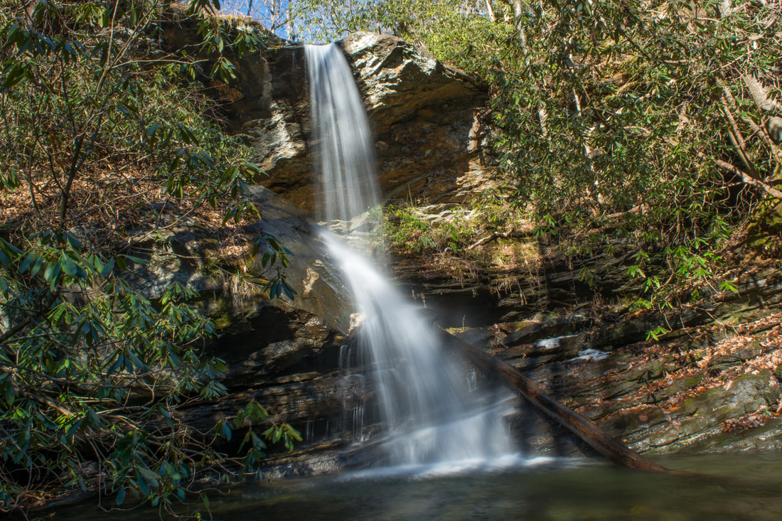
The west half of the Mountain Bridge Wilderness is encompassed by Caesars Head State Park, named for a prominent rock outcrop with striking views of the South Carolina Upstate. One of the area's main highlights is Raven Cliff Falls, a majestic waterfall on Matthews Creek that is cited to be 420 feet high. Among the wilderness's most scenic trails, the Naturaland Trust Trail provides direct access into the Matthew Creek gorge, passing views of Raven Cliff Falls after crossing an elegant suspension bridge at the waterfall's top. Several other trails in the park can be used to create the 12-mile loop Naturaland Trust Loop, which is not only among South Carolina's top hikes but also a very strenuous one. An added bonus for hiking the full loop, however, is optional access to two more gorgeous waterfalls on the property of Asbury Hills Camp: Moonshine Falls and Confusion Falls. This hike occurred on Saturday, January 20th, 2018. My plan was to hike the Naturaland Trust Loop clockwise from the Raven Cliff Falls parking area, although I came away with the feeling that hiking the loop counter-clockwise is better.
Chamberlain Trail is one of only two trails that ascends the east side of Pigeon Mountain from base to top. This lesser-known trail climbs at an easy to moderate pace through Atwood Gulf before meeting up with the Atwood Trail atop the mountain. While there aren't any notable attractions along the trail itself, a fantastic natural sight lies off-trail in Atwood Gulf: Nash Pit Falls. Have you ever heard the words pit and waterfall in one sentence? At Nash Pit Falls, a small stream flows out of a cave and instantly drops over 70 feet into the Nash Pit, a small but deep hole in the ground. In addition to the stunning Nash Pit Falls, this hike also visits a pair of McLemore Cove vistas on High Point - the highest point on Pigeon Mountain. This hike occurred on Saturday, January 13th, 2018. My plan was to hike the Chamberlain Trail from Chamberlain Road to Atwood Trail, making the bushwhack to Nash Pit Falls along the way. Next, I would follow the Atwood Trail to the Pocket/Bluff Trail. I would then follow the Pocket Trail and Bluff Trail in conjunction to the views on High Point. I would retrace my steps the same way.
|
About MeMark Oleg Ozboyd Dear readers: I have invested a tremendous amount of time and effort in this website and the Georgia Waterfalls Database the past five years. All of the work that has gone in keeping these websites updated with my latest trip reports has almost been like a full-time job. This has not allowed me to pick up a paid job to save up money for college, and therefore, I I've had to take out loans. If you find the information on this website interesting, helpful, or time-saving, you can say "thanks" and help me out by clicking the button above and making a contribution. I will be very grateful for any amount of support you give, as all of it will apply toward my college tuition. Thank you!

Coming in 2022-2023?
Other Hiking WebsitesMiles HikedYear 1: 540.0 Miles
Year 2: 552.3 Miles Year 3: 518.4 Miles Year 4: 482.4 Miles Year 5: 259.9 Miles Archives
March 2021
Categories
All
|
 RSS Feed