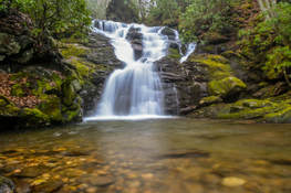
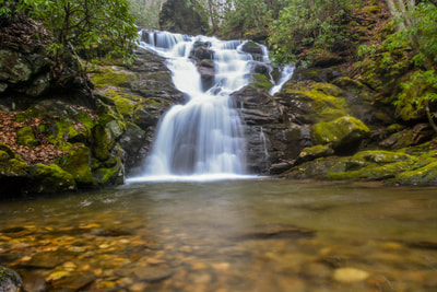
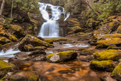
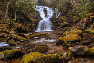
Southeast of the small college town of Cullowhee is the Caney Fork watershed, an area known little to most folks outside of locals. Although there aren't any notable waterfalls on the Caney Fork itself, many of its tributaries feature beautiful falls. Rough Butt Creek Falls is one of the nicer Caney Fork area falls, and it also happens to be fairly easy to access. Rough Butt Creek Falls is a gorgeous, picturesque cascade about 30 feet high that drops into a perfect, tranquil pool. Below the falls, you'll be treated to views of a particularly scenic section of the creek with numerous swift cascades and mossy rocks. This hike occurred on Saturday, March 24th, 2018. My plan was to hike out and back to Rough Butt Creek Falls along the shortest way.
Summary
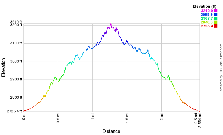
R/T Length of Trail: 2.6 Miles
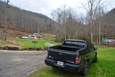
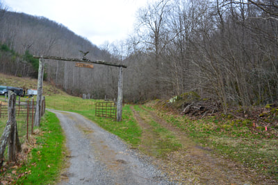
Duration of Hike: 1:30 plus 30 minutes of stopping and photography Type of Hike: Out and Back Difficulty Rating: 4 out of 10 Total Elevation Gain: 638 Feet Pros: Most of the hike is pretty easy, although there is one river crossing and a couple trickier scramble spots near the falls Cons: None Points of Interest: Rough Butt Creek Falls - 7 stars Trail Blaze Colors: None, not an official trail Best Seasons to Hike: Spring Fees: None Beginning Point: Intersection of Caney Fork Road and Ruff Butt Road Directions from Cullowhee, NC: From the main entrance to Western Carolina University (SR 1325) along NC 107 in downtown Cullowhee, follow NC 107 South for 3.8 miles. Then, turn left onto Caney Fork Road (SR 1737). Continue on Caney Fork Road for 9.4 miles to Ruff Butt Road on the right. An unpaved private road, Ruff Butt Road is marked by a wooden sign. Even though this is a private road, the public is welcome to walk it. Please park in the grassy area at the intersection of Caney Fork Road and Ruff Butt Road, as Ruff Butt Road becomes extremely rough farther on. Map
Click the link below to download a .GPX file with a track of this hike.
Hike Details
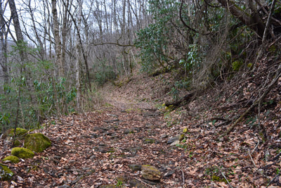
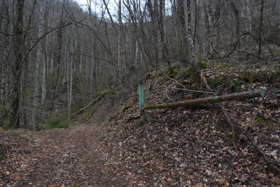
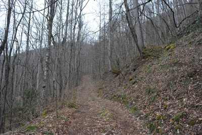
Rough Butt Creek Falls is a pleasant, fairly easy hike to a picturesque, lesser-known waterfall. I highly recommend this hike to all waterfall enthusiasts. Begin the hike by walking along Ruff Butt Road through the community. You'll pass driveways to several houses. At 0.1 mile, stay right on a much rougher dirt road. At 0.25 miles, the rocky road reaches a ford of Caney Fork. Even if you're able to drive this far, you're likely to have trouble driving across the creek and driving up the embankment on the other side. Thus, I would strongly urge you to park by Caney Fork Road. Cross Caney Fork on foot - this will be a knee-deep ford at most times. On the other side, turn left and keep following the dirt road on a steady, moderate uphill. You're now in Nantahala National Forest, following FS 4669. Technically, the road is open to ORVs, but you're highly unlikely to encounter anyone driving this road! As the road rises above Caney Fork, you'll pass several views of the Caney Fork gorge. Around 0.85 miles, the road curves into the Rough Butt Creek hollow.
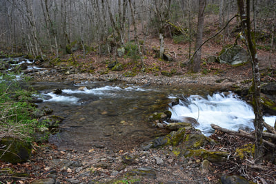
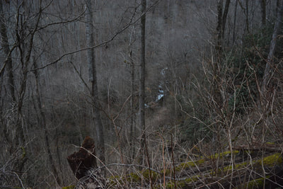
Reach a crossing of Rough Butt Creek at 1.1 miles. This is likely to be a wade too, but if you follow the path before the crossing upstream about 100 feet, you'll reach a spot with large boulders where you can possibly get across the creek dry. To be honest, it probably won't make a difference after the deeper crossing of Caney Fork! Regardless, the side path to Rough Butt Creek Falls begins on the other side of the creek (the east side), leaving the forest road on the right. The side path follows an old roadbed parallel to the creek. Although the path is distinct enough that it's easily-followed, it passes a couple sketchy spots where you'll need to work your way carefully across sloping rock slabs above the creek. The entire section of the creek between the road and the falls is very scenic, featuring numerous cascades surrounded by lush vegetation. At 1.3 miles, the path ends at Rough Butt Creek Falls. You'll want to cross the creek for a much nicer view of the falls and considerably better photo opportunities. About 30 feet high, Rough Butt Creek Falls is a very scenic cascading falls that culminates in a shallow, tranquil pool. The falls is in a jungle-like setting, enclosed by mossy ledges and rhododendron. A scenic cascade flowing through an assortment of moss-covered rocks just downstream from the waterfall makes for a great foreground to photos of the falls. Unfortunately, as soon as I reached Rough Butt Creek Falls (after hiking to two waterfalls on Buff Creek earlier), the sky opened up amidst a heavy thunderstorm. After shooting Rough Butt Creek Falls for 20 minutes in the rain, I realized that I'd forgotten to shoot in RAW format! Thus, my photos of this falls aren't the best. I didn't even take any photos of the scenic cascades below the primary waterfall. I plan on paying this area another visit to see the other waterfalls in the Caney Fork watershed, and I'll likely revisit Rough Butt Creek Falls then. Simply retrace your steps from Rough Butt Creek Falls to Caney Fork Road. You'll conclude the hike at 2.6 miles. Mileage
0.0 - Ruff Butt Road
0.25 - Caney Fork Crossing 1.1 - Rough Butt Creek Crossing (begin side path) 1.3 - Rough Butt Creek Falls 2.6 - Ruff Butt Road Variations
None
Bonus Stops
There are numerous other waterfalls in the vicinity of Caney Fork Road. Possible candidates for waterfalls to visit the same day as Rough Butt Creek Falls include Sugar Creek Falls & Upper Sugar Creek Falls, Piney Mountain Falls, Bearwallow Falls, and Moses Creek Falls. All are relatively short hikes that won't take more than a few hours (Bearwallow Falls and Piney Mountain Falls will take a half-day if your vehicle cannot drive FS 4666).
Pictures
2 Comments
John Stembel
8/29/2020 07:30:35 pm
Hiked this today with my wife and two pups. Great hike, spectacular scenery, hard to believe we had it all to ourselves.
Reply
Paul Aughey
9/17/2022 04:24:12 pm
No longer can park on Rough Butt road. Park on gravel road just 500’ further after bridge. If you have 4WD you may drive closer but currently trees blocking road after river crossing. You will get your feet (and maybe waist) deep if you hike to the falls.
Reply
Leave a Reply. |
About MeMark Oleg Ozboyd Dear readers: I have invested a tremendous amount of time and effort in this website and the Georgia Waterfalls Database the past five years. All of the work that has gone in keeping these websites updated with my latest trip reports has almost been like a full-time job. This has not allowed me to pick up a paid job to save up money for college, and therefore, I I've had to take out loans. If you find the information on this website interesting, helpful, or time-saving, you can say "thanks" and help me out by clicking the button above and making a contribution. I will be very grateful for any amount of support you give, as all of it will apply toward my college tuition. Thank you!
Coming in 2022-2023?
Other Hiking WebsitesMiles HikedYear 1: 540.0 Miles
Year 2: 552.3 Miles Year 3: 518.4 Miles Year 4: 482.4 Miles Year 5: 259.9 Miles Archives
March 2021
Categories
All
|
||||||

 RSS Feed