
Adjacent to the popular Panthertown Valley hiking area lies a much-lesser-visited valley: the Flat Creek watershed. This remote area is home to two very scenic waterfalls on Flat Creek. The massive Flat Creek Falls is among the most spectacular and stunning waterfalls in the Southeast. Dropping as much as 200 feet in a series of powerful cascades, slides, and a huge free-fall, Flat Creek Falls evokes a sense of amazement among anyone who finds their way to its base. Flat Creek features a much smaller but equally notable waterfall as well: Nellie's Falls. Located a couple of miles upstream, Nellie's Falls is a very picturesque double-drop waterfall. The lush, tropical-like setting of Nellie's Falls - the long moss-covered rock slabs near the base of the falls, in particular - help to make it a very scenic destination. Both waterfalls can be seen in the same hike, which utilizes mostly old roadbeds and unmaintained paths. Although the majority of the hike to both falls is fairly easy, getting to the base of Flat Creek Falls involves a steep off-trail descent. This hike occurred on Saturday, April 7th, 2018. My plan was to hike out and back from the end of Rock Bridge Road first to Nellie's and then to Flat Creek Falls.
Summary
R/T Length of Trail: 7.0 Miles
Duration of Hike: 4:10 plus 2 hours and 35 minutes of stopping Type of Hike: Double Out and Back Difficulty Rating: 7 out of 10 Total Elevation Gain: 1629 Feet Pros: Scenic, remote area; one of the Southeast's most spectacular waterfalls Cons: The final part of the hike to Flat Creek Falls is an extremely steep off-trail descent Points of Interest: Nellie's Falls - 9 stars; Flat Creek Falls - 10+ stars Trail Blaze Colors: None (not official trails) Best Seasons to Hike: Summer; Fall Fees: None Beginning Point: End of Rock Bridge Road Directions from Rosman, NC: From the intersection of US 64 and NC 281 west of Rosman near Lake Toxaway, follow NC 281 North for 9.2 miles. Then, turn left onto Rock Bridge Road. Continue for 1.7 miles. Then, at a fork, bear right on Rock Bridge Road, which is marked as FS Road 4662. Continue 2.2 miles to the end of FS 4662 at a turnaround and camping area by Flat Creek. Map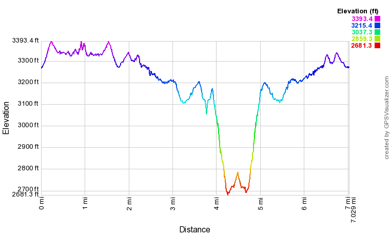
Click the link below to download a .GPX file with a track of this hike.
Details
Flat Creek Falls had been on my bucket list for years. I'd heard all about that incredible 200-foot waterfall that is so awesome and hard to reach. Its hype is not unwarranted. Flat Creek Falls is one of the most spectacular cataracts in the Southern Appalachians, and the long cross-country trek to it deters most casual hikers. With that said, my opinion is that the hike isn't all that difficult. I wouldn't recommend Flat Creek Falls to anyone who doesn't have some experience in navigation and hiking off the official trails, but the people who meet that criteria should get there fine. Many people hike to Flat Creek Falls via private property, but this trail report describes an alternate route that stays on USFS land and actually happens to be a significant shortcut. Also, this trail report includes Nellie's Falls on Flat Creek - a much shorter and easier hike than Flat Creek Falls. An extremely scenic waterfall in its own right, Nellie's Falls is a hike that even casual hikers can try.
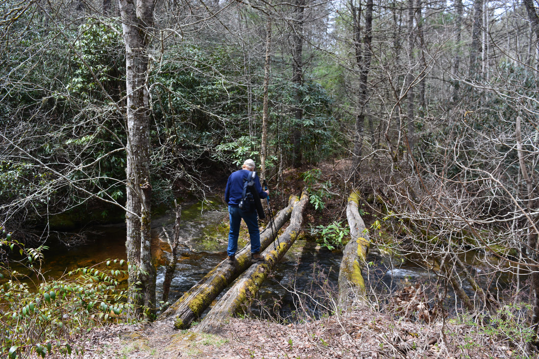
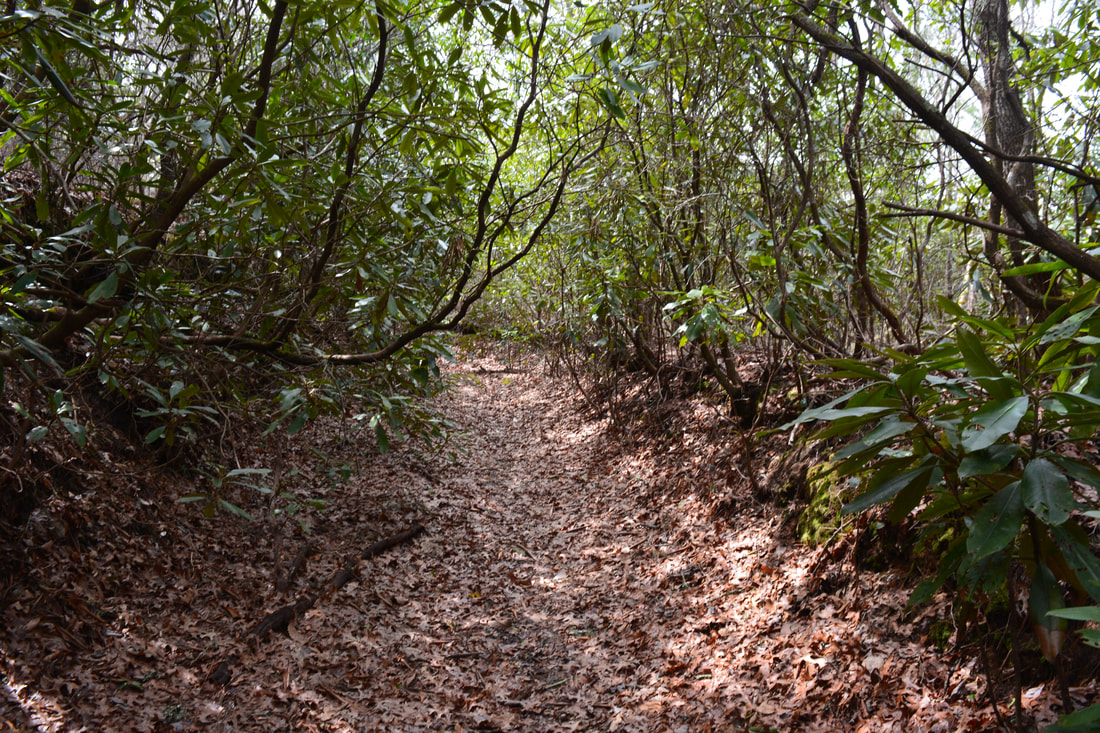
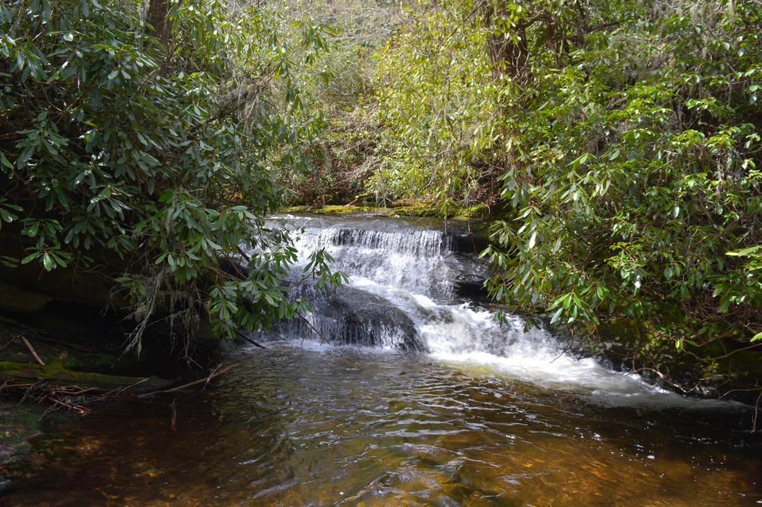
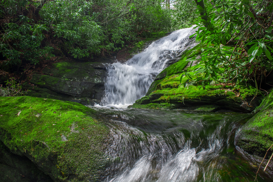
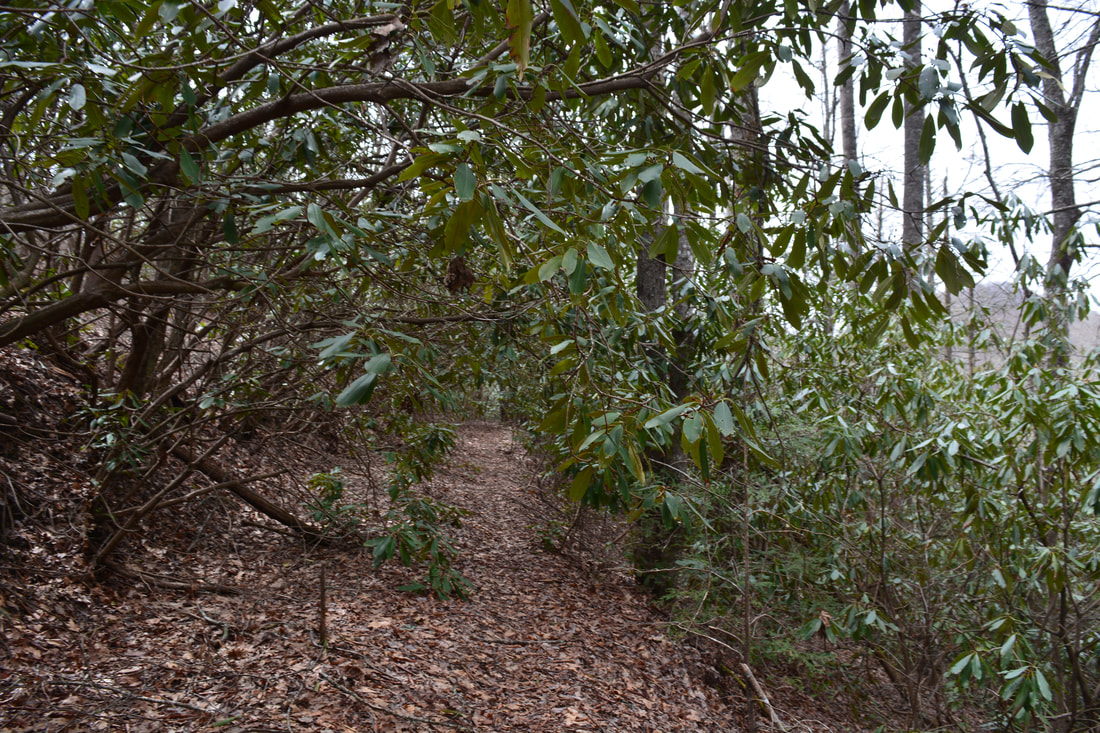
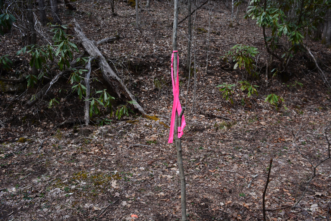
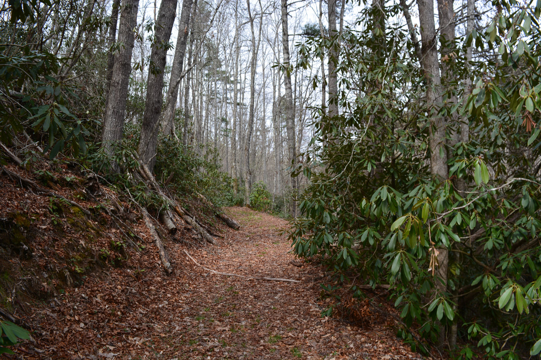
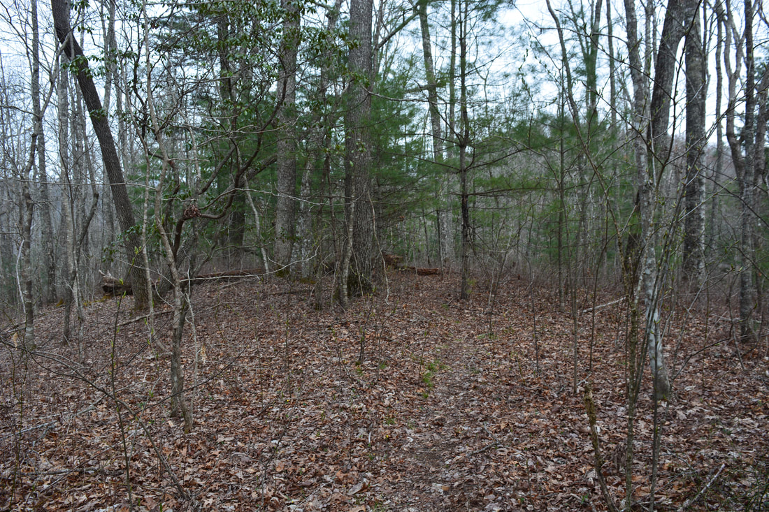
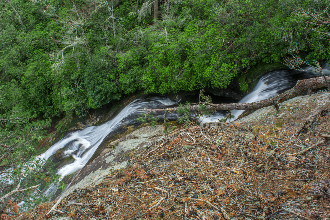
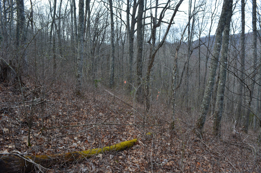
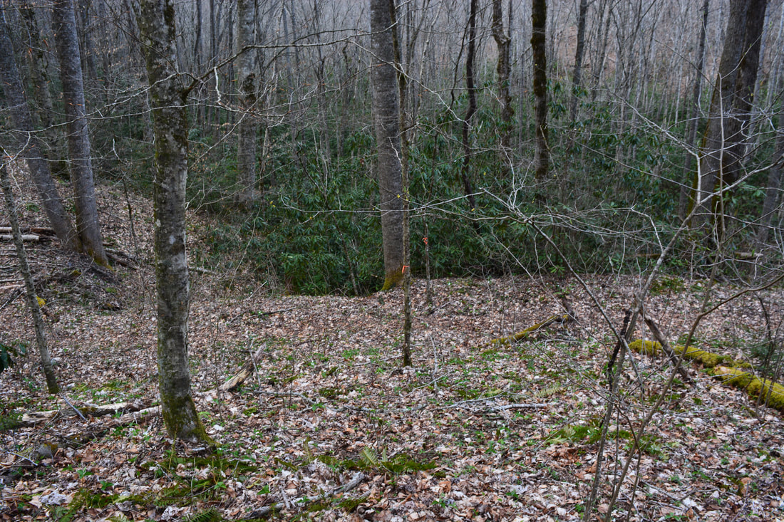
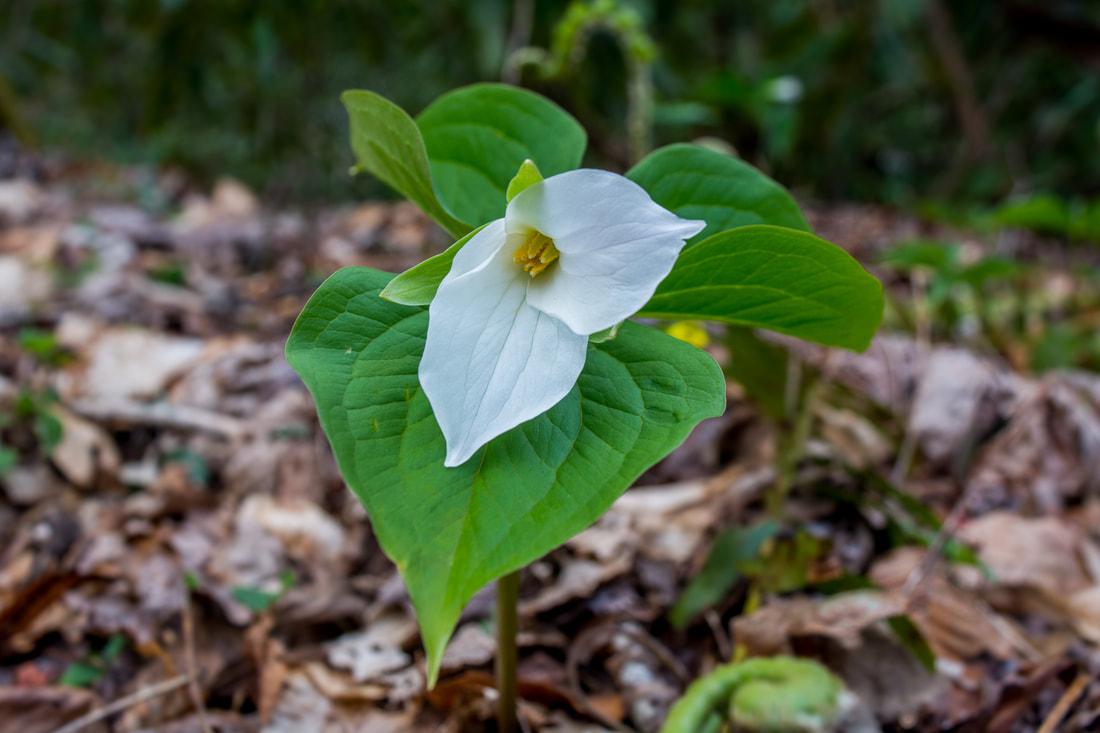
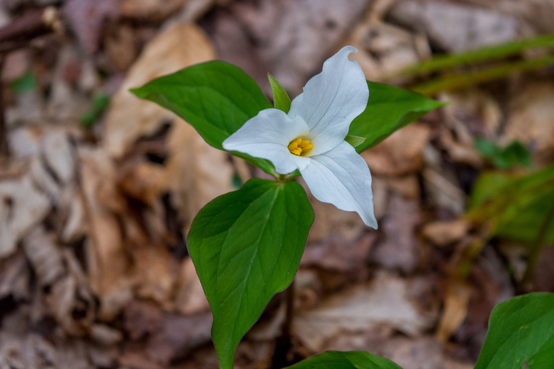
The hike to both Nellie's Falls and Flat Creek Falls starts at the end of Rock Bridge Road. Just to the left of the parking turnaround is an obvious crossing of Flat Creek. Hikers can choose to make an ankle-deep wade or stay dry by precariously crossing the creek on a set of logs high above. Sure-footed people should have no problem crossing the logs when they're dry, but do so at your own risk. Immediately on the other side, a road leads to another crossing on the left. Stay right on a broad forest road. 100 feet from the crossing with the logs, a narrower path leaves left along an old logging grade. The path on the left leads to Nellie's Falls, while the broad road straight ahead leads to Flat Creek Falls. This report describes the hike to Nellie's Falls first (that's also my recommendation), so turn left on the narrower path, which begins an easy ascent through a rhododendron tunnel along a ridge near Flat Creek. In 0.2 miles, reach a split. The road straight ahead passes high above Nellie's Falls and eventually leads to private property. Turn left onto a second path along another old logging road, which stays closer to the creek. This path remains easy to follow despite occasional blowdowns. Follow the main logging grade until it seems to abruptly peter out at a right curve at 0.65 miles. The slim path to Nellie's Falls turns left off the old logging grade at this point. The turn may be marked by pink flagging tape. The path crosses a low, muddy area, briefly climbs (the route to the upper section of Nellie's Falls leaves at the 'crest'), and drops back down to a crossing of Flat Creek right below a small cascade. Nellie's Falls is just out of sight upstream. You might be able to get across dry here using a series of rocks and twigs, particularly if you're hiking in boots, but it will be tricky. On the other side, walk along a slippery rock slab and pick up a path that scrambles around a large boulder. The path comes out on the broad rock slabs at the base of Nellie's Falls at 0.8 miles. Nellie's Falls is a fantastic waterfall. In fact, I liked it just about as much as Flat Creek Falls! The lower drop of Nellie's Falls visible from the base is only about 25 feet high, but it's incredibly picturesque. The water splits into numerous free-falling and sliding sections that spread out perfectly across the jagged cliff. Just below the falls is a very scenic, elongated rock slab totally coated by thick, lush moss (please try to disturb it as little as possible when exploring the falls). Flat Creek even splits around a small rocky island just below the falls and forms a scenic cascade alongside the mossy rock slabs. The setting of Nellie's Falls is nearly as good as it gets. Photographers are sure to love this little waterfall, particularly in late spring and early summer. Nellie's Falls is sometimes referred to as Hidden Falls (on Burt Kornegay's map for Panthertown Valley, for example), but Nellie's Falls is the primary name. The coordinates for Nellie's Falls are N35° 12.079' W83° 01.977'. Nellie's Falls also has a scenic upper drop not visible from the base. To see it, return along the path for about 350 feet to the small crest, where the slope levels out. Turn left here and begin contouring along the slope back toward Nellie's Falls. You should see a faint path in places. The obscure route goes 0.1 mile to the top of the lower section of Nellie's Falls. From here, there's a nice view of the upper section, but the best view is on the other side of the creek. This is a tricky hop that must be treated with extreme care, as you're standing right at the top of a 25-foot drop-off. The upper section of a Nellie's Falls is a picturesque slide and cascade about 20 feet high. As with the lower section, all the rocks are covered in lush green moss. 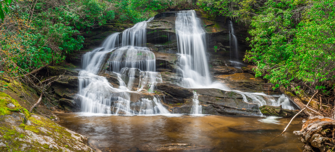
Nellie's Falls is a very picturesque 25-foot drop on Flat Creek situated in a fantastic lush setting.
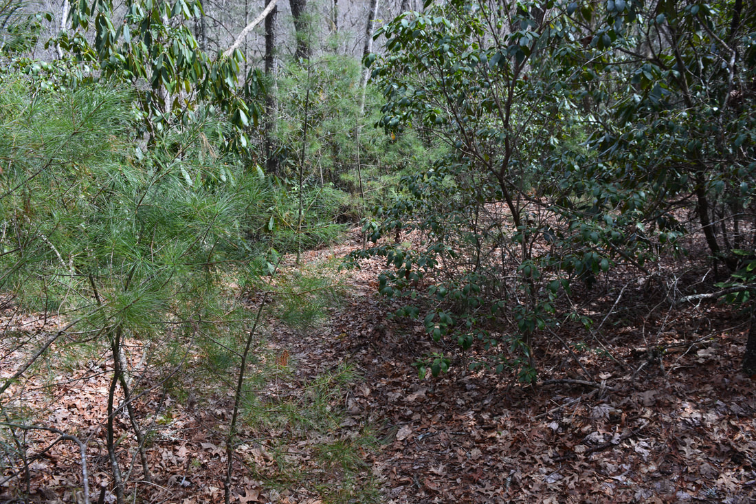
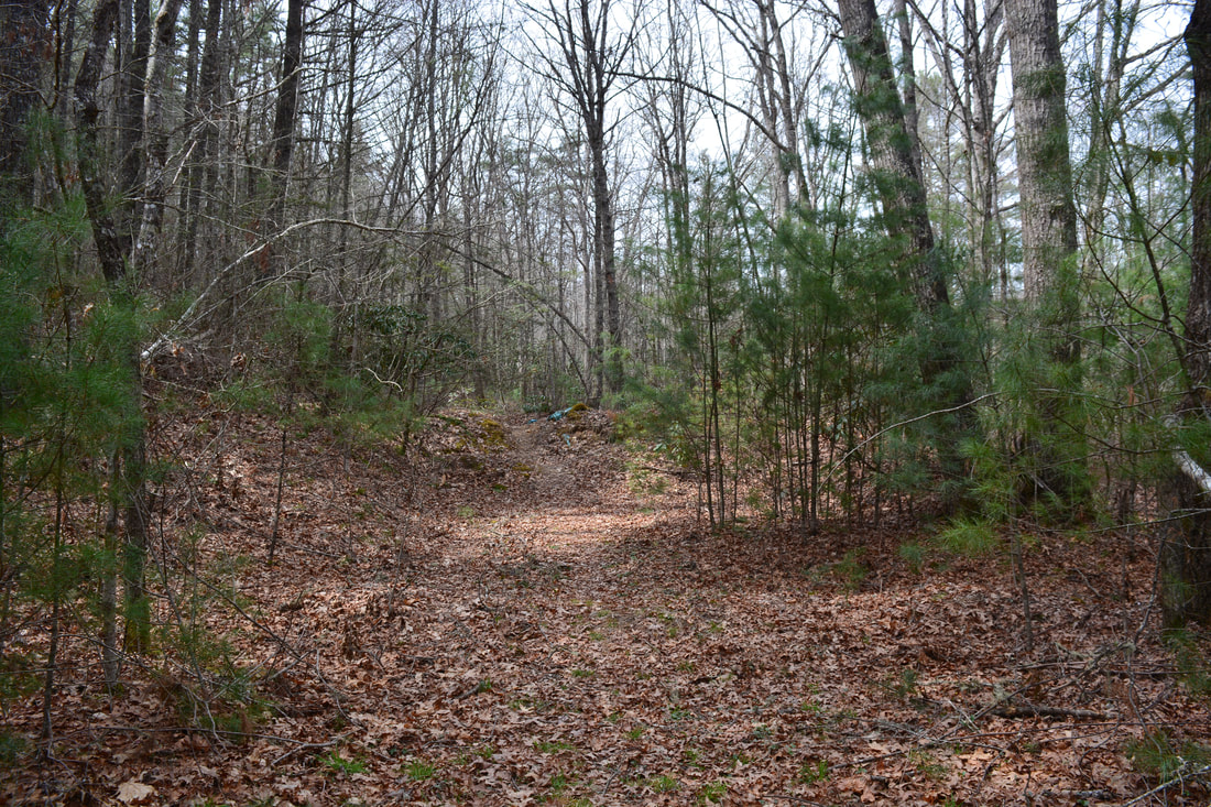
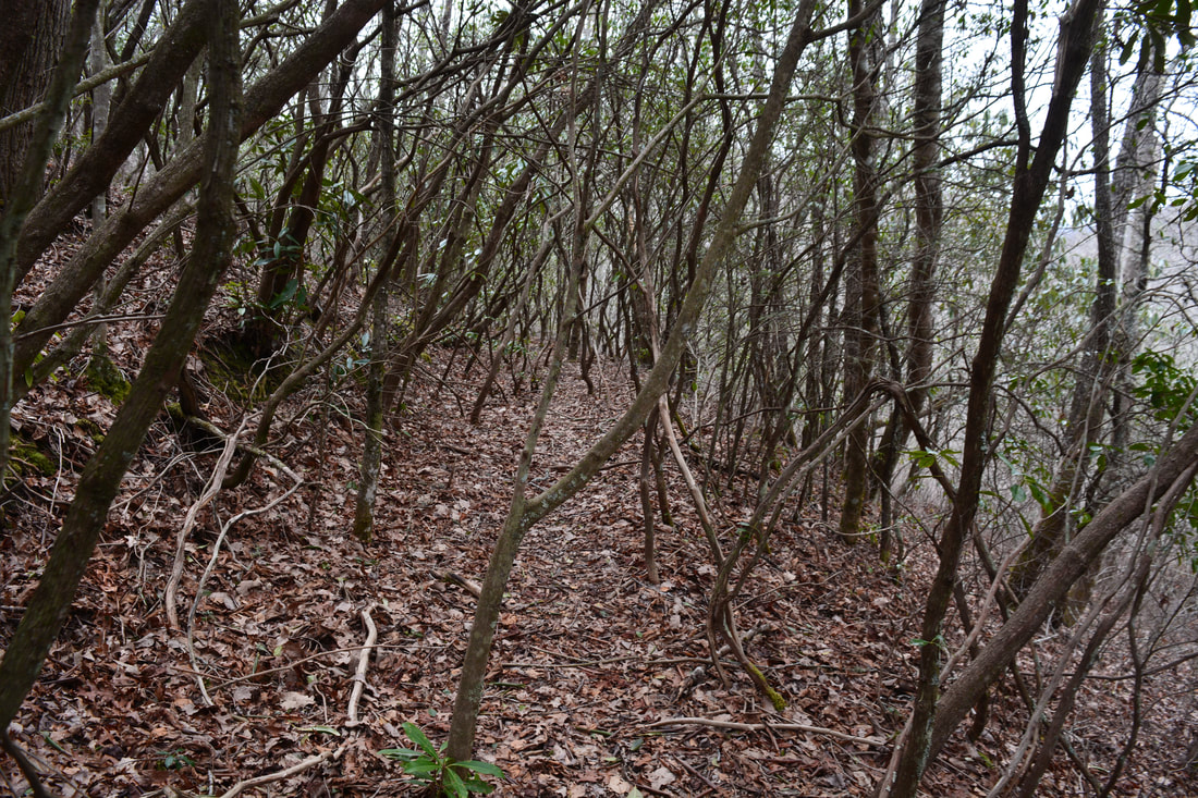
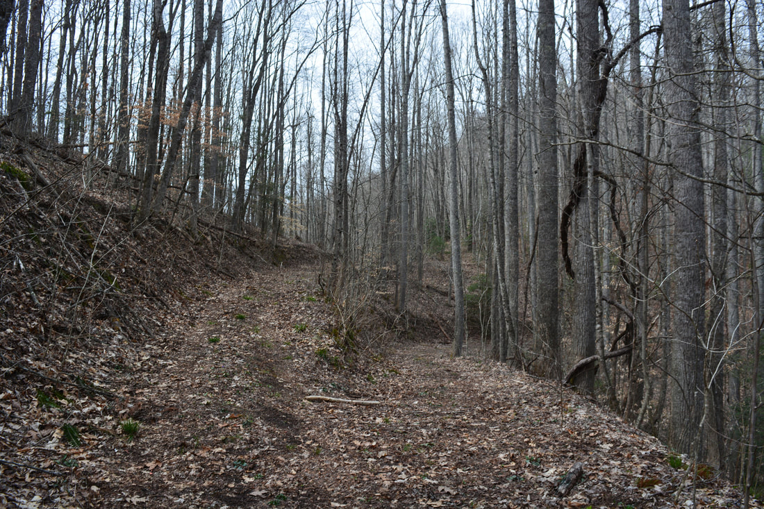
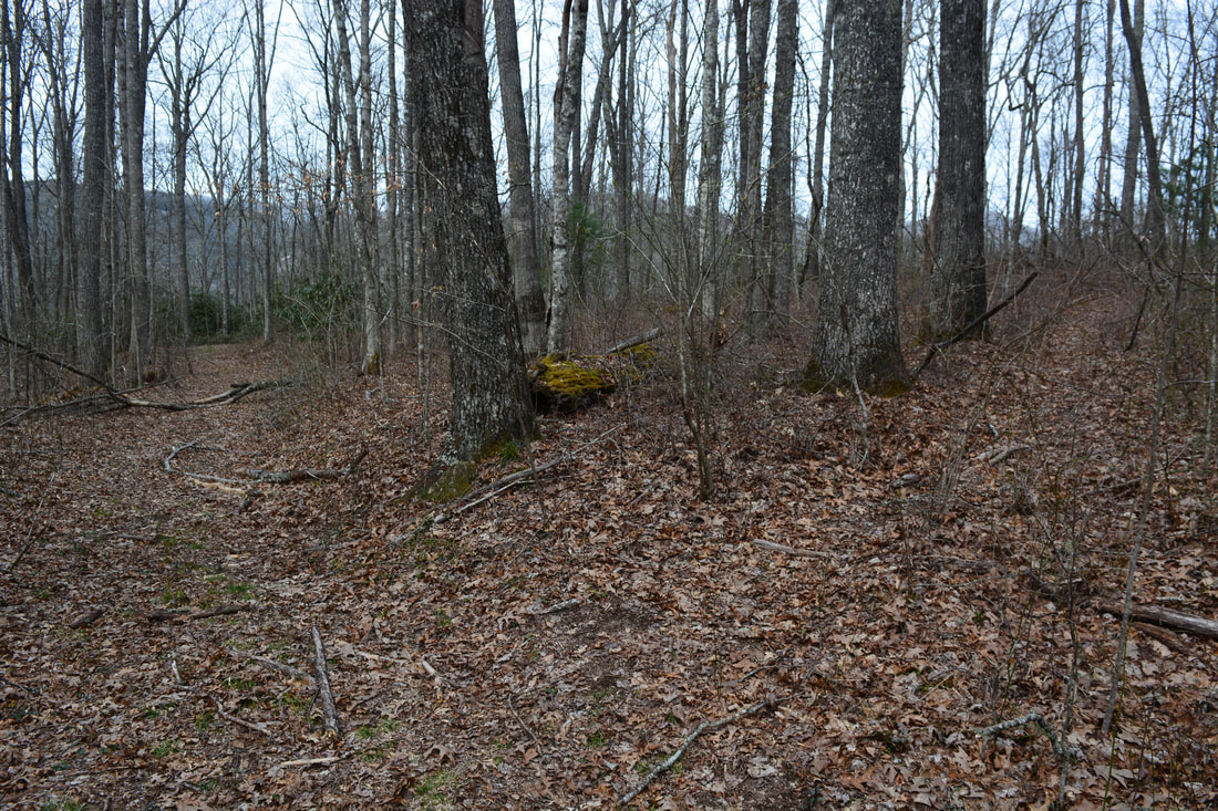
From Nellie's Falls and the upper section of it, retrace your steps back to the Flat Creek Falls trail. You'll return to it at 1.75 miles (including the side trip to the upper section). You could turn right and finish a 1.8-mile hike to just Nellie's Falls. This makes for a great afternoon outing to a little-known waterfall without much effort. However, if you have the time for a full-day hike and the necessary experience in cross-country navigation, I highly recommend to extend the hike to the astounding Flat Creek Falls. To see Flat Creek Falls, turn left on the main forest road, which passes through a muddy area and reaches a broad clearing with a campsite at 1.8 miles. This can be a confusing spot, as numerous roads and paths leave the clearing on all sides. The distinct trail to Flat Creek Falls leaves along the softer second right turn (NOT the sharper first right turn). You'll know you're on the right trail when you pass over a series of jeep-blocking mounds near its start. Kornegay's Panthertown Valley trail map calls this trail the Old Trestle Path. The trail follows an old railroad grade that contours along the slope well above Flat Creek. The trail is mostly easy, but there are a number of rough crossings of ravines where railroad trestles have likely washed out. Around 2.4 miles, the trail enters a lengthy rhododendron tunnel. Although the trail remains easy to follow, its unofficial status that it isn't maintained, and thus, the twisting path gets creative as it constantly bypasses rhododendron trunks and branches. This section can get a bit frustrating, particularly on the return trip.
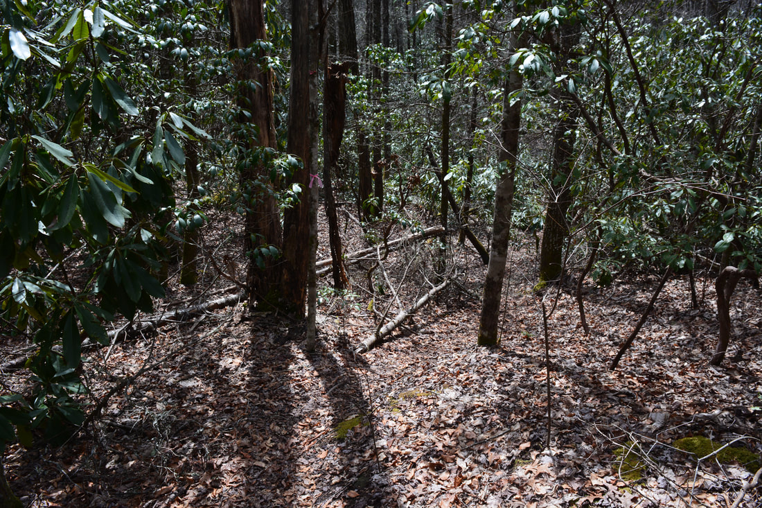
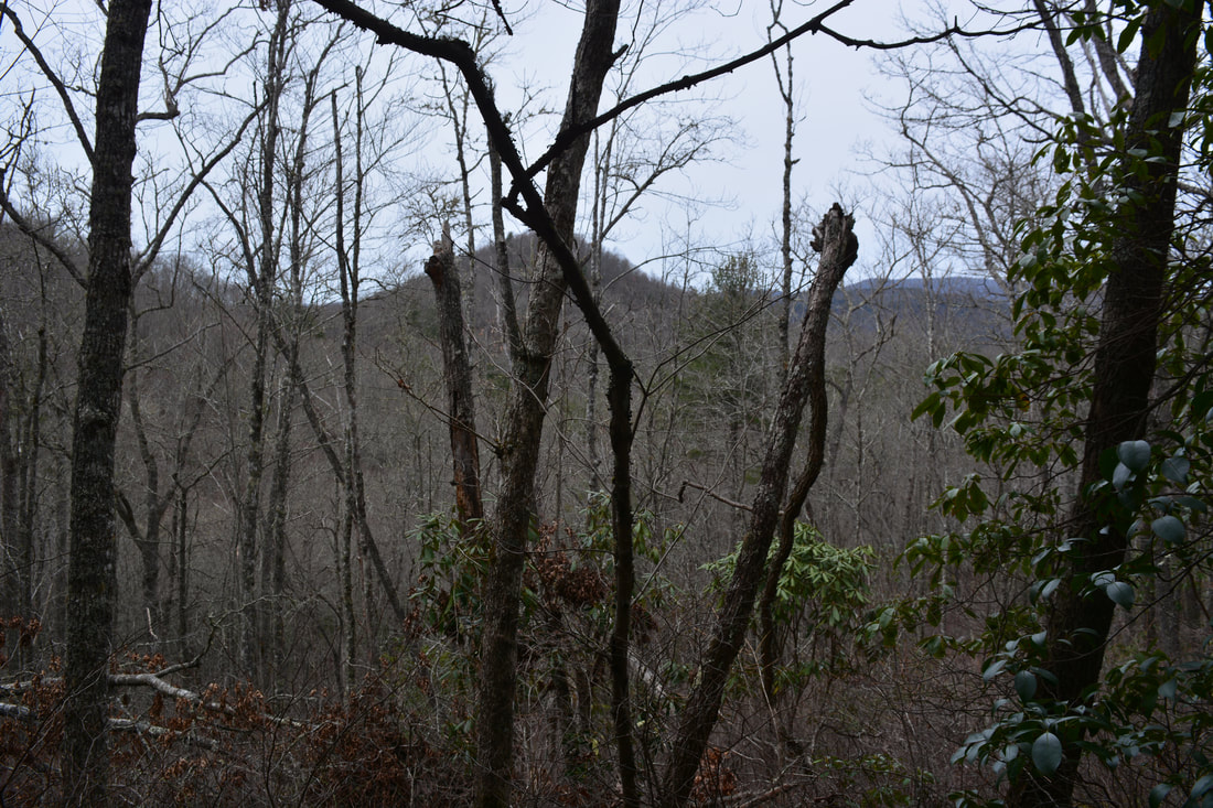
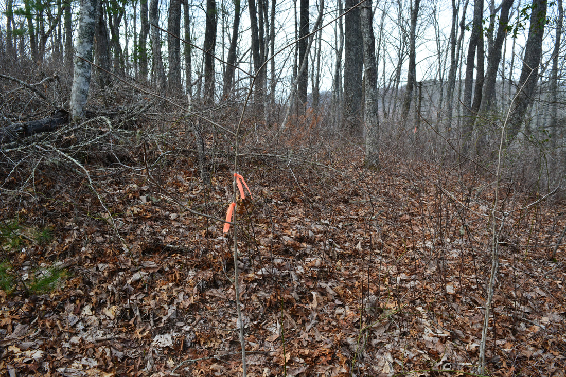
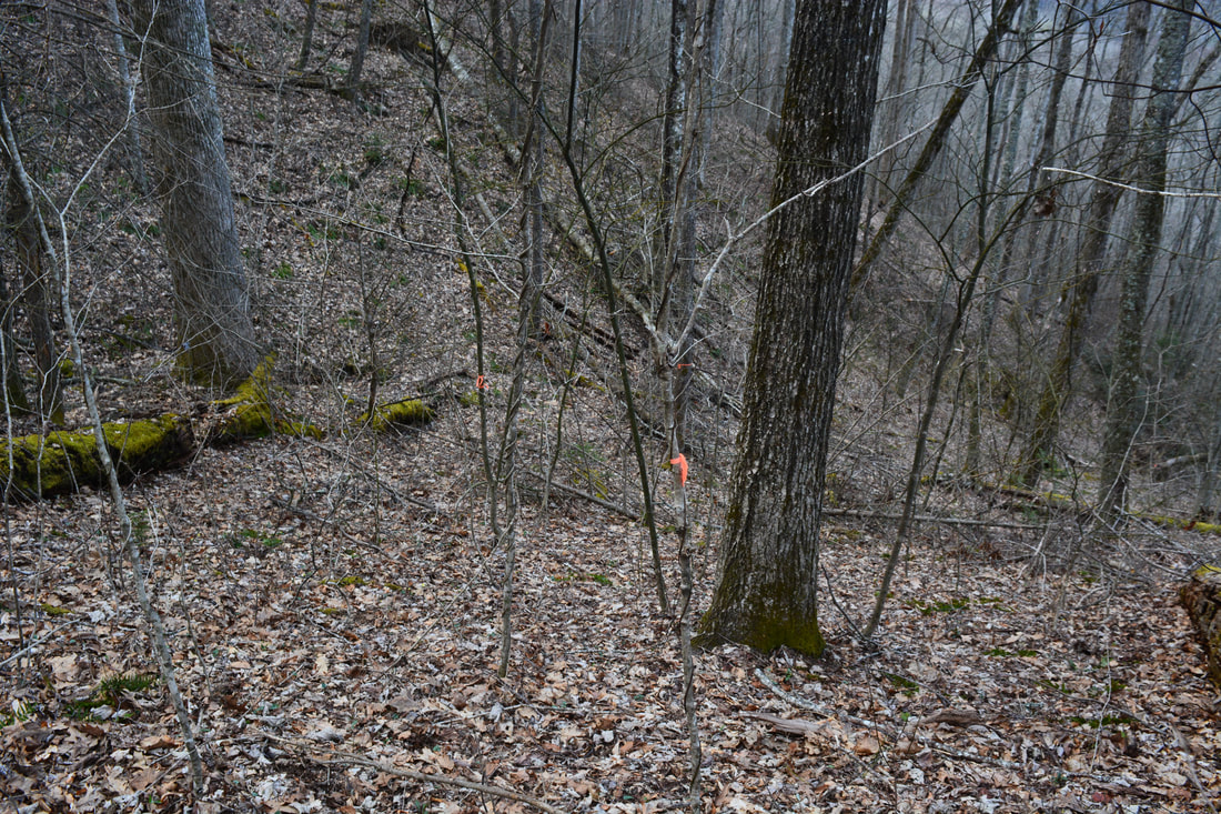
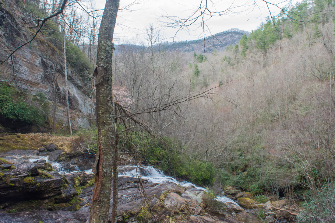
At 2.6 miles, the path seems to abruptly end by a wet-weather drainage. Actually, the path leaves the old railroad grade and turns right, following a rather faint track paralleling the drainage downstream. In about 300 feet, the path crosses the drainage on slick rock slabs and climbs the bank to meet a much broader and more distinct old logging road at 2.7 miles. This turn is extremely easy to walk straight by on the way back. On my trip, it was marked by pink flagging tape, but there's no guarantee that it'll still be present when you do the hike. Regardless, turn right onto the broad logging road and follow it on a gradual descent as it curves around Isinglass Knob. At 3.0 miles, reach a Y-split. The road that bears left crosses a gap between Isinglass Knob and Beetree Knob and enters private property. Stay right. The road levels out near a placid, marshy section of Flat Creek at 3.3 miles and begins to climb toward Grassy Gap. At 3.6 miles, the road passes through Grassy Gap - one of the most important intersections of the hike. Straight ahead, the road shortly switchbacks left and begins a steep descent along Eyelet Ridge (north of Beetree Knob) toward Bear Creek Lake. The entire section of the road along Eyelet Ridge is strictly private property. Many people hike to Flat Creek Falls this way, but I neither condone nor recommend it - it is longer, more difficult, and does not pass through public land. Fortunately, the way I used to access the base of Flat Creek Falls from Grassy Gap is entirely on National Forest land. It's easy to follow and is a significant shortcut despite its extreme steepness. To access this route, first turn right on an inconspicuous path leaving eastward along the ridge from Grassy Gap toward the top of Flat Creek Falls. I suggest visiting the top of Flat Creek Falls as well before you venture toward the base. At 3.7 miles, the path passes a lot of new orange flagging tape on the left. Orange flagging tape marks the public route to the base of the falls, and it really is hard to miss, especially in winter. For now, continue along the main path. The final part is a steep scramble that culminates on a cliff above Flat Creek Falls at 3.8 miles. There aren't any outstanding views here, but it's still a nice spot. This is the only place from where you can see the section of Flat Creek Falls above the main free-falling drop. This section consists mostly of steep slides. The clifftop vantage point provides a nice view of Flat Creek dropping over a ledge and disappearing into the unknown. Are you ready to find out what lies below??? 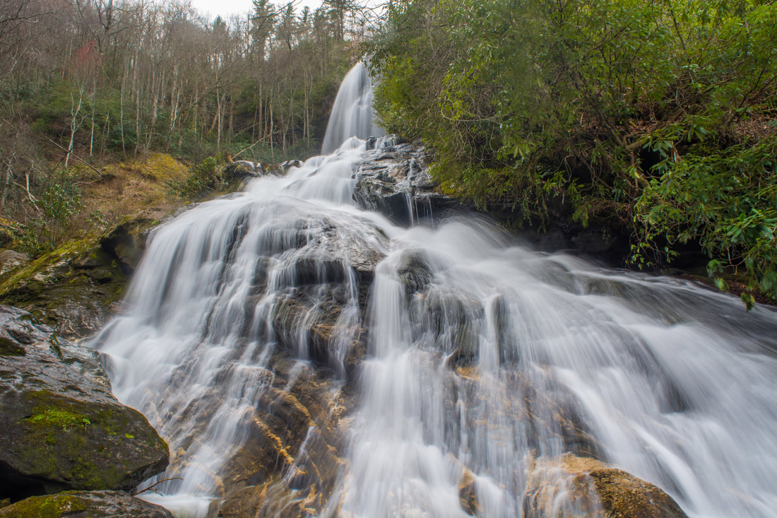
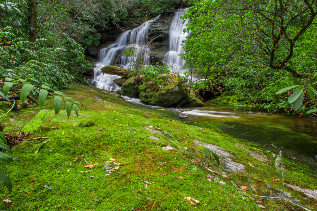
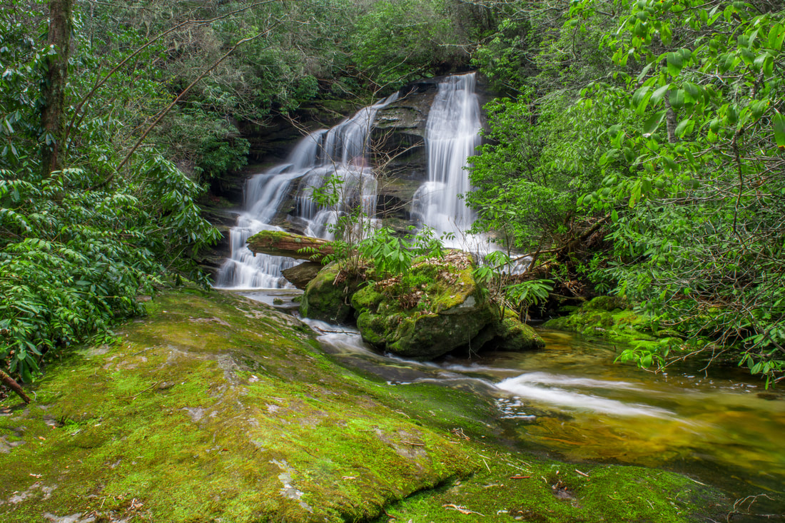
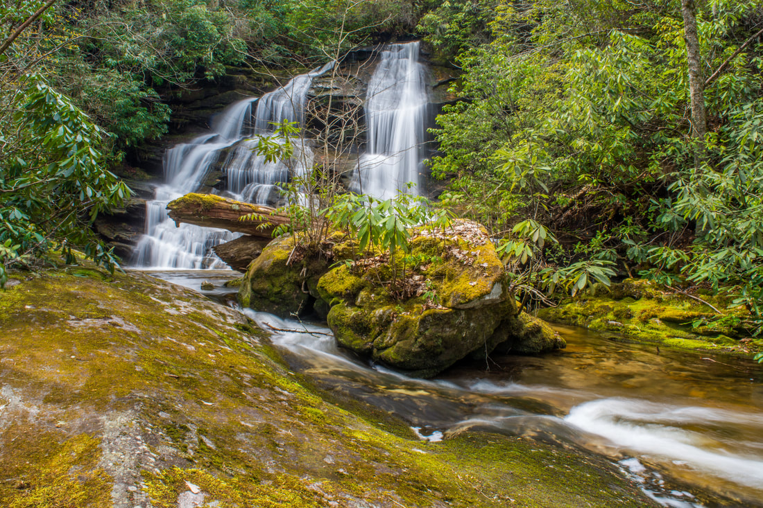
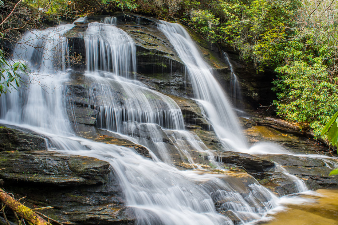
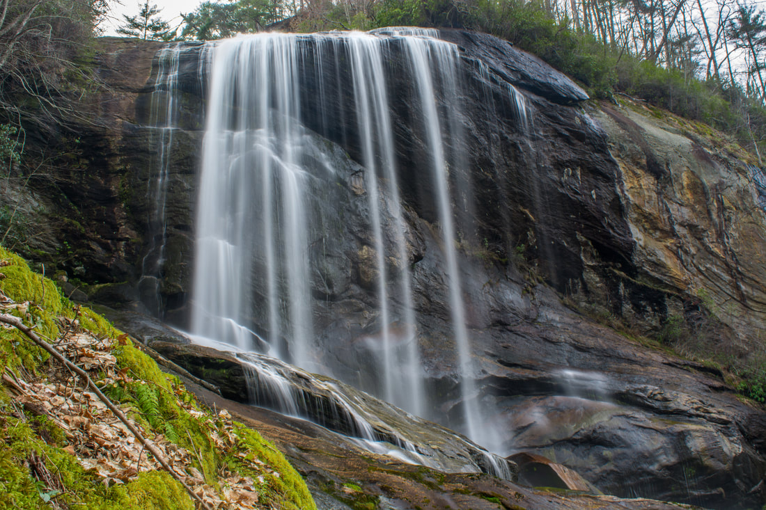
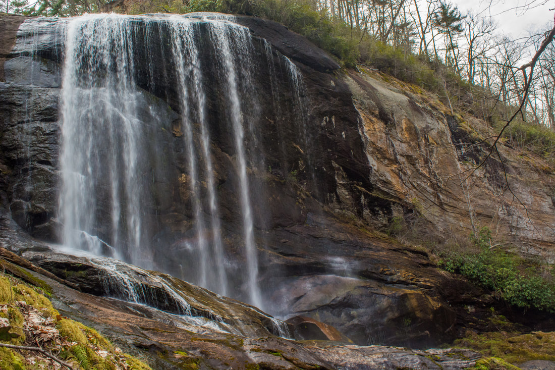
200-foot Flat Creek Falls is a breathtaking sight.
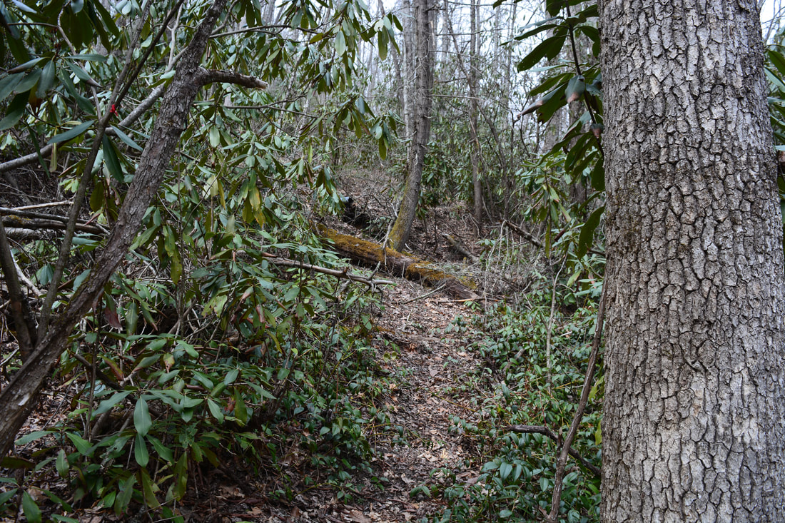
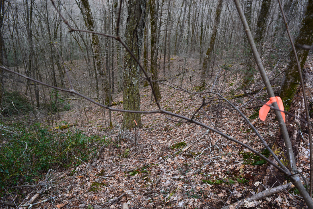
Retrace your steps one tenth of a mile to the start of the orange-flagged route to the base of Flat Creek Falls. There is actually a faint path along the first part of it. Even if you can't find the orange flagging tape, you should just head down the slope west of the falls in the same general north-northeast direction. I must caution you against descending close to the falls though, as that area is very cliffy, rugged, and overgrown. For the most part, the flagged route down the mountain is easy to follow and passes through very open woods. You won't have to worry about bushwhacking through a rhododendron jungle or anything like that here. It's extremely steep though - you'll lose 450 feet in elevation in just a quarter-mile! The route starts out heading north, but it slowly curves northeast. Finally, at about 4.25 miles, you should intersect a distinct path along an old roadbed just above Flat Creek. The lower end of the off-trail route down to Flat Creek is marked by orange flagging tape too, although it may be slightly harder to find than at the top. The entire route is marked very frequently and consistently. I found the flagging tape very easy to see in winter - discerning it could be harder when the leaves are out. Either way, the flagging tape should remain there for at least a few years. Perhaps by the time it fades people will have created an actual path here!
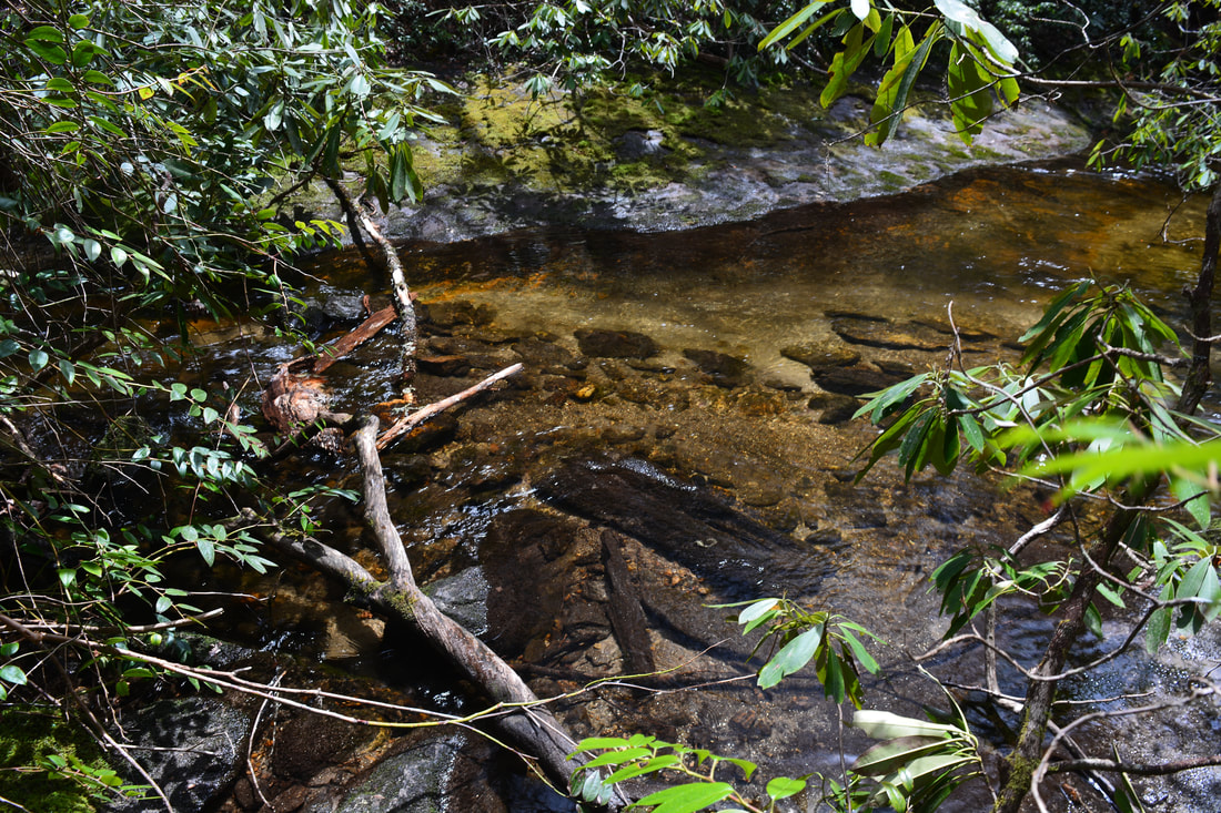
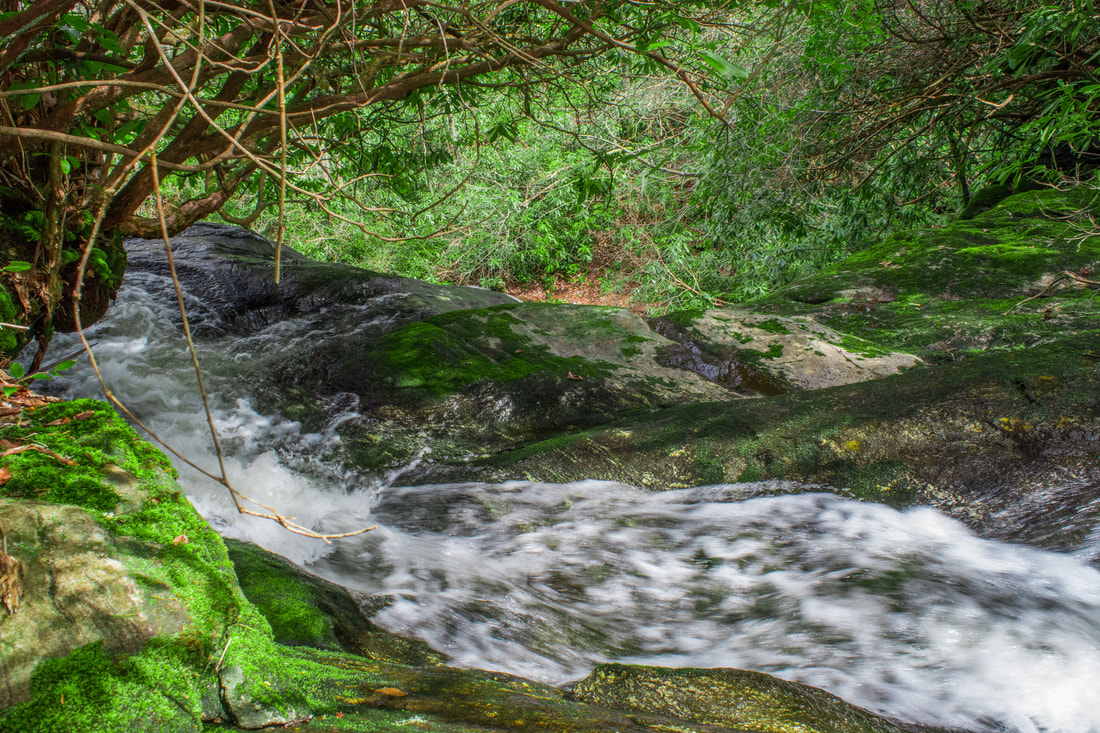
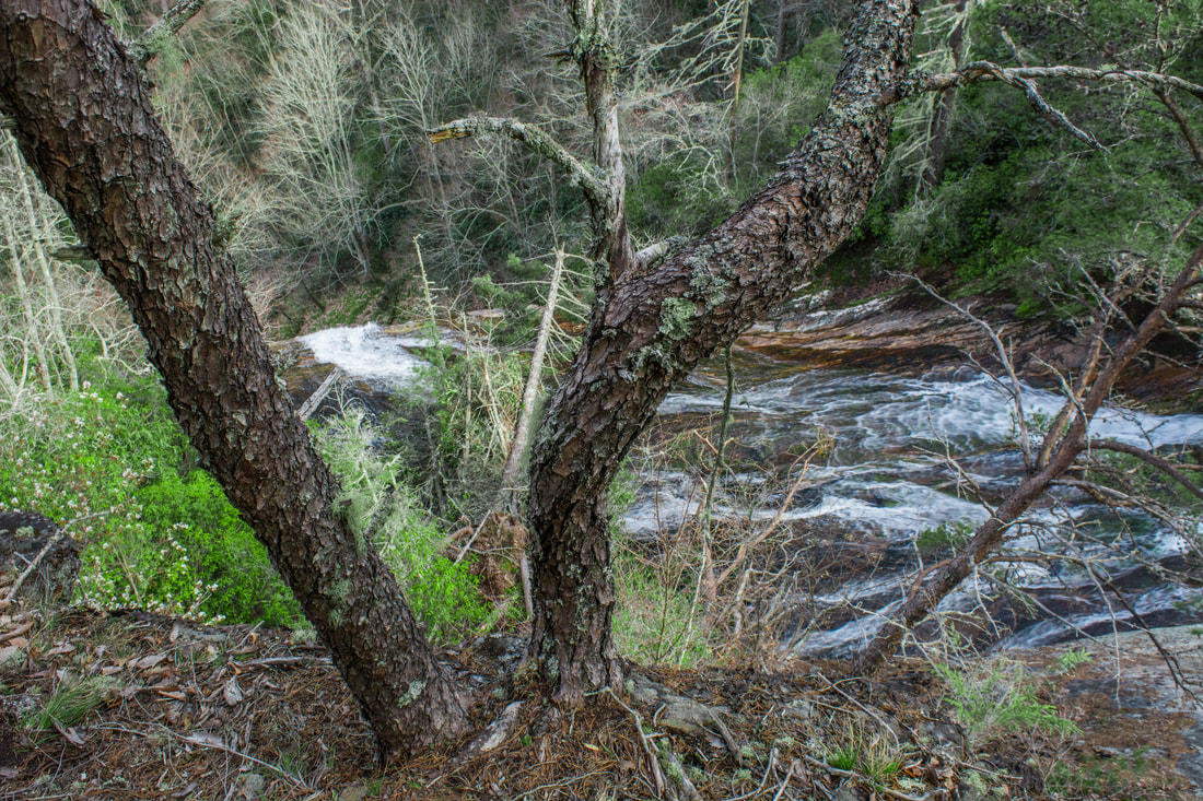
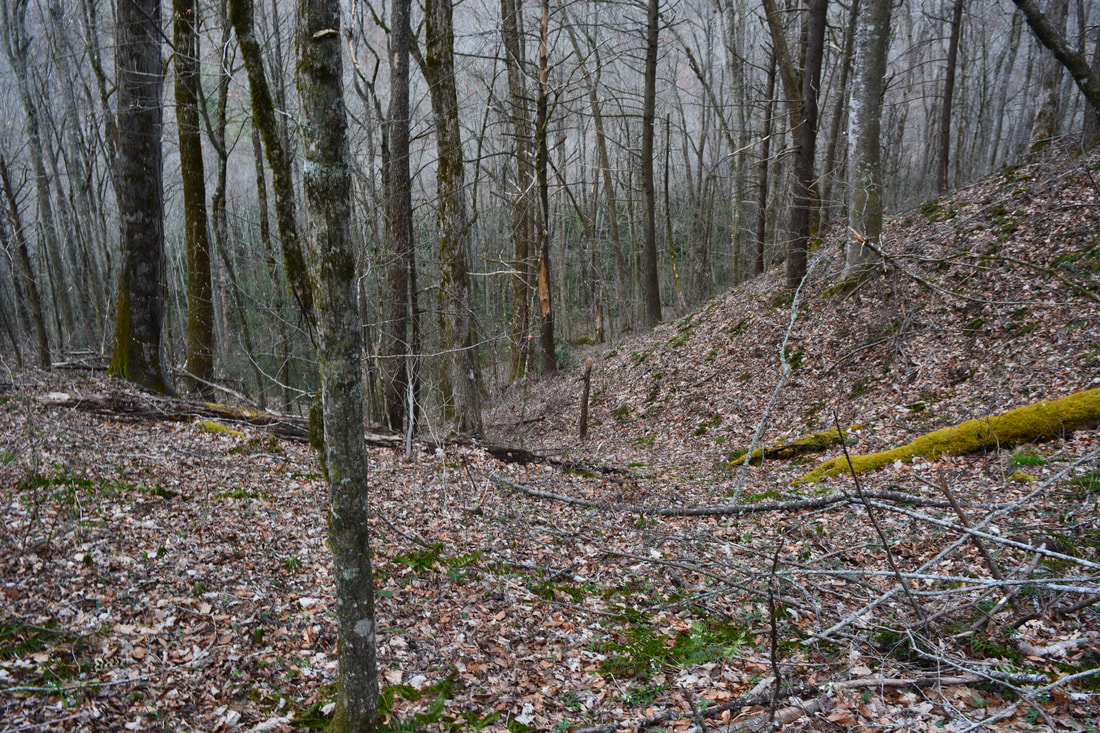
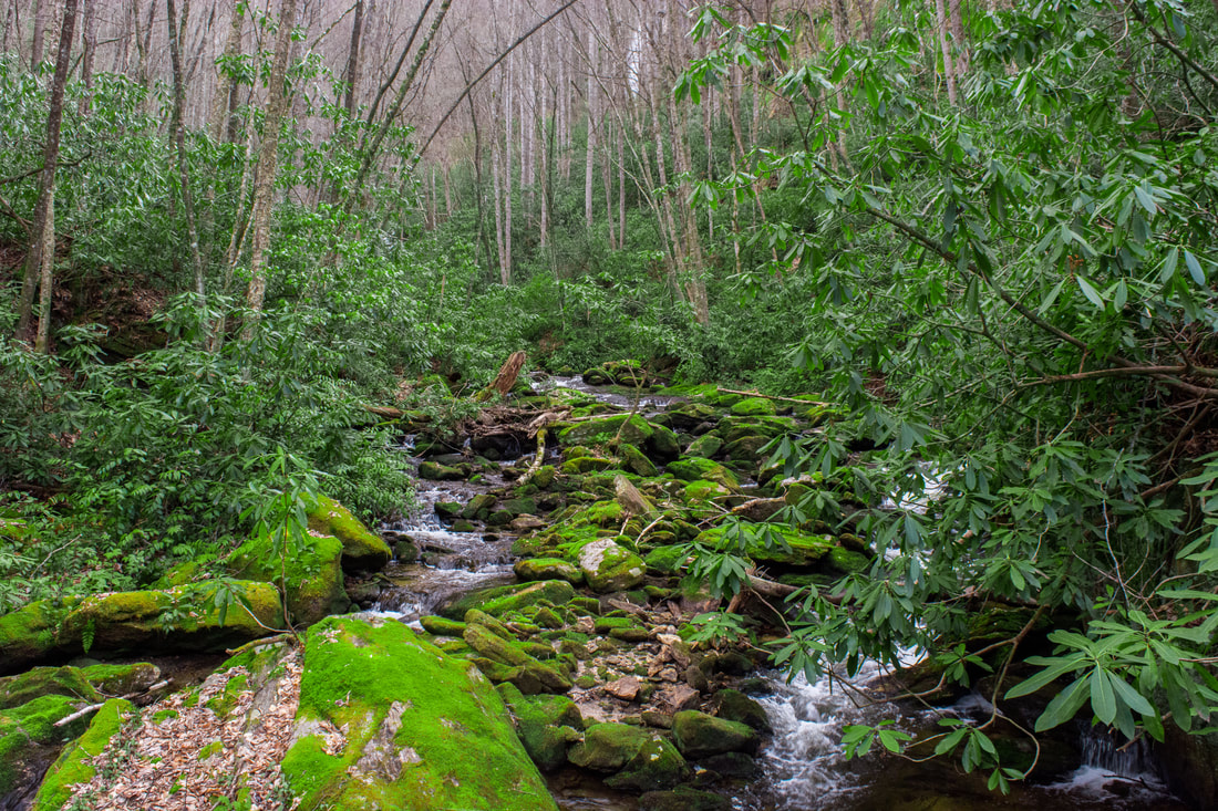
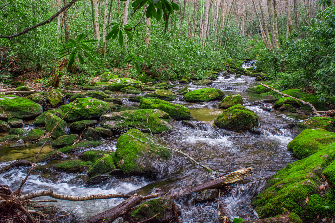
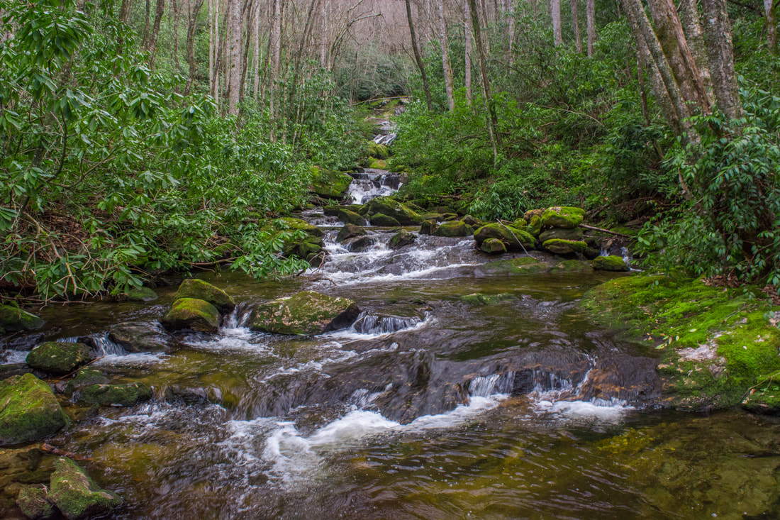
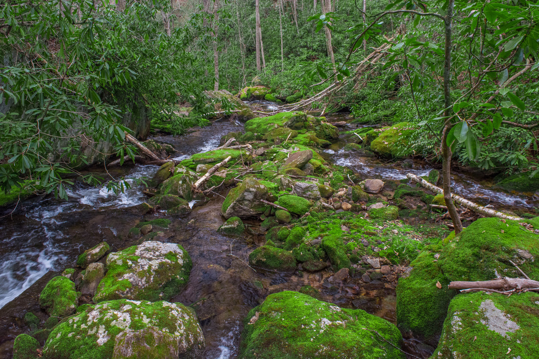
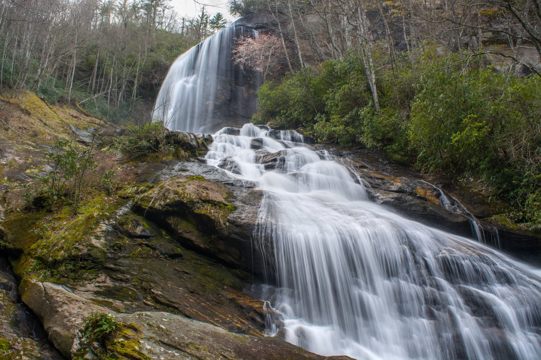
When you intersect the obvious path near Flat Creek, turn right onto it. The path dives into a muddy drainage channel, crisscrossing it three times. The path then arrives by the side of Flat Creek. What a beautiful stream it is here, cascading noisily among moss-coated boulders. The path turns right here, scrambling up a bank only to return to the creek at a crossing at 4.4 miles. If the water flow is average or above average, there's a good chance that you'll get your feet wet here. If it's too cold to cross, you can try hopping across via the numerous rocks, but to do this safely, you'll need two trekking poles, and you'll need to know that there's a good risk to dunk your boots here. On the other side, the well-defined path continues to follow the creek closely. As the path approaches the base of Flat Creek Falls, it passes a very scenic spot where every single rock around the creek is covered in a thick layer of moss. Finally, after scrambling up a series of boulders, the trail reaches its terminus by the base of Flat Creek Falls at 4.5 miles. Flat Creek Falls is located at the coordinates N35° 13.251' W83° 01.949'. The view of Flat Creek Falls from the base is simply jaw-dropping. You can see about 160 feet of the 200-foot waterfall from the base. The upper tier is the spectacular 100-foot free-falling section, and the lower tier is the 60-foot steep slide. The raw power of Flat Creek Falls contributes to its outstanding beauty even more than its height. How many waterways as large as Flat Creek have a waterfall as tall as this one? I bet that Flat Creek Falls looks great even in drought conditions! Many people aren't satisfied with the view from the base of Flat Creek Falls - they want to get to the base of the free-falling drop. I have some insight on that. Not under any circumstance should you climb up the open rock face on the left side of the lower tier! Although it may look somewhat easy to climb, the rock face is slicker than ice and steeper than it looks from a distance. The only practical route to the base of the free-falling drop is to bushwhack up the steep slope to the left of the open rock (on River Right of Flat Creek). The bushwhack isn't dangerous, but it still must be attempted only by people experienced in steep off-trail scrambling. Hikers who don't meet that criteria must remain at the base of the falls. If you do manage to make it all the way to the base of the free-fall though, you'll find an even more striking view. From that vantage point, there's also a view down the Flat Creek valley toward the Boardtree Knob cliffs in the distance. The Boardtree Knob cliffs have a completely different aerial view of Flat Creek Falls that is equally beautiful. The hike to the Boardtree Knob View is a lengthy ridge-top bushwhack from Rock Bridge Road. From Flat Creek Falls, simply retrace your steps back to the Rock Bridge Road parking area. You'll return to the parking area at 7.0 miles, concluding the hike. I have decided to rate this hike a "Best Hike" due to the outstanding nature of both waterfalls along it. As far as the Southeast goes, this waterfall hike is very hard to beat, particularly given the relatively easy access. Mileage
0.0 - Flat Creek Trailhead
0.8 - Nellie's Falls 3.6 - Grassy Gap 3.8 - The top of Flat Creek Falls 4.5 - Flat Creek Falls 7.0 - Flat Creek Trailhead Variations
Hike just out and back to Nellie's Falls - 1.8 Miles
Hike just out and back to Flat Creek Falls - 5.2 Miles Bonus Stops
If you're looking for another waterfall to round out your day (the Flat Creek Falls hike may take less than a full day depending on your speed and amount of stopping), Upper Sols Creek Falls farther north along NC 281 is an excellent choice.
Pictures & Videos
0 Comments
Leave a Reply. |
About MeMark Oleg Ozboyd Dear readers: I have invested a tremendous amount of time and effort in this website and the Georgia Waterfalls Database the past five years. All of the work that has gone in keeping these websites updated with my latest trip reports has almost been like a full-time job. This has not allowed me to pick up a paid job to save up money for college, and therefore, I I've had to take out loans. If you find the information on this website interesting, helpful, or time-saving, you can say "thanks" and help me out by clicking the button above and making a contribution. I will be very grateful for any amount of support you give, as all of it will apply toward my college tuition. Thank you!

Coming in 2022-2023?
Other Hiking WebsitesMiles HikedYear 1: 540.0 Miles
Year 2: 552.3 Miles Year 3: 518.4 Miles Year 4: 482.4 Miles Year 5: 259.9 Miles Archives
March 2021
Categories
All
|
||


 RSS Feed