
The 244-acre Rock Creek Gorge Scenic Area in Polk County is one of Southeast Tennessee's most spectacular natural areas. The Rock Creek Gorge is home to a jaw-dropping sixteen named waterfalls, spread across Rock Creek and several of its tributaries flowing off Chilhowee Mountain. All are scenic and many are tall. The only easily-accessible waterfalls are Rock Creek Falls, Benton Falls, and arguably Chestnut Mountain Falls. All of the others involve various degrees of creek-walking and/or bushwhacking. While one could visit all sixteen falls in one day, it will require a high level of physical capability and off-trail experience. Folks who chose to visit the waterfalls in several different trips will still be well-rewarded. The best time of year to visit the waterfalls of the Rock Creek Gorge Scenic Area is winter or spring, when the waterfalls are flowing more boldly and when the area is less overgrown. This hike occurred on Saturday, April 14th, 2018. My plan was to hike the Scenic Spur Trail from Highway 30 to Rock Creek Falls. I would follow a scramble path to Chestnut Mountain Falls. From there, I would begin the off-trail section of the hike by first visiting the waterfalls on Laurel Branch and then walking up Rock Creek past several waterfalls to the Slickrock Branch confluence. Next, I would bushwhack alongside Slickrock Branch out to the Rim Rock Trail, visiting more waterfalls along the way. I would then follow the Clemmer Trail to Benton Falls, also bushwhacking to Elora Falls and Silvermine Branch Falls. Finally, I would return to Highway 30 along the Clemmer Trail.
Summary
R/T Length of Trail: 8.4 Miles
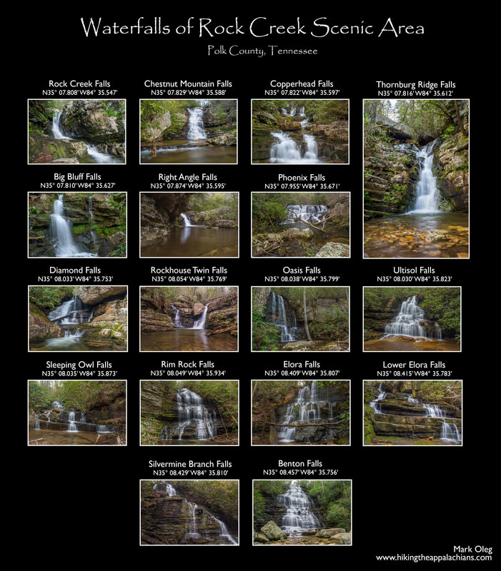
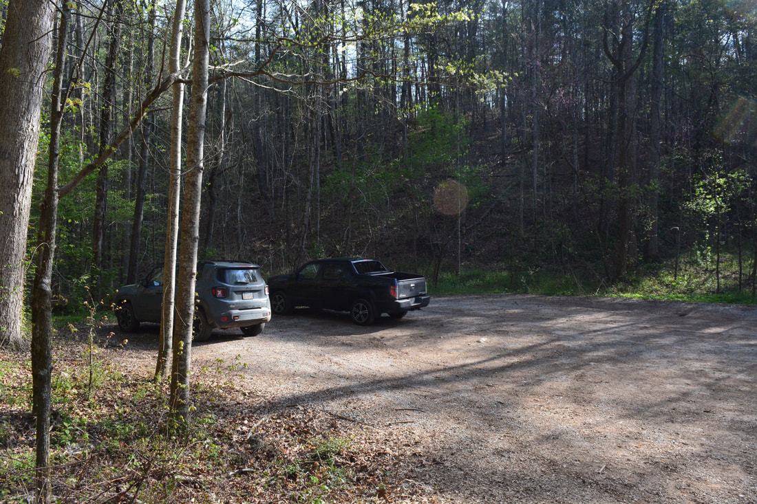
Duration of Hike: 7:00 plus about four hours of stopping and photography Type of Hike: Loop Difficulty Rating: 9 out of 10 Total Elevation Gain: 1901 Feet Pros: Countless remote, scenic waterfalls Cons: Parts of the hike's off-trail section are slow and rough Points of Interest: Rock Creek Falls - 7 stars; Chestnut Mountain Falls - 9 stars; Copperhead Falls - 4 stars; Thornburg Ridge Falls - 8 stars; Big Bluff Falls - 5 stars; Right Angle Falls - 6 stars; Phoenix Falls - 7 stars; Diamond Falls - 5 stars; Rockhouse Twin Falls - 6 stars; Oasis Falls - 9 stars; Ultisol Falls - 7 stars; Sleeping Owl Falls - 3 stars; Rim Rock Falls - 10 stars; Elora Falls - 6 stars; Lower Elora Falls - 3 stars; Silvermine Branch Falls - 4 stars; Benton Falls - 10 stars Trail Blaze Colors: Scenic Spur Trail - White; Clemmer Trail - Green; Benton Falls Trail - Blue Best Seasons to Hike: Winter, Spring Fees: None Beginning Point: Clemmer Trailhead off TN 30 Directions from Benton, TN: From the intersection of US 411 and US 64/74 south of Benton, follow US 64/74 East for 9.6 miles. Then, turn left onto TN 30. In 300 feet, at a sign for Clemmer Trailhead (also the Scenic Spur Trailhead), turn left onto a gravel road. Follow the unpaved road 400 feet to a turnaround and parking area, where the hike begins. Map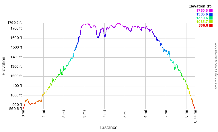
Click the link below to download a .GPX file with a track of this hike.
The collage below includes my photos of every single notable waterfall in the Rock Creek Gorge Scenic Area, along with GPS coordinates for each one.
Details
Back in 2014, I made my first foray into the Rock Creek Gorge Scenic Area, hiking the Rim Rock Trail and stopping by Benton Falls. Back then, I knew that I'd yet to see the other waterfall in the scenic area shown on trail maps - Rock Creek Falls at the mouth of the gorge. At the time, however, I had no clue about the existence of numerous other waterfalls in the gorge that weren't shown on the trail map. The reason is simple - none of the other fourteen named waterfalls are on marked trails! Four years later, I decided that it was finally time to see Rock Creek Falls, revisit Benton Falls for better photos, and bag each of the falls in between the two. I must credit Tom Dunigan's amazing Tennessee Landforms website for how much it helped me in finding these waterfalls, as it lists the location of each one. I highly recommend that anyone who is looking to visit waterfalls in Tennessee checks out the TN Landforms site. It features a wealth of info for hundreds of waterfalls across the state. Prior to moving on with the trail report, I must include a disclaimer. A visit to any of the off-trail waterfalls in the Rock Creek Gorge will include travel over hazardous, unmarked terrain. Substantial off-trail experience and navigational skills are a necessity for folks wishing to see these falls. Less seasoned hikers will want to see only Rock Creek Falls, Benton Falls, and perhaps Chestnut Mountain Falls.
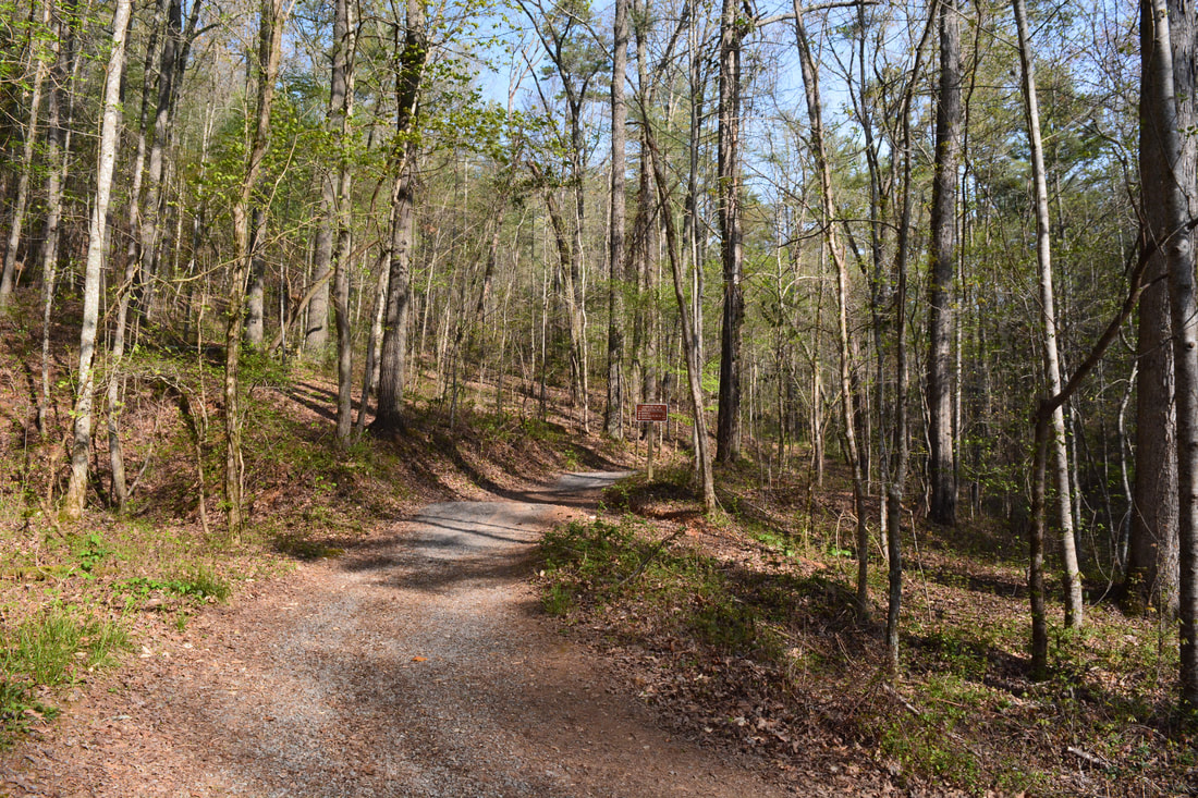
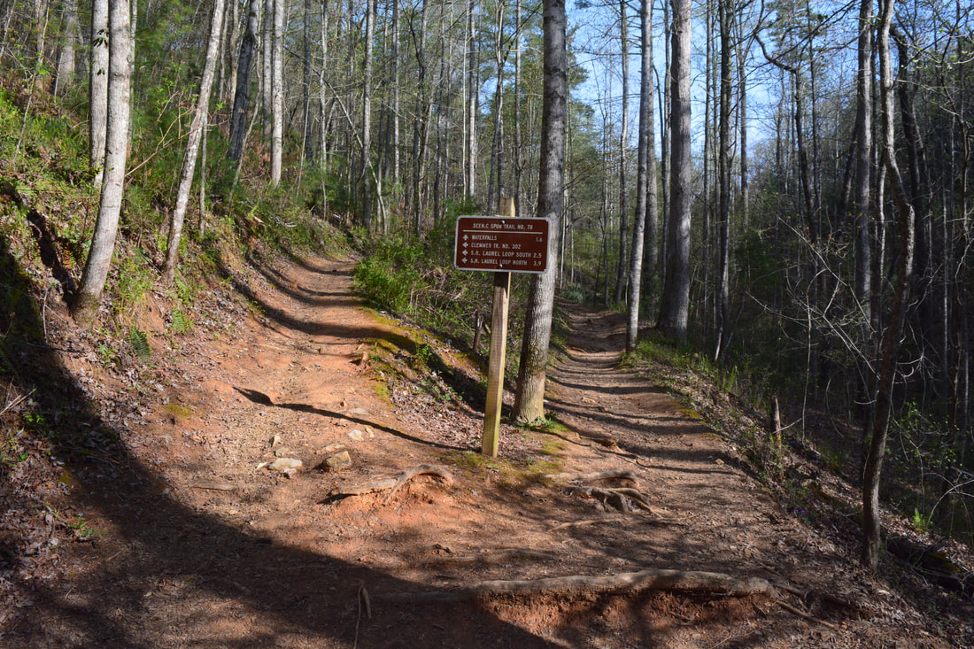
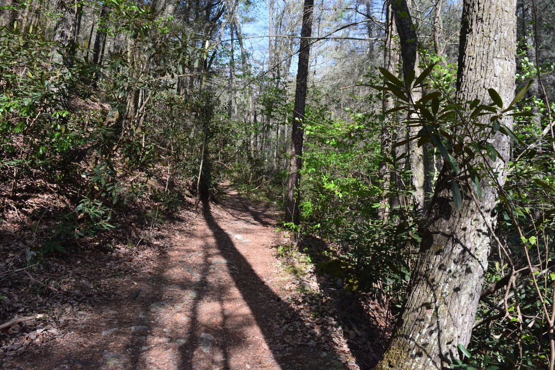
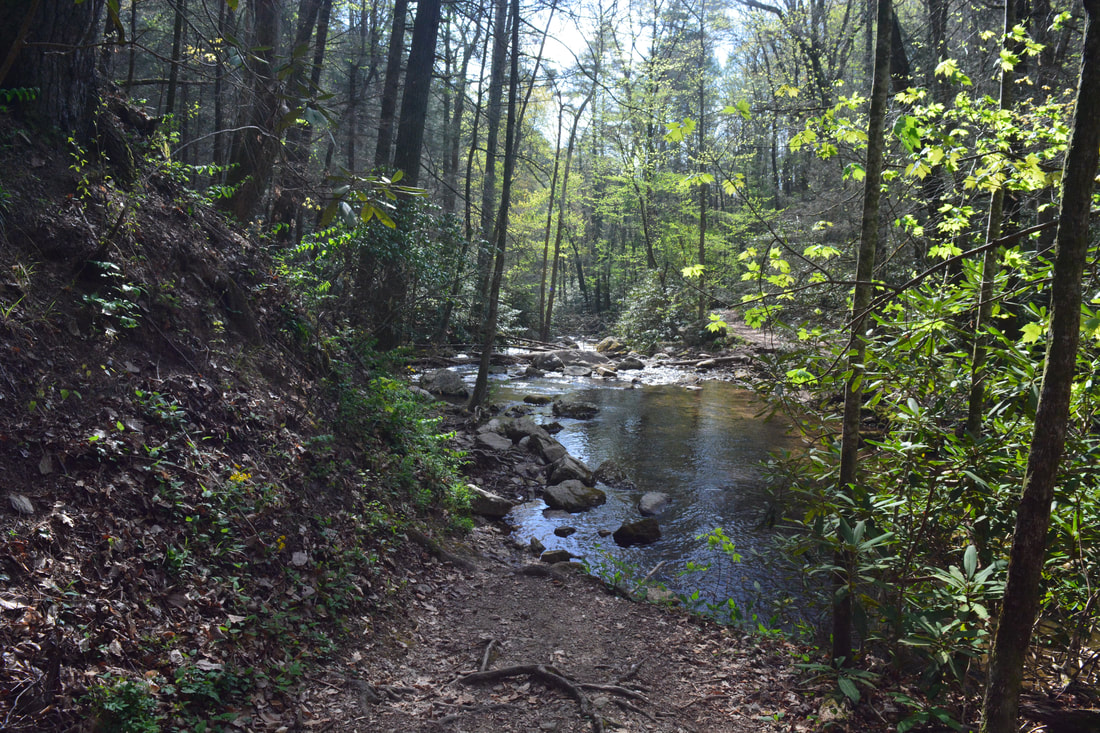
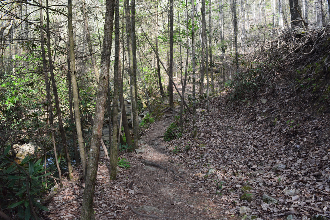
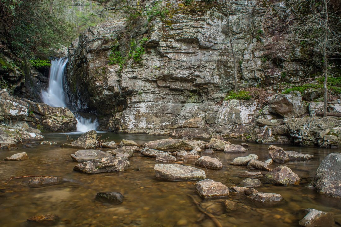
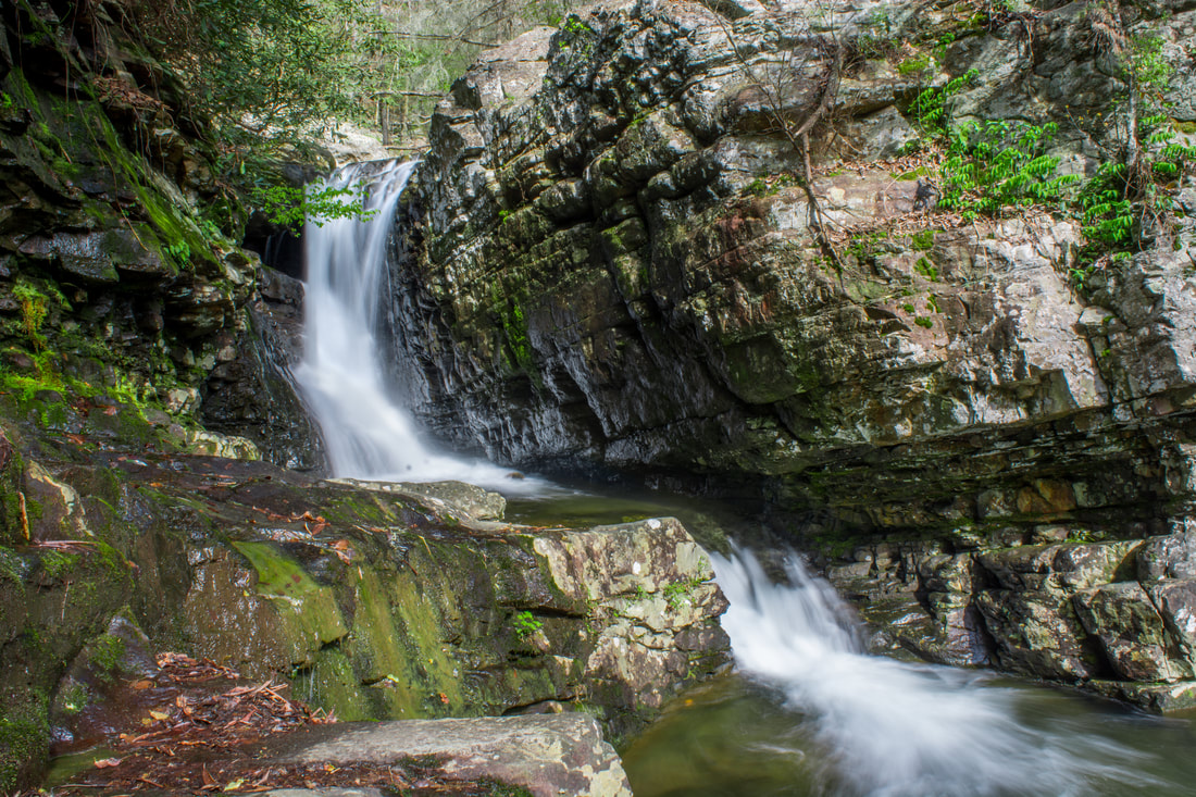
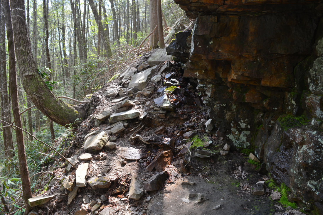
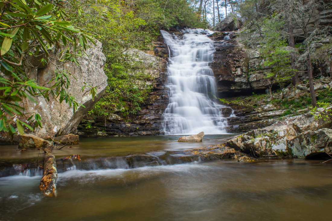
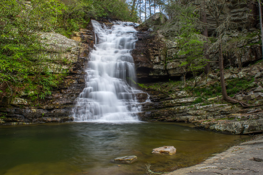
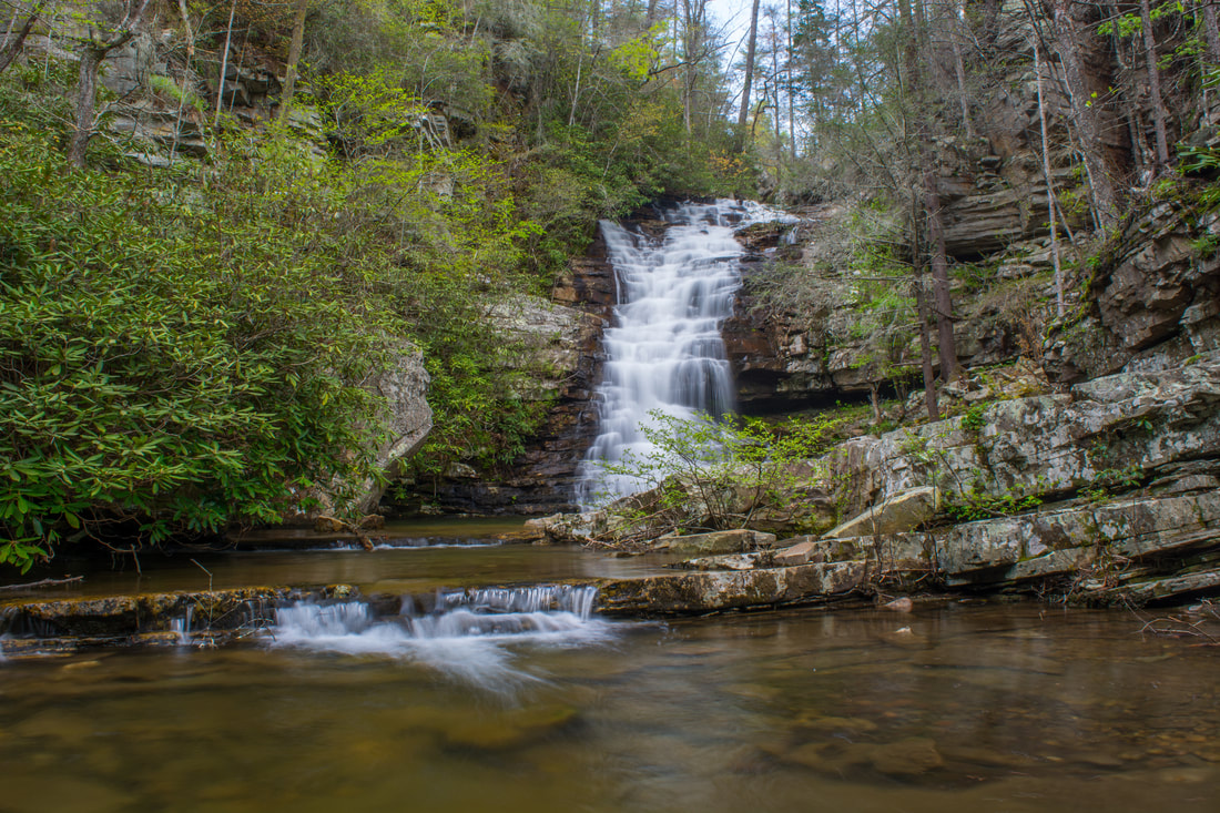
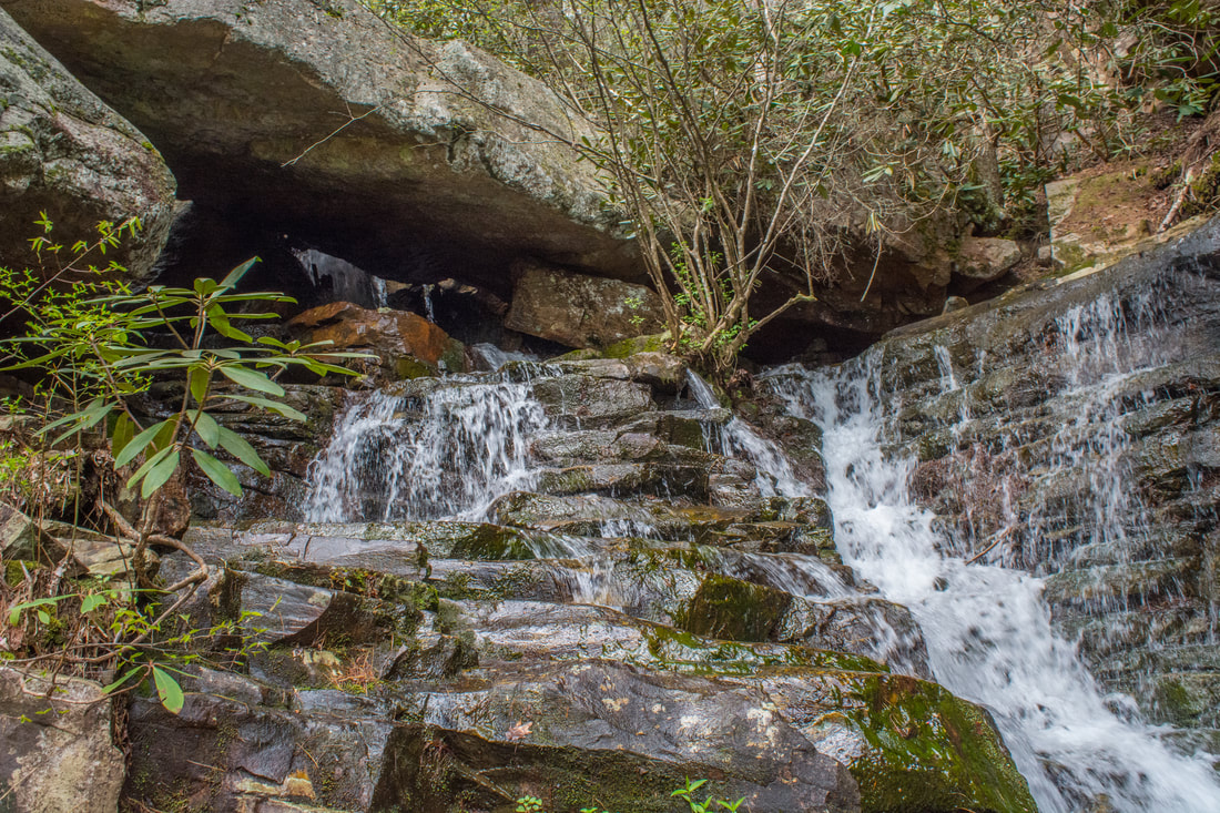
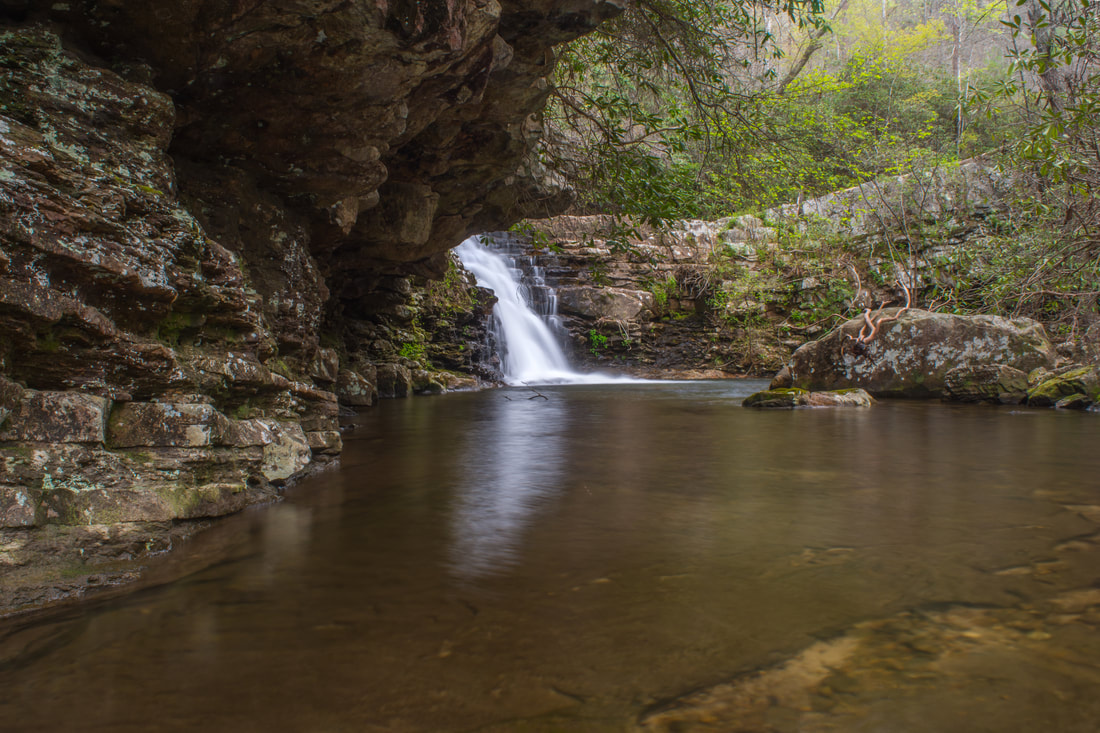
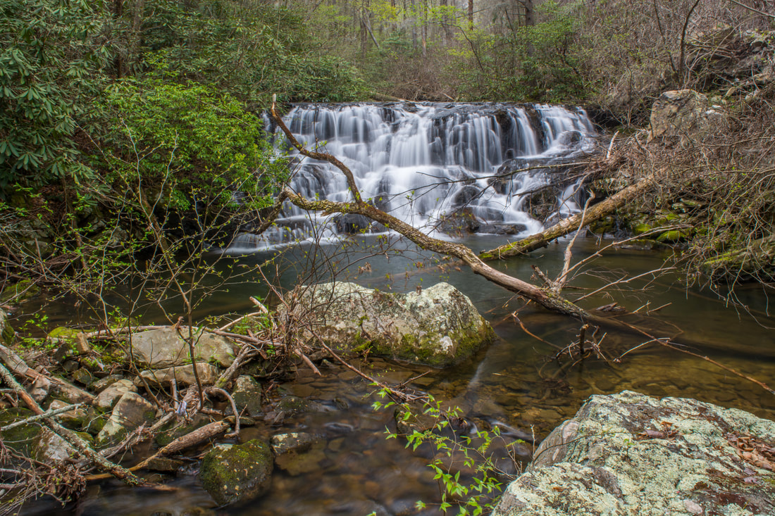
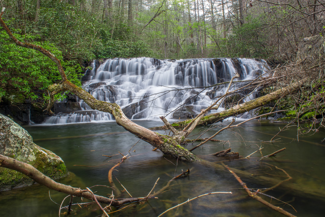
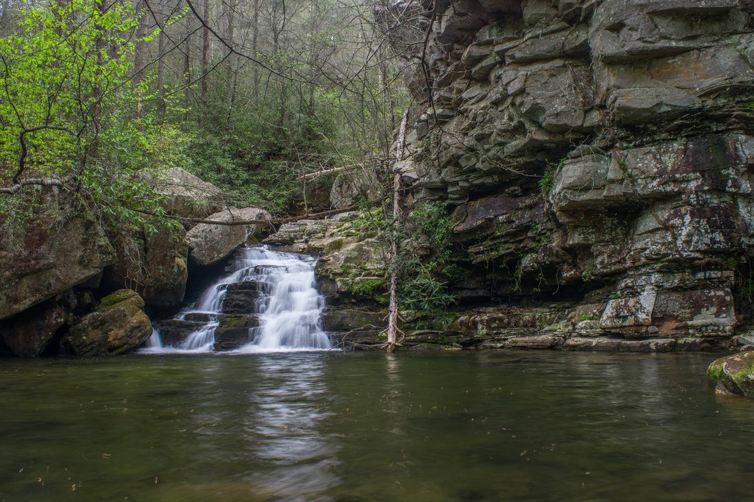
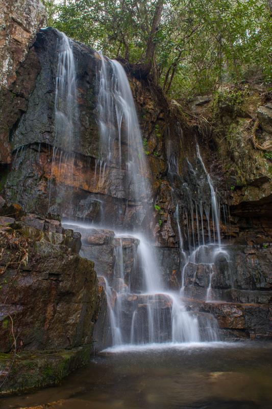
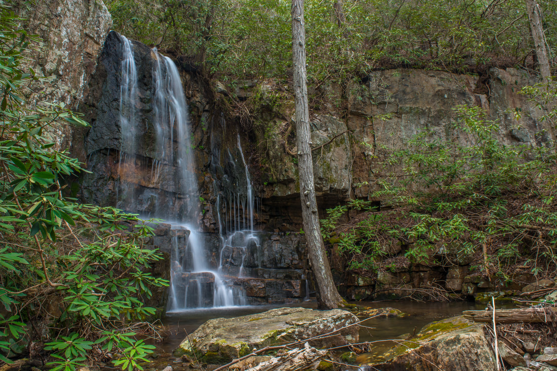
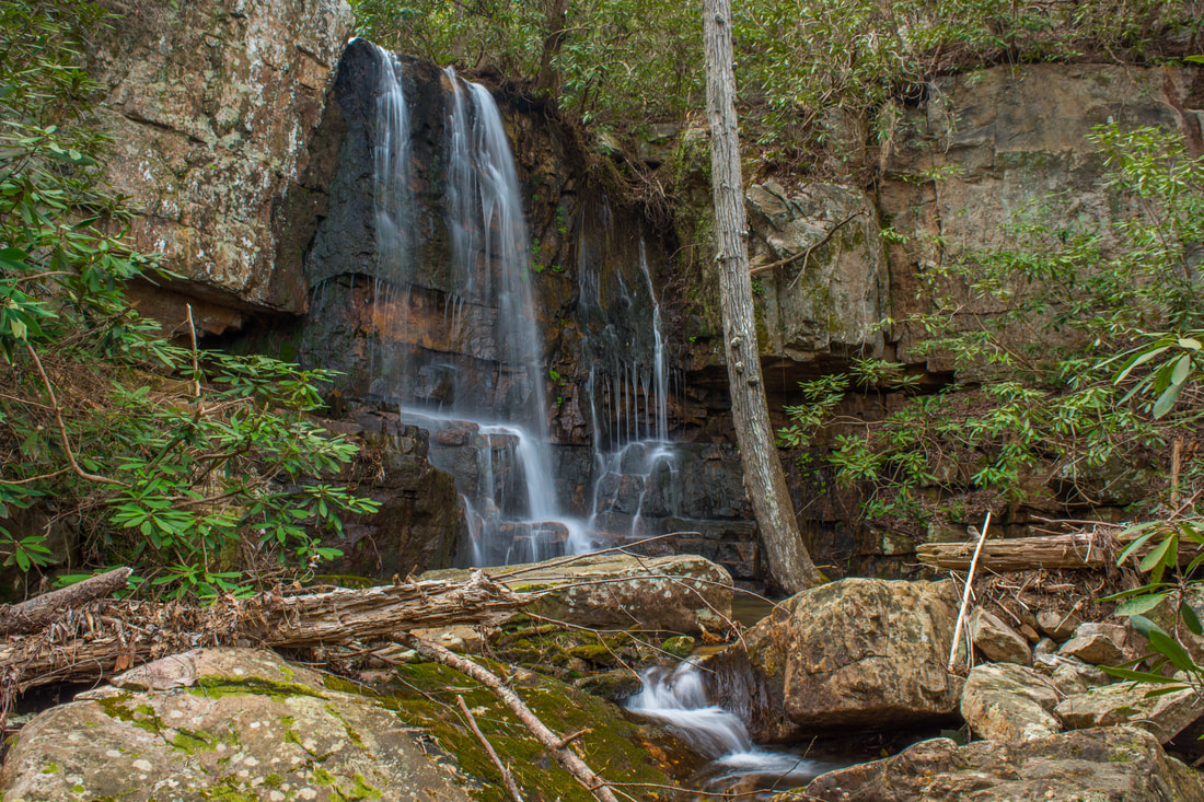
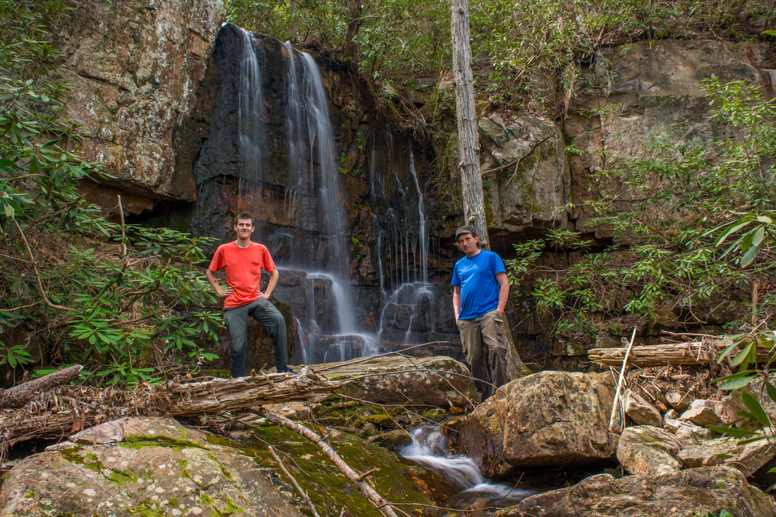
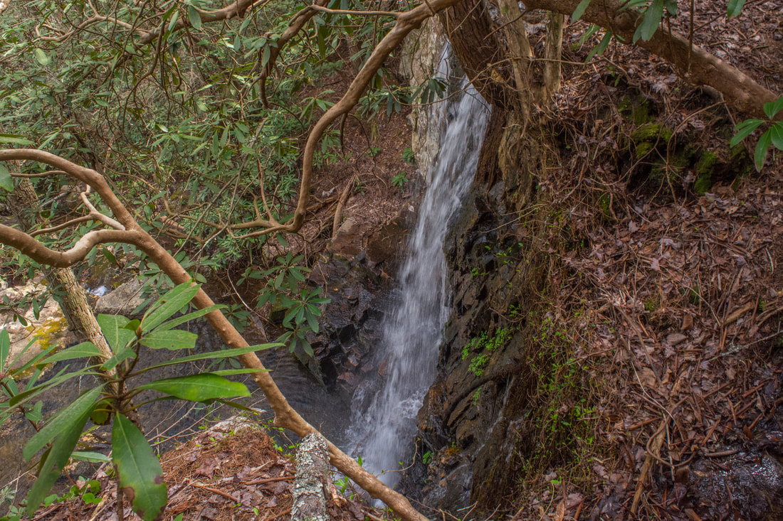
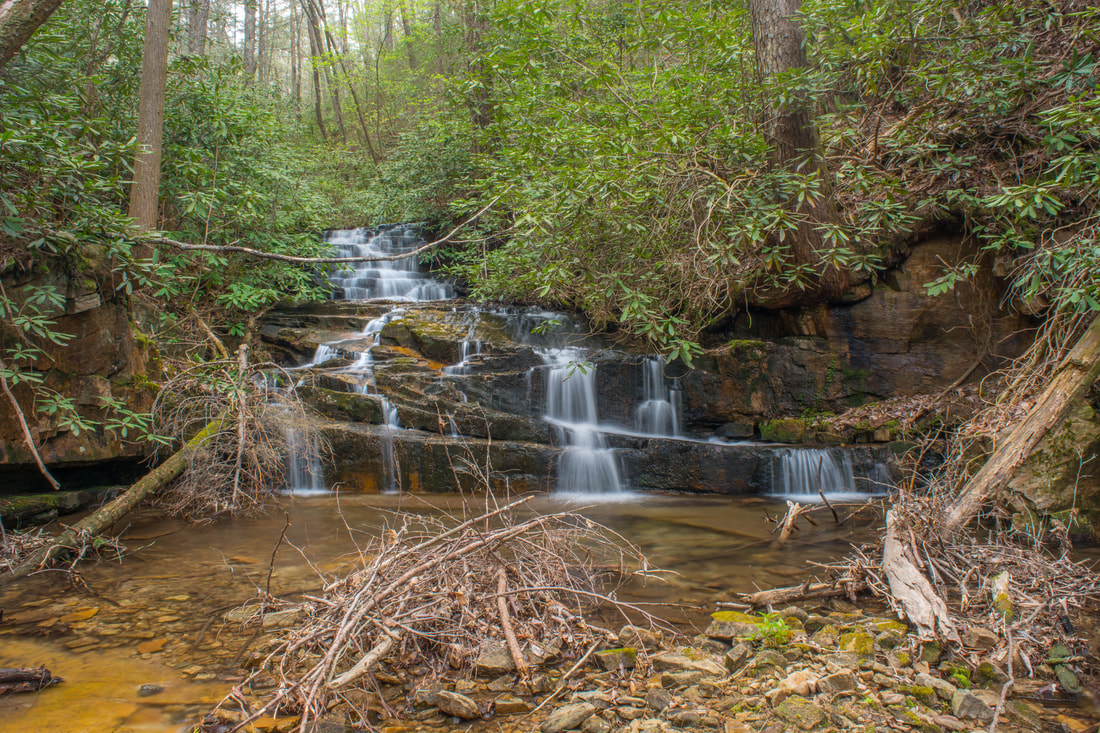
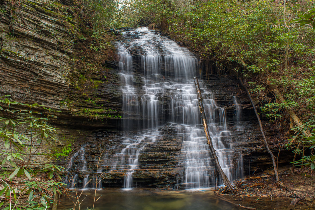
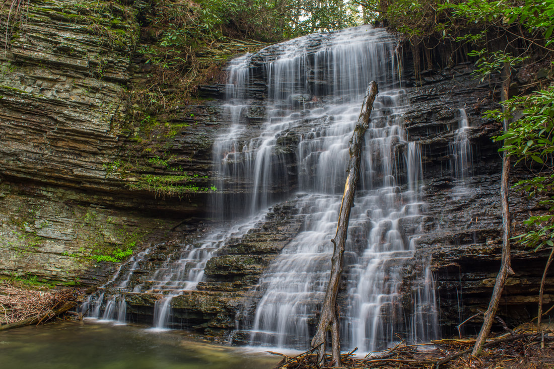
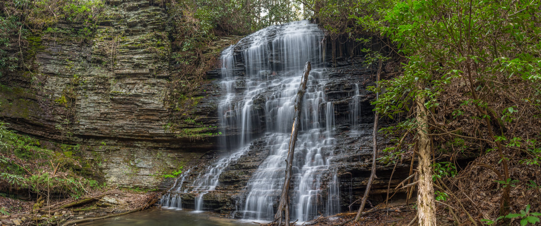
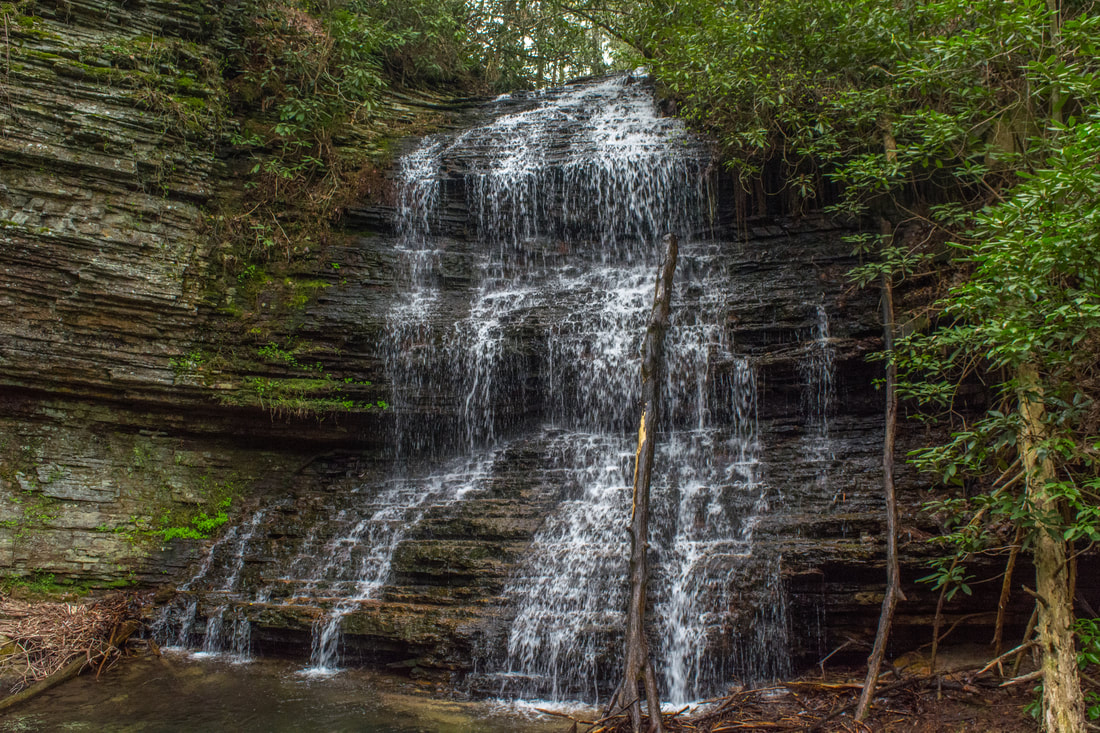
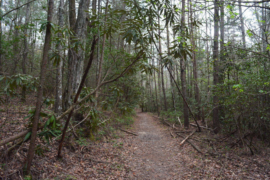
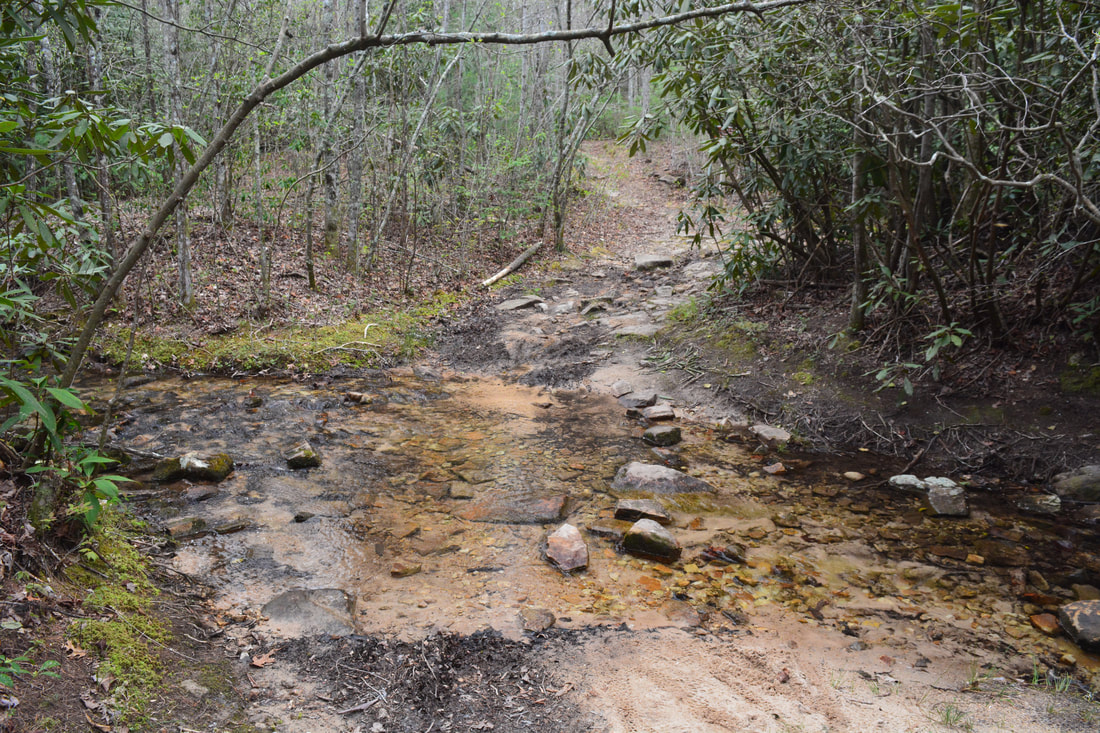
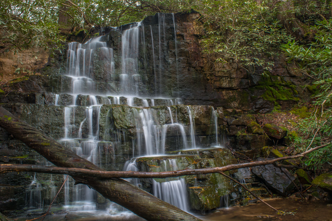
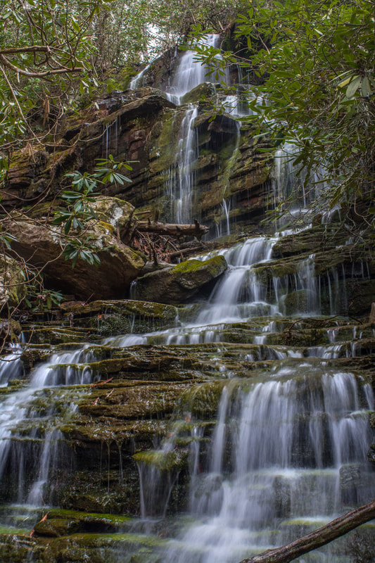
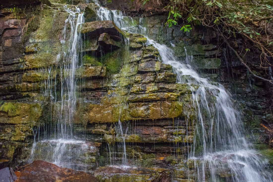
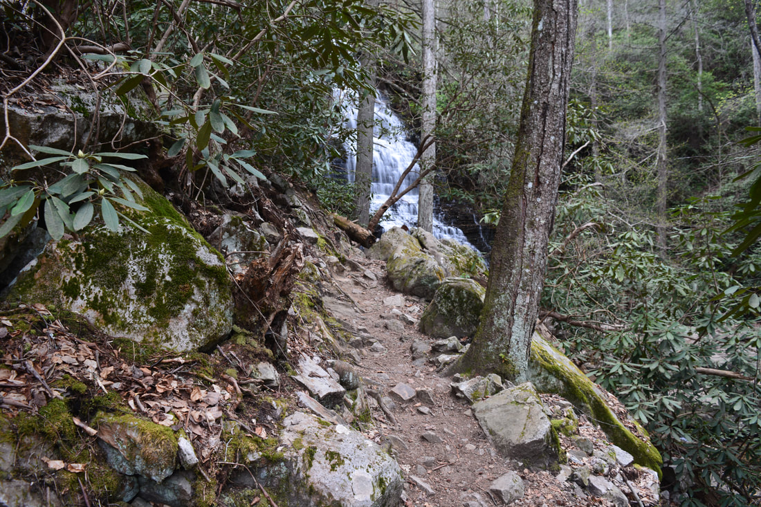
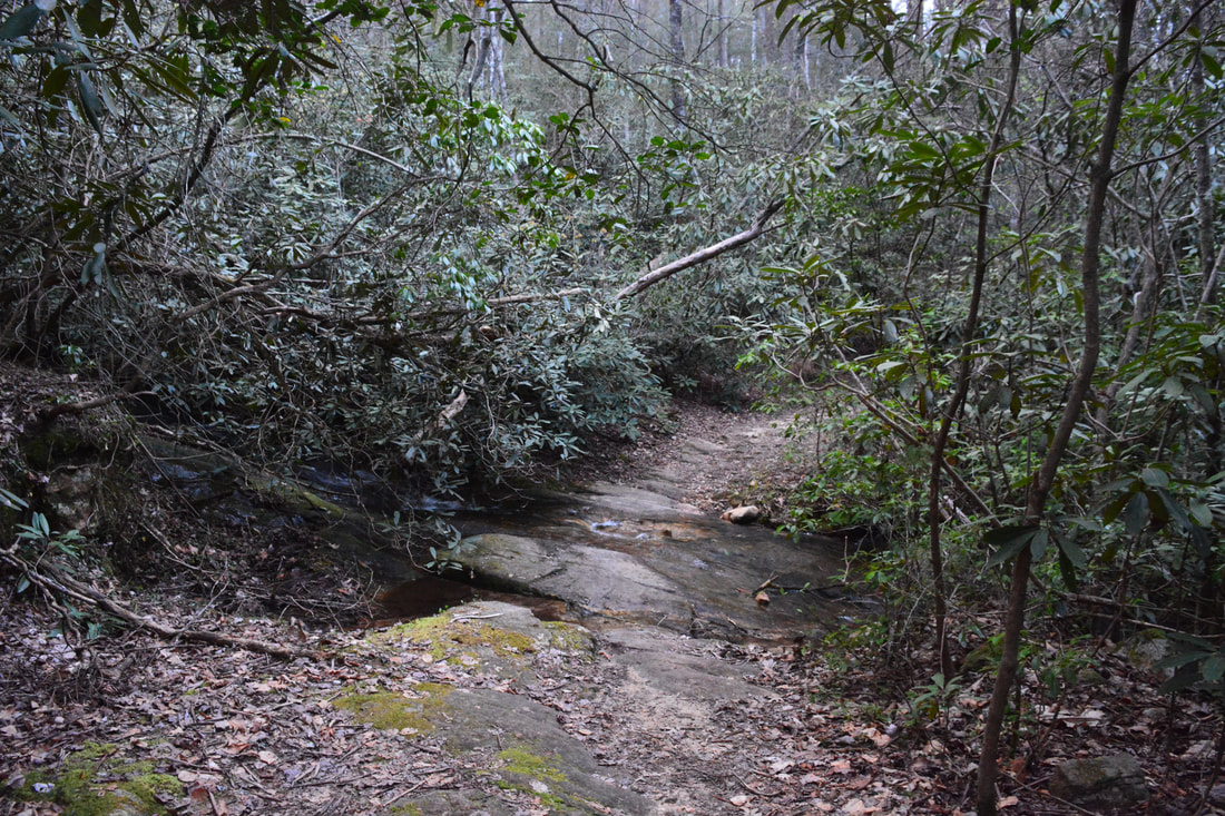
The hike begins along the Scenic Spur Trail (#78), which initially runs in conjunction with the Clemmer Trail (#302) along an old roadbed. At 0.15 miles, the Clemmer Trail splits off to the left - that's your return route. Stay right on the Scenic Spur Trail, which briefly parallels the Clemmer Trail as it comes over a small hill. The trail then drops into the Rock Creek valley. Cross an old forest road (the Clemmer Spur Trail #86) at 0.6 miles. The Scenic Spur Trail soon comes alongside cascading Rock Creek, reaching a creek crossing at 0.9 miles. Rock Creek can usually be rock-hopped here. On the other side, the broad trail passes boulders and rock outcrops near Rock Creek before its second and last crossing of the cascading stream at 1.5 miles. After passing a set of large cascades (sometimes called Lower Rock Creek Falls), the Scenic Spur Trail terminates at Rock Creek Falls at 1.7 miles. Rock Creek Falls is a scenic 20-foot falls flanked by large cliffs. The upper section drops through a tight crevice with jagged bluffs on both sides. On the left side of the falls, the dripping, mossy rock wall is particularly scenic. Alternate names for Rock Creek Falls include Rainbow Falls (shown on the official CNF trail map), Rattlesnake Falls, and Falls of the Scenic Spur. Even though the officially maintained trail ends at Rock Creek Falls, it's fairly easy to proceed upstream. From the trail's end by the falls, a distinct scramble path turns acutely left. The path follows and rounds the bluff line. Above the cliffs is a split with a path to the top of Rock Creek Falls on the right. Stay left on the Chestnut Mountain Falls path, which makes a short, steep drop to the creek. You'll need to scramble over some large, slippery boulders along the final stretch to Chestnut Mountain Falls. Reach Chestnut Mountain Falls at 1.8 miles. 40-foot Chestnut Mountain Falls is one of the most beautiful waterfalls in the scenic area. The falls is a very picturesque stairstep cascade with short free-falling sections, culminating in a tranquil pool. You can't see the full waterfall from its base due to its slant. Just as Rock Creek Falls, Chestnut Mountain Falls is surrounded by tall, jagged bluffs. These bluffs present one of the tougher obstacles along the trek, but you don't have to worry about them just yet - I suggest exploring the waterfalls of Laurel Branch first. Laurel Branch is the smaller tributary that ties into Rock Creek from the left just below the base of Chestnut Mountain Falls. Laurel Branch has three waterfalls on it: Copperhead Falls, Thornburg Ridge Falls, and Big Bluff Falls. 
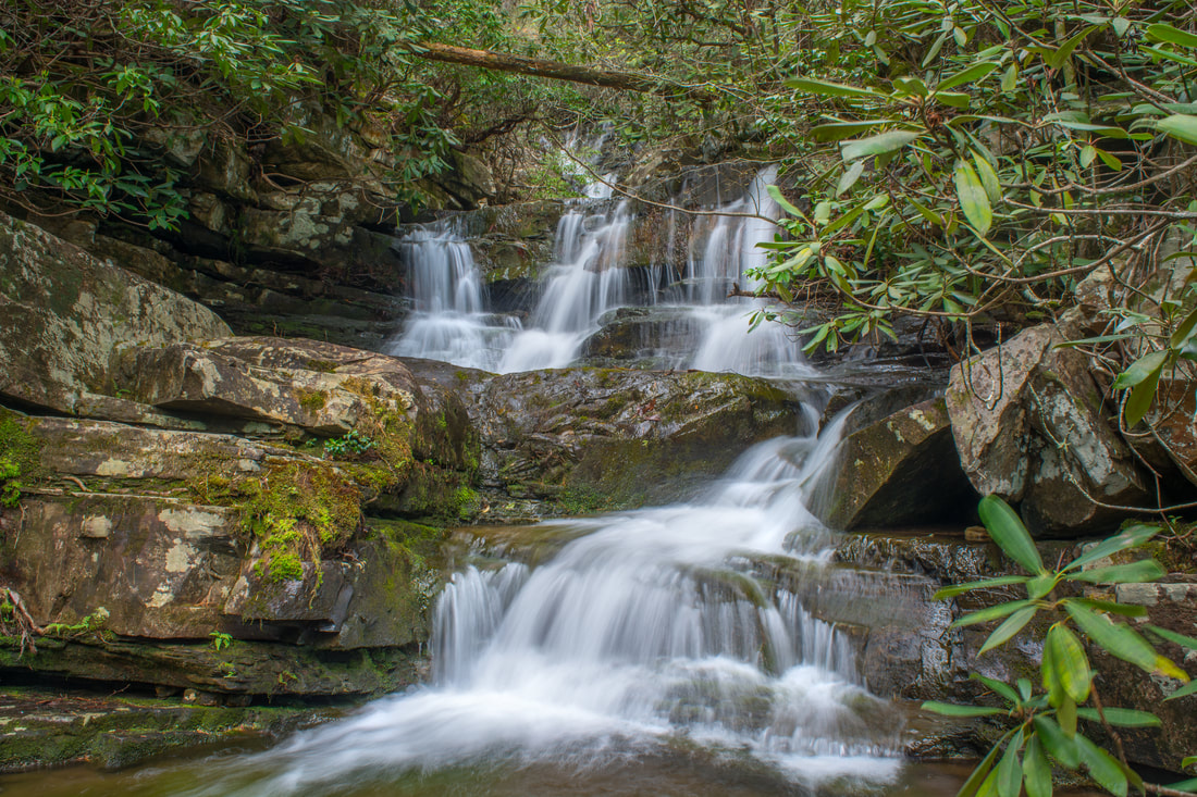
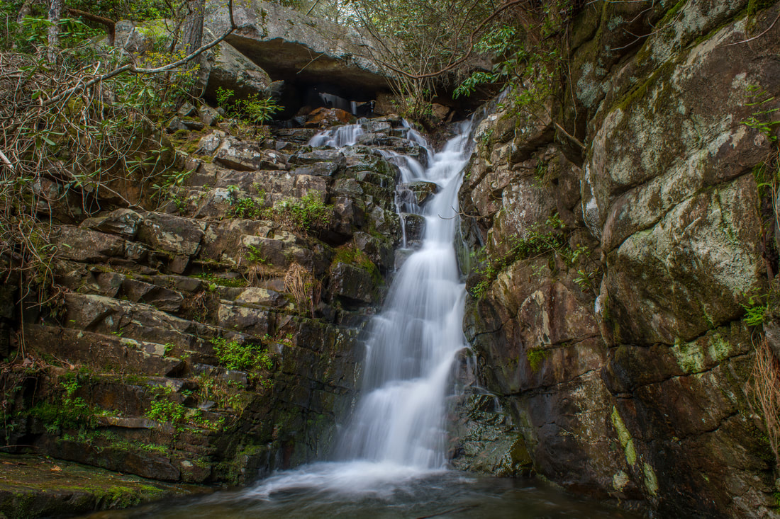
40-foot Chestnut Mountain Falls is a gorgeous stairstep cascade on Rock Creek
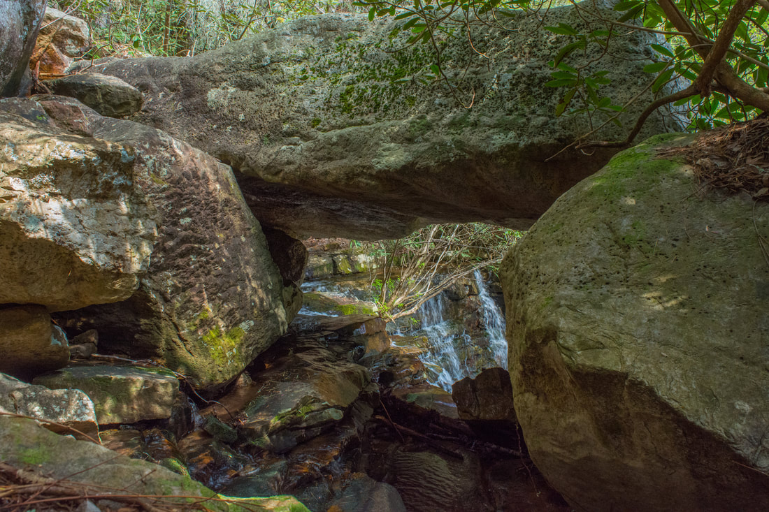
The lower waterfall on Laurel Branch, Copperhead Falls, is right at the confluence. Copperhead Falls is really just a series of picturesque cascades about 20 feet high, but it's still a very scenic sight. It's reasonable to treat Copperhead Falls as just the lower section of Thornburg Ridge Falls, but it's identified as a separate waterfall on Tennessee Landforms. The best way to see Copperhead Falls is simply walk up the creek a few yards from the Rock Creek confluence (beware of the slippery rocks). Meanwhile, a faint, rough path runs along the south side of Laurel Branch. The path is only slightly better than nothing, but it's still the best way to access Thornburg Ridge Falls and Big Bluff Falls. The path passes an open spot on the hillside where you can see the full extent of Chestnut Mountain Falls. It's only 200 feet from Copperhead Falls to Thornburg Ridge Falls. The path comes out near the top of the falls - you'll need to scramble down a large rock outcrop to get to the base at 1.85 miles. Thornburg Ridge Falls is perhaps the hike's most unique waterfall. At the top of the falls, Laurel Branch passes under a 23x6 gravity-formed natural bridge. The rock slab resting above the falls is an amazing sight. Below the natural bridge, Thornburg Ridge Falls continues as the stream cascades steeply between layered rock walls and into a shallow pool with colorful stones.
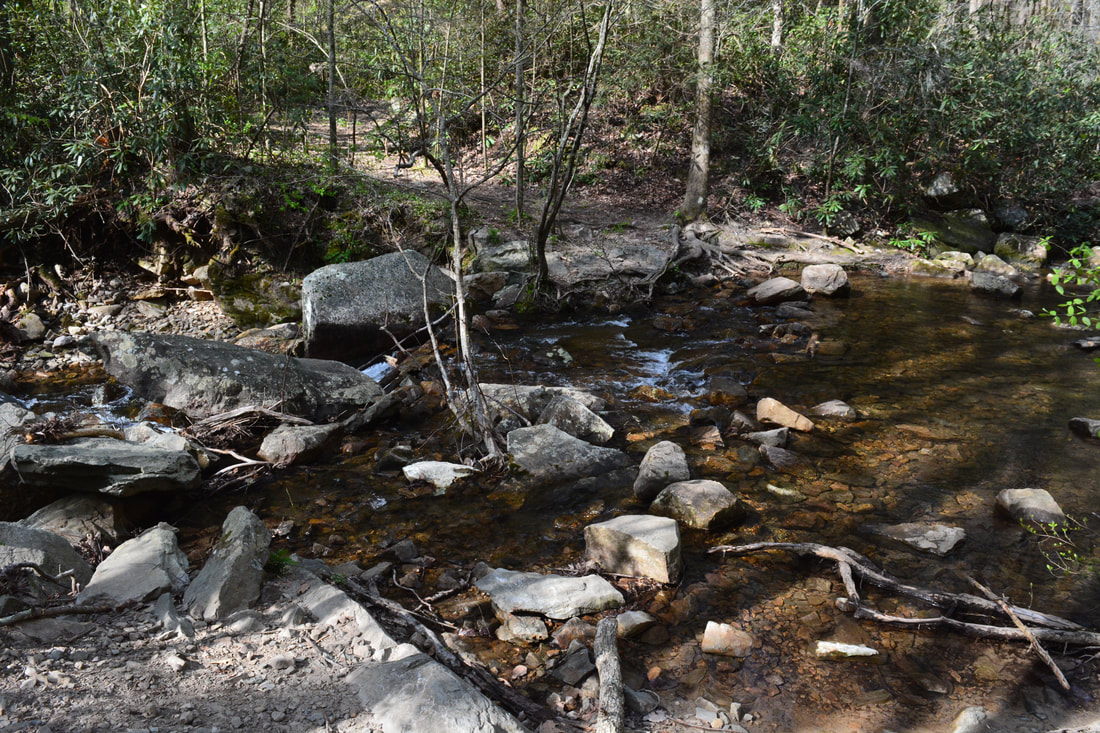
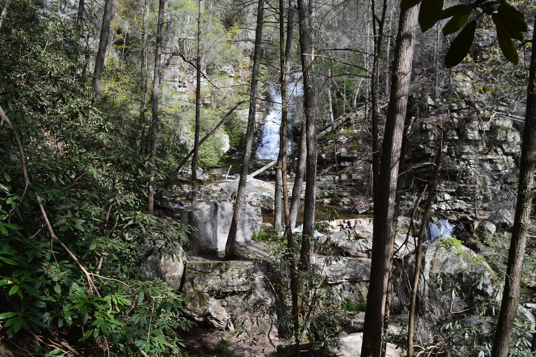
Return to the path and keep following it upstream along Laurel Branch, passing right by the natural bridge. Even though the path remains faint, it's pretty easy as far as off-trail hiking goes. Big Bluff Falls is only about 100 feet above Thornburg Ridge Falls. You'll know when you get there, because the path essentially ends there. Big Bluff Falls is a scenic free-falling drop about 15 feet high. If the flow is high, it's actually a twin falls. Lush moss grows under the waterfall's rock overhang. From Big Bluff Falls, retrace your steps to Rock Creek and Chestnut Mountain Falls. To continue the Rock Creek waterfall tour, it's necessary to get above Chestnut Mountain Falls. The only feasible route is on the east (River Left) side of Rock Creek. Some people climb to the top directly alongside the falls, but this is not recommended as it can be tricky and involves risk. It's best to climb above the first set of cliffs and swing wide around the second set of cliffs. A bluff at the top provides a nice birds-eye view across the gorge toward Laurel Branch and Big Bluff Falls. Once you've definitely reached the top of the cliffs, bushwhack in the upstream direction, slowly working back down to Rock Creek. If you follow the route of least resistance, you should return to Rock Creek at a secluded campsite by the base of Right Angle Falls at 2.1 miles. On its own, the cascading 10-foot drop of Right Angle Falls isn't particularly remarkable. However, the deeply-undercut cliff running along the west side of Rock Creek here makes up for it. This is a very scenic spot. To proceed, make an easy scramble to the top of Right Angle Falls along the east (River Left) side of the creek. At the top is an open, dry rock slab stretching along a sluice in the creek. This is a scenic view of Right Angle Falls as well. The top of Right Angle Falls is the point where it's best to begin walking up Rock Creek. There is a heavily-damaged old logging road on the River Left side of Rock Creek between Right Angle Falls and Phoenix Falls, but it won't really help you. My best suggestion is to stay in the creek as much as possible, although it probably would be nearly as easy to follow the bank. Up to Phoenix Falls, the creek-walk is fairly easy by creek-walking standards. Reach Phoenix Falls at 2.25 miles. About 15 feet high, Phoenix Falls is a very scenic creek-wide drop. Unfortunately, several awkwardly-positioned fallen trees in the pool mar the waterfall's photogenic qualities, but it's still a nice little falls. I particularly liked the elevated view from a large boulder in front of the falls, as this view turned the deadfall a little less distracting. To get past Phoenix Falls, cross over to the west (River Right) side of Rock Creek and follow a makeshift path through a thicket around the falls. A small cascade with a deep pool is at the top of Phoenix Falls - you'll need to bypass that as well. The creek-walk gets more difficult above Phoenix Falls, but the creekbed probably remains the best route. It's about 0.15 miles between Phoenix Falls and the lower drop of Diamond Falls. The creek is swifter and rockier here. Generally, I stayed close to the River Left bank after bypassing Phoenix Falls, but this does involve a few minor scrambles. When a massive cliff begins to tower above the creek, you'll know that you're approaching Diamond Falls. Reach the lower drop of Diamond Falls at 2.4 miles. The drop is just a small sliding cascade. The main attraction here is the massive jagged cliff along Rock Creek. The best way to proceed is to cross over to the west (River Right) side again. Slickrock Branch then comes in from the left (west) in just a few feet. The hike later continues along Slickrock Branch, but for now, stay near Rock Creek to see the upper section of Diamond Falls. This is a scenic 10-foot drop that squeezes through a small notch among boulders. In fact, rock outcrops around the small falls form a sort of diamond shape, giving the falls its name. 
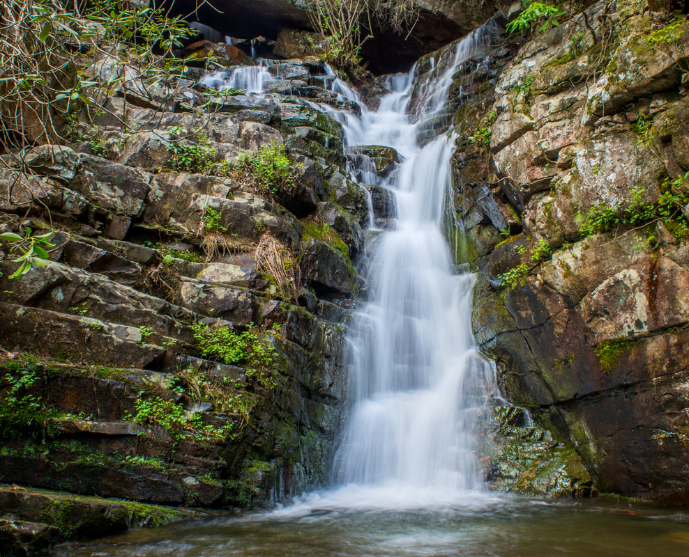
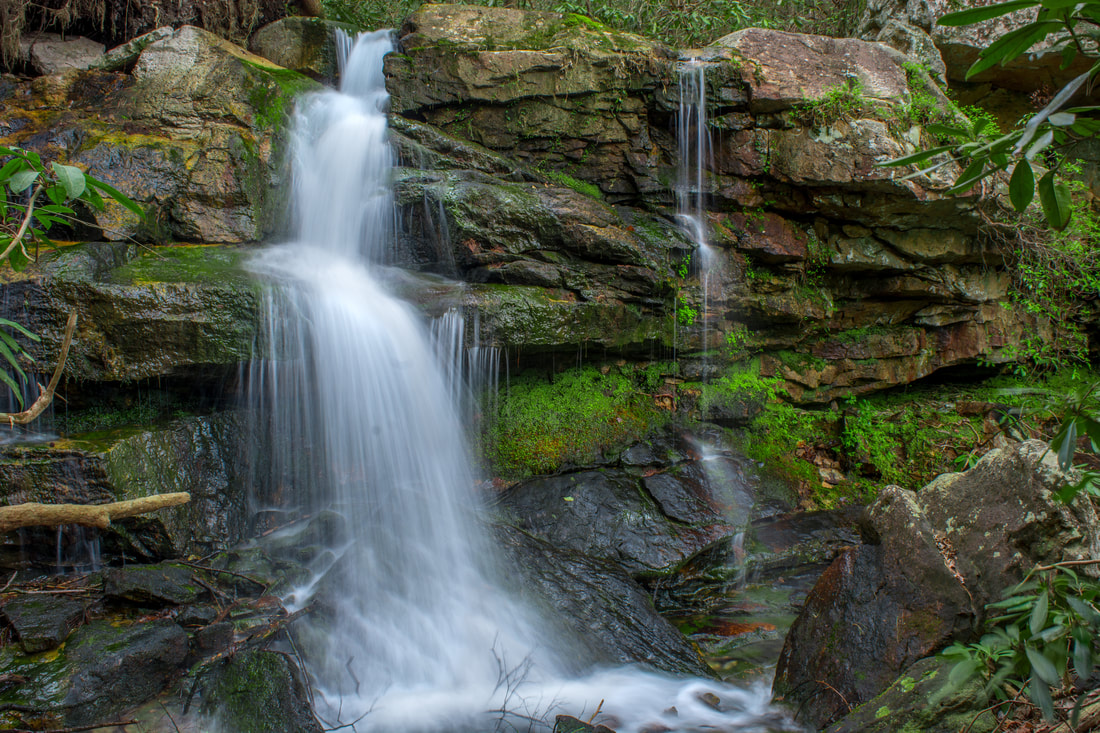
Oasis Falls is a 30-foot free-falling waterfall on Slickrock Branch
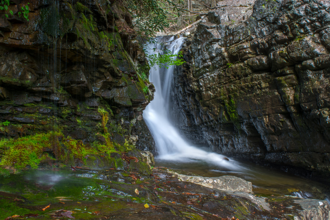
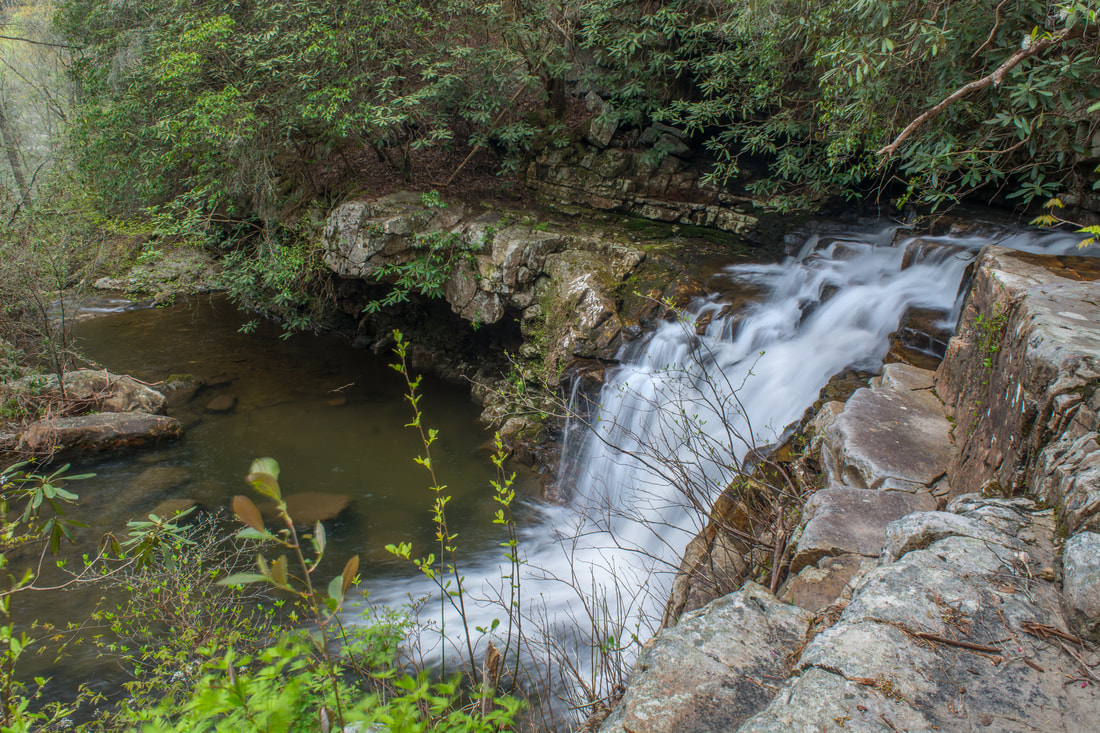
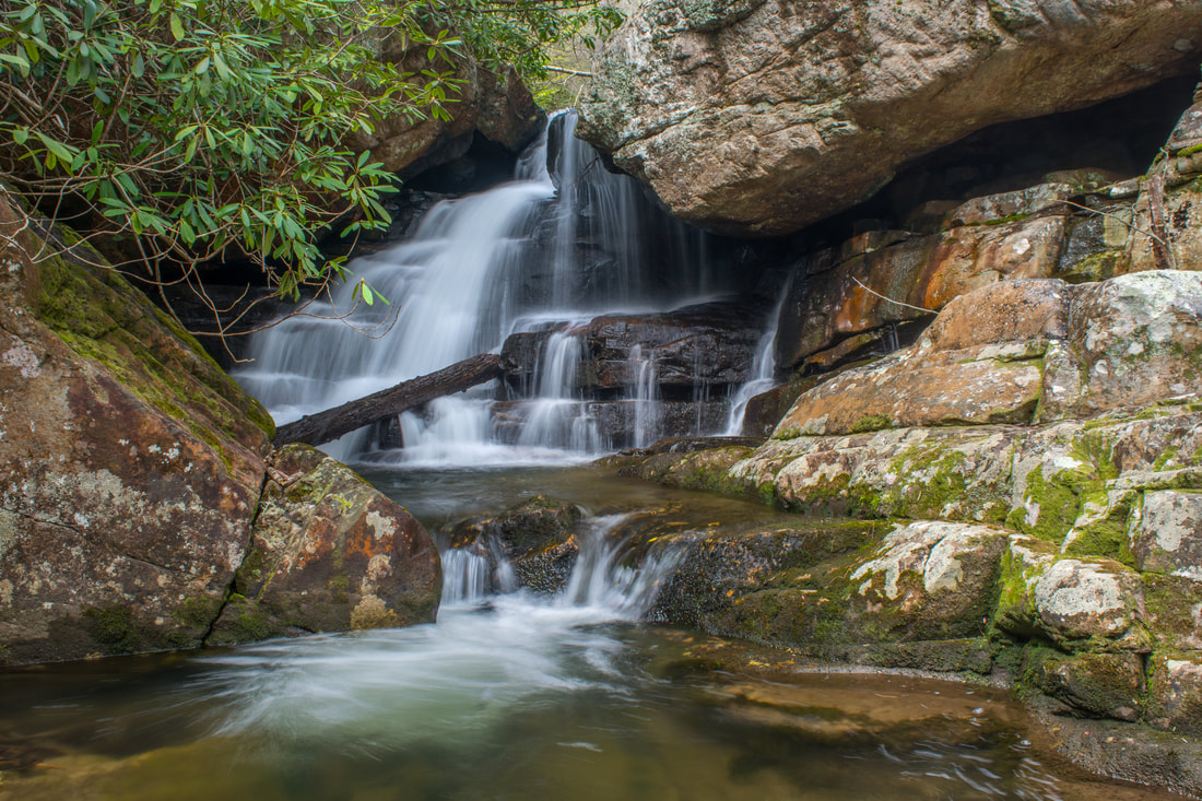
At the upper section of Diamond Falls, it's best to cross Rock Creek again to get to Rockhouse Twin Falls. You'll scramble over some deadfall and rock outcrops before coming to a long, low rockhouse. Rockhouse Twin Falls is just ahead. Reach the base of Rockhouse Twin Falls at 2.45 miles. Rockhouse Twin Falls is a 20-foot drop enclosed by rock walls. What makes it unique is the split flow that converges in a pool at the base. This is a particularly impressive sight when the left side is flowing well. Rockhouse Twin Falls is the last significant waterfall on Rock Creek until Benton Falls. Thus, from here on, the hike turns to follow Slickrock Branch. From the far end of the pool, climb up the bank on the west (River Right) side of Rock Creek. Then, aim toward Slickrock Branch - Oasis Falls will soon become audible. By following the route of least resistance, you should reach Slickrock Branch right by the base of Oasis Falls at 2.5 miles. Even though its flow is often on the low side, Oasis Falls is among my favorite waterfalls in the scenic area. This is a very interesting 30-foot free-falling falls. The different spouts of water converge at the base just before a shallow pool. In addition, a section of the stream trickles out from underneath a root system at the top of the falls. A tree that grows out of a rock in the pool is often underwater, hence the name Oasis Falls. The cliff that forms the falls stretches far away from the creek on either side. This cliff forms a seemingly-formidable obstacle, but actually, there's an easy way to keep going upstream.
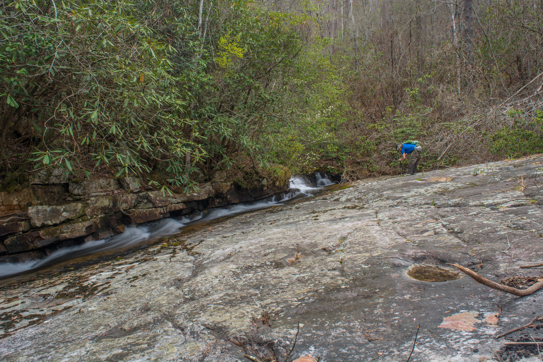
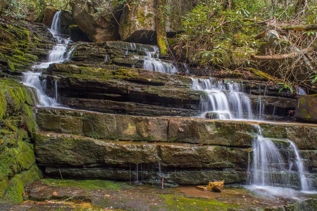
Follow the base of the cliff northeastward for a little away from the creek (on the River Left) side. You'll shortly come to an obvious scramble path that climbs through a gap in the cliffs. The faint path continues at the top and leads straight to Ultisol Falls at 2.55 miles. Located almost right at the top of Oasis Falls, Ultisol Falls is a picturesque cascading waterfall about 15 feet high. Yellowish rock slabs are found in the creekbed at the falls. The word ultisol stands for a type of reddish-yellow acid soil. The best route past Ultisol Falls is to parallel Slickrock Branch on its north (River Left) side. Try to stay a little above the stream to avoid its overgrown banks. There is no real path between Ultisol Falls and Rim Rock Falls, but this isn't a hard bushwhack. You will encounter a few overgrown spots and some deadfall on the way though. The route passes above Sleeping Owl Falls at 2.65 miles. The quick scramble down to the base is worth it. 20-foot Sleeping Owl Falls is a long and gentle stairstep cascade. After viewing the falls, continue following the north side of Slickrock Branch toward Rim Rock Falls. This remains the best route even when the slope steepens. At 2.8 miles, arrive at Rim Rock Falls (you'll need to scramble down to the creek again for a good view). 30-foot Rim Rock Falls is quite stunning. In fact, it's my favorite waterfall in the scenic area. Rim Rock Falls is a very photogenic stairstep cascade with free-falling sections. It looks great in just about any season, regardless of flow. The tall, layered cliff on the River Right side of the falls enhances the setting. Rim Rock Falls is the uppermost notable waterfall on Slickrock Branch. Thus, the best route from here is to scramble up the extremely steep slope on the north side of Slickrock Branch. If you look closely, you'll see signs of slipping and sliding here. The 'path' disappears where the slope moderates - just keep heading northward in a straight line through the mountain laurel thicket. It's a bit dense, but fortunately, it's short. You should come out on the Rim Rock Trail at about 2.9 miles. Turn left. In around 300 feet, reach a junction with the Clemmer Trail. Here, you have a decision to make. You could turn left and return to the parking area without further side trips. However, if you have the time and energy, I highly recommend including Elora Falls, Silvermine Branch Falls, and Benton Falls in the hike. To do so, turn right on the Clemmer Trail. 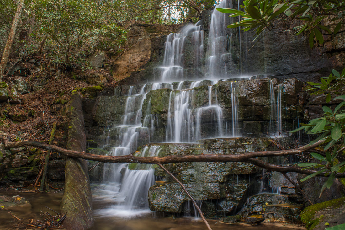
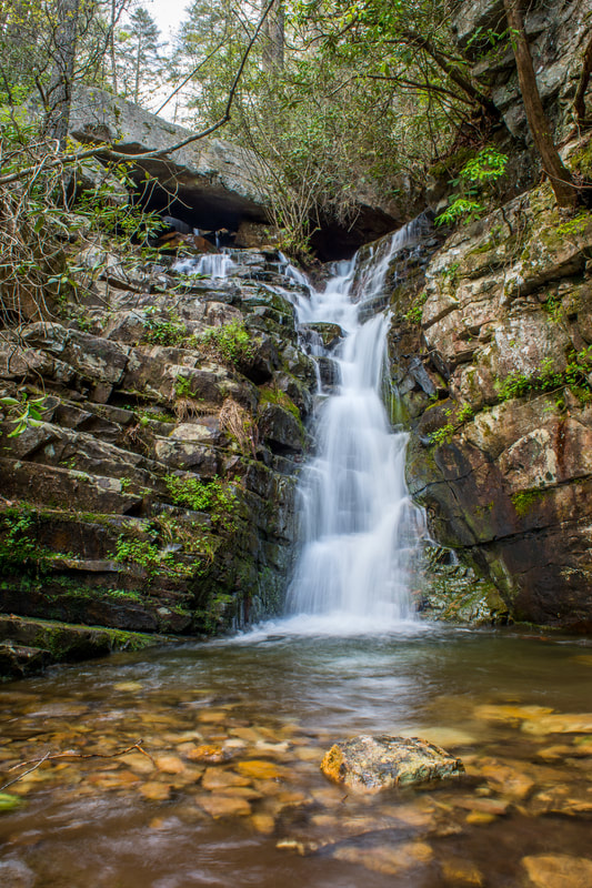
20-foot Elora Falls is a mysterious cascade on Hancock Licklog Branch near the well-known Benton Falls
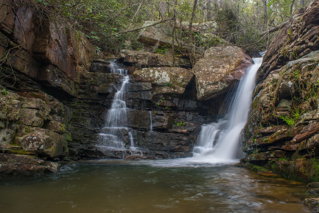
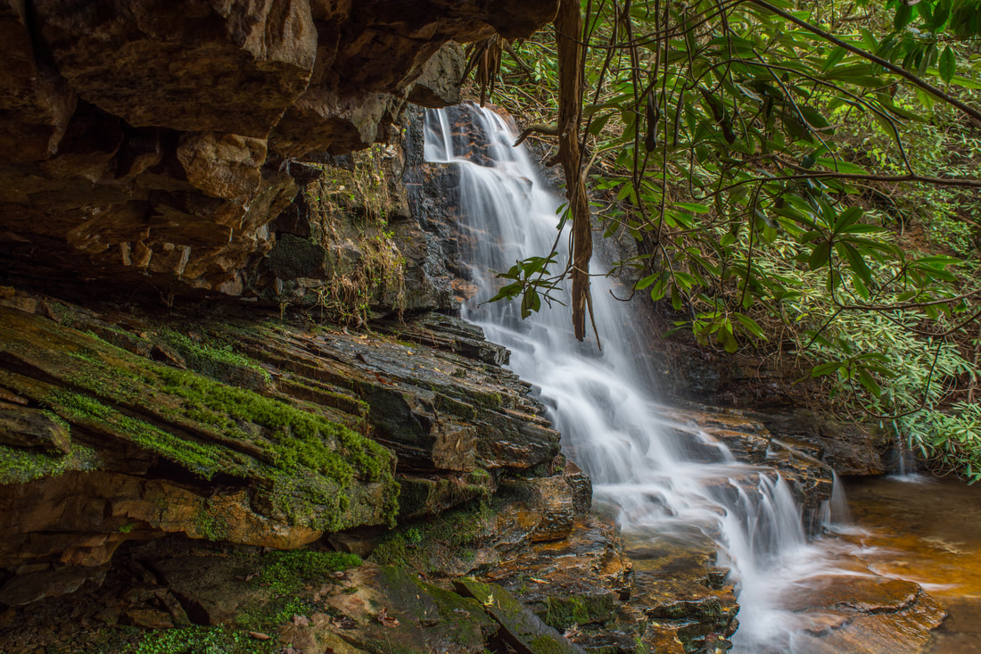
Between the Rim Rock Trail junction and the Benton Falls vicinity, the Clemmer Trail is very easy and pleasant. It remains nearly level, passing through a predominantly-pine forest. At 3.45 miles, the trail crosses Hancock Licklog Branch. Elora Falls is well downstream from the crossing, so remain on the trail for now. Just past the crossing, the Laurel Loop of the Slickrock Trail leaves left - stay right. At 3.6 miles, the trail makes a gradual curve to the left about 100 feet prior to crossing Silvermine Branch. This is the best place to leave the trail to bushwhack down Elora Falls and Silvermine Branch Falls. I felt that the these two falls involved the toughest bushwhack out of any on the hike. However, if you successfully managed to see all of the other waterfalls, you should have no problem with these either. Begin by bushwhacking down the steep slope on the right side of the trail. You might come to a point where you can see both Silvermine Branch Falls on the left and Elora Falls on the right, though it's more likely that you'll end up closer to Elora Falls first. The last part of the bushwhack to Elora Falls passes through a very dense rhododendron jungle. Reach Elora Falls at 3.65 miles. Elora Falls is another scenic stairstep cascade about 20 feet high. Two logs at the base meet in a cross-like fashion. In 2006, a fatal black bear attack occurred at Benton Falls. The body of the girl killed, whose name was Elora, was found at the base of the waterfall known today as Elora Falls.
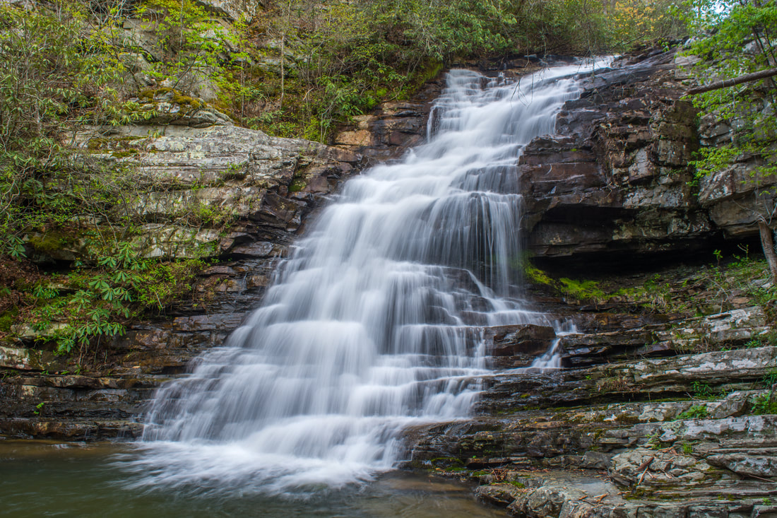
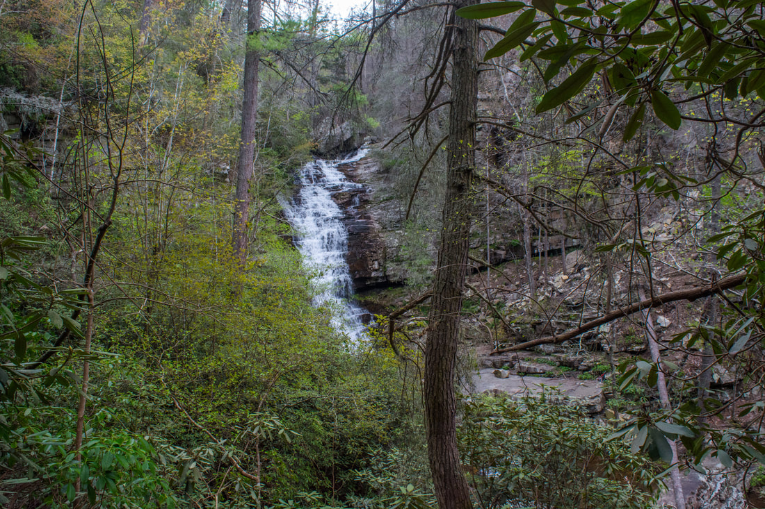
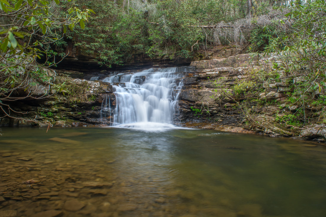
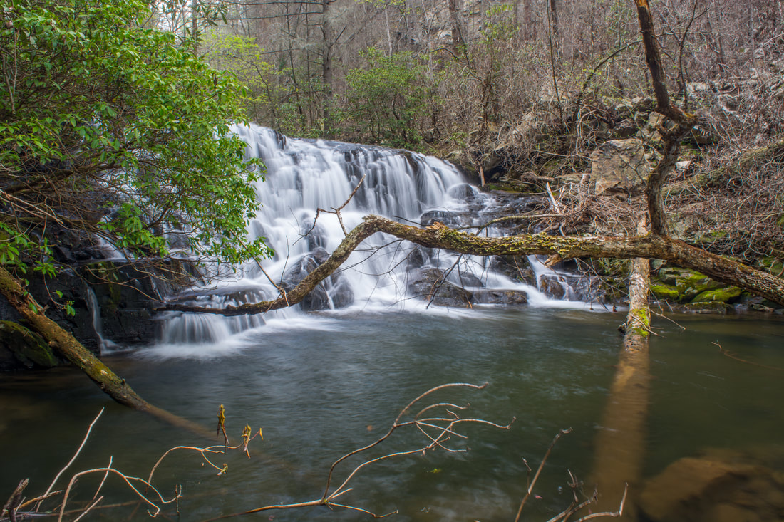
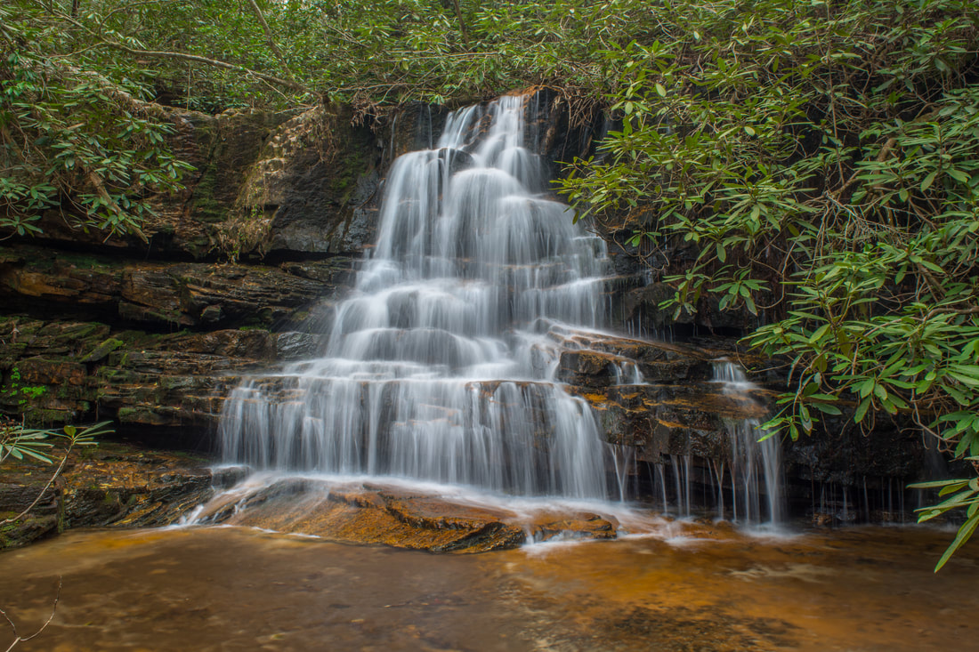
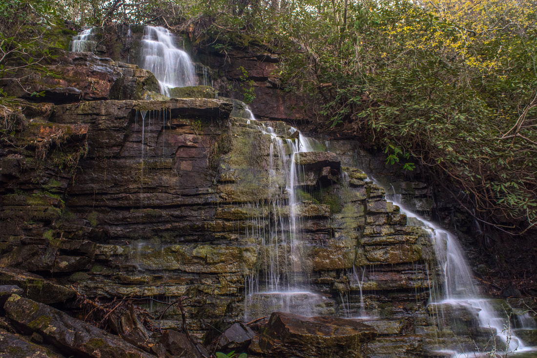
Another 20-foot waterfall is located a short distance down from Elora Falls on Hancock Licklog Branch. I refer to this waterfall as Lower Elora Falls. It's also a stairstep cascade, but it's probably not worth the effort unless there has been a lot of rain. It's possible to walk up to Elora Falls from Benton Falls, and this route would take you right by Lower Elora Falls. However, I didn't feel that this route is any easier than the bushwhack from the Clemmer Trail. Regardless, at Elora Falls, turn north to head toward Silvermine Branch Falls. You'll cross a small lead before coming to Silvermine Branch, which is even smaller than Hancock Licklog Branch. You'll probably come out either at the base of the upper section of the falls or the base of the full falls at 3.75 miles, but if you come out farther downstream, just work your way up the creekbed. Silvermine Branch Falls is pretty tall and impressive despite the low water volume - it's about 50 feet high. The 25-foot upper section is very scenic and interesting, particularly when the water level is high. The stream flows through a narrow chute above a neat rock wall that almost looks hand-crafted! When the water is high, the chute overflows in free-falling spouts of water over the rock wall. From Silvermine Branch Falls, retrace your steps to the Clemmer Trail and keep following it to the final waterfall of the day, Benton Falls. After crossing Silvermine Branch, the Clemmer Trail arrives at a junction with the Benton Falls Trail at 3.95 miles. Turn right onto the Benton Falls Trail, which descends down a series of rock steps and a switchback to the base of 60-foot Benton Falls. Reach the falls at 4.05 miles. Benton Falls might be the most spectacular waterfall in the Rock Creek Gorge, though with that comes a certain popularity. Benton Falls is a gorgeous stairstep cascade that spreads out perfectly among the many mini-ledges of the vertical cliff. Large boulders surround the base of the falls. 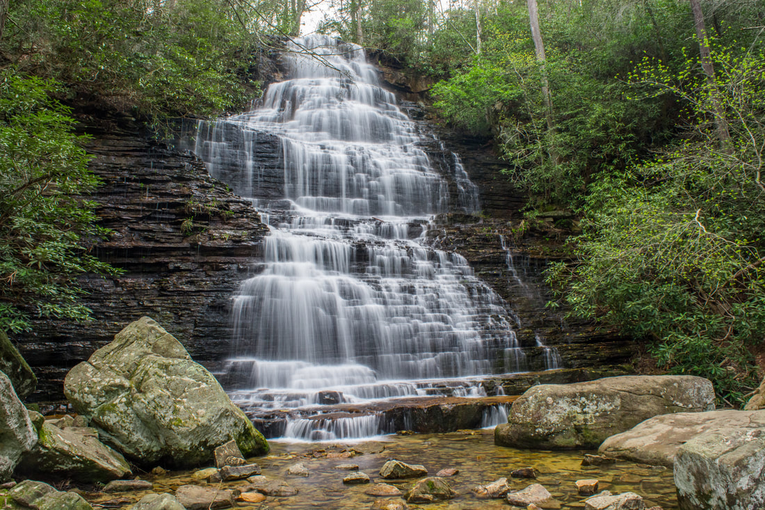
Benton Falls on Rock Creek is one of the most beautiful and popular waterfalls in the Rock Creek Gorge Scenic Area
From Benton Falls, return to the Clemmer Trail and begin following it back southward. Stay on the Clemmer Trail when you pass the Rim Rock Trail junction again. At 5.15 miles, the trail rock hops Slickrock Branch. At 5.3 miles, the Rim Rock Spur Trail leaves the Clemmer Trail on the left, only to rejoin it at 5.6 miles. I did not take this longer, alternate trail, but it sounds like it's a little more scenic with some limited views into the gorge. The Clemmer Trail crosses a tributary of Laurel Branch at 5.75 miles, after which the other end of the Slickrock Trail's Laurel Loop leaves right. The Clemmer Trail crosses Laurel Branch itself at 6.3 miles and then begins a lengthy descent back to Highway 30. Parts of the rhododendron-lined trail are quite nice, affording winter views into the gorge as well as toward Big Frog Mountain in the distance. At one point, if the leaves are off, you might be able to spot Chestnut Mountain Falls far below. At 8.2 miles, the Clemmer Spur Trail splits off to the left. A short distance farther, the Clemmer Trail bears left off the forest road at a sign and rejoins the Scenic Spur Trail at 8.25 miles. Keep following the Scenic Spur Trail back to the trailhead, which you'll reach at 8.4 miles, concluding the hike.
Mileage
0.0 - Scenic Spur Trailhead
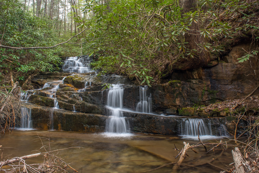
1.7 - Rock Creek Falls 1.8 - Chestnut Mountain Falls 1.8 - Copperhead Falls 1.85 - Thornburg Ridge Falls 1.85+ - Big Bluff Falls 2.1 - Right Angle Falls 2.25 - Phoenix Falls 2.4 - Diamond Falls 2.45 - Rockhouse Twin Falls 2.5 - Oasis Falls 2.55 - Ultisol Falls 2.65 - Sleeping Owl Falls 2.8 - Rim Rock Falls 2.9 - Rim Rock Trail 3.65 - Elora Falls 3.75 - Silvermine Branch Falls 4.05 - Benton Falls 8.4 - Scenic Spur Trailhead Variations
Hike out and back to Rock Creek Falls and Chestnut Mountain Falls - 3.6 Miles
Hike out and back to Benton Falls via Clemmer Trail - 8.7 Miles Bonus Stops
Nearby Goforth Creek off Highway 64 features many scenic cascades, small waterfalls, and spring wildflowers. A scenic unofficial trail follows the trail for several miles.
Pictures & Videos
3 Comments
Bill Solomon
5/3/2018 11:36:32 pm
You've been to some awesome waterfalls Mark, but Rock Creek is mind-blowing. Congrats on hitting it at the perfect time and sharing it your experience! 5/31/2018 08:36:42 pm
Beautiful photos and videos, and excellent narrative. Thanks again for all that you do. Even if I don't get to several of the off-trail falls, I greatly appreciate all the information, and the great detail, that you always provide. You're the best!
Joshua Smeton
8/12/2021 12:47:20 pm
I had no idea about the falls along Laurel Branch, and I did not know that there is way to get above Chestnut Falls. Also, in the past, I looked for the falls below Benton Falls, but never could find them. Next time I visit this area, I will have to follow in your footsteps. Many thanks for sharing. :) Leave a Reply. |
About MeMark Oleg Ozboyd Dear readers: I have invested a tremendous amount of time and effort in this website and the Georgia Waterfalls Database the past five years. All of the work that has gone in keeping these websites updated with my latest trip reports has almost been like a full-time job. This has not allowed me to pick up a paid job to save up money for college, and therefore, I I've had to take out loans. If you find the information on this website interesting, helpful, or time-saving, you can say "thanks" and help me out by clicking the button above and making a contribution. I will be very grateful for any amount of support you give, as all of it will apply toward my college tuition. Thank you!

Coming in 2022-2023?
Other Hiking WebsitesMiles HikedYear 1: 540.0 Miles
Year 2: 552.3 Miles Year 3: 518.4 Miles Year 4: 482.4 Miles Year 5: 259.9 Miles Archives
March 2021
Categories
All
|
||


 RSS Feed