
The Ellicott Rock Wilderness Area covers over 8000 acres across Georgia, South Carolina, and North Carolina. The wilderness's namesake is Ellicott Rock, located in the very heart of the wilderness at the point where all three states come together. From Burrells Ford, one can follow the Chattooga River Trail north into the wilderness all the way to Ellicott Rock and beyond. Besides passing Spoonauger Falls, the Chattooga River Trail affords numerous views of the river that it closely follows all the time. The other waterfall in the vicinity of Burrells Ford, King Creek Falls, is also easily-accessed and is among the most breathtaking waterfalls of the region. Intrepid waterfall chasers can also pick up the Bad Creek Trail from Ellicott Rock and make a challenging bushwhack to a secluded and pristine waterfall on Fowler Creek. This hike occurred on Saturday, January 27th, 2018. My plan was to first hike the Foothills Trail from Burrells Ford Campground to King Creek Falls. Then, I'd take the King Creek Trail and connect to the Chattooga River Trail. I'd follow the Chattooga River Trail north into the Ellicott Rock Wilderness all the way to Ellicott Rock, making the side trip to Spoonauger Falls along the way. From Ellicott Rock, I would follow the Bad Creek Trail and bushwhack down to Fowler Creek Falls. I would retrace most of my steps from Fowler Creek Falls, but when I would return to the vicinity of Spoonauger Falls, I would take the Foothills Trail straight to Burrells Ford Campground.
Summary
R/T Length of Trail: 11.7 Miles (10.3 Miles without Fowler Creek Falls)
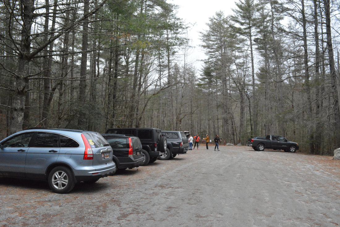
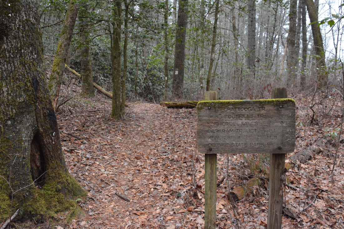
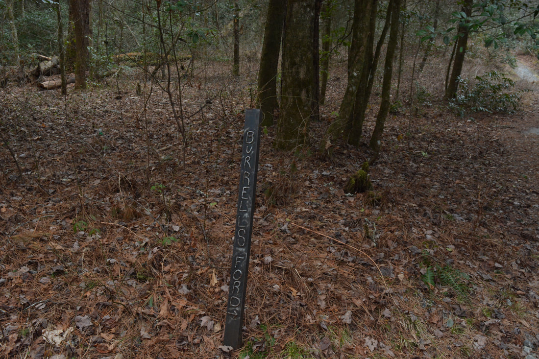
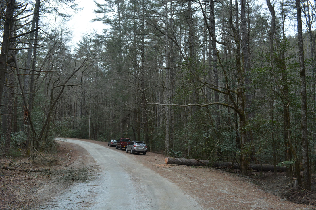
Duration of Hike: 7:00 plus 2 hours of stopping and photography Type of Hike: Out and Back (with small loop) Difficulty Rating: 5 out of 10 for the trail part, 9 out of the 10 for the optional bushwhack to Fowler Creek Falls Total Elevation Gain: 2277 Feet Pros: Numerous views of the Chattooga River; Mostly easy trail with few extended climbs; Very photogenic waterfalls Cons: The bushwhack to Fowler Creek Falls is challenging Points of Interest: King Creek Falls - 10 stars; Spoonauger Falls - 9 stars with good flow; Fowler Creek Falls - 7 stars; Ellicott Rock and Commissioners Rock; Burrells Ford; Numerous views of the Chattooga River Trail Blaze Colors: Foothills Trail - White; King Creek Trail - Orange; Chattooga River Trail - Lime Green (outside wilderness) or None (inside wilderness); Bad Creek Trail - None; Foothills Trail Connector - Blue Best Seasons to Hike: Spring Fees: None Beginning Point: Burrells Ford Campground Trailhead Directions from Walhalla, SC: From the intersection of South College Street (SC 183) and Main Street (SC 28), follow SC 28 North for 8.1 miles and bear right on SC 107. In another 10.1 miles, turn left onto Burrells Ford Road (FS Road 708). The road shortly turns unpaved, but it's in good shape for all passenger vehicles. In 2.3 miles, the entrance to Burrells Ford Campground will be on the left. Park in the spacious lot at the entrance. The campground is gated in winter, but the lot's always open. Map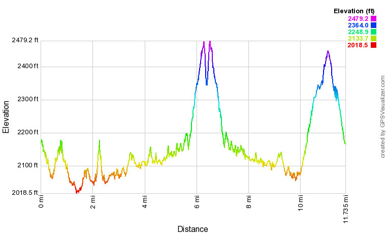
Click the link below to download a .GPX file with a track of this hike.
Details
I don't know why it took me five years to go for my first hike in the Ellicott Rock Wilderness. Somehow, the Chattooga River area never attracted me as much as other parts of the Southern Appalachians. I suspect that the feeling was strengthened after my previous two hikes in the region, along the first two sections of the Chattooga River Trail on the Georgia side, because neither hike afforded very many views of the river. However, Section Four of the Chattooga River Trail (from Burrells Ford to Ellicott Rock) is the complete opposite. This part of the trail closely parallels the river for its entire length. Furthermore, the Burrells Ford vicinity is home to two of the region's most picturesque waterfalls. Both King Creek Falls and Spoonauger Falls are easy to access and stunning (especially if the water flow is high). Fowler Creek Falls, the third waterfall that I visited on my hike, is significantly more challenging to see. My suggestions is that only seasoned waterfallers should attempt reaching it.
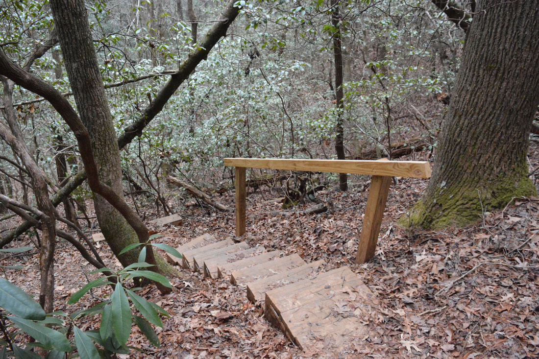
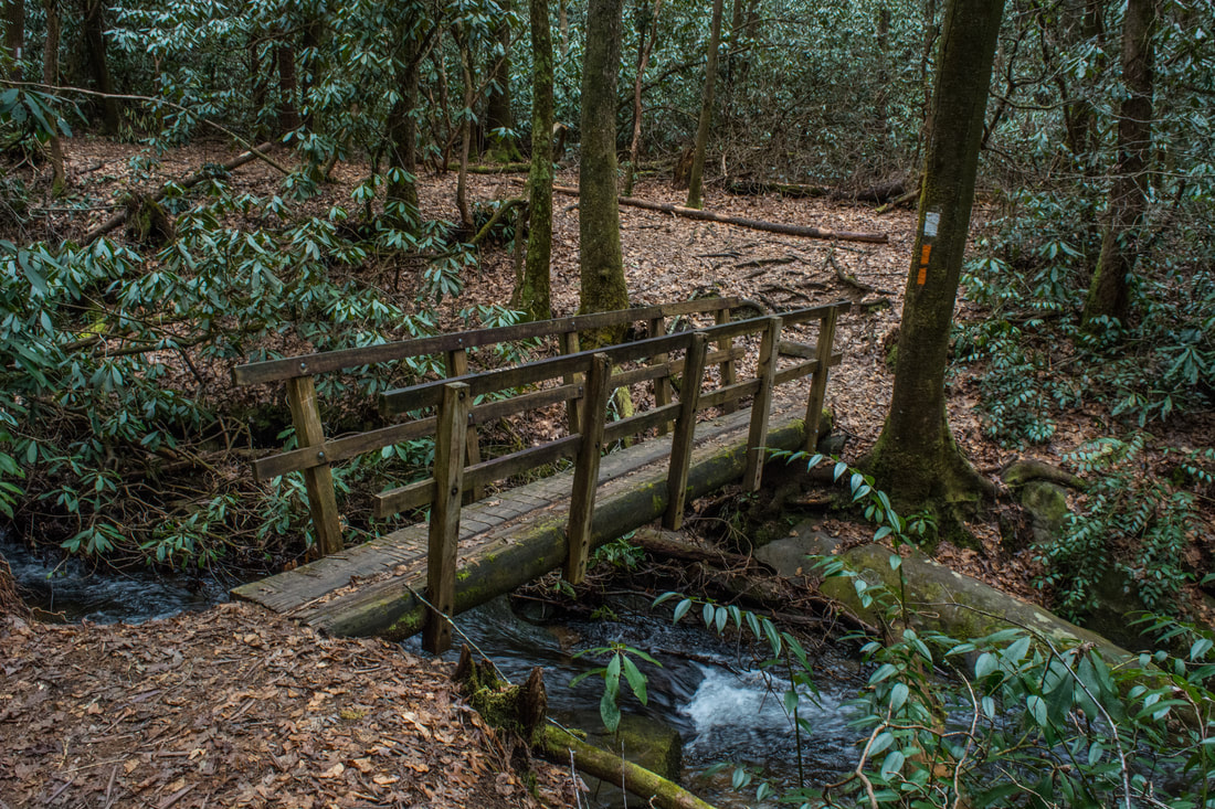
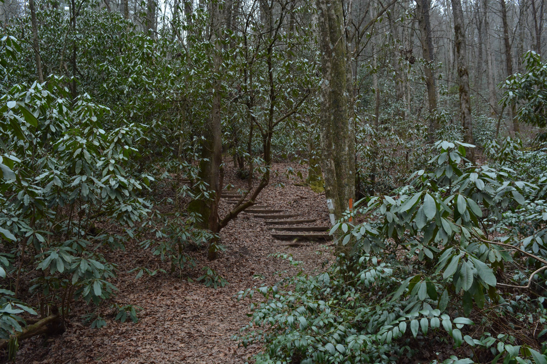
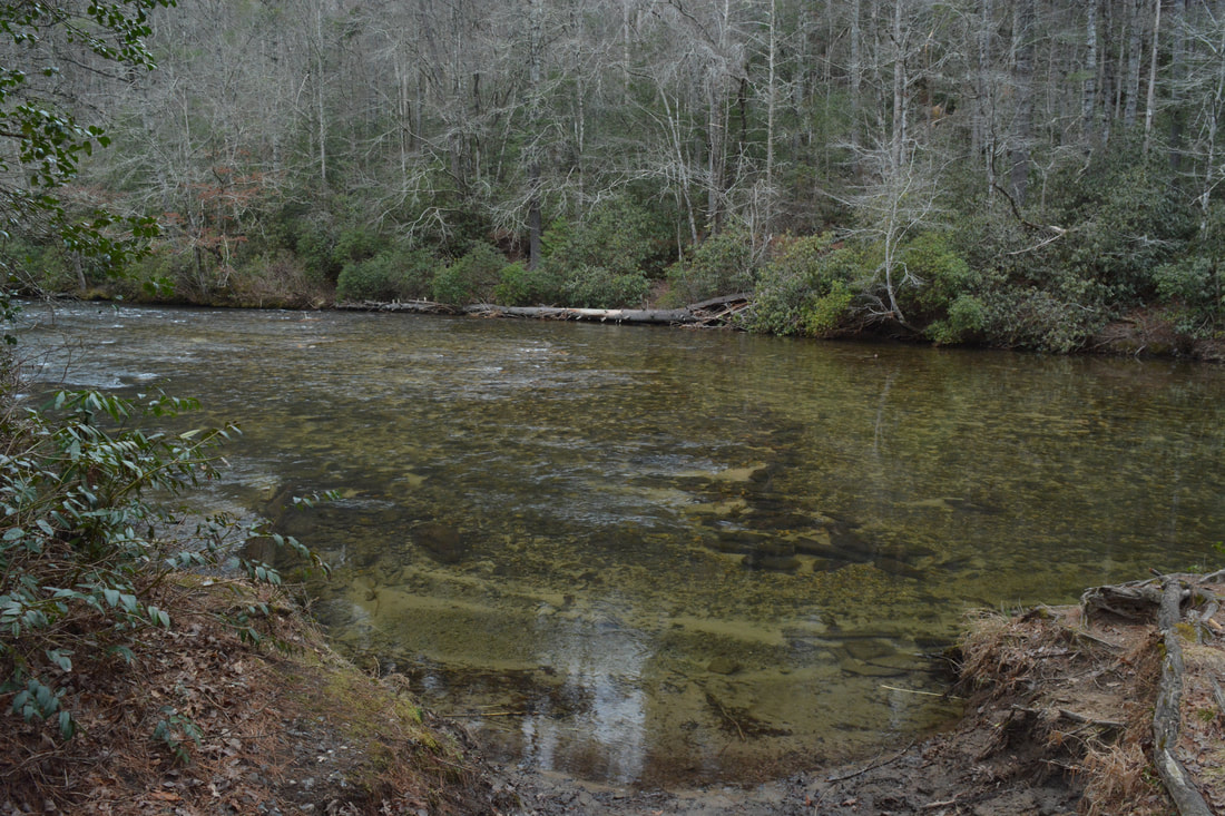
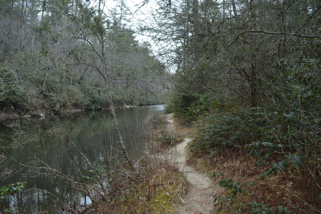
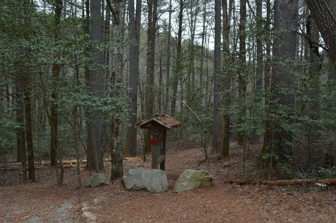
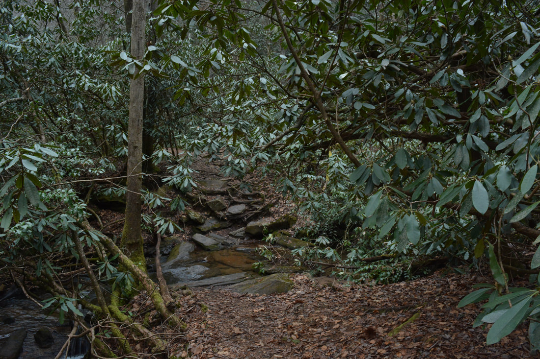
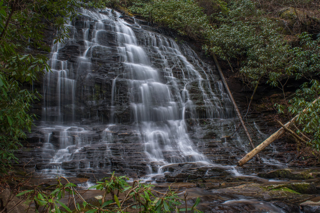
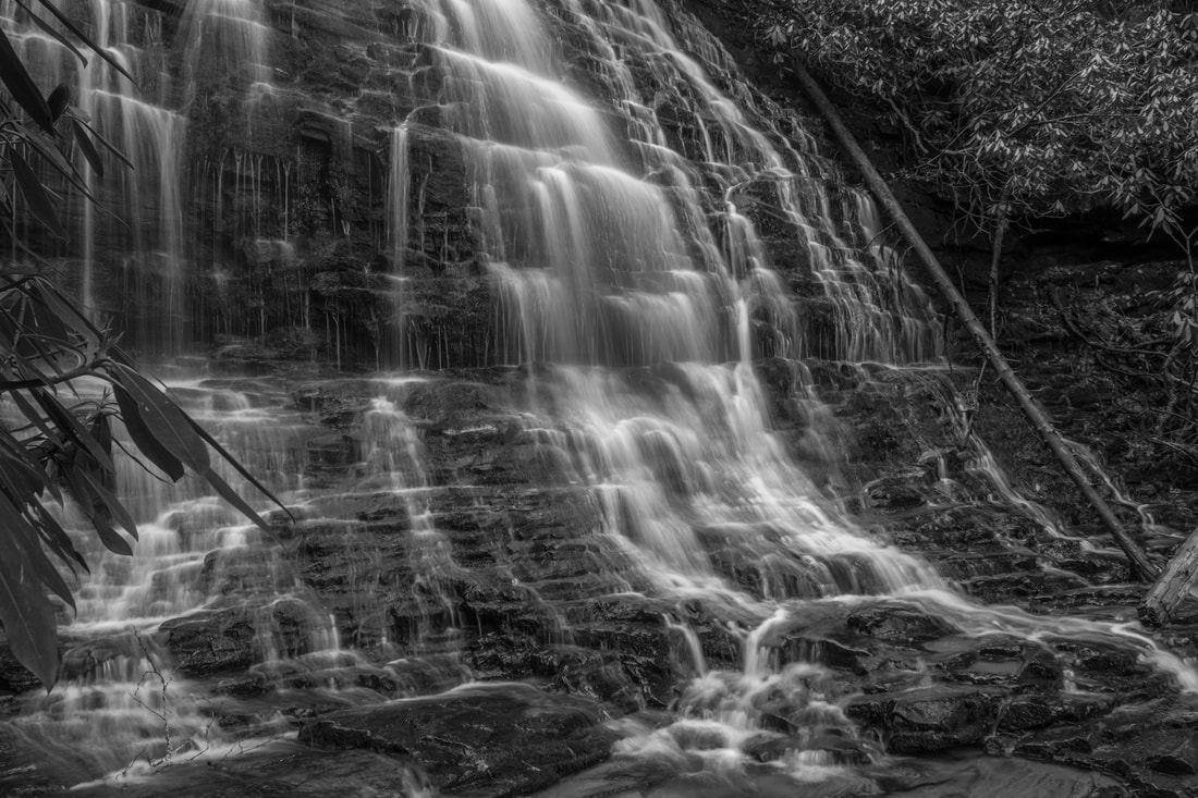
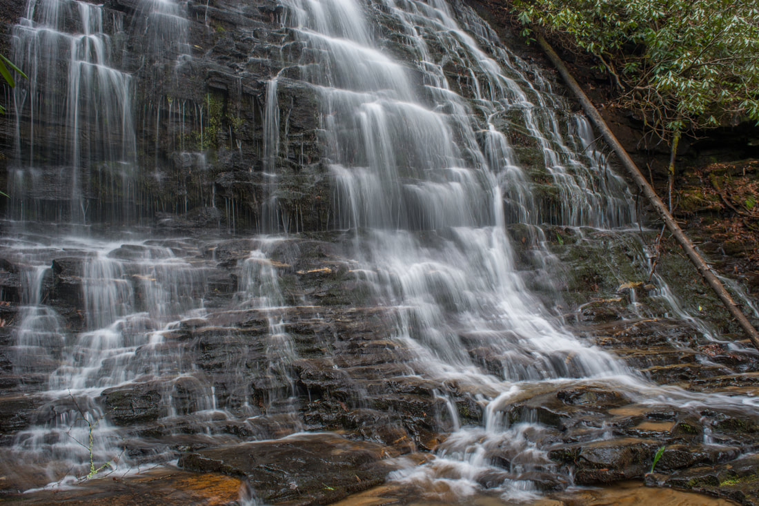
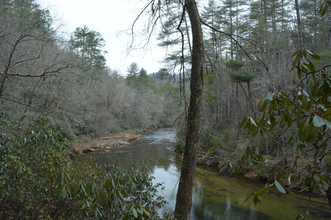
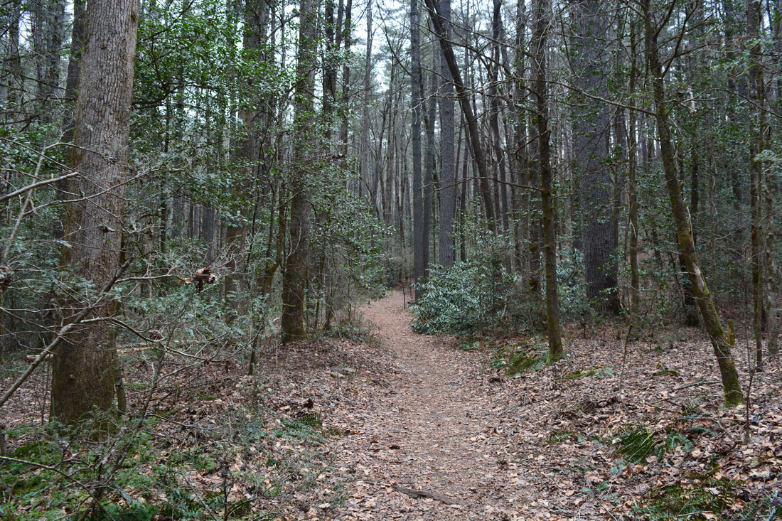
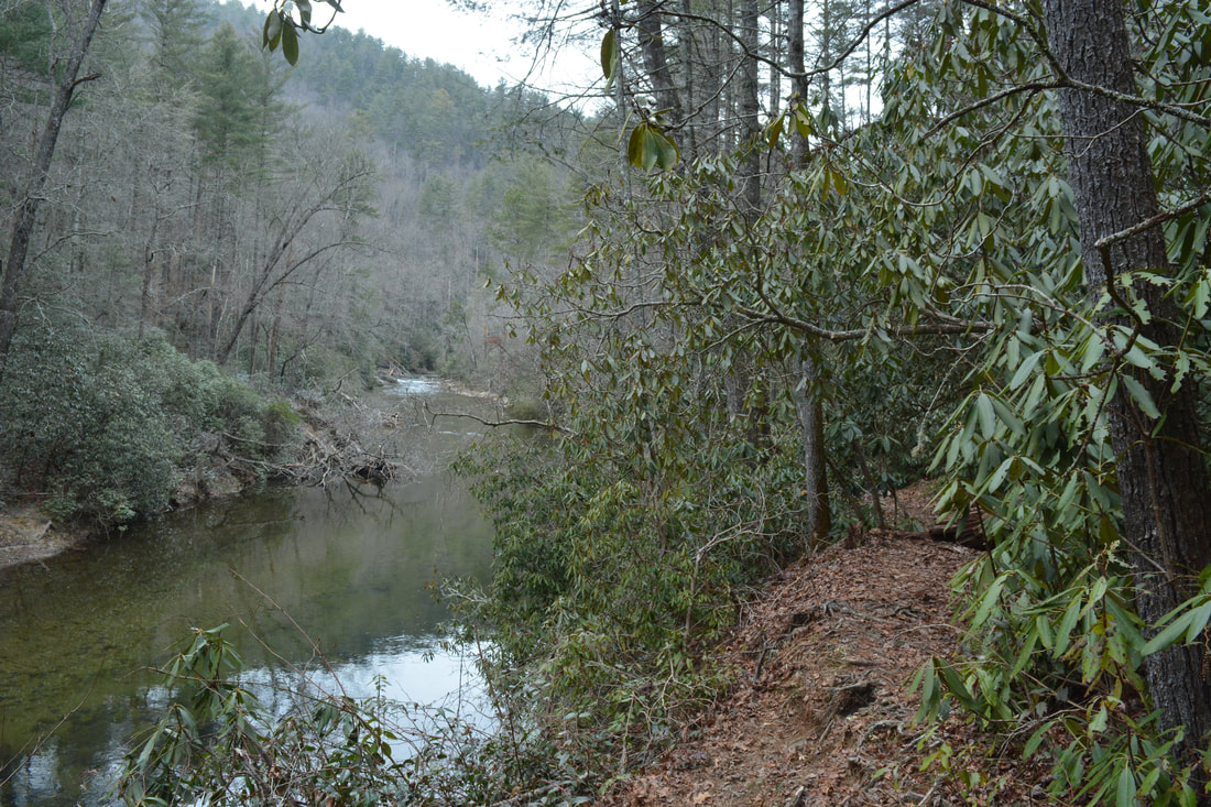
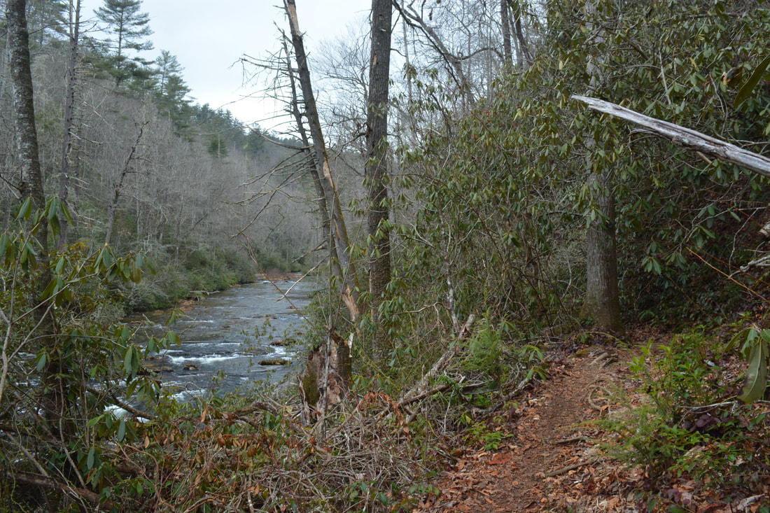
From the large parking lot off Burrells Ford Road, walk to the kiosk and pick up the trail behind it. In a few dozen feet, reach the Foothills Trail. Although you'll eventually return from the left, stay straight on the Foothills Trail past a mileage sign for the Foothills Trail and Section Three of the Chattooga River Trail. Section Three is the part of the Chattooga River Trail that heads south from Burrells Ford and eventually reaches Highway 28 at Russell Bridge. The Foothills Trail winds through a peaceful hollow before it drops into the King Creek valley. At 0.45 miles, come to a junction with the King Creek Trail on the right. Later you'll turn onto the trail, but for now, stay straight and cross a log footbridge over King Creek. The Foothills Trail then begins follow King Creek upstream. At 0.55 miles, at a signed junction, bear left up a set of wooden steps on the King Creek Falls spur trail while the Foothills Trail turns right. The trail closely follows the south side of King Creek the rest of way to the falls. It gets slightly tighter at the end, and you'll have to scramble over a large log once. The trail ends at King Creek Falls at 0.75 miles. King Creek Falls is a terrific waterfall! The part of it that you can see from the base is about 75 feet, although it's actually even taller. The falls begins as a wide set of cascades and drops. Then, the creek gets squeezed into a narrow free-fall by cliffs on both sides. The shallow sandy pool at the foot of the falls is great for wading. Although there's a little deadfall around the falls, I think it's still very photogenic. There are good ways to incorporate the deadfall into the scene. According to long-time visitors of King Creek Falls, the large slanted log laying at the base of the falls has been there for over 30 years! Return to the Foothills Trail footbridge and hike the King Creek Trail downstream along the creek's north side. This is a very easy, flat trail. The trail ends at 1.25 miles when it reaches a forest road in Burrells Ford Campground. To get to the Chattooga River Trail, turn right, and in 200 feet, turn left onto a broad connector. The connector ends by the riverside at 1.4 miles. A sign marks this as the site of the original Burrells Ford. The green-blazed Chattooga River Trail crosses from left to right here. This hike turns right on the trail, which follows the very edge of the Chattooga's clear, tranquil waters. When the trail rises away from the bank, there will be a distant view of the Burrells Ford Road Bridge. The trail eventually comes alongside Burrells Ford Road and crosses it at 1.9 miles. This is also the trailhead for Spoonauger Falls. 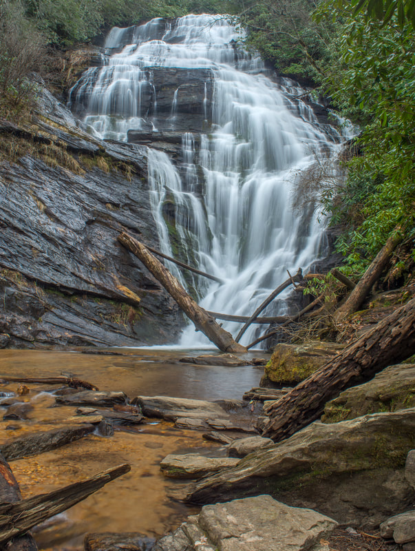
King Creek Falls is a terrific waterfall in close proximity to Burrells Ford.
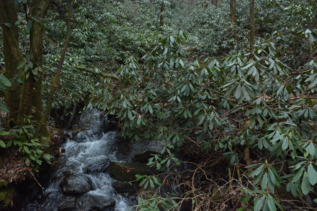
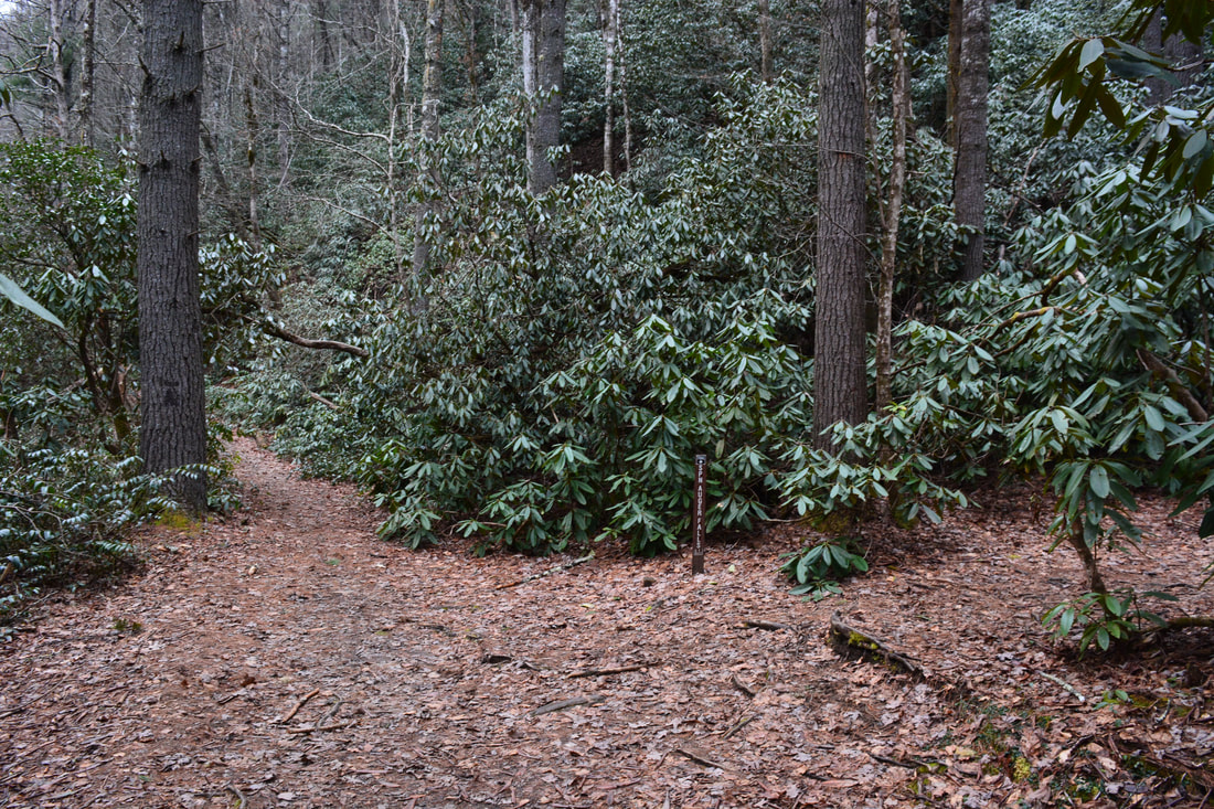
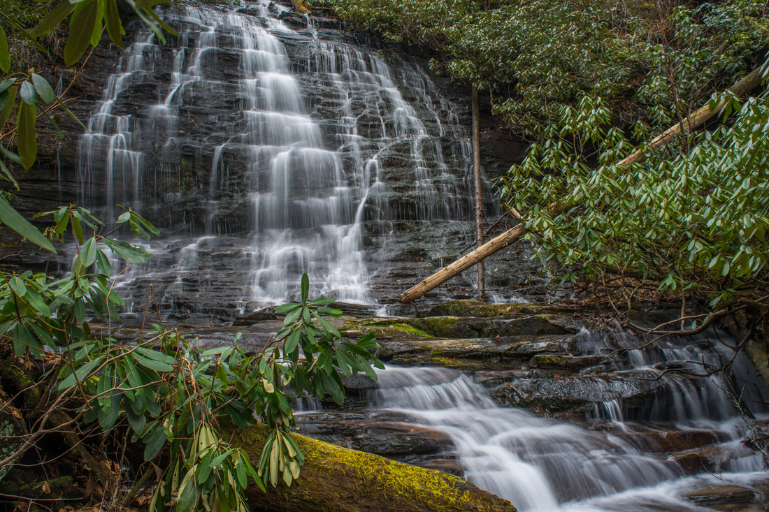
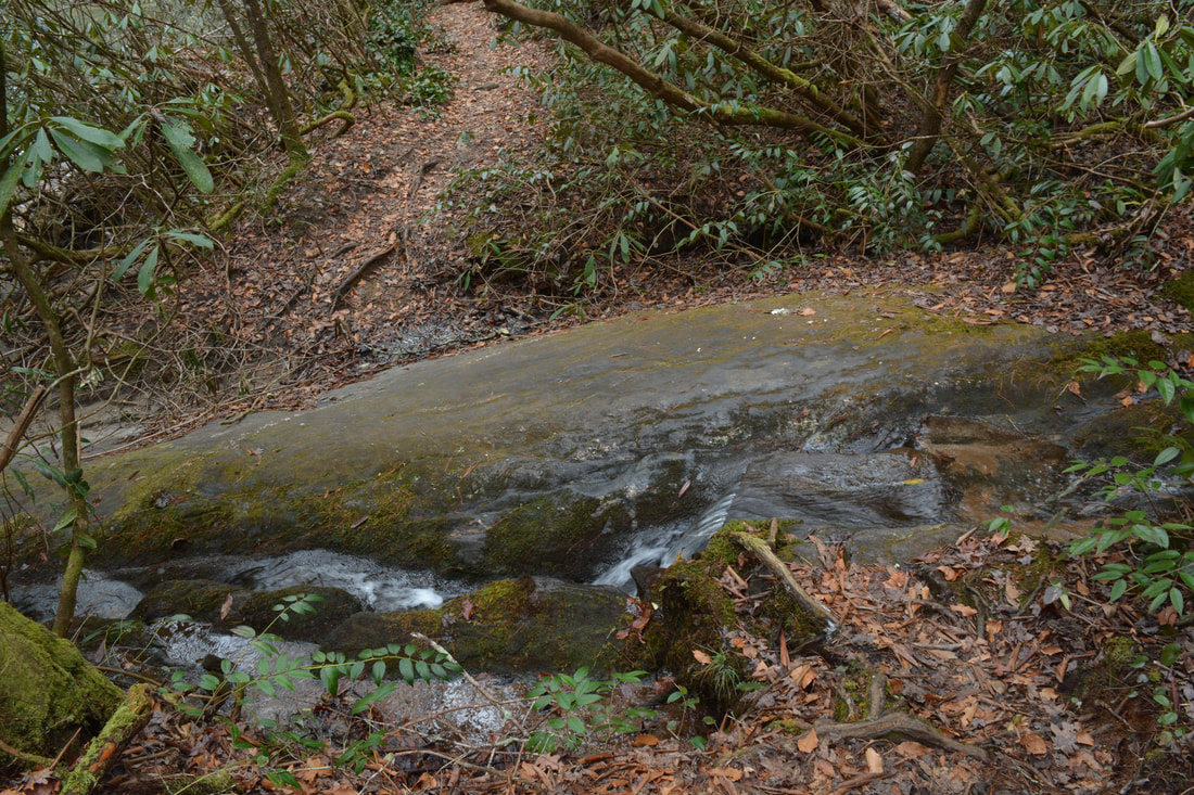
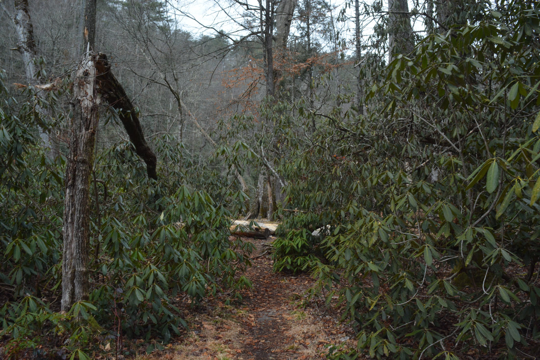
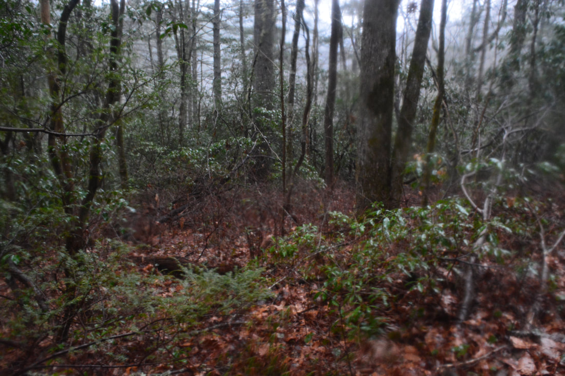
After crossing the road, the Chattooga River Trail loses no time in entering the Ellicott Rock Wilderness. As you come back alongside the Chattooga River, you'll rock hop a small stream at 2.15 miles. On the other side, the signed Spoonauger Falls Spur Trail leaves right. If the small stream features a healthy flow, this is a must-do side trip! The spur trail passes a tiny cascade and ascends via four switchbacks before it ends by Spoonauger Falls at 2.3 miles. 35-foot Spoonauger Falls is a gorgeous cascade that leaps down a nearly vertical rockface with many edges. With enough water, this is about as good as it gets for slow exposure photography! The steep cascades continue out of sight below the main drop, but from what I've heard, it's not worth scrambling to see them. Retrace your steps back to the Chattooga River Trail from Spoonauger Falls.
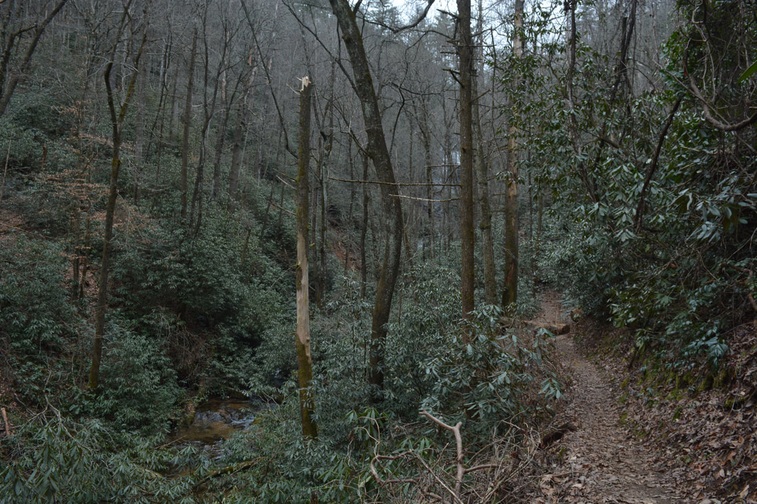
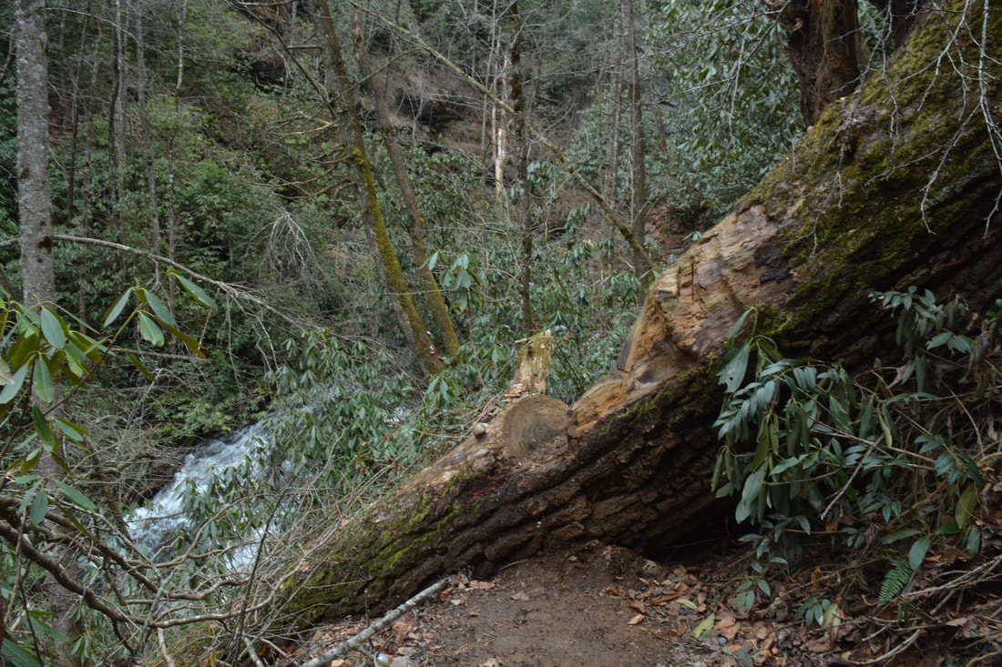
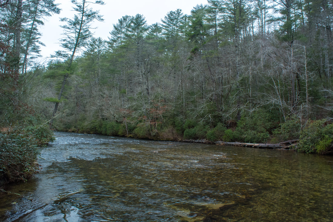
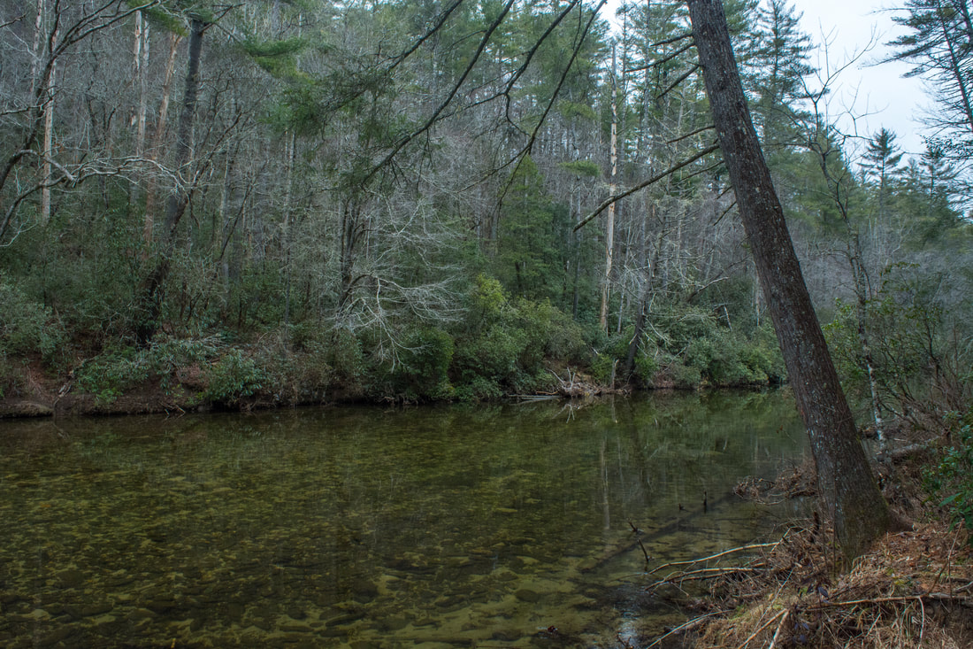
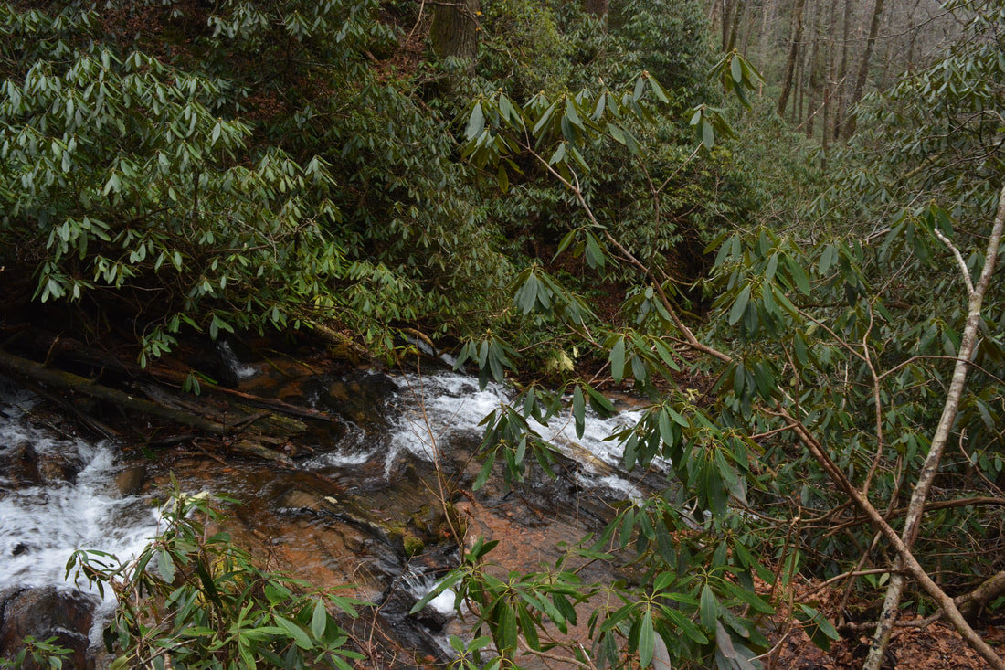
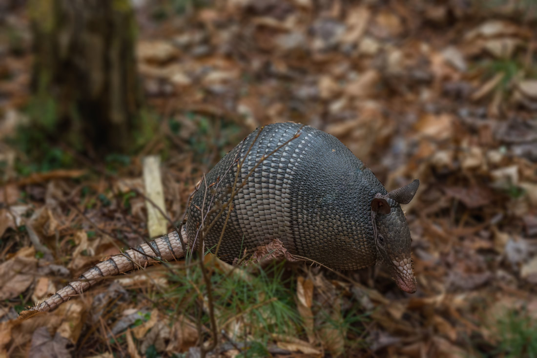
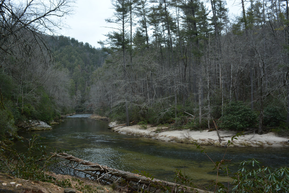
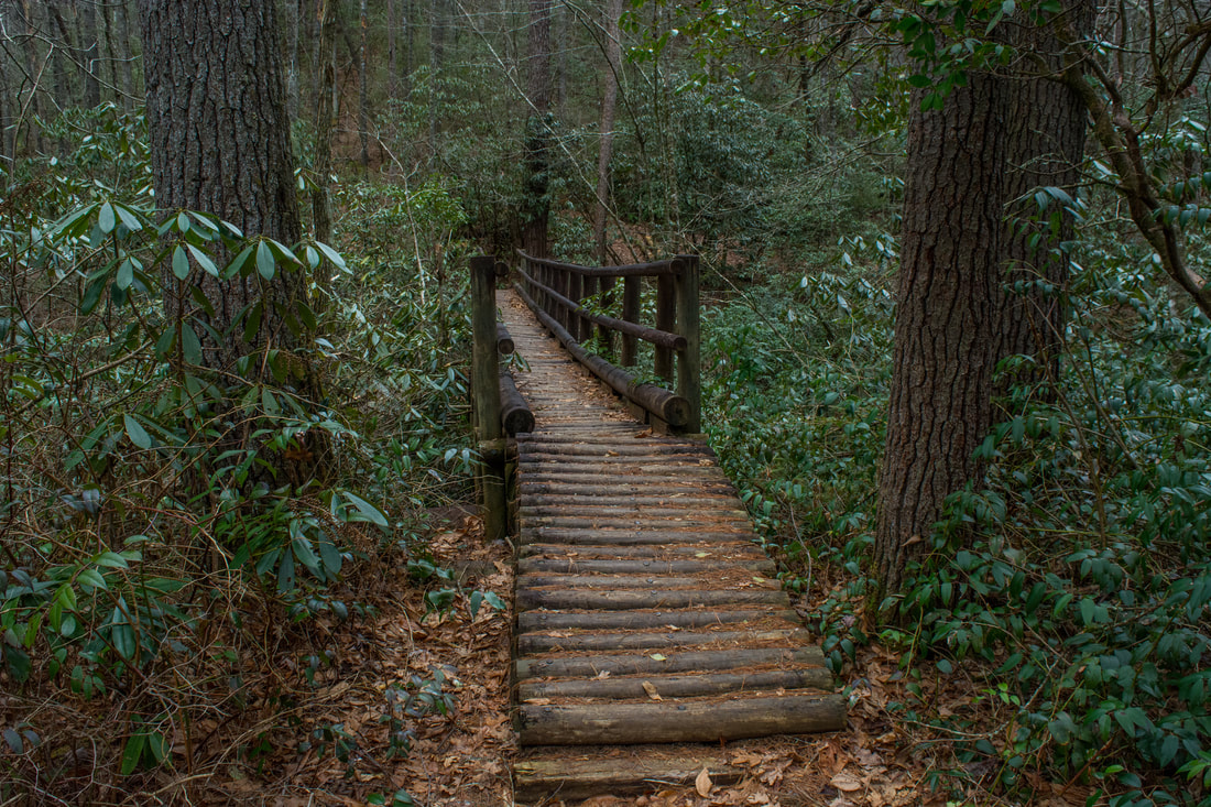
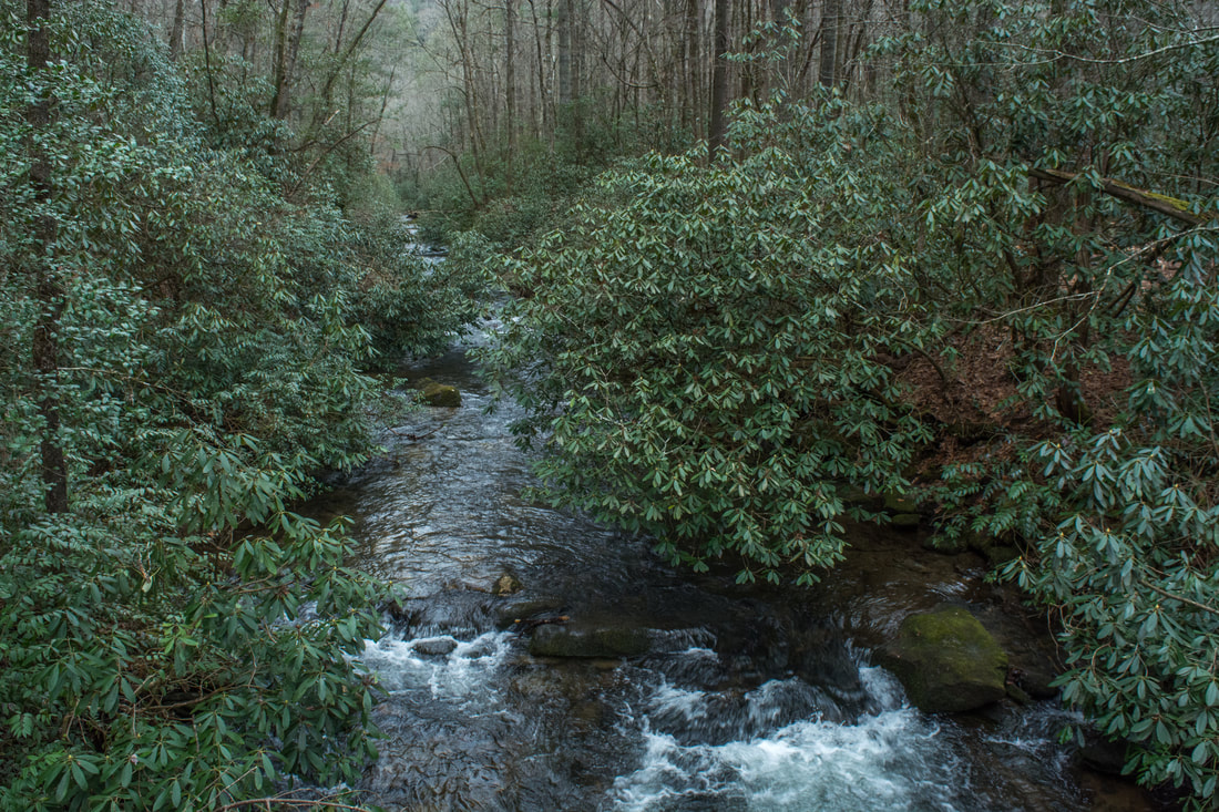
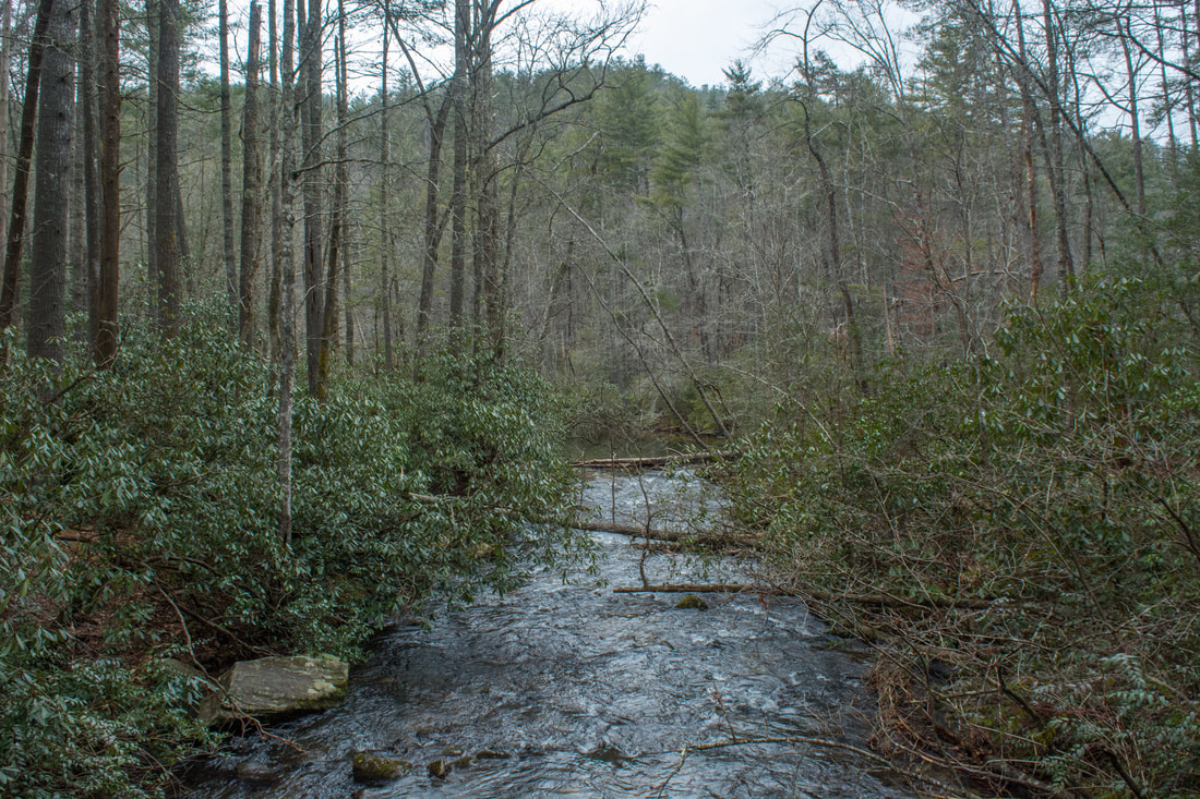
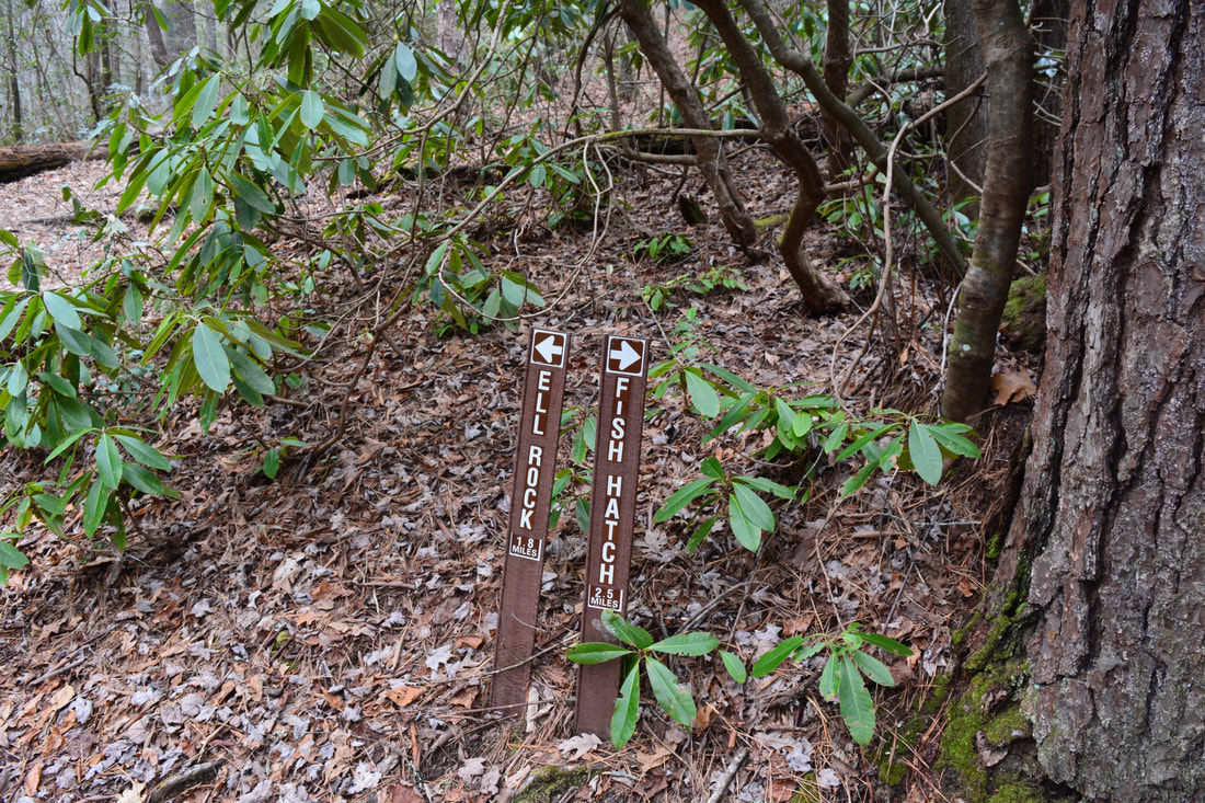
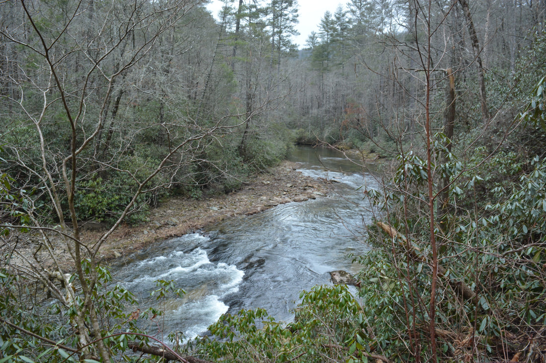
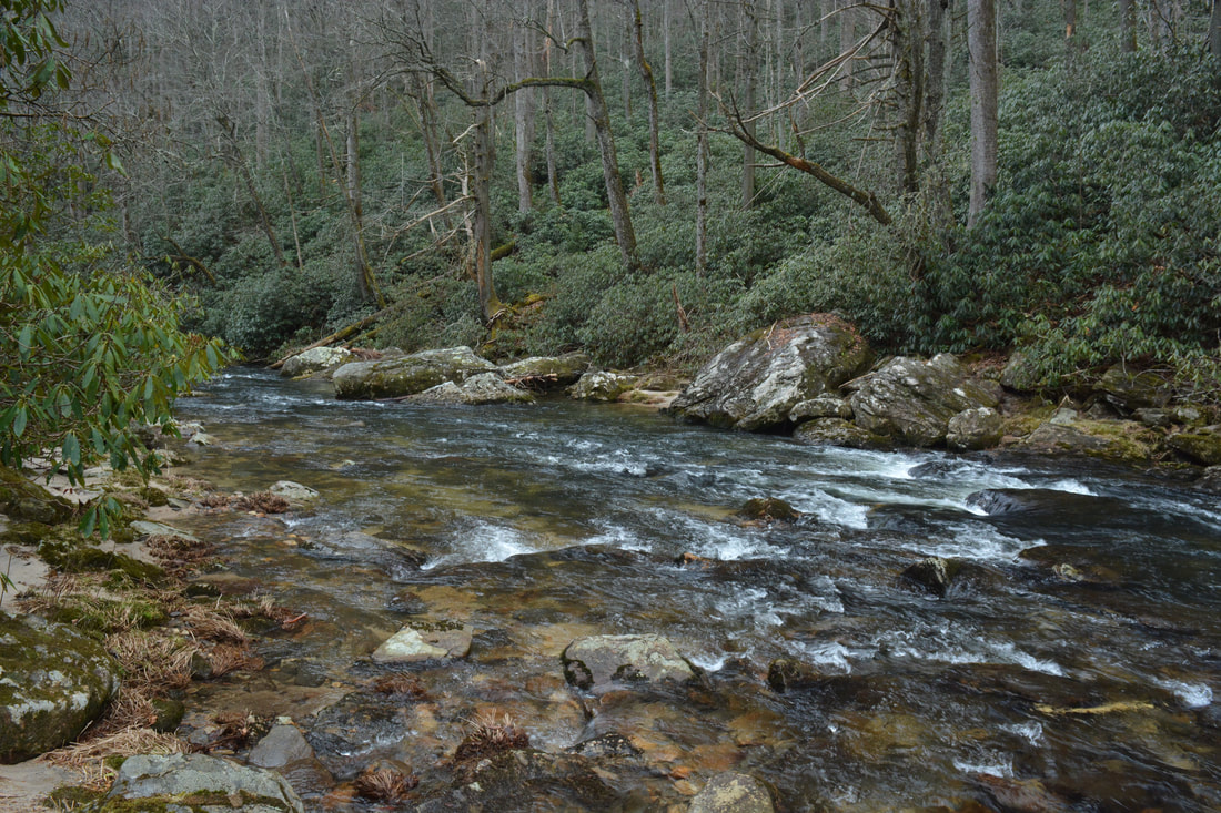
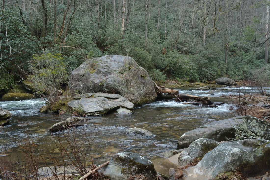
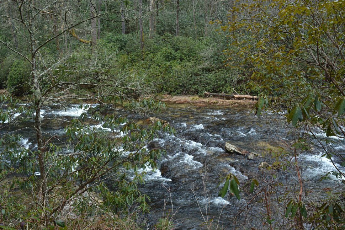
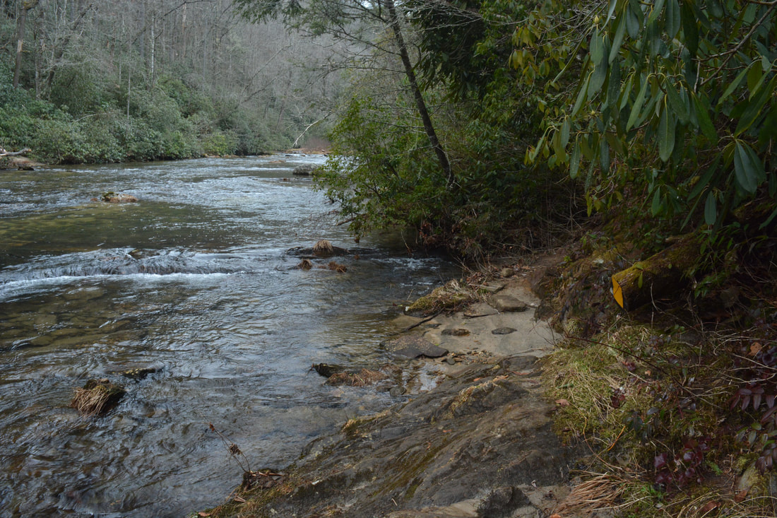
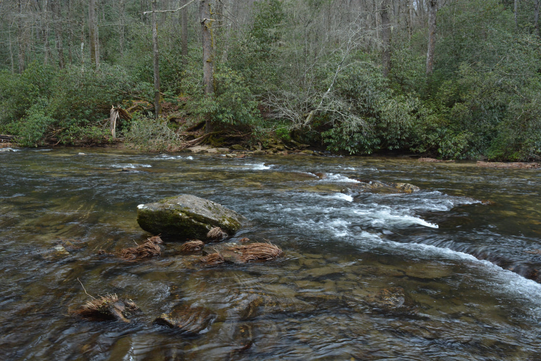
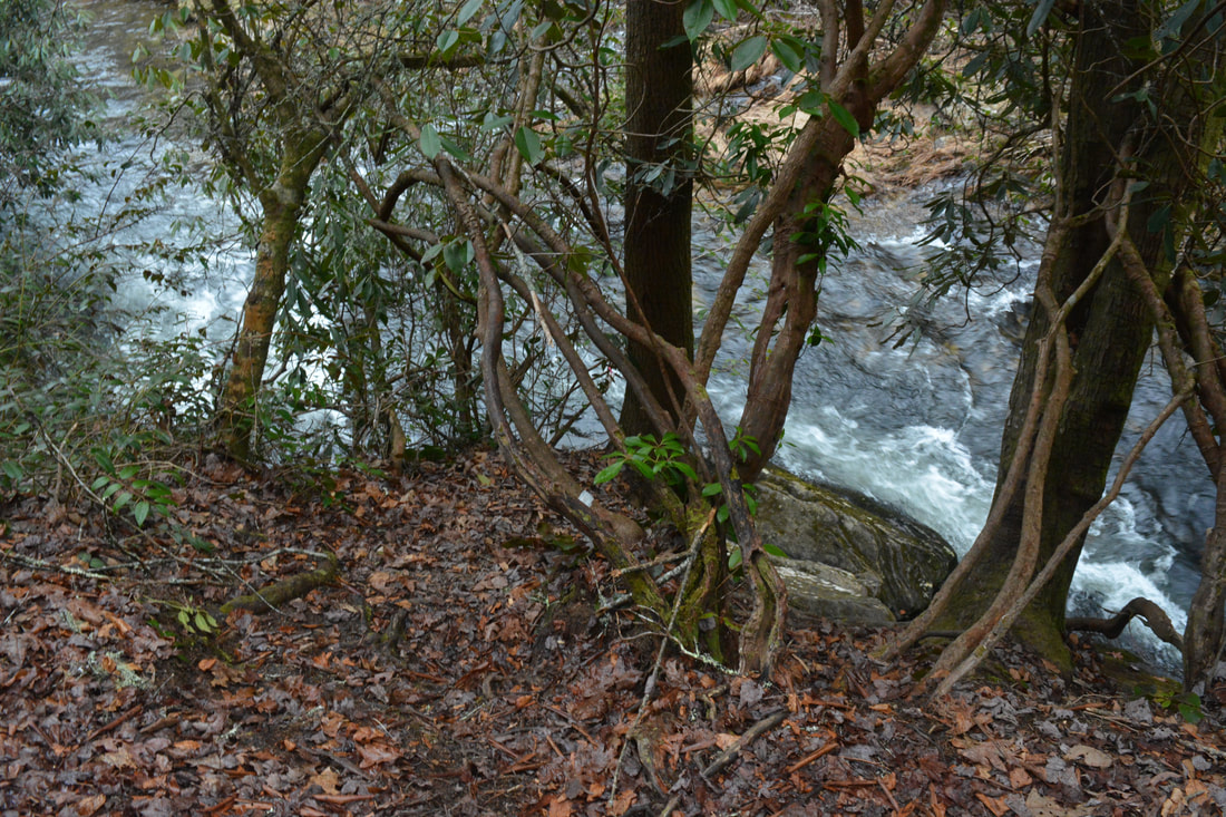
The Chattooga River Trail quickly enters a pattern with nearly continuous views of the river. It briefly veers away as it enters a broad floodplain area at 2.6 miles. It's here that I surprisingly encountered an armadillo. It was the first time I'd ever seen one so far north! The armadillo wasn't shy either, allowing me to get great zoom photos of him. The Chattooga River Trail passes the signed Foothills Trail Connector on the right at 2.7 miles. From here on, the hike is out and back. Mile 3.15 features a beautiful elevated view of the river. At 3.75 miles, the trail passes through a flat with numerous campsites and crosses the East Fork Chattooga River on an elaborate log footbridge. The bridge is constructed entirely from logs - no planks! The bridge has great views of the waterway as it rushes to join the smoother Chattooga River. Just past the bridge is a T-intersection with the East Fork Trail. To the right, the East Fork Trail - a scenic hike in its own right - leads 2.5 miles to a trailhead by the Walhalla Fish Hatchery. This hike turns turns left, staying on the Chattooga River Trail. The trail turns a little more rugged after the East Fork Trail junction, and although there are no extended climbs before Ellicott Rock, there are numerous bumps along the way by the river. At 4.4 miles, the trail reaches a crossing of Bad Creek. This is the largest water crossing on the hike. In fact, there's a possibility that you'll get your feet wet here. Although the stepping stones were submerged on this day, a small tree was fortunately downed across the creek. As long as the tree remains in place, it should be easy to cross the creek by it. After Bad Creek, continuous views of the Chattooga River Trail resume. The river becomes more scenic as well, featuring numerous cascades. At 5.0 miles, a neat island is in the river on the left. The trail then makes an interesting stream crossing using a sloping rock. A huge boulder lies in the river at 5.25 miles. At 5.45 miles, at a spot where the Chattooga River Trail comes down to the very edge of the water, it reaches a junction with the Ellicott Rock Trail. The Ellicott Rock Trail leaves left and starts out with a deep ford of the Chattooga River, eventually reaching Bullpen Road in 4.3 miles. A yellow metal plate nailed to a log on the right side of the trail is the only marker for the junction. Regardless, this hike stays on the Chattooga River Trail on the same side of the river. At 5.5 miles, the Chattooga River Trail crosses a tiny plank footbridge. The bridge isn't remarkable in any way, but it serves the important purpose of informing hikers that Ellicott Rock lies about 0.1 mile ahead. 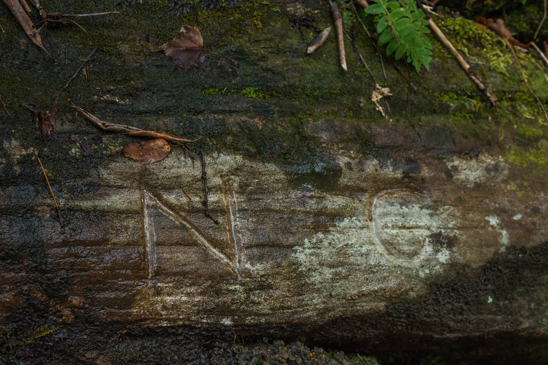
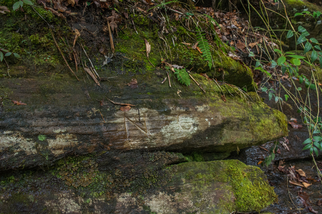
The legendary Ellicott Rock with its N - G engraving is located at the point where Georgia, North Carolina, and South Carolina all come together.
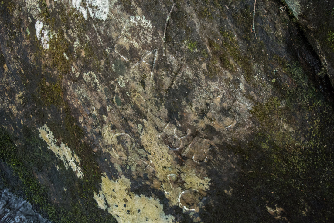
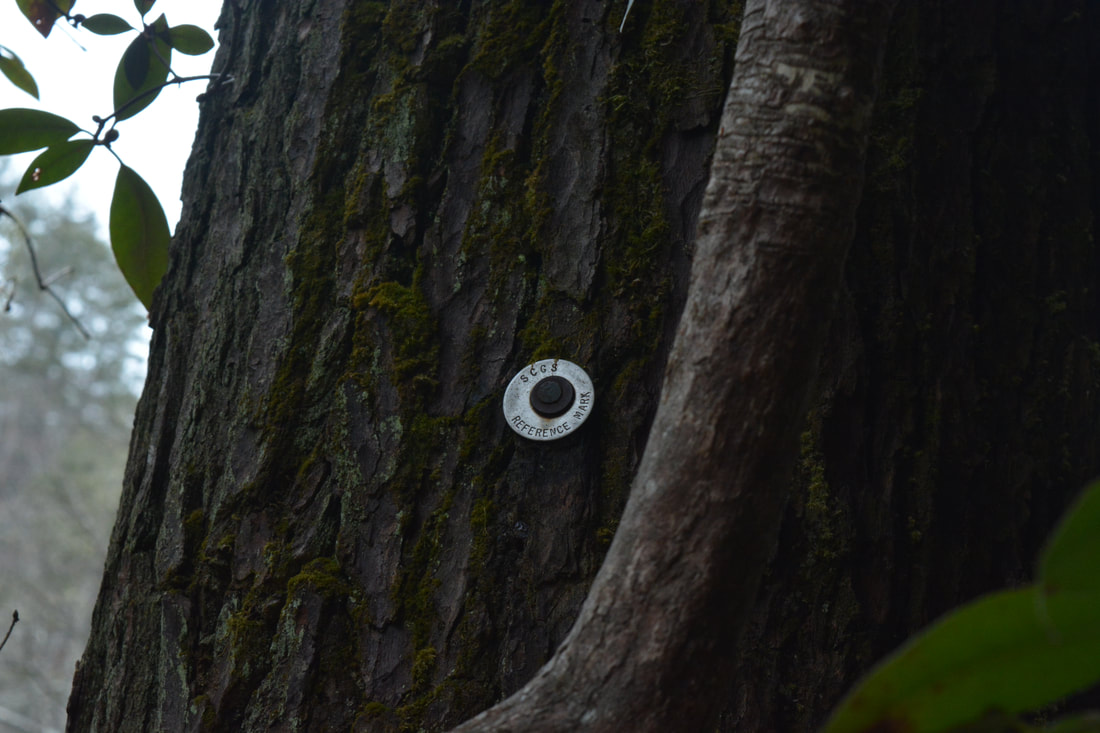
Both Commissioners Rock and Ellicott Rock are just below the trail by the riverside at 5.6 miles. Beside the plank bridge 0.1 mile before the rocks, there are a couple other landmarks that should help you to identify the location. Two faint scramble paths lead down to the river - the first to Commissioners Rock, the second to Ellicott Rock. At the time of my hike, the first path was marked by pink flagging tape, but don't count on it still being there. Just past the second path (to Ellicott Rock), a tiny metal pin with the inscription "SCGS REFERENCE MARK" is nailed to a trailside tree. Also, at the same spot, there's a cluster of medium-sized boulders in the middle of the river. One of them has a modern USGS benchmark that denotes the state line. When you take the first path, you'll come out on a slightly sloping rock at the water's edge. This is Commissioners Rock. The following engraving is directly under your feet:
LAT 35
AD 1813 NC + SC
In 1813, two years after Andrew Ellicott was initially sent to survey the state line, commissioners from North Carolina and South Carolina marked this rock as the boundary of SC and NC. Ellicott Rock is only a couple dozen feet upstream from Commissioners Rock, but during high flow, it's best to return to the trail and take the second scramble path to the rock. Unlike Commissioners Rock, Ellicott Rock is actually in the side of the slope (higher above the water). The engraving is a simple N - G. These two letters, denoting the North Carolina/Georgia state line, were inscribed by Andrew Ellicott in 1811. Ellicott had been sent to survey the boundary in order to resolve a boundary dispute between the two states. Interestingly, the state of Georgia didn't agree with the location of the border (believing that the actual border was several tenths of a mile to the north), and it even refused to pay its share of Ellicott's fee!
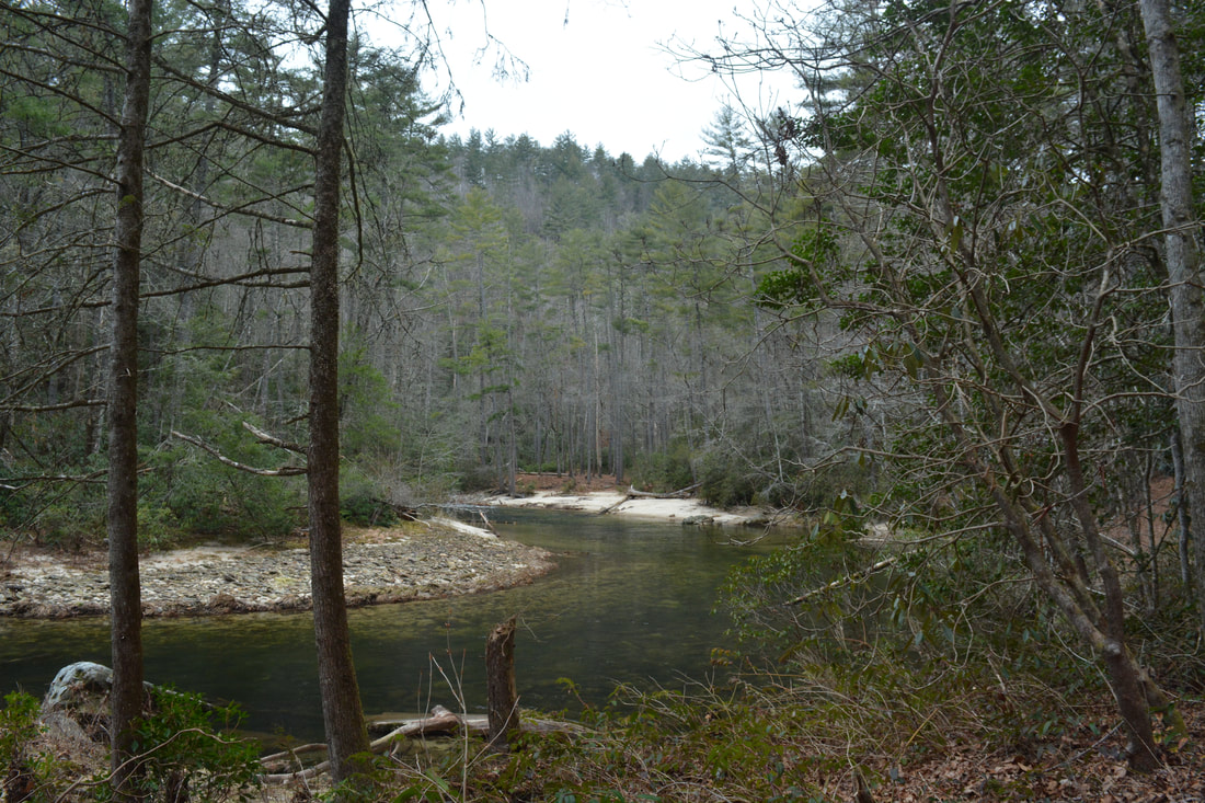
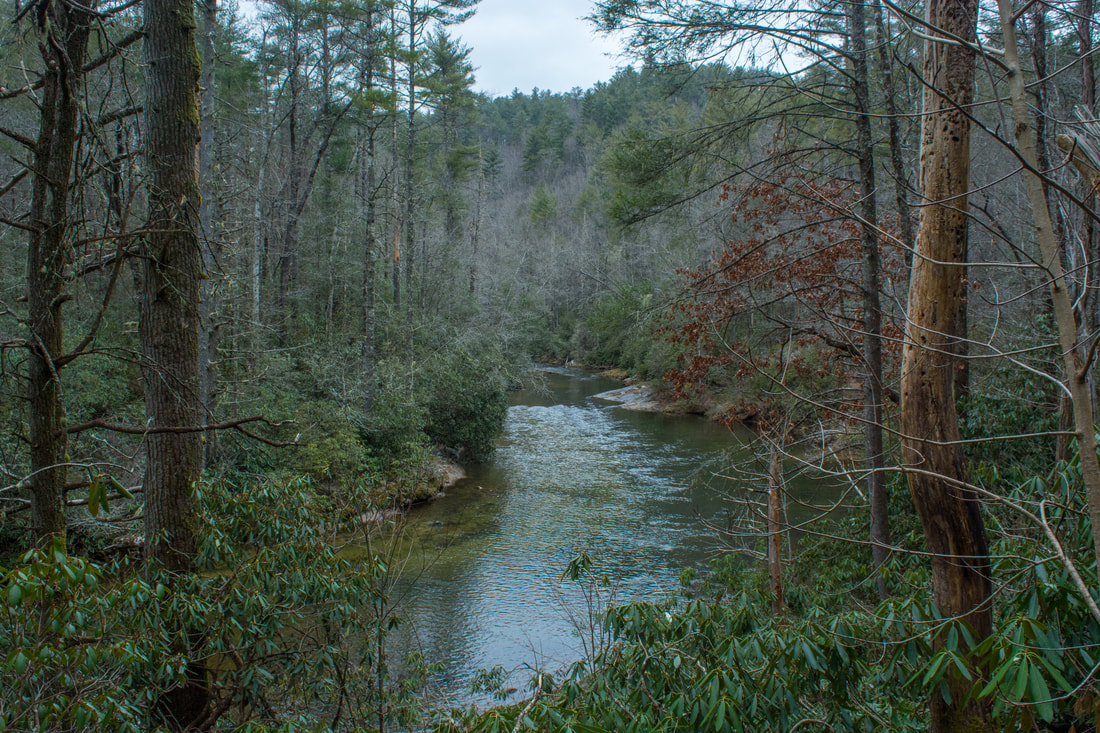
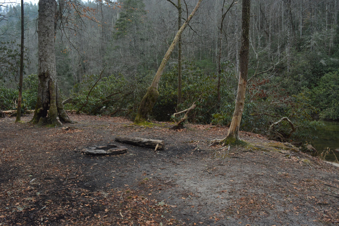
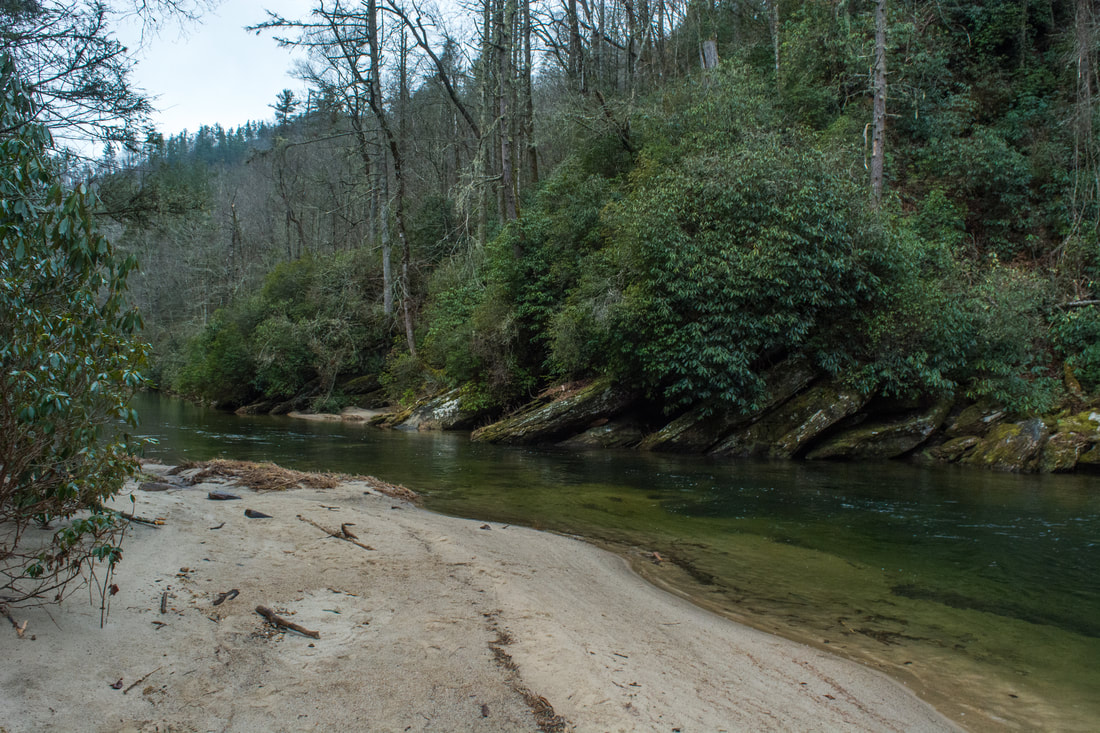
Even if your destination isn't Fowler Creek Falls, it's worth continuing on the Chattooga River Trail to a very scenic location on the river. Keep in mind that after you've passed Ellicott Rock, you've entered North Carolina. At 5.7 miles, the Chattooga River officially ends at a pleasant campsite. To the right, the unsigned Bad Creek Trail begins by heading up the slope. What most casual hikers will want to do is stay straight along a twisting path to a second campsite. The second campsite is a fantastic spot by a secluded sandy beach. Across from the beach, the river flows by a series of jagged rock outcrops. In my opinion, this is one of the most beautiful river views on the hike. If you choose to turn around here, the hike will be 10.3 miles long. If you'd like to learn more about the Foothills Trail Connector part of the hike, skip the next section, which covers Fowler Creek Falls. 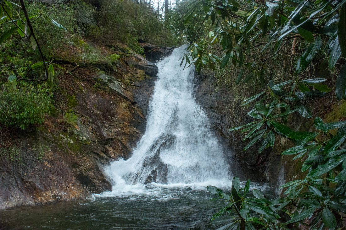
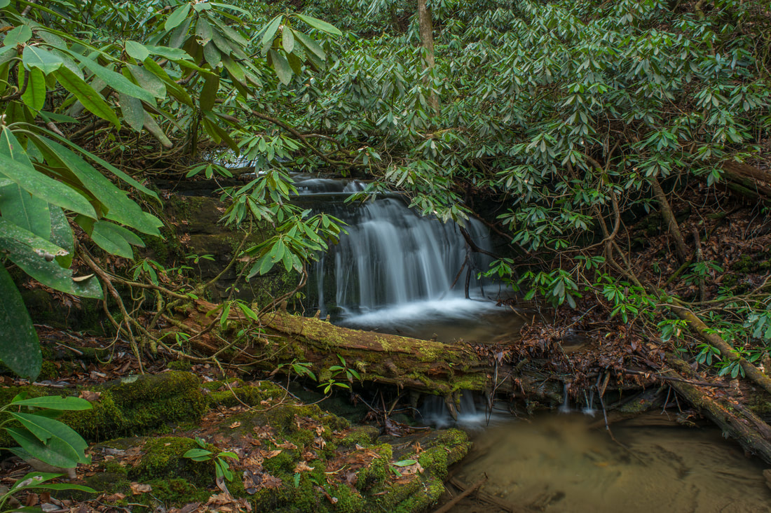
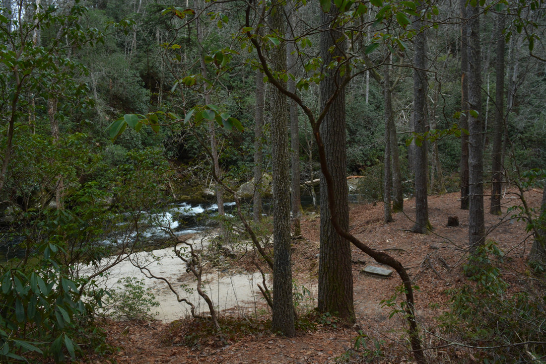
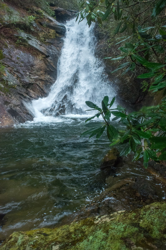
Fowler Creek Falls is a steeply sliding 40-foot waterfall at a very remote location in the heart of the Ellicott Rock Wilderness.
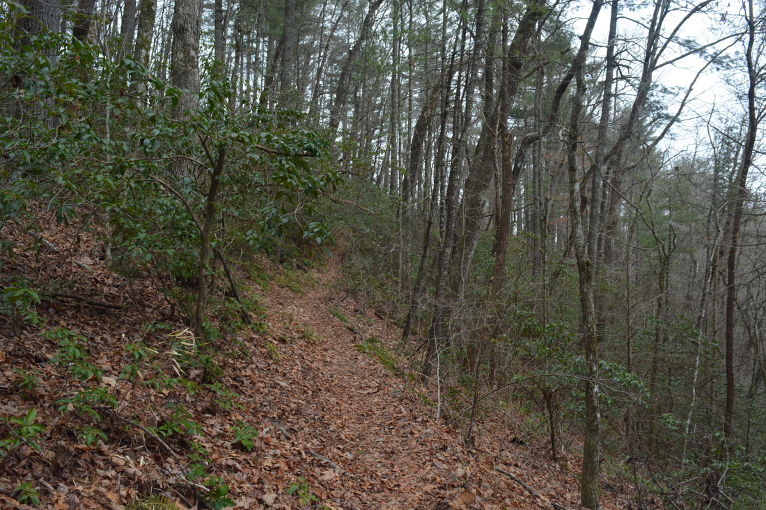
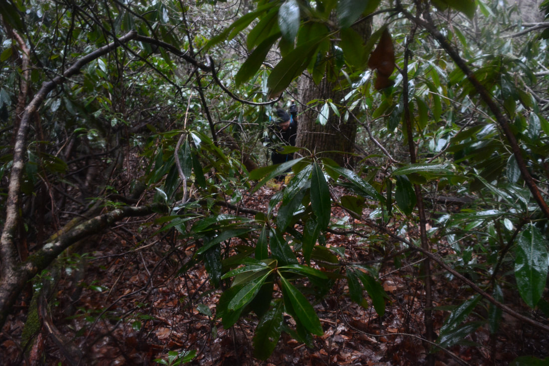
The Bad Creek Trail quickly starts ascending out of the Chattooga River Gorge. You'll rise 300 feet before you begin bushwhacking to Fowler Creek Falls. At 5.75 miles, a steep path drops down to the second campsite. The main trail makes three switchbacks in quick succession during a gentle ascent. Switchback #4 is at 6.05 miles, and switchback #5 is at 6.2 miles. Remember this: there are five switchbacks before the start of the Fowler Creek Falls bushwhack. If you reach a sixth bushwhack, you've gone too far. On the map above, I marked the sixth switchback with the way point "switchback" so that you know where it's at. The bushwhack to Fowler Creek Falls begins on the left at 6.3 miles, about 0.1 miles past the fifth switchback. For comparison, the sixth switchback is about 200 feet past the start of the bushwhack, or less than 0.15 miles after the fifth switchback. It's pretty tough to locate the "entrance" to the bushwhack, but it's essential that you stay as close to my track as possible. The GPS coordinates for the point to leave the trail are N35° 00.160' W83° 06.343'. The corridor of "decent" route to the base is quite narrow. Everything to the right (east) of my track is a hellacious bushwhack with widespread downfall. I speak from experience. I don't know exactly what the area to the west of my track is like, but I feel confident that you would end up at the top of a 30-foot cliff that way. Going further west won't help you anyway, because if you come at Fowler Creek below the falls, you'll have to do some nasty boulder scrambling and bushwhacking to get there. One more note: if you see orange flagging tape at the sixth switchback, you can safely disregard it. It doesn't mark the easiest route to the falls. You can actually hear the waterfall better from the switchback than from the start of the easiest bushwhack, but that doesn't mean anything at all.
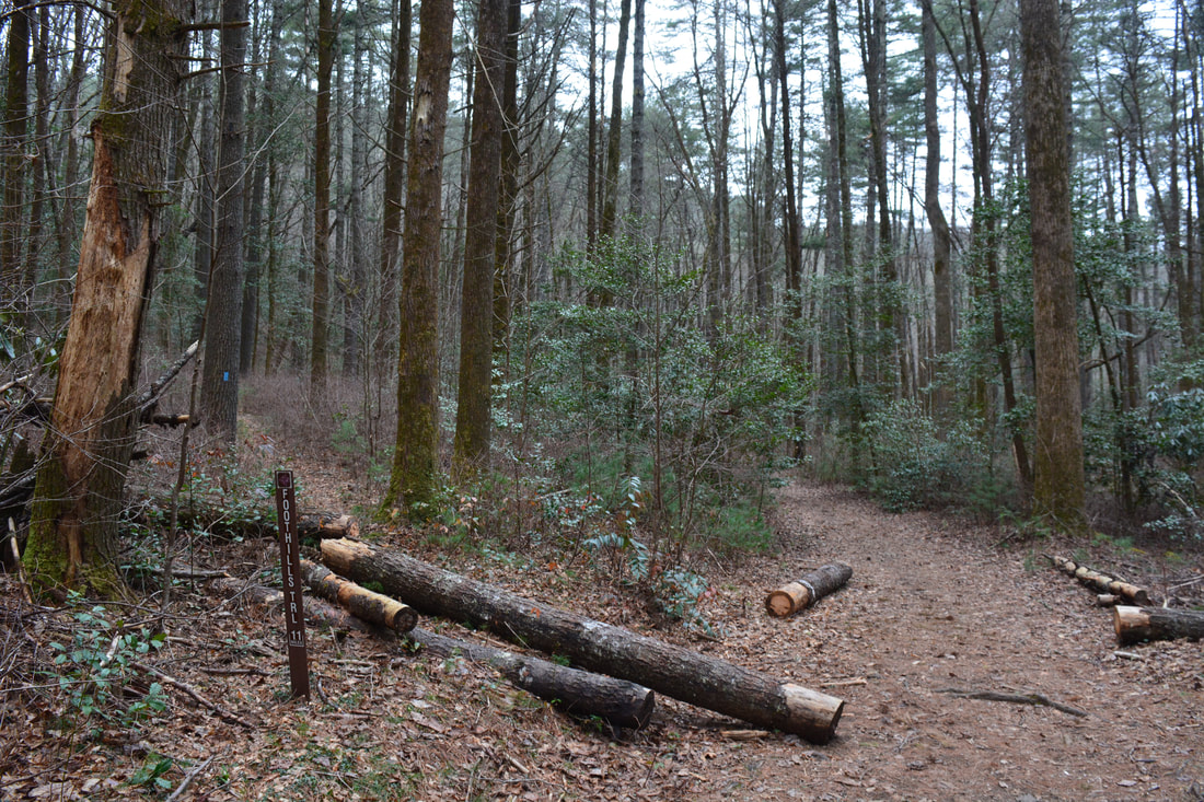
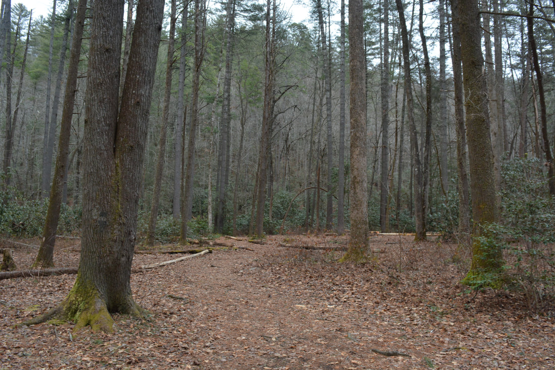
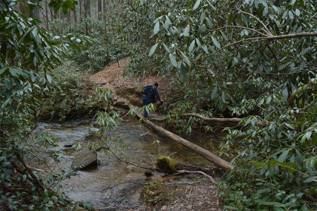
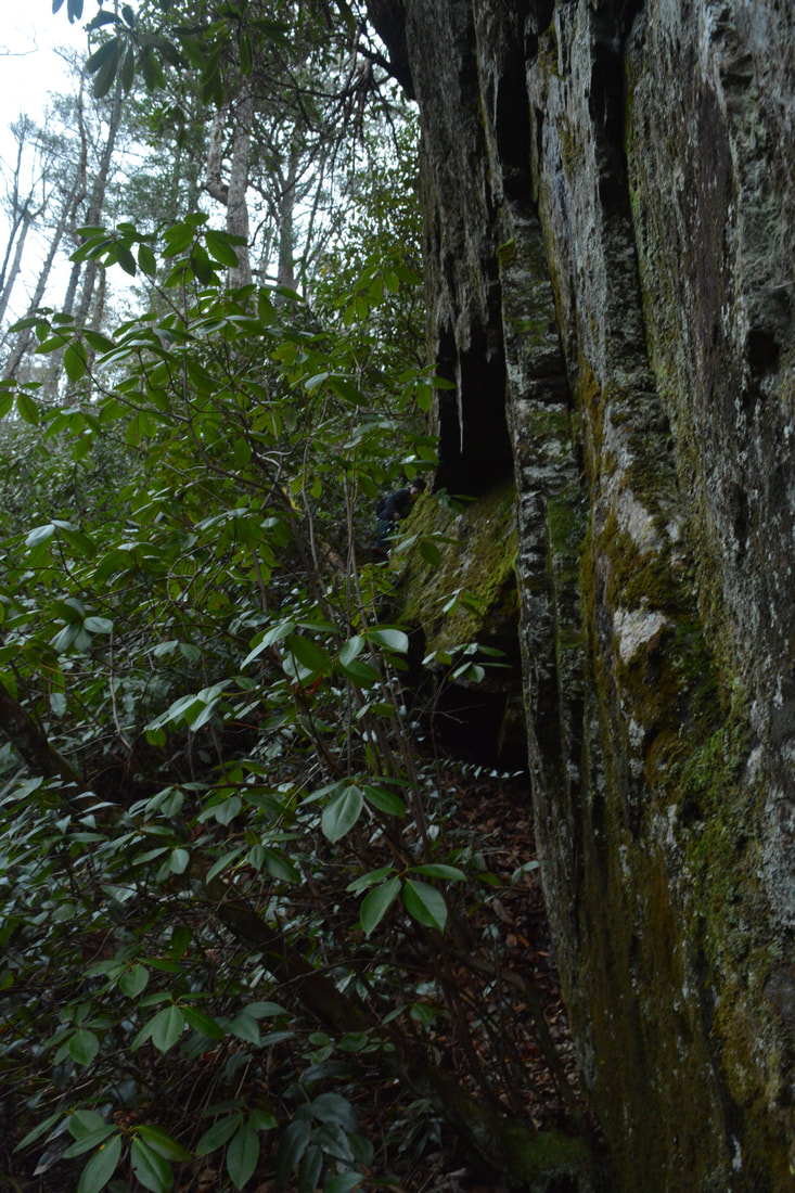
Assuming that you went off-trail at the correct location, the first part should be relatively easy. The slope quickly turns steep and rhododendron-choked, but it should be possible to pick out a route of least resistance. It's a good idea to follow the sound of the waterfall far below. About 250 feet from the trail, the terrain gets insanely steep. Bear right here and be sure to exercise caution. At the end of the near-vertical pitch is a 10-foot rock bluff. Although it looks imposing, the bluff can be scaled without a rope. A tree to the left makes for a good handhold, and there's a small foothold as well. Just make sure to drop down at the right spot, because the cliff is considerably higher on either side. At the base of the cliff, turn left and follow the base. The "base" is extremely steep too. Reach the end of the cliff in 150 feet. Stay right here and continue dropping down a very steep, semi-open slope. The culmination of the descent is a rocky gully. Once you're at the falls at 6.4 miles, what you'll find is a very limited dry viewing zone on a sloping rock on the same side of the creek. You'll need to wade across in order to get to the optimal vantage point for photos. The coordinates for Fowler Creek Falls are N35° 00.234' W83° 06.360'. The waterfall is powerful and scenic. Fowler Creek squeezes through a crack and makes a near-vertical spreading slide of 40 feet. The beauty rating for Fowler Creek Falls is above the average for most sliding waterfalls due to the falls' gorgeous shape. Cliffs are on both sides of the falls. After passing through a turbulent pool, Fowler Creek drops over a sizable cascade and disappears from sight. I think that Fowler Creek Falls could especially be beautiful during June when the rhododendron all around the falls is blooming, although the bushwhack could become even more formidable during the warmer months. Retrace your steps from Fowler Creek Falls back to Ellicott Rock and along the Chattooga River Trail all the way to the Foothills Trail Connector junction. Instead of continuing to the Spoonauger Falls Trailhead, however, bear left onto the single-track blue-blazed connector trail. The connector is a bit more difficult due to a moderate 350-foot ascent, but in my opinion, it's the best way to return to the campground parking. After curving into the small watershed of the Spoonauger Falls branch, the trail crosses it at 10.8 miles. This is the other water crossing on the hike that has a slight chance to be wet. Although the creek is small, there aren't any stepping stones for an easy crossing. I was able to utilize a well-placed group of branches to cross, but there's no telling when a small flood washes them away. At the climb's high point at 11.1 miles, the Foothills Trail Connector ties into the Foothills Trail itself. To the left, the Foothills Trail crosses Medlin Mountain and reaches Sloan Bridge at Highway 107 in over 7 miles. This hike continues straight on the Foothills Trail toward Burrells Ford. The final descent starts here. At 11.4 miles, the trail squeezes through a rock crack and rock hops one last stream. Finally, at 11.7 miles, the trail crosses Burrells Ford Road and reaches the end of the loop. Turn right and follow the 100-foot access trail, shortly concluding the hike at the Burrells Ford Campground parking area. Mileage
0.0 - Burrells Ford Campground Foothills Trailhead
0.75 - King Creek Falls 1.25 - Burrells Ford Campground 1.4 - Burrells Ford 1.9 - Burrells Ford Road 2.3 - Spoonauger Falls 3.75 - East Fork Chattooga River 4.4 - Bad Creek 5.6 - Ellicott Rock 5.7 - End Chattooga River Trail; Begin Bad Creek Trail 6.3 - Begin Fowler Creek Falls Bushwhack 6.4 - Fowler Creek Falls 10.0 - Foothills Trail Connector Junction 11.1 - Foothills Trail Junction 11.7 - Burrells Ford Campground Trailhead Variations
Hike just the King Creek Falls/Spoonauger Falls Loop - 4.4 Miles
Skip the Fowler Creek Falls add-on along the Bad Creek Trail - 10.3 Miles Bonus Stops
Consider stopping by the Stumphouse Tunnel Recreation Area to see the tunnel and Isaqueena Falls. Another possible stop is Yellow Branch Falls. Both are off Highway 28 north of Walhalla near Mountain Rest.
Pictures & Videos
1 Comment
2/18/2018 01:16:19 pm
Hello Mark, Leave a Reply. |
About MeMark Oleg Ozboyd Dear readers: I have invested a tremendous amount of time and effort in this website and the Georgia Waterfalls Database the past five years. All of the work that has gone in keeping these websites updated with my latest trip reports has almost been like a full-time job. This has not allowed me to pick up a paid job to save up money for college, and therefore, I I've had to take out loans. If you find the information on this website interesting, helpful, or time-saving, you can say "thanks" and help me out by clicking the button above and making a contribution. I will be very grateful for any amount of support you give, as all of it will apply toward my college tuition. Thank you!

Coming in 2022-2023?
Other Hiking WebsitesMiles HikedYear 1: 540.0 Miles
Year 2: 552.3 Miles Year 3: 518.4 Miles Year 4: 482.4 Miles Year 5: 259.9 Miles Archives
March 2021
Categories
All
|
||


 RSS Feed