
If you're looking for the perfect combination of beauty and ease of access to a waterfall in North Carolina, Elk River Falls has to be at the top of your list. A well-used relaxing trail leads along the banks of the mighty Elk River to the base of Elk River Falls, a tight sheer 50-foot drop into a huge plunge pool that is known for its swimming opportunities. Most folks who hike to Elk River Falls don't know that another excellent waterfall can be reached fairly easily from the same trailhead. 100-foot Jones Falls is on a small tributary of the Elk River and during the wetter months is a sight no less impressive than Elk River Falls. A signed spur trail from the Appalachian Trail facilitates access to this gorgeous spot. Hikers will be able to see both waterfalls with a hike of fewer than four miles. This hike occurred on Wednesday, July 5th, 2017. My plan was to hike out and back to Elk River Falls and then to follow a forest road and unofficial connector path to the Appalachian Trail, which I would use to reach Jones Falls. I would return the same way. This hike was the first of ten hikes that I did during a seven-day trip to the mountains of northwest North Carolina.
Summary
R/T Length of Trail: 3.5 Miles
Duration of Hike: 2:40 Type of Hike: Out and Back (Y-Configuration) Difficulty Rating: 4 out of 10 Total Elevation Gain: 900 Feet Pros: Remote setting at Jones Falls despite relative ease of access Cons: Trash around Elk River Falls; a couple of brief rough spots on the connector trail to the AT and Jones Falls Points of Interest: Elk River Falls - 9 stars; Jones Falls - 8 stars Trail Blaze Colors: Elk River Falls Trail (Big Falls Trail) - None; Elk River to Appalachian Trail Connector - None; Appalachian Trail - White; Jones Falls Spur Trail - Blue Best Seasons to Hike: Winter Fees: None Beginning Point: End of Elk River Road Directions from Elk Park, NC: From the intersection of Old Mill Road with US 19E just north of Elk Park, follow Old Mill Road East for 0.3 miles and then turn left onto Elk River Road at the Elk River Falls sign. Continue on Elk River Road for 4.1 miles to the dead end. The large turnaround at the end serves as the parking area - do not block the gate. Be sure to get here early in summer as the parking area fills up fast! The last part of Elk River Road is unpaved but in excellent shape. Map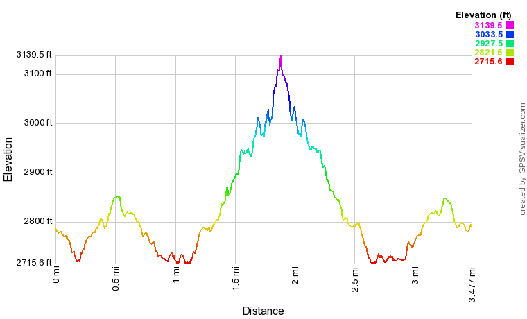
Click here to download a track of this hike.
Details
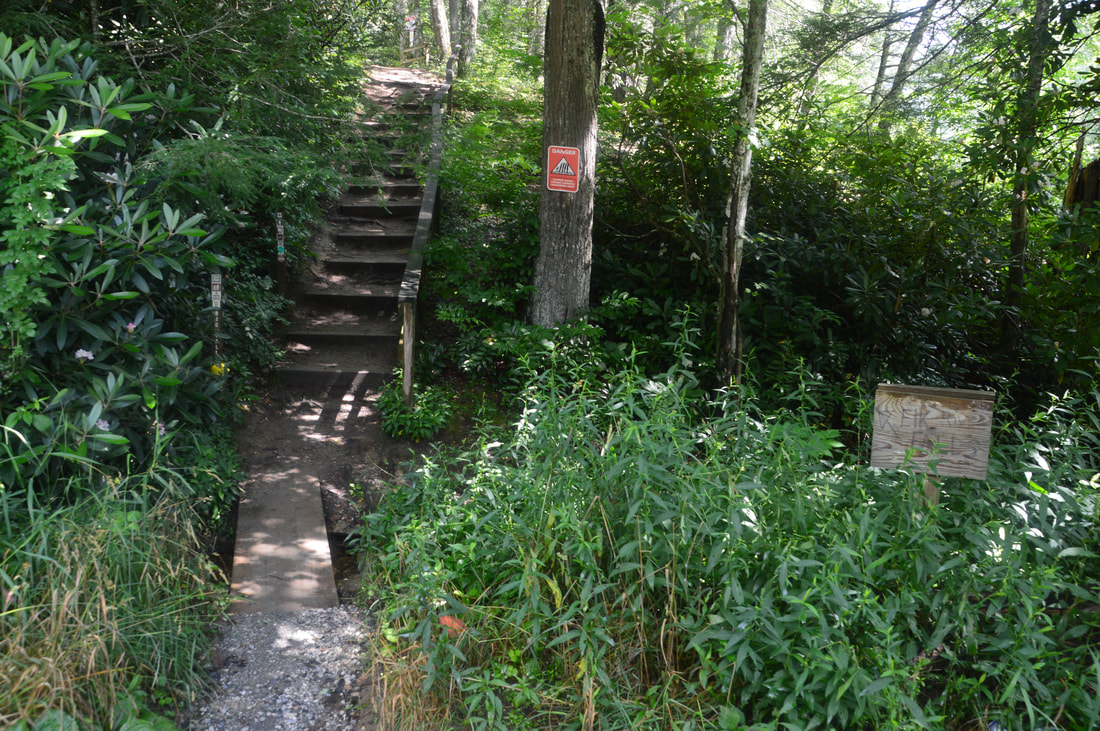
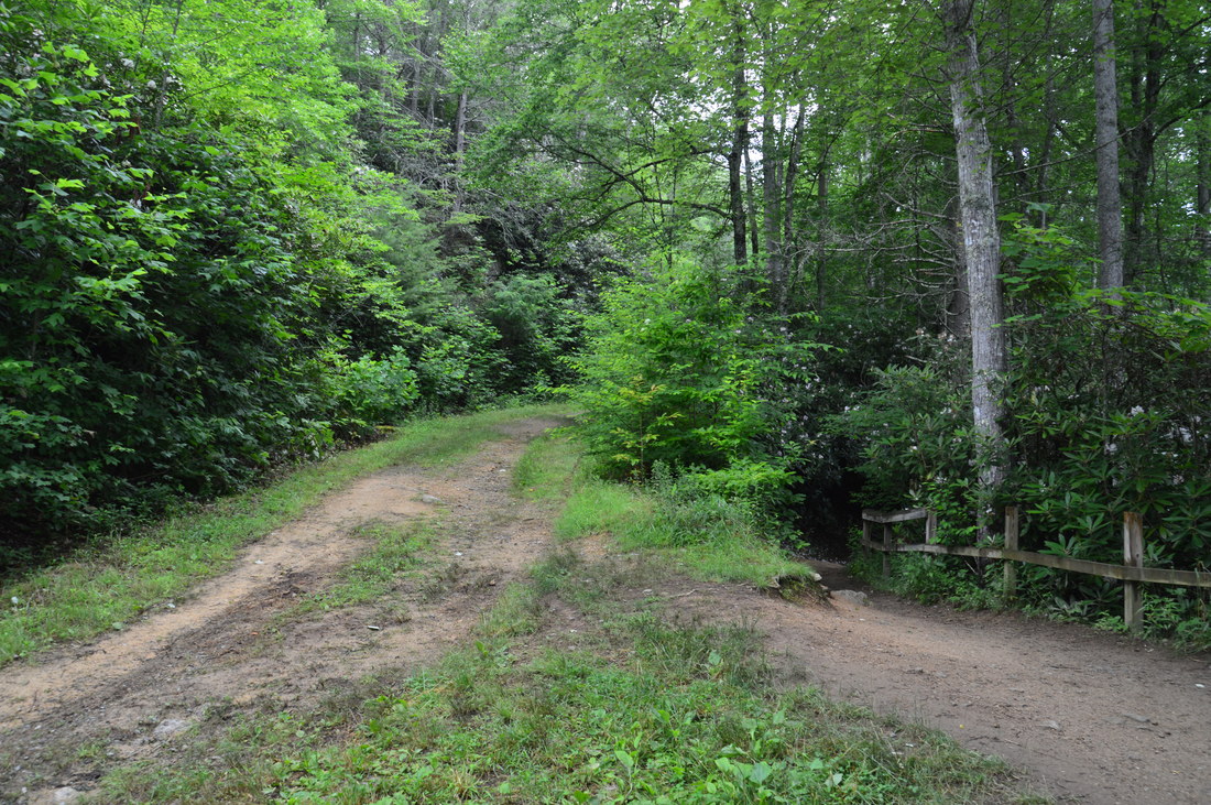
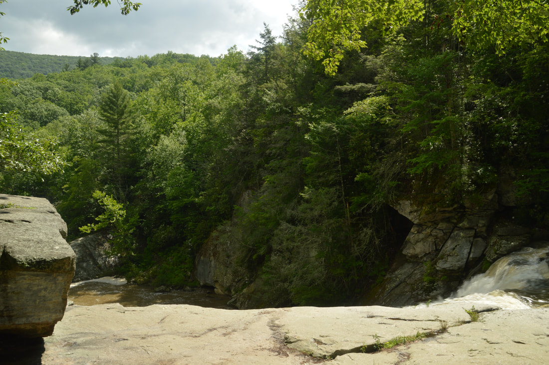
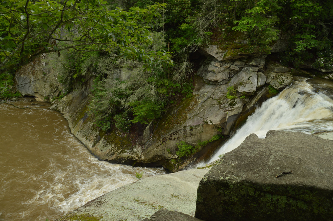
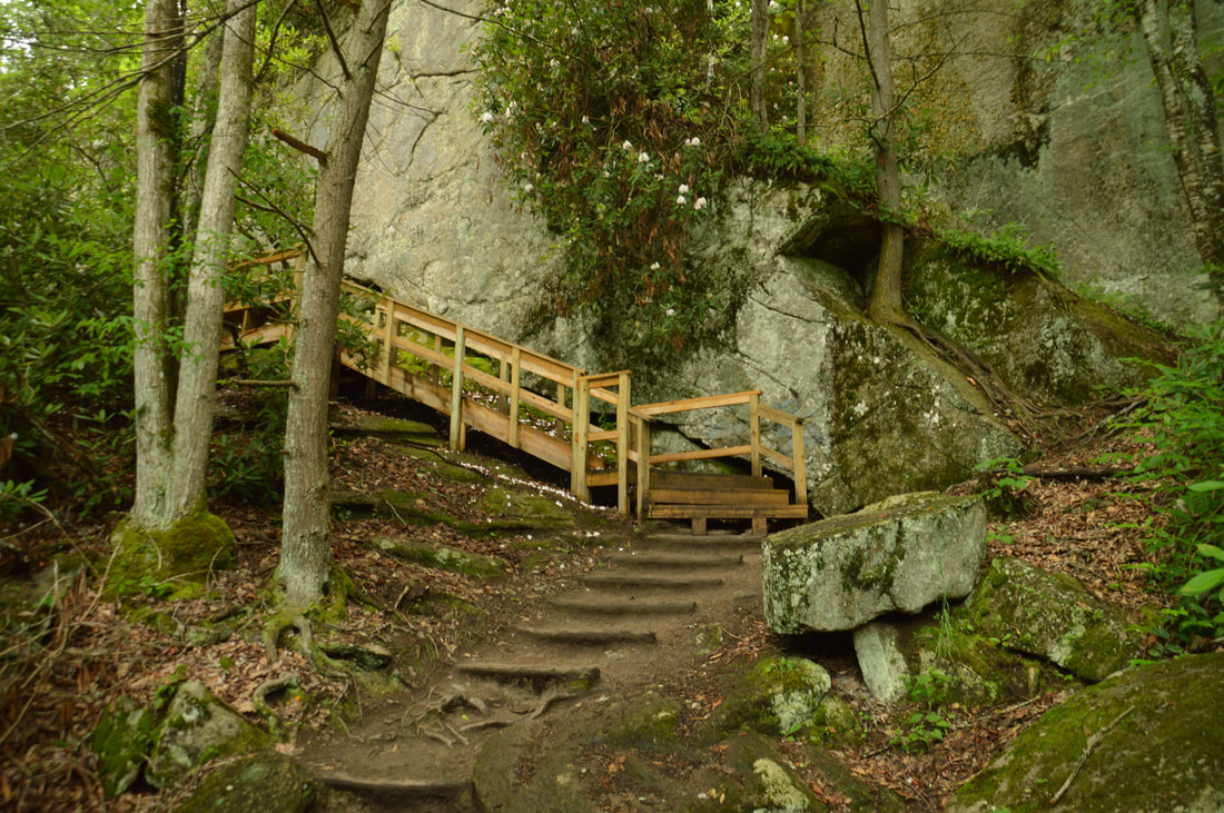
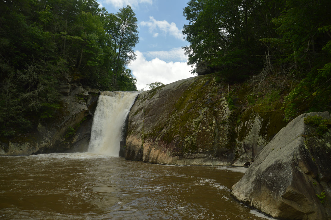
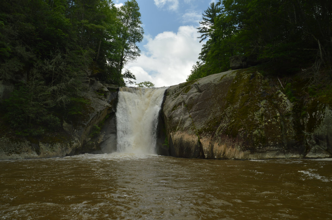
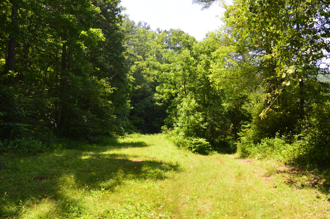
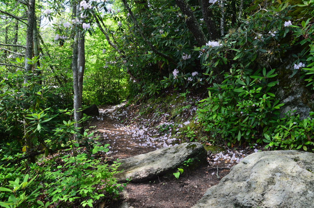
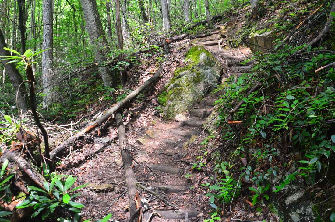
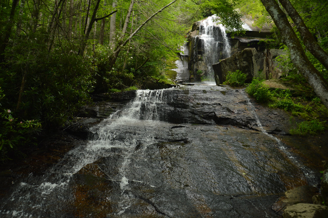
The hike to Elk River Falls begins at the signed trailhead at the end of Elk River Road. Oddly, the official sign for the trail calls it the 'Big Falls Trail'. I've read that Big Falls is another name for Elk River Falls, but Elk River Falls definitely is the name I see used most. Head up the wooden steps and in 150 feet reach the forest road that began at the parking behind the gate. For now, stay right on the trail to Elk River Falls, but on the way back, you will take the forest road to Jones Falls. The Elk River Falls Trail comes alongside the broad and placid Elk River and reaches the top of Elk River Falls at 0.15 miles. The view down the falls from the rock slab at the top is impressive, but make sure to stay away from the edge. The trail bears left and descends down a wooden staircase to the plunge pool, reaching an open rock slab at the pool and near the base of Elk River Falls at 0.2 miles.
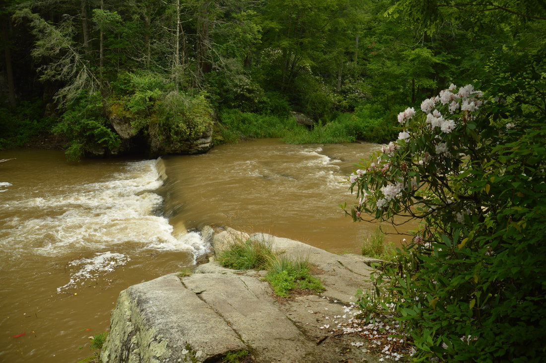
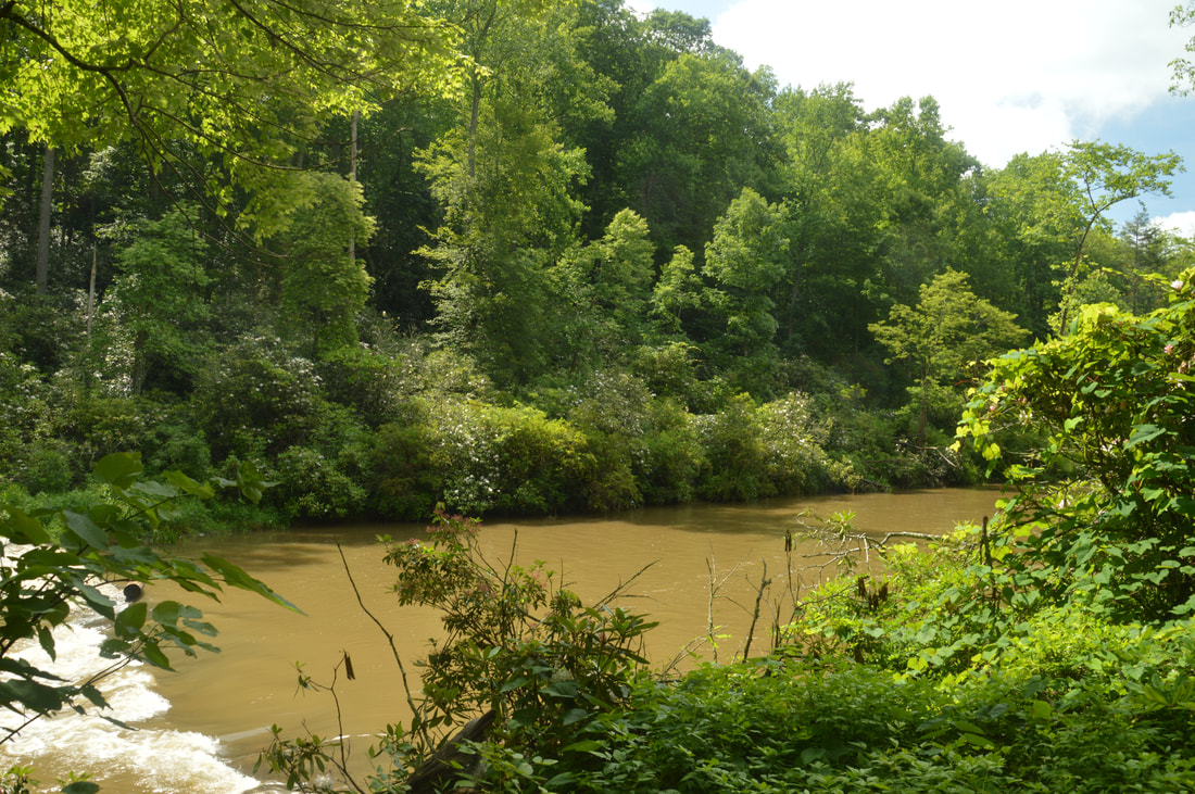
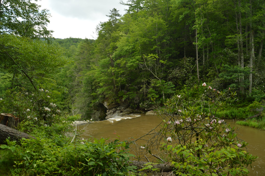
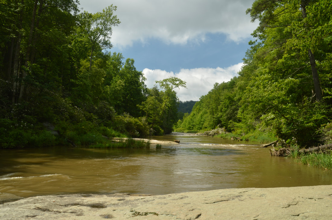
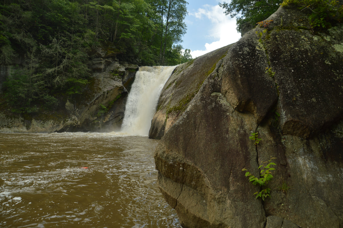
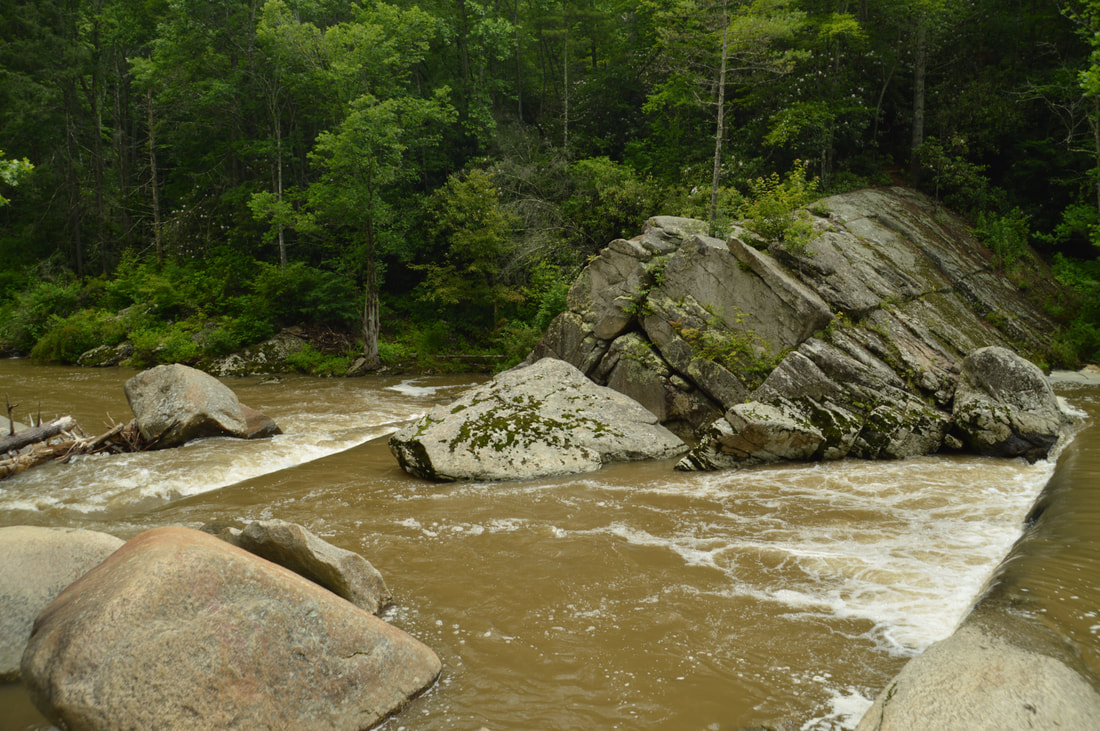
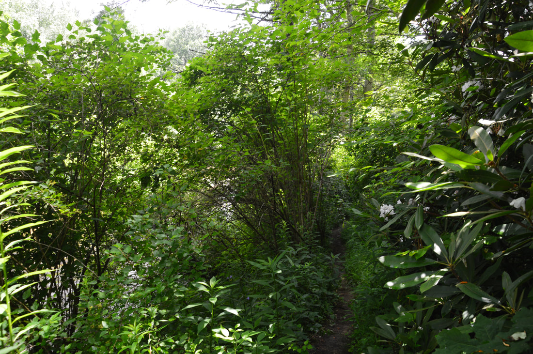
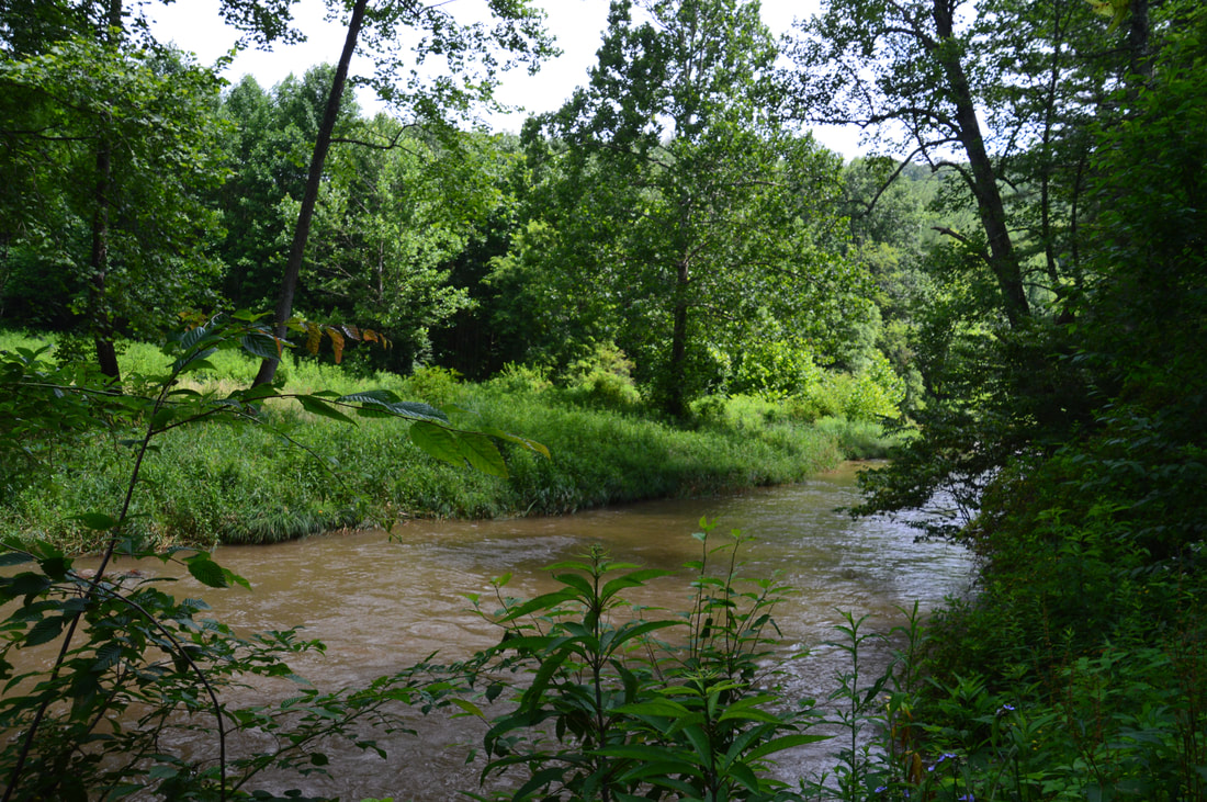
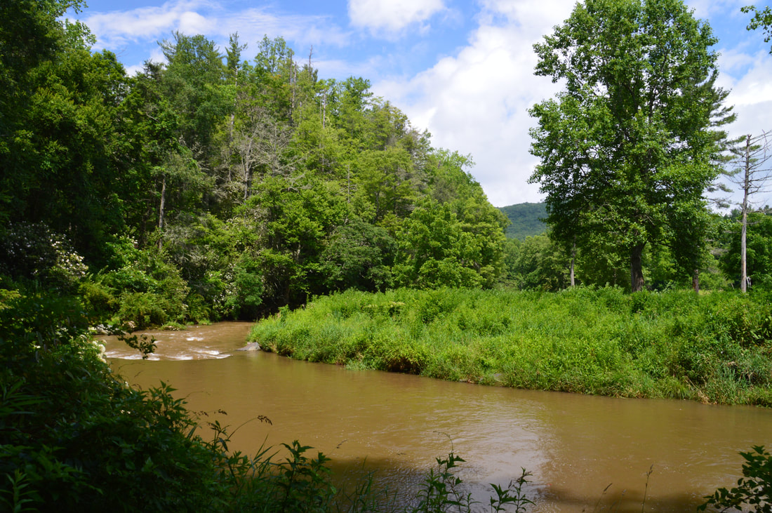
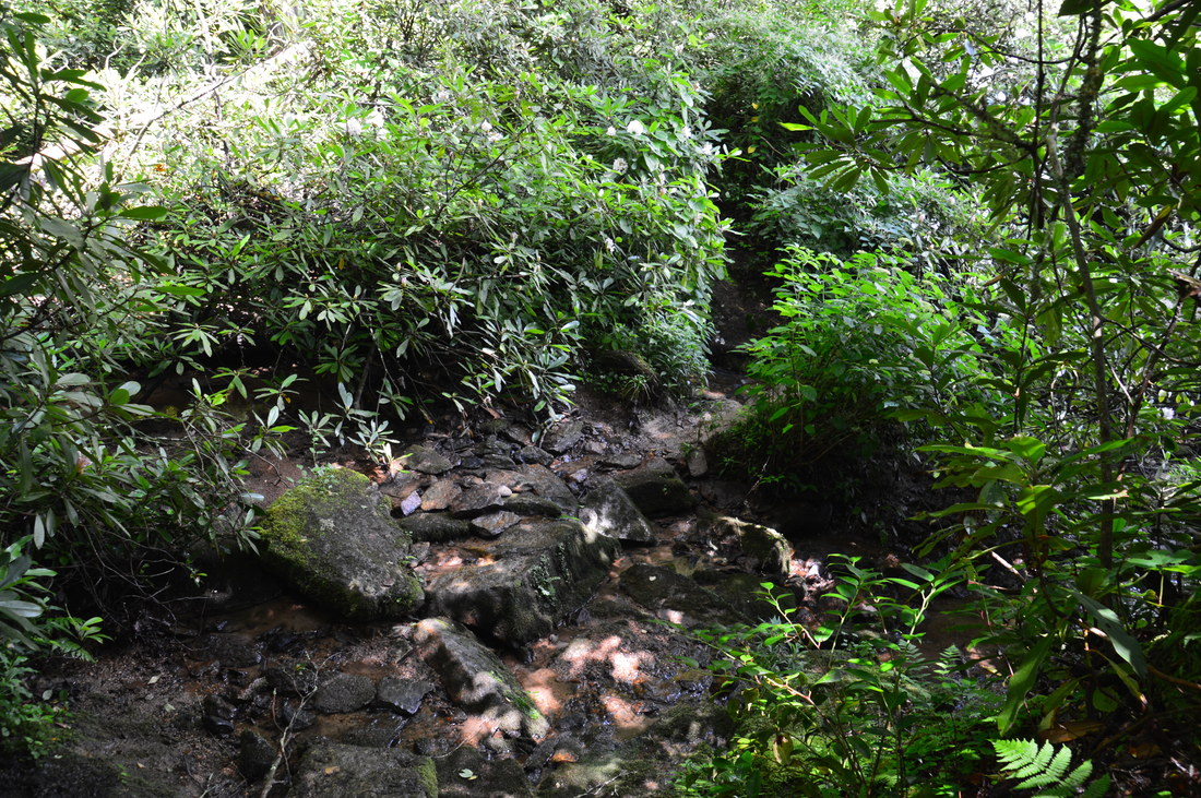
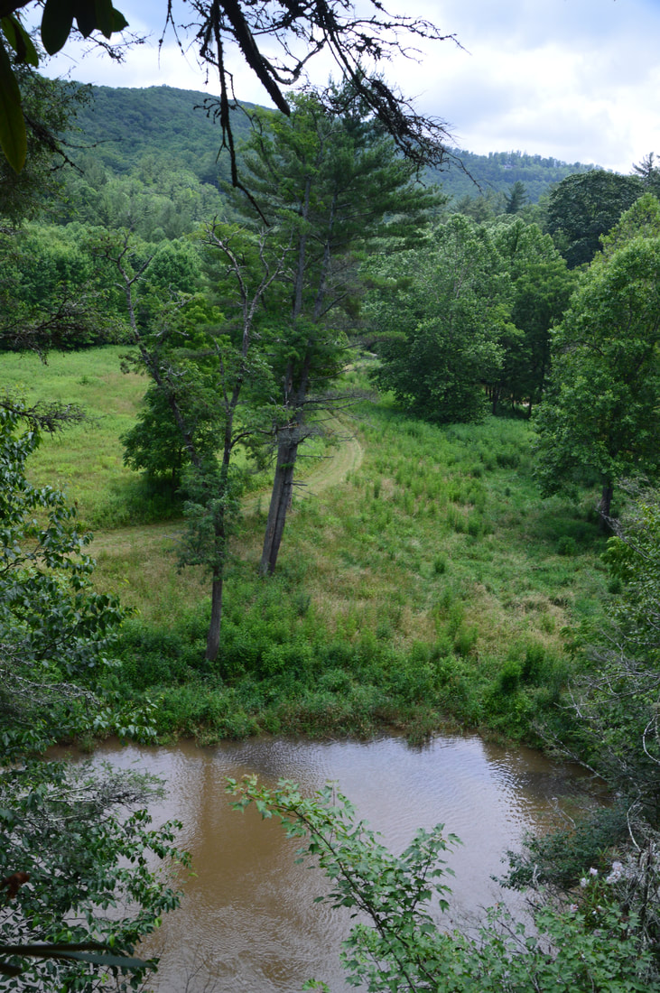
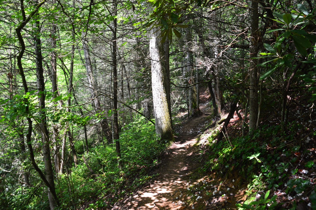
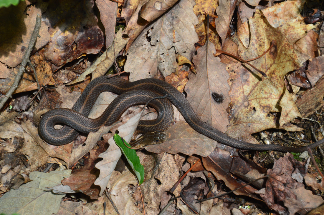
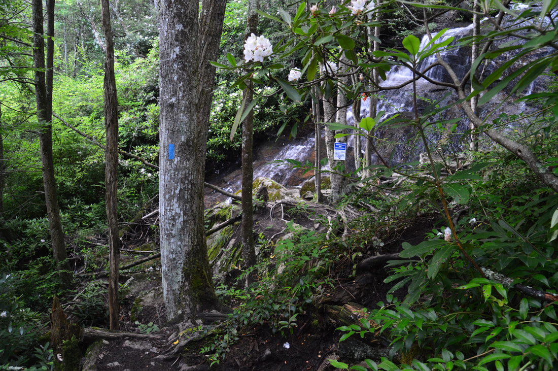
About 50 feet high, Elk River Falls is very powerful because the mighty Elk River is constricted into one narrow channel down the vertical cliff at the far end of the plunge pool. Because Elk River Falls is out in the open so much, sunny day photos here often work out better than cloudy day photos. The best time of year to see the falls is winter when all the swimmers are absent, although it might not be too bad other times of the year as well if you can get there early in the morning. From Elk River Falls, return to the forest road junction and turn acutely right onto the forest road. The road heads northward, crisscrossing a powerline cut well above the Elk River. The forest road eventually descends to the level of the Elk River. At 0.95 miles, the forest road bears right and fords the Elk River. You have to stay on the same side of the river, bearing left into a field with a narrow path. Passing a campsite and quickly entering the woods, this path is the connector to the Appalachian Trail. For the next 0.15 miles, the path closely follows the Elk River, and while it is mostly easy, there are a couple of slippery spots on the steep bank. As you hike along the river, there are views of open fields on the opposite side. At 1.1 miles, the trail reaches a campsite and then bears right to cross Jones Branch. This small stream can normally be rock-hopped. After this, the trail climbs steeply for about 250 feet to a junction with the Appalachian Trail at 1.15 miles. While the Appalachian Trail continues straight into the White Rocks Mountain area - providing access to a small 10-waterfall called Splash Dam Falls on the Elk River along the way - you have to turn sharply left onto the white-blazed trail to access Jones Falls. After the narrow connector trail, the AT will feel like a freeway! The AT crosses the Tennessee state line and enters Cherokee National Forest about 400 feet after the junction. In fact, Jones Falls is actually a quarter-mile into Tennessee, which is why it isn't well-known to North Carolina waterfallers. After an initial easy period of ascent, the AT ascends up a neat wooden staircase and makes a switchback at 1.45 miles. The trail then curves away from Jones Branch and circles around and over a small ridge, where I saw three garter snakes gathered closely together. The easy to moderate ascent continues to a signed junction with the side trail to Jones Falls at 1.8 miles. As the Appalachian Trail bears right toward US 19E, you have to stay left on the blue-blazed spur trail, which crosses a seep and ends at the base of Jones Falls at 1.9 miles. 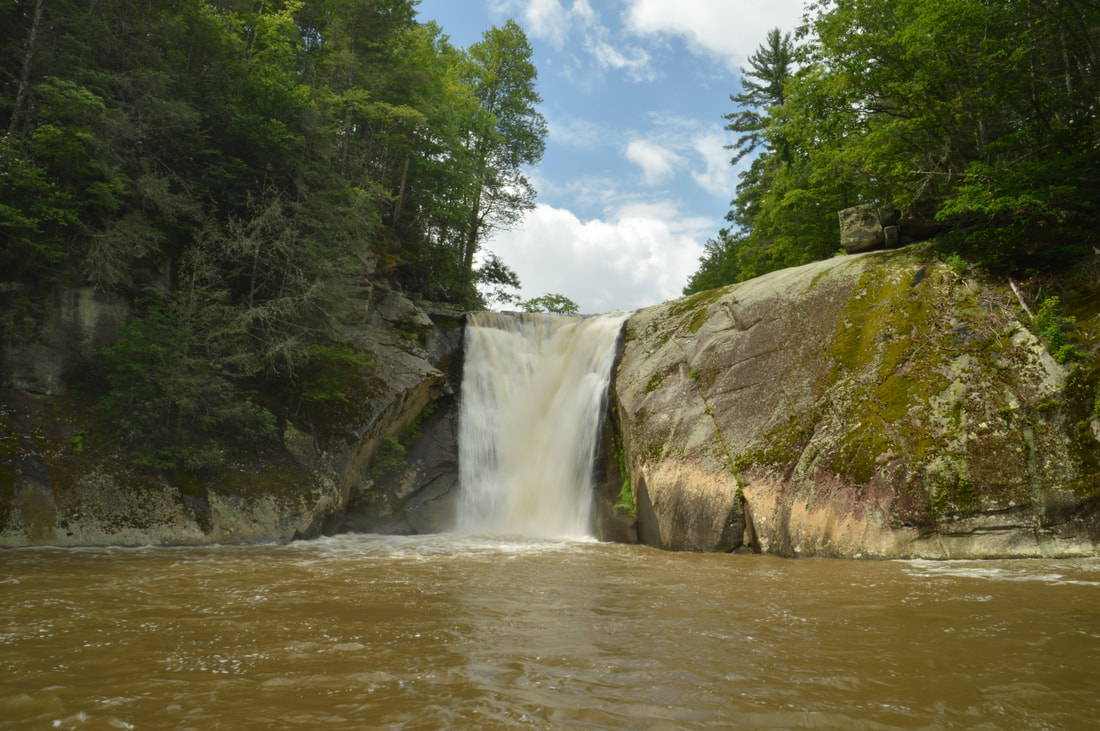
Elk River Falls is a spectacular 50-foot waterfall dropping into a huge plunge pool.
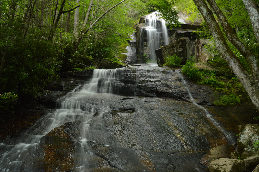
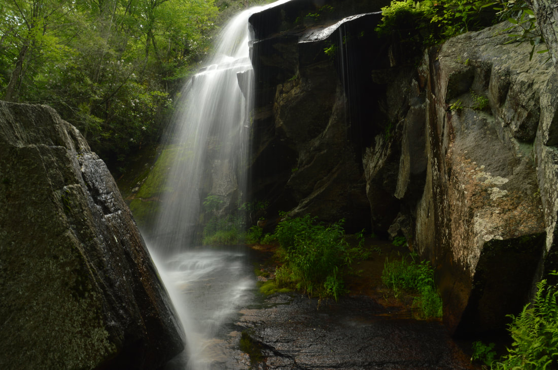
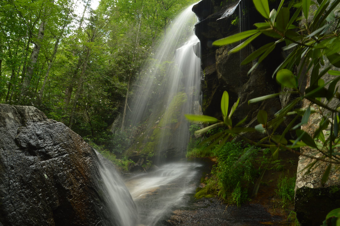
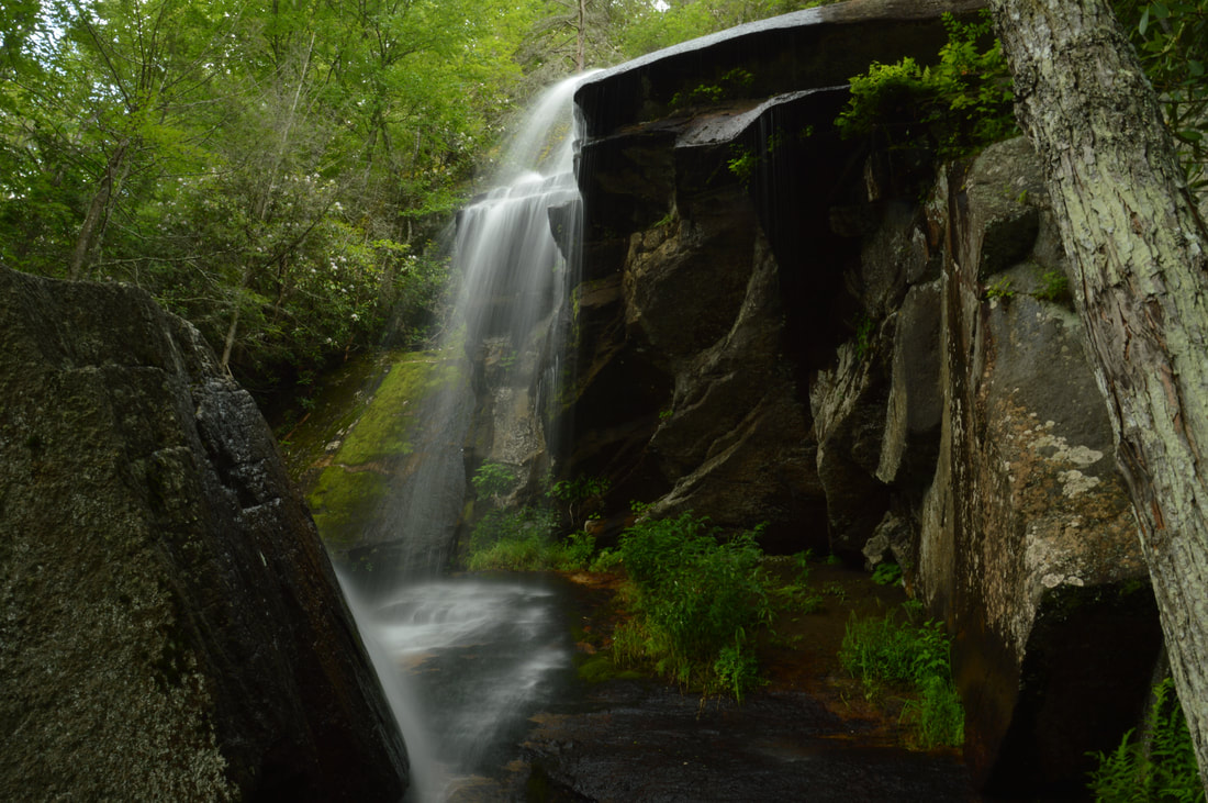
Jones Falls is a very tall and stunning waterfall. The full waterfall is at least 100 feet high with two distinct parts. The lower part of the waterfall is a long broad slide, while the upper part is a spectacular free-fall among jagged cliffs that resemble the cliffs of Cochrans Falls in Georgia. The main drawback of Jones Falls is that it's in a very small watershed, so the full beauty of the waterfall will be revealed during winter and other wet periods. Fortunately, my visit here was during one such wet period, as evidenced by the muddy state of the Elk River. For your visit to Jones Falls, I highly recommend taking the well-defined scramble trail to the base of the upper free-fall drop. The scramble path is on the right-hand side of the creek and ends at the upper drop in about 100 feet. As the water drops at the upper part of Jones Falls, part of it hits a large boulder that briefly sends the water backward! During high water, this is a very picturesque scene.
From Jones Falls, simply return along the same way back to the Elk River Falls trailhead. For the final little stretch of the hike, you can simply follow the forest road all the way to the parking area. You will return to your car and conclude the hike at 3.5 miles. Mileage
0.0 - Elk River Falls Trailhead
0.2 - Elk River Falls 0.95 - Begin Connector Path in Field 1.15 - Appalachian Trail 1.9 - Jones Falls 3.5 - Elk River Falls Trailhead Variations
Hike out and back to Elk River Falls - 0.4 Miles
Add on Splash Dam Falls to the full hike - 5.3 Miles Bonus Stops
Consider hiking to Twisting Falls on the same day as doing this hike. Twisting Falls (the main drop of which is sometimes referred to as Compression Falls) is located several miles downstream on the Elk River, although reaching the trailhead for it from Elk Park involves a fairly long drive on back roads.
PicturesVideos
3 Comments
Robert, Z Jaremsek
3/8/2021 09:13:10 pm
Thanks for the detailed description of the hike to Jones falls. Could a person ride a mountain bike from Elk River Falls all of the way to Jones Falls on the service road?
Sheila
1/14/2022 05:59:03 pm
No there is a gate at beginings g that stays closed at all times Leave a Reply. |
About MeMark Oleg Ozboyd Dear readers: I have invested a tremendous amount of time and effort in this website and the Georgia Waterfalls Database the past five years. All of the work that has gone in keeping these websites updated with my latest trip reports has almost been like a full-time job. This has not allowed me to pick up a paid job to save up money for college, and therefore, I I've had to take out loans. If you find the information on this website interesting, helpful, or time-saving, you can say "thanks" and help me out by clicking the button above and making a contribution. I will be very grateful for any amount of support you give, as all of it will apply toward my college tuition. Thank you!

Coming in 2022-2023?
Other Hiking WebsitesMiles HikedYear 1: 540.0 Miles
Year 2: 552.3 Miles Year 3: 518.4 Miles Year 4: 482.4 Miles Year 5: 259.9 Miles Archives
March 2021
Categories
All
|


 RSS Feed