HIKING THE APPALACHIANS AND BEYOND
  • Home
  • Trail Reports
    • Best Hikes
    • Hikes with Scenic Views
    • Hikes with Water Features
    • Alabama
    • Georgia
    • Florida
    • North Carolina
    • South Carolina
    • Tennessee
    • Vermont
    • Virginia
  • Map
  • Hike List
  • Testimonials
  • Resources
  • Contact Us
  • Southeast Nature Society
    • Our Team
  • Georgia Waterfalls Database

Blue Ridge Parkway: English Falls, Spruce Pine, North Carolina

8/11/2017

3 Comments

 
Picture
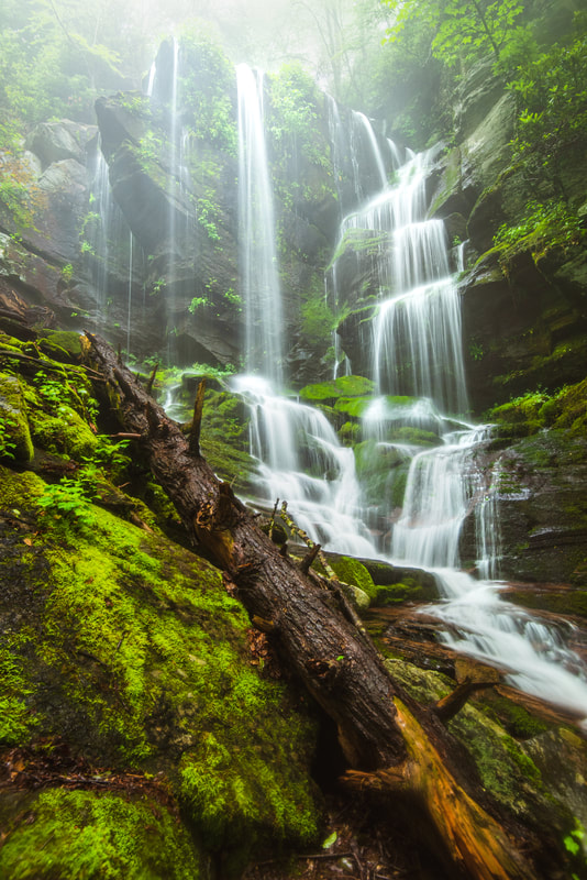
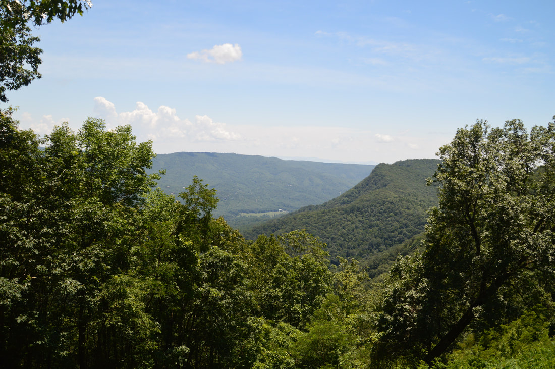
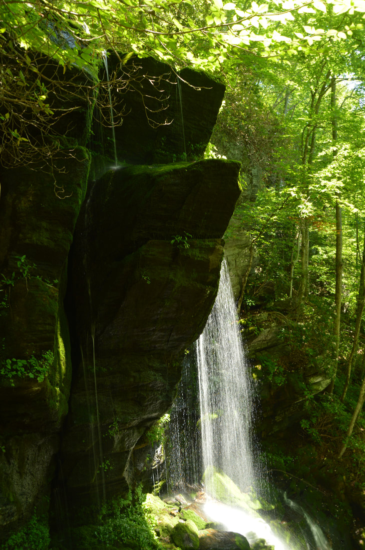
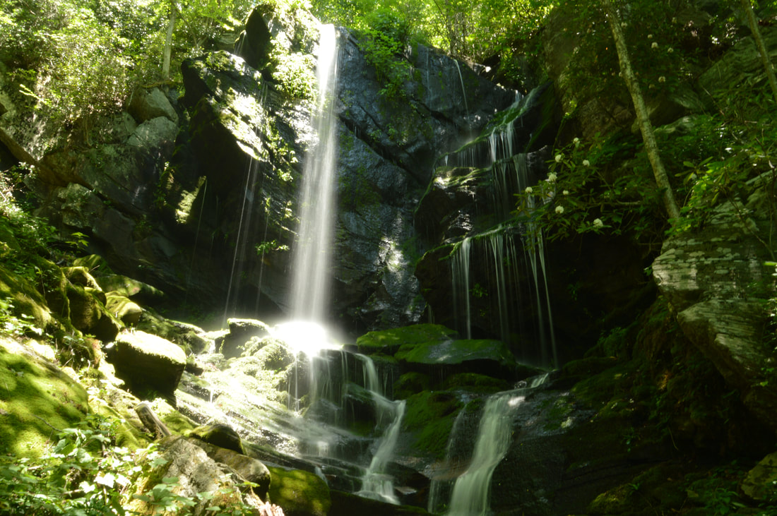
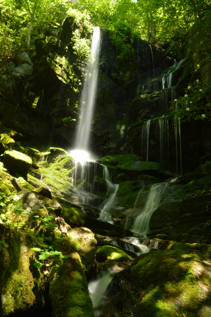
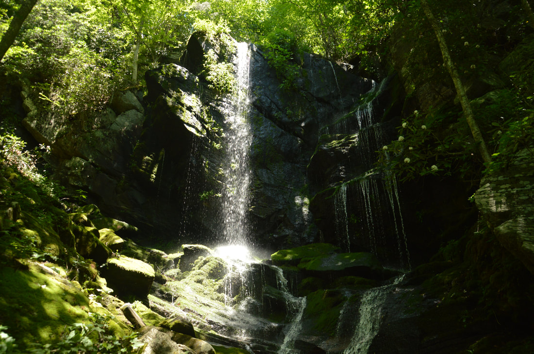
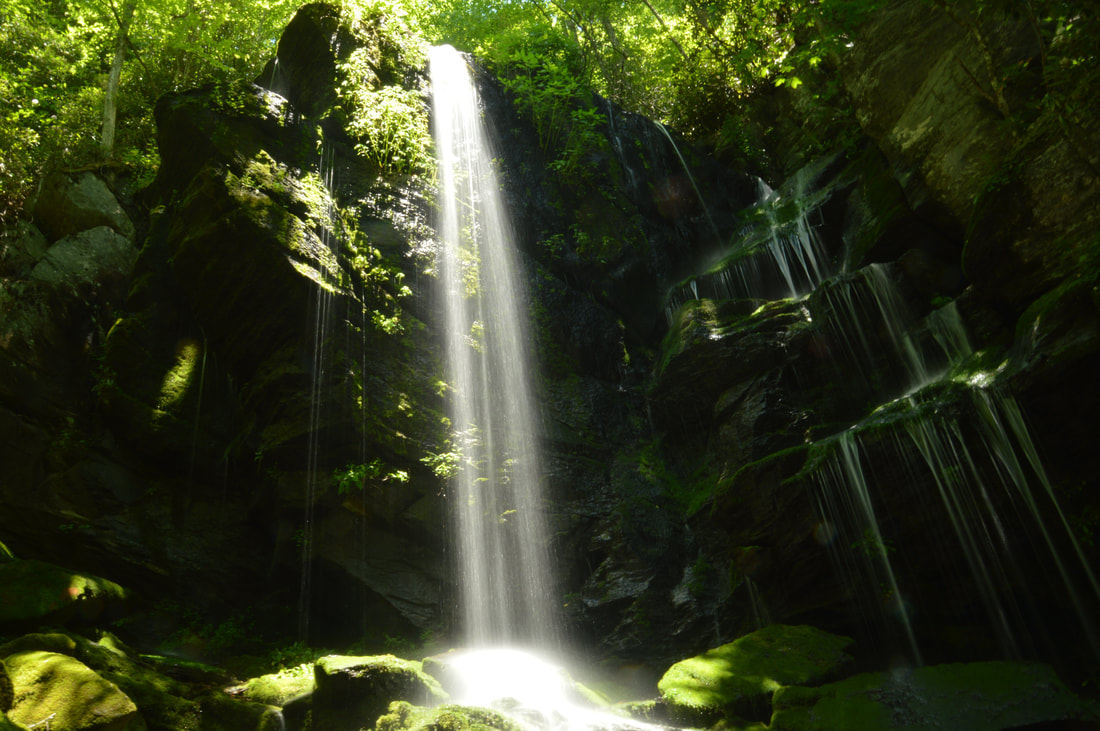
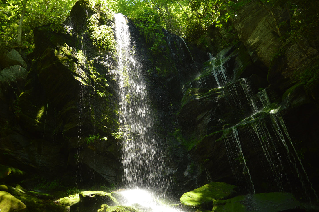
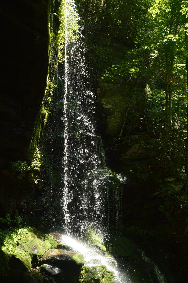
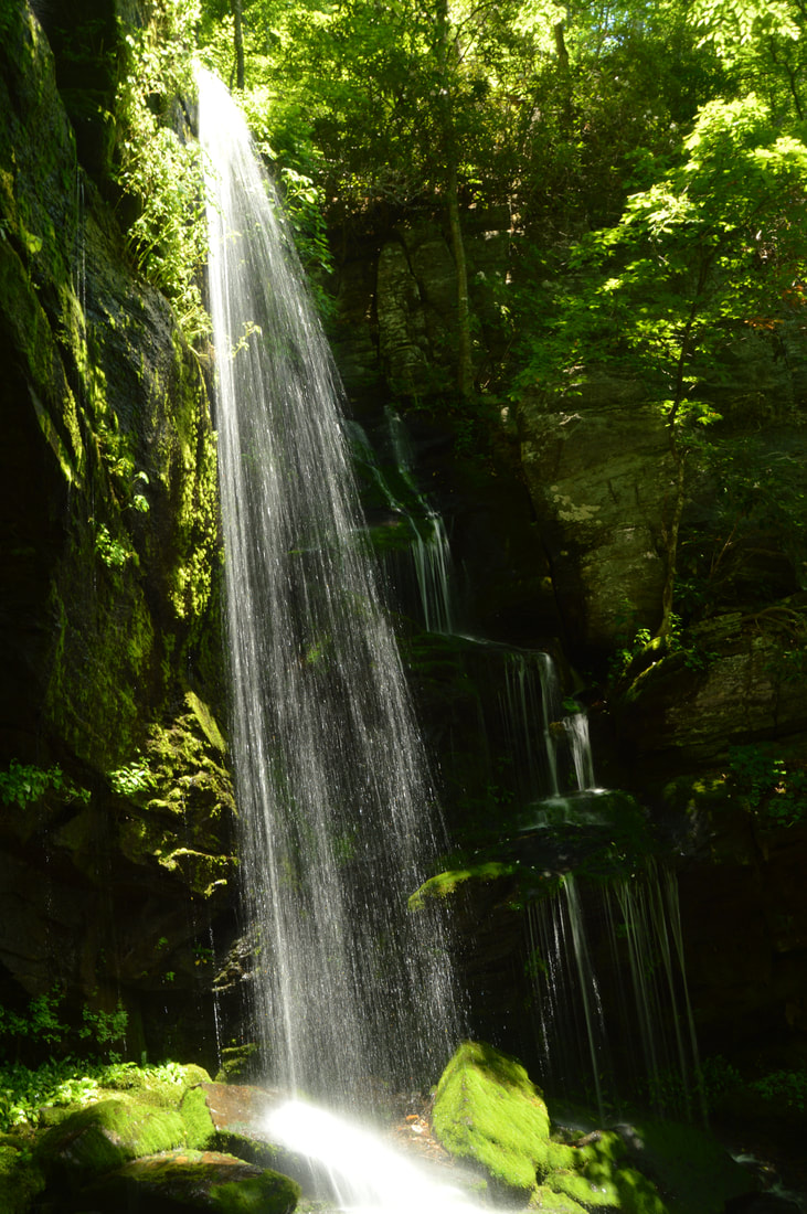
A 50-foot waterfall that spouts water from all sides of a jagged sheer cliff, accessible by a steep and tricky yet short path from the Blue Ridge Parkway: that's the matching description for English Falls. Located in Northwest North Carolina not far from the quaint town of Spruce Pine, English Falls possesses charm of a level that few other of the state's waterfalls seem to reach. The setting of the waterfall is magical, due to the lush greenery that peppers the cliffs and boulders at and around the falls. A small drawback of English Falls is that it is on a small unnamed stream, so the flow can be low during parts of the year. Nevertheless, visiting English Falls at the right time will yield one of the most unusual and photogenic waterfalls that you'll ever see. This hike occurred on Tuesday, July 11th, 2017, and a revisit occurred on Wednesday, June 17th, 2020. My plan was to hike out and back to English Falls via the access path from the Blue Ridge Parkway. ​In 2017, this hike was the tenth and final of ten hikes that I did during a seven-day trip to the mountains of northwest North Carolina. ​

Update 6/23/20: I have finally revisited English Falls almost three years later. The trail has changed in several ways. English Falls has seen an explosion in visitation over the last few years so the trail is now very trampled down and eroded. As a result, the hike has actually become more difficult. The slope is very slick with few footholds or handholds. Agility and experience with ropes are a must to complete this scramble safely. The trip report has been revised with the most recent directions plus information about Upper English Falls. ​

Summary

R/T Length of Trail: 0.4 Miles
Duration of Hike: 2:00 (includes lengthy break at the falls) 
Type of Hike: Out and Back 
Difficulty Rating: 9 out of 10
Total Elevation Gain: 304 feet 
Pros: Spectacular waterfall 
Cons: Very steep, difficult, dangerous scramble straight down the mountain 
Points of Interest: English Falls - 9 stars 
Trail Blaze Colors: None, not an official trail 
Best Seasons to Hike: Spring 
Fees: None 
Beginning Point: Grassy Pullout near Milepost 322 on Blue Ridge Parkway 
Directions from Spruce Pine, NC: From the intersection of Altapass Highway and US Highway 19E in Spruce Pine, follow Altapass Highway South for 4.6 miles to a T-intersection with the Blue Ridge Parkway. Then, turn left on the Blue Ridge Parkway and follow it for 5.4 miles to a grassy clearing with a great view on the right. Milepost 322 is on the left side of the road at the end of the clearing. Here, the Blue Ridge Parkway curves left. About 0.1 mile after the clearing and milepost, there is a small grassy pullout on the right. This is the parking area - make sure to park your car fully off the road. There is space for two to maybe three cars here. If the pullout is full, by any chance, there is another small pullout on the right just before the clearing. 

Map

Picture
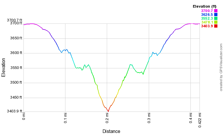
Click the link below to download a .GPX file with a track of this hike. 
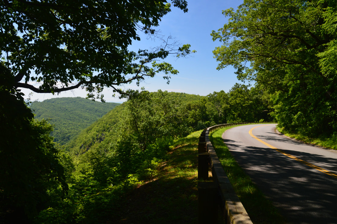
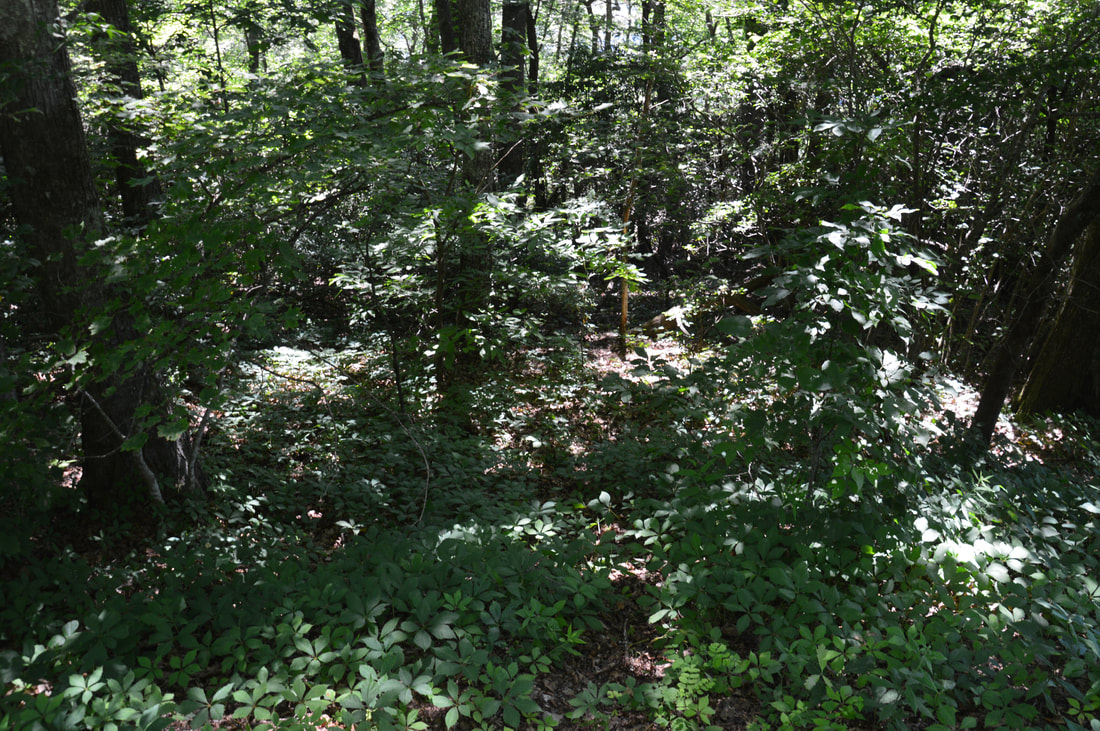
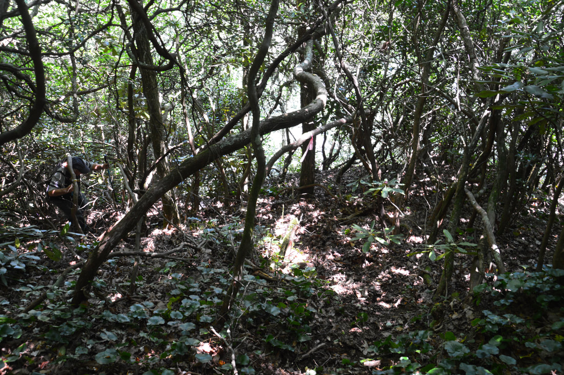
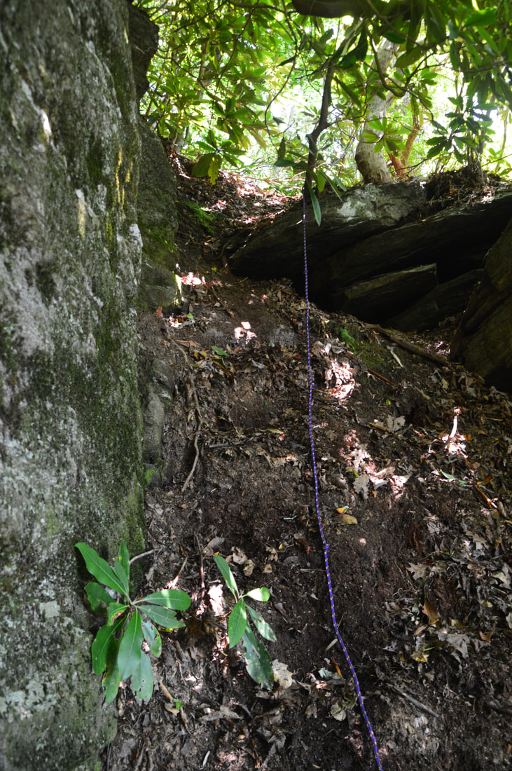
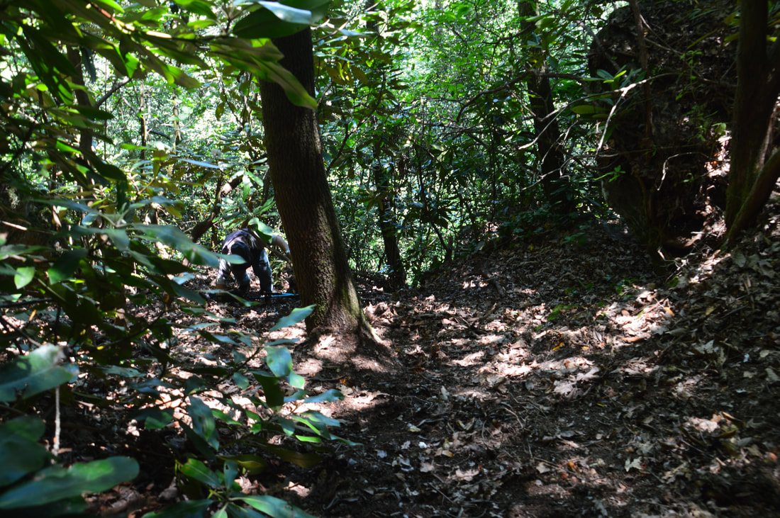
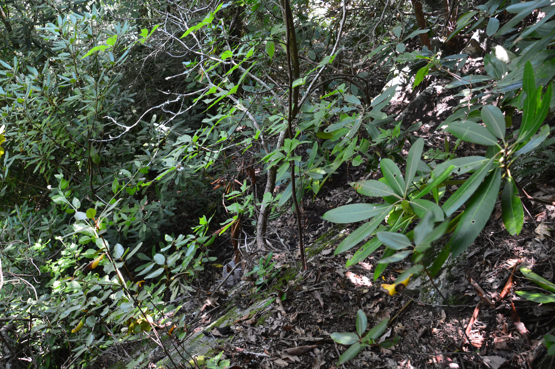
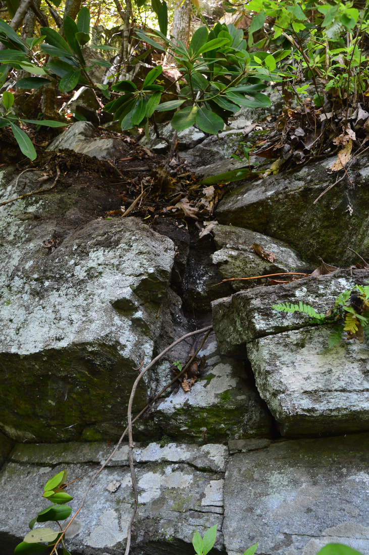
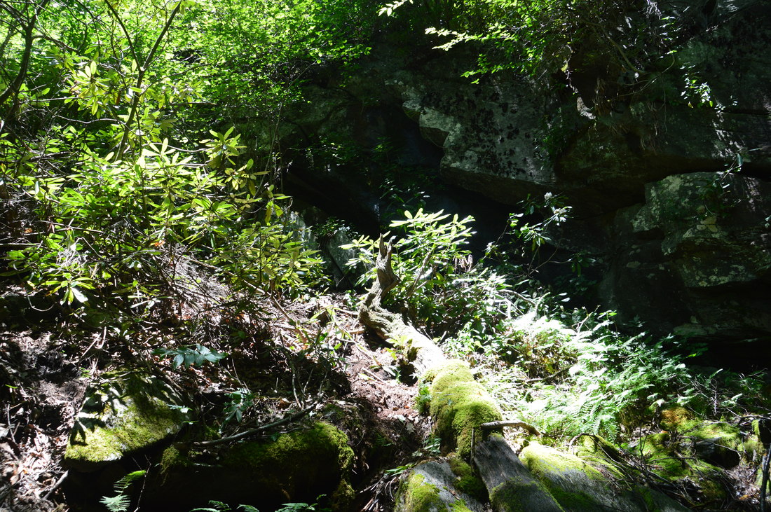
blue_ridge_parkway__english_falls.gpx
File Size: 33 kb
File Type: gpx
Download File

Details

English Falls is one of my favorite additions in Kevin Adams' new Third Edition of North Carolina Waterfalls. It is amazing that such a beautiful waterfall so close to the Blue Ridge Parkway has been off the radar for such a long time, with only a few select people being aware of its existence until recently. Today, two routes are used to access English Falls. On both of my visits, I have used the better-known route on the west side of English Falls (the River Right side). This is the route most people use. It is certainly doable for those who are experienced in rock scrambling, but it has become increasingly more difficult with erosion from high visitation. The other route is on the east side of English Falls (the River Left side). It is longer and used to be a bushwhack, but there is now a path here too. The scrambling is generally milder and easier on this route but I haven't field-checked precisely how it leads to the base. 

To hike to English Falls the way I did, you first have to walk along the Blue Ridge Parkway for a little bit southward from the grassy pullout area (assuming you parked in the pullout north of the clearing and view). Thus, follow the same side of the parkway as you parked slowly downhill to Milepost 322, which is on the other side of the road about 300 feet from the starting point. There is a guardrail along the road here. Right around the milepost (a few feet past it), a well-defined trail begins below the guardrail and drops steeply into the woods. In about 250 feet, the trail reaches the top of a cliff line that marks the rim of the North Fork Catawba River gorge. Bear left on the obvious path along the bluff line and continue about 350 feet to a split right before the unnamed creek that English Falls is on. If you wish to access the base of English Falls using the main route I used, turn right. The path straight ahead crosses the creek and is the alternative route to the base of English Falls, so you may follow it if you wish - I just don't have intel on its precise route.

​So to follow my route, turn right, go about 50 feet, and then turn right again, arriving at a precipice. This is where the path begins its extremely steep pitch to the base of English Falls. There are three distinct tricky sections. On my visit, there were ropes in place left by other hikers. However, there are a couple caveats. These ropes are illegally placed and could be removed by the National Park Service at any time, as these ropes are treated as maintenance of an unofficial trail, and they expose the NPS to liability. I am aware that ropes have already been removed from this path several times, only to be replaced again by unaware hikers. On top of this, I would personally never trust ropes that were left behind by other hikers - who knows how long they have been in place and what their condition is? I strongly encourage you to bring your own ropes instead of expecting ropes to already be in place for you. And be sure that you pack out your own ropes.
Picture
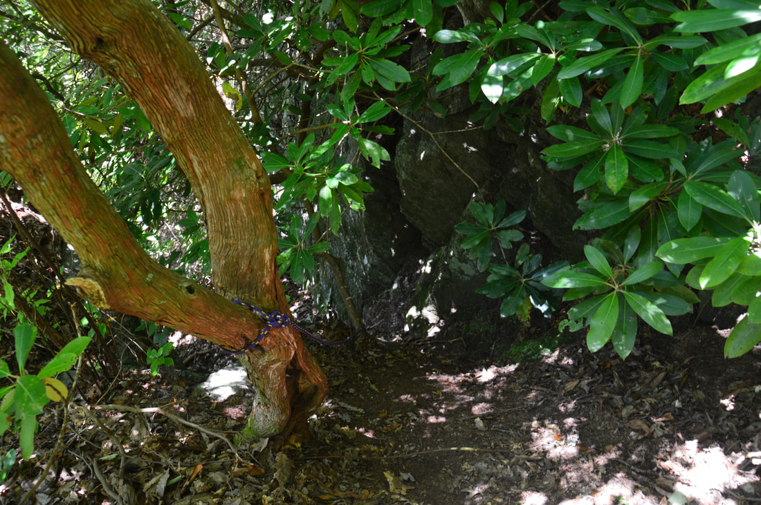
The steep scramble to English Falls begins with this tricky rope-aided drop.
As mentioned above, I'm describing the crux of the descent to English Falls as three 'precarious' sections. The initial steep dirt pitch drops through a cleft in the cliff line. A few feet past the end of this steep pitch, the path turns left away from the upper cliff and begins the second steep pitch. The second section is the longest and most dangerous in my opinion, as it's a near-vertical slope that consists of nothing but dirt and mud. Although there are a few trees you can hold on to, a rope is nearly a necessity here. About halfway down the second steep pitch, you will pass a secondary bluff line on the left. This is the access for Upper English Falls. You'll arrive directly at the base of Upper English Falls after following the bluff for less than a minute. Upper English Falls is only about 15 feet high, but it's a very scenic multi-faceted drop leading into a small pool. Be very careful around this spot as just behind you is the top of 50-foot English Falls. There are a couple more small cascading drops above Upper English Falls. You can explore them by climbing through a small cave on the far side of Upper English Falls. 

Back on the main route - once you're past the second steep pitch, the path turns right for a few feet, hugging the base of another cliff, and then turns left, hopping down a 10-foot ledge. This is the final tricky spot. Getting down the ledge isn't a major issue and is just a large hop for those who are sure-footed with good knees.  Getting back up may be more problematic though so evaluate the scene wisely. If you look closely, there are several small incisions in the ledge with just enough space to place your hands and feet on, but you have to be sure of your capabilities to use both your hands and feet for the scramble before attempting this. Again, if you've brought a rope, it will ease this part immensely. In the photo gallery below you will find my photos from 2017 that highlight the trail and the most difficult sections. Once you're at the base of this final ledge, turn left, approaching English Falls up ahead. The main path soon turns right and continues a slick and muddy (but less dangerous) scramble to the base of English Falls. The fainter path straight ahead descends closer to the falls but also leads to the base. The total hiking distance from the Parkway to English Falls is about 0.2 mile. 
Picture
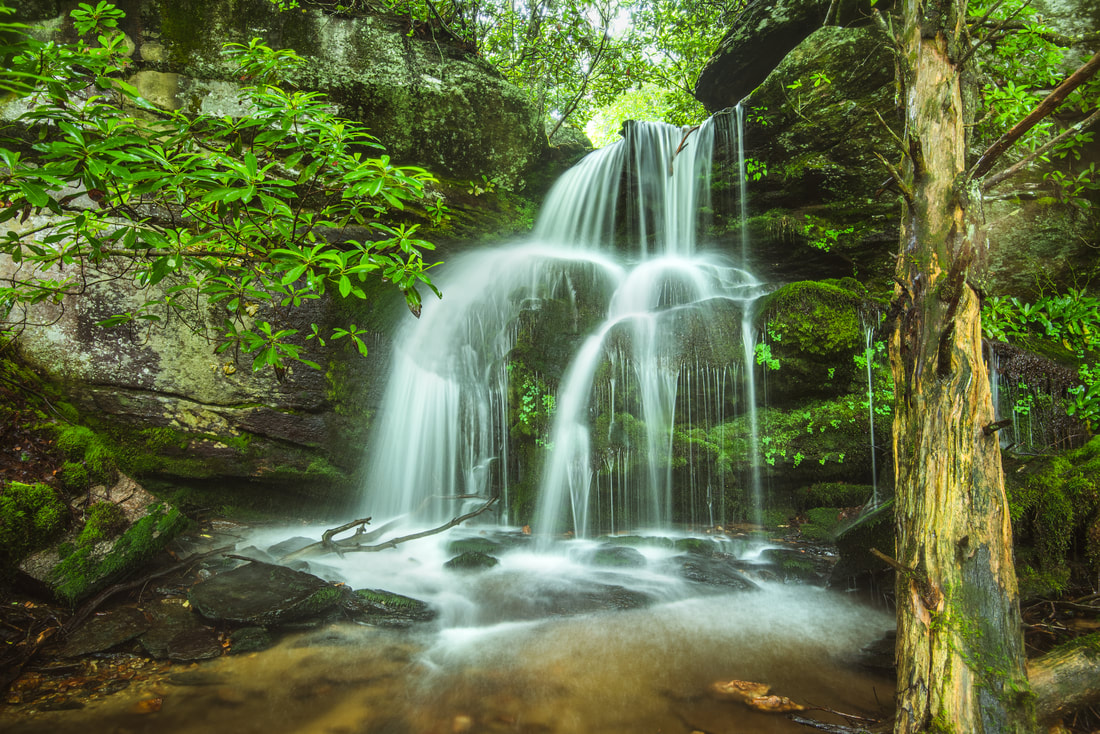
Scenic Upper English Falls is a miniature counterpart of this hike's main prize.

The environment around English Falls is very sensitive. English Falls was one of the greenest waterfalls I'd ever seen when I first visited in 2017, like a scene straight out of a tropical rainforest. Due to the exponential increase in visitation, many of the endangered spray-community plants and lush colonies of moss growing on the rocks and slopes around the falls have been trampled to death. When you hike to English Falls, whatever you do, please stick to the established path and areas that have already been trampled to dirt. It is fine to step on the bare rocks in the creek, but please do not step on anything with vegetation growing on it. Is that photo opportunity really worth it? The sensitive ecosystems around English Falls have already suffered so much impact - let's save what's left. With that said, English Falls is a very beautiful waterfall - especially when the flow is good. The falls' cliff is magnificent, and the creek spouts water from all sides of the cliff. The main drop is a free-fall in the middle, but an equally impressive cascading drop run comes in from the right, and during high flow, there is another free-fall on the left side. All of this converging falling water creates a unique scene with three separate waterfalls. English Falls is located on an unnamed tributary of the North Fork Catawba River. There have been a few references to the creek as 'English Creek', but this is incorrect - the creek is not named on topographic maps. The falls is named after the English family, who lives downstream from the falls. Even though there is private property some distance downstream, English Falls is on land that is completely open to public access - land that is at the boundary of Blue Ridge Parkway territory and US Forest Service territory. 

From the base of English Falls, simply retrace your steps back to the parking area. Remember that you can also cross the creek and scramble up the opposite side of the falls (if you're uncomfortable with climbing back up the ledge and steep, muddy slope), but you're on your own there. You will return to your car at 0.4 miles, concluding the hike. Despite its short distance, I would allow between one and one and a half hours for this hike, plus the necessary amount of time to just relax at the falls and contemplate the gorgeous scene. ​
Thanks Brett Haas for sharing the following video of the route to English Falls!
The video shows the primary scramble path route to the base of English Falls.
This video was taken in 2017 so the trail looks very different now, but it will still give you a nice general idea. 
Use the full screen button on the bottom right of the video to view it in full size.

Pictures from 2017

Videos

3 Comments
Jennifer Johnson
3/27/2018 09:59:39 am

I wonder if you have Gaia GPS of English Falls. I like your suggestion how to get there. I just want to follow your tracking suggestions. I noticed many hikers walked in loop trail. I am not interested to walk in loop trail. Just one way trail (out and back).

Reply
R S
4/11/2021 06:33:37 pm

I'd like to add a mention of a little more specifics of where to start. As I followed your instructions, and there are many grassy pull off spot along the BRPW. I don't want people to make the same blunder as I did tromping through the woods and potentially getting lost. The trail starts on the north side of the guard rail. If the guard rail is on your right as you are driving. The trail starts just after the railing ends.

Reply
Matthew
9/14/2022 07:01:43 pm

Hiked the trail today. Ropes are not currently present. As a spry 20 year old, I was able to complete the trail without the aid of ropes. Areas have been dug out on the muddy slopes that give you decent footholds and handholds. I would still recommend ropes, though. The area is still fairly lush but the trails are heavily worn and quite slick. Overall a difficult short hike with a beautiful waterfall to view.

Reply


Leave a Reply.

    About Me

    Mark Oleg Ozboyd
    I'm an avid outdoor explorer and a hobbyist landscape photographer. I'm 21 years old and have been hiking since 2011. Originally based out of Atlanta, Georgia, I started out by occasionally hiking short trails throughout well-known Georgia State Parks. During 2012 and 2013, I began to expand my trips into adjacent states, as well as into the wilder National Forest areas rather than just State Parks. Throughout the years that followed, as I slowly ran out of popular hiking trails in my area, I began to search for and hike in more seldom-visited areas. Today, you can find me out in the woods every weekend, whether it's on an official trail or bushwhacking through cross-country terrain without any paths. I now attend Washington & Lee University and am exploring Virginia and West Virginia. My other hobbies include chess, science, old music, and meteorology. I have 3 years of amateur weather forecasting experience, having studied a lot of meteorology basics over the years. I am also a student at European School of Music where I learned that music and nature have a lot in common. Listening to good music inspires me to capture nature's beauty on the camera in different aspects that also make me recall many beautiful music pieces that I've heard.​


    Dear readers: I have invested a tremendous amount of time and effort in this website and the Georgia Waterfalls Database the past five years. All of the work that has gone in keeping these websites updated with my latest trip reports has almost been like a full-time job. This has not allowed me to pick up a paid job to save up money for college, and therefore, I I've had to take out loans. If you find the information on this website interesting, helpful, or time-saving, you can say "thanks" and help me out by clicking the button above and making a contribution. I will be very grateful for any amount of support you give, as all of it will apply toward my college tuition. Thank you! 

    Enter your email address to subscribe for trail reports:

    Delivered by FeedBurner


    Picture
    Coming in 2022-2023?

    Other Hiking Websites

    DWHike's Adventures
    Florida's Natural Wonders
    Florida Trailblazer
    Meanderthals
    Mountain Images
    by Bernie Boyer

    North Carolina Waterfalls with
    ​Kevin Adams
    Take-a-Hike!
    Tennessee Landforms
    Waterfall Page
    Waterfall Adventurer
    Zach's Mild Adventures

    Miles Hiked

    Year 1: 540.0 Miles
    Year 2: 552.3 Miles
    ​Year 3: 518.4 Miles
    Year 4: 482.4 Miles
    Year 5: 259.9 Miles

    Archives

    March 2021
    February 2021
    January 2021
    November 2019
    October 2019
    September 2019
    August 2019
    July 2019
    June 2019
    February 2019
    January 2019
    December 2018
    November 2018
    October 2018
    August 2018
    July 2018
    June 2018
    May 2018
    April 2018
    March 2018
    February 2018
    January 2018
    December 2017
    November 2017
    October 2017
    September 2017
    August 2017
    July 2017
    June 2017
    May 2017
    April 2017
    March 2017
    February 2017
    January 2017
    December 2016
    November 2016
    October 2016
    September 2016
    August 2016
    June 2016
    May 2016
    April 2016
    March 2016
    January 2016
    December 2015
    November 2015
    October 2015
    September 2015
    August 2015
    July 2015
    June 2015
    May 2015
    April 2015
    March 2015
    February 2015
    January 2015
    December 2014
    November 2014
    October 2014
    September 2014
    August 2014
    July 2014
    June 2014
    May 2014
    April 2014
    March 2014
    February 2014

    Categories

    All
    Adel
    Adirondack Park
    Alabama
    Alfred A. Ring Park
    Allegheny Trail
    Amicalola Falls State Park
    Anniston Area
    Apalachicola Bluffs And Ravines Preserve
    Apalachicola National Forest
    Apalachicola/Port St. Joe Area
    Apopka
    Appalachian Trail
    Appling
    Art Loeb Trail
    Aska Trail System
    Bakersville
    Balm-Boyette Scrub Preserve
    Balsam Lake Recreation Area
    Bankhead National Forest
    Bartow County Parks
    Bartram Trail
    Basinger
    Beersheba Springs
    Benton
    Benton Mackaye Trail
    Berry College Trail System
    Best Hike
    Big South Fork National Recreation Area
    Black Bear Wilderness
    Black Rock Mountain State Park
    Blairsville
    Blakely
    Blood Mountain Wilderness
    Blowing Rock
    Blue Ridge
    Blue Ridge Parkway
    Boone
    Bradenton
    Bradenton Beach
    Brasstown Bald
    Brasstown Wilderness
    Brevard
    Bryson City
    Buchanan
    Bucks Pocket State Park
    Bulow Creek State Park
    Bulow Plantation Ruins State Park
    Caesars Head State Park
    Caladesi Island State Park
    Calhoun
    Camel's Hump State Park
    Cashiers
    Caspersen Beach Park
    Catfish Creek State Park
    Caves
    CC Putnam State Forest
    Cedar Point Environmental Park
    Chatsworth
    Chattahoochee National Forest
    Chattanooga
    Chattanooga Valley
    Chattooga National Wild And Scenic River
    Cheaha Wilderness
    Cherohala Skyway
    Cherokee
    Cherokee National Forest
    Chiefland Area
    Chillhowee Recreation Area
    Chipley
    Chunky Gal Trail
    Circle B Bar Reserve
    Citico Creek Wilderness
    Citrus Wildlife Management Area
    Clarkesville
    Clayton
    Cleevland
    Cleveland
    Cloudland Canyon State Park
    Cohutta Wilderness
    Collier-Seminole State Park
    Cordele
    Cornelia
    Covington
    Crestview Area
    Crew-land-and-water-trust
    Cullowhee
    Cumberland Trail
    Dahlonega
    Dalton
    Dawson Forest Wildlife Management Area
    Dawsonville
    Dayton
    De Soto National Memorial
    DeSoto State Park
    Dillard
    Double Springs
    Ducktown
    Duncan Ridge Trail
    Dunlap
    Eagle's Rest Park
    Eastpoint
    Econfina Creek Wildife Management Area
    Eglin Air Force Base
    Elizabethton
    Elkins
    Elk Knob Game Lands
    Elk Park
    Ellicott Rock Wilderness
    Ellijay
    Emerson Point Preserve
    Englewood Area
    Enota Retreat
    Erwin
    Falling Waters State Park
    Fayetteville
    Fires Creek Recreation Area
    Fire Tower
    Flint River
    Florence Area
    Florida
    Florida Caverns State Park
    Florida Trail
    Foothills Trail
    Fort Mountain State Park
    Fort Myers Area
    Fort Payne
    Fort Payne Area
    Fort Yargo State Park
    Franklin
    Franklin Delano Roosevelt State Park
    Franklin-Marion State Forest
    Frozen Head State Park
    Gainesville
    Gainesville Area
    Gatlinburg
    George Washington National Forest
    Georgia
    Georgia Veterans Memorial State Park
    Glasgow
    Gorges State Park
    Grandfather Mountain State Park
    Great Smoky Mountains National Park
    Greeneville
    Green River Game Lands
    Gruetli-Laager
    Grundy Forest State Natural Area
    GTM Reserve
    Guana River Wildlife Management Area
    Hayesville
    Helen
    Hiawassee
    High Falls State Park
    Highlands
    Highlands Scenic Highway
    Hillsborough River State Park
    Hinson Conservation & Recreation Area
    Historic Sites
    Honeymoon Island State Park
    Hot Springs
    Huntington
    Inverness Area
    Jackson
    Jasper
    Jefferson National Forest
    Joan M. Durante Park
    Jonathan Dickinson State Park
    Jones Gap State Park
    Joyce Kilmer Slickrock Wilderness
    Joyce Kilmer - Slickrock Wilderness
    Juniper Prairie Wilderness
    Kelly Park
    Keown Falls Recreation Area
    Kolomoki Mounds State Park
    LaFayette
    Lake City Area
    Lake George Wild Forest
    Lake June-in-Winter State Park
    Lakeland Area
    Lake Placid
    Lake Russell Wildlife Management Area
    Lake Wales Ridge State Forest
    Laurel Fork North Wilderness
    Leffis Key Preserve
    Leon Sinks Geological Area
    Lexington
    Lineville
    Linville
    Linville Gorge Wilderness
    Lithia Springs
    Little Frog Wilderness
    Little Manatee River State Park
    Little River Canyon National Preserve
    Longboat Key
    Long Trail
    Lookout Mountain
    Lookout Mountain Battlefield
    Lovingston
    Lula Lake Land Trust
    Lumpkin
    Maggie Valley
    Manatee Springs State Park
    Marianna Area
    Mark Trail Wilderness
    Marlinton
    Mccaysville
    McMinville
    Mentone
    Middlesex
    Mistletoe State Park
    Monongahela National Forest
    Montreat
    Mountain Bridge Wilderness Area
    Mountain City
    Mountains To Sea Trail
    Mountains-to-Sea Trail
    Mount Rogers National Recreation Area
    Myakka River State Park
    Myron B. Hodge City Park
    Nantahala National Forest
    Naples
    Naples Area
    Natural Bridge State Park
    Neal Preserve
    New Castle
    Newport
    New River Gorge National Park
    New York
    North Carolina
    Ocala Area
    Ocala National Forest
    Ocean-to-Lake Trail
    Oconee State Park
    Oconee Station Historic Site
    Okaloacoochee Slough State Forest
    Oldsmar
    Oneida
    Orlando Area
    Ormond Beach
    Oscar Scherer State Park
    Oxford
    Palatka
    Palmetto Trail
    Panama City Area
    Panthertown Valley
    Parrish
    Paynes Creek Historic State Park
    Peaks Of Otter Recreation Area
    Pigeon Crockford Mountain Wildlife Management Area
    Pigeon-Crockford Mountain Wildlife Management Area
    Pigeon-Crockford Wildlife Management Area
    Pine Mountain
    Pinhoti Trail
    Pinnacle Park
    Pisgah Civitan Park
    Pisgah National Forest
    Pittman Center
    Pond Mountain Wilderness
    Ponds/Lakes
    Prentice Cooper State Forest
    Providence Canyon State Park
    Pumpkintown
    Quick Point Nature Preserve
    Raven Cliffs Wilderness
    Reed Bingham State Park
    Reliance
    Rice Creek Conservation Area
    Riverview Pointe Preserve
    Robbinsville
    Robinson Preserve
    Rock Creek Gorge Scenic Area
    Rock Island State Park
    Rome
    Rosman
    Sale Creek
    Salem
    Salt Springs
    Saluda
    Santa Rosa Beach
    Sarasota
    Sarasota Area
    Savage Gulf State Natural Area
    Scenic Views
    Scottsboro Area
    Sebring Area
    Sewanee
    Sheltowee Trace Trail
    Shining Rock Wilderness
    Signal Mountain
    Sipsey Wilderness
    Sky Valley
    Smithgall Woods State Park
    Snowbird Backcountry Area
    Soddy Daisy
    Soddy-Daisy
    Sopchoppy
    South Carolina
    South Cumberland State Park
    Southeastern Cave Conservancy
    Southern Nantahala Wilderness
    Sparta
    Sprewell Bluff Park
    Spring City
    Spring Hill
    Springs
    Spruce Pine
    Standing Indian Backcountry Area
    St. Augustine
    St. George Island State Park
    St. Joseph Bay State Buffer Preserve
    St. Marks Area
    St. Marks National Wildlife Refuge
    Stone Mountain
    Stone Mountain Park
    Suches
    Sumatra
    Sumter National Forest
    Suwannee River
    Swallow Creek Wildlife Management Area
    Sweetwater Creek State Park
    Sylva
    Talladega National Forest
    Tallahassee Area
    Tallulah Falls
    Tallulah Gorge State Park
    Tampa Bay Area
    Tate City
    Tate's Hell State Forest
    Tea Creek Wildlife Management Area
    Tellico Plains
    Tennessee
    Thomaston
    Toccoa
    Topsail Hill State Park
    Torreya State Park
    Townsend
    Tracy City
    Tray Mountain Wilderness
    Trenton
    Triple Creek Preserve
    Troutdale
    Unaka Mountain Wilderness
    Upper Tampa Bay County Park
    Venice
    Vermont
    Virgin Falls State Natural Area
    Virginia
    Virginia Outdoors Foundation
    Vogel State Park
    Wakulla Springs State Park
    Waleska
    Walhalla
    Wartburg
    Water Features
    Waynesville
    Weedon Island Preserve
    Weeki Wachee Preserve
    Wekiwa Springs State Park
    West Palm Beach Area
    West Virginia
    Whitehall
    White Springs
    Winder
    Withlacoochee State Forest
    Young Harris

    RSS Feed

TRAIL REPORTS

Hikes in Alabama
​Hikes in Florida
Hikes in Georgia
Hikes in North Carolina
Hikes in South Carolina
Hikes in Tennessee
Hikes in Virginia

Hiking Resources

Alabama Resources
​
Florida Resources
Georgia Resources
North Carolina Resources
​South Carolina Resources
​
Tennessee Resources

Other

Contact
Map of Hikes
Alphabetical List of Hikes
Southeast Nature Society
© COPYRIGHT 2014-2018
​ALL RIGHTS RESERVED.
Important: I disclaim any responsibility for any damage or personal injury that may occur as a result of the activities and information found on this website. All outdoor activities, especially off-trail hiking, are done at your own risk. Never hike or head into that area that may be above your fitness or experience level.
  • Home
  • Trail Reports
    • Best Hikes
    • Hikes with Scenic Views
    • Hikes with Water Features
    • Alabama
    • Georgia
    • Florida
    • North Carolina
    • South Carolina
    • Tennessee
    • Vermont
    • Virginia
  • Map
  • Hike List
  • Testimonials
  • Resources
  • Contact Us
  • Southeast Nature Society
    • Our Team
  • Georgia Waterfalls Database