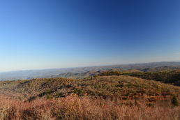
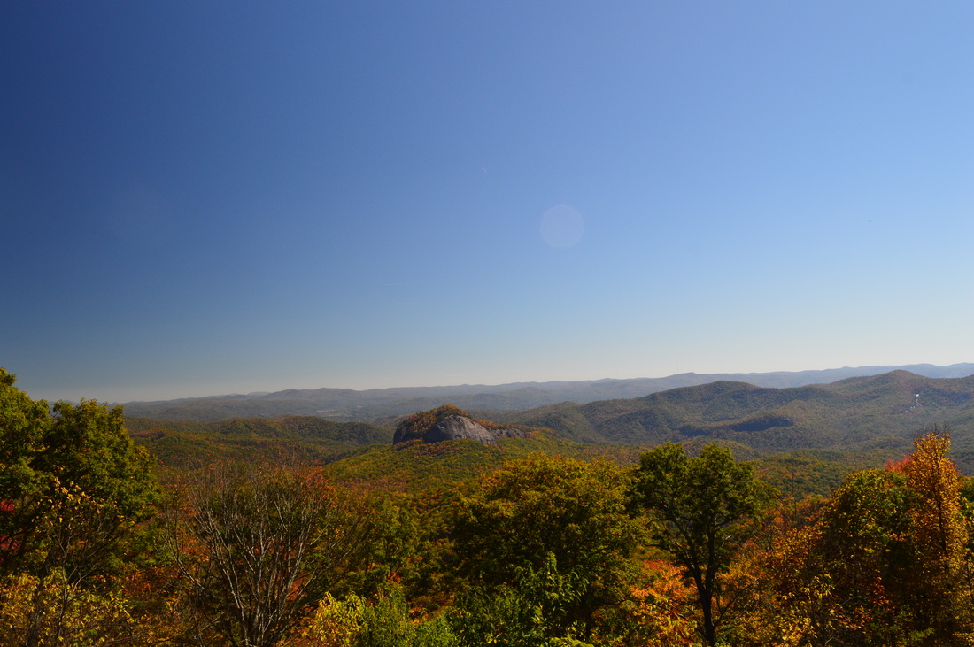
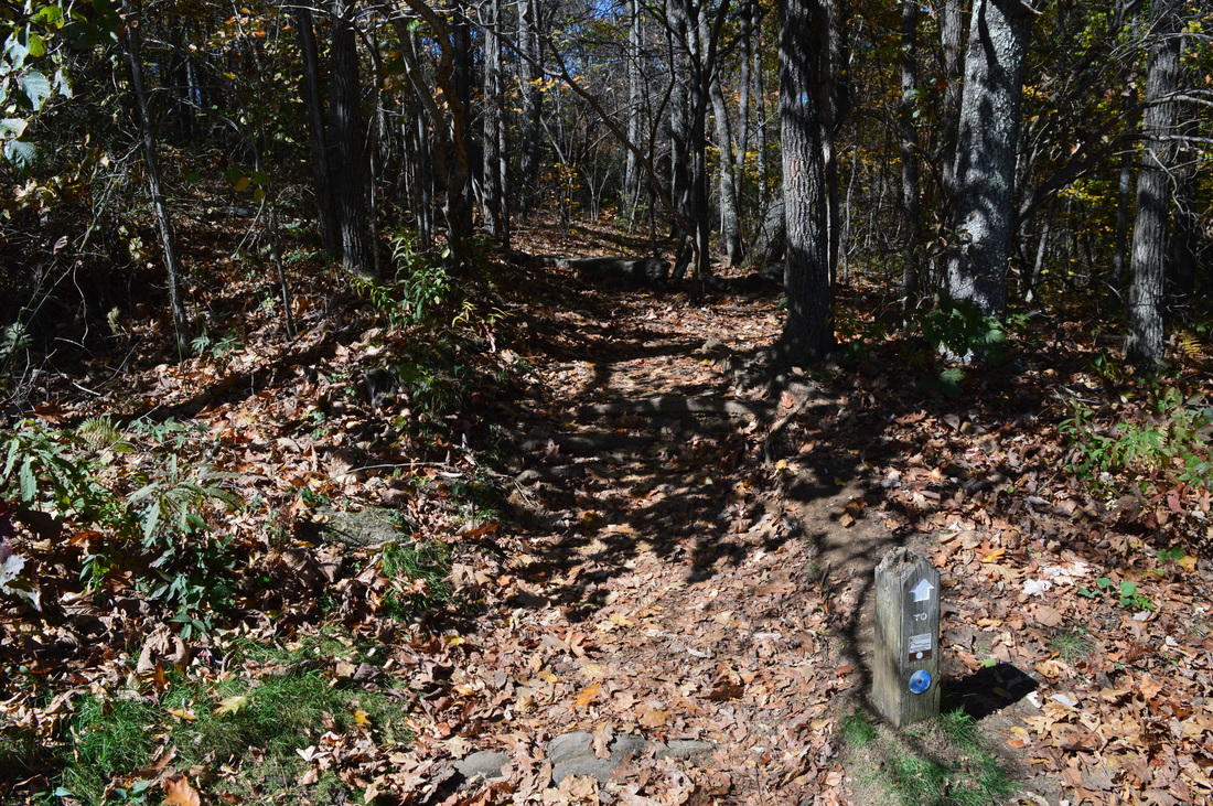
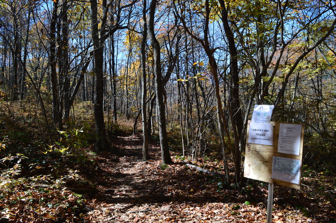
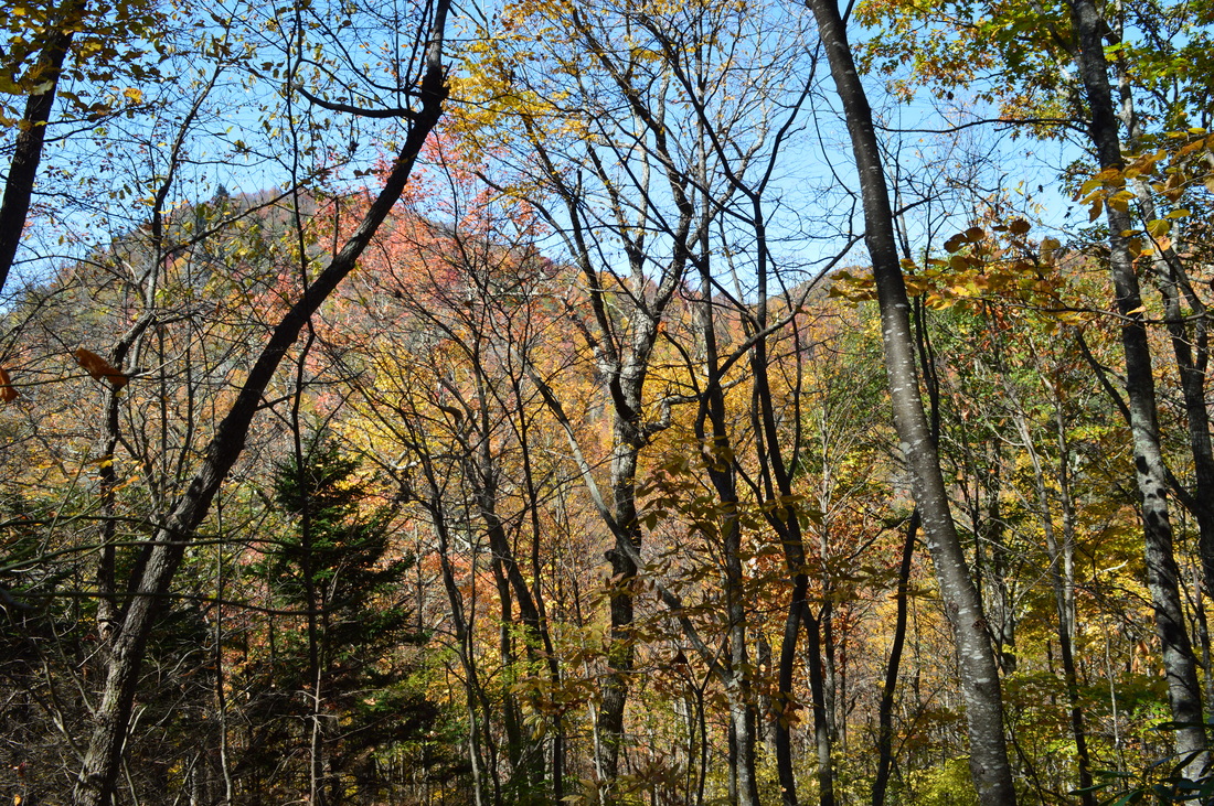
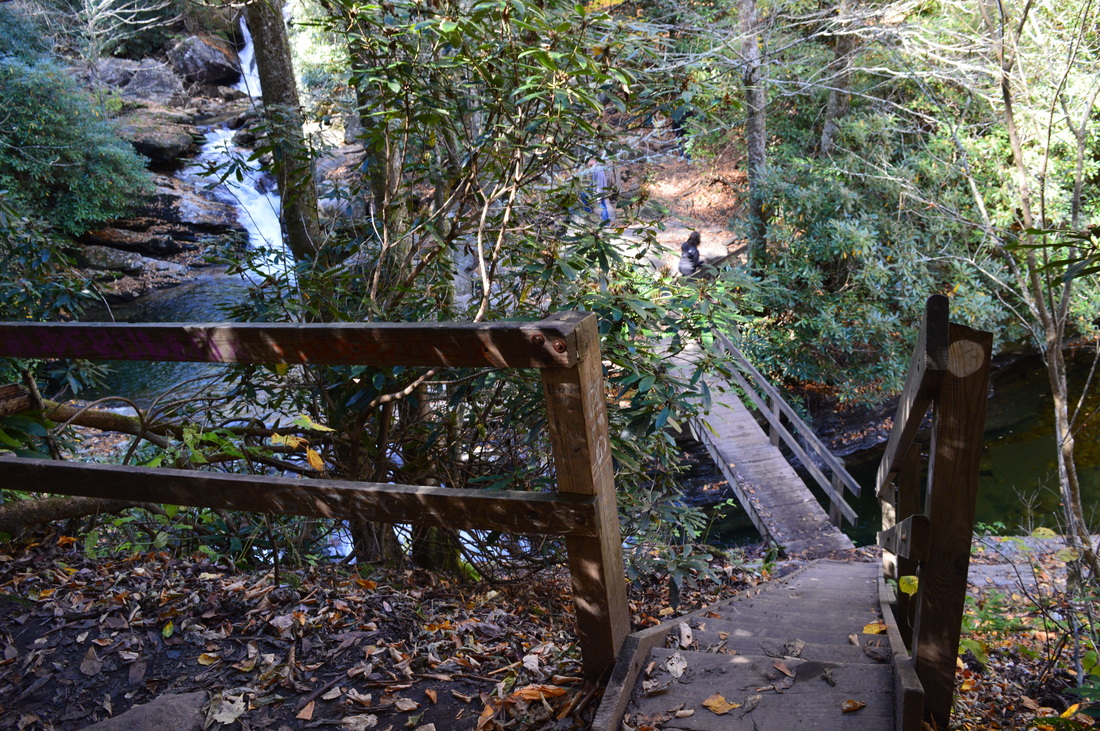
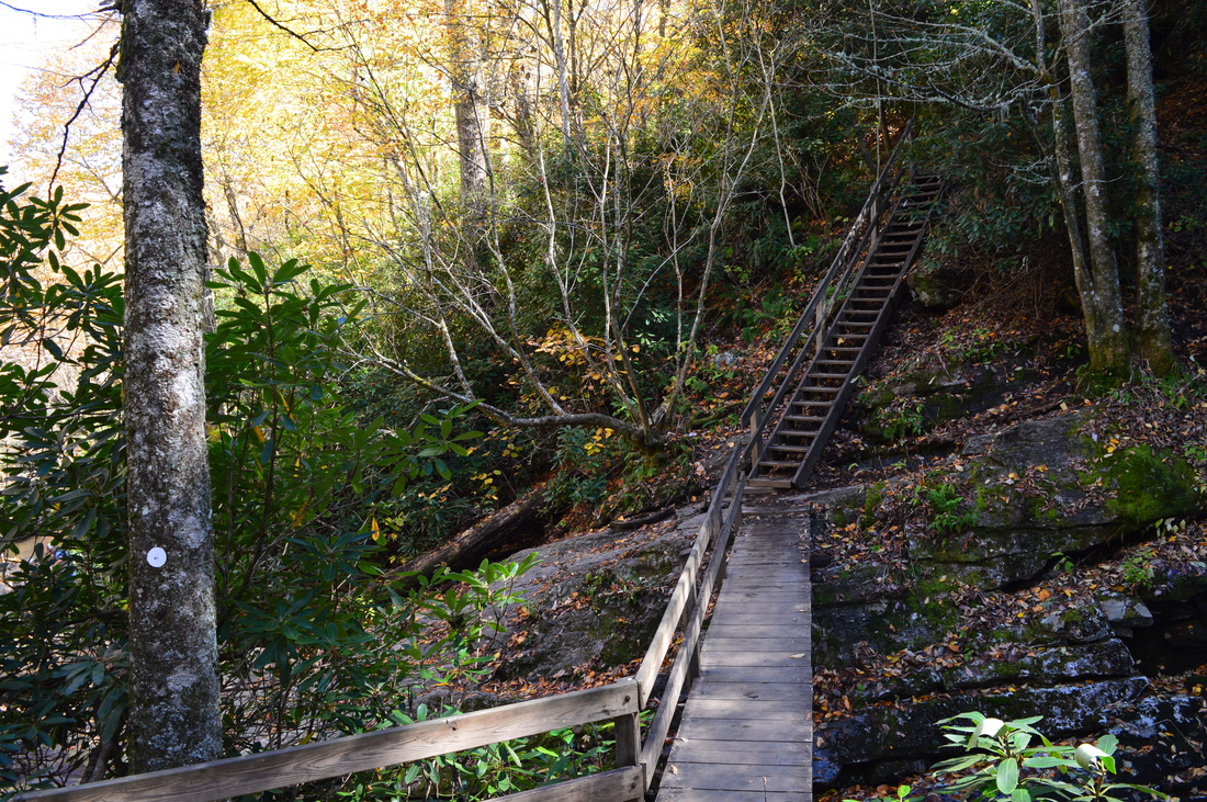
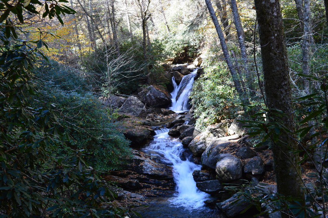
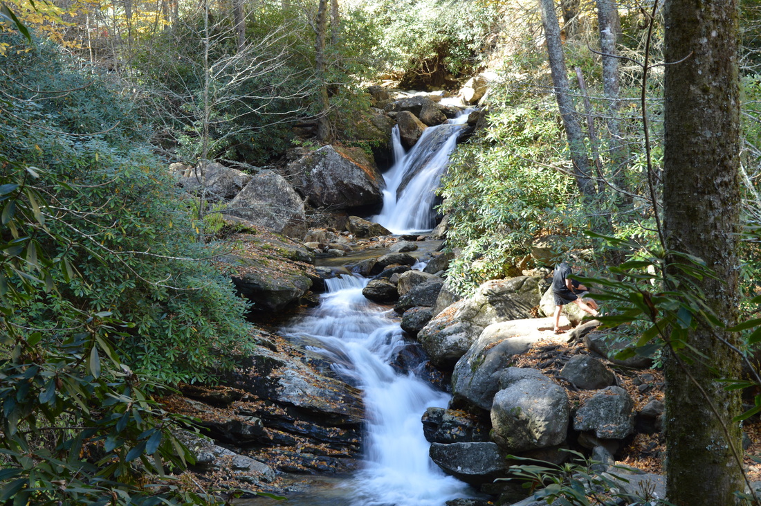
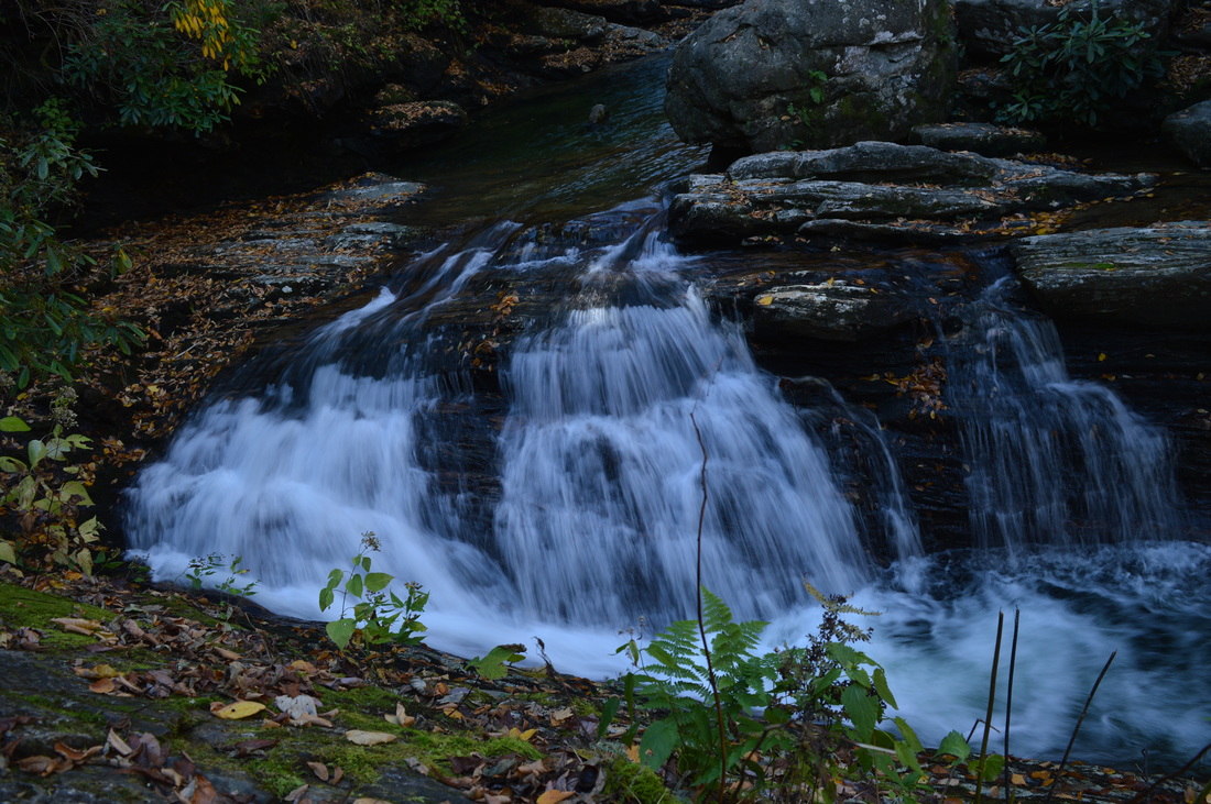
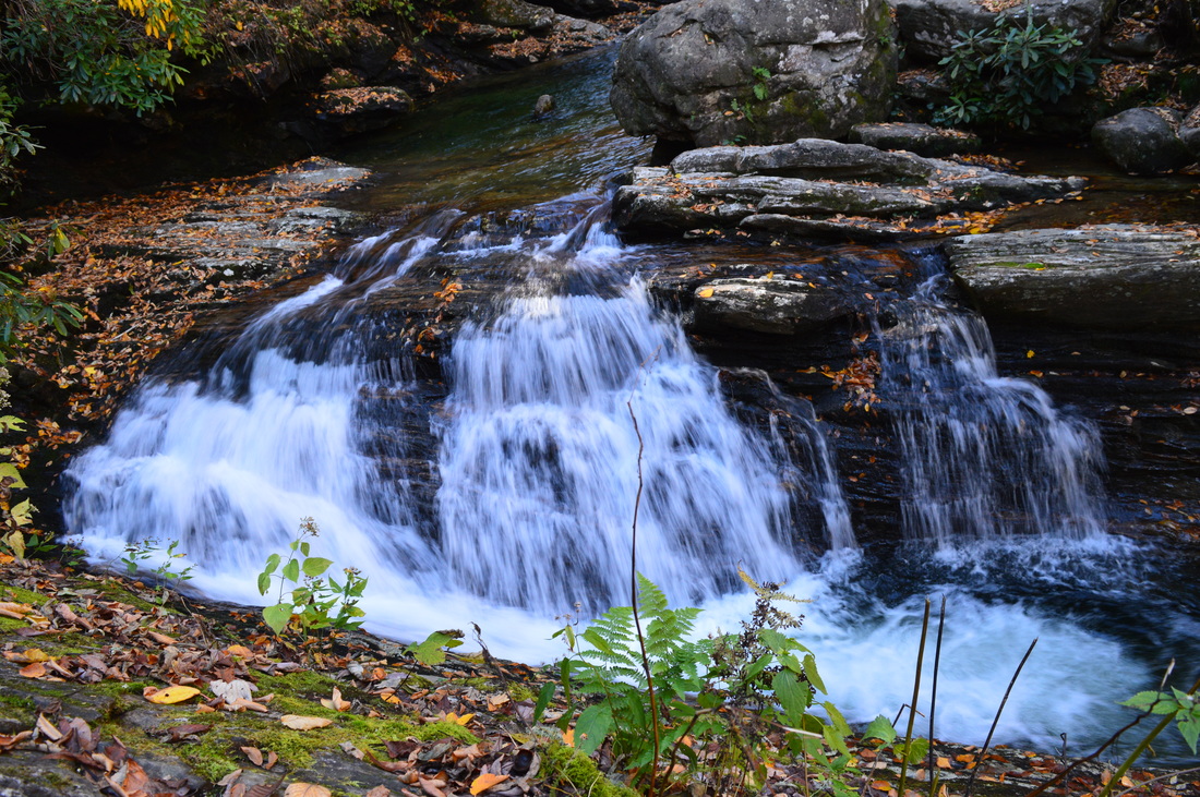
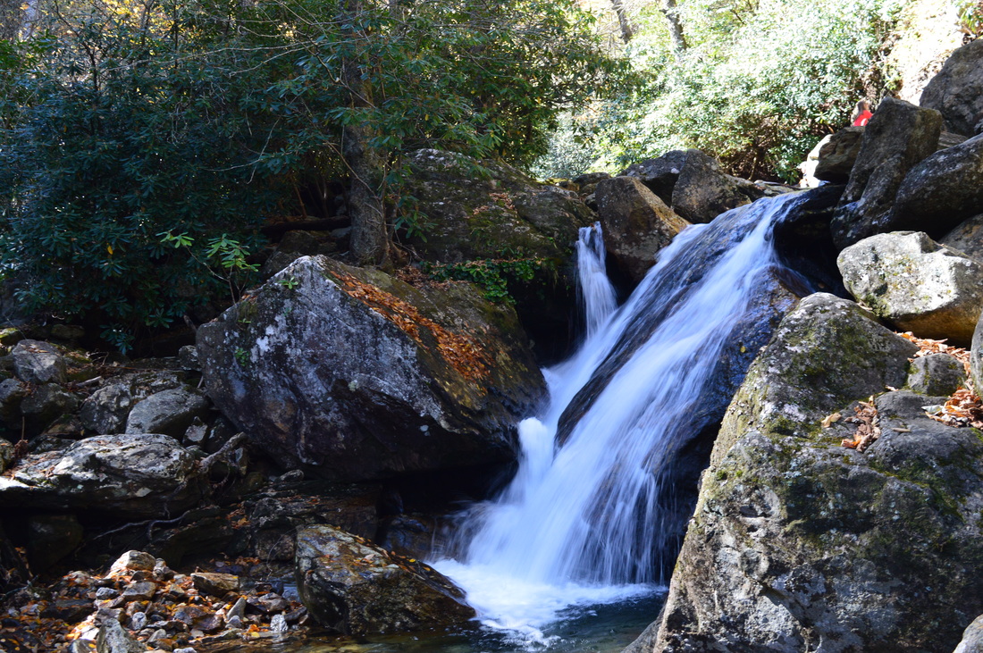
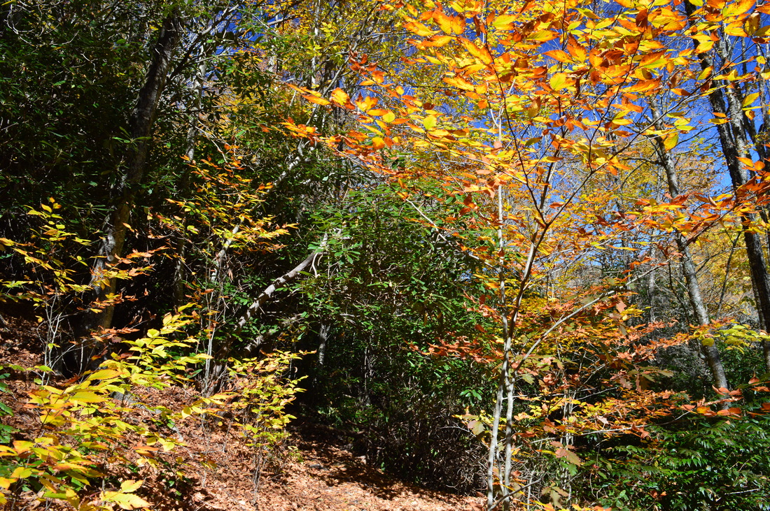
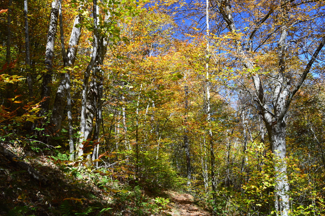
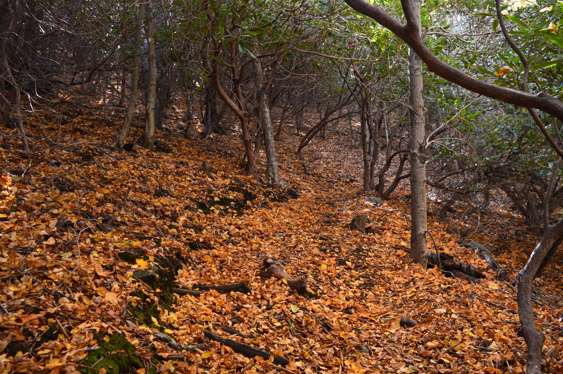
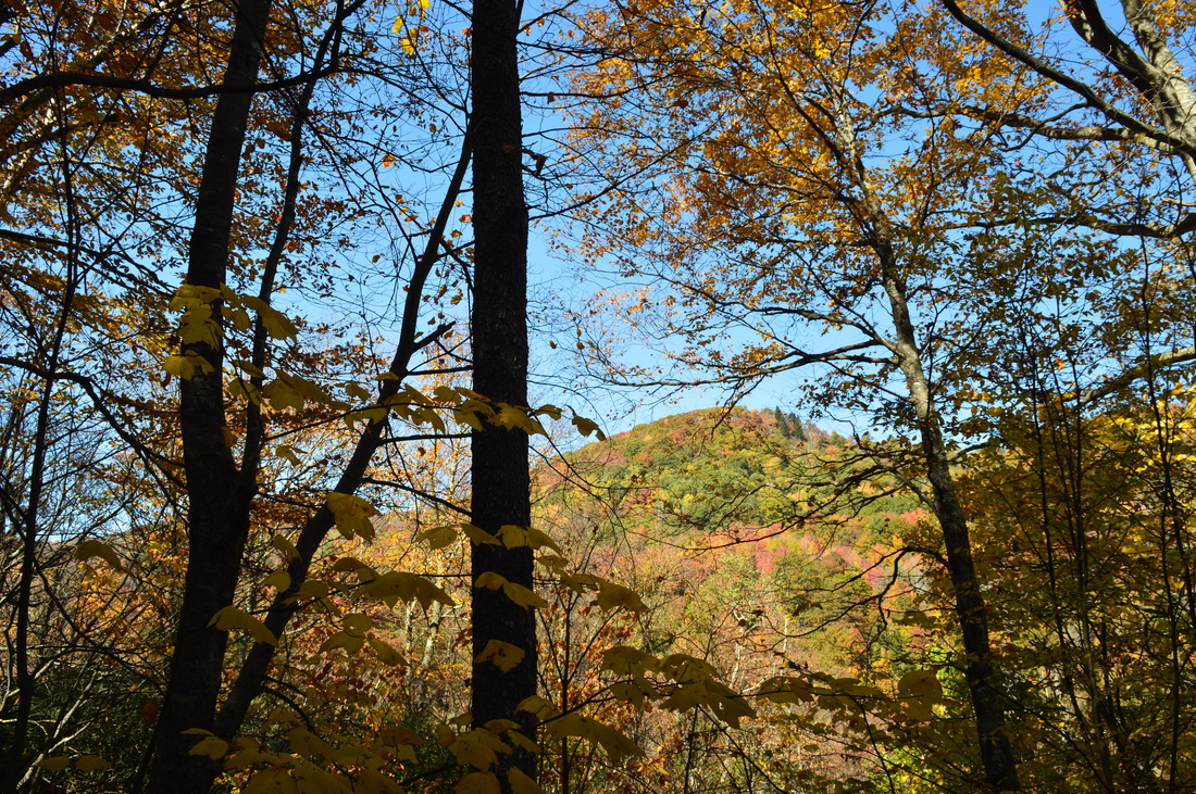
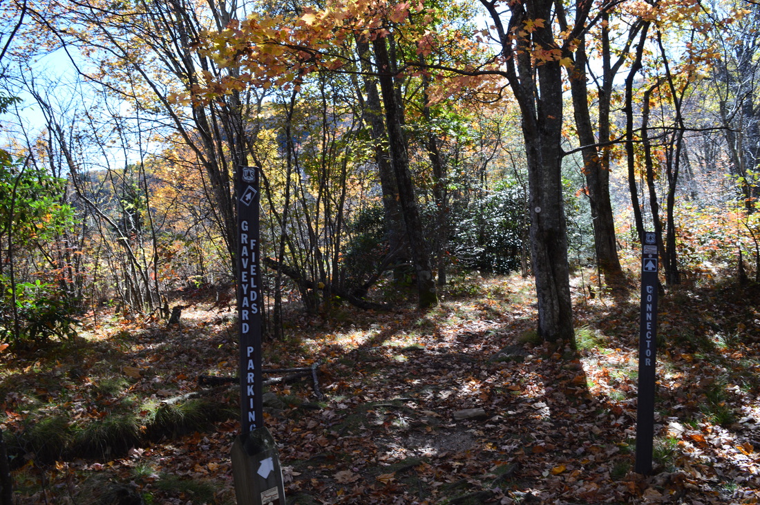
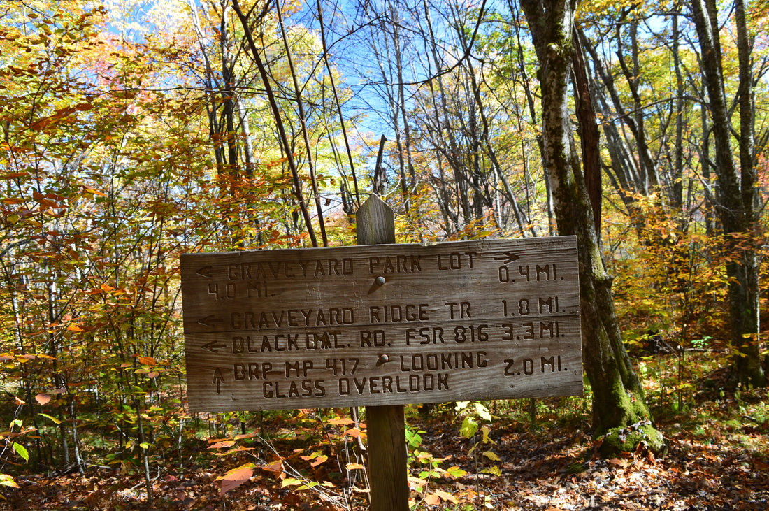
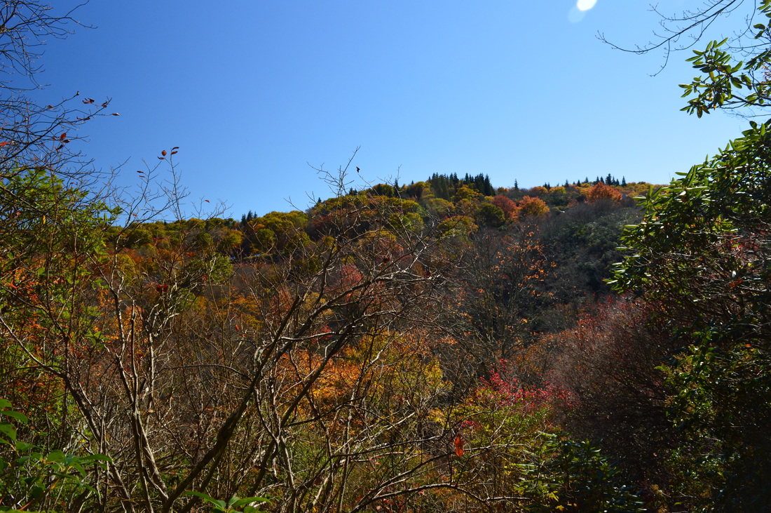
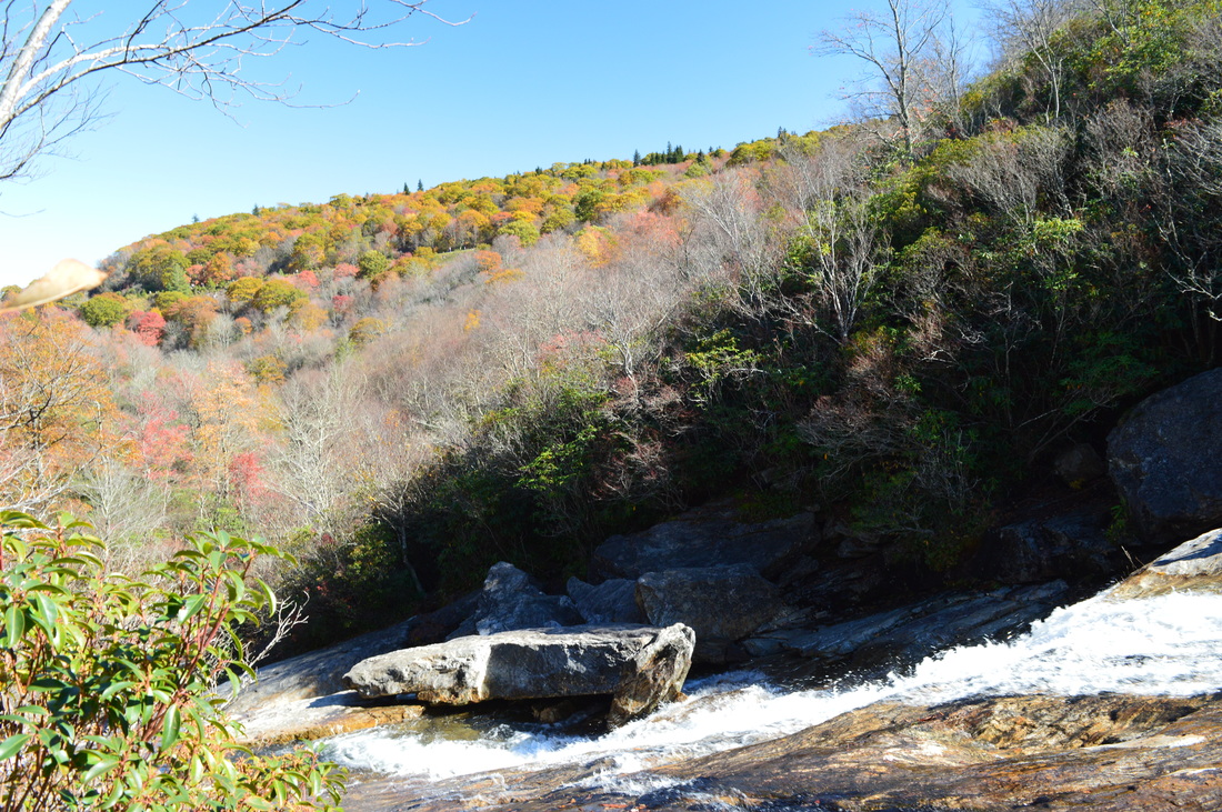
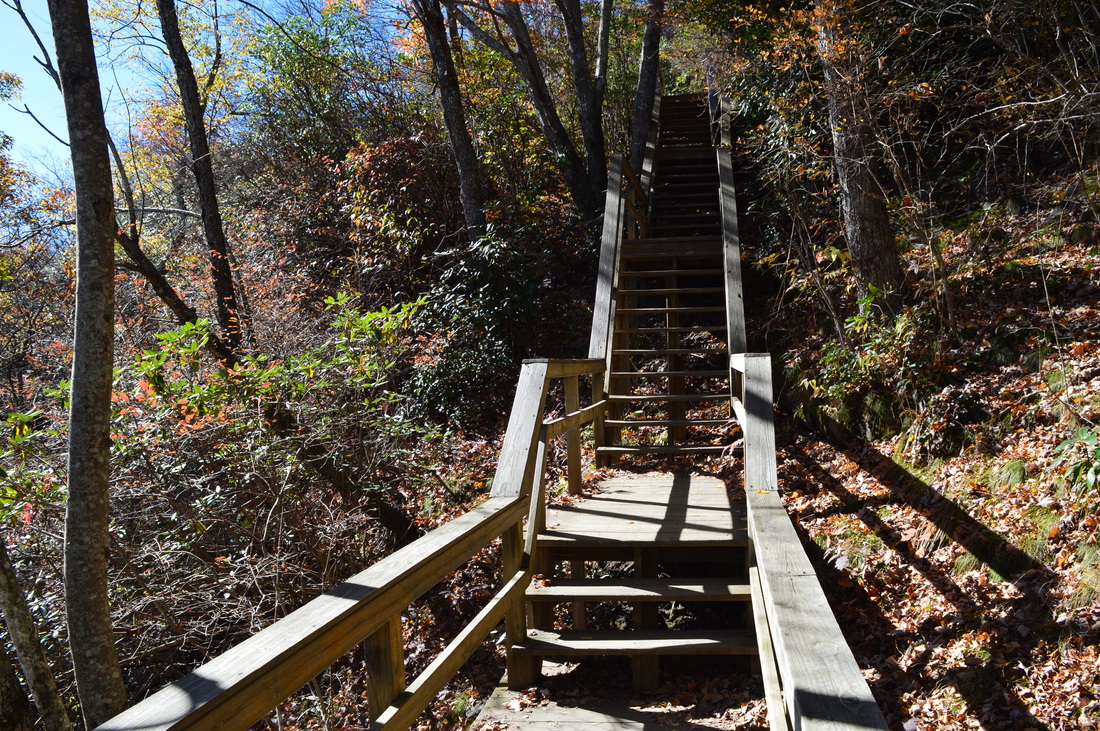
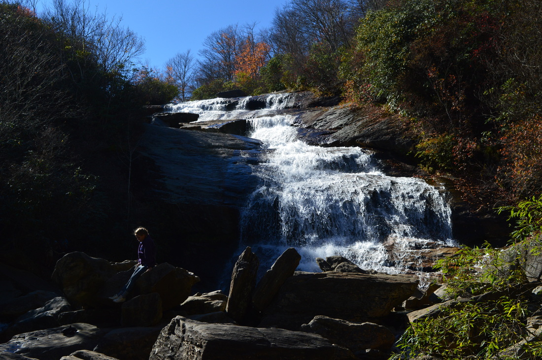
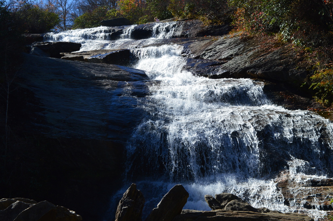
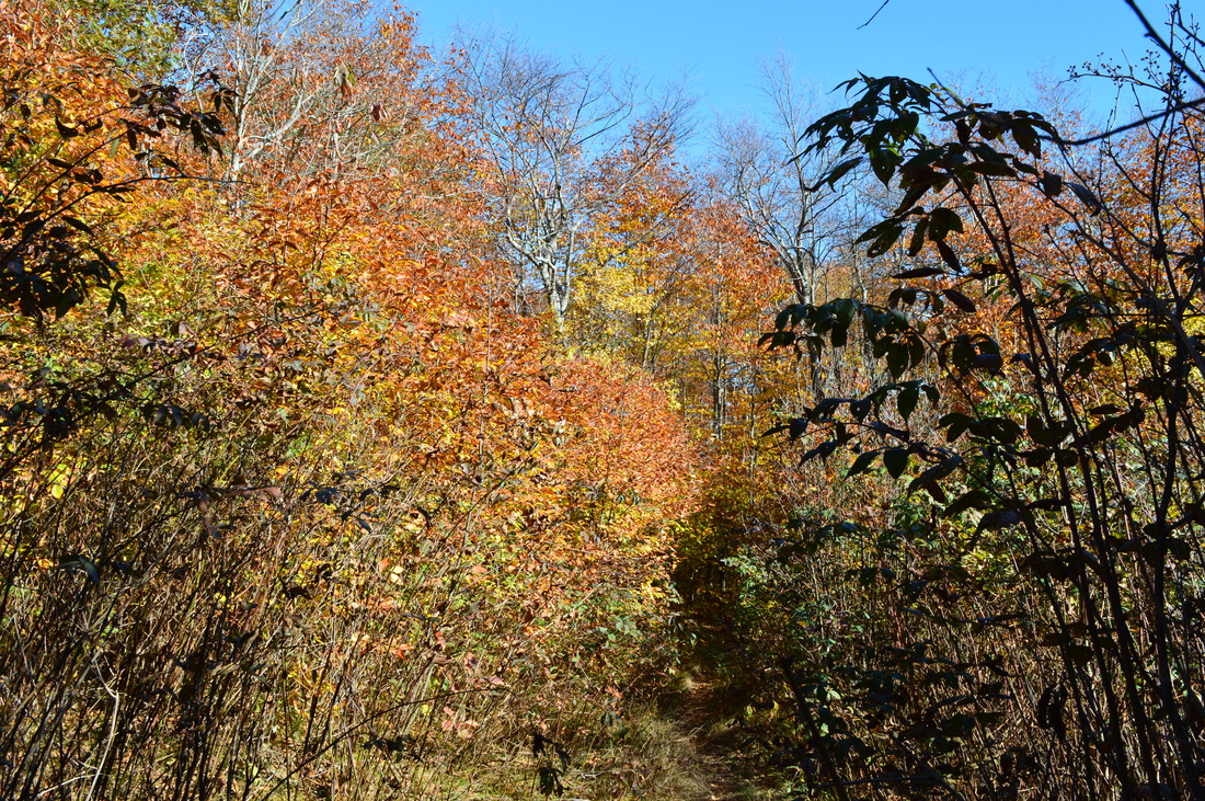
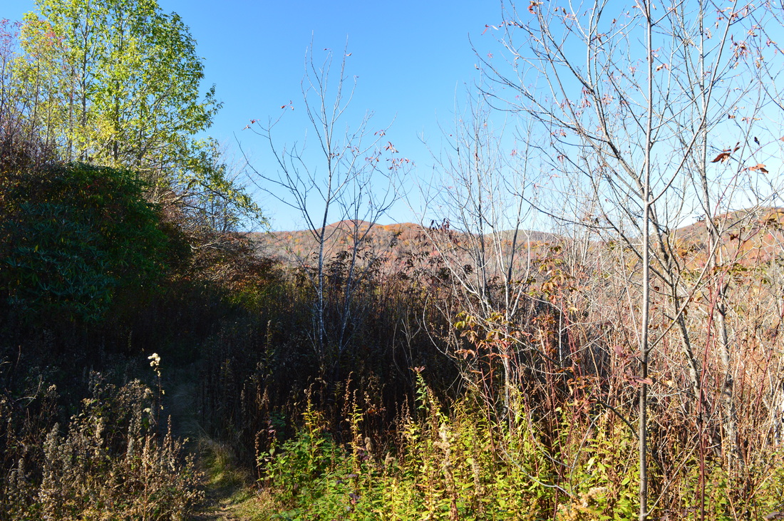
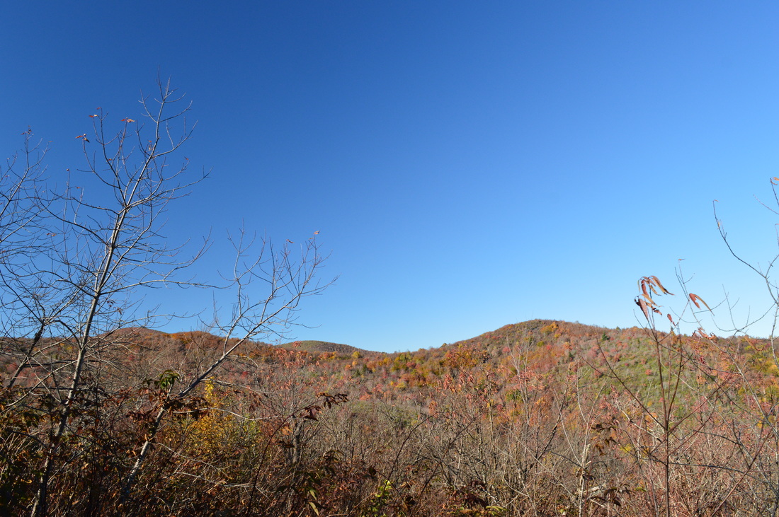
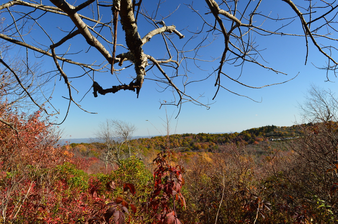
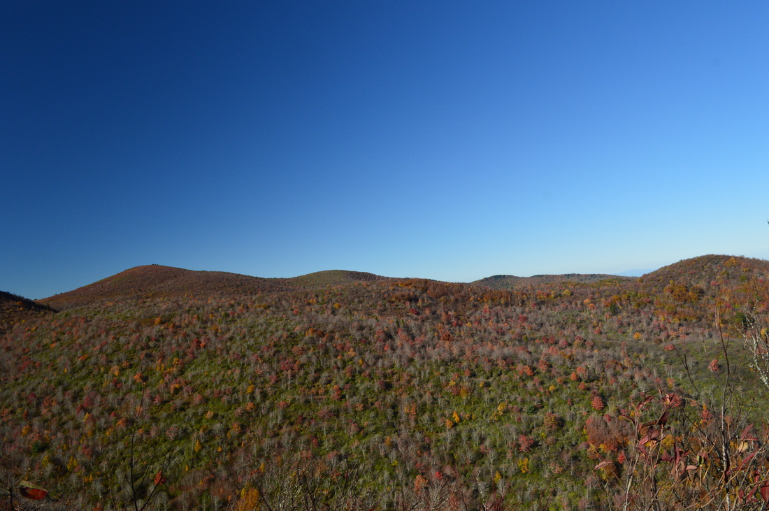
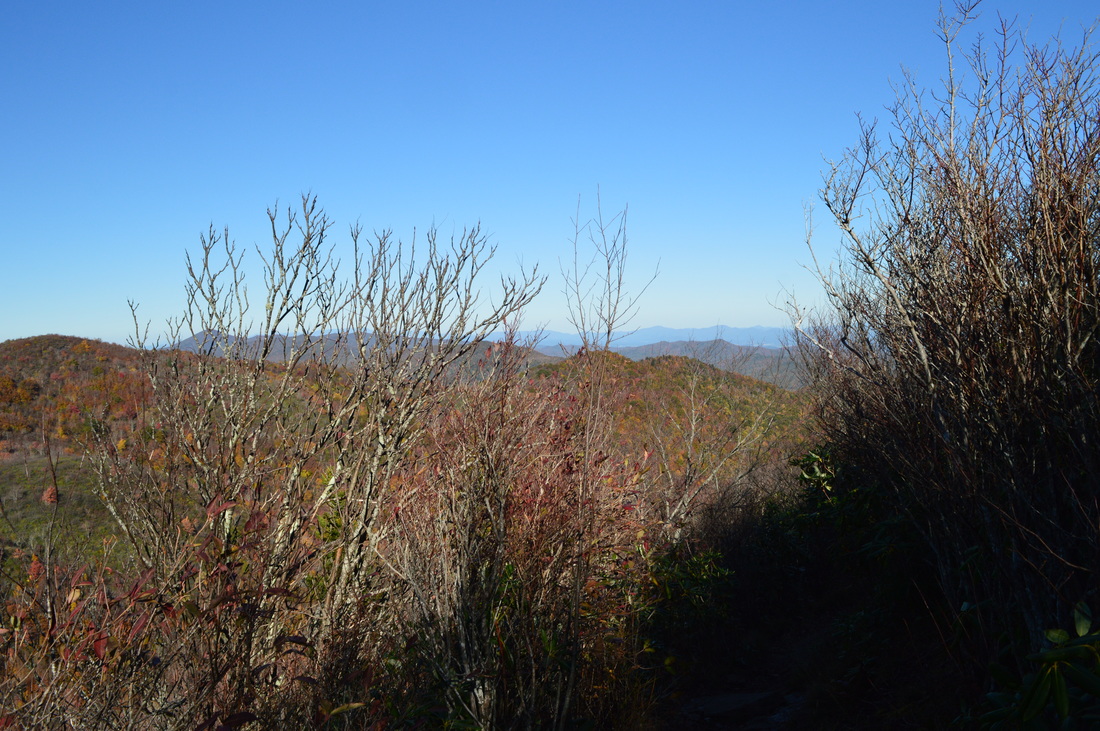
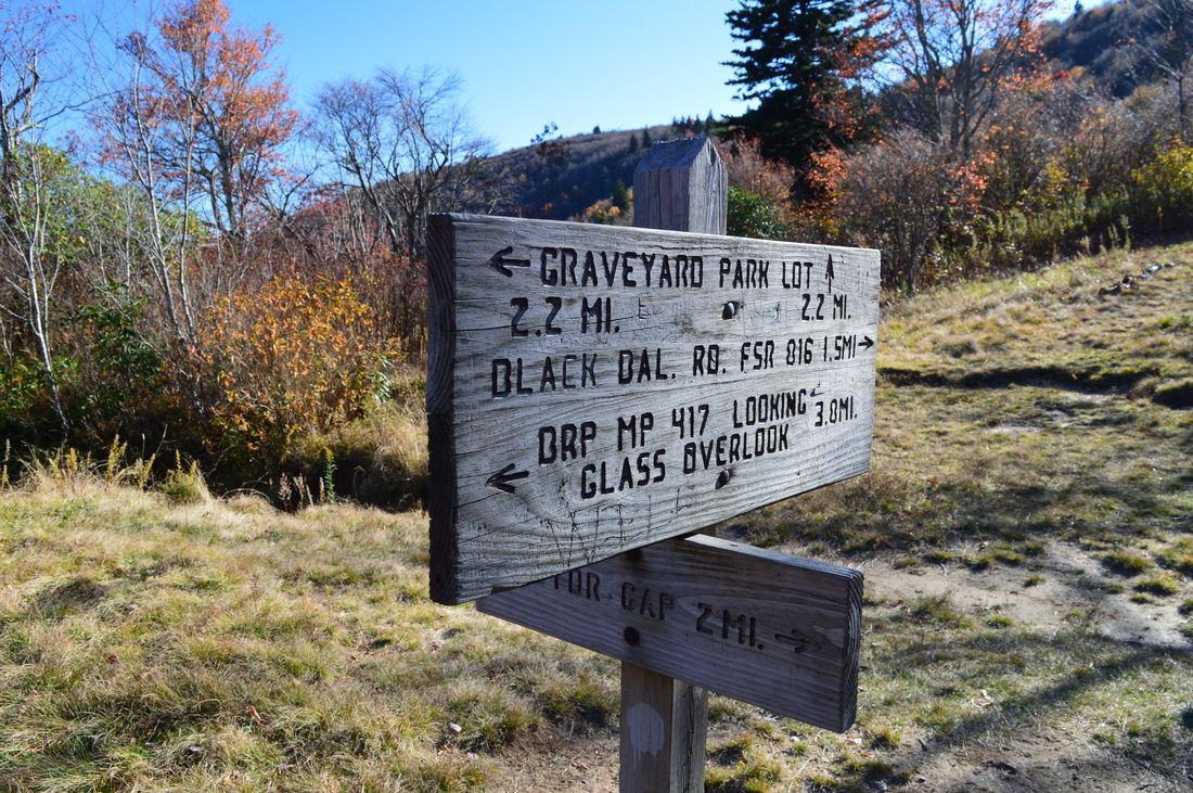
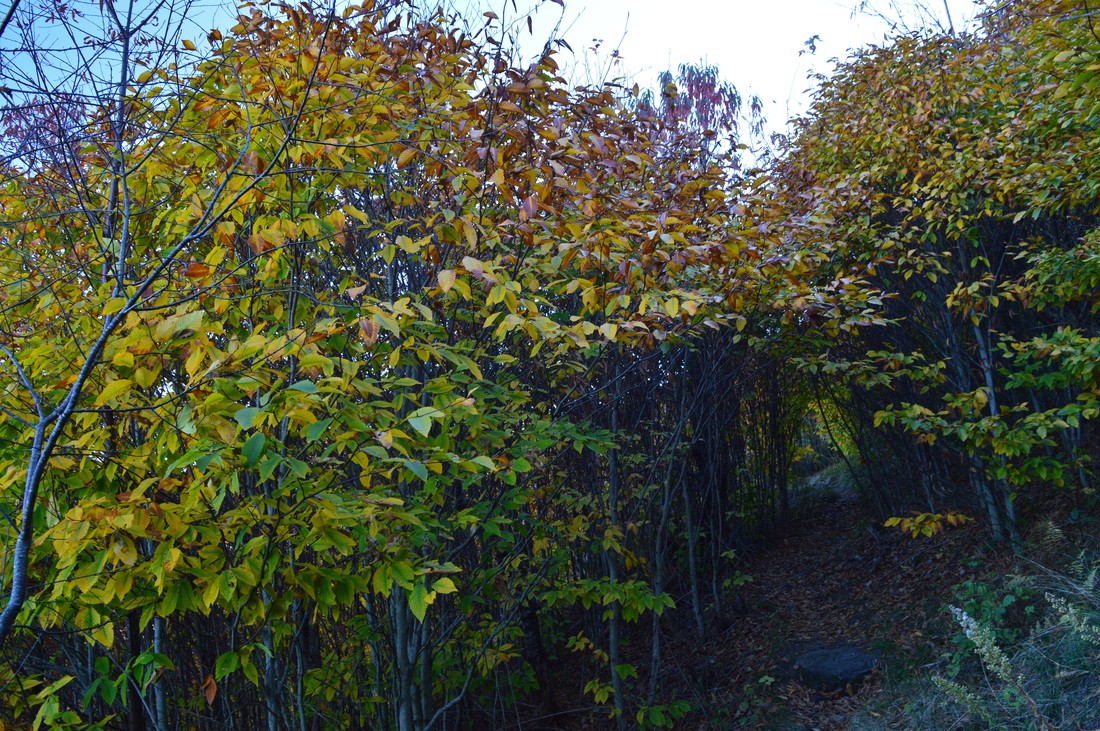
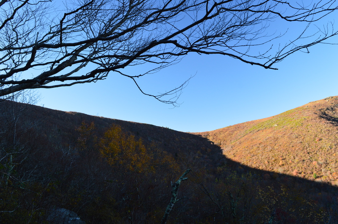
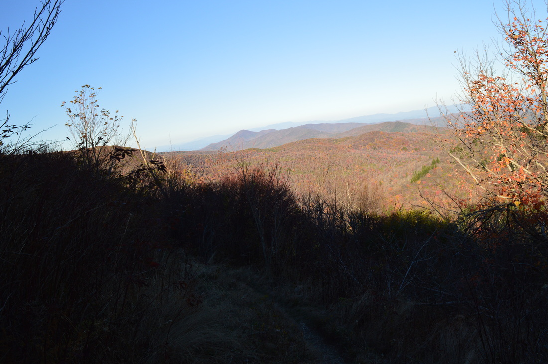
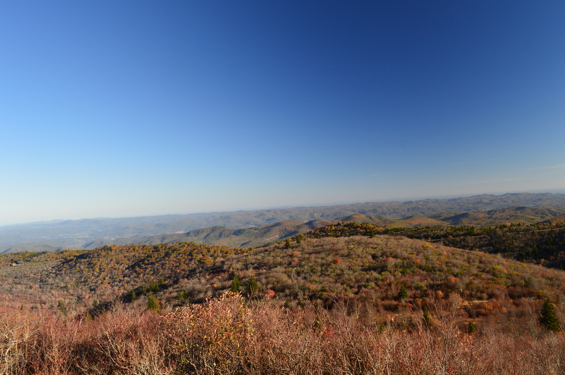
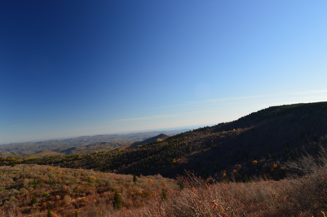
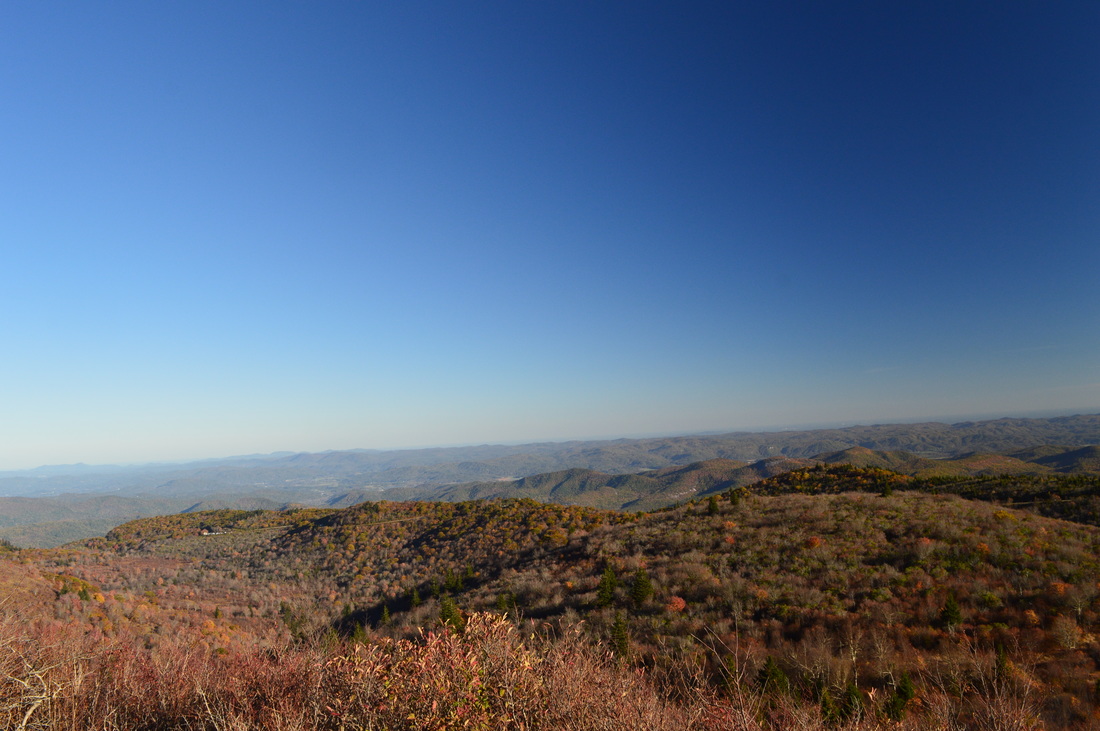
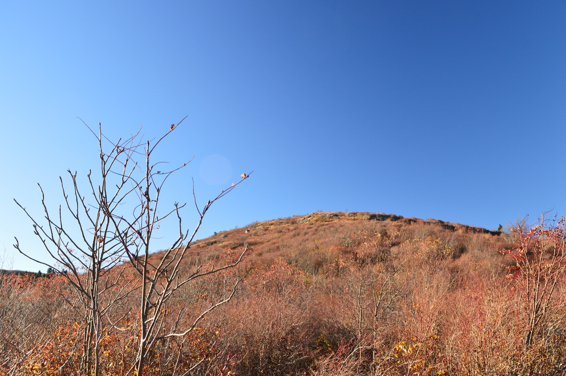
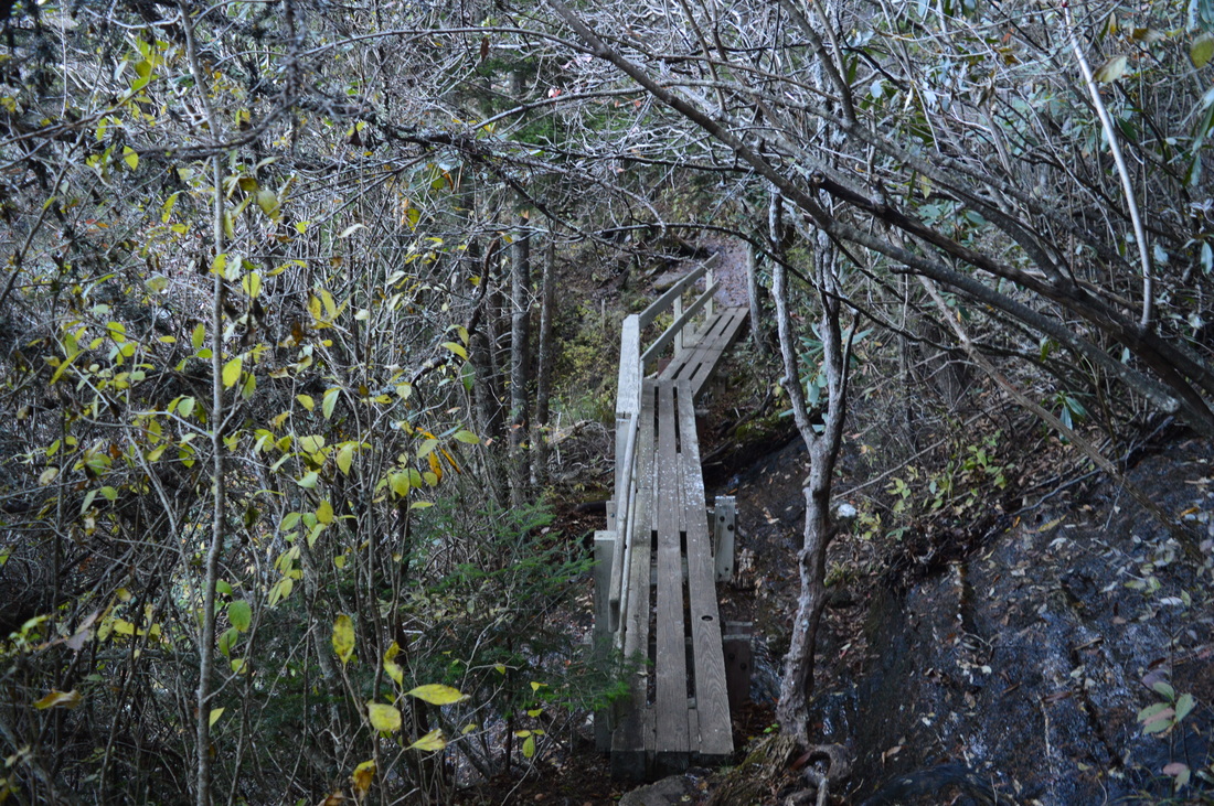
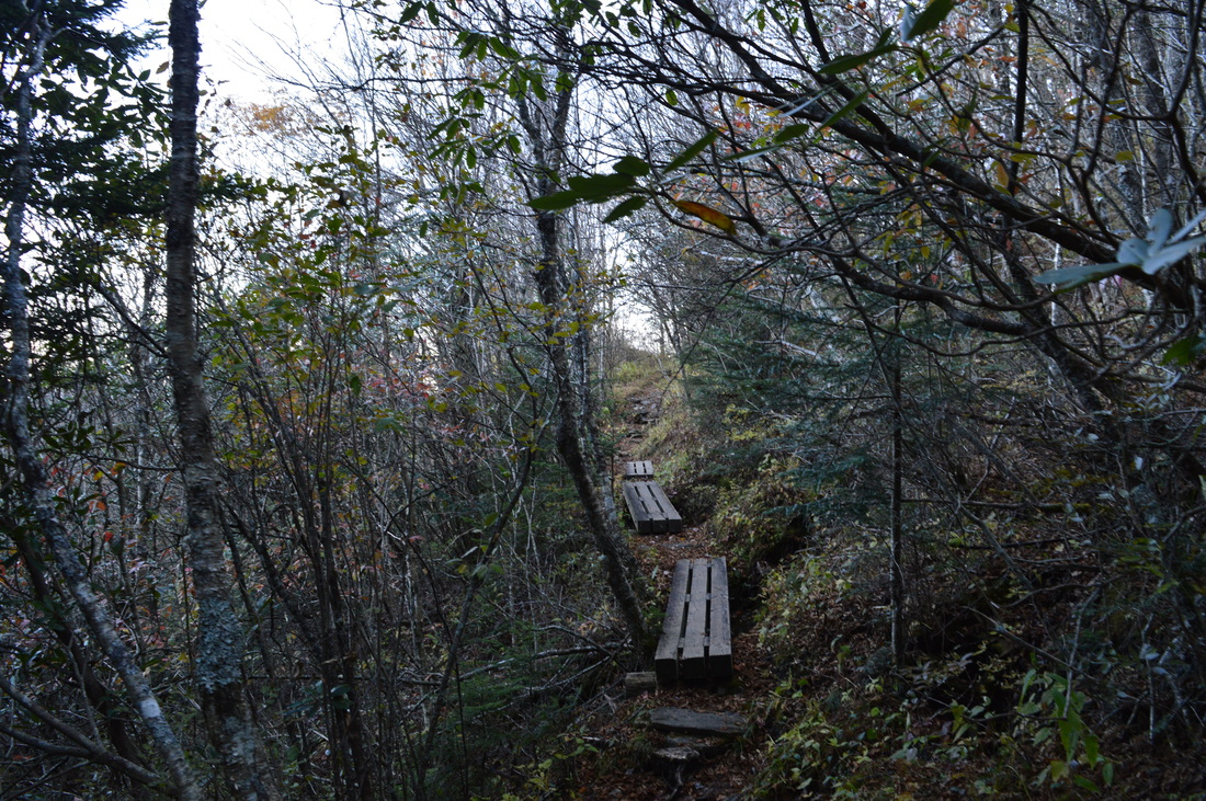
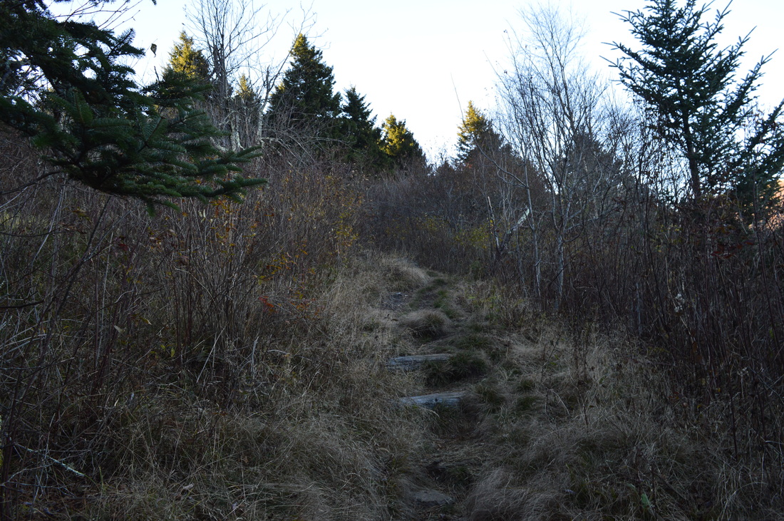
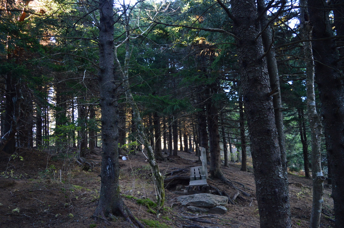
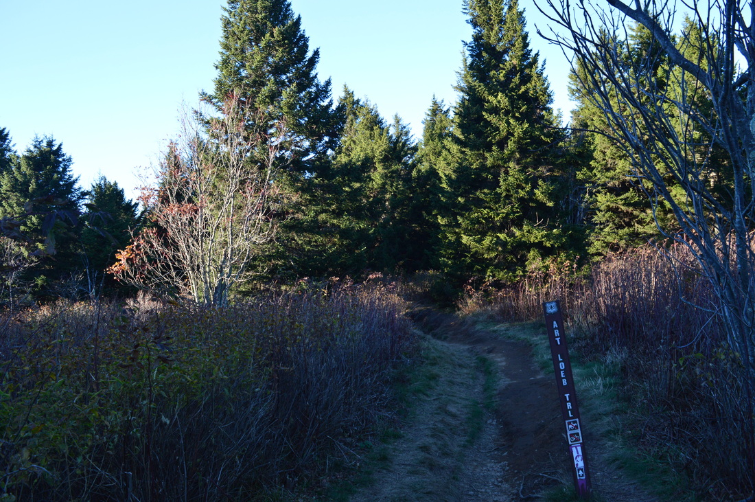
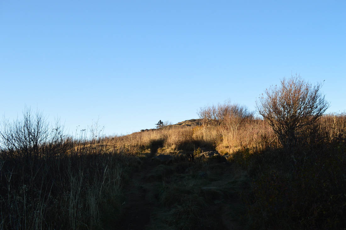
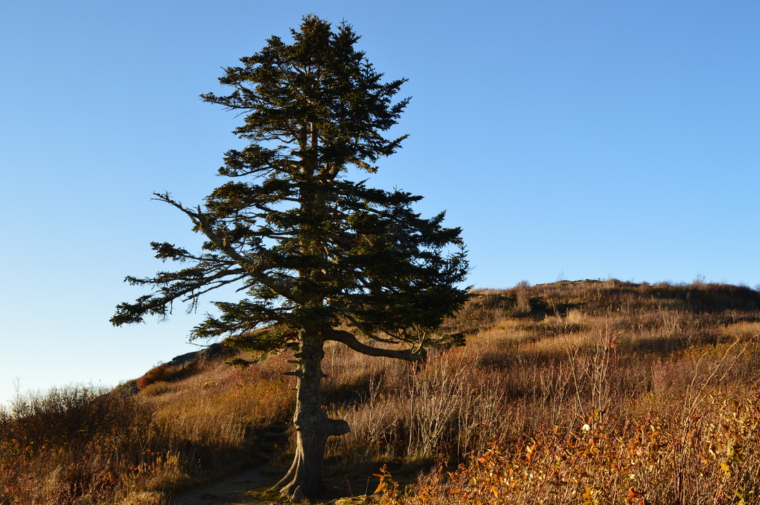
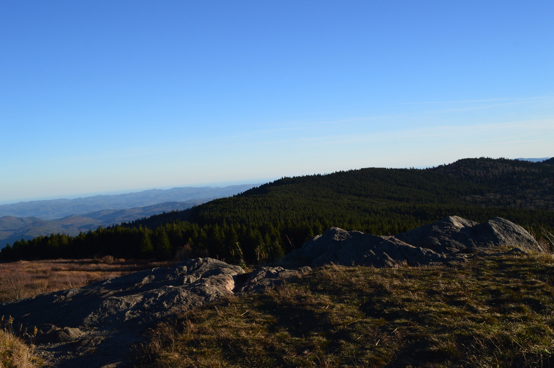
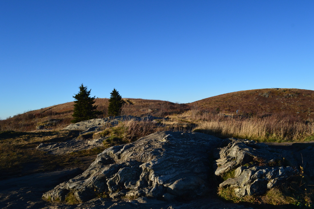
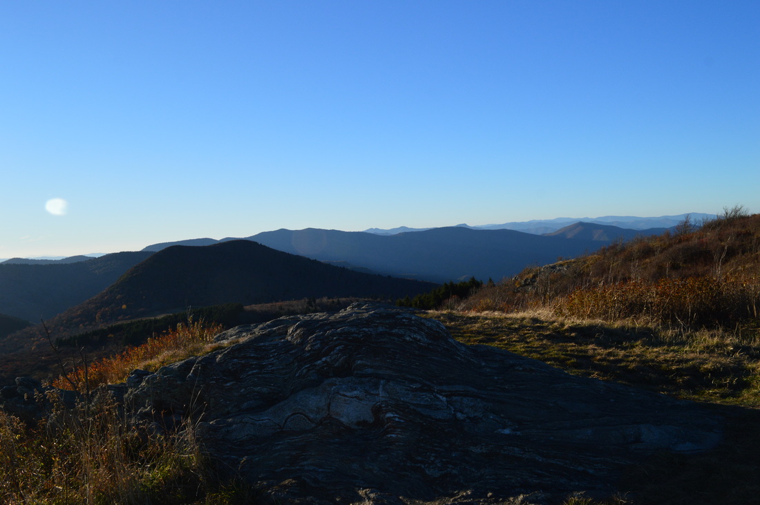
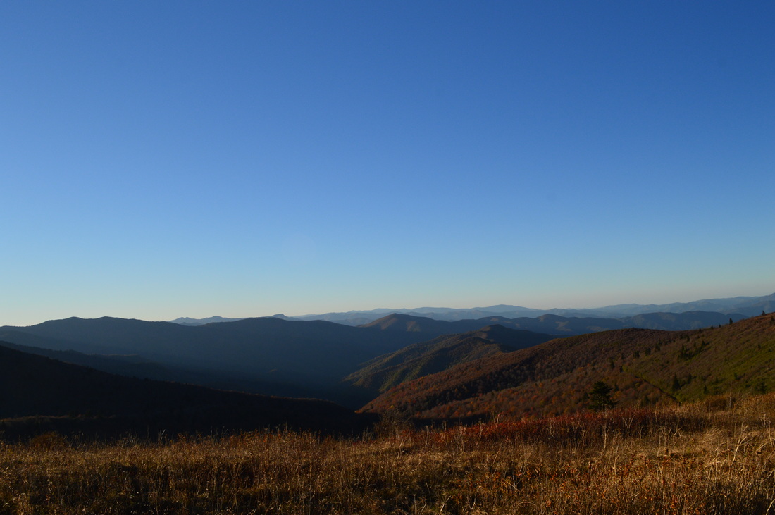
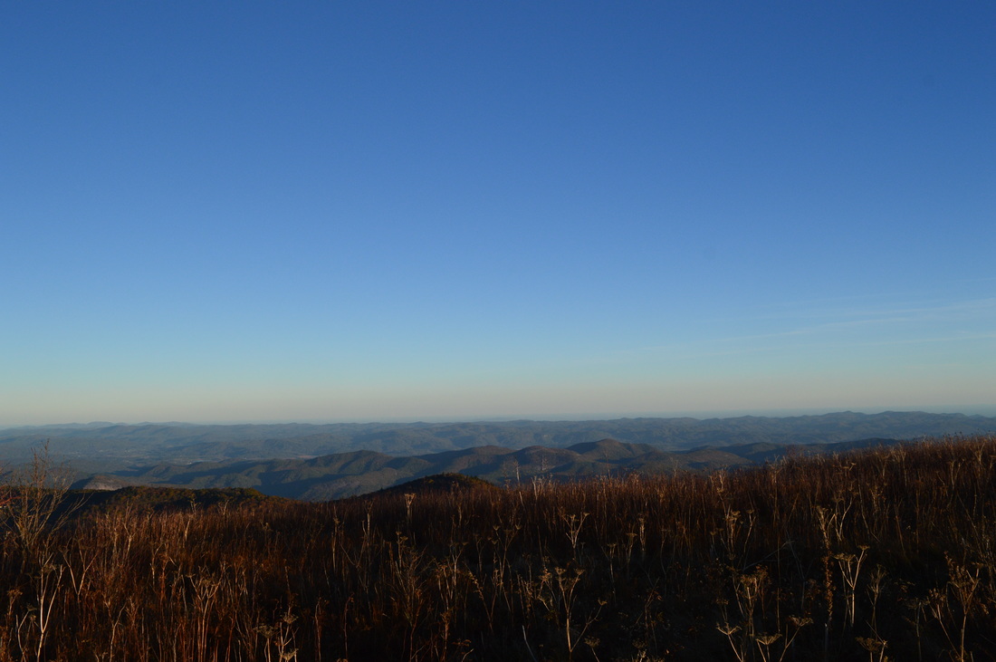
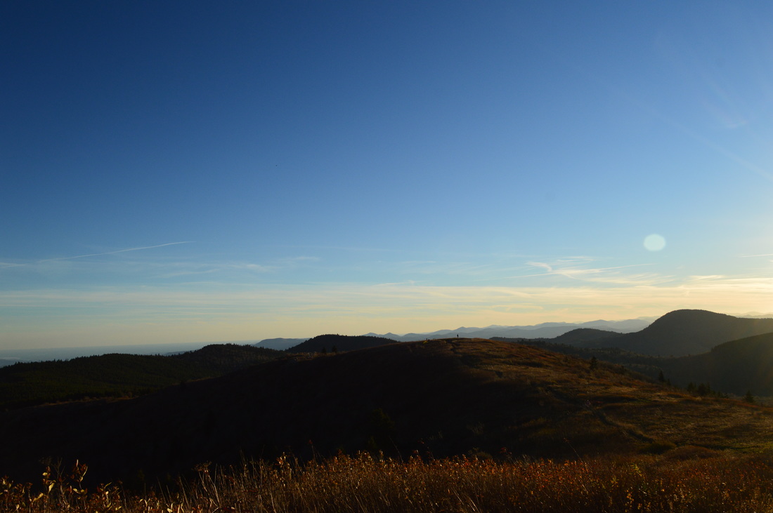
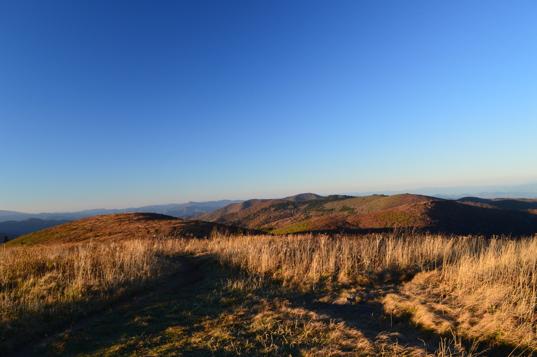
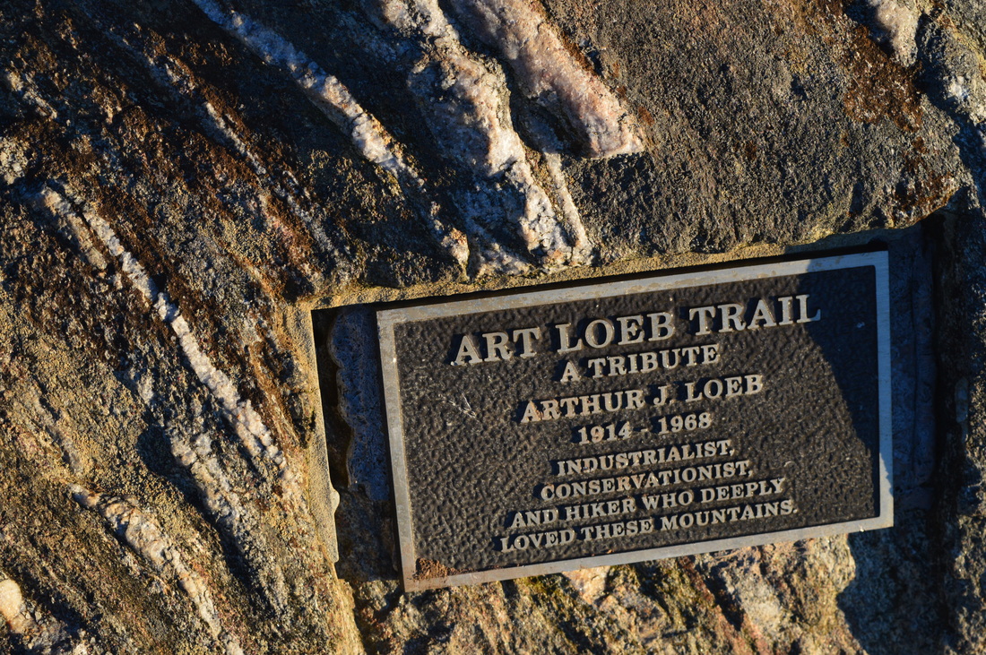
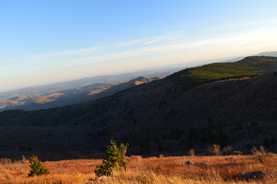
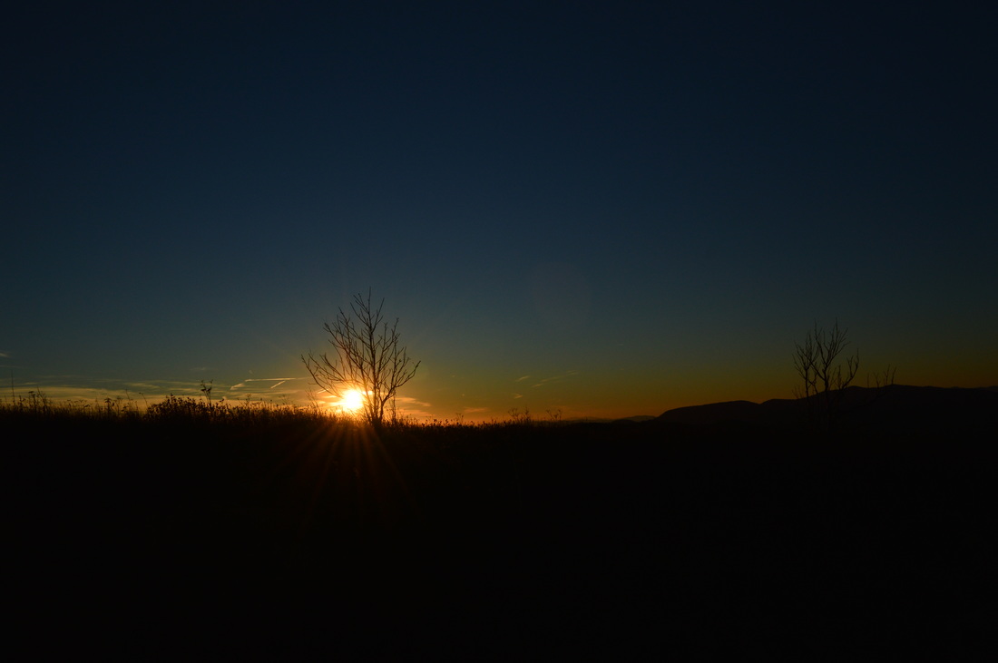
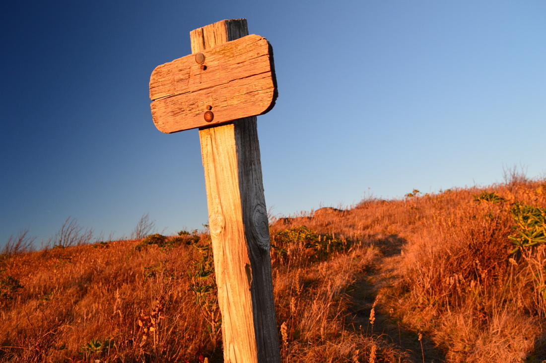
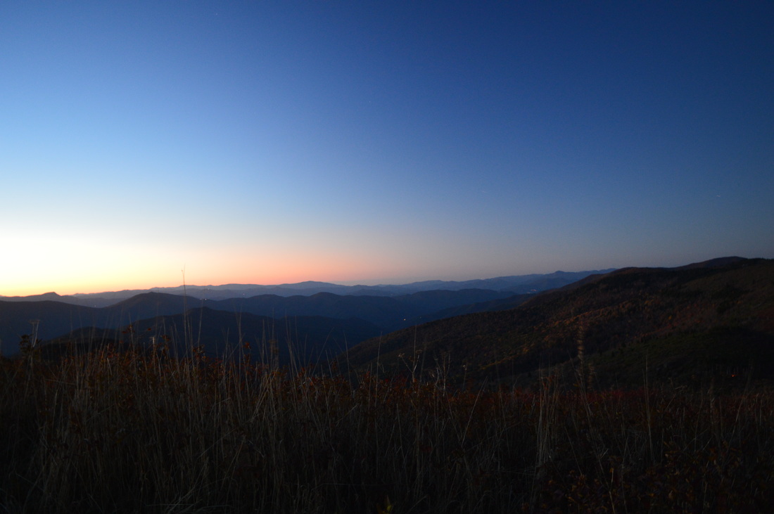
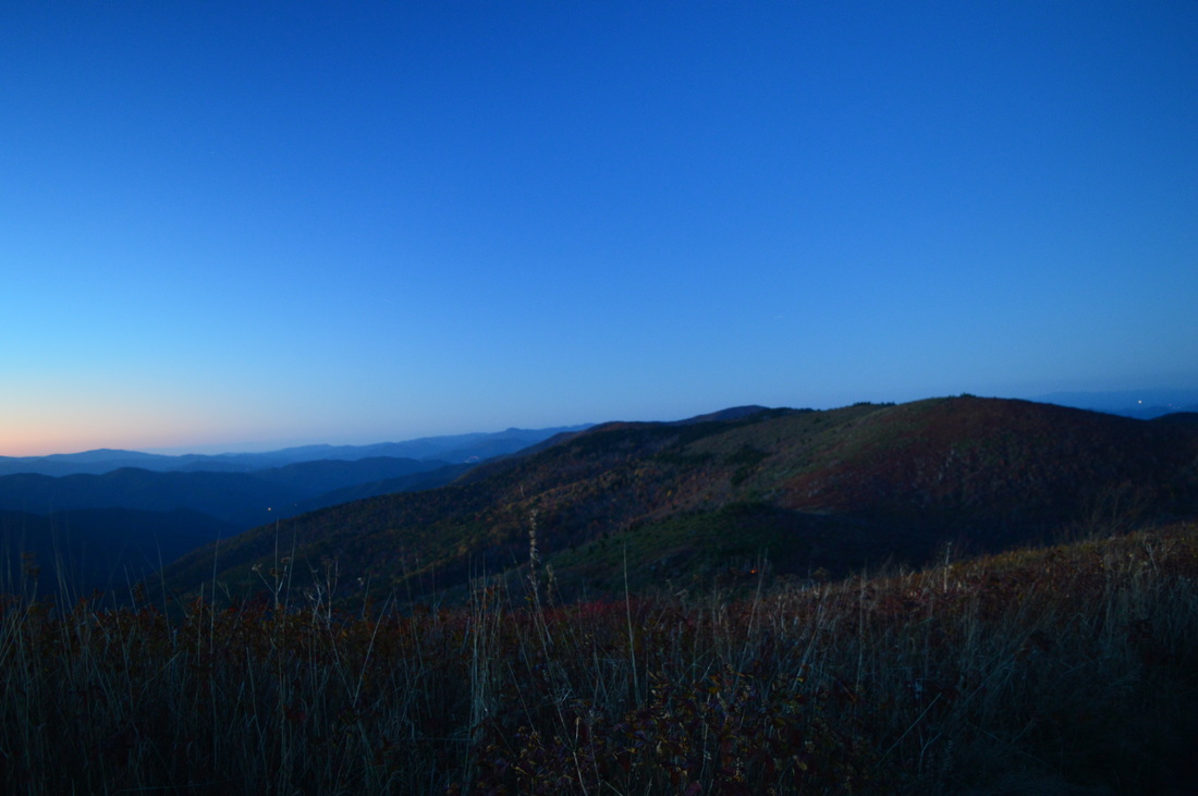
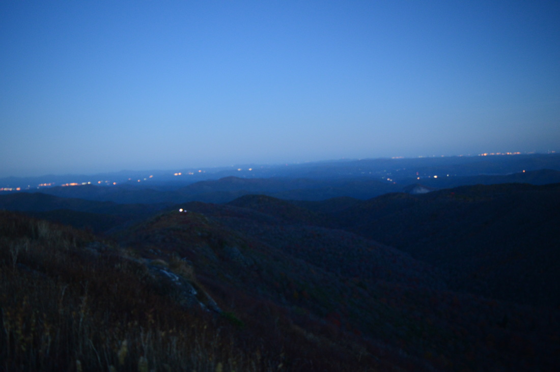
 The Shining Rock Wilderness and adjacent areas is North Carolina's High Country. A multitude of peaks, some above 6000 feet, with astonishing views is accessed via rugged, wilderness pathways from the Blue Ridge Parkway. As you immerse into the backcountry of this wild region, you will also see many water features and scenic streams. My long, difficult hike in this area proved to be spectacular on one fall day when the fall colors were at peak level. This hike occurred on Saturday, October 17th, 2015. My plan was to follow the Mountains-to-Sea Trail from Looking Glass Rock Overlook to Black Balsam Road, with a stop along the way at Skinny Dip Falls and a short side trip to Second Falls in Graveyard Fields. From Black Balsam Road, I would follow the Art Loeb Trail over Black Balsam Mountain, Tennent Mountain, and to Ivestor Gap. From Ivestor Gap, I would take the Greasy Cove Trail to the Big East Fork, and finally, I would take the Big East Fork Trail back to Looking Glass Overlook. SummaryR/T Length of Trail: 13.5 Miles Duration of Hike: 10:00 Type of Hike: Loop Difficulty Rating: 9 out of 10 Pros: Most trails are well-maintained and most intersections are relatively well-marked, although Greasy Cove Trail is a trail much more primitive than the others encountered on this hike. Cons: The Greasy Cove Trail is a steep, often very steep trail that is seemingly endless. Points of Interest: Skinny Dip Falls - 7 stars; Second Falls - 6 stars; Vistas on Graveyard Ridge - an average of 6 stars; Vista below Black Balsam Knob - 10 stars; Black Balsam Mountain Views - 10 stars; Tennent Mountain Views - 10+ stars Trail Blaze Color(s): Mountains-to-Sea Trail - White Circles; Mountains-to-Sea Connector - Yellow; Art Loeb Trail - White; Greasy Cove Trail - None; Big East Fork Trail - None; Bridges Camp Gap Trail - Yellow Best Season(s) to Hike: Fall Beginning Point: Looking Glass Overlook Directions: From Brevard, NC: Follow US Route 64 East for 3.4 miles. Then, turn left onto US Route 276 North. Follow US-276 for 15 miles. In Wagon Road Gap, turn right on the ramp to the Blue Ridge Parkway. In 0.2 miles, turn left on the Blue Ridge Parkway. Continue on the Blue Ridge Parkway for 5.2 miles. Then, you will see Looking Glass Rock Overlook and its parking area on the left. Park here. An access trail to the Mountains-to-Sea Trail is directly across from the parking area. Note: I have read and heard that this parking lot fills up quickly on good summer days, when folks head out to hang out at Skinny Dip Falls. MapA map and some other information regarding this hike can be viewed here. DetailsOnce, on a dreary, unseasonably cool summer day I set out to the Blue Ridge Parkway with goals of hiking to Black Balsam Mountain and Tennent Mountain from Graveyard Fields. That day, my efforts proved to be in vain, as both peaks were totally fogged in. I did get to see an unusually swollen Upper Falls, however. Now, more than a year later, I decided to visit these peaks again, with the prospect of excellent weather. Some of my route on this day overlaps the route of my previous hike, but most of it was on trails I hadn't previously hiked. The hike I did this time also proved to be significantly more strenuous. One day, I might simply do the classic Art Loeb/Ivestor Gap Loop to get the full feeling of the High Country without the strenuous climbing on this hike. The hike starts at Looking Glass Rock Overlook, a popular stopping point and trailhead. The only nearby such overlook that rivals Looking Glass Rock Overlook in popularity is the Graveyard Fields Overlook - perhaps one of the most crowded spots on the entire Blue Ridge Parkway. The trail sets off on a path and reaches the Mountains-to-Sea Trail at 0.1 miles at a small campsite. Here, if you continue straight, you'll be headed the direction I hiked towards Skinny Dip Falls. A right turn would put you on the opposite direction for the loop, visiting Big East Fork first. Both routes have uphill at the end, although I think doing the hike counterclockwise, opposite from how I did it, may be slightly better, as it'll have you do the difficult Greasy Cove Trail first. A different problem, though, is that I do not know if one will want to hike up the Greasy Cove Trail! Once you are on the MST, it's a mostly downhill hike to Skinny Dip Falls. The winter views are really great on this section, and the fall colors were some of the best in this area and around Skinny Dip Falls were the best too, because farther up in the High Country, it was past peak by now. However, the lower elevation fall colors more then made up for it. At 0.4 miles, reach a steep staircase that leads to a footbridge over Yellowstone Prong. The best view of the full Skinny Dip Falls is here from a sort of observation area. Skinny Dip Falls consists of three drops, and this actually turned out to be a quite beautiful waterfall compared to what I've heard about it. It might look worse in summer, though. On this day, the combination of unusually high fall water levels and a carpet of colorful leaves around the falls created a picturesque scene. From the footbridge itself, there is a good view of the lower drop of the falls. Just past the footbridge, you can head close to the stream and get a close-up of the upper drop. The middle drop is best seen from the observation area on the other side of the creek. From Skinny Dip Falls, the MST makes a sharp right turn and traces Yellowstone Prong downstream. You will pass a nice campsite right at the trail. Before long, the trail leaves Yellowstone Prong and begins a steady ascent up Graveyard Ridge. The ascent is never steep and has switchbacks to aid with it. At 1.6 miles, the trail levels out in a small somewhat overgrown meadow with a partial view to the west and northwest. At 1.7 miles, reach an intersection with a spur trail to some campsites atop a knob. Just ahead, there are plenty of campsites in an open, gap-like area. At 1.9 miles, following a slight uphill from the gap-like area, reach an important intersection. The Mountains-to-Sea Connector continues straight to Graveyard Fields. The MST turns right. My plan was to continue straight to Second Falls and backtrack to this point. But as I reached this intersection, I realized I forgot my tripod at a stop almost a mile earlier. Backtracking to get my tripod added about nearly two miles and 45 minutes more to my hike (this data is not included in the summary statistics). By the time I returned to this intersection from getting my tripod, I realized I was running late - and I would only fall back further on the long scent ahead. As usual, a good section of the trail in the dark (at least I saw the High Country in the daylight). Sigh. I took the MTS Connector and after a gentle downhill, I reached a junction in Graveyard Fields at 2.2 miles. The Graveyard Fields Loop is to the right with a footbridge over Yellowstone Prong. Straight ahead, a popular side trail leads to the top of Second Falls where there is a good view up Yellowstone Prong and Graveyard Fields Overlook is visible. To the left, a wide pathway leads to the base of Second Falls. I took the pathway. The path shortly reaches a long series of steps besides Second Falls. At the end of the staircase, you will reach the base of Second Falls at 2.3 miles, the most popular waterfall in the Graveyard Fields area. It is a nice, tall waterfall, but it lacks unique features, and I personally liked Skinny Dip Falls better. Plus, Skinny Dip Falls had less people than this crowded waterfall (although the pool below Skinny Dip Falls is a popular local swimming hole in summer). From Second Falls, retrace your steps to the MST, reaching it at 2.7 miles. Turn left onto the MST. The MST ascends for a little bit but then levels out on the top of Graveyard Ridge, before descending slightly to a gap with an intersection at 3.1 miles. Here, the Graveyard Ridge Trail departs to the left and follows an old road along the south side of Graveyard Ridge before recrossing the MST in a gap below Black Balsam Knob (along the way, the trail meets up with a connector trail from Graveyard Fields). Both the Graveyard Ridge Trail and the MST are about the same distance to the gap below Black Balsam Knob, but the Graveyard Ridge Trail avoids some ascent. However, the MST route is much more scenic with numerous vistas. On my previous visit, I hiked most of that section of the Graveyard Ridge Trail, so this time, I took the MST. The MST in this area is very rugged, constantly scrambling through steep terrain on the north side of Graveyard Ridge. At 3.4 miles, there is an obvious but unmarked side trail to the left that leads to a vista atop Graveyard Ridge, looking at the Blue Ridge Parkway snaking through the mountains with the Graveyard Ridge Overlook and dozens of parked cars there visible directly ahead. After that vista, there will be numerous other vistas to the northwest and north, and some of the key features that'll be visible in these vistas include Black Balsam Knob, Tennent Mountain, and Ivestor Ridge. At 4.4 miles, the rugged trail finally widens and comes out into an open, sunny gap below Black Balsam Knob that is one of the more important intersections in the area. Here, the Graveyard Ridge Trail crosses from left to right. A left turn leads back to the junction you saw earlier, while a right turn is an easy route to Ivestor Gap, bypassing the strenuous climbing that is still to come on the route that I chose. While I haven't hiked the section of Graveyard Ridge Trail between this gap and Ivestor Gap, there's no doubt that the route across the balds of Black Balsam Mountain and Tennent Mountain is way more gorgeous and must not be missed. Continue across the gap and ascend on the MST into sparse forest on the south side of Black Balsam Knob. After some rather steep switchbacks, the trail makes a turn and stays almost level for a while. At 5.2 miles, the trail reaches a spectacular southward vista from the flank of Black Balsam Mountain. This breathtaking view intakes ridge after ridge of western North Carolina's high country, with the various knobs and rises looking like rolling hills, and the valleys far in the distance. It doesn't get much better than this, although when you reach the summit of Tennent Mountain, you'll see that there's still a way it can get better. Just after this vista, I managed to miss an important turn in the trail (I must have been still reminiscing about the vista) and ended up at a muddy streambed. It seems like the trail switchbacked somewhere before this, and I do remember the switchbacks from my previous hike here, but I failed to find them this time. Instead, I descended about 200 feet on a very steep goat path and found myself rejoining the trail again. Continuing on the trail, at 5.5 miles I crossed a number of footbridges over the streams that together form the headwaters of Yellowstone Prong. After significant rainfall, there's some pretty notable cascades here to the right of the trail. After this, the trail ascends steadily and reaches a black balsam pine forest near Black Balsam Road, where the trail makes a sharp right turn and stays parallel to Black Balsam Road in thick, dark forest. Watch for blazes carefully. At 5.9 miles, the Mountains-to-Sea Trail comes out of the pine forest and reaches the Art Loeb Trail at a crossing of Black Balsam Road with some parking (the parking is rather limited here and may be full on good weekends). The MTS turns left across the road and follows the Art Loeb Trail south to Chestnut Bald and Silvermine Bald, another great hike that is described in detail here. However, that hike would not be a good idea to add on to this already difficult hike. Turn right onto the Art Loeb Trail (heading northward) and begin the final ascent onto Black Balsam Knob. You'll head out into the open balds quite shortly and not leave them for several miles. According to guidebooks and maps, there is an Art Loeb Spur Trail at 6.3 miles that leads to the main Black Balsam Road trailhead. I never saw the spur trail though. At 6.4 miles, reach a knob that lies below the summit of Black Balsam Knob. Ignore the markers I placed on my GPS track - at the time, I thought that this was Black Balsam Knob and the next summit was Tennent Mountain, but that was actually quite wrong. I had forgotten about this unnamed knob. From this knob, descend to a gap at 6.5 miles, and then ascend steeply to the true, broad summit of Black Balsam Knob at 6.6 miles. The views are breathtaking, and there is only one minor problem - due to the summit being so broad, you cannot quite see all directions at once. You will have to walk to different ends of the summit to see the views into each direction. This is the only reason that the views from Tennent Mountain's sharp summit are notably better. At the summit, there is a memorial plaque regarding the Art Loeb Trail. From Black Balsam Knob, you will descend on a rutted and beautiful trail with views in all directions. At 7.1 miles, the trail bears right, crosses over a ridge protruding from Black Balsam Knob, and descends more steeply to an open gap at 7.5 miles. From here, ascend for a while, sometimes steeply, over rough and totally open in-the-sun terrain before reaching the sharp summit of Tennent Mountain at 7.8 miles. The views from Tennent Mountain rank up with the best mountain views I have ever seen, and can be closely compared to Little Hump Mountain and Big Hump Mountain in the Roan Highlands. The views from the summit make a 360-degree panorama. To the right (south), you can see Black Balsam Knob, Graveyard Ridge, Graveyard Fields, and the Blue Ridge Parkway. Straight ahead (to the east), you can see Ivestor Ridge and the Big East Fork valley To the left (north), you can see Ivestor Gap, Grassy Cove Top, the Shining Rock Gap area, and much of the expanse of the Shining Rock Wilderness. Behind you (to the west), countless ridges and mountains of the Pisgah District/Middle Prong Wilderness are visible with the twin peaks of Sam Knob standing out in the foreground. It was hard to leave the vista, except that I had spent so much time on the ascent that it was close to nightfall now, and the Greasy Cove Trail was still coming up through the heart of the wilderness. After Tennent Mountain, the trail becomes very rutted and descends moderately to a gap at 8.5 miles. Here, an old road leading sharply left is the Ivestor Gap Trail to Black Balsam Road. The Art Loeb Trail bears right across the gap, while the Ivestor Gap Trail continues by bearing left just farther to Ivestor Gap. Both the Art Loeb Trail and Ivestor Gap Trail lead to Ivestor Gap in the same distance, but the Art Loeb Trail climbs over a wooded knob in the process. On my previous hike here, I ended up taking the Ivestor Gap Trail back to Black Balsam Road because I couldn't locate the Graveyard Ridge Trail (I had assumed that this is Ivestor Gap but it isn't). The Art Loeb Trail ascends a small knob before Ivestor Gap, and this knob is full of campsites. A lot of the campsites were full when I did this hike, despite the chilly October weather. The trail enters Shining Rock Wilderness and reaches Ivestor Gap at 8.8 miles. Ivestor Gap is one of the most important intersections in Shining Rock Wilderness. It is also one of the centerpoints of the area and a popular destination for the end of a day's hike and a place to spend the night. From Ivestor Gap, a number of trails head off into different directions. Ivestor Gap is the end of an old road that starts at the end of Black Balsam Road. The old road was the route of the Ivestor Gap Trail, but from here, the Ivestor Gap Trail (bending around Grassy Cove Top on its way to Shining Rock Gap) is not as well-defined as before. The Art Loeb Trail continues from Ivestor Gap around Grassy Cove Top, although I never noticed it. The Greasy Cove Trail bears right at the far end of the gap's open area, onto another old road (but not as wide as the other one). This turn is at a 180-degree turn in the main road that serves as the route for the Ivestor Gap Trail. Once you take the Greasy Cove Trail, you pass a sign for Graveyard Ridge Trail. This is the same trail that was bypassing Graveyard Ridge much earlier. You can use the Graveyard Ridge Trail to return to that area - it'll ease up the hike. To continue on my route, continue straight on Greasy Cove Trail. From the junction, continue eastward on a generally level trail following the south side of Grassy Cove Top. Grassy Cove Top is yet another bald out of a series of nearly half a dozen balds in this area (Black Balsam Mountain and Tennent Mountain are the ones that are known best). However, I wasn't planning to see it on this hike. I do have a future plan of seeing it, though. In case you do want to see Grassy Cove Top, be aware that there is no official or maintained trail to the top, and you'll have to locate a goat path leading to the summit from the Art Loeb Trail. At 9.5 miles, reach an unmarked intersection on the east side of Grassy Cove Top near a small gap. To the left, an unmarked trail seems to lead to the Art Loeb Trail. Straight ahead, a path continues too, and honestly, I'm not sure where it could go - there is no official trail on the map into that direction. It may lead to some campsites or possibly back to the Art Loeb Trail, although I kindof doubt that a trail in that direction would lead to the Art Loeb Trail. In any case, at this confusing, unmarked intersection, turn right to continue on the Greasy Cove Trail. The trail stays level as it passes through a gap between Grassy Cove Top and the rest of Grassy Cove Ridge. This luxury doesn't really last long. I didn't know what type of trail I would be dealing with the next 2.6 miles. Heading out here in darkness was more of a wrong decision than a right one - when I was hiking here, I hadn't thought about using the Graveyard Ridge Trail to return to where I was earlier. That was the more correct choice. Now back to the trail description, the trail begins a steep plunge down Grassy Cove Ridge with few major switchbacks at around 9.7 miles. The trail isn't quite the steepest I've been on, but it is pretty bad, and I'm not sure how much I'd want to be hiking uphill on this trail, as nearly the entire 2.6 miles are this steep. After the first descent off of a knob that lies on Grassy Cove Ridge just below Grassy Cove Top, the trail briefly levels out and even ascends slightly to cross over a knob. The trail descends more gradually and crosses another knob before reaching Grassy Cove Gap at 10.5 miles. At Grassy Cove Gap, the Greasy Cove Trail makes a right turn and begins descending straight to Big East Fork. And when I said "straight", I really meant it - from here to Big East Fork, the trail makes an uninterrupted "old school" steep and often very rocky descent without anything to break it into sections. Hiking downhill on this section is nothing short of difficult - I can only imagine how it would be uphill (perhaps one day I need to try it). In the course of the upcoming 1.6 miles, the trail descends 1200 feet - that's around 750 feet per mile! As the trail descends towards Greasy Cove Prong, it becomes increasingly rockier. Combine fallen leaves and tons of rocks with a steep downhill and you have a pace just about as slow as for the uphill version of this trail. At 11.2 miles, the trail approaches Greasy Cove Prong, which is clearly audible. The trail now parallels Greasy Cove Prong - the descent continues to be almost just as steep, and the footing continues to be just as annoying. At 11.7 miles, the trail suddenly bears right, descends down a number of very steep steps, and fords Greasy Cove Prong. This may be a dry crossing if the water level is low, but on this day, it was an ankle-deep ice-cold ford. Just above the ford, a pretty cascade is seen. On the other side of the ford, it can be difficult to locate the trail. I took a path that went along Greasy Cove Prong to the left, and eventually reconnected with the Greasy Cove Trail after a steep scramble. I'm not very sure where the actual trail went here, although there was a path that beared right - it could've been the trail. After some more steep downhill, the trail finally levels out in a large area of campsites at the confluence of Greasy Cove Prong and Big East Fork at 12.1 miles. It is hard to locate a trail on the opposite side of Big East Fork, but from the campsites area, continue straight and ford the Big East Fork straight. This is a fairly deep ford, with areas being between knee-deep and waist-deep when I did this hike. The water was also very cold, possibly the coldest ford I've ever done - I believe air temperatures were slightly below or near freezing. On the other side of Big East Fork, ascend steeply to an unmarked pathway heading from left to right. While it is not marked in any way whatsoever, this is the Big East Fork Trail and the eastern end of Greasy Cove Trail. From here to the trailhead, most of the trail is uphill (not the best ending for a hike such as this one!). At least it's never steep. Turn right onto the Big East Fork Trail. While this is still wilderness, you should be able to notice a difference - this trail is much easier to follow than Greasy Cove Trail! At 12.4 miles, the trail reach the boundary of Shining Rock Wilderness. Here, the name of the trail changes to Bridges Camp Gap Trail and yellow blazes appear - something you haven't seen since Ivestor Gap. The trail continues to follow Big East Fork's east side until 12.8 miles. Here, there is a number of campsites near the river. Just upstream, Dark Prong and Yellowstone Prong join together to form the Big East Fork of the Pigeon River. Meanwhile, the trail switchbacks sharply left and ascends away from the river. There will be another switchback soon - watch for blazes. You should be able to easily follow the trail generally without blazes too. At 13.3 miles, after some gradual ascent, reach the end of Bridges Camp Gap Trail at the Mountains-to-Sea Trail. Here, the MTS continues straight and turns sharply left. The Blue Ridge Parkway is so close at this point that I simply scrambled up to it and walked the remaining 0.2 miles, but if you will want to follow the trail, then you will need to continue straight on the MTS. Then, at around 13.4 miles, you will reach the end of the loop. There, you will turn left onto the MTS access trail and reach the trailhead at 13.5 miles, finishing this very difficult but rewarding hike. Despite the difficulties in completing this hike, and the long, difficult ascent, the rewards from this hike are incredible, and this certainly is on the list of one of the most scenic hikes in the Southeast. I'd say that this hike is also in my top 5 favorite hikes. I rate this hike a Best Hike. VariationsHike to Skinny Dip Falls and back - 0.8 Miles Hike to Second Falls and back - 4.6 Miles Hike to Second Falls, do the Graveyard Fields Loop, see Upper Falls, and return - 8.2 Miles Hike to Black Balsam Mountain, Tennent Mountain, and Ivestor Gap the way I did, and then return via Graveyard Ridge Trail - 15.3 Miles but easier than the hike that I did Bonus StopsAfter you completed this hike, a good bonus stop would be to stop by one of the numerous nearby overlooks on the Blue Ridge Parkway and enjoy the views. PicturesVideos
1 Comment
8/4/2022 06:13:26 am
Edirne baymak servisi hizmetlerimiz memnuniyet odaklıdır. Detayları incelemek için hemen web adresimize göz at! https://www.edirneklimaservisi.com/edirne-baymak-servisi/ Leave a Reply. |
About MeMark Oleg Ozboyd Dear readers: I have invested a tremendous amount of time and effort in this website and the Georgia Waterfalls Database the past five years. All of the work that has gone in keeping these websites updated with my latest trip reports has almost been like a full-time job. This has not allowed me to pick up a paid job to save up money for college, and therefore, I I've had to take out loans. If you find the information on this website interesting, helpful, or time-saving, you can say "thanks" and help me out by clicking the button above and making a contribution. I will be very grateful for any amount of support you give, as all of it will apply toward my college tuition. Thank you!

Coming in 2022-2023?
Other Hiking WebsitesMiles HikedYear 1: 540.0 Miles
Year 2: 552.3 Miles Year 3: 518.4 Miles Year 4: 482.4 Miles Year 5: 259.9 Miles Archives
March 2021
Categories
All
|


 RSS Feed