
The Wilson Creek watershed in the Grandfather Ranger District of Pisgah National Forest is well-known for its numerous hiking trails and backpacking opportunities. One of the largest tributaries of Wilson Creek is Harper Creek. Harper Creek and its tributaries are home to several spectacular waterfalls in the shadow of Grandfather Mountain. Particularly impressive is South Harper Creek Falls: a massive 120-foot double sliding waterfall that can be viewed from three distinct locations: the base, the midpoint, and the cliffs on the other side of Harper Creek. If you hike the Harper Creek Loop, you'll also pass triple-tier Harper Creek Falls - that isn't too shabby either - and have the option to take a lengthy side trail to Bard Falls on North Harper Creek. However, it is best to be prepared for overgrown trails and over a dozen wet crossings of Harper Creek if you do hike the full loop. This hike occurred on Thursday, July 6th, 2017. My plan was to hike the Harper Creek Loop counter-clockwise from Brown Mountain Beach Road, following the Harper Creek Trail and then the Raider Camp Trail. Along the way, I would take a side trip to Bard Falls along the North Harper Creek Trail, and I would also take short side trails to Harper Creek Falls and three different viewpoints for South Harper Creek Falls. This hike was the fourth of ten hikes that I did during a seven-day trip to the mountains of northwest North Carolina.
Summary
R/T Length of Trail: 12.8 Miles
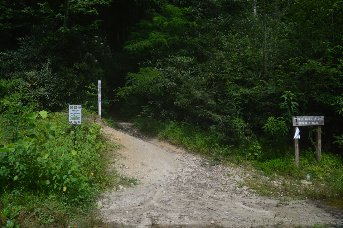
Duration of Hike: 9:30 Type of Hike: Loop (with side trips) Difficulty Rating: 7 out of 10 Total Elevation Gain: 2513 Feet Pros: Relatively little elevation gain for such a long hike (and most of the ascents are gradual) Cons: Primitive and overgrown trail with many wet crossings between North Harper Creek Trail junction and Raider Camp Trail upper junction Points of Interest: Harper Creek Falls - 7 stars; Bard Falls - 4 stars; South Harper Creek Falls - 10 stars collectively for all three views Trail Blaze Colors: Harper Creek Trail - Orange; North Harper Creek Trail - Blue; Raider Camp Trail - Yellow; Mountains-to-Sea Trail - White Circle Best Seasons to Hike: Spring; Summer; Fall Fees: None Beginning Point: Harper Creek Trailhead off Brown Mountain Beach Road Directions from Linville, NC: From the intersection of Roseboro Road and Linville Avenue in downtown Linville, follow Roseboro Road East for 10.6 miles. The road becomes unpaved after 1.7 miles. With the exception of a brief paved stretch in the middle, the rest of the road is unpaved (but in excellent shape). At the T-intersection with Edgemont Road, turn right. The road begins paved but quickly turns gravel again. In 2.1 miles, turn right onto Brown Mountain Beach Road in the community of Mortimer. Follow the road for 1.5 miles to the Harper Creek Trailhead and its large parking area on the right. Map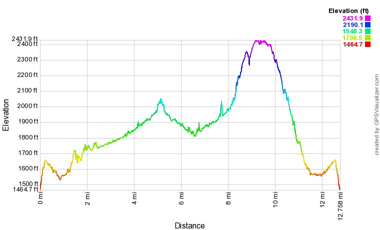
Click here to download a track of this hike.
Details
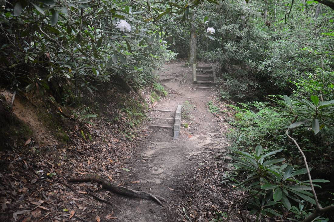
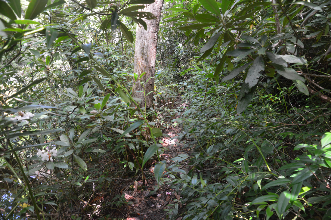
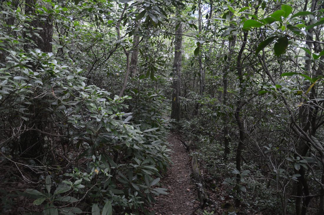
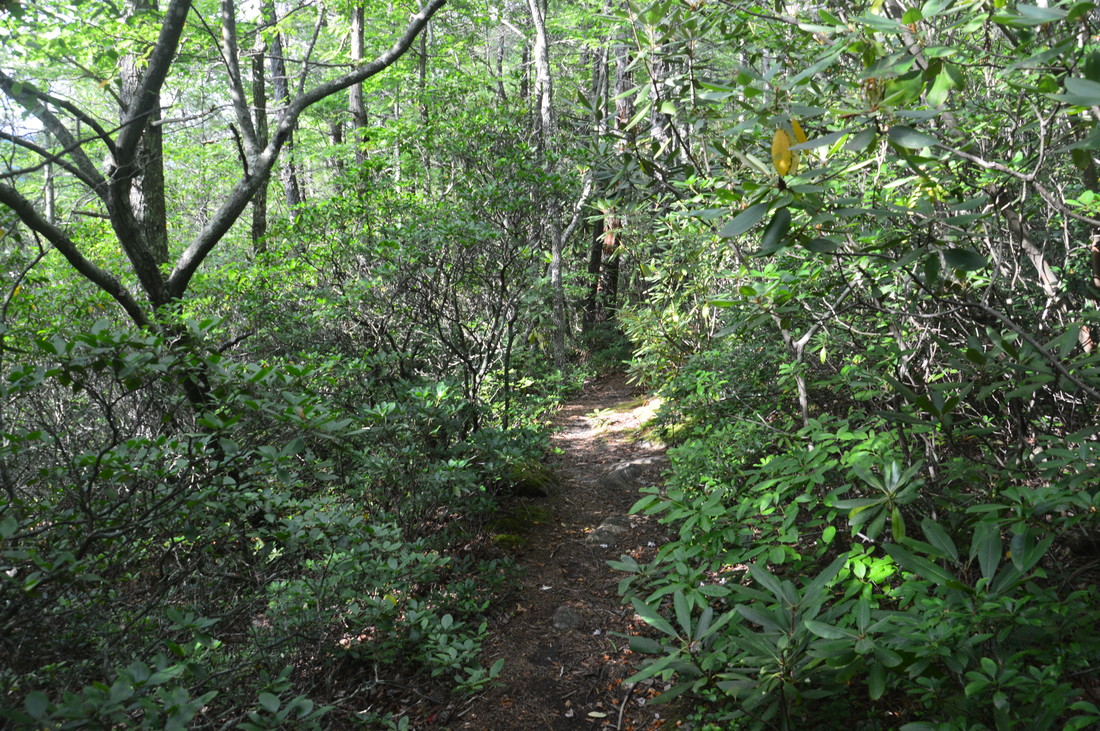
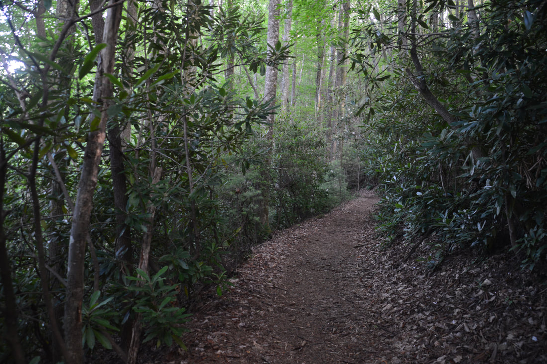
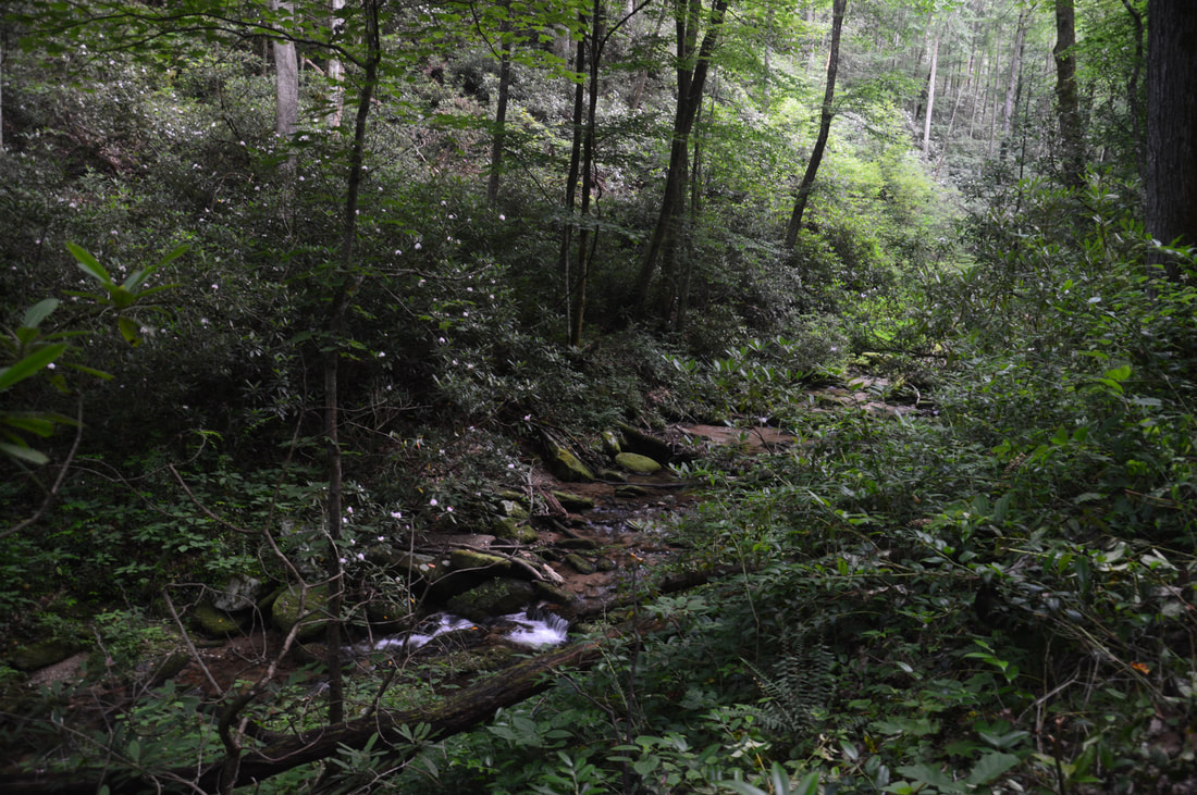
In a lot of ways, hiking the Harper Creek Loop reminded me many hikes that I have done in Georgia's Cohutta Wilderness. Of course, the waterfalls in the Harper Creek area - which is actually a wilderness study area - are generally more impressive and plentiful, which is why I enjoyed this hike as much as I did. Throughout the hike, there are 24 wet fords (14 without the side trip to Bard Falls) and portions of primitive creekside trail that make this hike an excellent rewarding wilderness experience.
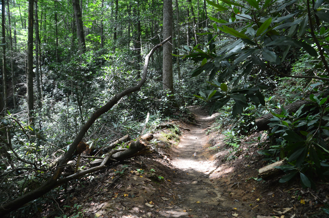
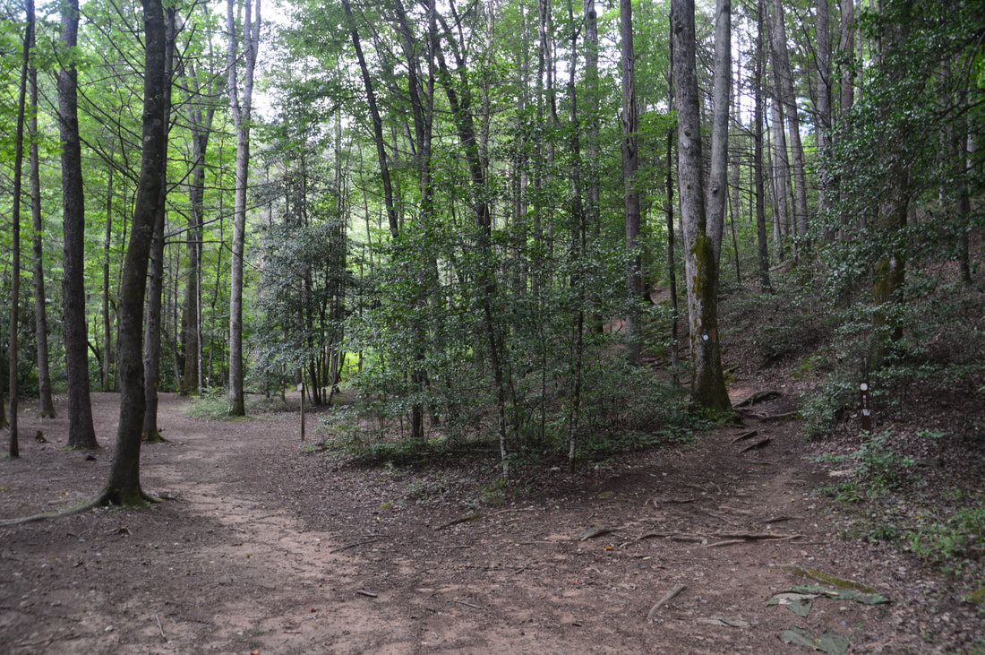
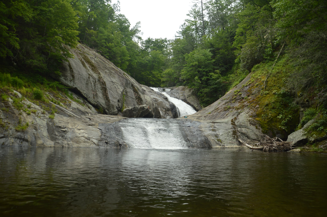
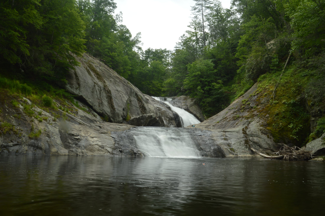
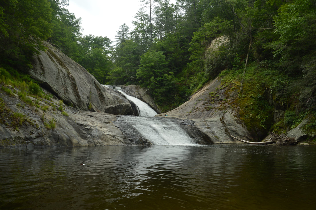
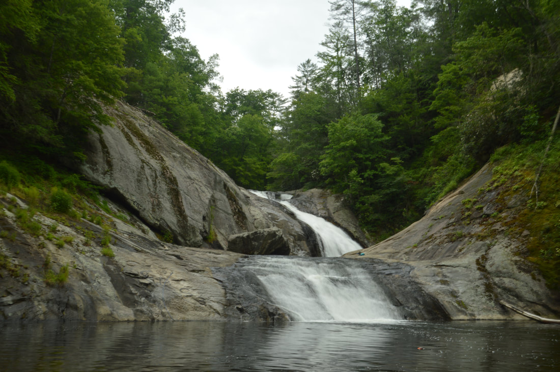
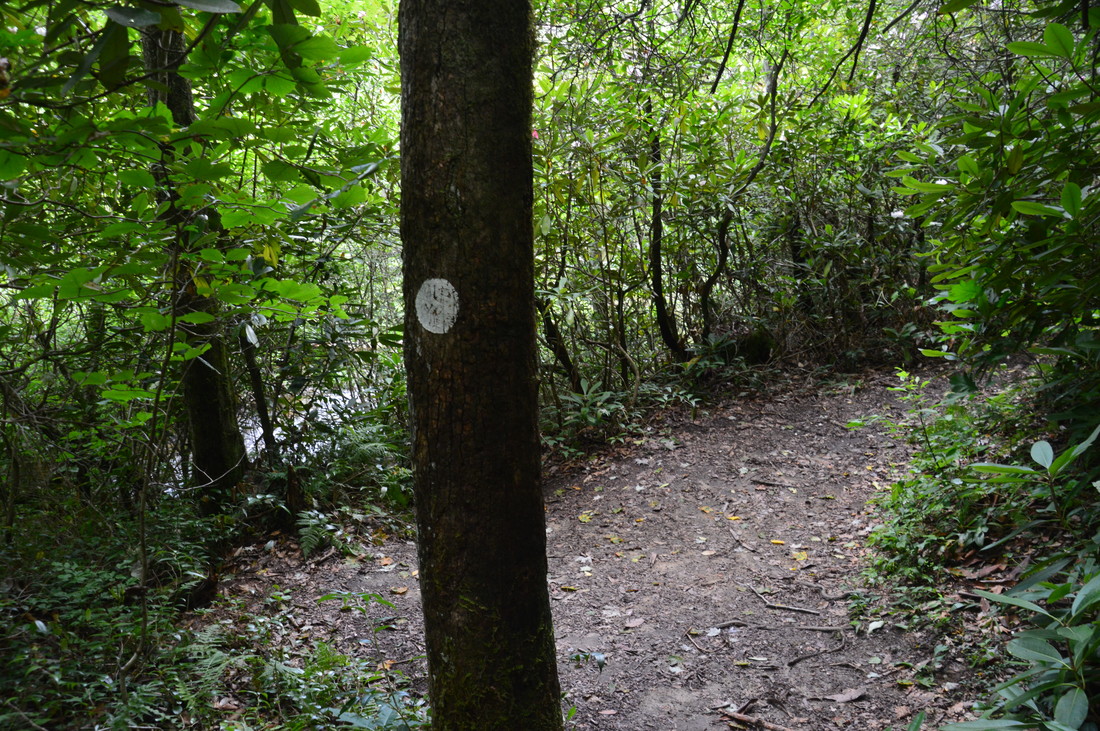
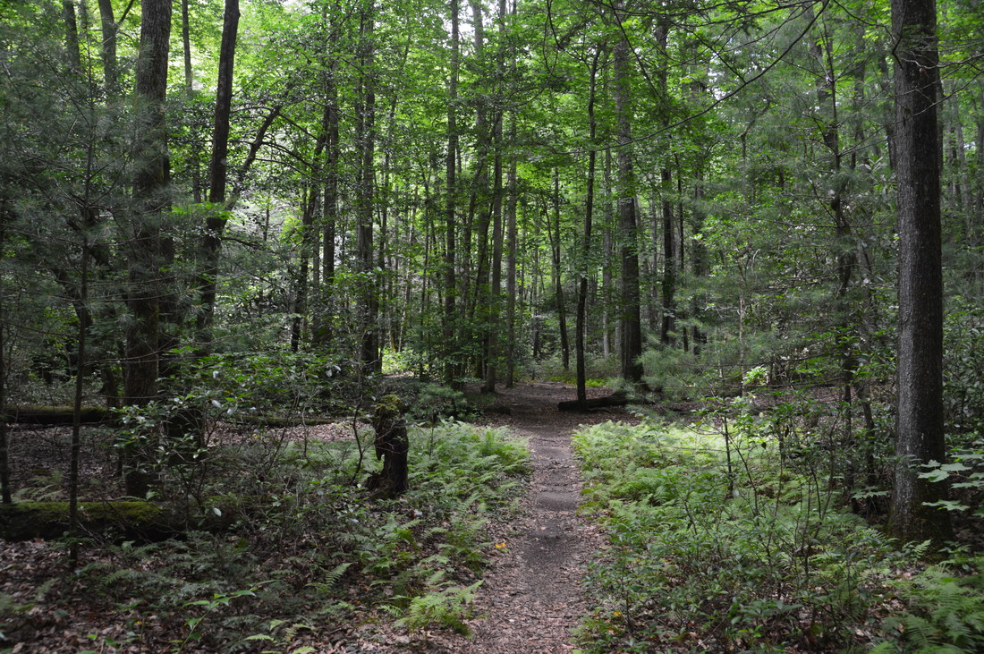
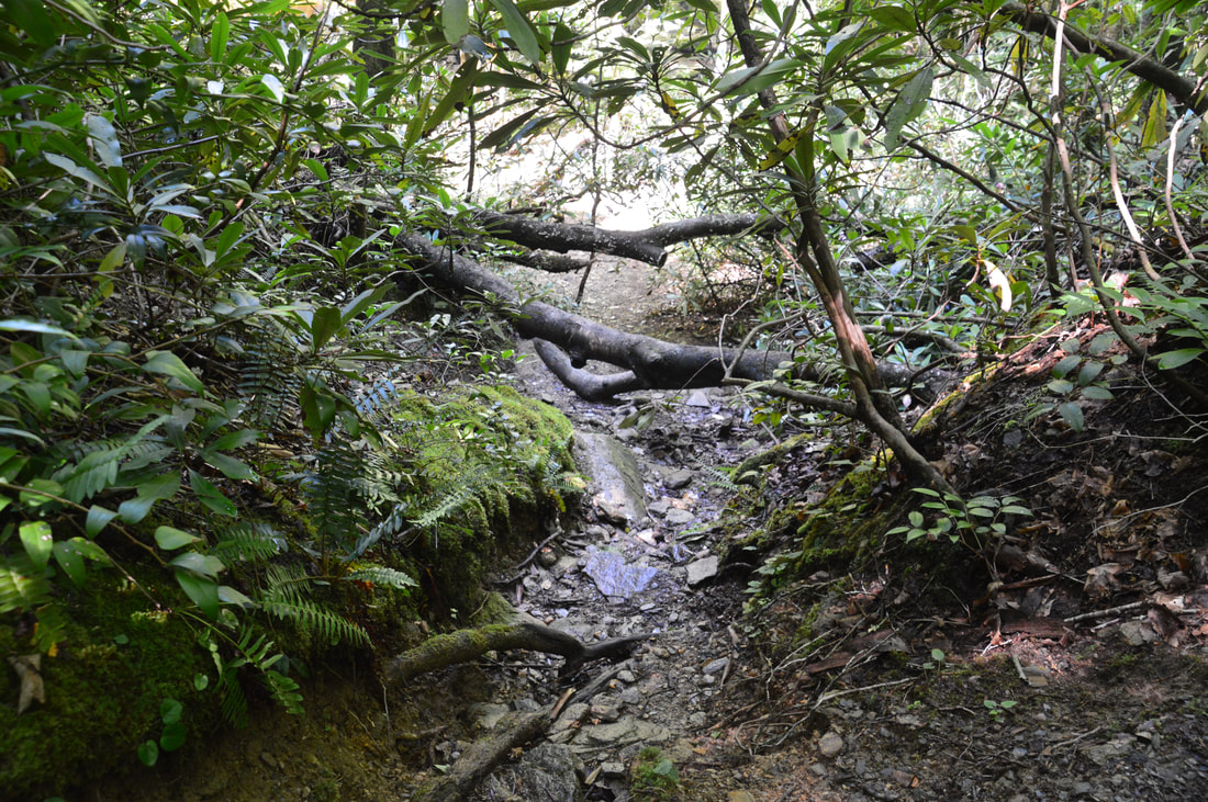
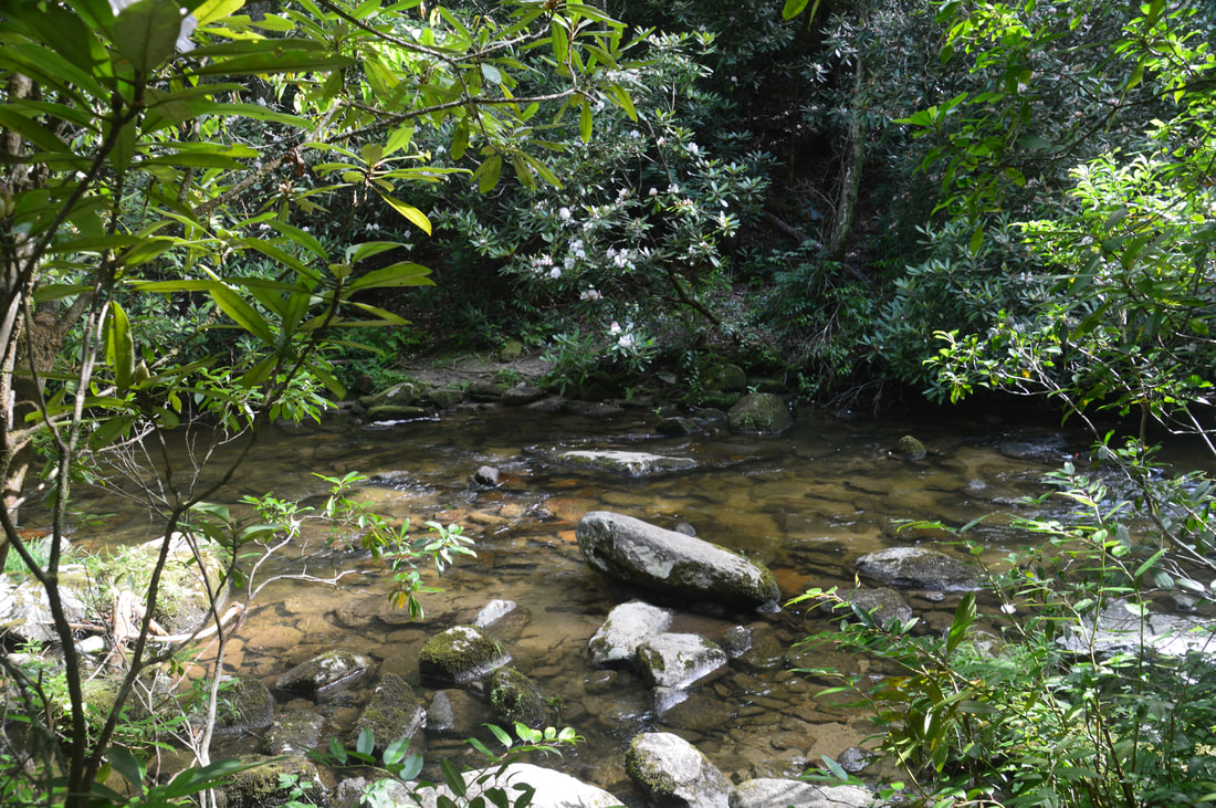
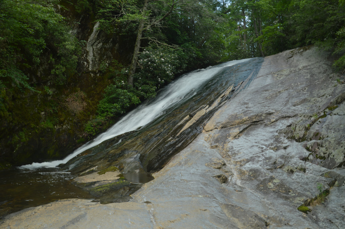
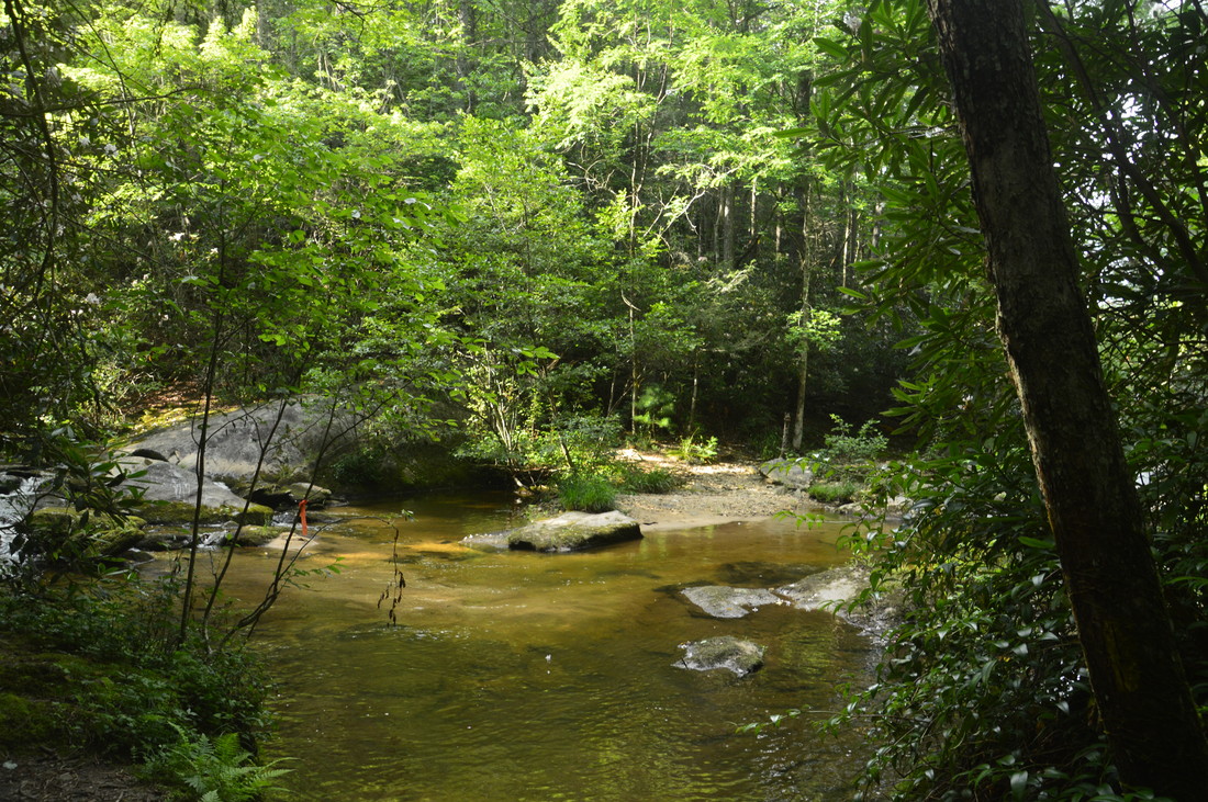
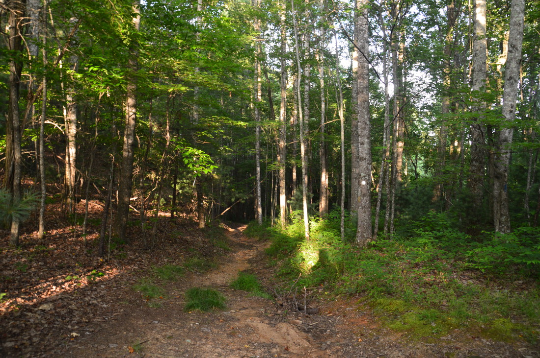
Begin the Harper Creek Loop by entering the woods at the Harper Creek Trail sign off Brown Mountain Beach Road. Right off the bat, there is a steep ascent up a ridge that comes down from Yellow Buck Mountain and separates Harper Creek from Wilson Creek. The ascent does have a few steep switchbacks. At 0.25 miles, the trail reaches a gap in the ridge with a campsite to the left and the unsigned Yellow Buck Trail leaving right. The Yellow Buck Trail provides an alternative route to North Harper Creek and Bard Falls before eventually ending at Edgemont Road. For this hike, continue straight along the Harper Creek Trail as it contours along the slope high above Harper Creek while gradually descending. Between 0.8 and 0.9 miles, the trail will pass several campsites down near the creek as well as a large cliff to the right. Then, at 1.15 miles, the Harper Creek Trail reaches a junction in a large camping flat with the Raider Camp Trail. The Raider Camp Trail, your return route on the loop, continues straight, while the Harper Creek Trail bears right and uphill. The long-distance Mountains-to-Sea Trail also comes in from the Raider Camp Trail and turns onto the Harper Creek Trail, which means that you'll be following the trail in conjunction with the MST for a while. Continue on the orange-blazed Harper Creek Trail as it remains close to the whitewater of Harper Creek. At 1.35 miles, reach the unsigned junction with the side trail to Harper Creek Falls. Here, blazes direct the Harper Creek Trail to bear right, while the broad and very rooty side trail to Harper Creek Falls continues straight along an old roadbed. Follow the side trail, which narrows as the sides of the gorge steepen. The first scramble path on the left leads to a campsite by the creek. At 1.5 miles, you will see a second scramble path on the left - this path leads to the base of the falls, but first, continue hiking straight to the Harper Creek Falls overlook. About 200 feet farther, a third scramble path on the left leads to the base of the main middle drop of the falls, but this scramble path has a very difficult and dangerous rope descent down a steep rock face that is not recommended for most hikers. Plus, the view from the midpoint isn't any better than the other two views, and you would probably only want to go there if you want to swim in the more secluded pool at the base of the middle tier and/or slide down the lower tier. Meanwhile, in another 50 feet, at 1.55 miles, the initial side trail ends at a great view of Harper Creek Falls. The height of the three tiers of Harper Creek Falls adds up to about 50 feet, although you can only see the upper two tiers from the overlook. The upper tier is a small cascade, while the middle tier is a powerful steep slide. The lower tier is hiding behind the vegetation to the far left. What I really like about this view is that it provides the best perspective on the huge sloping rock slab to the left of the falls. 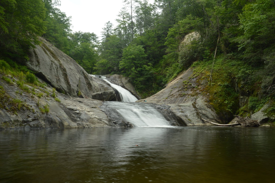
Harper Creek Falls is the first waterfall that you'll see on the Harper Creek Loop. While not the biggest waterfall in the watershed, this 50-foot triple tier falls is gorgeous and well worth the scramble.
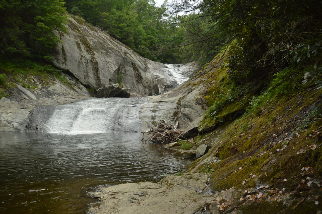
To reach the base of the falls, return back to the second scramble path. The path descends steeply for 100 feet to the pool at the base. The last part of the descent has a steep rock slab that was equipped with a rope when I was there. The descent down the rock slab wasn't too difficult for me, but it definitely isn't the same for everyone. After rain, the rocks will be very slippery. However, keep in mind that this is much easier than the insane descent down the third scramble path to the midpoint of the falls. Also, on the second scramble path, there is a small bypass on the left side of the rock slab with the rope that can be used to avoid the rock, although the bypass is pretty steep too. The pool at the base of Harper Creek Falls is massive and very deep in places, making it a popular swimming hole on good summer weekends. From the pool, Harper Creek Falls appears to be smaller than it really is, but together with the pool and the enormous rock slabs and cliffs, the falls remains quite gorgeous.
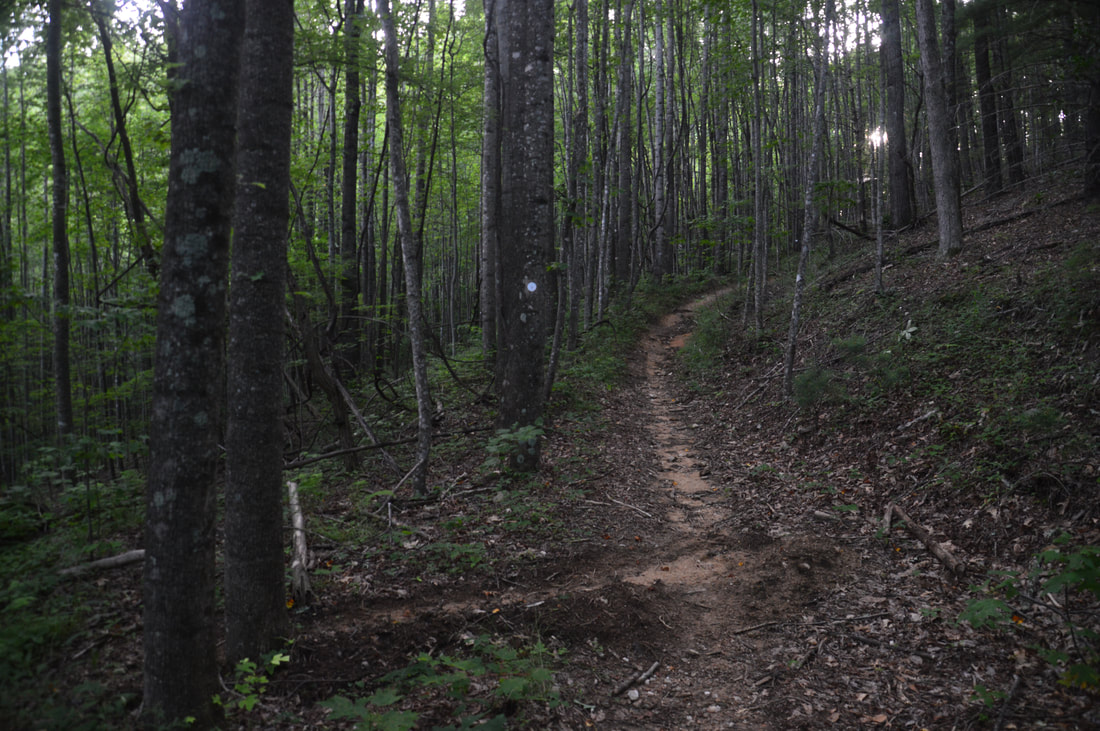
From the base of Harper Creek Falls, retrace your steps back to the Harper Creek Trail, reaching it at 1.8 miles. Turn sharply left onto the trail and follow it as it parallels the side trail but stays above it to bypass the rugged cliffs around the falls. At 1.95 miles, the trail will pass directly above the falls before slowly descending back to the level of the creek and passing the first of many first-rate campsites near Harper Creek. Most of the trail between this point and the North Harper Creek junction is nearly flat. At 2.7 miles, the Harper Creek Trail reaches Ford #1 of Harper Creek. Like most other fords on this hike, the ford is fairly wide and was around ankle-deep on this day. There is only one ford on this hike that is above knee-level during normal summer flow, although in spring, the fords will be deeper. The trail makes Ford #2 at 3.0 miles. Most fords provide beautiful views up and down the broad creek. The Harper Creek Trail then reaches a junction with the North Harper Creek Trail at 3.7 miles. Here, the Harper Creek Trail bears left and becomes much narrower, while the broader blue-blazed North Harper Creek Trail bears right in conjunction with the MST. The North Harper Creek Trail actually looks like the main trail at this junction, as the Harper Creek Trail resembles more of a fishing path. If you want to just hike the main loop, you have to stay left at the junction (it is easy to take the wrong trail). If you are interested to make the 2.9-mile (roundtrip) side trip to Bard Falls though, like I did, stay right on the North Harper Creek Trail, which rises up a small hill before coming alongside North Harper Creek - another large stream nearly the size of Harper Creek. Note that in this trail report, the ford count for the North Harper Creek Trail is separate from the main loop. There are 14 fords on the Harper Creek Loop and 5 fords in each direction on the North Harper Creek Trail below Bard Falls. At 3.95 miles, the trail makes Ford #1 of North Harper Creek, quickly followed by Ford #2 at 4.0 miles and Ford #3 at 4.2 miles. At 4.5 miles, there is a junction with the yellow-blazed Persimmon Ridge Trail at Ford #4. The Persimmon Ridge Trail comes in from the left and briefly joins the North Harper Creek Trail as the trail fords the creek. On the other side of the creek, the North Harper Creek Trail turns left and continues to closely follow the creek, while the Persimmon Ridge Trail bears right and connects to the Yellow Buck Trail. Stay on the North Harper Creek Trail, which quickly makes Ford #5 - the final ford before Bard Falls - at 4.55 miles. Crossing the creek from east to west, this is by far the deepest ford on the hike. The trail crosses North Harper Creek through a long pool that was waist-deep on this day during normal summer flow. It may be even deeper in spring, although I suppose that there could be shallower crossing points downstream or upstream. Fortunately, there was pretty much zero current at this ford. On the other side of the creek, the trail soon passes straight through a long and somewhat confusing flat with a campsite before rising a bit above the creek. As I was approaching Bard Falls, I luckily noticed at the last second the small copperhead sprawled across the trail - the first venomous snake I had encountered on a hike in nearly a year. As Bard Falls comes into view, the North Harper Creek Trail reaches the Bard Falls side trail on the right at 5.1 miles. The distinct side trail is unmarked, but it should be fairly easy to spot as you will have seen the falls through the trees just before it. The side trail descends down a small gully, over a couple downed trees, and passes through a campsite before reaching the base of Bard Falls at 5.15 miles. 
Bard Falls is a scenic 25-foot waterfall on North Harper Creek. The large heart-shaped pothole on the left side of the falls is unique to Bard Falls.
Bard Falls is a small but scenic waterfall. The falls is about 25 feet high. It begins with a sliding section followed by a short free-fall into a churning channel. The channel twists around the rock slabs below the falls before emptying into a small pool. The large rock slab on the left side of the falls is home to a beautiful large pothole that is shaped like a heart. This pothole is what makes Bard Falls particularly unique and attractive despite its small size. Bard Falls is the lower waterfall on North Harper Creek. A breathtaking upper waterfall called simply North Harper Creek Falls lies a couple miles upstream. Even though the North Harper Creek Trail continues to North Harper Creek Falls, adding it on to this hike was unrealistic due to the distance. The easiest route to North Harper Creek Falls is from a different trailhead off Pineola Road.
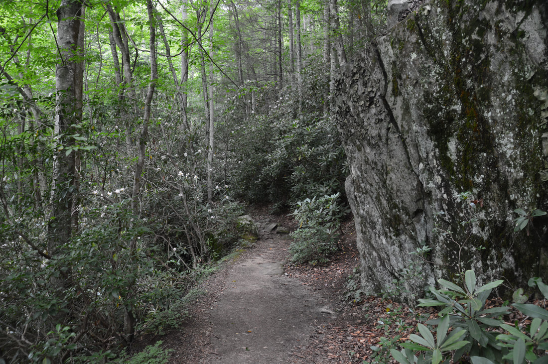
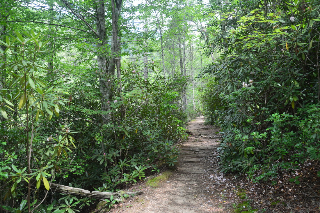
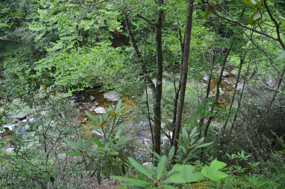
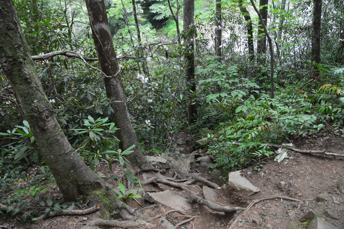
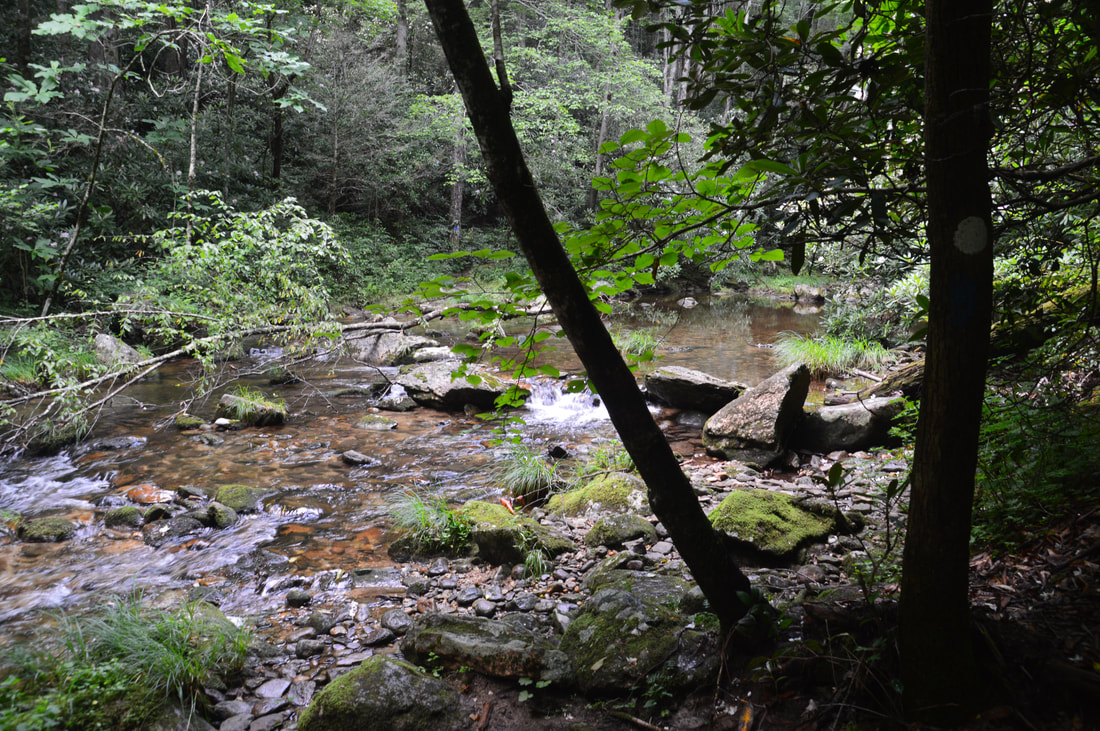
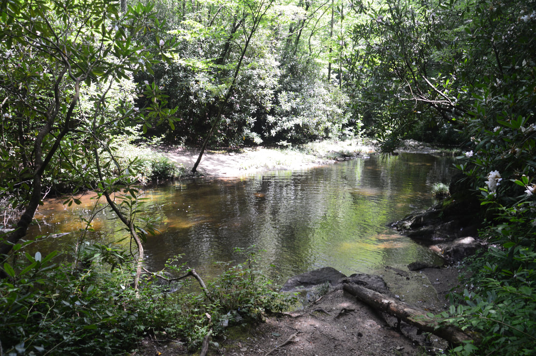
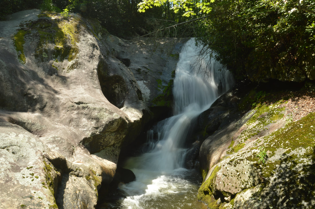
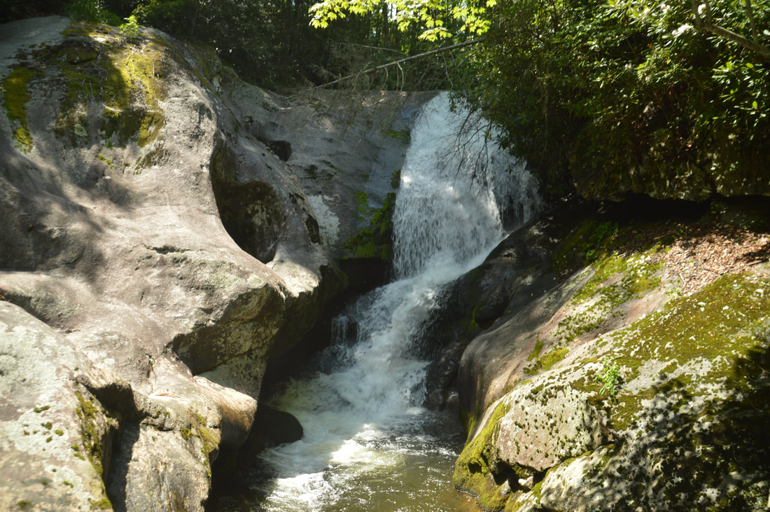
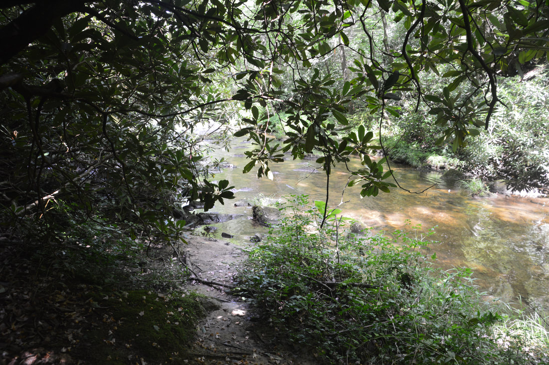
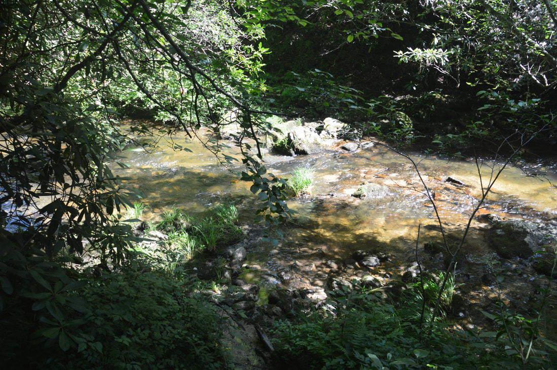
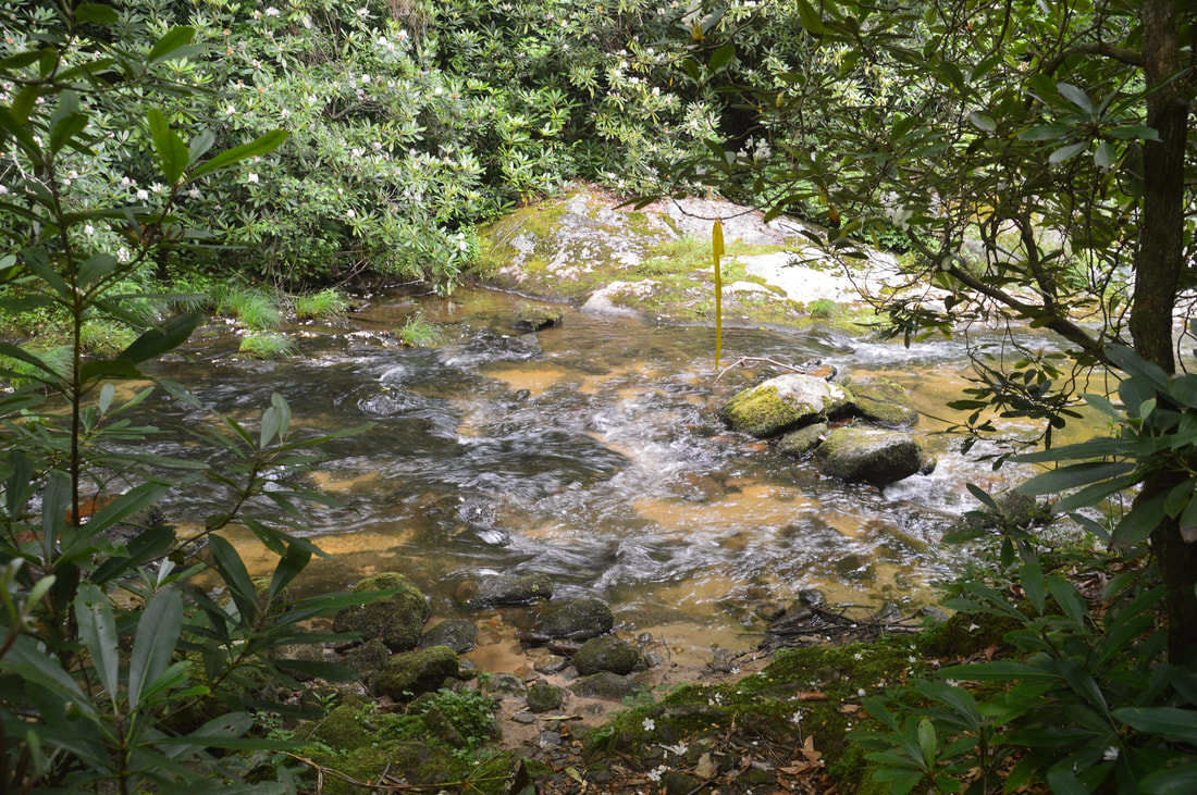
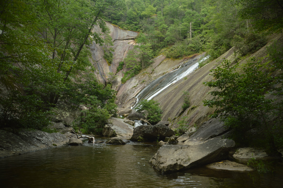
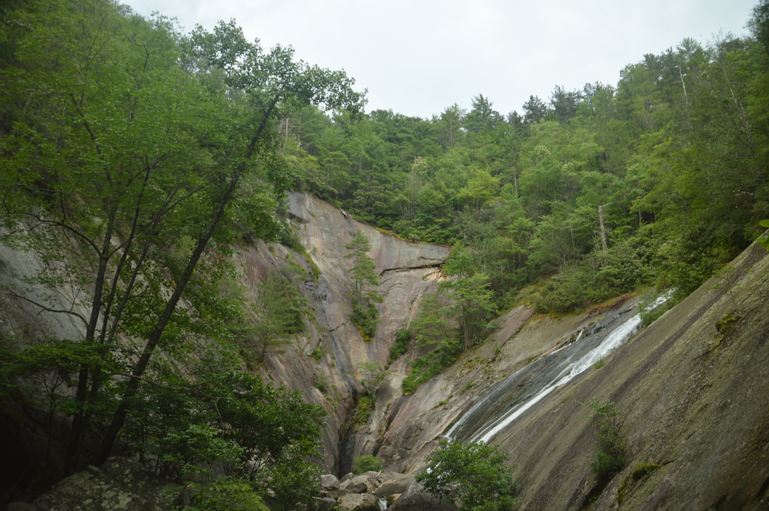
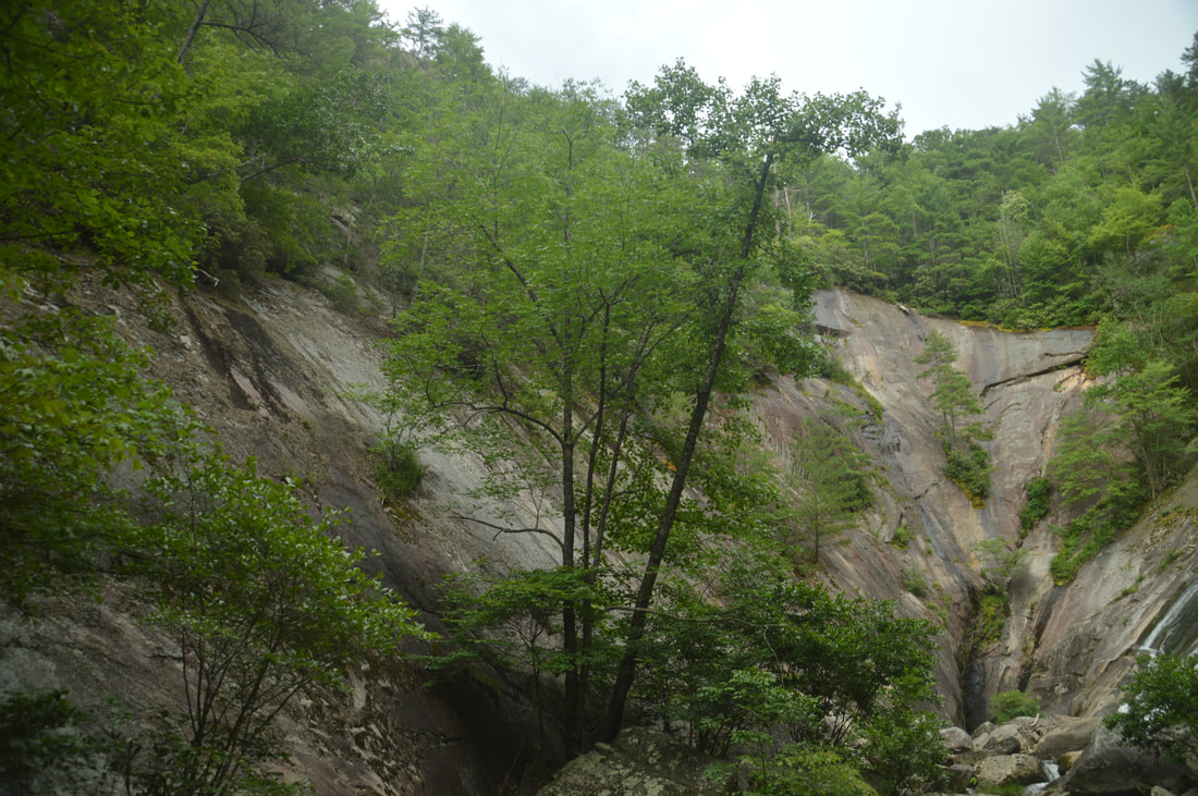
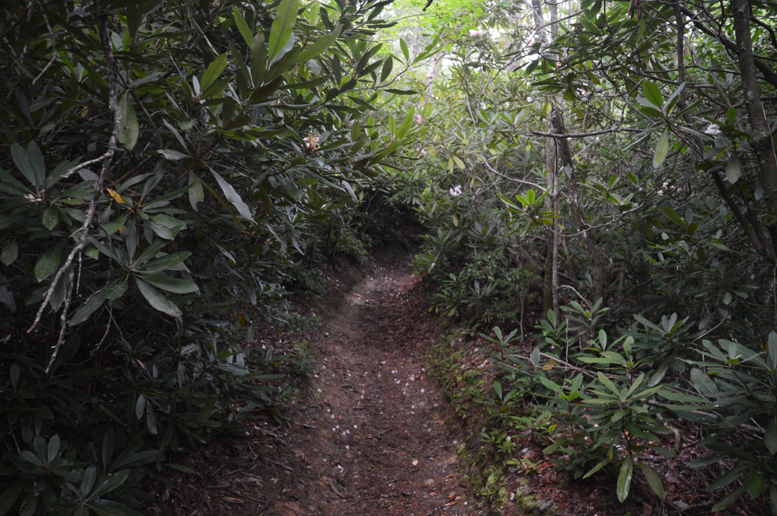
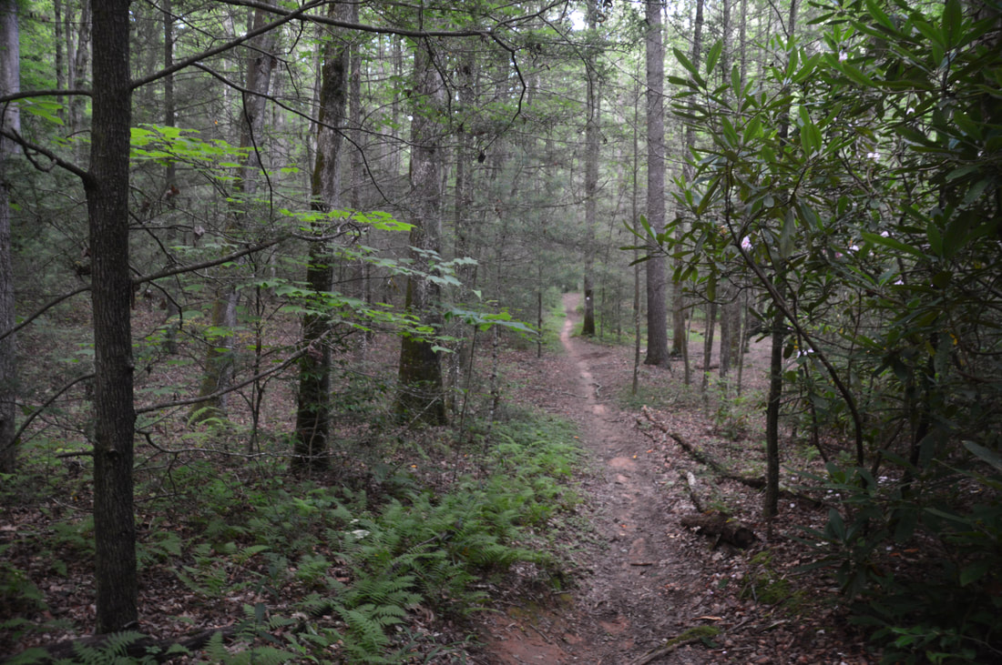
From Bard Falls, simply retrace your steps along the North Harper Creek Trail and through the five fords back to the Harper Creek junction, returning to it at 6.6 miles. Now, turn right onto the Harper Creek Trail and follow it for a few feet to Ford #3 (remember that the ford count for the Harper Creek Trail excludes the Bard Falls side trip). The next 1.9 miles are the most difficult part of the hike, as the trail is primitive and frequently overgrown with downed trees and very few blazes. In addition, there are 10 fords in this section (including Ford #3). From a physical standpoint, the trail remains fairly easy and nearly flat with occasional periods of gentle ascent until it approaches the base of South Harper Creek Falls. Ford #4 is at 6.8 miles, Ford #5 is at 6.95 miles, and Ford #6 is at 7.0 miles. After a short-lived dry stretch, the trail arrives at Ford #7 at 7.35 miles - a crossing of large but unnamed Harper Creek tributary. This ford will usually be wet as well. Ford #8 quickly follows at 7.4 miles as the trail reaches Harper Creek once again. Flagging tape marked many of the fords at the time of my hike. Coming up at 7.55 miles is Ford #9, which can be quite confusing. There is actually an island in the middle of Harper Creek here, so the trail crosses over onto the island and rock hops along the side of the left branch of the creek for a few feet before exiting the island and crossing the right branch of the creek at Ford #10, only 100 feet past Ford #9. Then, the trail makes Ford #11 at 7.65 miles. It is always worth taking a minute to observe the beautiful pristine waterway that is Harper Creek at each of the fords. After Ford #11, the trail embarks on a relatively long dry stretch - the longest since Ford #3. In this section, there were many downed trees at the time of my hike, but there also were several scenic cascades and slides as the terrain slowly began to steepen ahead of South Harper Creek Falls. At 8.05 miles, the trail makes Ford #12 at the top of another picturesque slide, crossing back over to the right-hand side of the creek (kayakers say River Left). This is the last ford before South Harper Creek Falls, and in fact, the massive cliffs of South Harpers Creek Falls shortly appear ahead through the trees. At 8.25 miles, there is a well-used but extremely steep scramble path on the left that provides access to the base of South Harper Creek Falls. It isn't necessary to go to the base of the falls because the best view of it will be from the cliff overlook, but if you're comfortable with the steepness of the path, I highly suggest taking it. The path descends 100 feet to Harper Creek - a campsite with a fire ring lies on the far side of the creek. You can see South Harper Creek Falls from here, but for the best view, wade through Harper Creek upstream for another 100 feet to a deep pool in the creek close to the base of the falls. 
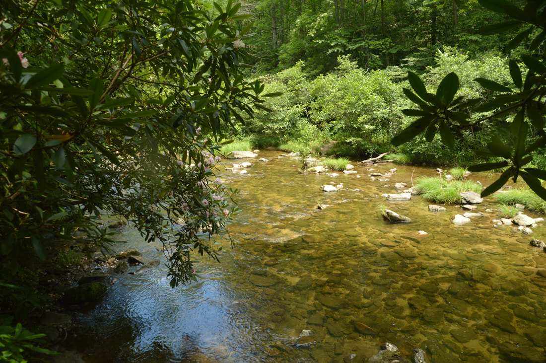
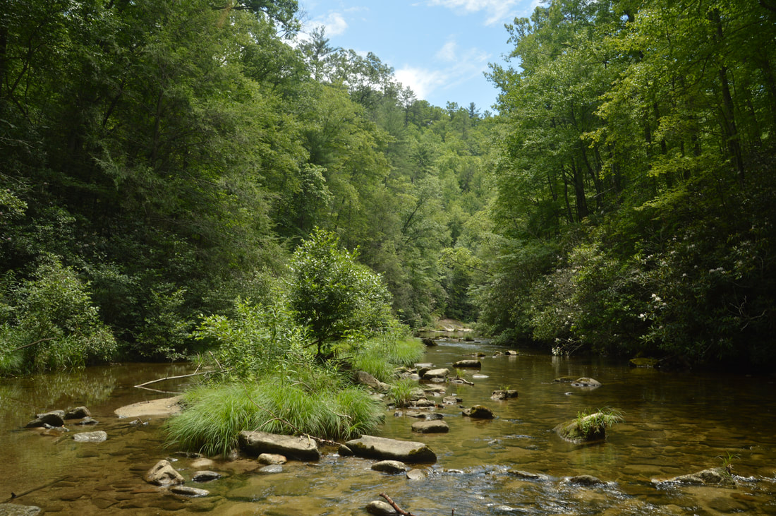
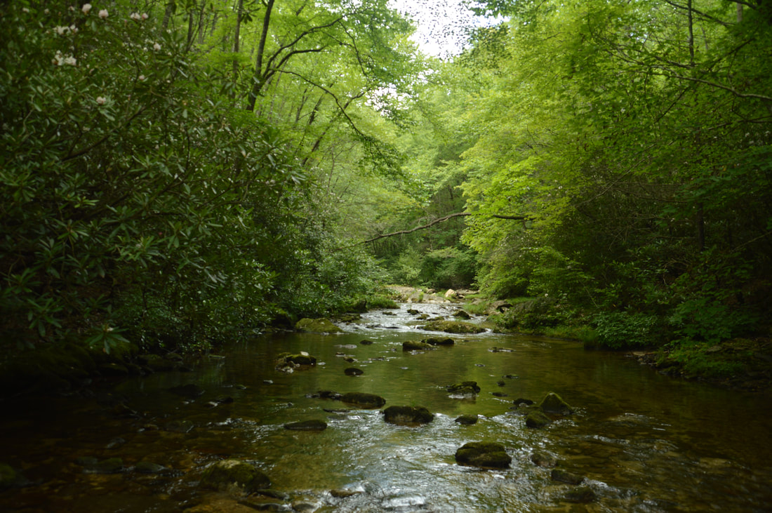
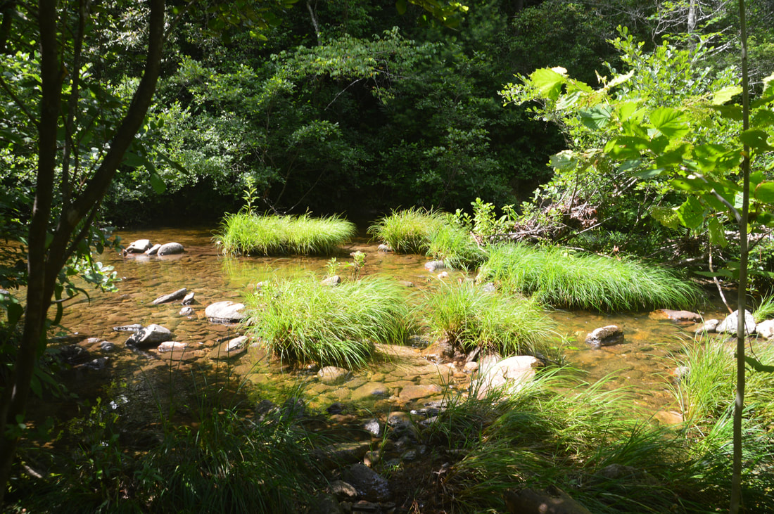
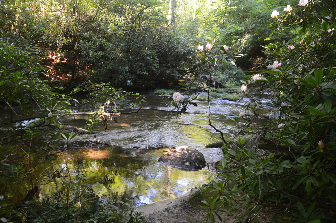
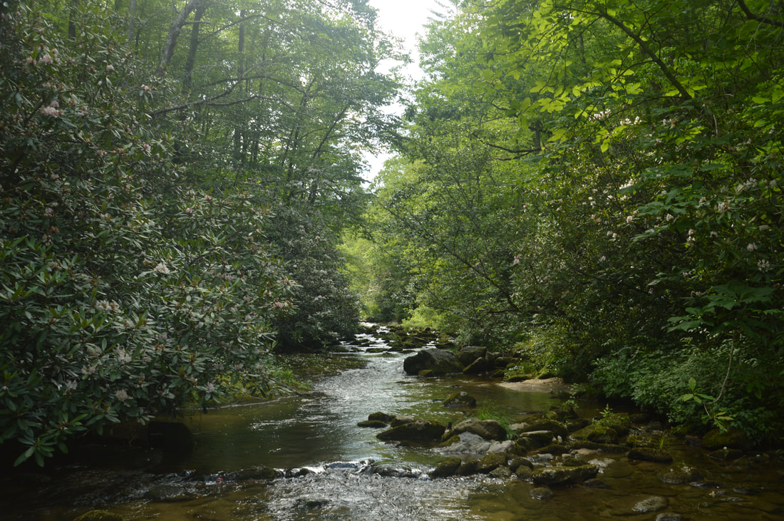
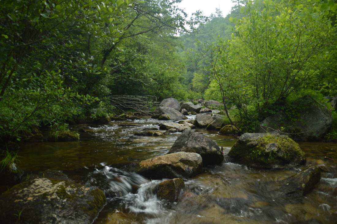
As the Harper Creek Trail crisscrosses Harper Creek over a dozen times, there are great views of this pristine mountain waterway.
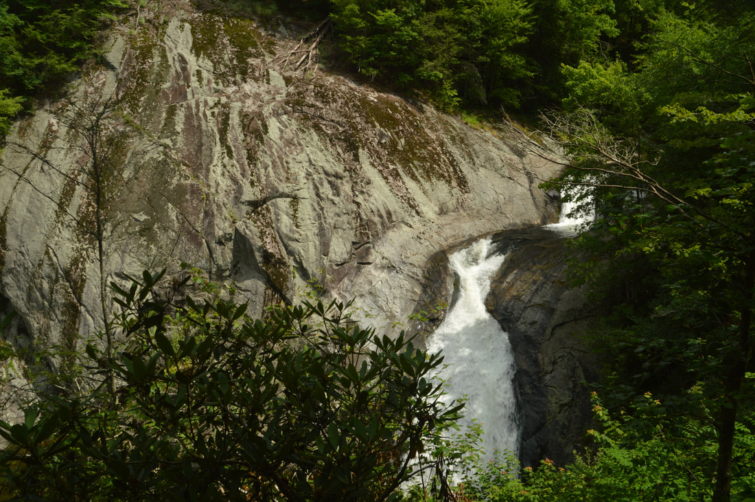
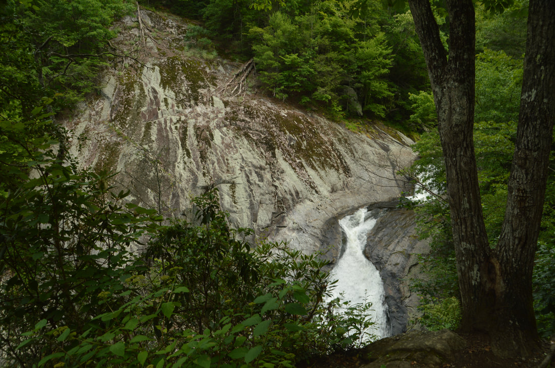
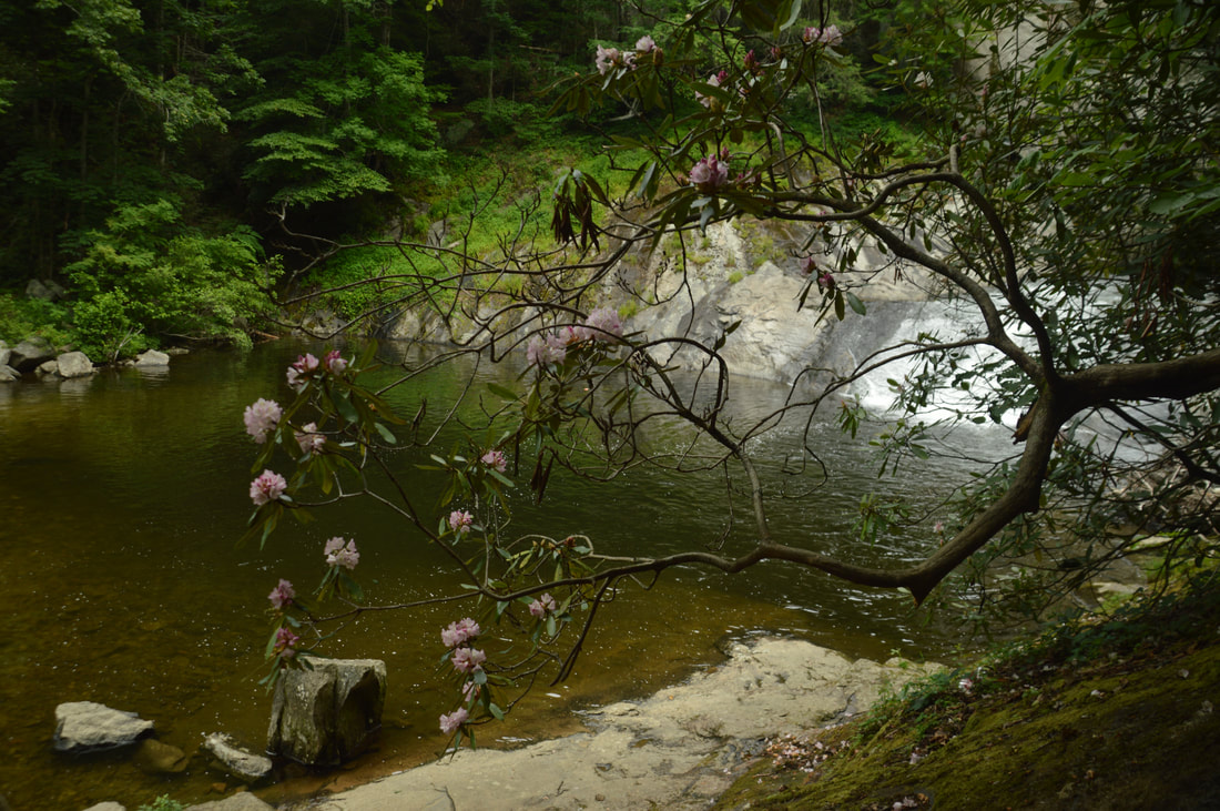
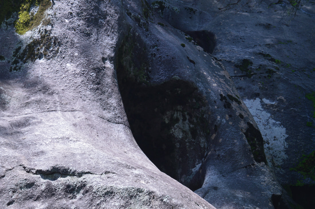
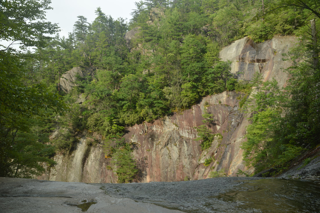
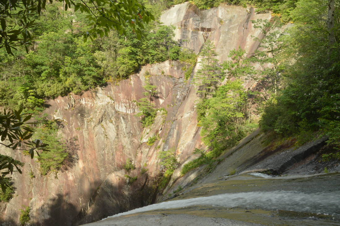
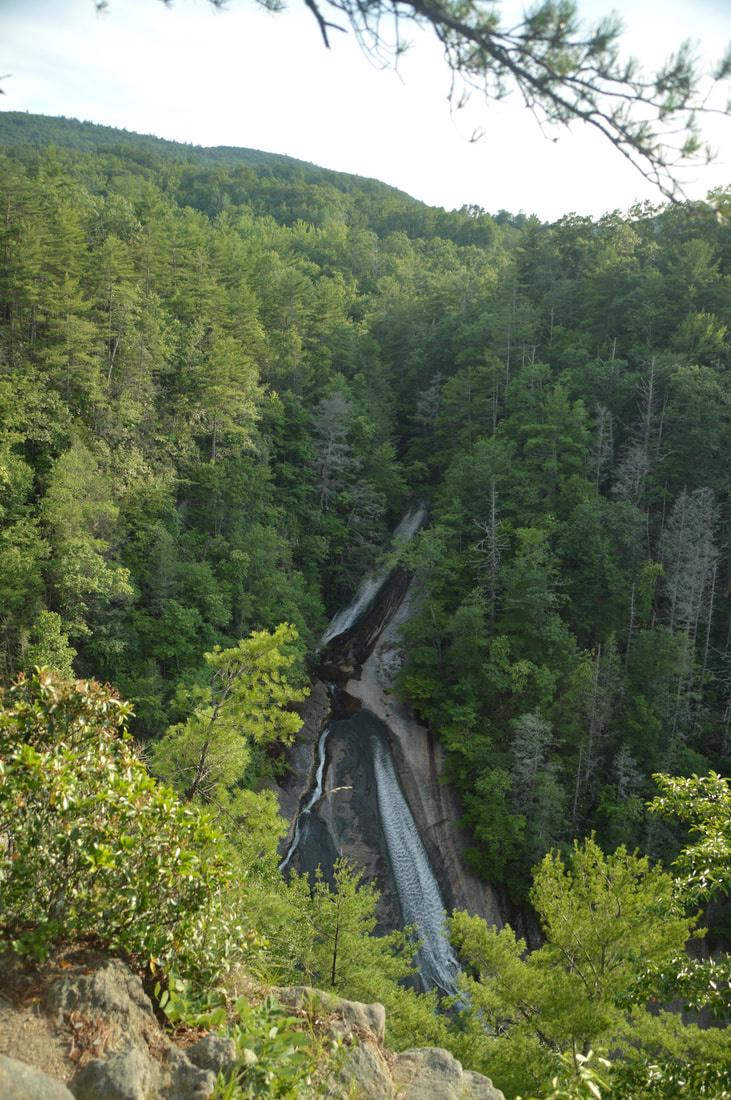
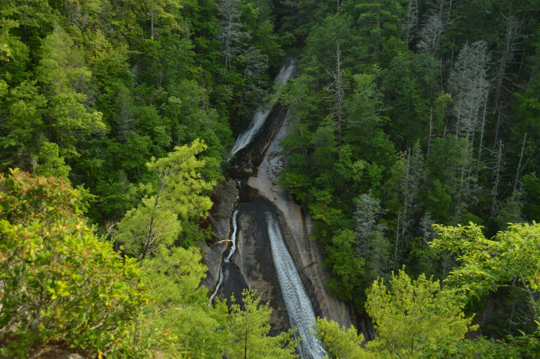
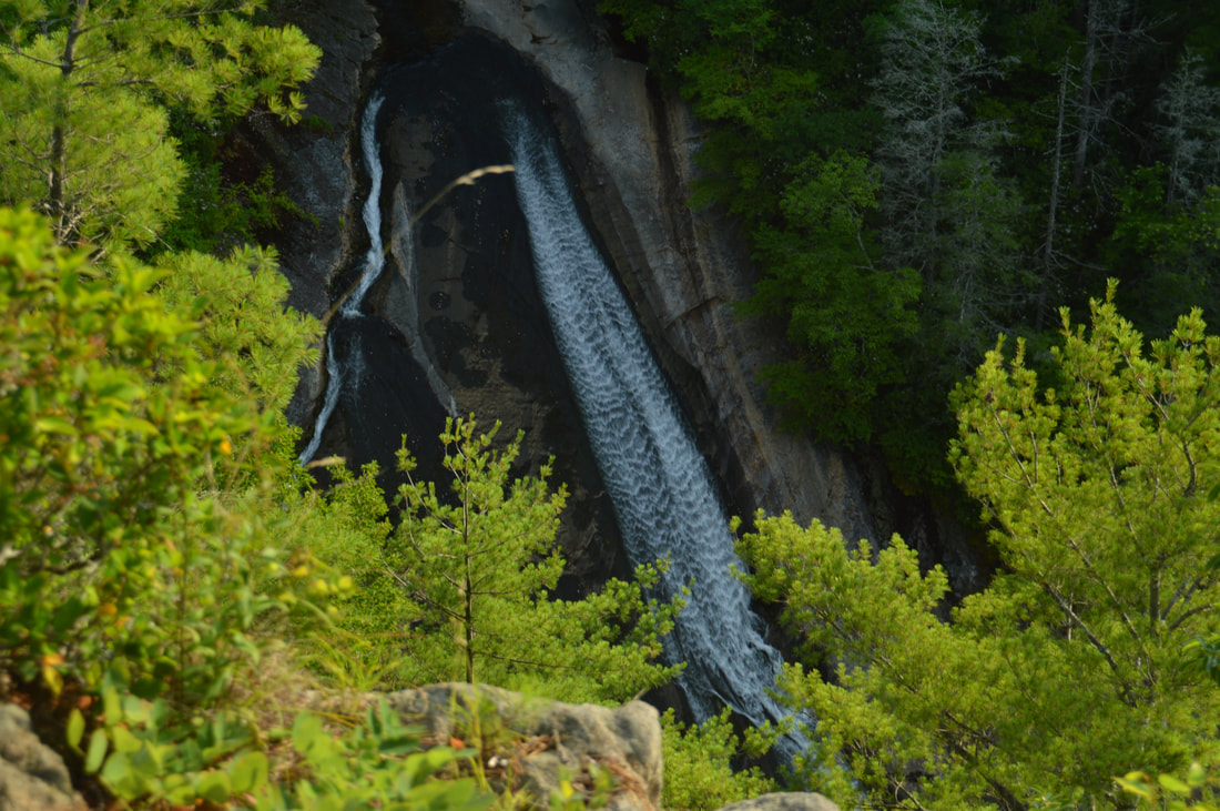
From the base, South Harper Creek Falls does not look like a great waterfall - it simply looks like a long thin sliding waterfall all of which you can't even see. You can only see about 70 feet of 120-ft South Harper Creek Falls from the base. However, the setting of South Harper Creek Falls is incredible and is one of the most beautiful waterfall settings I have seen. Huge cliffs over a hundred feet high box in the creek at the falls. The creek itself forms the waterfall over one of the cliffs, and then, the creek makes a 90-degree turn at the base of the falls, so in a way, the cliffs make it look like the creek dead-ends (because the cliffs surround the creek on three sides)! The cliff on the left side of the creek is home to the overlook of South Harper Creek Falls at the top, and soon, you'll be up there.
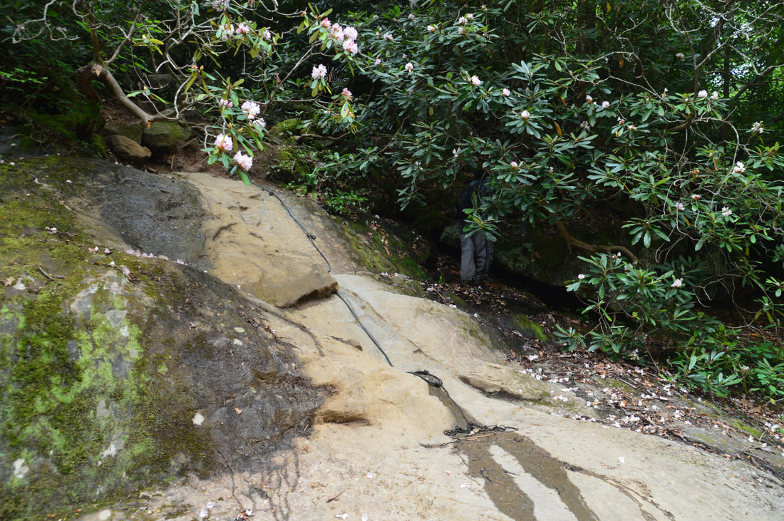
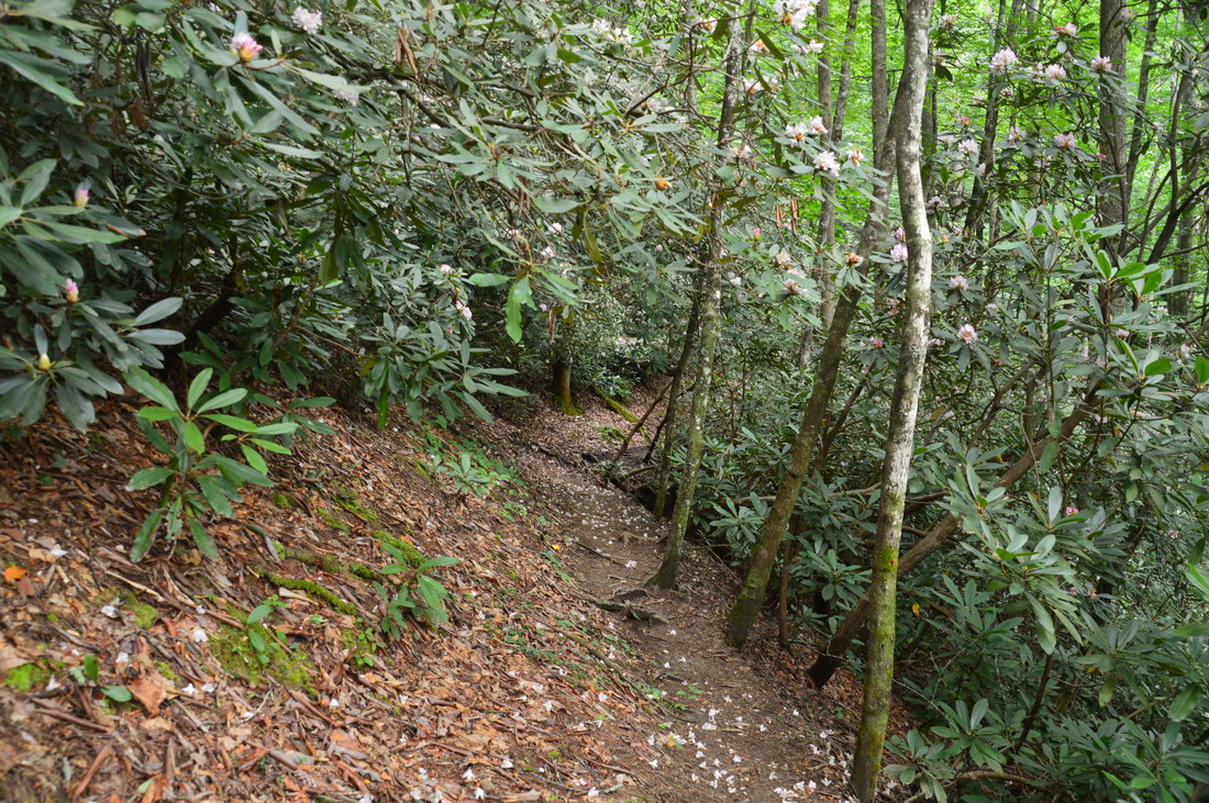
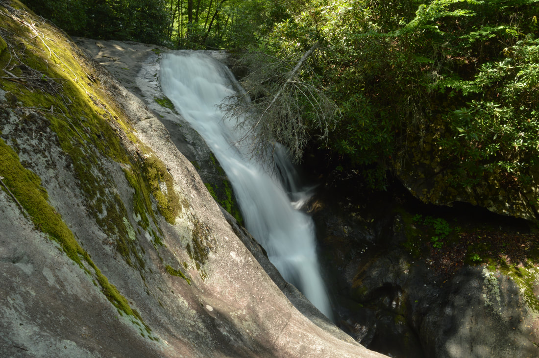
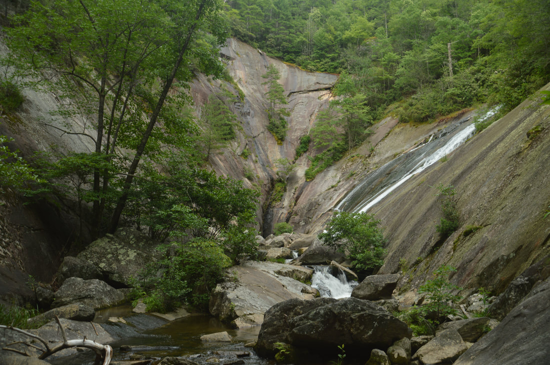
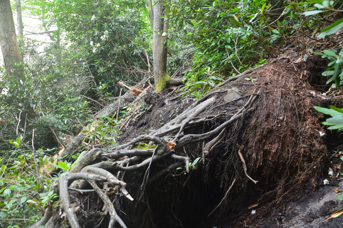
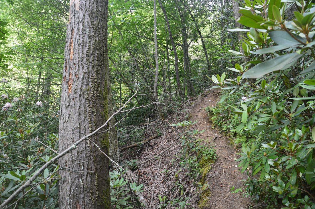
Return to the Harper Creek Trail at 8.3 miles and continue following it as it begins to ascend the South Harper Creek Falls escarpment. The next 0.1 mile is the most difficult part of the hike. The ascent begins with a steep and muddy scramble that is followed by a pair of obscure switchbacks with blowdowns. At the time of my hike, one of the trickiest blowdowns I've ever come across was on the trail a few feet after the second switchback. The tree was completely uprooted when it fell, and the tree's massive rootball was right on the trail. Getting around it was impossible due to the gorge's steep and overgrown slopes, and climbing over it involved scrambling up and down a very slippery area and getting completely muddy. At 8.4 miles, now above the main portion of South Harper Creek Falls, reach a distinct side trail on the left. Take this 100-foot side trail to the midpoint of South Harper Creek Falls. Normally, it is safe to walk out onto the flat and dry rock slabs, but if the water is up, stay away from the rocks as they will be very dangerous. With that said, this is a breathtaking view. A few feet below you, Harper Creek begins its 90-foot sliding plunge down the steep cliff. As you look across the gorge, you gain a different perspective of the spectacular cliffs just east of the falls. A few feet above you, the 30-foot upper tier of South Harper Creek Falls forms a scenic waterfall in its own right. The view at the end of this side trail is must-see. Once again, return to the Harper Creek Trail and follow it as it ascends above the upper tier of the falls and past a great campsite near the top of the falls. At 8.5 miles, the Harper Creek Trail reaches a signed junction with the yellow-blazed Raider Camp Trail. Here, the Harper Creek Trail bears right and reaches an alternative trailhead off Forest Road 58 known as the Kawana Trailhead in about 1.3 miles. The hike bears left on the Raider Camp Trail, reaching Ford #13 of Harper Creek in a hundred feet. This ford is the uppermost ford that you'll make, and during low flow, it could be rock-hopped. On the other hand, if the flow is above average, when you're crossing factor in the fact that South Harper Creek Falls lies only a few hundred feet downstream. A 25-foot sliding waterfall lies on Harper Creek just above Ford #13, but it is on private property and can only be viewed from a distance. On the other side of the creek, the Raider Camp Trail begins a gradual ascent with many switchbacks toward the cliffs. Altogether, there are five switchbacks, during which the trail is fairly overgrown but distinct. The last switchback occurs at 8.75 miles, soon after which the trail bears left at a yellow arrow as the eroded old Raider Camp Trail comes in from the right. Then, at 8.85 miles, the trail reaches a junction with an eroded gully going straight. While this gully is often used to get to the South Harper Creek Falls Overlook, it is best to stay right for a few more feet to the official graded side trail to the overlook. Follow the side trail as it descends out into open flats near the cliffs. This area would make for an amazing campsite. Continue following the obvious route to the edge of the cliffs, reaching the South Harper Creek Falls Overlook at 8.9 miles. 
The view from the midpoint of South Harper Creek Falls is absolutely breathtaking.
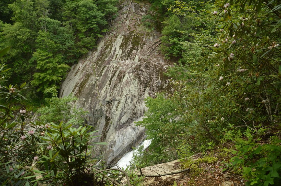
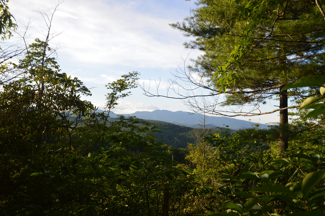
The view from the South Harper Creek Falls Overlook is jaw-dropping. From the cliffs, you can see nearly the entire run of the 120-foot waterfall. You can see both the upper and lower tiers, although the end of the lower tier is hidden by vegetation. Remember that rock slab that you were standing on at the midpoint of the falls? The rock looks vertical from the overlook! During the fall color season, this view is about as good as it gets, and judging by the overgrown nature of the trail, not many people go to this overlook - even from the Kawana Trailhead. But that's not even all! From the cliffs, to the right there is also a nearly clear view of Grandfather Mountain way in the distance to the north. With binoculars, you may even be able to spot some of Grandfather Mountain's signature cliffs. Last but not least, Sugar Knob rises up just to the left of South Harper Creek Falls. An interesting note about South Harper Creek Falls is that it is on Harper Creek and that there is no such creek as South Harper Creek. The waterfall was named so only to distinguish it from Harper Creek Falls and the North Harper Creek waterfalls.
From the overlook, return to the Raider Camp Trail and continue following it as ascends a ridge coming down from the Chestnut Mountain area. At 9.15 miles, the trail reaches the highest point on the hike at a junction with the Mountains-to-Sea Trail. The MTS comes in from the right and continues straight, joining the Raider Camp Trail. A right turn would lead to NC 181 in several miles, but this hike continues straight along the Raider Camp Trail, which now begins to follow a broad old roadbed that provides an easy and relaxing walk along a gentle downhill grade. In this section of the trail, there are several great winter views of Grandfather Mountain to the left. At 9.75 miles, the Raider Camp Trail passes a blue-blazed trail on the right that is not shown on maps but likely connects to the MST or Pine Ridge Trail. Meanwhile, the Raider Camp Trail leaves the old roadbed and begins descending fairly steeply along an eroded path into the Raider Camp Creek valley. The trail briefly comes alongside the creek at 10.75 miles, passing a small and inaccessible waterfall. Even though the rest of the trail stays in the valley, it rarely follows the rugged and dense sides of Raider Camp Creek and instead follows the hillside above it, curving in and out of numerous hollows with small streams. At 11.2 miles, the trail comes alongside Raider Camp Creek again before reaching its confluence with Harper Creek at 11.5 miles. Turn left to stay on the trail and briefly follow it upstream along Harper Creek to the final ford of the hike - Ford #14 of Harper Creek - at 11.6 miles. This is a very wide ford but it is normally easy. On the other side of the creek, the trail crosses a small stream and passes through a large flat that serves as a camping area just before reaching the end of the hike's loop section at the Harper Creek Trail at 11.65 miles. Stay straight on the Harper Creek Trail, following a section of the trail that you hiked at the beginning of the day. You will reach the end of the trail back at the trailhead and your car at 12.8 miles, concluding the hike. The Harper Creek Loop is a top-notch water hike. With three spectacular waterfalls and such a fun and great experience of constantly following and fording Harper Creek and North Harper Creek, I decided to rate this hike a "Best Hike". I highly recommend for all waterfall enthusiasts to do this hike. Mileage
0.0 - Harper Creek Trailhead
0.2 - Yellow Buck Trail Junction 1.15 - Raider Camp Trail Junction (Lower) (Begin Loop) 1.6 - Harper Creek Falls 3.7 - North Harper Creek Trail Junction 4.5 - Persimmon Ridge Trail Junction 5.15 - Bard Falls 6.6 - Return to North Harper Creek Trail Junction 8.3 - Base of South Harper Creek Falls 8.4 - Midpoint of South Harper Creek Falls 8.5 - Raider Camp Trail Junction (Upper) 8.9 - South Harper Creek Falls Overlook 9.15 - MST Junction 11.65 - Harper Creek Trail Junction (End Loop) 12.8 - Harper Creek Trailhead Variations
Hike out and back from Harper Creek Trailhead to Harper Creek Falls - 3.2 Miles
Hike out and back to Harper Creek Falls and Bard Falls from Harper Creek Trailhead - 9.85 Miles Hike out and back to South Harper Creek Falls Overlook via Raider Camp Trail from Harper Creek Trailhead - 7.8 Miles Hike out and back to Base of South Harper Creek Falls via Harper Creek Trail from Harper Creek Trailhead (this includes the side trip to Harper Creek Falls but not Bard Falls) - 10.35 Miles Hike out and back to South Harper Creek Falls Overlook and Base/Midpoint of South Harper Creek Falls from Kawana Trailhead - About 3.9 Miles Hike the Harper Creek Loop without the Bard Falls side trip - 9.9 Miles Bonus Stops
Consider stopping by the Little Lost Cove Cliffs, accessed by a short hike with great views off Pineola Road, also in the Wilson Creek area.
PicturesVideos
1 Comment
Jennifer
8/3/2021 09:37:43 am
Do I need a permit to stay 1 night for backpacking? Leave a Reply. |
About MeMark Oleg Ozboyd Dear readers: I have invested a tremendous amount of time and effort in this website and the Georgia Waterfalls Database the past five years. All of the work that has gone in keeping these websites updated with my latest trip reports has almost been like a full-time job. This has not allowed me to pick up a paid job to save up money for college, and therefore, I I've had to take out loans. If you find the information on this website interesting, helpful, or time-saving, you can say "thanks" and help me out by clicking the button above and making a contribution. I will be very grateful for any amount of support you give, as all of it will apply toward my college tuition. Thank you!

Coming in 2022-2023?
Other Hiking WebsitesMiles HikedYear 1: 540.0 Miles
Year 2: 552.3 Miles Year 3: 518.4 Miles Year 4: 482.4 Miles Year 5: 259.9 Miles Archives
March 2021
Categories
All
|


 RSS Feed