
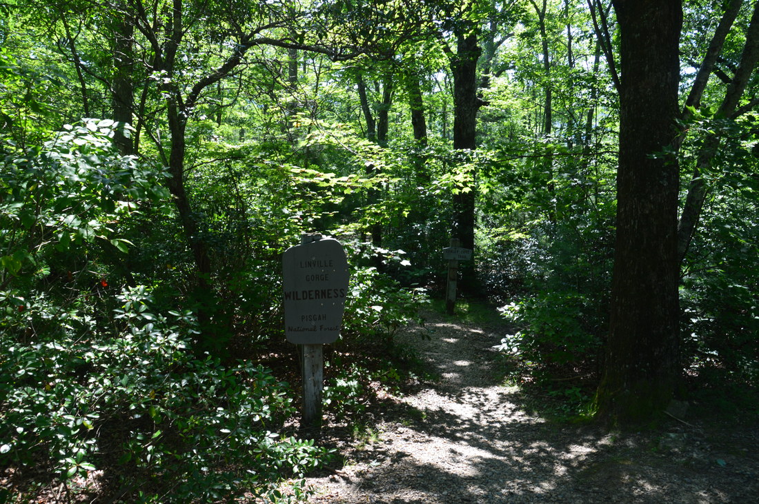
The Linville Gorge Wilderness of Pisgah National Forest, North Carolina's third largest wilderness area, encompasses an area that is one of the most rugged areas in the Southeast: Linville Gorge. Flowing along the bottom of the gorge is the boulder-strewn Linville River, located as much as over 1500 feet below the gorge's rims at its deepest spots. The Linville Gorge Trail runs through nearly the entire length of the gorge, passing countless obstacles as it follows the steep banks of the Linville River for miles. An array of trails and roads runs along the rims of the gorge, and a number of extremely steep paths provide access to the gorge floor, allowing one to hike loops of varying length encompassing both the gorge floor and rim. One of those loops is the Rock Jock Loop: a spectacular yet grueling hike that passes at least six particularly breathtaking vistas and many other smaller views as well as numerous cataracts on the Linville River and one tall waterfall on its tributary. While it is possible to hike the Rock Jock Loop in one day like I did, it will be very tiring, and in order to get the most enjoyable and relaxing experience, turning the Rock Jock Loop into a weekend backpacking trip could be a good idea. This hike occurred on Saturday, July 8th, 2017. My plan was to hike the Rock Jock Loop/Linville Gorge Loop counter-clockwise from the Conley Cove Trailhead. This hike was the seventh of ten hikes that I did during a seven-day trip to the mountains of northwest North Carolina.
Summary
R/T Length of Trail: 12.7 Miles
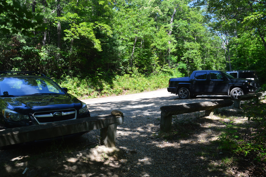
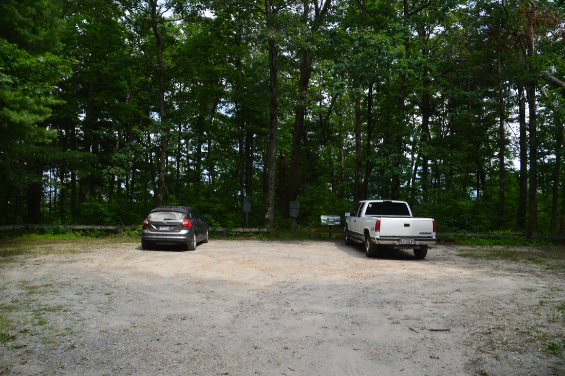
Duration of Hike: 11:50 (Yes, the hike is this slow, although this does include stops at all vistas and the falls) Type of Hike: Loop Difficulty Rating: 10 out of 10 Total Elevation Gain: 4336 Feet Pros: Countless vistas along the Rock Jock Trail Cons: Very difficult steep descent down Pinch-In Trail; the Linville Gorge Trail is very rocky and overgrown with numerous scrambles, all of which sets a slow pace; there aren't quite as many river views as desired on the Linville Gorge Trail; the hike ends with a long steep ascent that will feel punishing after a long day of hiking Points of Interest: Fern Point Vista - 8 stars; Hackers Point Vista - 8 stars; Zen Point Vista - 6 stars; Razor Point Vista - 10 stars; T-Shirt Point Vista - 10 stars; Pinch-In Vista - 9 stars; Cathedral Falls - 6 stars (much lower in dry periods) Trail Blaze Colors: All trails in the Linville Gorge Wilderness are unblazed Best Seasons to Hike: Winter, Fall Fees: None Beginning Point: Conley Cove Trailhead Directions from Linville, NC: From the intersection of US 221 and NC 181 near downtown Linville, follow US 221 South/NC 181 South for 2.9 miles and then turn left onto NC 181. Continue on NC 181 for 3.3 miles, and then, turn right onto NC 183. Follow NC 183 for another 3.8 miles, and then, turn acutely left at a Linville Gorge Wilderness sign onto Old NC Highway 105 (also known as Kistler Memorial Highway and County Road 1238). Follow this unpaved road for 5.4 miles to the parking area for Conley Cove Trail on the left. At the time of my hike, the road was in good shape and suitable for most passenger vehicles, but I have read that sometimes the road can be in much worse shape. Map
Click the link below to download a .GPX file with a track of this hike.
Details
During my trip to northwest North Carolina, I really wanted to make one hike that would be a premier loop in LInville Gorge (in my mind, a premier Linville Gorge Loop meant visiting both the gorge floor and the rim cliffs and views in one hike). There's a saying among 'Gorge Rats' though that 'Gorge Miles are tough miles', and that saying is very true of this hike. It took me nearly 12 hours to hike the full loop, with about a couple hours of total stopping at all vistas and waterfalls. Part of that was due to the extremely steep descents and ascents. In fact, the Pinch-In Trail is by far steeper than any trail of the same length that I've hiked. But also, all of the trails on this hike are rocky, overgrown, or both, not allowing a fast pace anywhere throughout the loop. The Rock Jock Trail is a bit faster than the other trails on this hike, but the difference is very marginal, as the trail is still pretty rugged and there are many side trails and vistas along it.
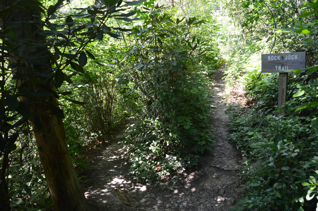
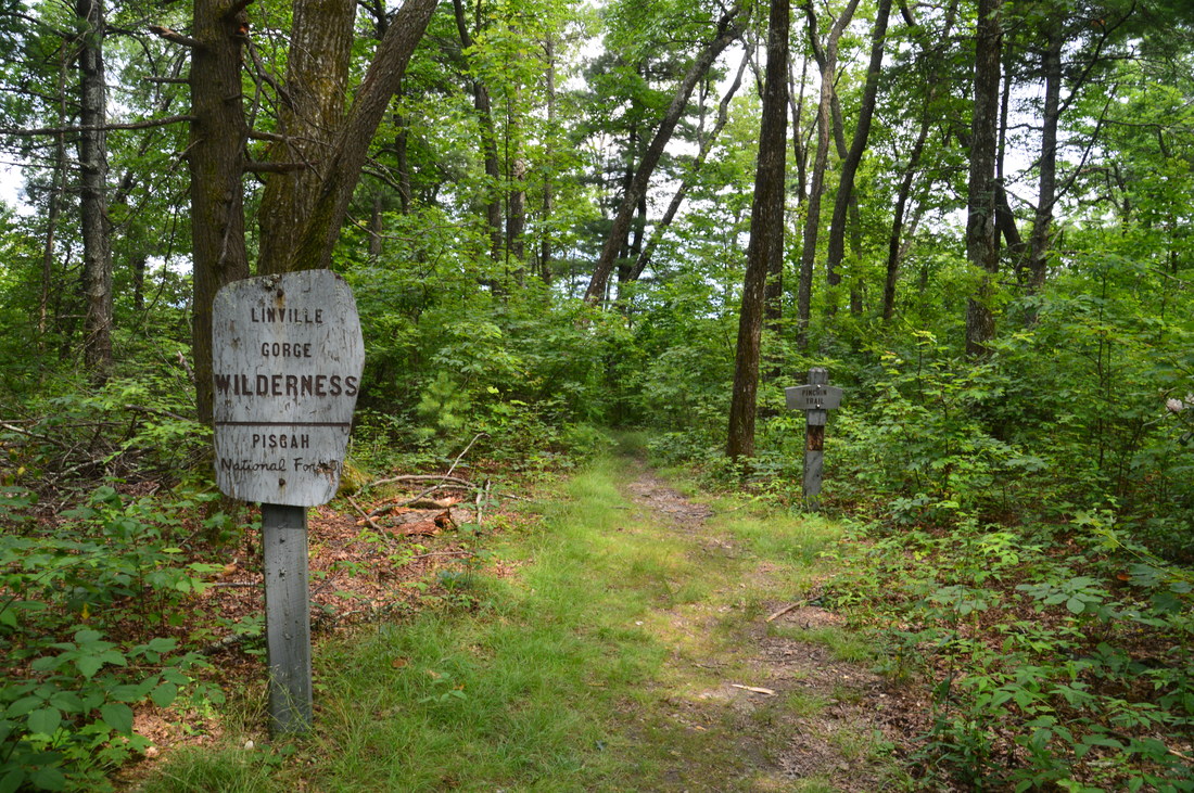
It is best to start the hike at the Conley Cove Trailhead, because that way, the hike's chief ascent out of Linville Gorge is split into two widely separate parts: one in the first half of the hike at the end of the Rock Jock Trail and the other at the end of the hike on the Conley Cove Trail. Pick up the Conley Cove Trail as it begins descending moderately from the parking past a pair of signs. At 0.2 miles, there is a split at the beginning of the loop. The Conley Cove Trail, your return route, bears left and into the gorge, while the signed Rock Jock Trail begins by bearing right. Stay right on the Rock Jock Trail, a trail that roughly follows the top of the west rim's cliff line (sometimes called the Gold Coast Cliffs). Initially, the trail ascends up a small ridge, passing a couple of side trails on the left to a campsite and an ephemeral pond called Lost Dog Pond at 0.4 miles. Then, the trail drops down to the edge of the cliff line, reaching the first of countless small views on the trail. At 0.7 miles, a distinct side trail on the left leads 50 feet to Fern Point Vista, the first major vista on the hike. From Fern Point, there is a spectacular view upstream along Linville Gorge, with the instantly recognizable forms of Table Rock and Hawksbill Mountain visible. These mountains will stand out as unique landmarks at almost every one of the Rock Jock Trail's vistas. Return to the trail and follow it along the cliffs for a bit to the next side trail that continues straight 100 feet over some small rock slabs to Hackers Point Vista at 0.9 miles, while the Rock Jock Trail bears right. Take the side trail to the Hackers Point Vista, which is similar to Fern Point, except it may be a bit more open and has a view of the Fern Point cliffs as well where you were a short while ago. After enjoying the view, return to the Rock Jock Trail and follow the rocky trail down into a gully that may sometimes be referred to as Blue Jay Canyon. Even though it is unblazed, the Rock Jock Trail is - for the most part - not too difficult to follow. Sometimes, it is an easy well-defined path, but at other times, it can be very rocky and slightly overgrown. In the gully, the trail passes along the base of a moist cliff and then passes through a passage between a cliff on the right and a huge boulder on the left at 1.2 miles. This passage is known as Split Rock. Then, the trail contours along the slopes for a while, passing a campsite nicknamed 'Bean Camp' on the right at 1.55 miles. At 1.7 miles, there is an unmarked but somewhat obvious Y-split with the trail to Razor point, Razor Edge, and Zen Point, which bears left while the Rock Jock Trail bears right. Make sure to not miss this side trail, as it leads to arguably the best vista on the hike. 
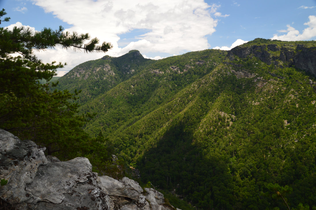
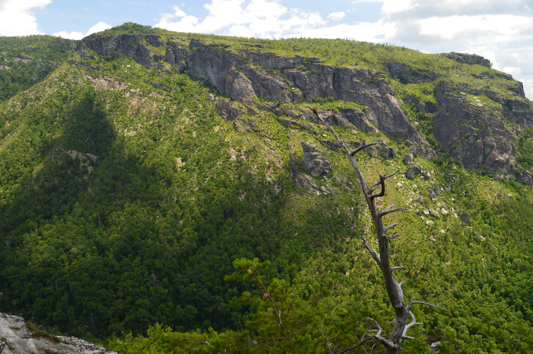
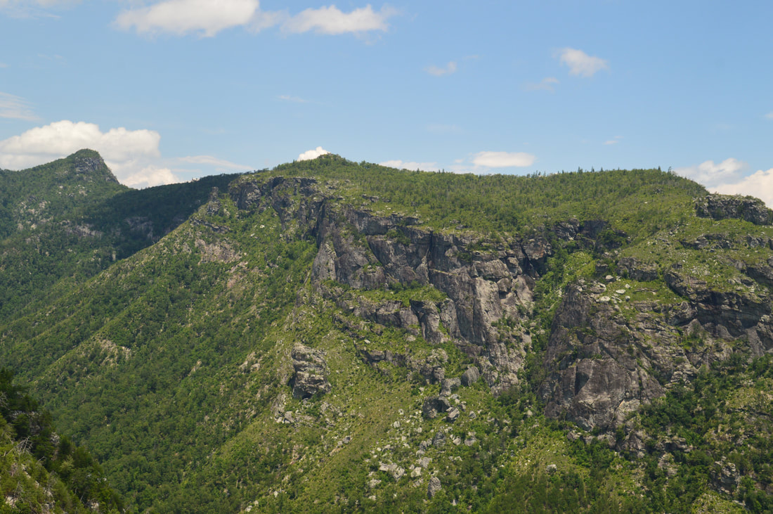
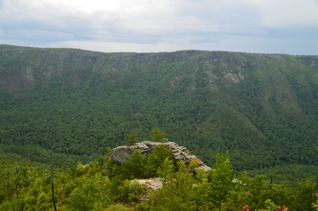
One of the Rock Jock Trail's many vistas, Zen Point provides an unobstructed view of the North Carolina Wall and The Amphitheater directly across the gorge.
The Razor Point side trail begins descending fairly steeply toward the cliffs (as the main trail has stayed above the cliff line lately). In 0.1 mile, at 1.8 miles, there is the first of many splits along the side trail. Here, the trail to Zen Point bears left, while the trail to Razor Edge and Razor Point bears right. Zen Point isn't as impressive as Razor Point, so I would suggest checking it out on the way back. Thus, stay right for now. In about 100 feet, there is a second split, where the main trail appears to go right. The path on the right is a dead-end, however; bear left on the narrower path. In another 100 feet, reach the third split on the side trail. Here, the trail to Razor Edge turns acutely left. Razor Edge is a very unique rock outcrop in the middle of the cliffs around Razor Point. Climbing to the top of Razor Edge is possible without ropes, but it involves a fairly technical rock scramble that I didn't have time to do on this day. To head to Razor Point, stay right on the path, following the base of a cliff and passing a small sign reading "Razors Edge Point ^ " attached to a tree. In about 150 more feet, reach the fourth and final split along the side trail. I suspect that the straight path leads to another view, but the trail to Razor Point bears right here. The path finally ends at Razor Point in about 350 more feet at 1.95 miles.
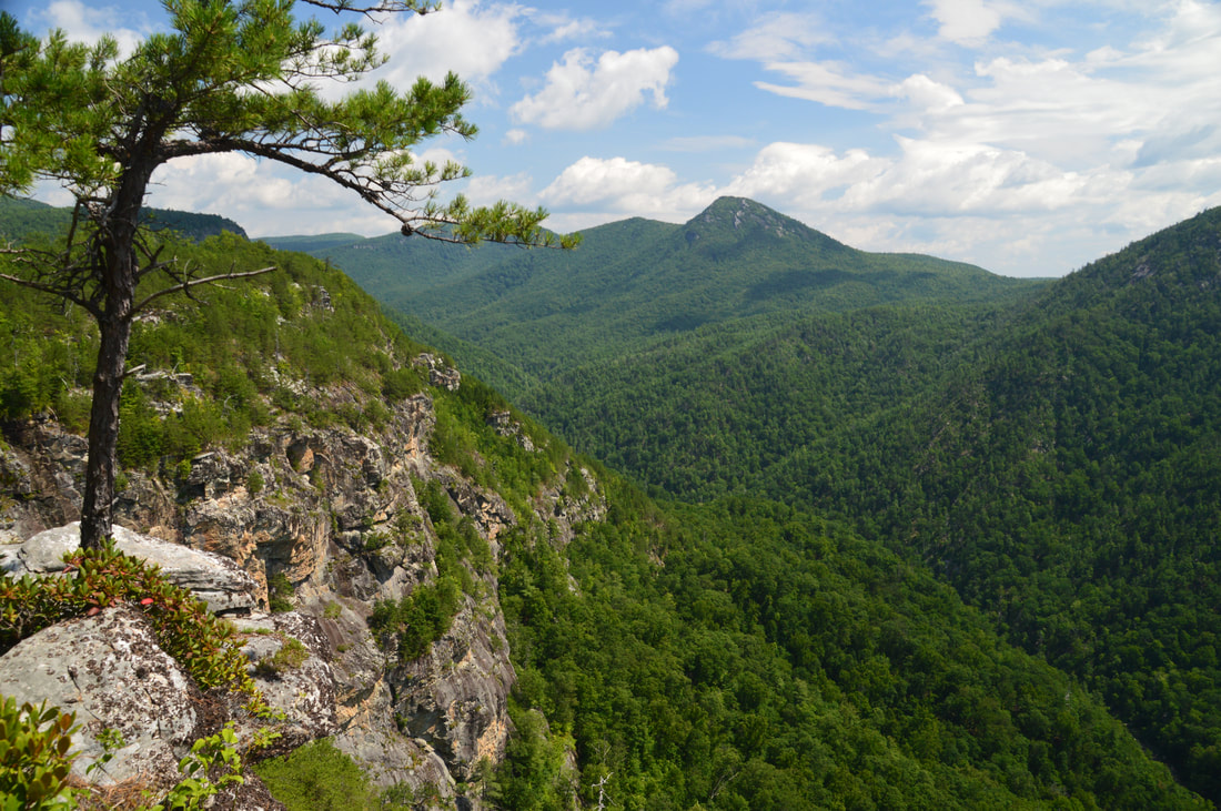
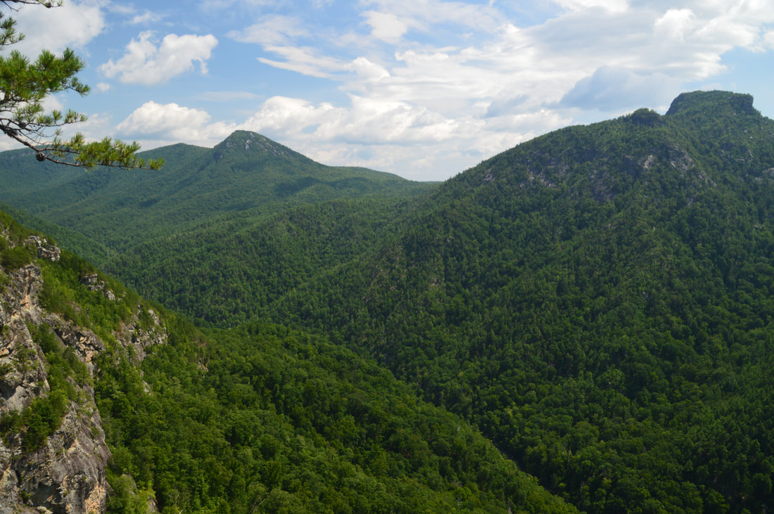
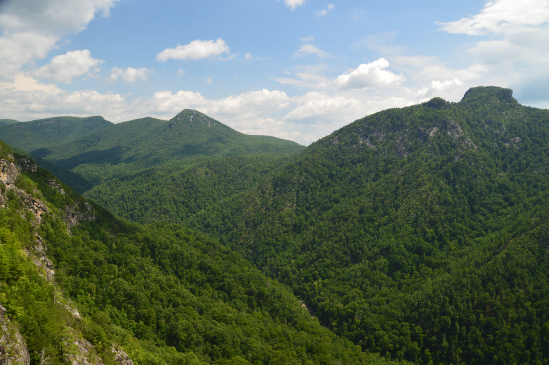
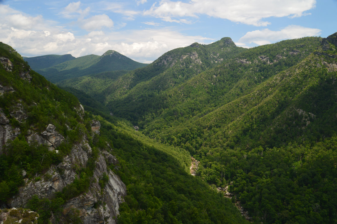
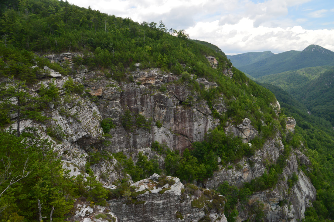
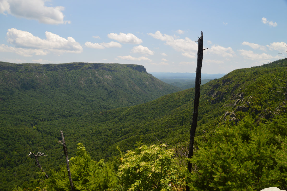
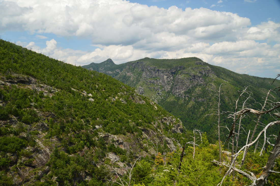
There are two parts to the Razor Point view: the main North View and the secondary South View. When the trail ends at the edge of the cliffs, the North View will be a few feet to the left and the South View will be a few feet to the right. I suggest seeing both. The North View is absolutely stunning, due to how the surrounding cliffs and the forms of Table Rock and Hawksbill Mountain are arranged. There is a great view of the North Carolina Wall and The Amphitheater on the east side of the gorge as well. Directly below the cliff that you're standing on, the walls of Razor Edge Rock stands out just like a razor. For this reason, Razor Point is also known as Razor(s) Edge Point. Meanwhile, the South View has a great close-up of the Linville River as it twists below the North Carolina Wall. Just think - later today, you'll be hiking along the river all the way down there! Razor Point is definitely a place to linger at. From Razor Point, retrace your steps to the Zen Point side trail and turn right onto it. The side trail descends slowly to a campsite, from where the path narrows and becomes steeper before ending at a rock outcrop near or at Zen Point at 2.2 miles. While the view isn't as expansive as from Razor Point, it does have two highlights: it provides a completely unobstructed view of The North Carolina Wall and The Amphitheater, and it also shows the cliffs of Razor Point where you were only a few minutes ago. From this rock outcrop, return to the previous split and to the Rock Jock Trail, rejoining the main trail once again at 2.35 miles. The trail curves in and out of another rocky gully that is called Moonshine Canyon. Then, at 2.7 miles, there's a faint side path on the left that leads down to the Sunshine Point Vista. The side trail is fairly long and loses a decent amount of elevation, so I skipped it. After curving in and out of yet another densely-wooded gully, the trail enters a more open area and reaches T-Shirt Point at 3.3 miles. Scramble up the rock outcrop on the left for a spectacular view just as the trail turns right. I like this view just as much as the one from Razor Point, and it is also more open than the Razor Point view. The 180-degree panorama encompasses not only Hawksbill Mountain, Table Rock, and NC Wall, but also Chimney Gap, Shortoff Mountain, and Pinch-In Ridge. 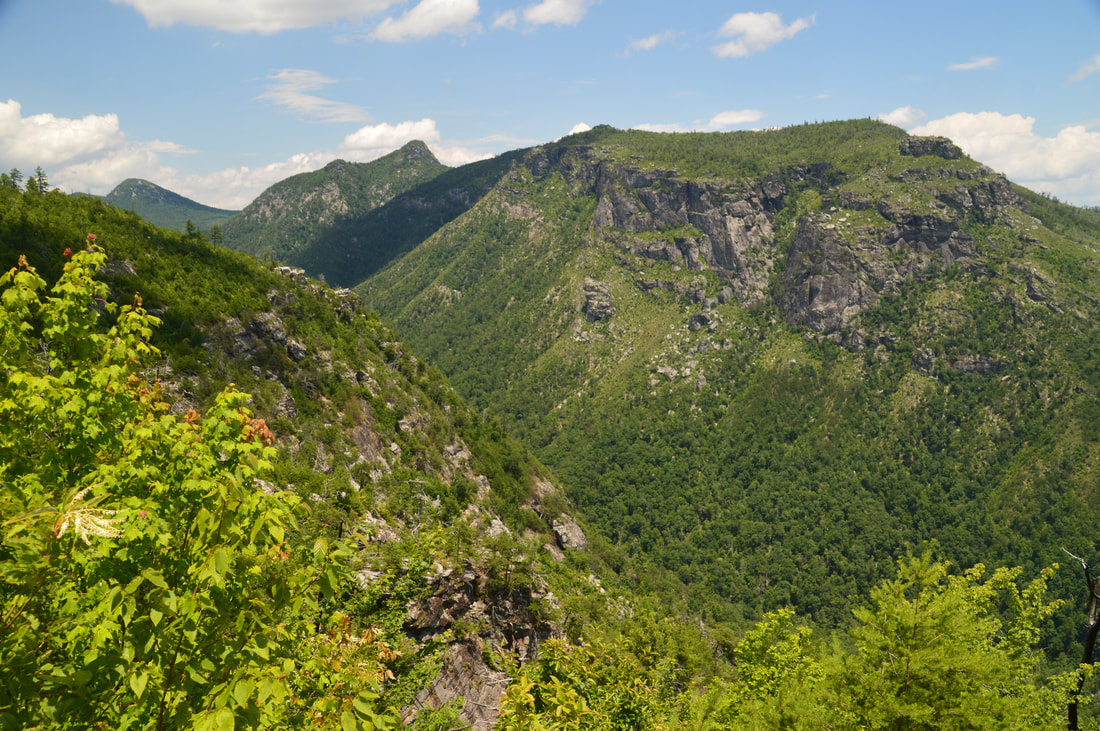
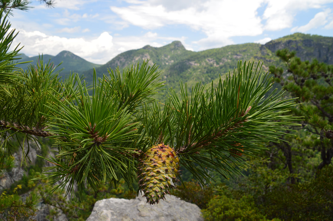
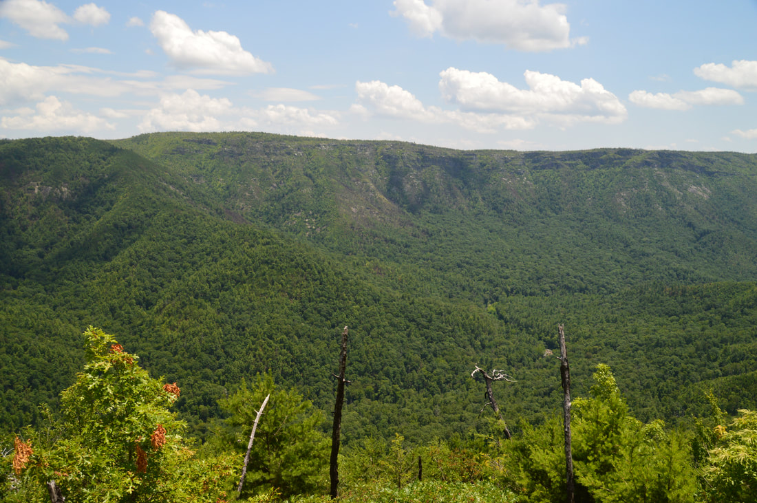
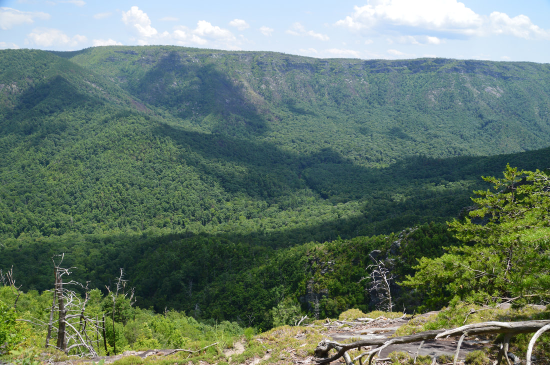
The stunning view from T-Shirt Point provides this perfect perspective of The North Carolina Wall, Table Rock, and Hawksbill Mountain.
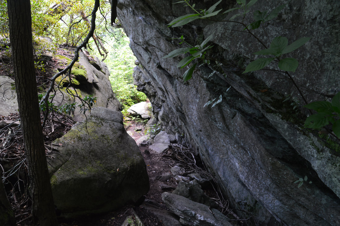
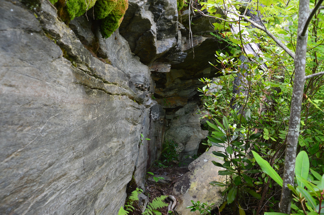
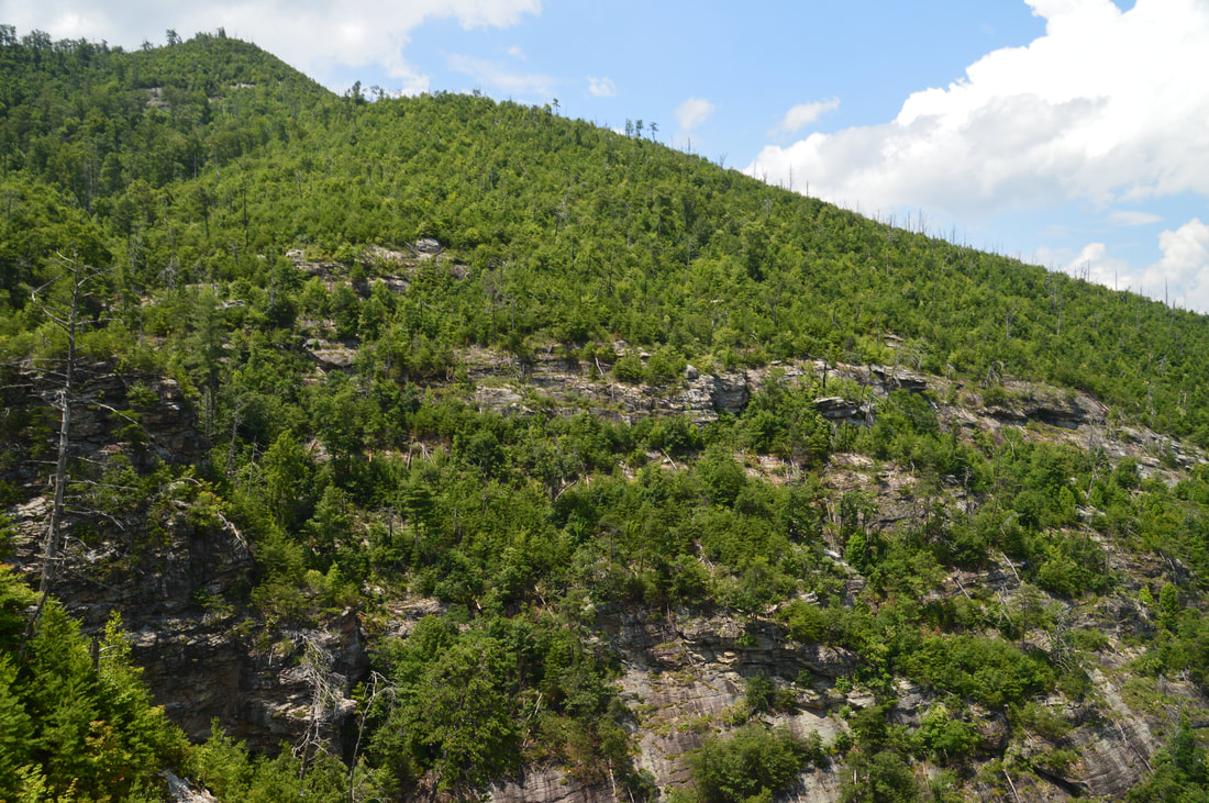
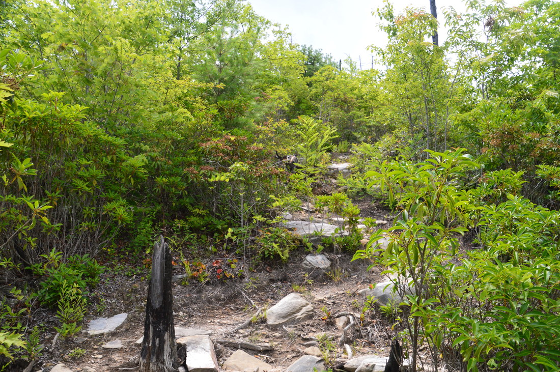
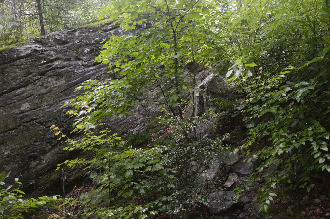
After T-Shirt Point, the Rock Jock Trail begins to curve into an area known as Mossy Canyon. Around 3.5 miles, several rock outcrops along the trail provide great views of the cliffs of Mossy Canyon, which is by far the largest and most impressive 'gully' that the trail passes through. At 3.65 miles, the trail bears left on some broad rock slabs and crosses a tiny stream that flows through the center of the canyon, after which it makes a short but steep scramble out of the canyon. The next section of trail is extremely rocky, as the trail passes by a huge cliff with a rock shelter and slowly rounds the canyon, staying above the cliffs on its south side. At 4.05 miles, the Rock Jock Trail reaches the far end of Mossy Canyon, returning to its traverse above the cliff line. At this point, a short side trail on the left leads to a great unnamed vista from a large rock slab. This perch has great views of Mossy Canyon's cliffs. After the hike, I learned that a point of interest called 'Balanced Rock' is located in the immediate vicinity of this vista, but I didn't know about it and was not paying attention, so I missed it. Meanwhile, the main trail passes a few more views and then abruptly turns right at 4.25 miles.
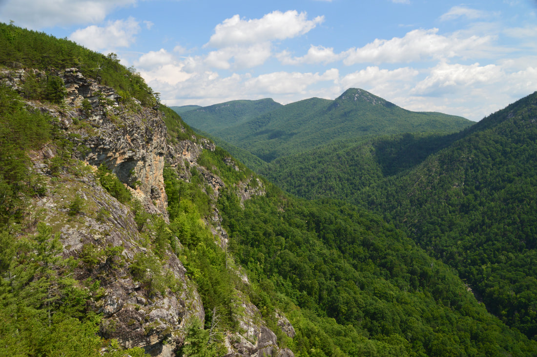
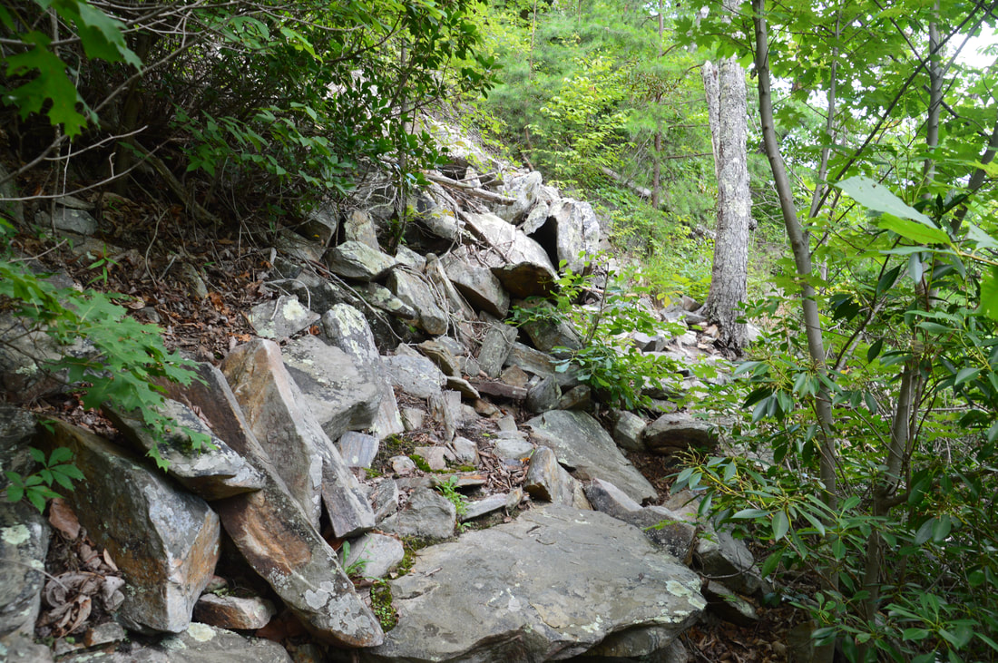
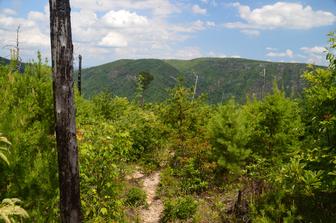
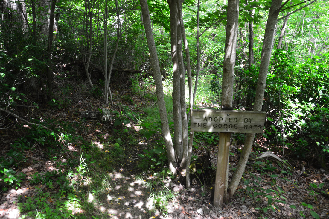
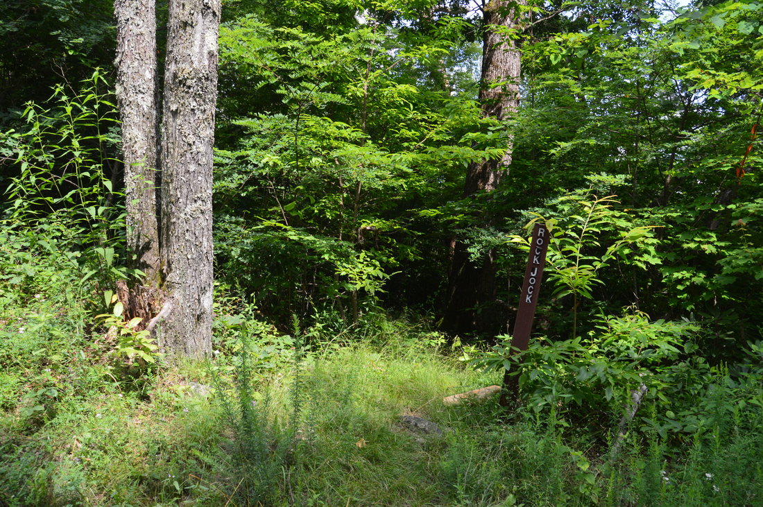
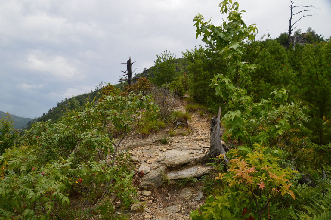
While up to this point, there has been a handful of ups and downs on the trail, this is the beginning of the trail's first 'true' ascent. In the next 0.5 miles, the Rock Jock Trail ascends about 650 feet to the rim of Linville Gorge and to Kistler Memorial Highway. This is the steepest ascent on the hike, and it can be quite a drag. There are no helpful switchbacks along the trail as it ascends pretty much straight up, first through the open sparse forest closer to the cliffs and then through dense woods near the top. Just before the top, you will pass a sign that says "Adopted by The Gorge Rats". The Gorge Rats are a group of seasoned hikers and climbers who have essentially explored every nook and cranny of Linville Gorge (but they still find a new one every now and then and name it). When the Rock Jock Trail was destroyed by two separate fires on the west rim of the gorge in 2000 and 2007, the Gorge Rats rebuilt part of it - between Conley Cove and (almost) Pinch-In Ridge - but unfortunately, the section between Conley Cove and Wiseman's View was left abandoned. There are distant plans for a connector to be built between Rock Jock Trail and Pinch-In Trail, which would eliminate a lot of unnecessary ascent, but right now, following the trail up to the road and then making a short walk along it to the Pinch-In Trailhead is the only option. At 4.75 miles, the Rock Jock Trail reaches its end at Kistler Memorial Highway. The trail is marked by a carsonite stake but there is no parking space here. If you feel like you've had enough of Gorge Miles, you can turn right onto Kistler Memorial Highway and return to your car in 2.4 miles. To hike the full loop though, turn left onto the dirt road and follow it on an easy grade along the ridge for 0.5 miles. At 5.25 miles, the parking area for Pinch-In Trail will be on the left. Walk through the parking lot and pick up the trail at the signs. The Pinch-In Trail is the route that you will take from the rim to the floor of the gorge. Over the next 1.2 miles, the trail descends approximately 1685 feet! Going UP such a trail would make one miserable, although down is no picnic either - and it can be hard on the knees. The trail becomes very steep right away, but it will turn even steeper after the Pinch-In Vista. At 5.65 miles, a side trail on the left leads to a campsite. Shortly after that, the trail enters an open area with continuous views up and down the gorge. Shortoff Mountain and the mouth of the gorge are very close now. At 5.75 miles, as the Pinch-In Trail turns left, a short side path bears right and leads to a prominent rock outcrop that you probably noticed as you were descending toward it. The rock outcrop is easy to scramble up and provides the best view along the Pinch-In Trail. The Pinch-In Vista is the final major view along the Rock Jock Loop. This vista is somewhat similar to the view from T-Shirt Point, but Table Rock is farther away and Shortoff Mountain is closer. 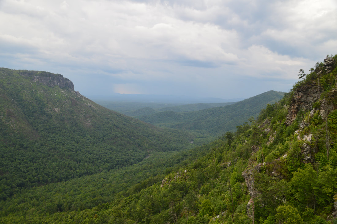
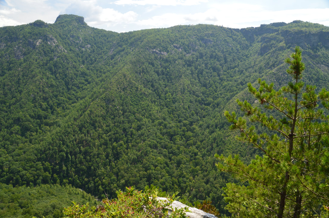
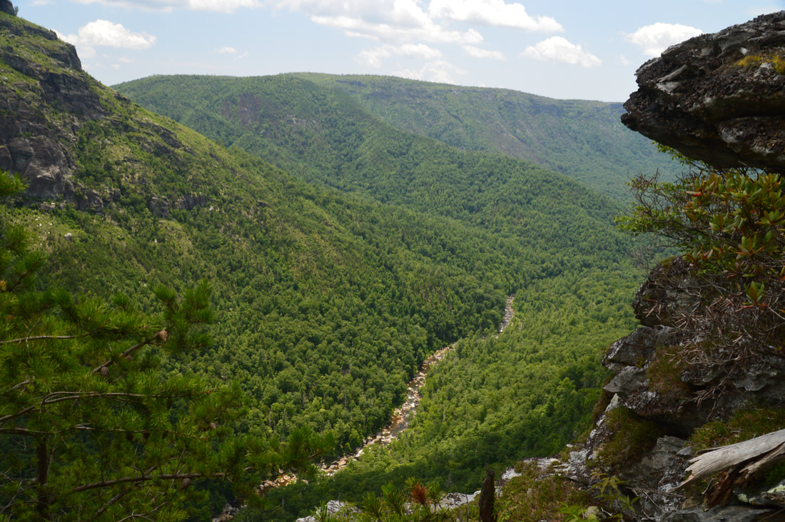
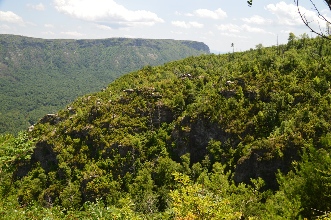
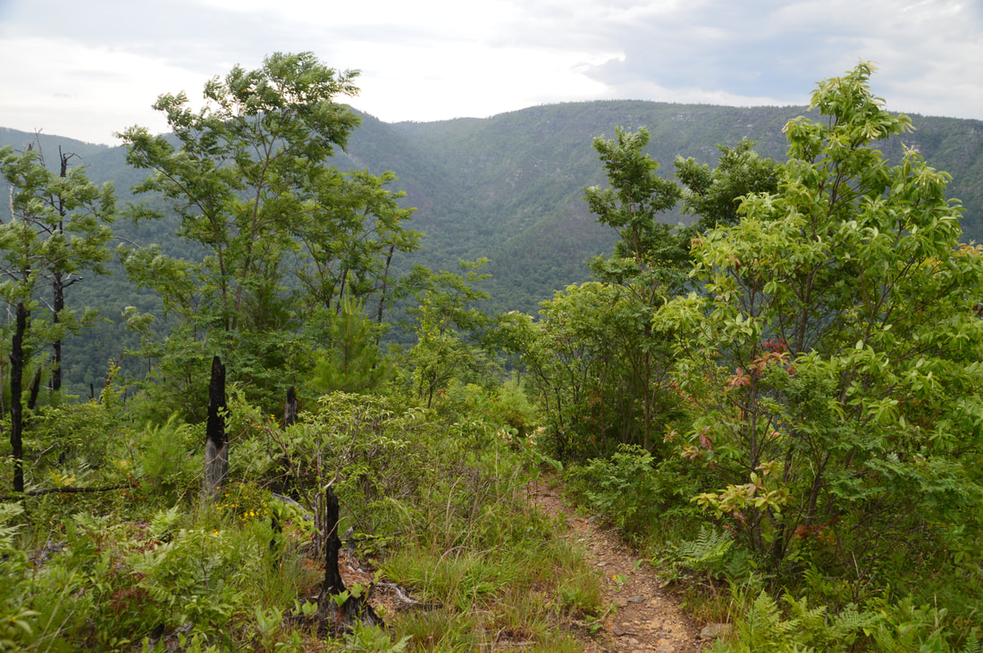
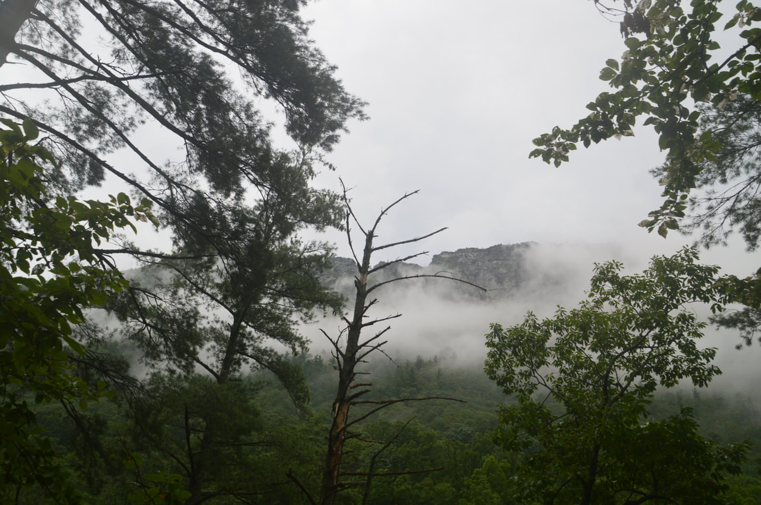
The Pinch-In Vista, which is the final view on the Rock Jock Loop, is close to the mouth of Linville Gorge and provides a close-up view of Shortoff Mountain and the gorge mouth.
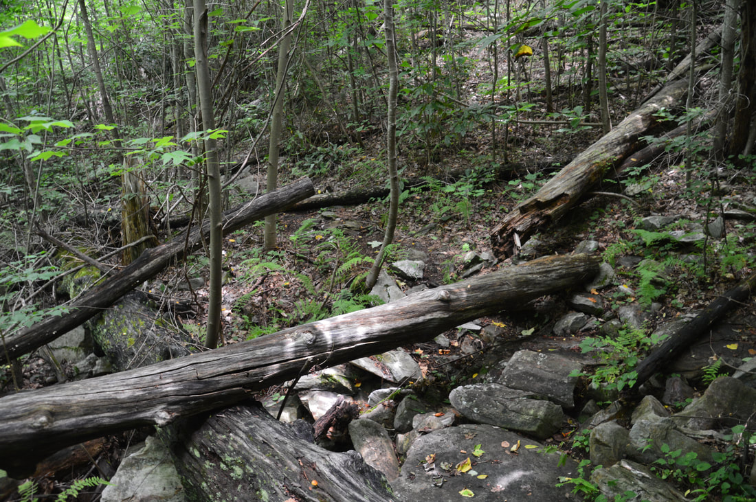
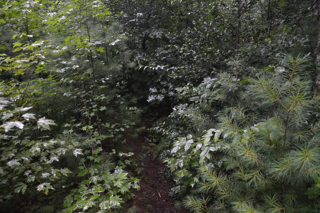
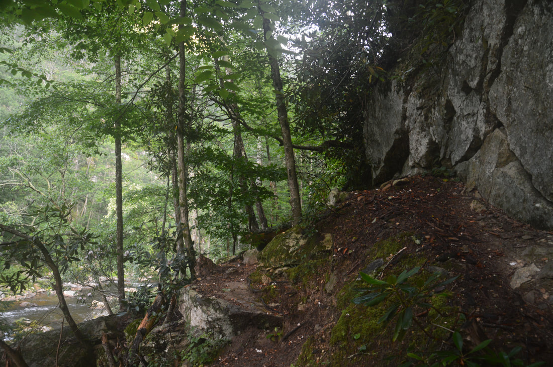
The trail only gets steeper and the footing gets rougher after the vista. The Pinch-In Trail is pretty eroded and slippery in places - it's a wonder that it's been kept in such good shape still. Eventually, the trail enters the woods below the cliffs as it steadily descends into the gorge. Finally, the trail slowly begins to moderate near the gorge floor, before ending at a signed junction with the Linville Gorge Trail at 6.45 miles. To the right, the Linville Gorge Trail leads toward the south end of the gorge, but to follow the loop, stay straight (bear left) onto the LGT. After crossing a small stream, the trail reaches a campsite near the Linville River at 6.6 miles. The river here is relatively broad and quiet, but the farther you follow it upstream, the more rugged it will become. Generally, the Linville Gorge Trail is the exact opposite of a relaxing walk along a river. The first part of it is not too rugged but extremely overgrown. Then, as the gorge narrows around 7.5 miles, the trail also becomes extremely rugged, with many rock scrambles and hills along the river. Unfortunately, there are almost no river views in the first part of the trail. At 7.65 miles, the trail crosses a particularly large rock outcrop with a great view of the NC Wall and The Chimneys/The Camel high above. After this, the river views gradually increase in number, although the trail still doesn't spend quite enough time next to the river. In this section of the trail, there is one designated campsite.
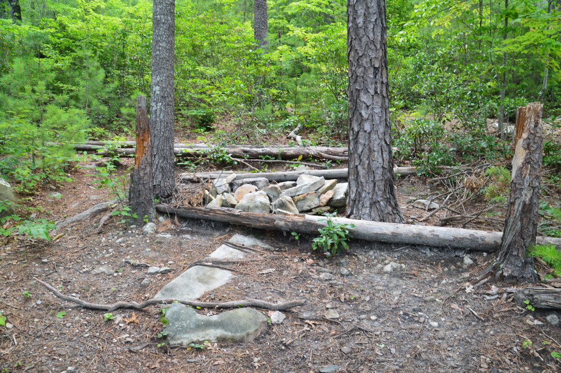
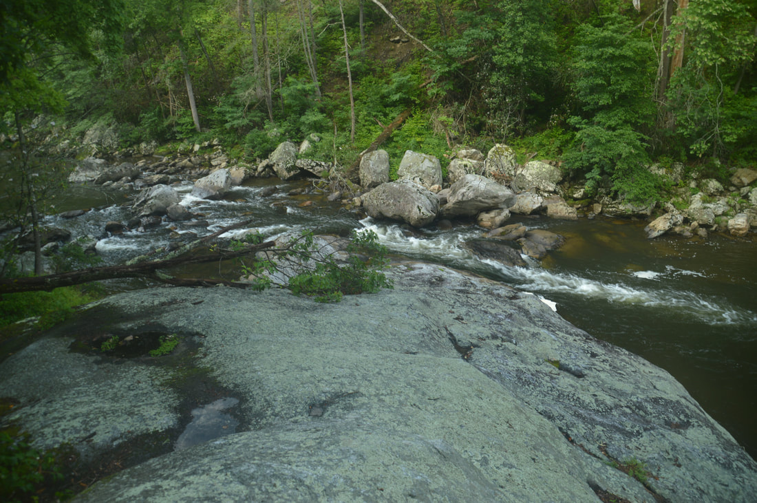
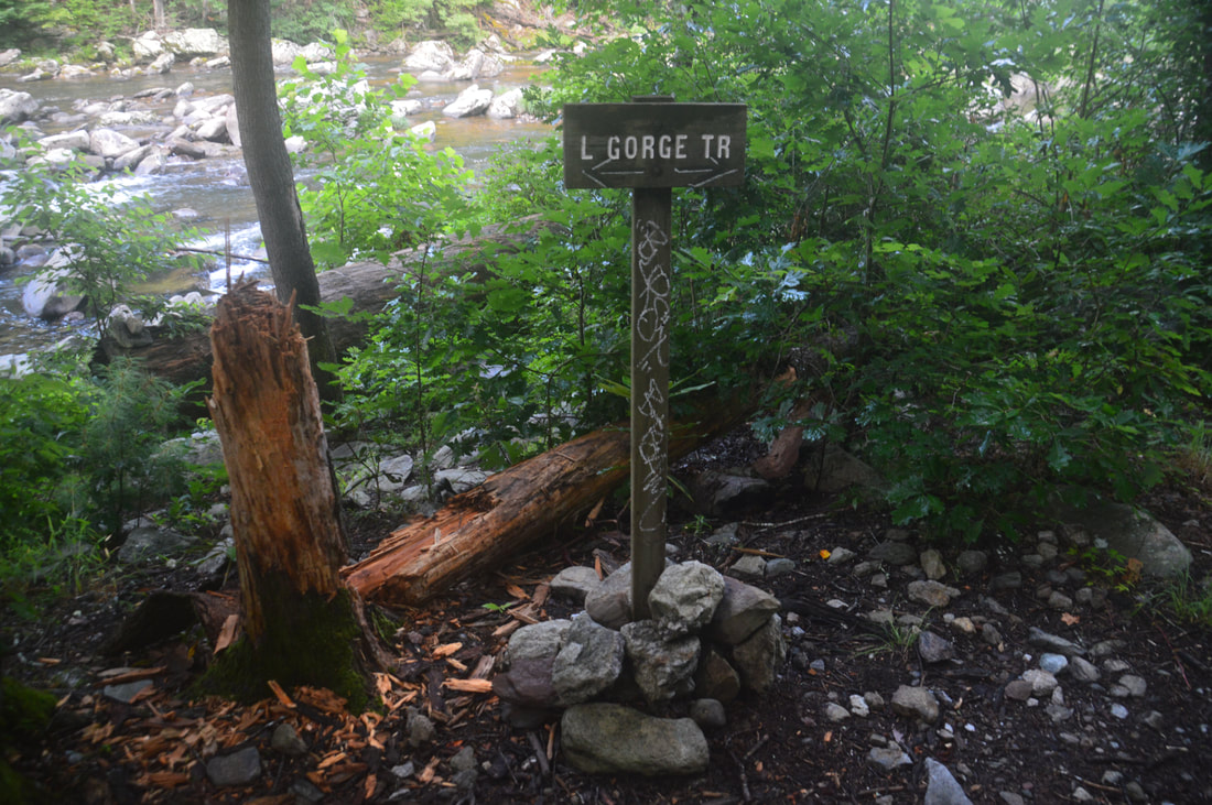
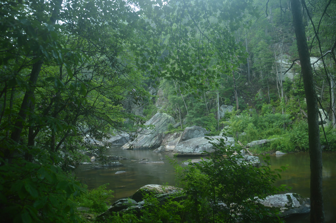
After what has seemed like an endless couple of miles, the Linville Gorge Trail reaches and crosses a huge open rock slab at 9.45 miles. Situated right above a powerful cascade and deep pool on the Linville River, this rock slab is a great place to take a break and enjoy the pristine beauty of the gorge. Shortly afterwards, the trail passes a series of great campsites by the river. Due to their proximity to the Conley Cove Trail, these campsites are often full in summer, but if you were to split this hike into a backpacking trip, one of these sites would be a good place to spend the night (the site near the Pinch-In junction is a good one again). Drinking even filtered water from the Linville River is not recommended, so it is best to use water from its tributaries. At 9.8 miles, the Linville Gorge Trail reaches the junction with Conley Cove Trail just past a campsite. While the Conley Cove Trail, which leaves left, is not marked, a sign on the right that says "< Linville Gorge Trail >" will assure you that this is the junction. If you wish to skip the side trip to Cathedral Falls, you have to turn left to exit the gorge now, but if you have the energy and if the water levels aren't too low, I highly recommend doing the side trip. 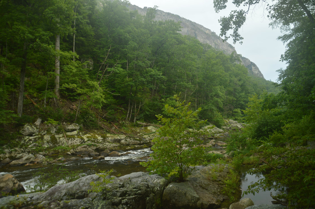
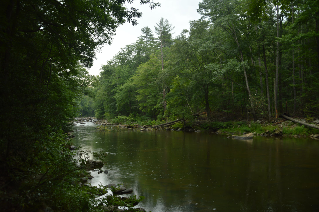
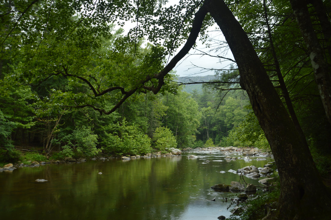
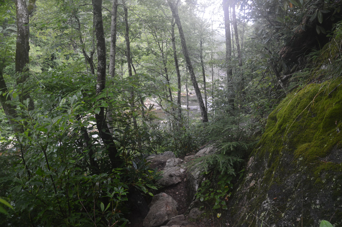
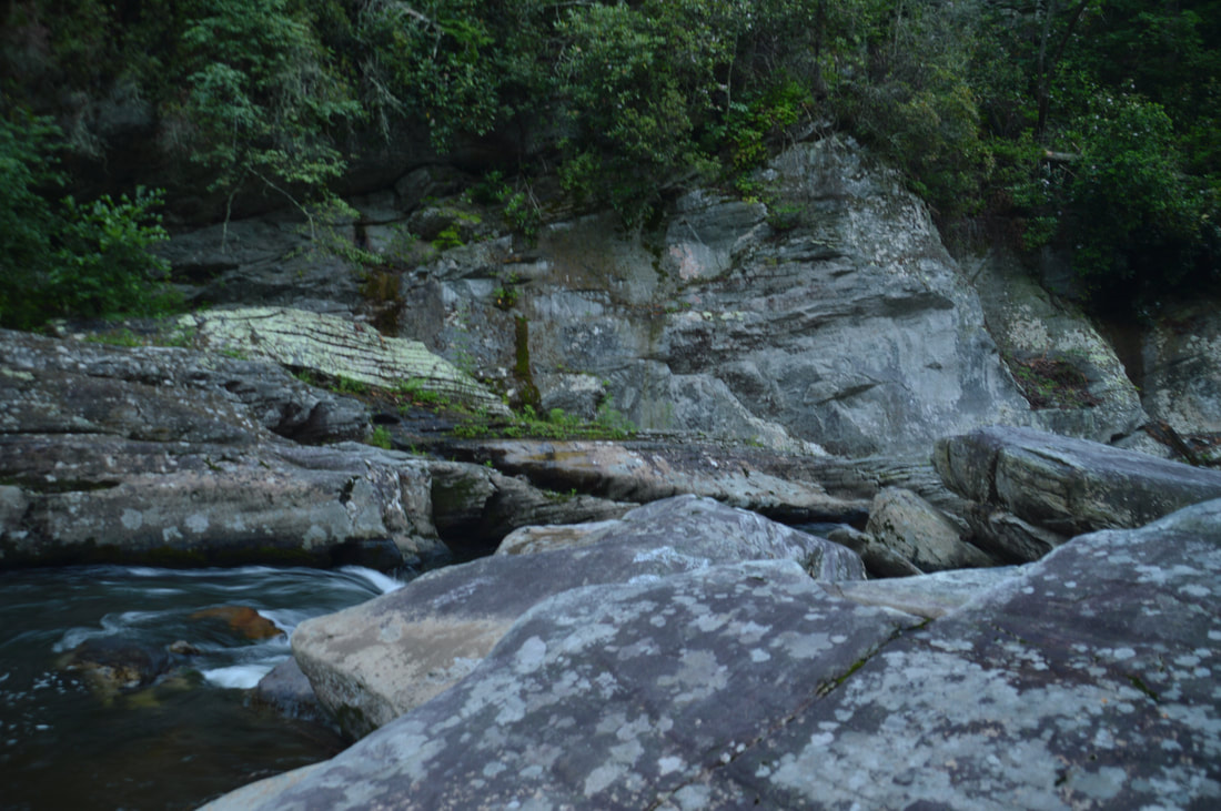
The Linville Gorge Trail is frequently accompanied by the beauty of the boulder-strewn Linville River.
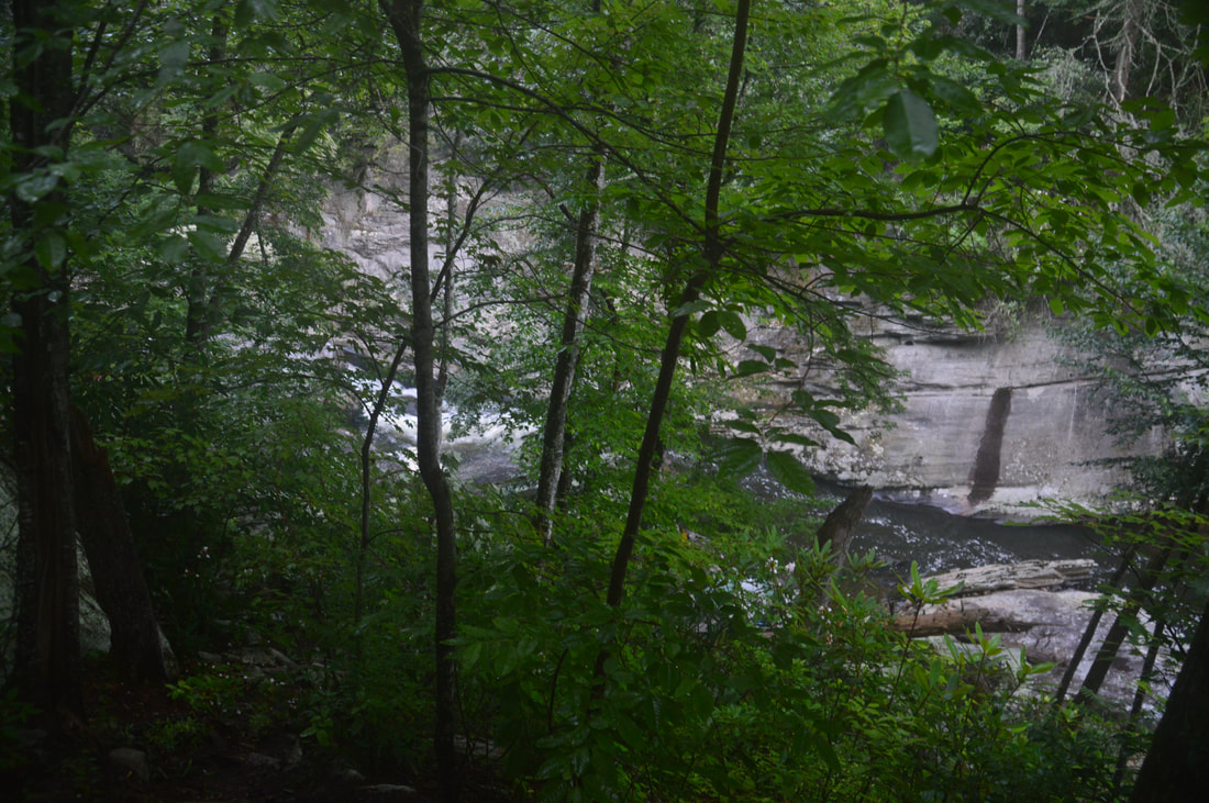
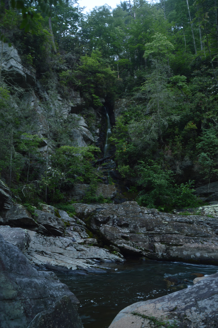
For Cathedral Falls, stay on the Linville Gorge Trail. After the junction, there are several campsites as the trail becomes even more rugged. Huge boulders litter the riverbed and surrounding slopes, and there are several noisy rapids on the river itself. Eventually, the trail rises a bit above the river. At 10.5 miles, just before the LGT intersects the Spence Ridge Trail, there is a junction with a distinct but steep side trail on the right down to a campsite. This is also the side trail to Cathedral Falls. The side trail is easy to follow but you have to be careful due to how steep it is. When the trail ends at the campsite, walk through it (or around it if it's occupied) and then scramble down some huge boulders to the Linville River on the far side. You'll get a view of Cathedral Falls at 10.55 miles. The falls is located on the other side of the Linville River, but it is easily viewed from the boulders on this side.
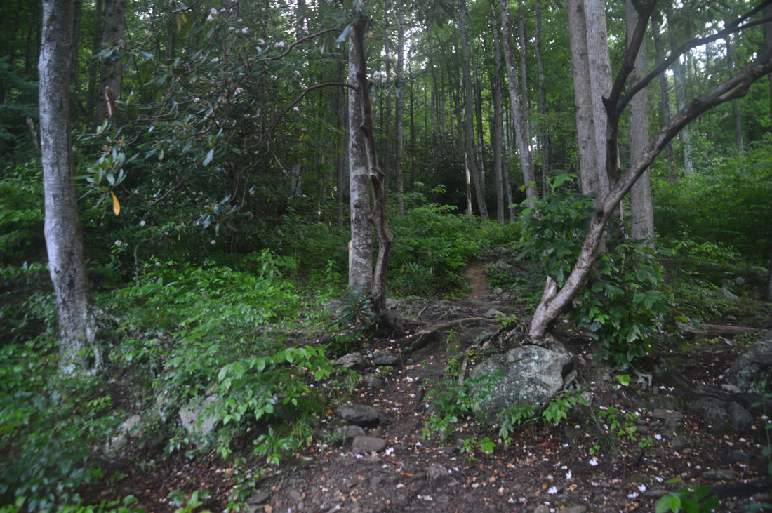
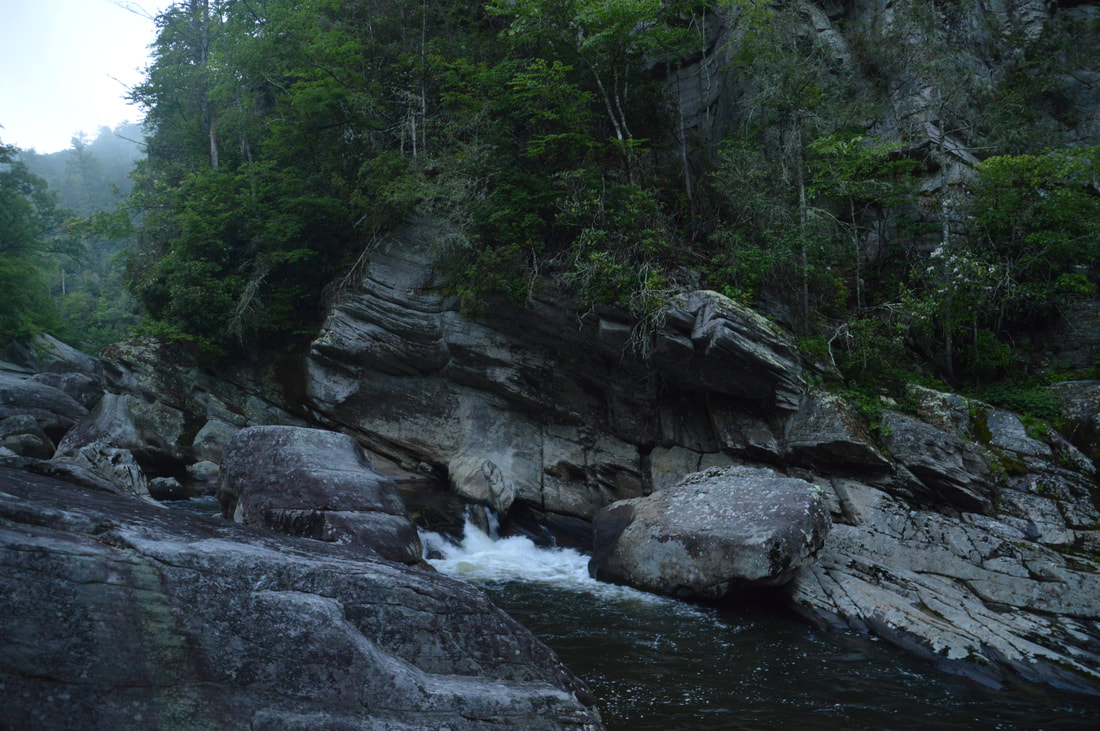
The waterfall is fairly tall - the main tier is about 45 or 50 feet - but it is on a small unnamed tributary of the river, so there will be parts of the year where the waterfall is essentially non-existent. Even during high flow, it will usually be low-volume, but what it lacks in flow it makes up for in beauty. The setting around is magical, thanks to the jagged cliffs around Cathedral Falls, the house-sized boulders in the Linville River, and the deep pool - perfect for cooling off on a hot summer day - in the river right in front of you. There is one small note that I need to make about Cathedral Falls. Both a "hikers' version" and "kayakers' version" of Cathedral Falls exist. The "hikers' version" is the tall, low-flow waterfall on the unnamed Linville River tributary. While there is some confusion regarding which rapid is the "kayakers' version" of Cathedral Falls, the rapid immediately upstream from the Cathedral Falls (hikers' version) viewing area is most often referred to as the kayakers' version of Cathedral Falls. It is a small but very powerful rapid that spills into the pool. Together with the surrounding cliffs and boulders, this scenic rapid fits into the setting very nicely. There are a few nice rapids downstream as well that may sometimes also be referred to as the kayakers' version of Cathedral Falls. Just know that the 'best' Cathedral Falls is the tall, low-flow one. There are a few small waterfalls above Cathedral Falls, but they are difficult to reach, and from what I have heard, they are probably not worth the effort to most people. From Cathedral Falls, simply retrace your steps to the Conley Cove junction, now turning right onto the Conley Cove Trail at 11.3 miles. The rest of the hike is a steep ascent. Over the final 1.4 miles of the hike, you will ascend about 1070 feet, with the bulk of the ascent being in the first 1.2 miles. However, there is one thing that makes the Conley Cove Trail a little easier and more pleasant than the other trails on the hike: switchbacks! While the ascent is still very steep, it is relatively moderate by gorge standards thanks to over 15 switchbacks. Generally, the trail ascends up a small cove, passing a side trail on the left at 12.4 miles to a campsite and large rock overhang known as Conley Cave at one of the trail's final switchbacks. At 12.5 miles, the Conley Cove Trail reaches the intersection with the Rock Jock Trail, where you were many hours earlier. Simply continue straight on the final leg of the trail to the Conley Cove Trailhead, concluding this outstanding but grueling hike at the parking area and your car at 12.7 miles. 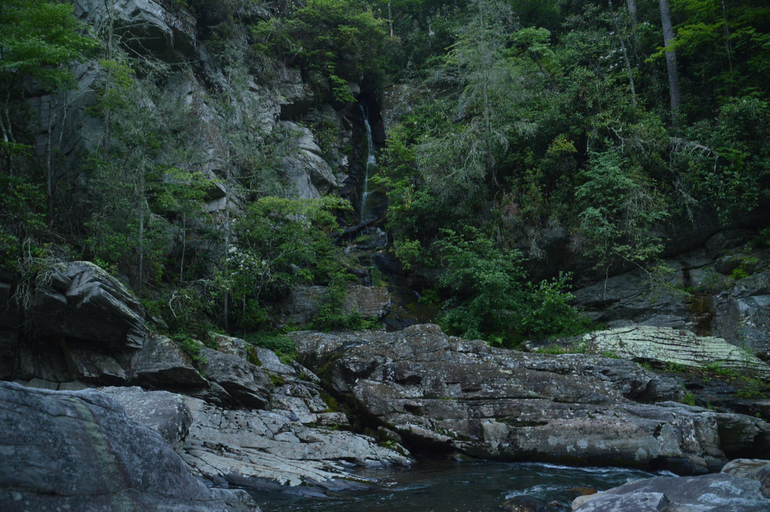
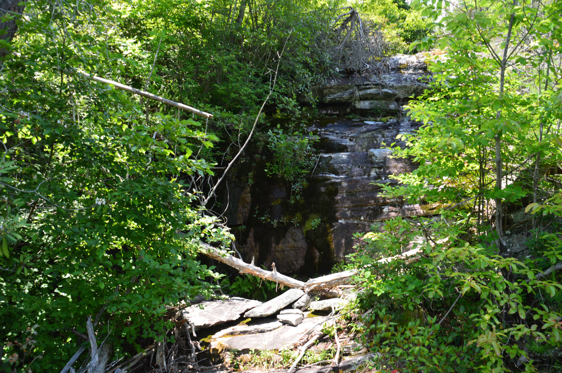
This picture does not do justice to the beauty of the setting around Cathedral Falls, but it still shows that the hikers' version of Cathedral Falls is a fairly impressive drop - ableit low-volume.
Mileage
0.0 - Conley Cove Trailhead
0.2 - Rock Jock Trail Junction 0.7 - Fern Point Vista 0.9 - Hackers Point Vista 1.2 - Split Rock 1.7 - Side Trail to Razor Edge, Razor Point, and Zen Point 1.95 - Razor Point (Razors Edge Point) Vista 2.2 - Zen Point Vista 3.3 - T-Shirt Point Vista 3.65 - Mossy Canyon 4.05 - Unnamed Vista and Balanced Rock 4.75 - Rock Jock Trailhead 5.25 - Pinch-In Trailhead 5.75 - Pinch-In Vista 6.45 - Linville Gorge Trail Junction 7.65 - North Carolina Wall View 9.45 - Rock Slab Above Linville River 9.8 - Conley Cove Trail Junction 10.55 - Cathedral Falls 11.3 - Conley Cove Trail Junction 12.5 - Rock Jock Trail Junction 12.7 - Conley Cove Trailhead Variations
Hike out and back to Fern Point and Hackers Point from Conley Cove Trailhead - 1.8 Miles
Hike out and back to Fern Point, Hackers Point, Razor Edge Point, and Zen Point from Conley Cove Trailhead - 4.1 Miles Hike out and back to Cathedral Falls from Conley Cove Trailhead - 4.3 Miles Hike just the Rock Jock Trail and loop it with Kistler Memorial Highway - 7.15 Miles Skip the Cathedral Falls side trip - 11.2 Miles Bonus Stops
On the drive to the trailhead, you will have passed a sign for Wiseman's View. The short paved walk to Wiseman's View leads to yet another top-notch view of Linville Gorge.
PicturesVideos
0 Comments
Leave a Reply. |
About MeMark Oleg Ozboyd Dear readers: I have invested a tremendous amount of time and effort in this website and the Georgia Waterfalls Database the past five years. All of the work that has gone in keeping these websites updated with my latest trip reports has almost been like a full-time job. This has not allowed me to pick up a paid job to save up money for college, and therefore, I I've had to take out loans. If you find the information on this website interesting, helpful, or time-saving, you can say "thanks" and help me out by clicking the button above and making a contribution. I will be very grateful for any amount of support you give, as all of it will apply toward my college tuition. Thank you!

Coming in 2022-2023?
Other Hiking WebsitesMiles HikedYear 1: 540.0 Miles
Year 2: 552.3 Miles Year 3: 518.4 Miles Year 4: 482.4 Miles Year 5: 259.9 Miles Archives
March 2021
Categories
All
|
||


 RSS Feed