
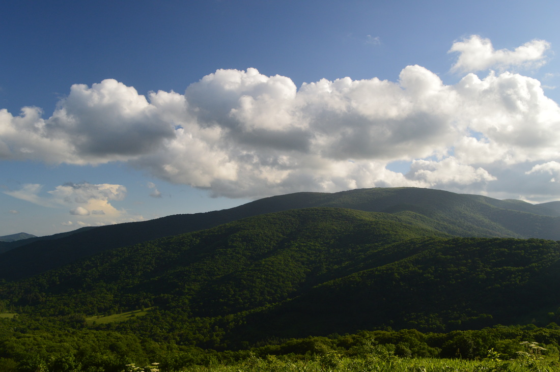
Deep in the mountains of northwestern North Carolina and northeastern Tennessee lie the Highlands of Roan. This widely-known name represents one of the most beautiful spots in the Southeast, and perhaps the entire Appalachian Mountains. This series of mountain balds lies on the route of the Appalachian Trail, and quite a scenic of a hike it is. Whether you're coming here for the spring wildflowers, the autumn foliage show, or after a winter snowstorm, you're not likely to be disappointed (except it may be a little too cold in winter). Although only the most seasoned hiker will be able to do this physically difficult and tiring trek in a single day, there are several variations that can split this hike into several, and then, there's always the backpacking option. This hike occurred on Saturday, June 13th, 2015. My plan was to hike the Appalachian Trail from Carvers Gap over Round Bald, Jane Bald, and Little Hump Mountain, finishing at Big Hump Mountain. I would return the same way. I would also take the spur trails to Grassy Ridge Bald and Overmountain Shelter.
Summary
R/T Length of Trail: 19.4 Miles
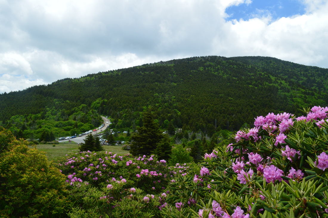
Duration of Hike: 13:15 Type of Hike: Out and Back Difficulty Rating: 10+ out of 10 Pros: Mostly well-built trail; outstanding views; unique hiking along bald mountaintops Cons: Extremely difficult hike with many long and steep ascents; rough trail on Jane Bald and Grassy Ridge Bald Points of Interest: Hump Mountain - 10+ stars; Little Hump Mountain - 10 stars; Round Bald - 10 stars; Jane Bald - 9 stars; Grassy Ridge Bald - 9 stars; Meadow near Yellow Mountain Gap - 7 stars; Vista near Overmountain Shelter - 6 stars Trail Blaze Color(s): Appalachian Trail - White; Overmountain Shelter Spur Trail - Blue; Grassy Ridge Spur Trail - None Best Season(s) to Hike: Spring; Fall Beginning Point: Carvers Gap Trailhead Directions: From Bakersville, NC: Follow NC State Route 261 North for 12.8 miles to Carvers Gap. There is a multi-section parking area to the left of the road. This large parking area fills up quickly on good weekends, particularly in the spring and early summer for the wildflower show, so try to get here as early as possible! MapDetails
This hike is simply incredible. This hike is probably the most scenic hike I have ever done in my life. The views, especially from Little Hump Mountain and Hump Mountain, are outstanding and such that you will find in few, if any places in the southern Appalachians. These Switzerland-type mountain balds, known as the Highlands of Roan, make up the longest stretch of mountain balds in the southern Appalachians, and indeed, what a sight it is. With this, however, don't neglect how difficult this hike is. In fact, this hike is a rare combination: it was both my all-time most scenic hike and my all-time hardest hike. In fact, it was so hard that my legs were still like jelly two days after the hike. And the reason it's so hard? Overall, there's many ascents, some steep, but really, the kill factor in this hike is a strenuous 3-mile ascent to Grassy Ridge near the end of the hike. I highly don't recommend for you to hike this entire route in one day. You must be a very seasoned hiker to be able to do it one day. See the variations section at the bottom of this page for shorter options for this hike. You can also do this hike as a two or three-day backpacking trip, by setting up camp on Little Hump Mountain, Hump Mountain, or possibly in the Yellow Mountain Gap area, if you've got the legs to make it there and back to the gap in one day (it's somewhat easier than doing the whole hike in one day, because you don't have to deal with the climb up Grassy Ridge on the first day).
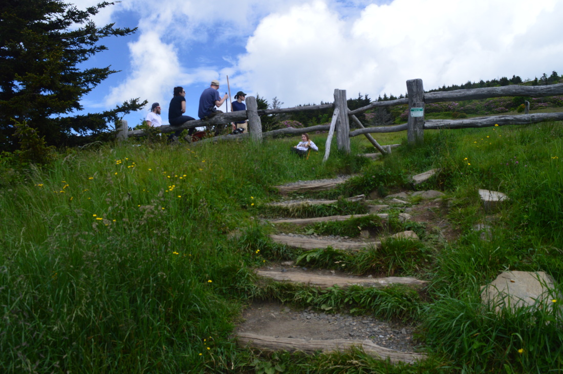
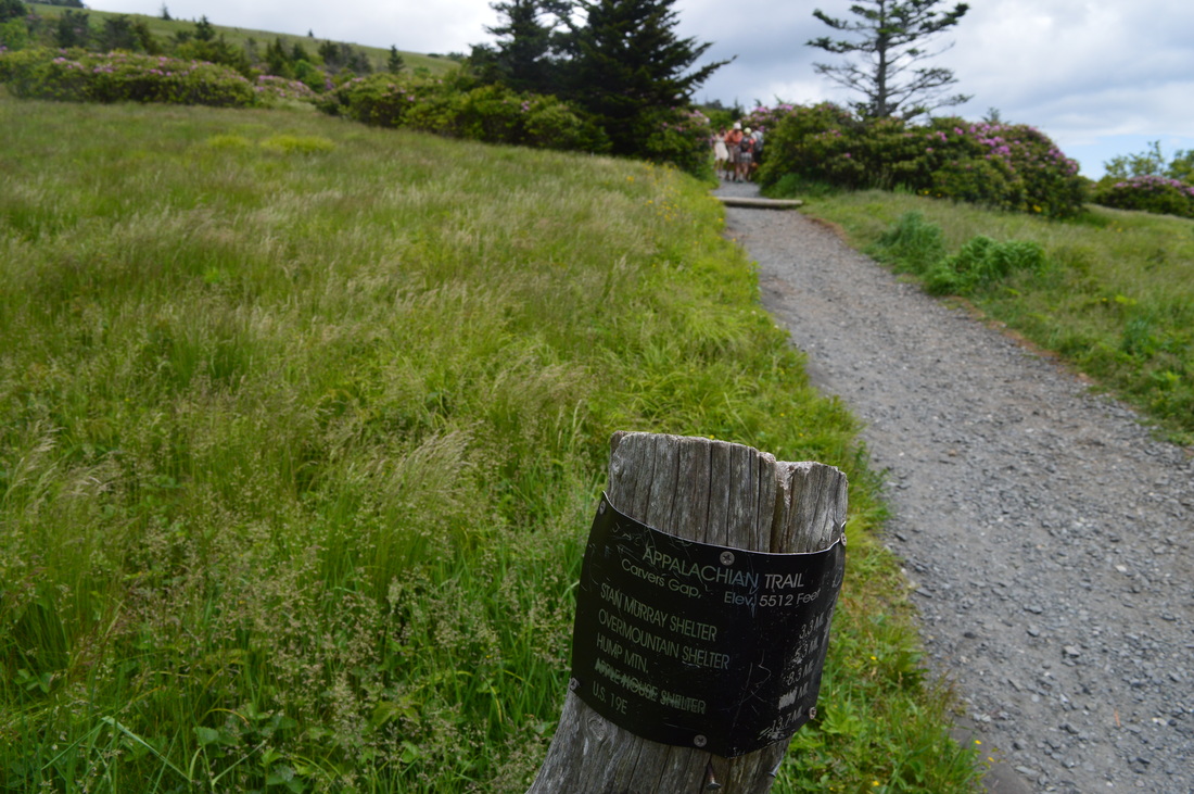
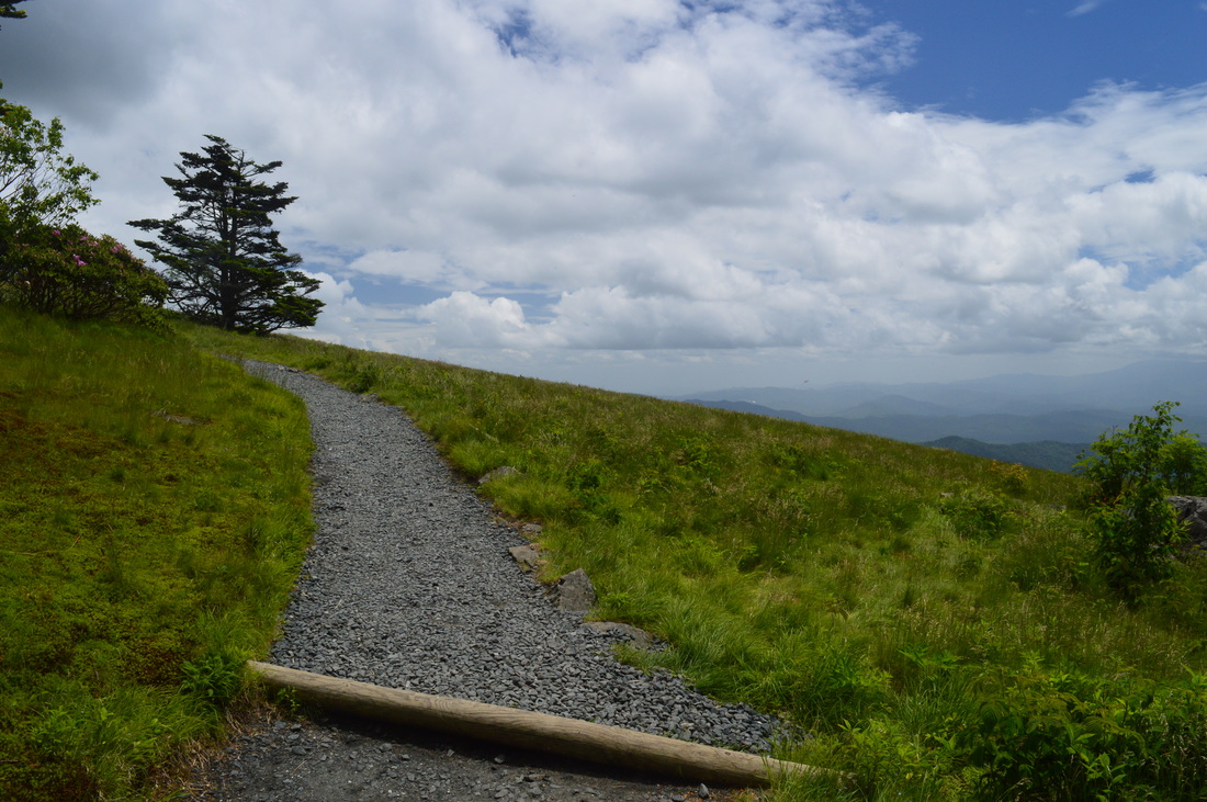
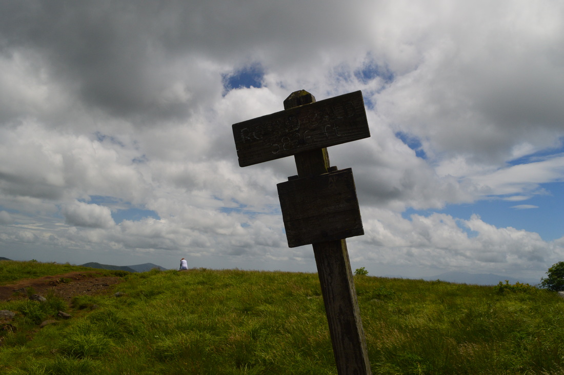
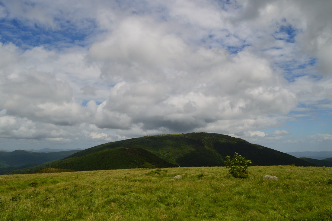
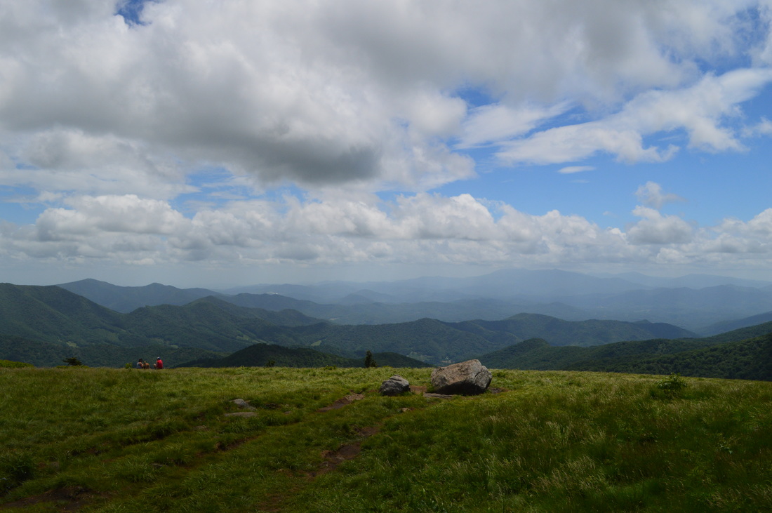
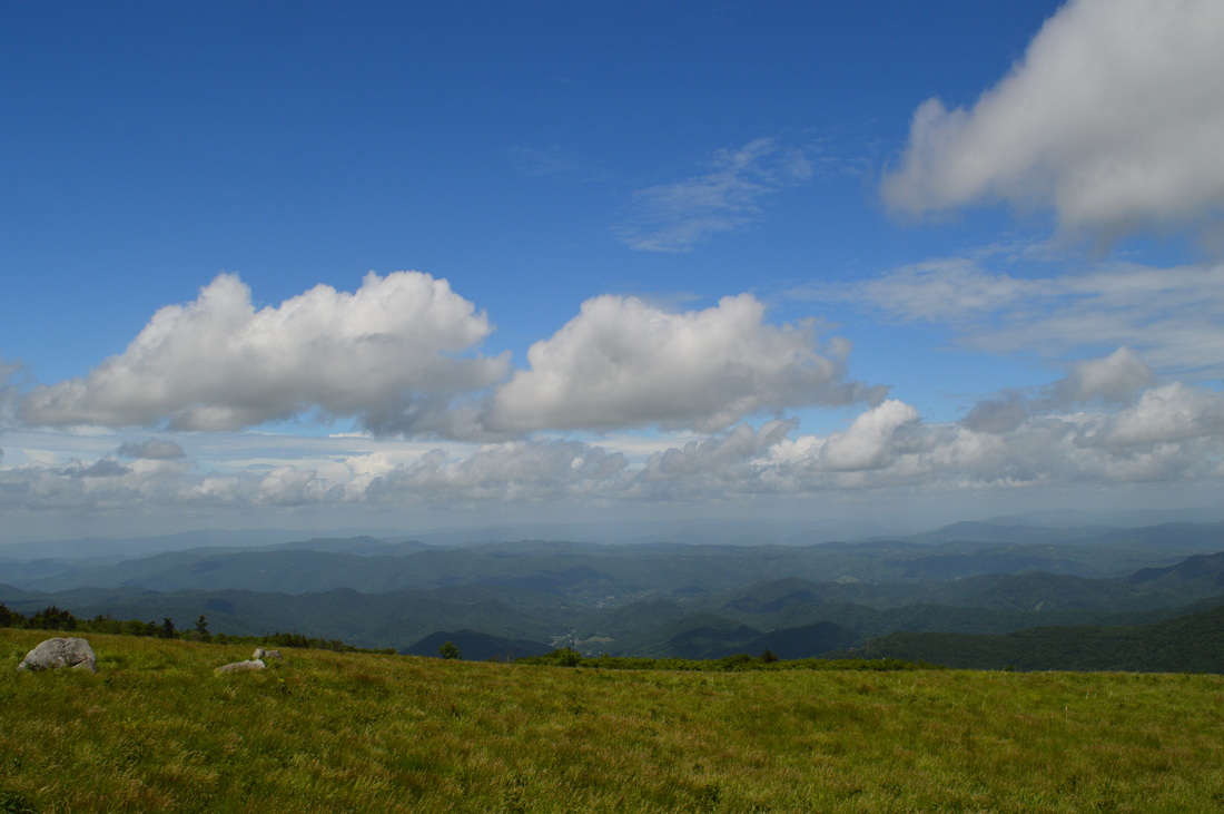
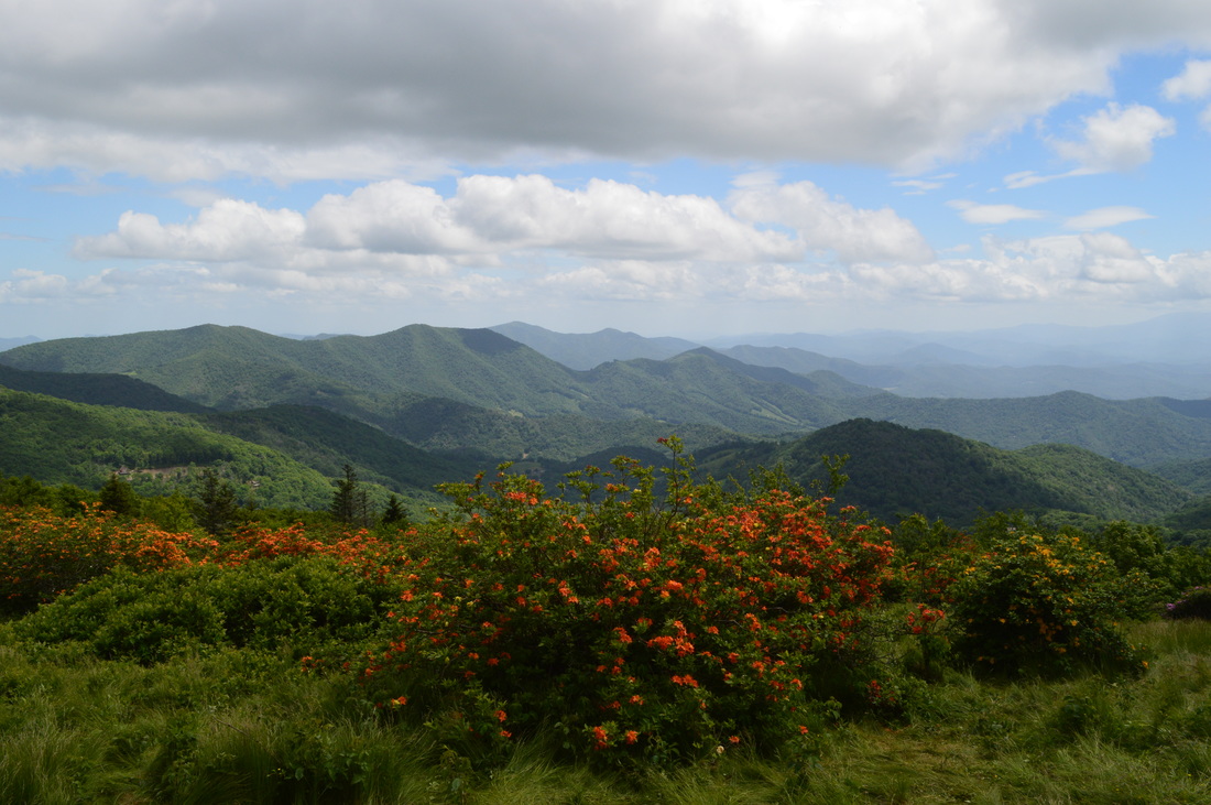
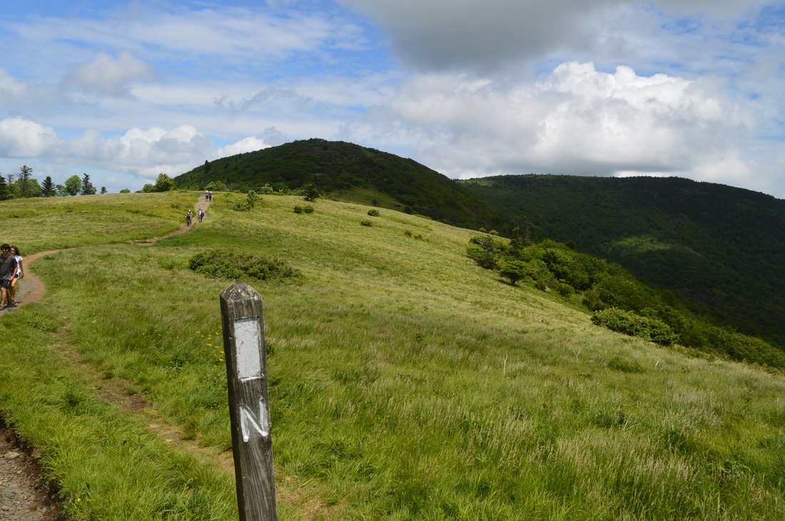
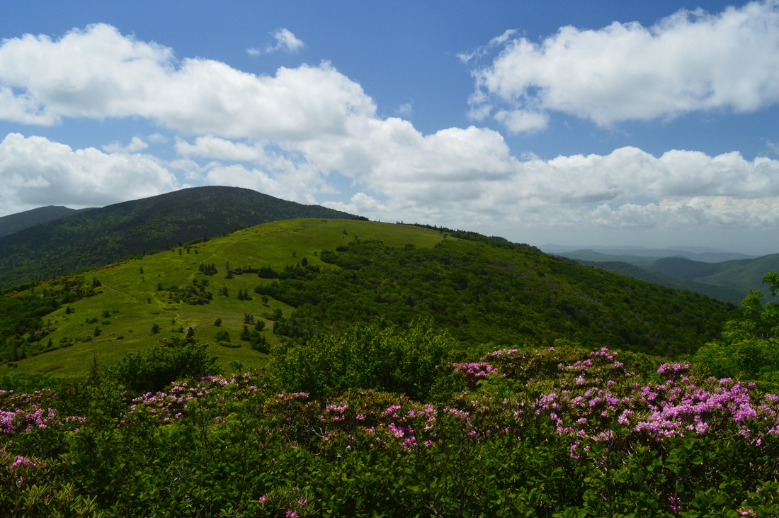
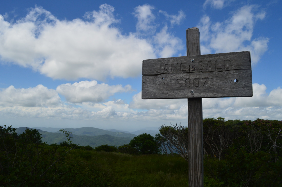
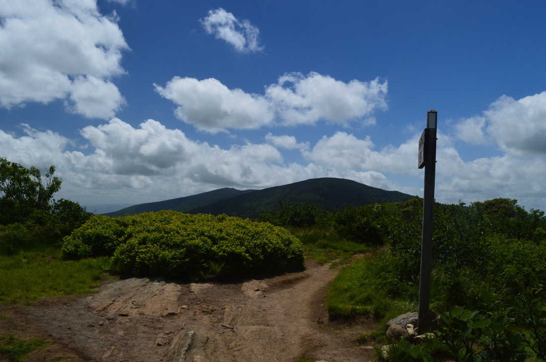
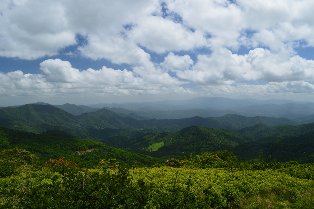
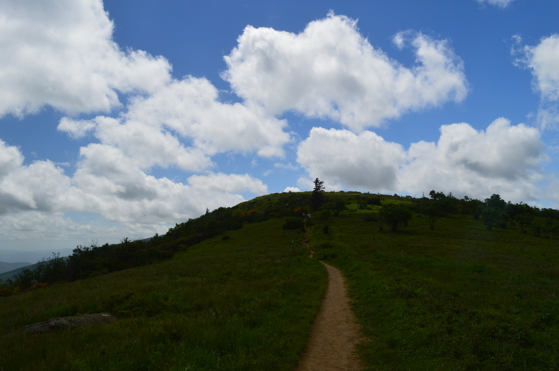
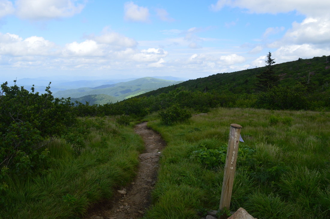
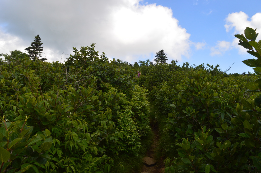
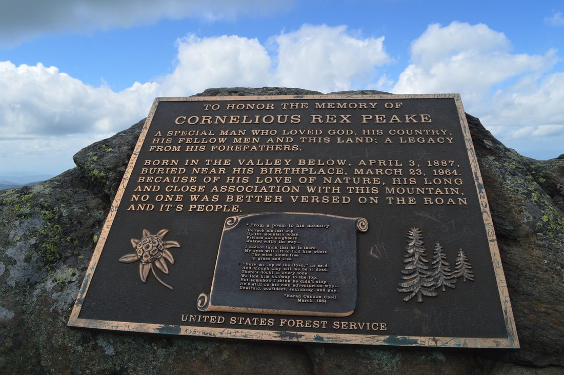
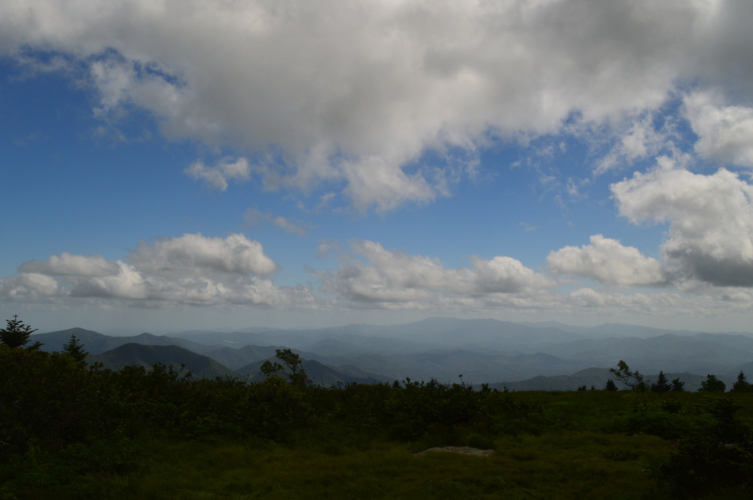
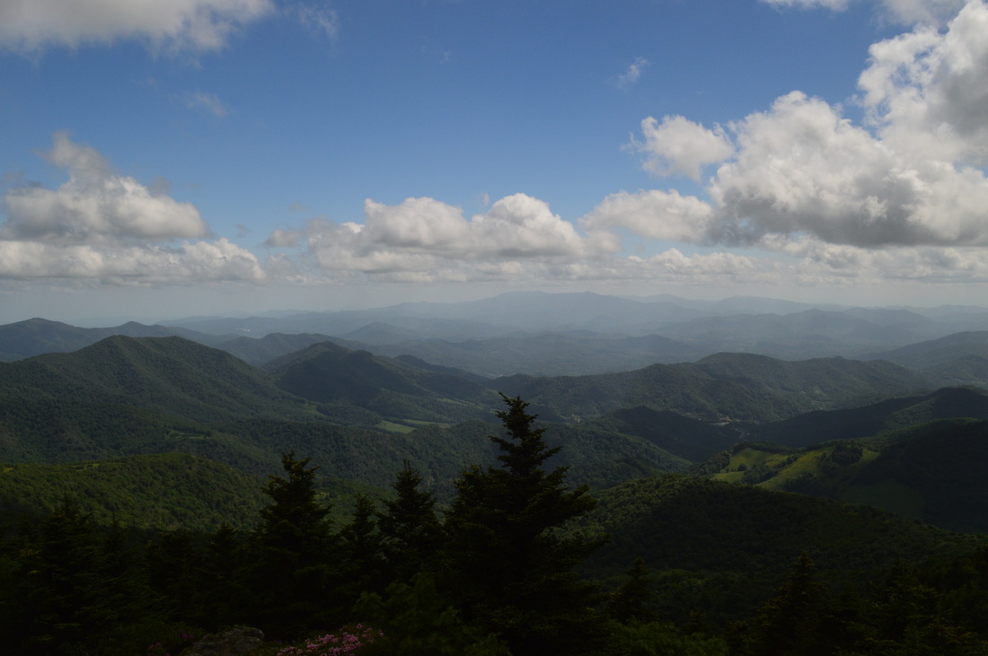
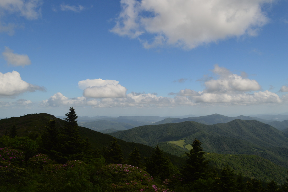
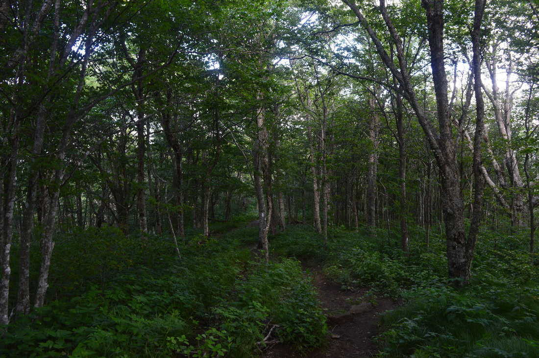
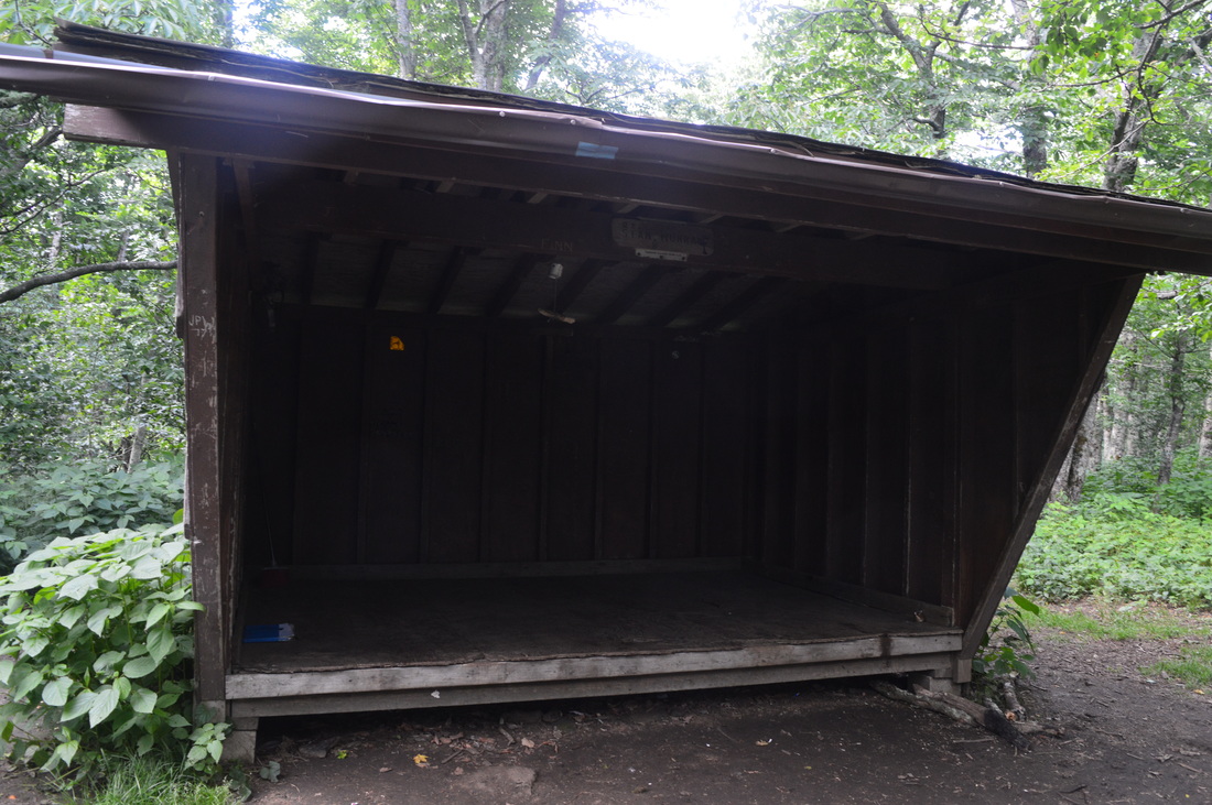
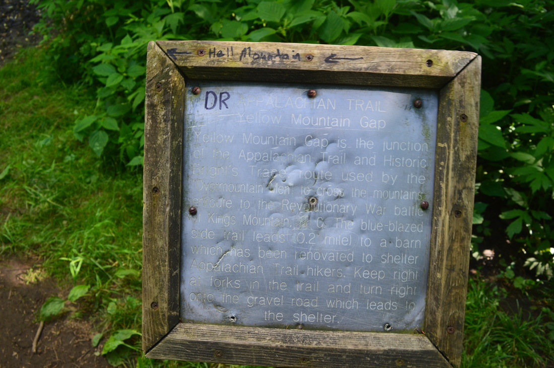
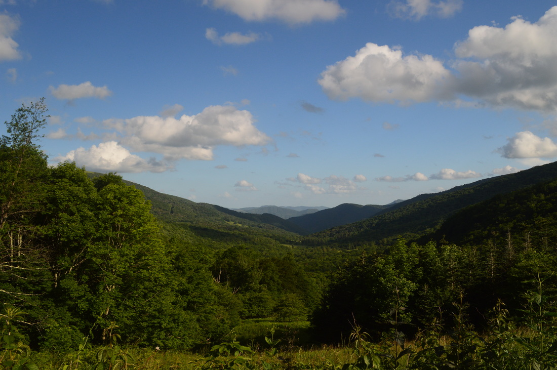
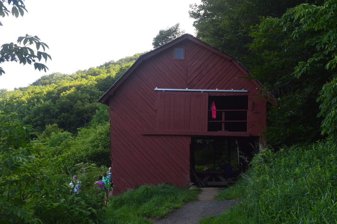
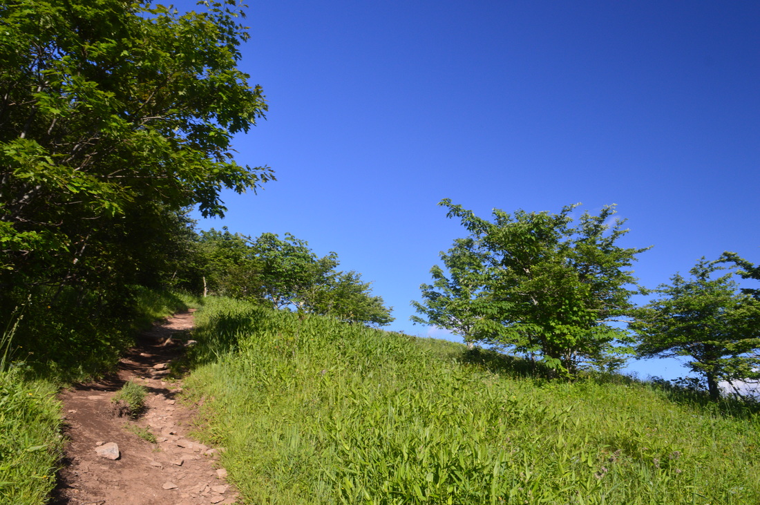
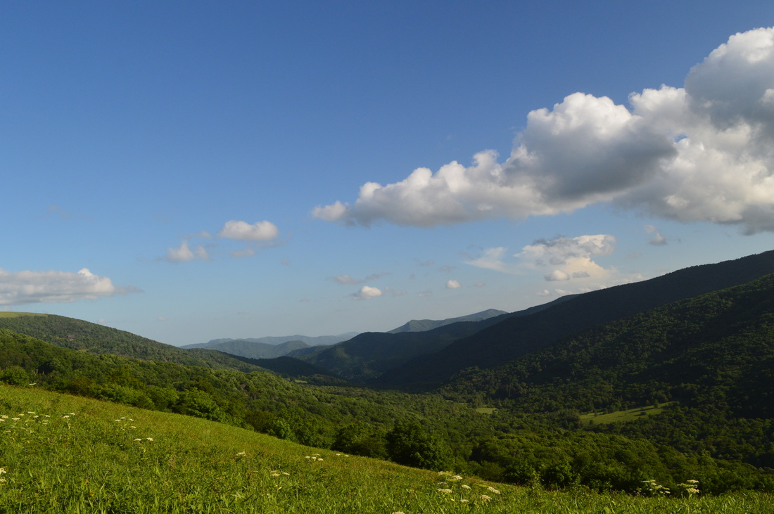
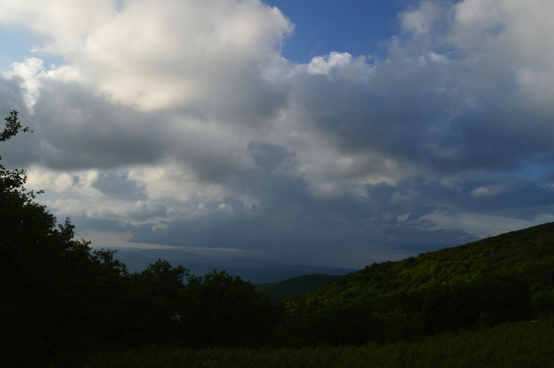
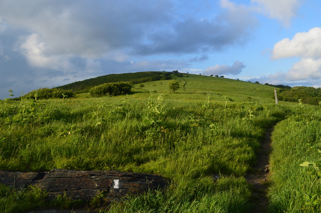
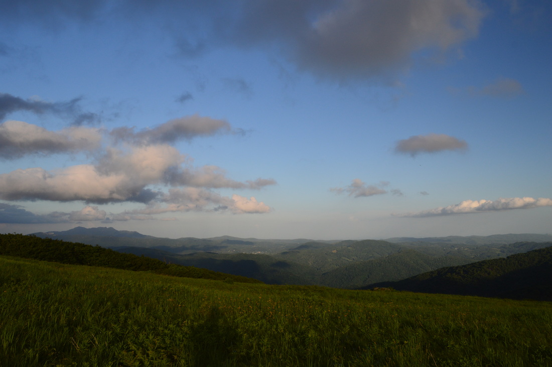
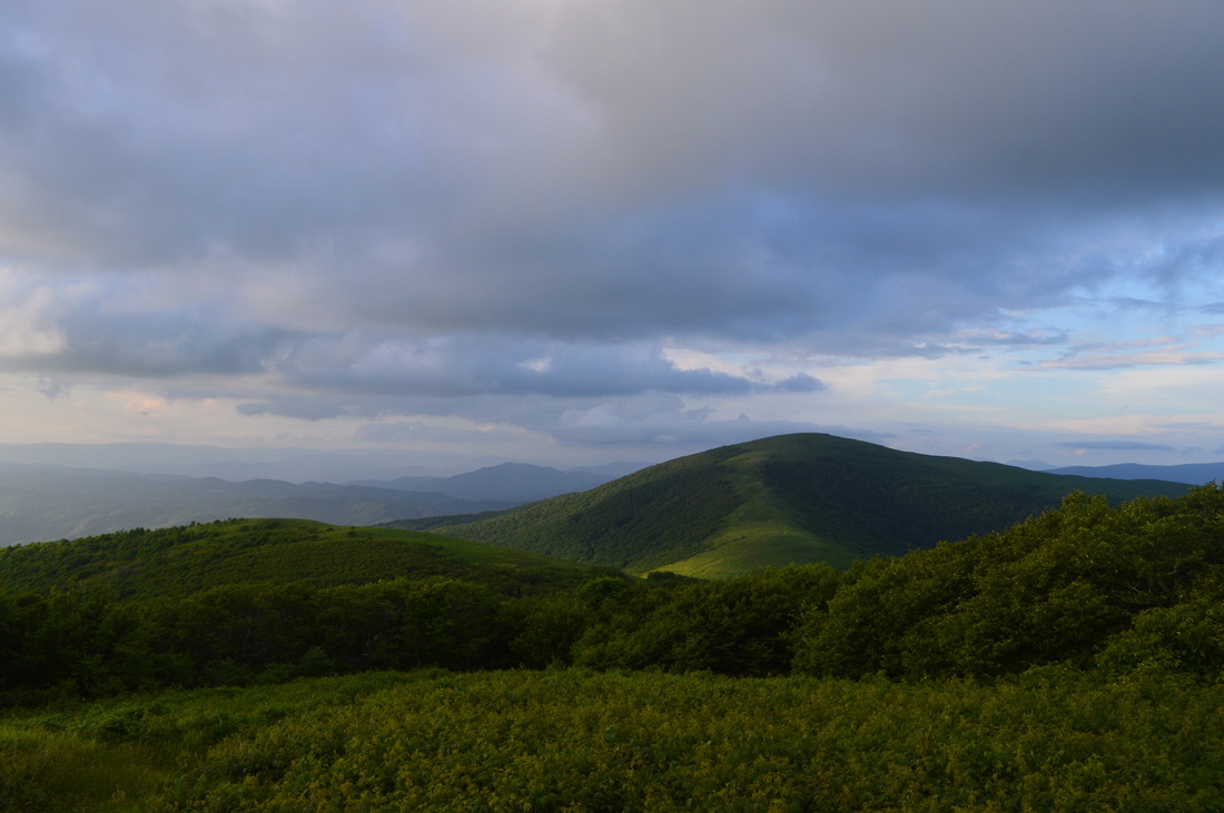
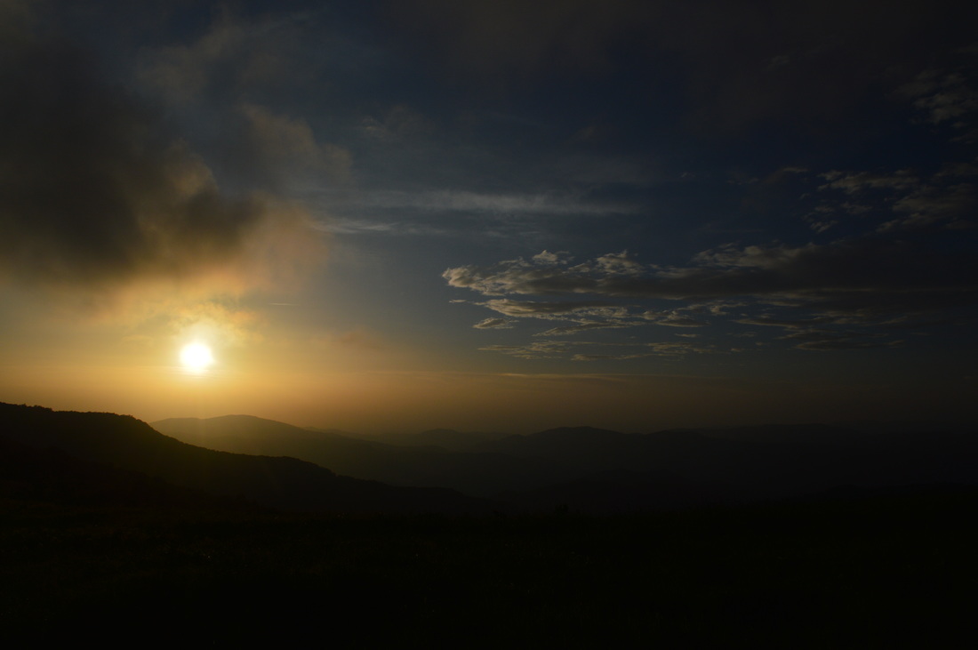
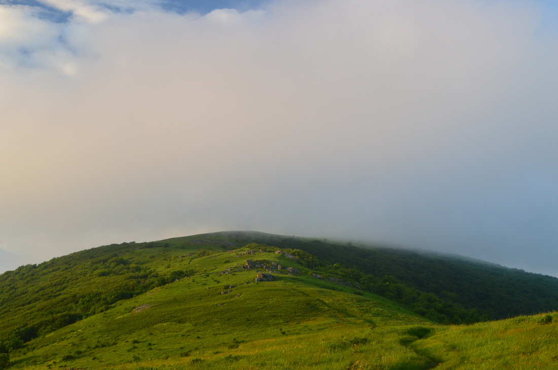
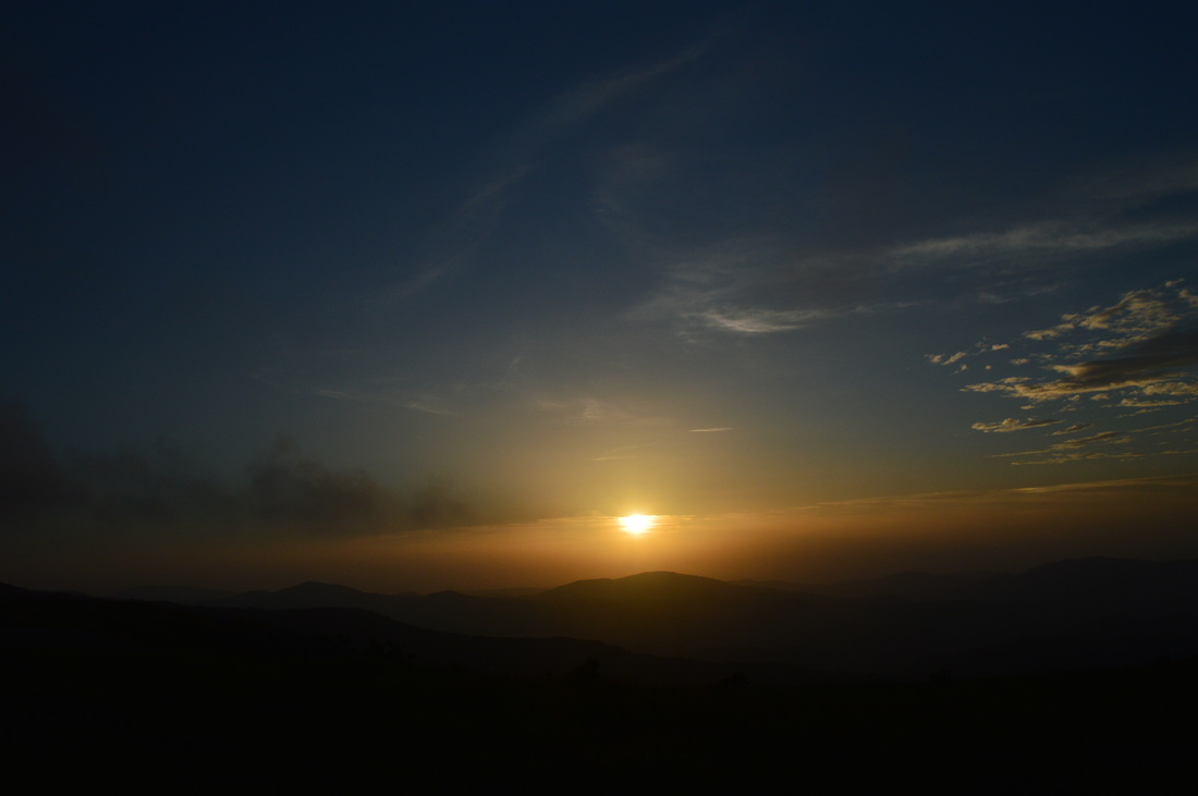
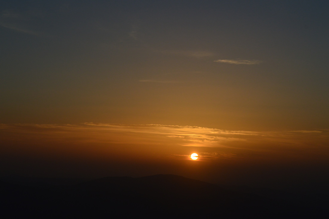
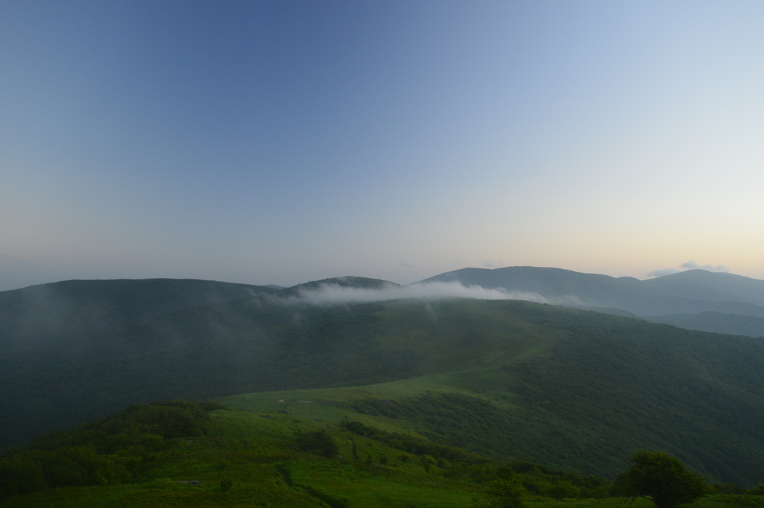
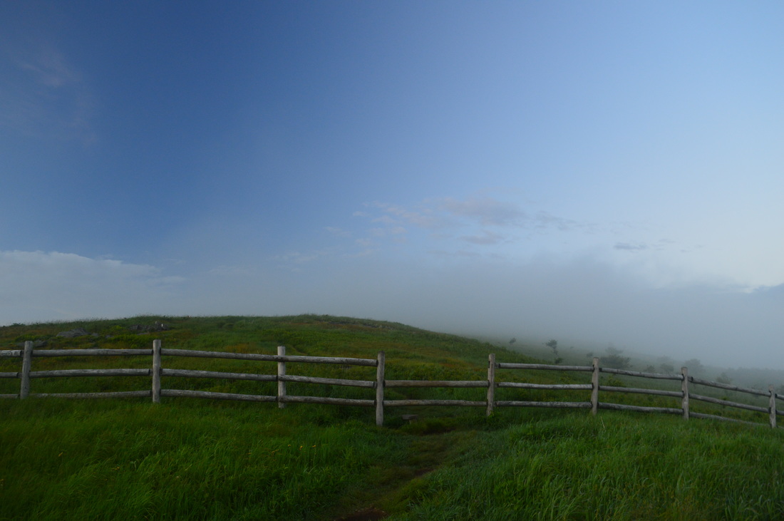
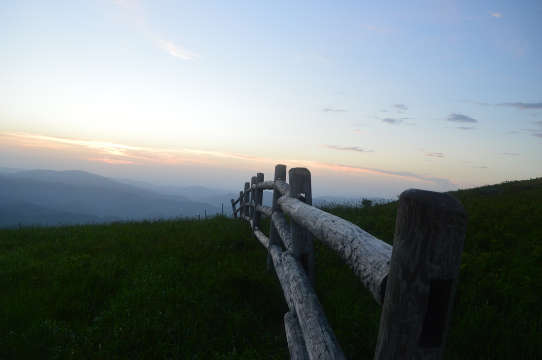
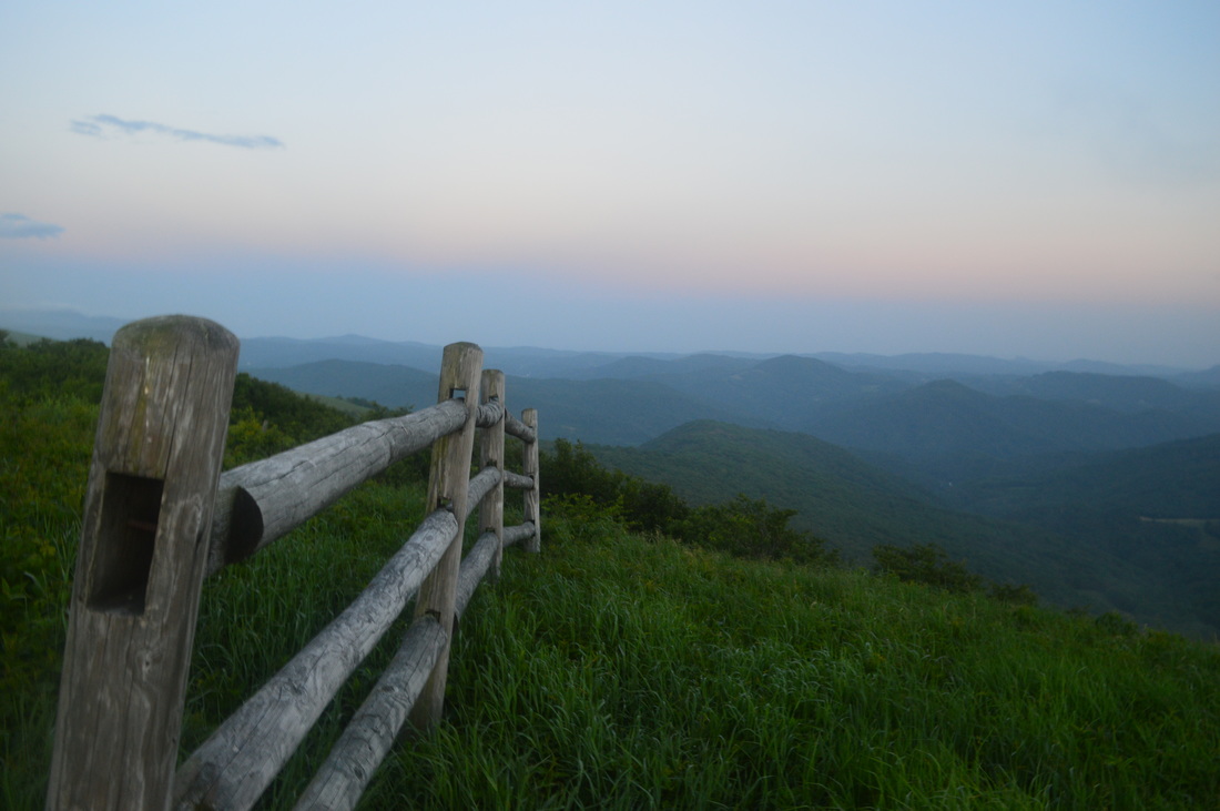
The hike starts at Carvers Gap, a very popular trailhead. Make sure to get here as early as possible in order to have a guaranteed spot. We barely found a spot when we came in the early afternoon. In winter, there may be less people, but in spring and fall, it's going to be full. However, the good news are that the bulk of the people will be encountered within the first two to three miles. The hike starts across the road from the parking area at Carvers Gap. Pass through a fence and begin ascending Round Bald on a wide, graveled path. Pass a mileage sign shortly. According to my GPS recordings, the mileages on the sign were slightly off on the low side, but they were fairly close. The path passes through some rhododendron bushes with great views of Carvers Gap and Roan High Knob behind you and to your left. At 0.1 miles, enter a spruce-fir forest on the west and north side of Round Bald. This is an interesting little stretch of trail. Forests like this are home to the rare saw-whet owl, the smallest out of all owls in the eastern US. In fact, this short stretch of forest is the last you'll see for quite some time. After several switchbacks on an easy trail, exit the forest at 0.4 miles into the open of Round Bald. As you ascend, the views begin to expand both north and south - views that will continue for a couple miles. At 0.6 miles, reach the summit of Round Bald, marked by a sign. Excellent views abound in all directions, with Roan High Knob behind you, and Jane Bald and Grassy Ridge/Grassy Ridge Bald looming straight ahead. At this point, Jane Bald looks like a part of Grassy Ridge. A spur trail to the right leads to a better view south from Round Bald. the Black Mountains and Mount Mitchell dominate the horizon. From Round Bald, descend moderately towards Engine Gap. Wooden stakes with white blazes mark the way. There is some flame azalea to the right of the trail in this area. As you hike, keep an eye out for the endangered Gray's Lily (if you are here in June). It can be found in the grass a little off the trail. At 1.1 miles, reach Engine Gap. There used to be a railroad track here that would take locomotives with logging purposes from the Tennessee side of the ridge, over the ridge, into North Carolina. That is where the name comes from. Following Engine Gap, begin a rocky ascent up Jane Bald. At first, it's easy, but it becomes steep shortly and climbs through rhododendron bushes that could have spectacular blooms during peak season in mid or late June. At 1.4 miles, reach the summit of Jane Bald, also marked by a sign. The views are not as great from here as from Round Bald, but there is still excellent panorama both behind you of Round Bald, Roan High Bald, and Unaka Mountain, and ahead of you of Grassy Ridge. Additionally, a rock outcrop on the right has excellent southern views. From Jane Bald, descend amidst rhododendron and flame azalea to an unnamed gap at 1.6 miles, and begin ascending to Grassy Ridge Bald on a very rough trail. Great views abound. At 2 miles, following a rock outcrop on the right, reach a junction with the Grassy Ridge spur trail. The Appalachian Trail bears left on its way to Yellow Mountain Gap, while the Grassy Ridge Trail continues straight/bears right towards the summit of Grassy Ridge Bald. While our hike will continue on the Appalachian Trail, take the spur trail first - it's worth going to the summit of Grassy Ridge Bald! The spur trail is slightly overgrown (even though it's well used), and it ascends moderately through a rhododendron tunnel. Then, it pops out onto the mostly bald ridge, with good views in all directions. At 2.5 miles, reach the summit of Grassy Ridge Bald. There is a commemorating plague here and good views of the Black Mountains and the area you just came from. You'll have to walk around a bit to see the views in all directions, however, as the flat, grassy summit is quite large. From the summit, the Grassy Ridge Trail continues to a gap and to a second summit on Grassy Ridge. I've heard there are more views from there, but I turned around at a rock outcrop with great views southward to the Black Mountains at 2.6 miles. After retracing your steps, reach the Appalachian Trail at 3.2 miles. Turn right, and begin a long descent from Grassy Ridge. You'll remember this descent as an ascent on the way back - in fact, this is the reason most people don't hike beyond Grassy Ridge and those who do do it as a multi-day hike. The descent begins by passing over numerous seeps, with springs nearby. Some northerly views abound, especially in winter. Shortly, the ascent steepens and switchbacks begin. After a long moderate descent with winter views on both sides of the trail, reach Low Gap and the Stan Murray Shelter (also known as Roan Highlands Shelter or Low Gap Shelter) at 4.9 miles. This is a fairly small shelter. There is a picnic table at the shelter. The trail continues past the shelter and ascends gently into a meadow with views of Grassy Ridge on the right. However, the descent soon resumes as the trail rounds a knob. Descend moderately to Buckeye Gap at 6 miles. This is still not the end of the descent. After a brief period of uphill over a small knob, continue following a ridge, and eventually continue descending to Yellow Mountain Gap. You finally bottom out at Yellow Mountain Gap at 6.7 miles. The Overmountain Victory Historic Trail crosses the Appalachian Trail here. This "trail" is actually a historic route from the Revolutionary War, but the section here is practically the only non-roadwalk section of it. While the trail is barely maintained, a well-used side trail leads right to Overmountain Shelter and Roaring Creek Trailhead. Turn right here - the spur trail to the shelter is worth seeing the unique shelter and the view near it. The spur trail enters an overgrown meadow. The Overmountain Victory Trail turns left at a trail wand, but the route to the shelter continues down the meadow and then into the woods. The descent is moderately steep. Soon, join an old road - keep right here (the road leads left to the Roaring Creek Trailhead) and reach the large grassy flat area near the shelter at 7.1 miles. There is plenty of space for tents here, and there is a great view down the Roaring Creek Valley. The Overmountain Shelter is located at the end of the clearing. This shelter is the largest on the southern portion of the Appalachian Trail, with space for at least 25 people. The shelter is actually an old barn that was transformed to a shelter. From the shelter, retrace your steps to Yellow Mountain Gap, reaching it 7.5 miles. Turn right, and continue on the Appalachian Trail. The ascent starts out very steeply up and along a large meadow. This meadow provides excellent views of Grassy Ridge, Roaring Creek Valley, and other numerous mountains far away. After the trail leaves the meadow, the ascents becomes easier along a ridge. Around here, something large and dark darted over the trail right ahead of me - I wasn't paying too much attention as to who exactly it was. I was looking back at that moment, but I suspect it was a wild hog. After some more gentle uphill, the trail enters the meadows of Little Hump Mountain at 8.5 miles. The trail passes trough a gap and begins ascending moderately to the summit of Little Hump Mountain. As the trail ascends the bald, there are spectacular views in all directions. Barring bad weather (thunderstorms or snow), this is an excellent place for camping. After a rock outcrop on the right with a spectacular view back south towards Grassy Ridge, continue towards the summit. Reach the summit of Little Hump Mountain at 8.9 miles. This is one of the most spectacular vistas I've been at, with outstanding views of ridge upon ridge of mountains in all directions. Hump Mountain (or Big Hump Mountain) looms straight ahead. From the summit, the trail descends into the forest for a short period of time, before switchbacking along the lower portions of the grassy meadow on Little Hump Mountain. After reentering the forest, pass some campsites and a spur trail to a spring. Pass an unnamed bald below Little Hump Mountain on the left, and then reenter the open and descend through a meadow to Bradley Gap at 10.1 miles. After this, begin a steep ascent up Hump Mountain. This is one of the hardest parts of the hike. The ascent looks like it is not hard, but it is deceiving. The trail ascends steeply through the huge meadow that makes up Hump Mountain. I actually didn't make it to the true summit, as it was getting late, but even though I didn't, the views were some of the best I've seen in my life. I imagine that they are even better at the summit, if that's even possible. As I was working my way uphill, the sun was setting to the west. The hazy sunset was beautiful, and behind me, evening fog and clouds rolled across Little Hump Mountain, often obscuring the distant Grassy Ridge from view. The scene is portrayed well in my picture that is at the top of this page. On the way up, you will pass several rock outcrops that enhance the views. At 10.7 miles, reach a fence. The trail crosses it through a fence stile. This was where I turned around. The views are breathtaking. I suggest continuing a couple more tenths of a mile to the summit of Hump Mountain. From Hump Mountain, the route back is the same. Just don't do the spur trails again, unless you have any specific reason to. You will return to the parking area at 19.4 miles - or should I say "hobble" into the parking area? See the variations below for other ways to do this hike or split it up. To summarize, this is one of the most spectacular hikes I have ever done, without question rating it a "Best Hike". However, the difficulty is not to be dismissed. While the views are breathtaking from all five mountains on this hike, it would be best to split it up into sections, like I've already mentioned before. Make sure to not let the difficulty to take away the beauty of this hike for you. Variations
Out and back from Carvers Gap to Grassy Ridge Bald - 5 Miles (slightly more if you continue to the second summit on Grassy Ridge)
Out and back from Roaring Creek Trailhead to Hump Mountain 8-9 Miles (I do not know exact distance, because I haven't measured the distance to the true summit of Hump Mountain and also from Roaring Creek Trailhead to Overmountain Shelter) Do the entire hike in two or three days; best camping locations are on Little Hump Mountain, Hump Mountain, Grassy Ridge Bald, and near Overmountain Shelter Bonus Stops
If you have any extra time or energy, check out the Rhododendron Gardens, the vista at Roan High Bluff, and the site of the Cloudland Hotel, all just west of of Carvers Gap.
Pictures
10 Comments
6/24/2015 12:24:11 am
Mark, GREAT write up! Oh how I have wished many times that I had started hiking earlier in life before I had so many responsibilities.
Mark Oleg
6/24/2015 05:39:27 am
Thanks! I imagine it would be a pretty extreme hike in winter conditions - cold, wind, etc. But it would be interesting to try though.
Disco Rob
6/24/2015 01:50:47 am
I wouldn't call this area 10+ out of 10 in difficulty at all. It sounds like you just overdid yourself, something that an actual seasoned hiker would know better than to do. The Roan is a cake walk compared to Maine.
Mark Oleg
6/24/2015 05:41:37 am
Disco, the ratings are all relative. For me.. this was the hardest hike I've ever done. If someone does it the same way I did, it's going to be about as hard for them. If someone splits it up, it will definitely be easier. I haven't hiked north of Virginia, so I don't know about the trail conditions in Maine and New Hampshire. If I ever get over there, I will likely have to do some adjustments to my overall difficulty rating scale.
Marie Johnson
2/8/2016 09:33:00 am
This is by far one of my favorite hiking spots. Definitely worth the effort!! 5/11/2019 03:49:44 pm
My daughter and I are looking to do a 3 day backpacking trip here. 20 - 25 miles with good camp sites away from roads and day hikers. Suggestions?
Ben Bateson
3/2/2020 10:12:03 am
Great write-up for this hike. I've done this in sections and definitely recommend doing it that way. The Roaring Creek trailhead is open year-round and it makes the climb up to then from Hump mountain an attainable day hiking goal for moderately experienced hikers.
William Edson
7/21/2020 03:22:41 pm
Just hiked it out and back yesterday, 7/20/20. Great hike with unique views and scenery. 8 hour round trip, but could have shaved time off if we wanted. We’re fairly fast hikers and we’re not passed by anyone, for people wanting to estimate hiking time. Hike out is more difficult. 8/4/2022 06:14:15 am
Edirne baymak servisi hizmetlerimiz memnuniyet odaklıdır. Detayları incelemek için hemen web adresimize göz at! https://www.edirneklimaservisi.com/edirne-baymak-servisi/
Jay Gilliam
7/5/2024 06:57:24 pm
GREAT write up! EXACTLY the information I've been looking for! I'm planning on making a day hike of this soon! =) Leave a Reply. |
About MeMark Oleg Ozboyd Dear readers: I have invested a tremendous amount of time and effort in this website and the Georgia Waterfalls Database the past five years. All of the work that has gone in keeping these websites updated with my latest trip reports has almost been like a full-time job. This has not allowed me to pick up a paid job to save up money for college, and therefore, I I've had to take out loans. If you find the information on this website interesting, helpful, or time-saving, you can say "thanks" and help me out by clicking the button above and making a contribution. I will be very grateful for any amount of support you give, as all of it will apply toward my college tuition. Thank you!

Coming in 2022-2023?
Other Hiking WebsitesMiles HikedYear 1: 540.0 Miles
Year 2: 552.3 Miles Year 3: 518.4 Miles Year 4: 482.4 Miles Year 5: 259.9 Miles Archives
March 2021
Categories
All
|


 RSS Feed