If I had to name the ten best hikes that I have ever done, the hike along the east rim of Linville Gorge to Table Rock and the North Carolina Wall would make the list without question. This section of the Mountains-to-Sea Trail provides access to several jaw-dropping vistas of Linville Gorge as well as its surroundings. North of the Table Rock Picnic Area is the summit of Table Rock, whose lofty peak is surrounded by cliffs hundreds of feet high and whose elongated rocky summit is home to a series of grand vistas that encompass a 360-degree view. Meanwhile, to the south, the MST first passes through a place called The Chimneys, a series of wild and jagged rock outcrops of all shapes and sizes, where the knife-edge ridge with 360-degree views forms a boundary between the rolling hills of the North Carolina Piedmont and the ruggedness of Linville Gorge. Then, if all of that wasn't enough, a pair of side trails lead to the North Carolina Wall. Rising hundreds of feet high, the North Carolina Wall is an incredible line of cliffs with continuous views over a half-mile long along the east rim of the gorge. This hike occurred on Friday, July 7th, 2017. My plan was to hike the Mountains-to-Sea Trail and Table Rock Trail from the Table Rock Picnic Area to the summit of Table Rock. On my way back, I would take a side trail to an area of cliffs known as the Devil's Cellar. Then, I would follow the Mountains-to-Sea Trail in the other direction to and through The Chimneys, before taking a side trail down to an area on the rim of the gorge known as The Amphitheater. Finally, I would follow another faint trail along the top of the NC Wall back to the MST, before retracing my steps back to the picnic area. This hike was the sixth of ten hikes that I did during a seven-day trip to the mountains of northwest North Carolina.
Summary
R/T Length of Trail: 4.9 Miles
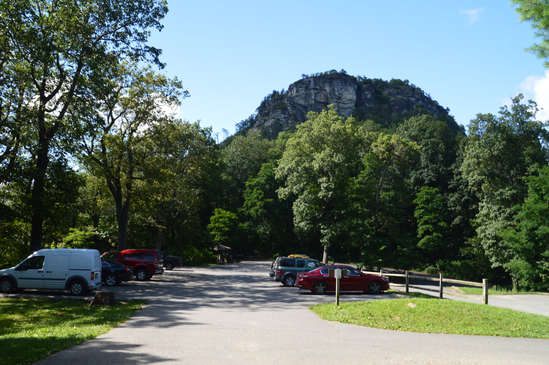
Duration of Hike: 4:30 (this includes a lot of stopping at the numerous vistas) Type of Hike: Double Out and Back Difficulty Rating: 5 out of 10 Total Elevation Gain: 1803 Feet Pros: Endless breathtaking views Cons: The NC Wall Trail is very overgrown (where applicable) Points of Interest: Table Rock Summit Views - 10+ stars collectively; Devil's Cellar; The Chimneys Views - 10+ stars collectively; The Amphitheater & North Carolina Wall Views - 10+ stars collectively Trail Blaze Colors: Mountains-to-Sea Trail - White Circle; Table Rock Trail - None; Amphitheater Trail - None; NC Wall Trail - None; Mossy Monster Trail - None Best Seasons to Hike: Fall (Winter is very good too but the road to Table Rock Picnic Area is closed most of the winter, so you would have to start at Spence Ridge Trailhead which makes the hike longer by a couple miles) Fees: None Beginning Point: Table Rock Picnic Area Directions from Linville, NC: From the intersection of US 221 and NC 181 near downtown Linville, follow US 221 South/NC 181 South for 2.9 miles and then turn left onto NC 181. Continue on NC 181 for 6.3 miles, before turning right onto Ginger Cake Road. Follow Ginger Cake Road for 1.2 miles to where it turns into unpaved Table Rock Road. Continue on Table Rock Road (Forest Service Road 210) for 4.6 miles, and then, turn right onto Forest Service Road 210B to continue following Table Rock Road. If you follow the signs for the Table Rock Picnic Area, you're driving down the right roads. Stay on FS 210B for 1.5 miles to an intersection with FS 99. Once again, turn right onto FS 99 - which is actually paved due to its steepness. Follow FS 99 for 1.4 miles to its end at a parking lot in the Table Rock Picnic Area. Even where it's unpaved, Table Rock Road still is in great shape. Map
Click the link below to download a .GPX file with a track of this hike.
Details
When there's three vistas on a hike that are rated a '10+' each, you know the hike is seriously outstanding. For years, I had been waiting to hike in Linville Gorge, but the driving time of over five hours from Atlanta prevented me from getting there sooner. When I got the chance to take a seven-day vacation in the mountains, I instantly knew where I was going: northwest North Carolina, the home of Linville Gorge and Grandfather Mountain, two places that anyone living in the Southeast must visit at least once. In fact, if you are in North Carolina, you absolutely must do the Table Rock-Chimneys-NC Wall hike. If you haven't done it yet, you're missing out on some of North Carolina's most spectacular natural sights. The hikes to Table Rock and North Carolina Wall aren't super difficult either, and even if you do the two together - like I did on this day - the difficulty rating is still moderate. The only drawback to this hike is that in order to hike along the entire North Carolina Wall, you need some navigational skills as the trail is nearly non-existent. However, you don't have to hike the entire NC Wall to experience its views - simply hiking to The Amphitheater and the NC Wall's lower end could be enough.
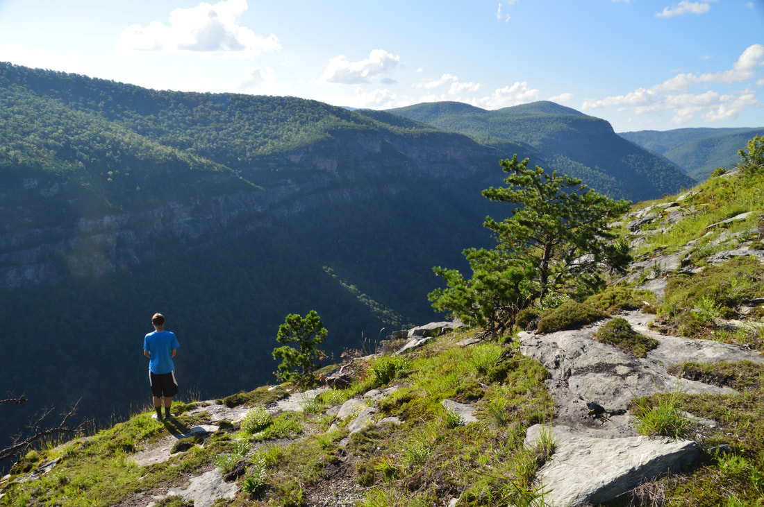
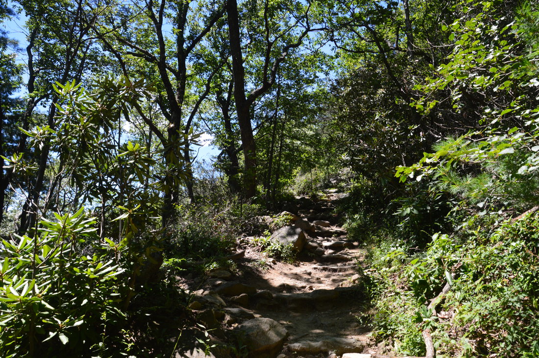
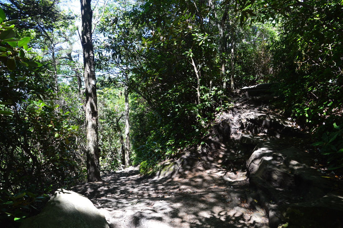
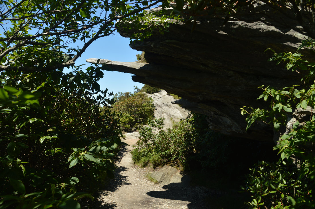
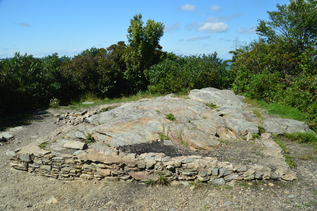
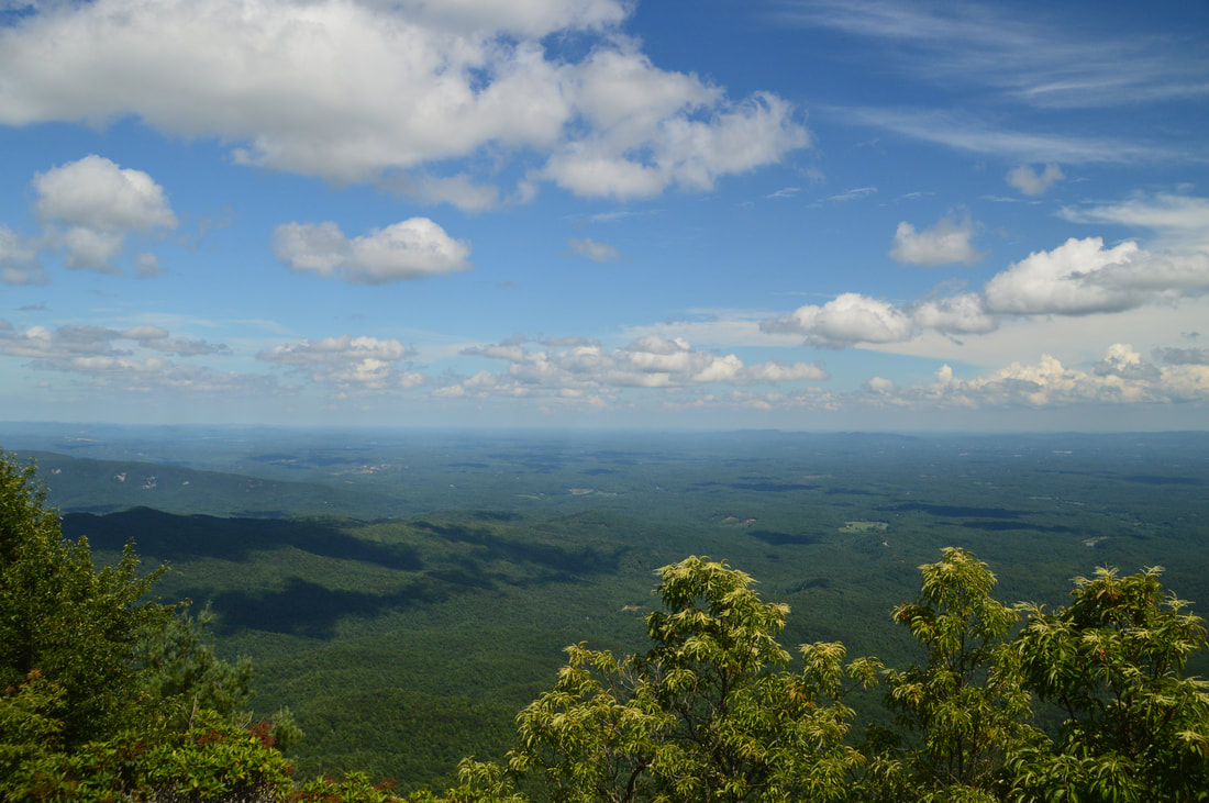
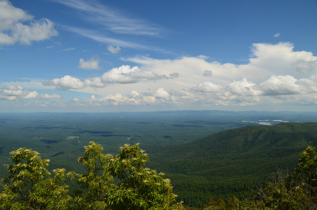
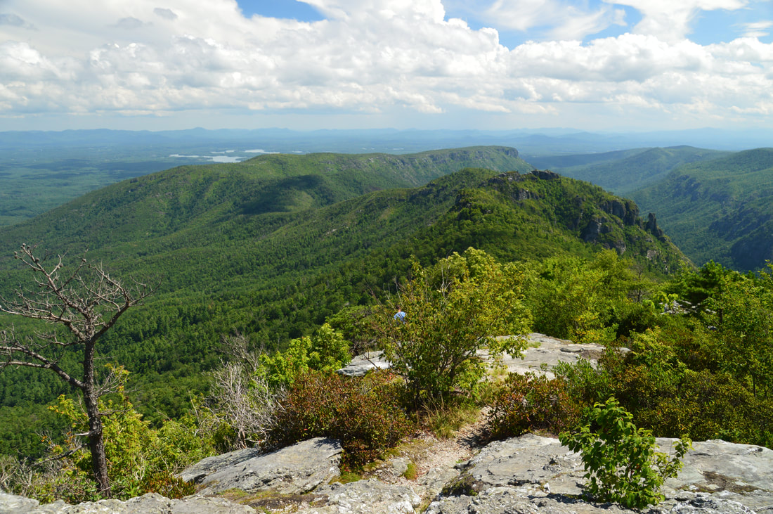
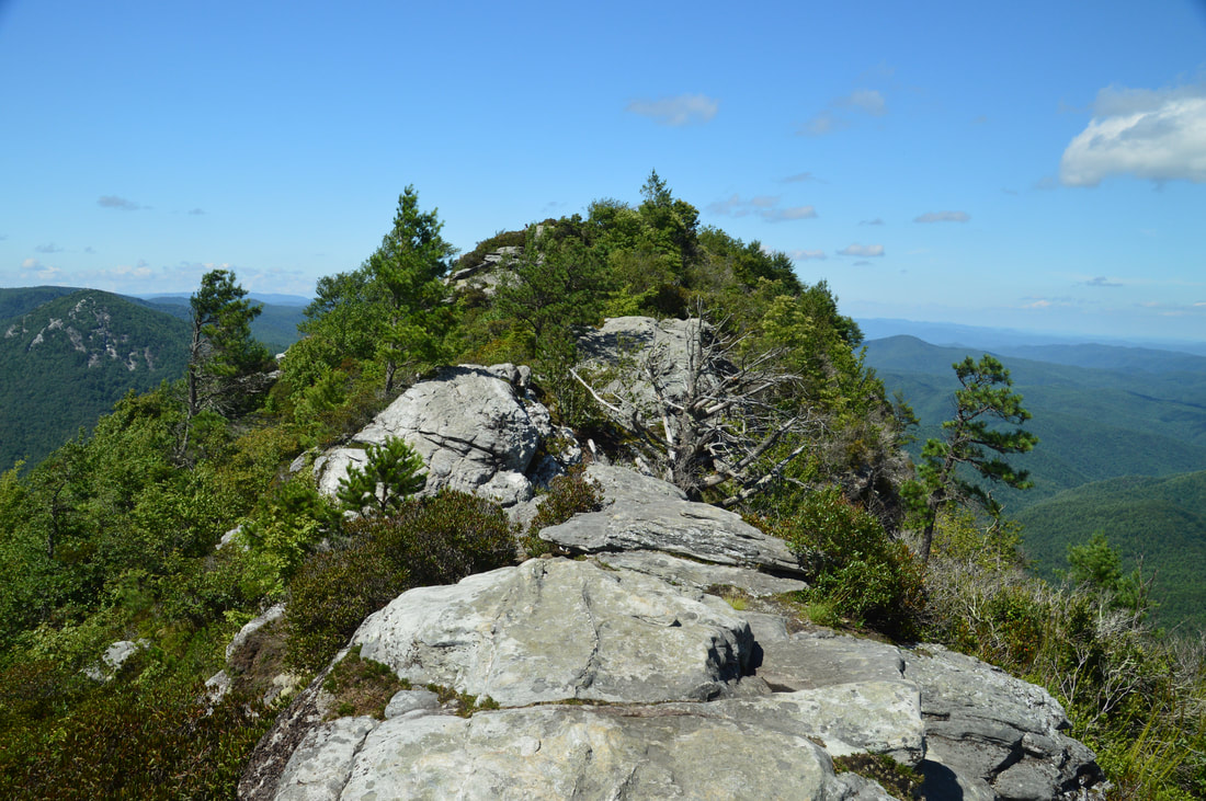
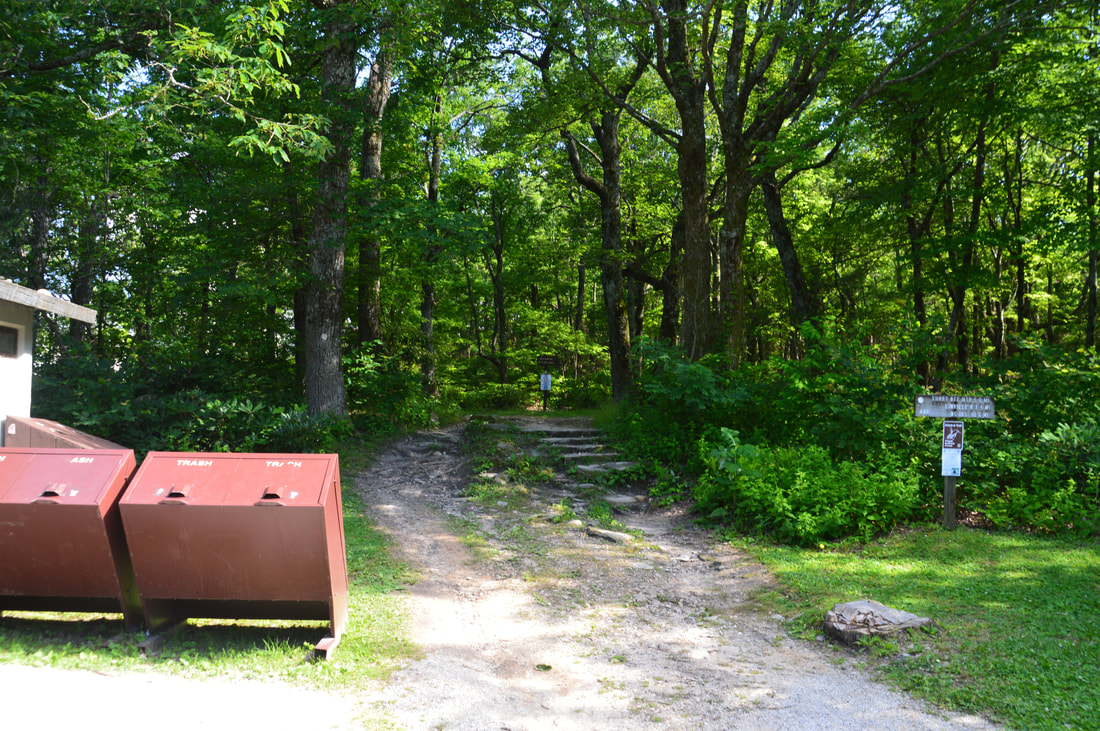
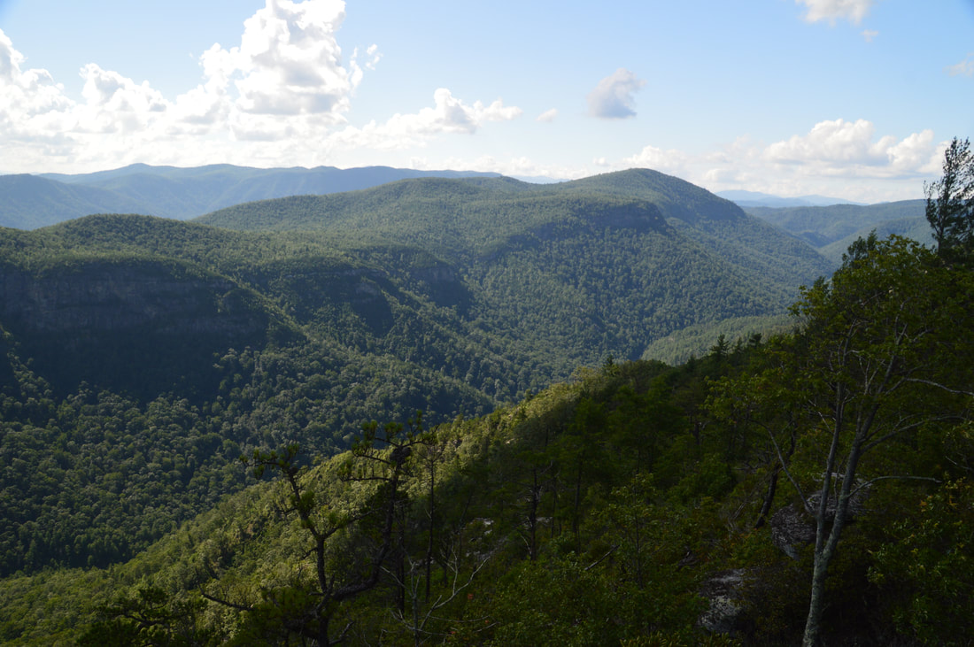
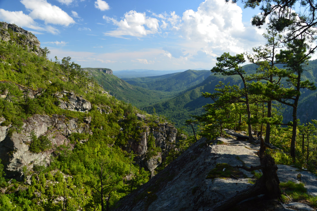
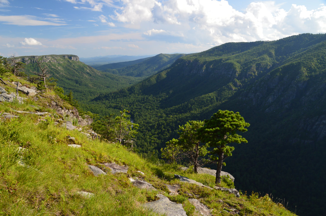
The ascent and overall hike to Table Rock is a bit more difficult, so if you're planning to do both, it is probably best to start with Table Rock. From the parking area, walk to the north trailhead for the Mountains-to-Sea Trail, where a sign says "Table Rock 1 Mile", although it appears to actually be a bit less than that. After a couple of switchbacks, the moderately ascending trail quickly enters a relatively open area on the south side of Table Rock, where there is a view of Table Rock's south cliffs - popular with rock climbers - and also your first views of Linville Gorge. As the trail slowly bends around the west side of Table Rock, Little Table Rock comes into view ahead, complete with its own cliffs. At 0.3 miles, the MST reaches a junction with the Little Table Rock Trail, which turns left as the MST turns right toward Table Rock. The Little Table Rock Trail eventually connects to the Spence Ridge Trail, passing a side trail to the summit of Little Table Rock where more views await along the way, but I skipped this side trip today, turning right onto the MST. In about 250 feet at 0.35 miles, there is an important unmarked split, where the MST bears left toward Table Rock Road and Steels Creek while the unblazed but distinct Table Rock Trail continues straight/bears right. Make sure to continue on the Table Rock Trail. The ascent steepens, but occasional switchbacks still ease the grade. Just before the third switchback, the Table Rock Trail bears right while an unmarked but well-used side trail bears left at 0.5 miles. This is the trail to Devil's Cellar; make a mental note of the location so that you can check it out on your way back (or you can make the side trip now, if you wish). For further clarification, there is a steep but well-used switchback shortcut (that I do not recommend using) on the right just before the junction. Meanwhile, the Table Rock Trail continues to ascend the west side of Table Rock, making several more switchbacks. Along the way, there are several unofficial side trails to preliminary vistas. After the sixth switchback at 0.65 miles, the trail soon passes a rock overhang on the right and breaks out into the open, with continuous views to the west on the final approach to the summit. The official trail ends at the summit of Table Rock at 0.7 miles, just shy of elevation 4000 feet. The ruins of a fire tower's foundation can be seen at the summit. While this is the end of the official trail - and the view isn't that great - there are a couple of side trails leading to views to explore from the summit. First, turn right and follow the path along the rocky summit ridge southward. There is some rock hopping involved but it's pretty easy. In about 150 feet, reach a point with the best east-west view. To the right (east), some of the landmarks in the view are the steep slopes of Linville Gorge upstream, Hawksbill Mountain, and Grandfather Mountain in the distance. Meanwhile, to the left (west), there is a great view of the North Carolina Piedmont's rolling hills, with Lake James in the distance to the south. Continue following the path along summit ridge for another 300 feet to a broad rock outcrop facing southward at 0.8 miles. This is the best south view on Table Rock, and what a view it is. The rugged and narrow downstream passage of Linville Gorge is well-defined, and in fact, both The Chimneys and Shortoff Mountain along the gorge's east rim are visible from here. Particularly impressive is the chimney-shaped rock outcrop known as The Camel at the right end of The Chimneys area. There is a clear view of Lake James farther in the distance, with the South Mountains lining the horizon. 
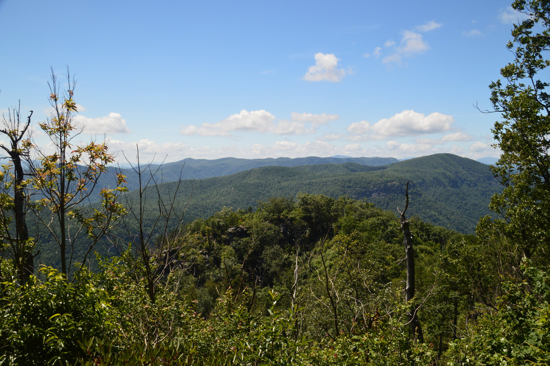
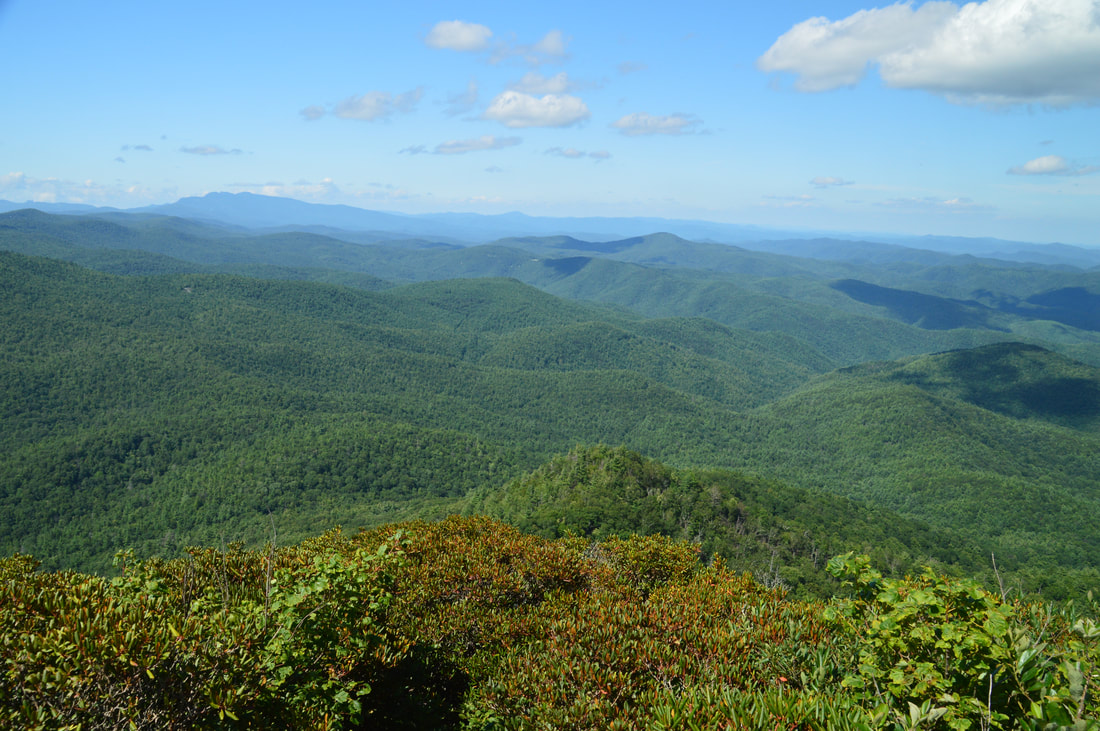
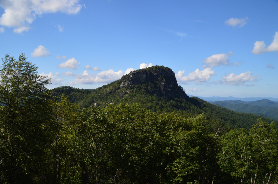
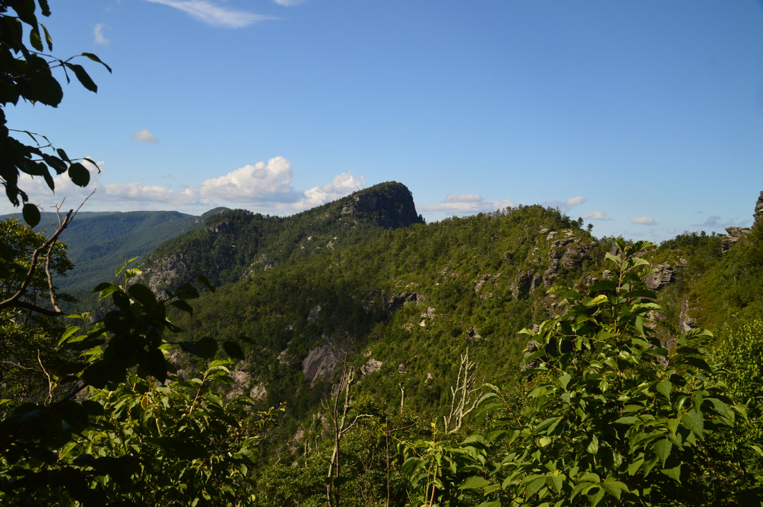
The southbound view from the summit of Table Rock encompasses much of Linville Gorge's lower end, with key landmarks such as The Chimneys and Shortoff Mountain standing out. In addition, Lake James adds color to the scene in the distance and the South Mountains line the horizon. This is only one part of the spectacular view from Table Rock.
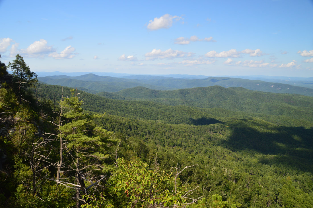
The path continues down from the south end of Table Rock's summit, but I do not know whether it connects to the Table Rock Trail, as I didn't field-check it myself. Regardless, it is best to retrace your steps along the rocky summit ridge as you haven't seen the north view yet. When you reach the fire tower ruins again, continue straight (northward) on another unofficial side path that ends at a broad rock outcrop in about 100 feet. From this outcrop, there is a spectacular panoramic northward view, with the cliffs of Hawksbill Mountain being its centerpoint. The view of the twisting Linville River flowing through the bottom of Linville Gorge on the left side of the view is frame-worthy! A bit to the right of the view's center, the profile of Grandfather Mountain in the distance is unmistakable.
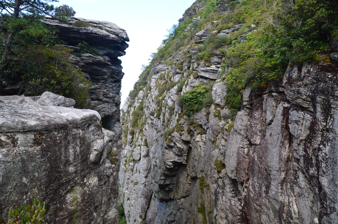
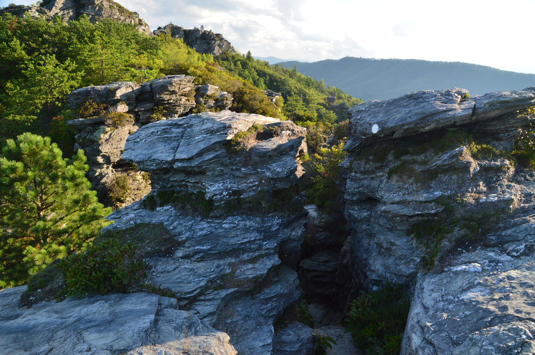
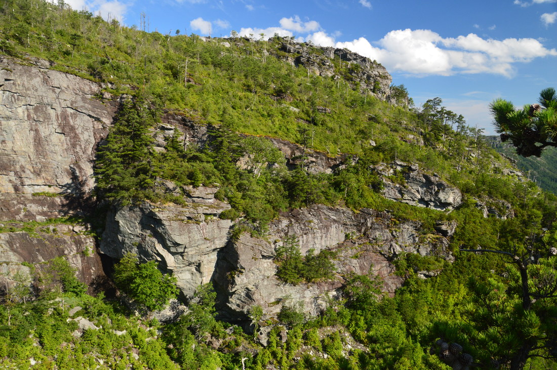
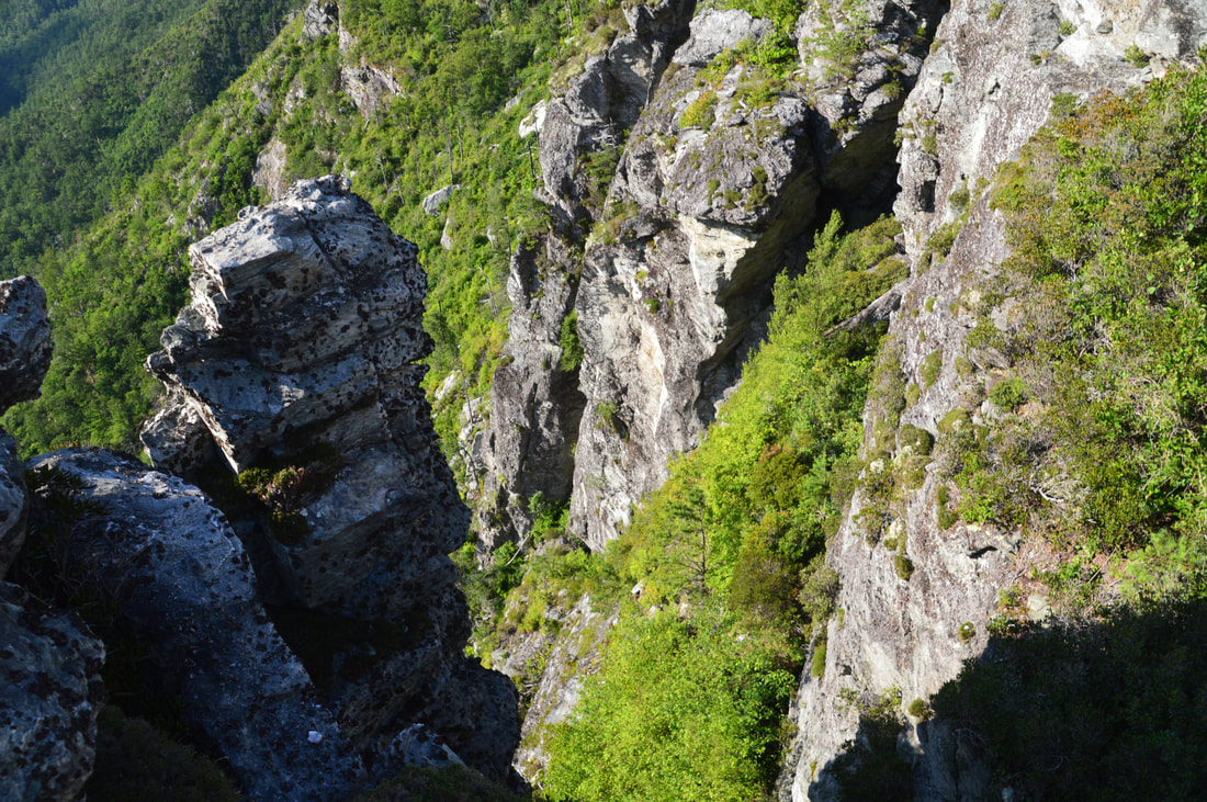
From the north view on Table Rock, return to the summit and begin retracing your steps back down from the mountain along the official Table Rock Trail. You will reach the junction with the Devil's Cellar Spur Trail once again at about 1.1 miles. Turn sharply right onto the spur trail, which contours along the slope with a brief ascent at the end. At 1.2 miles, the spur trail ends at the Devil's Cellar. The Devil's Cellar itself is actually the name for the very steep notch/gully right in front of you, squeezed in between two cliffs. What is so amazing about the Devil's Cellar though is the massive cliff on the right. Stretching along the northwest side of Table Rock, the cliff - speckled with moss and other greenery - is one of the most beautiful cliffs I've ever seen and well worth the side trip. Furthermore, there is another great view northward from the cliff on the left, the top of which is easily accessed from the end of the trail. In my opinion, the top of the cliff on the left also provides the best perspective of the main cliff on the right. An insanely steep climbers' path heads down the gully between the two cliffs but you will not want to try it unless you are sure of your scrambling and climbing skills. 
The Devil's Cellar is an incredibly beautiful notch between two cliffs on the west side of Table Rock.
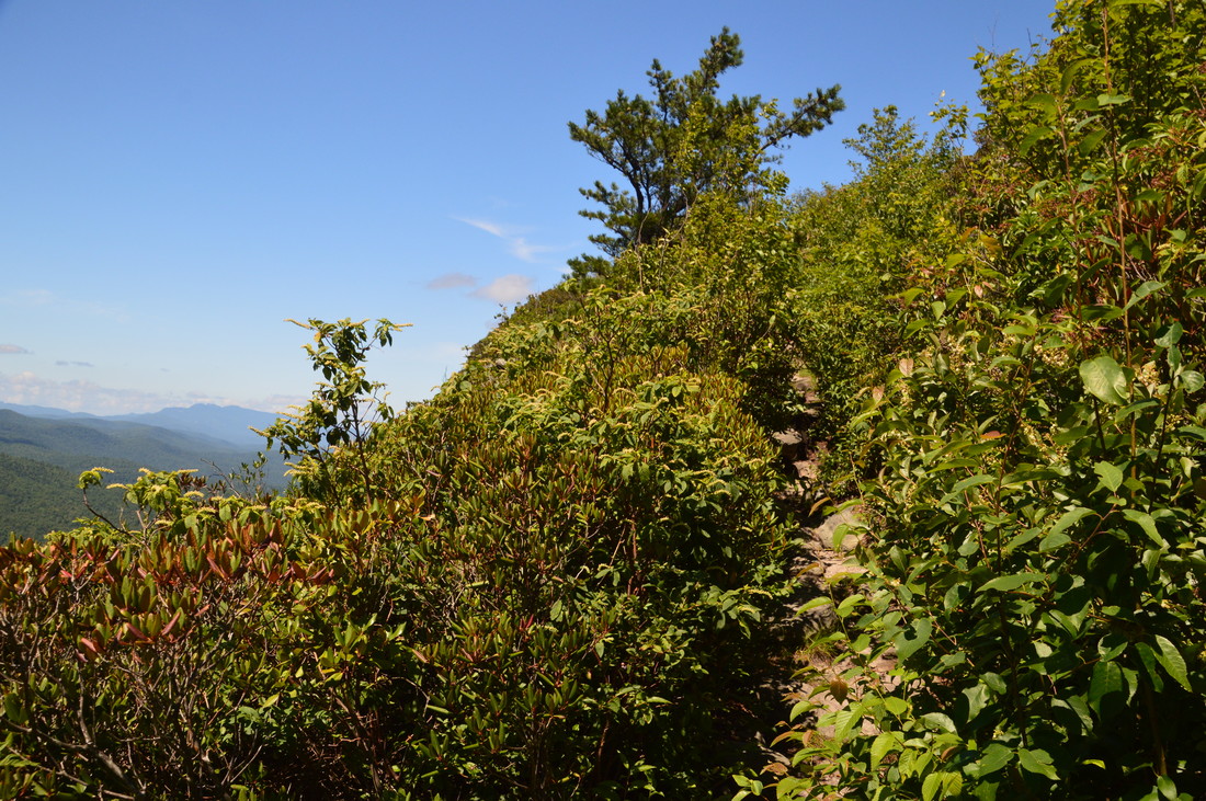
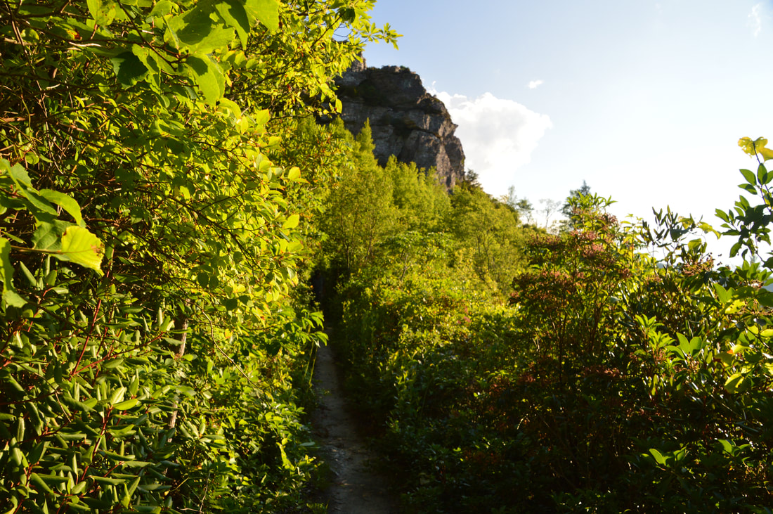
From the Devil's Cellar, return to the Table Rock Trail and continue retracing your steps back to the parking area, which you'll reach once again at 1.8 miles. If you still have enough energy, you should definitely do the hike's second part that I am about to describe. Walk across the parking area, reaching the signed south trailhead for the Mountains-to-Sea Trail. Before you head into the woods, take a minute to look back across the parking - the view of Table Rock's south cliffs is imposing. The MST quickly enters the Linville Gorge Wilderness as it begins to follow the ridge along the east rim of Linville Gorge. Initially, the trail passes several campsites and climbs gently up a small knob, near the top of which at 2.1 miles, a side trail on the left leads a few dozen feet to a rock outcrop with another great view of Table Rock's striking cliffs. At the same time, the trail crosses the knob and soon reaches the beginning of a spectacular open section of trail at The Chimneys at 2.25 miles.
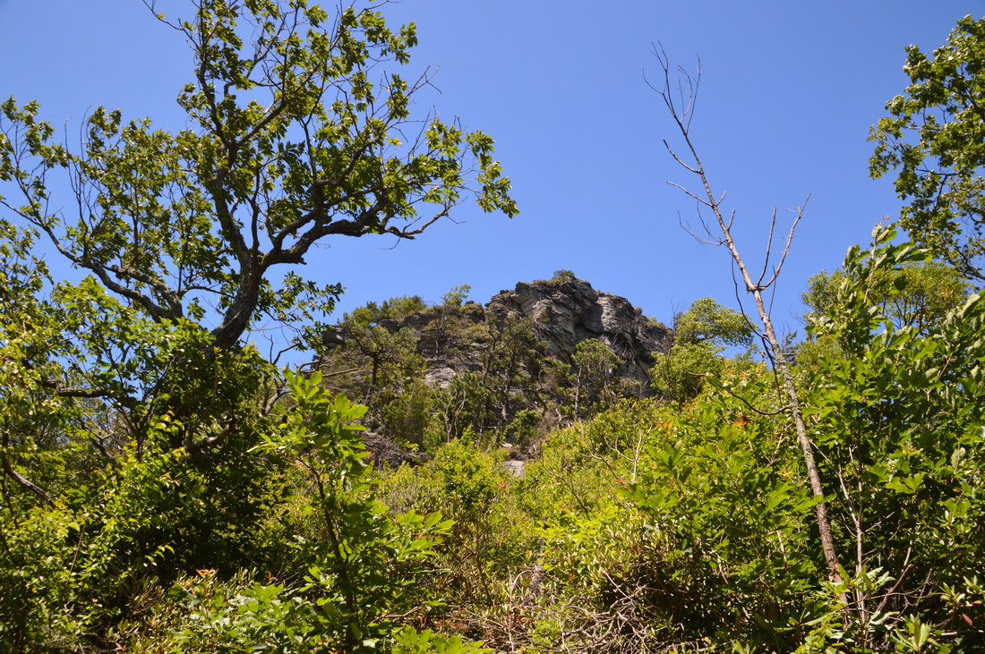
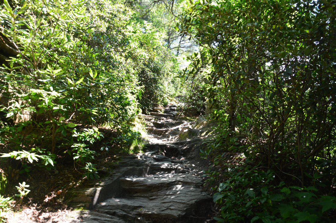
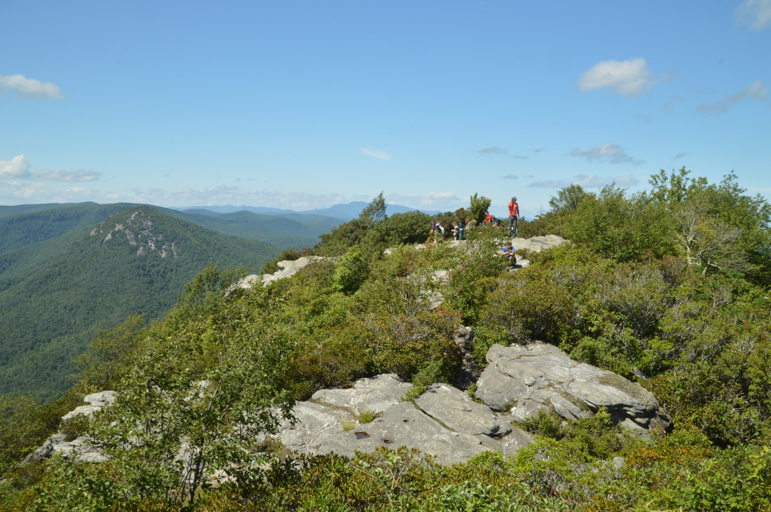
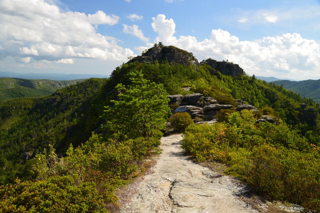
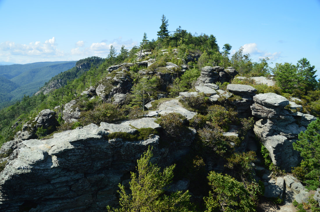
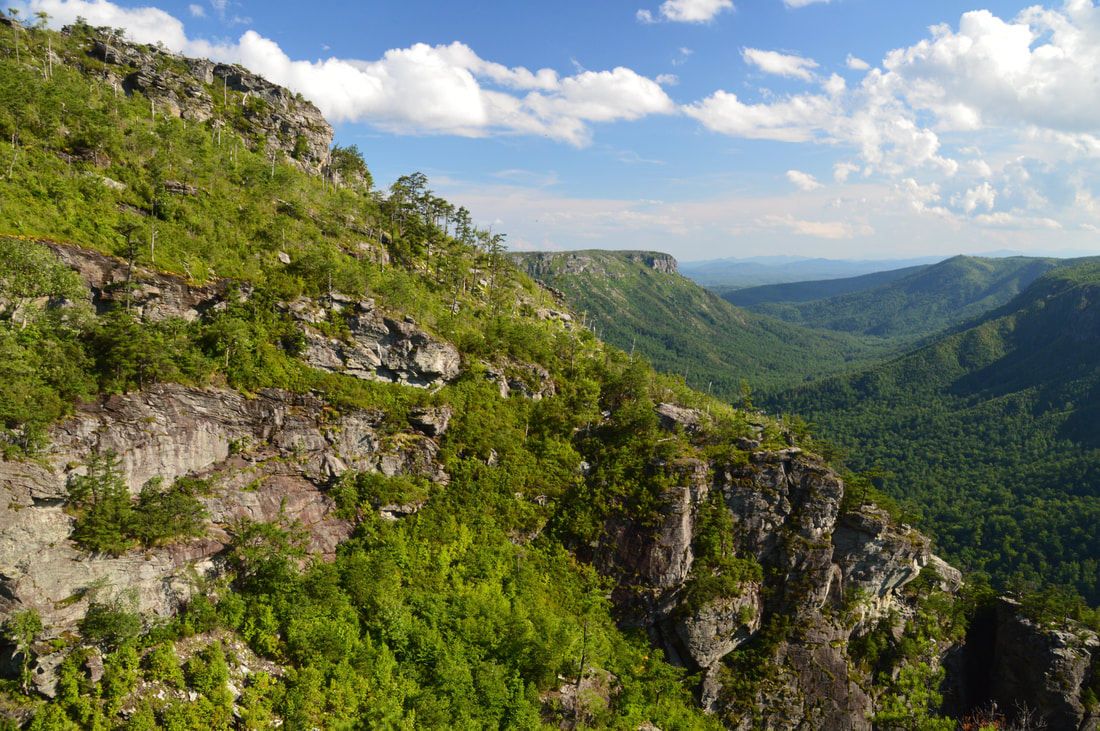
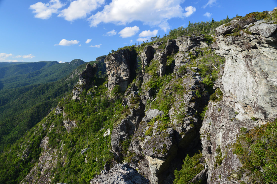
The Chimneys, a popular rock-climbing area, is a large array of rock outcrops of all shapes and sizes on the east rim of Linville Gorge. As mentioned before, The Camel is one of the most prominent rock outcrops. The trail briefly follows a knife-edge ridge with steep drop-offs on either side through the heart of The Chimneys. This section of the trail has breathtaking 360-degree views. In fact, just before the trail descends into a small gap, there is a point where the view is equally unobstructed both to the west and east. To the right (west), the cliffs on the west side of Linville Gorge are standing out, and to the left (east), the NC Piedmont once again rolls away to the horizon. Follow the white circles as the trail makes a steep but short rock scramble through a notch and reaches the gap, where there is a close-up view of some of The Chimneys' rock formations up ahead. here, the trail bears right and becomes slightly more wooded, passing below the rest of The Chimneys, but frequent side paths on the left lead to the various rock outcrops. Just before the trail leaves The Chimneys area and enters the forest, there is a great view on the right looking back at The Chimneys, Table Rock, and Little Table Rock. 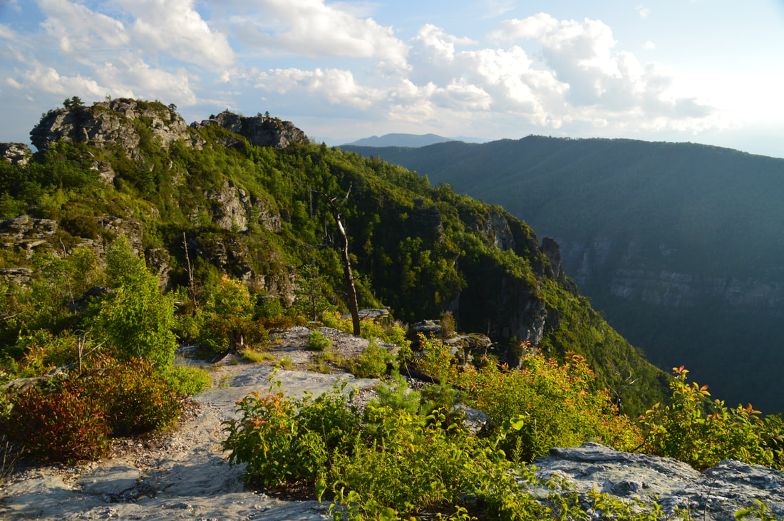
The Chimneys section of the Mountains-to-Sea Trail is simply jaw-dropping, with spectacular rock formations and 360-degree views.
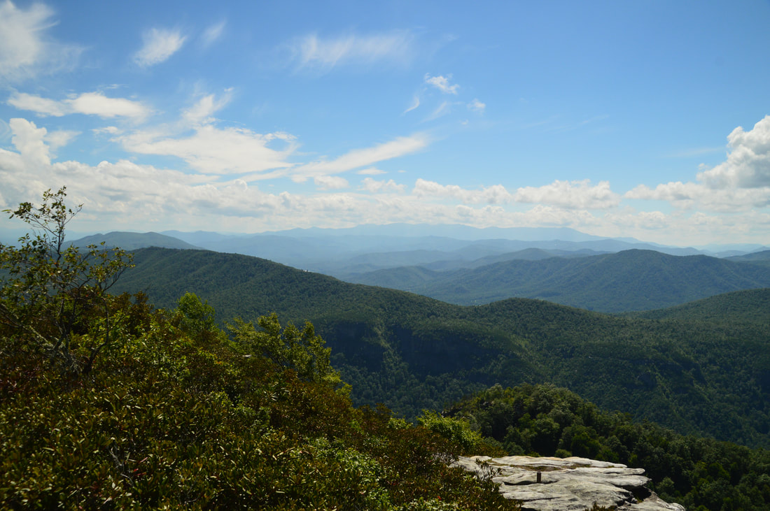
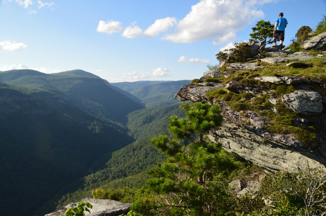
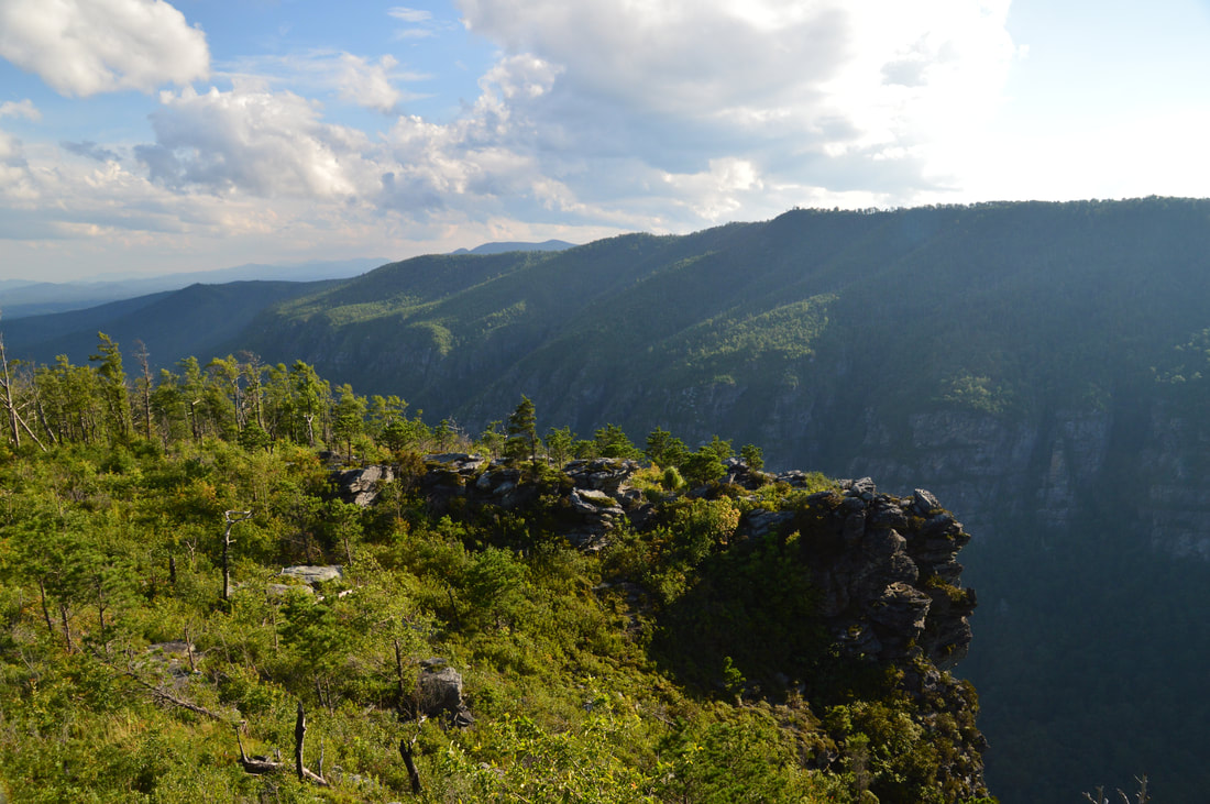
At 2.6 miles, just after the trail leaves The Chimneys, an overgrown trail on the right leads down to more views as well as climbing access for The Camel. I skipped this side trail today though due to time constraints. Keep following the MST, which at 2.65 miles reaches an unmarked junction with a well-defined side trail on the right. Nicknamed the Mossy Monster Trail, this unofficial trail leads to the North Carolina Wall and will be your return route - assuming that you can make it through the loop. If you don't make it through the loop, it may be worth making a separate side trip along this trail on the way back. For now, continue straight as the MST steadily descends down the ridge with few views. At 2.95 miles, there is a very important unmarked junction, where another unofficial trail known as the Amphitheater Trail leaves to the right. At the time of my visit, a large quartz stone laying obviously on the ground marked the junction. Also, there were some signs attached to a tree on the right regarding a climbing closure due to peregrine falcons nesting, but those signs are temporary. It is mandatory that you not miss this junction, because shortly afterwards, the MST begins a very steep descent to Chimney Gap. Once you've turned right onto the Amphitheater Trail, the narrow trail begins a fairly steep descent through open woods that were once seriously scarred during the Shortoff Fire in 2007. At 3.25 miles, as the trail approaches the cliff line, there is a junction. An extremely steep path to the left descends into The Amphitheater and is used as a climbing access. Another path to the right leads to the North Carolina Wall, but for now, continue straight onto a long and narrow rock outcrop. At 3.3 miles, reach The Amphitheater Viewpoint at the far end of the rock outcrop.
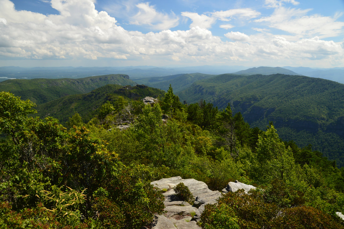
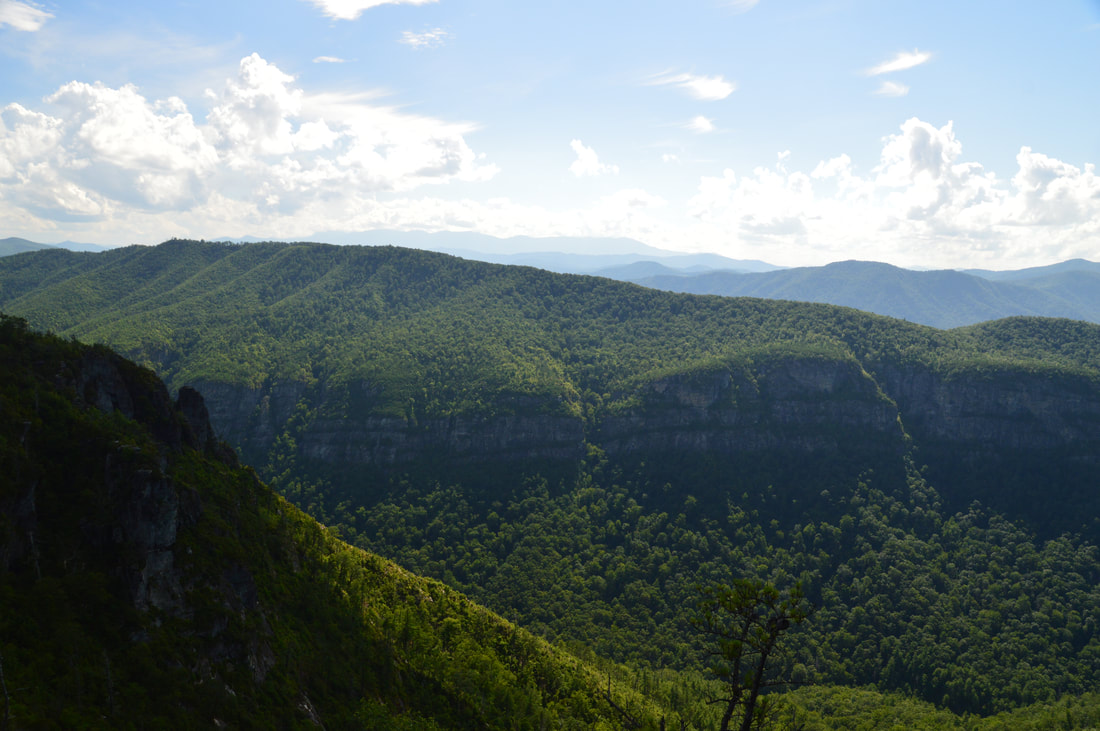
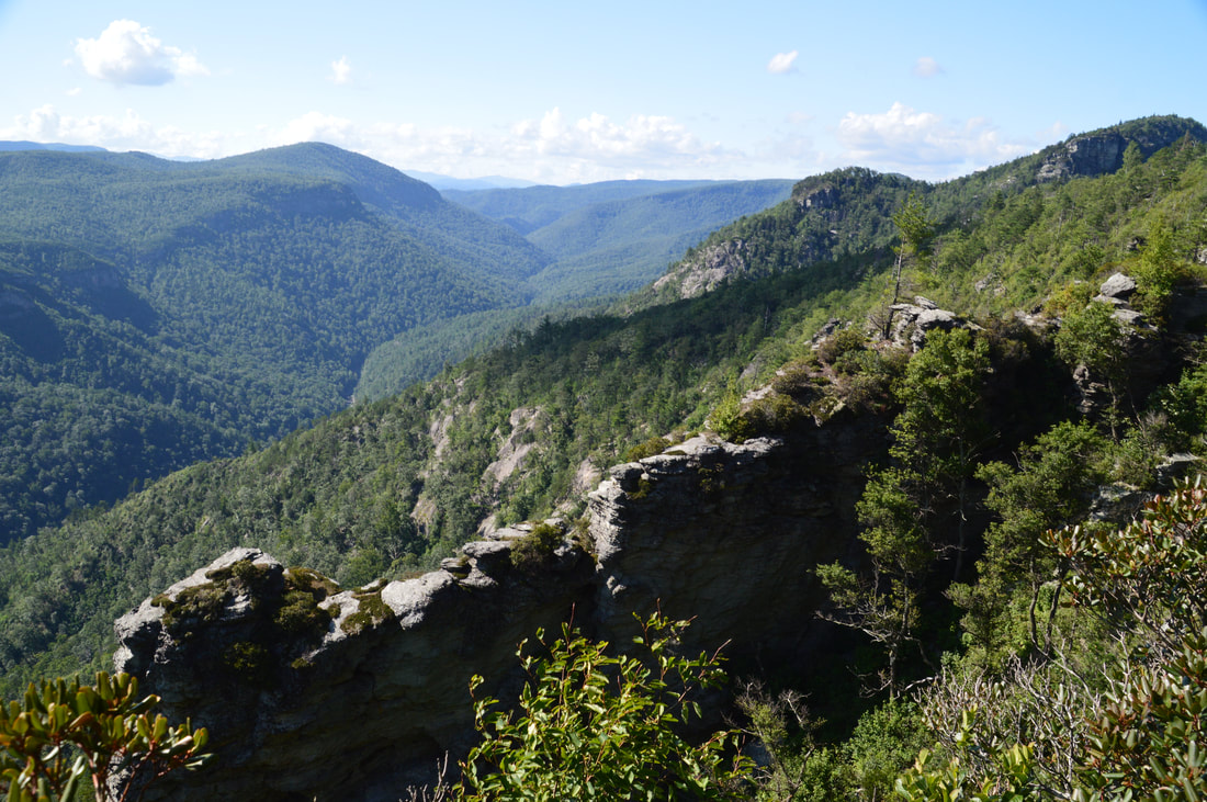
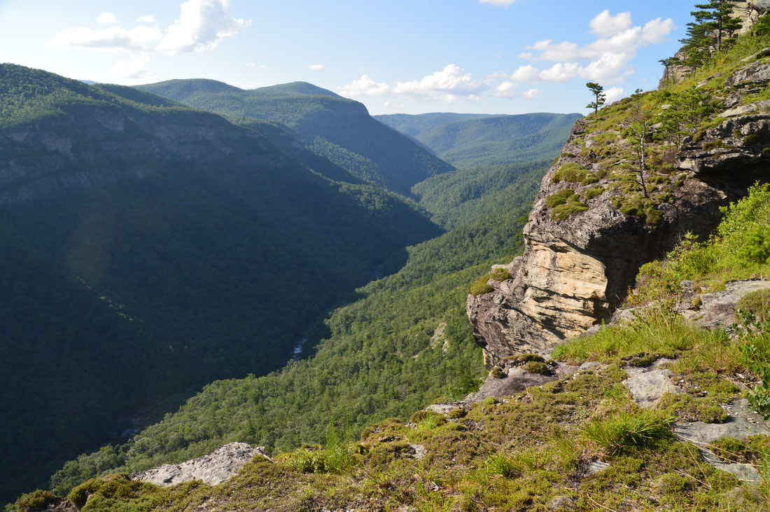
The view down Linville Gorge from this point is absolutely breathtaking. The cliffs of Shortoff Mountain are recognizable in the distance on the same side of the gorge, and on the other side of the gorge, the Gold Coast Cliffs form an impressive nearly unbroken line. The South Mountains stand out at the horizon. In the foreground of the view and to the left is an area known as The Amphitheater. As you look at this area, you may figure out how it got its name - the cliffs on the east side of the gorge form a semicircle of sorts here, with a small pass in the middle, hence the 'amphitheater' resemblance. Directly in front of you is a particularly noteworthy descending row of cliffs - the lowermost outcrop is known as The Mummy. 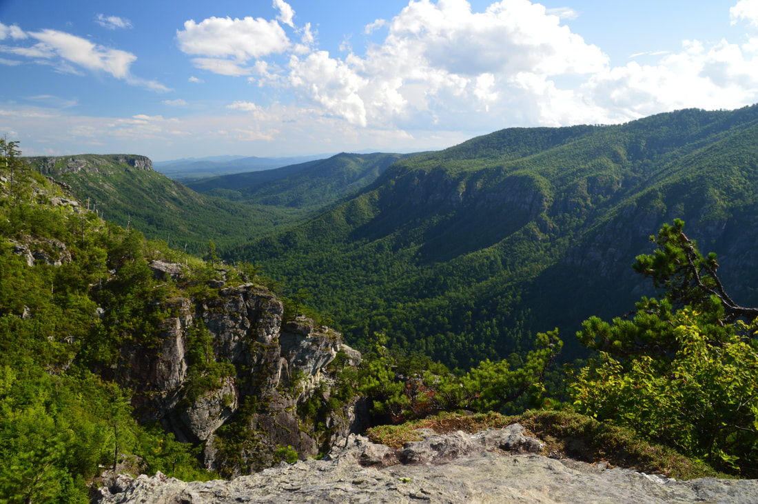
The postcard view of Linville Gorge from The Amphitheater Viewpoint.
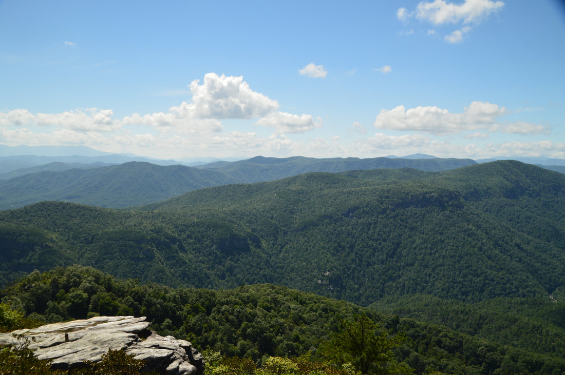
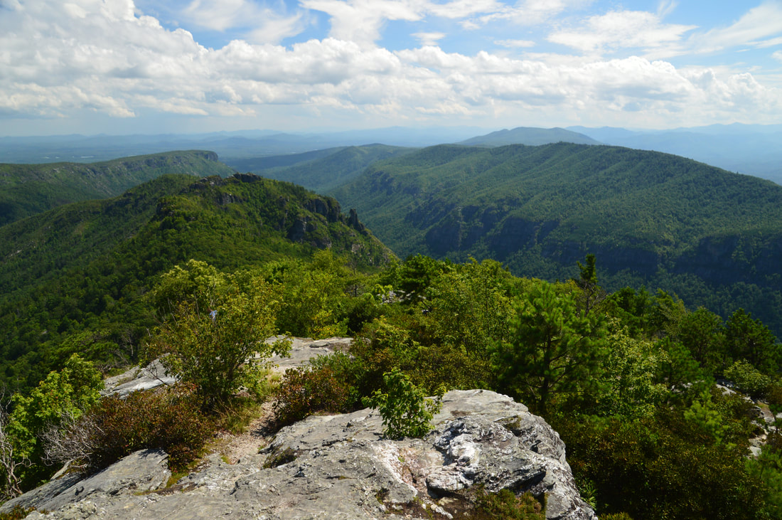
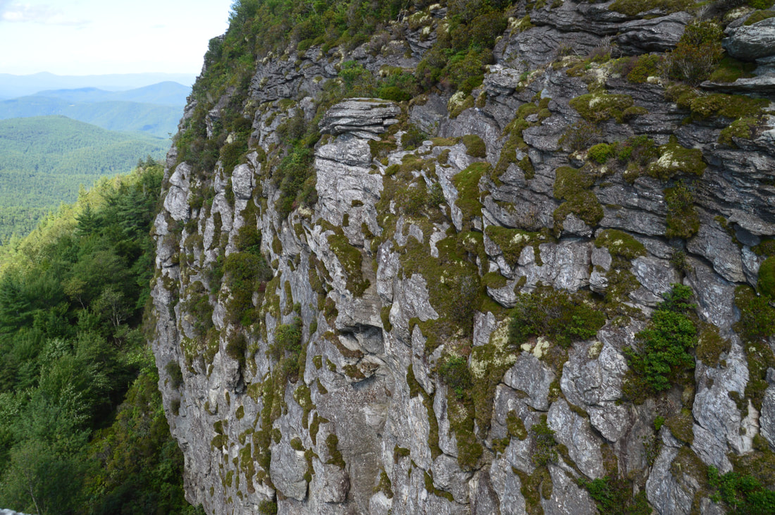
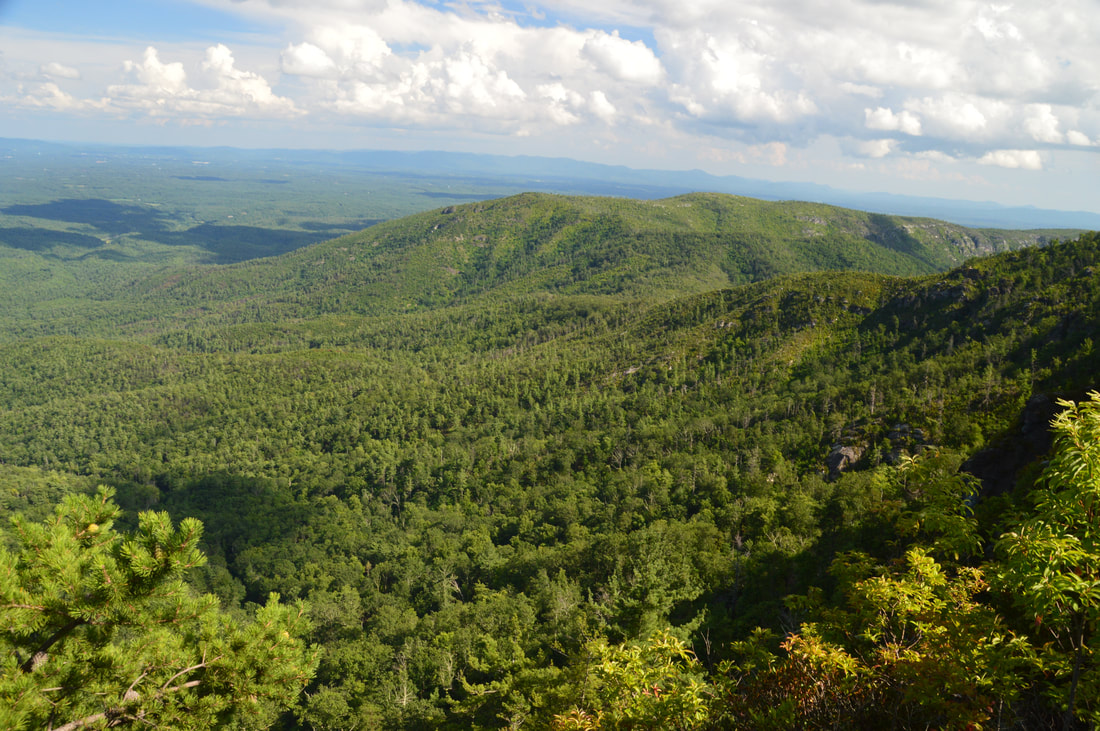
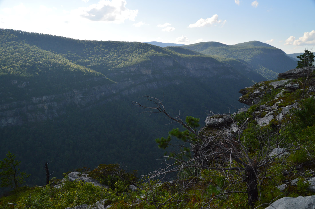
From The Amphitheater, return to the junction just before the view and now turn left onto the beginning of the unofficial North Carolina Wall Trail. Even though the path is narrow and has several blowdowns, it is fairly easy to follow until it reaches the NC Wall at 3.4 miles. This lower end of the North Carolina Wall's top is very open and grassy, allowing for easy viewing. And what a view it is! The North Carolina Wall provides a close-up view of the gorge in both directions, especially upstream, as well as the cliffs on the other side. The Linville River roars by over a thousand feet below. Just don't stray too close to the edge of the NC Wall - which is hundreds of feet high - as it's a long way down. Arguably, the views from the North Carolina Wall are the best views on the hike, although the other views are absolutely spectacular as well.
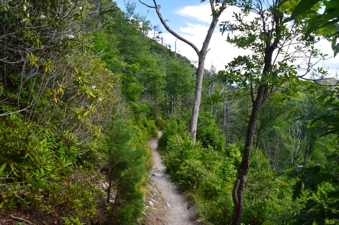
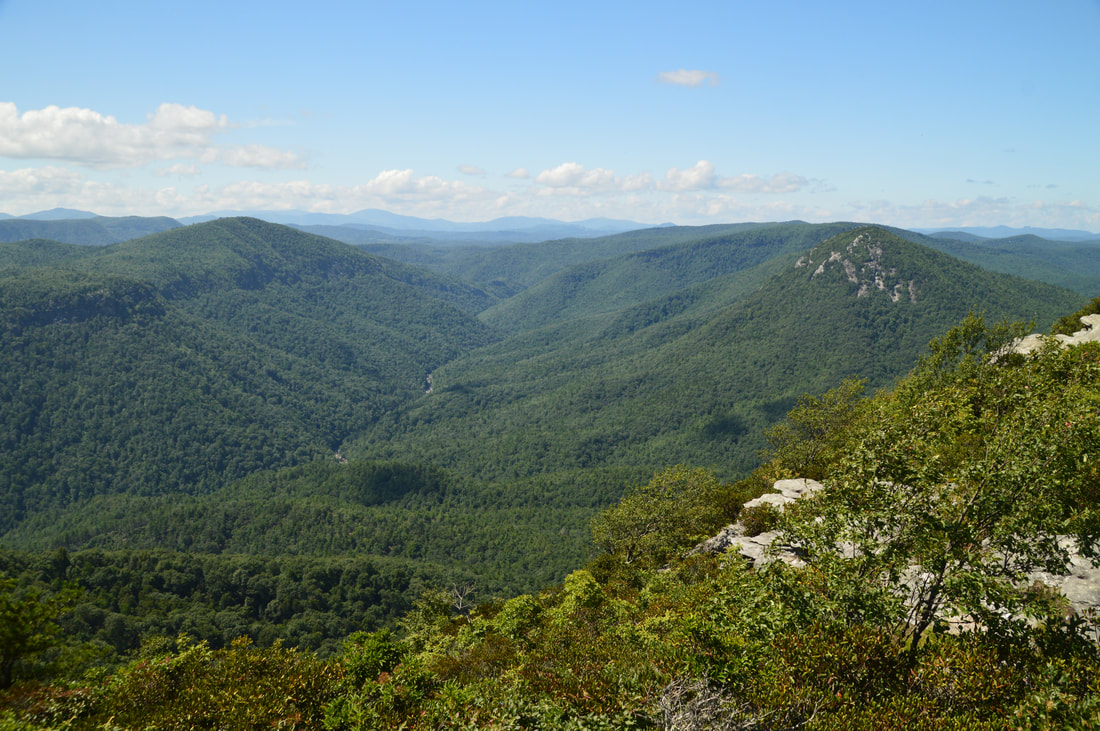
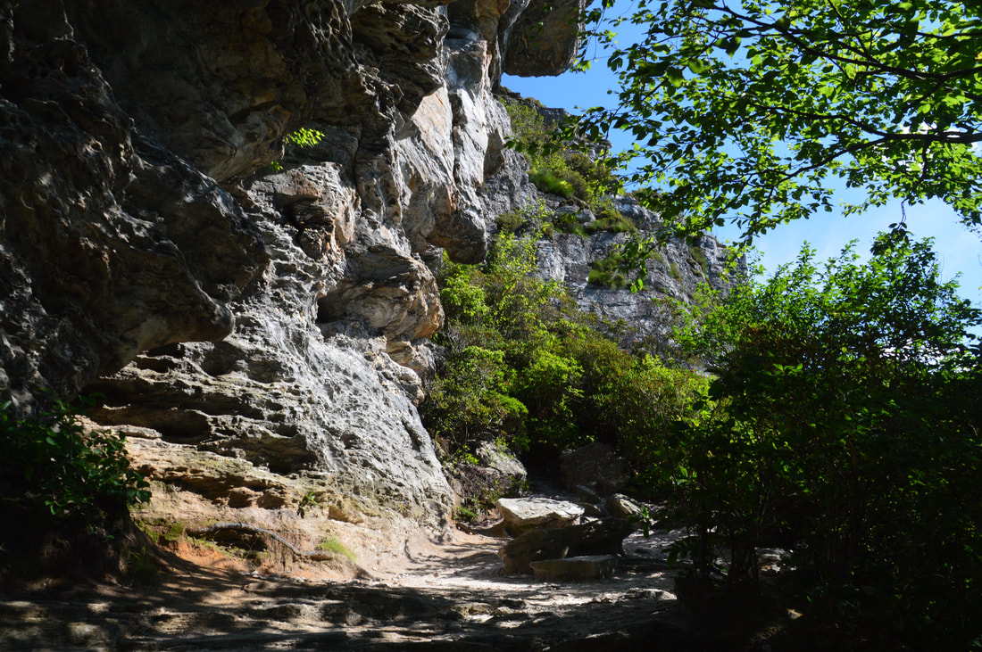
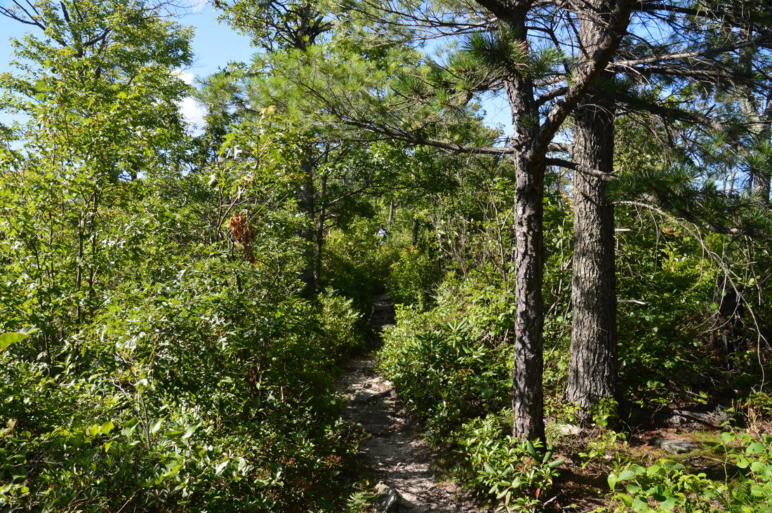
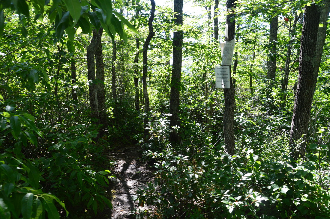
The following section of the hike requires a disclaimer. The rest of the North Carolina Wall Trail is suitable only for hikers with good navigational skills and experience in off-trail hiking/bushwhacking. The NC Wall Trail is very faint or non-existent much of the time until its junction with the Mossy Monster Trail. Since there are no blazes or markers, you are on your own here, although I will add that finding the way isn't terribly difficult. All you have to do is simply follow the cliff line and stay as close to the edge as possible without putting yourself at risk. I wouldn't call the NC Wall Trail a difficult bushwhack, because 3/4 of it follows open rocks and grassy slopes near the edge of the NC Wall, but when it does momentarily enter the brush (which it does a handful of times), it can get pretty slow, as the path isn't beaten down enough yet. A map, compass, and/or GPS unit would be helpful for following the trail, although they aren't mandatory if you just follow the cliffs. That being said, I highly recommend hiking the NC Wall Trail and looping back up the Mossy Monster Trail if you feel comfortable with it. In my opinion (which may be slightly biased due to my experience in off-trail hiking), the NC Wall Trail is the best part of the hike, as in the next 0.5 miles, the outstanding views of Linville Gorge and the many cliffs and rock outcrops on the rims are continuous. Trust me - you'll spend more time stopping at every rock outcrop and view than actually hiking along this segment. I was stopping less than I would have normally along this segment, because I was running out of water, but I still spent 50 minutes on the trail here - and not just because it was slow-going. In general, the hiking along the edge of the NC Wall isn't difficult. You'll have to do some rock hopping, but if you follow the route of least resistance, there will not be any real rock scrambling. Just make sure to not get too close to the edge. Even though the views up the gorge are generally similar, there is always something new in the view around every corner, as the cliffs and rock outcrops are ever-changing. When The Chimneys and The Camel begin coming into view, you'll know you're getting close to the Mossy Monster Trail. Near the junction, there will be one spot where the trail appears to turn into the woods, but in a few feet, you'll have to turn left and approach the cliffs again. At 3.9 miles, there will be a well-used campfire ring on a rock slab to the left. Here, the NC Wall Trail - if you can call it one - bumps into a much more defined trail that seems to be leading to the campsite. This is the Mossy Monster Trail. Turn right onto this path, which is easy to follow as it finally ascends away from the cliffs and toward the MST. 
The wild ever-changing cliffs and rocks are just one of the NC Wall Trail's many highlights.
At 4.05 miles, the Mossy Monster Trail ends at the Mountains-to-Sea Trail. You passed this junction earlier. From here, it is a relatively easy walk back to the Table Rock Picnic Area. Simply turn left onto the MST, passing through The Chimneys again where you'll get to see all of the views once more. After passing over the final knob, you'll return to the trailhead and car at 4.9 miles, concluding this outstanding hike.
The hike to Table Rock, The Chimneys, and North Carolina Wall is among the very best hikes that I have ever done. With most of the hike being surprisingly easy for its rewards, there is no excuse for not doing it if you live in North Carolina or surrounding areas. I am rating this hike a "Best Hike" and hope that you will enjoy it as much as I did when you complete it. Mileage
0.0 - Table Rock Picnic Area
0.7 - Summit of Table Rock, East-West Views 0.8 - South Vista on Table Rock 0.9 - North Vista on Table Rock 1.2 - Devil's Cellar 1.8 - Table Rock Picnic Area 2.1 - View of Table Rock 2.25 - The Chimneys 2.95 - Amphitheater Trail Junction 3.3 - The Amphitheater 3.4 - Begin North Carolina Wall 3.9 - End North Carolina Wall 4.05 - Reach MST Again 4.9 - Table Rock Picnic Area Variations
Hike out and back just to Table Rock/Devil's Cellar - 1.8 Miles
Hike out and back just to The Chimneys - 1.0 Miles Hike just to The Amphitheater and the NC Wall Loop - 3.1 Miles Bonus Stops
If you're up for more hiking after this hike, consider adding on a hike to the summit of Hawksbill Mountain or Sitting Bear Mountain. You can also check out some of the waterfalls on nearby Steels Creek.
PicturesVideos
1 Comment
Robert E Helms
8/3/2017 09:52:59 pm
ABSOLUTLY AWESOME VIEWS AND BACK UP INFORMATION, I WILL BE REVIEWING THIS PRESENTATION FOR MANY MONTHS, WELL DONE AND PROFESSIONAL 🛶 Leave a Reply. |
About MeMark Oleg Ozboyd Dear readers: I have invested a tremendous amount of time and effort in this website and the Georgia Waterfalls Database the past five years. All of the work that has gone in keeping these websites updated with my latest trip reports has almost been like a full-time job. This has not allowed me to pick up a paid job to save up money for college, and therefore, I I've had to take out loans. If you find the information on this website interesting, helpful, or time-saving, you can say "thanks" and help me out by clicking the button above and making a contribution. I will be very grateful for any amount of support you give, as all of it will apply toward my college tuition. Thank you!

Coming in 2022-2023?
Other Hiking WebsitesMiles HikedYear 1: 540.0 Miles
Year 2: 552.3 Miles Year 3: 518.4 Miles Year 4: 482.4 Miles Year 5: 259.9 Miles Archives
March 2021
Categories
All
|
||


 RSS Feed