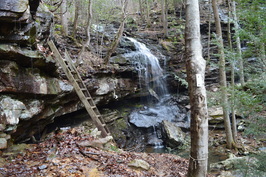
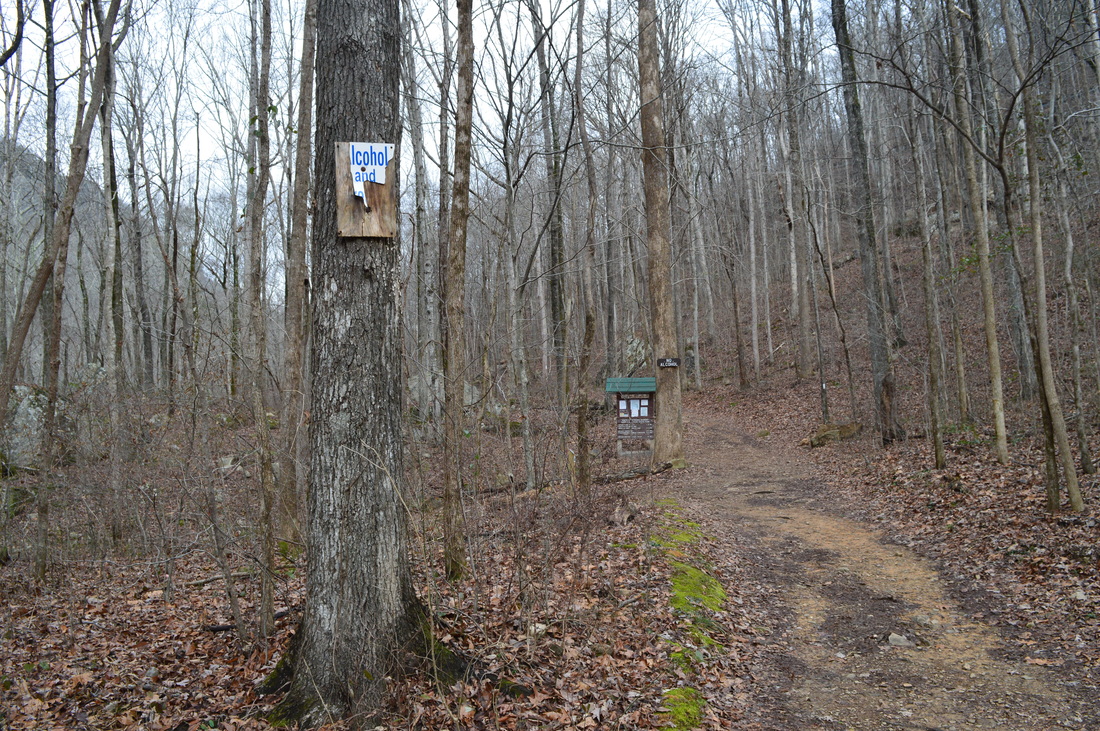
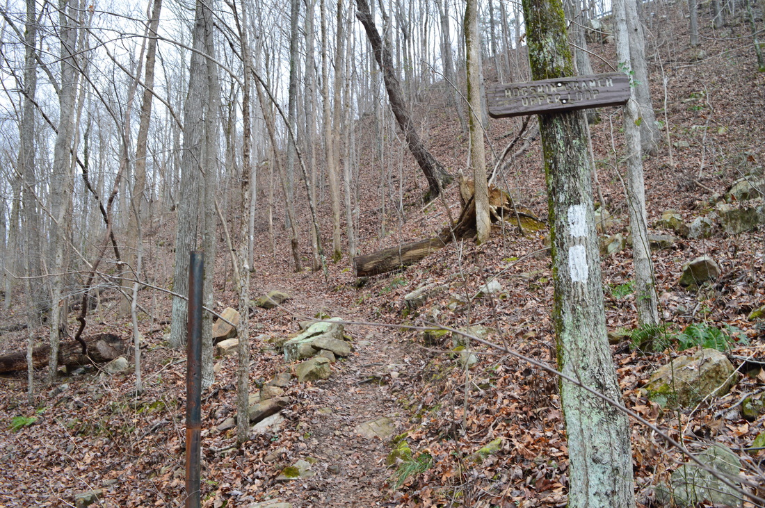
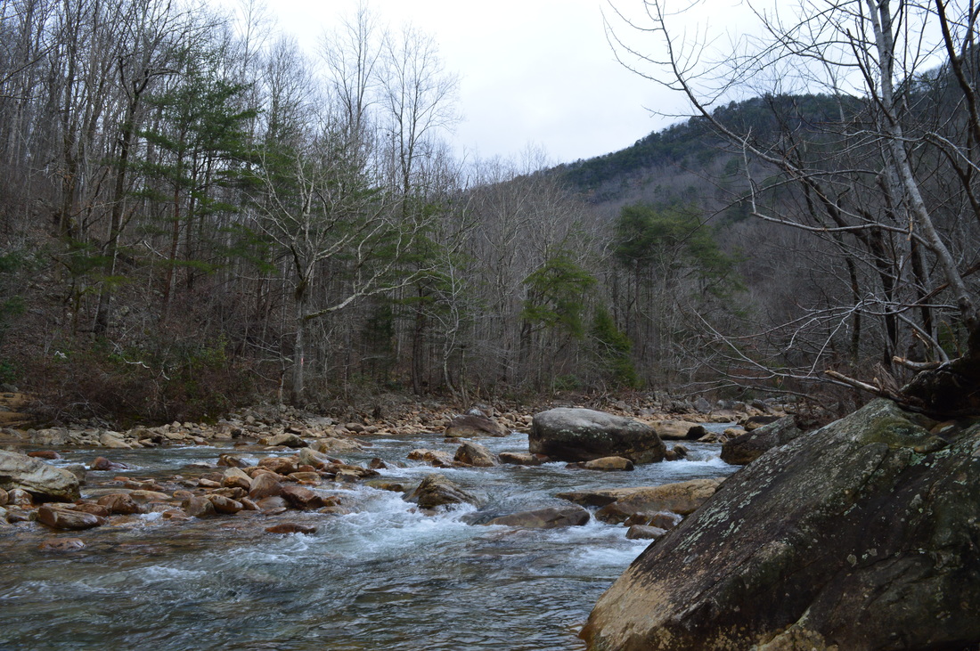
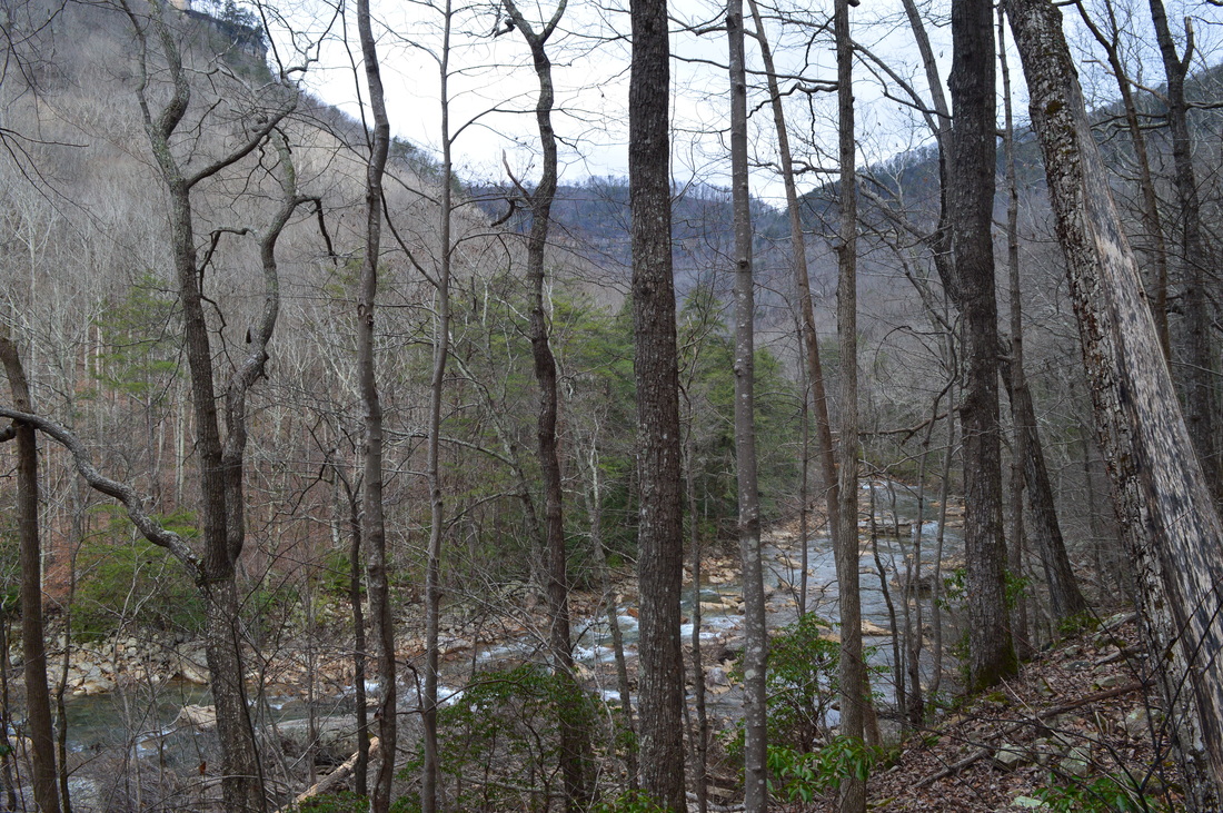
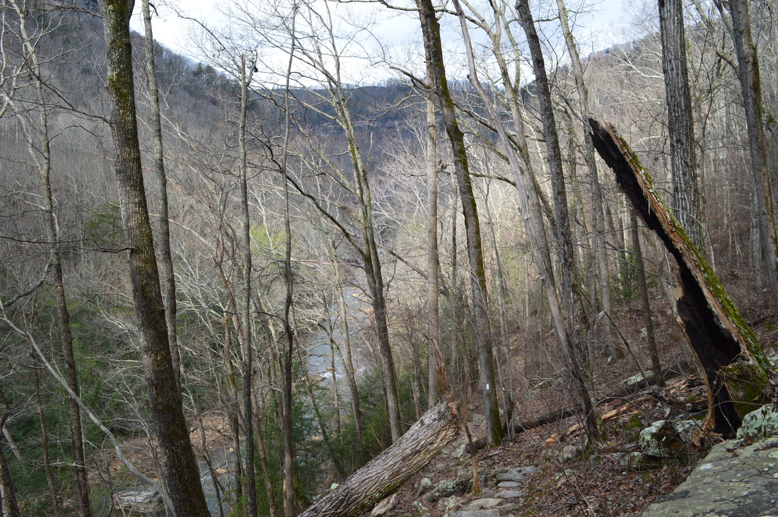
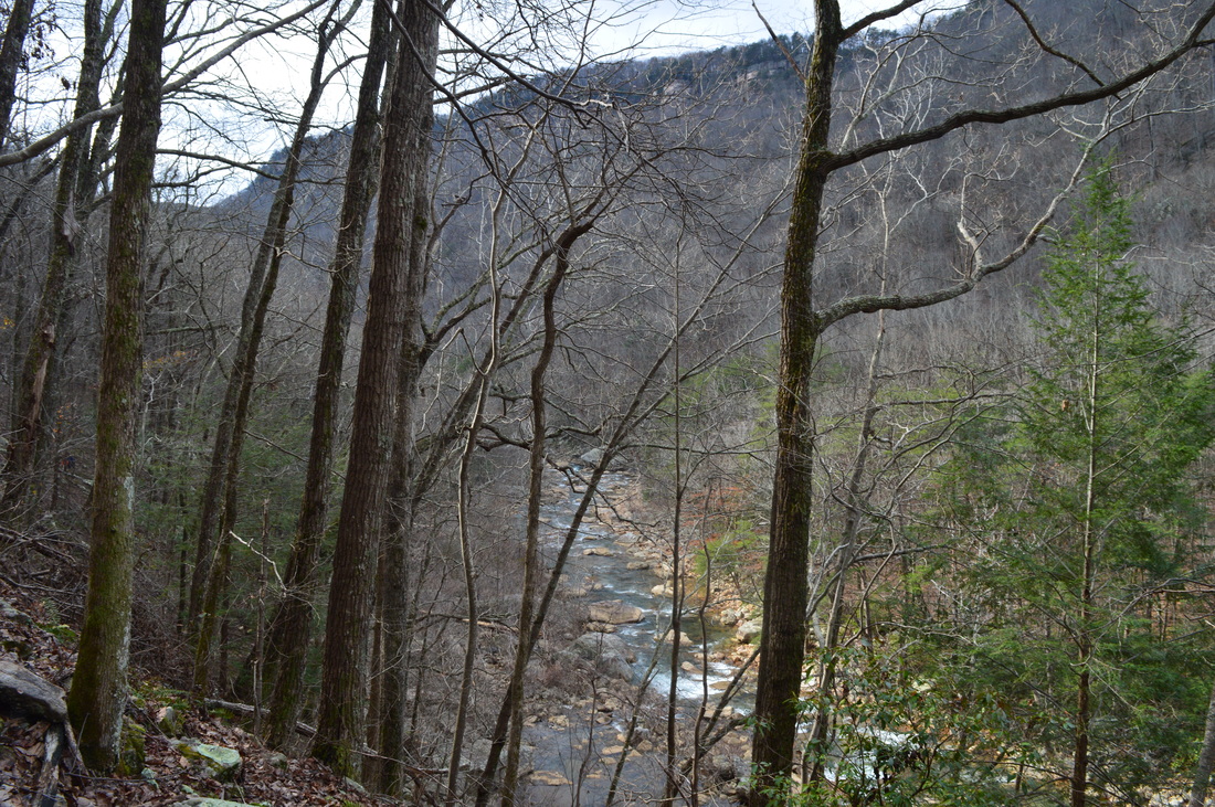
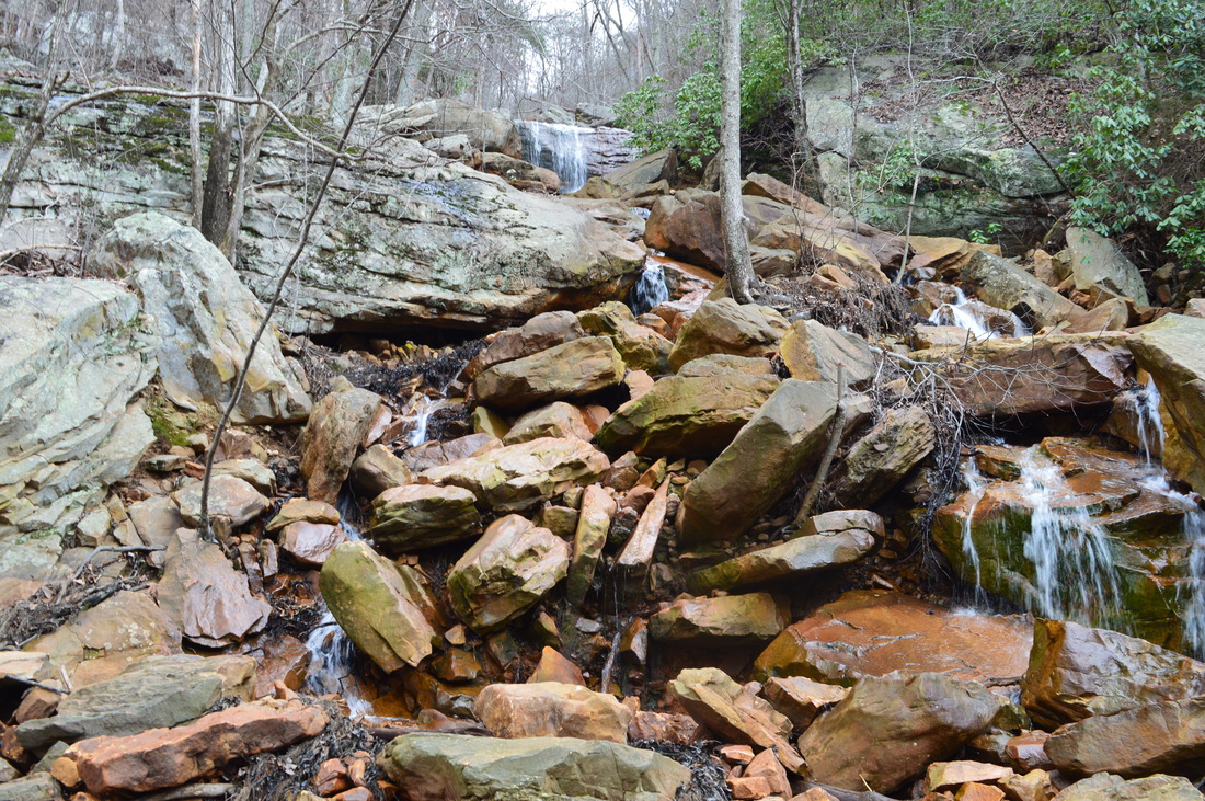
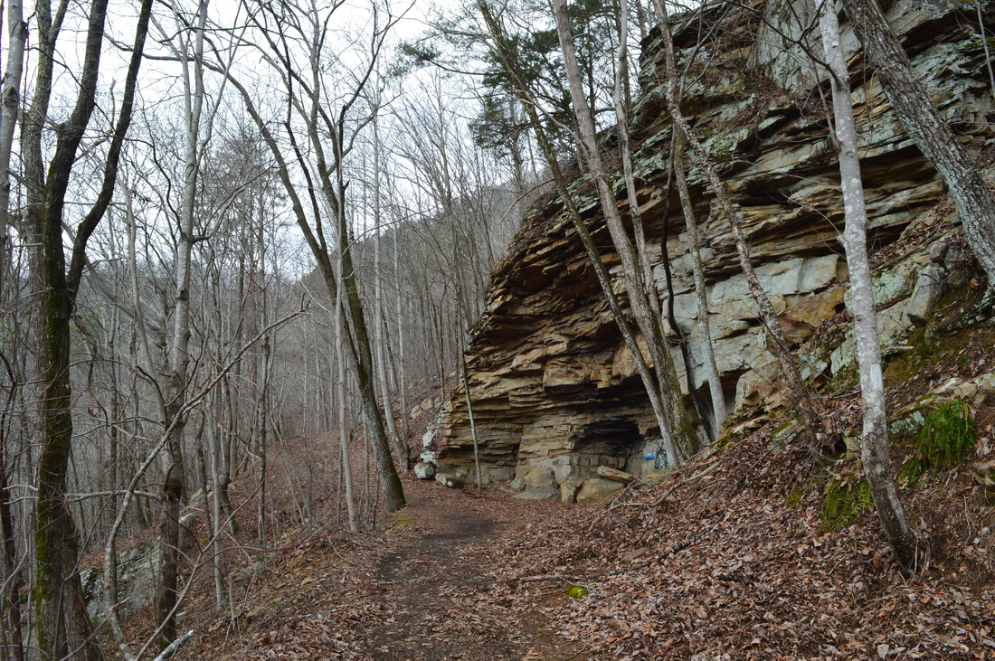
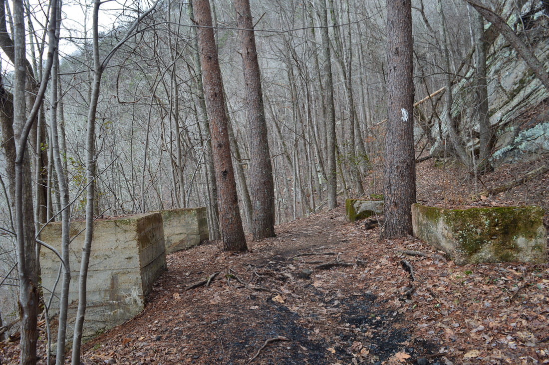
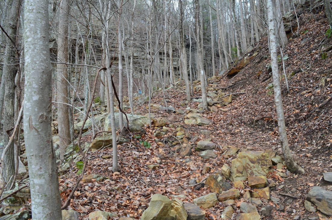
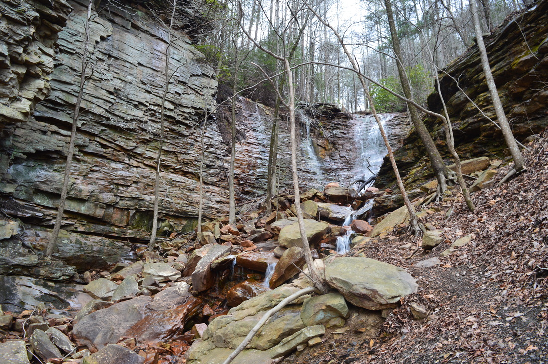
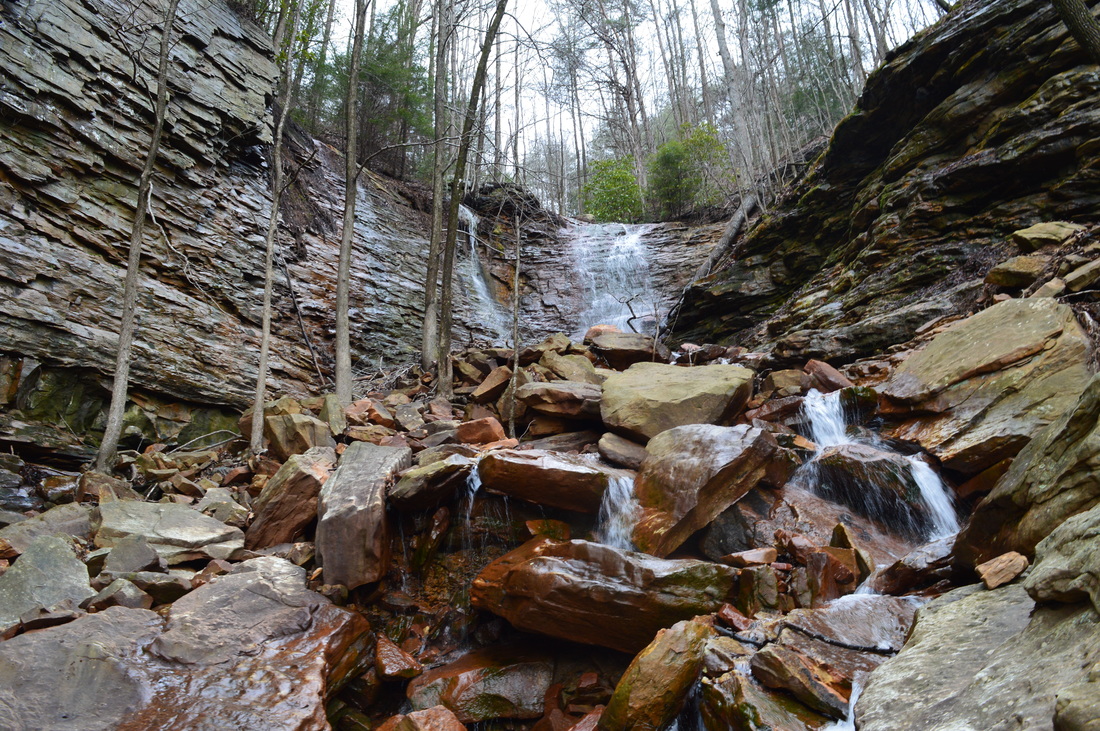
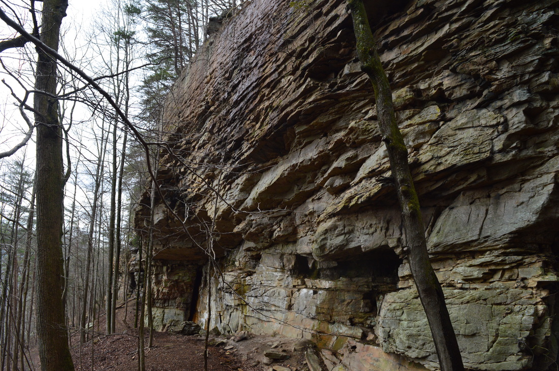
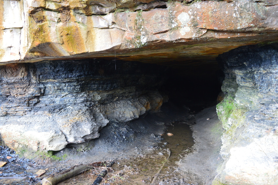
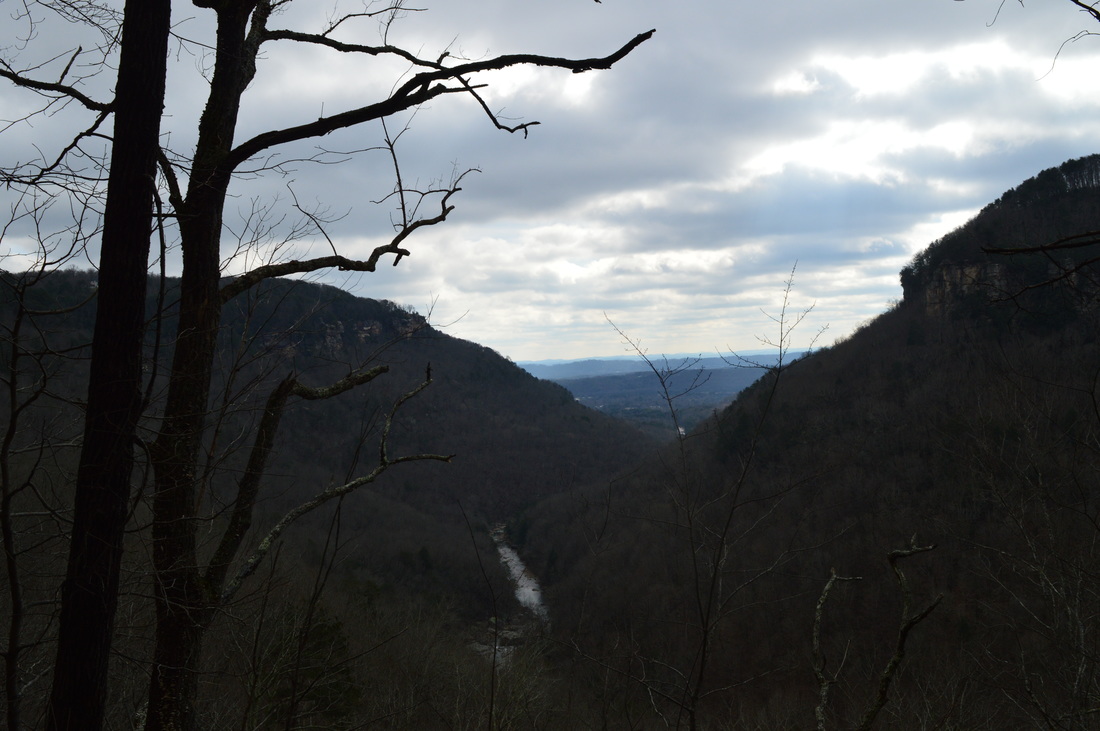
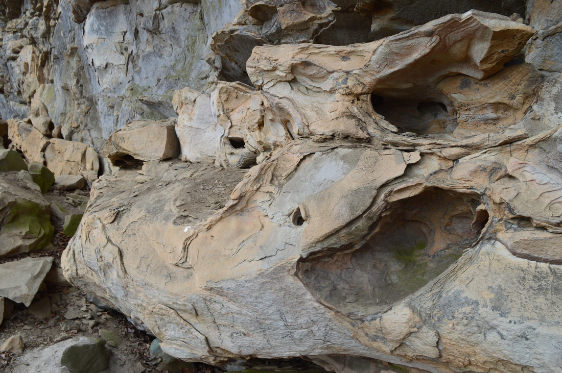
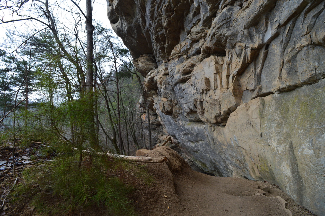
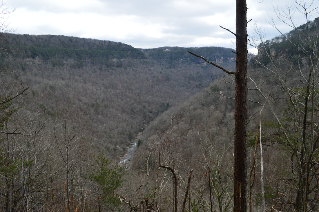
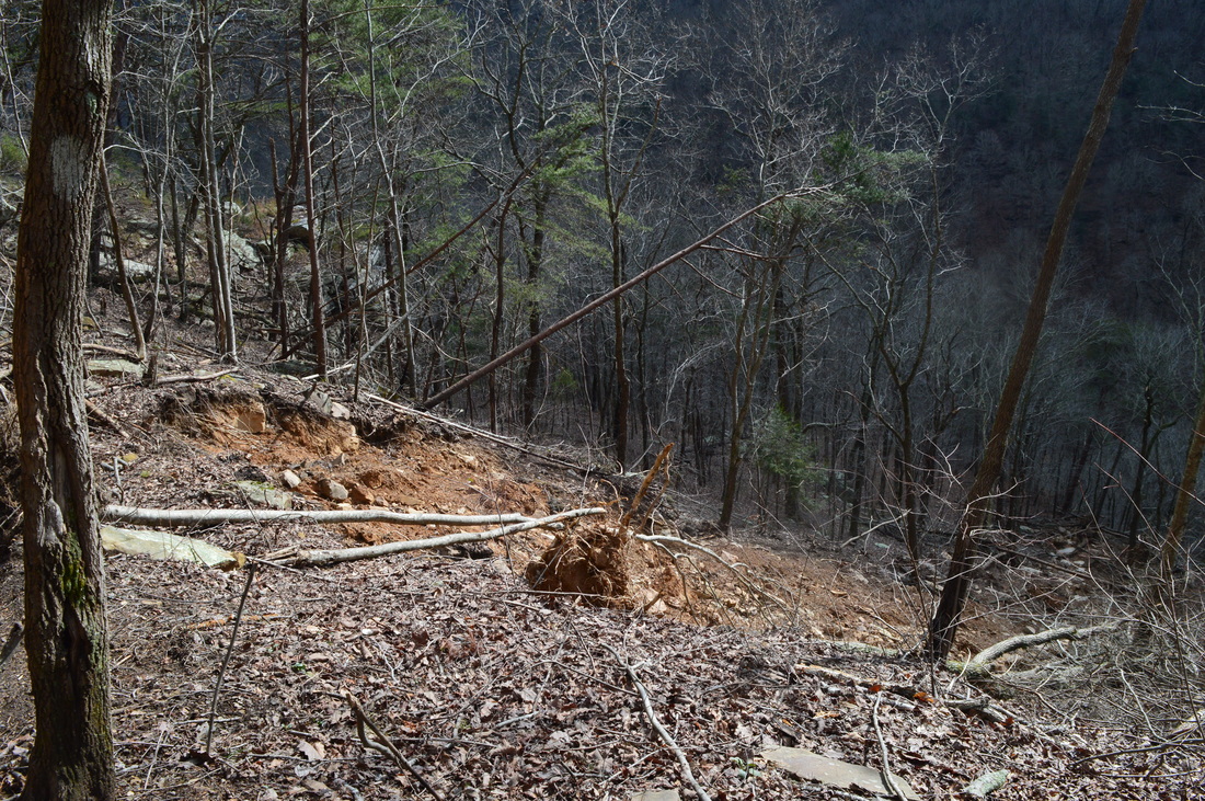
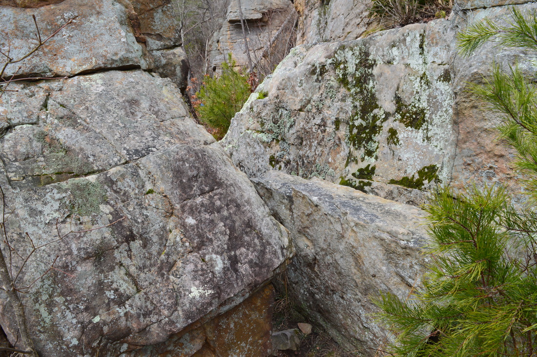
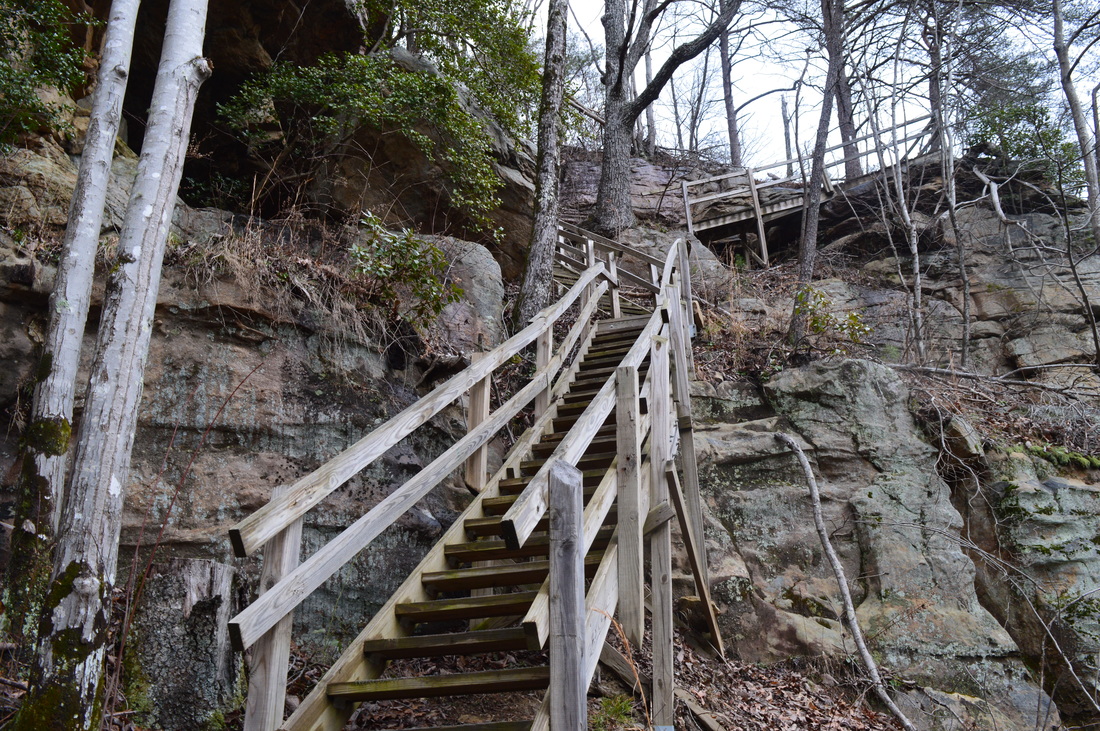
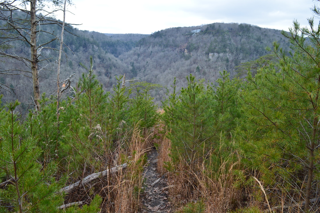
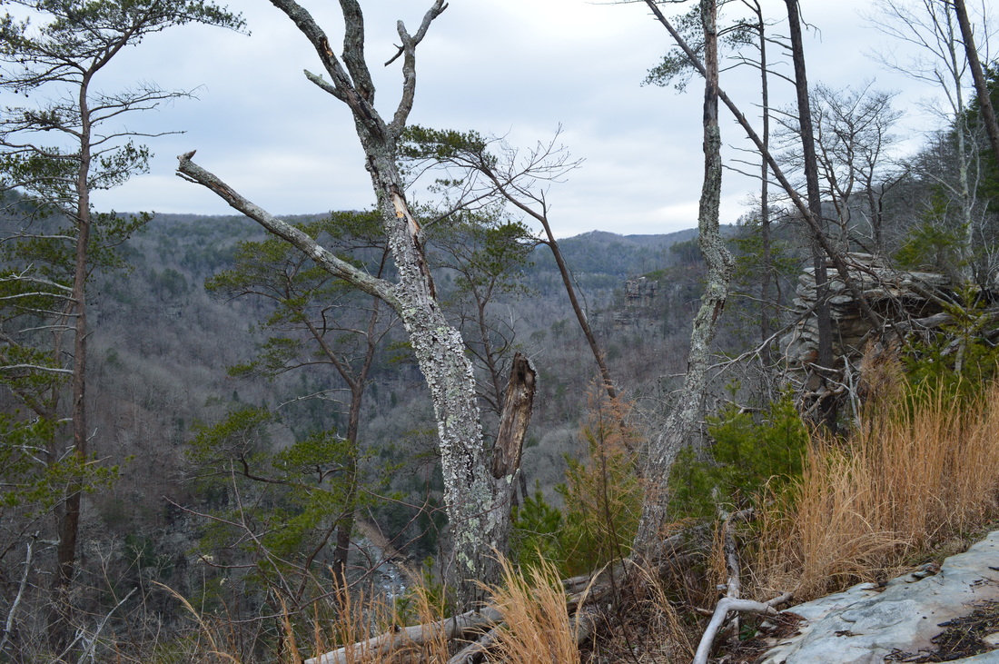
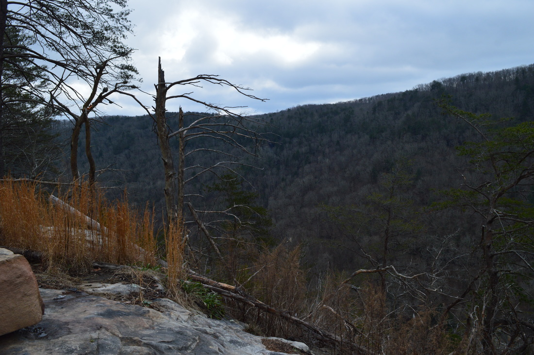
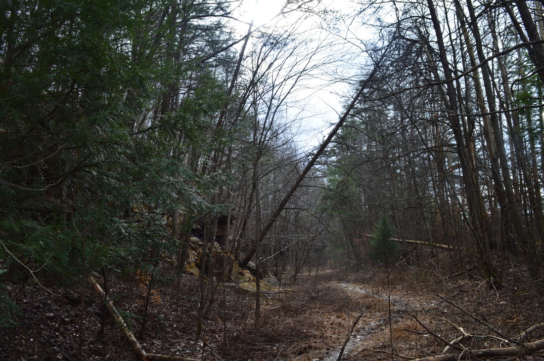
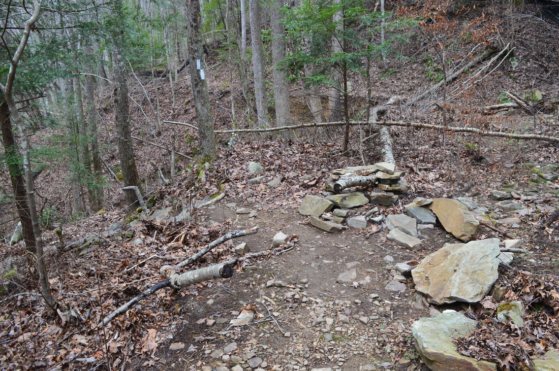
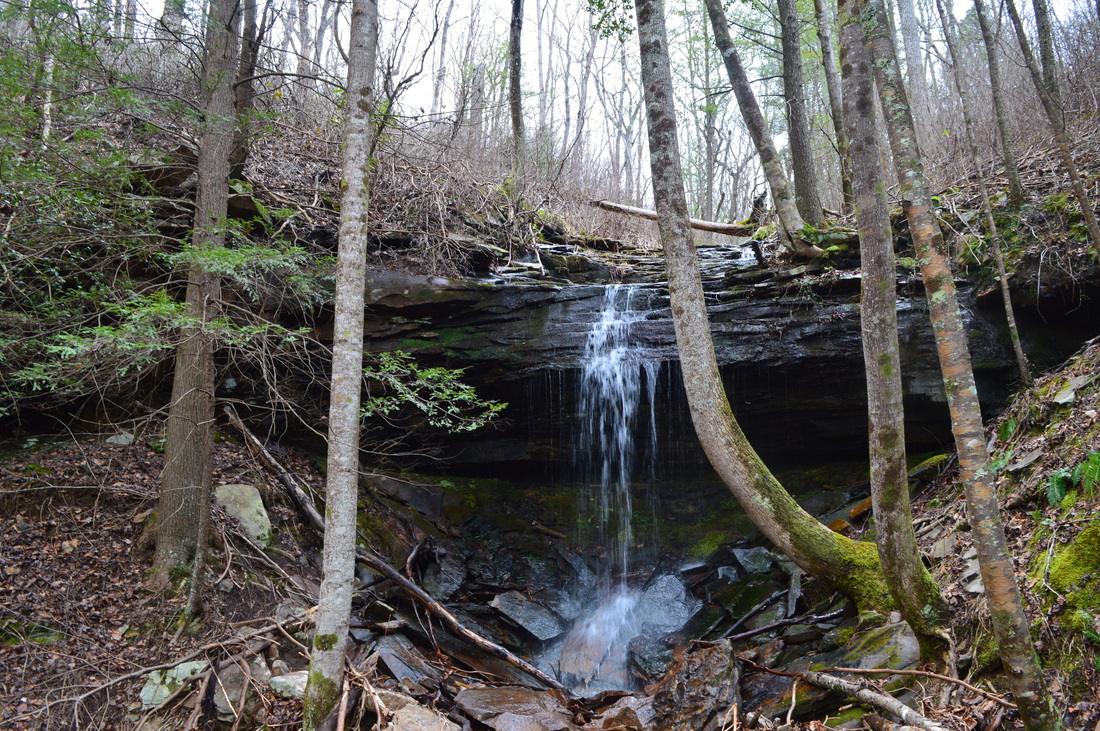
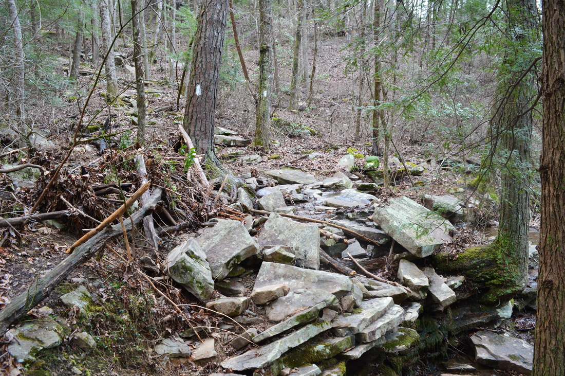
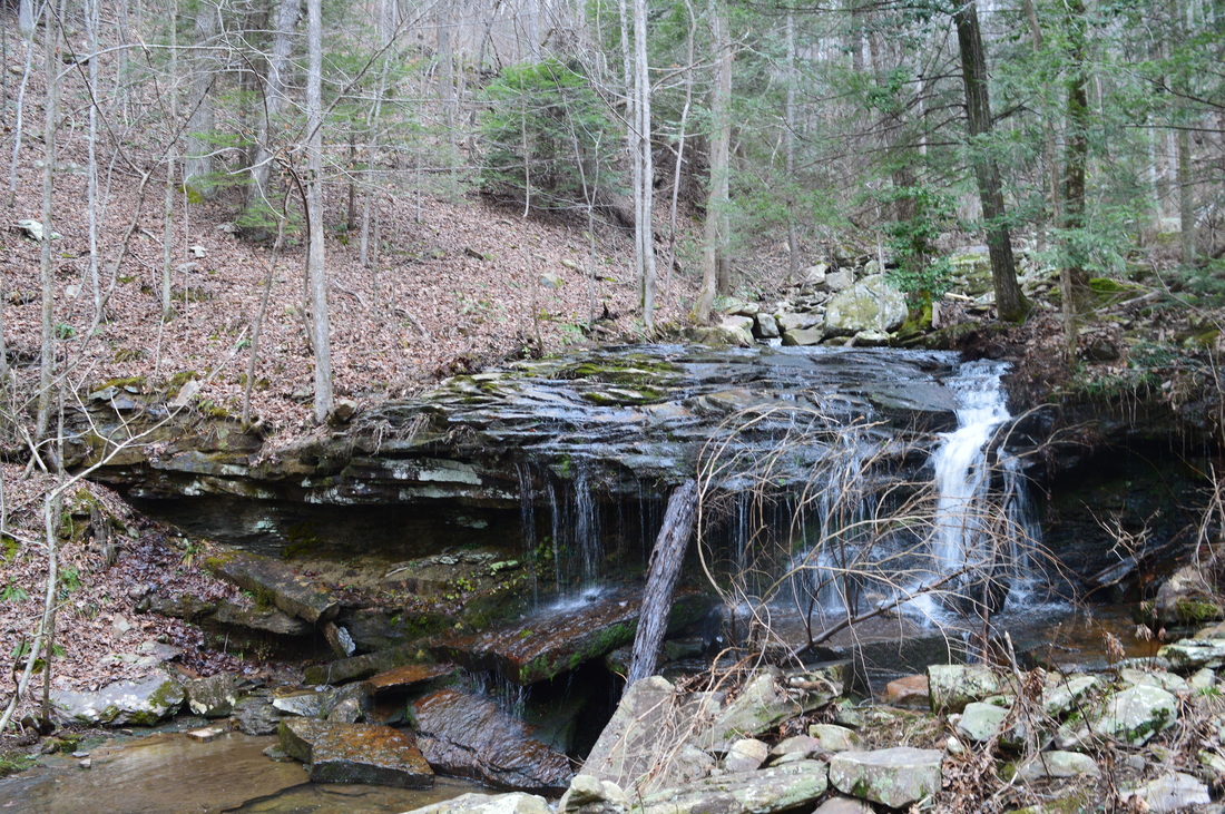
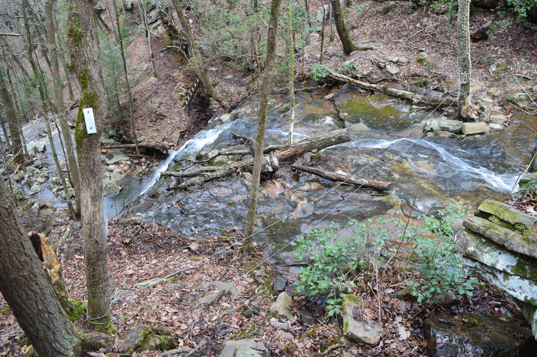
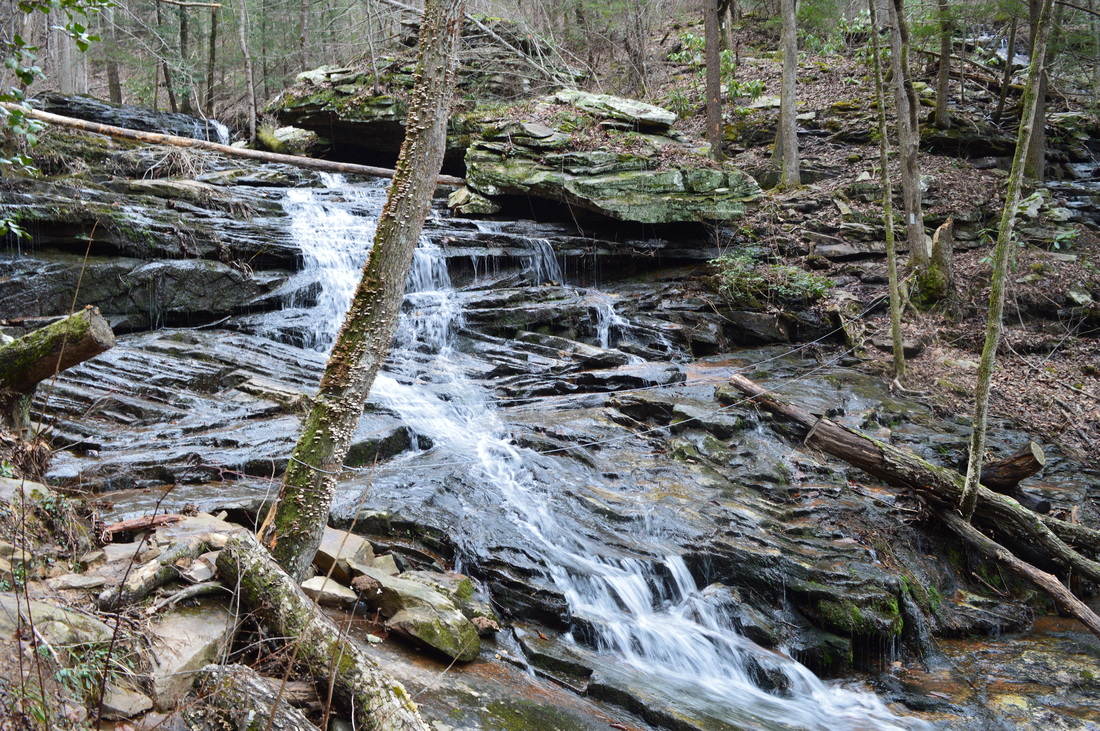
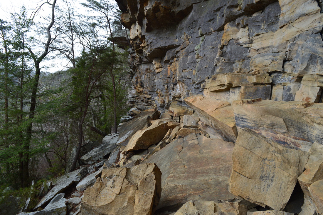
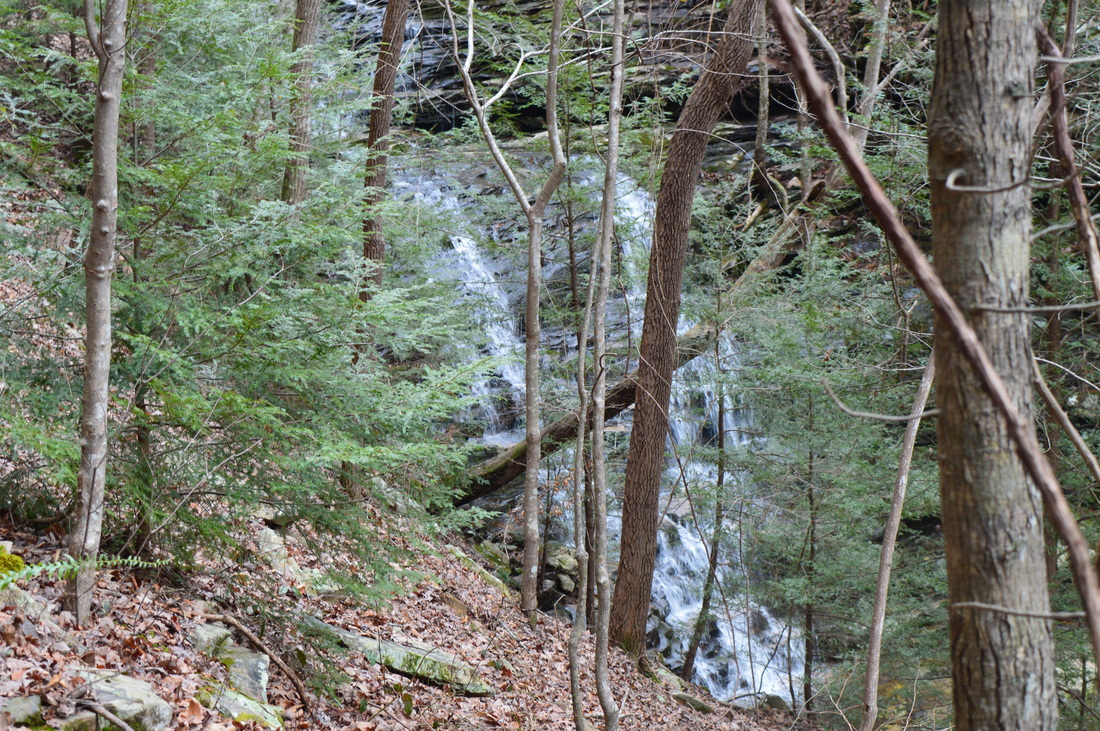
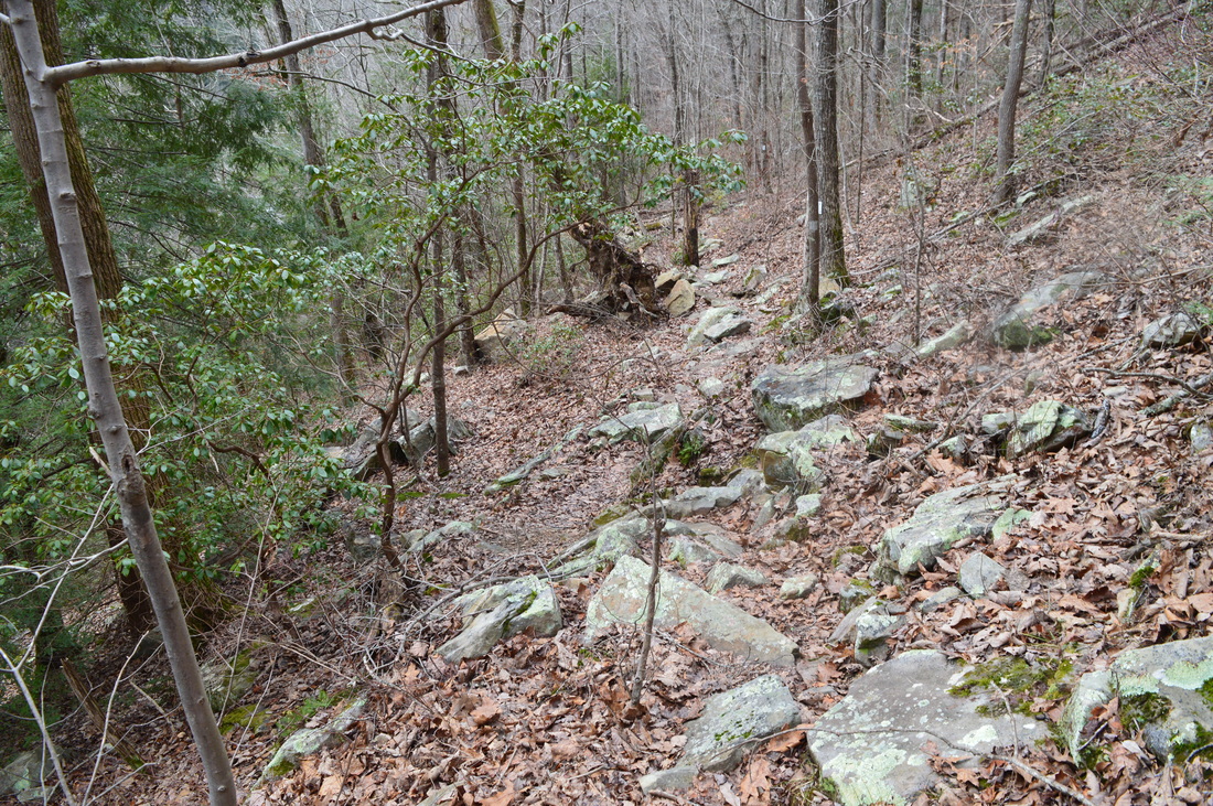
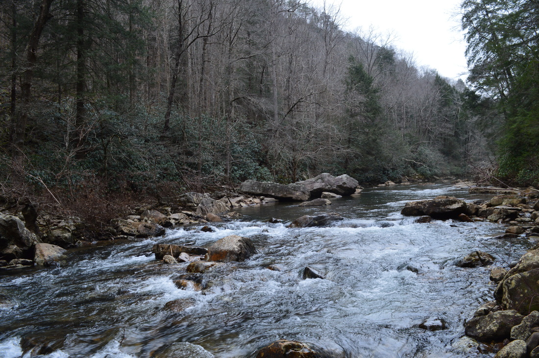
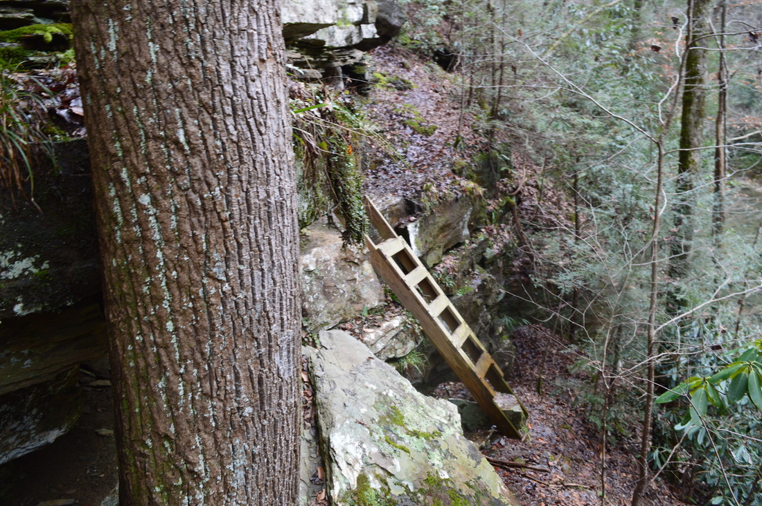
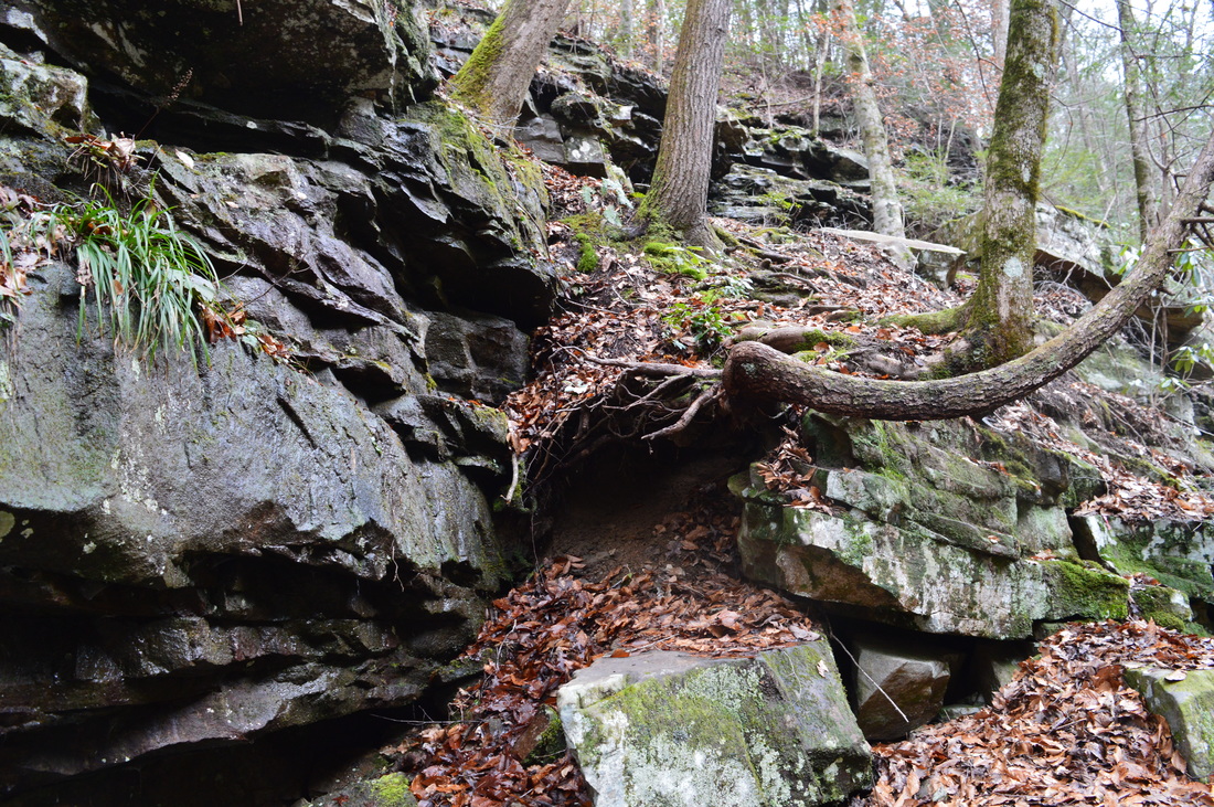
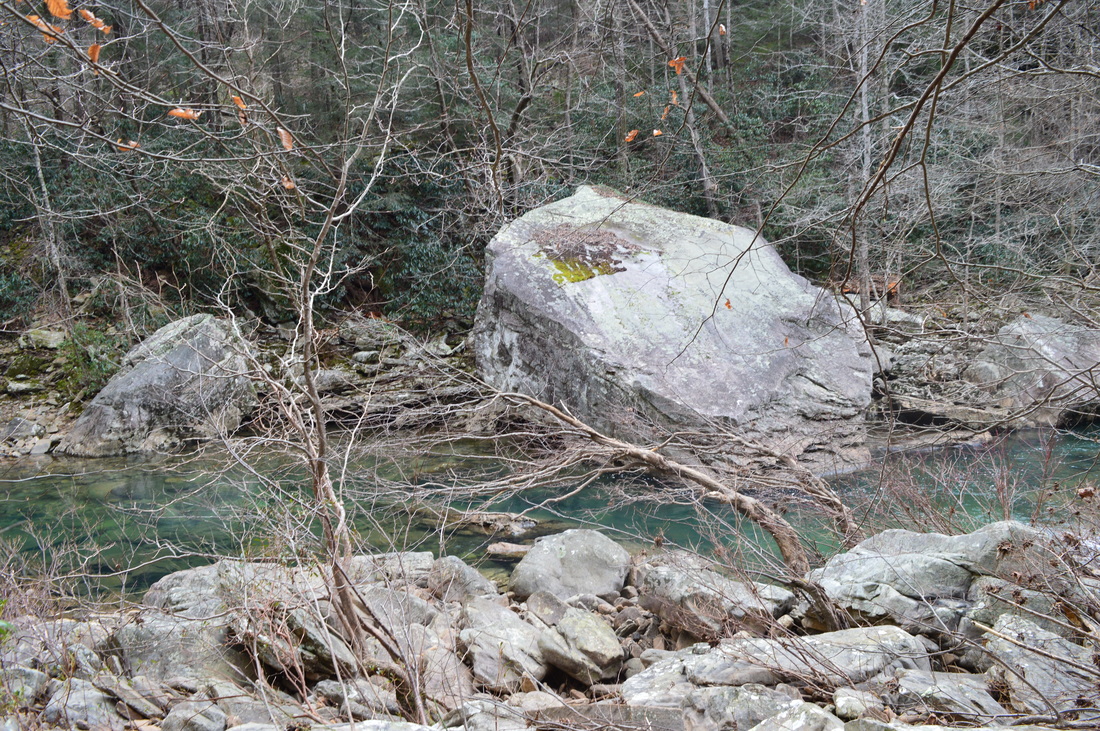
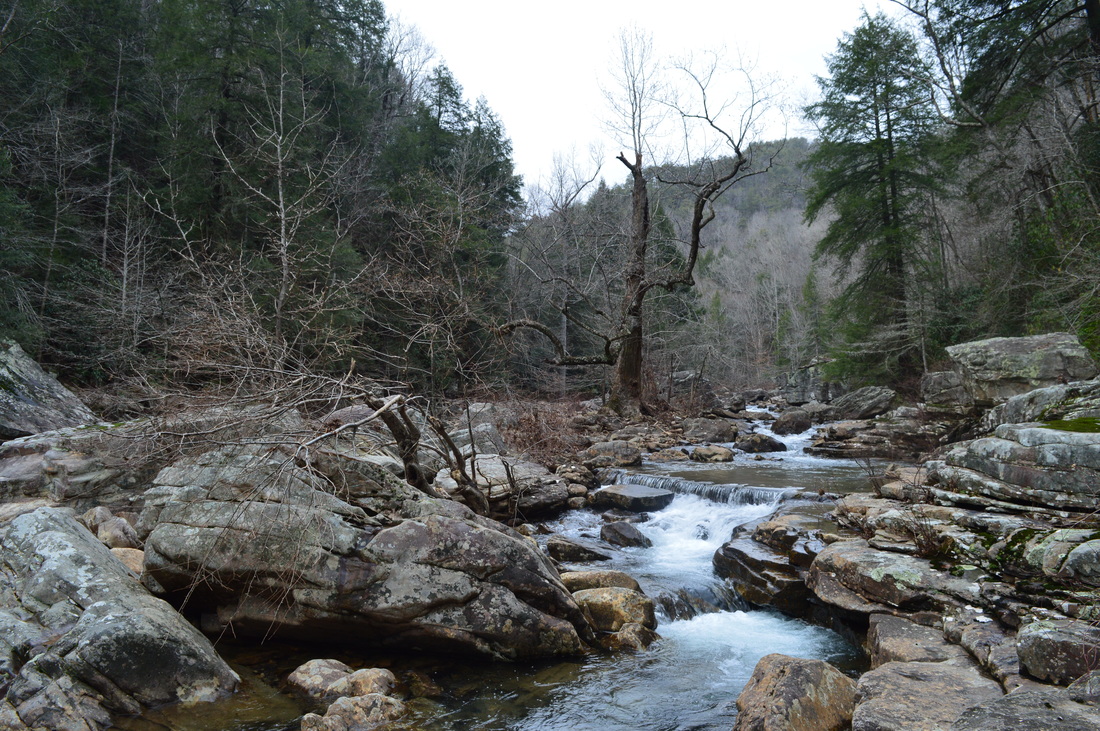
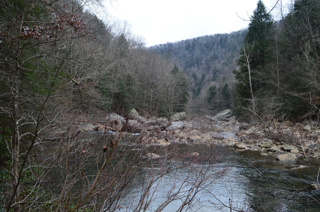
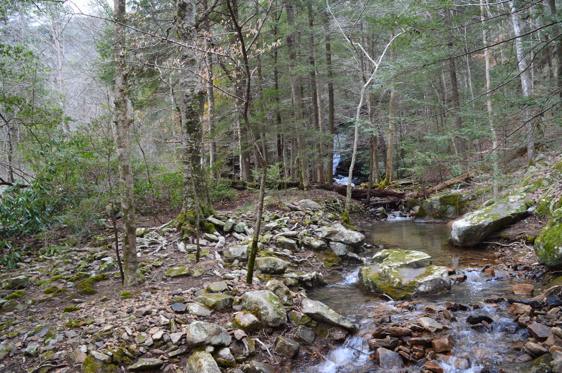
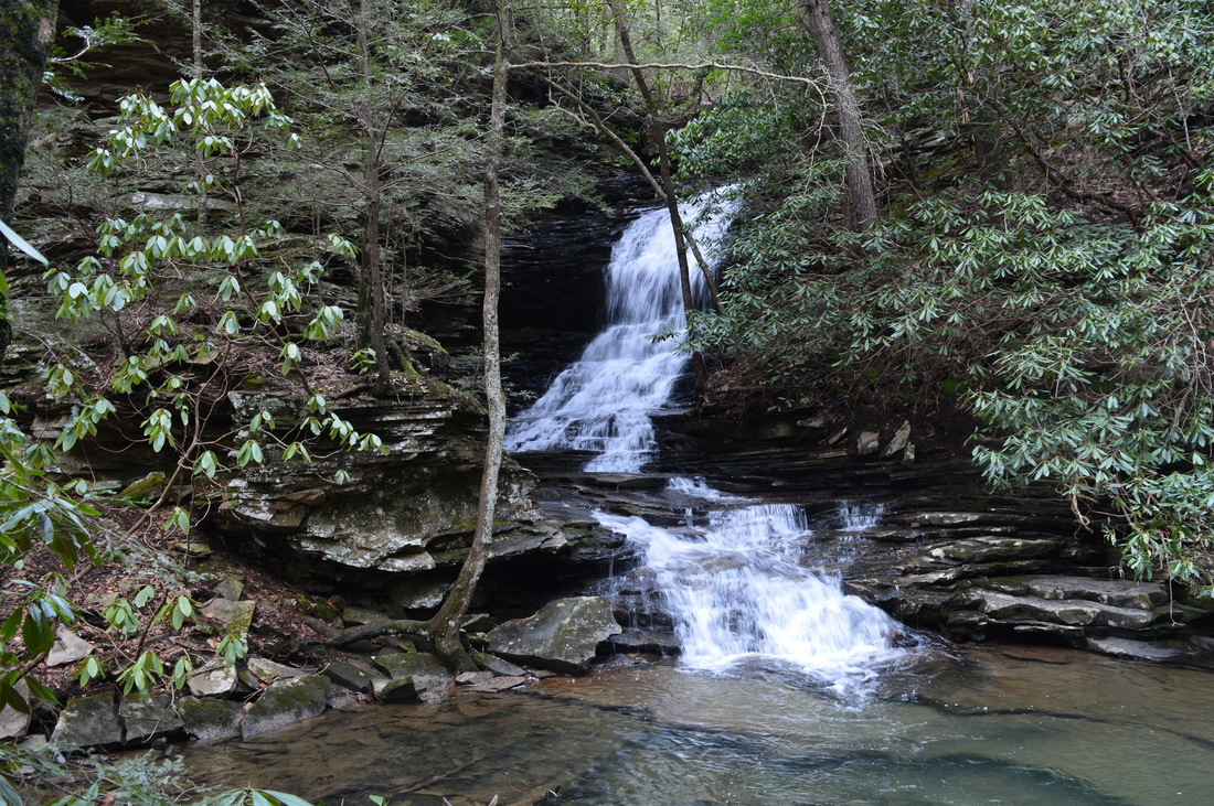
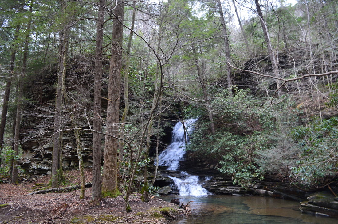
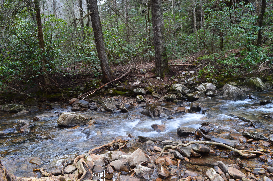
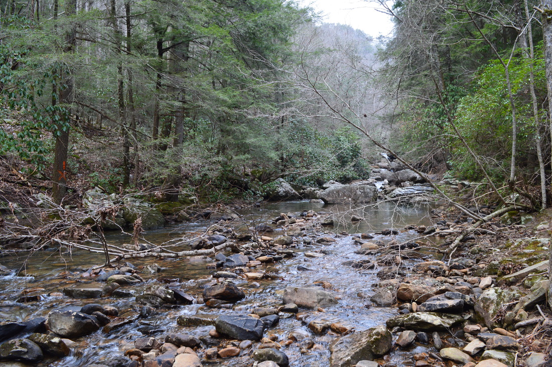
 If there ever was a hike that you must absolutely not miss, no matter where you have hiked or are planning to hike, then this is it. As my personal favorite hike on the Cumberland Trail (at least to this date), this is one segment of the famous long-distance trail that has just about everything that you can find on the Cumberland Plateau, from tall bluff lines that stretch on for miles, to spectacular vistas of one of the area's most picturesque gorges, Chickamauga Gulch, to remote waterfalls set in some of the best settings I've yet to see in this area. This is truly one spectacular hike by all means. This hike occurred on Saturday, January 16th, 2016. My plan was to hike the Cumberland Trail from the trailhead on Montlake Road to Panther Branch Overlook. However, due to time-consuming photography of the countless points of interest on this hike, as well as to the extremely rugged and slow nature of the latter part of the hike, I was only able to reach Stevenson Branch Falls. That was okay with me, however, as I have hiked the excellent section of the Cumberland Trail north of Stevenson Branch Falls, and the section to the south, that I hiked on this day, proved to be even more spectacular. SummaryR/T Length of Trail: 10.1 Miles Duration of Hike: 7:20 Type of Hike: Out and Back Difficulty Rating: 9 out of 10 Total Elevation Gain: 2184 Feet Pros: Spectacular views and interesting features spaced throughout the hike to keep you occupied Cons: The section of the hike between the cable crossing and Stevenson Branch Falls is extremely rugged and slow - it requires maneuvering through long boulder fields, and scrambling down steep slopes in Chickamauga Gulch Points of Interest: Wet-weather cascades on Hogskin Branch - 1 star; Strip Mine Falls - 6 stars; Series of waterfalls at cable crossing - 8 stars; Stevenson Branch Falls - 6 stars; Boston Branch Overlook - 5 stars; Other vistas of Chickamauga Gulch (especially in winter); Coal tipple remnants and coal mine entrances Trail Blaze Color(s): Cumberland Trail - White Best Season(s) to Hike: Winter Fees: None Beginning Point: Montlake Road Trailhead Directions: From Soddy-Daisy, TN: Follow Montlake Road northwest for 1.1 miles to the entrance to the North Chickamauga Gorge Trailhead Parking on the left side of the road. Bear left onto a gravel road, and continue following it for 0.1 miles to the parking area at the turnaround at the end. The gravel road has a few potholes. MapA map and some other information regarding this hike can be viewed here. Note: Due to the steep terrain inside the narrow Chickamauga Gulch, the GPS track "bounced around" and is not 100% correct, especially in the latter part of the hike. Keep in mind that the trail does not cross North Chickamauga Creek, despite what the GPS track shows. DetailsThe North Chickamauga Creek segment of the Cumberland Trail is personally my favorite section of this long-distance trail, out of the sections that I have done to this date. Over a year ago, in December 2014, I completed the northern half of this section. I hiked the CT from Barker Camp Road to Stevenson Branch Falls back then, and was stunned by the beauty of the North Chickamauga Creek gorge. Over a year later, on this day, I returned to hike the southern half of the segment, and personally, I liked it even better. However, you must keep in mind that the section north of the "cable crossing" is very rough, slow, and difficult, and the falls at the cable crossing can be a good turnaround point for less experienced hikers. The hike begins at he Montlake Road Trailhead near North Chickamauga Creek and near the mouth of the gorge. Take the wide old road from the parking area north into the gorge. You will pass various side paths that lead to North Chickamauga Creek. At 0.1 miles, reach a junction. The main Cumberland Trail turns right onto a narrow path that climbs the side of the gorge. Straight ahead, the Lower Hogskin Loop follows the dirt road. These two trails rejoin later. The path to the right will be your return route. Continue straight onto the Lower Hogskin Loop. The trail remains close to the creek. At 0.45 miles, the dirt road you have been following bears left to reach the creek where there is a good view of the gorge up and down. Meanwhile, the trail continues straight onto a rocky path that gradually ascends above the creek. As the trail rises above creek level, there are fantastic winter views of the gorge. The path stays very rocky. At 0.8 miles, reach and cross Hogskin Branch. This should normally be a dry crossing, as there is a lot of rocks available. There are some wet-weather cascades upstream. Following the crossing, the trail makes some switchbacks as it ascends to rejoin the main Cumberland Trail at 0.95 miles. The Cumberland Trail follows an old mining road here. Just to the right, there is a tall wet-weather waterfall on Hogskin Branch. Unless you want to hike just a short loop, turn left. The trail, now high above the creek and near the rim of the gorge, continues to gradually ascend along the old road. Starting about 1.4 miles, you begin to see some impressive bluffs to the right of the trail. These bluffs will continue for a while, and in fact, this was one of the most impressive single, unbroken bluff lines that I've ever seen. You will pass some coal tipple remnants at 1.5 miles, another sign of the long coal mining history of the area. At 1.6 miles, reach Strip Mine Falls. With adequate water, this is a impressive waterfall that falls through a sort of cleft in the bluff line. However, during drier times, it may not be much more than a trickle. After this, you will continue to follow the tall bluff line, with some cal mine entrances to the right. The winter views of the North Chickamauga Creek Gorge are outstanding here - some of the best on the entire hike. Shortly after Strip Mine Falls, there will be a vista to the left that should be visible year-round, although it is better in winter. From this vista, you can see how North Chickamauga Creek flows south to the mouth of the gorge. From 1.6 to 2.8 miles, the trail follows the bluff line closely on the ultra-steep gorge side. The views of the gorge are nearly continuous. At 2.8 miles, the trail turns sharply right and ascends up the tall bluff via a wooden staircase. At the top of the staircase, the trail makes several switchbacks before reaching Boston Branch Overlook at 2.9 miles. The unmarked spur trail to the overlook is to your left at a large open area at a switchback. The spur trail passes through a growth of young pines and shortly reaches the rock outcrop with the view. This is a good view of the North Chickamauga Creek gorge. Straight across the gorge, you can see Boston Branch and Rogers Creek joining the main creek. However, this view isn't as good as some other vistas on the Cumberland Trail. The main reason is that there is quite a few trees spaced around the rock outcrop, preventing a totally unobstructed view. Most people choose to turn around at Boston Branch Overlook. This is a wrong choice. I highly recommend continuing at least to the falls at the cable crossing, and if you have the legs and the will, continue all the way to Stevenson Branch Falls. After Boston Branch Overlook, the trail makes two switchbacks before leveling out on the rim of the gorge. Shortly afterwards, reach an old mining road. To the right, the road leads into private property. Turn left onto the road. While the road itself is wide, it is becoming overgrown and the trail cuts a narrow path along the road. There will be an area that has a lot of blowdowns as you continue along the road. At 3.3 miles, reach a concrete paved area where there used to be mining operations. To the right is a somewhat marshy area, which is unusual for this part of Tennessee.The trail crosses a small stream and continues to follow the road. At 4.05 miles, the trail suddenly turns left off the old road and begins a steep descent. just ahead, a small wet-weather waterfall is visible. After a short section of steep descent, reach the cable crossing at 4.1 miles. Here, the trail crosses a small creek over a slick slanted rock. A cable aids you to cross. There are several cascades at and above the crossing, and there is a large and impressive (during times of high water) waterfall just below the crossing. In fact, I personally think that this series of cascades and waterfalls at the cable crossing is the biggest point of interest on the entire hike. I recommend that hikers at least make it to this point, if they cannot continue to Stevenson Branch Falls. Following the cable crossing, descend down a ladder, and reach a view of the large waterfall and rock amphitheater. To the right of the main waterfall, a small stream cascades down the steep-sided gorge. This stream has its own wet-weather waterfall. Following this interesting location, the trail gets very difficult, rugged, and somewhat faint. The trail soon turns left and begins to descend sharply into the Chickamauga Creek Gorge. I made a mistake here - I continued straight along the tall bluff line and ran into a dead-end in a large rock jumble. Don't repeat my mistake! Take the trail down into the gorge. This is a very steep descent. There are many rocks that make the going quite slow. Also, pay attention to the blazes, as the trail is not very obvious in some spots. At 4.5 miles, the steeper section of the descent ends. Here, a spur trail leads left further down to North Chickamauga Creek.The ultra-slow trail continues through a boulder field, before descending some more and leveling out at the bottom of the gorge at 4.7 miles. There is an unofficial campsite here. Camping is technically not allowed here, however - please continue to the Stevenson Branch Campsite if you would like to camp. The trail continues more or less along North Chickamauga Creek, with occasional views of cascades in the creek and of the gorge itself. However, the terrain prohibits fast travel, as the rocks continue. At one point in this section, you will have to scramble down a very steep slope near the creek. You will also descend down a second ladder at a bluff. The endless mile along the creek finally ends as the trail reaches Stevenson Branch at 5.3 miles. Stevenson Branch Falls is just upstream. Cross the branch, which should be done with dry feet, and approach the falls. This water feature is not very tall, but it is somewhat unusual, as the creek makes a turn before dropping next to the bluff. Stevenson Branch Campsite is located just ahead, next to a tall bluff. This is a good campsite. From here, you can also go to North Chickamauga Creek and gain views of the gorge. From here, continue a little bit farther to Cooper Creek, reaching the creek at 5.4 miles. This is a good turnaround point. The trail crosses the creek here, and some cascades are visible on Cooper Creek, but I didn't continue further. Originally, I planned to continue to Panther Branch Overlook, a fantastic vista, but the slow nature of the trail before this limited the time I had available before the trailhead would be closed. However, I did the section from Barker Camp Road past Panther Branch Overlook to Cooper Creek and Stevenson Branch on a previous visit, so I did not have much to lose. From Cooper Creek, retrace your steps along the Cumberland Trail. Take care as you continue back through the very rocky and slow gorge. You will be back at the Hogskin Loop junction at 9.8 miles. Here, instead of turning right, continue straight across Hogskin Branch on the old mining road. Shortly afterwards, the trail turns right and begins descending towards the creek via switchbacks, while the old mining road reaches Montlake Road just ahead. At 10 miles, reach the lower Hogskin Loop junction. Turn left here, and shortly reach the trailhead at 10.1 miles. I classify this hike as a "Best Hike". In my opinion, this is truly one of the best hikes on the Cumberland Plateau and in Tennessee. VariationsHike out and back to Strip Mine Falls - 3.2 Miles Hike out and back to Boston Branch Overlook - 5.8 Miles Hike out and back to the falls at the cable crossing - 8.2 Miles Shuttle hike the entire North Chickamauga Creek segment of the Cumberland Trail from Montlake Road to Barker Camp Road - 10 Miles Bonus StopsThe short trail to a side view of Falling Water Falls is near this hike and worth the extra time. PicturesVideos
0 Comments
Leave a Reply. |
About MeMark Oleg Ozboyd Dear readers: I have invested a tremendous amount of time and effort in this website and the Georgia Waterfalls Database the past five years. All of the work that has gone in keeping these websites updated with my latest trip reports has almost been like a full-time job. This has not allowed me to pick up a paid job to save up money for college, and therefore, I I've had to take out loans. If you find the information on this website interesting, helpful, or time-saving, you can say "thanks" and help me out by clicking the button above and making a contribution. I will be very grateful for any amount of support you give, as all of it will apply toward my college tuition. Thank you!

Coming in 2022-2023?
Other Hiking WebsitesMiles HikedYear 1: 540.0 Miles
Year 2: 552.3 Miles Year 3: 518.4 Miles Year 4: 482.4 Miles Year 5: 259.9 Miles Archives
March 2021
Categories
All
|


 RSS Feed