HIKING THE APPALACHIANS AND BEYOND
  • Home
  • Trail Reports
    • Best Hikes
    • Hikes with Scenic Views
    • Hikes with Water Features
    • Alabama
    • Georgia
    • Florida
    • North Carolina
    • South Carolina
    • Tennessee
    • Vermont
    • Virginia
  • Map
  • Hike List
  • Testimonials
  • Resources
  • Contact Us
  • Southeast Nature Society
    • Our Team
  • Georgia Waterfalls Database

Cumberland Trail: Barker Camp Road to Stevenson Branch Falls, Soddy-Daisy, Tennessee

12/19/2014

0 Comments

 
Picture
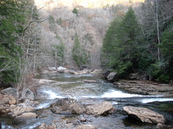
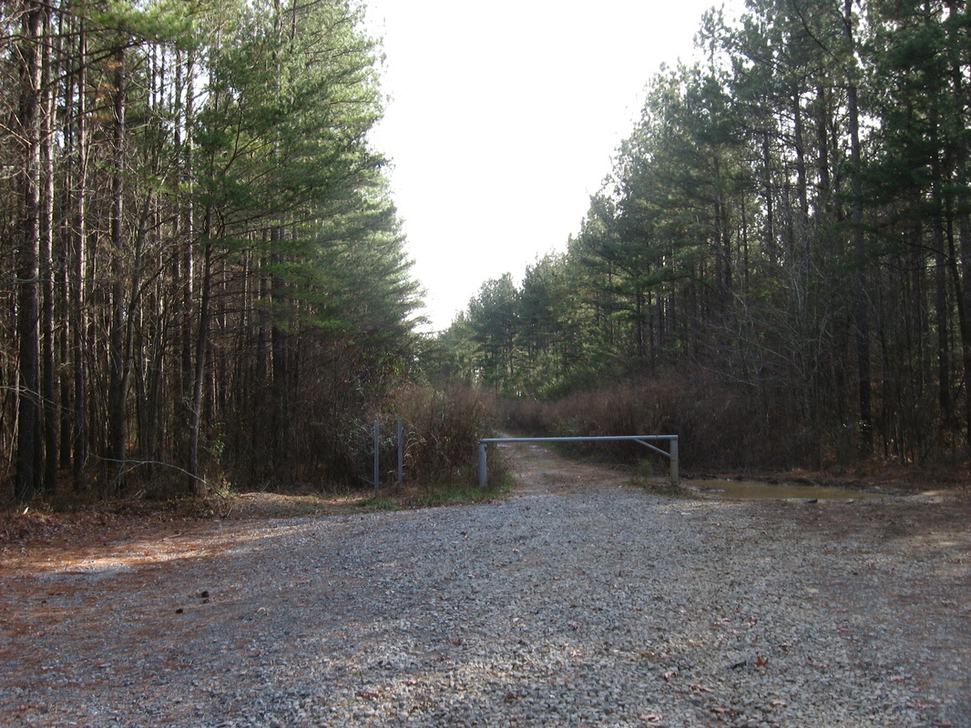
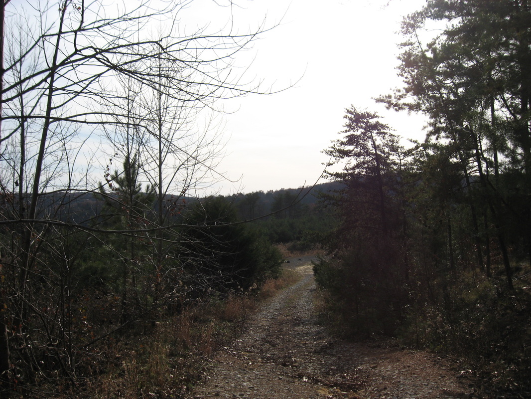
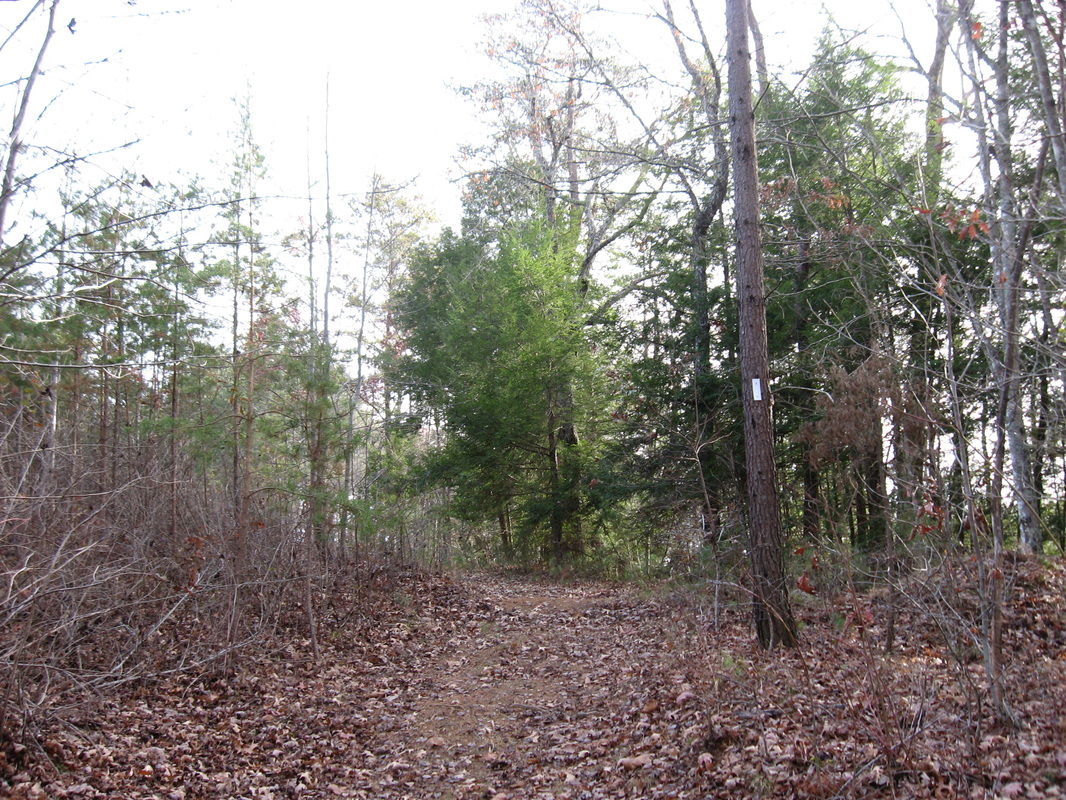
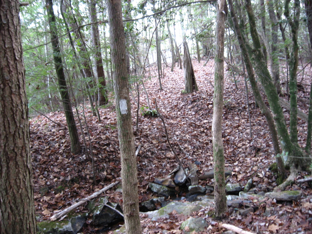
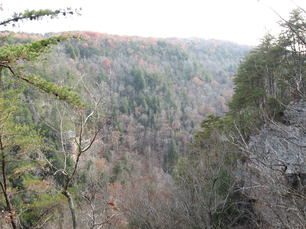
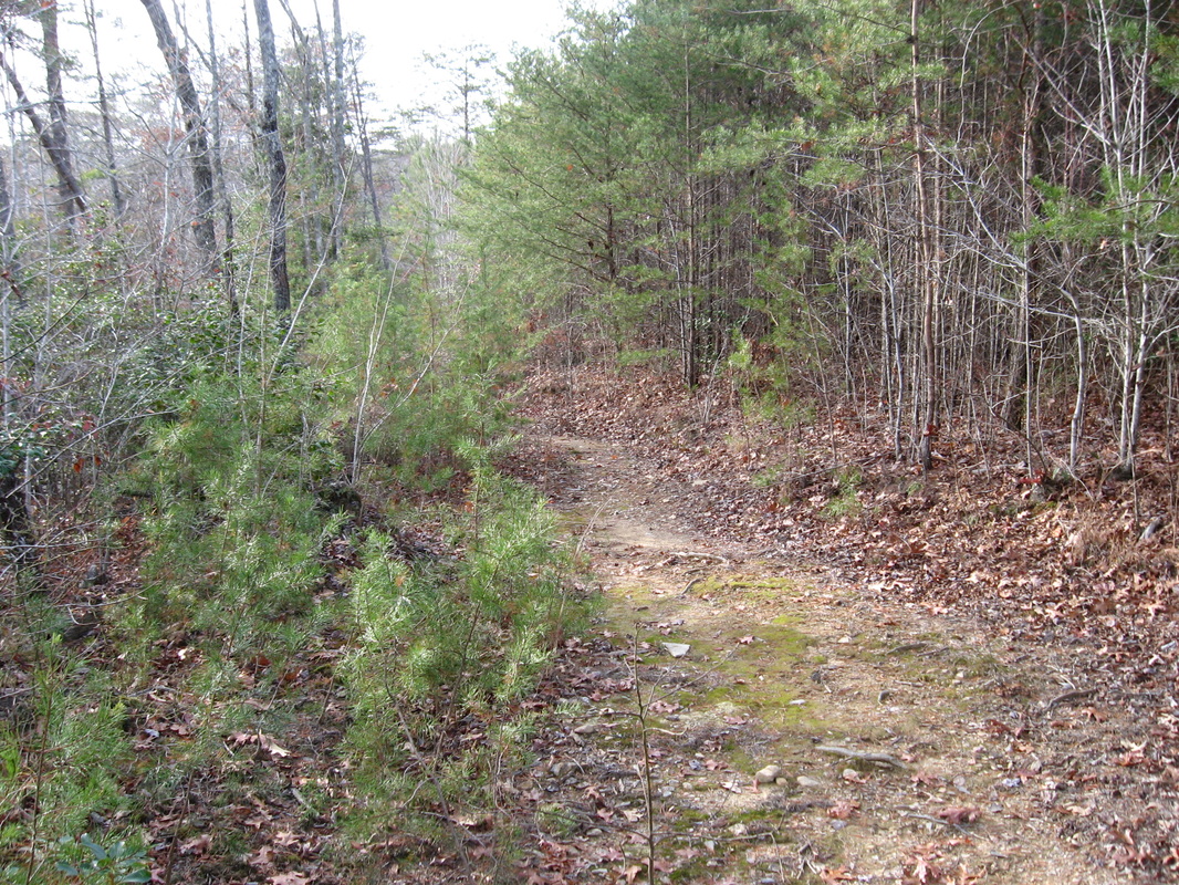
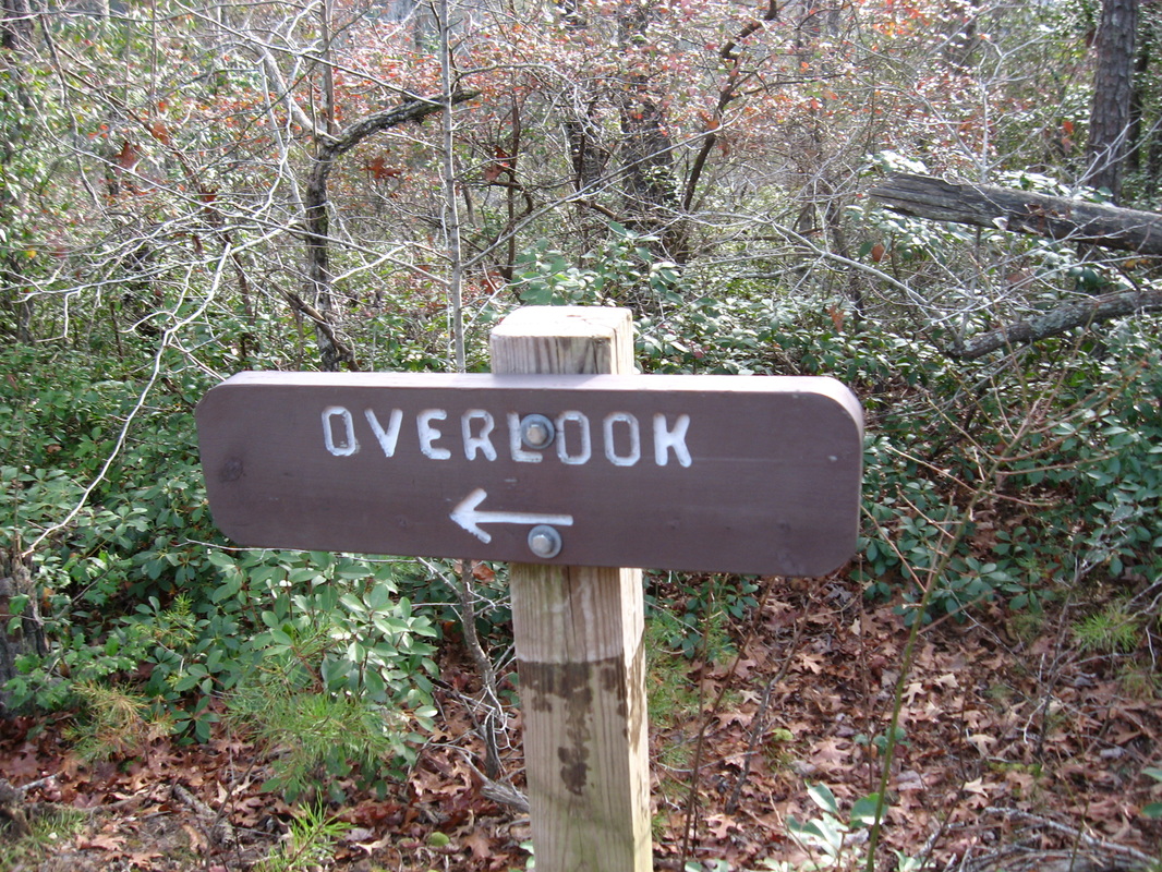
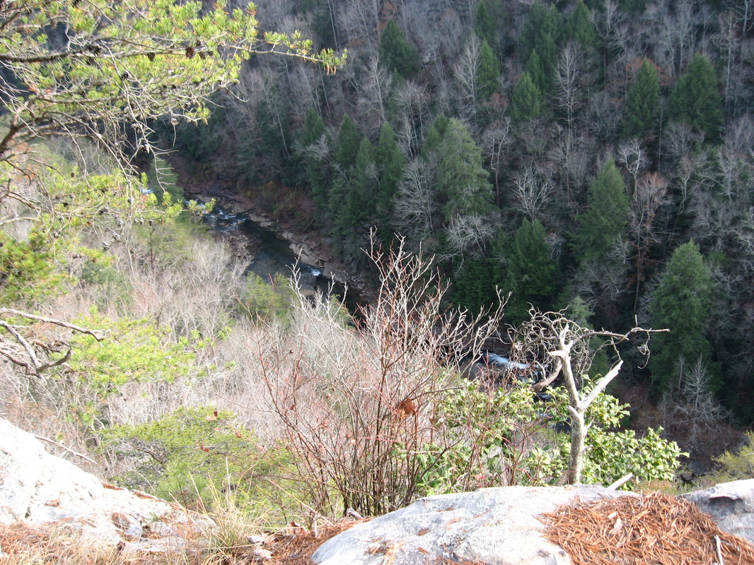
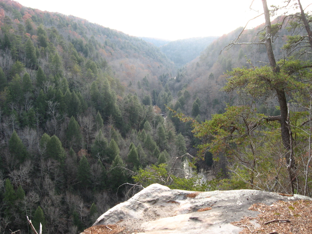
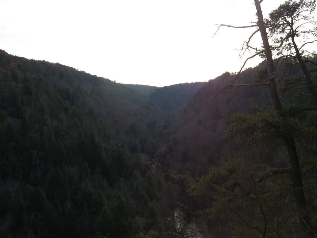
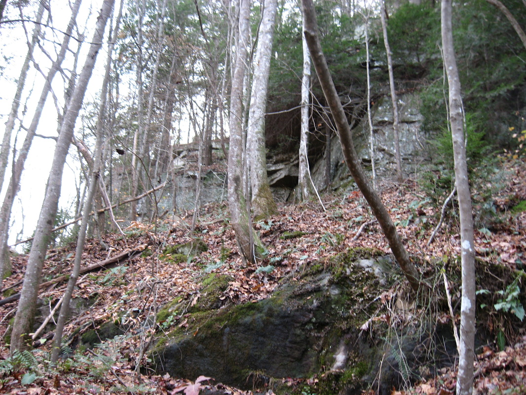
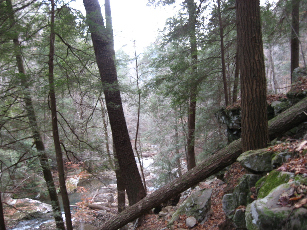
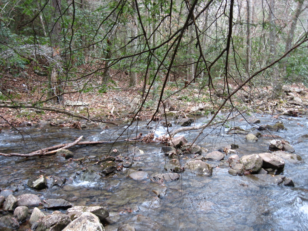
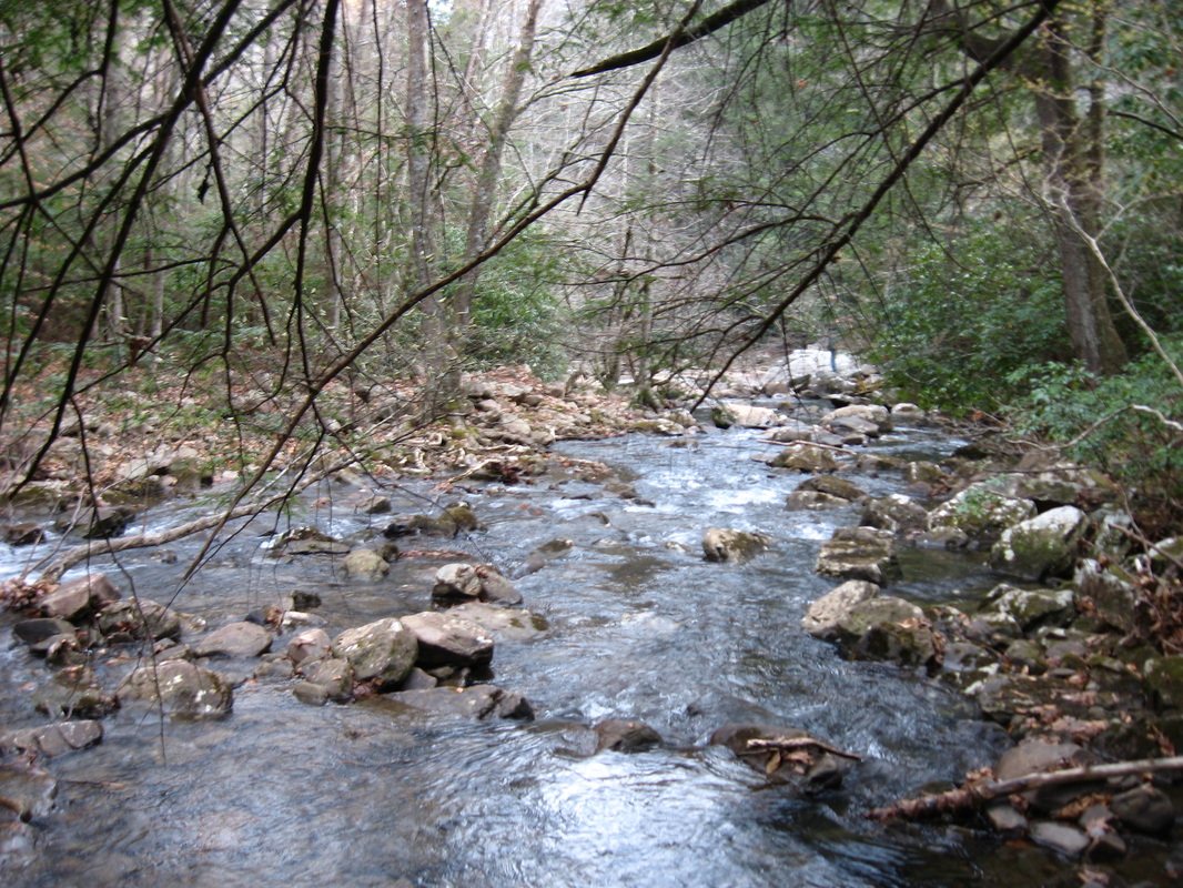
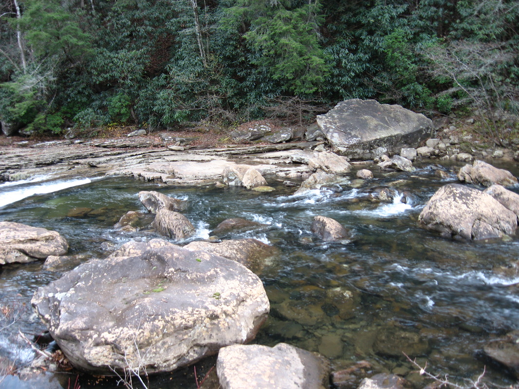
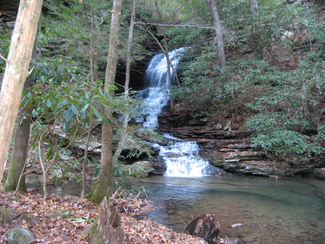
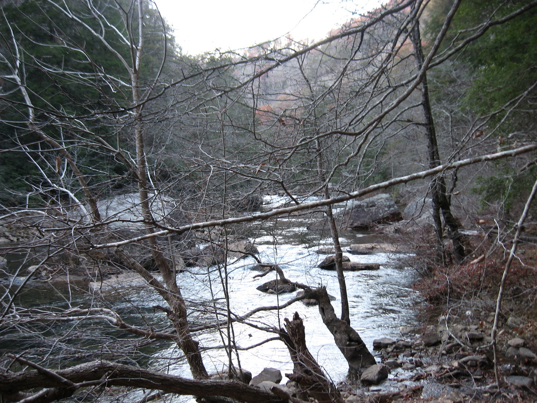
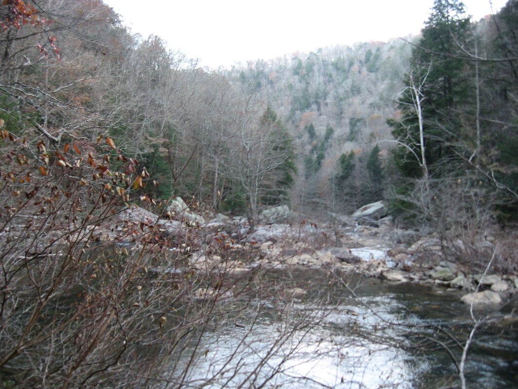
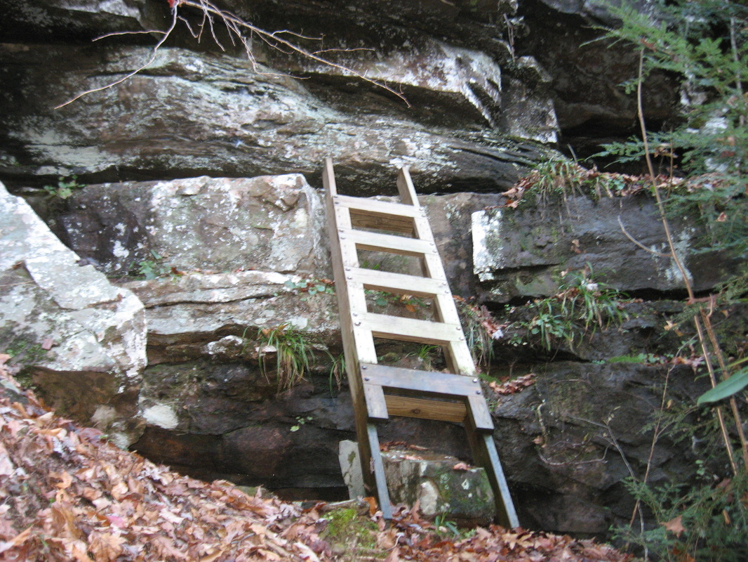
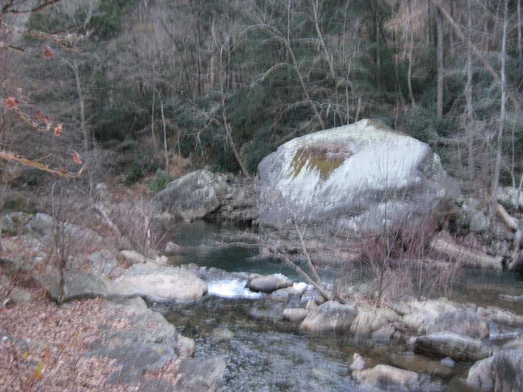
The Southern Cumberland Plateau is an incredibly scenic area. There's dozens of scenic gorges, full of waterfalls and rugged cliffs. North Chickamauga Creek Gorge is one of my ultimate favorites in this area after doing this hike. The rugged mountain streams in this gorge have beautiful waters, the gorge floor is incredibly beautiful, and the views of the upper section of the gorge are.... simply amazing. This hike occurred on Saturday, November 22nd, 2014. My plan was to start this hike from the gate at the end of the open Barker Camp Road, and follow Barker Camp Road on foot to the old turnaround. From there, I would follow an old jeep road to the Cumberland Trail, and take the Cumberland Trail south into North Chickamauga Creek Gorge. Before plunging into the gorge, I would stop at Panther Creek Overlook. Once in the gorge, I would ford Cooper Creek and reach the destination at Stevenson Branch Falls. My original destination was Boston Branch Overlook, but by seeing how much time it took to reach Stevenson Branch Falls, and seeing the deteriorating nature of the trail after Stevenson Branch Falls, I had to cut my plans by some. 

R/T Length of Hike: 10 Miles
Duration of Hike: 5:20
Type of Hike: Out and Back 
Difficulty Hike: 7 out of 10
Pros: Amazing views and beautiful scenery; very nice campsite; all climbing assisted with switchbacks and steps
Cons: Very rough and poorly-marked trail after Stevenson Branch Falls; lots of climbing on the way back 
Scenic Views: Panther Creek Overlook - 10 stars
Water Features: Stevenson Branch Falls - 6 stars
Trail Blaze Color(s): Cumberland Trail - White; Panther Creek Overlook Spur - Yellow
Best Season(s) to Hike: Winter; Spring
Beginning Point: The turnaround at the gate at the end of Barker Camp Road
Directions: From Soddy-Daisy, TN: Take Montlake Road north from Dayton Pike for 4.9 miles to Poe Road on the left. Follow Poe Road for 6.3 miles, and then take a left onto Grant Road. Once on Grant Road, take the first left in 0.3 miles onto Barker Camp Road. In 1.8 miles, turn left to keep following Barker Camp Road. Drive for roughly 2 miles until you reach the turnaround at the gate. I parked right before (on the side of the road) the open yellow gate, just in case so I wouldn't get locked in for one reason or another, although when I came back a couple hours after dark, the gate is open, so I assume it is safe to park in the turnaround. Do not drive beyond the second, closed gate. Most cars can drive around it through a deep puddle of water (and I did see someone's car in the old turnaround farther down the road after the gate). I don't think it's a good idea to do that. 
*Please zoom out on the above trail map to see the icons in the correct places. The default zoom puts them in slightly different places. Sorry for the inconvenience.*


This is a gem of a hike for the area. In fact, it is one of my favorites for the southern Cumberland Plateau, Especially if you continue past Stevenson Branch Falls to Boston Branch Overlook, then it can't get much better out there. Due to very rugged terrain, I was only able to get to just past Stevenson Branch Falls. I absolutely plan on making a return. 


While you can start this hike from the lower trailhead on Montlake Road and work your way up to Panther Branch Overlook, I decided the best option would be to start at the more remote north end trailhead on Barker Camp Road. Much of the area beyond the last house on Barker Camp Road is closed to vehicles (although some still make it through). I am not sure what is the reason... there's none that are obvious. From the gate and turnaround, walk on foot along Barker Camp Road. First it passes through a pine forest, but after 0.3 miles, you exit into the wide open. For some reason, the huge field here, although overgrown, had barely any trees growing. Also, at 0.3 miles, keep right on the main branch of Barker Camp Road. The left branch eventually dead-ends near Redbird Point near Cooper Creek. Barker Camp Road stays flat as it traverses the field with some distant views into North Chickamauga Creek Gorge. At 0.6 miles, the road starts to descend. At 0.7 miles, another small road heads left. It dead-ends shortly. Keep right here as the descent steepens. While it may not seem so at the moment, this ascent does take a toll, when you are on your way back here, with over 9 miles on the legs already. At 0.9 miles, the steep descent suddenly ends in a large turnaround (and obviously an old parking). An old van was standing here. I did see car tracks around the gate back at the parking area - I guess locals just drive down the road to end up here? Somehow the van was still, when I returned, well past dark. Hmm...? 


Anyway, at the old turnaround I just mentioned at 0.9 miles, turn right on the old jeep road. It is the only evident route from the turnaround, so I think it's easy to figure it out. The jeep road stays mainly flat, although it starts to descend towards the end on its way to the official Cumberland Trail beginning. You reach the Cumberland Trail at a small sign that simply says "CT"at 1.1 miles. Turn left here - the old jeep road just keeps descending towards Cain Creek. Once you turn left on the Cumberland Trail, the trail will follow an overgrown road and clearcut, although it leaves it soon and follows a more natural footpath starting 1.3 miles. The trail stays at the rim of the gorge until 1.5 miles, where a long and multi-tier descent into the gorge starts. Numerous rock steps ease this descent. The descent eases at 1.7 miles, shortly crossing several small creeks that are tributaries of North Chickamauga Creek. There are some views available on the cliffs here, but it can be dangerous to try to get closer to them, and the best views are ahead anyway. The trail stays just below the rim for now, and reaches the short spur trail to Panther Branch Overlook at 2.5 miles. The spur trail is yellow-blazed and marked with a simple sign "Overlook ---->". The view from the outcrop here is brilliant. The upstream view of the upper Chickamauga Creek Gorge is absolutely stunning. The downstream view is impressive as well - you can identify all the near-range cascades in the stream, especially after periods of rain. 


Retrace your steps back to the Cumberland Trail and then make a short descent into the Panther Branch valley. This is an easy crossing in all but the wettest of times, although the rocks can be slippery during/after rain. After this, the trail gently acends to meet an old road at 3 miles. Looking at the map, it seems like turning left on the road would bring you to the west branch of Barker Camp Road. However, the Cumberland Trail keeps right here onto the roadbed. The trail leaves the roadbed by turning right at 3.3 miles. This turn is marked with tape and blazes, but it's still possible to miss it, so make sure you don't. The trail descends gently from here until you reach a sudden change in terrain at 3.6 miles. The main descent into the Cooper Creek Gorge and North Chickamauga Creek Gorge starts here. There are many switchbacks on the way down, which are very helpful! Along the way down, there are many big rock outcroppings worthy of interest. At 4 miles, the main descent finally ends, and there are some good views of cascades and small waterfalls on Cooper Creek, which are pretty healthy after periods of rain. The Cumberland Trail continues along Cooper Creek here, reaching the Cooper Creek ford at 4.2 miles. If you bushwhack just downstream, you reach the Cooper Creek of North Chickamauga Creek confluence, which offers astounding views both doth directions in the gorge. Back to the ford, I would like to note that fording Cooper Creek during periods of high water may be difficult, due to a fast current, lots of uneven, slippery rocks below water, and knee-deep water in some places. During normal water levels, though, this ford is not deep and can possibly be accomplished without getting wet. 


On the other side of Cooper Creek, it gets confusing. The tail is very faint here, so just climb up the hill and go down through the trees and over a log, and somewhere around here, you should spot some blazes. Just beyond, there is a very nice campsite, Stevenson Branch campsite, at the base of a large sandstone cliff. Even though this campsite is near several large creeks (I don't like the wet, moist campsites), I think that this campsite is unusually dry, because of it's proximity to the cliff, so I liked it. A little down from the campsite, you reach the crossings of Stevenson Branch's several trickles. If you walk a bit upstream, you'll see the pool below the unusually-shaped Stevenson Branch Falls. It is not a large waterfall, but pretty, as it comes out behind a cliff, so it makes a turn while falling. As you may have noticed while reading the first part of this post, my original plan was to continue to Boston Branch Overlook, nearly 2 miles farther. I quickly figured out this was impossible, as soon as I started on the next section. Right after the crossing of Stevenson Branch, the trail becomes very rocky and follows the direct bank of North Chickamauga Creek. House-sized boulders line the beautiful mountain stream. The gorge is a sight not to be missed. After this, the trail climbs up a bit, and climbs a ladder without handrails onto a small ledge and a wet-weather trickle. I stopped around here, as the trail was confusing, rugged, and extremely slow. From here, the best option is to retrace your steps back to the trailhead. Whenever I come back here, I'll try to make it to Boston Branch Overlook, and I will make an updated post about it. 


In summary, this is an amazing hike to acquaint you with the beauties of the southern Cumberland Plateau. It doesn't get much better than this. I rate this hike a "Best Hike". Below are my pictures.
Best Hike
0 Comments


Leave a Reply.

    About Me

    Mark Oleg Ozboyd
    I'm an avid outdoor explorer and a hobbyist landscape photographer. I'm 21 years old and have been hiking since 2011. Originally based out of Atlanta, Georgia, I started out by occasionally hiking short trails throughout well-known Georgia State Parks. During 2012 and 2013, I began to expand my trips into adjacent states, as well as into the wilder National Forest areas rather than just State Parks. Throughout the years that followed, as I slowly ran out of popular hiking trails in my area, I began to search for and hike in more seldom-visited areas. Today, you can find me out in the woods every weekend, whether it's on an official trail or bushwhacking through cross-country terrain without any paths. I now attend Washington & Lee University and am exploring Virginia and West Virginia. My other hobbies include chess, science, old music, and meteorology. I have 3 years of amateur weather forecasting experience, having studied a lot of meteorology basics over the years. I am also a student at European School of Music where I learned that music and nature have a lot in common. Listening to good music inspires me to capture nature's beauty on the camera in different aspects that also make me recall many beautiful music pieces that I've heard.​


    Dear readers: I have invested a tremendous amount of time and effort in this website and the Georgia Waterfalls Database the past five years. All of the work that has gone in keeping these websites updated with my latest trip reports has almost been like a full-time job. This has not allowed me to pick up a paid job to save up money for college, and therefore, I I've had to take out loans. If you find the information on this website interesting, helpful, or time-saving, you can say "thanks" and help me out by clicking the button above and making a contribution. I will be very grateful for any amount of support you give, as all of it will apply toward my college tuition. Thank you! 

    Enter your email address to subscribe for trail reports:

    Delivered by FeedBurner


    Picture
    Coming in 2022-2023?

    Other Hiking Websites

    DWHike's Adventures
    Florida's Natural Wonders
    Florida Trailblazer
    Meanderthals
    Mountain Images
    by Bernie Boyer

    North Carolina Waterfalls with
    ​Kevin Adams
    Take-a-Hike!
    Tennessee Landforms
    Waterfall Page
    Waterfall Adventurer
    Zach's Mild Adventures

    Miles Hiked

    Year 1: 540.0 Miles
    Year 2: 552.3 Miles
    ​Year 3: 518.4 Miles
    Year 4: 482.4 Miles
    Year 5: 259.9 Miles

    Archives

    March 2021
    February 2021
    January 2021
    November 2019
    October 2019
    September 2019
    August 2019
    July 2019
    June 2019
    February 2019
    January 2019
    December 2018
    November 2018
    October 2018
    August 2018
    July 2018
    June 2018
    May 2018
    April 2018
    March 2018
    February 2018
    January 2018
    December 2017
    November 2017
    October 2017
    September 2017
    August 2017
    July 2017
    June 2017
    May 2017
    April 2017
    March 2017
    February 2017
    January 2017
    December 2016
    November 2016
    October 2016
    September 2016
    August 2016
    June 2016
    May 2016
    April 2016
    March 2016
    January 2016
    December 2015
    November 2015
    October 2015
    September 2015
    August 2015
    July 2015
    June 2015
    May 2015
    April 2015
    March 2015
    February 2015
    January 2015
    December 2014
    November 2014
    October 2014
    September 2014
    August 2014
    July 2014
    June 2014
    May 2014
    April 2014
    March 2014
    February 2014

    Categories

    All
    Adel
    Adirondack Park
    Alabama
    Alfred A. Ring Park
    Allegheny Trail
    Amicalola Falls State Park
    Anniston Area
    Apalachicola Bluffs And Ravines Preserve
    Apalachicola National Forest
    Apalachicola/Port St. Joe Area
    Apopka
    Appalachian Trail
    Appling
    Art Loeb Trail
    Aska Trail System
    Bakersville
    Balm-Boyette Scrub Preserve
    Balsam Lake Recreation Area
    Bankhead National Forest
    Bartow County Parks
    Bartram Trail
    Basinger
    Beersheba Springs
    Benton
    Benton Mackaye Trail
    Berry College Trail System
    Best Hike
    Big South Fork National Recreation Area
    Black Bear Wilderness
    Black Rock Mountain State Park
    Blairsville
    Blakely
    Blood Mountain Wilderness
    Blowing Rock
    Blue Ridge
    Blue Ridge Parkway
    Boone
    Bradenton
    Bradenton Beach
    Brasstown Bald
    Brasstown Wilderness
    Brevard
    Bryson City
    Buchanan
    Bucks Pocket State Park
    Bulow Creek State Park
    Bulow Plantation Ruins State Park
    Caesars Head State Park
    Caladesi Island State Park
    Calhoun
    Camel's Hump State Park
    Cashiers
    Caspersen Beach Park
    Catfish Creek State Park
    Caves
    CC Putnam State Forest
    Cedar Point Environmental Park
    Chatsworth
    Chattahoochee National Forest
    Chattanooga
    Chattanooga Valley
    Chattooga National Wild And Scenic River
    Cheaha Wilderness
    Cherohala Skyway
    Cherokee
    Cherokee National Forest
    Chiefland Area
    Chillhowee Recreation Area
    Chipley
    Chunky Gal Trail
    Circle B Bar Reserve
    Citico Creek Wilderness
    Citrus Wildlife Management Area
    Clarkesville
    Clayton
    Cleevland
    Cleveland
    Cloudland Canyon State Park
    Cohutta Wilderness
    Collier-Seminole State Park
    Cordele
    Cornelia
    Covington
    Crestview Area
    Crew-land-and-water-trust
    Cullowhee
    Cumberland Trail
    Dahlonega
    Dalton
    Dawson Forest Wildlife Management Area
    Dawsonville
    Dayton
    De Soto National Memorial
    DeSoto State Park
    Dillard
    Double Springs
    Ducktown
    Duncan Ridge Trail
    Dunlap
    Eagle's Rest Park
    Eastpoint
    Econfina Creek Wildife Management Area
    Eglin Air Force Base
    Elizabethton
    Elkins
    Elk Knob Game Lands
    Elk Park
    Ellicott Rock Wilderness
    Ellijay
    Emerson Point Preserve
    Englewood Area
    Enota Retreat
    Erwin
    Falling Waters State Park
    Fayetteville
    Fires Creek Recreation Area
    Fire Tower
    Flint River
    Florence Area
    Florida
    Florida Caverns State Park
    Florida Trail
    Foothills Trail
    Fort Mountain State Park
    Fort Myers Area
    Fort Payne
    Fort Payne Area
    Fort Yargo State Park
    Franklin
    Franklin Delano Roosevelt State Park
    Franklin-Marion State Forest
    Frozen Head State Park
    Gainesville
    Gainesville Area
    Gatlinburg
    George Washington National Forest
    Georgia
    Georgia Veterans Memorial State Park
    Glasgow
    Gorges State Park
    Grandfather Mountain State Park
    Great Smoky Mountains National Park
    Greeneville
    Green River Game Lands
    Gruetli-Laager
    Grundy Forest State Natural Area
    GTM Reserve
    Guana River Wildlife Management Area
    Hayesville
    Helen
    Hiawassee
    High Falls State Park
    Highlands
    Highlands Scenic Highway
    Hillsborough River State Park
    Hinson Conservation & Recreation Area
    Historic Sites
    Honeymoon Island State Park
    Hot Springs
    Huntington
    Inverness Area
    Jackson
    Jasper
    Jefferson National Forest
    Joan M. Durante Park
    Jonathan Dickinson State Park
    Jones Gap State Park
    Joyce Kilmer Slickrock Wilderness
    Joyce Kilmer - Slickrock Wilderness
    Juniper Prairie Wilderness
    Kelly Park
    Keown Falls Recreation Area
    Kolomoki Mounds State Park
    LaFayette
    Lake City Area
    Lake George Wild Forest
    Lake June-in-Winter State Park
    Lakeland Area
    Lake Placid
    Lake Russell Wildlife Management Area
    Lake Wales Ridge State Forest
    Laurel Fork North Wilderness
    Leffis Key Preserve
    Leon Sinks Geological Area
    Lexington
    Lineville
    Linville
    Linville Gorge Wilderness
    Lithia Springs
    Little Frog Wilderness
    Little Manatee River State Park
    Little River Canyon National Preserve
    Longboat Key
    Long Trail
    Lookout Mountain
    Lookout Mountain Battlefield
    Lovingston
    Lula Lake Land Trust
    Lumpkin
    Maggie Valley
    Manatee Springs State Park
    Marianna Area
    Mark Trail Wilderness
    Marlinton
    Mccaysville
    McMinville
    Mentone
    Middlesex
    Mistletoe State Park
    Monongahela National Forest
    Montreat
    Mountain Bridge Wilderness Area
    Mountain City
    Mountains To Sea Trail
    Mountains-to-Sea Trail
    Mount Rogers National Recreation Area
    Myakka River State Park
    Myron B. Hodge City Park
    Nantahala National Forest
    Naples
    Naples Area
    Natural Bridge State Park
    Neal Preserve
    New Castle
    Newport
    New River Gorge National Park
    New York
    North Carolina
    Ocala Area
    Ocala National Forest
    Ocean-to-Lake Trail
    Oconee State Park
    Oconee Station Historic Site
    Okaloacoochee Slough State Forest
    Oldsmar
    Oneida
    Orlando Area
    Ormond Beach
    Oscar Scherer State Park
    Oxford
    Palatka
    Palmetto Trail
    Panama City Area
    Panthertown Valley
    Parrish
    Paynes Creek Historic State Park
    Peaks Of Otter Recreation Area
    Pigeon Crockford Mountain Wildlife Management Area
    Pigeon-Crockford Mountain Wildlife Management Area
    Pigeon-Crockford Wildlife Management Area
    Pine Mountain
    Pinhoti Trail
    Pinnacle Park
    Pisgah Civitan Park
    Pisgah National Forest
    Pittman Center
    Pond Mountain Wilderness
    Ponds/Lakes
    Prentice Cooper State Forest
    Providence Canyon State Park
    Pumpkintown
    Quick Point Nature Preserve
    Raven Cliffs Wilderness
    Reed Bingham State Park
    Reliance
    Rice Creek Conservation Area
    Riverview Pointe Preserve
    Robbinsville
    Robinson Preserve
    Rock Creek Gorge Scenic Area
    Rock Island State Park
    Rome
    Rosman
    Sale Creek
    Salem
    Salt Springs
    Saluda
    Santa Rosa Beach
    Sarasota
    Sarasota Area
    Savage Gulf State Natural Area
    Scenic Views
    Scottsboro Area
    Sebring Area
    Sewanee
    Sheltowee Trace Trail
    Shining Rock Wilderness
    Signal Mountain
    Sipsey Wilderness
    Sky Valley
    Smithgall Woods State Park
    Snowbird Backcountry Area
    Soddy Daisy
    Soddy-Daisy
    Sopchoppy
    South Carolina
    South Cumberland State Park
    Southeastern Cave Conservancy
    Southern Nantahala Wilderness
    Sparta
    Sprewell Bluff Park
    Spring City
    Spring Hill
    Springs
    Spruce Pine
    Standing Indian Backcountry Area
    St. Augustine
    St. George Island State Park
    St. Joseph Bay State Buffer Preserve
    St. Marks Area
    St. Marks National Wildlife Refuge
    Stone Mountain
    Stone Mountain Park
    Suches
    Sumatra
    Sumter National Forest
    Suwannee River
    Swallow Creek Wildlife Management Area
    Sweetwater Creek State Park
    Sylva
    Talladega National Forest
    Tallahassee Area
    Tallulah Falls
    Tallulah Gorge State Park
    Tampa Bay Area
    Tate City
    Tate's Hell State Forest
    Tea Creek Wildlife Management Area
    Tellico Plains
    Tennessee
    Thomaston
    Toccoa
    Topsail Hill State Park
    Torreya State Park
    Townsend
    Tracy City
    Tray Mountain Wilderness
    Trenton
    Triple Creek Preserve
    Troutdale
    Unaka Mountain Wilderness
    Upper Tampa Bay County Park
    Venice
    Vermont
    Virgin Falls State Natural Area
    Virginia
    Virginia Outdoors Foundation
    Vogel State Park
    Wakulla Springs State Park
    Waleska
    Walhalla
    Wartburg
    Water Features
    Waynesville
    Weedon Island Preserve
    Weeki Wachee Preserve
    Wekiwa Springs State Park
    West Palm Beach Area
    West Virginia
    Whitehall
    White Springs
    Winder
    Withlacoochee State Forest
    Young Harris

    RSS Feed

TRAIL REPORTS

Hikes in Alabama
​Hikes in Florida
Hikes in Georgia
Hikes in North Carolina
Hikes in South Carolina
Hikes in Tennessee
Hikes in Virginia

Hiking Resources

Alabama Resources
​
Florida Resources
Georgia Resources
North Carolina Resources
​South Carolina Resources
​
Tennessee Resources

Other

Contact
Map of Hikes
Alphabetical List of Hikes
Southeast Nature Society
© COPYRIGHT 2014-2018
​ALL RIGHTS RESERVED.
Important: I disclaim any responsibility for any damage or personal injury that may occur as a result of the activities and information found on this website. All outdoor activities, especially off-trail hiking, are done at your own risk. Never hike or head into that area that may be above your fitness or experience level.
  • Home
  • Trail Reports
    • Best Hikes
    • Hikes with Scenic Views
    • Hikes with Water Features
    • Alabama
    • Georgia
    • Florida
    • North Carolina
    • South Carolina
    • Tennessee
    • Vermont
    • Virginia
  • Map
  • Hike List
  • Testimonials
  • Resources
  • Contact Us
  • Southeast Nature Society
    • Our Team
  • Georgia Waterfalls Database