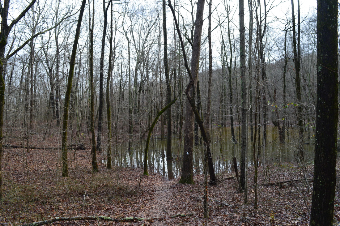
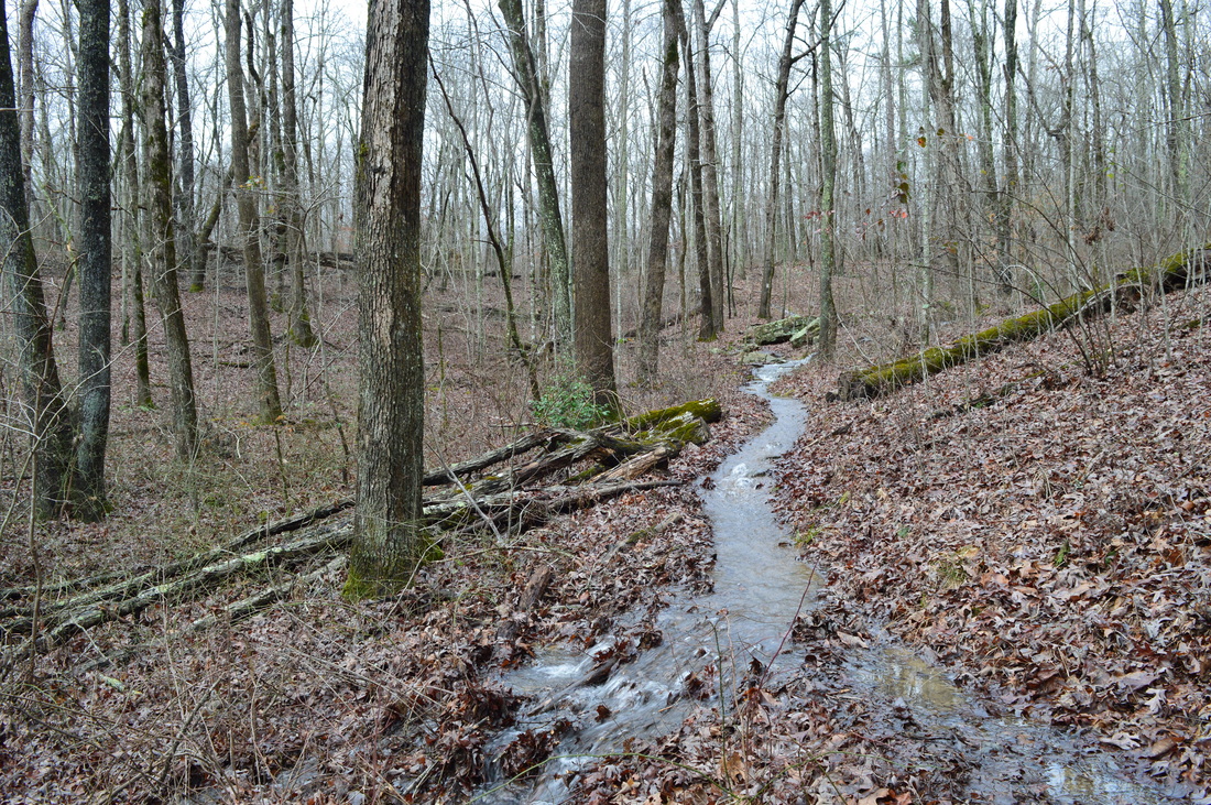
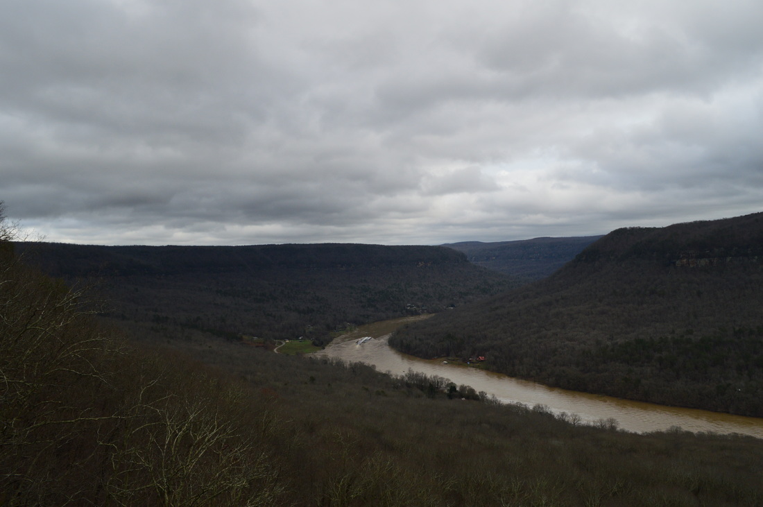
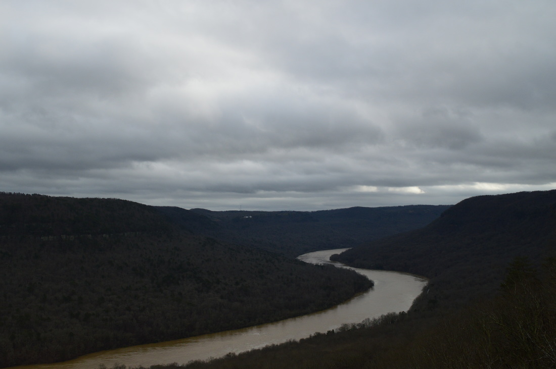
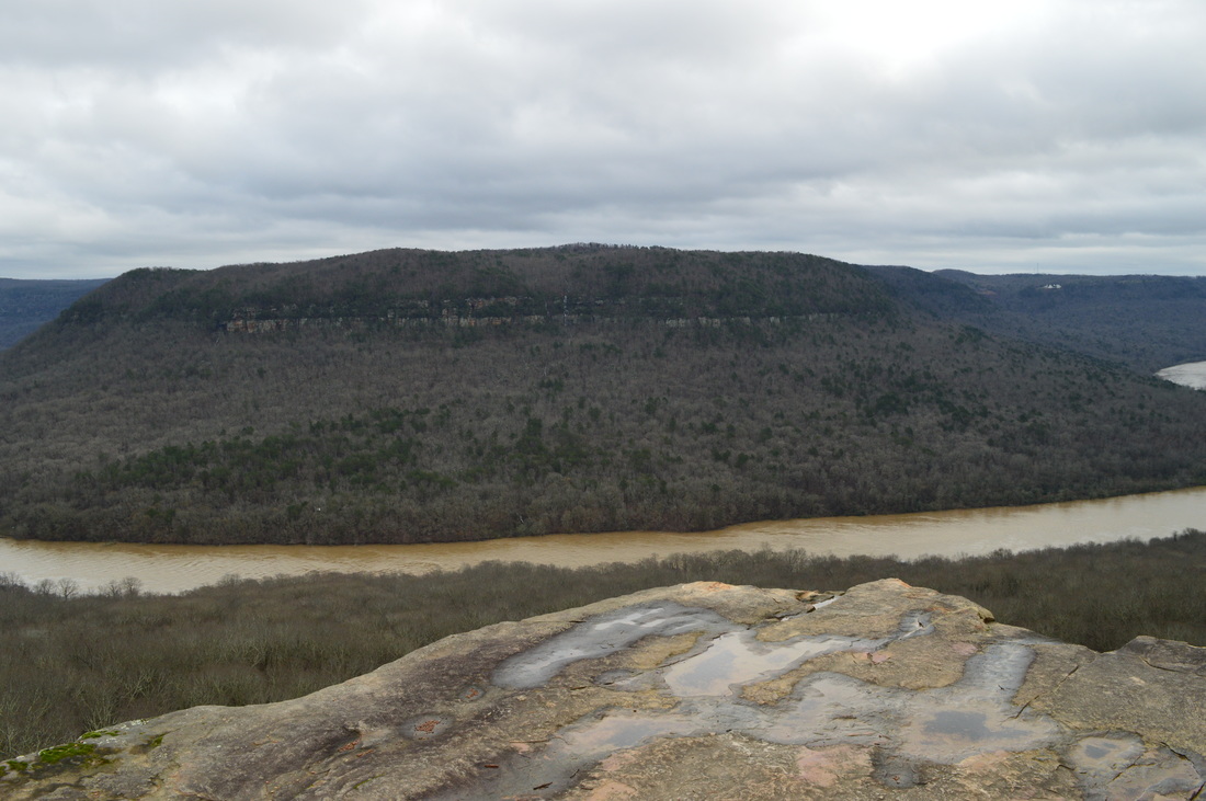
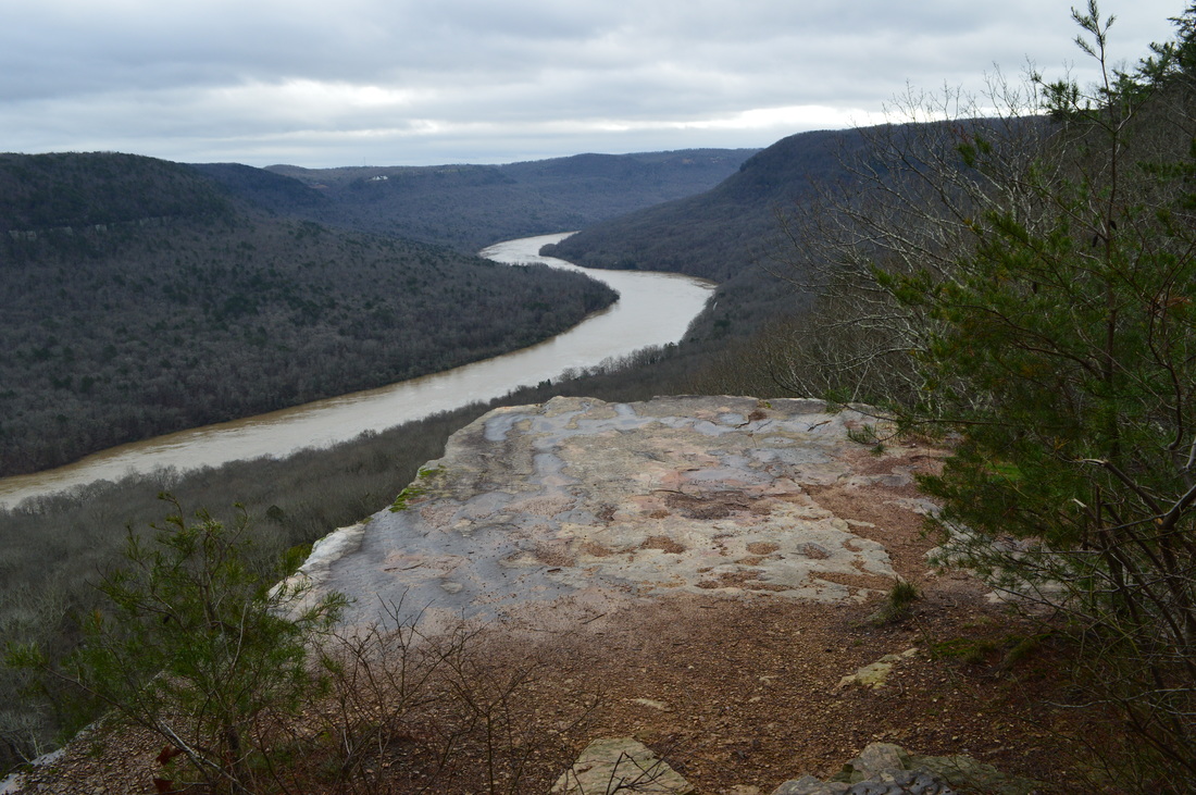
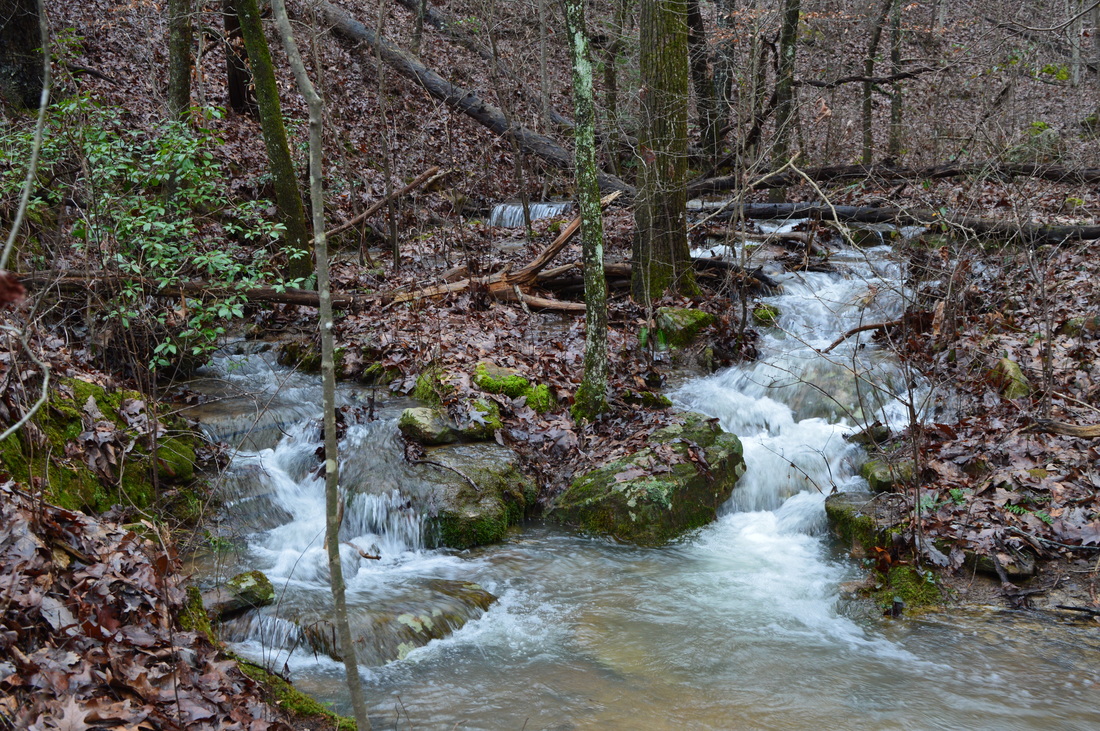
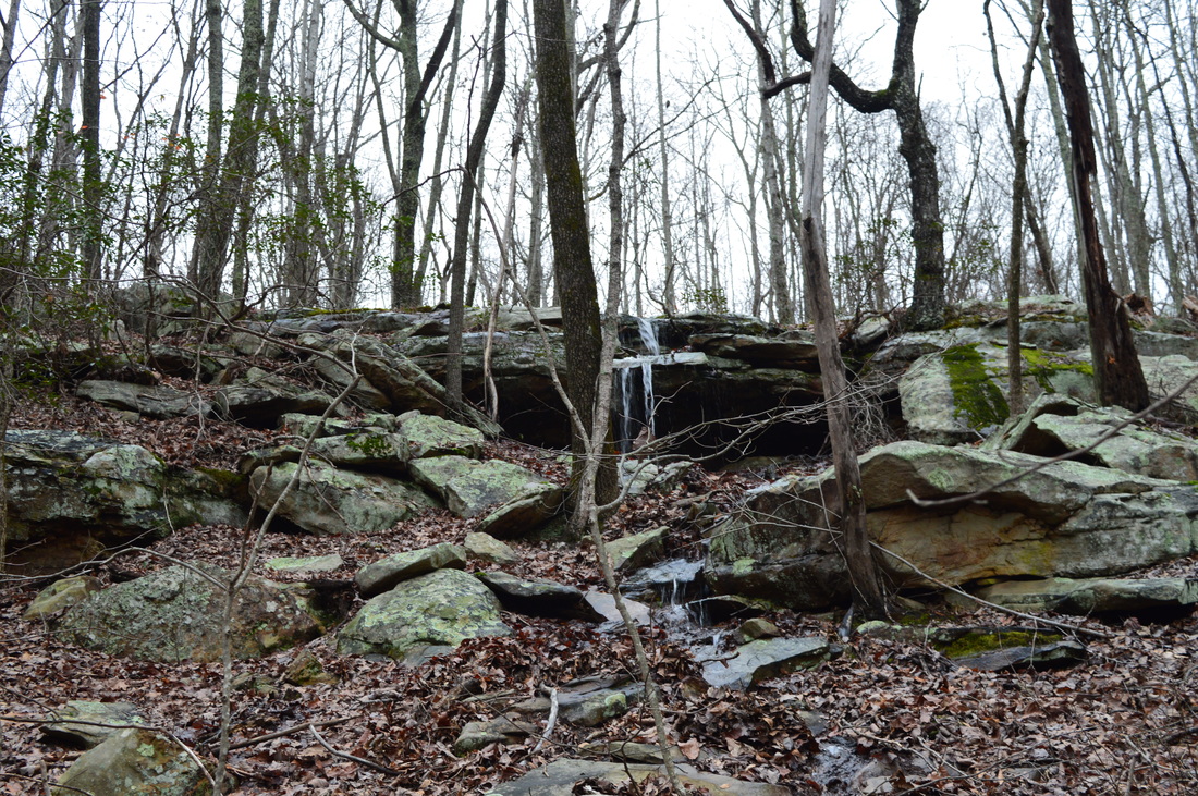
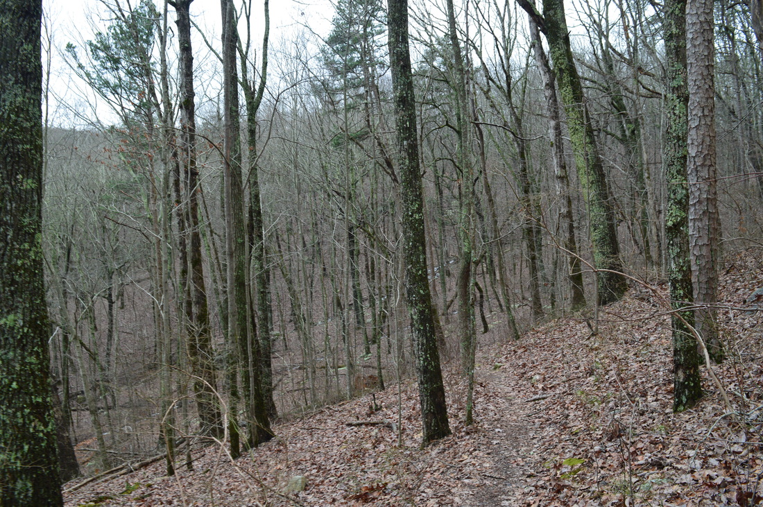
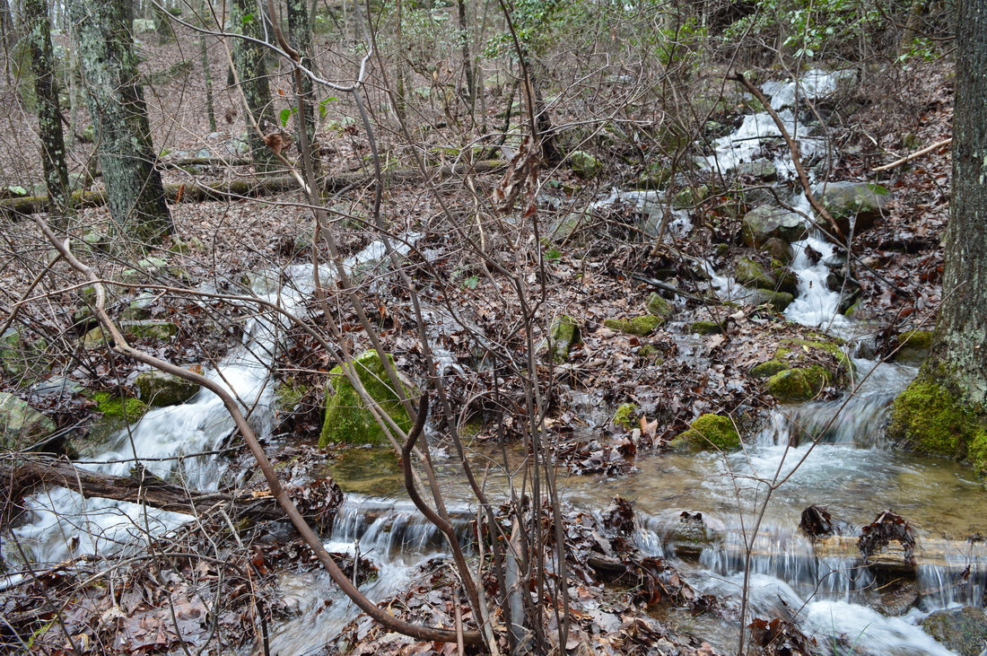
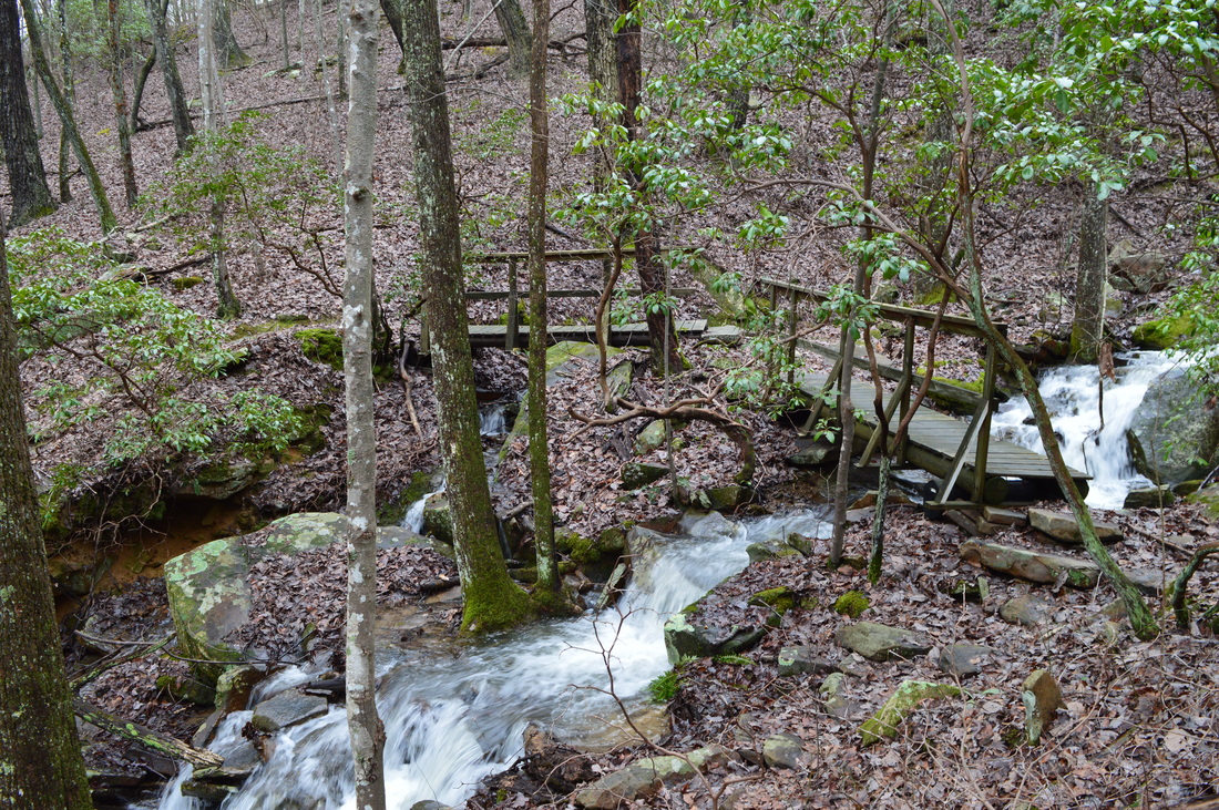
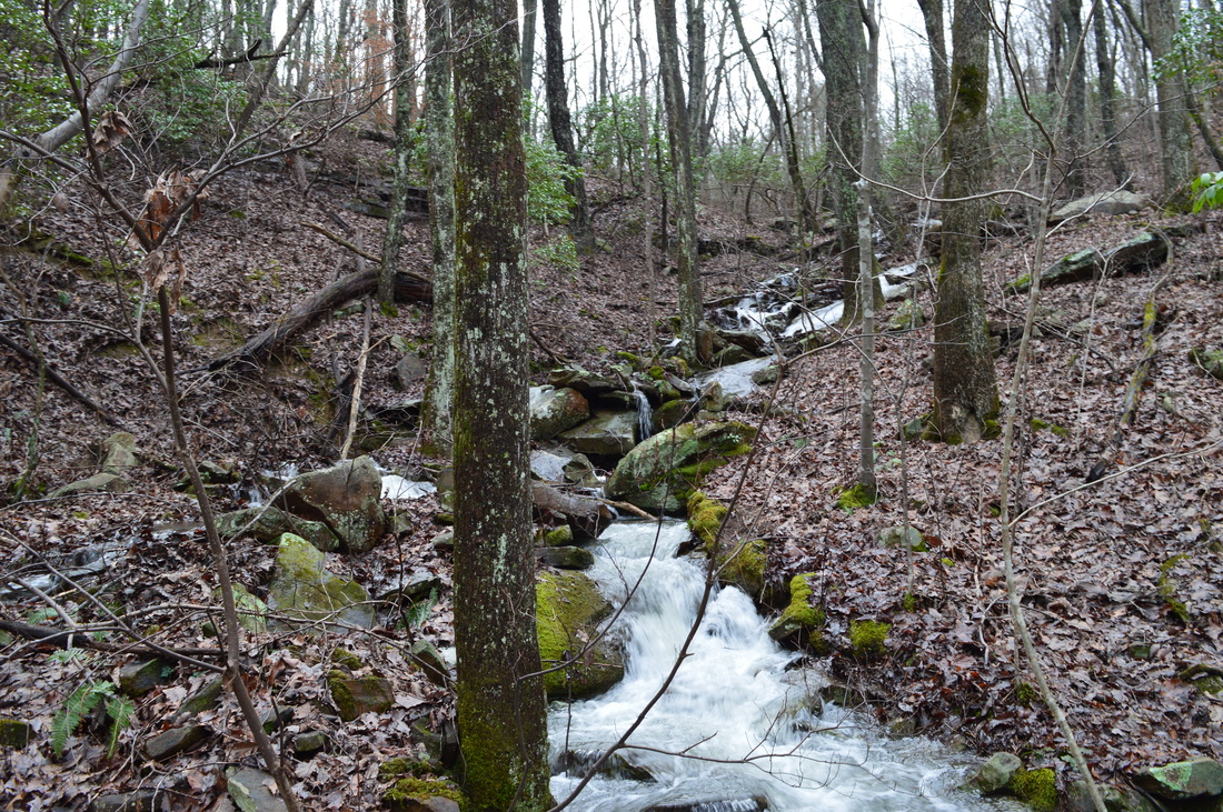
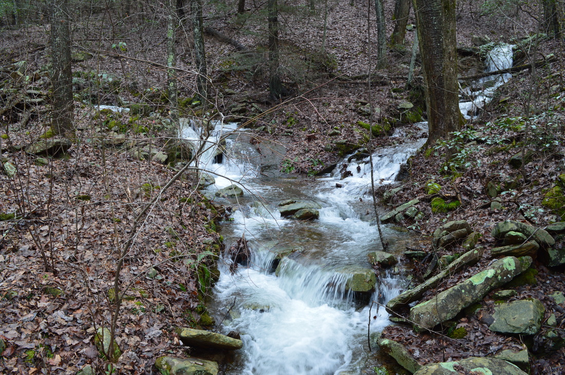
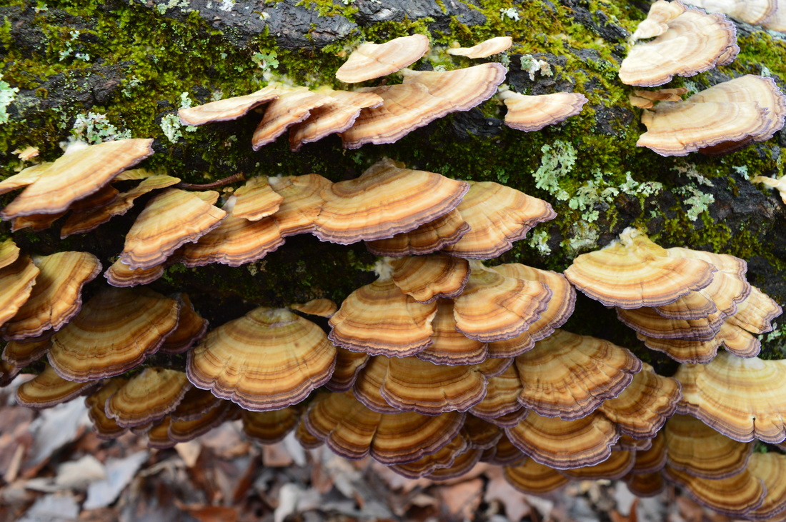
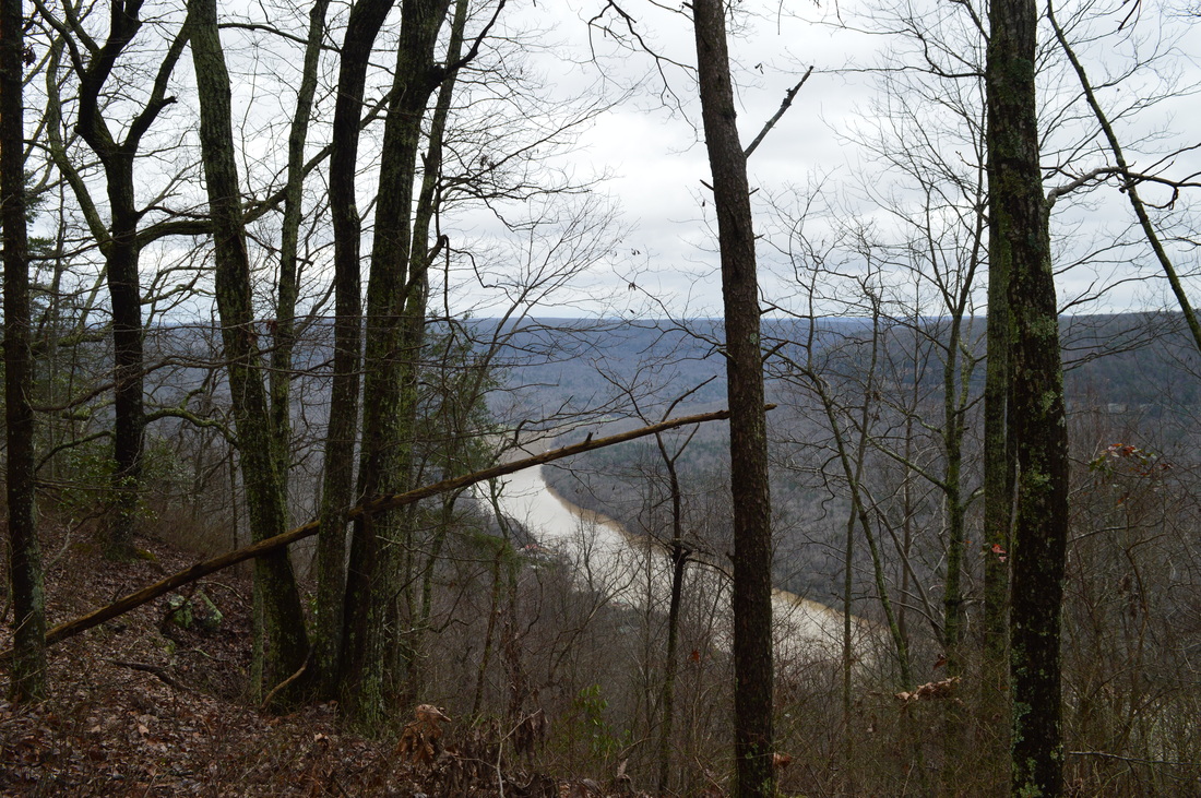
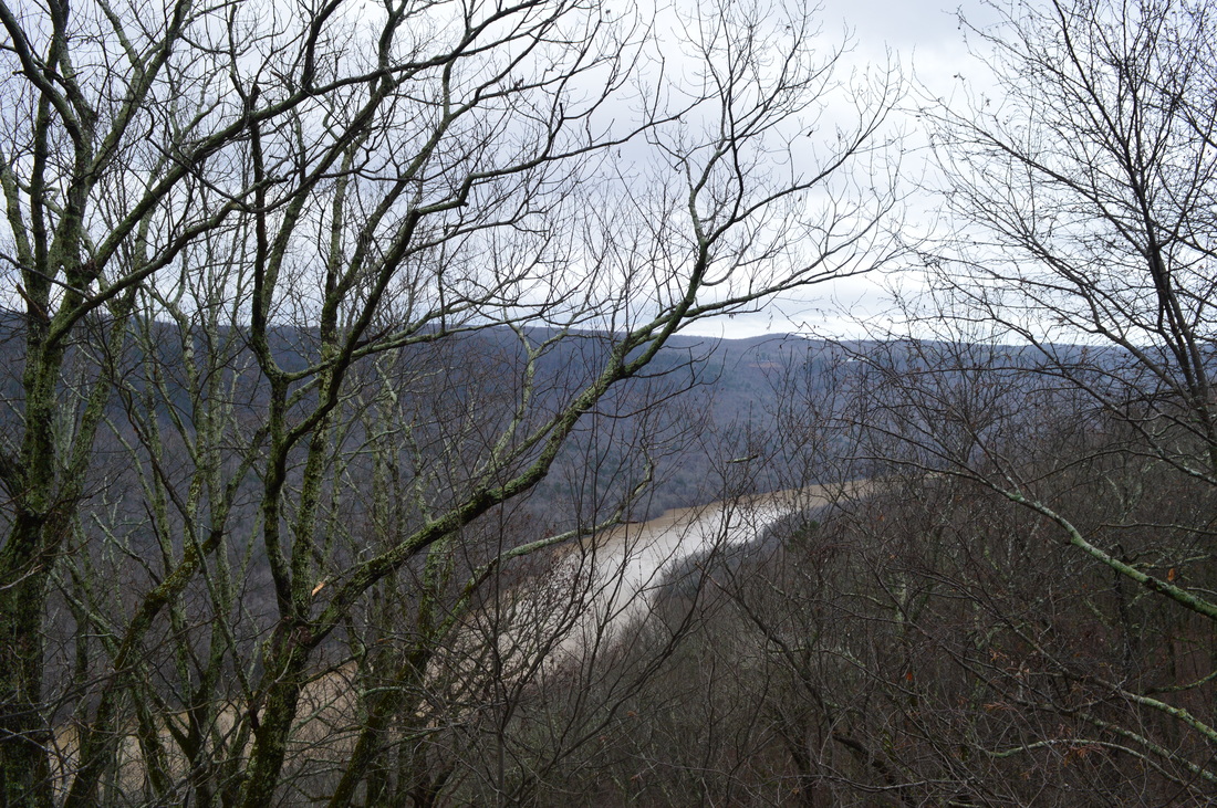
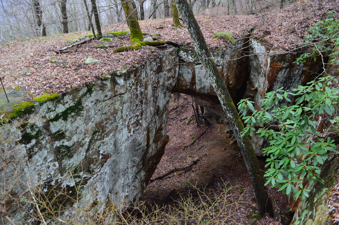
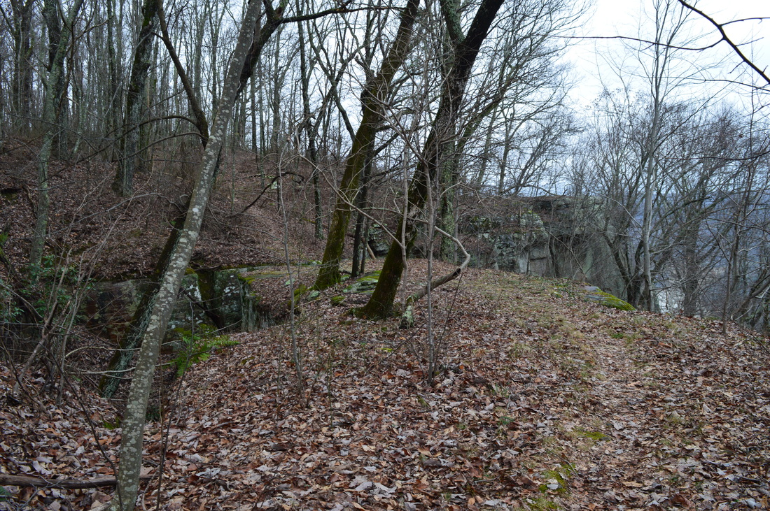
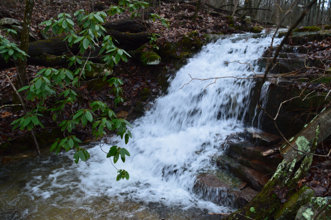
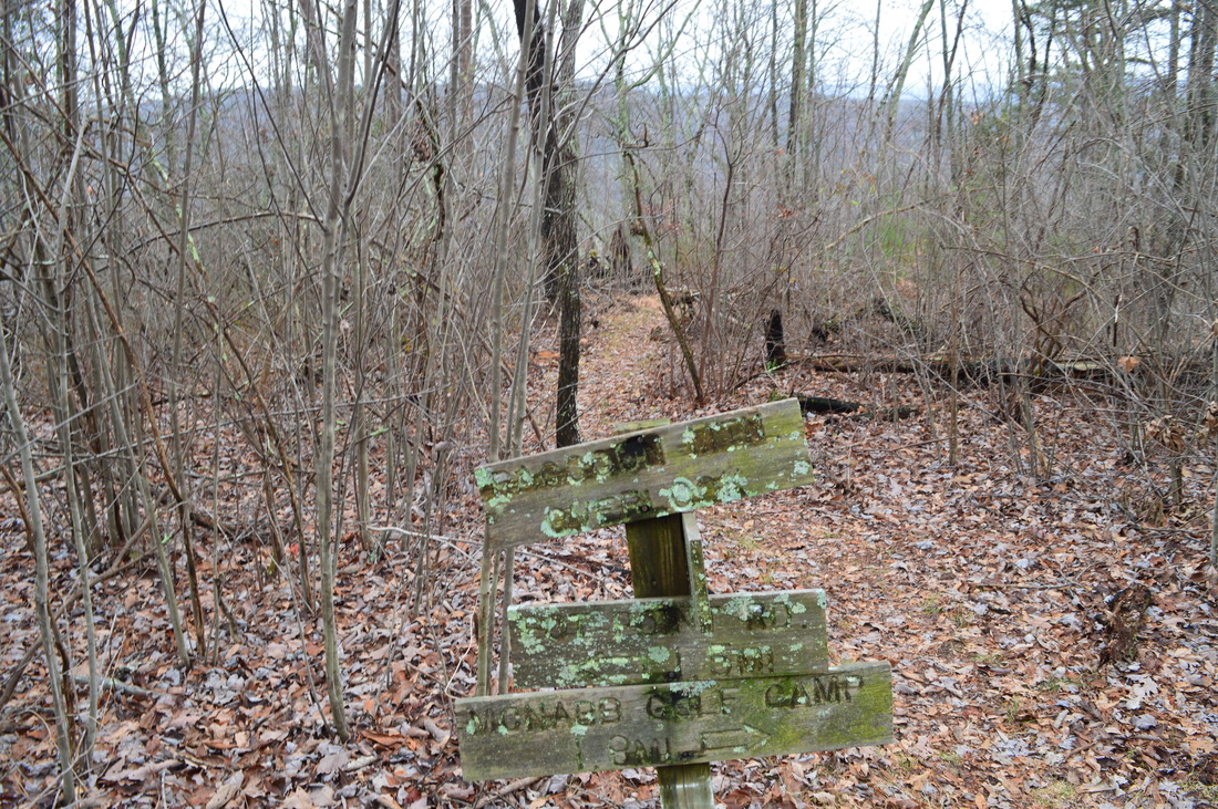
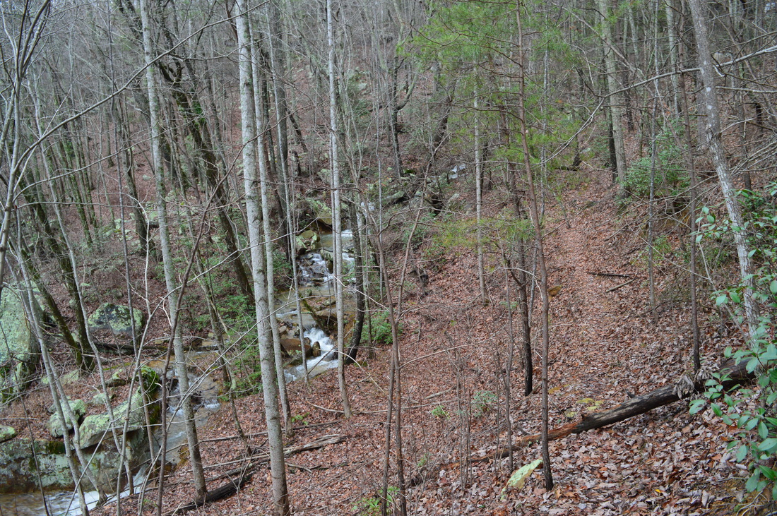
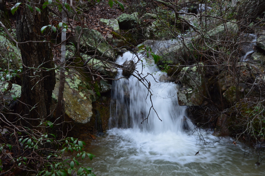
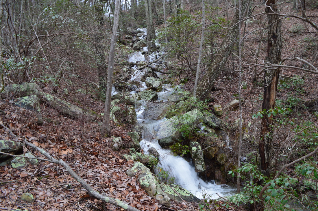
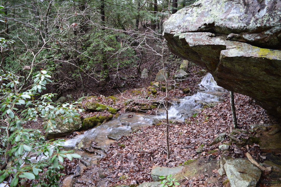
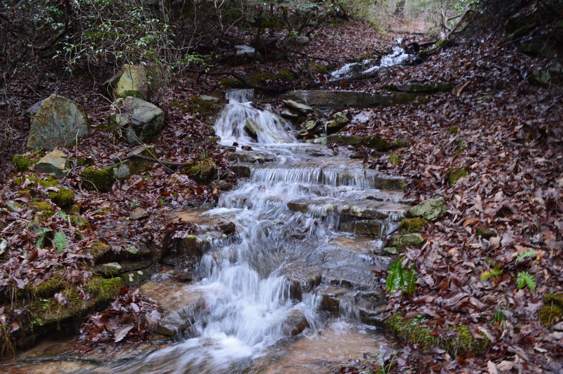
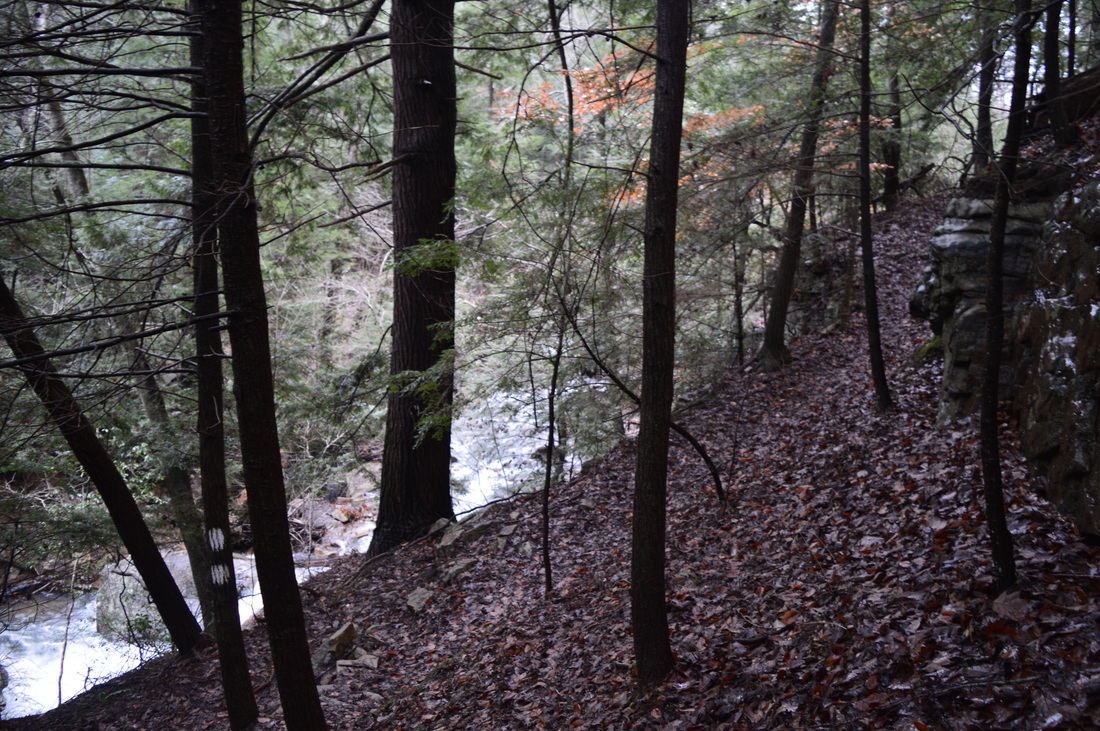
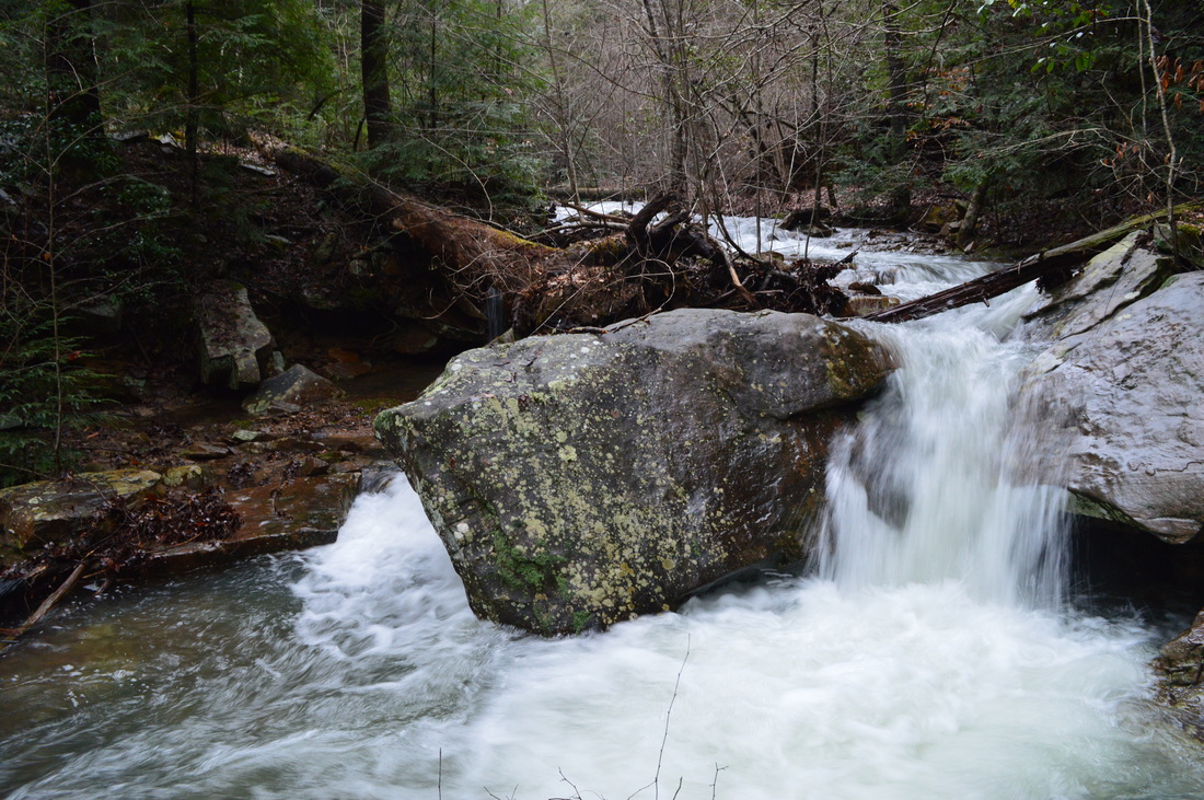
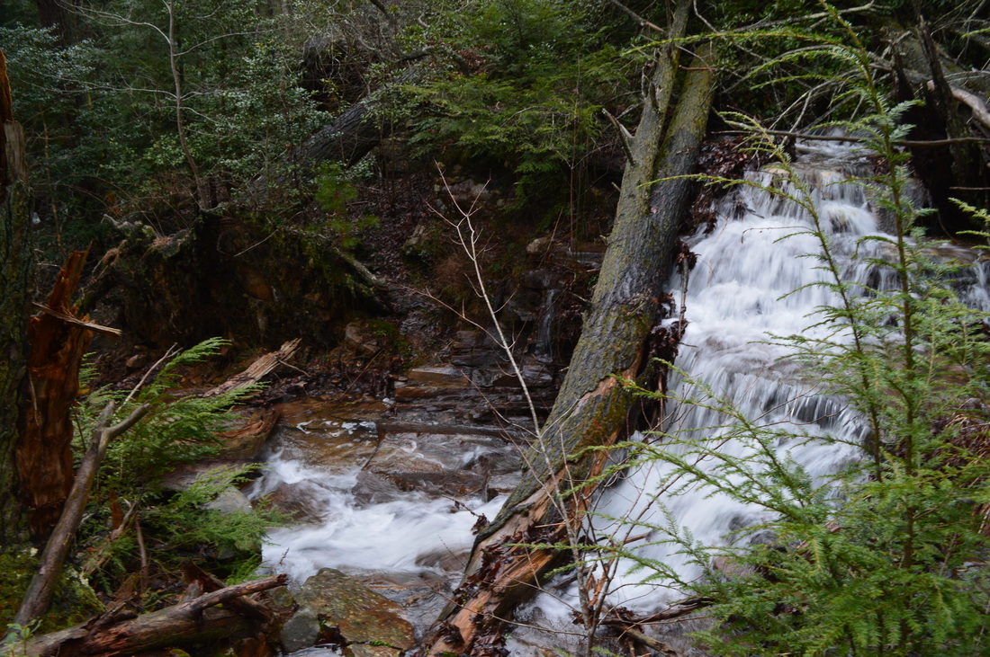
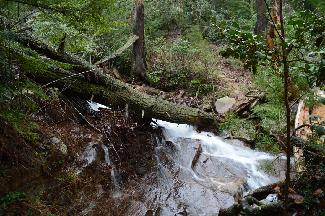
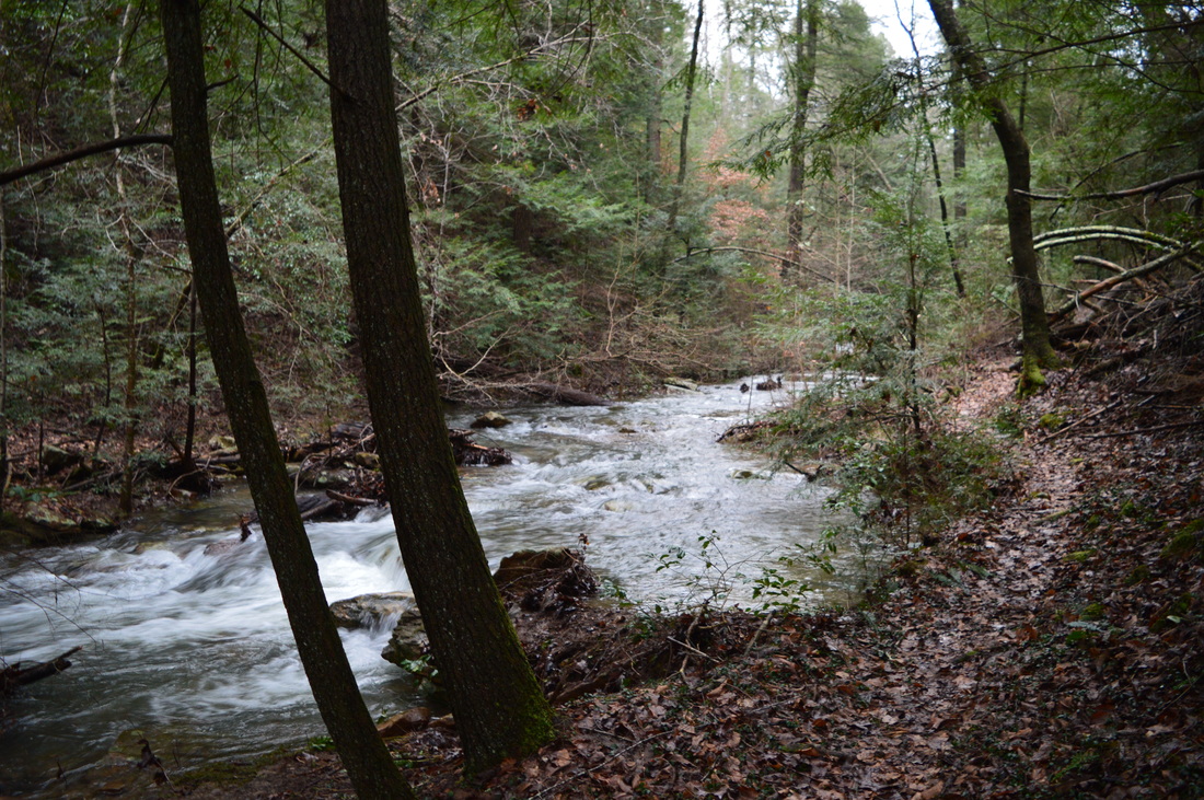
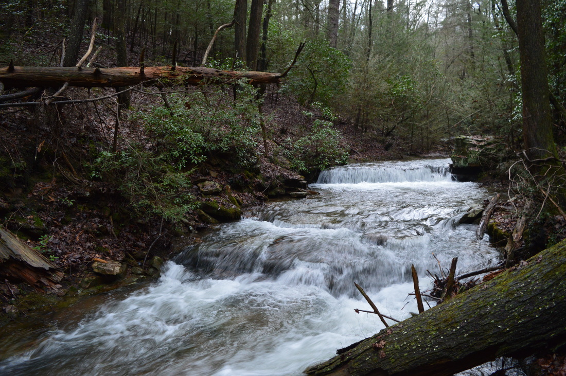
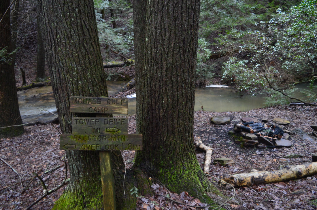
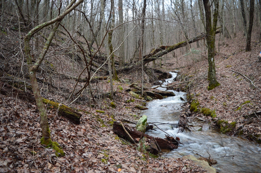
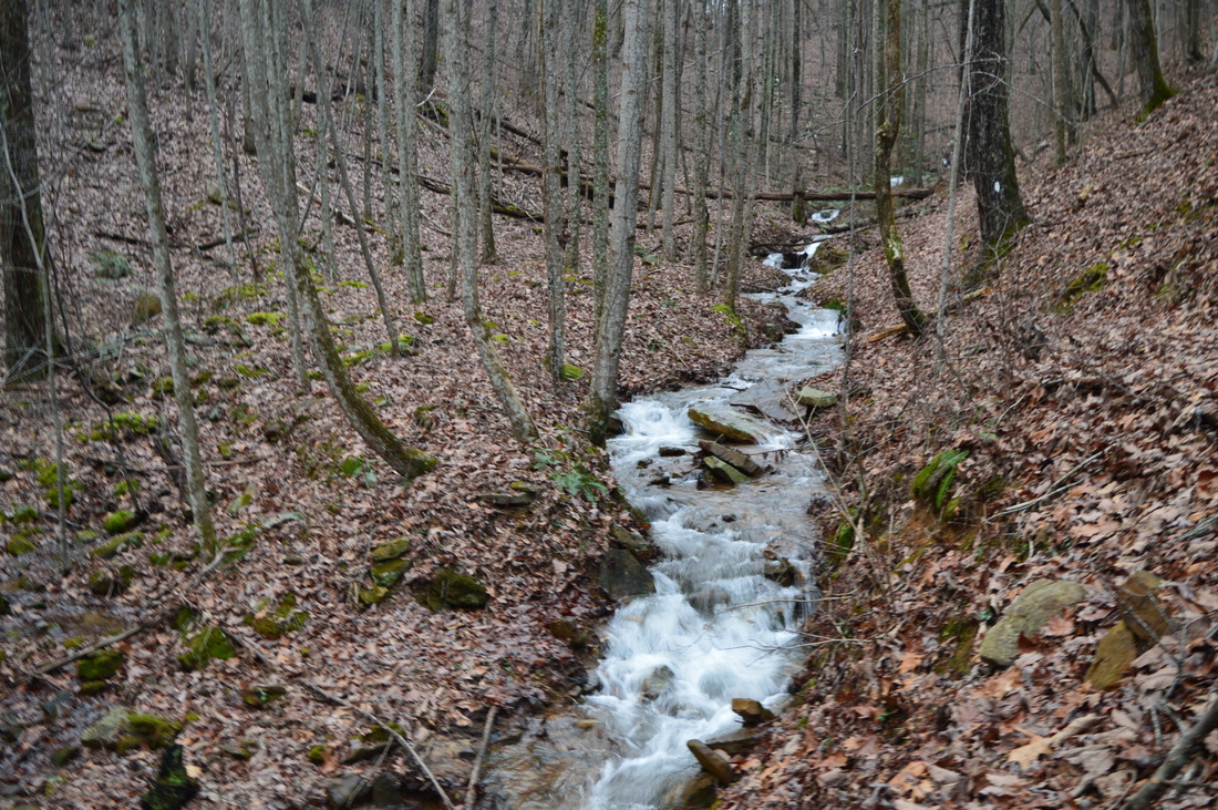
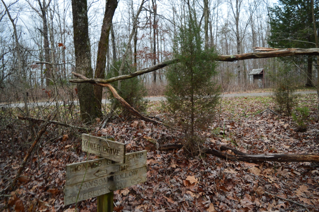
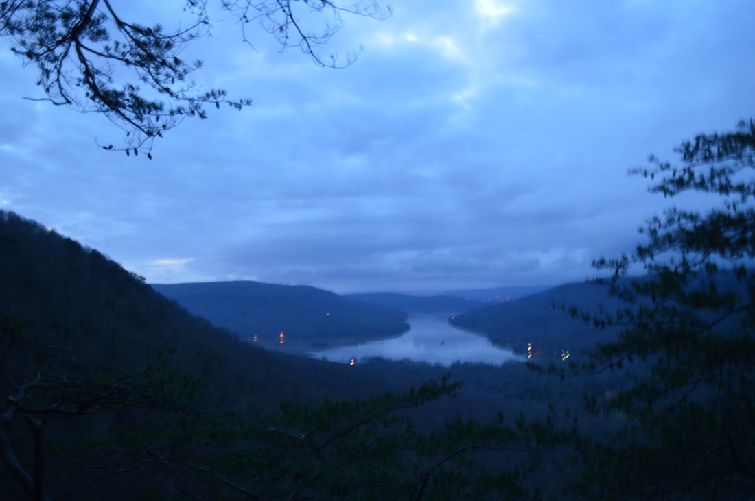
 The Tennessee River is Tennessee's grand river. Near the city of Chattanooga, the river carves a passage through a deep gorge before becoming Nickajack Lake. On this hike atop a finger of the Cumberland Plateau that juts out into the Tennessee River Gorge, you will see several vistas of the river, a bizarre geological formation called the Natural Bridge, and a number of wet-weather waterfalls - they really are invisible, unless you happen to hike the trail in the middle or after a notable flooding event. Expect quite a workout curving throughout countless hollows before arriving at Ransom Hollow Overlook, one of the best vistas on the southern Cumberland Plateau. This hike occurred on Saturday, December 26th, 2015. My plan was to hike the Pot Point Loop clockwise from the Snoopers Rock Trailhead. SummaryR/T Length of Trail: 12.6 Miles Duration of Hike: 7:30 Type of Hike: Loop Difficulty Rating: 7 out of 10 Total Elevation Gain: 2026 Feet Pros: Well-marked trail and several great destinations Cons: Much of the trail is not very interesting with much of the same repeating itself; numerous elevation changes as the trail passes through countless hollows Points of Interest: Snoopers Rock Overlook - 9 stars; Natural Bridge; Raccoon Mountain Overlook - 3 stars (best in winter); Ransom Hollow Overlook - 10 stars Trail Blaze Color(s): Pot Point Loop - White Best Season(s) to Hike: Fall; Winter Fees: None Beginning Point: Snoopers Rock Trailhead Directions: From Chattanooga, TN: Follow US Route 127 North for 1.7 miles. Then, turn left onto TN State Route 27. Follow it for 8 miles, and then, turn left onto Choctaw Trail at a sign for Prentice Cooper State Forest. Shortly bear left, and 0.2 miles from TN 27, turn left onto Game Reserve Road. Follow Game Reserve Road for 6.1 miles. The Snoopers Rock Trailhead parking will be to the left. Much of Game Reserve Road is gravel but it is in excellent shape. MapA map and some other information regarding this hike can be viewed here. DetailsPrentice Cooper State Forest has over twenty miles of hiking trails, and its trail system is one of the best-known destinations on the southern Cumberland Plateau. While the trail system may be a bit overrated, the destinations found throughout the state forest are certainly not to be missed. The trail system consists of two loops, the Mullens Cove Loop and and the Pot Point Loop, as well as the Poplar Springs section of the Cumberland Trail. This hike along the Pot Point Loop may seem a bit dull sometimes, but the vistas it passes are well worth the trek to get there. The day I hiked this loop was after a week of near historical rains across the Tennessee River valley, with many major rivers flooding. Even roads had ponding and in some cases were closed due to being completely flooded (luckily not the road to this trailhead). All streams were swollen, and along the way to the trailhead, normally small Suck Creek was a raging whitewater torrent. Every stream on this hike, big or small, was a creek with many beautiful waterfalls that would normally be dry or mere trickles. The lower part of the section through McNabb Gulf was especially rewarding with several notable cascades and waterfalls that would normally not amount to much. While there was reason to regret I had not done a hike that visited better waterfalls, it was still a good time to hike this loop. There is no big difference as to which direction to hike the Pot Point Loop, although you may want to hike it counter-clockwise to get the two bigger dips into the Hemlock Branch valley and McNabb Gulf first. This trail report describes the loop clockwise. The trail begins near the kiosk at the trailhead. Right away, it became obvious that this hike would be nothing out of the ordinary. A small depression at the beginning of the trail was a pond following all the rain, and the trail was flooded - a detour was needed to be done. Following this "interesting" obstacle, the trail and a small stream became one for a period of time (usually this stream is probably dry this high up). At 0.3 miles, reach an intersection. Here, the Pot Point Loop and Mullens Cove Loop split ways, and the Pot Point Loop turns right while the Mullens Cove Loop continues straight. However, before turning right, continue straight to Snoopers Rock - do not miss this vista. Cross a turnaround at the end of a dirt road and reach Snoopers Rock at 0.4 miles. This is a very good and unique vista of the Tennessee River gorge, positioned in the middle of a bend in the river. Consider using a wide-angle lens to get a good picture of this panorama. Straight across the river lies Elder Mountain, where a rare waterfall could be seen dropping down the side of the mountain on this day. Also, the stream that flowed together with the trail earlier makes quite the drop to the right of Snoopers Rock and sports numerous waterfalls after significant rainfall. From Snoopers Rock, return to the Pot Point Trail junction and turn left. Cross the stream, one of the two branches of Muddy Branch, and rise briefly before crossing the second branch of Muddy Branch at 0.7 miles. The trail ascends with some switchbacks and soon reaches the rim. Throughout the trail, especially during the first half, you will be treated to good winter views of the Tennessee River. There is nothing much to say about the trail here as it travels along the mostly level rim. At 1.85 miles, you will cross a tributary, if flowing, of a stream in Ritchie Hollow. You will soon descend into the head of Ritchie Hollow and bridge the two main branches of the stream in the hollow. These are larger streams and may be flowing most of the year. There are some nice cascades following significant rainfall. At 2.7 miles, cross another tributary. Each stream crossing involves some downhill and uphill, and the hollows just keep coming, so there are few level sections. At 3 miles, the trail makes two switchbacks to a somewhat open area where the winter views of the Tennessee River are slightly better than so far. At 3.35 miles, a spur trail to the left leads a short distance to an overlook of the Tennessee River gorge that is best seen in winter. From this rock outcrop, you can also see the Natural Bridge, a very interesting rock formation just to your right. There is supposed to be a sign for the Natural Bridge, but it was not here when I hiked this trail, so I hope you will not miss it. It's not easy to miss it, as the trail travels right across the bridge. Right before reaching the bridge, go right on a path and get the best perspective of this bizarre geological formation. A scramble route leads down to the base of the bridge. The trail continues across the Natural Bridge and soon descends to cross Blowing Springs Branch at 3.7 miles. All of these streams fall into the Tennessee River not far below you - they never get a chance to grow big, although on this day, nearly all of them were big! At 4.35 and 4.65 miles, cross twin branches in Chestnut Bridge Hollow. Wind in and out of several more hollows with a rollercoaster type of trail before finally crossing Pot Point Road and reaching Pot Point at 5.5 miles. While there are only winter views at Pot Point, this location is important geographically as it is the southeastern end of the finger of the Cumberland Plateau that stretches out into the Tennessee River gorge. Also, Pot Point is the highest point on this hike at 1800 feet. From Pot Point, the trail gradually turns west and resumes the pattern of winding in and out of hollows. At 7 miles, reach the spur trail to Raccoon Mountain Overlook. Turn left onto the spur trail, and reach the overlook at 7.05 miles. This is not a very good vista due to numerous trees blocking the view, but in winter, it is a nice view down the Tennessee River and to Raccoon Mountain on the opposite side. Return to the main trail, turn left, and shortly cross Piney Branch. This crossing was a bit more difficult than the others so far, but during most times, it should be an easy dry crossing. At about 7.8 miles, the trail begins to curve away from the Tennessee River and into the McNabb Gulf. Personally for me, this is my favorite section of the trail, especially when there's water, due to the numerous cascades and waterfalls found on the tributaries of McNabb Creek and McNabb Creek itself. During drier times, however, you may not find much interesting in this section. The first tributary of McNabb Creek is crossed at 7.85 miles. The second tributary is crossed at 8.15 miles. This stream had a long cascade on this day. On the other side of this tributary, the forest is noticeably different, in fact totally different. Suddenly, you enter a moist, dark streamside forest that looks absurd after all the high-and-dry hiking for the first 8 miles. The trail soon approaches McNabb Creek and descends along a bluff via a rock staircase. At the bottom of the staircase, at 8.65 miles, the main trail turns right tracing what possibly may be an old roadbed. However, a goat path leads left to McNabb Creek, where a pretty cascade lies. In times of high water such as on this day, the creek here is full of whitewater and the cascade can prove to be a photogenic location. At 8.7 miles, reach another tributary of McNabb Creek. This is perhaps the most difficult crossing on the hike, although I think that this one too should be a dry crossing most of the time. On this day, it was somewhat a wet crossing. With this crossing comes what I consider one of the best wet-weather water features on this hike, a fairly tall falls cascading down a stair-step rock wall right next to the crossing. A fallen log, used as a handhold for the crossing, adds beauty to this pristine scene. This is a spot to linger at. After this crossing, the trail reaches the bottom of the McNabb Gulf and runs alongside McNabb Creek. This is the lowest point on the hike at about 1400 feet. The trail gradually ascends together with the creek from here. At 8.9 miles, reach McNabb Gulf Campsite, the only campsite right on this hike. At 9.05 miles, cross a pair of small tributaries. Between 9.1 miles and 9.3 miles, the trail cross the now smaller McNabb Creek three times. These crossings should be dry during normal water levels, although the were just barely dry on this day. The cascades continue as the gulf opens up and steepens. After the third crossing at 9.3 miles, the trail leaves the McNabb Gulf and makes numerous switchbacks as it ascends back onto the dry plateau. This is one of two slightly steeper and more prolonged ascents on this hike. At 9.55 miles, reach the top of the ascent and cross Game Reserve Road. You can have a second car placed here, although you would miss the highlight of the hike - Ransom Hollow Overlook. After Game Reserve Road, the trail descends a little bit and at 9.9 miles, crosses a tributary of Mullens Creek in Ransom Hollow. This trail never does descend into Ransom Hollow, however. At 10.35 miles, reach a signed intersection. The spur trail to Ransom Hollow Overlook leads left. Whatever you do, do not miss this spur trail - the overlook is breathtaking and unique. Even if you're very worn out by now, I highly recommend to still take the spur trail, as it is only 0.3 miles roundtrip. At 10.5 miles, reach the end of the sour trail at Ransom Hollow Overlook. The rock outcrop here provides a fantastic view of Ransom Hollow opening up into the Tennessee River gorge. The Tennessee River here is the upper end of Nickajack Lake. Hicks Mountain to the left and Raccoon Mountain straight ahead help to frame the photogenic scene. This is certainly the best vista on this hike, and one of the best vistas I've been to on the southern Cumberland Plateau. From Ransom Hollow Overlook, return to the main trail, and turn left onto it at 10.65 miles. At 11 miles, approach a tributary of Mullens Creek. There is an impressive wet-weather waterfall on this unnamed stream. The trail crosses the stream just above the waterfall in a boulder field. On the other side of the stream, two massive boulders are on the ground, with the trail squeezing in between. At 11.6 miles, the trail drops off the rim and begins descending into the Hemlock Branch valley. At 12 miles, bottom out in the valley. Here, you will reach a junction with the Mullens Cove Loop. Hemlock Branch Campsite and Mullens Cove Overlook are a short distance to the left across the creek. To continue on the Pot Point Loop, which runs in conjunction with Mullens Cove Loop from here to the trailhead, bear right. The trail continues upstream along Hemlock Branch, crossing several tributaries and eventually the stream itself. The ascent steepens as you leave the Hemlock Branch valley. The Pot Point Loop reaches Game Reserve Road and the trailhead at 12.6 miles. This concludes your hike. VariationsAdd the trek to Mullens Cove Overlook to this hike - 13.4 Miles Bonus StopsThe Indian Rockhouse and Stone Door are a 1-mile roundtrip hike from the Mullens Cove Trailhead. PicturesVideos
2 Comments
3/16/2019 12:30:10 pm
Wow this is a great article. The detail in which you describe the trails make me feel that I am right there. I may go there later this week. Did you hike by or near a place on the trails off Mullins Cove road to a place called the Tennessee Wall? I'm not sure if it is very well known. I am currently working on a treasure hunt that may be around this area. Keep up the excellent blogging. My Dad did a lot of deer hunting in this area. I am from Chattanooga and am retired. In doing this treasure hunt I'm finding a lot of places in the area I need to visit and camp. Again thank you for the great article. Leave a Reply. |
About MeMark Oleg Ozboyd Dear readers: I have invested a tremendous amount of time and effort in this website and the Georgia Waterfalls Database the past five years. All of the work that has gone in keeping these websites updated with my latest trip reports has almost been like a full-time job. This has not allowed me to pick up a paid job to save up money for college, and therefore, I I've had to take out loans. If you find the information on this website interesting, helpful, or time-saving, you can say "thanks" and help me out by clicking the button above and making a contribution. I will be very grateful for any amount of support you give, as all of it will apply toward my college tuition. Thank you!

Coming in 2022-2023?
Other Hiking WebsitesMiles HikedYear 1: 540.0 Miles
Year 2: 552.3 Miles Year 3: 518.4 Miles Year 4: 482.4 Miles Year 5: 259.9 Miles Archives
March 2021
Categories
All
|


 RSS Feed