Cumberland Trail: Shut-in Gap Road (East Trailhead) to White Pine Cascades, Spring City, Tennessee4/21/2015 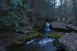
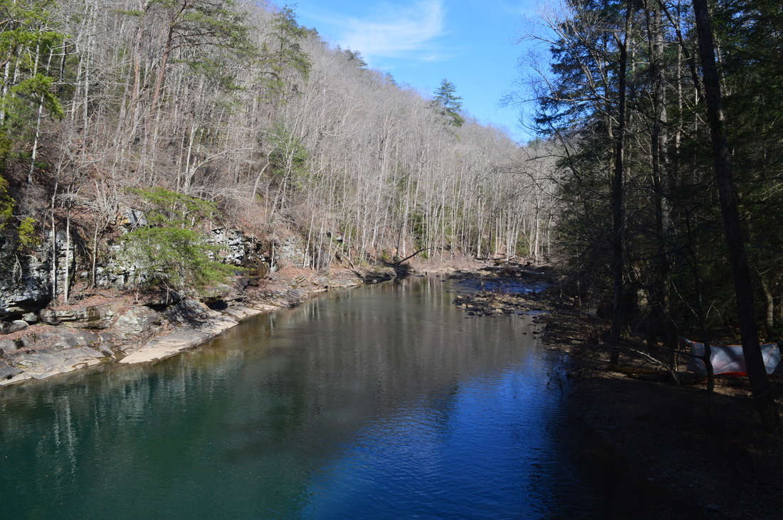
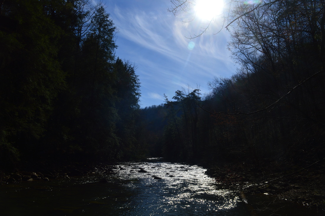
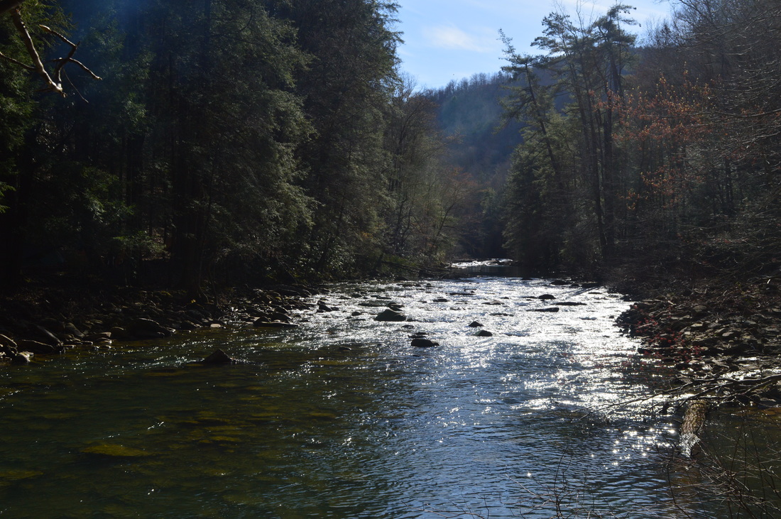
The Piney River is one of the larger waterways that the Cumberland Trail intersects or follows. Amidst its large watershed, the Cumberland Trail visits five cascades and waterfalls, and also provides excellent water views. In addition, visit Twin Rocks Overlook and make a fun rock scramble to reach the views at the top. This hike occurred on Saturday, March 28th, 2015. My plan was to hike the Cumberland Trail from the Piney River/Shut-in Gap Road Trailhead to at least White Pine Cascades with a side trip to Twin Rocks Overlook. Time permitting, I would continue all the way to the western Shut-In Gap Road Trailhead.
R/T Length of Trail: 15 Miles
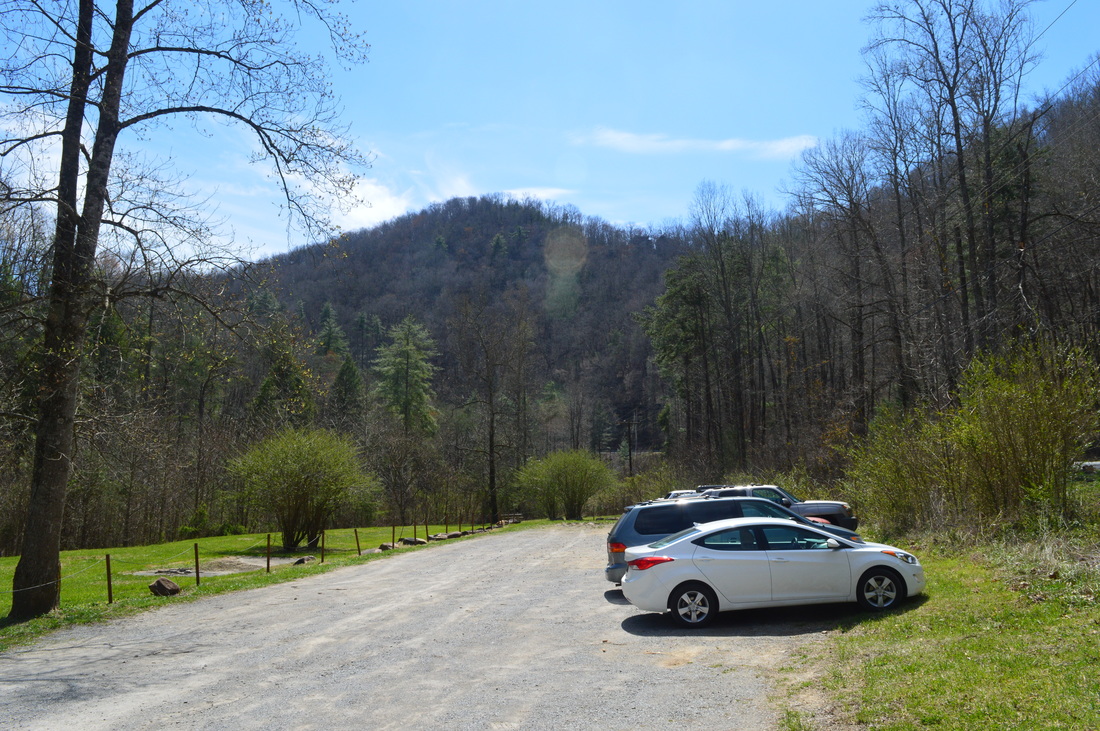
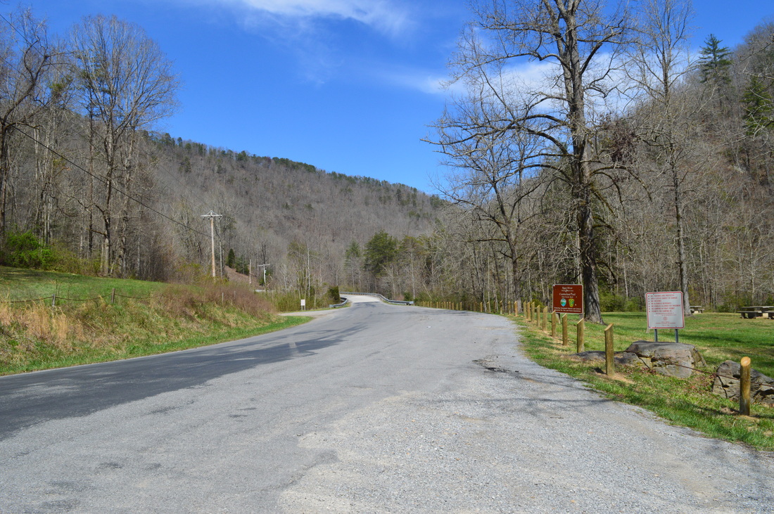
Duration of Hike: 8:15 Type of Hike: Out-and-Back with Side Trails Difficulty Rating: 6 out of 10 Pros: All trails are well-groomed; beautiful river views; many water features Cons: Lower three rungs of ladder to Twin Rocks Overlook are gone, thus a rock scramble is required to get there; small but potentially slick crossing of McDonald Branch Scenic Views: Twin Rocks Overlook - 4 stars Water Features: White Pine Cascades - 8 stars; Deep Pool Cascades - 7 stars; Rockhouse Branch Cascades - 5 stars; Hemlock Falls - 4 stars; Pine Branch Falls - 3 stars Best Season(s) to Hike: Winter Trail Blaze Color(s): Cumberland Trail - White; Spur Trails - Blue or Yellow Beginning Point: East Trailhead on Shut-in Gap Road Directions: From Spring City, TN: Drive west on Piccadilly Avenue for 0.6 miles, and then, turn right onto TN State Route 68. In 0.2 miles, turn left onto Shut-in Gap Road, just before a bridge over the Piney River. Follow Shut-In Gap Road for 1.2 miles until the parking area on the right, by the bank of the river. If you've crossed a bridge over the Piney River, you've gone too far. The trail starts across the road from the parking area.
Every time I hike on the Cumberland Plateau, it's a great hike. But sometimes, there are hikes even more astounding than others. Such is the case with this one - the beauty of Duskin Creek and Piney River is likely to take your breath.
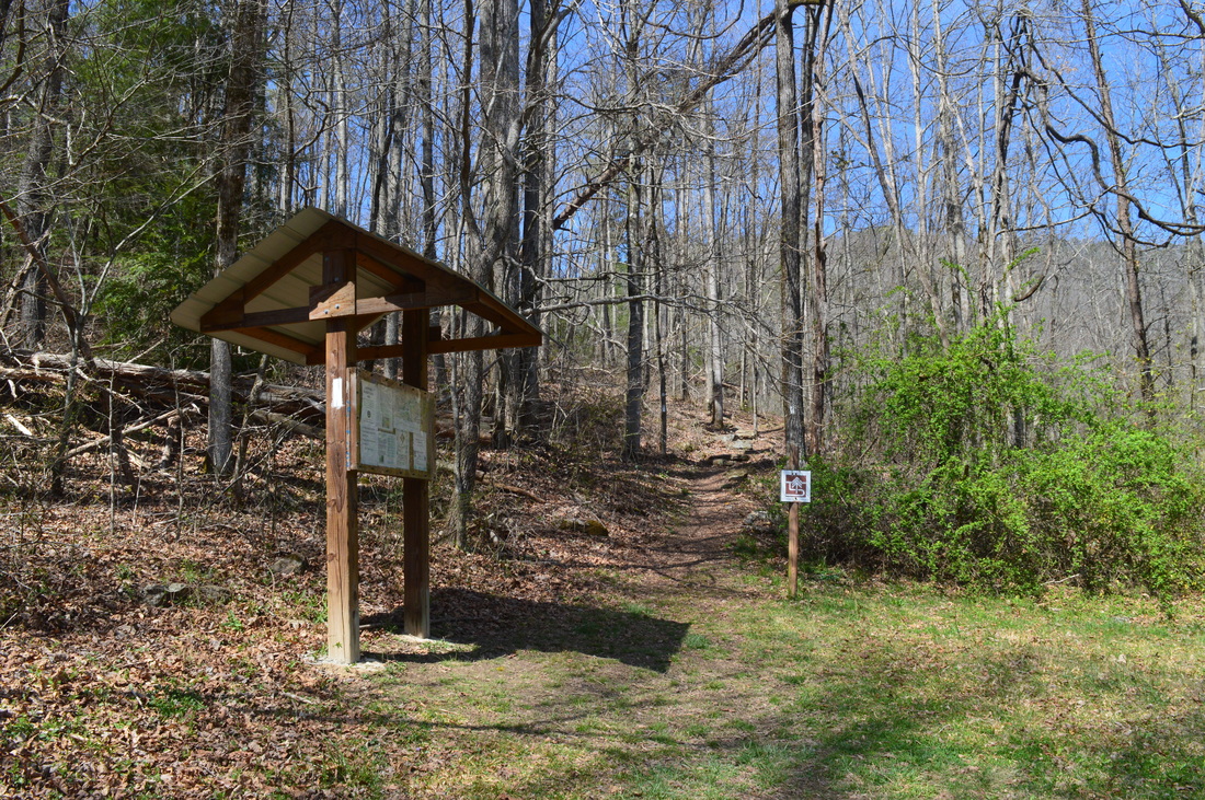
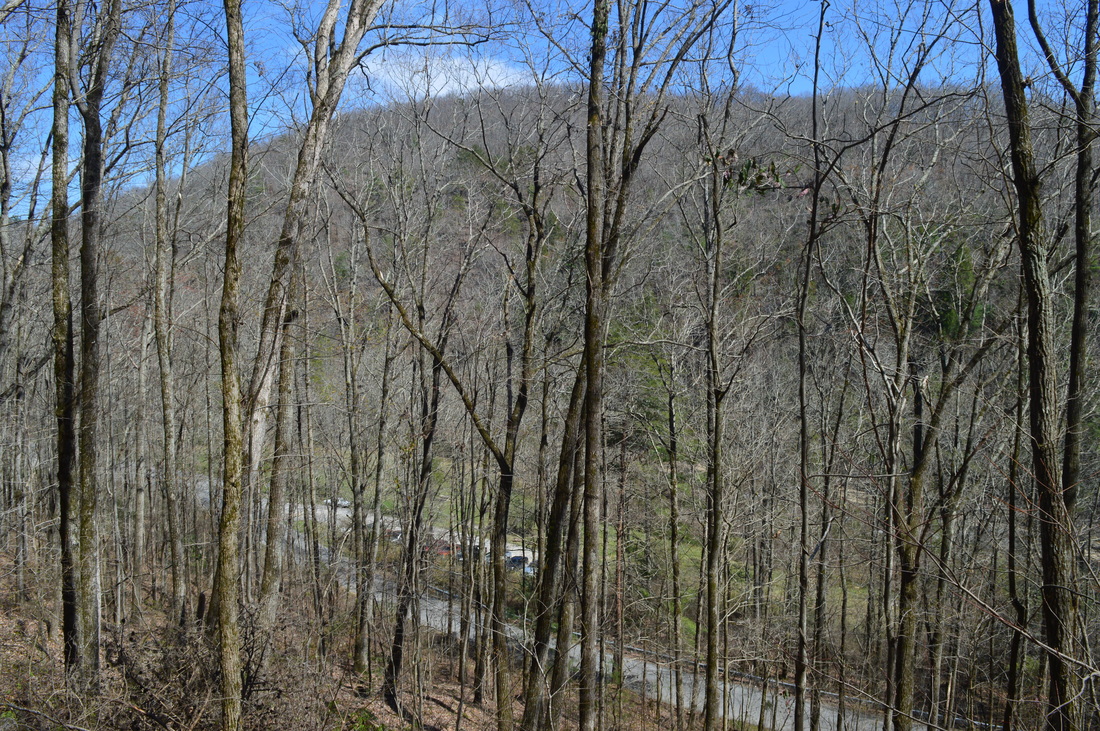
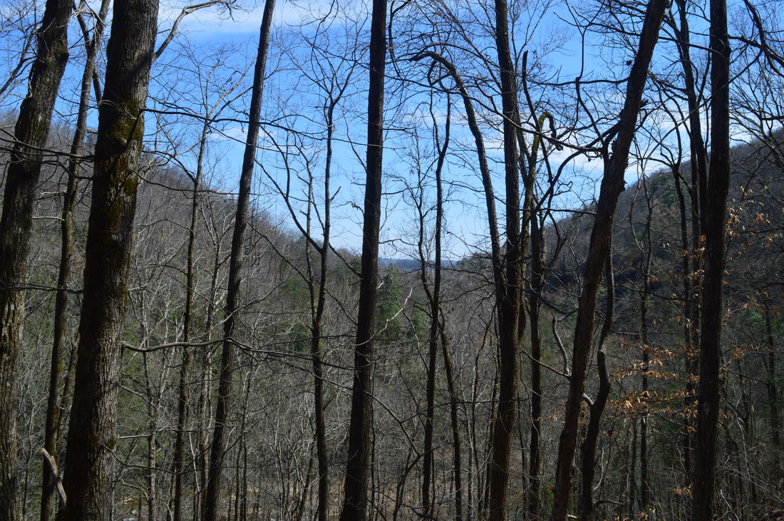
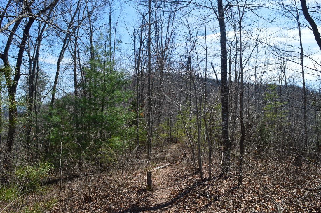
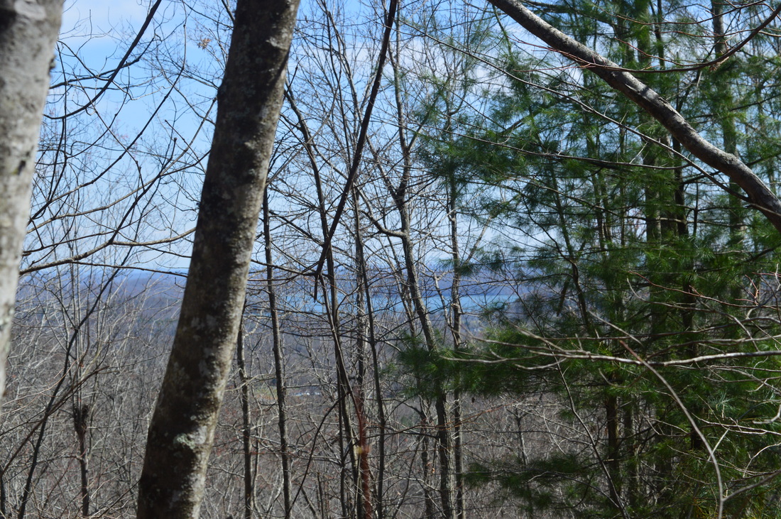
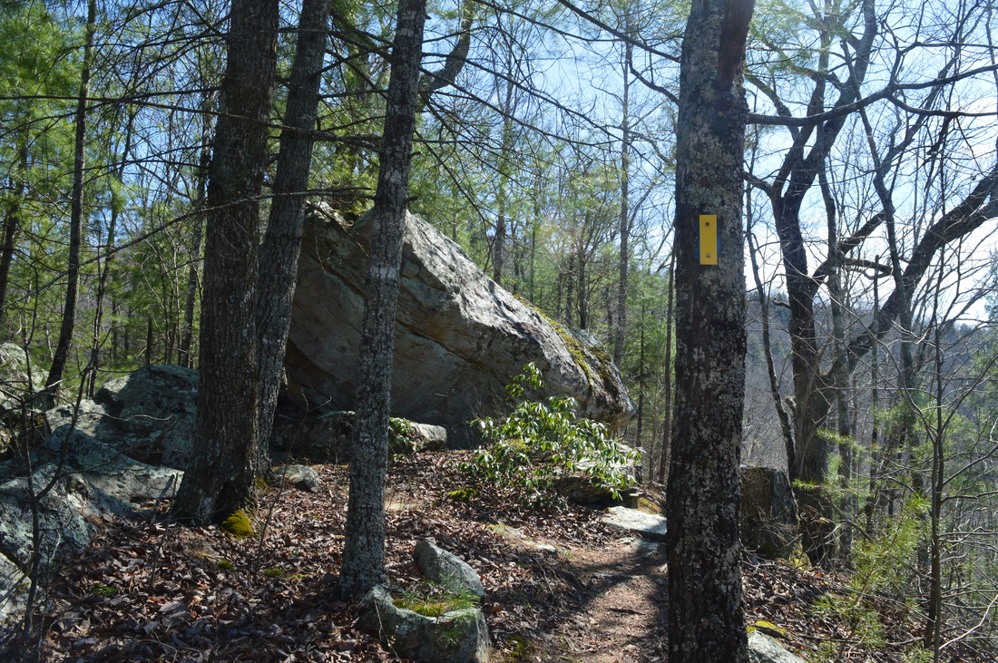
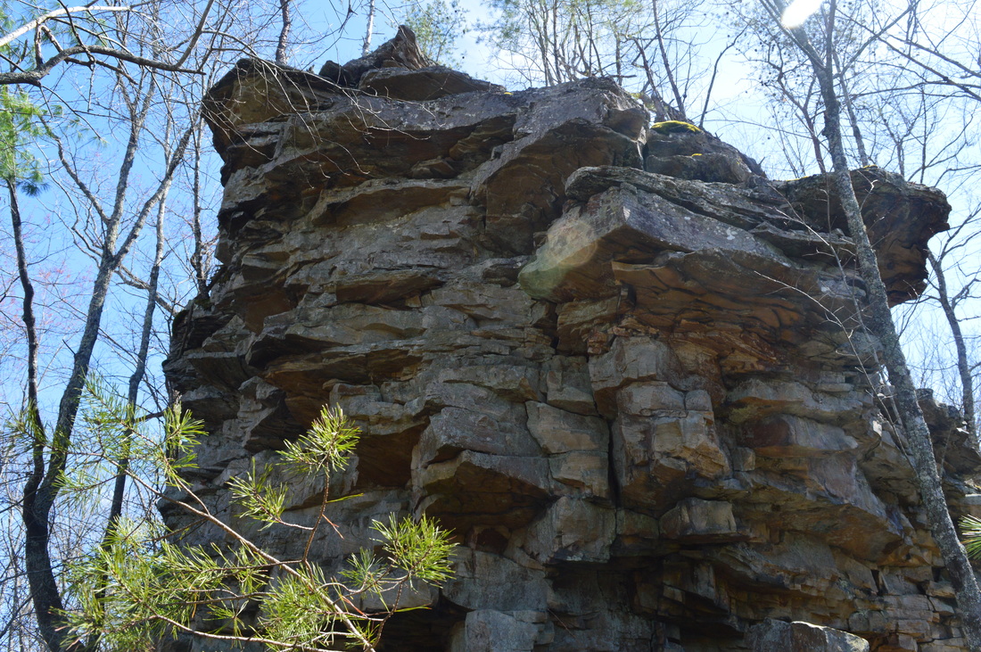
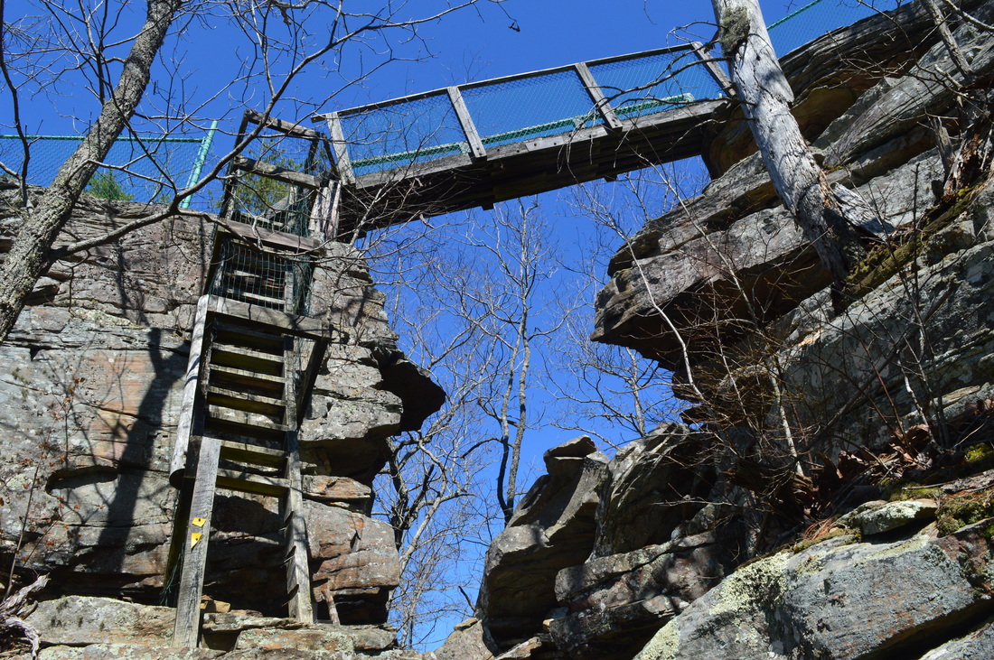
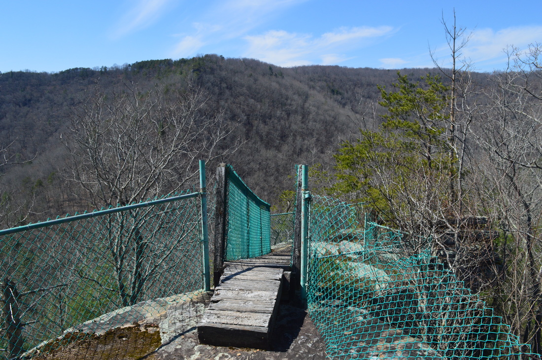
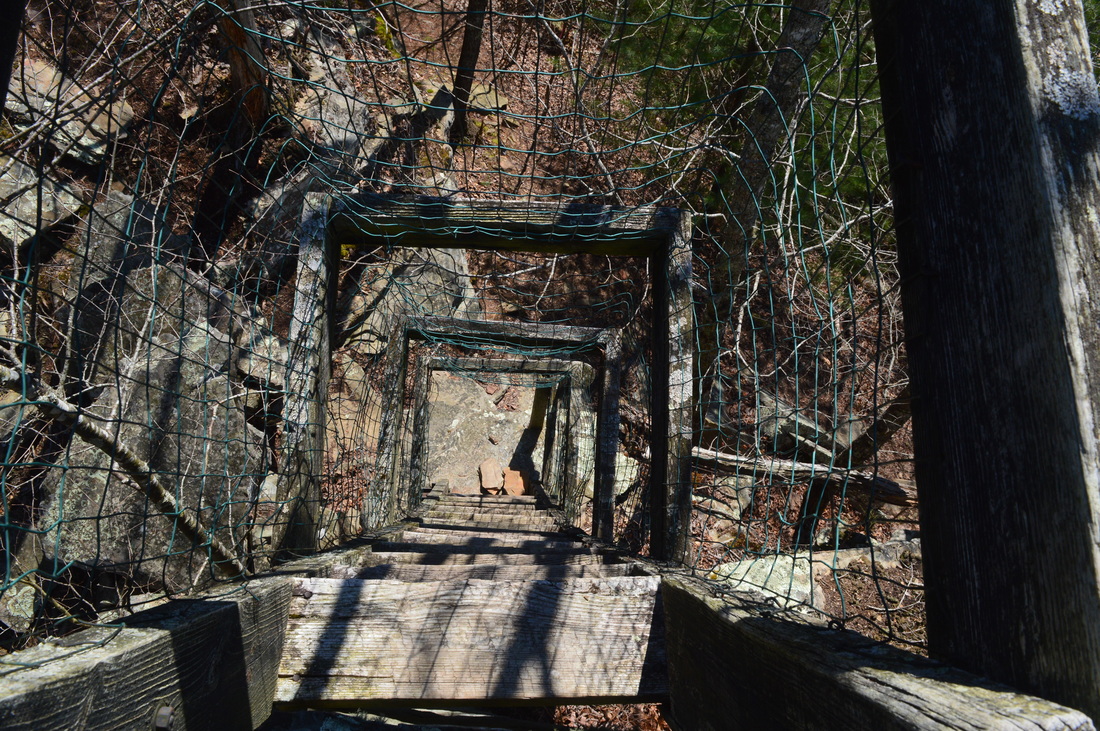
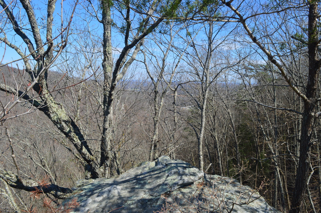
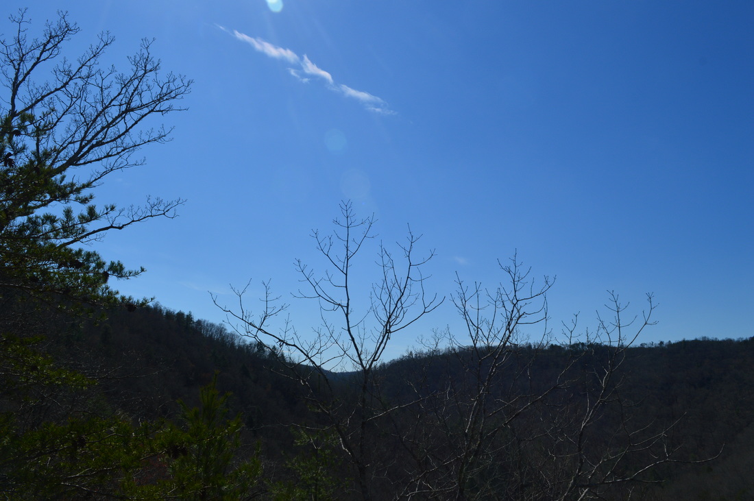
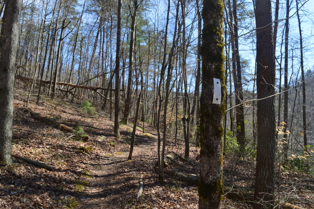
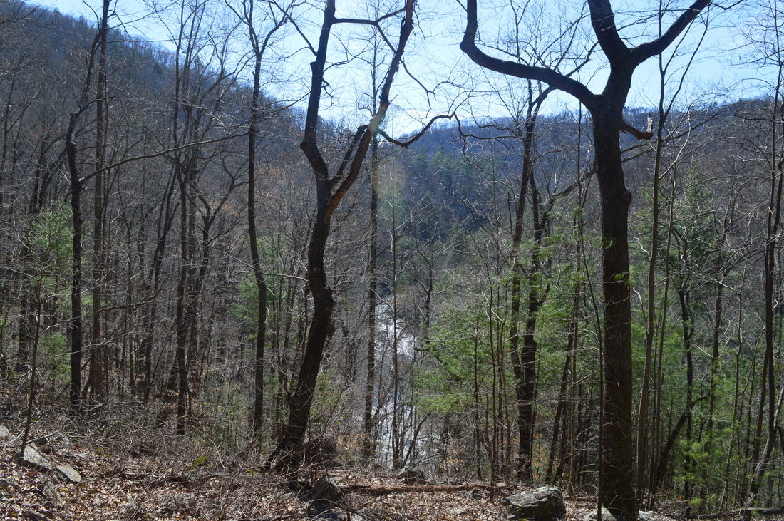
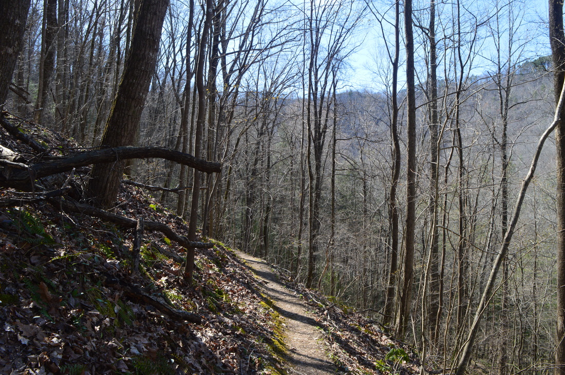
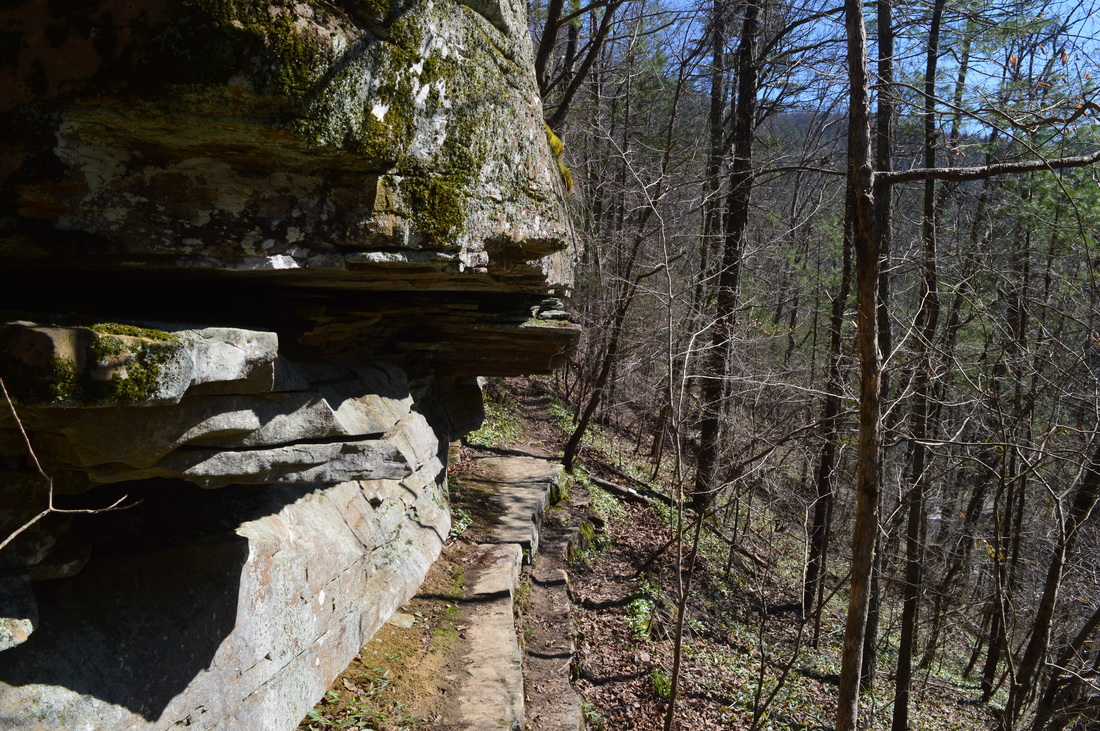
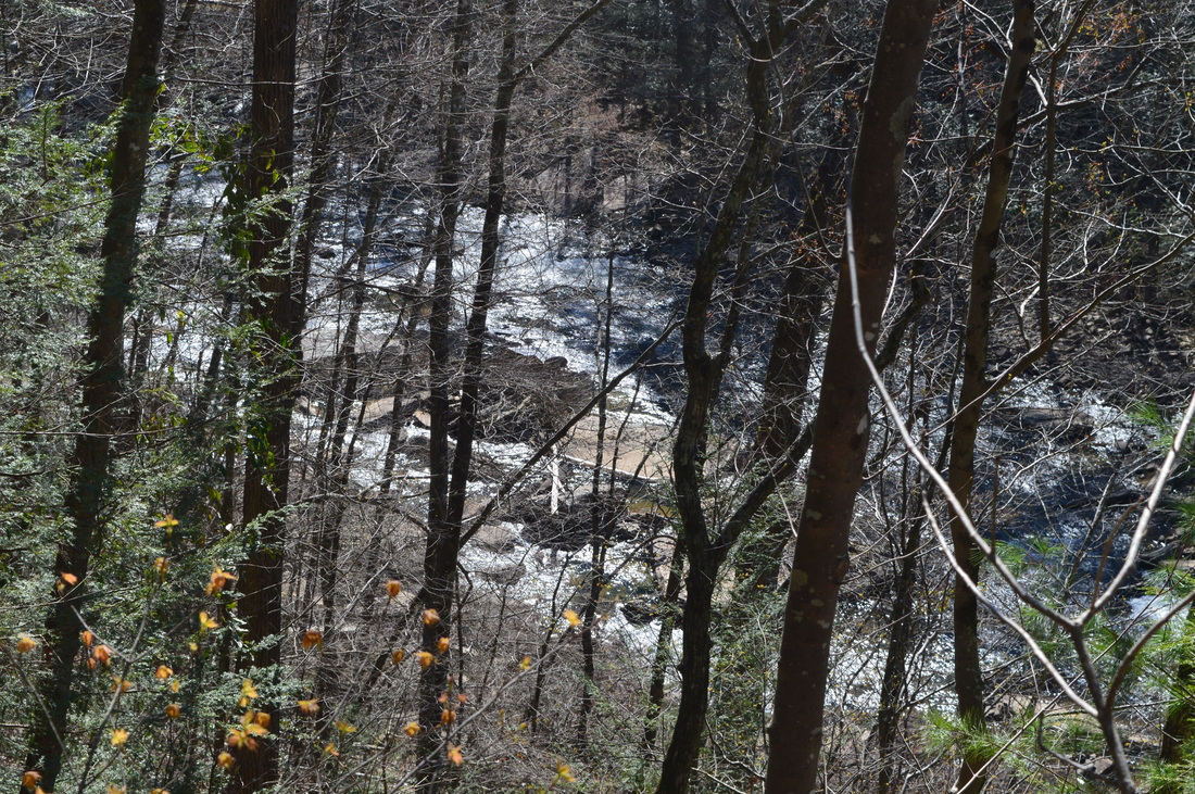
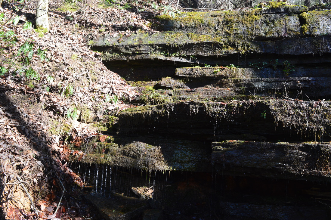
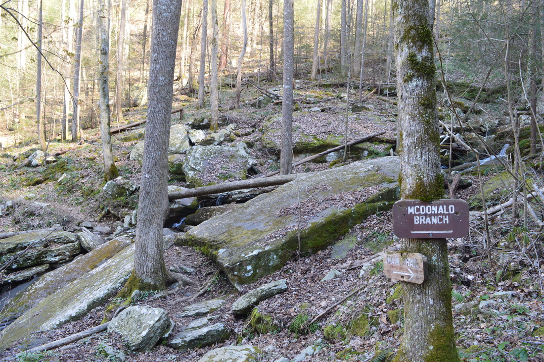
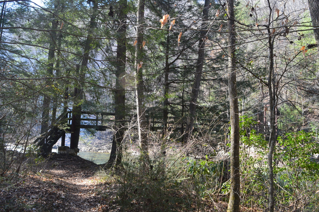
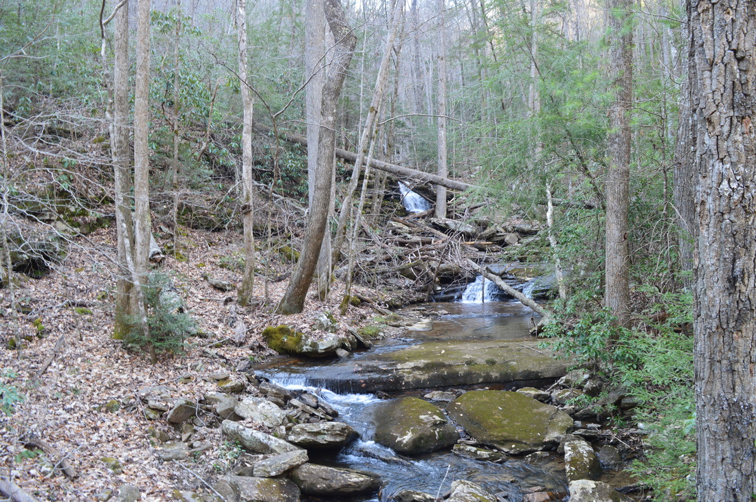
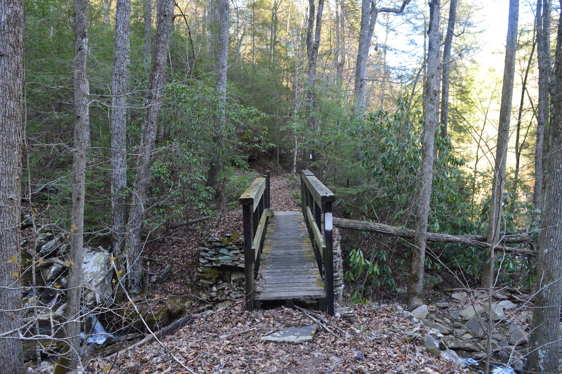
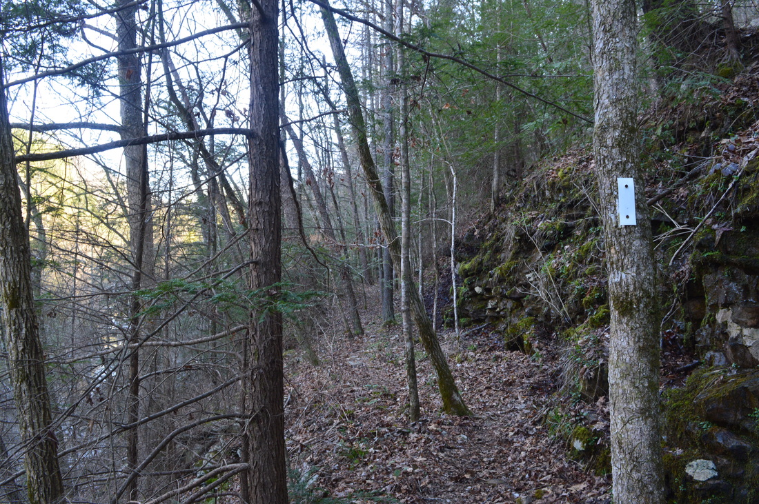
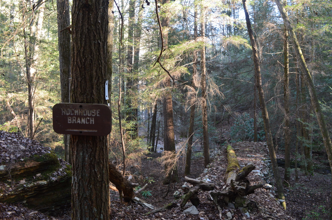
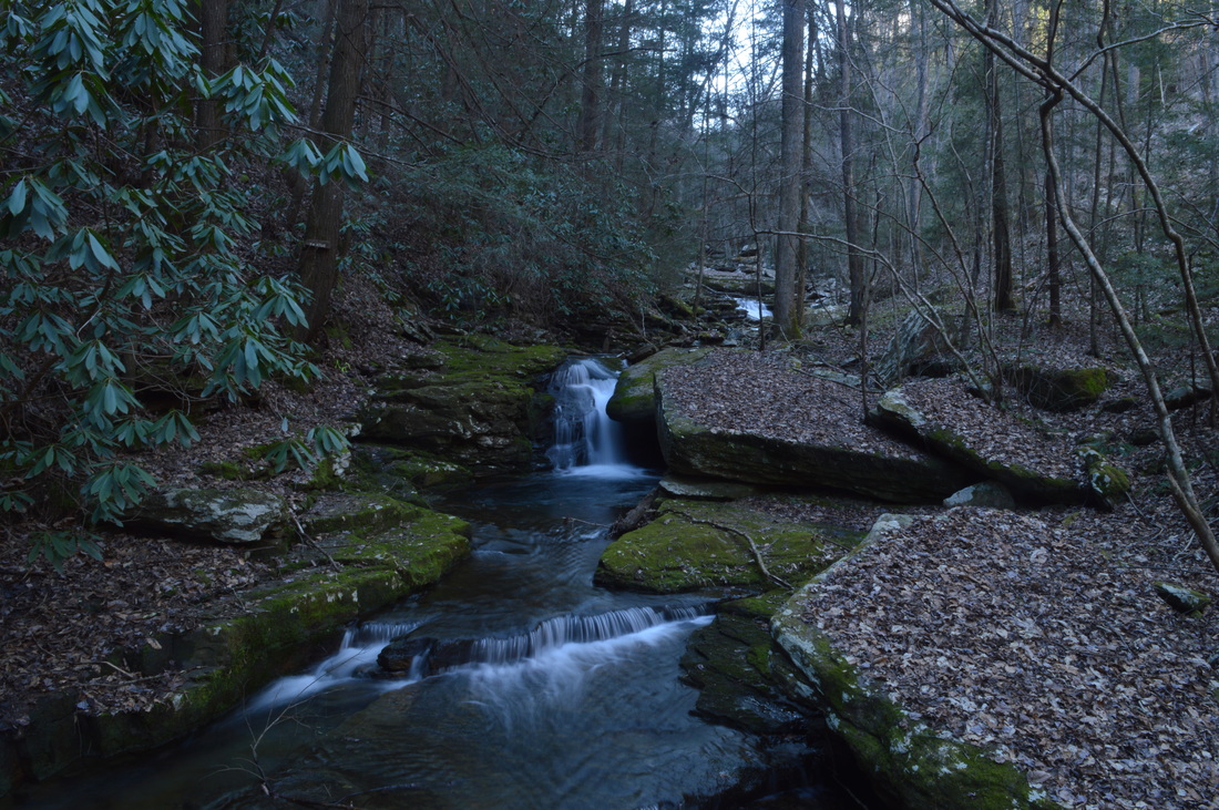
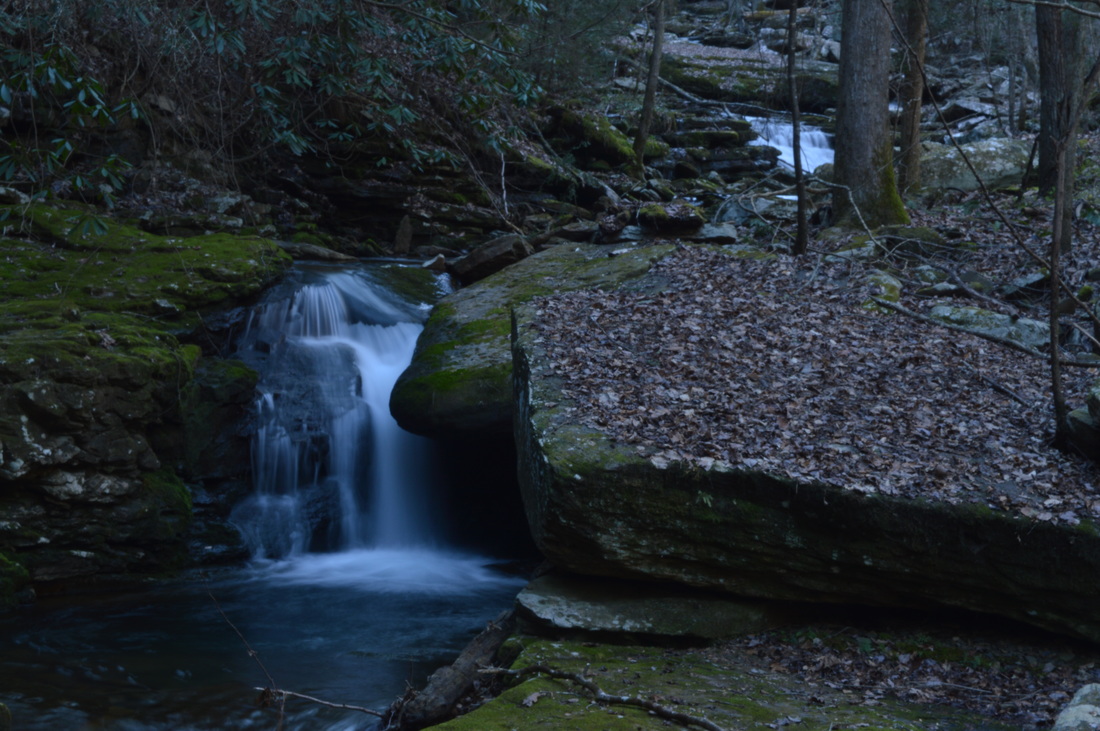
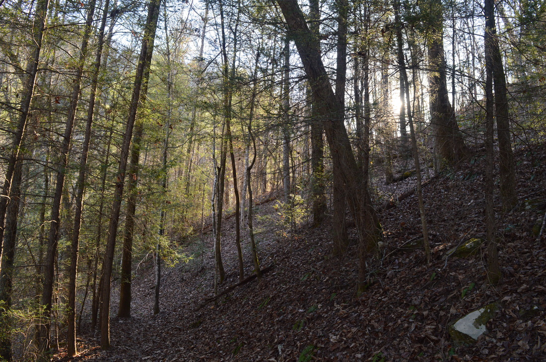
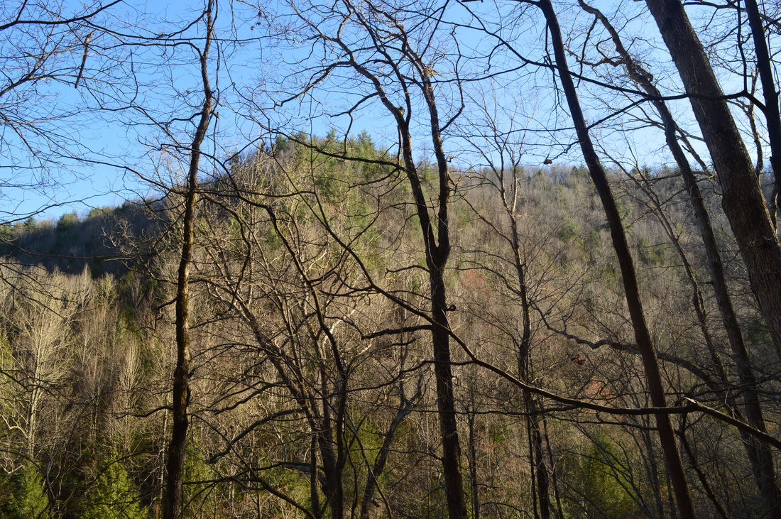
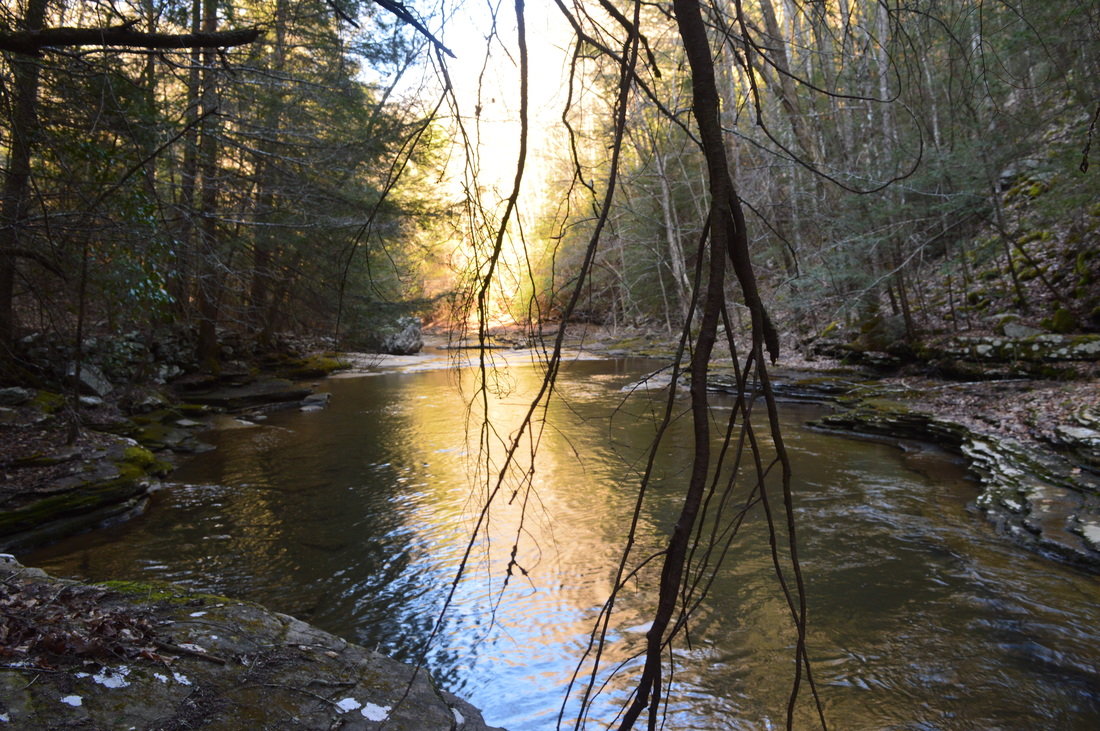
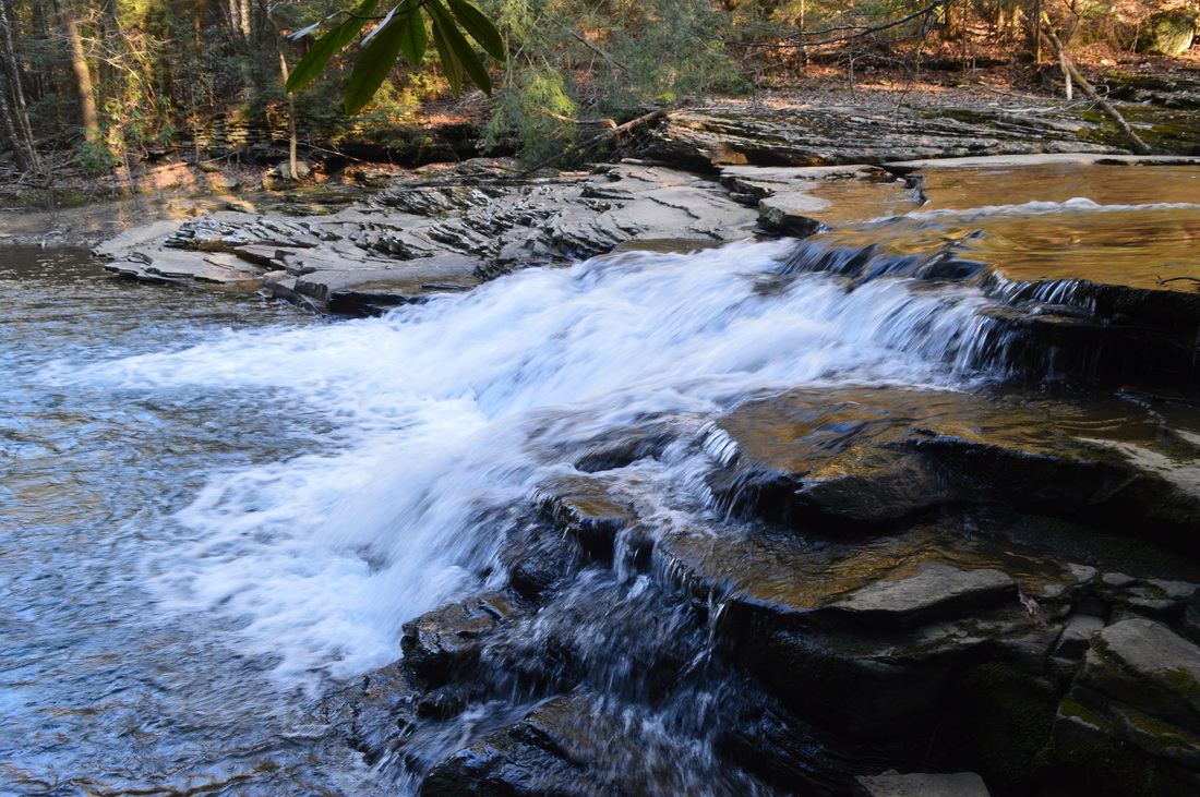
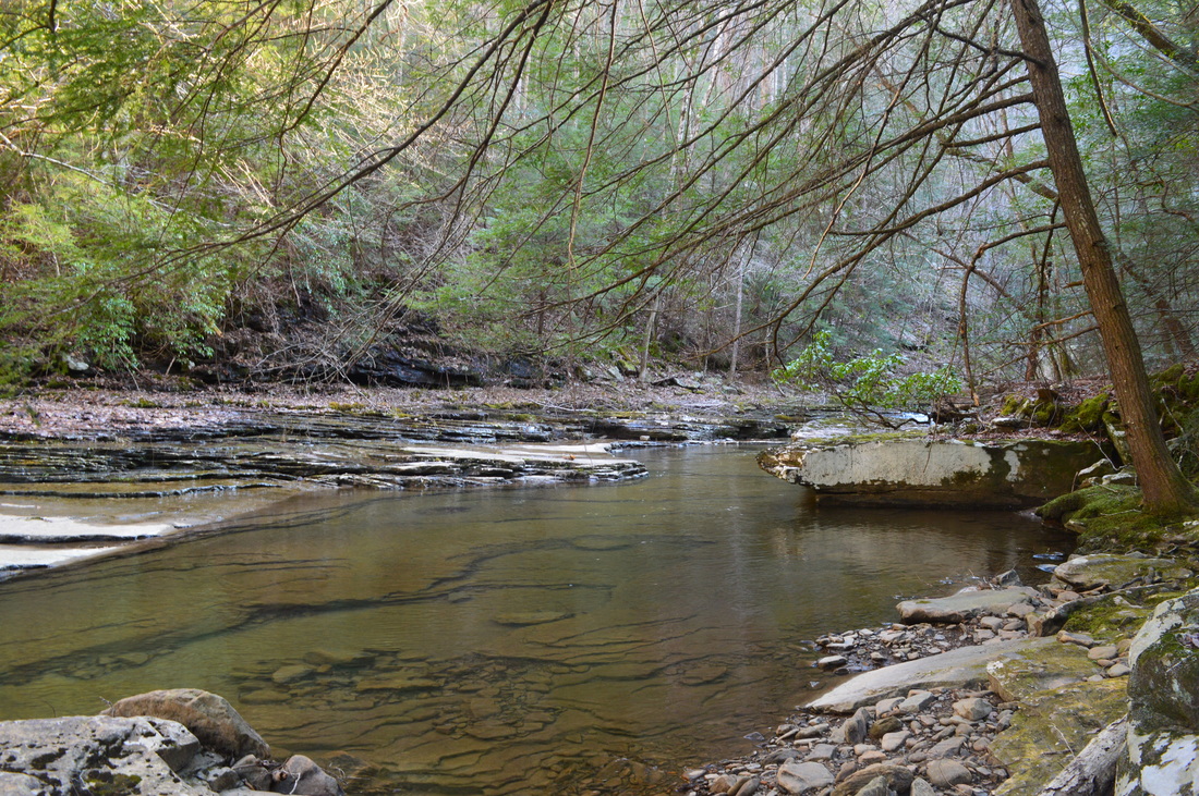
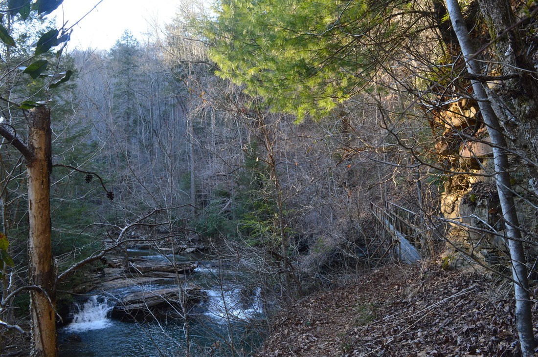
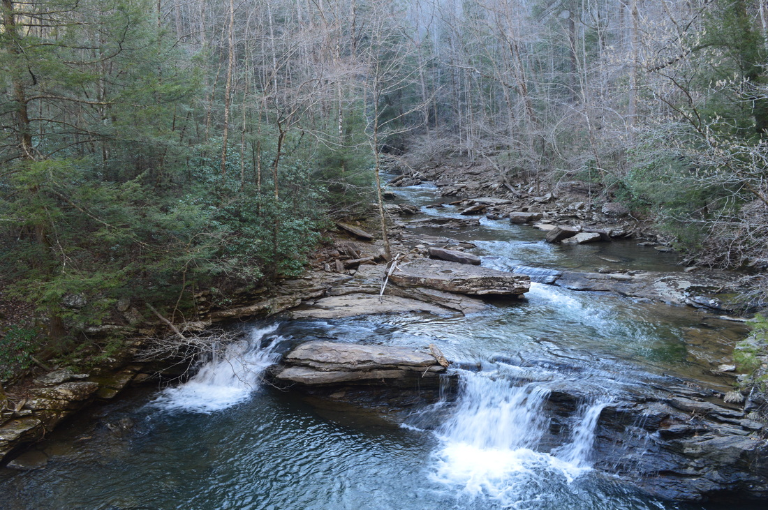
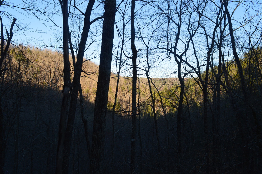
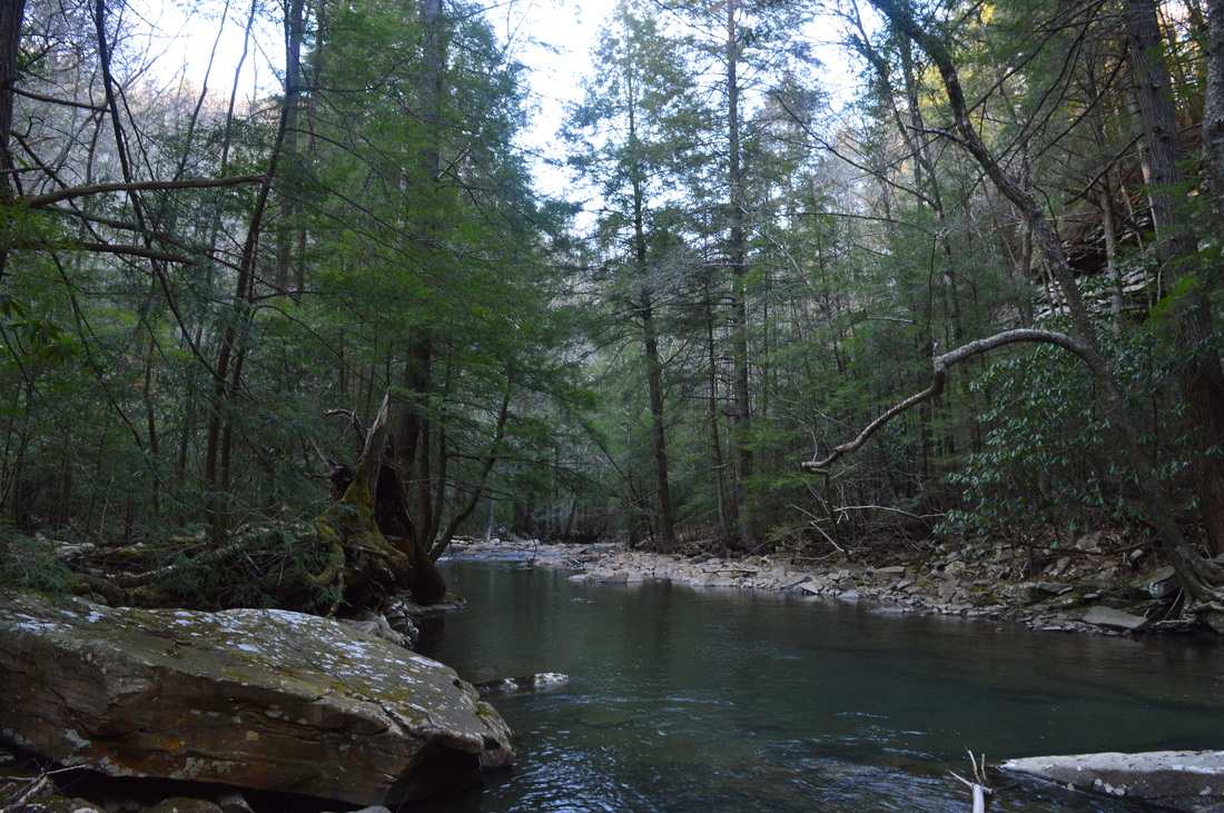
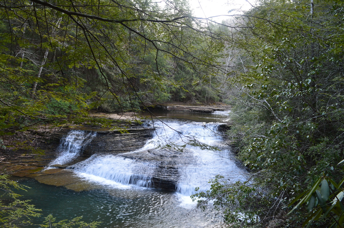
This hike starts at the eastern trailhead for the Piney River section of the Cumberland Trail. There are three trailheads on this section: the Piney River Trailhead, the Duskin Creek Trailhead, and the Newby Branch Trailhead. I was planning to at least hike to White Pine Cascades from the Piney River Trailhead, although I was hoping there would be enough time for me to hike the entire section of the trail.Before you start your hike, make sure to check out the Piney River, which flows right by the parking area. Meanwhile, the trail starts directly across the parking area. Ascend some steps past a trailhead kiosk, and reach the Twin Rocks Overlook Spur Trail at 0.1 miles. Turn left here. The main Cumberland Trail continues straight. begin a gentle ascent onto the ridge that juts into the bend of the Piney River. As you ascend, watch how Shut-In Gap Road and the parking gradually get farther and farther away. There will be a couple of switchbacks as the trail gradually ascends. At 0.7 miles, reach a trail junction. Continue straight, if you still wish to see Twin Rocks Overlook. Afterwards, you will backtrack to this spot, and take the trail that heads right - it is a shorter way back to the Cumberland Trail. Meanwhile, the trail that continues straight shortly pops out on the ridge with good winter views. After passing a small hill, descend slightly into a saddle before making the final ascent up some steps to Twin Rocks Overlook at 1.1 miles. When you reach the huge rock wall that has the overlook, you will see a ladder on the left leading to the top. It appears that the lower three rungs of the ladder are gone, for some reason unknown to me, and it took me a while to figure out how to get to the top in any other way. The best way to do so is to scale the rock outcroppings straight ahead, and pull yourself up them. It's not that long or hard, but I'd recommend to leave your pack below, as it would make things easier. Once you're at the top, pull yourself over the fence on the back side of the overlook. The overlook has a nice view directly across the Piney River gorge, as well as winter views to the east towards Watts Bar Lake, and to the west into the depth of the Piney River gorge. There are two separate rock slabs at the overlook, with a footbridge connecting the two. Once you've seen the overlook, retrace your steps back to the previous trail junction, reaching it at 1.5 miles. Take a left. This path is narrower and has more blowdowns than the rest of the trails encountered on this hike. Descend via switchbacks to reach the Cumberland Trail at 1.8 miles. Turn left for now. When you will be finishing this hike, you will not turn here, but you will instead continue straight (which would be a right turn right now). Once you turn left, you will find yourself on a very well-groomed path - and that will be the case for most of the hike. The trail will ascend very gently, as it stays about 250 feet above the Piney River. There are great river views of the large waterway, especially in winter, when the leaves are down. The next couple miles are generally the same, as the trail stays above the river and there are good views of it, although with time, the trail does slowly get closer to it. At 3.3 miles, reach McDonald Branch. This is the only unbridged crossing on the entire hike, and it's still a small one. However, it still has slick rocks, so take care when crossing. After the crossing, the trail passes through several rocky areas, and then, makes two switchbacks to descend down to the Piney River. At the first switchback, at 4.1 miles, is the point where the Cumberland Trail's Upper Piney River section will be constructed to eventually connect with the Laurel-Snow segment. The next section of trail to Newby Branch Trailhead will then become a spur trail. For now, it is still the main trail. At 4.4 miles, pass through a large camping area in a flat and cross the Piney River on a suspension bridge. Great views of the river abound. On the other side of the suspension bridge, the trail turns left and continues to closely follow the river upstream. At 4.5 miles, cross a small stream and scramble up and through a landslide area. It must have been quite a landslide, as there were big rocks lying everywhere! At 4.8 miles, reach Pine Branch and a footbridge over it. A short spur trail leads right to the low-flow Pine Branch Falls. Following Pine Branch, the trail closely follows some cliffs, with the river close below. At 5.5 miles, the trail reaches Rockhouse Branch. Straight ahead lies a long, old rock wall. This old wall is a remnant from the days, when a railroad was here. Meanwhile, the trail turns right, following Rockhouse Branch upstream. Pass a few cascades, and reach the Rockhouse Branch footbridge. From the footbridge, there is a good view of a set of small scenic cascades, which I will refer to as Rockhouse Branch cascades. Even though they are small, they are pretty, especially the middle drop, where water falls behind a large boulder. Beyond the footbridge, watch for a campsite to the left, known as Rockhouse Branch Campsite or Logging Camp Campsite. Shortly pass a spur trail to the Piney River Picnic Area, which leads to the same campsite. Then, the trail joins an old railroad bed and bears right, leaving the Piney River. The trail now follows Duskin Creek, although the change is hardly noticeable, as the size of the creek is not much smaller. At 5.8 miles, the trail gradually gains some elevation, running below a ridge and crossing several spur ridges. the Duskin Creek Gorge can be clearly outlined upstream. In this section, there are good views across the creek to the opposite side of the gorge. At 6 miles, the trail descends a set of rock steps, and a spur trail leaves left for Hemlock Falls, while the main trail turns right. Turn left onto the 0.2-mile long spur trail. Pass several cascades in Duskin Creek and a small campsite, before reaching Hemlock Falls, which is actually a wide and somewhat powerful cascade in Duskin Creek. While it says "end of trail" here, scramble down to the right to the bank, and then proceed down the side of Hemlock Falls to get a good side view of it. This may not be an option after periods of rain. If you feel like getting your feet wet, you could proceed into the cold stream to get a better front view of the small falls. Retrace your steps to the main trail, reaching it at 6.4 miles. Continue following it upstream along Duskin Creek. At 6.6 miles, reach a footbridge over a large rock hollow located right by the stream. It is an impressive rock formation. Just upstream, you can see several impressive sets of cascades, known as Deep Pool Cascades. Right after the footbridge, a short side path goes steeply to the left to the base of the upper cascades. The short scramble is worth the view of the creek. Following Deep Pool Cascades, the trail closely follows Duskin Creek, and after passing through a campsite, ascends steeply up rock steps,and then more gently, gaining a ridge. Make two switchbacks before reaching a spur ridge and the high point of the short climb at 7.2 miles. The trail never quite reaches the main ridge and rim of the gorge. At this spur ridge, there is also a junction with a spur trail to Spider Den Bluff. This 0.3-mile long spur trail steeply descends down to Duskin Creek to a pretty area along the creek with large cliffs and boulders. There are also several campsites there. The side trail is worth the effort, so take it. It steeply descends down at first, but then becomes slightly more gentle, following several switchbacks. Do not take the shortcuts. Reach the bottom and enjoy the scene. Then, climb backup to the main trail, reaching it at 7.8 miles. Before continuing on the main trail, look back - there are good winter views of the Duskin Creek Gorge making its way downstream to the Piney River. There is also a somewhat limited upstream view. Continue following the trail up the gorge. The trail stays well above the creek, and seems like it will continue to stay there for a while, but it is a deceiving feeling. Soon descend sets of stone steps - a large cascade in Duskin Creek can be seen on the left, although there is no obvious spur trail leading to it. Soon reach the creek. Follow the easy trail upstream along the creek, before reaching a large cascade in Duskin Creek at 5.3 miles, and a short side trail leading to it. The sign is actually located a little past the cascades, but this spot is White Pine Cascades, and ended up being my turnaround point for this hike. These cascades might be one of the most beautiful small waterfalls I've seen, as the water fans out across a diagonal rock face. In summer, this falls may be a mere trickle, so make sure to go when it flows! Beyond White Pine Cascades, it is approximately 1.5 miles to Walden Mountain Road and Duskin Creek Trailhead, and approximately 2.6 miles to Newby Branch Trailhead. If you choose to continue further, your total hike distance will be 20.2 miles roundtrip. It was getting late in the day, and I decided to not continue further. This is already a very good hike. From here, simply retrace your steps back to the parking area. Do you remember the point where Twin Rocks Overlook Trail leaves the main trail? Continue following the main trail here. The main trail will hug the steep gorge, and will traverse some rocky terrain, before ending at the trailhead. Also, the Flat Rock Loop will leave and then rejoin the main trail on the left. This 0.4-mile trail is worth the side trip for a view of the Piney River. Tip: if you do not feel like hiking 15 miles (and it is a big distance for many hikers), there is another option for this hike. Have two cars, one at Newby Branch Trailhead and the other at Piney River Trailhead, and do it as a shuttle hike for a total of 10.9 miles, including all spur trails. The hike is probably best hiked from top to down, from east to west, although the elevation change on this hike is minimal enough that the direction is not too much of an issue. To summarize, this is one of the best hikes on the Cumberland Plateau. You get to see a series of pretty cascades on Duskin Creek and other Piney River tributaries, and in addition, you top it off with a nice view. Add in the river views that last for most of the hike, and this makes me rate this hike a Best Hike.
0 Comments
Leave a Reply. |
About MeMark Oleg Ozboyd Dear readers: I have invested a tremendous amount of time and effort in this website and the Georgia Waterfalls Database the past five years. All of the work that has gone in keeping these websites updated with my latest trip reports has almost been like a full-time job. This has not allowed me to pick up a paid job to save up money for college, and therefore, I I've had to take out loans. If you find the information on this website interesting, helpful, or time-saving, you can say "thanks" and help me out by clicking the button above and making a contribution. I will be very grateful for any amount of support you give, as all of it will apply toward my college tuition. Thank you!

Coming in 2022-2023?
Other Hiking WebsitesMiles HikedYear 1: 540.0 Miles
Year 2: 552.3 Miles Year 3: 518.4 Miles Year 4: 482.4 Miles Year 5: 259.9 Miles Archives
March 2021
Categories
All
|


 RSS Feed