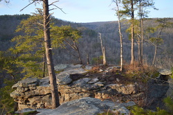
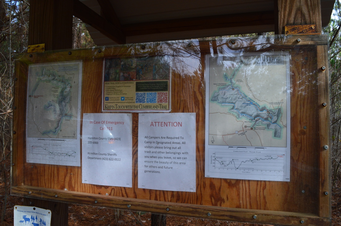
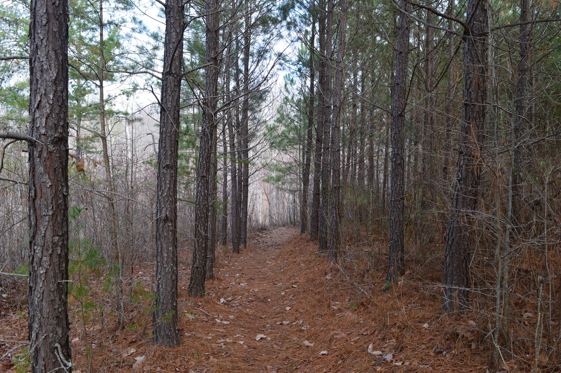
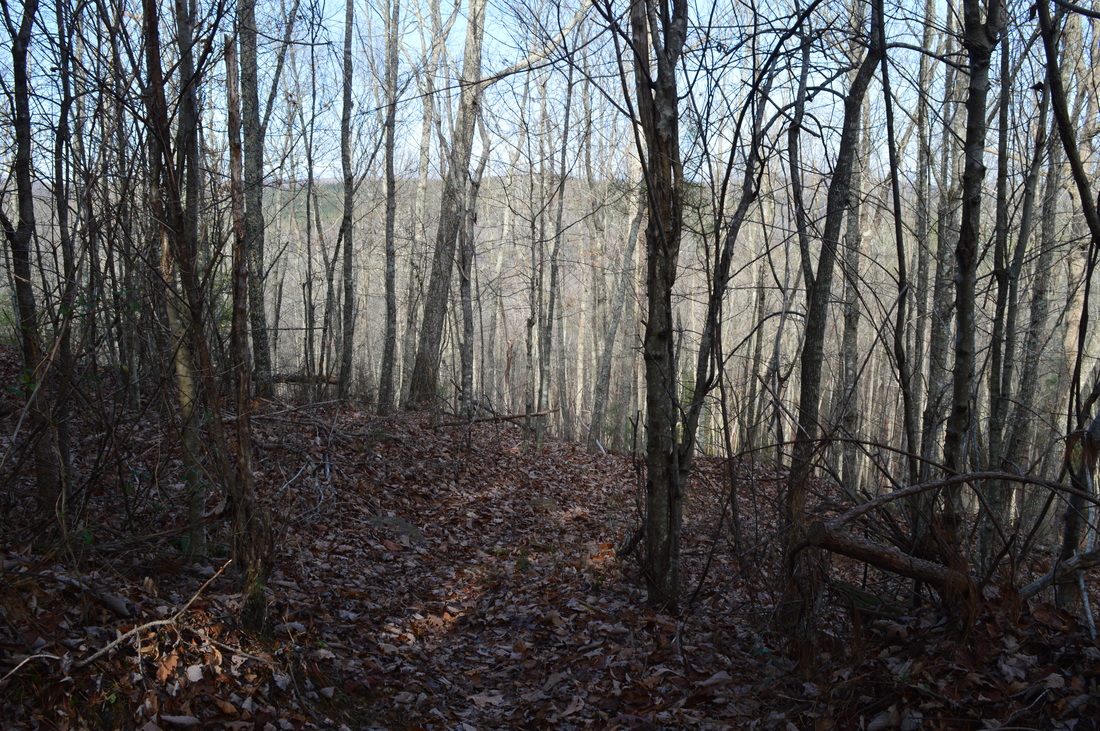
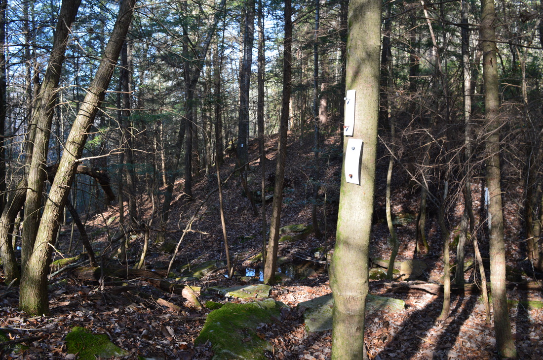
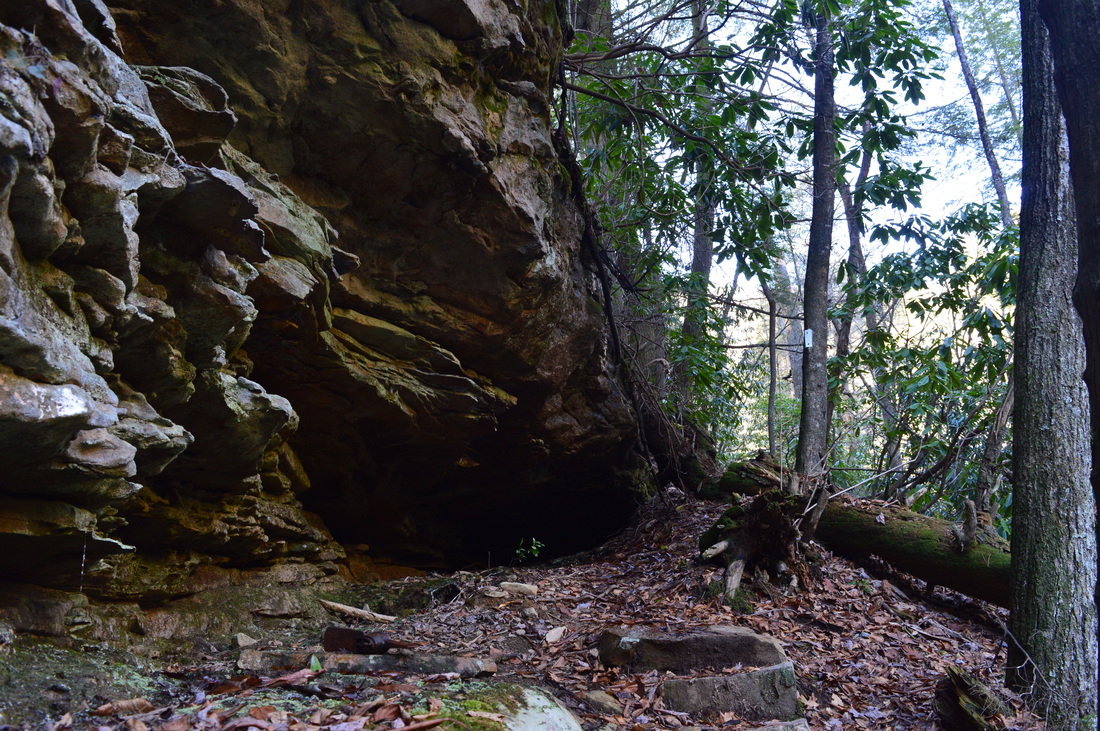
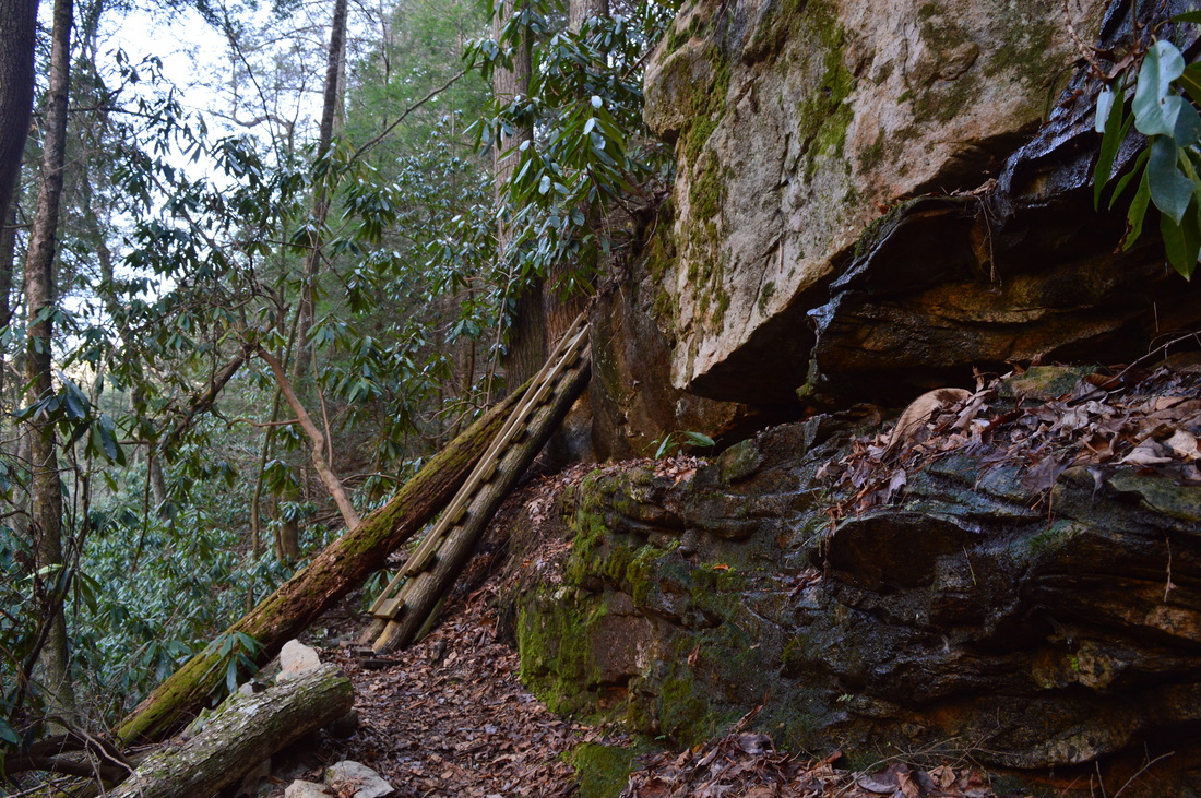
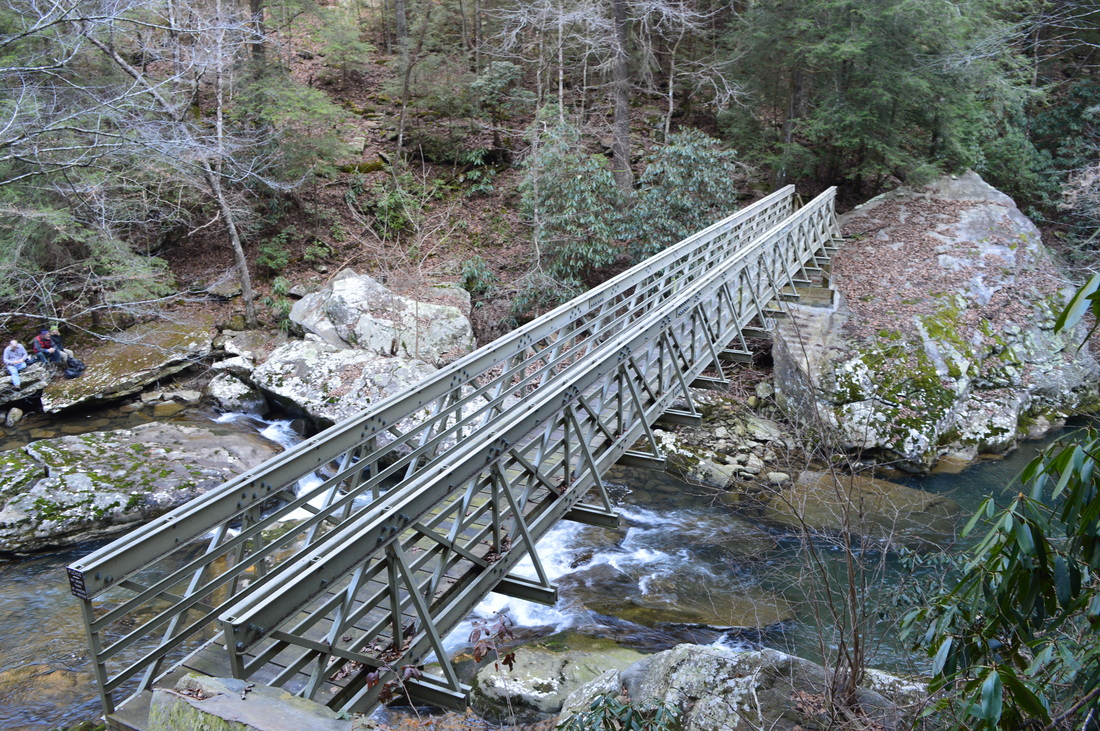
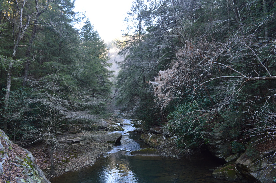
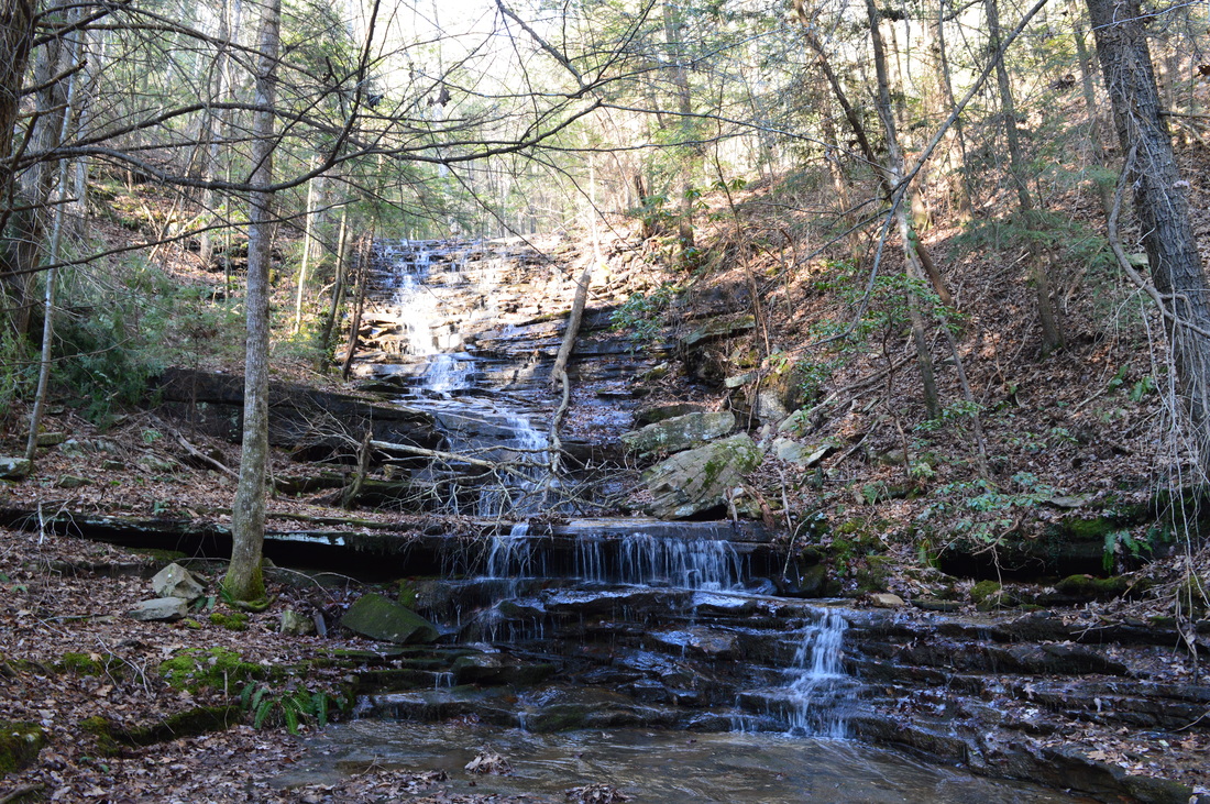
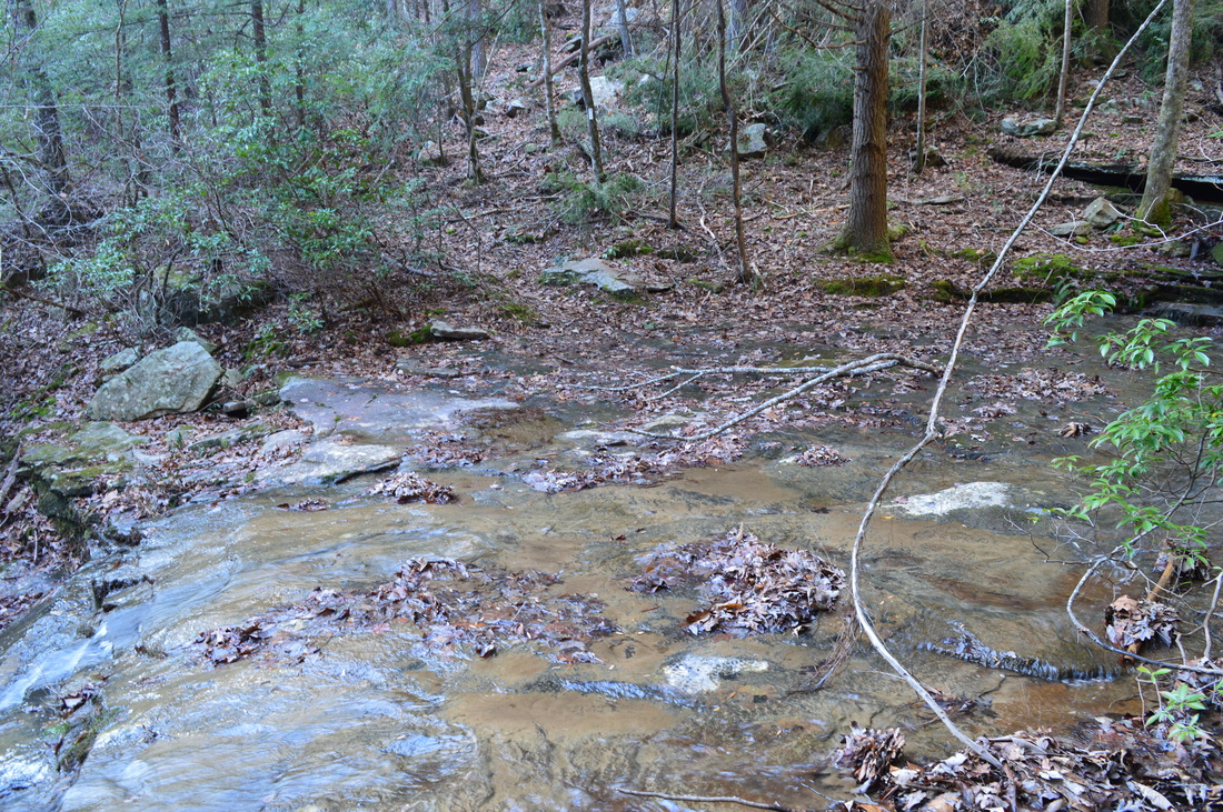
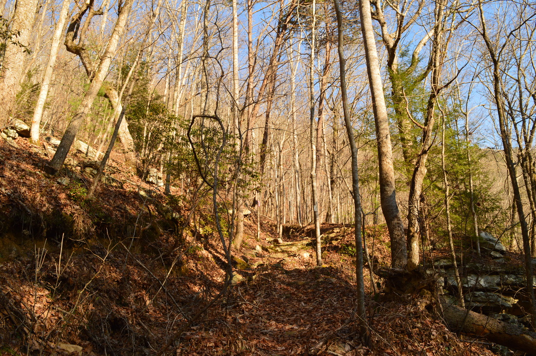
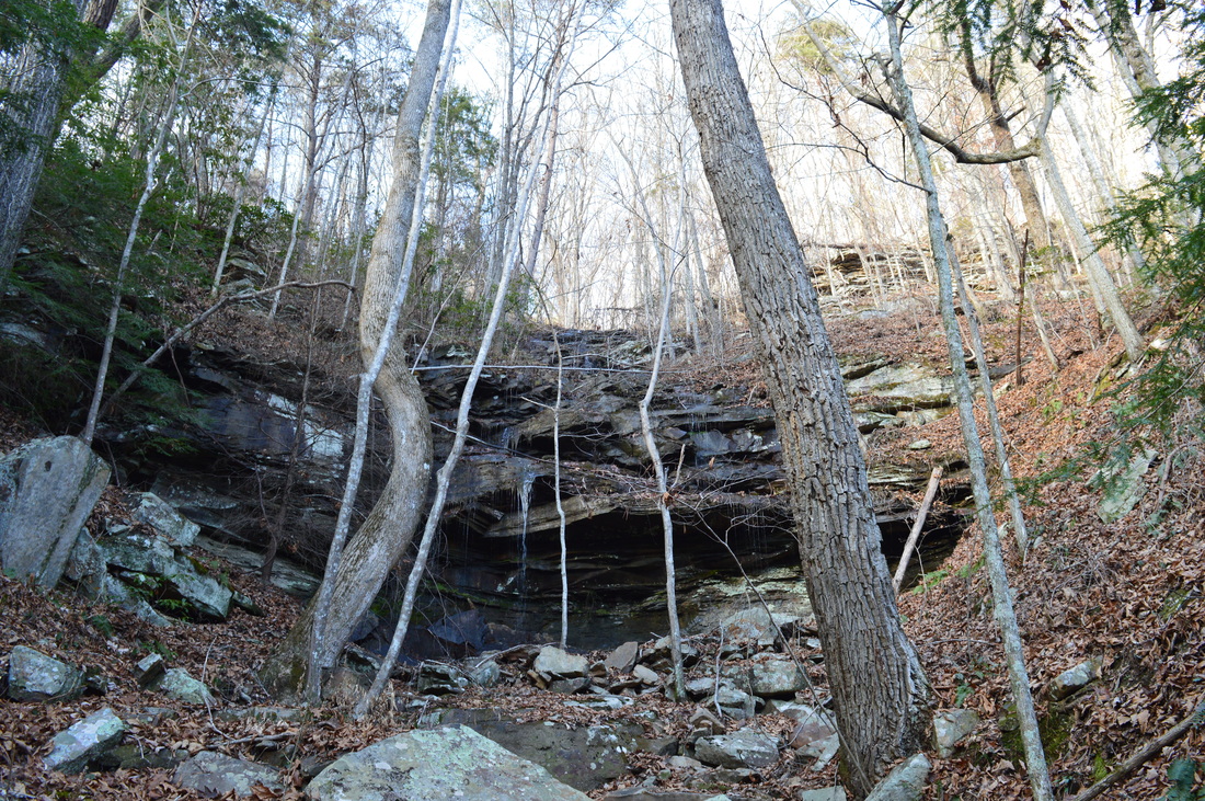
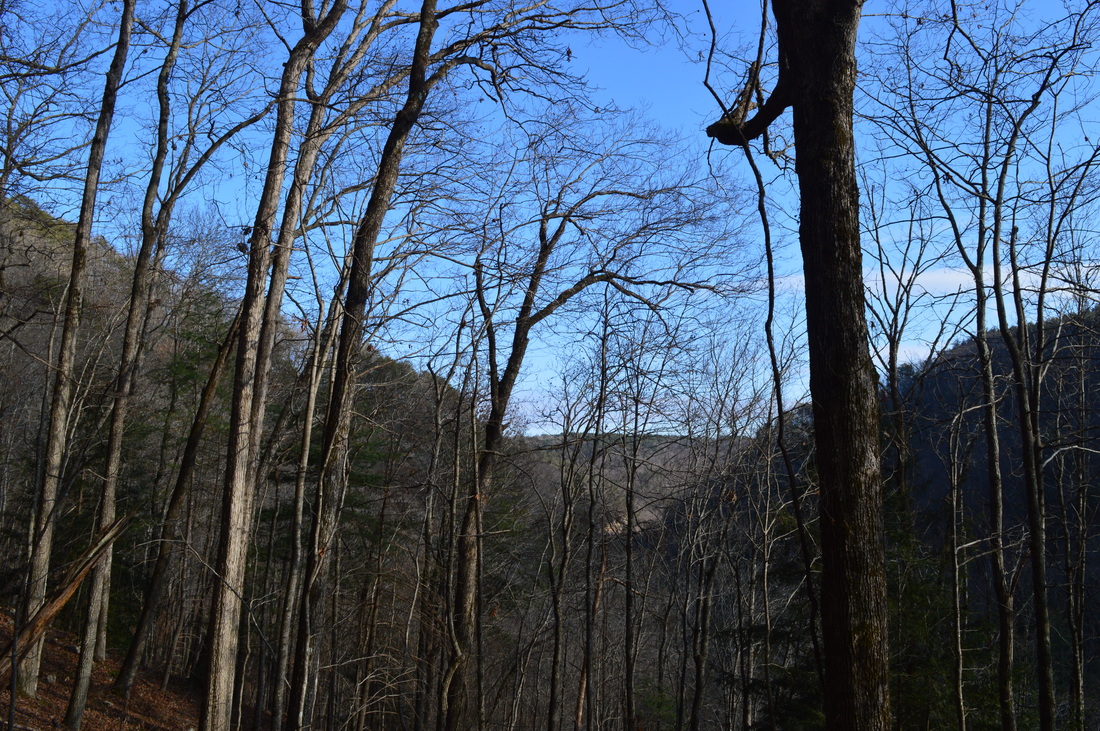
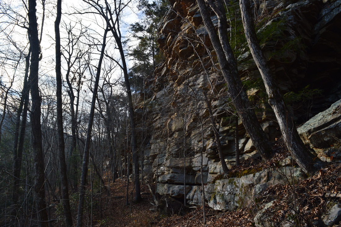
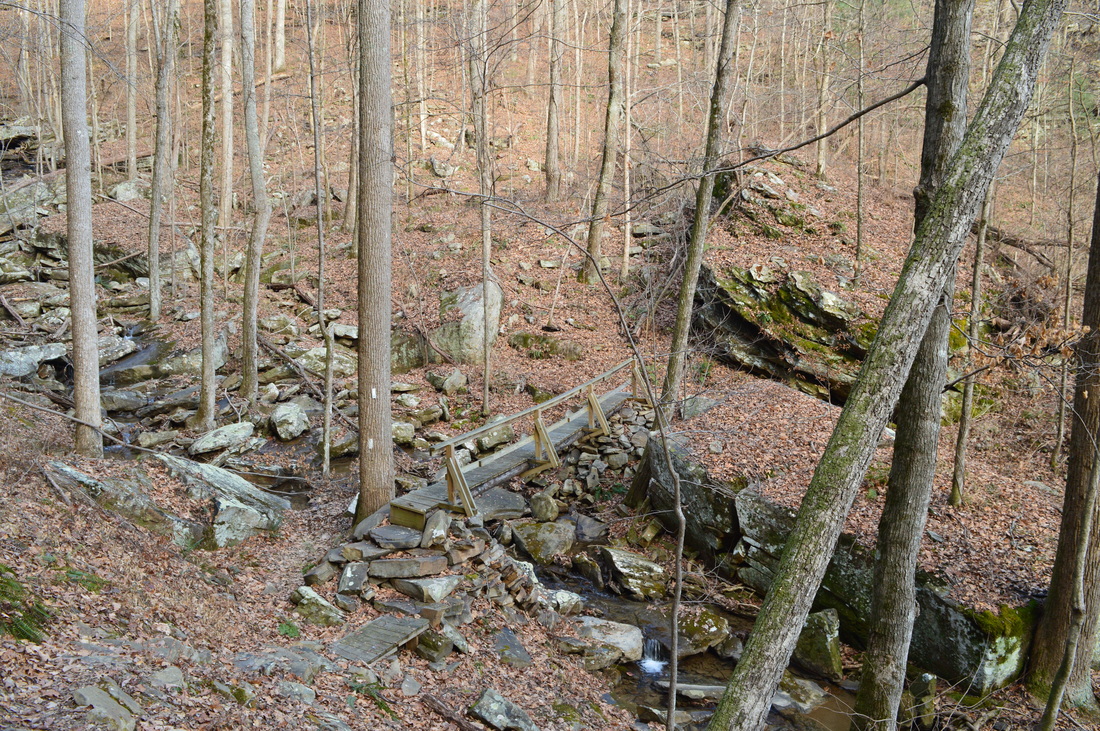
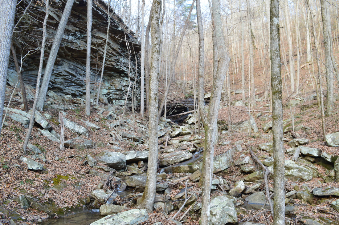
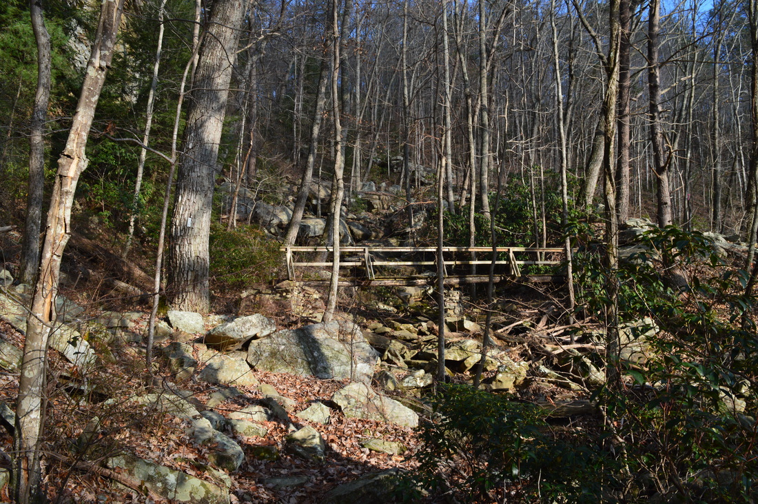
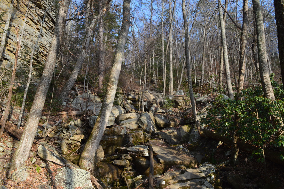
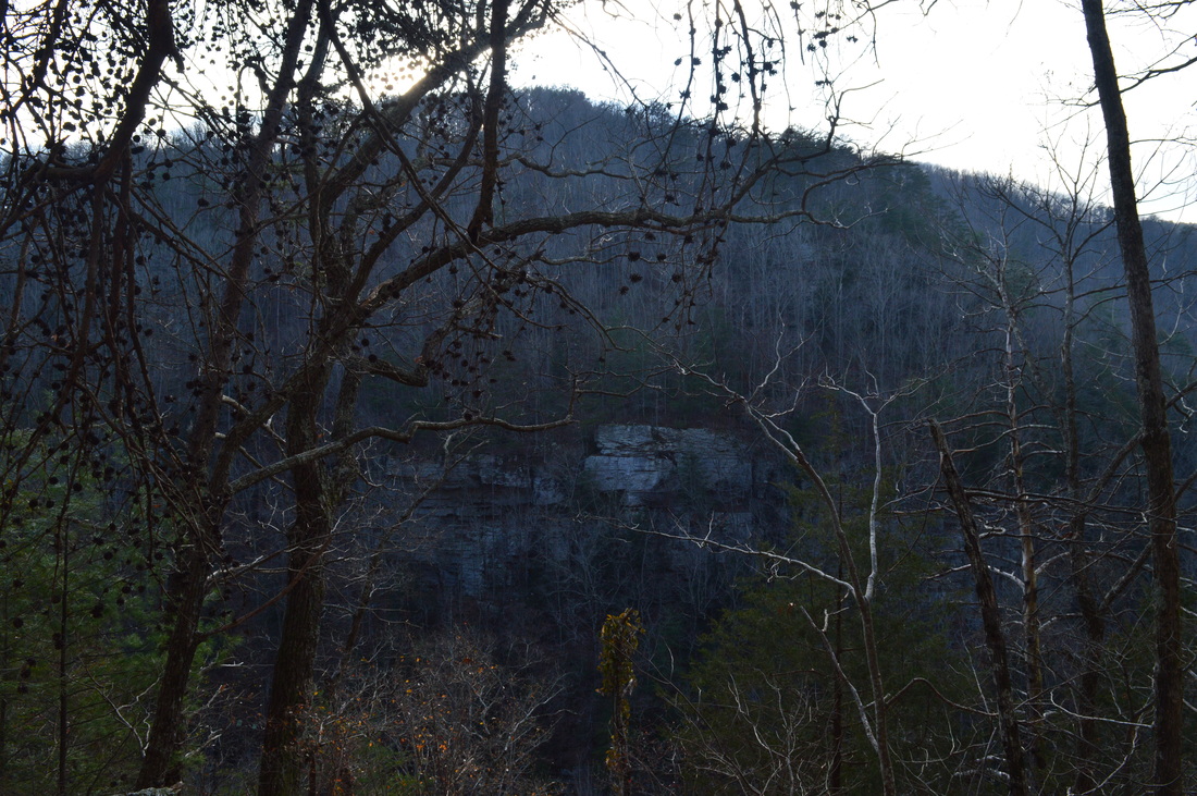
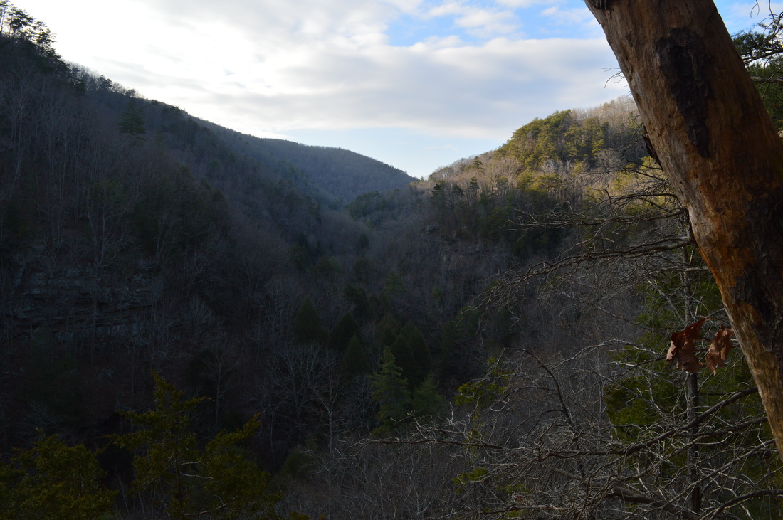
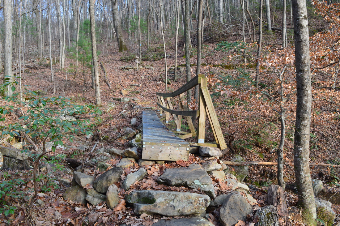
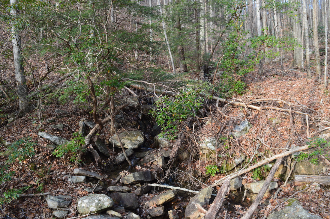
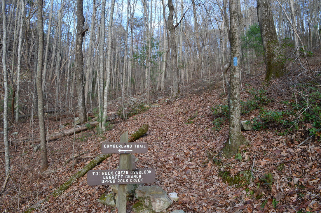
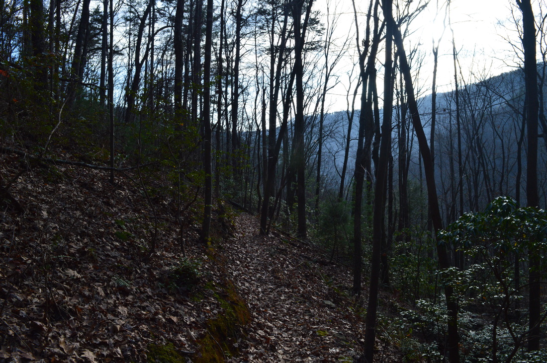
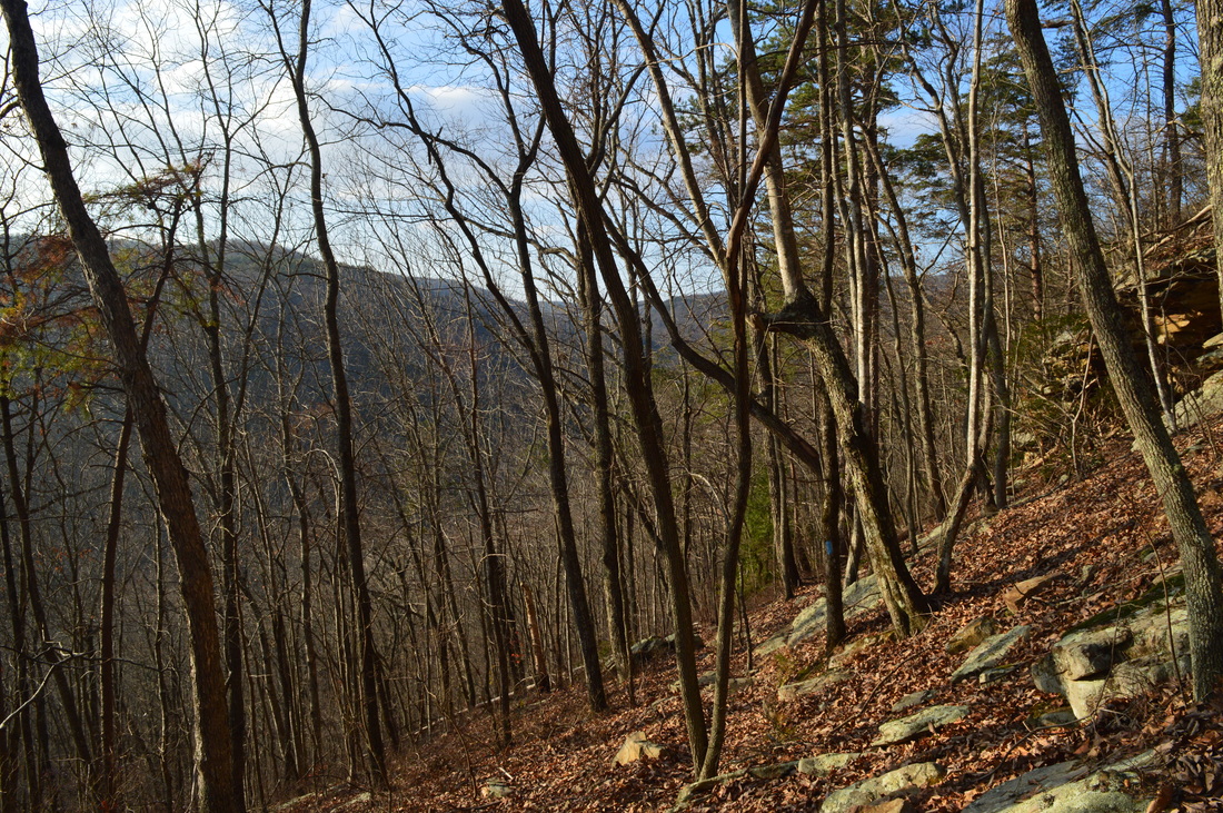
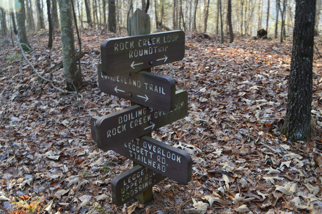
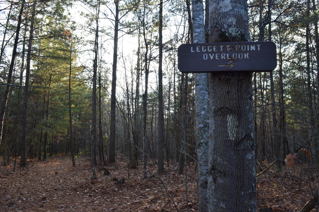
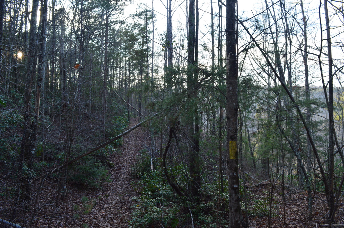
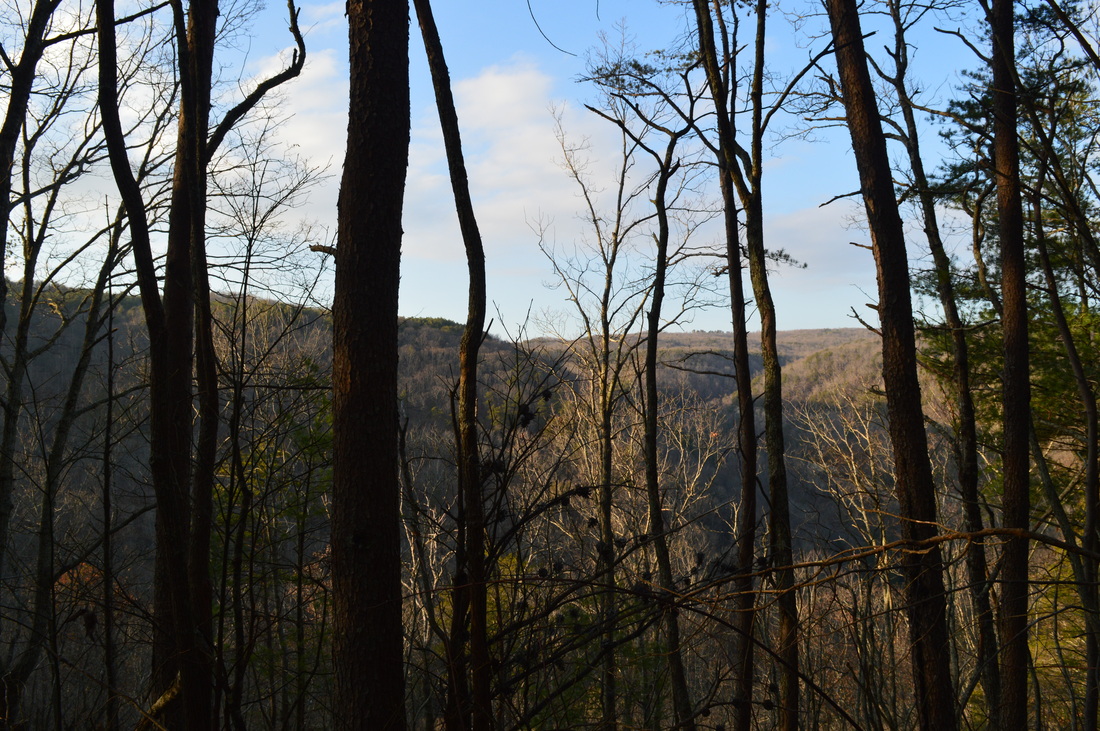
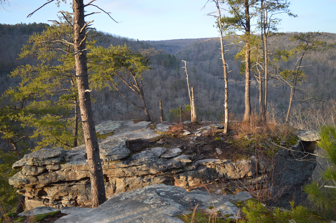
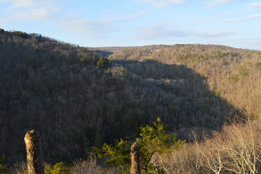
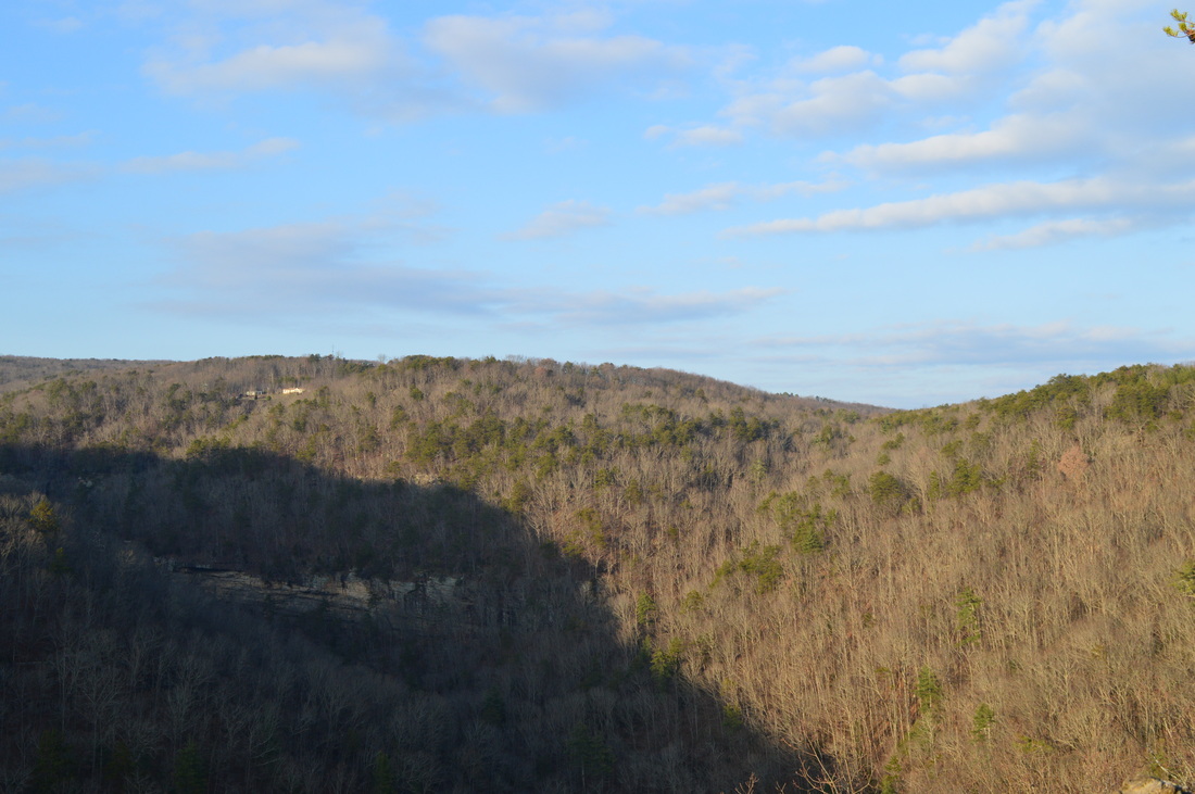
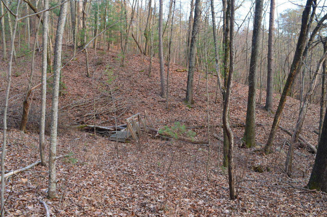
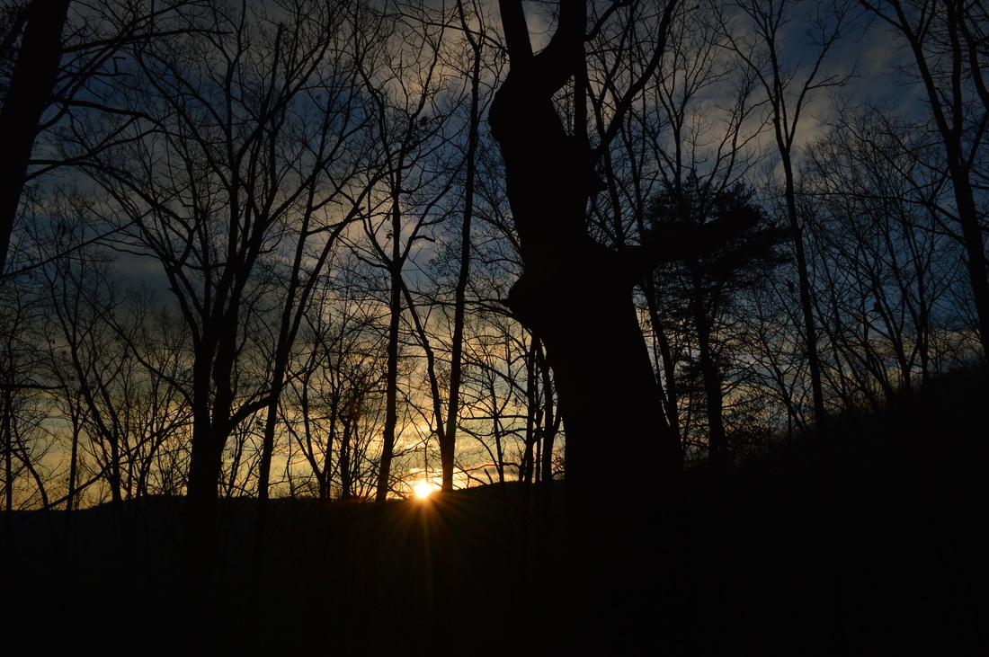
 The Three Gorges segment of the Cumberland Trail is a very beautiful area, part of the Bowater Paper Company's former lands. The three main gorges on this segment of the Cumberland Trail get better in succession from south to north. It starts with the Soddy Creek Gorges, which are the only ones I haven't visited yet on this section (although I heard that they are not very interesting with few attractions). Just to the north, the Possum Creek Gorges are considerably more scenic, with more waterfalls and a few small views. The best of the three is Rock Creek Gorge, described in this post. The Rock Creek Gorge is full of pristine wilderness with many small cascades and outstanding views of the gorge from multiple viewpoints on the east rim. This hike occurred on Saturday, December 20th, 2014. My plan was starting from the Retro-Hughes Trailhead to hike the Cumberland Trail north into the Rock Creek Gorge. Once I would get to the end of the current Cumberland Trail section here, I would complete the short Rock Creek Loop with the side trip to the outstanding views from Leggett Point, then return the way I came on the Cumberland Trail. R/T Length of Trail: 14.2 Miles Duration of Hike: 6:30 Type of Hike: Lollipop Difficulty Rating: 8 out of 10 Pros: Beautiful streams; multiple excellent views of Rock Creek Gorge; rugged wilderness Cons: Lack of many camping spots; Leggett Creek crossing may require wading during high water Scenic Views: Rock Creek Overlook - 6 stars; Leggett Point Overlook - 8 stars Water Features: Leggett Creek Cascades - 5 stars Trail Blaze Color(s): Cumberland Trail - White; Rock Creek Loop - Blue (and White where it shares paths with Cumberland Trail); Leggett Point Trail - Yellow Best Season(s) to Hike: Year-round Beginning Point: Trailhead for Cumberland Trail on Retro-Hughes Road Directions: From Sale Creek, TN: From US Route 27, follow Retro-Hughes Road west. Drive 7.3 miles until the parking area located on the right. It will be right after a gated gravel road goes right. First of all, before I start the description of this hike, I would like to let you know on some upcoming changes to trail maps, that will be in effect starting the next post. There are several issues with the current trail maps, which will be erased in the upgraded trail maps. The first and foremost upgrade will be 100% GPS-based tracks. In addition, zooming and icons will not be a problem anymore, as currently, if you zoom in or out the icons change their places slightly. The Three Gorges segment of the Cumberland Trail crosses Retro-Hughes Road after the second gorge, counting from south to north. The trailhead provides access to two excellent hikes: Big and Little Possum Creek gorges to the south, and Rock Creek Gorge to the north. If you're into exploring every corner of the Cumberland Plateau, like me, both are worth doing. I'd say that Rock Creek Gorge is more scenic than Big and Little Possum Creek Gorges. It is also less strenuous. When you start the Rock Creek Gorge hike described here, make sure to follow the Cumberland Trail in the direction that goes straight into the woods, not the one that goes back across the road. The first section of this hike is deceivingly easy, because the first mile is primarily a walk in the pine forest that was once the lands of Bowater Paper Company. The lands would periodically would be stripped of trees, until Bowater decided to sell the lands. Following an investigation by the Cumberland Trail Conference, they decided to buy the lands and put them in use and route the Cumberland Trail through them. The trail passes a trailhead kiosk in the beginning with maps, and then sets off at a gentle downhill through the young pine forest. Over the course of he first mile, the trail stays generally flat or slightly downhill, although it will dip down to span a couple of hollows, descending via switchbacks to each one. The second one will be the bigger one at 0.5 miles, and during wet weather, there could be some water here. However, even if there is, there is a rock slab, so you can safely cross. After this second hollow,the trail stays mainly fat for another half-mile, then intersects an old forest road. This road is sometimes used for logging operations. On the way back, make sure to not take the road instead of the trail (on the way back, the road will be forking left, while the trail will be forking right). After this, a more pronounced descent begins. The trail exits the pine forest shortly, and then switchbacks down a much more open slope, with good winter views of Rock Creek Gorge lying ahead. From here, it looks like one of your normal western North Carolina stream valleys, without the bonus of the Cumberland Plateau's rugged terrain. At 1.5 miles, the trail crosses an ATV road. In both directions are hunting areas, but the gated, signed one on the left is a private one. A short, steep descent leads to a crossing of a small branch of Rock Creek at 1.6 miles. The crossing is normally a dry-foot one, with many rocks allowing for an easy crossing. After this, a short ascent brings you onto a brief flat stretch with more gorge views. At 1.7 miles, the trail crosses another old road, and a steep descent starts, one that you will remember when climbing back up this stretch on the way back with over 10 miles on your legs. This steep descent (ascent on the way back) is probably the hardest part of the hike... too bad it comes near the end. At 1.8 miles, there will be a small rock house on the right. After this, the descent steepens, but it is aided by switchbacks. After the first set few switchbacks, the trail will cross several small streams on rocks, then follow the rim for a little bit. At 2.2 miles, several more switchbacks continue the descent to Rock Creek, and at 2.6 miles, the trail climbs up a rock bluff via a wooden ladder. Shortly afterwards,a couple more switchbacks lead to the sturdy bridge over Rock Creek. There are some picturesque rapids up and down the creek here. After the bridge, the trail turns right, but stays at the bottom of the gorge for a little bit. At 2.8 miles, there will be several campsites on the part, part of Rock Creek Campsite. After the second campsite, the trail slowly starts climbing up and out of the gorge. At 2.9 miles, it will cross a small branch on rocks, and then rise a bit more onto the more thinly-wooded upper part of the slopes of the gorge. There are great winter views east into the gorge here. A short descent on the trail will lead to Leggett Branch at 3.3 miles, the only crossing on this hike to be worried about. In normal water levels, you can stay dry here, but it is easy for the low rocks to be under water after rain. Upstream are the Leggett Branch Cascades. They are pretty, but are best seen after rainfall, because otherwise, the low amount of water will not make them very interesting. This is not the main attraction of the hike though. After the Leggett Branch crossing, a short but steep ascent brings you out back onto the upper reaches of the gorge's slopes, and you can see the rim's stone walls just above the trail. At times, the trail will be directly under them and following them. It also will descend and ascend over several ridges that are located on this part of the gorge. At 4.2 miles, the trail will cross on rocks over a small stream, and then at 4.4 miles, cross Rocky Branch on a footbridge. At 4.5 miles, the trail crosses Flat Branch on a footbridge, and then at 4.6 miles, a short spur trail leads to Rock Creek Overlook with great views of Rock Creek Gorge, especially upstream. From the overlook, the trail follows the slopes and then crosses Boiling Springs Branch on a footbridge at 4.9 miles. All three branches have low water, but after periods of rain, they can be scenic. Right after the Boiling Springs Branch footbridge is the junction with Rock Creek Loop. Currently, the white-blazed route of the Cumberland Trail heads right tot the Lower Leggett Road parking area, but when the next section (connecting Three Gorges and Graysville Mountain) will be created, the white blazes will be rerouted to go left. For the purposes of this hike's description, follow the Rock Creek Loop clockwise, which means turn left. This way, you do the steepest climbing in the beginning of the loop, and get to see the overlook at Leggett Point earlier. The next section is pretty steep. A lot of stone steps and some switchbacks help to climb up to the top of the rim. Then, when the climbing is over, the trail enters a pine forest and reaches a junction with the spur to Upper Leggett Trailhead at 5.3 miles. The spur trail goes left and reaches the trailhead in 0.1 miles. Meanwhile, the Rock Creek Loop turns right. Turn right and follow it. It follows a gentle downhill through the pine forest on Leggett Point. You can see Leggett Road through the woods on the left. At 5.6 miles, reach the spur trail for Leggett Point. The yellow-blazed spur trail turns right. It is about a quarter mile long and is the key point of the hike. At the end of the spur trail, reach the double rock outcrop (pictured in the header for this post) with a terrific view of Rock Creek Gorge and where you came from. The one thing this view lacks is looking the way down the gorge, but even without it, it is still an amazing view. From Leggett Point, retrace your steps back to the junction with Rock Creek Loop at 6.1 miles. Turn right and keep following the loop. The trail stays flat for a little bit, but then begins a long descent. There will be three footbridges over the course of the descent, that cross hollows. At 7.2 miles, the gradual ascent comes to an end as the trail reaches the bottom of Rock Creek Gorge. If you turn left, Lower Leggett Connector will bring you to the Lower Leggett Trailhead in 1.1 miles. To follow the route of this hike, turn right to keep following Rock Creek Loop. This last leg of the loop follows the slopes just above Rock Creek, although ascending all the time. At first, the trail stays in the bottomlands, but shortly crosses a small creek on rocks and begins the slow ascent. It is generally not steep, but sometimes rocky, and passes through a couple of boulder fields. The Rock Creek Gorge is taller here, so the gorge walls are felt most when hiking this section of the trail. Other than this, the trail generally stays the same. When you hear close-by water, you know you're almost at Boiling Springs Branch and Cumberland Trail junction, which comes at 8.3 miles. From here, retrace your steps back on the Cumberland Trail to the trailhead at 14.2 miles. Remember the climb after Rock Creek bridge! In summary, this is yet another excellent Cumberland Trail hike that someone who is seeking to visit every major attraction on the Cumberland Plateau must do. It is one of the longest hikes on this website so far and one of the longest I've done in the area, but yet,, it is doable in a day, as it's less strenuous than some shorter Cumberland Plateau hikes I have done. The difficulty rating is at an 8 more so due to distance than due to steep ascents, rugged terrain, etc. Although the extended climb out of Rock Creek Gorge on the way back does weigh in. Below are my pictures and videos from the hike.
13 Comments
8/20/2022 06:59:47 pm
NestaCloud VDS Sunucu kampanyalarından hemen yararlanın. Tüm hosting ve sunucu hizmetlerinde sezon indirimi başladı. %50 indirim ile sizde dilediğiniz sunucuyu ilk ay indirimi ile kullanabilirsiniz. Artık sunucu sahibi olmak çok kolay. 8/21/2022 09:19:43 am
Mp3Video.org'u tercih etmelisiniz çünkü Youtube Mp3 ve Youtube Video İndir alanında lider teknoloji sağlayıcılarındandır. Hızlı altyapısı güvenilir sistemi. reklamsız ara yüzü ile kalite odaklı bir hizmet sunmaktadır. pişman olmama garantili bir servistir. 8/22/2022 02:53:41 am
DonghuaTR Türkçe Anime ve Donghua izleme adresi. Bir çok çeşit Animeyi sitemizde HD kalitede izleyebilirsiniz. Anime bölümleri her zaman güncel olarak sitemizde yayınlanır. Aradığınız tüm animeleri DonghuaTR'de bulabilir ve izleyebilirsiniz. 9/25/2022 02:26:51 pm
En güncel urfa haber için sitemizi ziyaret et! Site adresi https://haberurfadan.com/ 10/5/2022 12:06:37 pm
Hızlı takipçi satın alma seçeneği ile hesaplarınızı büyütmek artık çok kolay. Profesyonel hizmetlerimiz ve paketlerimiz adresimizde sizleri bekliyor. 10/6/2022 05:31:10 pm
istanbul kepenk tamiri sitesidir! Kepenk tamiri hizmetleri için ziyaret et! https://kepenktamiriistanbul.net/ 10/19/2022 09:29:53 am
Zaful is your one-stop online shop for today's most daring exciting & dgy fashion apparel. Get specail Zaful coupon code from joyfulcoupon.com. 10/22/2022 02:10:11 pm
Find the latest verified SHEIN promo codes coupons and discounts for October 2023. Save now on your SHEIN online purchase. 10/24/2023 04:48:36 pm
The first section of this hike is deceivingly easy, because the first mile is primarily a walk in the pine forest that was once the lands of Bowater Paper Company. The lands would periodically would be stripped of trees, Thank you for the beautiful post! Leave a Reply. |
About MeMark Oleg Ozboyd Dear readers: I have invested a tremendous amount of time and effort in this website and the Georgia Waterfalls Database the past five years. All of the work that has gone in keeping these websites updated with my latest trip reports has almost been like a full-time job. This has not allowed me to pick up a paid job to save up money for college, and therefore, I I've had to take out loans. If you find the information on this website interesting, helpful, or time-saving, you can say "thanks" and help me out by clicking the button above and making a contribution. I will be very grateful for any amount of support you give, as all of it will apply toward my college tuition. Thank you!

Coming in 2022-2023?
Other Hiking WebsitesMiles HikedYear 1: 540.0 Miles
Year 2: 552.3 Miles Year 3: 518.4 Miles Year 4: 482.4 Miles Year 5: 259.9 Miles Archives
March 2021
Categories
All
|


 RSS Feed