
The Cumberland Trail, a work in progress that will be a 300-mile trail when completed, has its southern terminus at Signal Point in the Chattanooga metro area. One of the Cumberland Trail's most spectacular sections is its very first one as it traces the rim of the Tennessee River Gorge, visiting outstanding views at Signal Point and Edwards Point as well as a unique geological formation known as Mushroom Rock at the edge of the Suck Creek Gorge. Beside the Cumberland Trail, several lesser-used trails give hikers the option to turn a hike to Edwards Point into a full-day loop with additional sights. Most notable is a spectacular half-mile section of the Orange Trail as it follows a remote and rugged bluff line in the Middle Creek Gorge. This hike occurred on Saturday, November 25th, 2017. My plan was to hike a loop from Signal Point that would follow the Cumberland Trail past Edwards Point all the way to Mushroom Rock, from where I would follow the Mushroom Rock Trail, Blue Trail, Orange Trail, and Bee Branch Trail back to Signal Mountain. After coming out at Ohio Avenue, I would conclude the hike with a short roadwalk through the town of Signal Mountain to Signal Point.
Summary
R/T Length of Trail: 12.1 Miles
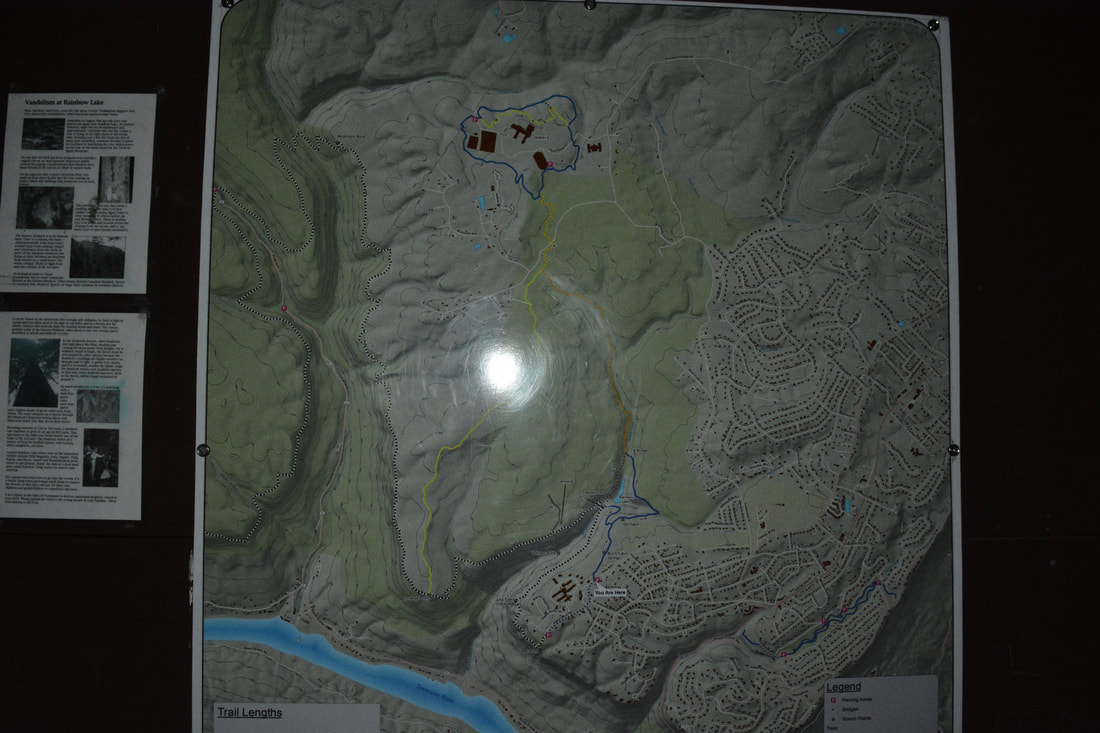
Duration of Hike: 5:45 plus 2 hours and 45 minutes of stopping and photography Type of Hike: Loop Difficulty Rating: 7 out of 10 Total Elevation Gain: 2029 Feet Pros: Numerous spectacular views of the Tennessee River Gorge Cons: No official access to Rainbow Falls; a short boring section in the vicinity of Edwards Point Road and Shackleford Ridge Park Points of Interest: Signal Point Views - 7 stars; Julia Falls Overlook - 5 stars; Edwards Point Views - 10 stars collectively; Mushroom Rock; Middle Creek Gorge Bluffs; Rainbow Lake Dam; Historic Chimney on Bee Branch Trail Trail Blaze Colors: Cumberland Trail - White; Mushroom Rock Trail - None (a few white arrows); Blue Trail - Blue; Orange Trail - Orange; Bee Branch Trail - Blue Best Seasons to Hike: Fall Fees: None Beginning Point: Signal Point Park Directions from Chattanooga, TN: From US 127 (Signal Mountain Road) at the point where it intersects US 27 north of downtown Chattanooga, follow US 127 North for 4.6 miles, entering the town of Signal Mountain. Just before the traffic light, turn left onto Signal Mountain Boulevard. In 0.2 miles, take the second left to stay on Signal Mountain Boulevard. Follow it to a 4-way intersection with James Boulevard and Ohio Avenue in 0.9 miles. Continue straight ahead on the narrower Signal Point Road for 0.3 miles to a dead end at the parking area in Signal Point Park. Map
Click the link below to download a .GPX file with a track of this hike.
Details
My very first hike on the Cumberland Trail was over 3 years ago. I did part of the same section that I did on this day, a relatively short out and back from Signal Point to Edwards Point. I recall being amazed by the jaw-dropping vistas of the Tennessee River. On this day, my plan was to hike the same segment, revisiting the views I remembered in addition to visiting a number of other sights such as Mushroom Rock on the longer loop. Having completed the loop, my opinion is that it is even better than the out and back hike to Edwards Point. Even though there are some boring sections, the loop has more highlights and more solitude. The hike to Edwards Point has become quite popular, but most day hikers don't go any further. In fact, some folks even fail to realize that there are any more views after the first rock outcrop - and I was one of those people myself on my previous hike to Edwards Point!
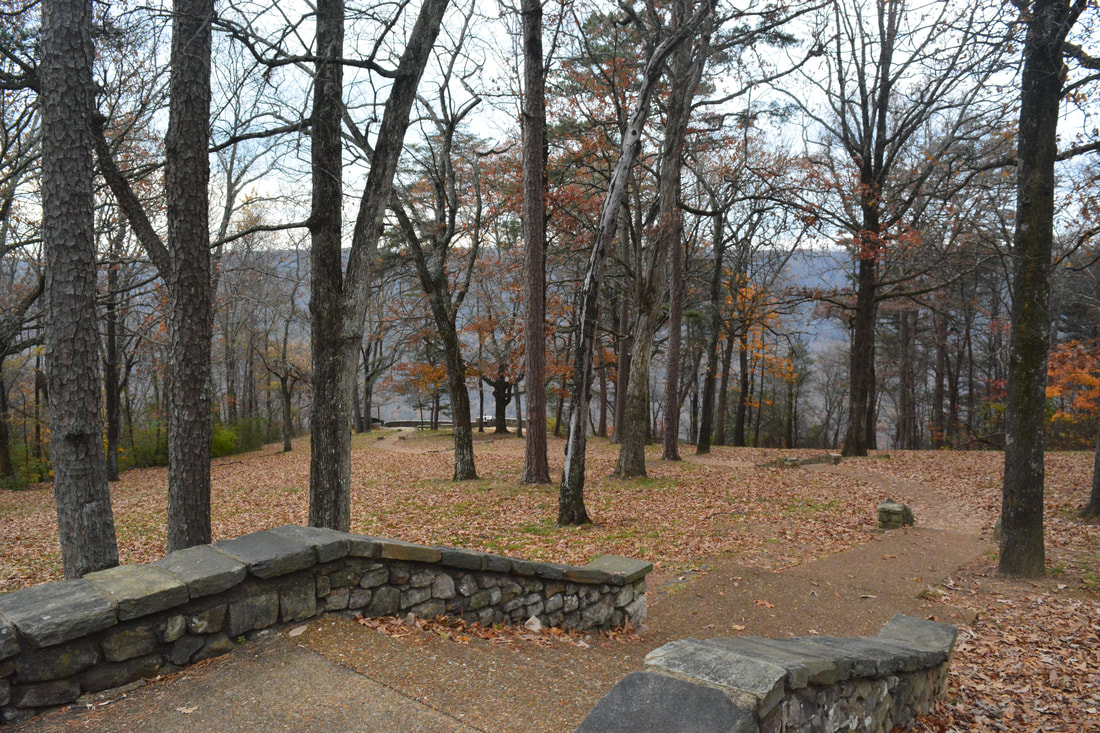
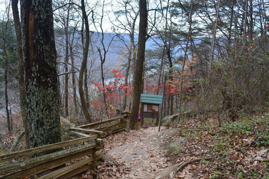
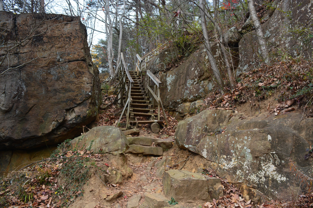
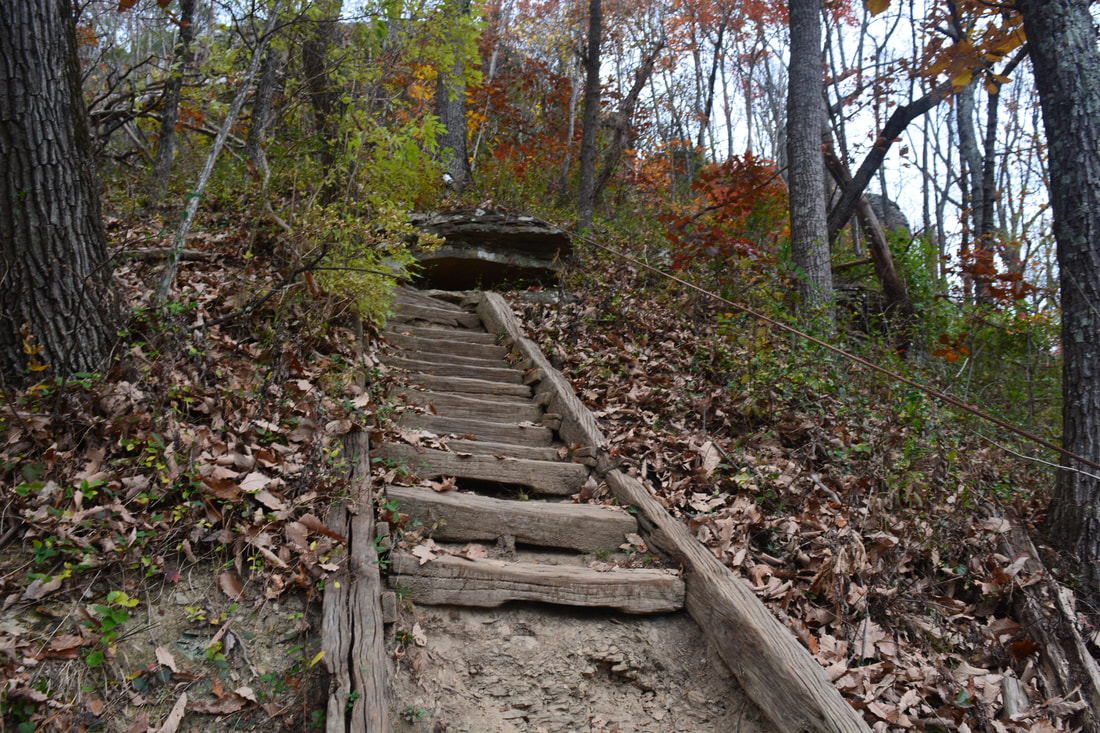
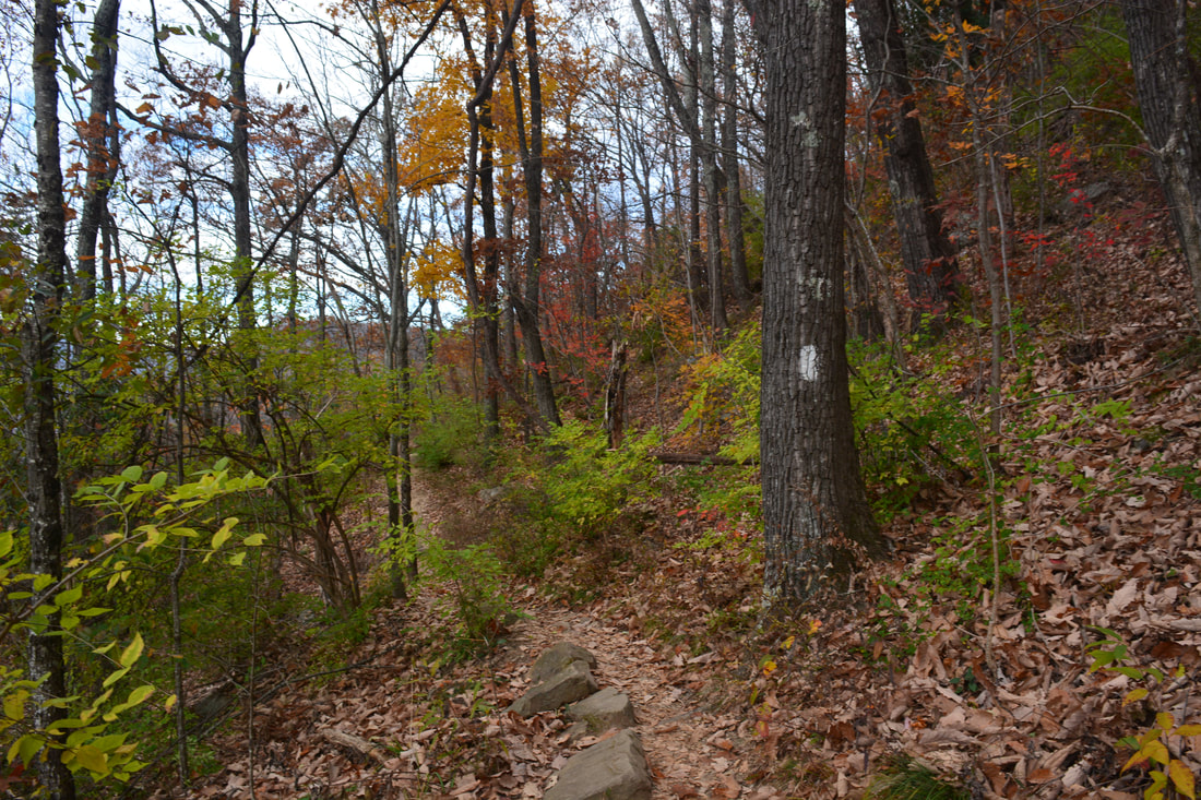
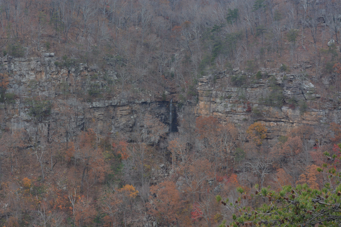
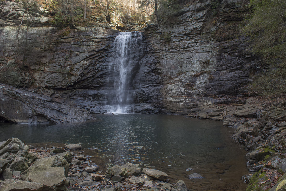
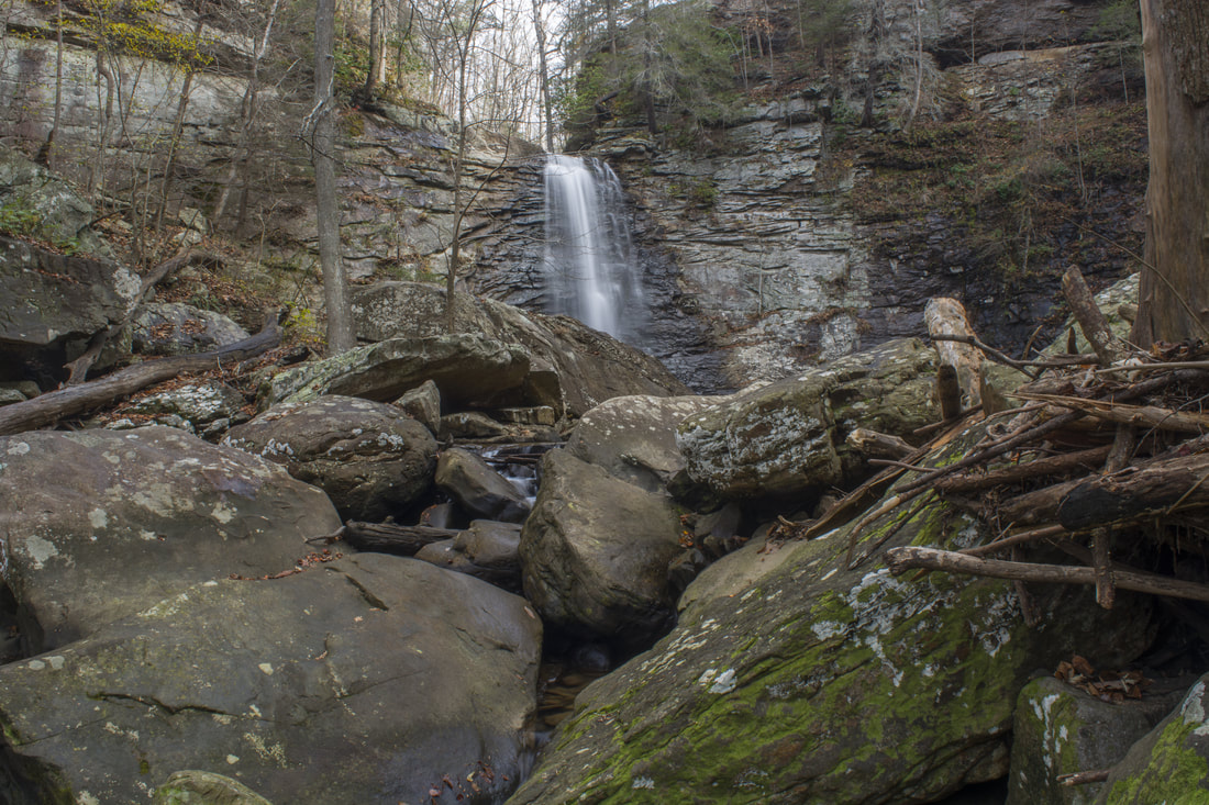
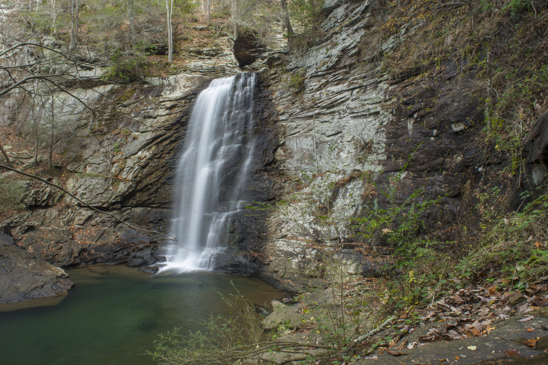
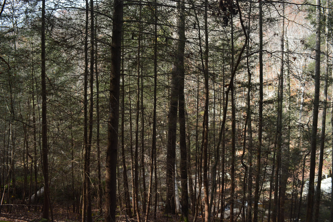
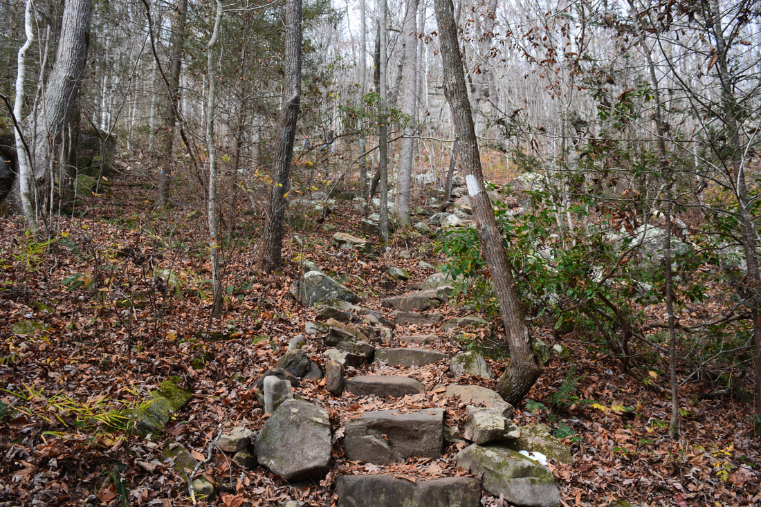
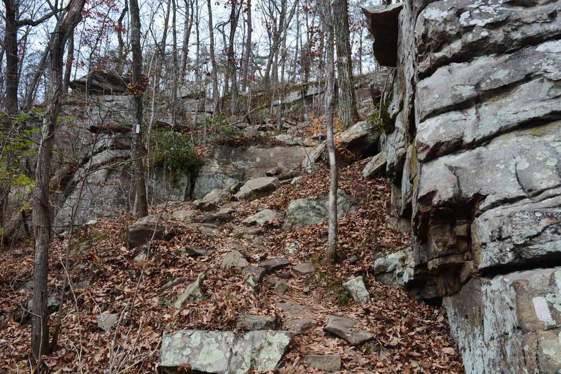
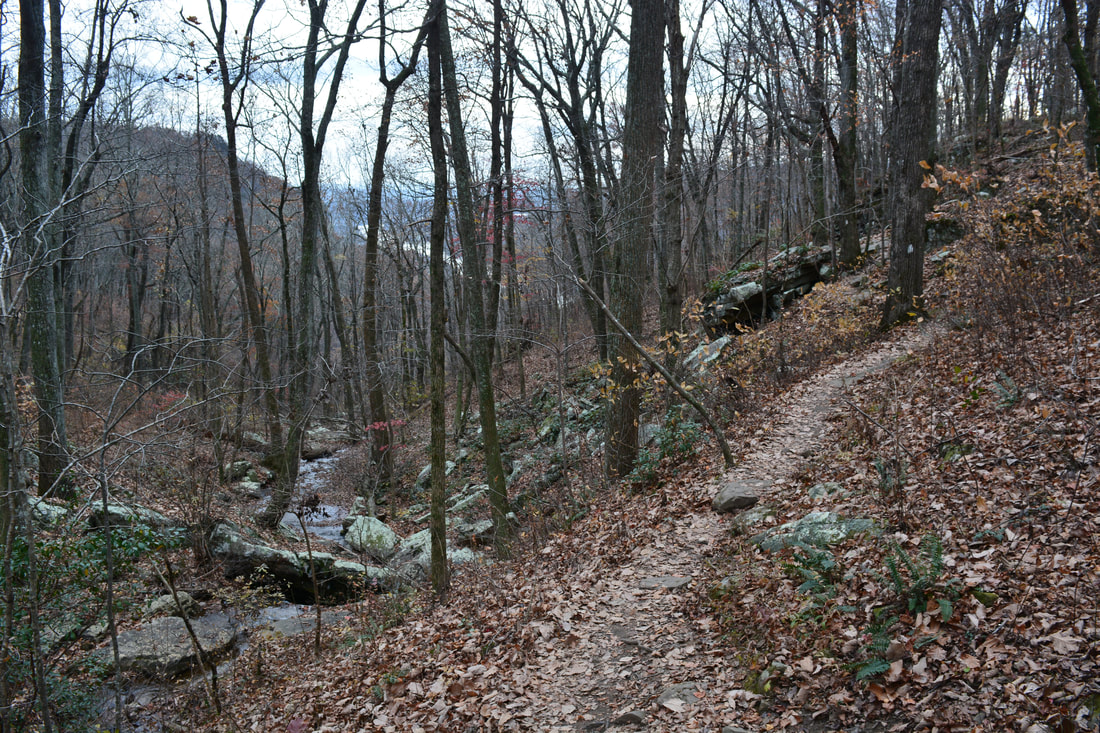
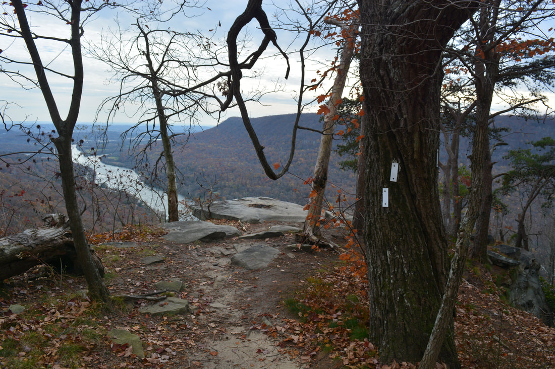
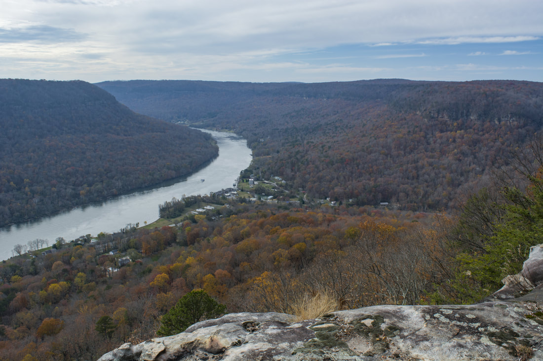
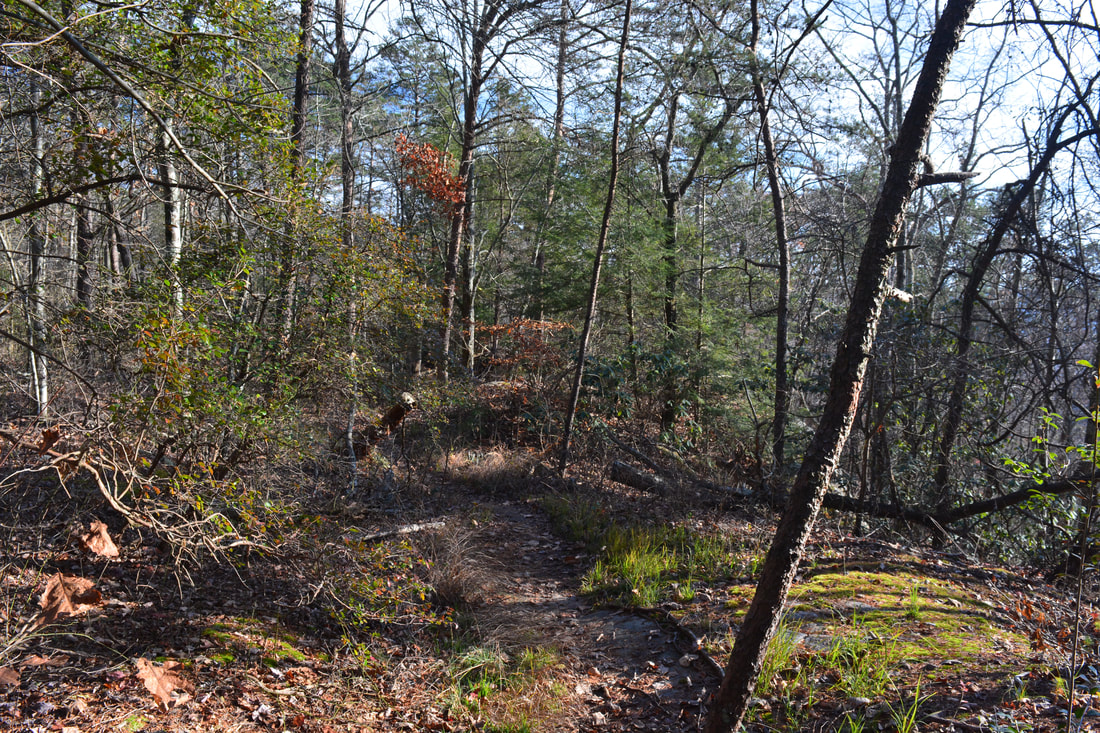
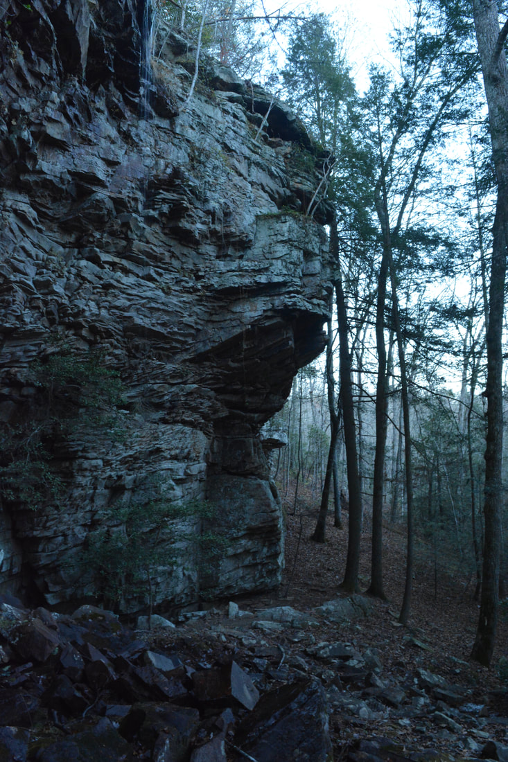
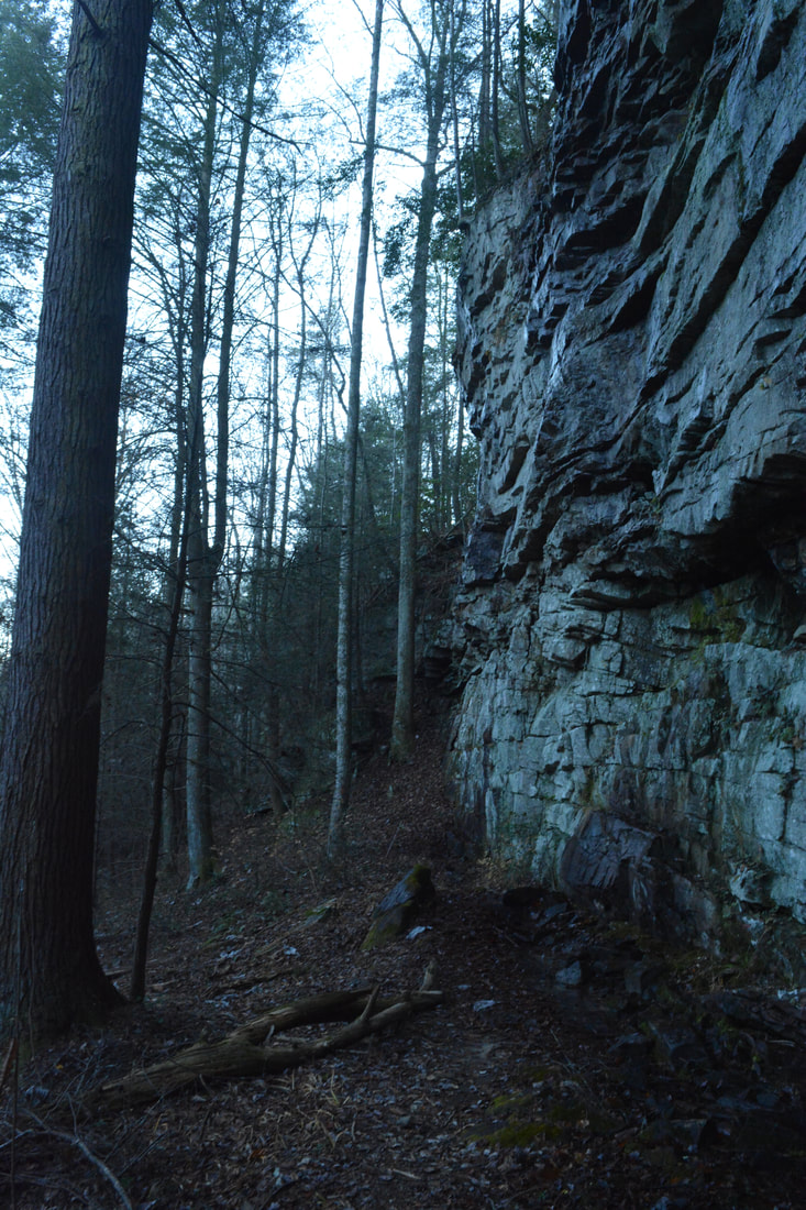
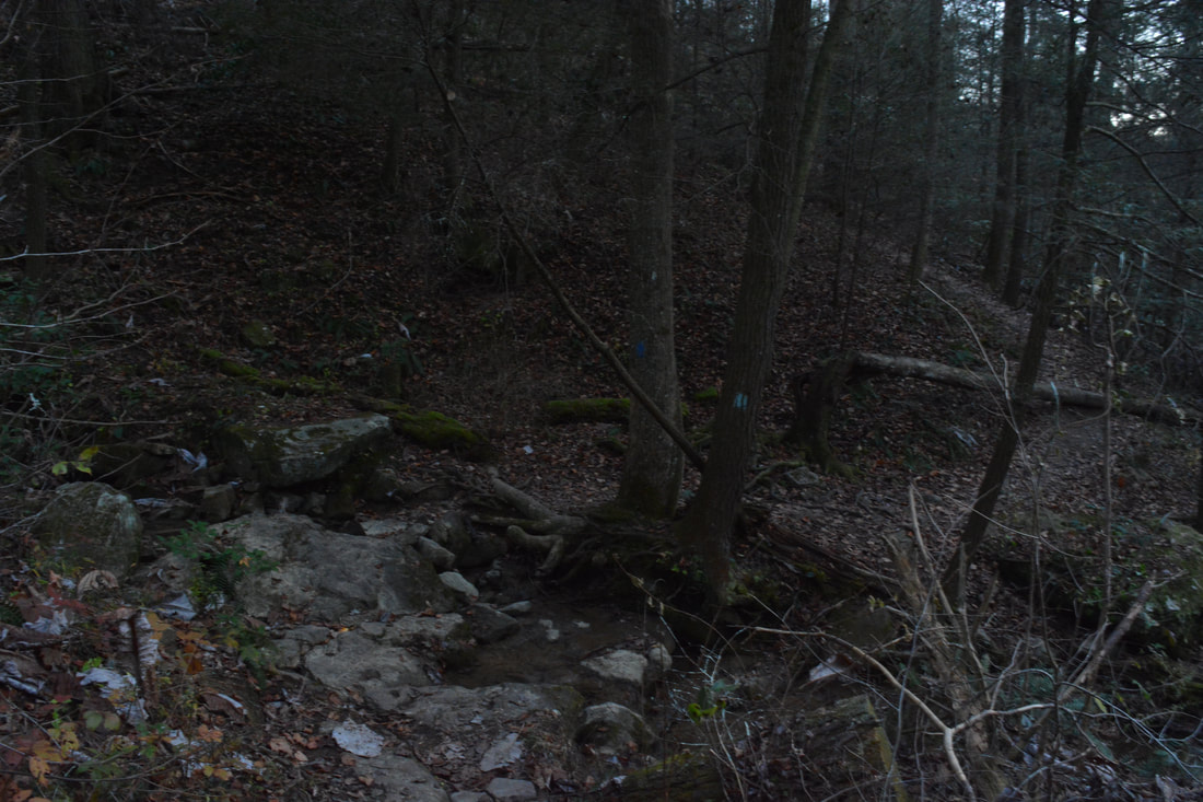
From the parking area at Signal Point, pick up the paved path that heads downhill 300 feet to a viewing area of the Tennessee River Gorge. While this is the official view from Signal Point, there is a more impressive view a short distance down the Cumberland Trail. The Cumberland Trail begins on the right-hand side of the viewing area at a kiosk with maps and mileage info. The trail begins with a steep descent below the rim of the gorge, utilizing several staircases to negotiate the steep and rugged terrain. After several switchbacks and one final set of steps with a cable alongside it, the Cumberland Trail levels out and turns right at 0.2 miles. A narrow path continues straight ahead 150 feet to a sheer cliff with a spectacular panoramic view of the Tennessee River Gorge. Folks who are looking for just a short post-work hike can head out and back to this beautiful spot without expending a lot of effort. For the main hike, continue following the Cumberland Trail as it stays just below the bluff line and passes several large boulders before reaching the next viewpoint - Julia Falls Overlook - at the edge of the Middle Creek Gorge at 0.5 miles. During times of wet weather, Julia Falls is a 100-foot waterfall that is formed by an unnamed stream spilling down a cliff on the north rim of the Middle Creek Gorge. Julia Falls is pretty much out in the open so it is visible well from this rock outcrop along the CT on the south rim, although today, the falls was just a trickle. It was gushing on my previous visit though! Julia Falls Overlook also has a nice view of some of the rock outcrops at Edwards Point (also on the north rim) as well as the Tennessee River disappearing behind a bend. Meanwhile, the Cumberland Trail bears right and enters the Middle Creek Gorge on a narrow rocky path. The trail passes directly below the buildings of the Alexian Brothers Retreat atop Signal Mountain around 0.75 miles. Then, at 1.0 miles, the trail passes directly above Rainbow Falls, a 40-foot waterfall on Middle Creek. You can always hear the waterfall and can see it well when the leaves are off the trees. A sign states that there is no access to the falls due to steep slopes. It is possible to find a route down to the base of the falls, but all potential routes are very rugged, steep, and even slippery in places, so it is not recommended for most hikers. Regardless, stay right on the Cumberland Trail as it enters a boulder field where things get pretty slow-going. 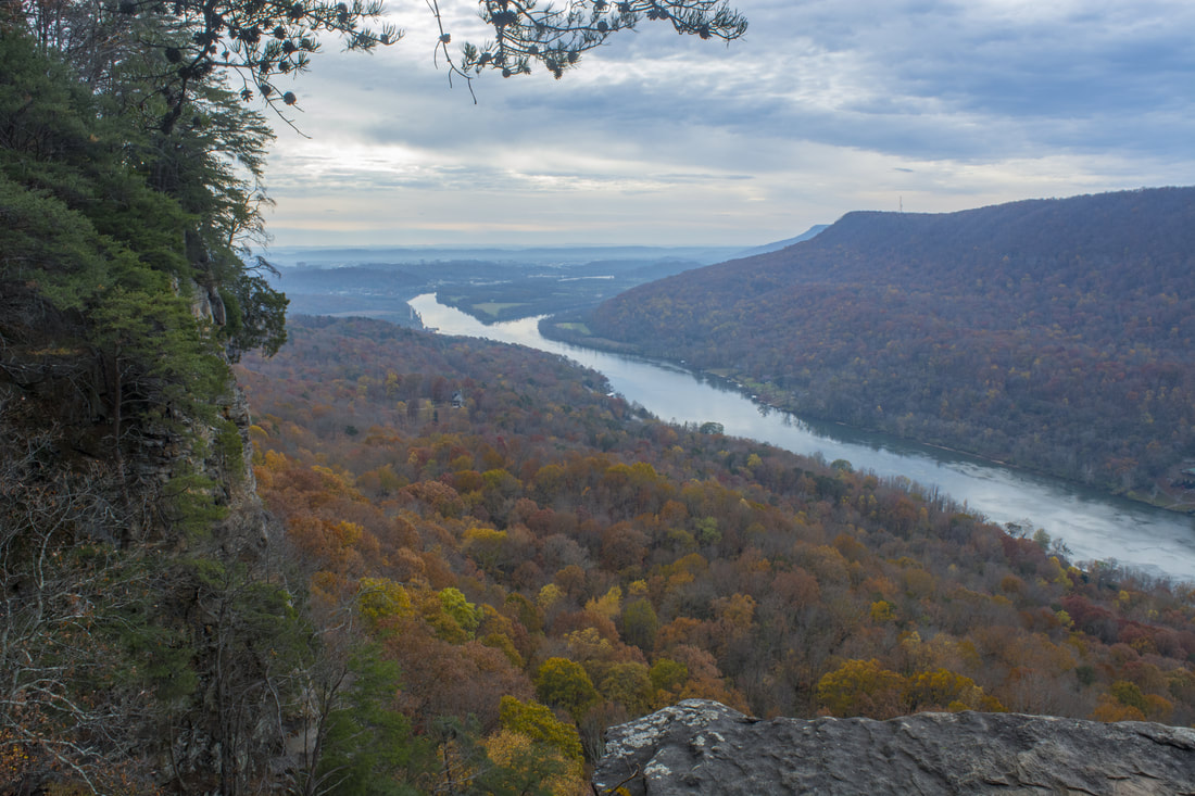
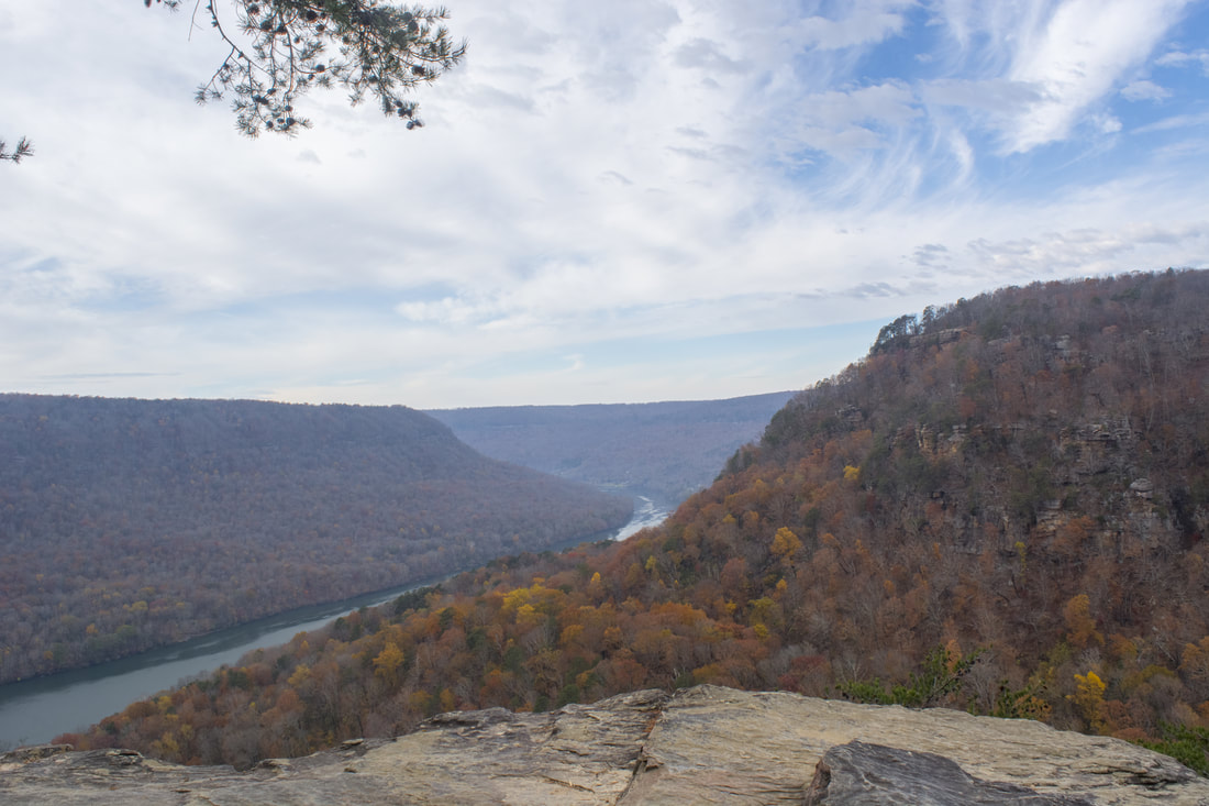
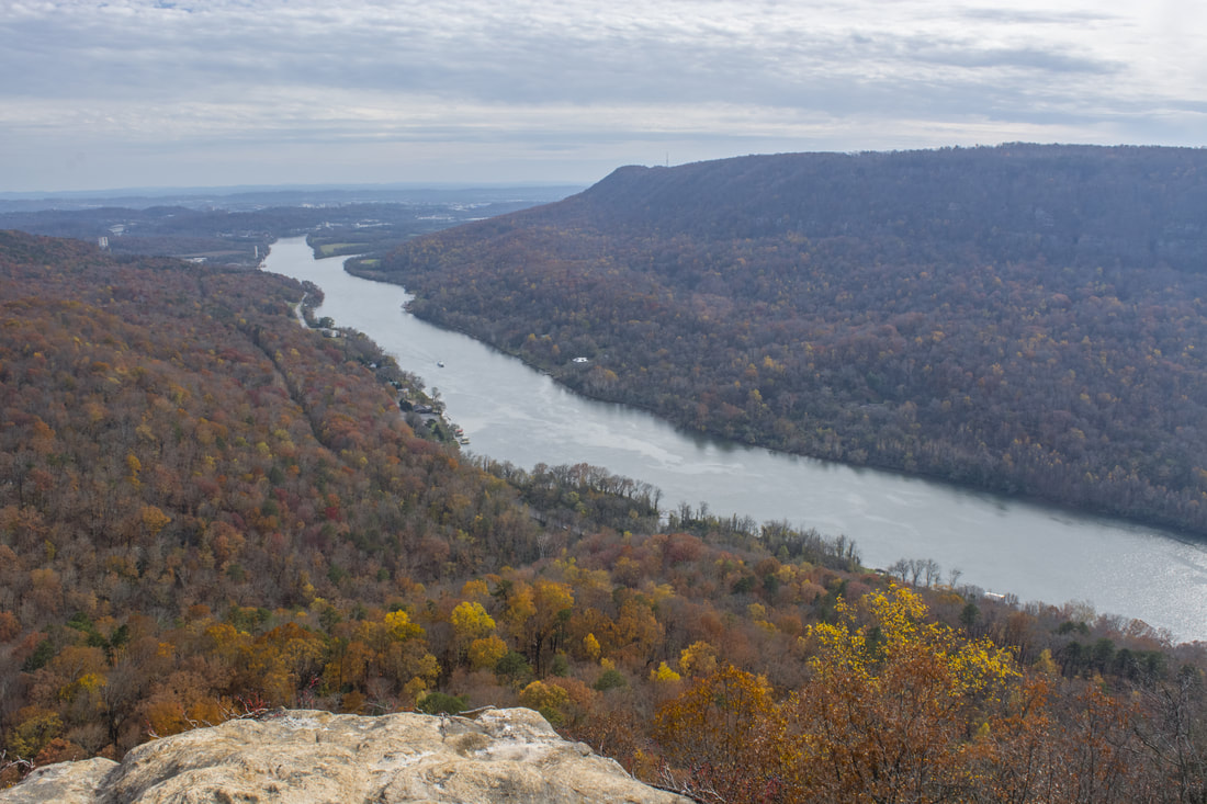
A sheer cliff below Signal Point just off the Cumberland Trail provides stunning views of the Tennessee River Gorge.
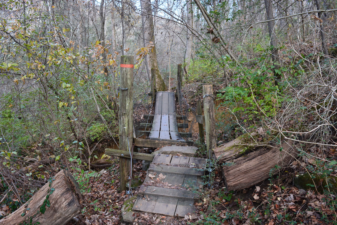
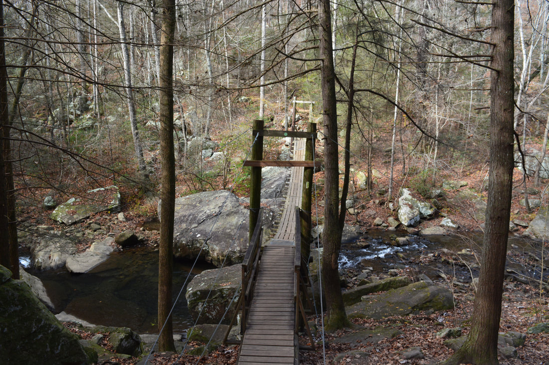
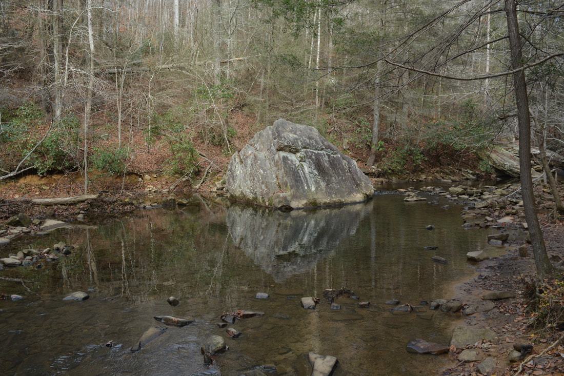
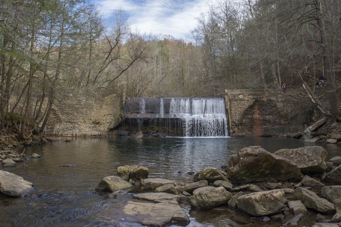
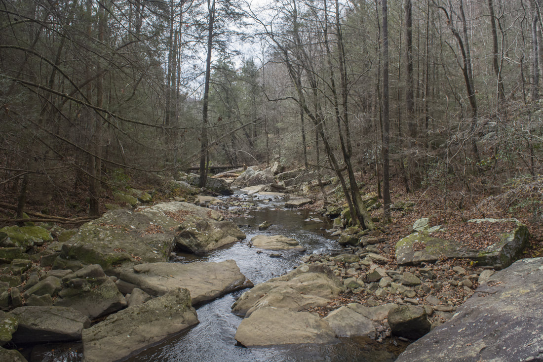
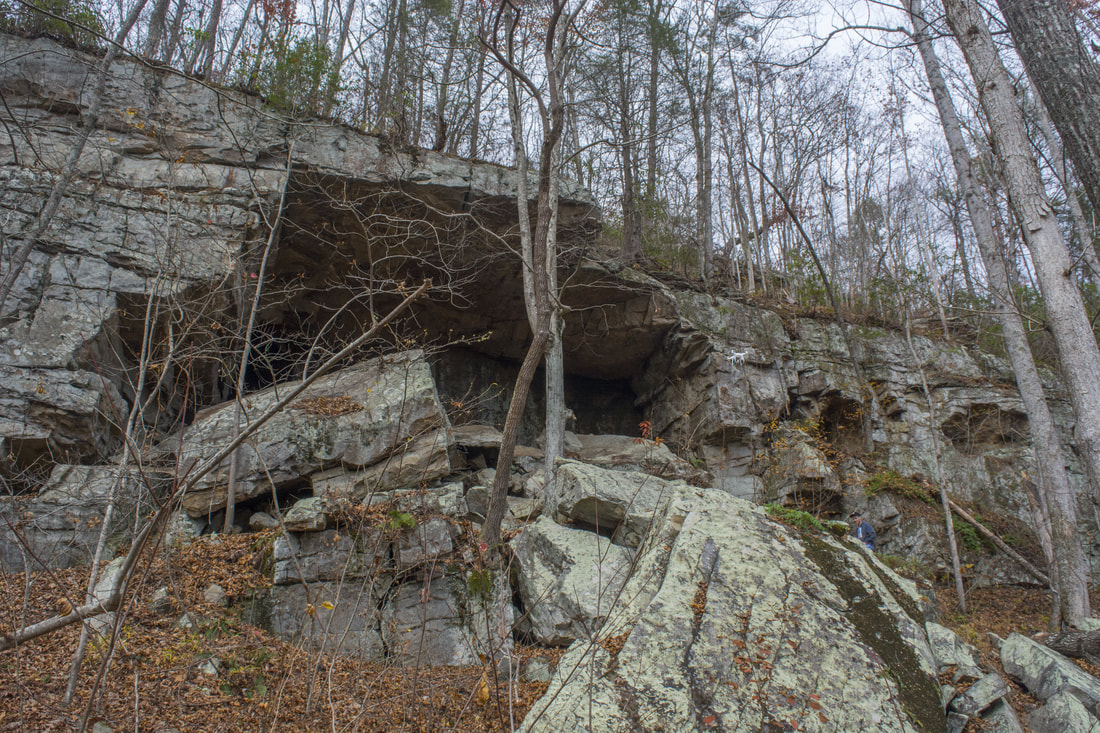
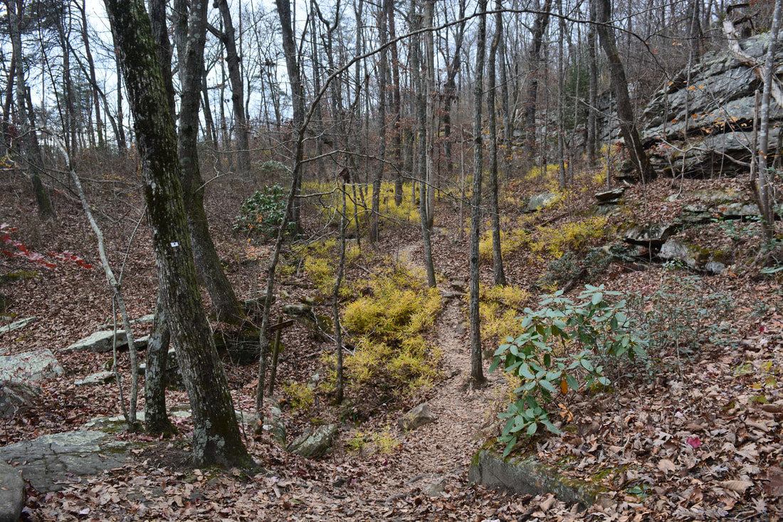
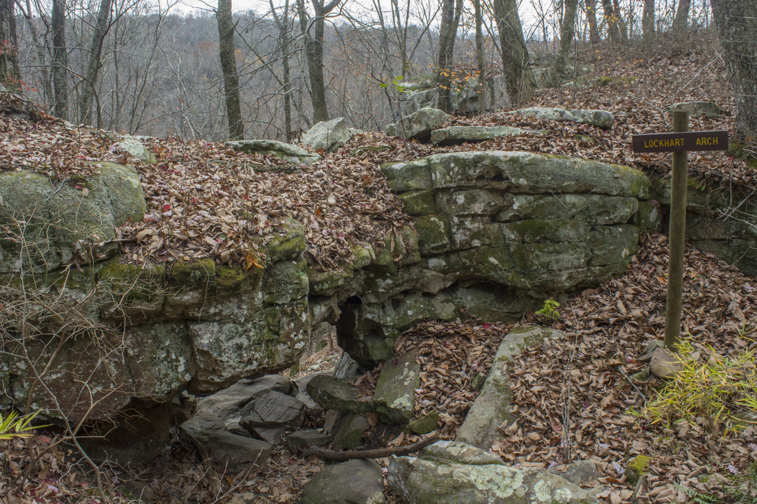
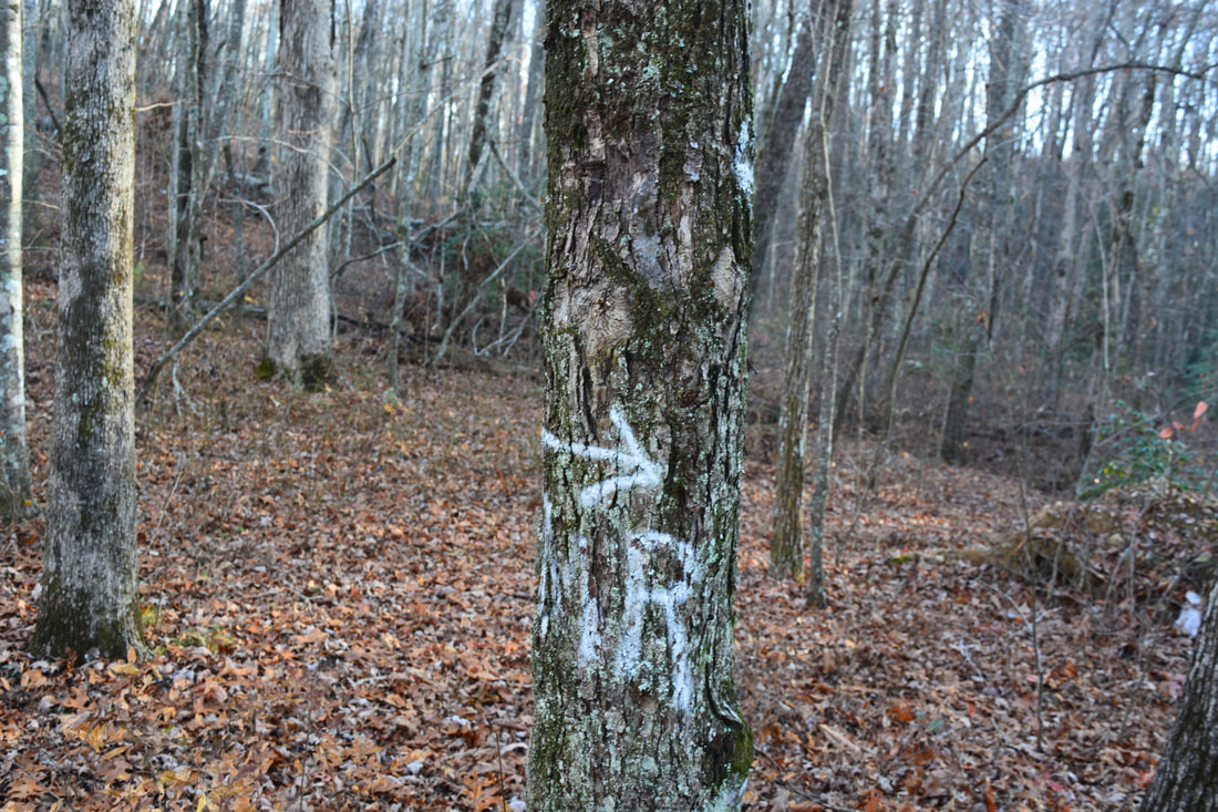
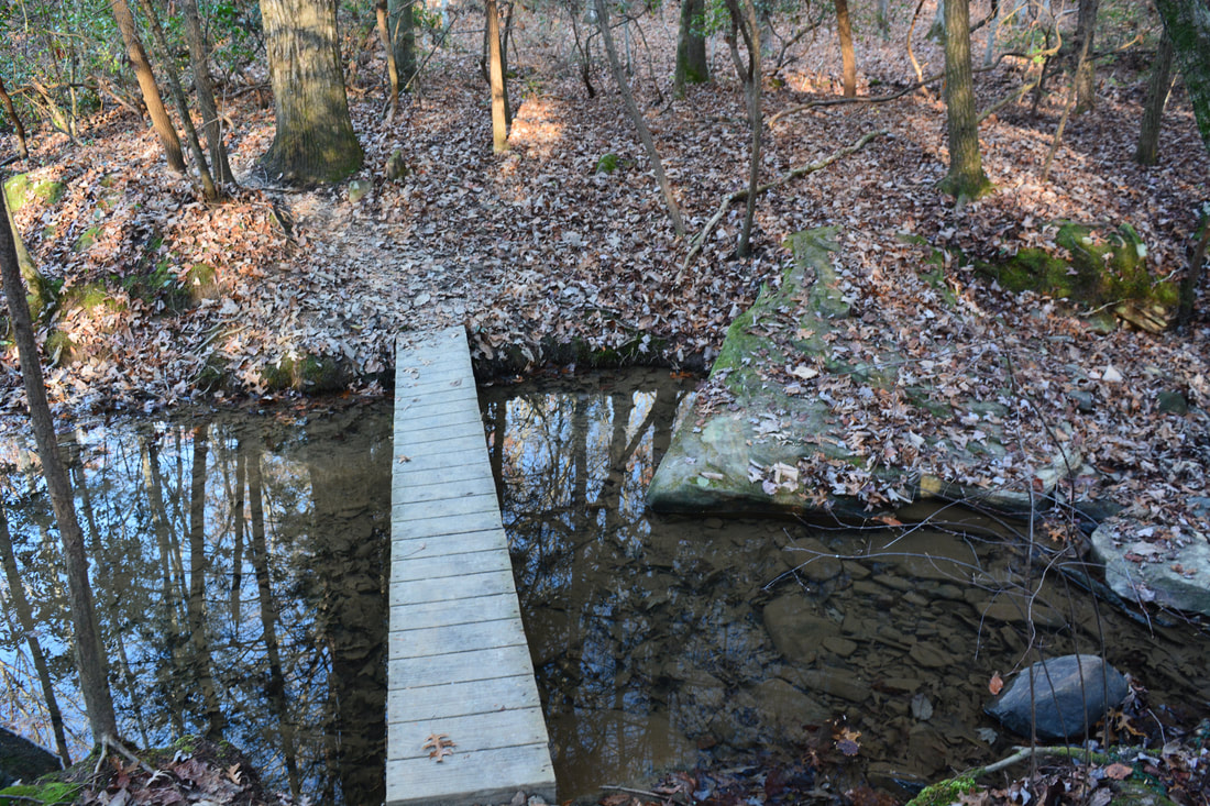
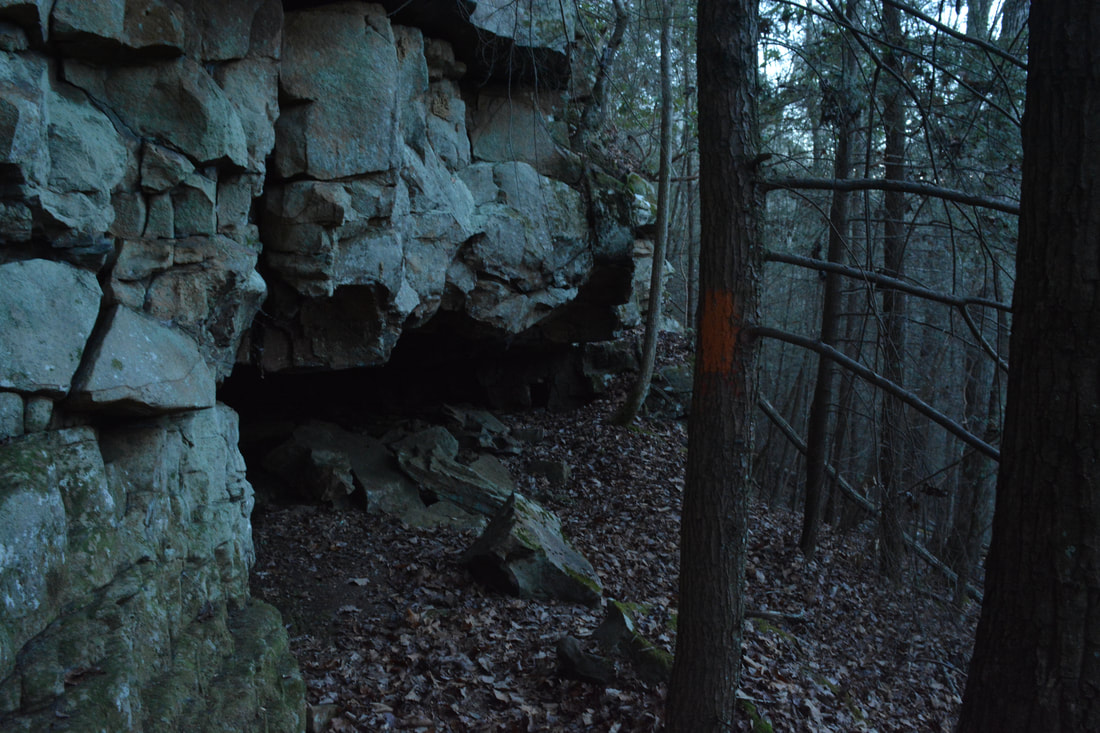
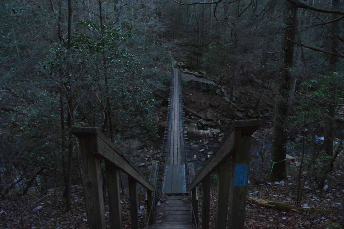
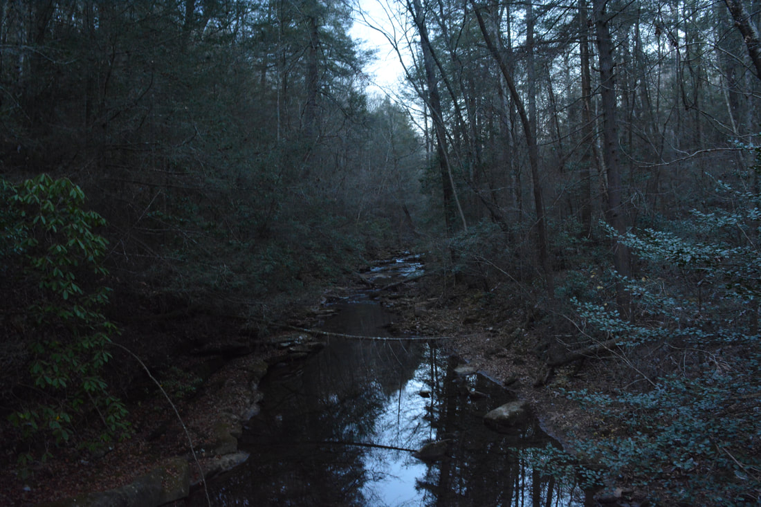
After crossing a small suspension bridge across a Middle Creek tributary at 1.2 miles, the Cumberland Trail enters a hemlock grove approaching Middle Creek itself. Arrive at a junction at 1.5 miles. The Cumberland Trail turns left and crosses Middle Creek via a suspension bridge on its way to Edwards Point while a blue-blazed trail continues ahead and connects to the Ohio Avenue Trailhead. I suggest going up the blue-blazed trail for 0.1 miles to a pretty dam on Middle Creek just below Rainbow Lake. Even though the Rainbow Lake Dam is man-made, it's still a photogenic spot. Then, head back to the CT and cross the bridge. I'll tell you - that bridge is so bouncy that you'll feel like you're drunk when crossing it, especially if you're not alone on it! On the other side, the Orange Trail leaves to the right toward Shackleford Ridge Park while the CT continues straight. Although you will not be returning to this spot, you will hike much of the Orange Trail later along the loop. Meanwhile, the CT ascends via rock steps away from Middle Creek, shortly reaching the bluff line where there is an impressive rockhouse. After briefly following the bluff line, an arrow along with a double white blaze directs the Cumberland Trail as it turns right and scrambles to the rim of the Middle Creek Gorge through a gap in the bluffs. The trail reaches Lockhart Arch as soon as it gains the rim of the gorge at 2.0 miles. Lockhart Arch is a unique geological feature: a small natural bridge in the bluffs. At one point, it was proposed to route the Cumberland Trail right under the arch!
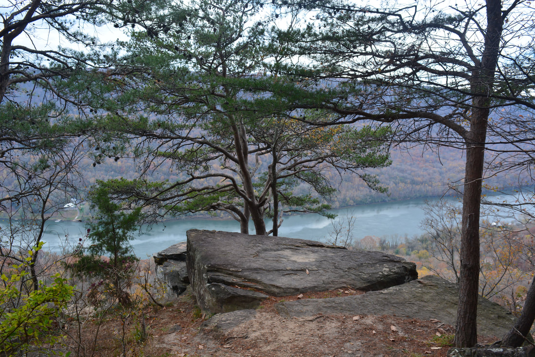
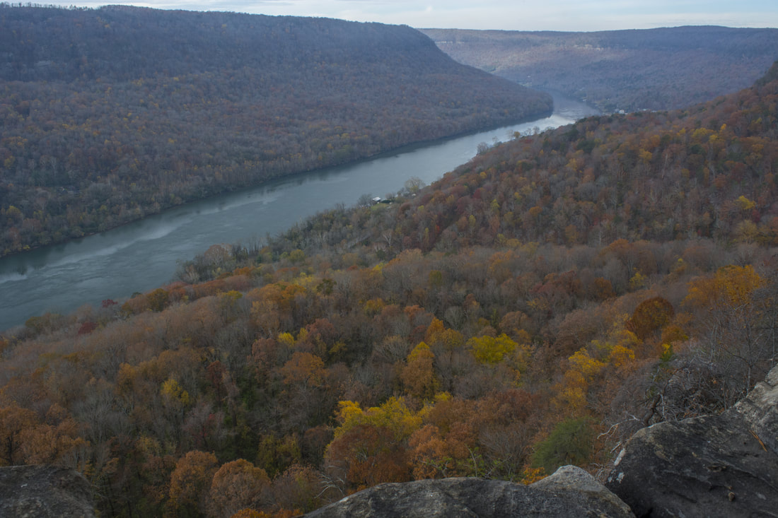
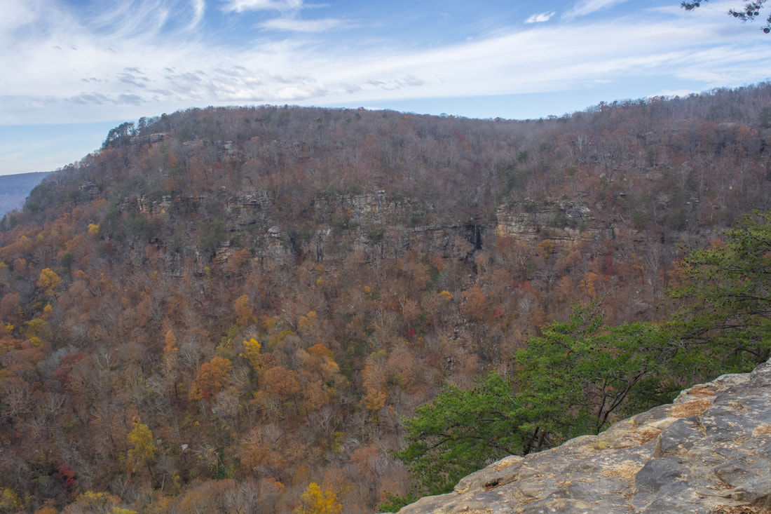
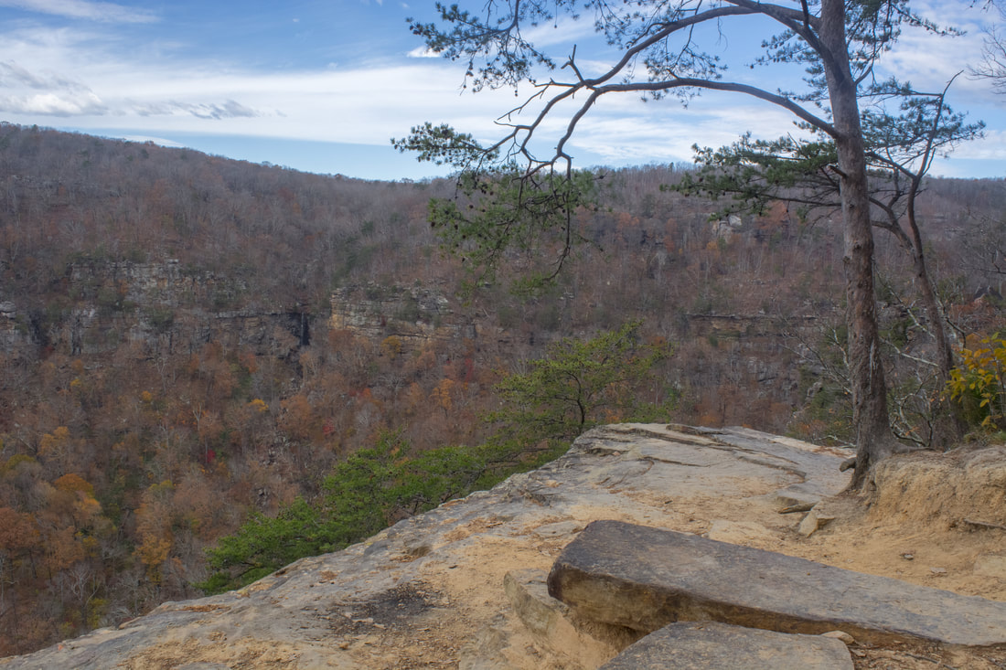
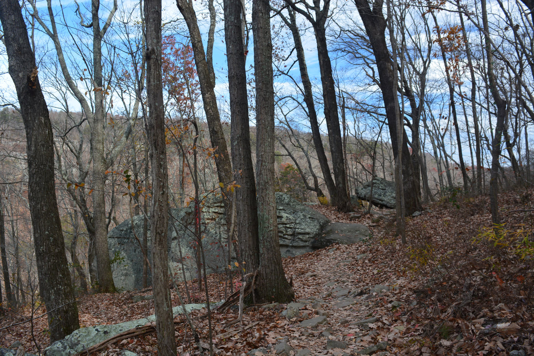
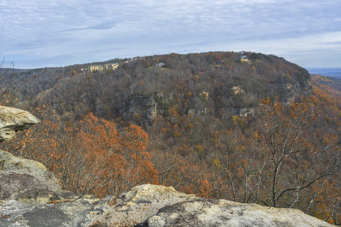
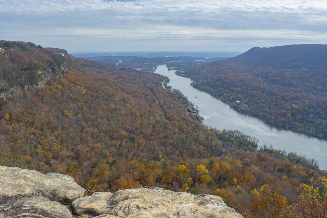
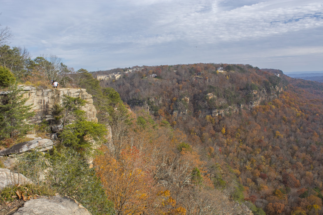
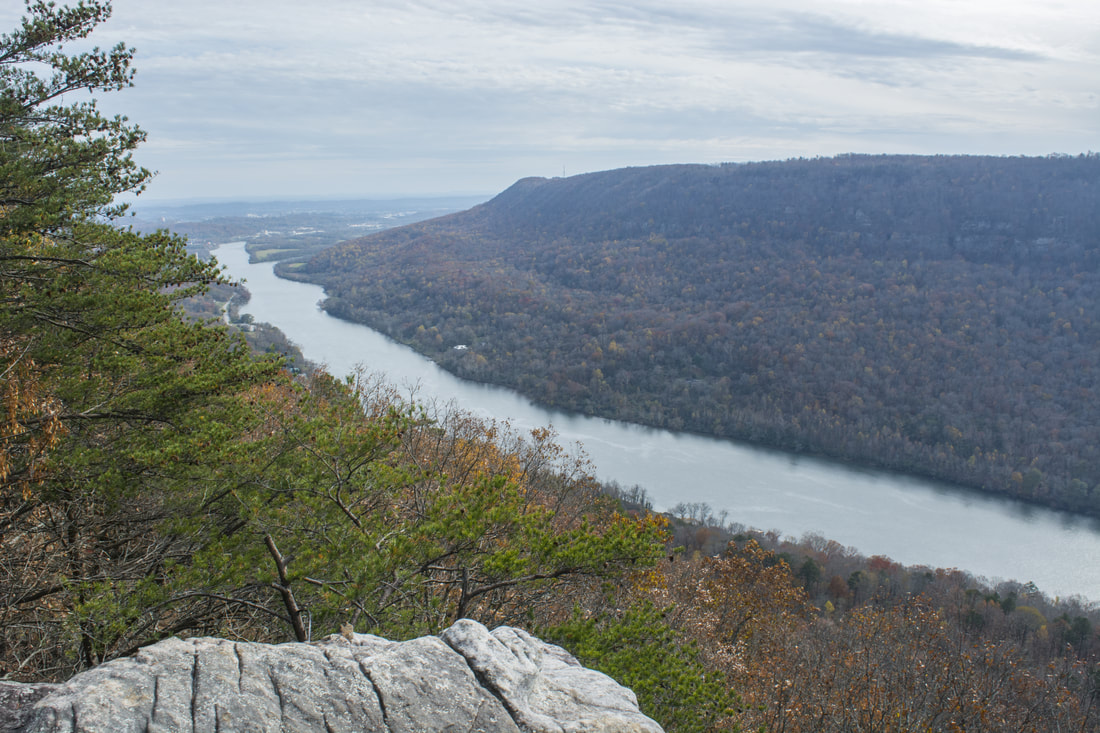
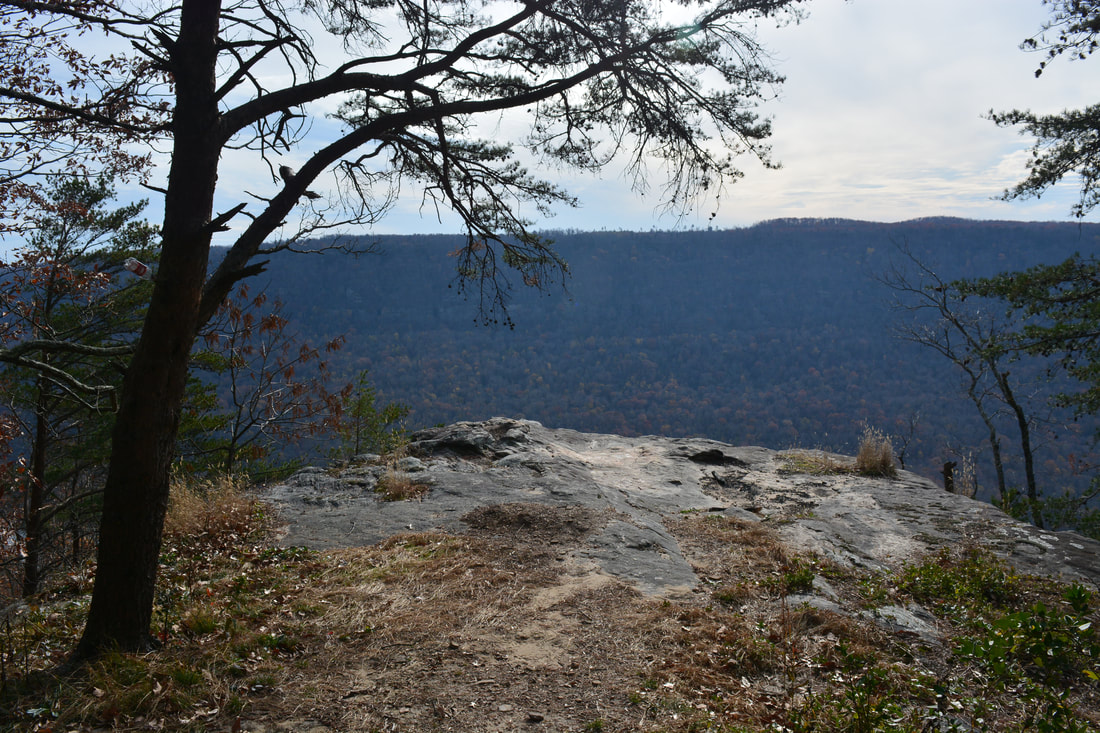
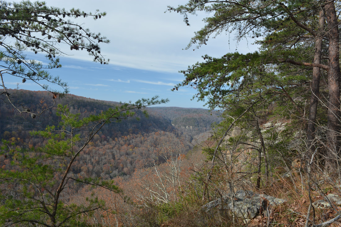
From here on, the CT follows the rim of the Middle Creek Gorge, crossing several small streams and passing views across the gorge such as an open view of the Alexian Brothers Retreat at 2.2 miles. At 2.7 miles is a crossing of the stream that forms Julia Falls. During wet periods, there are some impressive cascades just below the crossing. At 2.95 miles, where a double blaze marks a sharp right turn, there is a rock outcrop ahead with a fantastic view of the Tennessee River Gorge. Many people think this is the view from Edwards Point, but the best view is actually 0.1 mile farther (although this rock outcrop has a slightly better view of the Middle Creek Gorge). Follow the white blazes of the CT to a much bigger cliff with a stunning panoramic view on the left at 3.05 miles (there is a large ATV road clearing/intersection on the right at this spot and it is also where the Yellow Trail from Shackleford Ridge Park comes in and ends). This is the official postcard view from Edwards Point, and what a view it is! The entrance to the Tennessee River Gorge is visible straight ahead, with Signal Point on the left and Raccoon Mountain on the right forming a sort of visual gate to the gorge. Farther in the distance, the city of Chattanooga is visible. I bet it would look especially great at night from this viewpoint! Continue following the white-blazed CT. Many people don't know that there are several more viewpoints a bit farther. Over the next 0.2 miles, numerous side trails lead to cliffs and views of the Tennessee River on the left, and the trail also crosses another ATV access road. The last and second best view is on the left at 3.25 miles, where a rock outcrop provides a view downstream along the Tennessee River. The lower portion of the Suck Creek Gorge is in the view, and farther in the distance is the vast expanse of Prentice Cooper Wildlife Management Area. You might even be able to identify the cliff that is home to the famous view from Snoopers Rock! After this final view, the Cumberland Trail leaves the Tennesee River Gorge and begins tracing the rim of the smaller Suck Creek Gorge. 
A bouncy suspension bridge offers passage across Middle Creek just below the Rainbow Lake Dam...
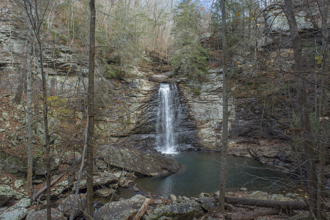
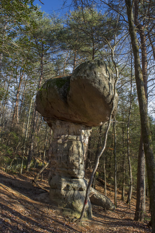
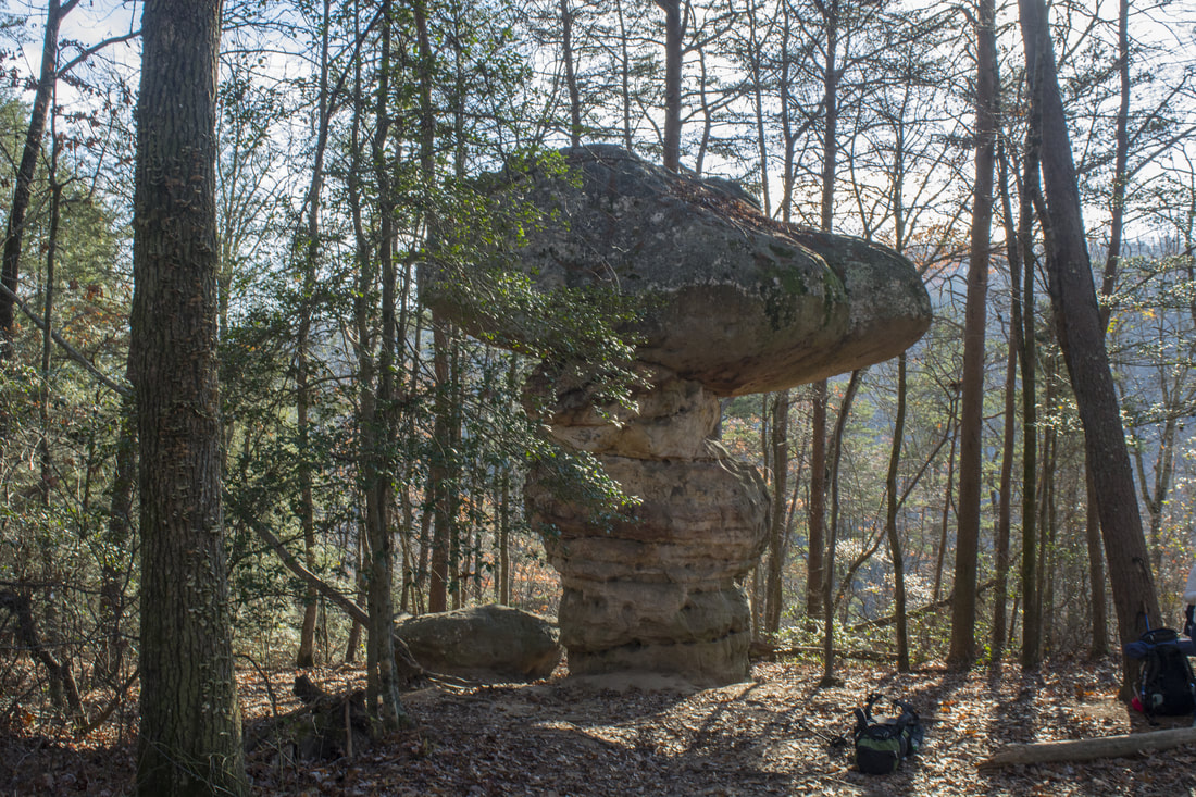
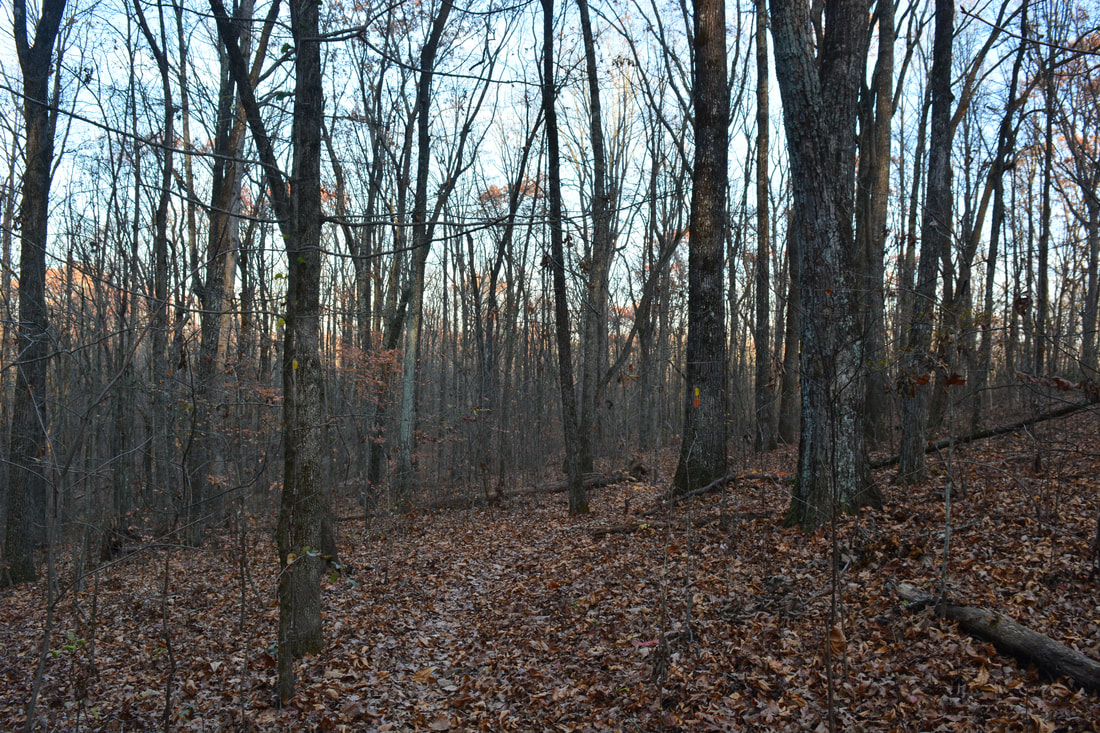
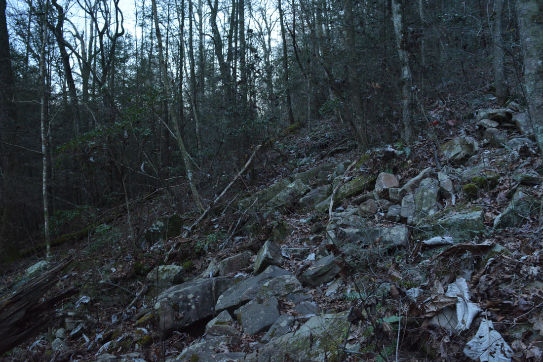
Over the next 3.3 miles, the Cumberland Trail mostly follows the rim of the Suck Creek Gorge and North Suck Creek Gorge, crossing five small streams along the way (at 4.55, 4.7, 5.25, 5.65, and 6.3 miles). Even though there aren't any spectacular sights here, it is still a great section of trail with numerous winter views into the Suck Creek Gorge and lots of solitude. It's unlikely that you'll encounter many people on this section of the trail! The first part of the section follows the boundary of the Tennessee River Gorge Land Trust where access is by permission only. At 6.55 miles, the Cumberland Trail finally reaches Mushroom Rock. This unique rock formation truly resembles a mushroom! The top part of the rock looks like the "cap" of the mushroom. Plus, the rock is around 25 feet high! Mushroom Rock is where you are going to leave the Cumberland Trail to keep following the loop. The Cumberland Trail continues straight and then bears left, first crossing the North Suck Creek Gorge and then reaching TN 27 in the South Suck Creek Gorge. There are future plans to route the Cumberland Trail upstream through the North Suck Creek Gorge to eventually connect with the North Chickamauga Creek segment of the CT, but at the moment, there is no defined route. Regardless, at Mushroom Rock, turn right onto the unmarked but obvious Mushroom Rock Trail.
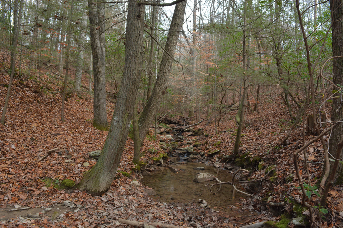
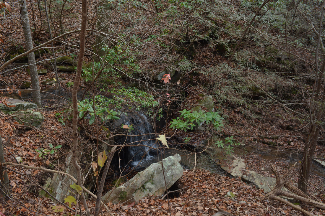
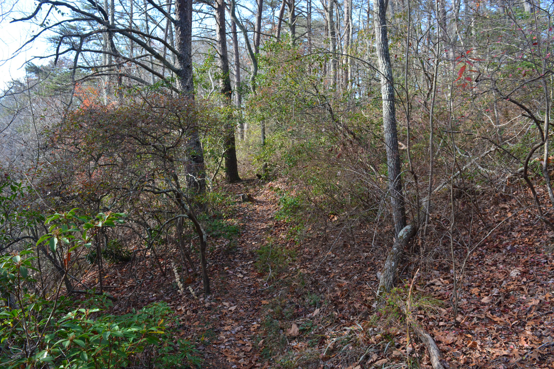
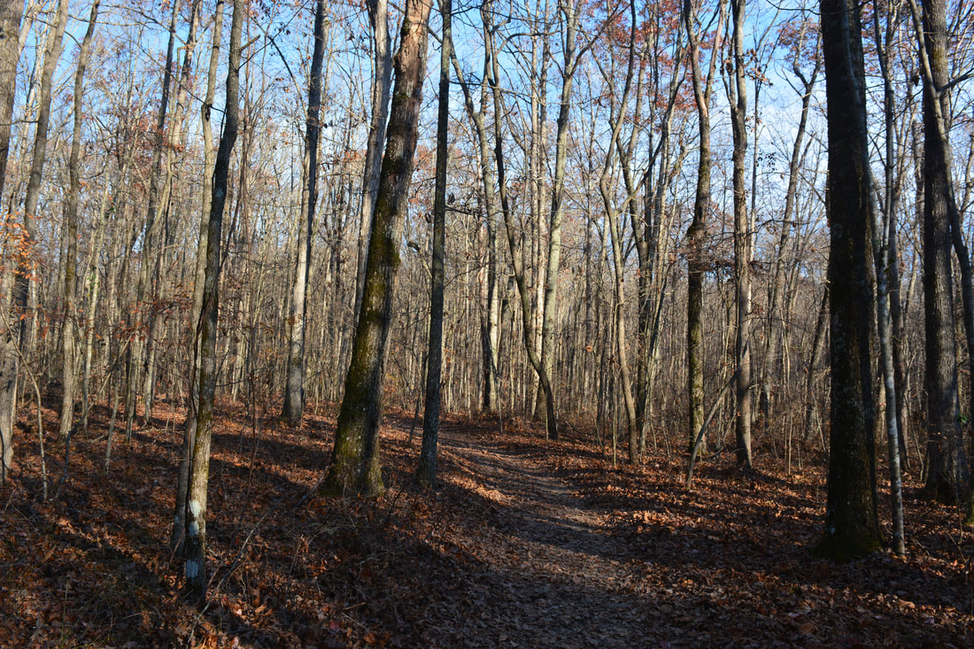
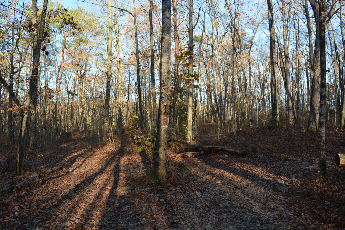
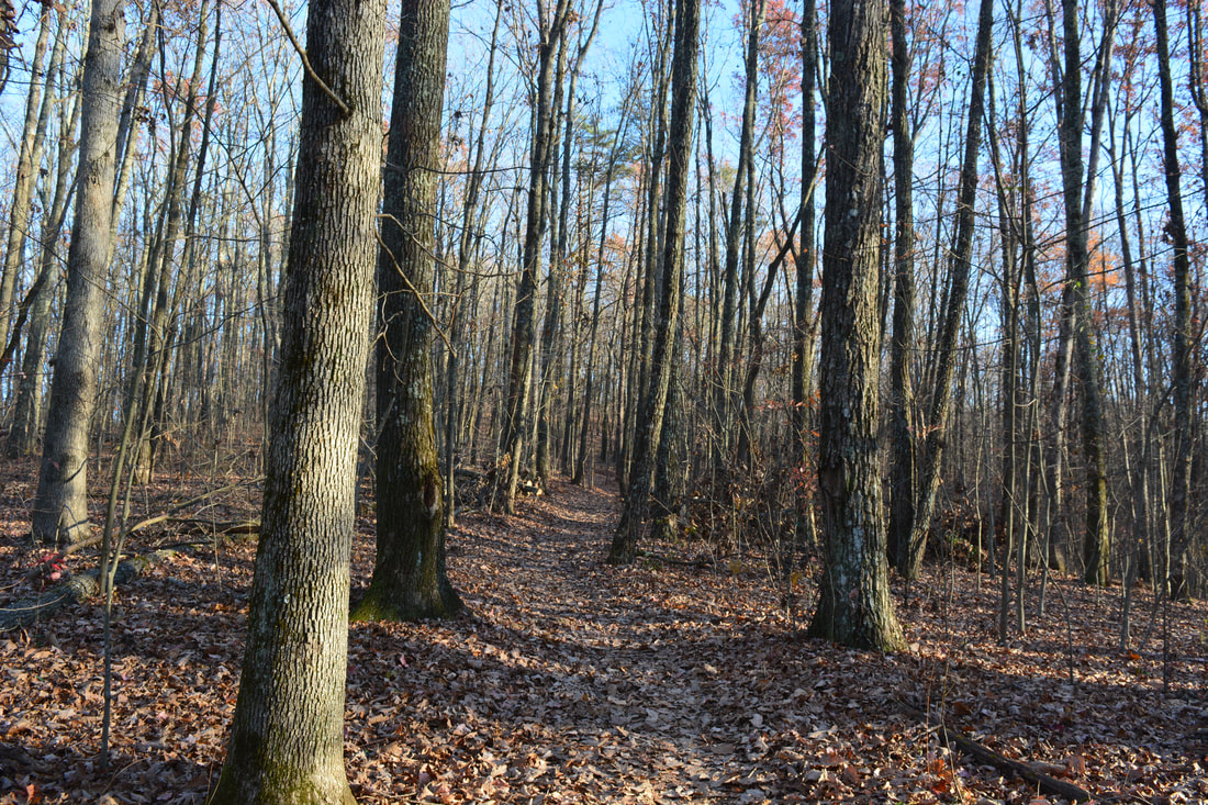
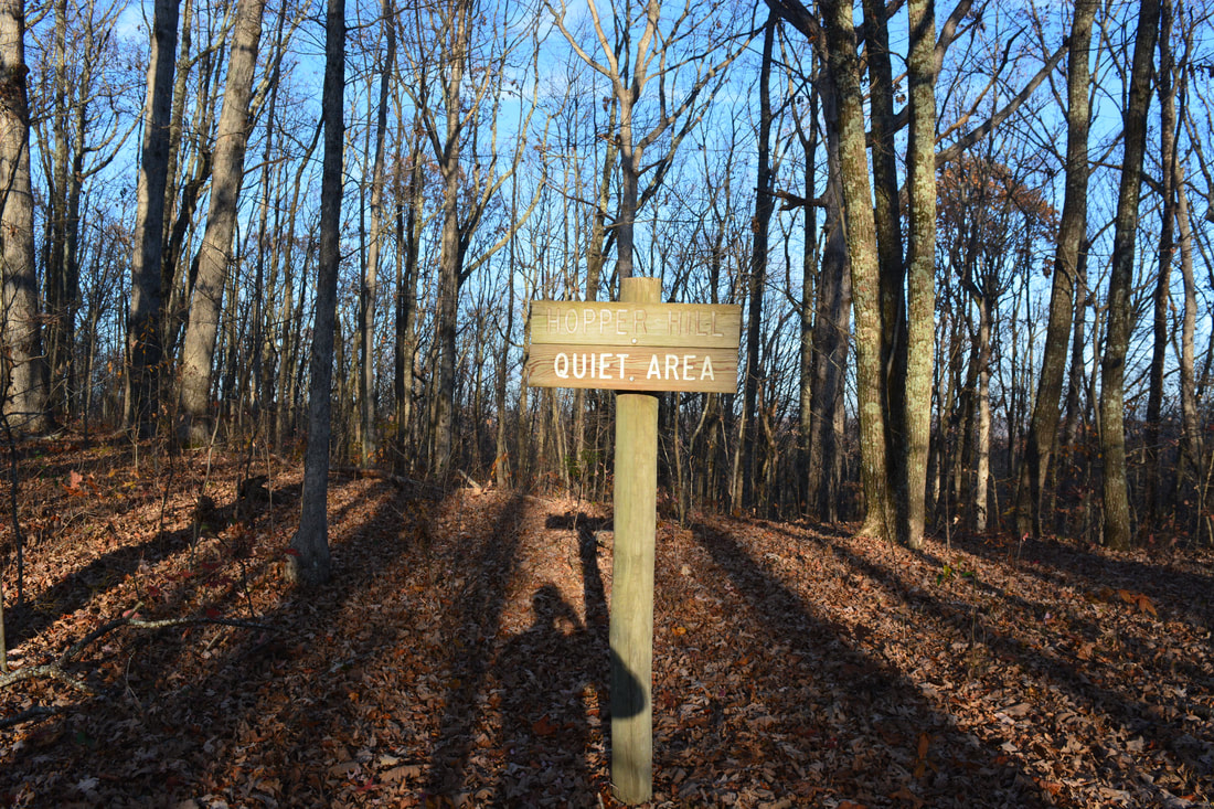
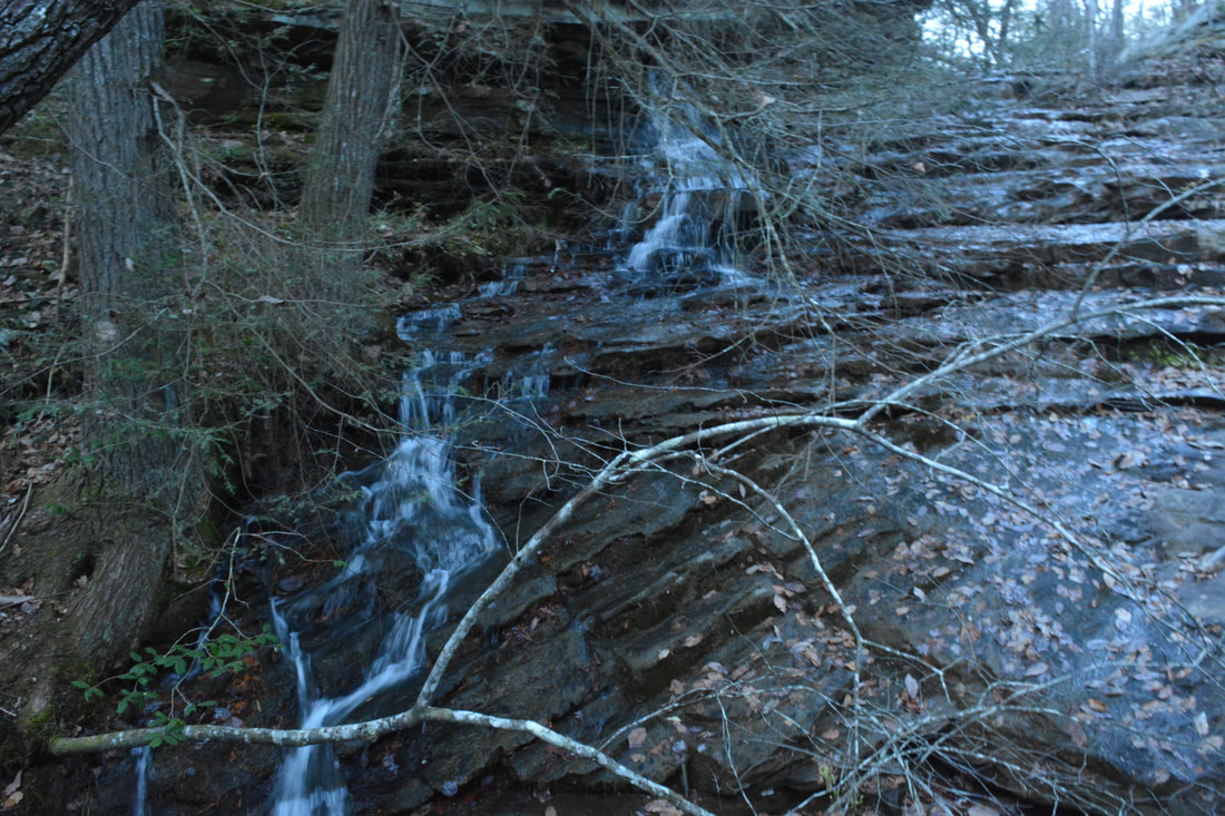
I am not sure if the Mushroom Rock Trail is official since it is not blazed, but it is very easy to follow. The trail follows old forest roads. There are three key splits and each one is marked by white arrows painted on trees. The first split is a Y-split where you should stay left; you'll have to turn left at the second split. At 7.15 miles, a narrow footlog takes the trail across a tributary of Conner Creek. 0.15 miles farther, at 7.3 miles, make sure to turn right to stay on the Mushroom Rock Trail (as an old road stays straight). The trail briefly ascends a steep hill before leveling out on the plateau. As the trail approaches the soccer fields of Shackleford Ridge Park, there are a couple of trail junctions. First, a trail marked by a white arrow leaves left - ignore it. A few feet farther, a blue-blazed trail bears right at 7.5 miles. This Blue Trail is the one you must take. The Blue Trail bypasses the soccer fields and other recreational facilities as it winds through the hills atop the plateau, crossing footbridges across some small streams. A few houses are visible to the right at 8.0 miles. The Blue Trail reaches the highest point on the hike at 8.35 miles, where a sign designates the spot as "Hopper Hill". After a shot descent off the hill, the Blue Trail reaches a signed intersection with the Yellow and Orange Trail at 8.45 miles. While the Blue Trail turns left back toward Shackleford Ridge Park, you must turn right onto the Yellow/Orange Trail (both colors run in conjunction here) to hike back toward Signal Mountain. The next portion of the Orange Trail is very easy as it stays nearly level on the plateau. At 8.85 miles, follow the yellow and orange blazes across Edwards Point Road. After the road crossing, the trail briefly parallels the road before coming to a junction at 9.05 miles. Here, the Yellow Trail continues straight on a path toward Edwards Point, while the Orange Trail turns left onto a broader track. The Orange Trail is the one you should take. After the junction, the Orange Trail finally begins a descent back into the Middle Creek Gorge. At 9.5 miles, the trail reaches an old road that appears to be an ATV path. Bear left, walk a few feet down the road, and then bear right on the orange-blazed path. The trail shortly reaches an unnamed tributary of Middle Creek with a surprising amount of water in it. 200 feet after the ATV road, stay right as another trail leaves left and crosses the creek at the brink of a small cascading falls. The trail curves around the cascade, and it's not difficult to bushwhack to the base of it. With enough water, the 20-foot stairstep cascade could be pretty photogenic, but during low water, most of the flow is slightly obscured by tree branches. 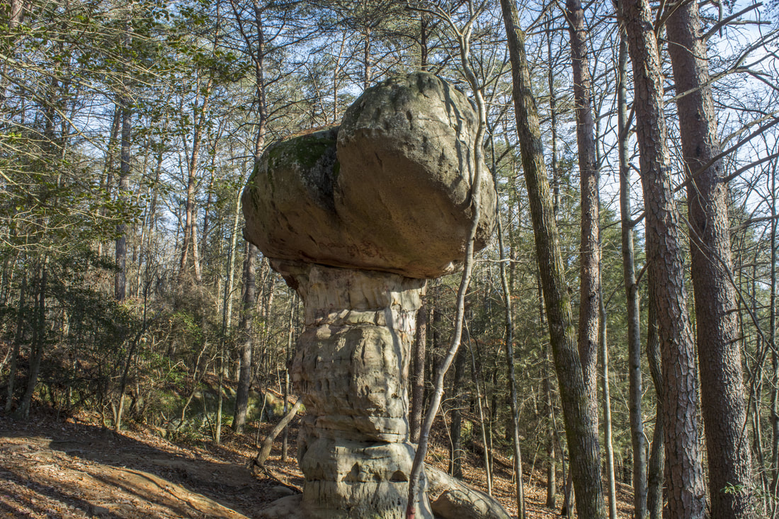
Rising about 25 feet, Mushroom Rock is a unique rock formation that has surprising resemblances to an oversized mushroom!
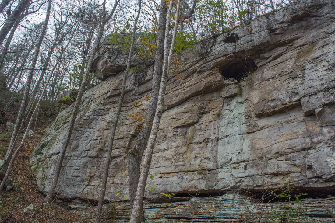
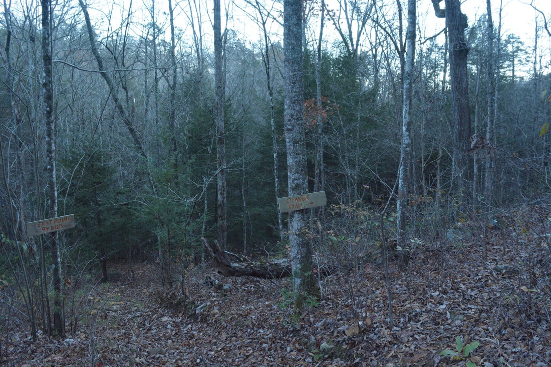
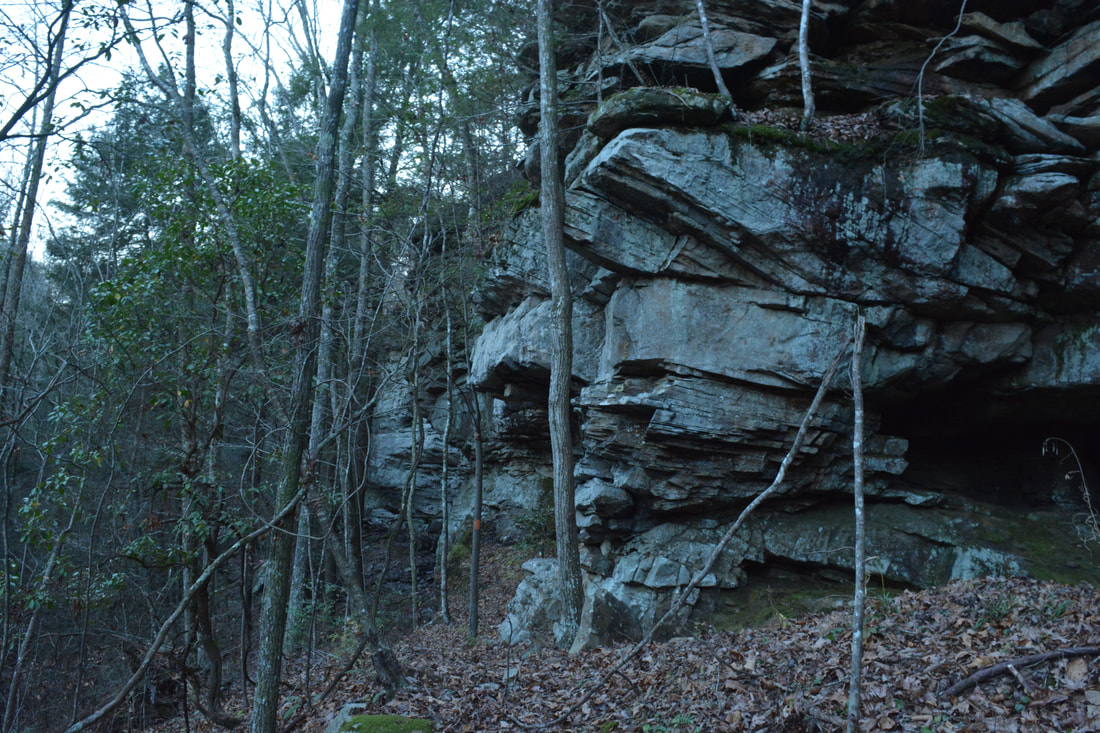
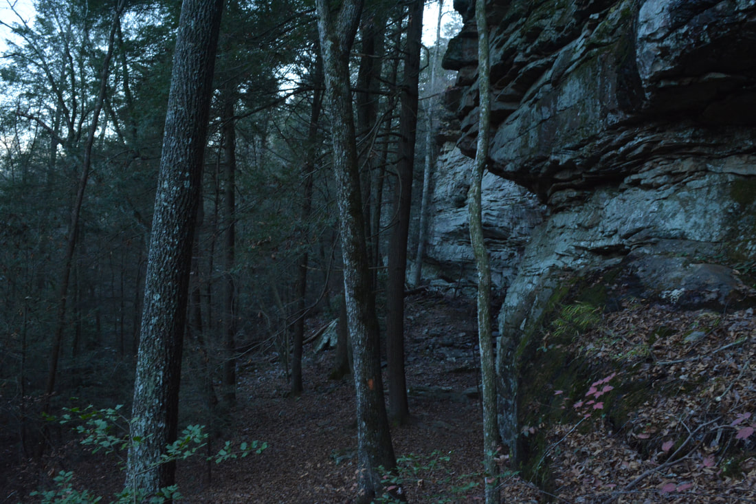
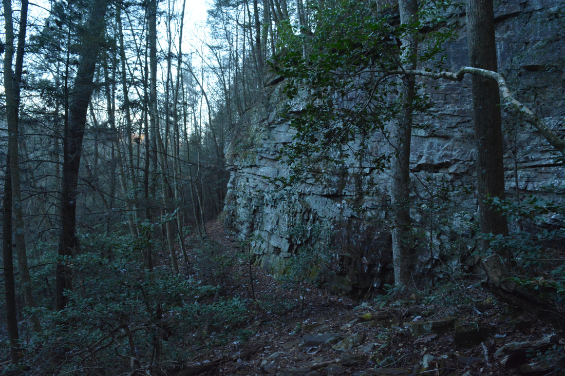
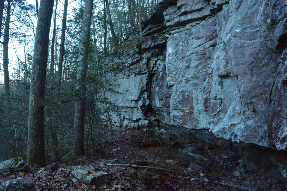
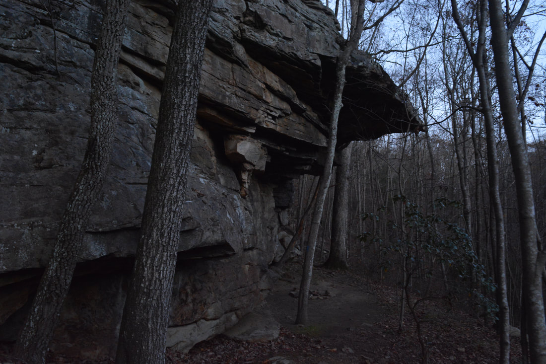
At 9.85 miles, the Orange Trail makes two switchbacks as it drops to the bottom of the Middle Creek Gorge. Immediately past the second switchback is a signed junction just before Middle Creek. It's important to not overshoot this junction, because the Orange Trail turns right here and begins following the Middle Creek Gorge downstream. A sign states that the trail straight ahead leads 0.94 miles to an exit point at Timberlinks Drive. Regardless, for this hike, turn right onto the Orange Trail. The following section of the Orange Trail, between the "Exit Point" junction and Bee Branch Trail junction, is very scenic and is one of my favorite parts of the hike. The trail immediately begins following the bluff line above Middle Creek. As the faint orange-blazed path traces the base of the bluffs, keep looking up to see all of the unique rock outcrops and the cliffs rising as tall as 80 feet. In general, the path stays very close to the bluff line and not near Middle Creek, although there are a few glimpses of the creek from time to time. A particularly gorgeous spot is at 10.1 miles, where a tiny stream drips over a particularly tall section of cliffs. Even where the trail isn't directly following the bluffs, it is still very rocky, rugged, and slow. Finally, at 10.5 miles, the trail reaches a marked junction with the Bee Branch Trail. The Orange Trail continues straight 0.3 miles to the lowers Middle Creek suspension bridge on the CT (where you were earlier), but this hike turns left onto the Bee Branch Trail, which crosses the creek via a second suspension bridge that isn't much less bouncy than the first one.
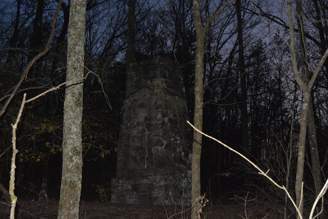
A final 300-foot ascent out of the Middle Creek Gorge begins along the Bee Branch Trail. You'll pass several more impressive cliffs along the way. At 11.0 miles, the trail crosses Bee Branch. Shortly afterward, the trail levels out near the rim of the gorge and comes up along the boundary of a private golf course on Signal Mountain. A historic homestead with a standing old chimney is located to the left at 11.2 miles. At 11.3 miles, the blue-blazed trail from Rainbow Lake and the Cumberland Trail comes up from the right. Continue straight on the increasingly wider trail toward the Ohio Avenue Trailhead. The trail gets a little confusing after passing Burnt Cabin Spring at 11.5 miles, but just keep following the main track and do not take one of the paved paths that are part of the golf course. Finally, at 11.7 miles, the trail ends at the parking area off Ohio Avenue. To finish off the hike, turn right onto Ohio Avenue and walk along it for 0.1 miles. Then, turn right onto Signal Point Road, and follow it for the remaining 0.3 miles to the Signal Point parking area, concluding the hike at 12.1 miles in Signal Point Park. The Edwards Point Loop is a true Cumberland Plateau classic. With up to two waterfalls, numerous long-range views, and many interesting rock formations and cliffs, there'll be plenty of gorgeous scenery to keep you occupied through much of the hike - even if a few segments in the middle might feel a little monotonous. A unique feature of this hike is the easy option of turning it into a loop unlike most other Cumberland Trail hikes, where you are forced to go out and back due to the lack of secondary trails. I've done a handful of hikes on the Cumberland Plateau and I believe that this is one of the finest. I am rating it a "Best Hike" and highly recommend it to all hikers from Tennessee and beyond! 
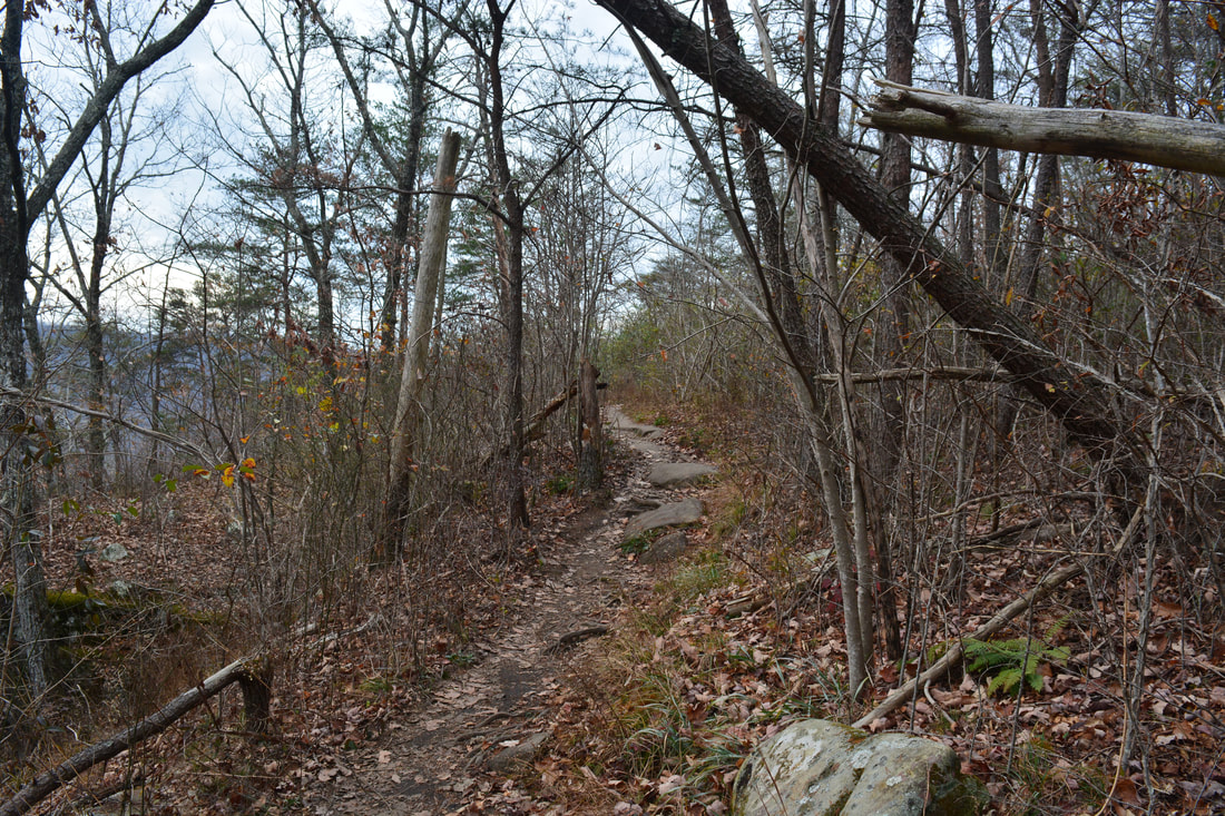
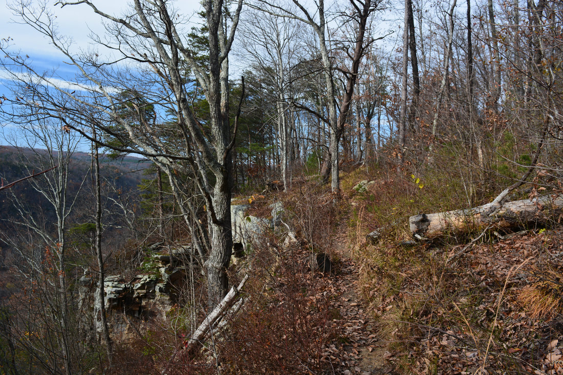
The Orange Trail's passage along the Middle Creek Gorge bluff line is one of the most exciting parts of the Edwards Point Loop.
Mileage
0.0 - Signal Point Park
0.2 - Vista below Signal Point 0.5 - Julia Falls Overlook 1.6 - Rainbow Lake Dam 2.0 - Lockhart Arch 3.05 - First Main View at Edwards Point 3.25 - Second Main View at Edwards Point 6.55 - Mushroom Rock 7.5 - Blue Trail Junction 8.35 - Hopper Hill 8.45 - Yellow/Orange Trail Junction 8.85 - Edwards Point Road 9.05 - Yellow/Orange Trail Split 10.5 - Bee Branch Trail Junction 11.7 - Ohio Avenue 12.1 - Signal Point Park Variations
Hike out and back to Julia Falls Overlook from Signal Point - 1.0 Miles
Hike out and back to Edwards Point from Signal Point - 6.5 Miles Hike out and back to Mushroom Rock from Signal Point - 13.1 Miles Bonus Stops
After the hike, I suggest driving up Palisades Drive and seeing the roadside view of Chattanooga and the Tennessee River Valley from Wilder Point. I actually spent some time on nighttime city lights photography there following the Edwards Point hike. The photo gallery below includes one night photo from Wilder Point at the end.
Photos & Videos
2 Comments
Anne Davis
12/17/2017 03:58:52 pm
Yes, that exit from the orange trail leads out to Timberlinks.
Mark Oleg
12/17/2017 05:32:22 pm
Thanks Anne for confirming! Leave a Reply. |
About MeMark Oleg Ozboyd Dear readers: I have invested a tremendous amount of time and effort in this website and the Georgia Waterfalls Database the past five years. All of the work that has gone in keeping these websites updated with my latest trip reports has almost been like a full-time job. This has not allowed me to pick up a paid job to save up money for college, and therefore, I I've had to take out loans. If you find the information on this website interesting, helpful, or time-saving, you can say "thanks" and help me out by clicking the button above and making a contribution. I will be very grateful for any amount of support you give, as all of it will apply toward my college tuition. Thank you!

Coming in 2022-2023?
Other Hiking WebsitesMiles HikedYear 1: 540.0 Miles
Year 2: 552.3 Miles Year 3: 518.4 Miles Year 4: 482.4 Miles Year 5: 259.9 Miles Archives
March 2021
Categories
All
|
||


 RSS Feed