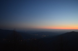
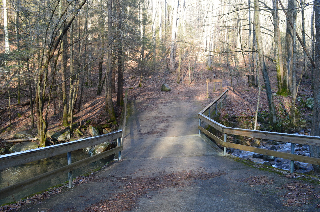
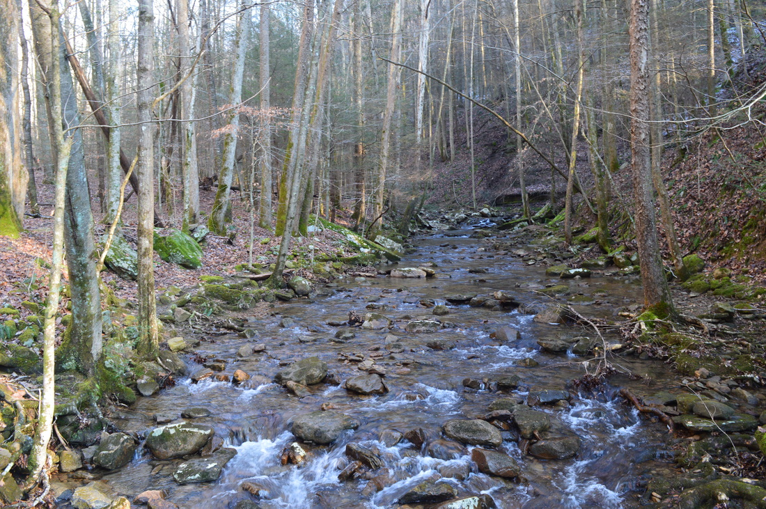
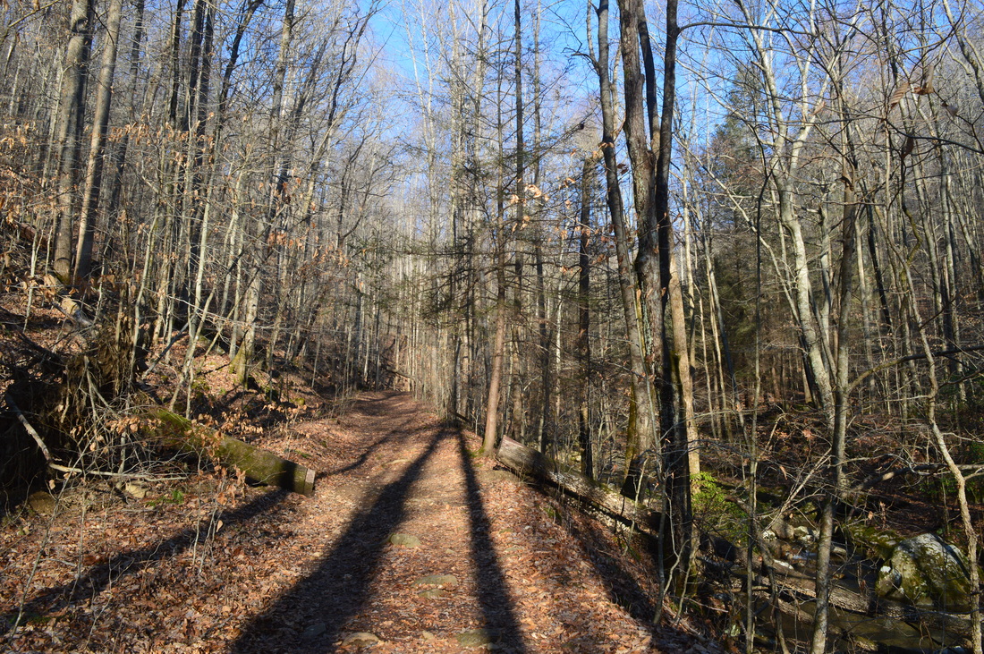
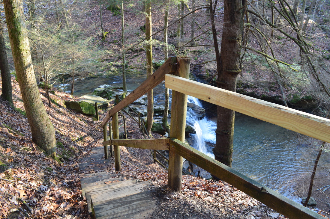
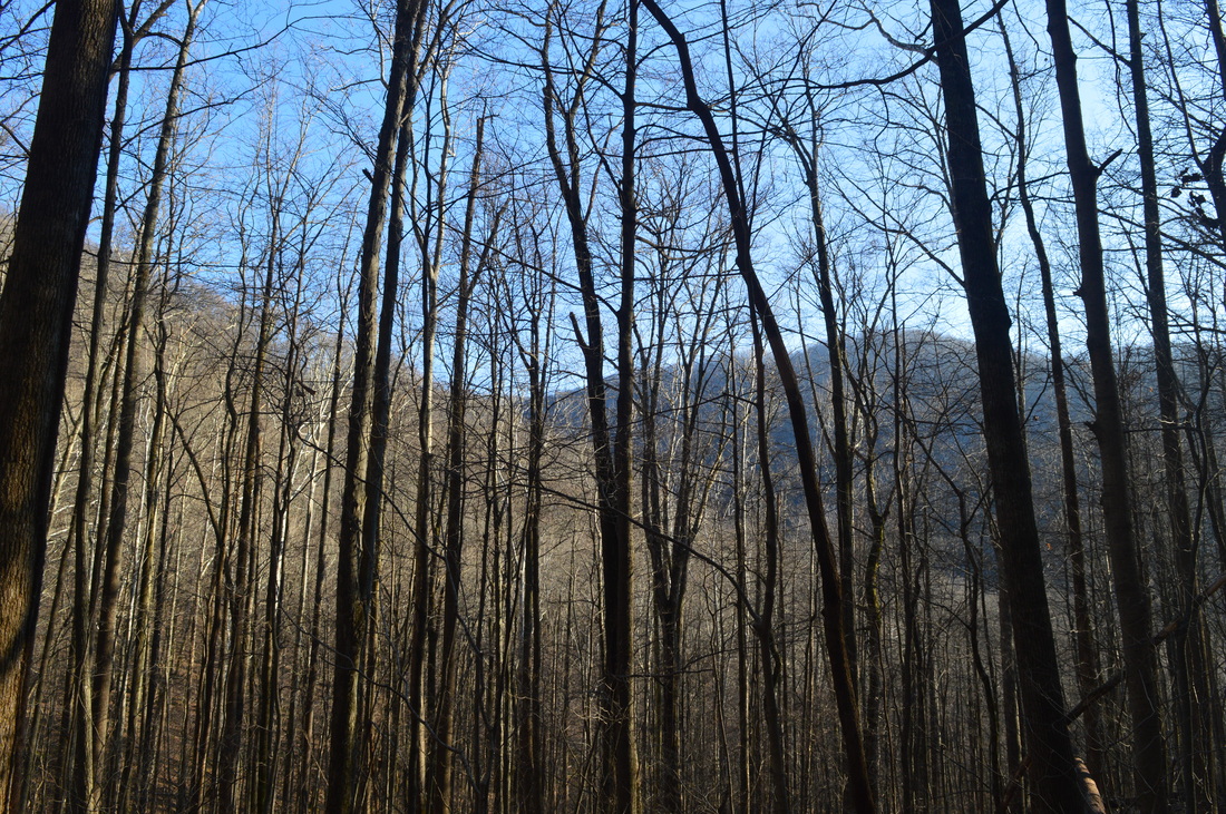
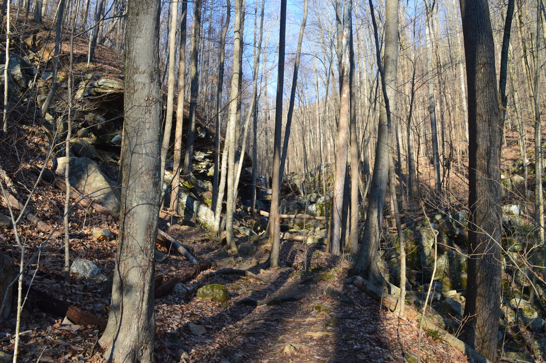
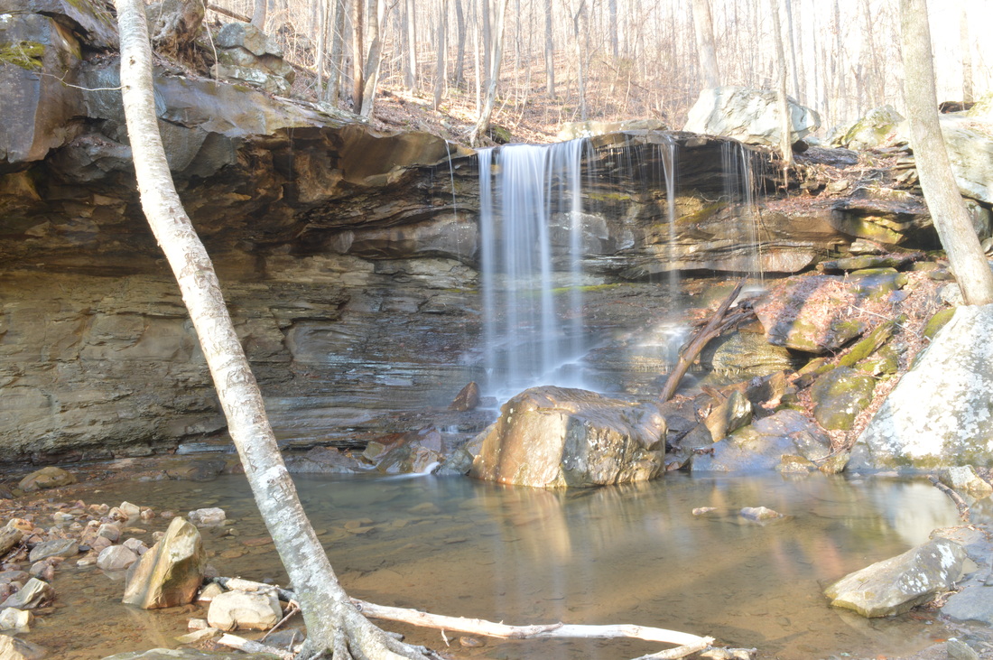
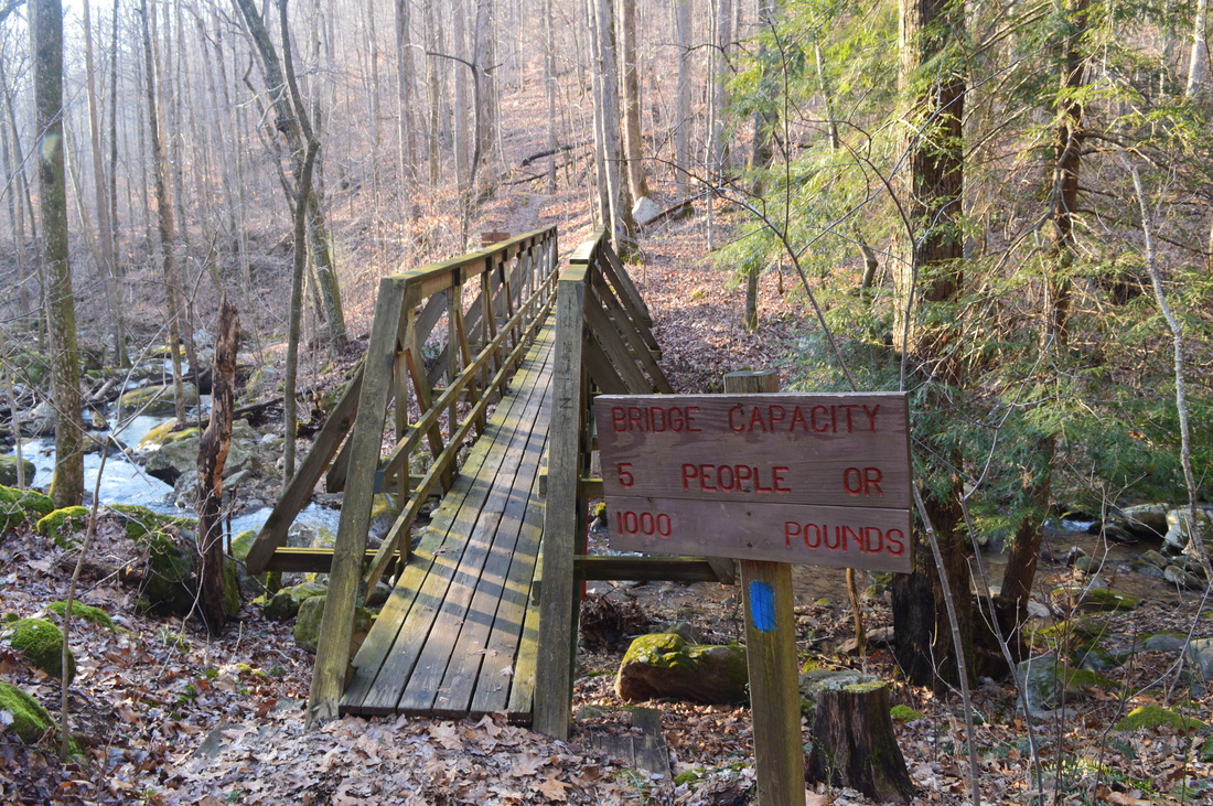
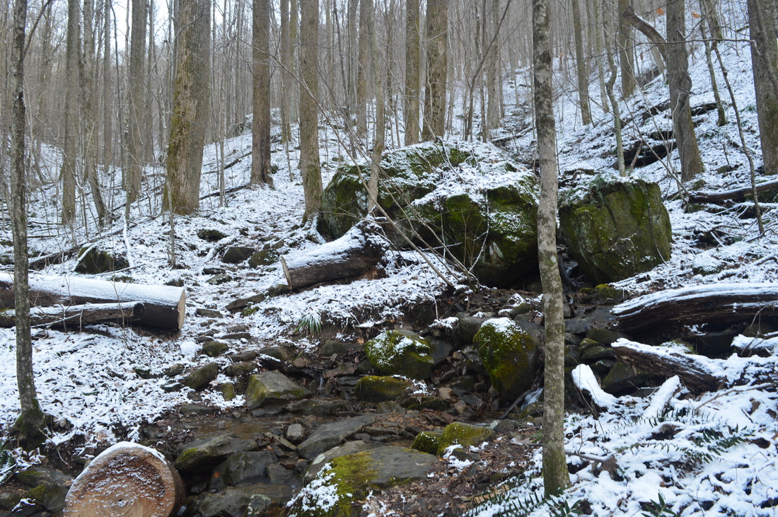
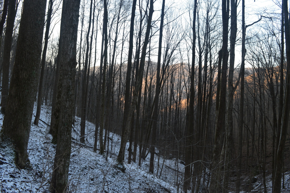
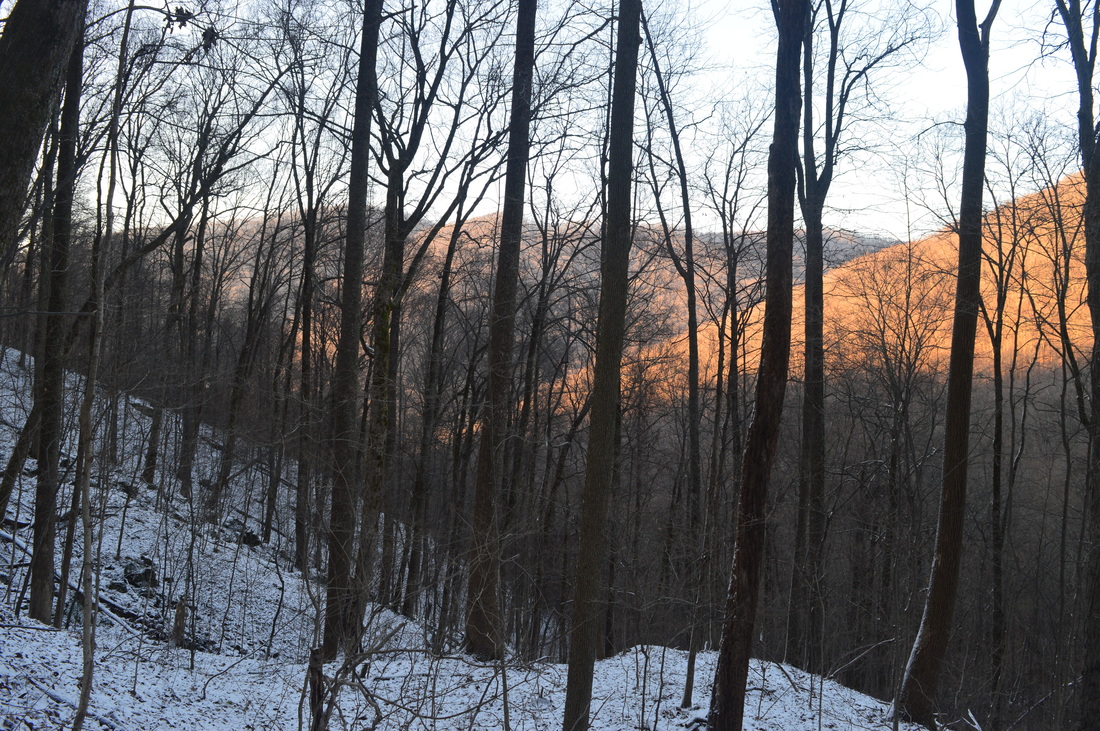
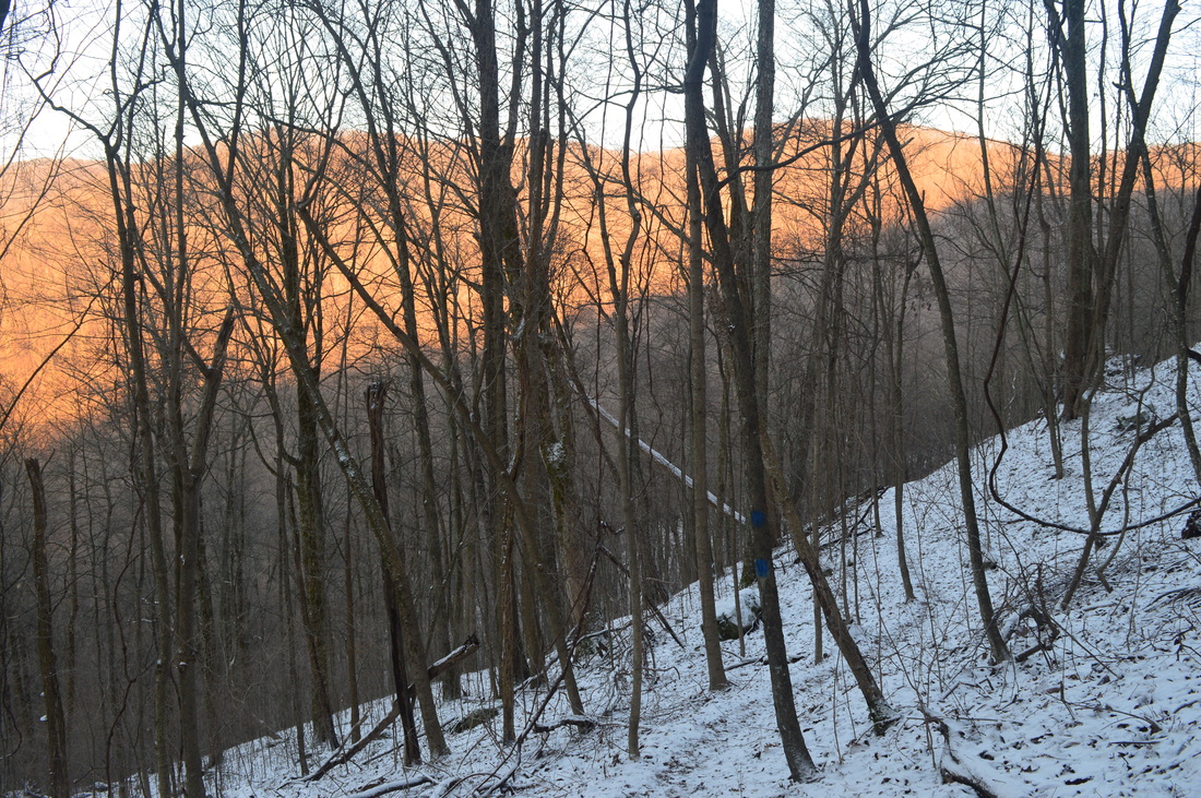
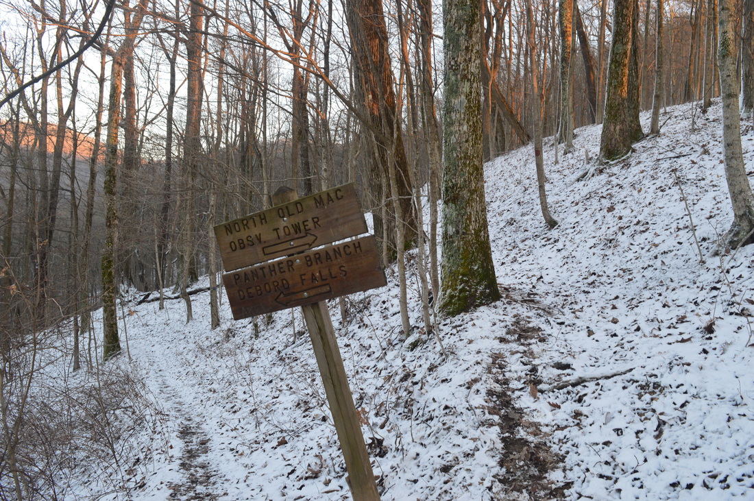
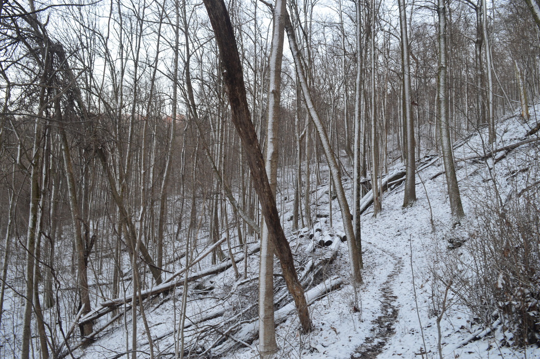
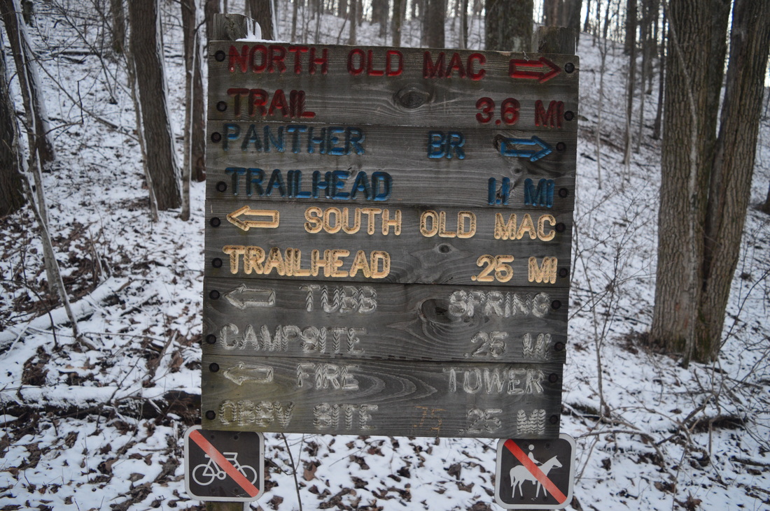
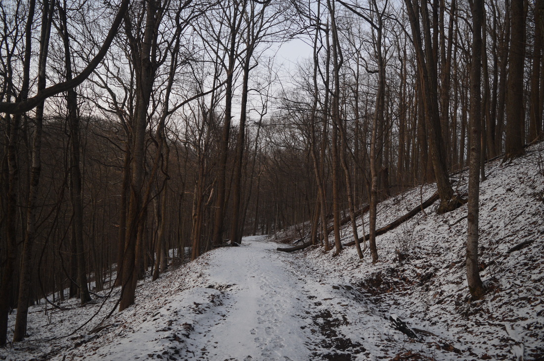
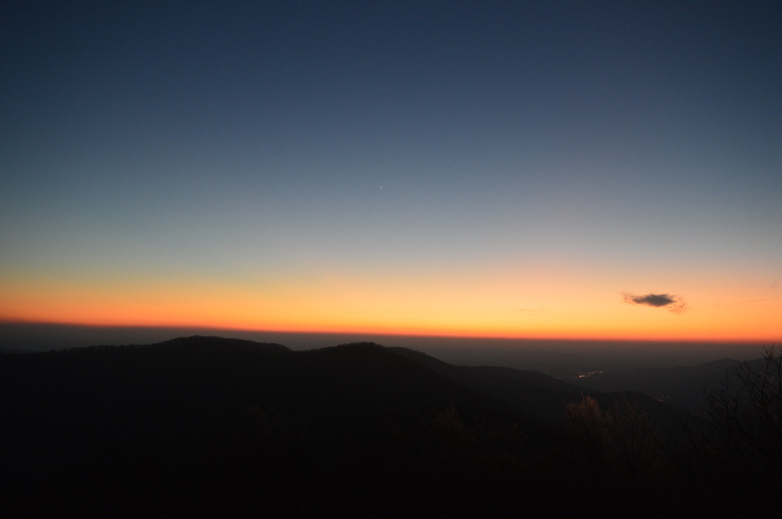
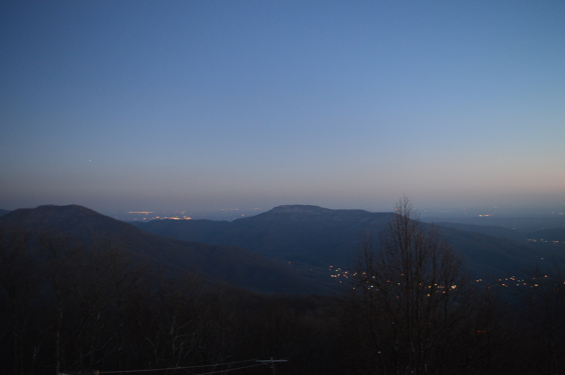
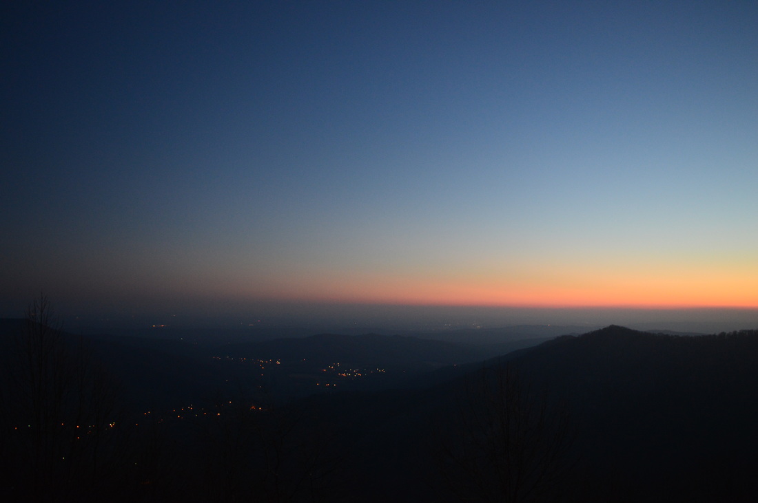
 The Cumberland Mountains is the Cumberland Plateau with a twist - the same canyons but higher elevations and better views. Frozen Head State Park has some of the best the Cumberland Mountains have to offer: two waterfalls and a fire tower with panoramic views. This hike occurred on January 24th, 2015. My plan was to hike the Panther Branch Trail to North Old Mac Trail, and take the North Old Mac Trail to Frozen Had Lookout Tower. Along the way, I would stop at DeBord Falls and do the spur trail to Emory Gap Falls. From the Lookout Tower, I would return by Lookout Tower Trail back to the main park road, and then follow it back to the trailhead. R/T Length of Trail: 12.6 Miles Duration of Hike: 5:50 Type of Hike: Loop Difficulty Rating: 6 out of 10 Pros: No steep climbing; descent is very gradual along old road; panoramic views from lookout tower Cons: Emory Gap Falls needs some water Scenic Views: Frozen Head Lookout Tower - 7 stars Water Features: DeBord Falls - 4 stars; Emory Gap Falls - 5 stars Trail Blaze Color(s): Panther Branch Trail - Blue; Emory Gap Trail - White; North Old Mac Trail - Red; Lookout Tower Trail - None Best Season(s) to Hike: Year-round; Winter might be best but can be cold at fire tower Beginning Point: Panther Branch Trailhead in Frozen Head State Park Directions: From Wartburg, TN: Follow TN State Route 62 for about 2 miles, and then turn left onto Flat Fork Road. Follow Flat Fork Road for 5.2 miles to the dead end and parking area. I have meant to do some hiking in the Cumberland Mountains for a while. This is only my second hike there - the first one was near Middlesboro, Kentucky. It's just so far away from where I am. But it's a beautiful area. I like how it combines both rocky gorges and many scenic views, making some hikes potentially more interesting than the ones on the Cumberland Plateau. This hike is a good example of what to expect, when hiking in the Cumberland Mountains. The Flat Fork and its tributaries have two waterfalls inside Frozen Head State Park: DeBord Falls and Emory Gap Falls. Both are not very impressive, but they are worth the side trips. DeBord Falls is smaller but has more water - Emory Gap Falls is taller and longer, but it is on a small side branch that can be dried up in summer. Even in winter when I went, the water level was not very good, but enough to make the waterfall worth seeing. The hike starts at the Panther Branch Trailhead. The parking area is on the south side of the Flat Fork, but right away, the trail crosses the Flat Fork on a concrete bridge and then starts following it on a very wide trail (possible old roadbed?). Most of the small tributaries are crossed on wooden bridges on this section of the trail. The level of maintenance is really good on the entire hike. At 0.5 miles, reach the short spur trail to DeBord Falls. It leaves right, off the main trail, and after passing by an observation deck of the falls, descends to the Flat Fork and gives a view from the base of the falls. While the falls isn't tall or strong, it is slightly unusual with the way it is shaped. After DeBord Falls, keep following Panther Branch Trail along the Flat Fork on mainly flat terrain until another junction at 1 mile. Here, the Panther Branch Trail turns right to cross the Flat Fork on a large wooden bridge, while the Emory Gap Trail goes forward. The Emory Gap Trail is a spur trail leading to Emory Gap Falls. It is 0.5 miles one way. The junction is at the place where Emory Gap Branch and Panther Branch form the Flat Fork. The Emory Gap Trail follows Emory Gap Branch. It starts climbing, and then at 1.2 miles, makes a long two switchbacks as the creek rises more sharply. These switchbacks in a place where they were barely needed really show the high maintenance of the trails in the park. At 1.5 miles, the trail ends just below Emory Gap Falls, and there is a sign that the trail ends too. However, Emory Gap Falls is hardly see from this vantage point. It's best to cross the creek on a large fallen tree and then scramble up to the falls to see it closely. The falls is one moderate-sized drop over a ledge, and then a series of small cascades. If there was very high water here, the falls would be very scenic, but I suspect that the water level I saw them at is close to maximum. At 2 miles, return to the Panther Branch Trail, and cross Flat Fork on the footbridge. On the other side of the creek, reach the Panther Branch Campsite. Maximum group size here is 8 people. It is a nice spot in a flat that is just enough from the creeks to not fully feel the moisture effects of it. Water is close by though. The Panther Branch Trail follows Panther Branch for 0.4 miles, and then crosses it on a small, wooden footbridge. After this, the trail follows Panther Branch's right side and crosses a couple of small feeder stream. All of them were small, but one didn't have any rocks whatsoever, so it did require wet feet, but barely so, because the water is so shallow that it's not noticed. Then, at 2.8 miles, the trail sharply switchbacks away from the creek. There is a sign here as well. There is a steep, narrow, but evident path that continues beyond the sign. Judging by maps, this seems like it could be a shortcut to Panther Gap below the summit of Frozen Head Mountain. This is not an official trail, though, so just use the official trail as it's described and signed. The trail leaves Panther Branch for good after the sign, but it does cross several of the feeder streams that were crossed below. None of these are problematic. The trail switchbacks its way to Old Mac Ridge, and along the way, there are good winter views of Bird Mountain and Emory Gap area. At 3.3 miles, the trail reaches a junction with the North Old Mac Trail. Turning right leads to the Frozen Head State Visitor Center, while turning left leads toward the fire tower. It's about 2.8 miles to the office if turning right, and 1.8 miles to the fire tower, if turning left. I turned left. The North Old Mac Trail follows the contours of Old Mac Ridge, but never quite reaches the top of the ridge. There are still good winter views into and across the Flat Fork Valley. At 4.3 miles, the North Old Mac Trail ends at the Lookout Tower Trail. Turning left eventually brings you back to the park, although it's quite a distance from here. My plan was to return that way. Meanwhile, turning right on the Lookout Tower Trail leads to the fire tower and can also lead to a variety of other places, if you know where you are going. I'll explain that shortly. I turned right. The Lookout Tower Trail is wide service road for the communication towers on Frozen Head Mountain, as they are located right by the fire tower. At 4.6 miles, the Lookout Tower Trail reaches a gap in Old Mac Ridge that separates the main summit of Frozen Head Mountain from everything else. This gap is also home to a major trail junction - one of the biggest in the park. It perhaps can act as a centerpoint, although it's a little too far southeast. A hard right would take you onto the South Old Mac Trail. This trail descends to Judge Branch and eventually reaches the Visitor Center in 3 miles at the same place where North Old Mac Trail does. South Old Mac Trail never reaches Judge Branch. It stays somewhat above it,although it's always within hearing distance down below. At some point down the trail though, the Judge Branch Trail splits off and follows Judge Branch, eventually reconnecting with South Old Mac Trail. A softer right at the gap junction would take you onto the Chimney Top Trail. At 6.8 miles, it is the second longest trail in the park (after the 8.5-mile Lookout Tower Trail). The Chimney Top Trail follows a ridgeline much of its length, and might have fantastic winter views both north and south. It eventually ends at the park Visitor Center too, although it is longer than both North Old Mac Trail and South Old Mac Trail. It is probably more scenic too. A sharp left at the gap junction will lead shortly to Tub Spring Campsite (maximum group size 10 people). A softer left at the same junction is the continuation of the Lookout Tower Trail. The Tub Spring is just down the trail there. It is the start of Sugarcamp Branch, a feeder of the New River. The trail also reaches Armes Gap and TN State Route 116 in 2.3 miles. Finally, a spur trail continues forward at the gap junction, reaching the Frozen Head Fire Tower in a half mile. This is where I was headed now. I have forgot to mention that pretty much since I left the Flat Fork, I was walking in a light snow cover, maybe half an inch altogether. That snow cover was maximized as I was approaching the Frozen Head Mountain summit. The old road leading to it looked nice in the light snow. This last half-mile, while is a steady climb, is not steep. It is surprising that there are no steep climbs at all on this hike despite a fairly good elevation gain. There are good winter views as the old road climbs to the summit of the mountain. The views are to the west - a direction we haven't really seen much into yet, because until now, Bird Mountain would block the view. At 5.1 miles, the trail reaches the summit of Frozen Head Mountain and the communication towers and fire tower. There used to be a classic fire tower here, but the park renovated it and made an observation deck at the top, similar to the one on Wesser Bald, except it is metal, not wooden. The tower supports 25 people at a time. The view from the tower is good and nearly 360 degrees. The main landmark is Fodderstack Mountain to the east. The Lookout Tower Trail heads to Armes Gap, and then connects with a trail that climbs to Fodderstack Mountain. The mileages are relatively short for what looks like a HUGE gap in between the two mountains! I'll have to try it one day. To the south, you can see the primarily flat expanse of the Cumberland Plateau. As you know, the Cumberland Plateau isn't really "flat", but being 2000 feet higher than most of it, it will look flat from this place. There are some views west too, but really the only direction it's harder to see is north, because the trees there are higher than the fire tower. There are still some winter views that way. Once you have enjoyed the view, retrace your steps back to the main gap junction, reaching it at 5.6 miles. From the gap, continue following the Lookout Tower Trail the direction you came from, but when you reach North Old Mac Trail at 5.9 miles, do not turn onto it - keep following the old road (Lookout Tower Trail) passing through Panther Gap. A spur trail leads right to Panther Gap Rockhouse Campsite. The next several miles are mainly along or on top of a ridgeline, with great winter views south and sometimes north too. I was expecting this section to be mainly flat or downhill, but it's not. There's several climbs, although none are prolonged or steep. At 7.4 miles, Coffin Spring Trail exits right. It connects to the Cumberland Trail in 0.8 miles. The main trail bears left and bypasses the summit of Square Knob. At 8.1 miles, the Square Knob Campsite will be on a spur trail on the right. Shortly after this, a steep descent leads to Emory Gap at 8.4 miles. At 8.7 miles, the trail reaches a junction with the North Bird Mountain Trail, and also the Cumberland Trail ties in here. The North Bird Mountain Trail turns right and traverses the northern sections of Bird Mountain before joining the Bird Mountain Trail in 5.5 miles. The Lookout Tower Trail briefly follows the Cumberland Trail, but at 8.8 miles, at the junction with Bird Mountain Trail, they separate. The Cumberland Trail turns right and follows the Bird Mountain Trail. The Bird Mountain Trail was my original plan, as it ends up in the same place as the Lookout Tower Trail. However, it's over a mile longer and has many ups and downs along the Bird Mountain ridge. It might be a good idea for a separate hike or at least not in conjunction with Frozen Head Mountain. I might try it one day. But the route of this hike continues forward on the Lookout Tower Trail. The Lookout Tower Trail leaves the ridgeline for good from here. It is a steady descent the next 3 miles to the park. The trail continues to be a wide service road, and it is a gradual descent with no steep grades. There will be two streams crossed on wooden bridges. At 11.6 miles, the trail reaches the lower end of Bird Mountain Trail, which comes in from the right. Then, at 11.8 miles, the Lookout Tower Trail ends at Big Cove Campground. It is a seasonal campground. Walk down the paved road and cross the Flat Fork on a one-lane road bridge at 12.1 miles. Turn left onto the main park road and follow it until the parking area at the dead end for 0.5 miles, reaching the parking area at 12.6 miles. To summarize, this is a good hike, and a good way to be introduced to the Cumberland Mountains. It is not hard, and with all the gentle grades, as long as you're fine with the distance, this is a pretty moderate, doable hike. I still have to do more hiking in this area. I really want to check out the Big South Fork one day. Below are my pictures and videos.
2 Comments
Michele Archer
10/21/2016 09:47:08 am
Went here about a month ago and purposely waited until late afternoon, as I wanted to capture the sunset from the tower. Signs all over the place states that the gates will be closed at dusk, so we didn't get to hike all the way to the tower for fear we would be locked in the park overnight. I suppose another option would be to go backpacking/ backcountry camping, which we are long overdue for.. How did you capture the sunset? Did you spend the night in the State Park? Lovely post by the way!!!
Mark Oleg
10/21/2016 04:55:10 pm
Even though the signs are there, on my visit, the gate was not locked upon my return, which was a couple of hours after sunset. I had originally planned to complete the entire hike within daylight hours, but due to getting a much later start than I had planned, I decided to risk doing the trail despite the signs, because I've had an experience of seeing signs like this before, and usually, the gates were not locked as promised. This was another such case. Leave a Reply. |
About MeMark Oleg Ozboyd Dear readers: I have invested a tremendous amount of time and effort in this website and the Georgia Waterfalls Database the past five years. All of the work that has gone in keeping these websites updated with my latest trip reports has almost been like a full-time job. This has not allowed me to pick up a paid job to save up money for college, and therefore, I I've had to take out loans. If you find the information on this website interesting, helpful, or time-saving, you can say "thanks" and help me out by clicking the button above and making a contribution. I will be very grateful for any amount of support you give, as all of it will apply toward my college tuition. Thank you!

Coming in 2022-2023?
Other Hiking WebsitesMiles HikedYear 1: 540.0 Miles
Year 2: 552.3 Miles Year 3: 518.4 Miles Year 4: 482.4 Miles Year 5: 259.9 Miles Archives
March 2021
Categories
All
|


 RSS Feed