HIKING THE APPALACHIANS AND BEYOND
  • Home
  • Trail Reports
    • Best Hikes
    • Hikes with Scenic Views
    • Hikes with Water Features
    • Alabama
    • Georgia
    • Florida
    • North Carolina
    • South Carolina
    • Tennessee
    • Vermont
    • Virginia
  • Map
  • Hike List
  • Testimonials
  • Resources
  • Contact Us
  • Southeast Nature Society
    • Our Team
  • Georgia Waterfalls Database

Blue Ridge Parkway: Linville Falls Trail System, Linville, North Carolina

7/31/2017

0 Comments

 
Picture
Linville Falls is one of the most photographed waterfalls in North Carolina. Located on the Linville River at the very head of Linville Gorge, the falls cascades over a hundred feet via multiple tiers, crashing into a huge plunge pool lined by tall cliffs at the end of the final 45-foot tier of the falls. A network of popular trails, stemming from the Linville Falls Visitor Center, weaves around the falls and leads to five different viewpoints of it (including the base itself). In addition, a bonus waterfall known as Duggers Creek Falls can be seen from one of the trails. This hike occurred on Friday, July 7th, 2017. My plan was to hike out and back to each of the five viewpoints of Linville Falls as well as Duggers Creek Falls from Linville Falls Visitor Center. This hike was the fifth of ten hikes that I did during a seven-day trip to the mountains of northwest North Carolina. 

Summary

R/T Length of Trail: 4.3 Miles 
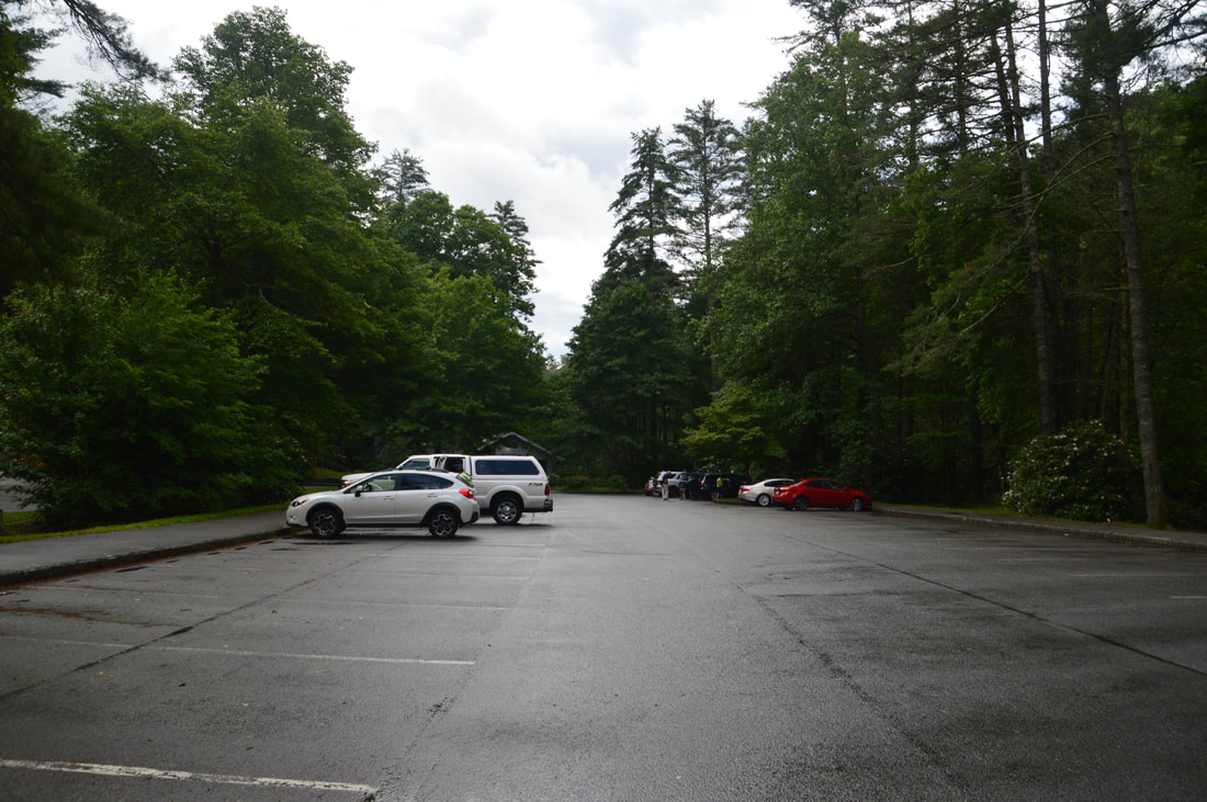
Duration of Hike: 3:15 
Type of Hike: Y-Configuration
Difficulty Rating: 4 out of 10 
Total Elevation Gain: 1310 Feet
Pros: Well-established trails to the falls views 
Cons: Large crowds, especially on the trails south of the river
Points of Interest: Linville Falls Views - 8 stars collectively; Duggers Creek Falls - 3 stars  
Trail Blaze Colors: None, none needed 
Best Seasons to Hike: Year-round 
Fees: None 
Beginning Point: Linville Falls Visitor Center
Directions from Linville, NC: From the intersection of US 221 and NC 181 near downtown Linville, follow US 221 South/NC 181 South for 2.9 miles and then turn left onto NC 181. Continue on NC 181 for 1.7 miles before turning left onto a short connector to the Blue Ridge Parkway. Then, turn right onto the Blue Ridge Parkway and follow it for 4.3 miles to Linville Falls Road. Turn left onto Linville Falls Road and follow it for 1.5 miles to a dead end at the visitor center's large parking area. 

Map

Picture
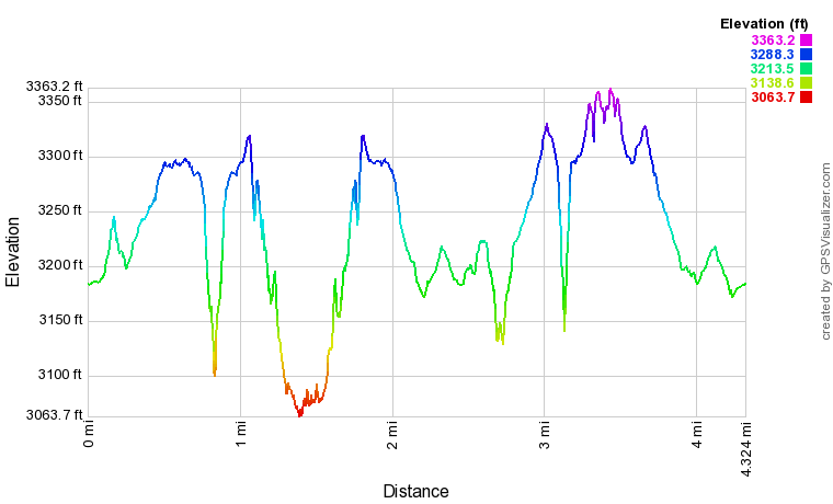
Click here to download a track of this hike. 

Details

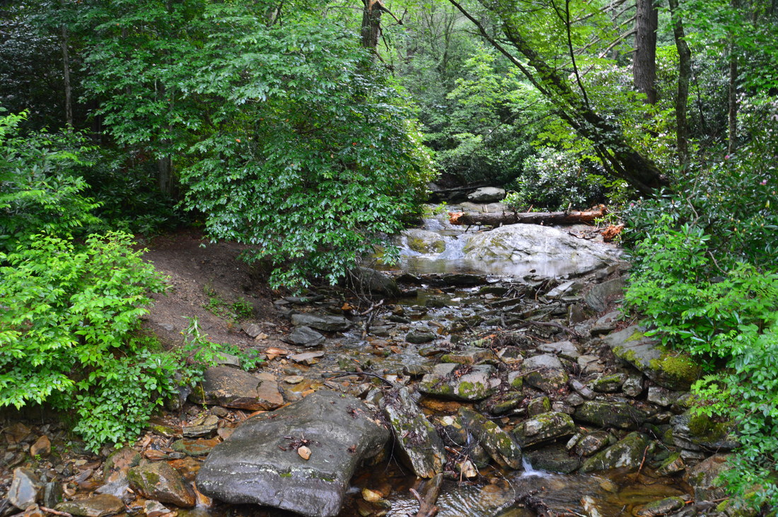
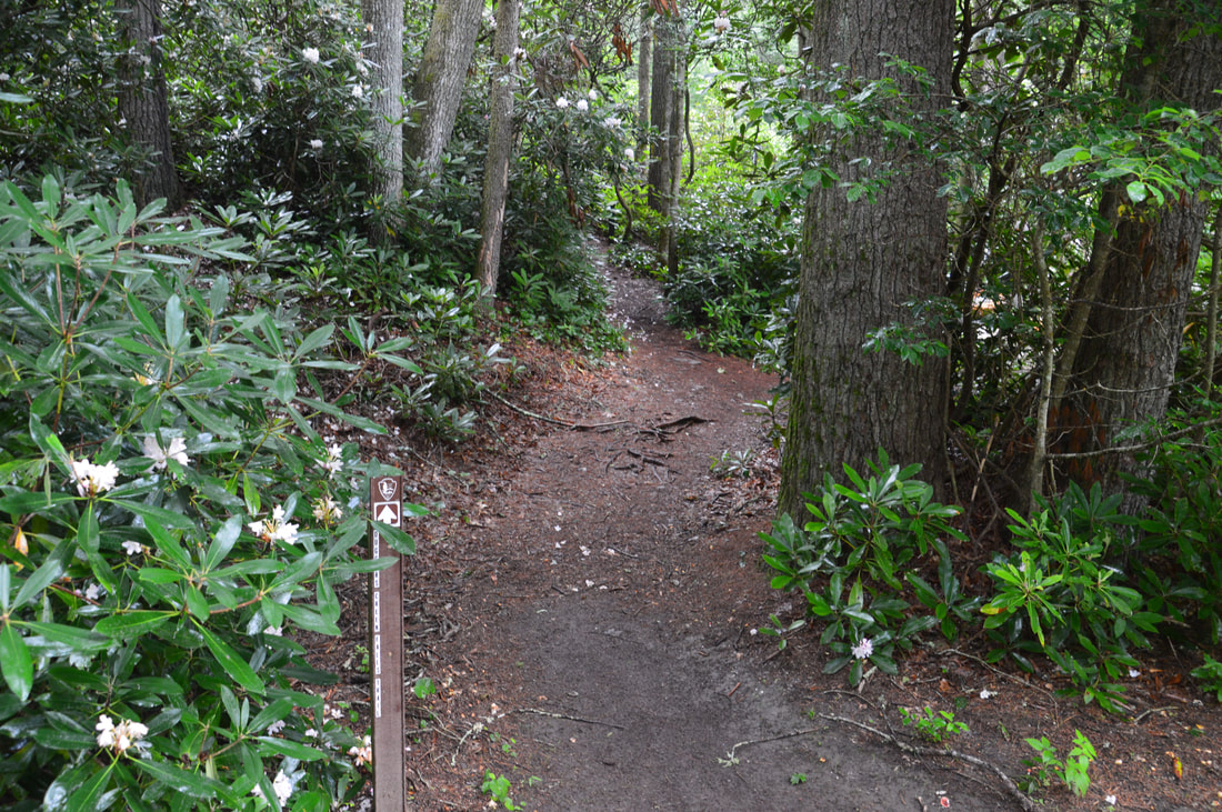
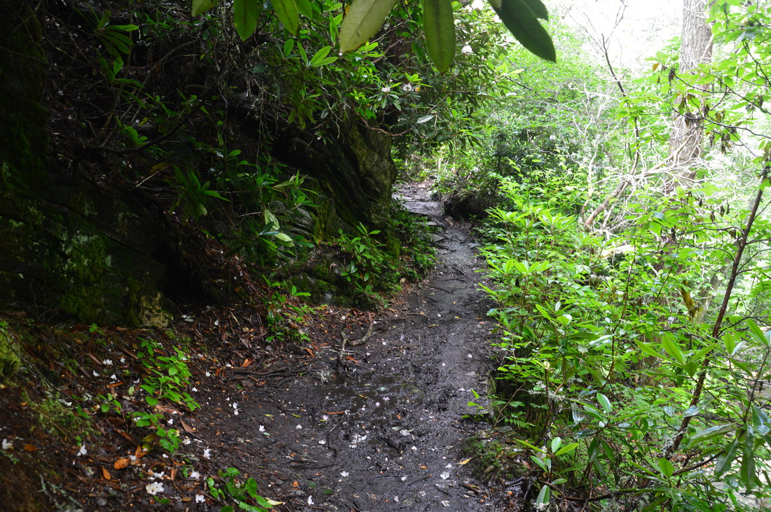
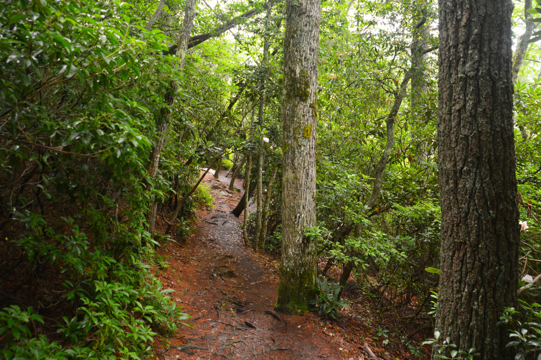
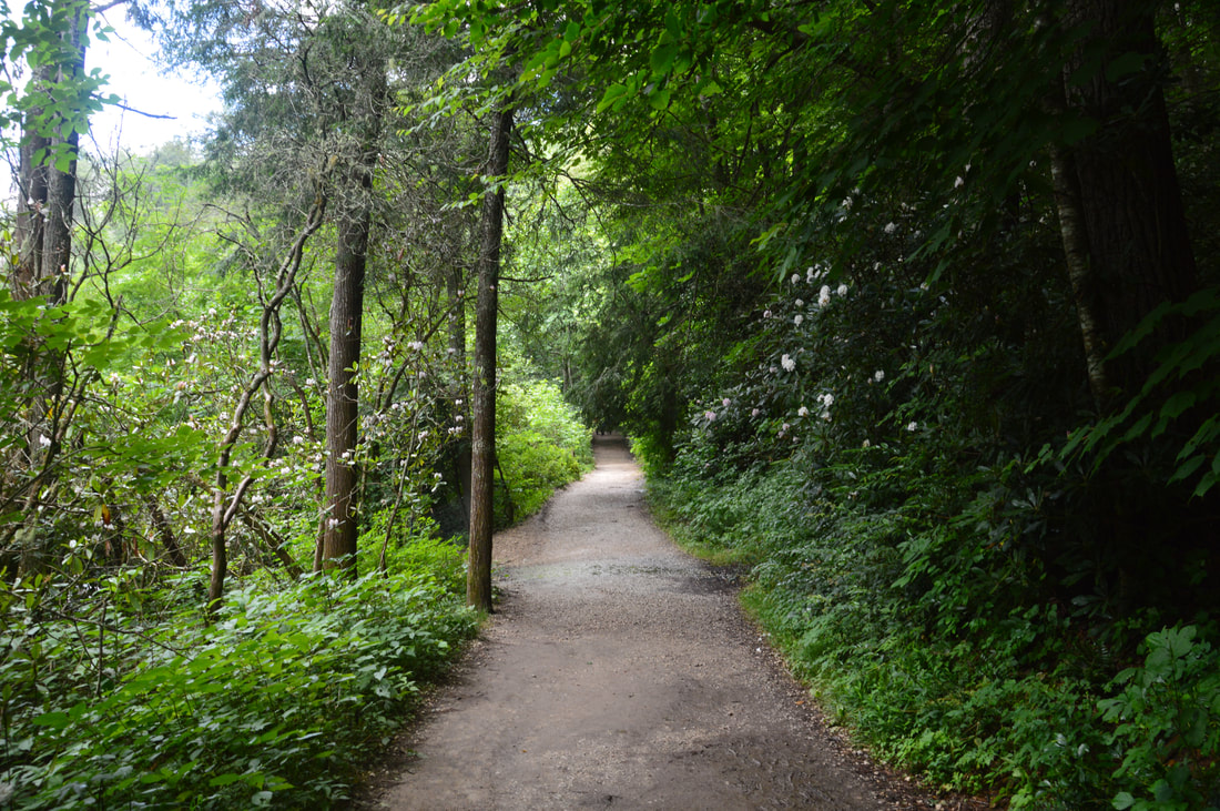
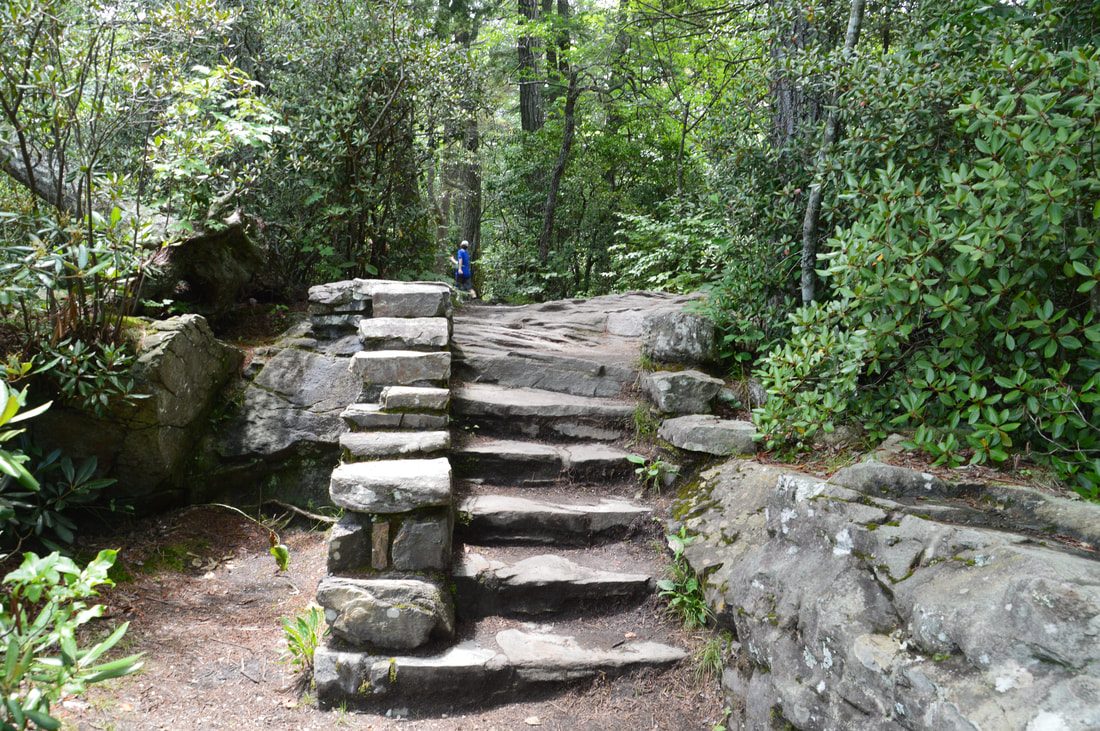
The Linville Falls trail system is split into two parts. The more rugged and difficult north half visits Duggers Creek Falls, Plunge Basin Overlook, and the base of Linville Falls deep in the gorge. The south half - which accesses Upper Falls View, Chimney View, and Erwins View - mostly consists of groomed paths that make for easy walking. My suggestion is to start with the north half and then relax on the south half. It is best to begin the hike by heading to Duggers Creek first. Thus, from the parking area, start walking back along the entrance road. At 0.1 miles, just after the road bridge across Duggers Creek, the signed Duggers Creek Falls Trail begins on the right. Begin following the trail as it climbs a small hill and then drops down a pair of stone staircases to Duggers Creek. At 0.2 miles, the trail crosses Duggers Creek on a sturdy footbridge. Duggers Creek Falls is located just upstream from the footbridge and is best viewed from the bridge itself. Duggers Creek is a small stream and the falls normally has a low volume, but it is a very interesting waterfall nonetheless. Duggers Creek Falls is about 15 feet high and has a two-tier drop in a short but narrow slot canyon with beautiful stone walls. Under the right conditions, this will be a photogenic waterfall despite its small size and low flow. 

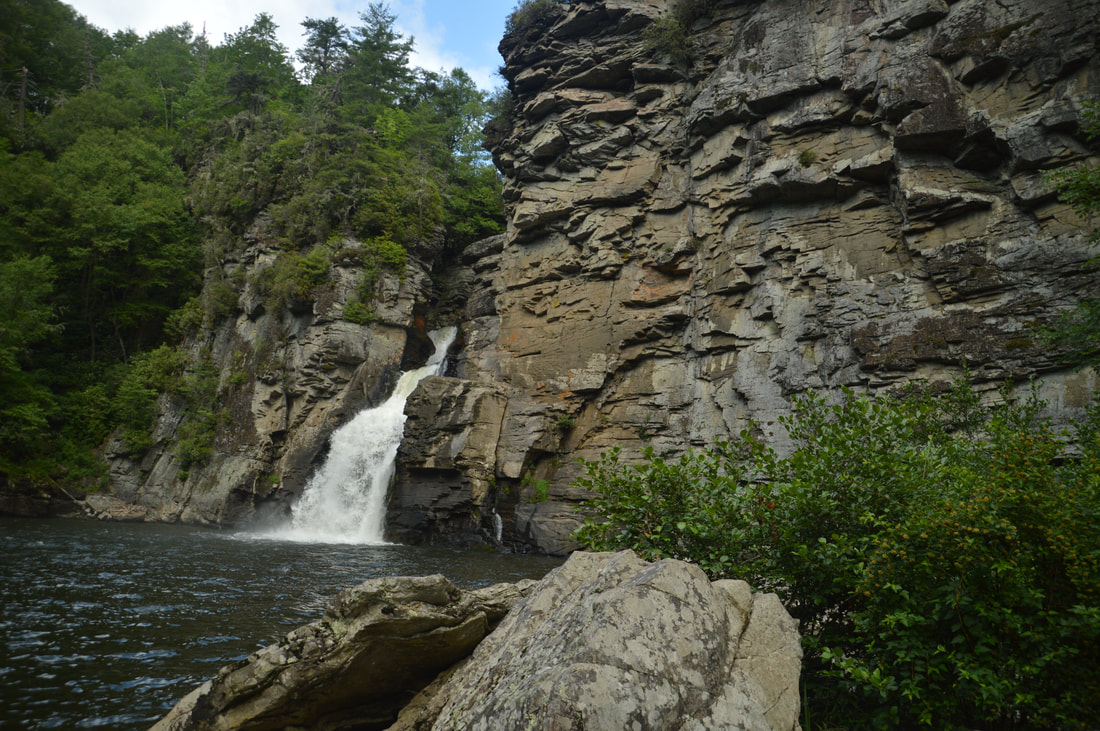
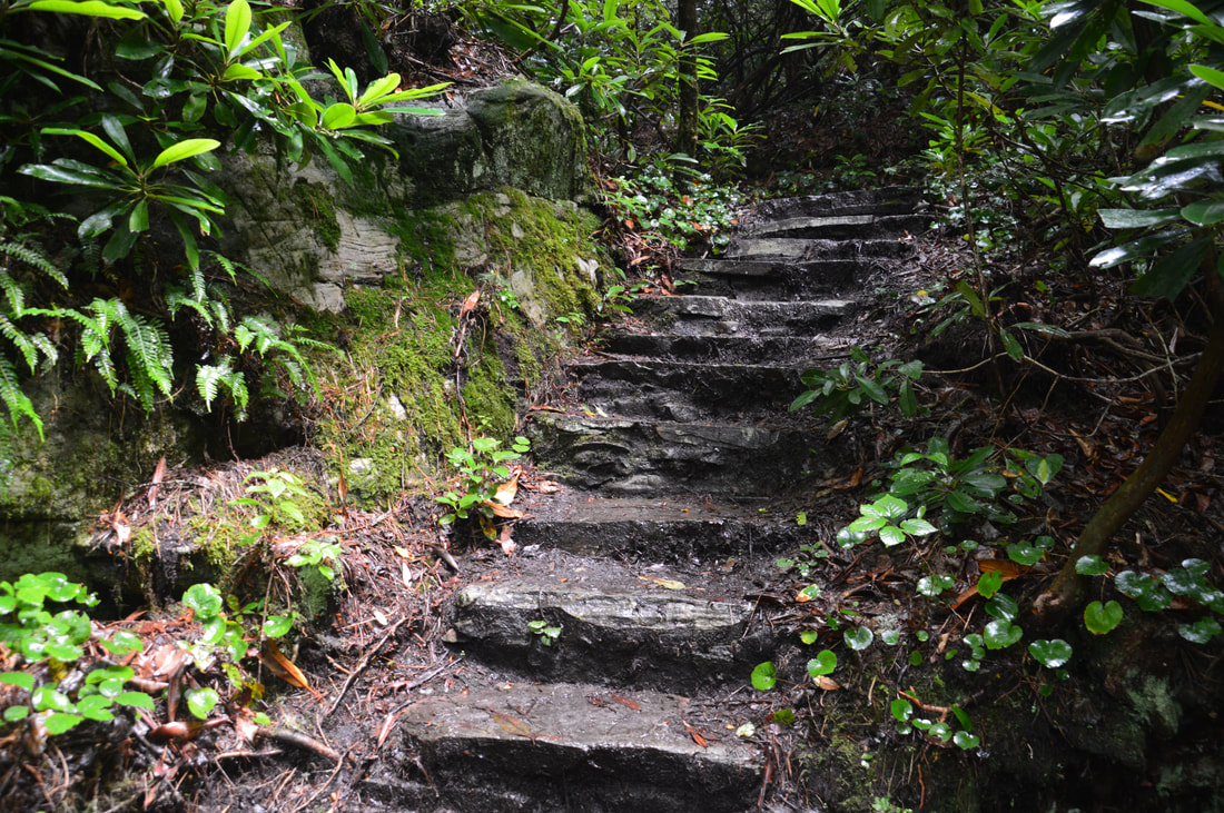
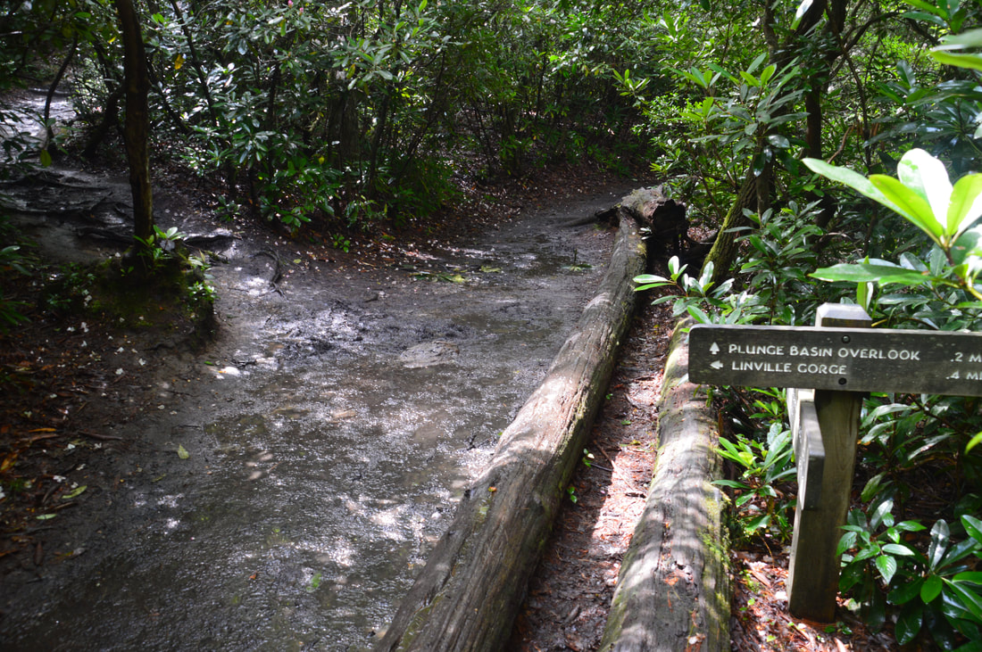
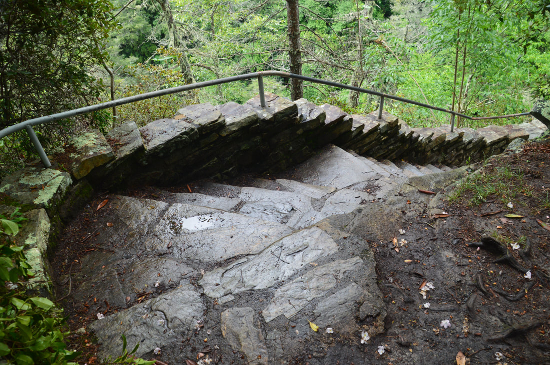
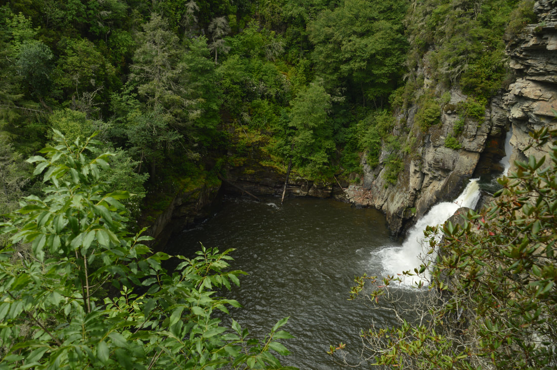
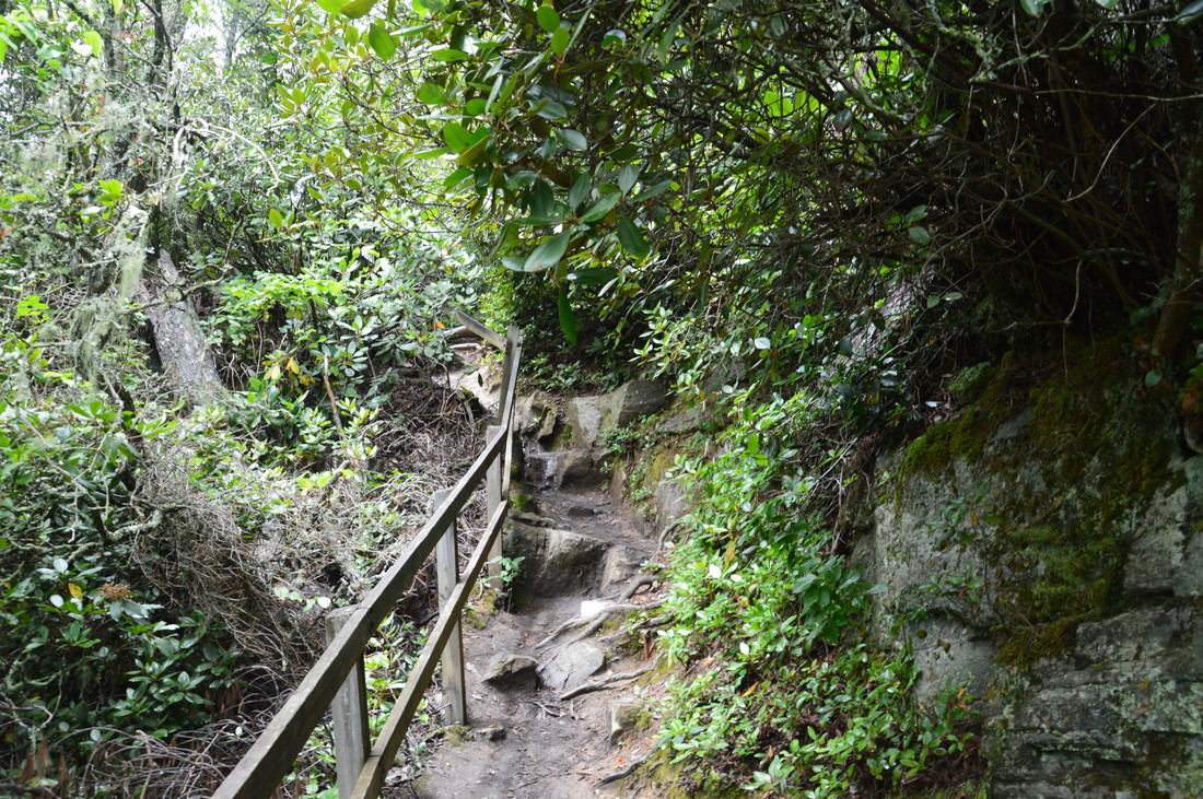
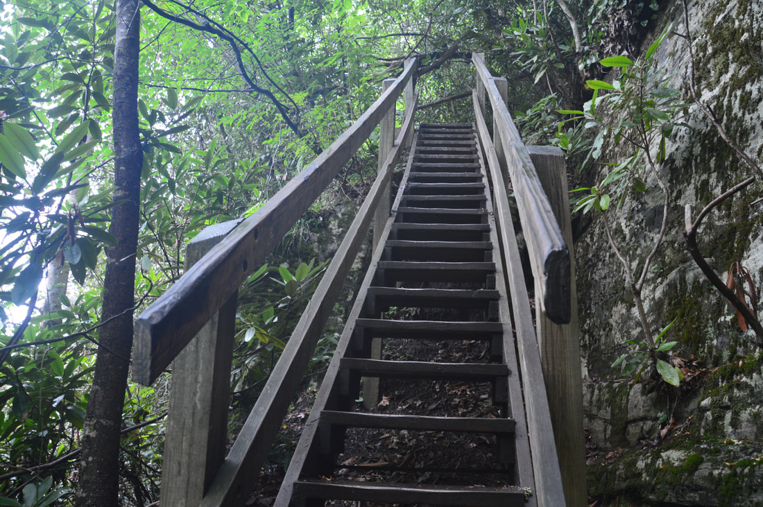
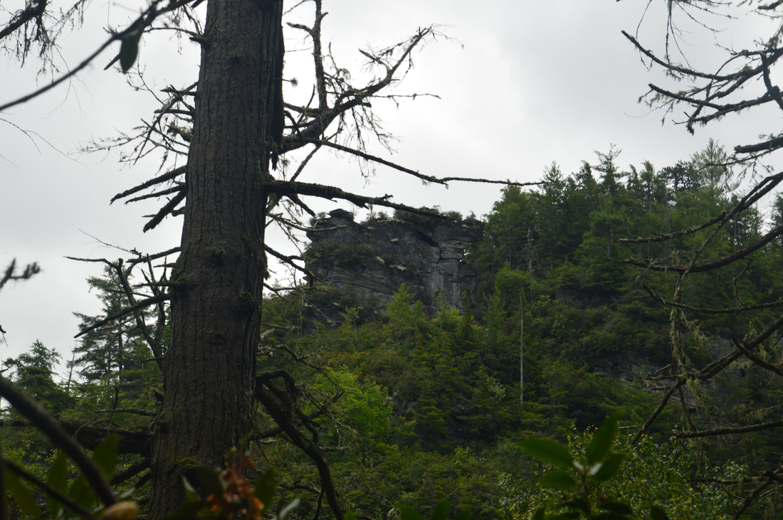
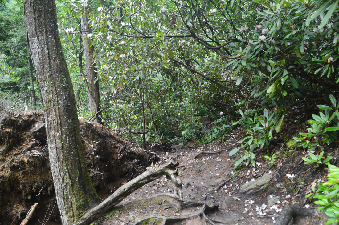
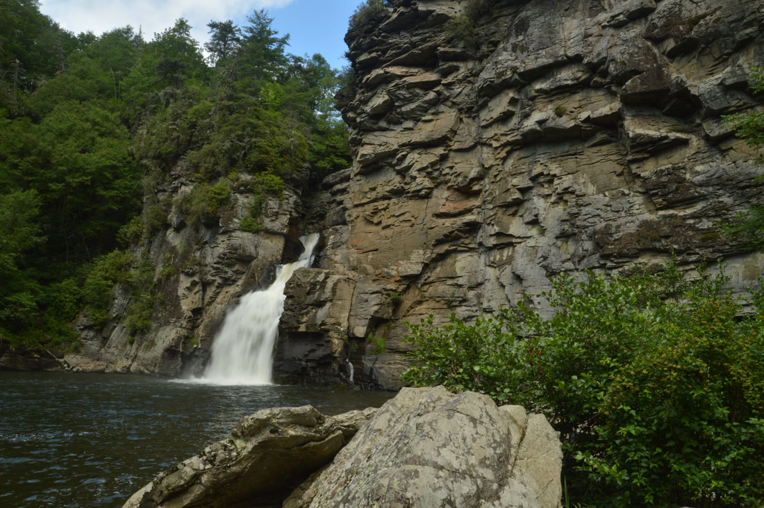
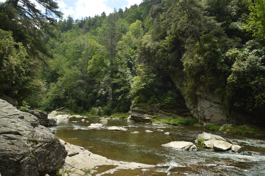
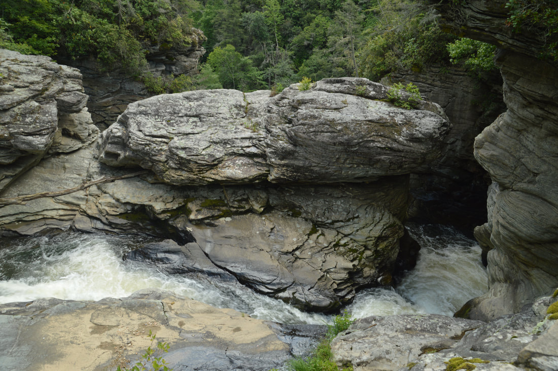
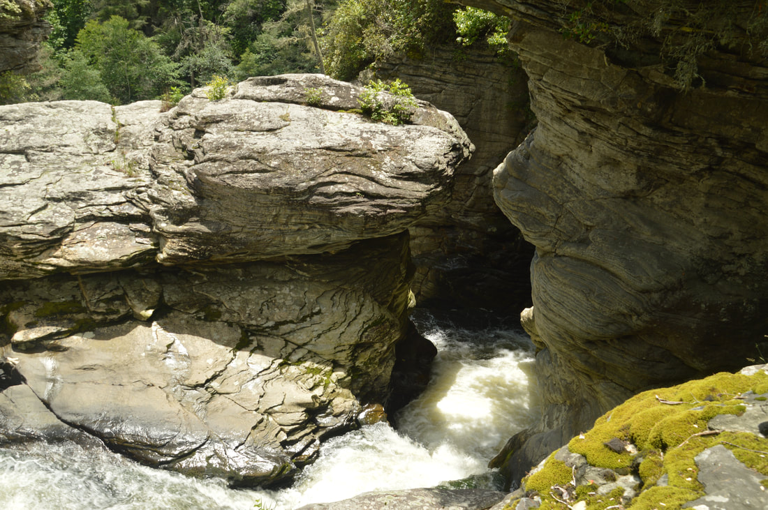
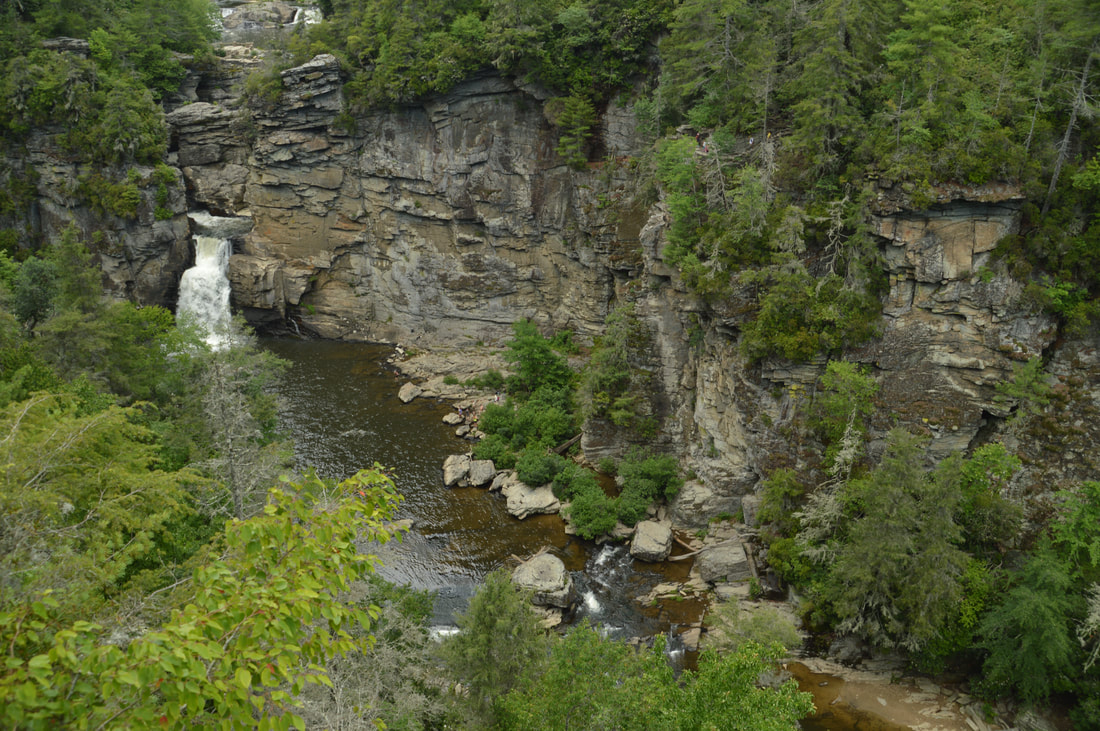
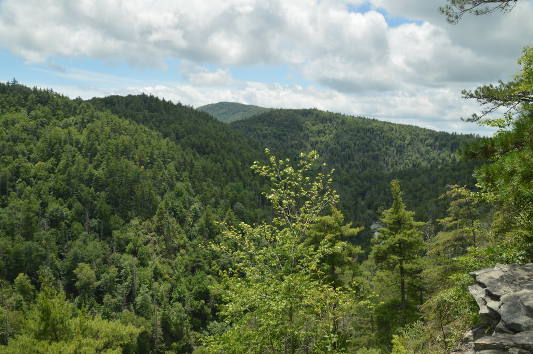
Past the falls, the trail reaches a junction near the parking area. Stay left on the main trail, slowly ascending to another junction with the main Linville Falls Trail coming in from the visitor center. Turn left onto this trail to hike toward Plunge Basin Overlook and the base of Linville Falls. The gradual ascent continues to a signed split at 0.65 miles, where the trail into the gorge and to the base of the falls turns left and the trail to Plunge Basin Overlook continues straight. I decided to hike to the Plunge Basin Overlook first, staying straight. The trail soon drops off the ridge and descends down a series of staircases to its end at the overlook at 0.85 miles. From the Plunge Basin Overlook, there is a great side view of Linville Falls crashing down into the pool surrounded by cliffs that nearly appear to form a square. Looking across the gorge, you can see people up at the Chimney View where you'll be later. 

From Plunge Basin Overlook, return to the junction at 1.05 miles and now turn right onto the trail to the base of the falls itself. The trail quickly begins the 250-foot descent into the gorge, passing a couple of fenced-off areas with dangerous drop-offs and descending a long wooden staircase. At 1.15 miles, the trail makes a sharp switchback, turning right back in the direction of the falls. The trail becomes fairly rugged and does not allow quick travel as it passes over many rooty and rocky areas. Shortly after the switchback, the trail also passes the base of a tall cliff. At 1.4 miles, the trail ends at the Linville River just below Linville Falls. From here, simply pick your way upstream through the rocks as best you can to the base of the falls. Today, I was able to stay completely dry all the way, but if the water is up, you may get your feet a bit wet. Reach the base of Linville Falls at about 1.45 miles. 
Picture
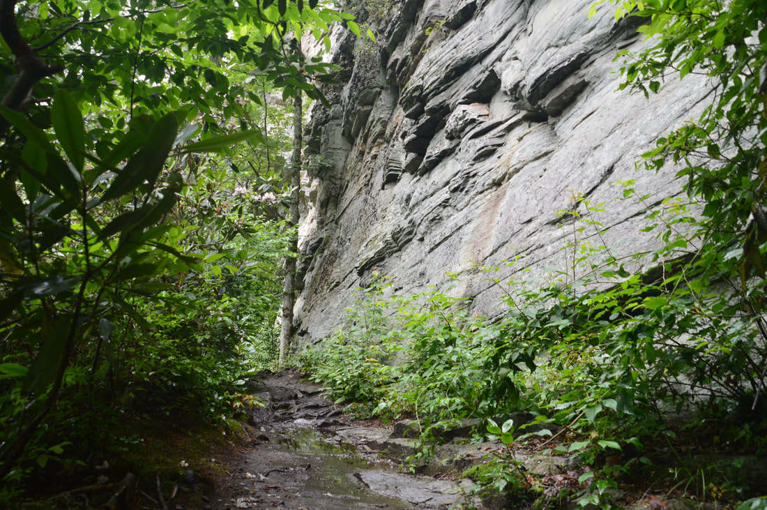
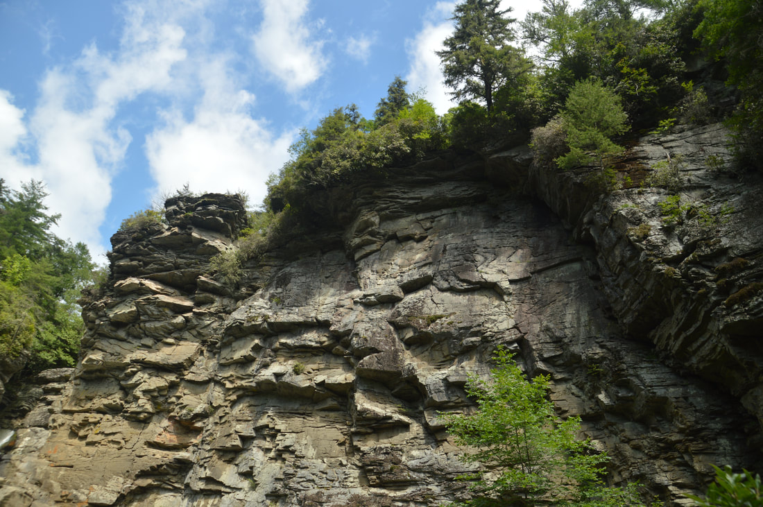
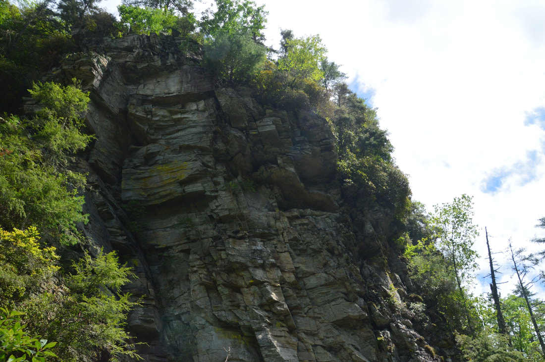
The Linville Falls Trail comes alongside this huge cliff at one point.
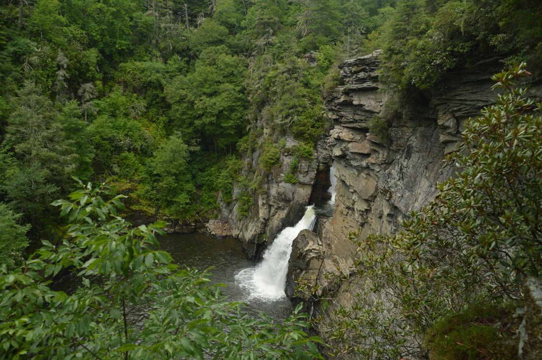
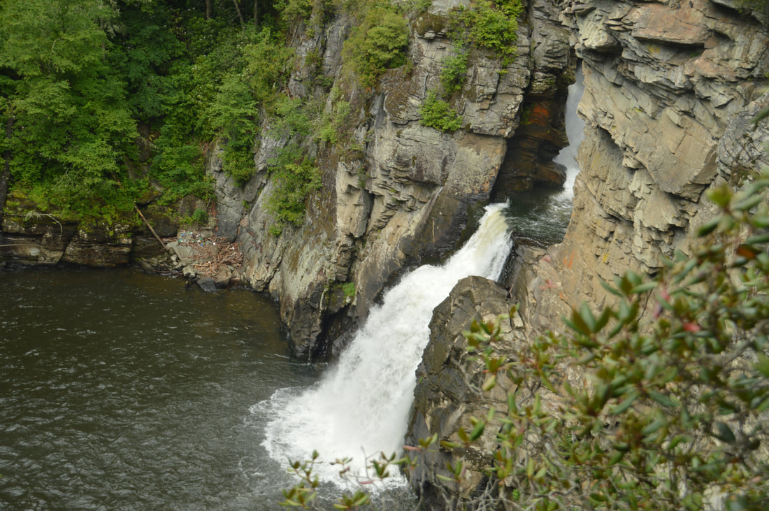
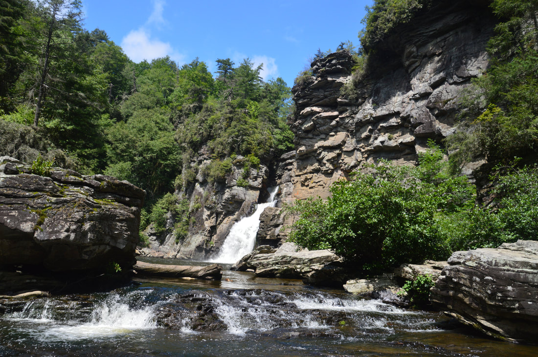
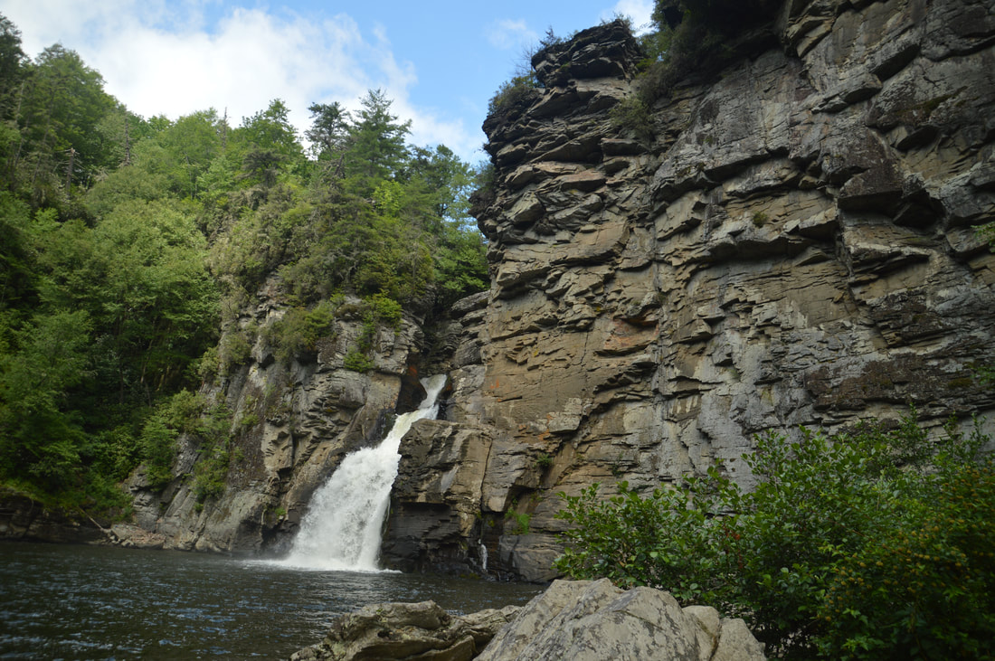
Because the mighty Linville River gets squeezed into a powerful torrent through a short slot canyon at Linville Falls, this is a pretty unique waterfall. Even though the final drop of the falls is about 45 feet, it appears small because it gets dwarfed by the huge cliff well over a hundred feet high stretching away from the falls. The biggest drawback of Linville Falls is that there are going to be people here almost whenever you go. Visiting the falls in early morning or early evening may do the trick, but the most reliable choice for those who are seeking solitude at Linville Falls is to hike to it on a snowy winter day from the USFS parking area off Old NC Highway 105 (the access road to Linville Falls Visitor Center is often closed in winter, especially during snow). 

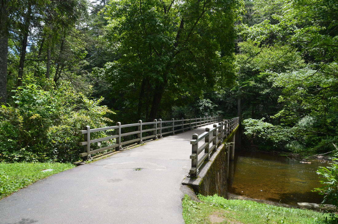
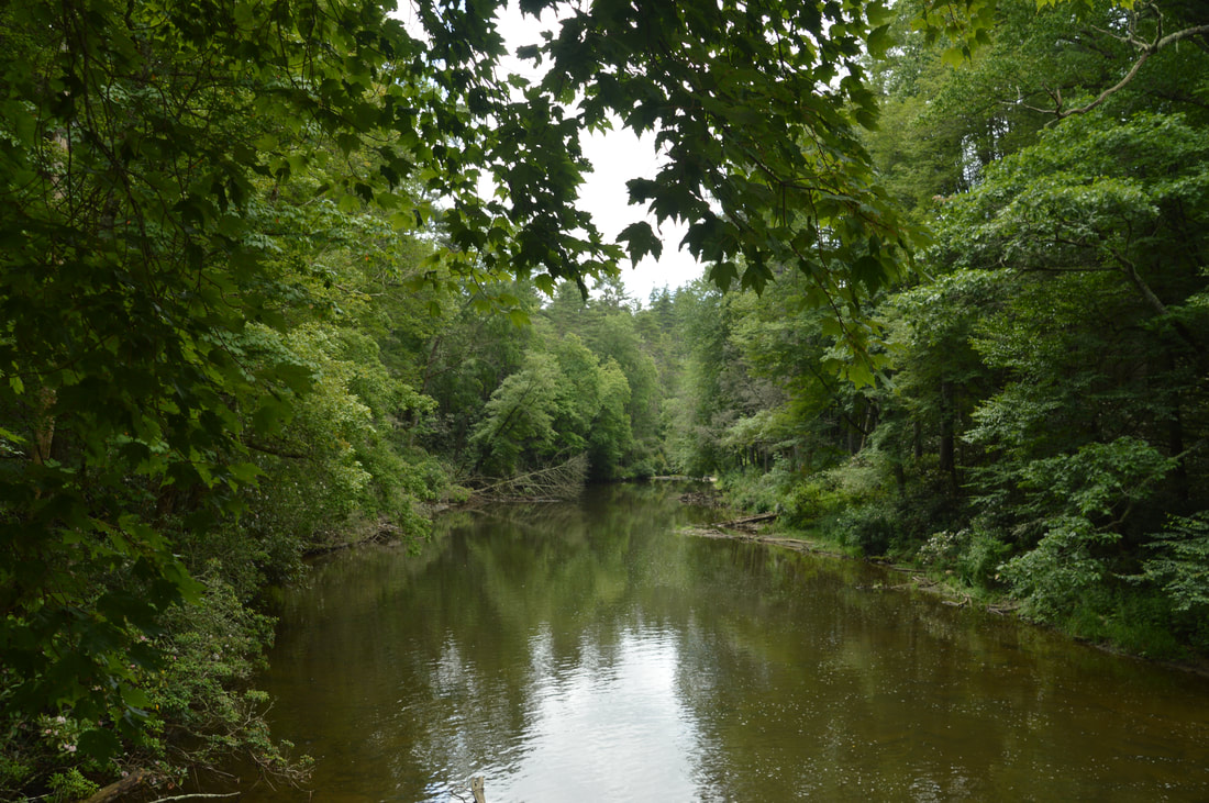
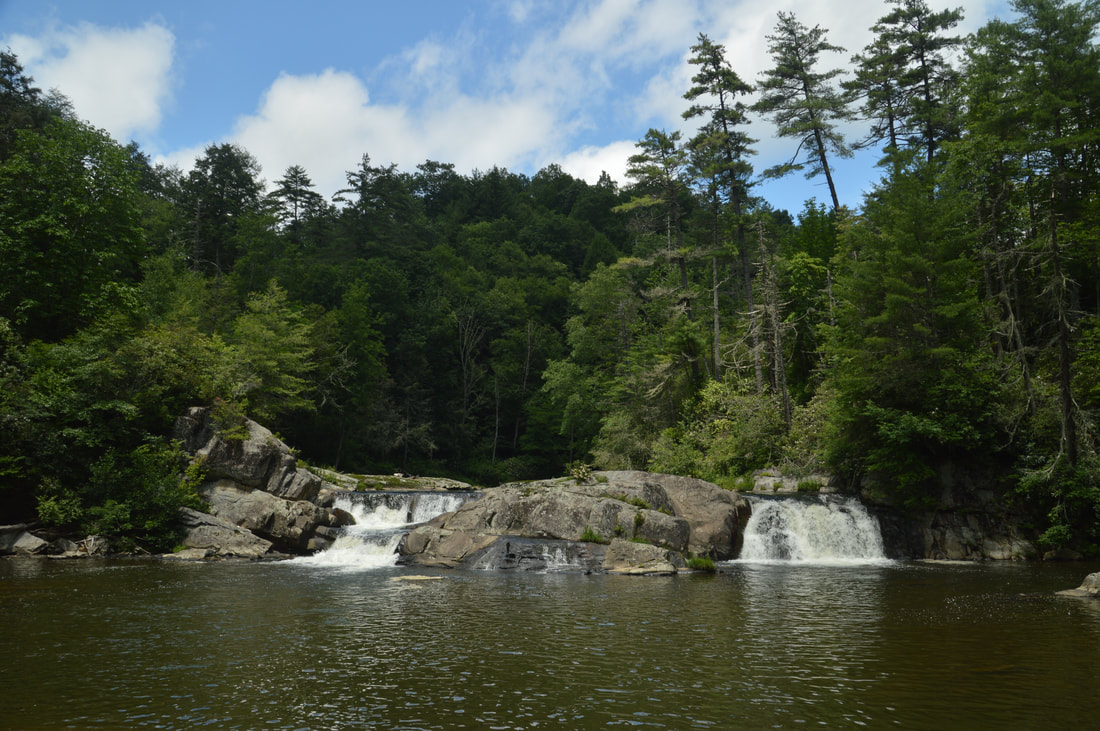
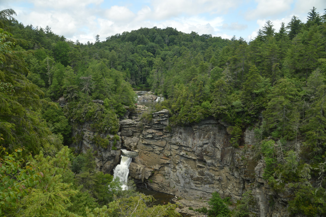
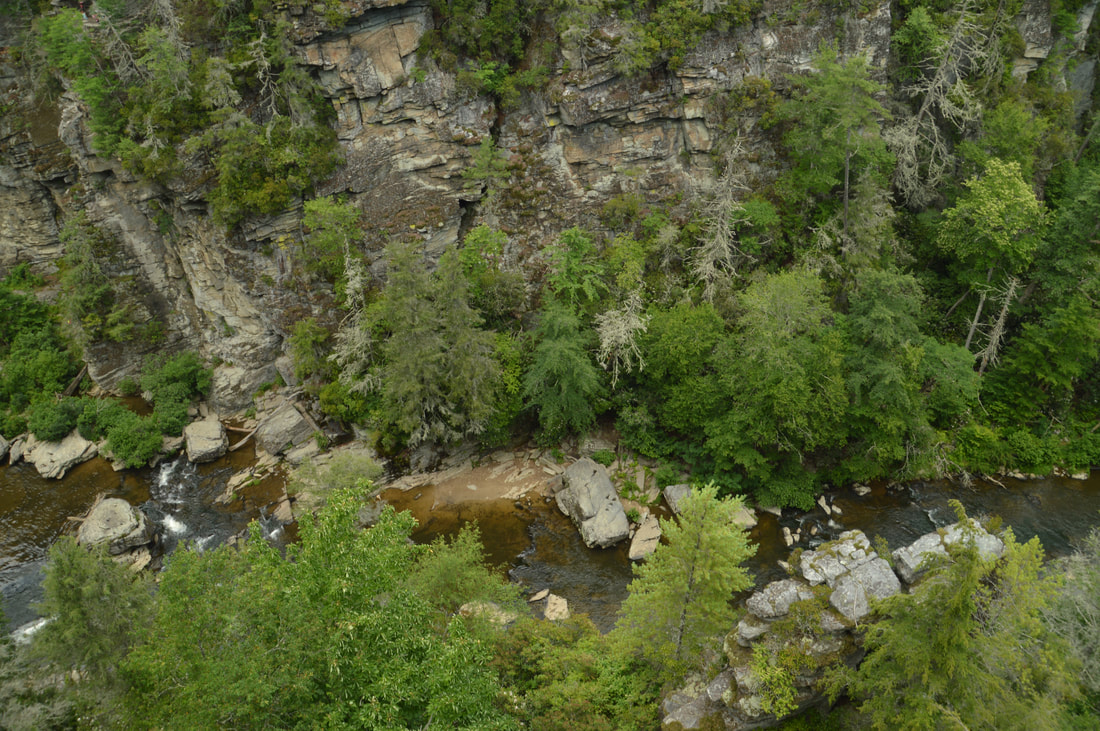
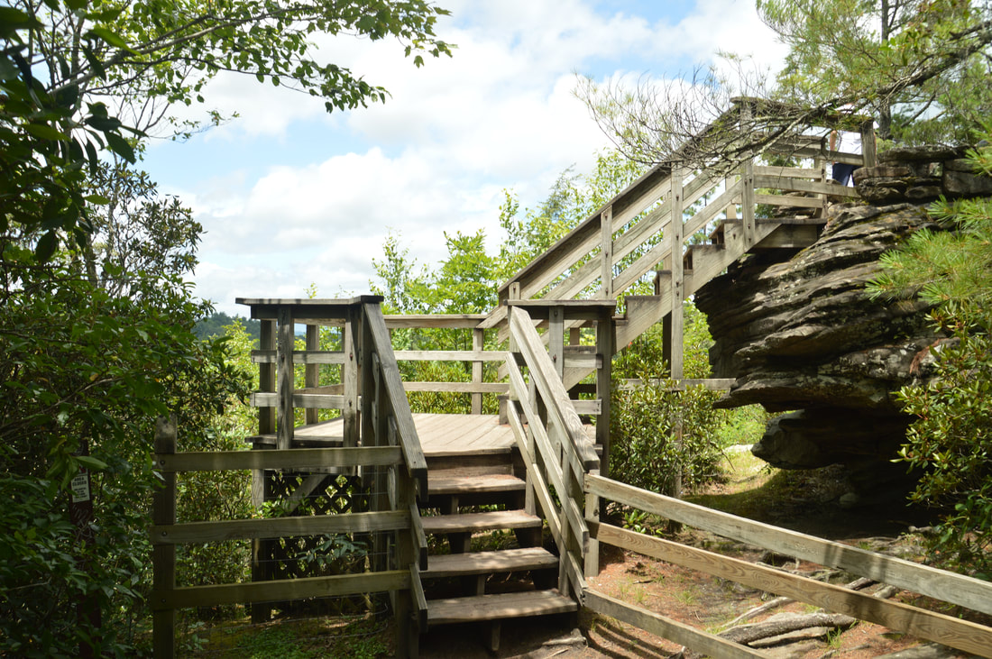
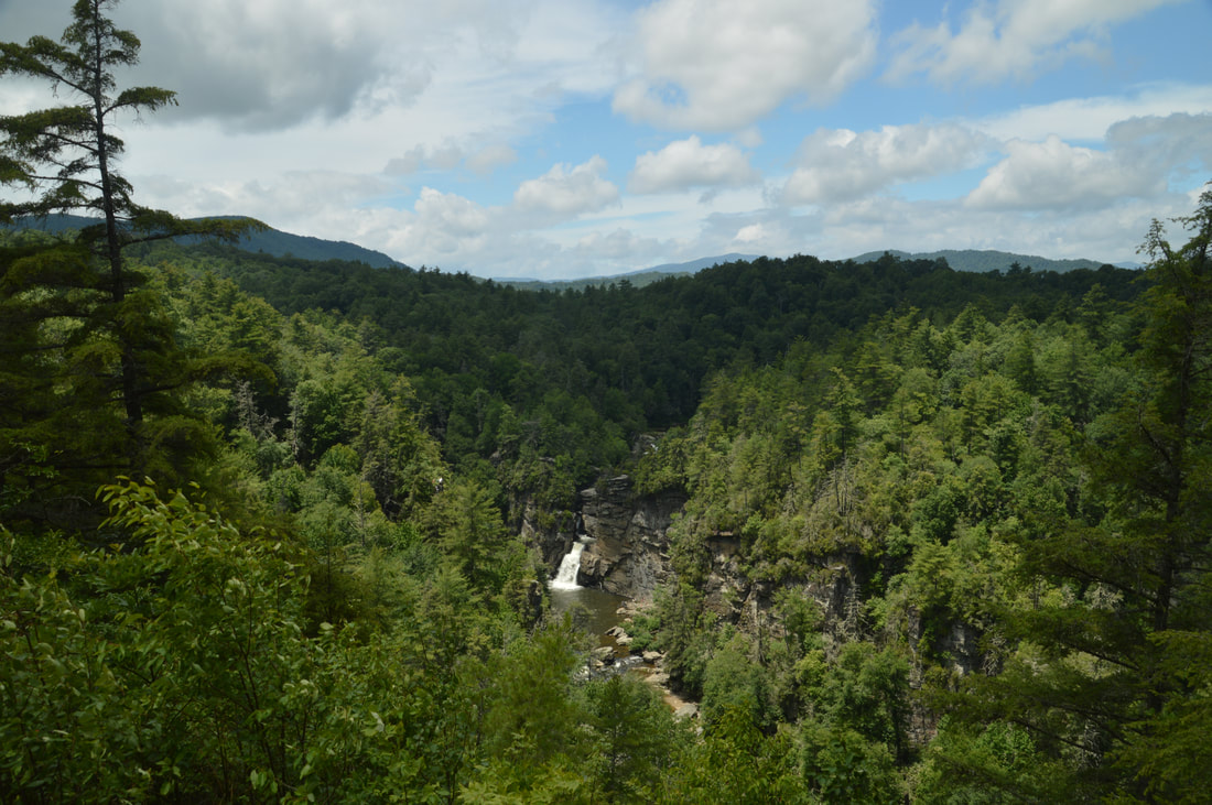
From Linville Falls, retrace your steps back to the top of the gorge and then toward the visitor center. When you pass the junction with the Duggers Creek Falls Trail, simply continue hiking straight on the downhill trail, which reaches the visitor center at 2.2 miles. To access the trails on the south side of the gorge, turn left to walk through the visitor center's breezeway and then to cross the Linville River - which is quite placid in this stretch above the falls - via a broad and sturdy concrete bridge. On the other side of the river, begin following the wide path as it heads in the downstream direction high above the river. At 2.6 miles, a connector trail from the parking area off Old NC Highway 105 comes in from the right. A few feet farther, the signed trail to Upper Falls View turns left. Follow this spur trail gradually downhill to its end at a fenced viewing area at the top of Linville Falls at 2.7 miles. This view is different from the other views on the hike, because it shows the beginning of the frothing upper slot canyon part of Linville Falls. The sight of the broad Linville River squeezing into a narrow stone passage is very impressive. Just upstream from the viewing area is a small but scenic river-wide set of cascades with a huge pool. 

Return to the main trail and begin a gradual ascent up a small knob. At 3.1 miles, the trail reaches another signed junction with the Chimney View side trail in a gap. This view is not to be missed. Turn left onto the side trail, which descends fairly steeply down a staircase and to a pair of viewing areas with a spectacular view at 3.15 miles. Chimney View provides a breathtaking bird's eye perspective of Linville Falls, its cliffs and plunge pool, and the Linville River Gorge just downstream from it. In fact, the scene looking down the gorge may be even more beautiful than the view of the falls itself. Hands down, this is my favorite view of Linville Falls.
Picture
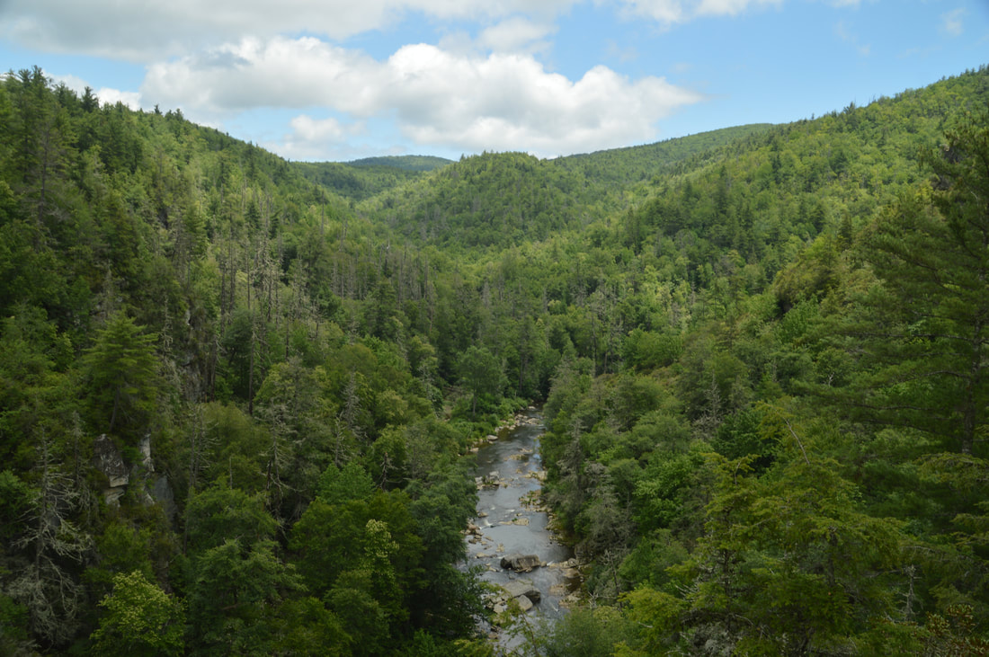
The view downstream along the Linville River from Chimney View is frame-worthy.
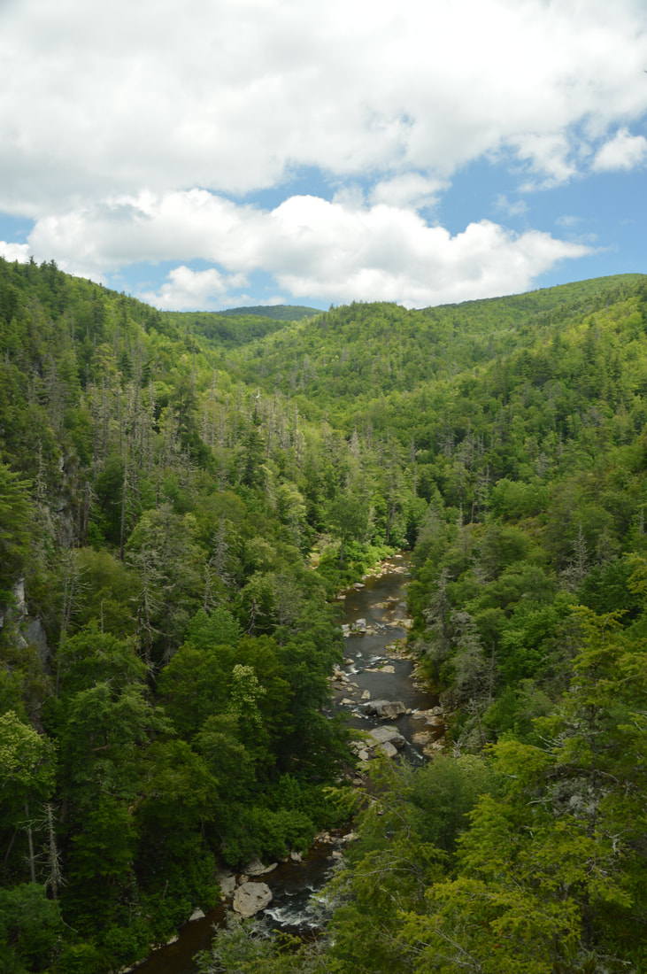
Once again, return to the main trail and follow it along the ridge, ascending gradually again in the direction of Erwins View. At 3.35 miles, the main trail abruptly turns left up a set of stone steps, but first, continue a few feet straight to a view of Linville Gorge. While you can't see the river well from here, the gorge is still prominent. Meanwhile, the trail to Erwins View continues to the very nose of the ridge, where a wooden staircase takes the trail up to the large rock outcrop that is home to Erwins View, the endpoint of the trail at 3.4 miles. 

Erwins View is often considered to be the most beautiful view of Linville Falls itself, because the view not only encompasses the falls but also many mountains in the background. While I personally liked Chimney View better than Erwins View, this perspective is still well worth the hike. From Erwins View, simply retrace your steps back along the main trail to the visitor center. You will return to the parking area and conclude the hike at 4.3 miles. 

Mileage

0.0 - Linville Falls Visitor Center 
0.2 - Duggers Creek Falls 
0.85 - Plunge Basin Overlook 
1.45 - Linville Falls
​2.2 - Linville Falls Visitor Center
2.7 - Upper Falls View 
3.15 - Chimney View 
3.35 - Gorge View 
3.4 - Erwins View 
4.3 - Linville Falls Visitor Center

Variations

Hike just the South Trails to Upper Falls View, Chimney View, and Erwins View - 2.1 Miles 
Hike just the North Trails to Plunge Basin Overlook and Linville Falls Base - 2.2 Miles 

Bonus Stops

There are many great hikes in Linville Gorge and its vicinity. A few hikes that you can consider adding on to Linville Falls are the hike to the summit of Table Rock, the hike to the summit of Hawksbill Mountain, and the hike to Steels Creek Falls. 

Pictures

Videos

0 Comments


Leave a Reply.

    About Me

    Mark Oleg Ozboyd
    I'm an avid outdoor explorer and a hobbyist landscape photographer. I'm 21 years old and have been hiking since 2011. Originally based out of Atlanta, Georgia, I started out by occasionally hiking short trails throughout well-known Georgia State Parks. During 2012 and 2013, I began to expand my trips into adjacent states, as well as into the wilder National Forest areas rather than just State Parks. Throughout the years that followed, as I slowly ran out of popular hiking trails in my area, I began to search for and hike in more seldom-visited areas. Today, you can find me out in the woods every weekend, whether it's on an official trail or bushwhacking through cross-country terrain without any paths. I now attend Washington & Lee University and am exploring Virginia and West Virginia. My other hobbies include chess, science, old music, and meteorology. I have 3 years of amateur weather forecasting experience, having studied a lot of meteorology basics over the years. I am also a student at European School of Music where I learned that music and nature have a lot in common. Listening to good music inspires me to capture nature's beauty on the camera in different aspects that also make me recall many beautiful music pieces that I've heard.​


    Dear readers: I have invested a tremendous amount of time and effort in this website and the Georgia Waterfalls Database the past five years. All of the work that has gone in keeping these websites updated with my latest trip reports has almost been like a full-time job. This has not allowed me to pick up a paid job to save up money for college, and therefore, I I've had to take out loans. If you find the information on this website interesting, helpful, or time-saving, you can say "thanks" and help me out by clicking the button above and making a contribution. I will be very grateful for any amount of support you give, as all of it will apply toward my college tuition. Thank you! 

    Enter your email address to subscribe for trail reports:

    Delivered by FeedBurner


    Picture
    Coming in 2022-2023?

    Other Hiking Websites

    DWHike's Adventures
    Florida's Natural Wonders
    Florida Trailblazer
    Meanderthals
    Mountain Images
    by Bernie Boyer

    North Carolina Waterfalls with
    ​Kevin Adams
    Take-a-Hike!
    Tennessee Landforms
    Waterfall Page
    Waterfall Adventurer
    Zach's Mild Adventures

    Miles Hiked

    Year 1: 540.0 Miles
    Year 2: 552.3 Miles
    ​Year 3: 518.4 Miles
    Year 4: 482.4 Miles
    Year 5: 259.9 Miles

    Archives

    March 2021
    February 2021
    January 2021
    November 2019
    October 2019
    September 2019
    August 2019
    July 2019
    June 2019
    February 2019
    January 2019
    December 2018
    November 2018
    October 2018
    August 2018
    July 2018
    June 2018
    May 2018
    April 2018
    March 2018
    February 2018
    January 2018
    December 2017
    November 2017
    October 2017
    September 2017
    August 2017
    July 2017
    June 2017
    May 2017
    April 2017
    March 2017
    February 2017
    January 2017
    December 2016
    November 2016
    October 2016
    September 2016
    August 2016
    June 2016
    May 2016
    April 2016
    March 2016
    January 2016
    December 2015
    November 2015
    October 2015
    September 2015
    August 2015
    July 2015
    June 2015
    May 2015
    April 2015
    March 2015
    February 2015
    January 2015
    December 2014
    November 2014
    October 2014
    September 2014
    August 2014
    July 2014
    June 2014
    May 2014
    April 2014
    March 2014
    February 2014

    Categories

    All
    Adel
    Adirondack Park
    Alabama
    Alfred A. Ring Park
    Allegheny Trail
    Amicalola Falls State Park
    Anniston Area
    Apalachicola Bluffs And Ravines Preserve
    Apalachicola National Forest
    Apalachicola/Port St. Joe Area
    Apopka
    Appalachian Trail
    Appling
    Art Loeb Trail
    Aska Trail System
    Bakersville
    Balm-Boyette Scrub Preserve
    Balsam Lake Recreation Area
    Bankhead National Forest
    Bartow County Parks
    Bartram Trail
    Basinger
    Beersheba Springs
    Benton
    Benton Mackaye Trail
    Berry College Trail System
    Best Hike
    Big South Fork National Recreation Area
    Black Bear Wilderness
    Black Rock Mountain State Park
    Blairsville
    Blakely
    Blood Mountain Wilderness
    Blowing Rock
    Blue Ridge
    Blue Ridge Parkway
    Boone
    Bradenton
    Bradenton Beach
    Brasstown Bald
    Brasstown Wilderness
    Brevard
    Bryson City
    Buchanan
    Bucks Pocket State Park
    Bulow Creek State Park
    Bulow Plantation Ruins State Park
    Caesars Head State Park
    Caladesi Island State Park
    Calhoun
    Camel's Hump State Park
    Cashiers
    Caspersen Beach Park
    Catfish Creek State Park
    Caves
    CC Putnam State Forest
    Cedar Point Environmental Park
    Chatsworth
    Chattahoochee National Forest
    Chattanooga
    Chattanooga Valley
    Chattooga National Wild And Scenic River
    Cheaha Wilderness
    Cherohala Skyway
    Cherokee
    Cherokee National Forest
    Chiefland Area
    Chillhowee Recreation Area
    Chipley
    Chunky Gal Trail
    Circle B Bar Reserve
    Citico Creek Wilderness
    Citrus Wildlife Management Area
    Clarkesville
    Clayton
    Cleevland
    Cleveland
    Cloudland Canyon State Park
    Cohutta Wilderness
    Collier-Seminole State Park
    Cordele
    Cornelia
    Covington
    Crestview Area
    Crew-land-and-water-trust
    Cullowhee
    Cumberland Trail
    Dahlonega
    Dalton
    Dawson Forest Wildlife Management Area
    Dawsonville
    Dayton
    De Soto National Memorial
    DeSoto State Park
    Dillard
    Double Springs
    Ducktown
    Duncan Ridge Trail
    Dunlap
    Eagle's Rest Park
    Eastpoint
    Econfina Creek Wildife Management Area
    Eglin Air Force Base
    Elizabethton
    Elkins
    Elk Knob Game Lands
    Elk Park
    Ellicott Rock Wilderness
    Ellijay
    Emerson Point Preserve
    Englewood Area
    Enota Retreat
    Erwin
    Falling Waters State Park
    Fayetteville
    Fires Creek Recreation Area
    Fire Tower
    Flint River
    Florence Area
    Florida
    Florida Caverns State Park
    Florida Trail
    Foothills Trail
    Fort Mountain State Park
    Fort Myers Area
    Fort Payne
    Fort Payne Area
    Fort Yargo State Park
    Franklin
    Franklin Delano Roosevelt State Park
    Franklin-Marion State Forest
    Frozen Head State Park
    Gainesville
    Gainesville Area
    Gatlinburg
    George Washington National Forest
    Georgia
    Georgia Veterans Memorial State Park
    Glasgow
    Gorges State Park
    Grandfather Mountain State Park
    Great Smoky Mountains National Park
    Greeneville
    Green River Game Lands
    Gruetli-Laager
    Grundy Forest State Natural Area
    GTM Reserve
    Guana River Wildlife Management Area
    Hayesville
    Helen
    Hiawassee
    High Falls State Park
    Highlands
    Highlands Scenic Highway
    Hillsborough River State Park
    Hinson Conservation & Recreation Area
    Historic Sites
    Honeymoon Island State Park
    Hot Springs
    Huntington
    Inverness Area
    Jackson
    Jasper
    Jefferson National Forest
    Joan M. Durante Park
    Jonathan Dickinson State Park
    Jones Gap State Park
    Joyce Kilmer Slickrock Wilderness
    Joyce Kilmer - Slickrock Wilderness
    Juniper Prairie Wilderness
    Kelly Park
    Keown Falls Recreation Area
    Kolomoki Mounds State Park
    LaFayette
    Lake City Area
    Lake George Wild Forest
    Lake June-in-Winter State Park
    Lakeland Area
    Lake Placid
    Lake Russell Wildlife Management Area
    Lake Wales Ridge State Forest
    Laurel Fork North Wilderness
    Leffis Key Preserve
    Leon Sinks Geological Area
    Lexington
    Lineville
    Linville
    Linville Gorge Wilderness
    Lithia Springs
    Little Frog Wilderness
    Little Manatee River State Park
    Little River Canyon National Preserve
    Longboat Key
    Long Trail
    Lookout Mountain
    Lookout Mountain Battlefield
    Lovingston
    Lula Lake Land Trust
    Lumpkin
    Maggie Valley
    Manatee Springs State Park
    Marianna Area
    Mark Trail Wilderness
    Marlinton
    Mccaysville
    McMinville
    Mentone
    Middlesex
    Mistletoe State Park
    Monongahela National Forest
    Montreat
    Mountain Bridge Wilderness Area
    Mountain City
    Mountains To Sea Trail
    Mountains-to-Sea Trail
    Mount Rogers National Recreation Area
    Myakka River State Park
    Myron B. Hodge City Park
    Nantahala National Forest
    Naples
    Naples Area
    Natural Bridge State Park
    Neal Preserve
    New Castle
    Newport
    New River Gorge National Park
    New York
    North Carolina
    Ocala Area
    Ocala National Forest
    Ocean-to-Lake Trail
    Oconee State Park
    Oconee Station Historic Site
    Okaloacoochee Slough State Forest
    Oldsmar
    Oneida
    Orlando Area
    Ormond Beach
    Oscar Scherer State Park
    Oxford
    Palatka
    Palmetto Trail
    Panama City Area
    Panthertown Valley
    Parrish
    Paynes Creek Historic State Park
    Peaks Of Otter Recreation Area
    Pigeon Crockford Mountain Wildlife Management Area
    Pigeon-Crockford Mountain Wildlife Management Area
    Pigeon-Crockford Wildlife Management Area
    Pine Mountain
    Pinhoti Trail
    Pinnacle Park
    Pisgah Civitan Park
    Pisgah National Forest
    Pittman Center
    Pond Mountain Wilderness
    Ponds/Lakes
    Prentice Cooper State Forest
    Providence Canyon State Park
    Pumpkintown
    Quick Point Nature Preserve
    Raven Cliffs Wilderness
    Reed Bingham State Park
    Reliance
    Rice Creek Conservation Area
    Riverview Pointe Preserve
    Robbinsville
    Robinson Preserve
    Rock Creek Gorge Scenic Area
    Rock Island State Park
    Rome
    Rosman
    Sale Creek
    Salem
    Salt Springs
    Saluda
    Santa Rosa Beach
    Sarasota
    Sarasota Area
    Savage Gulf State Natural Area
    Scenic Views
    Scottsboro Area
    Sebring Area
    Sewanee
    Sheltowee Trace Trail
    Shining Rock Wilderness
    Signal Mountain
    Sipsey Wilderness
    Sky Valley
    Smithgall Woods State Park
    Snowbird Backcountry Area
    Soddy Daisy
    Soddy-Daisy
    Sopchoppy
    South Carolina
    South Cumberland State Park
    Southeastern Cave Conservancy
    Southern Nantahala Wilderness
    Sparta
    Sprewell Bluff Park
    Spring City
    Spring Hill
    Springs
    Spruce Pine
    Standing Indian Backcountry Area
    St. Augustine
    St. George Island State Park
    St. Joseph Bay State Buffer Preserve
    St. Marks Area
    St. Marks National Wildlife Refuge
    Stone Mountain
    Stone Mountain Park
    Suches
    Sumatra
    Sumter National Forest
    Suwannee River
    Swallow Creek Wildlife Management Area
    Sweetwater Creek State Park
    Sylva
    Talladega National Forest
    Tallahassee Area
    Tallulah Falls
    Tallulah Gorge State Park
    Tampa Bay Area
    Tate City
    Tate's Hell State Forest
    Tea Creek Wildlife Management Area
    Tellico Plains
    Tennessee
    Thomaston
    Toccoa
    Topsail Hill State Park
    Torreya State Park
    Townsend
    Tracy City
    Tray Mountain Wilderness
    Trenton
    Triple Creek Preserve
    Troutdale
    Unaka Mountain Wilderness
    Upper Tampa Bay County Park
    Venice
    Vermont
    Virgin Falls State Natural Area
    Virginia
    Virginia Outdoors Foundation
    Vogel State Park
    Wakulla Springs State Park
    Waleska
    Walhalla
    Wartburg
    Water Features
    Waynesville
    Weedon Island Preserve
    Weeki Wachee Preserve
    Wekiwa Springs State Park
    West Palm Beach Area
    West Virginia
    Whitehall
    White Springs
    Winder
    Withlacoochee State Forest
    Young Harris

    RSS Feed

TRAIL REPORTS

Hikes in Alabama
​Hikes in Florida
Hikes in Georgia
Hikes in North Carolina
Hikes in South Carolina
Hikes in Tennessee
Hikes in Virginia

Hiking Resources

Alabama Resources
​
Florida Resources
Georgia Resources
North Carolina Resources
​South Carolina Resources
​
Tennessee Resources

Other

Contact
Map of Hikes
Alphabetical List of Hikes
Southeast Nature Society
© COPYRIGHT 2014-2018
​ALL RIGHTS RESERVED.
Important: I disclaim any responsibility for any damage or personal injury that may occur as a result of the activities and information found on this website. All outdoor activities, especially off-trail hiking, are done at your own risk. Never hike or head into that area that may be above your fitness or experience level.
  • Home
  • Trail Reports
    • Best Hikes
    • Hikes with Scenic Views
    • Hikes with Water Features
    • Alabama
    • Georgia
    • Florida
    • North Carolina
    • South Carolina
    • Tennessee
    • Vermont
    • Virginia
  • Map
  • Hike List
  • Testimonials
  • Resources
  • Contact Us
  • Southeast Nature Society
    • Our Team
  • Georgia Waterfalls Database