HIKING THE APPALACHIANS AND BEYOND
  • Home
  • Trail Reports
    • Best Hikes
    • Hikes with Scenic Views
    • Hikes with Water Features
    • Alabama
    • Georgia
    • Florida
    • North Carolina
    • South Carolina
    • Tennessee
    • Vermont
    • Virginia
  • Map
  • Hike List
  • Testimonials
  • Resources
  • Contact Us
  • Southeast Nature Society
    • Our Team
  • Georgia Waterfalls Database

Cherokee National Forest: Twisting Falls (Compression Falls), Elizabethton, Tennessee

7/25/2017

0 Comments

 
Picture
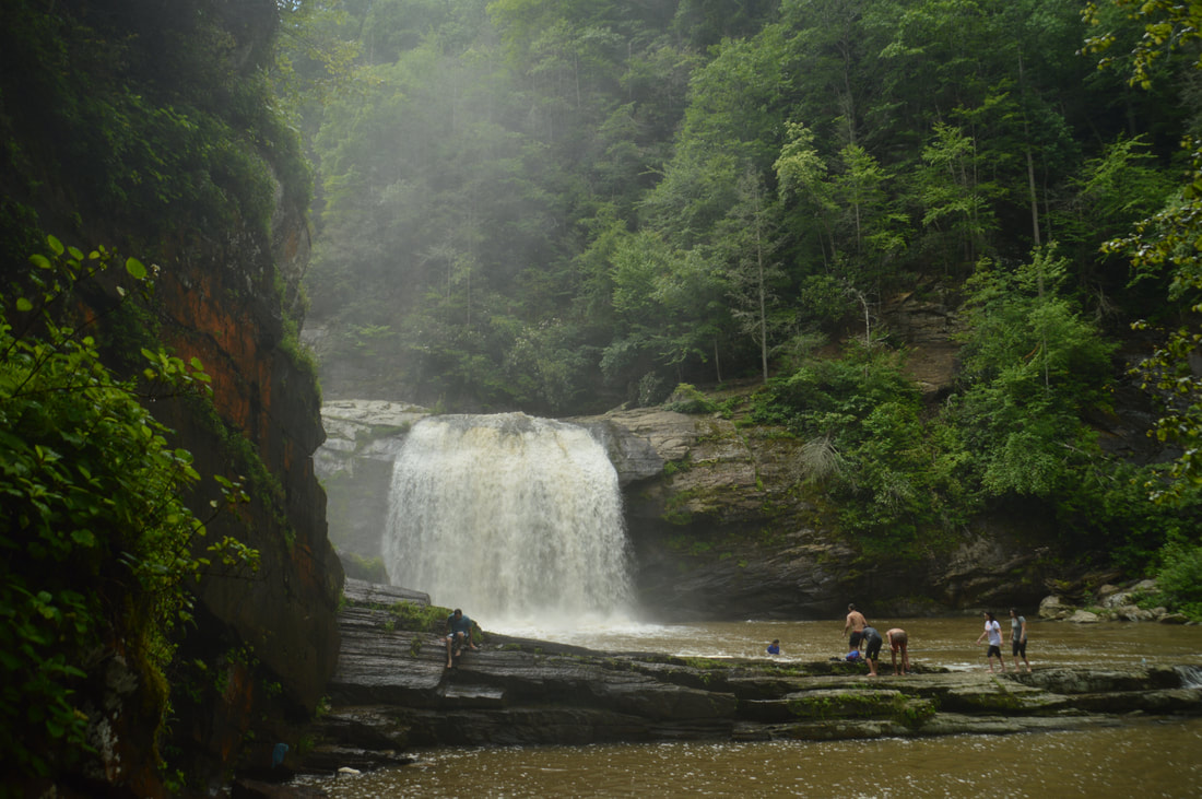
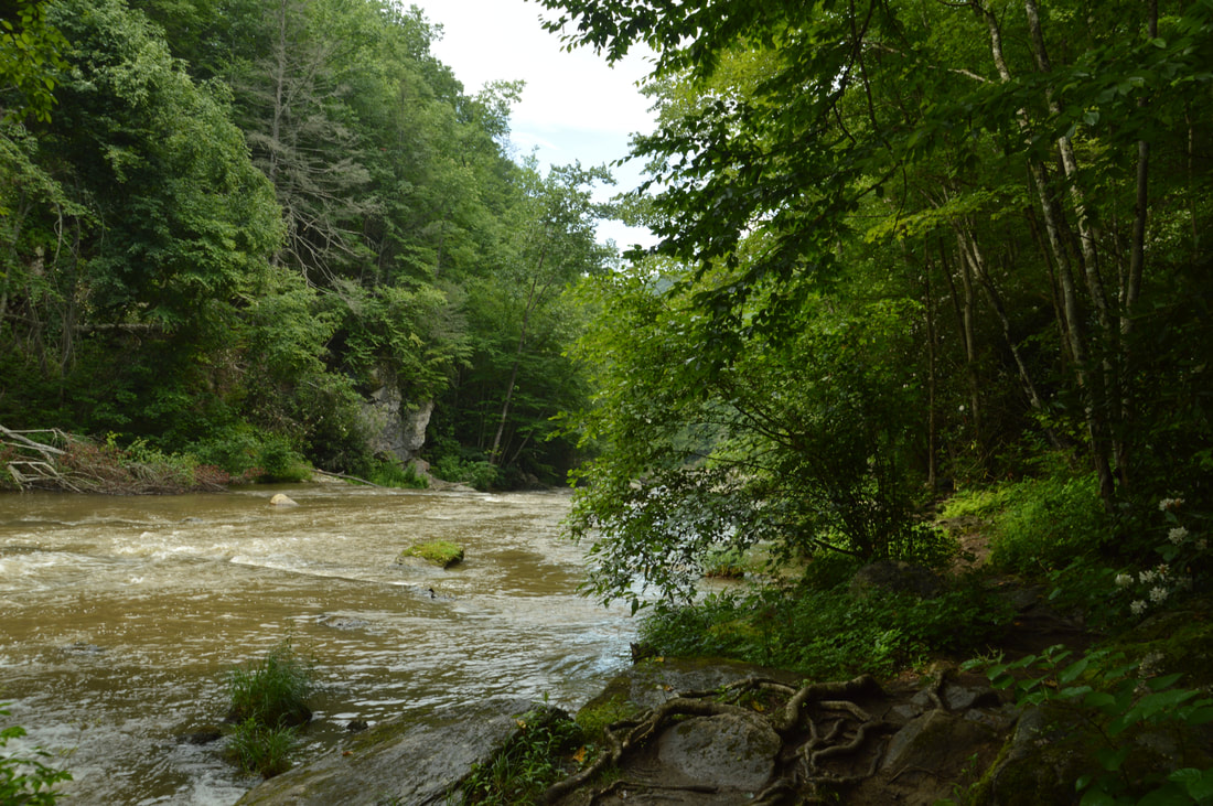
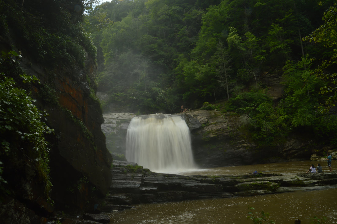
The Elk River is best known for its spectacular upper waterfall, Elk River Falls. But as the Elk River enters Tennessee, it encounters a twisting passage with a series of waterfalls collectively known as Twisting Falls that is even more jaw-dropping. The 35-foot lowermost drop of Twisting Falls, locally known as Compression Falls, creates one of the area's most impressive sights as it crashes with a deafening roar into a deep pool flanked by tall cliffs. The trail to the base of the falls is no joke though - the unofficial path descends over 400 feet to the Elk River in just a quarter-mile!  The destination waterfall is well worth it, but be prepared to huff and puff on the way back up. This hike occurred on Wednesday, July 5th, 2017. My plan was to hike out and back to the base of the lowermost drop of Twisting Falls (aka Compression Falls). This hike was the second of ten hikes that I did during a seven-day trip to the mountains of northwest North Carolina. 

Summary

R/T Length of Trail: 0.9 Miles 
Duration of Hike: 1:30 
Type of Hike: Out and Back 
Difficulty Rating: 6 out of 10 
Total Elevation Gain: 431 Feet 
Pros: High-volume waterfall 
Cons: Insanely steep trail to the falls; huge amounts of junk in the vicinity of the falls 
Points of Interest: Twisting Falls (lower drop, aka Compression Falls) - 10 stars 
Trail Blaze Colors: None, not an official trail 
Best Seasons to Hike: Winter 
Fees: None 
Beginning Point: Parking area off Dark Ridge Road 
Directions from Elizabethon, TN: From the intersection of US 321 South and US 19E in the community of Hampton south of Elizabethton, follow US 321 South for 17.0 miles. Then, turn right onto Poga Road. Continue for 4.0 miles before turning right again onto Clawson Road. In another 0.5 miles, turn right onto Dark Ridge Road. Follow Dark Ridge Road for 0.4 miles to the entrance to the Twisting Falls parking area on the right. At the time of my visit, an arrow attached to a tree pointed the way into the parking area, but don't count on it still being there. Dark Ridge Road turns unpaved after 0.2 miles but is in good shape. 

Map

Picture
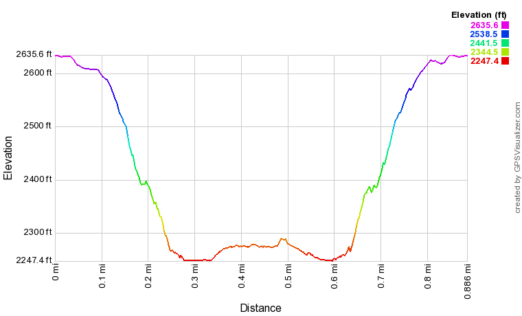
Click here to download a track of this hike. 

Details

The name of Twisting Falls has given birth to more chaos throughout the internet than the name of any other waterfall I've ever visited. Even now, lengthy arguments about the true name show up from time to time. Simply put, the series of waterfalls on this short twisting stretch of the Elk River is collectively known as Twisting Falls, but locals appear to know the lowermost main drop of the falls as Compression Falls. This name isn't officially correct, however, for several reasons. Most importantly, Twisting Falls was initially marked and named on the 1934 USGS topographic map. The name originated from the twisting nature of this series of waterfalls in such a short span of the Elk River. The name Twisting Falls was even added in 1980 to the US Board on Geographic Names (an authority on official names for geographic landmarks). Sometime in the late 1900s, however, a kayaker went over the lowermost drop of Twisting Falls and damaged his spine. The kayaker began to refer to the lower drop as Compression Falls, and the new unofficial name gradually went around and stuck with locals. Today, lots of people still call this lower drop Compression Falls and the upper drop Twisting Falls, but really - the entire series of waterfalls is Twisting Falls. Further evidence of this is found in the 1939 book "Tennessee, A Guide to the State". The excerpt 'water of the Elk River falls 200 feet in three big leaps' from the book is about a listing bearing the name Twisting Falls. While the height estimate is incorrect, the description matches the series of waterfalls still known as Twisting Falls. It is no wonder that Kevin Adams's guidebook "North Carolina Waterfalls" and Gregory Plumb's guidebook "Waterfalls of Tennessee" both refer to the falls as Twisting Falls and not Compression Falls. 

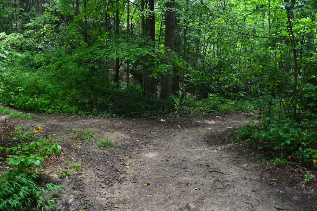
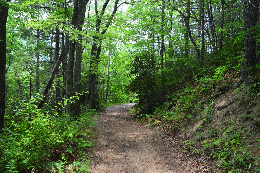
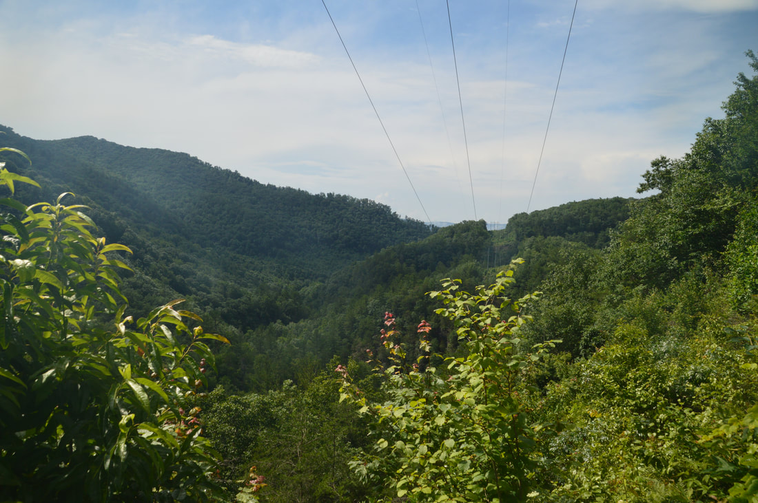
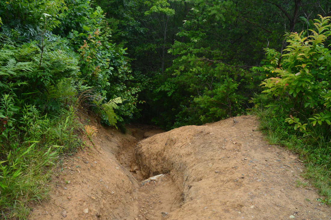
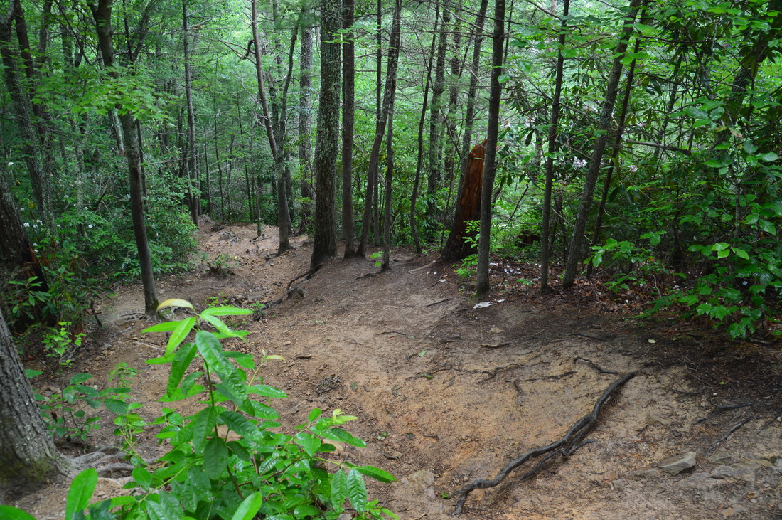
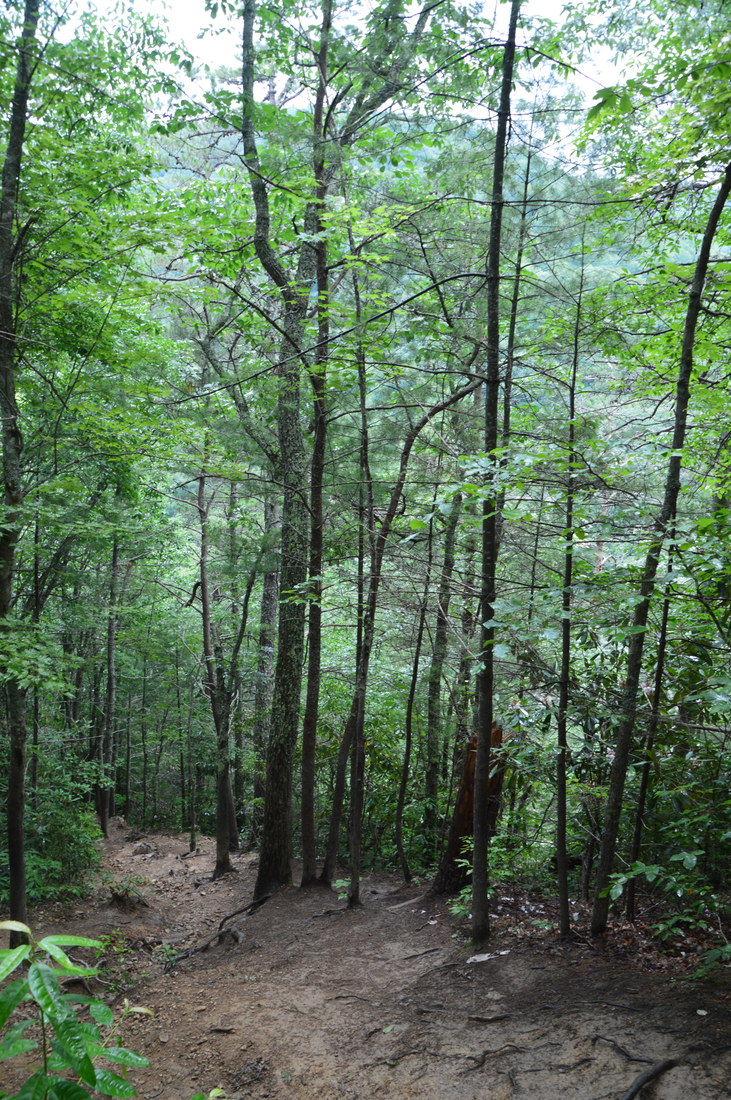
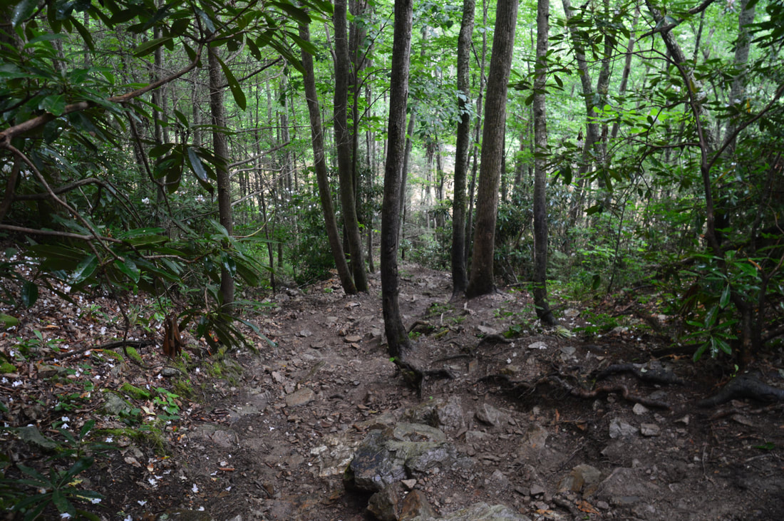
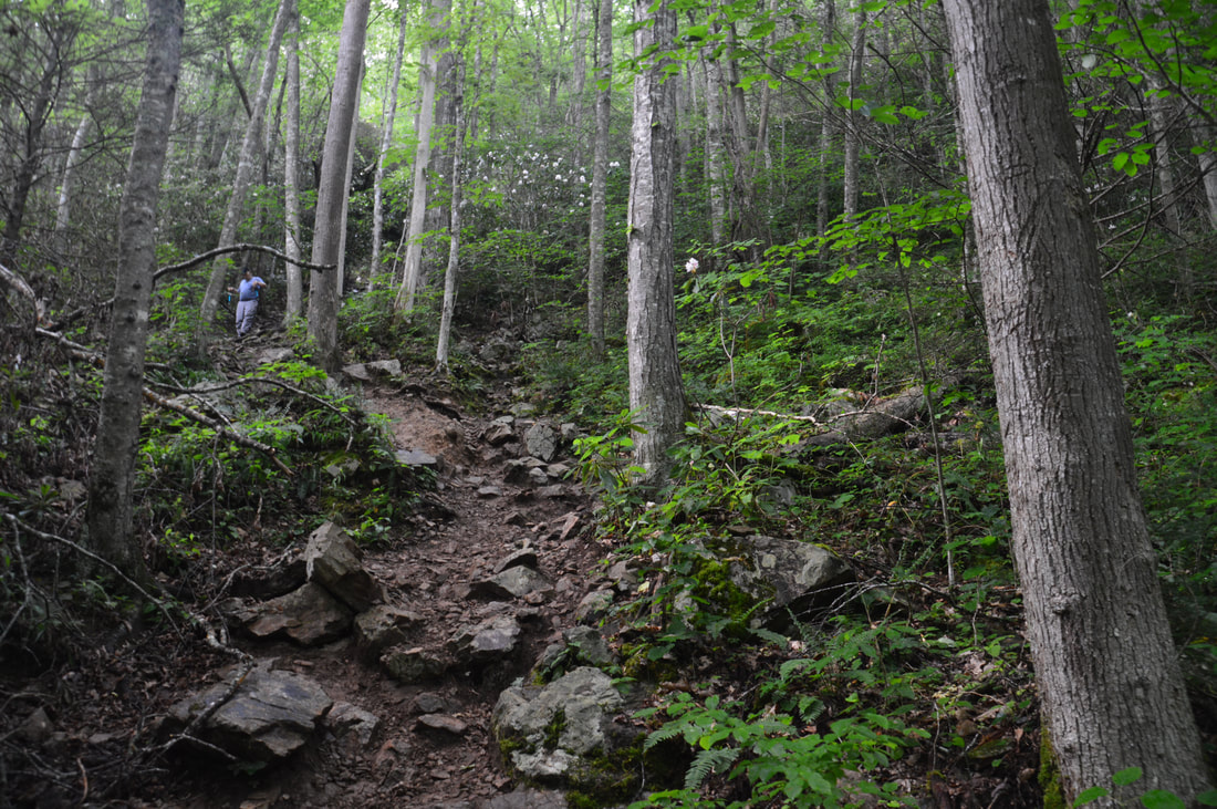
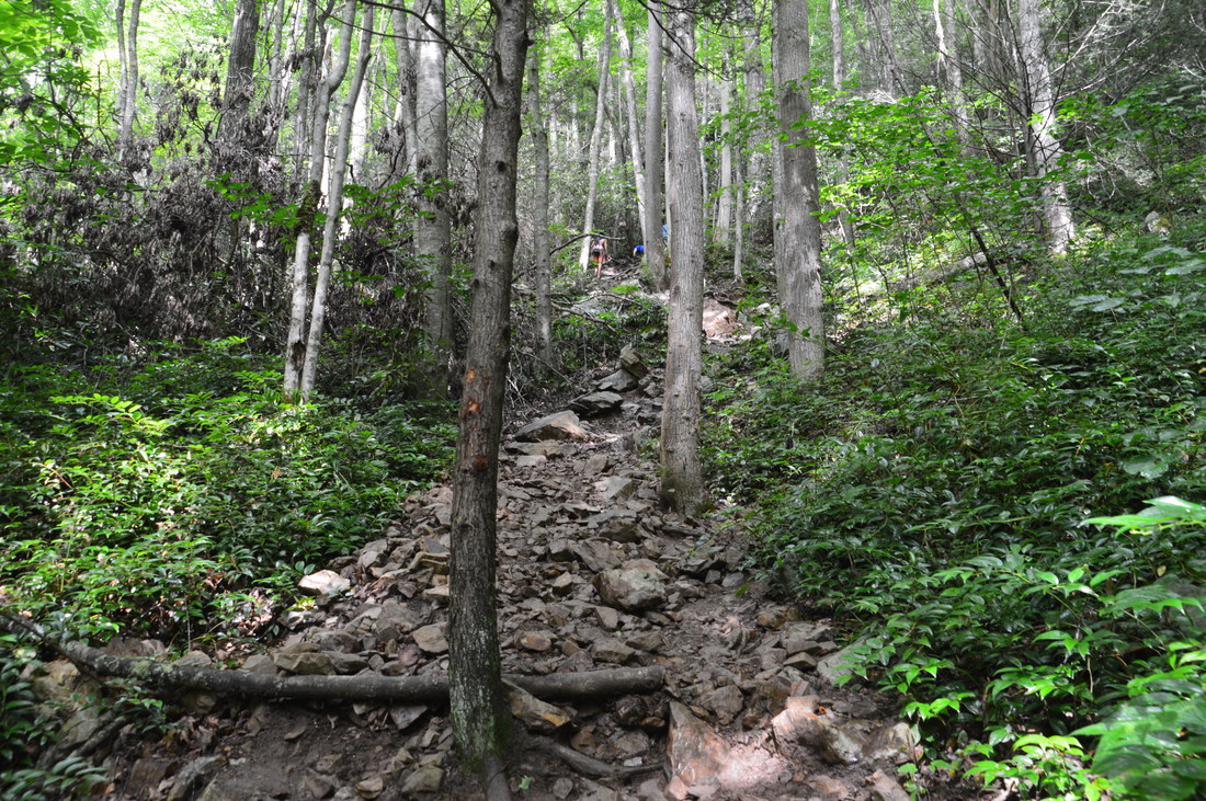
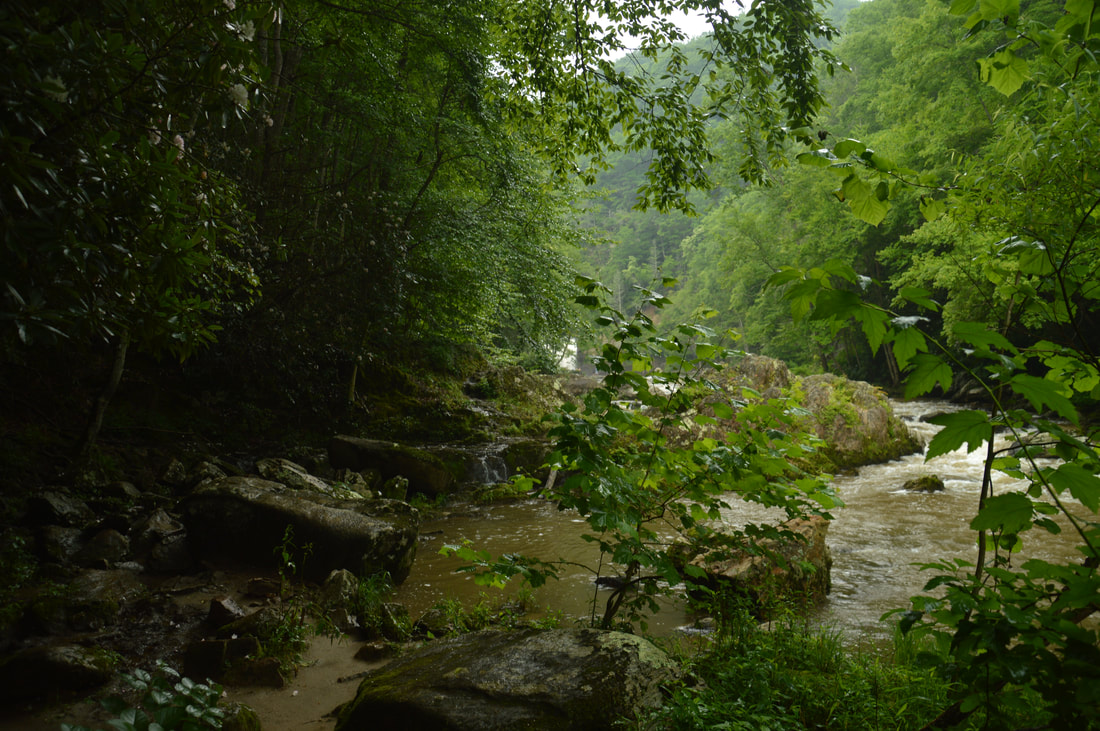
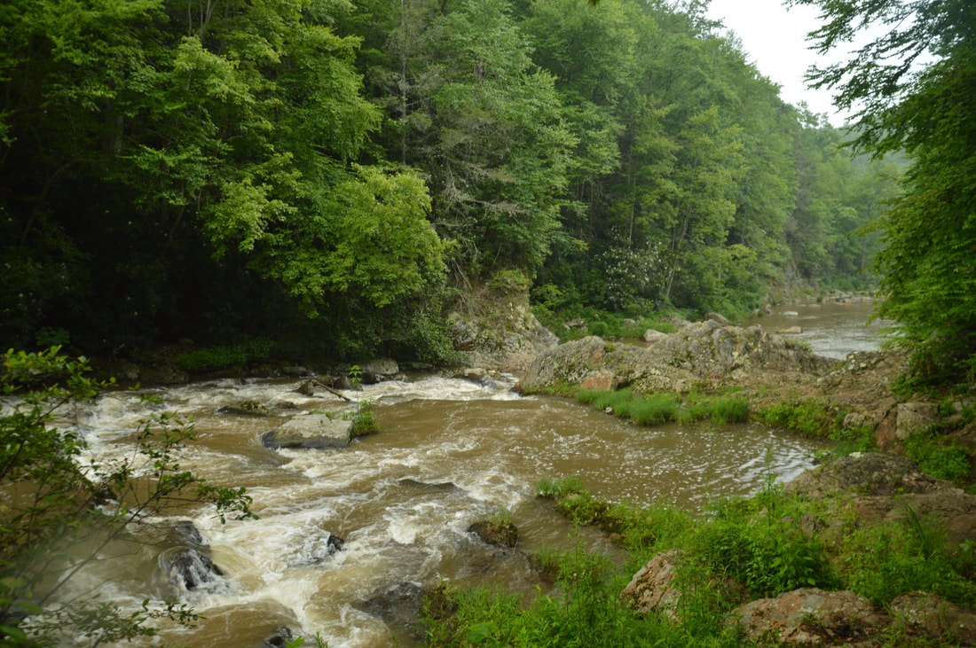
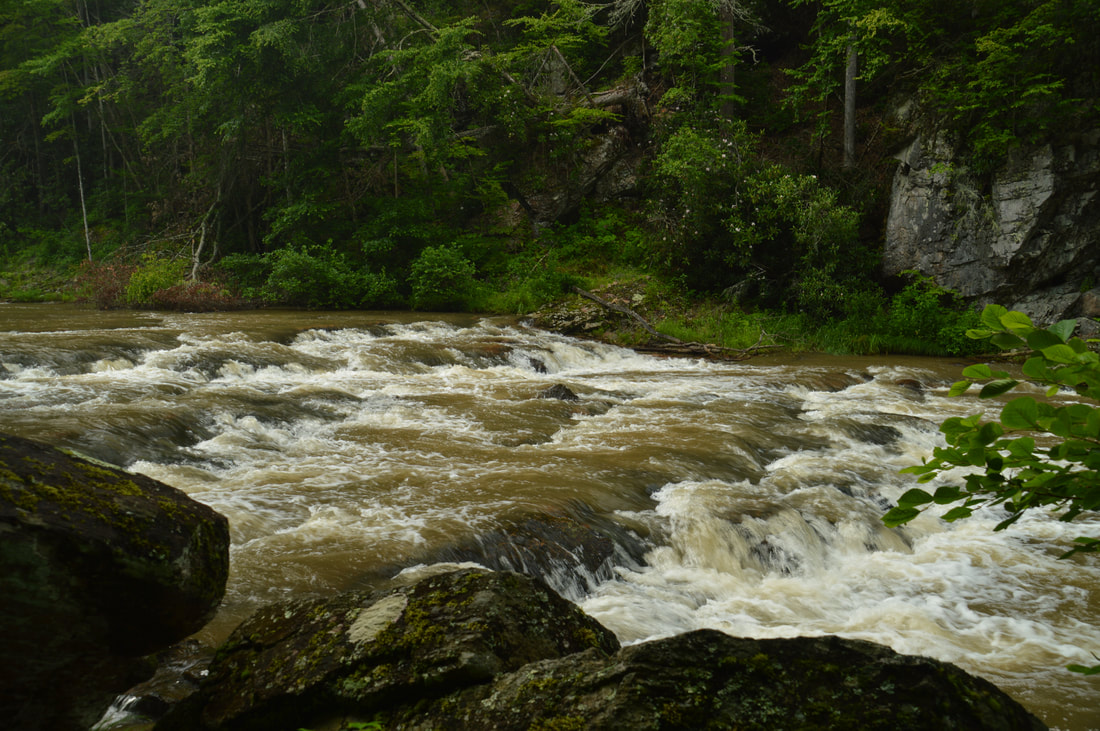
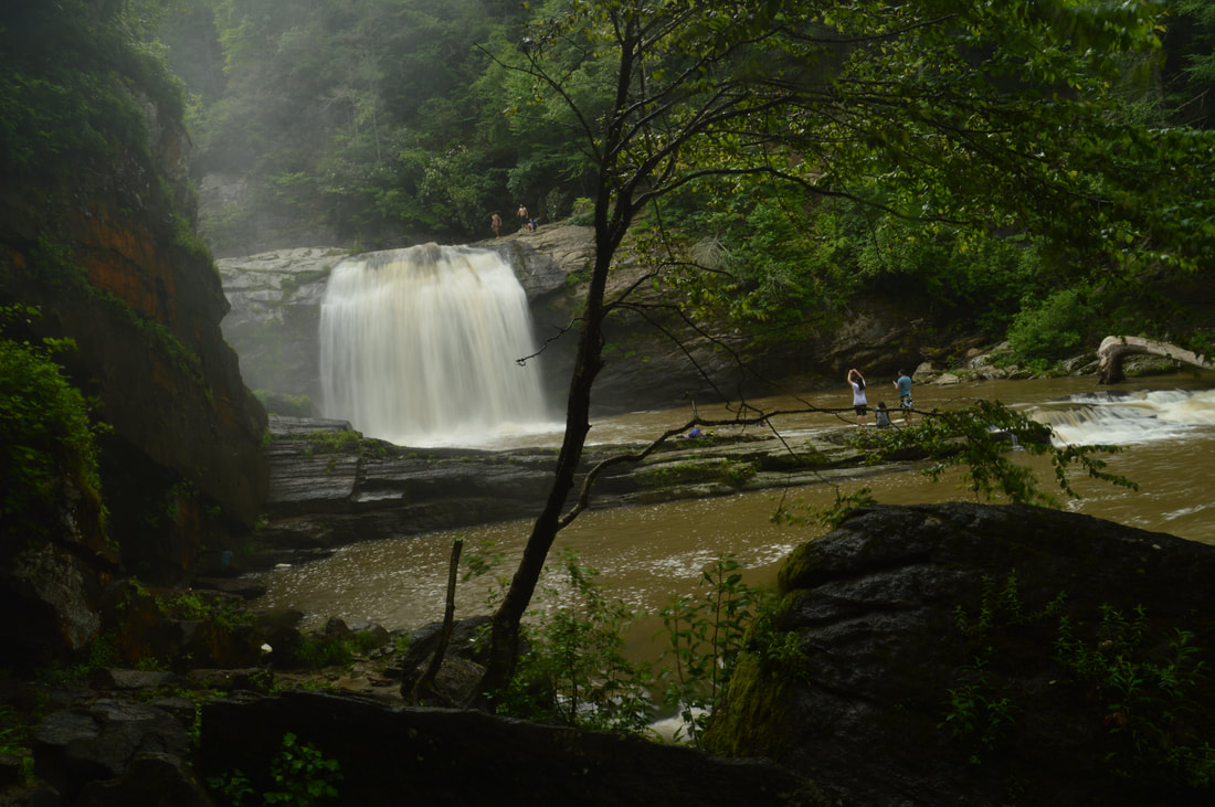
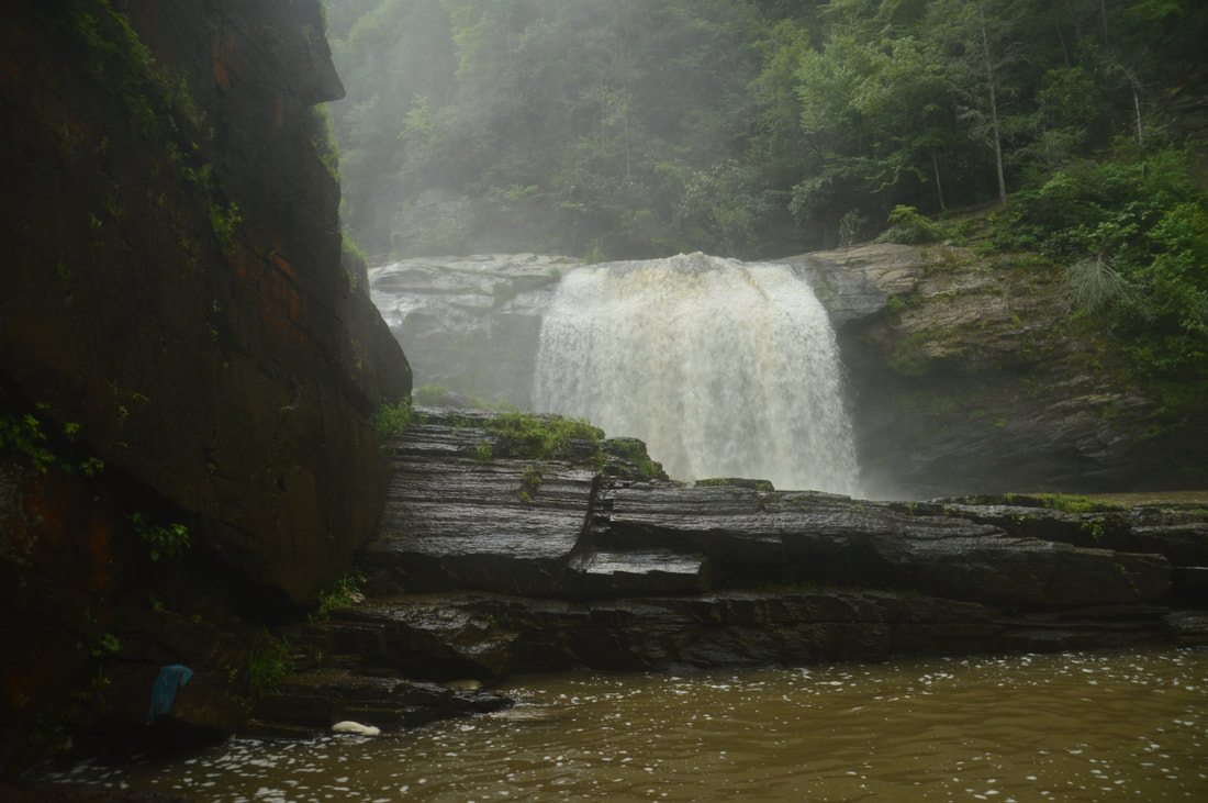
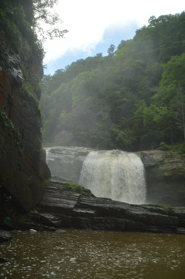
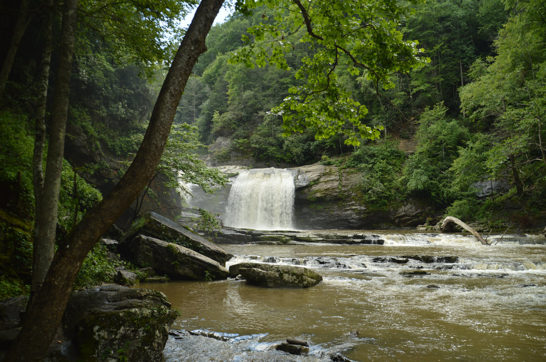
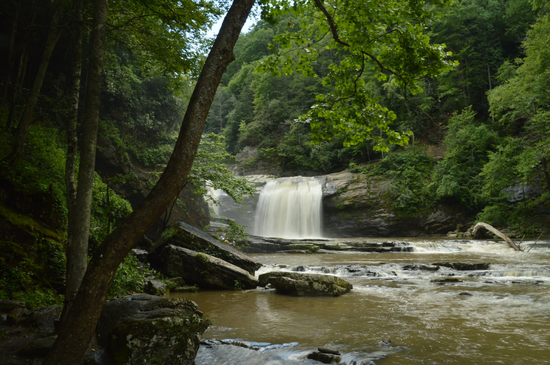
With that said, the hike to Twisting Falls begins at the west end of the parking area. An obvious path begins along an old forest road. In about 250 feet, keep right on the broad trail at a junction with other paths. The path begins a gradual descent toward the rim of the Elk River gorge. At 0.15 miles, the forest road that you're following reaches a powerline cut and bears right. For Twisting Falls, stay left on a narrower path which comes to a point right under the powerline in a few feet, where there is a decent view of the Elk River gorge. Here, turn sharply left onto an extremely steep trail that resembles a drainage gully more than a trail. This trail, which drops about 300 feet in the next 0.15 miles, leads directly to the Elk River at the bottom of the gorge. The ungraded trail is very rocky and slippery in many places, and while none of the spots are particularly technical, prepare for a lengthy descent that requires caution. The way back up might actually end up being faster, although the ascent is so steep that it will force even the most fit hikers to stop a few times. At 0.3 miles, the trail reaches the roaring Elk River. Turn left and follow the obvious path upstream along the river. There are a few spots that will be muddy or wet during high water, but all of them have bypasses. As the trail comes in sight of Twisting Falls, there will be a couple of brief scramble spots. The trail finally ends close to the bottom of the lower drop of Twisting Falls at 0.45 miles. From this vantage point, you can only see the main right arm of the falls. If the water is low enough, you will be able to hop onto a long rock slab with views of the left arm as well, but on this day, that required wading. A couple hundred feet before the end of the trail, there is a large boulder in the river that provides a limited view of the left arm as well. 

The main drop of Twisting Falls is jaw-dropping from all aspects. The first thing that you will notice is how powerful this 30-foot falls is. Due to how large the Elk River is here, this will be a powerful waterfall no matter the weather and time of year. The mist and spray from the falls were so strong on this day that I had to constantly wipe my lens standing nearly a hundred feet from the base. A huge deep pool lines the base of the falls. The waterfall wouldn't be complete without the massive cliff that rises dozens of feet into the air on the left side of the river at the falls, giving the setting a grotto feeling. The best time of year to see Twisting Falls is winter, because that's when the swimmers, jumpers, and sliders are absent. Yes, people do 'slide' down the falls from the top, and I witnessed a half-dozen people do it! Unfortunately, the trash that these revelers leave behind is present year-round, and there's plenty of it all around the falls. I have not been to the upper drops of Twisting Falls, which are smaller but do not appear to be less scenic. Access to them is very difficult and requires scrambling up very steep and dangerous slopes near the falls. For more information about the upper drops of Twisting Falls, please read Kevin Adams's excellent report on Twisting Falls. 

From Twisting Falls, simply return along the same way back to the parking area. Remember, the ascent will take a lot of time! You will reach your car at 0.9 miles, concluding the hike. 

Mileage

0.0 - Dark Ridge Road Parking 
0.15 - Powerline Cut, Begin Extremely Steep Descent
0.3 - Reach Elk River
0.45 - Base of Twisting Falls (lower drop, aka Compression Falls)
0.9 - Dark Ridge Road Parking 

Variations

None

Bonus Stops

An excellent waterfall hike in the same area is to Elk River Falls and Jones Falls. Another hike that you van consider combining with Twisting Falls is the hike to Laurel Fork Falls near Hampton.

Pictures

Videos

0 Comments


Leave a Reply.

    About Me

    Mark Oleg Ozboyd
    I'm an avid outdoor explorer and a hobbyist landscape photographer. I'm 21 years old and have been hiking since 2011. Originally based out of Atlanta, Georgia, I started out by occasionally hiking short trails throughout well-known Georgia State Parks. During 2012 and 2013, I began to expand my trips into adjacent states, as well as into the wilder National Forest areas rather than just State Parks. Throughout the years that followed, as I slowly ran out of popular hiking trails in my area, I began to search for and hike in more seldom-visited areas. Today, you can find me out in the woods every weekend, whether it's on an official trail or bushwhacking through cross-country terrain without any paths. I now attend Washington & Lee University and am exploring Virginia and West Virginia. My other hobbies include chess, science, old music, and meteorology. I have 3 years of amateur weather forecasting experience, having studied a lot of meteorology basics over the years. I am also a student at European School of Music where I learned that music and nature have a lot in common. Listening to good music inspires me to capture nature's beauty on the camera in different aspects that also make me recall many beautiful music pieces that I've heard.​


    Dear readers: I have invested a tremendous amount of time and effort in this website and the Georgia Waterfalls Database the past five years. All of the work that has gone in keeping these websites updated with my latest trip reports has almost been like a full-time job. This has not allowed me to pick up a paid job to save up money for college, and therefore, I I've had to take out loans. If you find the information on this website interesting, helpful, or time-saving, you can say "thanks" and help me out by clicking the button above and making a contribution. I will be very grateful for any amount of support you give, as all of it will apply toward my college tuition. Thank you! 

    Enter your email address to subscribe for trail reports:

    Delivered by FeedBurner


    Picture
    Coming in 2022-2023?

    Other Hiking Websites

    DWHike's Adventures
    Florida's Natural Wonders
    Florida Trailblazer
    Meanderthals
    Mountain Images
    by Bernie Boyer

    North Carolina Waterfalls with
    ​Kevin Adams
    Take-a-Hike!
    Tennessee Landforms
    Waterfall Page
    Waterfall Adventurer
    Zach's Mild Adventures

    Miles Hiked

    Year 1: 540.0 Miles
    Year 2: 552.3 Miles
    ​Year 3: 518.4 Miles
    Year 4: 482.4 Miles
    Year 5: 259.9 Miles

    Archives

    March 2021
    February 2021
    January 2021
    November 2019
    October 2019
    September 2019
    August 2019
    July 2019
    June 2019
    February 2019
    January 2019
    December 2018
    November 2018
    October 2018
    August 2018
    July 2018
    June 2018
    May 2018
    April 2018
    March 2018
    February 2018
    January 2018
    December 2017
    November 2017
    October 2017
    September 2017
    August 2017
    July 2017
    June 2017
    May 2017
    April 2017
    March 2017
    February 2017
    January 2017
    December 2016
    November 2016
    October 2016
    September 2016
    August 2016
    June 2016
    May 2016
    April 2016
    March 2016
    January 2016
    December 2015
    November 2015
    October 2015
    September 2015
    August 2015
    July 2015
    June 2015
    May 2015
    April 2015
    March 2015
    February 2015
    January 2015
    December 2014
    November 2014
    October 2014
    September 2014
    August 2014
    July 2014
    June 2014
    May 2014
    April 2014
    March 2014
    February 2014

    Categories

    All
    Adel
    Adirondack Park
    Alabama
    Alfred A. Ring Park
    Allegheny Trail
    Amicalola Falls State Park
    Anniston Area
    Apalachicola Bluffs And Ravines Preserve
    Apalachicola National Forest
    Apalachicola/Port St. Joe Area
    Apopka
    Appalachian Trail
    Appling
    Art Loeb Trail
    Aska Trail System
    Bakersville
    Balm-Boyette Scrub Preserve
    Balsam Lake Recreation Area
    Bankhead National Forest
    Bartow County Parks
    Bartram Trail
    Basinger
    Beersheba Springs
    Benton
    Benton Mackaye Trail
    Berry College Trail System
    Best Hike
    Big South Fork National Recreation Area
    Black Bear Wilderness
    Black Rock Mountain State Park
    Blairsville
    Blakely
    Blood Mountain Wilderness
    Blowing Rock
    Blue Ridge
    Blue Ridge Parkway
    Boone
    Bradenton
    Bradenton Beach
    Brasstown Bald
    Brasstown Wilderness
    Brevard
    Bryson City
    Buchanan
    Bucks Pocket State Park
    Bulow Creek State Park
    Bulow Plantation Ruins State Park
    Caesars Head State Park
    Caladesi Island State Park
    Calhoun
    Camel's Hump State Park
    Cashiers
    Caspersen Beach Park
    Catfish Creek State Park
    Caves
    CC Putnam State Forest
    Cedar Point Environmental Park
    Chatsworth
    Chattahoochee National Forest
    Chattanooga
    Chattanooga Valley
    Chattooga National Wild And Scenic River
    Cheaha Wilderness
    Cherohala Skyway
    Cherokee
    Cherokee National Forest
    Chiefland Area
    Chillhowee Recreation Area
    Chipley
    Chunky Gal Trail
    Circle B Bar Reserve
    Citico Creek Wilderness
    Citrus Wildlife Management Area
    Clarkesville
    Clayton
    Cleevland
    Cleveland
    Cloudland Canyon State Park
    Cohutta Wilderness
    Collier-Seminole State Park
    Cordele
    Cornelia
    Covington
    Crestview Area
    Crew-land-and-water-trust
    Cullowhee
    Cumberland Trail
    Dahlonega
    Dalton
    Dawson Forest Wildlife Management Area
    Dawsonville
    Dayton
    De Soto National Memorial
    DeSoto State Park
    Dillard
    Double Springs
    Ducktown
    Duncan Ridge Trail
    Dunlap
    Eagle's Rest Park
    Eastpoint
    Econfina Creek Wildife Management Area
    Eglin Air Force Base
    Elizabethton
    Elkins
    Elk Knob Game Lands
    Elk Park
    Ellicott Rock Wilderness
    Ellijay
    Emerson Point Preserve
    Englewood Area
    Enota Retreat
    Erwin
    Falling Waters State Park
    Fayetteville
    Fires Creek Recreation Area
    Fire Tower
    Flint River
    Florence Area
    Florida
    Florida Caverns State Park
    Florida Trail
    Foothills Trail
    Fort Mountain State Park
    Fort Myers Area
    Fort Payne
    Fort Payne Area
    Fort Yargo State Park
    Franklin
    Franklin Delano Roosevelt State Park
    Franklin-Marion State Forest
    Frozen Head State Park
    Gainesville
    Gainesville Area
    Gatlinburg
    George Washington National Forest
    Georgia
    Georgia Veterans Memorial State Park
    Glasgow
    Gorges State Park
    Grandfather Mountain State Park
    Great Smoky Mountains National Park
    Greeneville
    Green River Game Lands
    Gruetli-Laager
    Grundy Forest State Natural Area
    GTM Reserve
    Guana River Wildlife Management Area
    Hayesville
    Helen
    Hiawassee
    High Falls State Park
    Highlands
    Highlands Scenic Highway
    Hillsborough River State Park
    Hinson Conservation & Recreation Area
    Historic Sites
    Honeymoon Island State Park
    Hot Springs
    Huntington
    Inverness Area
    Jackson
    Jasper
    Jefferson National Forest
    Joan M. Durante Park
    Jonathan Dickinson State Park
    Jones Gap State Park
    Joyce Kilmer Slickrock Wilderness
    Joyce Kilmer - Slickrock Wilderness
    Juniper Prairie Wilderness
    Kelly Park
    Keown Falls Recreation Area
    Kolomoki Mounds State Park
    LaFayette
    Lake City Area
    Lake George Wild Forest
    Lake June-in-Winter State Park
    Lakeland Area
    Lake Placid
    Lake Russell Wildlife Management Area
    Lake Wales Ridge State Forest
    Laurel Fork North Wilderness
    Leffis Key Preserve
    Leon Sinks Geological Area
    Lexington
    Lineville
    Linville
    Linville Gorge Wilderness
    Lithia Springs
    Little Frog Wilderness
    Little Manatee River State Park
    Little River Canyon National Preserve
    Longboat Key
    Long Trail
    Lookout Mountain
    Lookout Mountain Battlefield
    Lovingston
    Lula Lake Land Trust
    Lumpkin
    Maggie Valley
    Manatee Springs State Park
    Marianna Area
    Mark Trail Wilderness
    Marlinton
    Mccaysville
    McMinville
    Mentone
    Middlesex
    Mistletoe State Park
    Monongahela National Forest
    Montreat
    Mountain Bridge Wilderness Area
    Mountain City
    Mountains To Sea Trail
    Mountains-to-Sea Trail
    Mount Rogers National Recreation Area
    Myakka River State Park
    Myron B. Hodge City Park
    Nantahala National Forest
    Naples
    Naples Area
    Natural Bridge State Park
    Neal Preserve
    New Castle
    Newport
    New River Gorge National Park
    New York
    North Carolina
    Ocala Area
    Ocala National Forest
    Ocean-to-Lake Trail
    Oconee State Park
    Oconee Station Historic Site
    Okaloacoochee Slough State Forest
    Oldsmar
    Oneida
    Orlando Area
    Ormond Beach
    Oscar Scherer State Park
    Oxford
    Palatka
    Palmetto Trail
    Panama City Area
    Panthertown Valley
    Parrish
    Paynes Creek Historic State Park
    Peaks Of Otter Recreation Area
    Pigeon Crockford Mountain Wildlife Management Area
    Pigeon-Crockford Mountain Wildlife Management Area
    Pigeon-Crockford Wildlife Management Area
    Pine Mountain
    Pinhoti Trail
    Pinnacle Park
    Pisgah Civitan Park
    Pisgah National Forest
    Pittman Center
    Pond Mountain Wilderness
    Ponds/Lakes
    Prentice Cooper State Forest
    Providence Canyon State Park
    Pumpkintown
    Quick Point Nature Preserve
    Raven Cliffs Wilderness
    Reed Bingham State Park
    Reliance
    Rice Creek Conservation Area
    Riverview Pointe Preserve
    Robbinsville
    Robinson Preserve
    Rock Creek Gorge Scenic Area
    Rock Island State Park
    Rome
    Rosman
    Sale Creek
    Salem
    Salt Springs
    Saluda
    Santa Rosa Beach
    Sarasota
    Sarasota Area
    Savage Gulf State Natural Area
    Scenic Views
    Scottsboro Area
    Sebring Area
    Sewanee
    Sheltowee Trace Trail
    Shining Rock Wilderness
    Signal Mountain
    Sipsey Wilderness
    Sky Valley
    Smithgall Woods State Park
    Snowbird Backcountry Area
    Soddy Daisy
    Soddy-Daisy
    Sopchoppy
    South Carolina
    South Cumberland State Park
    Southeastern Cave Conservancy
    Southern Nantahala Wilderness
    Sparta
    Sprewell Bluff Park
    Spring City
    Spring Hill
    Springs
    Spruce Pine
    Standing Indian Backcountry Area
    St. Augustine
    St. George Island State Park
    St. Joseph Bay State Buffer Preserve
    St. Marks Area
    St. Marks National Wildlife Refuge
    Stone Mountain
    Stone Mountain Park
    Suches
    Sumatra
    Sumter National Forest
    Suwannee River
    Swallow Creek Wildlife Management Area
    Sweetwater Creek State Park
    Sylva
    Talladega National Forest
    Tallahassee Area
    Tallulah Falls
    Tallulah Gorge State Park
    Tampa Bay Area
    Tate City
    Tate's Hell State Forest
    Tea Creek Wildlife Management Area
    Tellico Plains
    Tennessee
    Thomaston
    Toccoa
    Topsail Hill State Park
    Torreya State Park
    Townsend
    Tracy City
    Tray Mountain Wilderness
    Trenton
    Triple Creek Preserve
    Troutdale
    Unaka Mountain Wilderness
    Upper Tampa Bay County Park
    Venice
    Vermont
    Virgin Falls State Natural Area
    Virginia
    Virginia Outdoors Foundation
    Vogel State Park
    Wakulla Springs State Park
    Waleska
    Walhalla
    Wartburg
    Water Features
    Waynesville
    Weedon Island Preserve
    Weeki Wachee Preserve
    Wekiwa Springs State Park
    West Palm Beach Area
    West Virginia
    Whitehall
    White Springs
    Winder
    Withlacoochee State Forest
    Young Harris

    RSS Feed

TRAIL REPORTS

Hikes in Alabama
​Hikes in Florida
Hikes in Georgia
Hikes in North Carolina
Hikes in South Carolina
Hikes in Tennessee
Hikes in Virginia

Hiking Resources

Alabama Resources
​
Florida Resources
Georgia Resources
North Carolina Resources
​South Carolina Resources
​
Tennessee Resources

Other

Contact
Map of Hikes
Alphabetical List of Hikes
Southeast Nature Society
© COPYRIGHT 2014-2018
​ALL RIGHTS RESERVED.
Important: I disclaim any responsibility for any damage or personal injury that may occur as a result of the activities and information found on this website. All outdoor activities, especially off-trail hiking, are done at your own risk. Never hike or head into that area that may be above your fitness or experience level.
  • Home
  • Trail Reports
    • Best Hikes
    • Hikes with Scenic Views
    • Hikes with Water Features
    • Alabama
    • Georgia
    • Florida
    • North Carolina
    • South Carolina
    • Tennessee
    • Vermont
    • Virginia
  • Map
  • Hike List
  • Testimonials
  • Resources
  • Contact Us
  • Southeast Nature Society
    • Our Team
  • Georgia Waterfalls Database