Located in a sprawling urban area along the southwest Florida coast, Oscar Scherer State Park protects a large swath of land that is considered as an urban getaway. South Creek flows through the center of the park, and large areas of prime scrub jay habitat lie on either side. Oscar Scherer State Park is considered as the only remaining haven for scrub jays in southwest Florida. There are several hiking trails in the park that you can explore, split into two trail general trail systems: the North Trail System and the South Trail System. On this day, I hiked the entire South Trail System, first along the shores of South Creek and then through scrub where scrub jays flew from tree to tree and an old bald eagle nest from the past spring was perched high up in a grand pine tree. This hike occurred on Wednesday, June 29th, 2016. My plan was to hike the South Creek Trail and Lester Finley Trail out and back. I would then hike the Green Trail loop clockwise, before finishing up with the short walk around Lake Osprey.
Summary
R/T Length of Trail: 5.3 Miles
Duration of Hike: 2:30 Type of Hike: Double Hike (First - Out and Back; and then - Loop) Difficulty Rating: 2 out of 10 Total Elevation Gain: None Pros: This hike will be dry year-round Cons: None Points of Interest: Two observation areas and many views of South Creek on South Creek Trail and Lester Finley Trail; bald eagle nest on Green Trail Trail Blaze Color(s): There are no blazes, but the Green Trail has wooden posts with green rectangles that have arrows marking the trail. Best Season(s) to Hike: Year-round, but western section of Green Loop is closed from October 1 to May 15 Fees: There is a $5 fee for vehicles with 2 to 8 people, and a $4 fee for vehicles with one person, Beginning Point: Oscar Scherer State Park Nature Center Directions from Osprey, FL: Starting at the intersection of US Route 41 (Tamiami Trail) and Bay Street in Osprey, Florida, drive South on US 41 for 2 miles. Then, at a sign, turn left onto the Oscar Scherer State Park entrance road just before the South Creek bridge. After paying your fee at the entrance ranger station, continue on the road for a mile until the Nature Center and the parking area to the right. MapDetails
Oscar Scherer State Park was opened in 1956, one year after the death of Elsa Scherer Burrows. Part of the land that is the park today used to be the Scherer family's 460-acre South Creek Ranch, and the ranch was left to the state of Florida after Elsa's death. In 1991, Oschar Scherer State Park was expanded to three times its size, thanks to John Thaxton - a realtor and environmentalist, who campaigned for the state to purchase 922 acres from the Palmer Ranch, in order to help preserve scrub jay habitat.
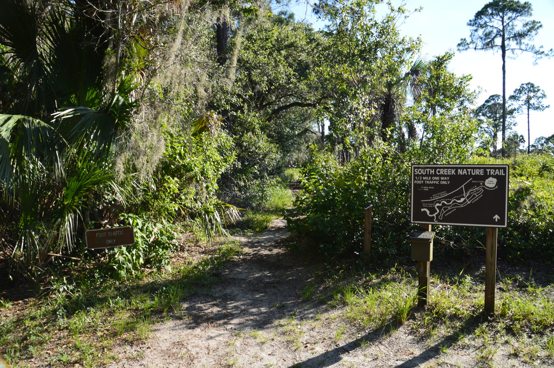
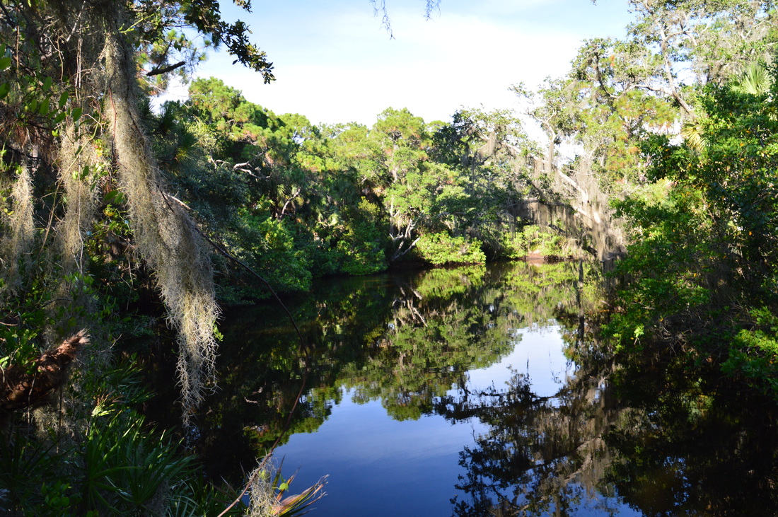
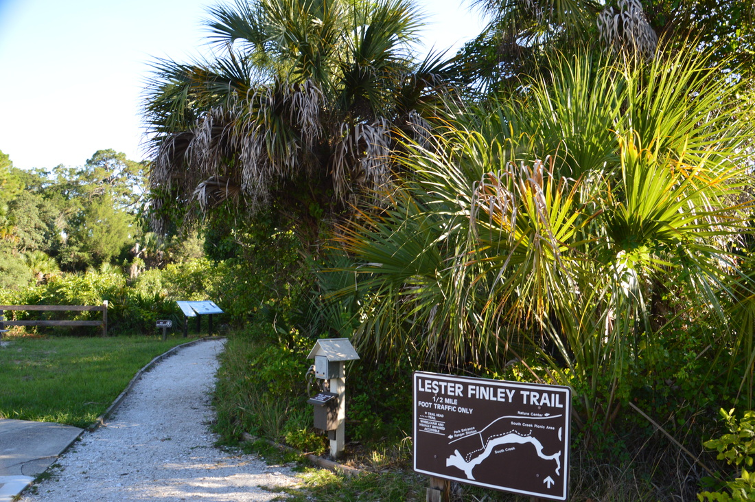
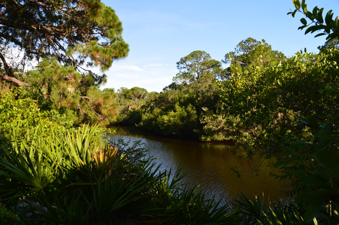
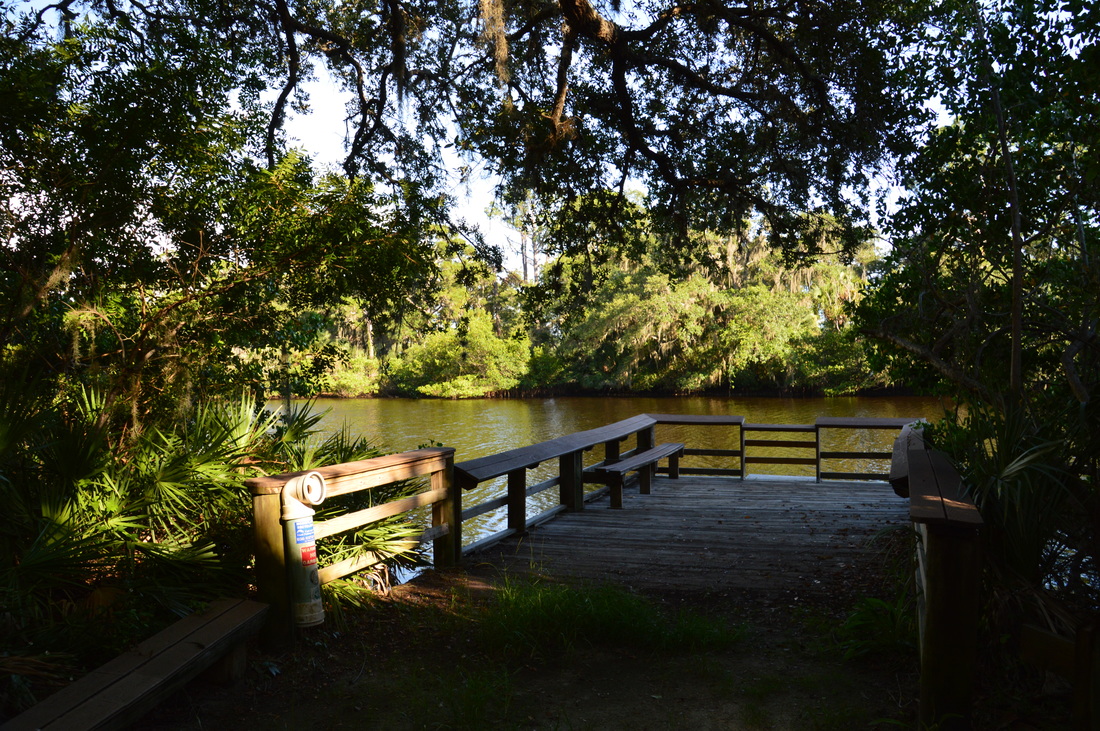
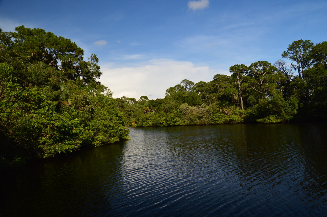
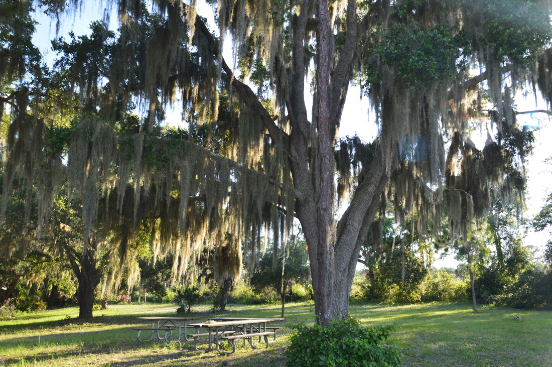
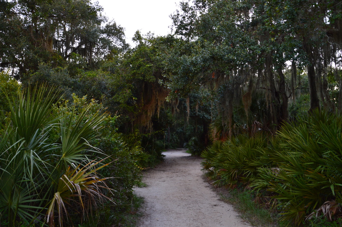
With this park being under a 30-minute drive from the location where I stayed at for the month of July, I just had to visit Oscar Scherer State Park and hike its trails. My visit was on a weekday late afternoon, so I did not have time to hike all of the park's trails, which are split into two trail systems: the North Trail System and the South Trail System. The South Trail System is the shorter one of the two, and it might also be more scenic, although I've yet to find out what the sights are like on the North Trail System. The North Trail System consists of the Red Trail, Blue Trail, and Yellow Trail, the last of which visits South Creek several times, as well as Big Lake. The South Trail System, which I hiked on this day, consists of the South Creek Trail, Lester Finley Trail, and the Green Trail. The first two trails are short strolls along South Creek; the last one is a longer, more remote loop through prime scrub jay habitat and a potential bald eagle viewing area. If you don't spot any bald eagles, you might at least see the nest. The hike begins on the South Creek Trail at the Nature Center. From the parking area, walk through a picnic area shaded by huge Spanish moss-draped live oaks. The entrance to the South Creek Trail is at the upper right corner, or southwest corner, of the picnic area. The trail entrance is marked by a sign and a diagram that shows the route of the trail. The trail starts off following an ecotone, with the lush forest along South Creek to the left and a small prairie dotted by a few pines to the right. The first good view of South Creek to the left is at 0.2 miles. The creek here is still small, and as you advance westward closer towards the mouth of the creek, you will notice how it grows progressively larger. At 0.25 miles, the trail crosses a paved road that leads to the park campground, located on the south side of South Creek. On the other side of the road, the trail winds into the palmetto-oak jungle along the creek. There is a dense curtain of vegetation that prevents you from seeing the creek all the time. At 0.5 miles, the trail reaches an observation deck at a scenic bend in South Creek. South Creek is a tidal stream - this means that the tide from Blackburn Bay can come up the creek, temporarily changing the direction of water flow. There is a slight chance to even spot a manatee somewhere in the creek, although this is a very rare occurrence. From the observation deck, continue following the South Creek Trail west. The South Creek Trail ends at the South Creek Picnic Area at 0.65 miles. Walk across the large gravel parking lot. The Lester Finley Trail begins on the far end of the picnic area. This is a wheelchair-accessible trail that follows South Creek to the western boundary of the park. The entire trail is either a wide sandy path or a boardwalk. This trail actually has more views of the creek itself than South Creek Trail. The first view is right at the beginning of the trail, and here the creek is a lot wider. 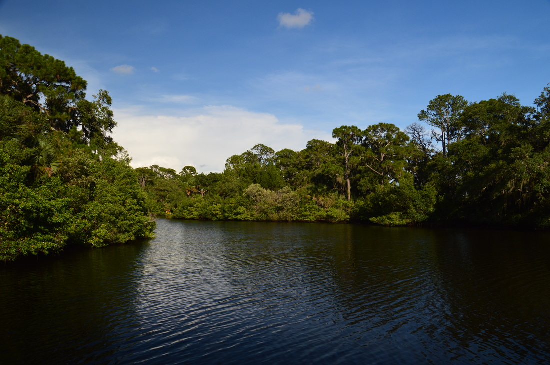
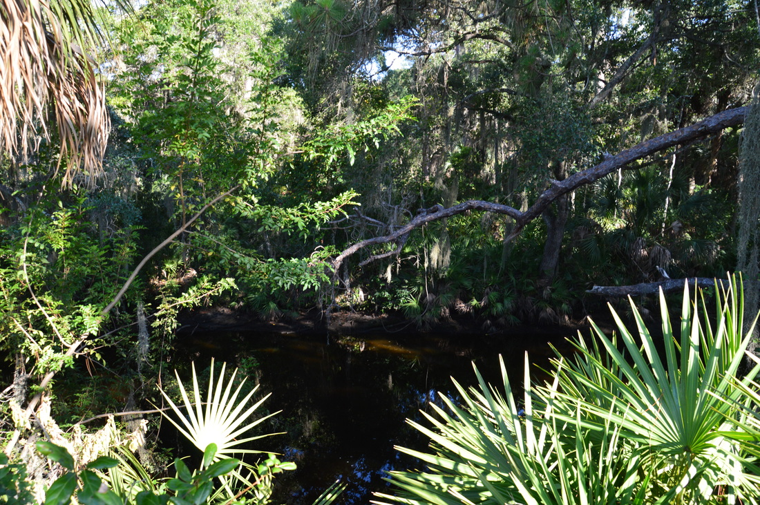
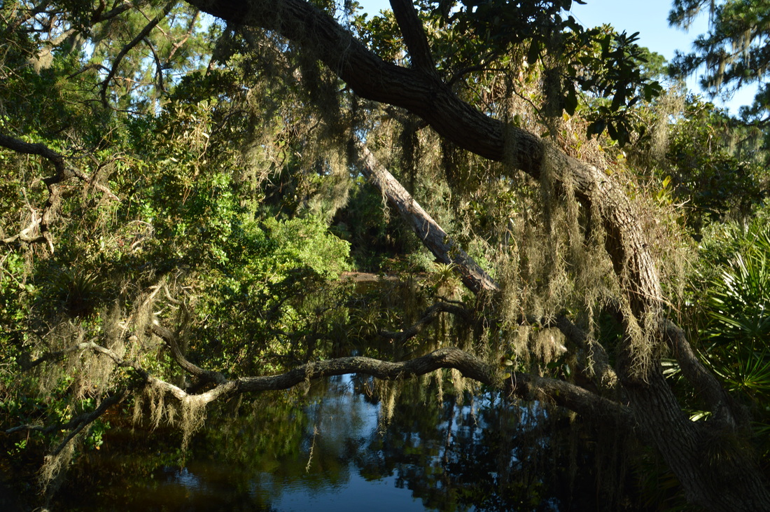
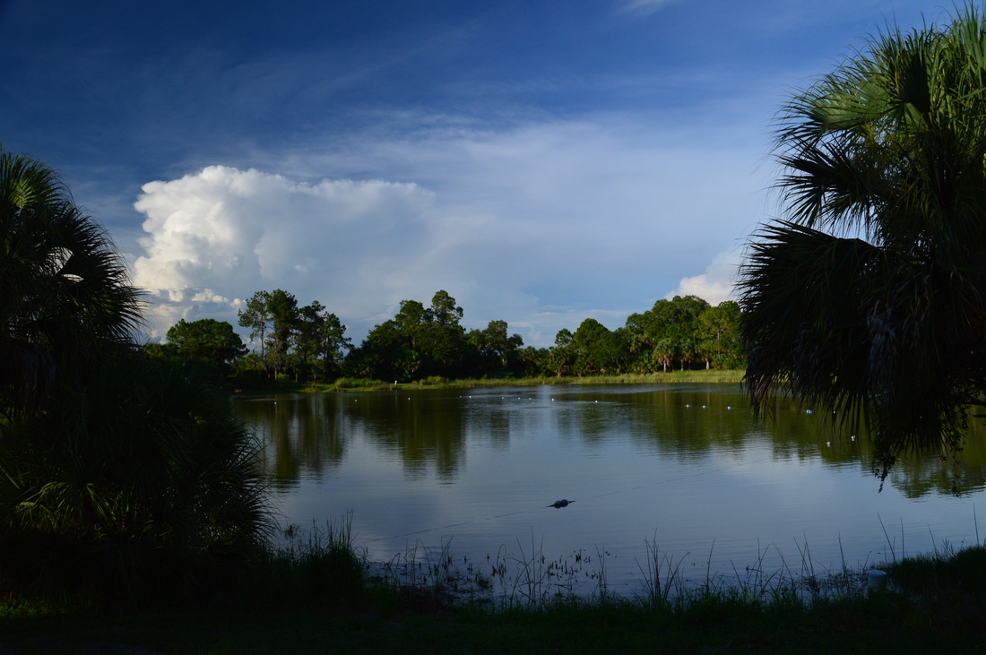
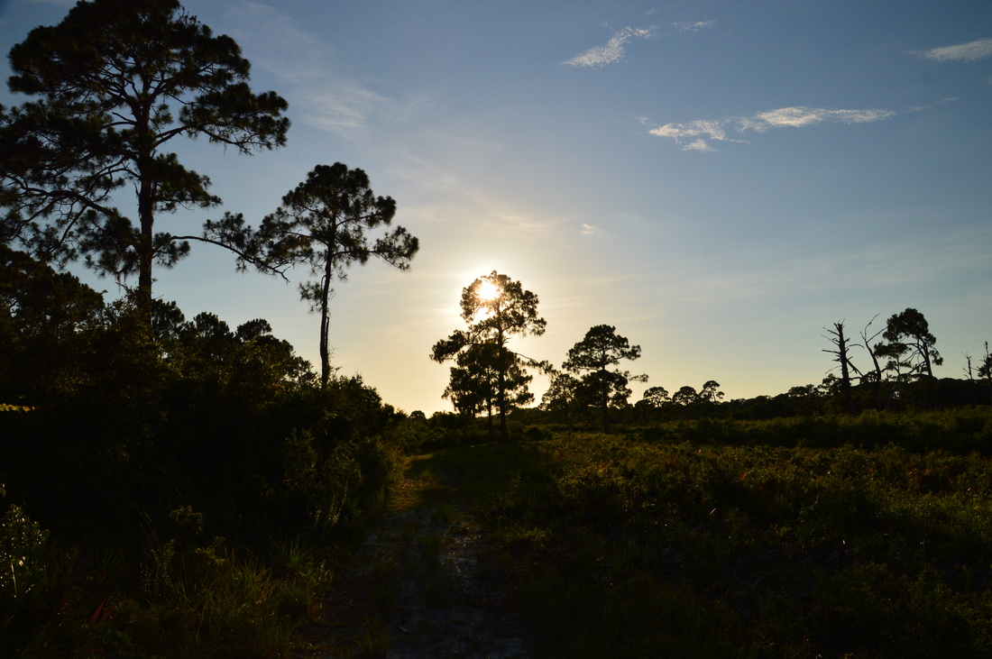
South Creek, a tidal stream in Oscar Scherer State Park
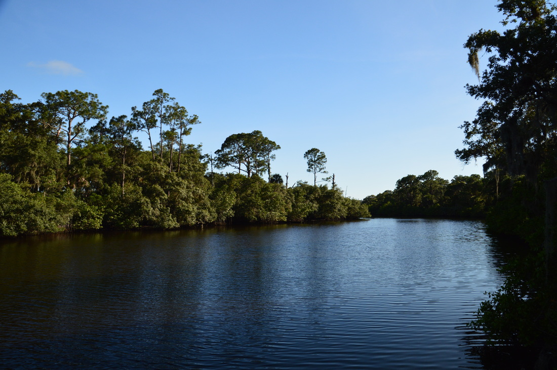
The second observation deck with views of South Creek is on the Lester Finley Trail at 0.8 miles. There is a notable difference between how the creek looks like at the first observation deck and the second observation deck. Since the creek here is closer to its mouth, it is a lot wider. However, in my opinion, the view was more scenic from the first observation deck, as the vegetation around the creek is not as picturesque anymore.
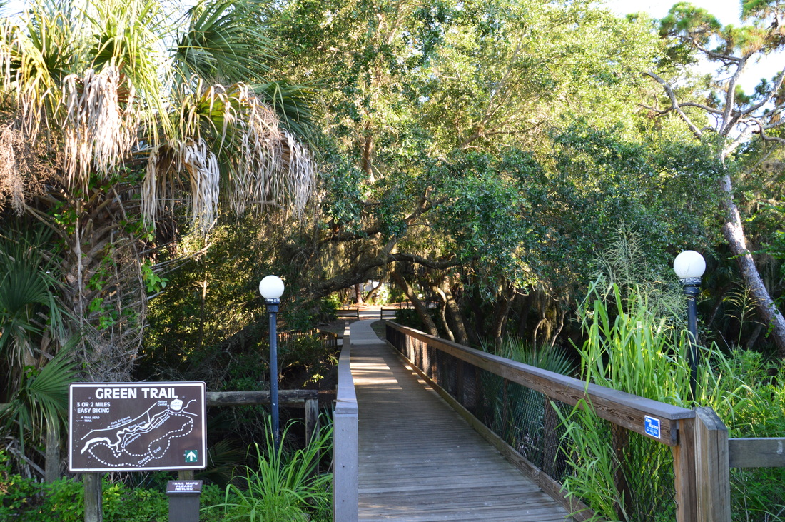
Following this, the Lester Finley Trail followed the creek west to the park boundary, passing several more views of the waterway. Numerous benches line the trail. At 1 mile, the Lester Finley Trail ends with a small loop that leads past one final view of South Creek at the park boundary, where you can see houses on the opposite side of the creek. Follow the small loop back to the trail, and retrace your steps along the Lester Finley Trail and then the South Creek Trail, back to the Nature Center. You should arrive at the Nature Center at 2 miles, completing the first part of your hike. The second part of the hike will be along the Green Trail through a completely different, yet equally scenic ecosystem. To reach the Green Trail, continue from left to right across the picnic area at the Nature Center. The Lake Osprey Trail, a short loop around its namesake lake, begins here. Follow the broad path just a bit down to the junction with the Green Trail, which begins to the right at a wooden footbridge across South Creek. 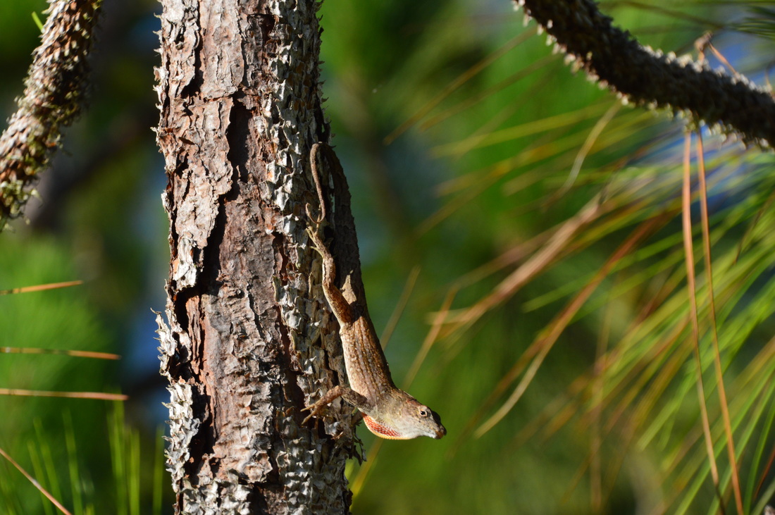
A green anole
Cross the footbridge across South Creek, and take a moment to admire the numerous stout branches of the live oaks that created a think canopy above the stream. The Oscar Scherer State Park Campground lies on the south side of the footbridge. As you enter the campground, turn left at a green-tipped marker, and walk past several RV lots towards the beginning of the Green Trail. At 2.1 miles, a service road leaves to the right. Continue straight on the Green Trail. You're now beginning to enter the scrub. Shrubs and occasional pines constitute the landscape to the right of the trail.
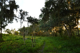
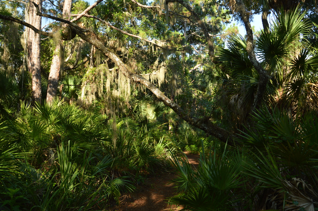
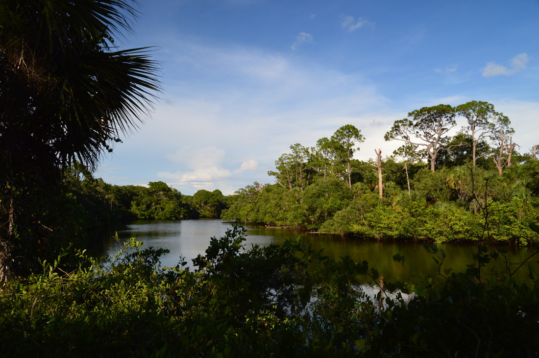
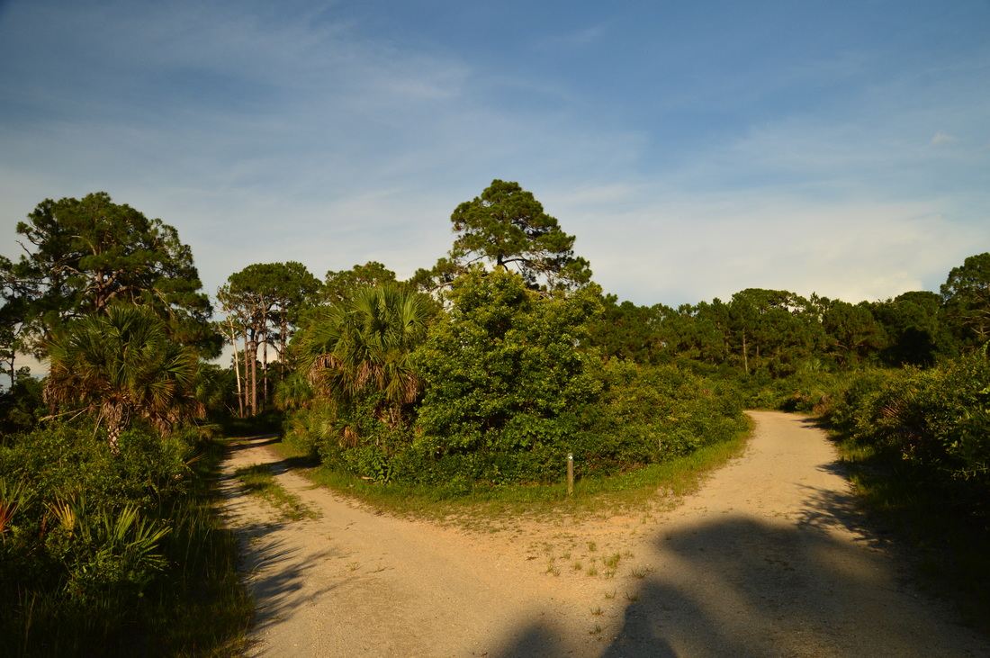
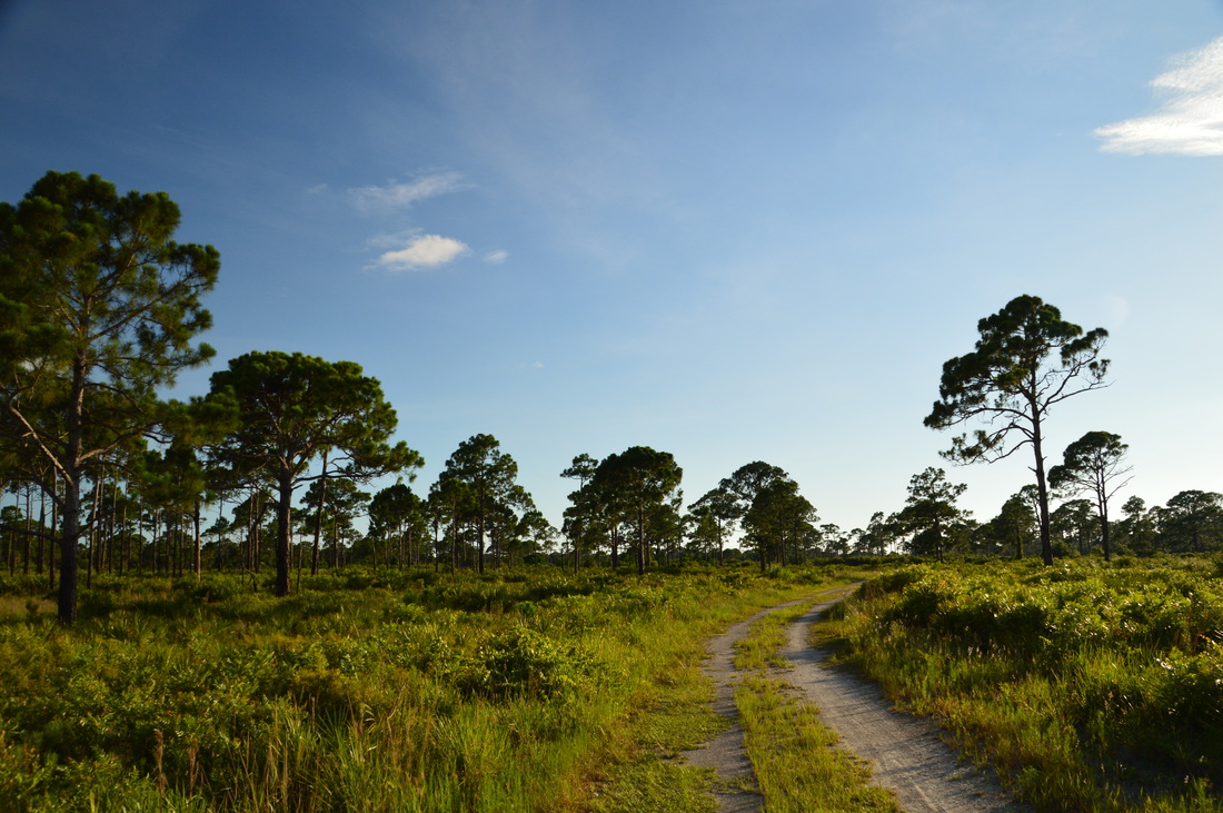
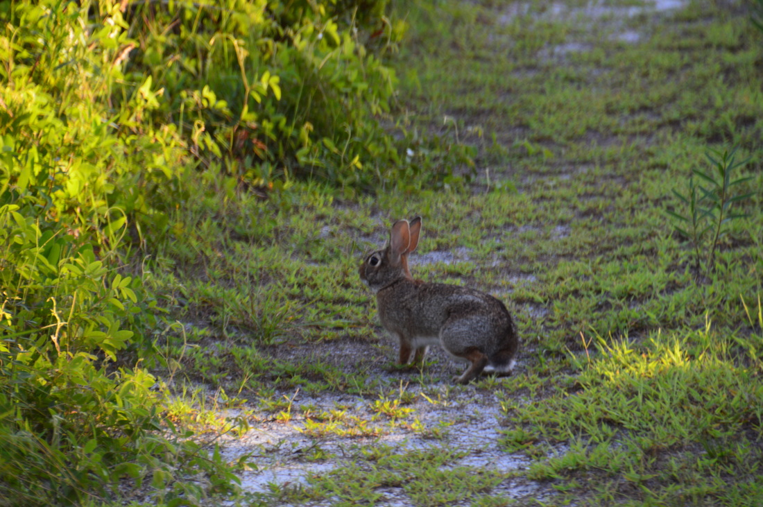
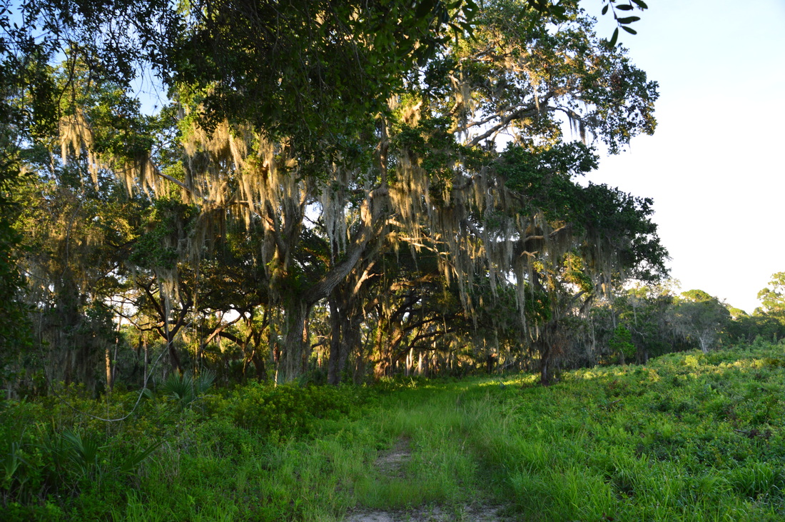
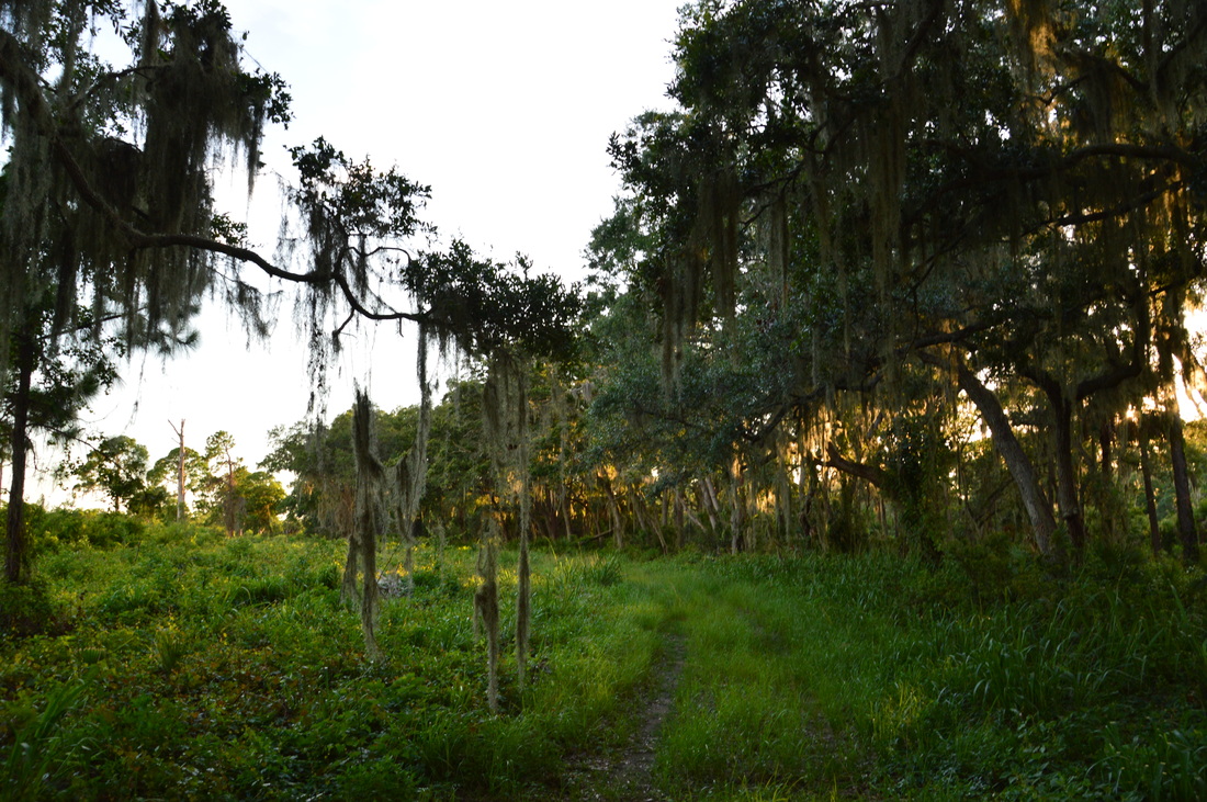
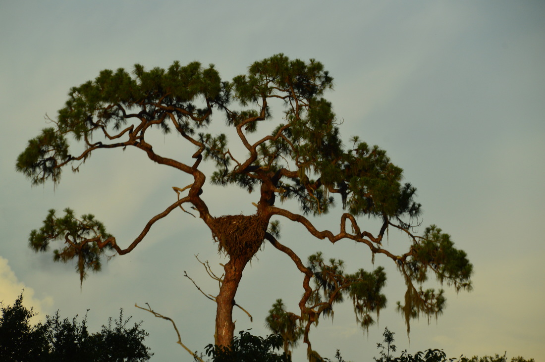
At 2.2 miles, there is a split in the service road the trail has been following. Bear right, and at 2.25 miles, turn right onto another closed service road to continue on the Green Trail. At 2.3 miles, the loop of the Green Trail begins, with one side branching off to the right. My plan was to hike it clockwise, so I continued straight. Much of the Green Trail follows various service roads, although some are more grown over than others. This is a biking trail too, and I saw many bicycle tracks in the sand, so keep an eye out. The trail soon after passes Bench #13 and enters the heart of the "wide open", with pine flatwoods to the left and more open scrub to the right. At one point, you can see cars moving swiftly along Route 681 far to the left. As an eastern cottontail rabbit hops across the trail, reach the junction at Bench #14 with the west half of the Green Trail at 2.9 miles. If you continue straight on the shortcut, you will make the hike one mile shorter. I opted to turn left onto the main trail to hike the full loop. However, keep in mind that this section of the Green Trail is closed from October 1 to May 15 due to eagle nesting season. The trail is open during summer, when I hiked it; however, depending on when was the last time a ranger had traveled down this way, you might still find a temporary fence and a warning sign describing the closure. After the left turn, the trail approaches the south boundary of the park, with a residential area coming into view. However, the trail soon draws away, At 3.2 miles, a service road leads off to the right. Here, I noticed what looked like a large nest in a tall pine tree in the distance. I believe that this was a bald eagle nest from spring. The trail was fairly far from the tree and its nest but I later found out that the loop on its north side got much closer to the tree. The most remote section of the hike begins as the trail approaches the westernmost point on the loop. I looked back upon the scrub. Apart from an occasional scrub jay, there were no signs of life, and the evening silence was hanging over the landscape. At Bench #15, the trail reached its westernmost point. A service road headed off to the left and then curved back to the south park boundary. The trail turned right and began following an ecotone, with the scrub to the right and a line of live oaks to the left. This line of live oaks, with their limbs overhanging the trail, was very photogenic (it is in fact what you see in the picture at the top of this post). 
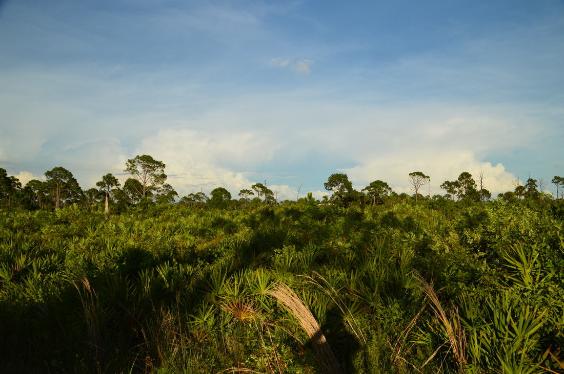
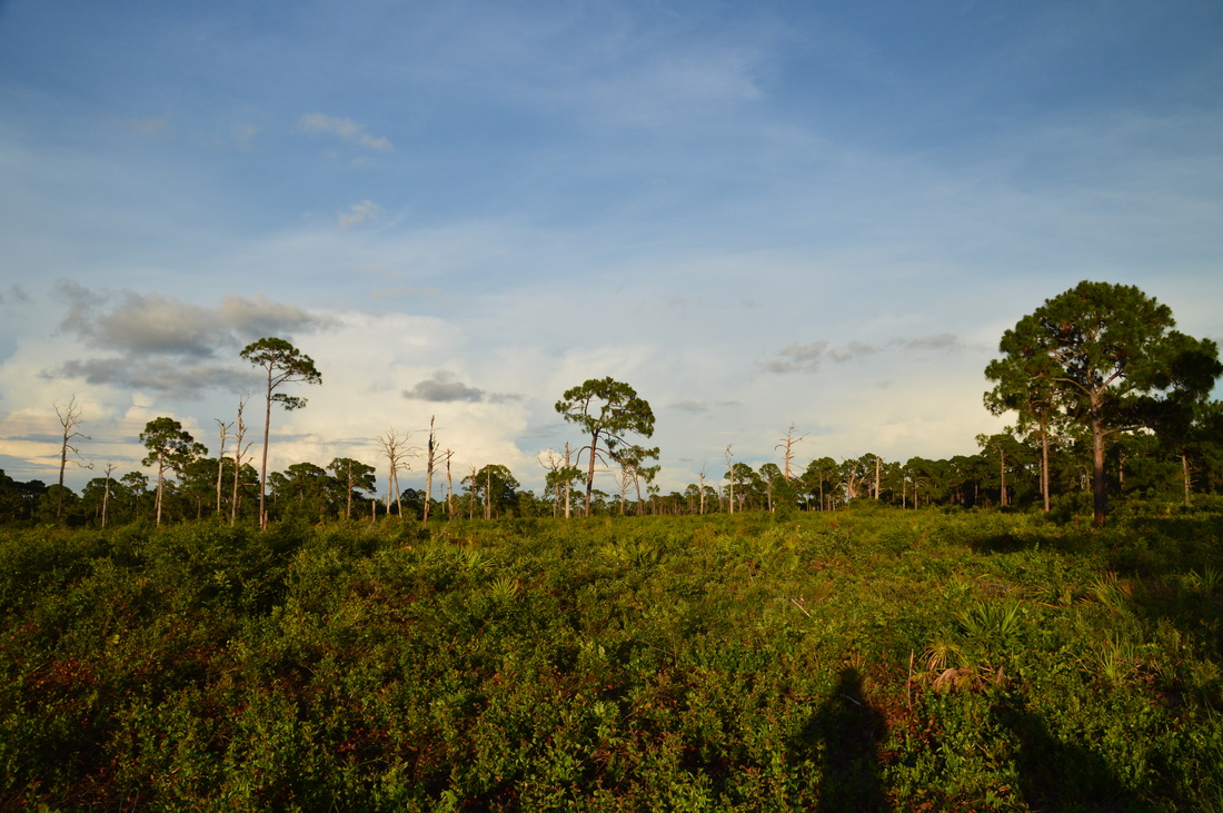
The Oschar Scherer State Park scrub
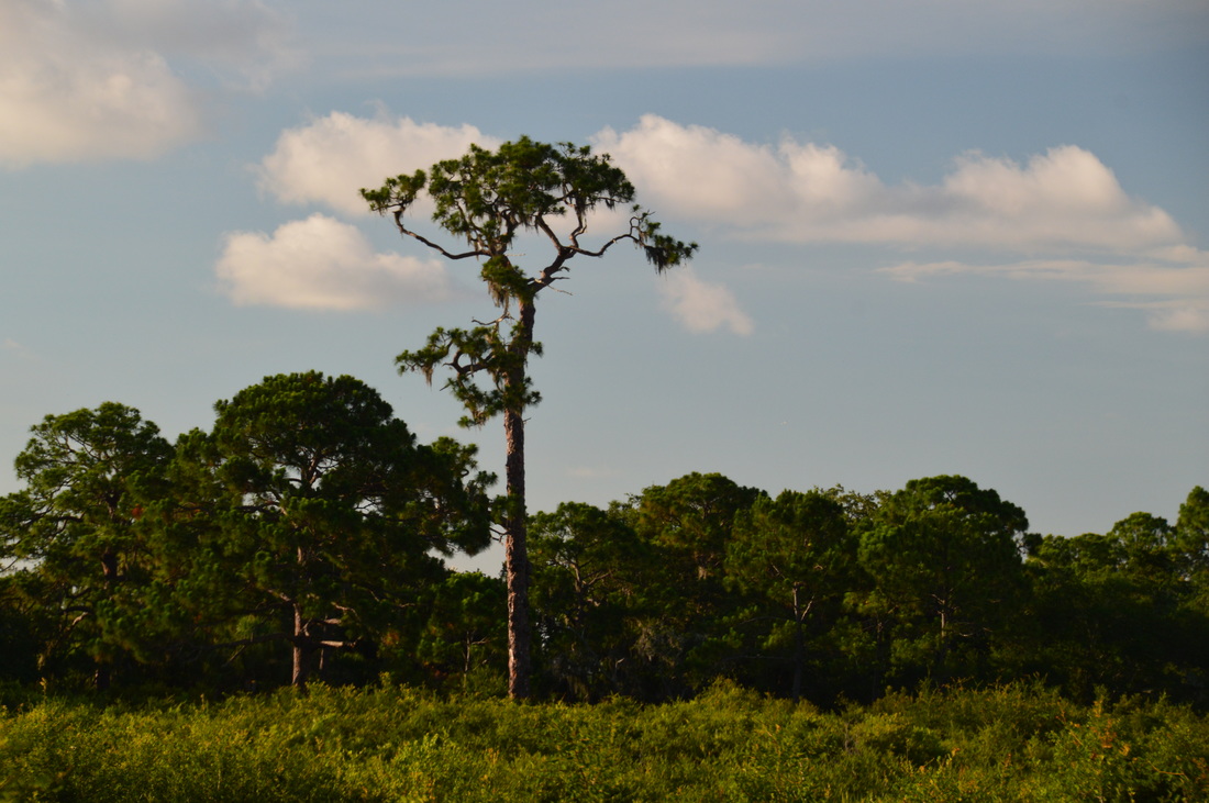
Continue following the Green Trail back to the east through the scrub. At 3.85 miles, the trail dips to and crosses a small drainage that leads to South Creek. Shortly afterwards, at about 3.9 miles, the trail comes very close to the tree with the huge nest in it. I don't know if this is an old bald eagle nest, but it is pretty impressive regardless. I added a picture of the nest in the gallery below.
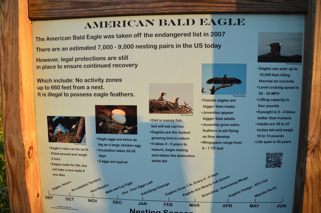
The trail veers right as a connector to the campground leaves off to the left. At 4.15 miles, the west half of the Green Trail's loop ends at the shortcut that you passed earlier. This is the end of the seasonal closure area, and there is an interpretive sign about bald eagles. Turn left onto a well-trodden sandy track. Keep following the arrows to make sure that you don't stray off the trail onto one of the numerous service roads. At 4.45 miles, the trail crosses one of the main service roads and then narrows to a single-track path, approaching the end of the loop. The loop ends at 4.65 miles. Turn left, and retrace your steps along the first segment of the Green Trail. You will be across the South Creek footbridge by 4.9 miles. The Nature Center and your car are just off to the left, but my plan was to slightly extend the hike by doing the short trail around Lake Osprey. Turn right onto the Lake Osprey Trail, which is a wide sandy track. Throughout the trail, there are great views of this tiny lake. On the north side of the lake, bear left from the main path and cross a small footbridge over a stream that noisily drains into the lake. This isn't a true waterfall, but it can be classified as a cascade. Shortly after this, the Lake Osprey Trail ends at the Nature Center. Arrive at your car at 5.3 miles, concluding the hike. Mileage
0.0 - Oscar Scherer State Park Nature Center
0.5 - First observation deck on South Creek 0.65 - South Creek Picnic Area 0.8 - Second observation deck on South Creek 1.0 - Westernmost point on Lester Finley Trail 2.0 - Oscar Scherer State Park Nature Center 3.5 - Westernmost point on Green Trail 3.9 - Potential bald eagle nest 4.9 - Lake Osprey 5.3 - Oscar Scherer State Park Nature Center Variations
Hike just the South Creek Trail and Lester Finley Trail - 2.0 Miles
Hike just the Green Trail and Lake Osprey Trail - 3.3 Miles Hike all of the trails in Oscar Scherer State Park (adding the Yellow Trail, Blue Trail, and Red Trail) - approx. 13.5-14 Miles Bonus Stops
There are several other opportunities for hiking in the area. Myakka River State Park and T. Mabry Carlton, Jr. Memorial Preserve both have miles of hiking trails just to the east. Caspersen Beach Park has a couple of short trails along a strip of wild coastline just southwest of Venice.
PicturesVideos
0 Comments
Leave a Reply. |
About MeMark Oleg Ozboyd Dear readers: I have invested a tremendous amount of time and effort in this website and the Georgia Waterfalls Database the past five years. All of the work that has gone in keeping these websites updated with my latest trip reports has almost been like a full-time job. This has not allowed me to pick up a paid job to save up money for college, and therefore, I I've had to take out loans. If you find the information on this website interesting, helpful, or time-saving, you can say "thanks" and help me out by clicking the button above and making a contribution. I will be very grateful for any amount of support you give, as all of it will apply toward my college tuition. Thank you!

Coming in 2022-2023?
Other Hiking WebsitesMiles HikedYear 1: 540.0 Miles
Year 2: 552.3 Miles Year 3: 518.4 Miles Year 4: 482.4 Miles Year 5: 259.9 Miles Archives
March 2021
Categories
All
|


 RSS Feed