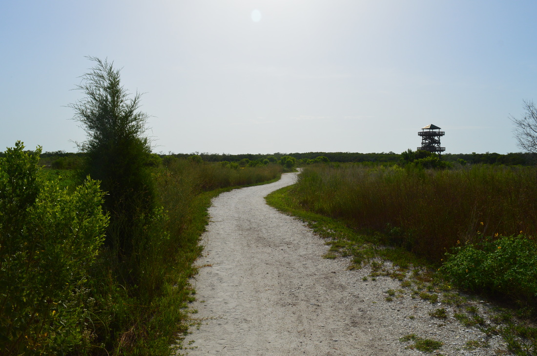
The salt marshes that dot the regions near the ocean can be some of the most scenic environments for hiking in Florida. On this hike, you can escape the urban feelings of the city of Bradenton for an afternoon walk in a relatively little-known preserve just outside of the city limits. On this hike, you'll traverse many miles of salt marshes, travel to the shoreline of Tampa Bay, and climb up an observation tower to a sweeping vista of Tampa Bay and the surrounding salt marshes. This hike occurred on Wednesday, July 1st, 2015. My plan was to hike the Osprey Loop counter-clockwise. Along the way, I would take the spur trail to the Manatee Overlook observation tower, as well as Tern Trail and Gull Trail. If I would have any leftover time, I would also take the Spoonbill Trail to the Ibis Trail and take the short Ibis Trail to a view of Perico Bayou.
Summary
R/T Length of Trail: 6.2 Miles
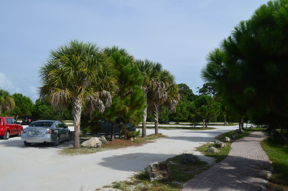
Duration of Hike: 3:00 Type of Hike: Loop with spur trails Difficulty Rating: 2 out of 10 Total Elevation Gain: Minimal Pros: Wide, easy trails; widespread views of salt marshes Cons: Lots of bike traffic Points of Interest: Manatee Overlook observation tower; Mead Point Trail Blaze Color(s): None Best Season(s) to Hike: Winter; Spring; Fall Fees: None Beginning Point: Robinson Preserve Trailhead Directions: From Bradenton, FL: Take Florida State Route 64 West for 3.7 miles. Then, turn right onto 75th Street. Follow it for 1.2 miles, and then turn left onto 17th Avenue. Follow it for 1.5 miles. Where 17th Avenue ends at 99th Street, the entrance to Robinson Preserve is straight ahead. Pass through the gates and park in the large parking area. MapDetails
It's not likely that true hikers will find this hike appealing - most of it will be on wide, manicured shell paths. However, for me personally, this was one of my most favorite hikes in Florida. What lacked in trails was made up in scenery. And if not the type of trails on this hike, I would have listed it as a Best Hike.
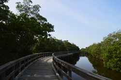
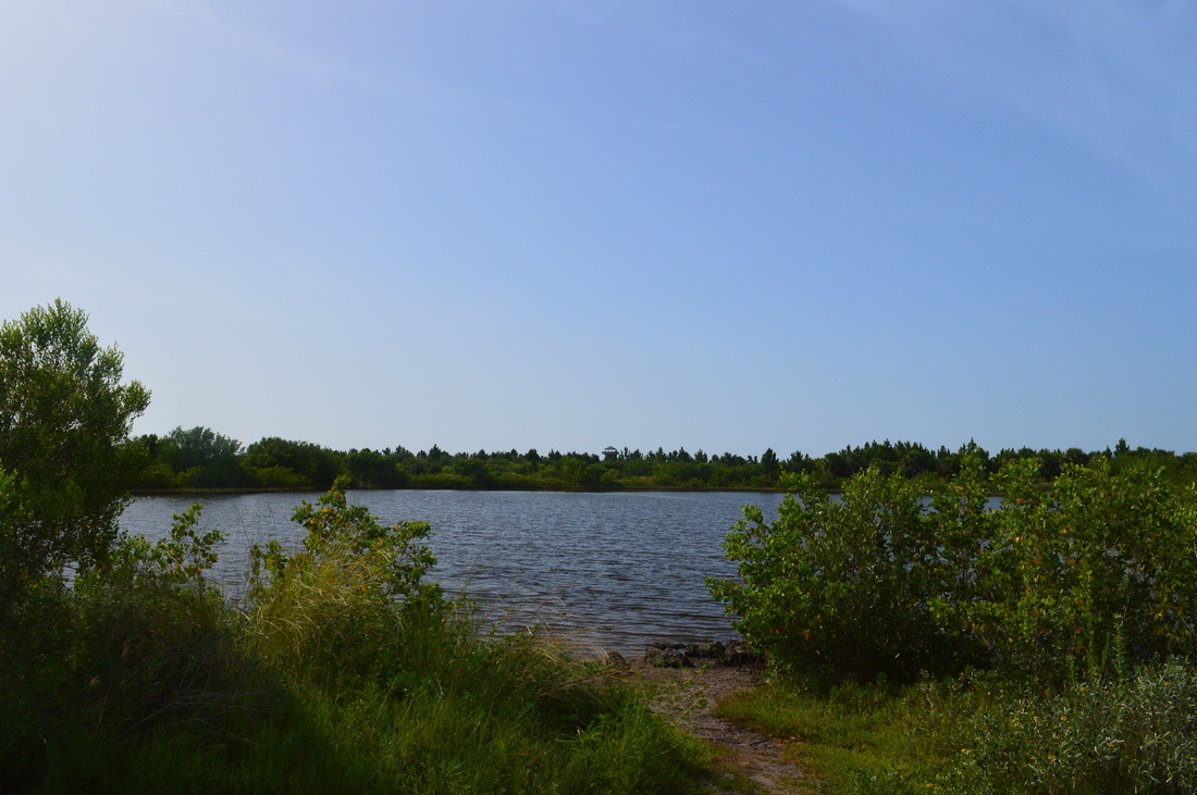
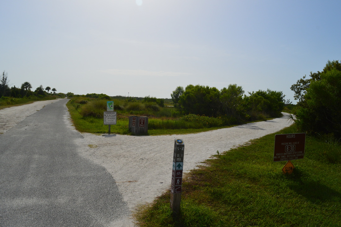
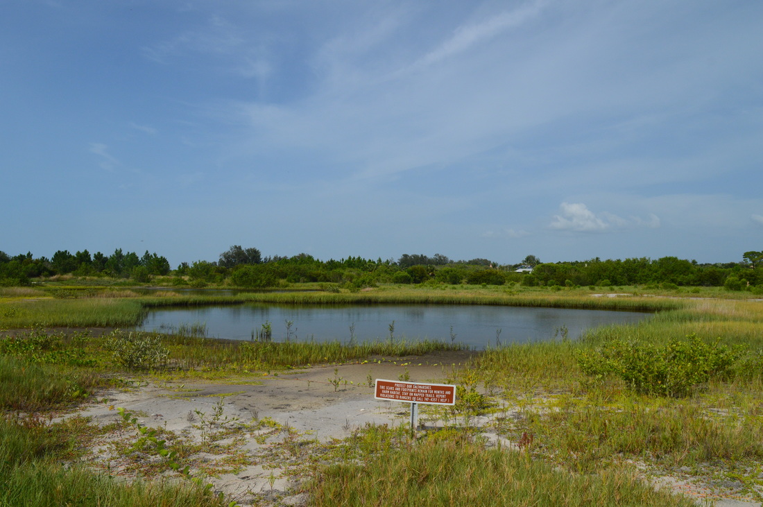
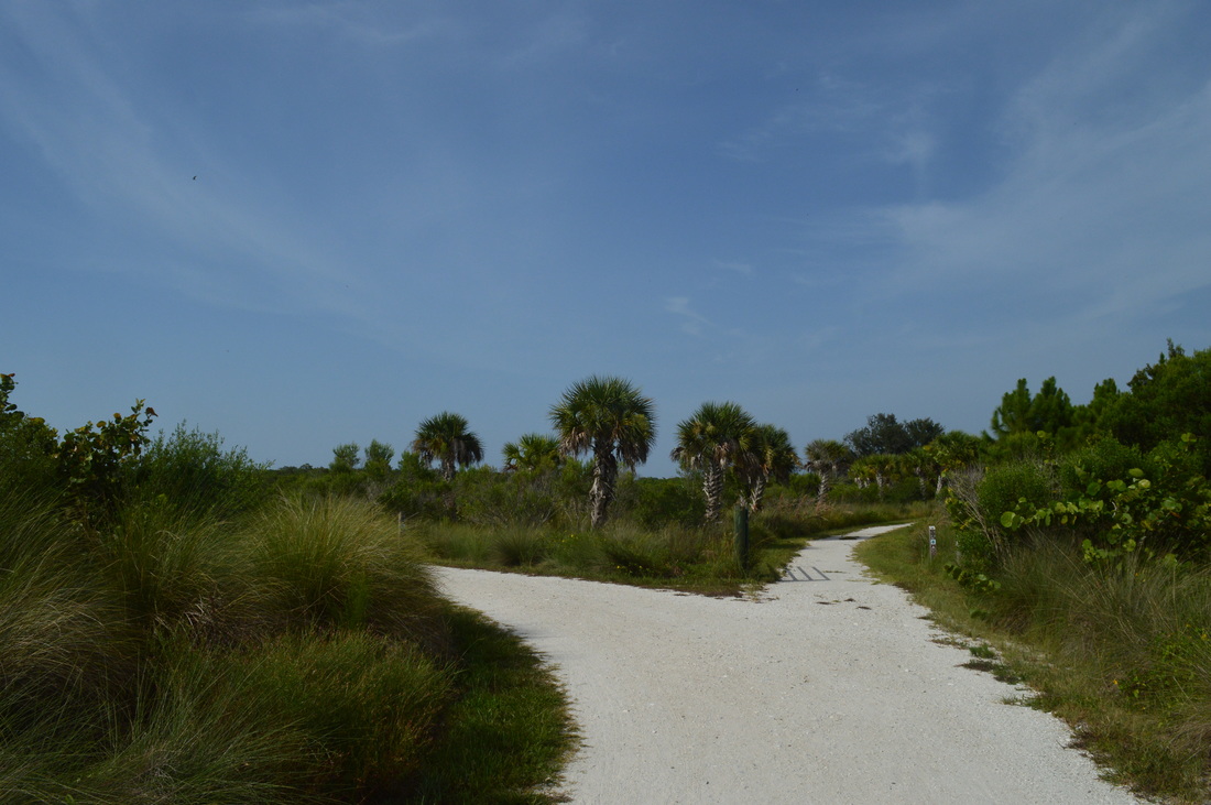
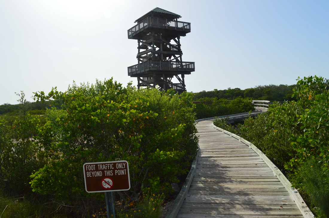
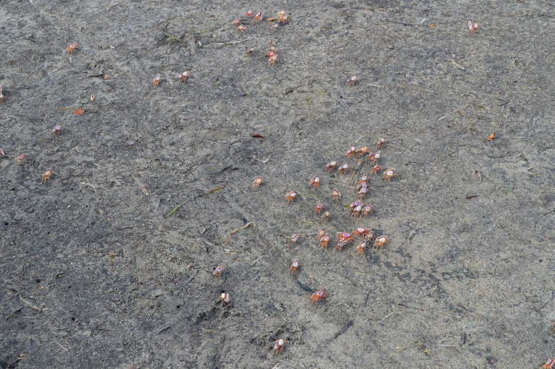
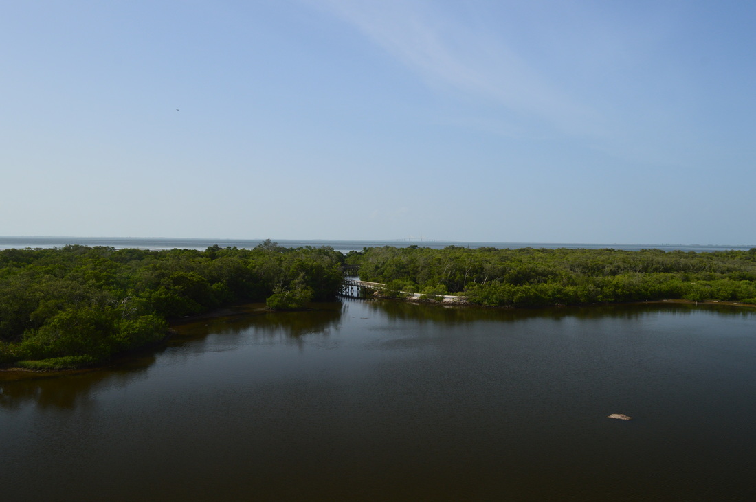
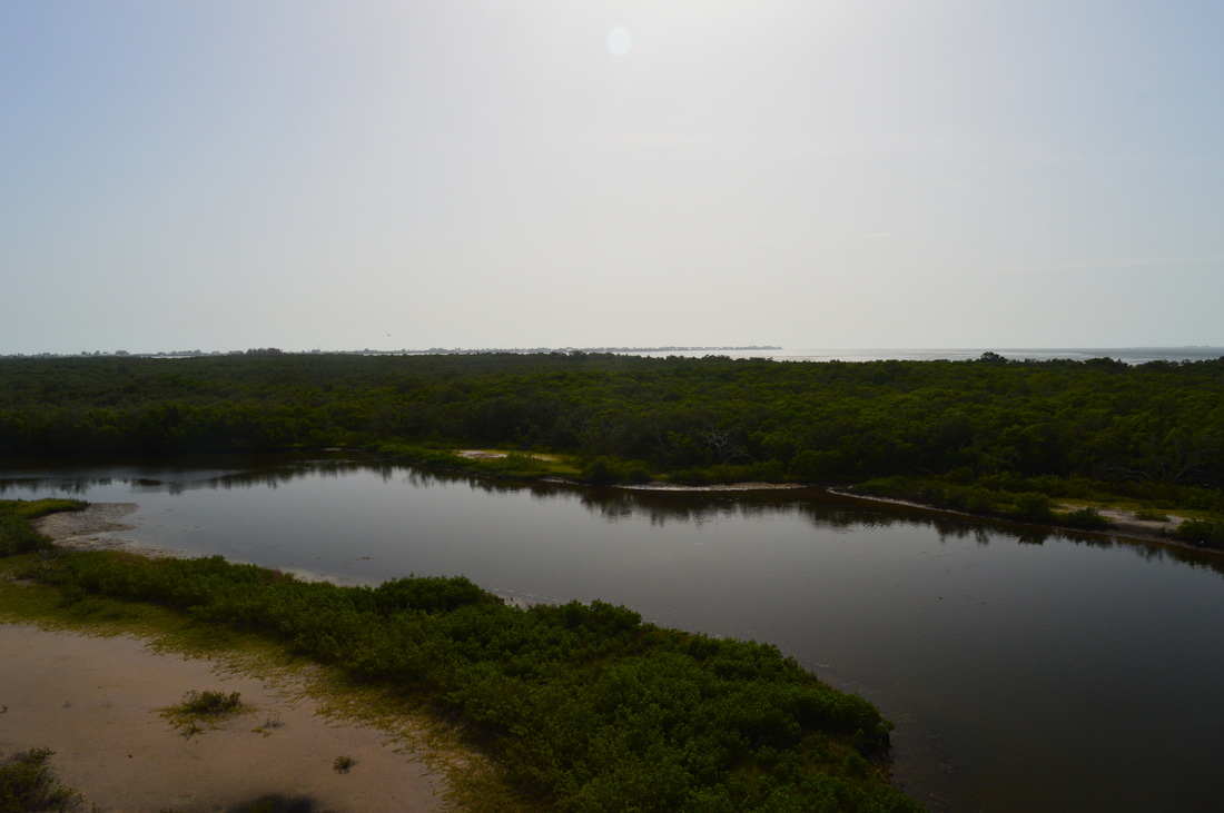
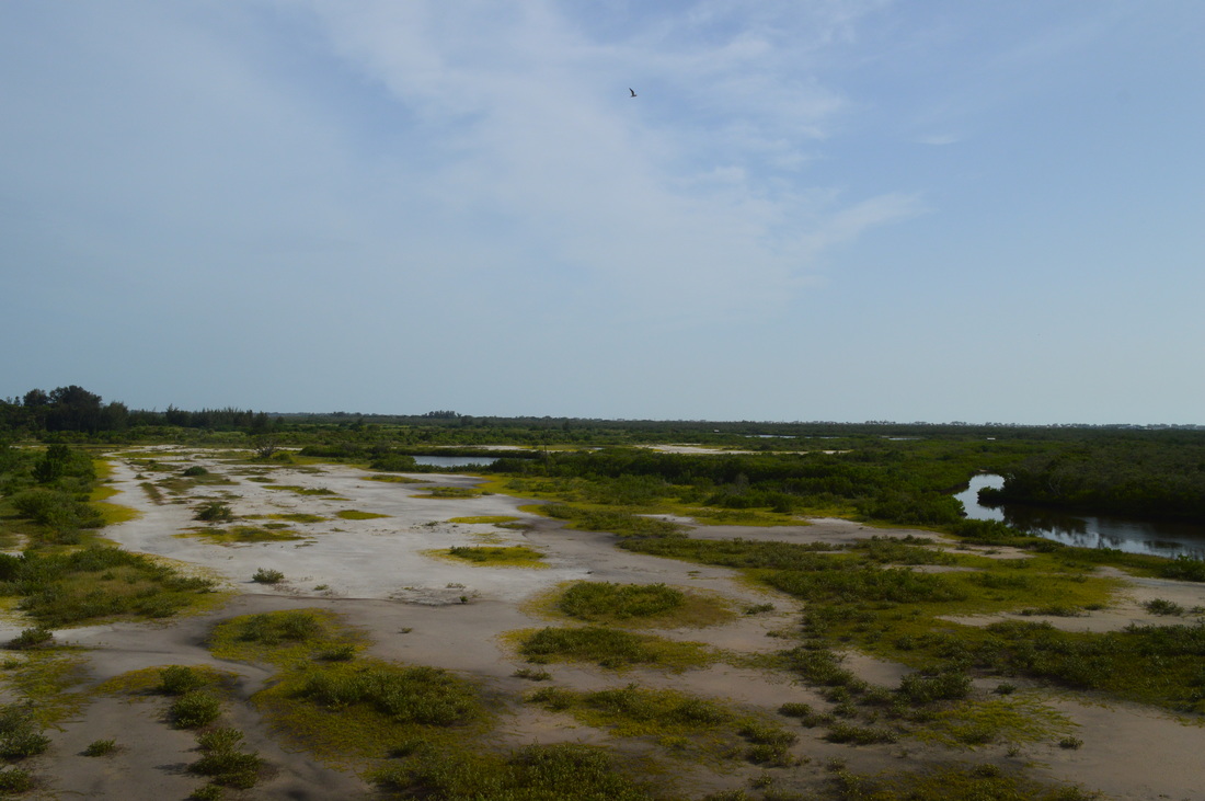
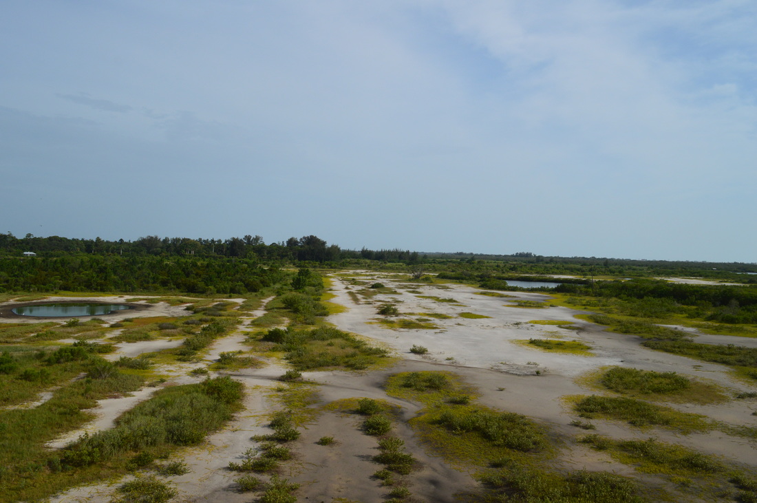
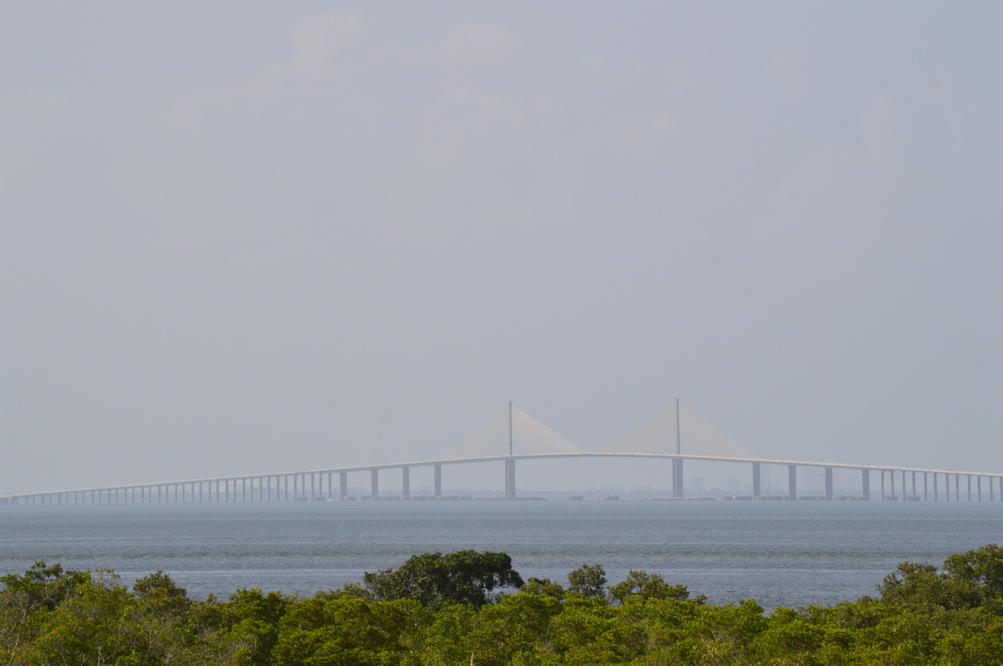
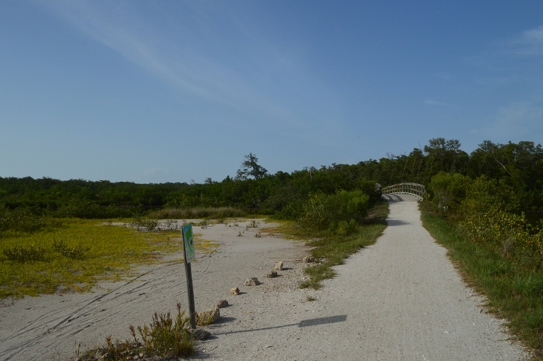
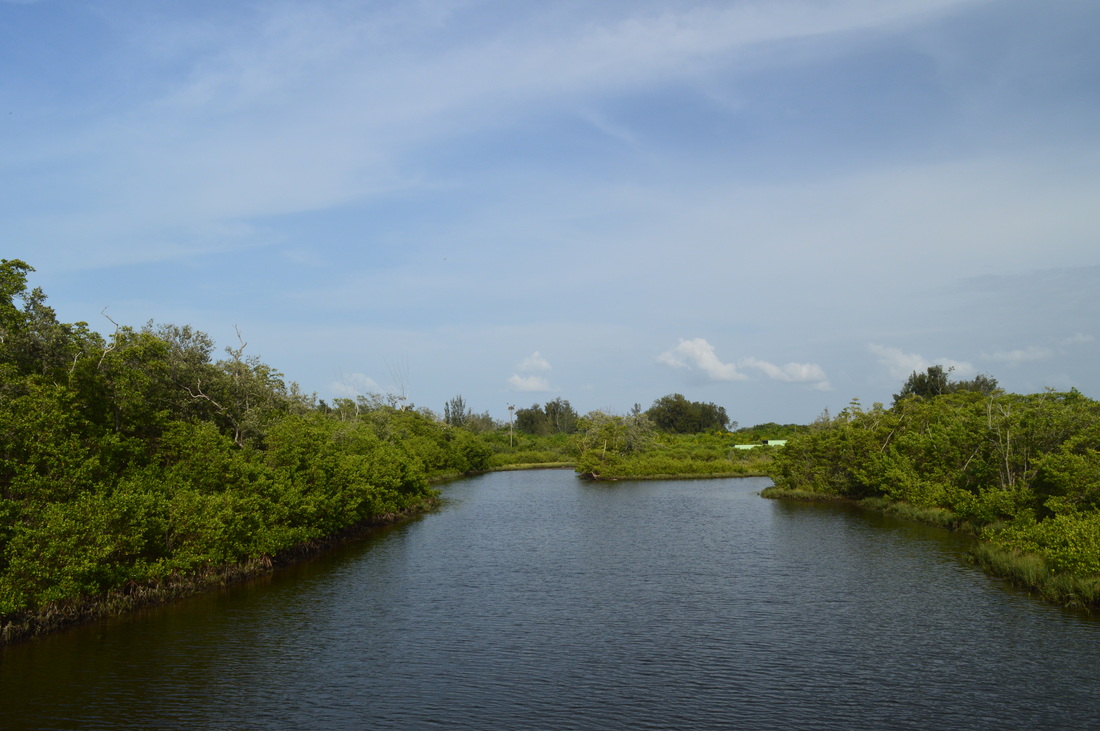
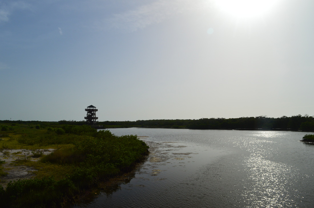
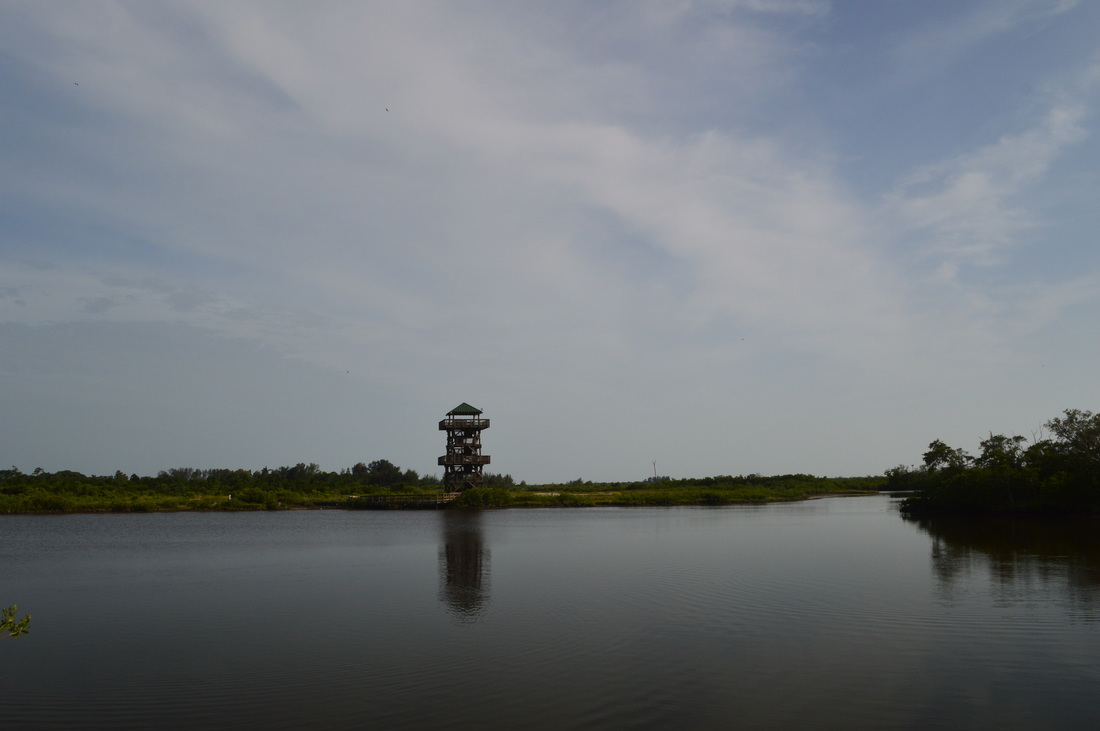
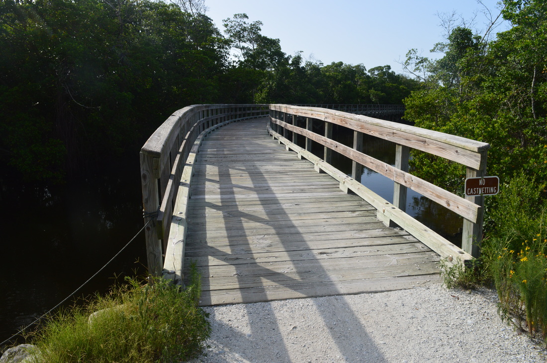
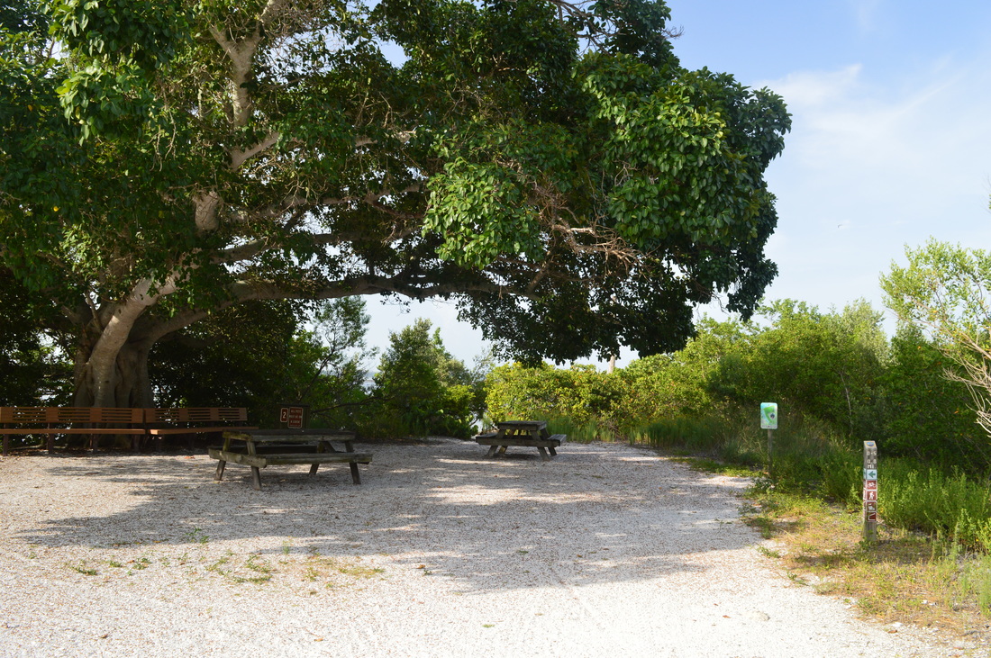
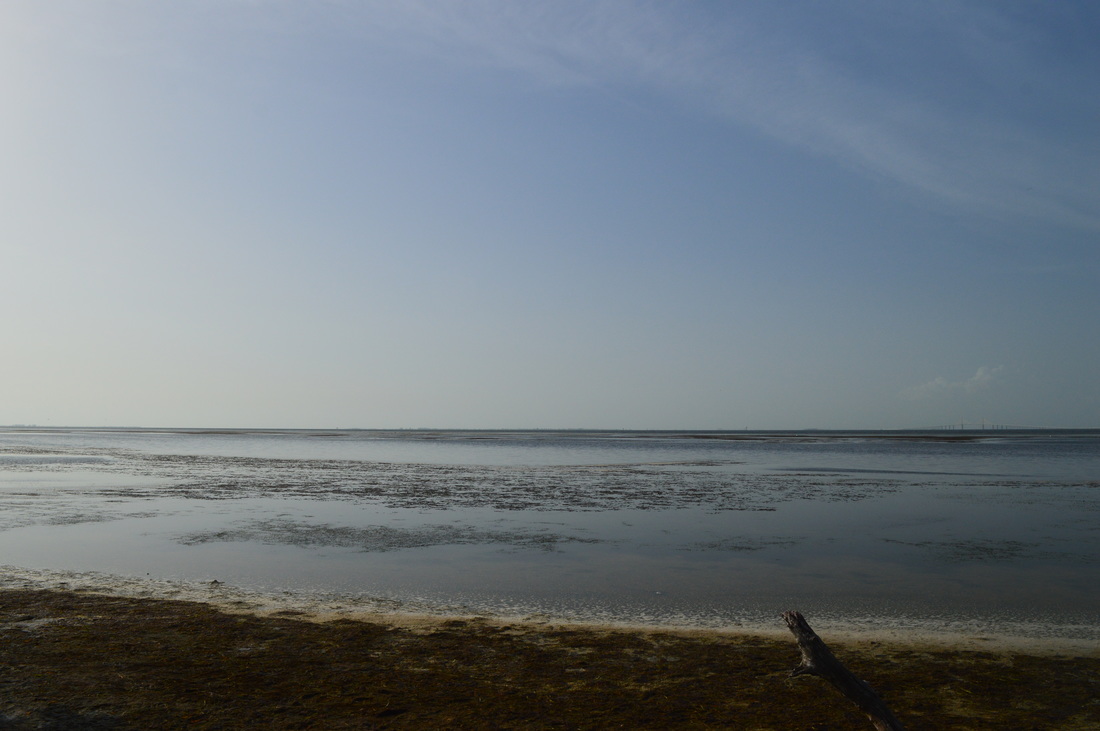
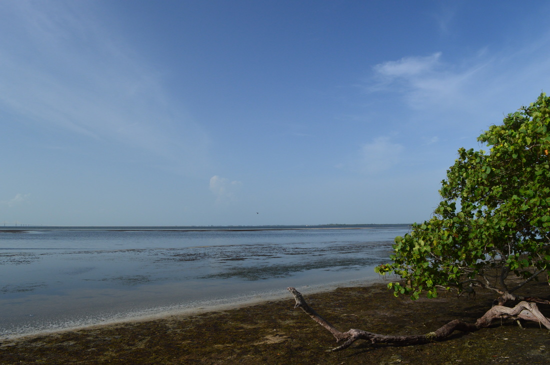
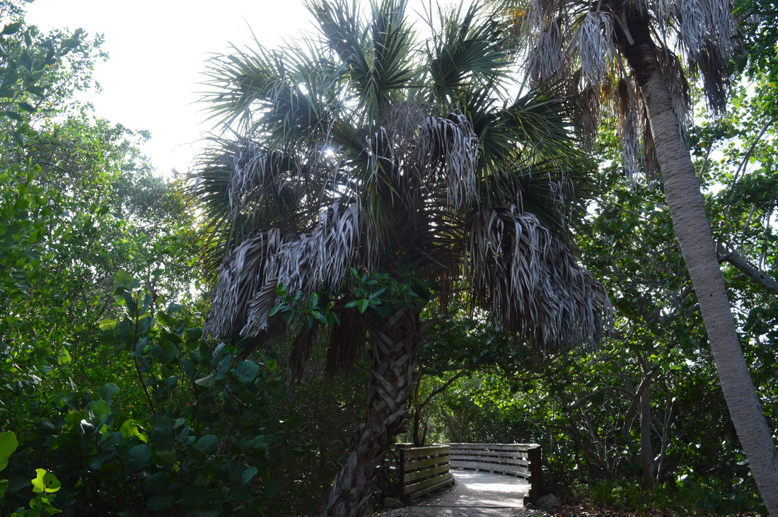
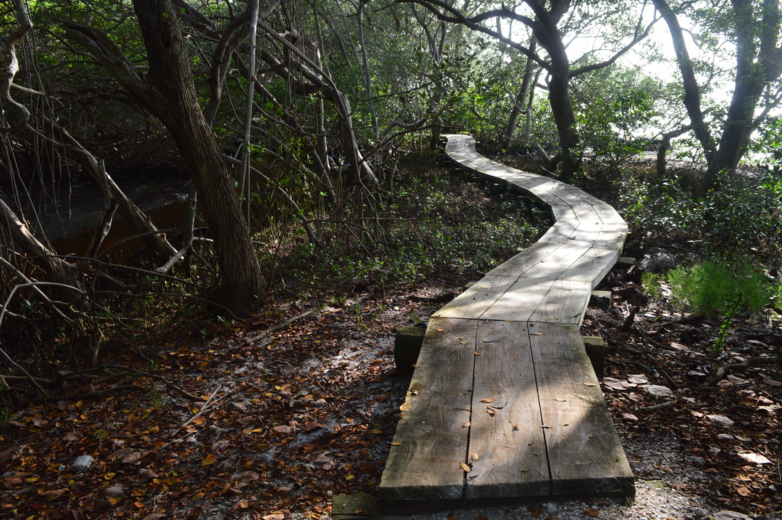
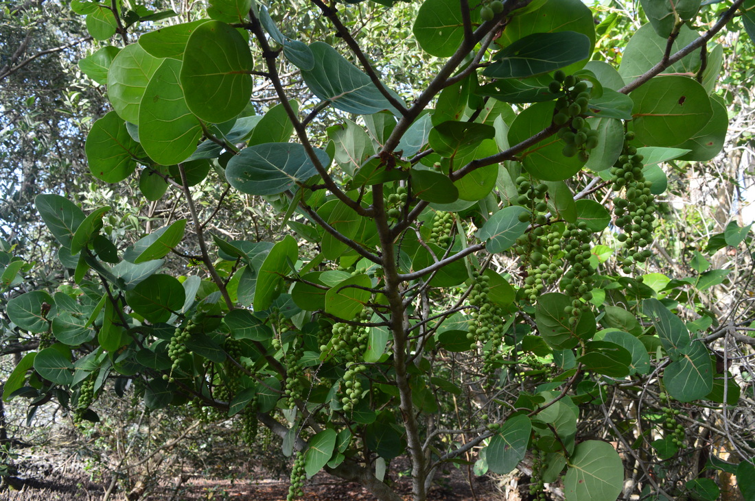
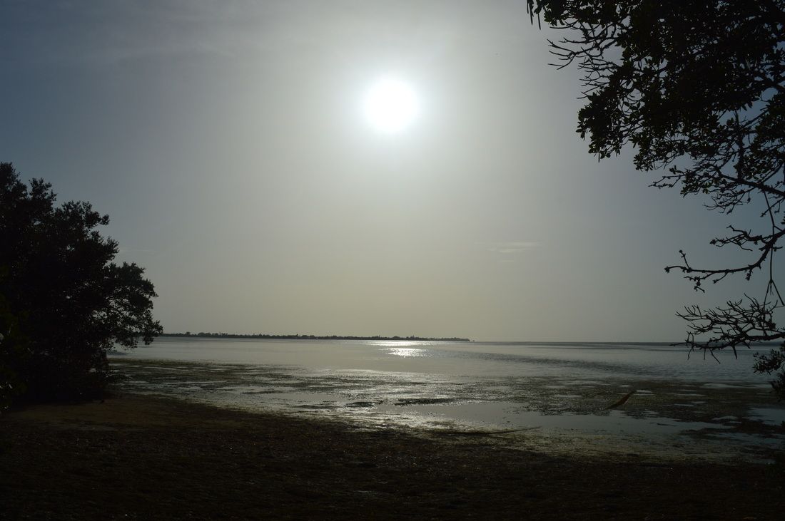
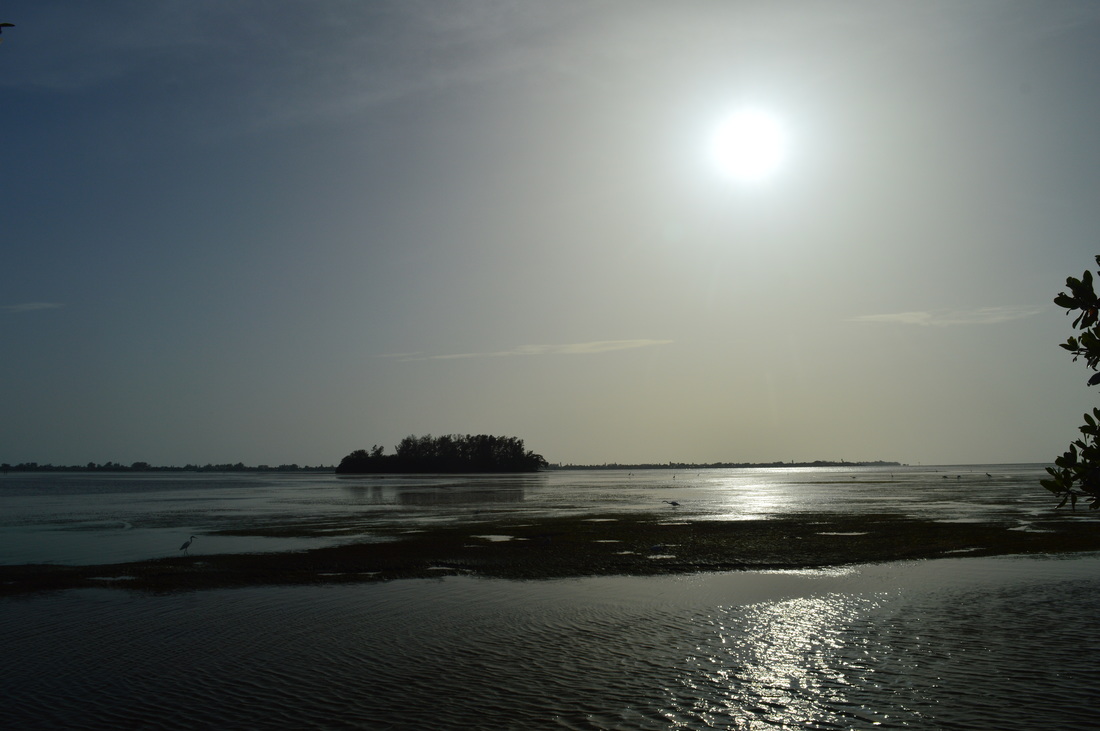
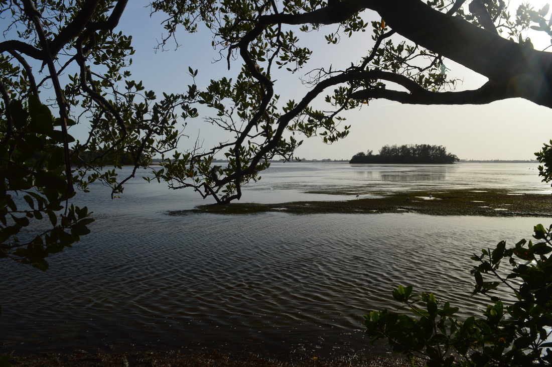
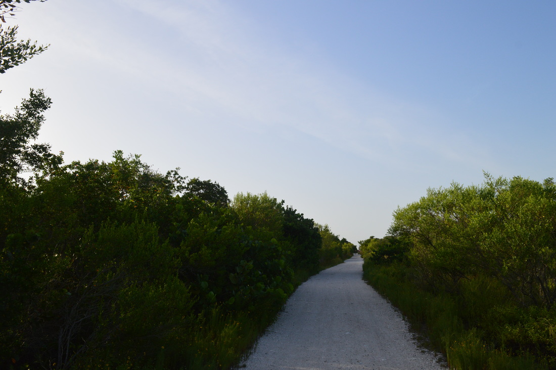
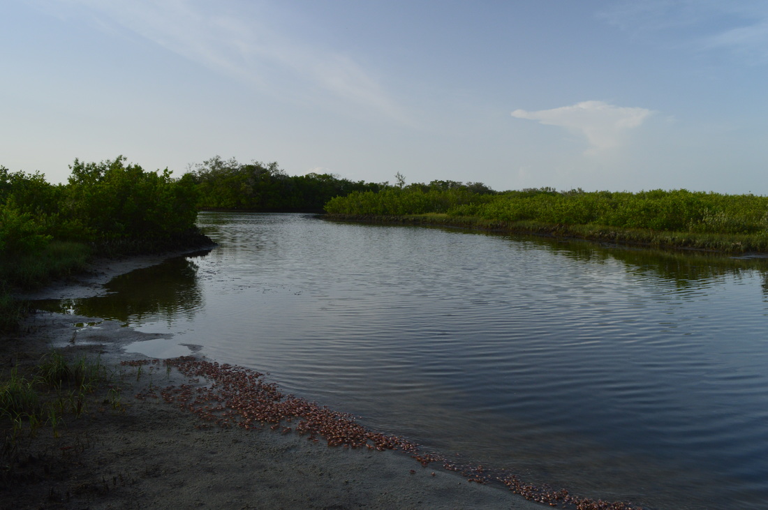
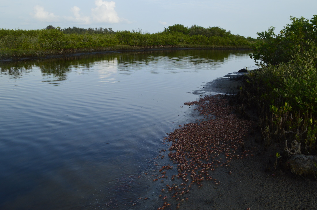
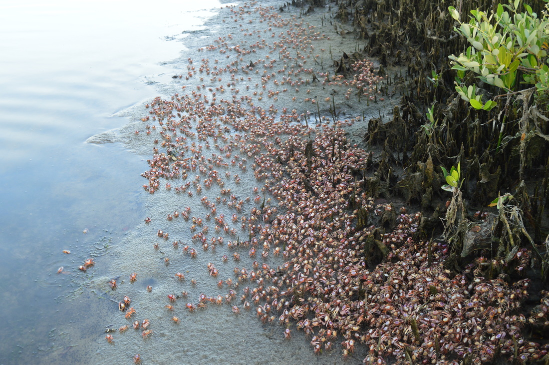
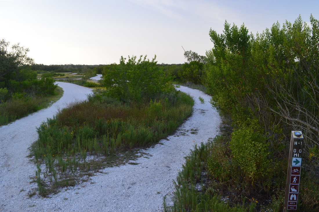
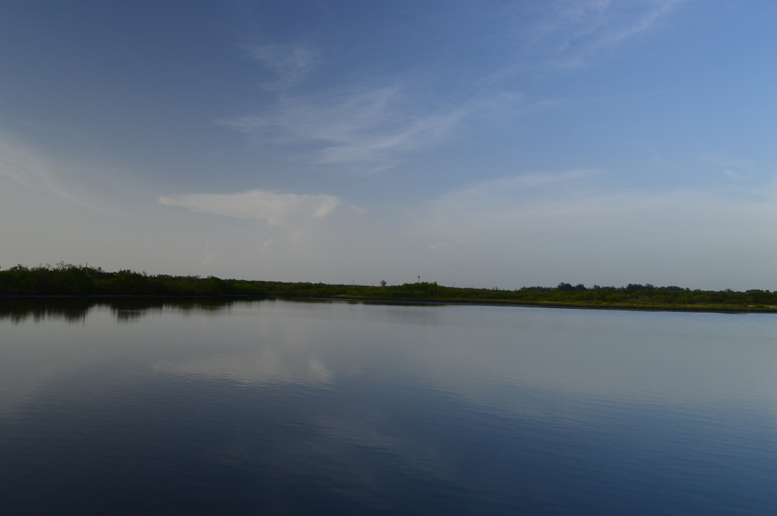
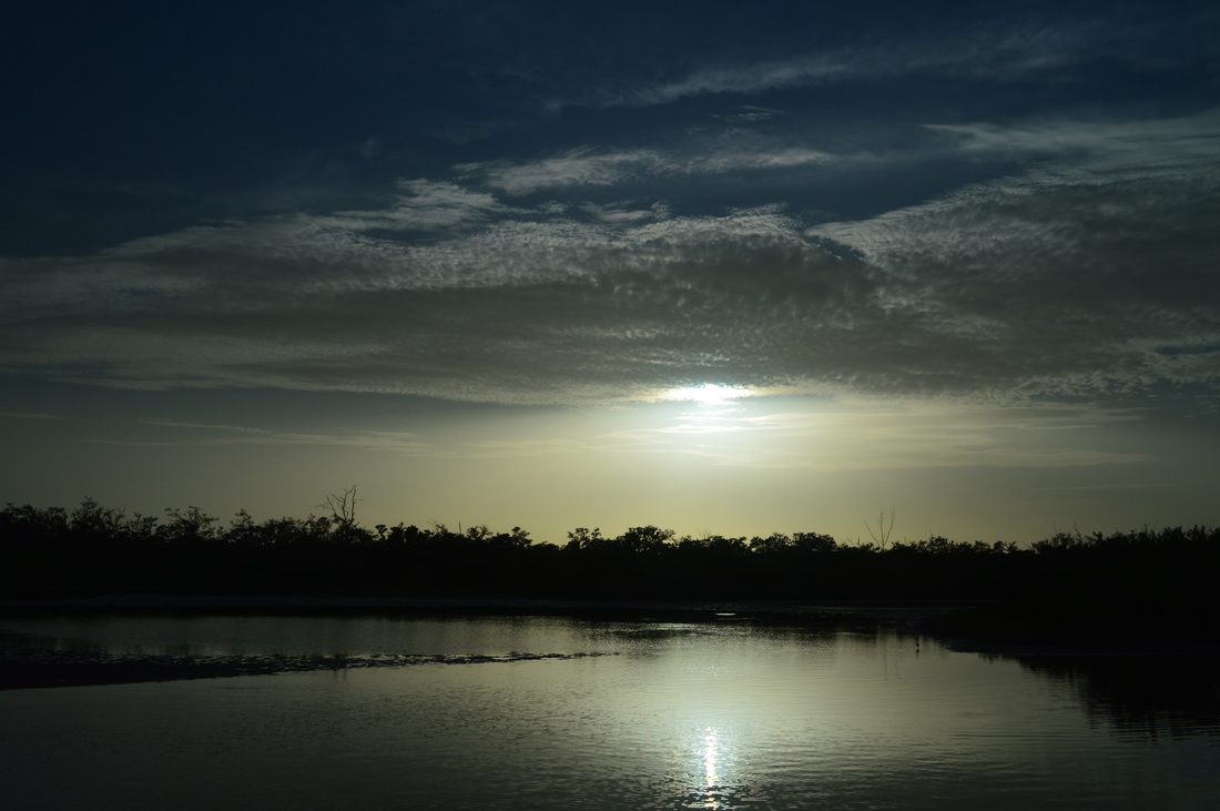
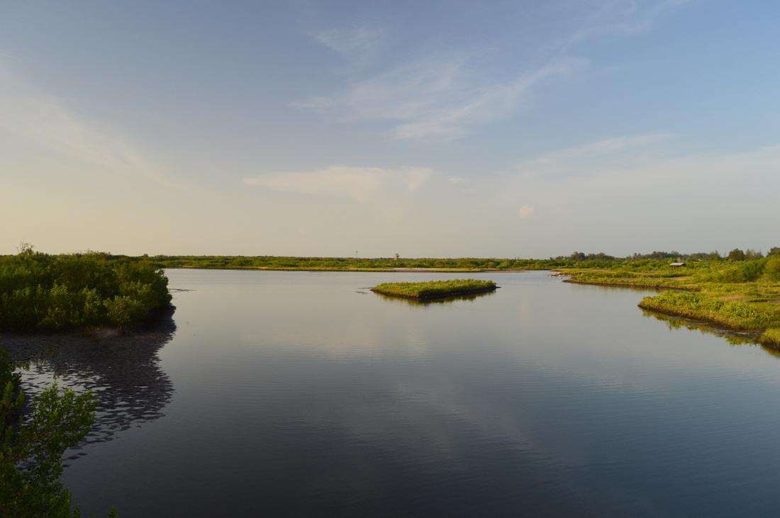
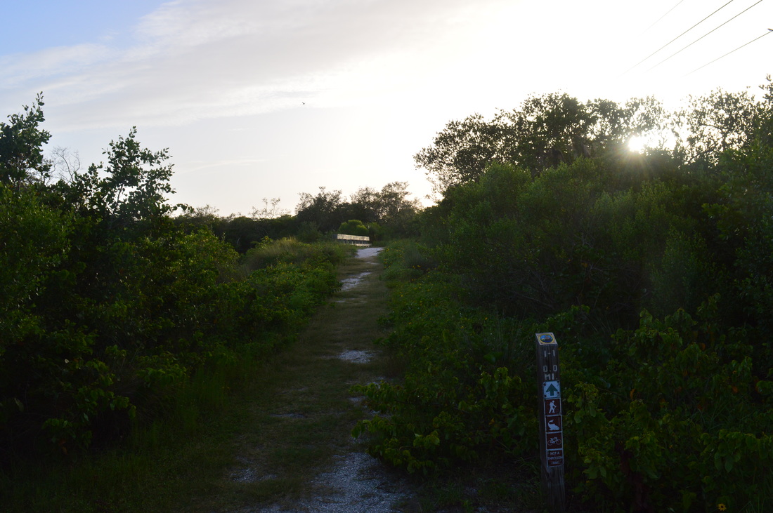
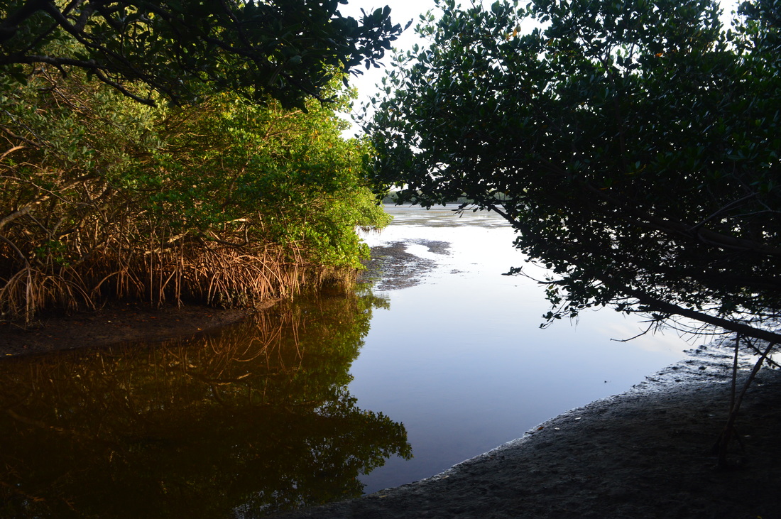
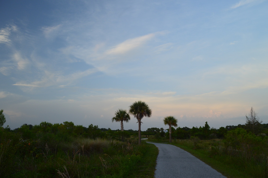
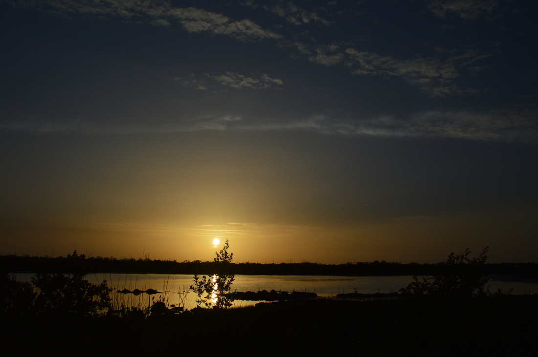
The hike starts on the Spoonbill Trail, a 2.2-mile paved trail that starts at the main trailhead and ends at Manatee Avenue (Florida State Route 64) near the Anna Maria Island Causeway. However, following a passage between two lakes, the Osprey Loop starts at 0.1 miles. Turn right here. The trail is no longer paved - instead, it's a wide shell path that travels amidst the salt marshes. At 0.3 miles, the trail turns left. A gate ahead marks a trail that leads to a campsite. The trail continues through the salt marshes. There are no blazes or any types of markers to assure you that you're on the trail (besides at intersections), but when the trail is this wide and obvious, it's nearly impossible to lose it. At 0.4 miles, you reach a junction. The observation tower is clearly visible to your left. Turn left onto the Manatee Overlook Spur Trail to see the tower. Later, you can choose from returning to this spot or looping to come out onto the main trail a bit farther ahead. At 0.5 miles, continue straight onto a waterfront boardwalk leading to the tower. To the right, the short loop continues. Continue straight onto the boardwalk. The boardwalk is at the edge of a large lake. A long boardwalk is visible on the other side of the lake - you'll be there soon. The boardwalk leads to the tower. Climb the tower, The views from the top are expansive. You can see all of the salt marshes and territory of Robinson Preserve. A good portion of the Tampa Bay area is visible, as well as the Perico Bayou. On a good day, you can see the Sunshine Skyway Bridge in the distance. After you've seen the vista, return back down the tower steps and along the boardwalk to the loop junction. You can continue back to the main trail, or you can keep following the loop. I suggest following the loop, as it's slightly shorter and you won't miss much. I turned left to continue following the loop. Shortly afterwards, at 0.6 miles, rejoin the main trail. Keep left to continue the Osprey Loop. Cross a bridge over a canal that connects the larger lake you just saw with the smaller lakes near the beginning. All of the water features on this hike are natural. After the bridge, the trail turns left and winds between some marshes before following the north shore of the lake for a bit. Here, you can see the observation tower and where you were earlier. Then, the trail turns right, and at 1 mile, enters the long boardwalk over the swamp. This is the same boardwalk you saw from the tower, and it is the cover photo of this post. The boardwalk continues right over the swamp canal all the way to the Tampa Bay shoreline, and you can see the swamp up-close. At 1.2 miles, the boardwalk ends at a sharp left turn of the trail. There is a picnic area here. A short side trail continues straight to a view of Tampa Bay, with the Sunshine Skyway Bridge visible ahead. This is one of the better bay vistas on the hike. After the vista, continue following the Osprey Loop on a narrow strip of land between the waterway on the left and the bay on the right. Then, at 1.3 miles, a series of bridges crosses the waterway, which empties into the bay. After this, the salt marshes take the place of water on the left. Throughout this section, there will be a couple more vistas of the bay to the right. At 1.7 miles, the trail reaches another junction. The Opsrey Loop turns left here. An opening to the right has a view of Tampa Bay. Straight ahead, a slim trail continues. The slim trail is the Tern Trail. It is an out-and-back trail to Mead Point. Take this trail - you'll return to this junction later. The spur trail is 1.4 miles roundtrip and is included in the mileage of the hike. The first thing you'll notice about this trail is that it is completely different from the other trails throughout the preserve. In fact, this is the only real single-track trail in the preserve, hence the sign "Primitive Trail". The Ibis Trail is similar, but much poorer in terms of quality. The trail stays in a mangrove jungle that lines the coast of Tampa Bay. Tampa Bay is visible at all times nearly from the start of the trail. You will soon cross a bridge over a small channel, and then a long boardwalk through a muddy area. After rain and during the wet season, this area can be underwater, so the boardwalk is certainly handy. After the boardwalk, the trail continues to twist through the bayside jungle, with many trees to bend under and roots to step over. You will also be seeing lots of sea grapes, some hanging right over the trail. As you hike the trail, you will have opportunities to see seabirds who explore the shoreline. You will pass a small beach-like area with a good view of the bay. The trail continues past the far end of it. When you see Perico Bayou to your left, you know you're getting close to the end of the trail at Mead Point. At 2.4 miles, reach a turnaround. This is Mead Point. Perico Bayou is to your left. Tampa Bay lies straight ahead and to the right. A short spur trail on the right leads to an opening with great views of Tampa Bay. If you wish, you can wade out into the water for a better view. Otherwise, retrace your steps along the Tern Trail to reach the Osprey Loop at 3.1 miles. Turn right onto the Osprey Loop to continue following the route of my hike. You have now left the Tampa Bay area for good. The trail continues back inland into the expanse of salt marshes. However, Perico Bayou is always not too far to your right. At 3.3 miles, after a long, straight stretch of trail, reach a trail junction. Here, the Gull Trail turns left. It is a 0.2-mile (roundtrip) spur trail that leads to a kayak launch. There is also a great view of one of the waterways. I did the short trail. At the end of it, I saw a unique sight - hundreds of crabs crawling away from me along the bank of the waterway. I saw some in the salt marshes earlier, but not this many. This waterway feeds into the lake by the tower. Return to the Osprey Loop at 3.5 miles. Turn left here. At 3.6 miles, reach another junction. A 0.2-mile (roundtrip) spur trail, not marked on any maps, turns left and leads to an observation deck at a large lake, similar to the one by the tower. The side trip is worth the visit. At the observation deck, you get a sweeping view of the terrain that you've covered so far, including the observation tower and more of the salt marshes. Return to the main trail at 3.7 miles. Rise slightly and cross a bridge over the waterway that feeds into the lake. Then, descend to a junction with the Spoonbill Trail at 3.8 miles. The Spoonbill Trail is the paved trail that you encountered in the beginning.The Osprey Loop turns left here and follows the paved Spoonbill Trail back to the trailhead. Originally, I had planned on turning left right away and then doing another hike at nearby Emerson Point Preserve, but by now, it was too late for that, so I opted to extend the hike in Robinson Preserve instead. Thus, I turned right with intentions to continue to the Ibis Trail and see the Perico Bayou vista at the end of that trail. I was unimpressed, however, so I would recommend going there only if you want to add mileage. The best plan is for you to continue all the way to the end of the Spoonbill Trail and also hike the Plover Trail. I would have done so, if I had extra time before the preserve closed for the night. If you want to continue following my route, turn right onto the Spoonbill Trail. Follow the paved path for 0.6 miles. You will be paralleling the waterway, which will be to your right. At 4.4 miles, reach a small powerline and a junction with the Ibis Trail. The Spoonbill Trail turns left. Meanwhile, turn right onto the Ibis Trail. Cross a bridge over the waterway and continue on a slightly overgrown trail. At 4.6 miles, reach the end of the Ibis Trail after a trail through thick forest. The trail ends at a waterway outlet at the Perico Bayou, but the views are minor. This destination is more useful as a kayak launch than as a vista, but it is still worth going here if you want to add some mileage to your hike. From here, retrace your steps back to the Osprey Loop junction, reaching it at 5.4 miles. Continue straight on the paved Spoonbill Trail. The trail will follow the shoreline of the lake, and then turn right aiming for the trailhead. Reach the trailhead at 6.2 miles. Variations
Just the Osprey Loop - 3.1 Miles
Osprey Loop, Tern Trail, and Gull Trail - 4.7 Miles Osprey Loop, Tern Trail, Gull Trail, Spoonbill Trail, Ibis Trail, and Plover Trail (entire trail system) - 7.8 Miles Bonus Stops
Mileage
0.0 - Robinson Preserve Trailhead
0.1 - Turn right onto Osprey Loop 0.3 - Turn left to continue on Osprey Loop 0.4 - Turn left onto Manatee Overlook Spur Trail 0.5 - Manatee Overlook Observation Tower 0.6 - Rejoin the main trail 1.0 - Boardwalk across marsh 1.2 - Sharp left turn, spur trail to view of Tampa Bay 1.7 - Junction, spur trail to view of Tampa Bay on right, continue straight onto Tern Trail 2.4 - Mead Point, views 3.1 - Return to Osprey Loop, turn right 3.3 - Junction with Gull Trail on left (short side trail) 3.6 - Side trail to observation deck with a view of a lake and salt marshes 3.8 - Turn right onto Spoonbill Trail 4.4 - Turn right onto Ibis Trail 4.6 - Ibis Trail terminus, small view of Perico Bayou 4.8 - Return to Spoonbill Trail, turn left 5.4 - Pass the Osprey Loop junction again, continue straight 6.2 - Robinson Preserve Trailhead PicturesVideos
0 Comments
Leave a Reply. |
About MeMark Oleg Ozboyd Dear readers: I have invested a tremendous amount of time and effort in this website and the Georgia Waterfalls Database the past five years. All of the work that has gone in keeping these websites updated with my latest trip reports has almost been like a full-time job. This has not allowed me to pick up a paid job to save up money for college, and therefore, I I've had to take out loans. If you find the information on this website interesting, helpful, or time-saving, you can say "thanks" and help me out by clicking the button above and making a contribution. I will be very grateful for any amount of support you give, as all of it will apply toward my college tuition. Thank you!

Coming in 2022-2023?
Other Hiking WebsitesMiles HikedYear 1: 540.0 Miles
Year 2: 552.3 Miles Year 3: 518.4 Miles Year 4: 482.4 Miles Year 5: 259.9 Miles Archives
March 2021
Categories
All
|


 RSS Feed