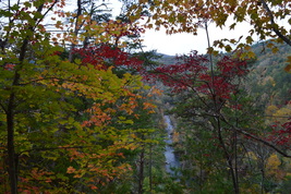
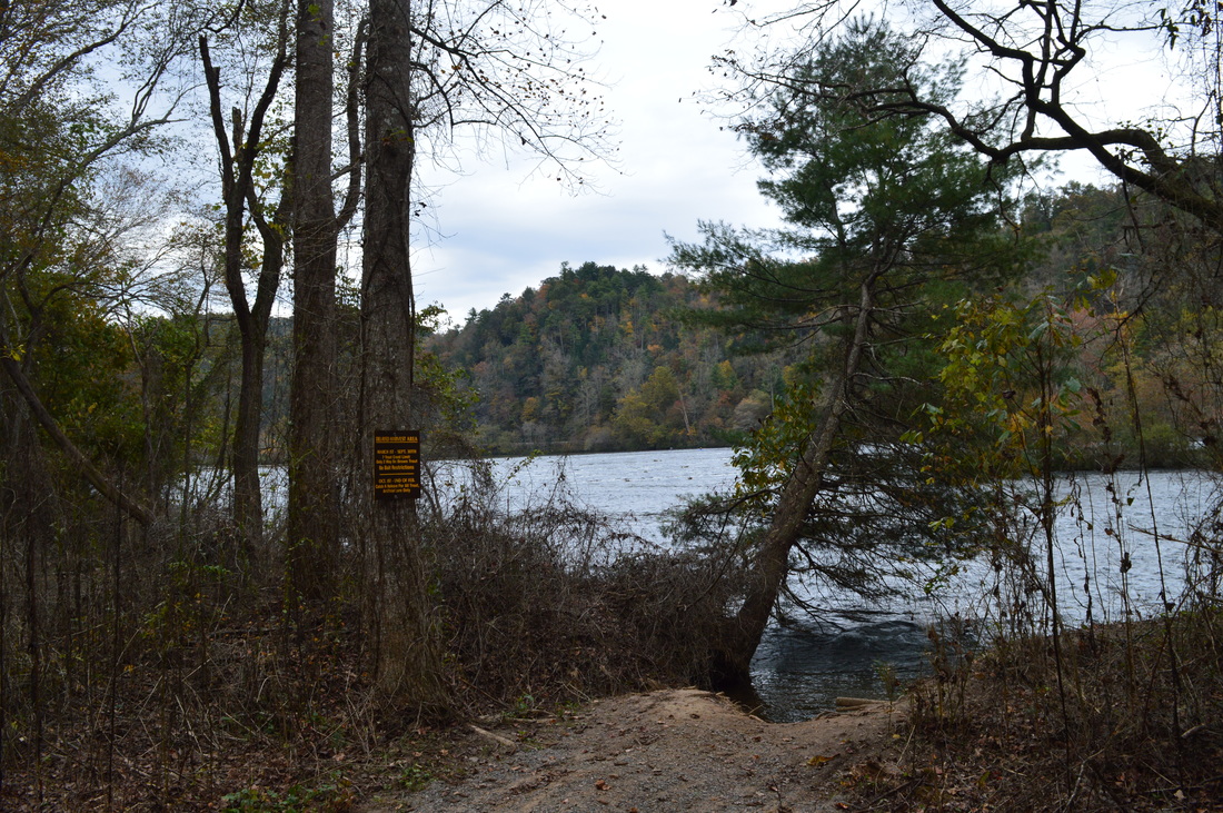
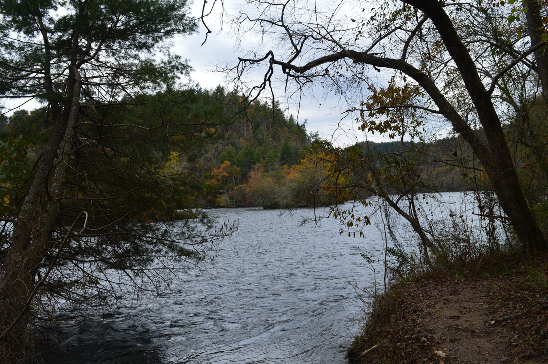
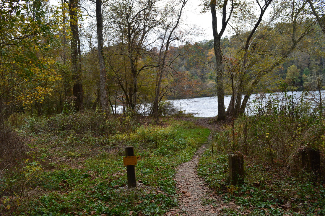
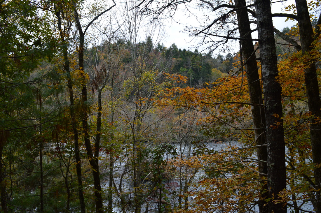
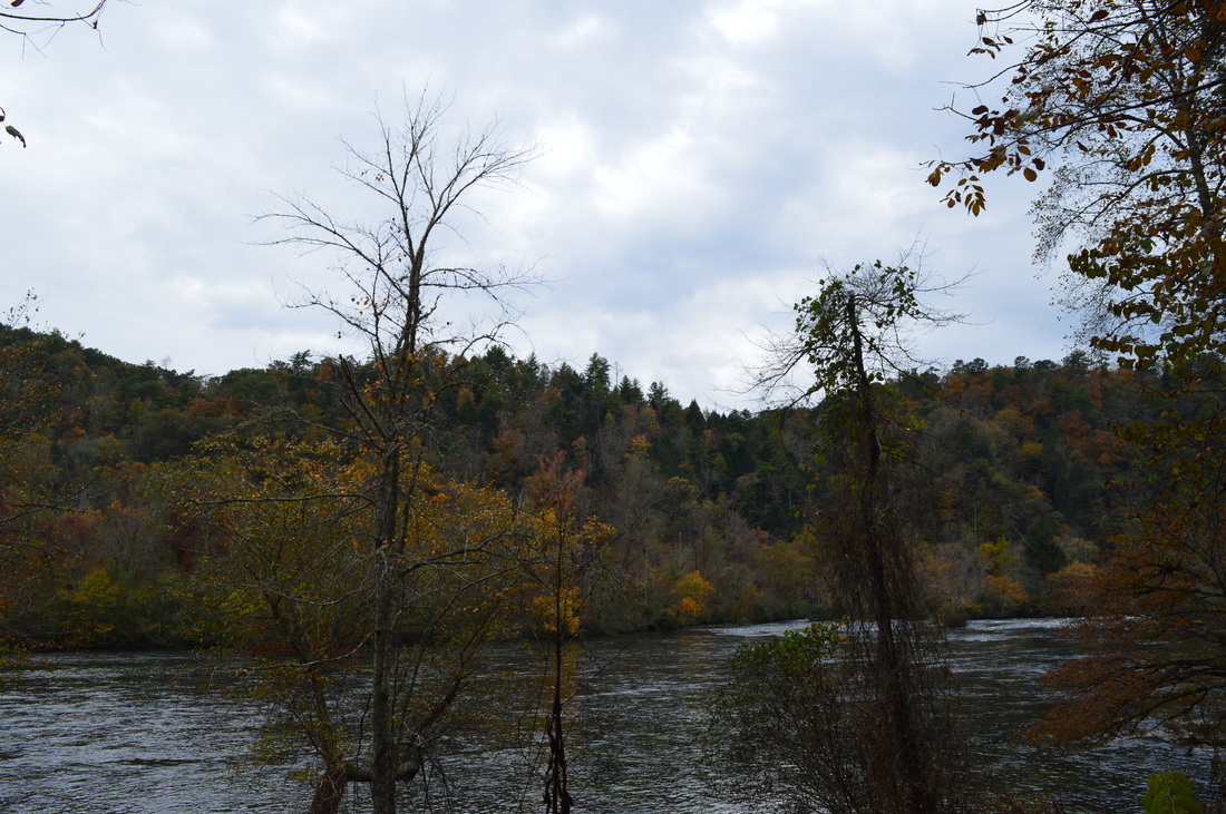
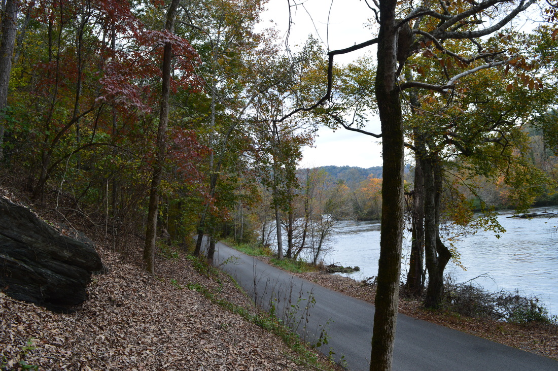
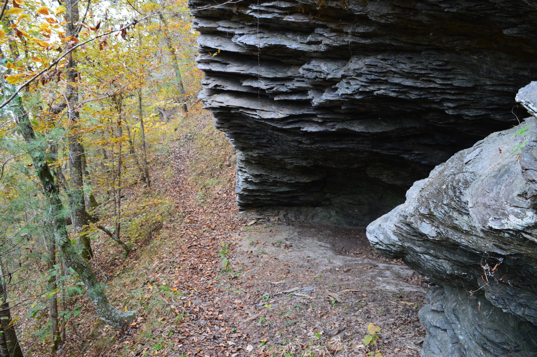
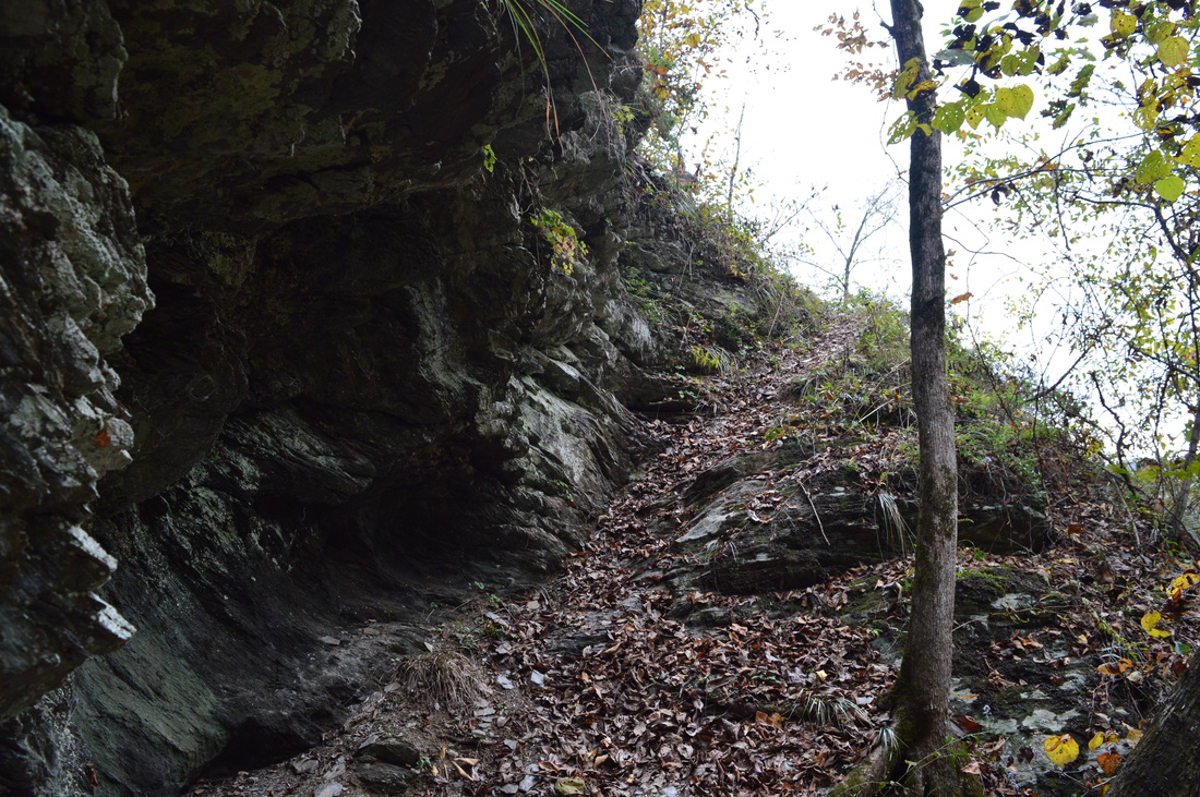
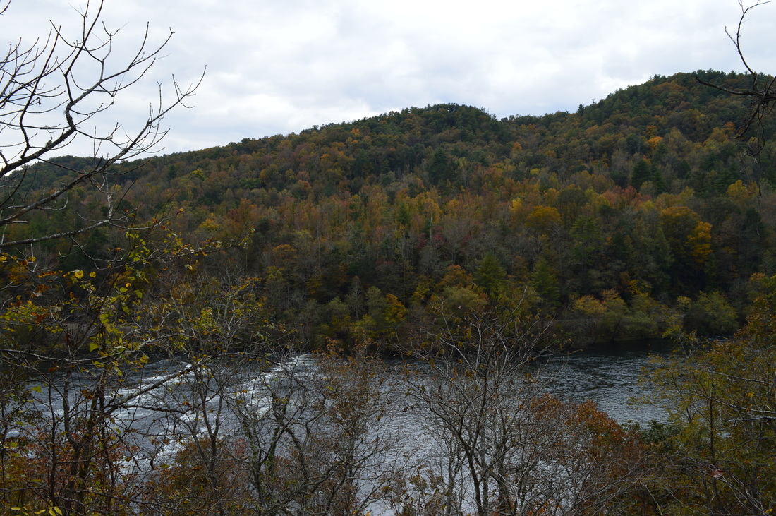
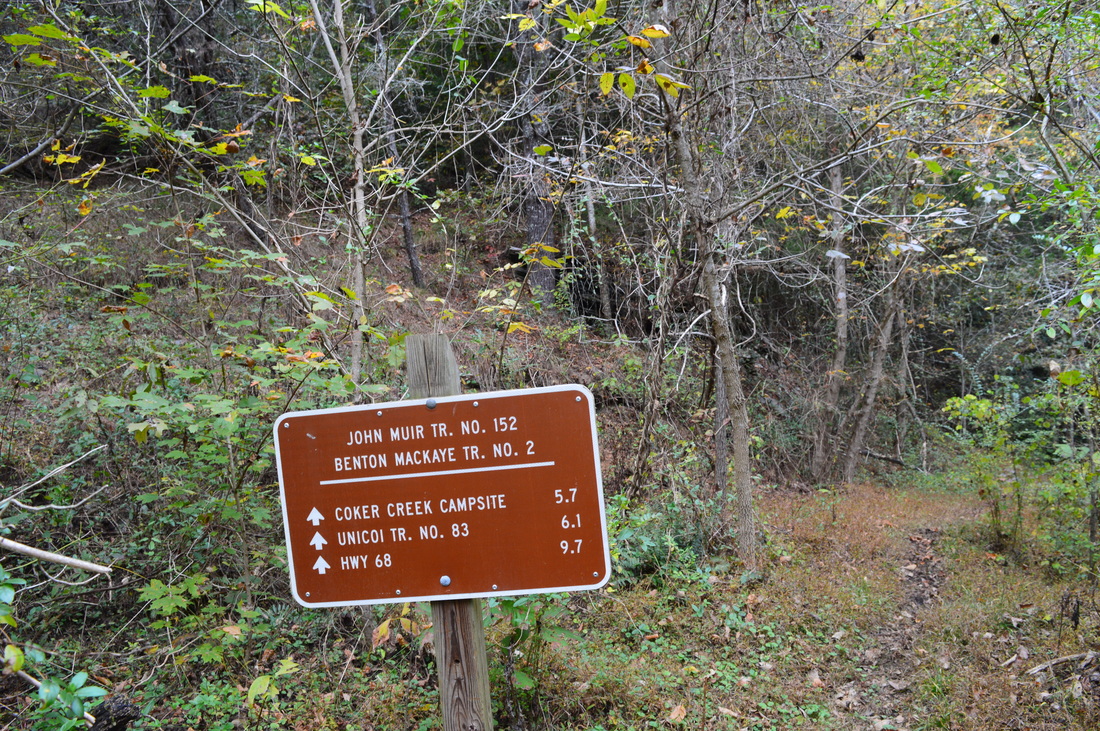
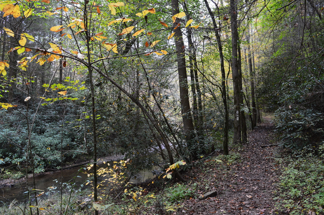
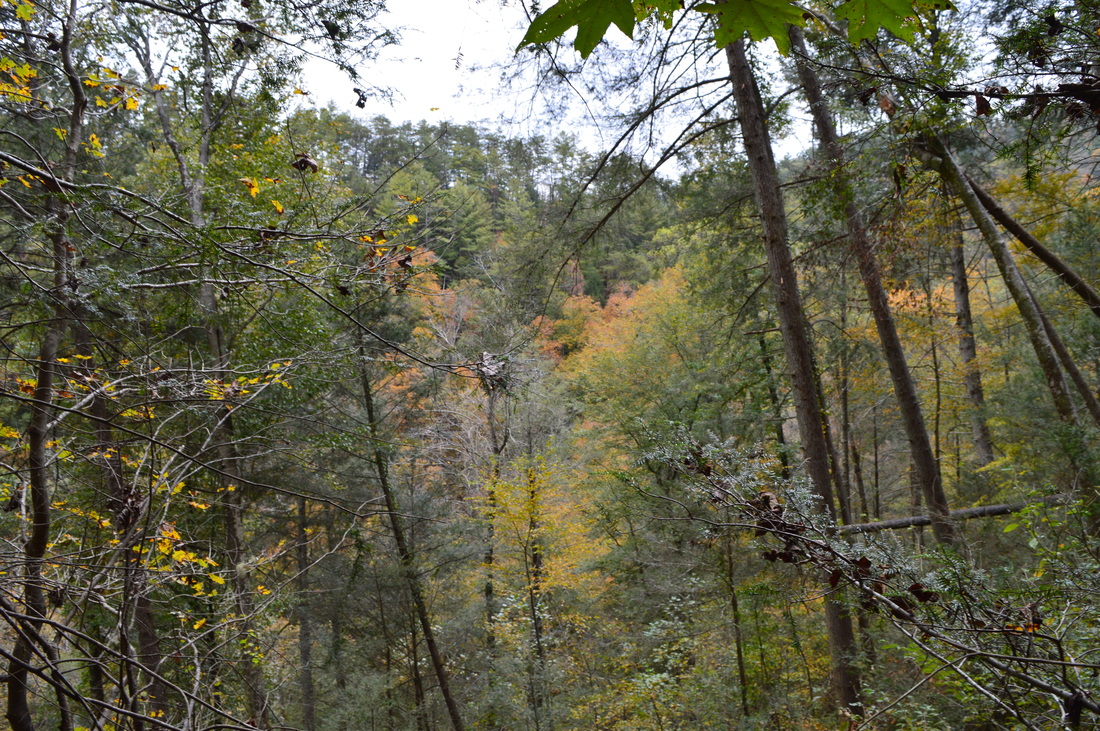
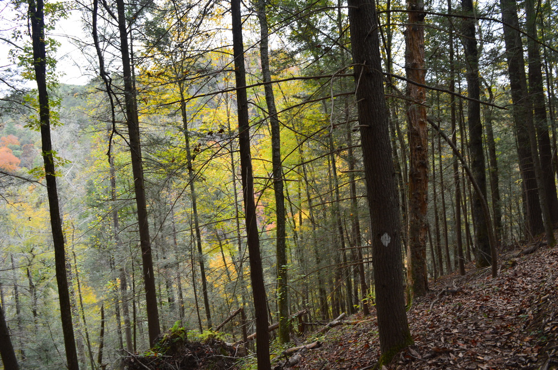
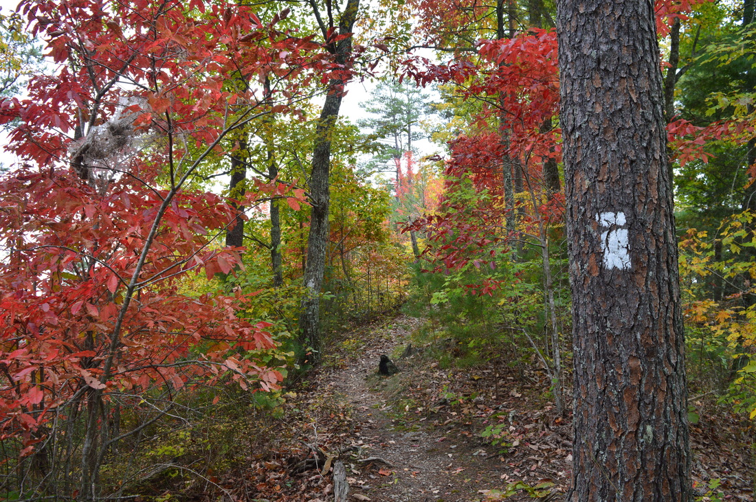
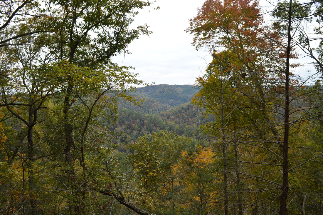
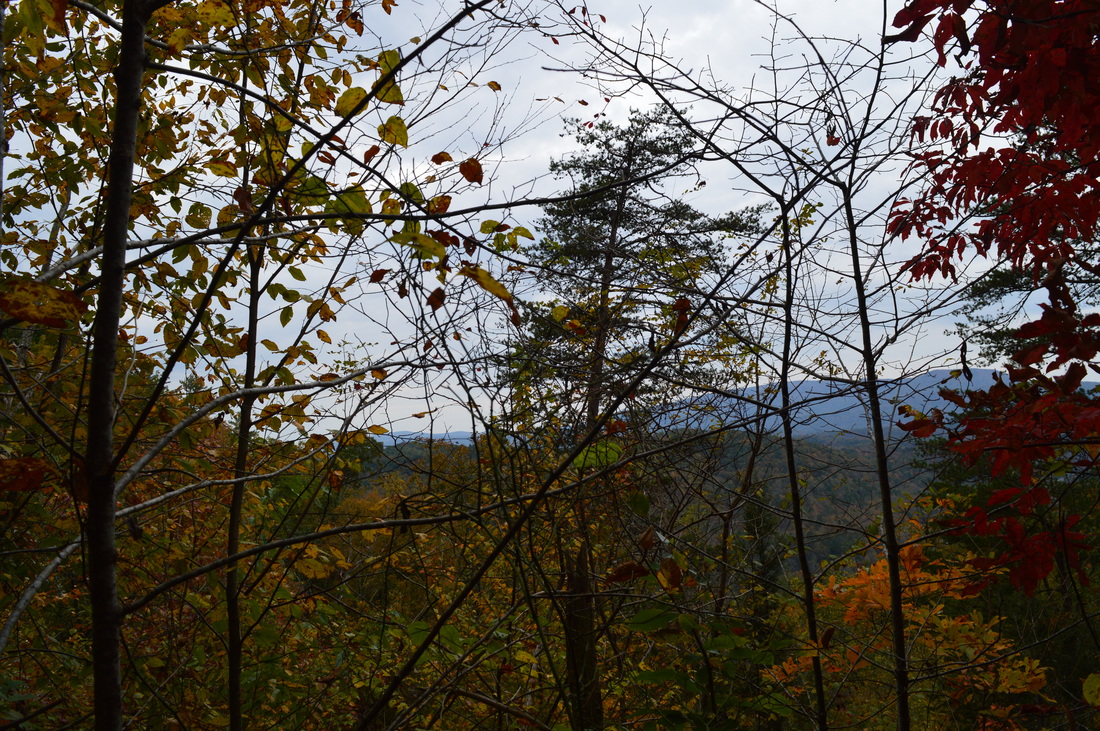
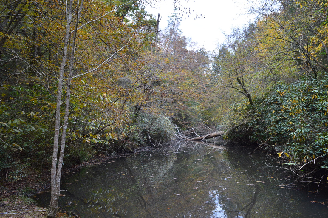
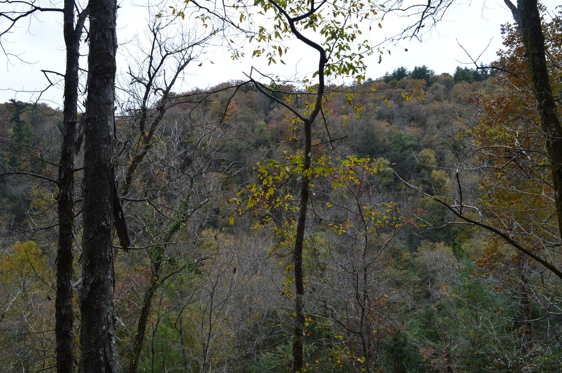
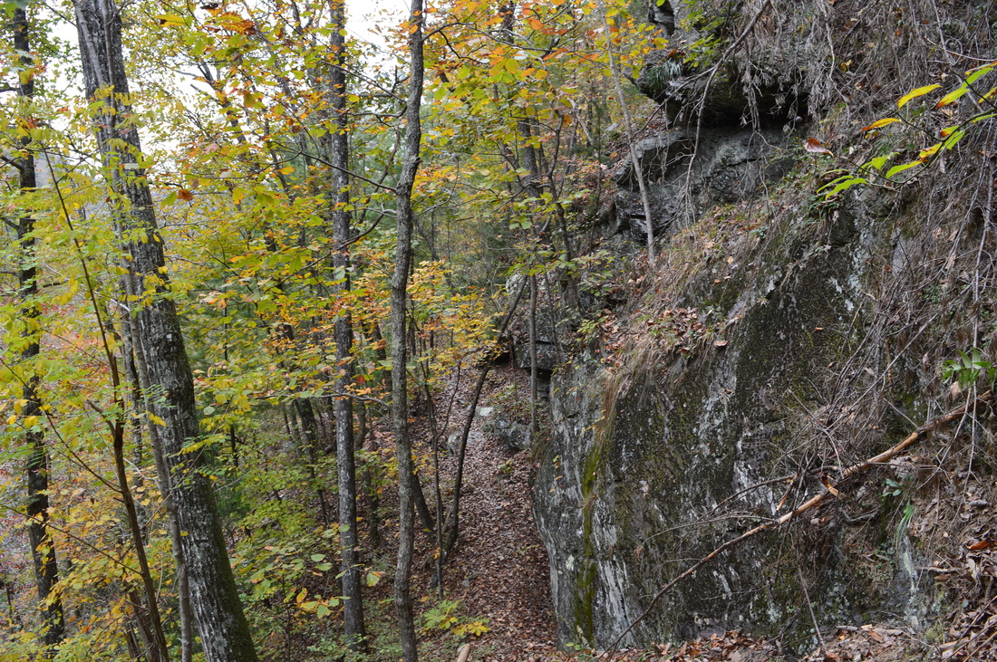
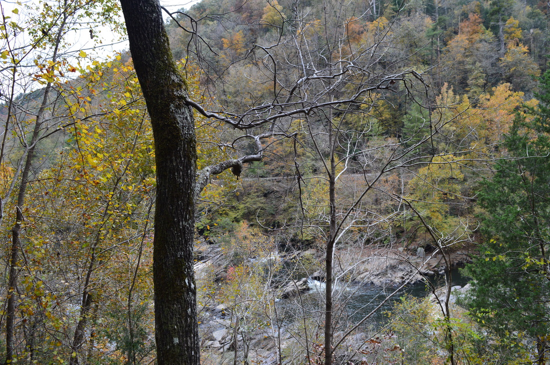
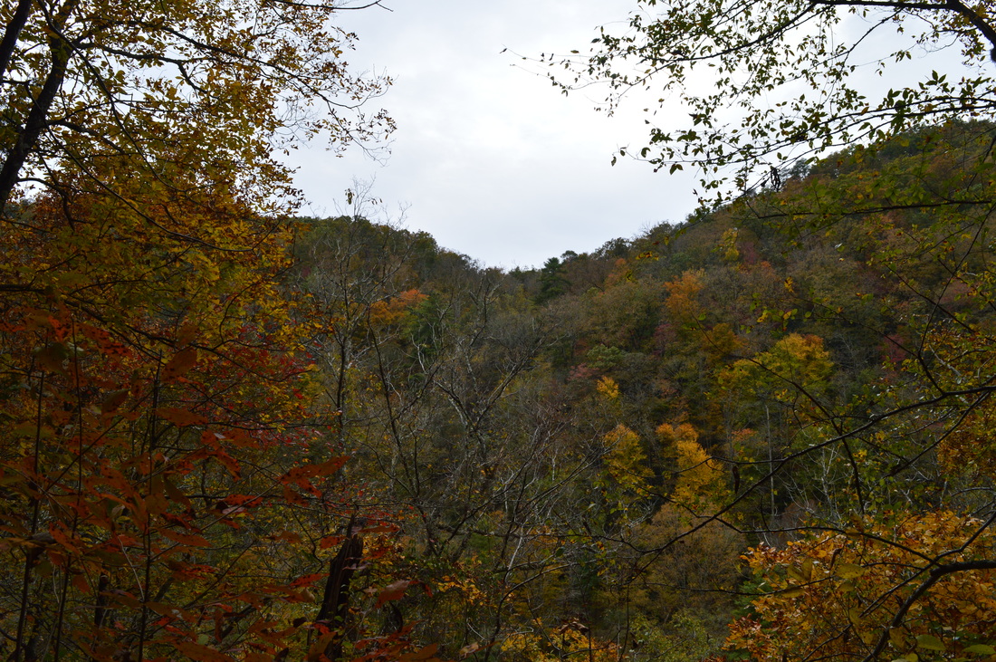
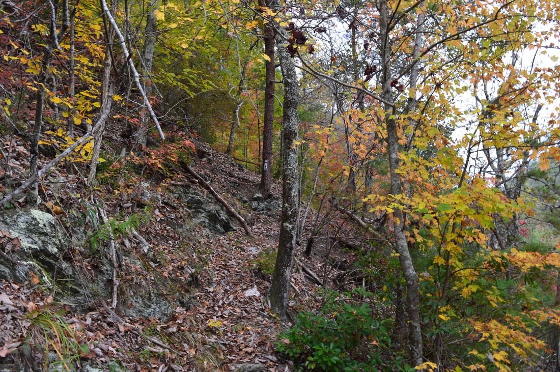
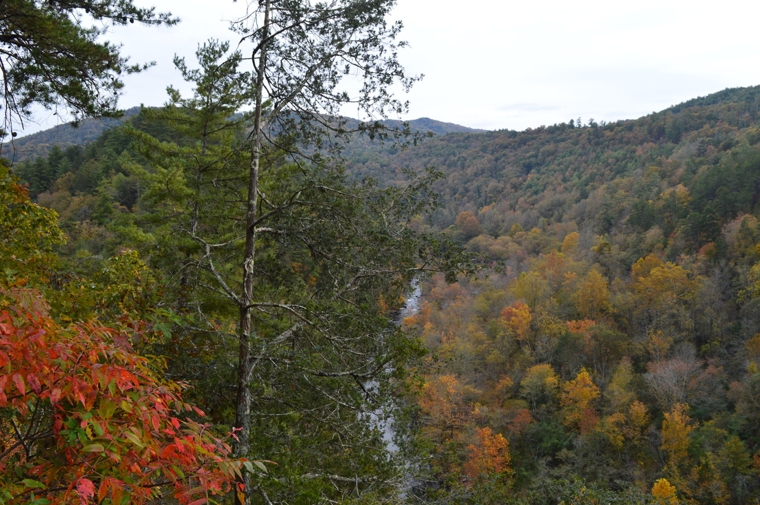
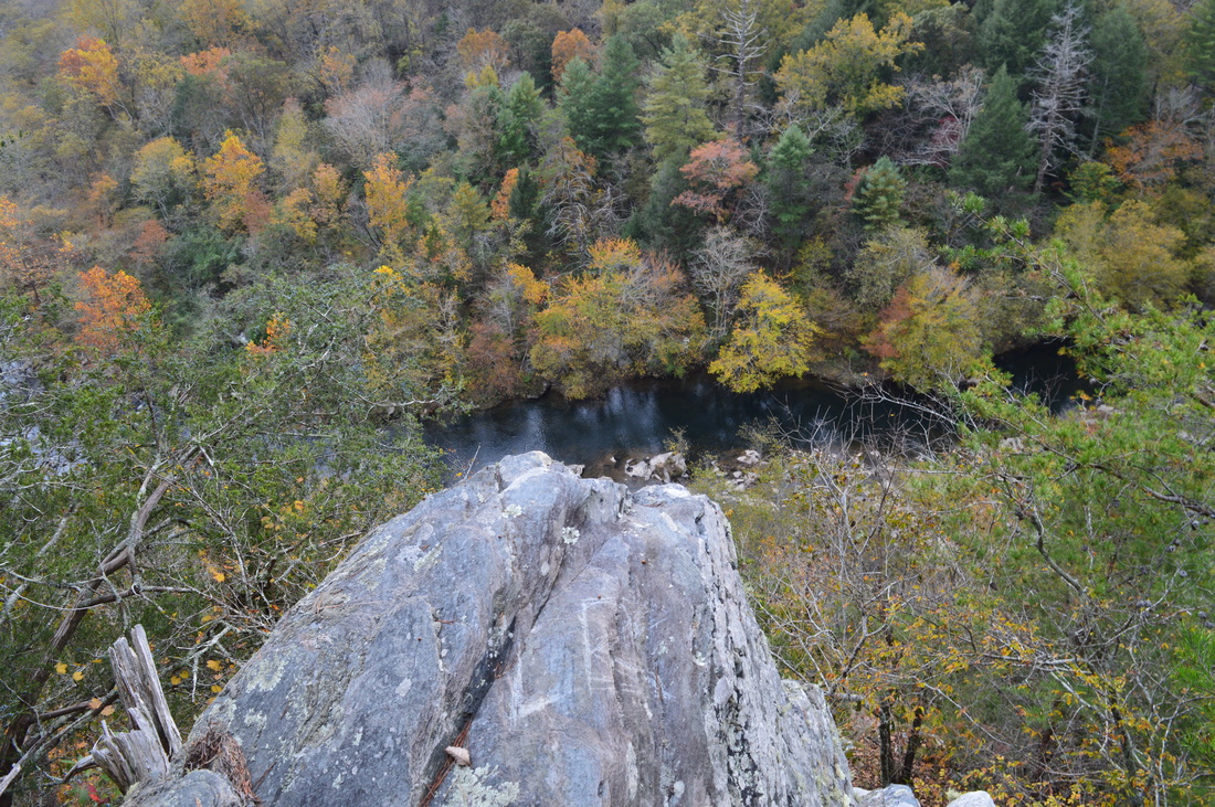
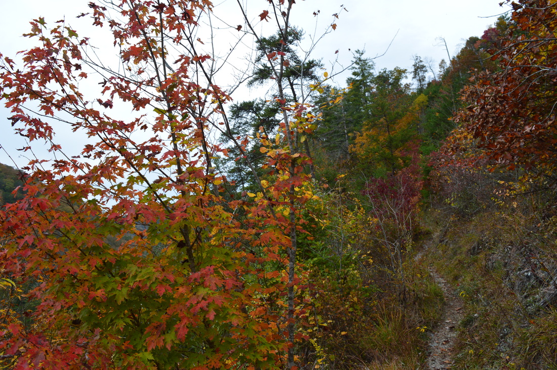
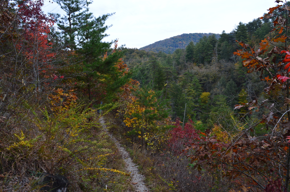
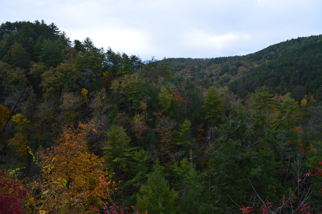
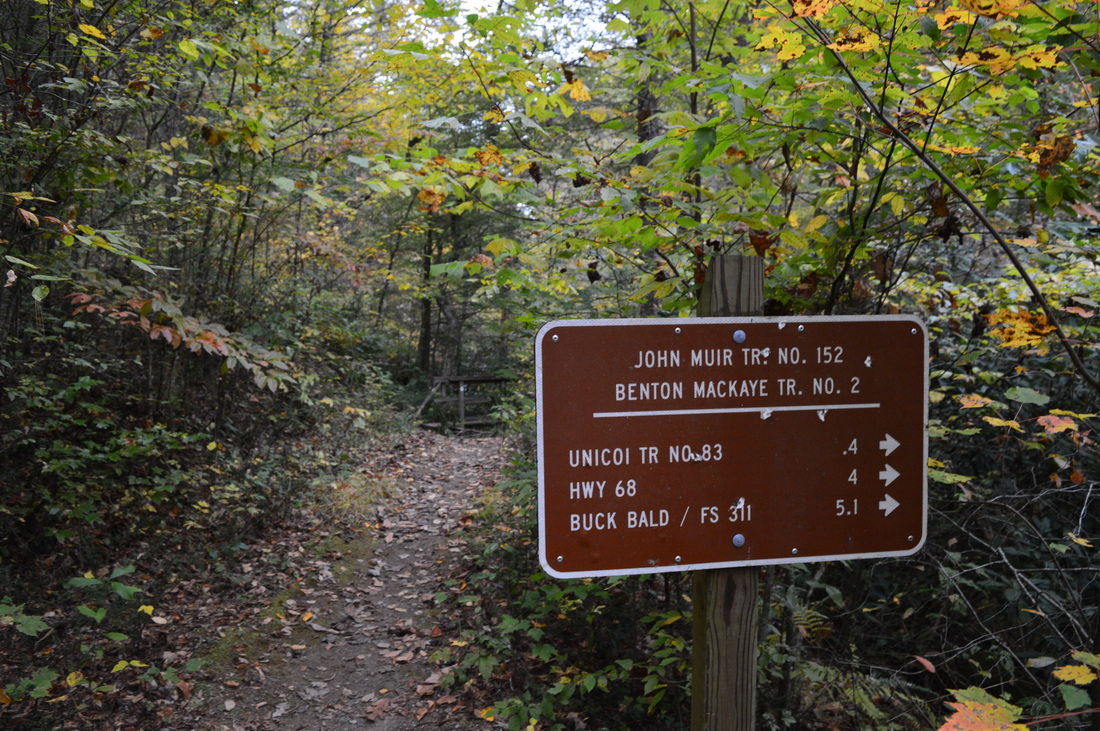
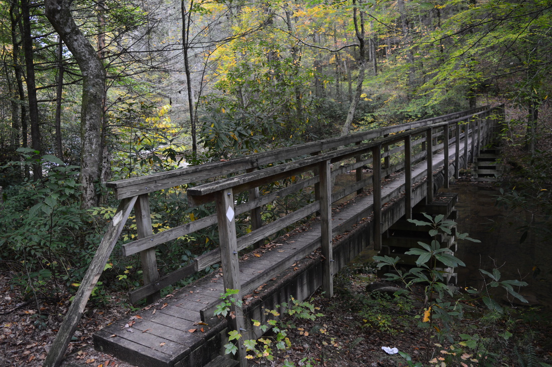
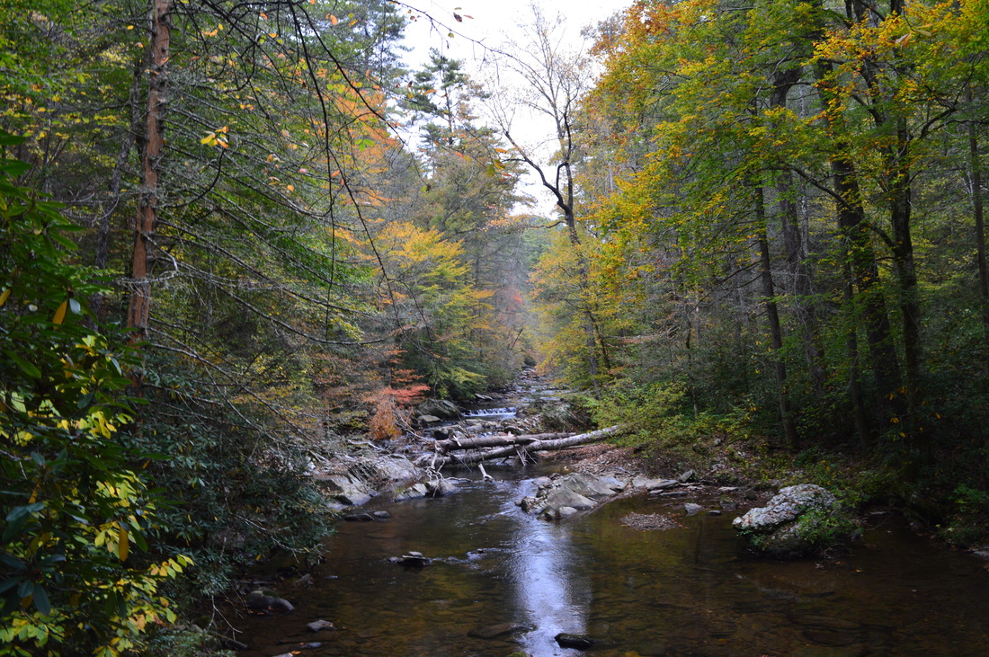
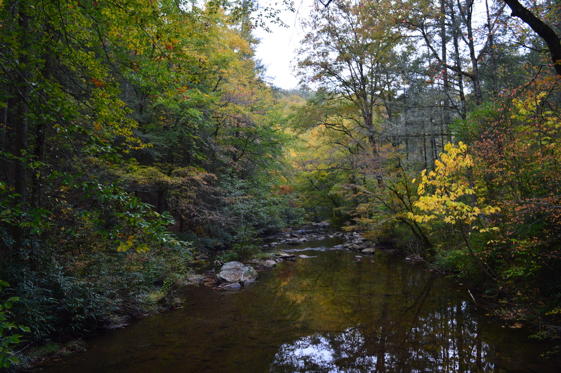
 Two large rivers are the highlights of southern Cherokee National Forest's Ocoee/Hiwassee Ranger District: the Ocoee River and the Hiwassee River. Both rivers run through gorgeous canyons and are full of whitewater rapids. The John Muir Trail (and partially in conjunction with the Benton Mackaye Trail) runs along the northern shores of the Hiwassee River for a distance of nearly 20 miles, presenting opportunities to see the river's rapids and rock formations up close. This hike occurred on October 24th, 2015. My plan was to hike the John Muir Trail/Benton Mackaye Trail from the Big Bend Recreation Area to the Coker Creek footbridge at Duckett Ridge Trailhead. I would return almost the same way, although on the return trip, I would attempt to follow the old route of the John Muir Trail past Apalachia Powerhouse. SummaryR/T Length of Trail: 14.2 Miles Duration of Hike: 7:50 Type of Hike: Out and Back Difficulty Rating: 6 out of 10 Pros: Trail is well-marked and well-maintained Cons: First mile of trail is parallel to a roadway; unbridged crossings of Towee Creek and Loss Creek have potential to cause problems during high water levels Points of Interest: Vista of Hiwassee River near Big Bend - 6 stars; Northward vista from McCulley Mountain - 2 stars; Vista of Hiwassee River near Coker Creek - 9 stars Trail Blaze Color(s): Benton Mackaye Trail - White Diamonds; John Muir Trail - White Best Season(s) to Hike: Year-round; in winter the river views will be best Beginning Point: Big Bend Recreation Area Directions: From Reliance, TN: Follow Childers Creek Road east for 1.2 miles, and then, turn right onto Powerhouse Road. Continue on Powerhouse Road for 1.1 miles to the riverside parking at Big Bend Recreation Area. A small parking area for hikers, with space for several cars, is located at the trailhead 0.1 miles farther. MapA map and some other information regarding this hike can be viewed here. DetailsMonroe and Polk Counties, Tennessee, are very gorgeous, and this area is perhaps my most favorite place to hike at, although there are other areas that come close to it. In the Tellico Ranger District of southern Cherokee National Forest, the Tellico River, Bald River, and Citico Creek are beautiful mountain waterways and have complex networks of trails around them. In the Ocoee/Hiwassee Ranger District, Big Frog Mountain and two rivers (Ocoee River and Hiwassee River) are the focal points for outdoor activities such as hiking. The Hiwassee River is dammed at Apalachia Lake near the TN/NC border, and from there until the Apalachia Powerhouse (that you'll see on this hike), much of the river's water is routed through an underground pipe on the ridge south of the riverbed. This was done to increase the water's power to make more energy at the powerhouse. When all that water gushes out at the powerhouse, the Hiwassee River becomes very wide and powerful (above the powerhouse the water levels are pretty low and in summer there may be very little water). The John Muir Trail follows the Hiwassee River's wildest and most beautiful stretch from Childers Creek near the TN-315 bridge to Brushy Creek near the TN/NC state line. The John Muir Trail is one of two National Recreation Trails in Cherokee National Forest (the other being Warrior's Passage Trail that I hike a few weeks after this one). The Benton Mackaye Trail shares paths with John Muir Trail from the beginning at Childers Creek to the Unicoi Mountain Trail near Coker Creek. On this day, I decided to hike what sounded like the most picturesque section from Big Bend to Coker Creek. The Big Bend Recreation Area is more of a parking area/stopping point for fishermen and kayakers. The John Muir Trail along with the BMT enter the parking from the west side and briefly follow the road. At 0.1 miles, the trail leaves the road at a small parking area for several cars. This section of trail was recently constructed. The trail follows a narrow strip of land between the road and the Hiwassee River with great views of the river and its rapids. At 0.3 miles, the John Muir Trail crosses Powerhouse Road at a small pullout with a picnic area. The trail then climbs a bluff next to the road and then continues to travel parallel to the road. This section of the trail is not traveled frequently and has a couple of blowdowns. At 0.9 miles, reach a rockhouse in the rock bluffs to the left. The rail is a bit farther away from the road here. Make a steep scramble up to a rock outcrop and an open area with a good vista of the Hiwassee River corridor and surrounding mountains. This vista is good but the one later on in the hike is more beautiful than this one. Still, I would suggest that this mile of trail near the road has this vista as a good reward. After the vista, the trail descends to a paved cul-de-sac, reaching it at 1.2 miles. This is the Towee Creek Trailhead. Most people who do this hike would start here, skipping the first section. While that would shorten your hike some, I recommend starting at Big Bend so you could see the vista. At the Towee Creek Trailhead, there is a mileage sign for the John Muir Trail/BMT. To prevent unnecessary repetition in this blog post, from now John Muir Trail will refer to the path of both the Benton Mackaye Trail and John Muir Trail, unless otherwise noted. The old route of the John Muir Trail stayed close to Powrhouse Road or followed it until the Apalachia Powerhouse from the Towee Creek Trailhead, but after the Benton Mackaye Trail was established across Tennessee, a new route was developed across McCulley Mountain. I was planning to finish by hiking the old route of the John Muir Trail on the way back, but for now, I continued on the new, maintained route along Towee Creek. At 1.4 miles, after paralleling Towee Creek, the trail reaches it and crosses it. On this day, with the aid of hiking poles, I was able to cross with dry feet utilizing some small trees in the creek, and I could see rocks used for crossing that, at the time, were slightly underwater. However, in high water levels, this crossing may become a bit problematic, although on this day, the water levels were already fairly high, so I guess a wet crossing here is not that common. Following Towee Creek, the John Muir Trail begins a steady ascent that has great views due to the open nature of the forest. Even in summer, you have some good views of the Towee Creek valley. After a whie, ther are a couple of switchbacks in the trail as it pulls away from the Towee Creek and ascends higher up the long ridge known as McCulley Mountain. The ascent is not difficult at all, and the steepest grades are only moderate. At 2.7 miles, the trail suddenly comes out onto a knife-edge ridge with steep dropoffs on both sides. A vista, the only real northward vista on this hike, lies just ahead in a gap in the ridge. Here, an opening in the trees provides views of Towee Mountain beyond the Towee Creek valley. To the south, there are some through-the-trees views of the Hiwassee River. Following this vista, the trail makes what perhaps is its steepest uphill section to the highest point on this hike on McCulley Mountain at 3 miles. The elevation here is just short of 1500 feet. The trail crosses diagonally over an old road that heads up the mountain (this road seems to connect to Rock Island Road), and then, the trail begins a moderate descent back to the Hiwassee River to rejoin the old route of the trail. After a bit of descent, the trail will make a hairpin turn (watch for blazes) and continue descending at a moderate pace. A small stream forms to the left of the trail - this stream soon falls into a slightly larger stream, Rock Island Branch. The trail descends parallel to Rock Island Branch the entire time. At 4.3 miles, the trail enters a sort of flat near the Hiwassee River, and this appears to be the end of the descent, but then, suddenly, the trail descends steeply down a small bluff and finally levels out besides what looks like a marsh at 4.4 miles. Here, the new John Muir Trail rejoins the old John Muir Trail. The new John Muir Trail turns left, and the old John Muir Trail turns right towards Appalachia Powerhouse. There is a sign here, although it doesn't state anything about the old route of the JMT. The old route is both slightly shorter and easier, as it doesn't involve the climb of McCulley Mountain. I recommend hiking both. The section of trail across McCulley Mountain is a very beautiful section with a wilderness feeling, but on the way back, it would be better to take the old route of the trail to avoid 1.4 miles of moderate ascent when you've already hiked around 10 miles. The "marsh" directly in front of you at the junction appears to be part of the Hiwassee River. It is kindof like a flood channel of the river that goes around the north side of Big Rock Island. The hill on the other side of this channel is Big Rock Island. The main mass of the Hiwassee River lies behind this island hill. Turn left onto the John Muir Trail and follow the channel. At 4.5 miles, cross Wildca Creek. A small but pretty cascade lies just upstream on Wildcat Creek. At 4.6 miles, the trail leaves the Big Rock Island channel and makes a number of switchbacks to rise above the river. At 4.9 miles, the trail reaches the Hiwassee River, and this time it's the entire river. The water is very still here - it doesn't remind a mountain river at all. At 5.1 miles, the trail makes a sharp left turn at a John Muir Trail marker with the digits 152. A side trail continues ahead to the river. The trail rises above the river and becomes very rough as it constantly scrambles up and down to follow the bluffs above the river. Down below, this section of the Hiwassee River is called The Narrows, a long series of cascades and waterfalls that are most beautiful during high water levels. Unfortunately, it is hard to get a close view of these water features, and that is the reason the trail is routed high - the terrain is even more rugged down by the river. As you hike along the bluffs, you get views of the many water features in the river far below. At 5.9 miles, the trail descends back to river level, although the river is not always visible. At 6.3 miles, the trail reaches a campsite, and there is a fork in paths. The path that goes more sharply left has blazes, but it seems like the actual trail is the one that goes more softly left. Both trails come out in about the same spot at Loss Creek, but when I took the blazed one, I ended up at a spot on Loss Creek just ahead, where I couldn't locate the crossing point. I lost a lot of time here trying to locate the crossing point, and this really is the only confusing spot on the entire hike. Loss Creek is a beautiful creek with many small cascades, and it can usually be crossed with dry feet. If you take the blazed path to Loss Creek, you need to cross slightly downstream to the right using some rocks that should be almost always above water. If you take the other path (that doesn't have blazes), this spot with rocks will be directly ahead of you. On the other side of Loss Creek, the trail makes a left turn and continues to stay in flats near the Hiwassee River, although the river itself is rarely visible. To the left, a steep gorge side looms. At 6.7 miles, the trail passes a pond-like marsh on the right that seems to be part of the floodplain of the Hiwassee River, or in other words, part of the river itself. After this, the John Muir Trail turns left and makes a number of switchbacks as it ascends high above the river on its way to the primary vista on this hike. As the trail rises higher, good winter views of the gorge appear. At 7.1 miles, the trail reaches the high point of this ascent. Here, an unmarked side trail leads right and descends briefly but steeply to a rock outcrop with a spectacular vista of the Hiwassee River Gorge. This vista reminds me of the first vista on the Rock Creek Gorge section of the Cumberland Trail, but this one is significantly more impressive than that one. The gorge is deeper and larger here, and the overall sensation of a true mountain gorge is felt better here. The only con that this vista has is a pine tree on the left side that slightly obstructs the view of the Hiwassee River upstream. This vista also reminds me Angel Falls Overlook in Big South Fork National Recreation Area, but I must say that Angel Falls Overlook is even more beautiful than this one - Angel Falls Overlook is almost one of a kind and it would be really hard to beat a view such as that one. Still, the vista of the Hiwassee River seen on this hike is by no means bad, and such a reward at the end of this already picturesque hike makes it an amazing hike. From this vista, most folks will probably backtrack, but for the sake of completion, I decided to continue just a bit farther to Coker Creek and Duckett Ridge Trailhead. Following the vista, the trail began to descend into the Coker Creek gorge - Coker Creek is large enough to have a fairly significant gorge of its own. Shortly after the vista, the trail passes through an open area with a great view of the confluence of Coker Creek's gorge with the larger Hiwassee River gorge. This is yet another beauty spot on this picturesque hike. The John Muir Trail makes two switchbacks in the process of descending. At the second switchback, at 7.4 miles, there is a "JM" sign. Also, at this switchback, there is a goat path that heads out to the confluence of Coker Creek and Hiwassee River. I have heard that the view at the end of the spur trail is beautiful, but I didn't do it on this day. I plan on doing the spur trail in the future when I hike to Coker Creek Falls. After this, the John Muir Trail descends some more to reach Duckett Ridge Road at 7.5 miles. To the left, Duckett Ridge Road leads to TN Highway 68. The Coker Creek Falls Trailhead is on Duckett Ridge Road as well. The John Muir Trail briefly follows Duckett Ridge Road - turn right onto the road to continue following the trail. The road bends to reach Coker Creek at 7.6 miles. This is the end of Duckett Ridge Road. There is a number of campsites here by the side of Coker Creek. At the vehicle turnaround, there is a mileage sign for the John Muir Trail/BMT. Also, here the Coker Creek Trail bears slightly left and steeply uphill upstream along Coker Creek. From here, it is 2.6 miles along Coker Creek Trail to Coker Creek Falls and 2.7 miles to the Coker Creek Falls Trailhead. Meanwhile, the John Muir Trail and BMT bear right to cross Coker Creek on a footbridge that provides a good view of Coker Creek both upstream and downstream. From the Coker Creek footbridge, it is another 0.4 miles to the location where the Benton Mackaye Trail and John Muir Trail split up, and both eventually reach TN Highway 68, but this footbridge was my turnaround point for the day. From this point, I retraced my steps back to the Big Rock Island area. I reached the junction with the old John Muir Trail at 10.8 miles. Here, continue straight past the sign that seems to direct the trail to the right. This is a no longer official or maintained trail, but it seems to receive fairly good use, and you can still spot old white blazes on some trees. At 10.9 miles, the trail approaches the edge of the river, where the canal behind Big Rock Island flows back into the river. This area may be submerged during very high water levels, but usually, you should be able to walk along the water's edge. After this, the trail is generally clear and there shouldn't be any doubt as to where to go, even if you do not see blazes.The closer you get to Apalachia Powerhouse, the more audible the distant din of the powerhouse becomes. As the trail approaches the powerhouse area, the river widens and the strong outflow of water from the tunnel causes waves to hit the shore where the trail is. For a moment, you may imagine yourself hiking along a wild oceanside as the waves increase and strengthen. At 11.7 miles, the narrow riverside pathway reaches the eastern end of Powerhouse Road near the Apalachia Powerhouse. Here, a large and very well-designed footbridge crosses the river and leads to Apalachia Powerhouse. It is unclear if travel across the footbridge is allowed. I would be inclined to say no, but why was it built then? In any case, from here on to the end of the hike, you have the option to walk the road the entire time or follow the trail from Towee Creek to Big Bend. There are a couple sections of old trail before the road too, but I didn't locate them and I didn't really try to - the road stays next to the river much of the time and is quite scenic as well. Plus, the road doesn't get that much use. If you follow the road, you'll walk past several parking areas and pullouts, and you'll return to the Big Bend Recreation Area at 14.2 miles, completing this extremely photogenic hike. It's not often that I end up doing two Best Hikes in a row. The fantastic river views stretching throughout almost this entire hike, the wilderness-like forest on McCulley Mountain, and the spectacular culmination at the breathtaking vista of the Hiwassee River Gorge near Coker Creek make this one of my most favorite hikes in all of 2015. I've done other good hikes this year, and I still have time to do a few more, but this one goes to the top of the list. Trails like this are uncommon - get out and hike it. It's not even difficult. I rate this a "Best Hike". VariationsStart at Towee Creek Recreation Area instead of Big Bend Recreation Area - 11.8 Miles Return via McCulley Mountain - 15.2 Miles Bonus StopsLowry Falls on a tributary of the Hiwassee River Is just a short walk from nearby TN Highway 30. PicturesVideos
0 Comments
Leave a Reply. |
About MeMark Oleg Ozboyd Dear readers: I have invested a tremendous amount of time and effort in this website and the Georgia Waterfalls Database the past five years. All of the work that has gone in keeping these websites updated with my latest trip reports has almost been like a full-time job. This has not allowed me to pick up a paid job to save up money for college, and therefore, I I've had to take out loans. If you find the information on this website interesting, helpful, or time-saving, you can say "thanks" and help me out by clicking the button above and making a contribution. I will be very grateful for any amount of support you give, as all of it will apply toward my college tuition. Thank you!

Coming in 2022-2023?
Other Hiking WebsitesMiles HikedYear 1: 540.0 Miles
Year 2: 552.3 Miles Year 3: 518.4 Miles Year 4: 482.4 Miles Year 5: 259.9 Miles Archives
March 2021
Categories
All
|


 RSS Feed