HIKING THE APPALACHIANS AND BEYOND
  • Home
  • Trail Reports
    • Best Hikes
    • Hikes with Scenic Views
    • Hikes with Water Features
    • Alabama
    • Georgia
    • Florida
    • North Carolina
    • South Carolina
    • Tennessee
    • Vermont
    • Virginia
  • Map
  • Hike List
  • Testimonials
  • Resources
  • Contact Us
  • Southeast Nature Society
    • Our Team
  • Georgia Waterfalls Database

Cherokee National Forest: Warriors Passage Trail, Tellico Plains, Tennessee

12/18/2015

0 Comments

 
Picture
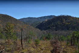
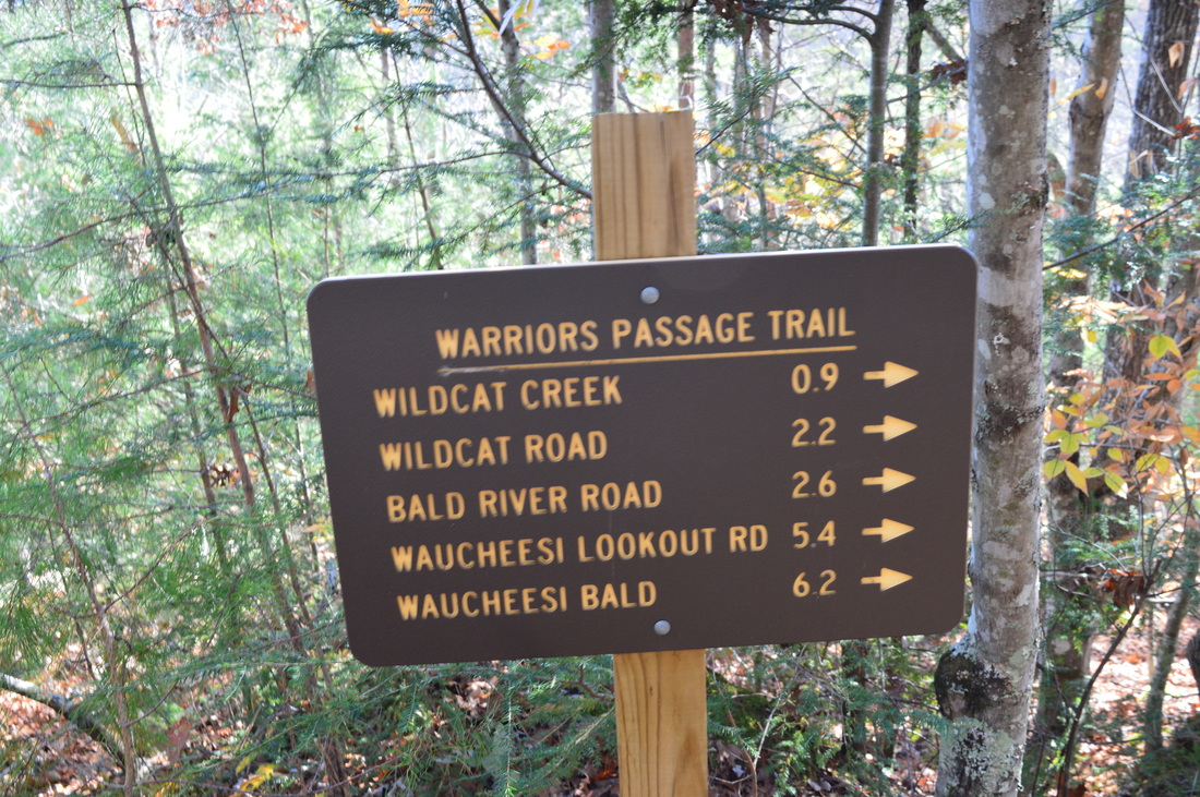
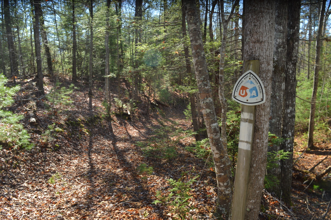
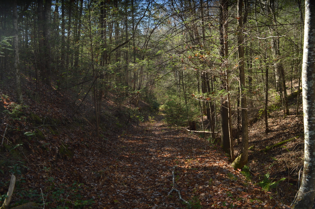
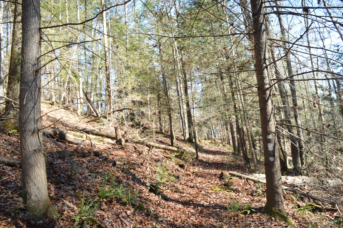
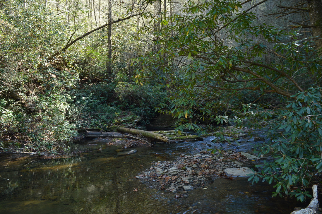
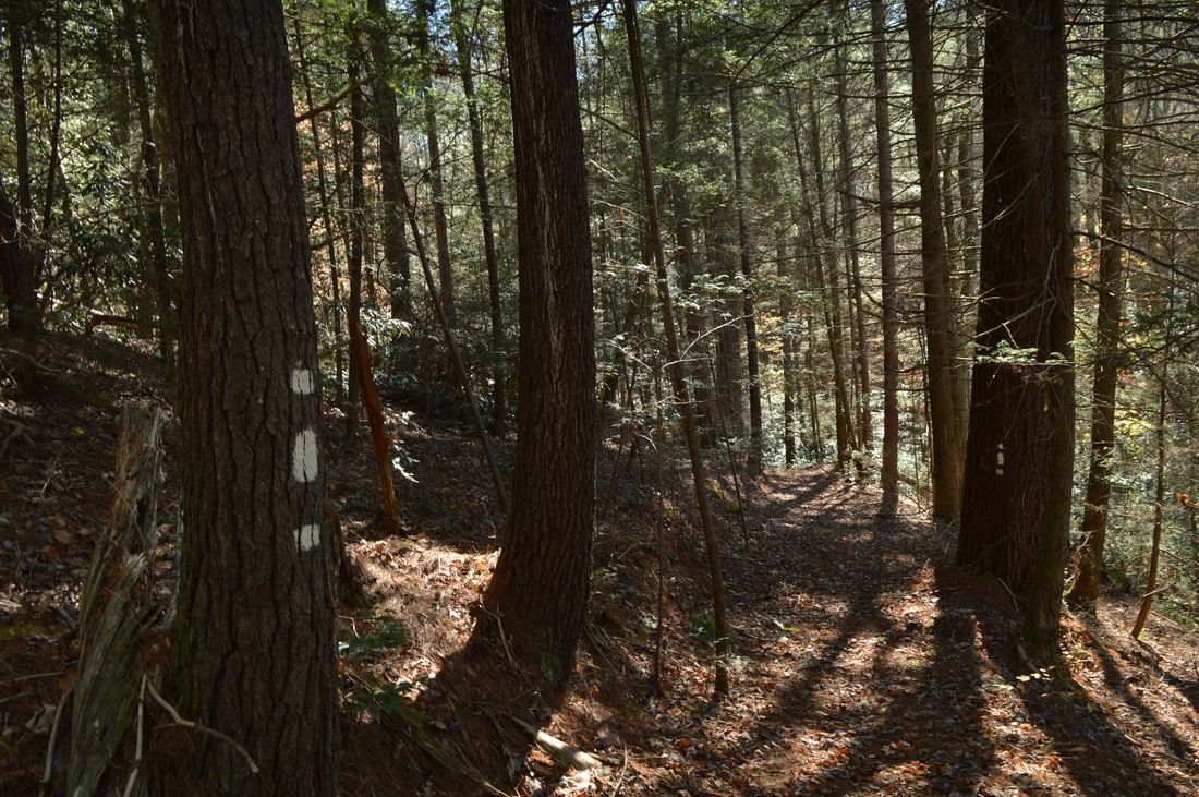
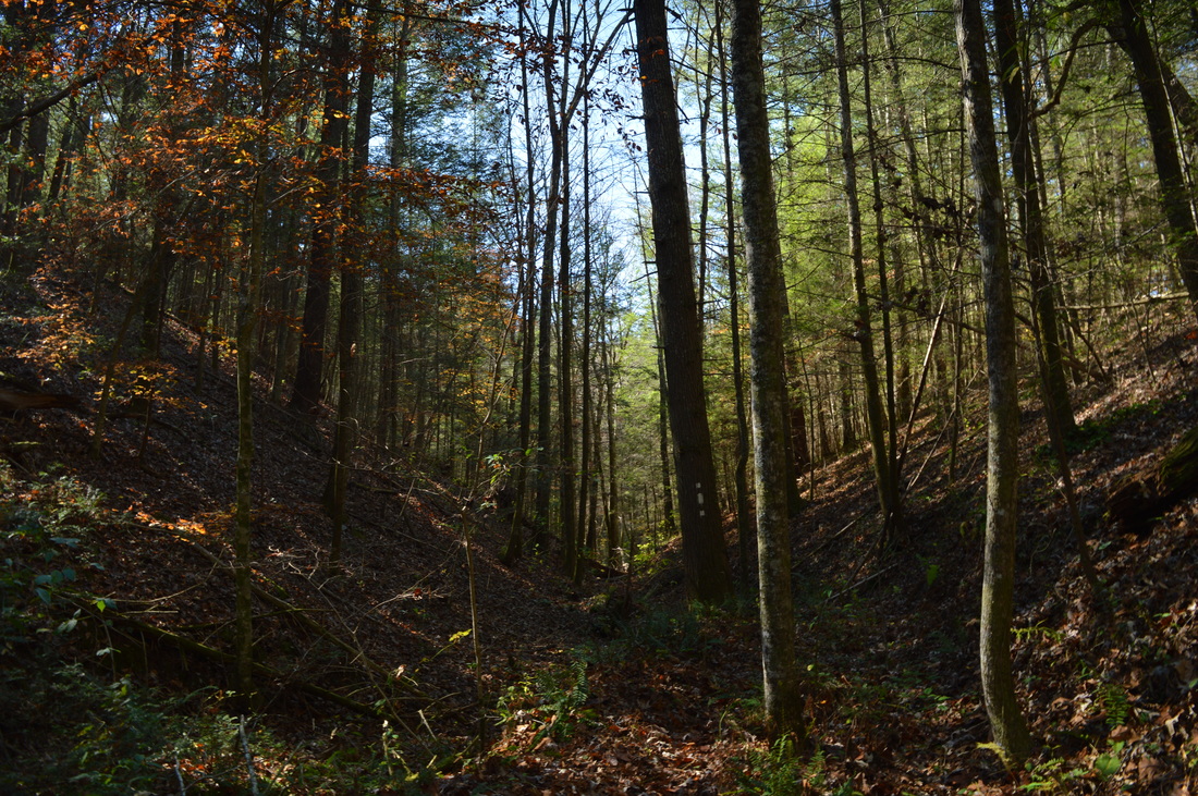
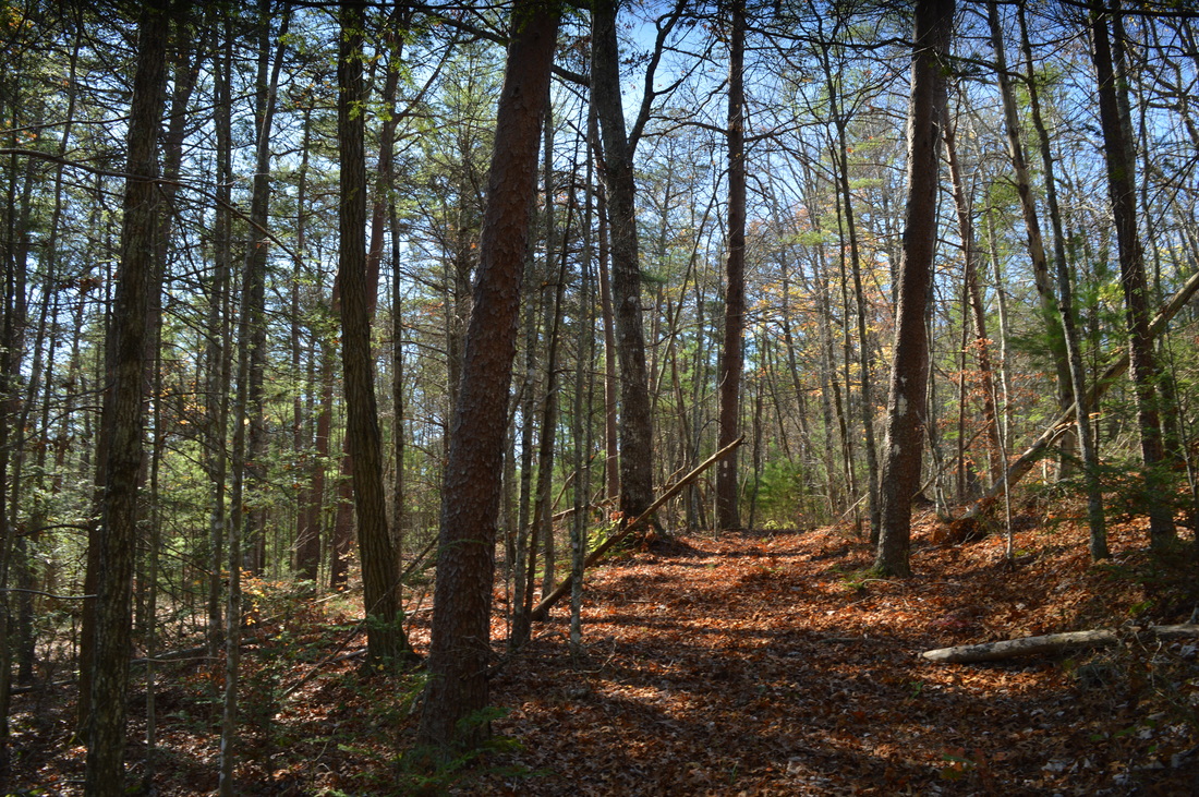
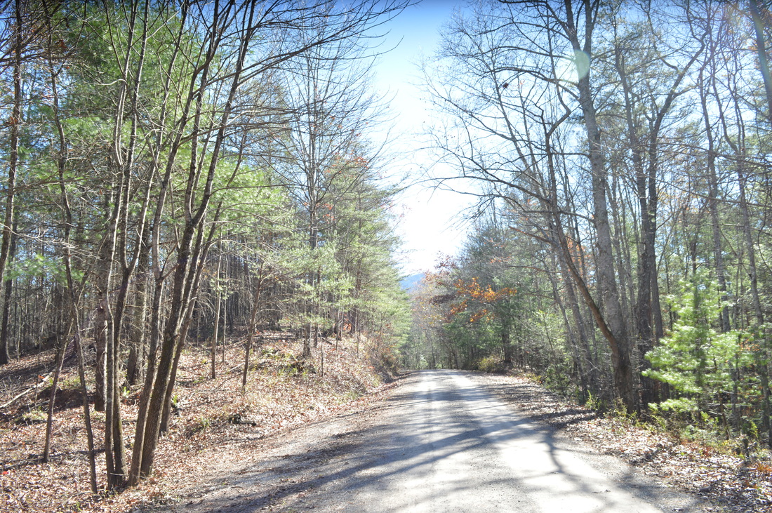
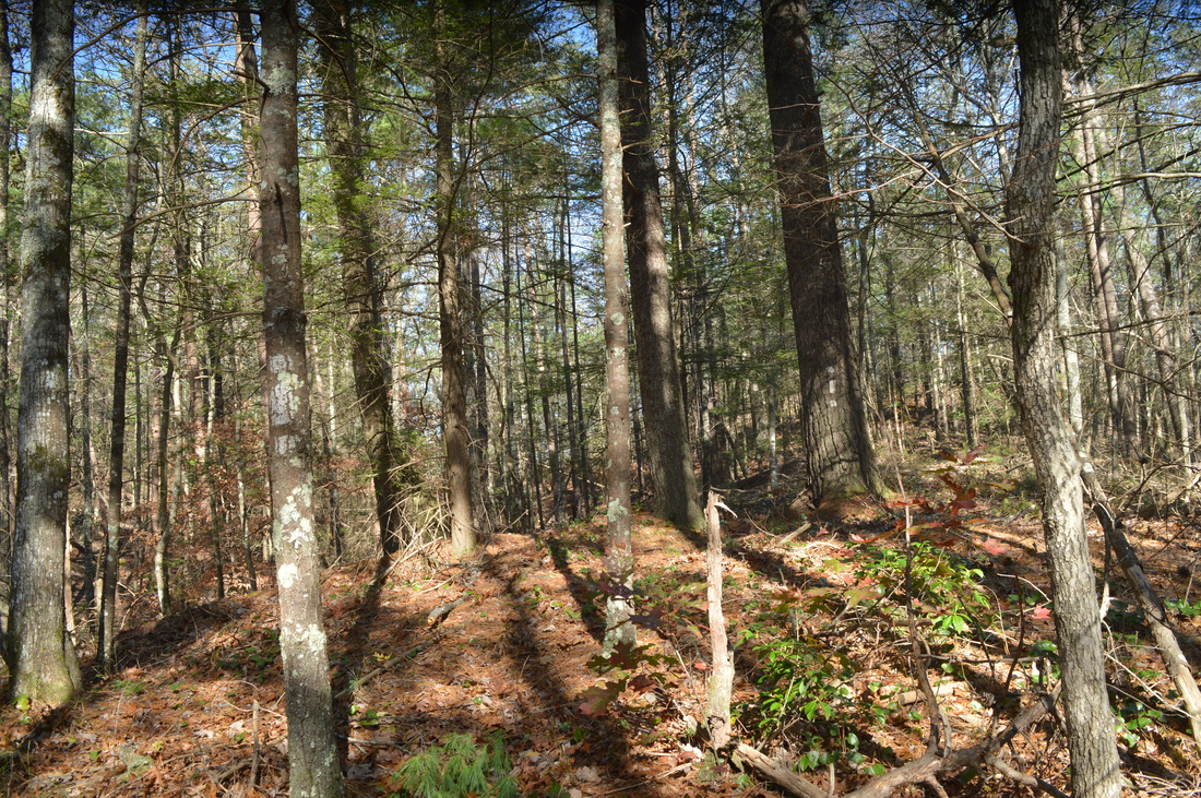
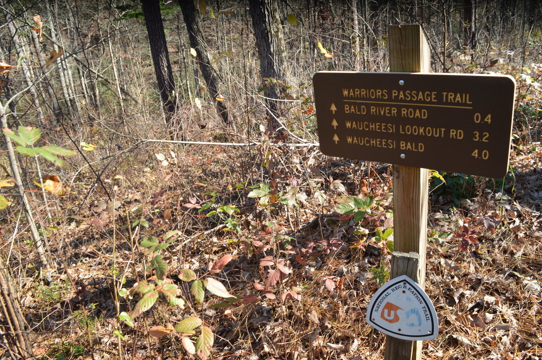
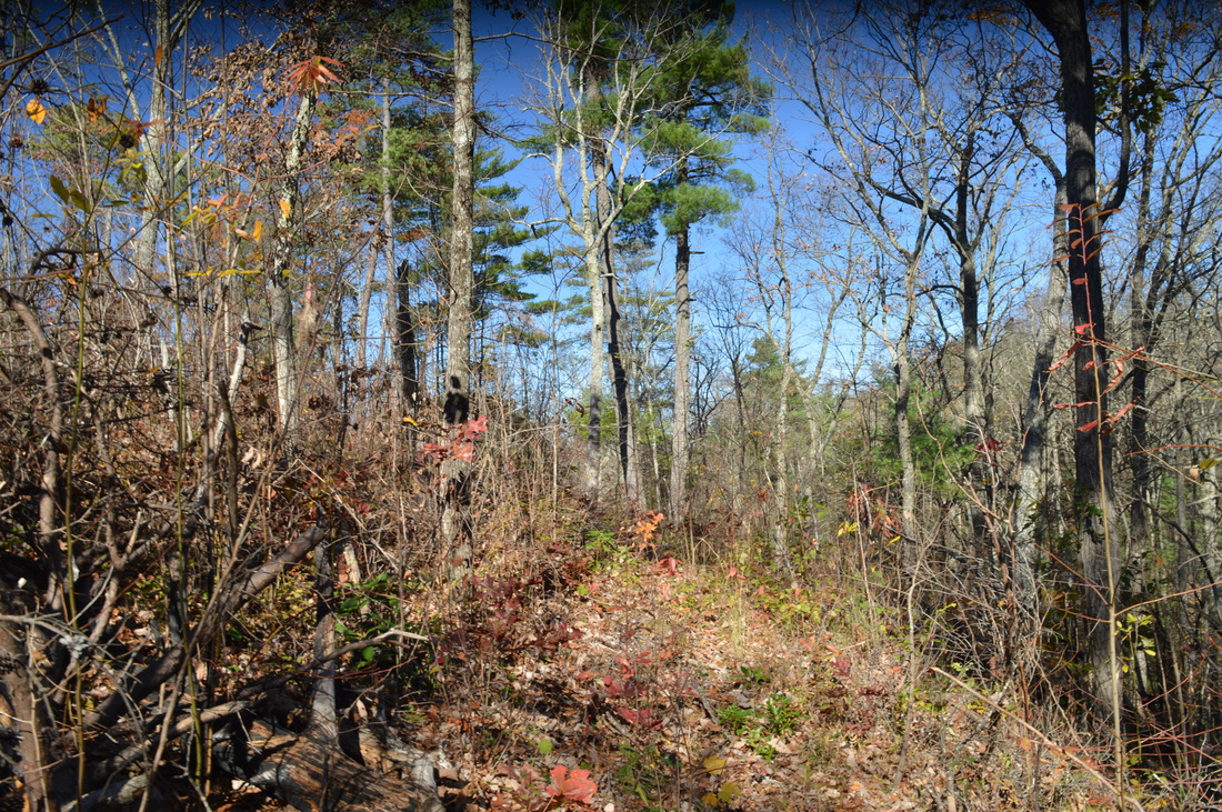
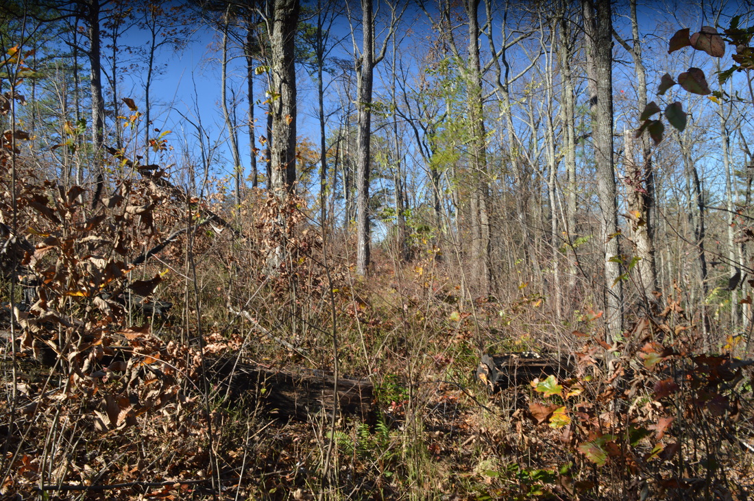
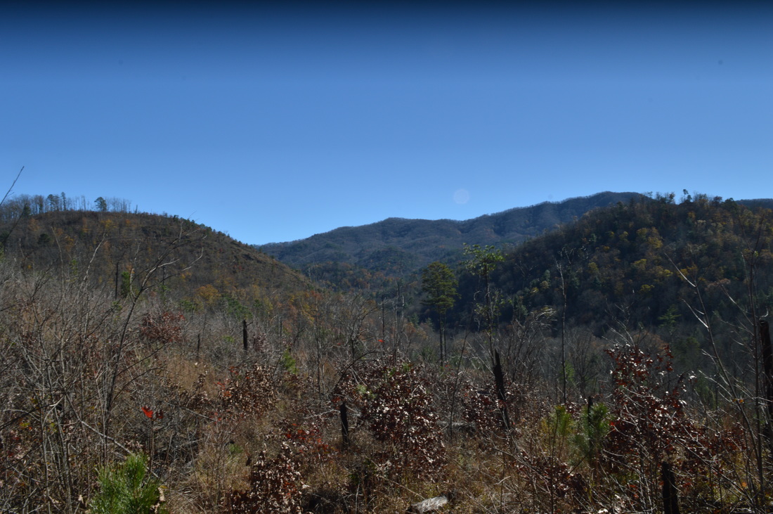
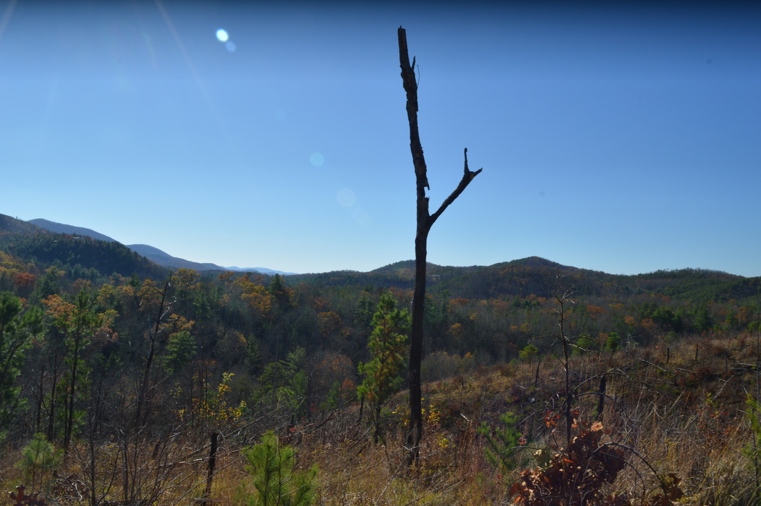
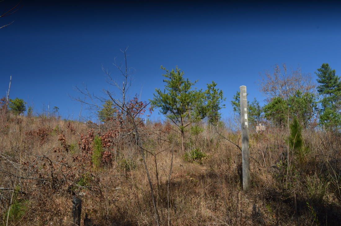
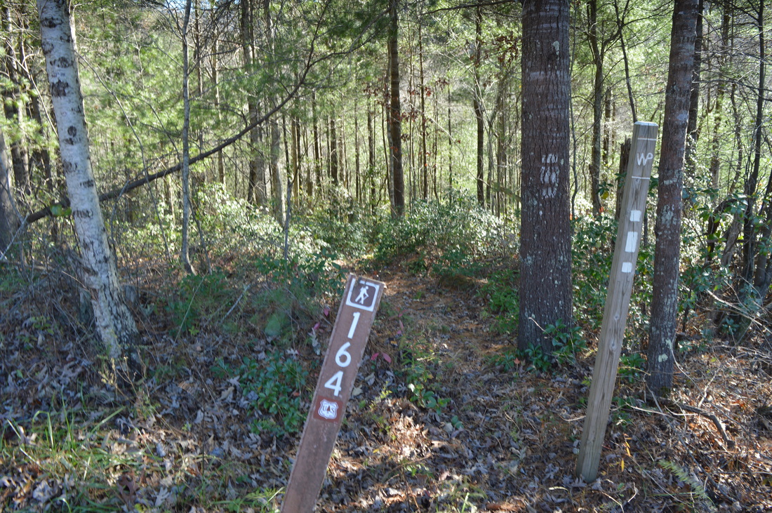
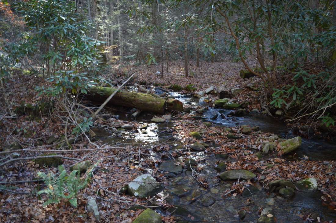
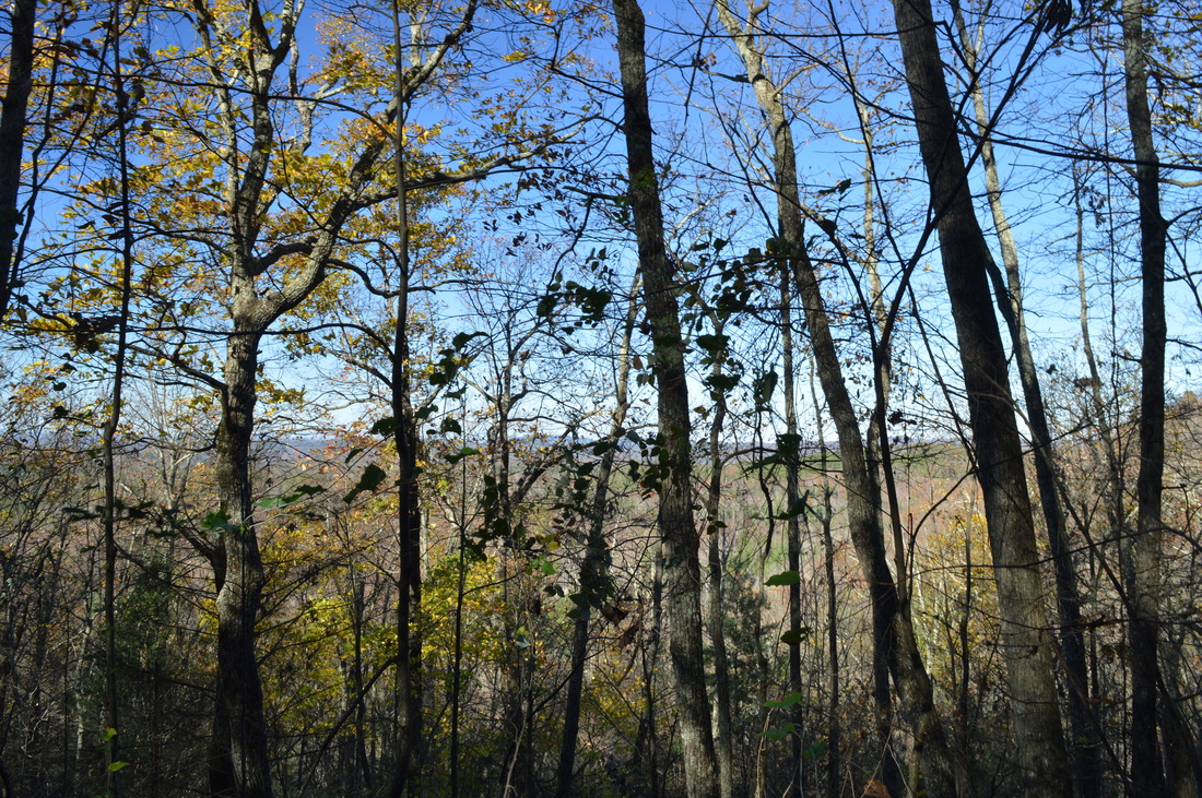
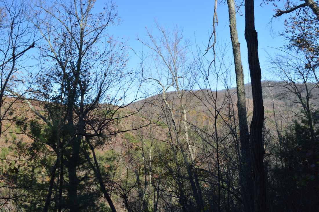
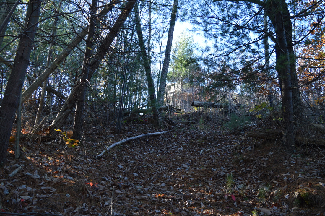
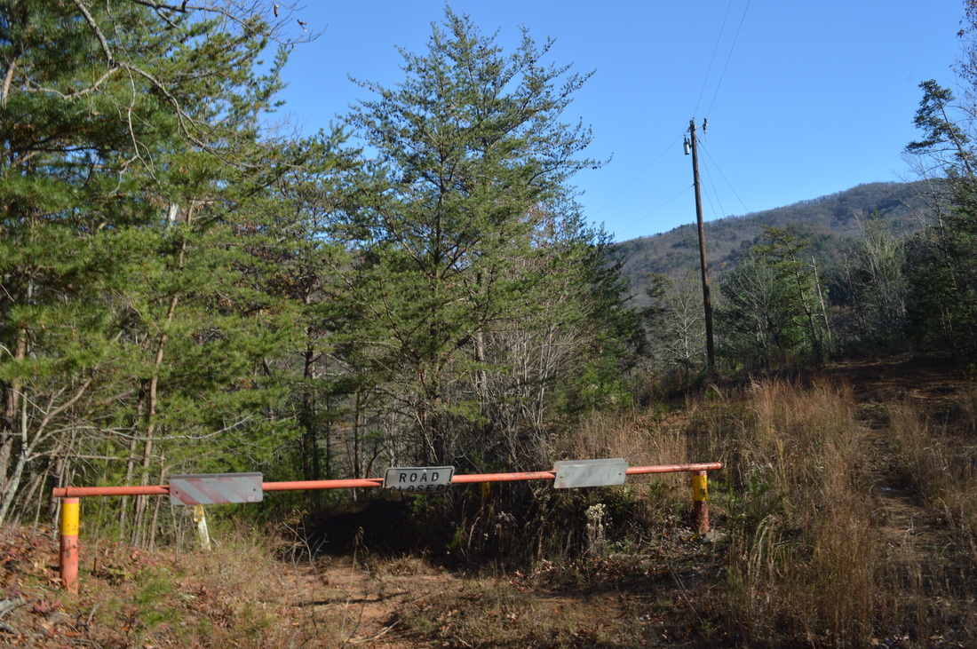
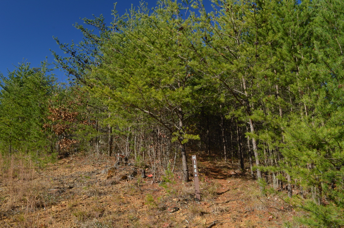
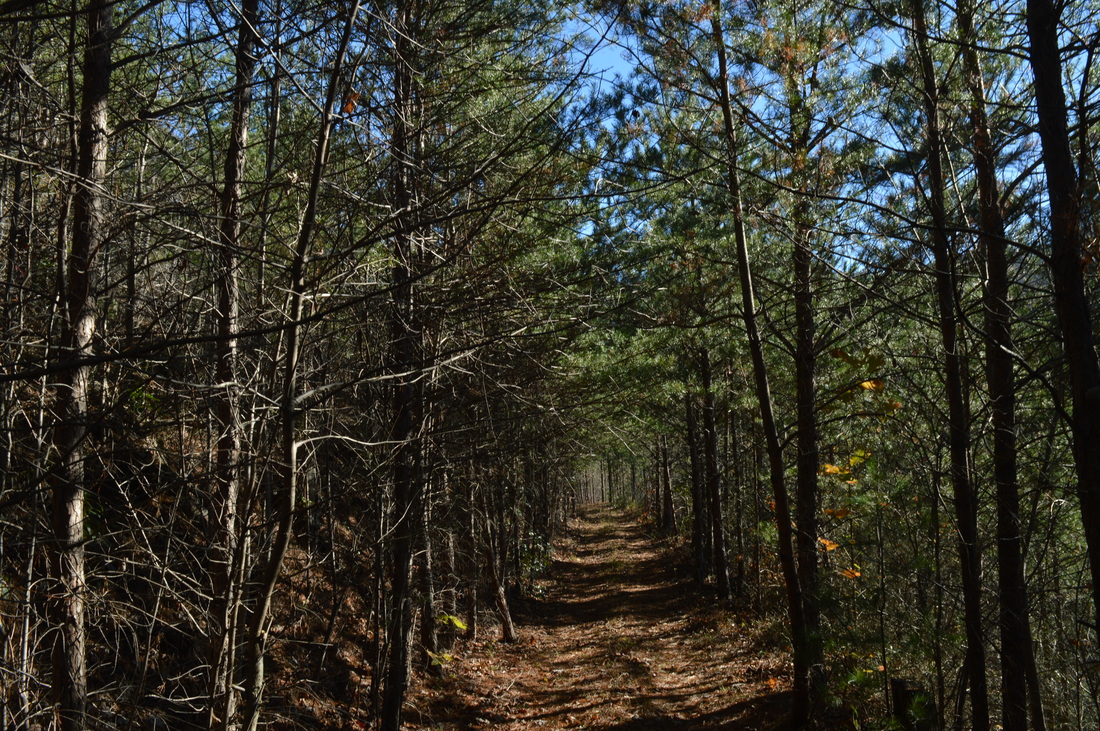
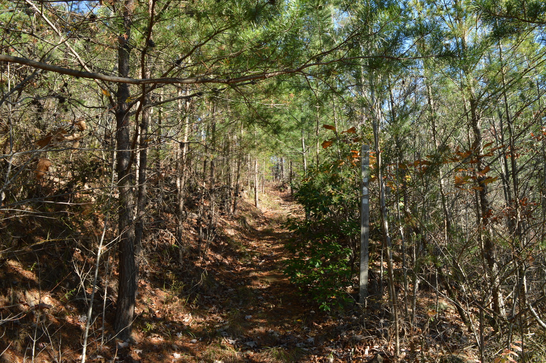
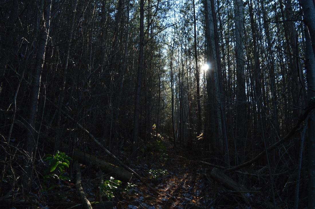
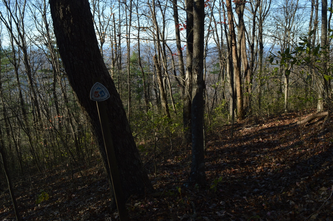
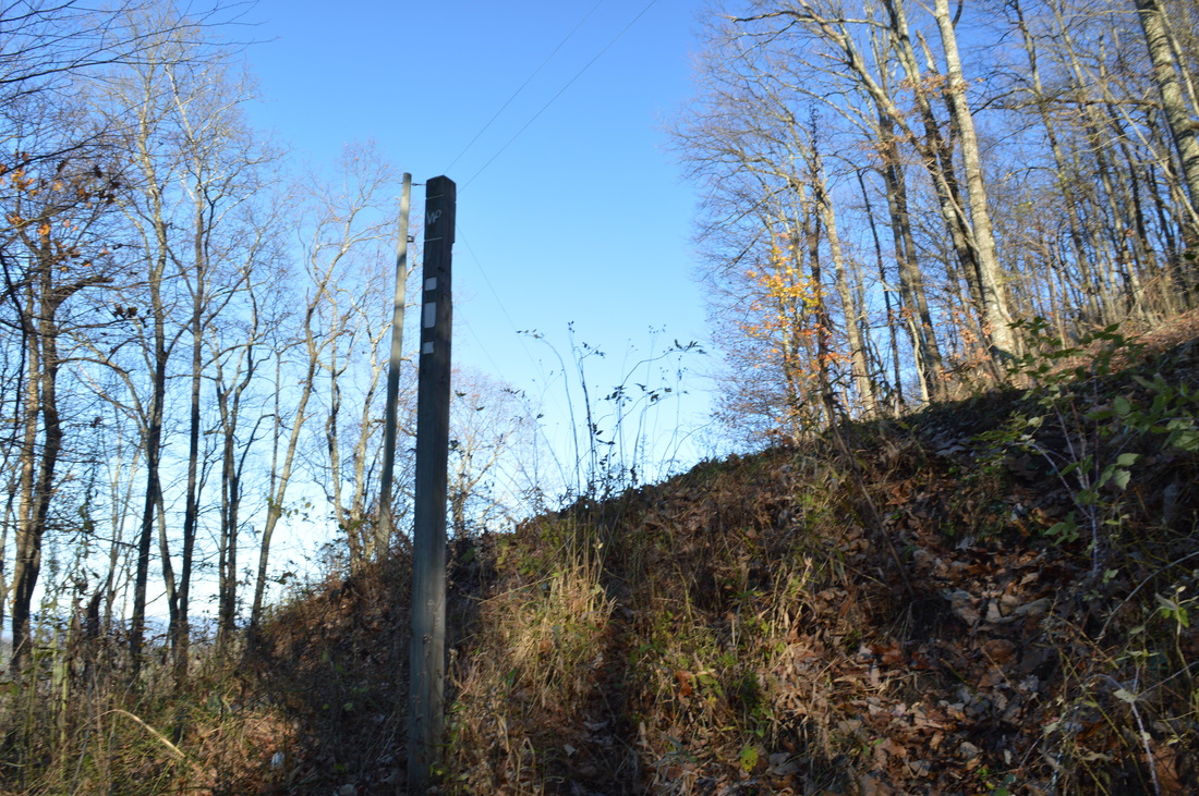
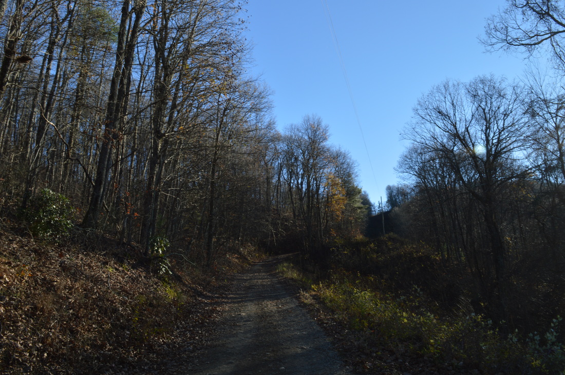
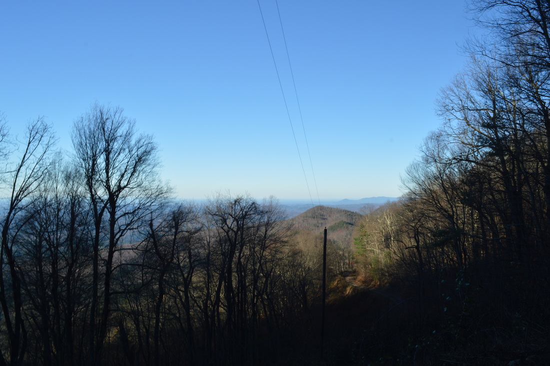
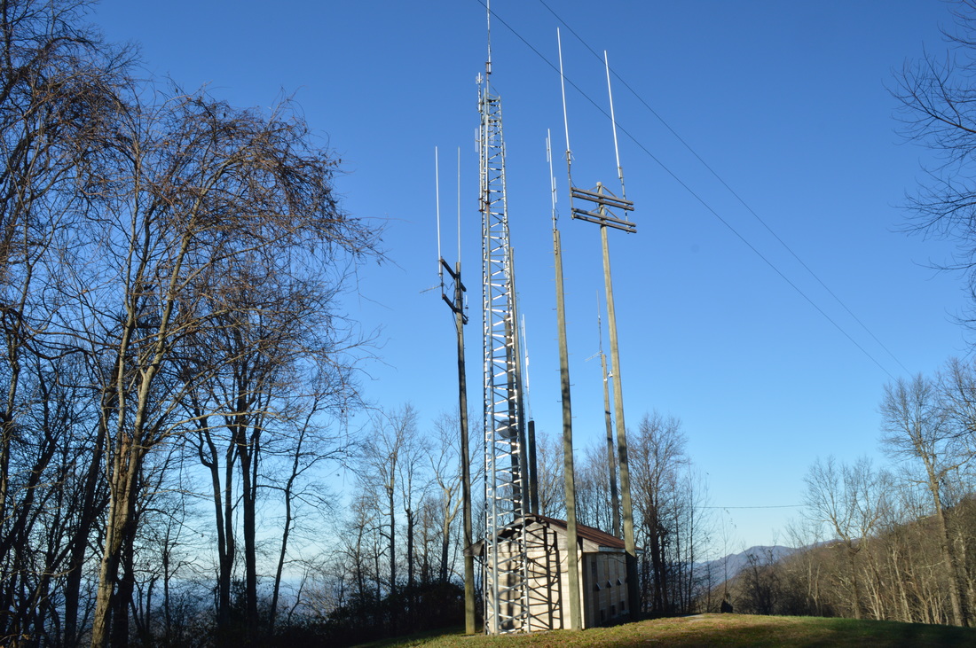
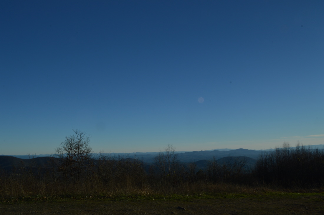
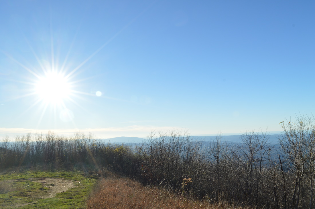
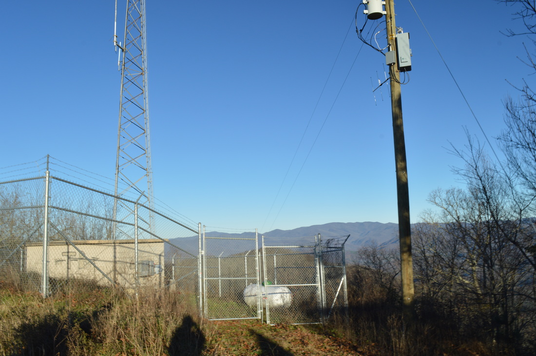
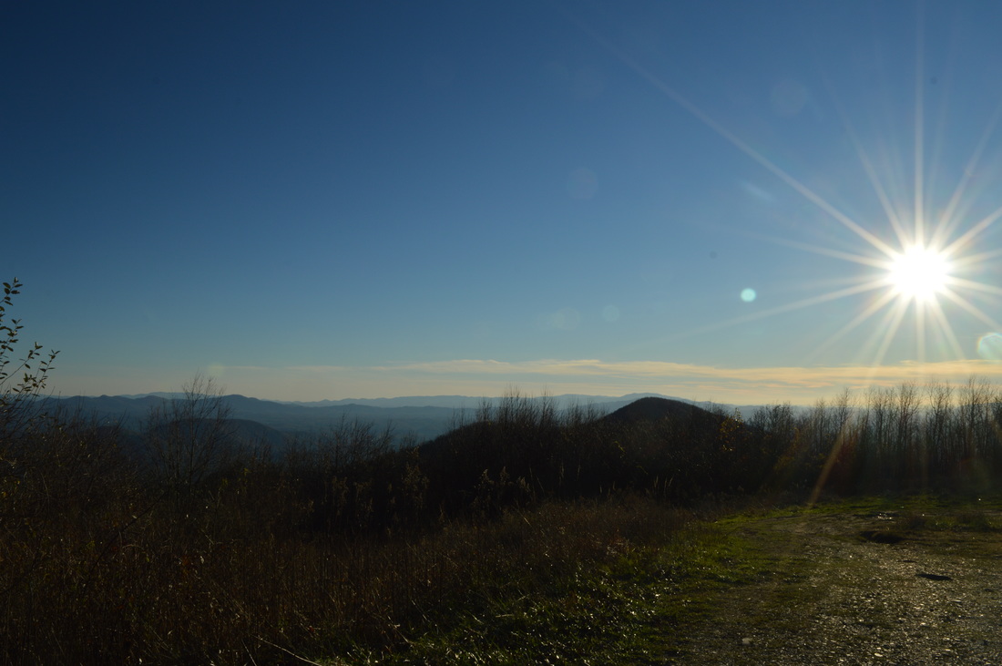
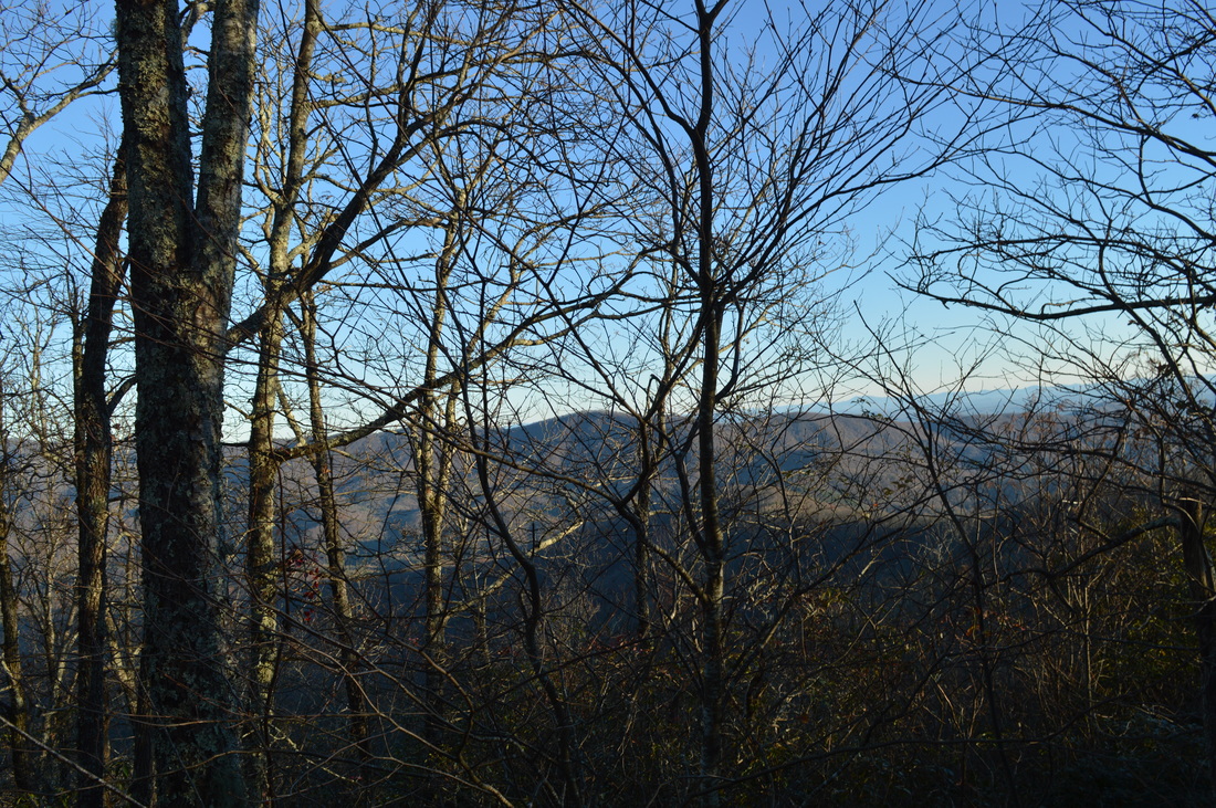
​The Warriors Passage Trail is one of two National Recreational Trails in Cherokee National Forest. This seldom-traveled pathway traverses a couple of low-elevation stream valleys before climbing up to Waucheesi Mountain, a small bald summit with views across the Tellico Ranger District. This hike occurred on Saturday, November 14th, 2015. My plan was to hike the entire Warriors Passage Trail out and back from Lyons Creek Trailhead to Waucheesi Mountain.

Summary

 R/T Length of Trail: 12.9 Miles
Duration of Hike: 9:00​
Type of Hike: Out and Back
Difficulty Rating: 7 out of 10
Pros: First part of trail is well-marked
Cons: Potentially difficult crossing of Wildcat Creek (unless you decide to simply ford it); 0.4-mile section of trail is obliterated between Wildcat Creek Road and Bald River Road
Points of Interest: Vista from unnamed mountain near Bald River Road - 8 stars; Views from ​​​​Waucheesi Mountain - 5 stars
Trail Blaze Color(s): Waucheesi Mountain Trail - White
Best Season(s) to Hike: Winter
Beginning Point: Lyons Creek Trailhead (Old Furnace Trailhead)
Directions: From Tellico Plains, TN: Follow TN State Route 165 East for 2.2 miles. Then, bear right onto Old Furnace Road. Old Furnace Road is a narrow paved road that looks more like a driveway. It shortly turns to gravel. The road is passable by most passenger vehicles. Continue on the road for 2.9 miles. The start of the Warriors Passage Trail will be on the left, marked by a large wooden post labeled WP and a sign a bit down the trail.​​ Parking is very limited here. There is space for one car (possibly two) at the start of the trail. If you drive a bit further along the road, there will be a small pullout on the right with space for several cars.

Map

A map and some other information regarding this hike can be viewed here.

Details

After my recent favorite hike on the John Muir Trail, ​I decided to try another trail in the area: Warriors Passage Trail, the other National Recreational Trail in Cherokee National Forest. This trail proved to be not quite as beautiful as the John Muir Trail, nor as well-marked, but it's still a good hike.

There are two starting points for the Warriors Passage Trail:​ Lyons Creek Trailhead, also known as Old Furnace Trailhead, located on Old Furnace Road, and Waucheesi Mountain Trailhead, located on the top of Waucheesi Mountain on Waucheesi Lookout Road. The Warrors Passage Trail comes out onto Waucheesi Lookout Road nearly a mile north of the summit, but there is barely any parking space there. Wanting to hike from low point to high point (so that the return route would be easier), I started at Old Furnace Road. The trail starts off downhill following an old roadbed. There is a mileage sign near the start. The trail descends quickly into a valley with a small unnamed stream. At 0.3 miles, the trail encounters a series blowdown at the crossing of the small stream. There is a bypass of the blowdown if you keep left and then cross the stream just downstream. After this, the trail rises out of the valley and passes over some unnamed hills on its way to Wildcat Creek. Keep an eye out for the blazes and "WP" posts - they show the way at some crucial turns. At 0.9 miles, the trail approaches Wildcat Creek and a flat suitable for camping. Here, make a sharp left and follow the creek downstream to a crossing at 1 mile. This is a wet ford (a shallow one)... unless you want to do what I did on a frigid November day - scramble across the large fallen tree to the left of the crossing. It may take some time, but it'll keep you dry.

From Wildcat Creek, the trail ascends steeply out of the valley. After the initial ascent, the trail levels out and then descends to an unnamed tributary of Wildcat Creek. Rock hop the small stream at 1.1 miles and move through a muddy area before recrossing the stream at 1.2 miles. The trail then ascends up ​a valley where the path is not much more than a game trail. Luckily, blazes are plentiful - keep an eye out for them. After you rise out of the valley, you'll ascend up to an unnamed ridge. Cross the ridge as well as an old road at 1.9 miles. A wooden post directs the trail across the ridge down another old road to Wildcat Creek Road. Reach Wildcat Creek Road at 2 miles. Do not cross the road - turn right onto a trail that parallels the road. Follow the trail parallel to the road, often in sight of the road, with several ups and downs, before crossing the road at 2.3 miles. The next 0.4 miles of the hike are some of the worst trail on the hike, as the trail is nearly obliterated. It is possible to avoid these 0.4 miles by following Wildcat Creek Road and then Bald River Road (as I did on my way back), but I wouldn't suggest in doing so, because you'll miss the best vista on this hike.

Cross the road and descend the other side of the road through a tangle of briars to a mileage sign. The next 0.2 miles of the trail are badly overgrown with briars and other brush. It is possible to make out the trail though - keep an eye out for the intermittent blazes. At 2.5 miles, the trail pops out onto an exposed ridge recovering from a previous fire. The view here is nothing short of spectacular. Straight ahead, Waucheesi Mountain rises proudly high. The Tobe Creek valley is visible, along with sections of Bald River Road. Beyond the valley, a hill rises up - the route of this trail farther on. To the right, lots of distant ridges and mountains rise up. Enjoy the view, and then continue on the trail... I mean, off-trail walk. There is no trace of a trail anywhere the next 0.2 miles. I walked to the top of a small hill with continuous views. Bald River Road is directly below you. It doesn't really matter which route you take here, as long as you end up on the section of Bald River Road below you and to your right. Whichever route you take, it'll be totally off-trail through brush and very steeply downhill. Once you reach Bald River Road,  turn right, and reach the crossing of the Warriors Passage Trail at 2.7 miles. Looking to the right, you can see some signs directing the "trail" straight up the burned slope without any signs of a path.

From Bald River Road, turn left onto the Warriors Passage Trail. I must say that from this point, there will be very few blazes, although generally, they are not needed - wooden posts mark key turns. Descend steeply on the trail into the Tobe Creek valley. At 3 miles, cross Tobe Creek. This should be a dry crossing most of the time. Tobe Creek is a tributary of Sixmile Creek, which in turn is a tributary of Wildcat Creek. After Tobe Creek, bear right on an old road and ascend gently out of the valley. At 3.2 miles, don't miss a sudden left turn off the old road. A wooden post marks the turn. I missed this turn and ended up backtracking a bit to locate it. From here, the trail will gradually ascend up the small mountain above Tobe Creek. There are numerous switchbacks to ease with the ascent. and even though the trail gets little use, you should be able to follow it. Approaching Mule Pen Gap, a steep side trail on the right will lead to private property. After this, you'll come over a small top and descend to Mule Pen Gap at 4.3 miles. An old road crosses Mule Pen Gap from right to left, and I believe that this road gives access to the private property nearby. Cross the road and then bear right at a trail marker into the woods on a flat, wide trail. This easy trail doesn't last long. At 4.5 miles, watch out for a wooden post that directs the trail sharply left. This next section is the most difficult section of the hike - the steep uphill doesn't let up for a while, and there are absolutely no switchbacks. The trail climbs up a narrow ridge with Tobe Creek on the left side and Rocky Branch on the right side.

After about half a mile of steep climbing along the ridge, some switchbacks appear as the trail enters a bizarre thick, dark forest. After five switchbacks, the trail returns to its straight-line climbing, although it is more gradual now. After a while, the trail exits the dark forest and climbs up a mountainside with open woods and good winter views. The switchbacks return as the trail is now ascending the main mass of Waucheesi Mountain. This part of the trail was built to not be difficult. You may notice a couple of old blazes. ​At 5.7 miles, scramble up onto Waucheesi Lookout Road and reach the southern terminus of Warriors Passage Trail. There is a small pullout here that could perhaps fit one car. To continue to the summit of Waucheesi Mountain, turn right. It is 0.8 miles to the summit along the road that ascends around 500 more feet. The road doesn't receive a lot of traffic, but it is an unpaved road in fairly good condition with a few small potholes. At 6.3 miles, pass a small service tower on the right. At 6.5 miles, reach the summit of Waucheesi Mountain at a turnaround in an open area. A large service tower is to the right. The views are good but not excellent due to trees approaching the summit from all sides. The best view is to the southwest and west. There are also some views to the east but these are best in winter, when the leaves are down.

Once you've taken in the view from Waucheesi Mountain, retrace your steps back to the trailhead the way you came. If you want to skip the trail section between Bald River Road and Wildcat Creek Road, remember you can hike the roads there instead. You'll return to the trailhead for a total roundtrip hike of 12.9 miles.​​

Variations

Hike out and back from Bald River Road to Waucheesi Mountain - 7.6 Miles
Hike out and back from Old Furnace Road to the vista near Bald River Road - 5 Miles​

Bonus Stops

​Bald River Falls on the Bald River is a very popular nearby roadside attraction.

Pictures

Sorry for the poor quality of some pictures. My camera was malfunctioning the entire day and I had to use manual settings which I do not operate very well yet. 
0 Comments


Leave a Reply.

    About Me

    Mark Oleg Ozboyd
    I'm an avid outdoor explorer and a hobbyist landscape photographer. I'm 21 years old and have been hiking since 2011. Originally based out of Atlanta, Georgia, I started out by occasionally hiking short trails throughout well-known Georgia State Parks. During 2012 and 2013, I began to expand my trips into adjacent states, as well as into the wilder National Forest areas rather than just State Parks. Throughout the years that followed, as I slowly ran out of popular hiking trails in my area, I began to search for and hike in more seldom-visited areas. Today, you can find me out in the woods every weekend, whether it's on an official trail or bushwhacking through cross-country terrain without any paths. I now attend Washington & Lee University and am exploring Virginia and West Virginia. My other hobbies include chess, science, old music, and meteorology. I have 3 years of amateur weather forecasting experience, having studied a lot of meteorology basics over the years. I am also a student at European School of Music where I learned that music and nature have a lot in common. Listening to good music inspires me to capture nature's beauty on the camera in different aspects that also make me recall many beautiful music pieces that I've heard.​


    Dear readers: I have invested a tremendous amount of time and effort in this website and the Georgia Waterfalls Database the past five years. All of the work that has gone in keeping these websites updated with my latest trip reports has almost been like a full-time job. This has not allowed me to pick up a paid job to save up money for college, and therefore, I I've had to take out loans. If you find the information on this website interesting, helpful, or time-saving, you can say "thanks" and help me out by clicking the button above and making a contribution. I will be very grateful for any amount of support you give, as all of it will apply toward my college tuition. Thank you! 

    Enter your email address to subscribe for trail reports:

    Delivered by FeedBurner


    Picture
    Coming in 2022-2023?

    Other Hiking Websites

    DWHike's Adventures
    Florida's Natural Wonders
    Florida Trailblazer
    Meanderthals
    Mountain Images
    by Bernie Boyer

    North Carolina Waterfalls with
    ​Kevin Adams
    Take-a-Hike!
    Tennessee Landforms
    Waterfall Page
    Waterfall Adventurer
    Zach's Mild Adventures

    Miles Hiked

    Year 1: 540.0 Miles
    Year 2: 552.3 Miles
    ​Year 3: 518.4 Miles
    Year 4: 482.4 Miles
    Year 5: 259.9 Miles

    Archives

    March 2021
    February 2021
    January 2021
    November 2019
    October 2019
    September 2019
    August 2019
    July 2019
    June 2019
    February 2019
    January 2019
    December 2018
    November 2018
    October 2018
    August 2018
    July 2018
    June 2018
    May 2018
    April 2018
    March 2018
    February 2018
    January 2018
    December 2017
    November 2017
    October 2017
    September 2017
    August 2017
    July 2017
    June 2017
    May 2017
    April 2017
    March 2017
    February 2017
    January 2017
    December 2016
    November 2016
    October 2016
    September 2016
    August 2016
    June 2016
    May 2016
    April 2016
    March 2016
    January 2016
    December 2015
    November 2015
    October 2015
    September 2015
    August 2015
    July 2015
    June 2015
    May 2015
    April 2015
    March 2015
    February 2015
    January 2015
    December 2014
    November 2014
    October 2014
    September 2014
    August 2014
    July 2014
    June 2014
    May 2014
    April 2014
    March 2014
    February 2014

    Categories

    All
    Adel
    Adirondack Park
    Alabama
    Alfred A. Ring Park
    Allegheny Trail
    Amicalola Falls State Park
    Anniston Area
    Apalachicola Bluffs And Ravines Preserve
    Apalachicola National Forest
    Apalachicola/Port St. Joe Area
    Apopka
    Appalachian Trail
    Appling
    Art Loeb Trail
    Aska Trail System
    Bakersville
    Balm-Boyette Scrub Preserve
    Balsam Lake Recreation Area
    Bankhead National Forest
    Bartow County Parks
    Bartram Trail
    Basinger
    Beersheba Springs
    Benton
    Benton Mackaye Trail
    Berry College Trail System
    Best Hike
    Big South Fork National Recreation Area
    Black Bear Wilderness
    Black Rock Mountain State Park
    Blairsville
    Blakely
    Blood Mountain Wilderness
    Blowing Rock
    Blue Ridge
    Blue Ridge Parkway
    Boone
    Bradenton
    Bradenton Beach
    Brasstown Bald
    Brasstown Wilderness
    Brevard
    Bryson City
    Buchanan
    Bucks Pocket State Park
    Bulow Creek State Park
    Bulow Plantation Ruins State Park
    Caesars Head State Park
    Caladesi Island State Park
    Calhoun
    Camel's Hump State Park
    Cashiers
    Caspersen Beach Park
    Catfish Creek State Park
    Caves
    CC Putnam State Forest
    Cedar Point Environmental Park
    Chatsworth
    Chattahoochee National Forest
    Chattanooga
    Chattanooga Valley
    Chattooga National Wild And Scenic River
    Cheaha Wilderness
    Cherohala Skyway
    Cherokee
    Cherokee National Forest
    Chiefland Area
    Chillhowee Recreation Area
    Chipley
    Chunky Gal Trail
    Circle B Bar Reserve
    Citico Creek Wilderness
    Citrus Wildlife Management Area
    Clarkesville
    Clayton
    Cleevland
    Cleveland
    Cloudland Canyon State Park
    Cohutta Wilderness
    Collier-Seminole State Park
    Cordele
    Cornelia
    Covington
    Crestview Area
    Crew-land-and-water-trust
    Cullowhee
    Cumberland Trail
    Dahlonega
    Dalton
    Dawson Forest Wildlife Management Area
    Dawsonville
    Dayton
    De Soto National Memorial
    DeSoto State Park
    Dillard
    Double Springs
    Ducktown
    Duncan Ridge Trail
    Dunlap
    Eagle's Rest Park
    Eastpoint
    Econfina Creek Wildife Management Area
    Eglin Air Force Base
    Elizabethton
    Elkins
    Elk Knob Game Lands
    Elk Park
    Ellicott Rock Wilderness
    Ellijay
    Emerson Point Preserve
    Englewood Area
    Enota Retreat
    Erwin
    Falling Waters State Park
    Fayetteville
    Fires Creek Recreation Area
    Fire Tower
    Flint River
    Florence Area
    Florida
    Florida Caverns State Park
    Florida Trail
    Foothills Trail
    Fort Mountain State Park
    Fort Myers Area
    Fort Payne
    Fort Payne Area
    Fort Yargo State Park
    Franklin
    Franklin Delano Roosevelt State Park
    Franklin-Marion State Forest
    Frozen Head State Park
    Gainesville
    Gainesville Area
    Gatlinburg
    George Washington National Forest
    Georgia
    Georgia Veterans Memorial State Park
    Glasgow
    Gorges State Park
    Grandfather Mountain State Park
    Great Smoky Mountains National Park
    Greeneville
    Green River Game Lands
    Gruetli-Laager
    Grundy Forest State Natural Area
    GTM Reserve
    Guana River Wildlife Management Area
    Hayesville
    Helen
    Hiawassee
    High Falls State Park
    Highlands
    Highlands Scenic Highway
    Hillsborough River State Park
    Hinson Conservation & Recreation Area
    Historic Sites
    Honeymoon Island State Park
    Hot Springs
    Huntington
    Inverness Area
    Jackson
    Jasper
    Jefferson National Forest
    Joan M. Durante Park
    Jonathan Dickinson State Park
    Jones Gap State Park
    Joyce Kilmer Slickrock Wilderness
    Joyce Kilmer - Slickrock Wilderness
    Juniper Prairie Wilderness
    Kelly Park
    Keown Falls Recreation Area
    Kolomoki Mounds State Park
    LaFayette
    Lake City Area
    Lake George Wild Forest
    Lake June-in-Winter State Park
    Lakeland Area
    Lake Placid
    Lake Russell Wildlife Management Area
    Lake Wales Ridge State Forest
    Laurel Fork North Wilderness
    Leffis Key Preserve
    Leon Sinks Geological Area
    Lexington
    Lineville
    Linville
    Linville Gorge Wilderness
    Lithia Springs
    Little Frog Wilderness
    Little Manatee River State Park
    Little River Canyon National Preserve
    Longboat Key
    Long Trail
    Lookout Mountain
    Lookout Mountain Battlefield
    Lovingston
    Lula Lake Land Trust
    Lumpkin
    Maggie Valley
    Manatee Springs State Park
    Marianna Area
    Mark Trail Wilderness
    Marlinton
    Mccaysville
    McMinville
    Mentone
    Middlesex
    Mistletoe State Park
    Monongahela National Forest
    Montreat
    Mountain Bridge Wilderness Area
    Mountain City
    Mountains To Sea Trail
    Mountains-to-Sea Trail
    Mount Rogers National Recreation Area
    Myakka River State Park
    Myron B. Hodge City Park
    Nantahala National Forest
    Naples
    Naples Area
    Natural Bridge State Park
    Neal Preserve
    New Castle
    Newport
    New River Gorge National Park
    New York
    North Carolina
    Ocala Area
    Ocala National Forest
    Ocean-to-Lake Trail
    Oconee State Park
    Oconee Station Historic Site
    Okaloacoochee Slough State Forest
    Oldsmar
    Oneida
    Orlando Area
    Ormond Beach
    Oscar Scherer State Park
    Oxford
    Palatka
    Palmetto Trail
    Panama City Area
    Panthertown Valley
    Parrish
    Paynes Creek Historic State Park
    Peaks Of Otter Recreation Area
    Pigeon Crockford Mountain Wildlife Management Area
    Pigeon-Crockford Mountain Wildlife Management Area
    Pigeon-Crockford Wildlife Management Area
    Pine Mountain
    Pinhoti Trail
    Pinnacle Park
    Pisgah Civitan Park
    Pisgah National Forest
    Pittman Center
    Pond Mountain Wilderness
    Ponds/Lakes
    Prentice Cooper State Forest
    Providence Canyon State Park
    Pumpkintown
    Quick Point Nature Preserve
    Raven Cliffs Wilderness
    Reed Bingham State Park
    Reliance
    Rice Creek Conservation Area
    Riverview Pointe Preserve
    Robbinsville
    Robinson Preserve
    Rock Creek Gorge Scenic Area
    Rock Island State Park
    Rome
    Rosman
    Sale Creek
    Salem
    Salt Springs
    Saluda
    Santa Rosa Beach
    Sarasota
    Sarasota Area
    Savage Gulf State Natural Area
    Scenic Views
    Scottsboro Area
    Sebring Area
    Sewanee
    Sheltowee Trace Trail
    Shining Rock Wilderness
    Signal Mountain
    Sipsey Wilderness
    Sky Valley
    Smithgall Woods State Park
    Snowbird Backcountry Area
    Soddy Daisy
    Soddy-Daisy
    Sopchoppy
    South Carolina
    South Cumberland State Park
    Southeastern Cave Conservancy
    Southern Nantahala Wilderness
    Sparta
    Sprewell Bluff Park
    Spring City
    Spring Hill
    Springs
    Spruce Pine
    Standing Indian Backcountry Area
    St. Augustine
    St. George Island State Park
    St. Joseph Bay State Buffer Preserve
    St. Marks Area
    St. Marks National Wildlife Refuge
    Stone Mountain
    Stone Mountain Park
    Suches
    Sumatra
    Sumter National Forest
    Suwannee River
    Swallow Creek Wildlife Management Area
    Sweetwater Creek State Park
    Sylva
    Talladega National Forest
    Tallahassee Area
    Tallulah Falls
    Tallulah Gorge State Park
    Tampa Bay Area
    Tate City
    Tate's Hell State Forest
    Tea Creek Wildlife Management Area
    Tellico Plains
    Tennessee
    Thomaston
    Toccoa
    Topsail Hill State Park
    Torreya State Park
    Townsend
    Tracy City
    Tray Mountain Wilderness
    Trenton
    Triple Creek Preserve
    Troutdale
    Unaka Mountain Wilderness
    Upper Tampa Bay County Park
    Venice
    Vermont
    Virgin Falls State Natural Area
    Virginia
    Virginia Outdoors Foundation
    Vogel State Park
    Wakulla Springs State Park
    Waleska
    Walhalla
    Wartburg
    Water Features
    Waynesville
    Weedon Island Preserve
    Weeki Wachee Preserve
    Wekiwa Springs State Park
    West Palm Beach Area
    West Virginia
    Whitehall
    White Springs
    Winder
    Withlacoochee State Forest
    Young Harris

    RSS Feed

TRAIL REPORTS

Hikes in Alabama
​Hikes in Florida
Hikes in Georgia
Hikes in North Carolina
Hikes in South Carolina
Hikes in Tennessee
Hikes in Virginia

Hiking Resources

Alabama Resources
​
Florida Resources
Georgia Resources
North Carolina Resources
​South Carolina Resources
​
Tennessee Resources

Other

Contact
Map of Hikes
Alphabetical List of Hikes
Southeast Nature Society
© COPYRIGHT 2014-2024
​ALL RIGHTS RESERVED.
Important: I disclaim any responsibility for any damage or personal injury that may occur as a result of the activities and information found on this website. All outdoor activities, especially off-trail hiking, are done at your own risk. Never hike or head into that area that may be above your fitness or experience level.
  • Home
  • Trail Reports
    • Best Hikes
    • Hikes with Scenic Views
    • Hikes with Water Features
    • Alabama
    • Georgia
    • Florida
    • North Carolina
    • South Carolina
    • Tennessee
    • Vermont
    • Virginia
  • Map
  • Hike List
  • Testimonials
  • Resources
  • Contact Us
  • Southeast Nature Society
    • Our Team
  • Georgia Waterfalls Database