HIKING THE APPALACHIANS AND BEYOND
  • Home
  • Trail Reports
    • Best Hikes
    • Hikes with Scenic Views
    • Hikes with Water Features
    • Alabama
    • Georgia
    • Florida
    • North Carolina
    • South Carolina
    • Tennessee
    • Vermont
    • Virginia
  • Map
  • Hike List
  • Testimonials
  • Resources
  • Contact Us
  • Southeast Nature Society
    • Our Team
  • Georgia Waterfalls Database

Collier-Seminole State Park: Adventure Hiking Trail, Naples, Florida

12/22/2015

7 Comments

 
Picture
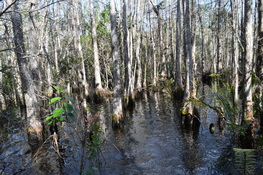
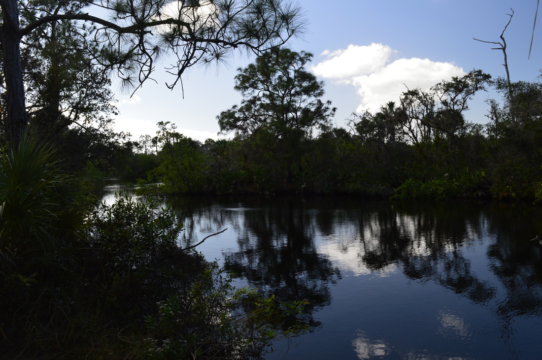
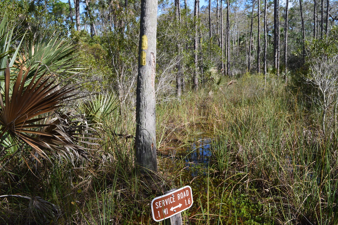
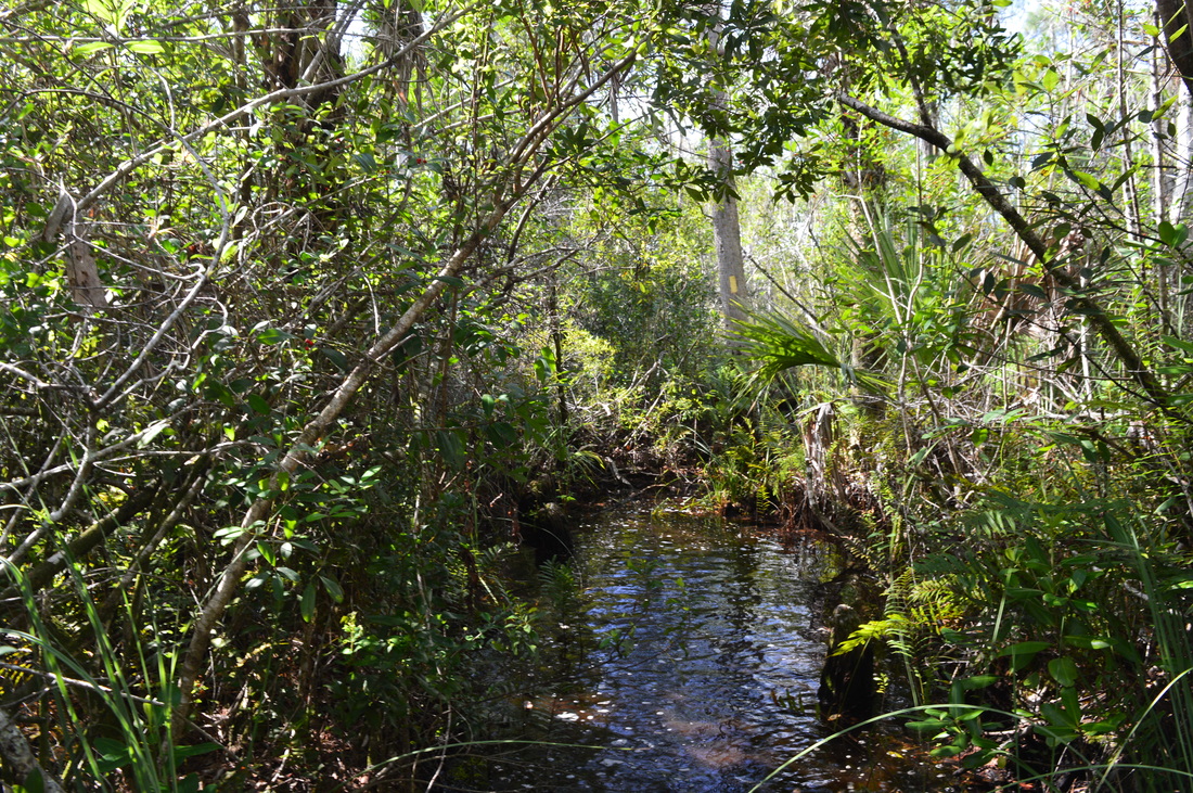
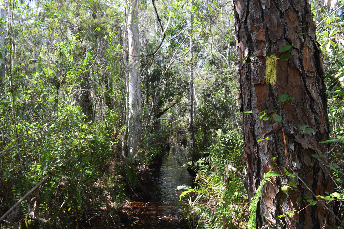
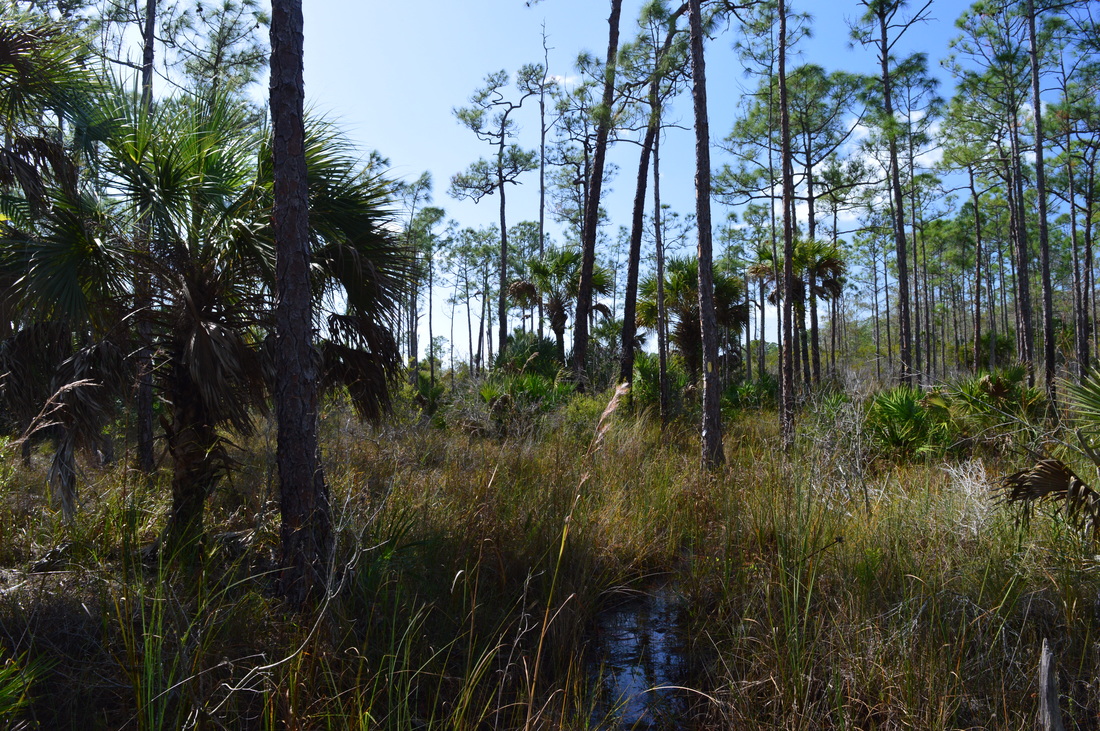
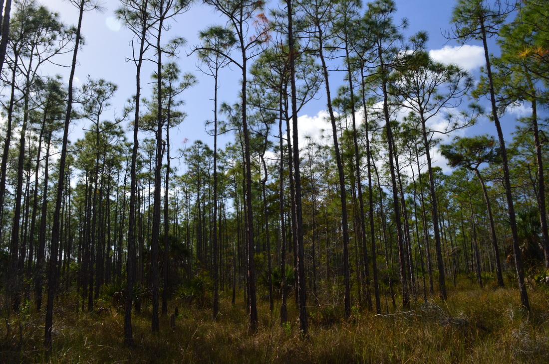
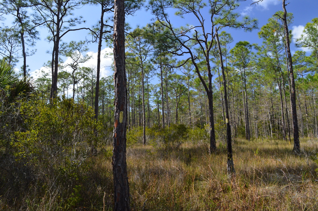
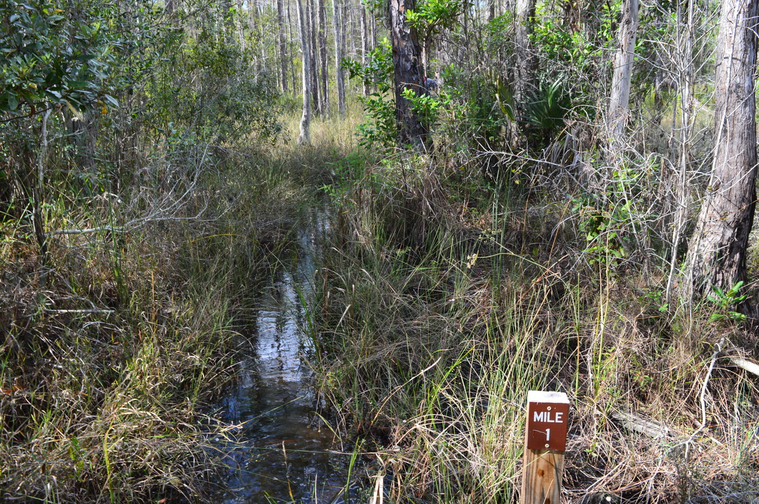
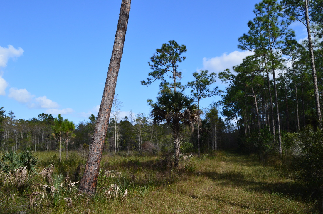
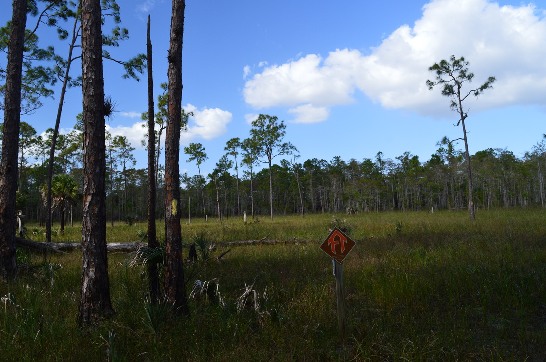
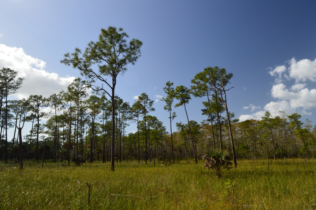
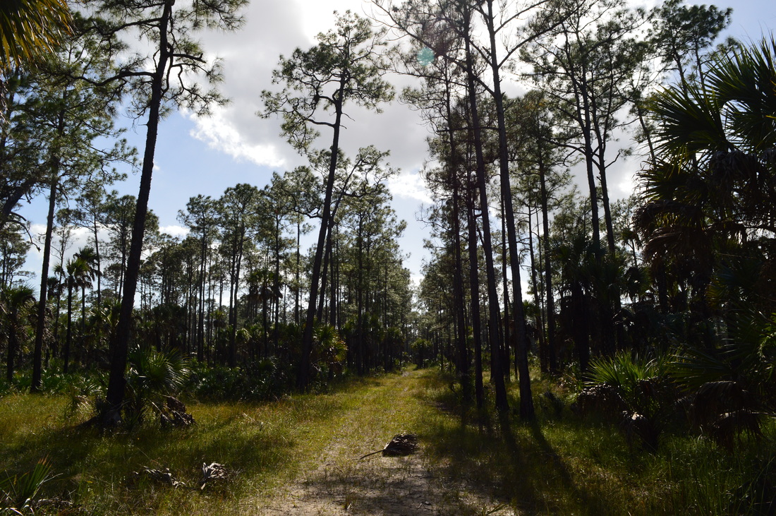
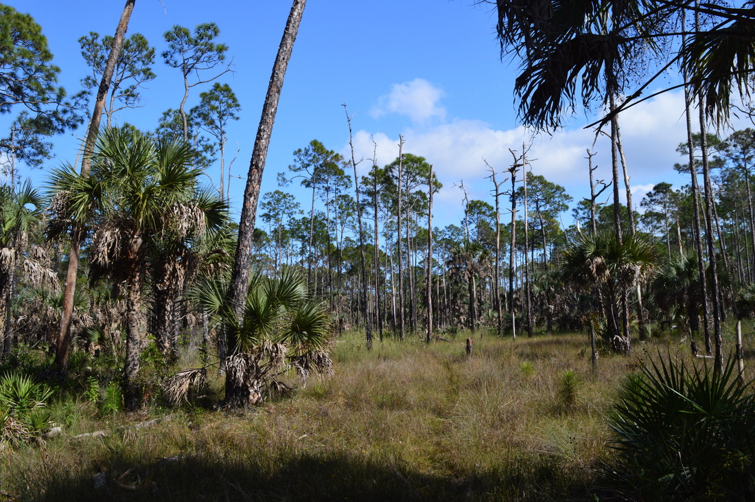
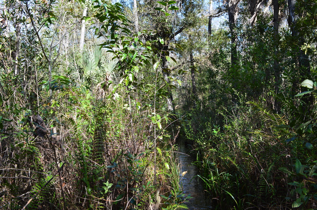
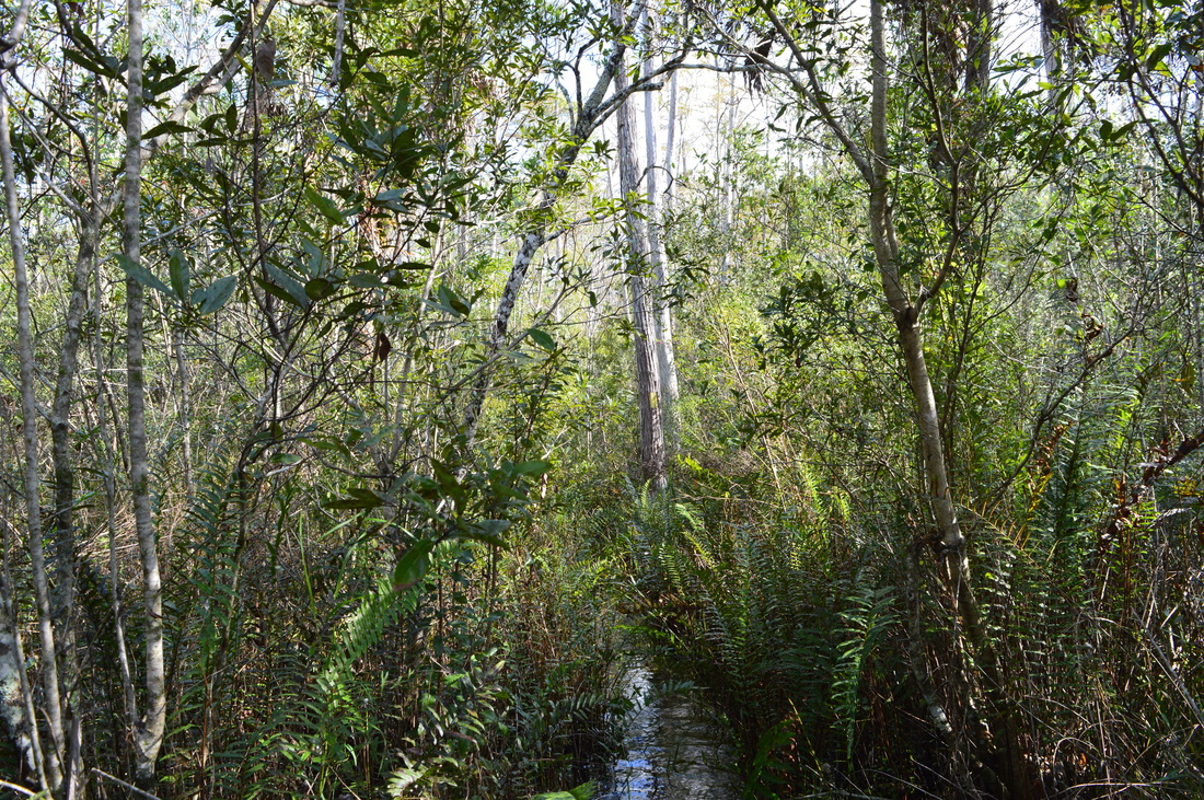
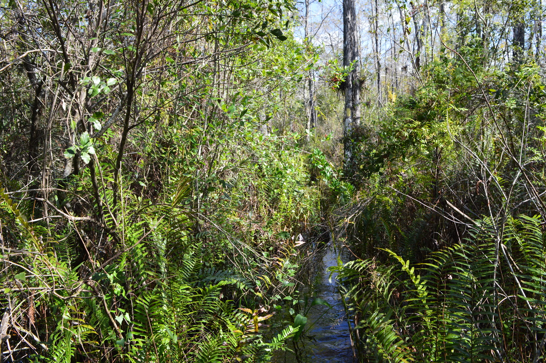
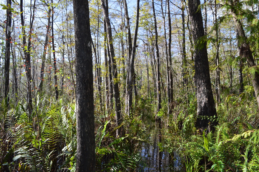
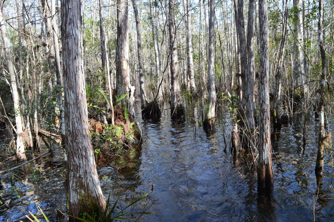
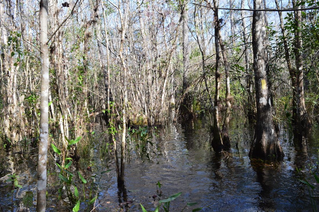
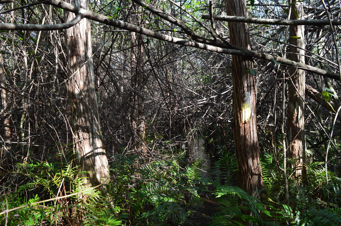
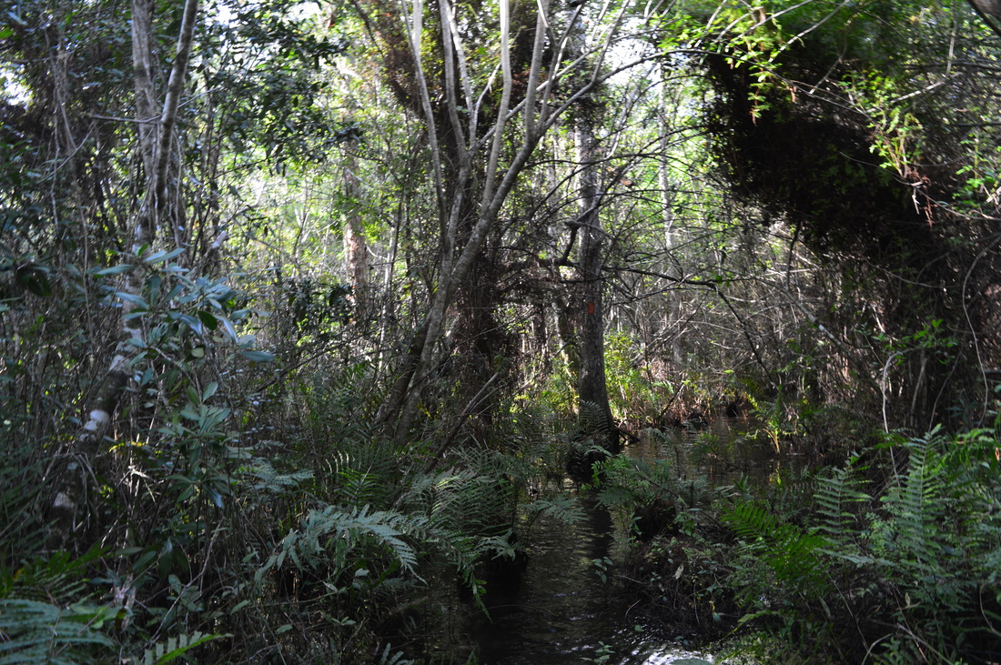
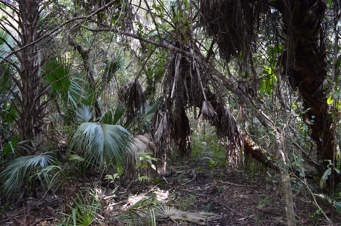
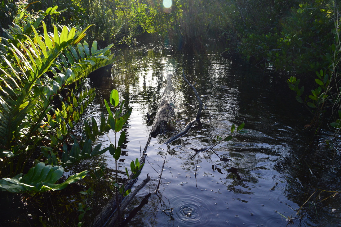
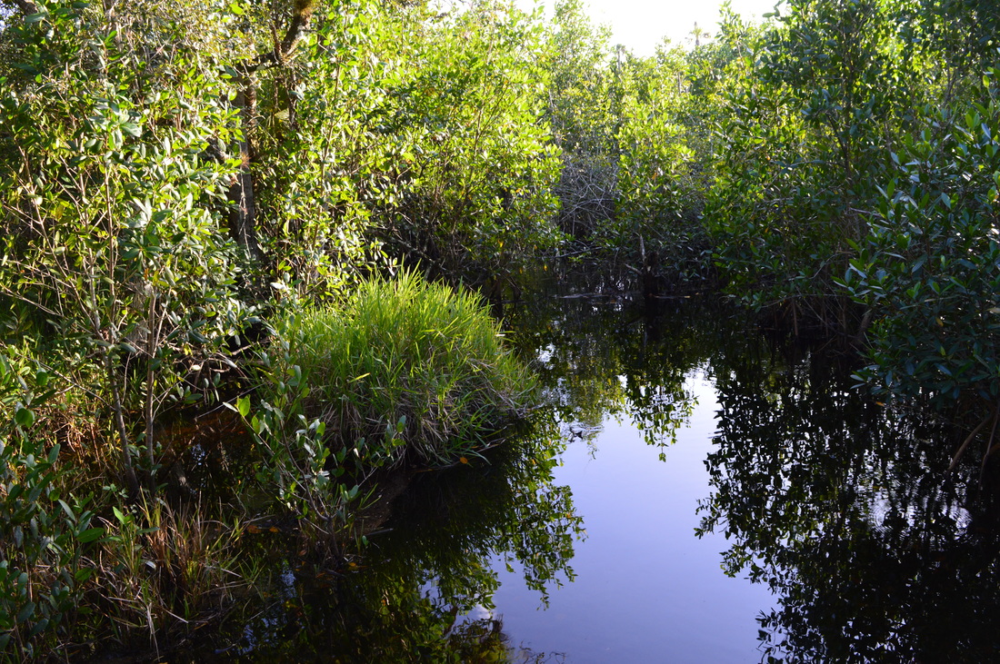
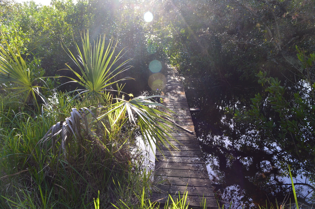
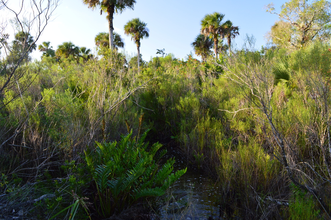
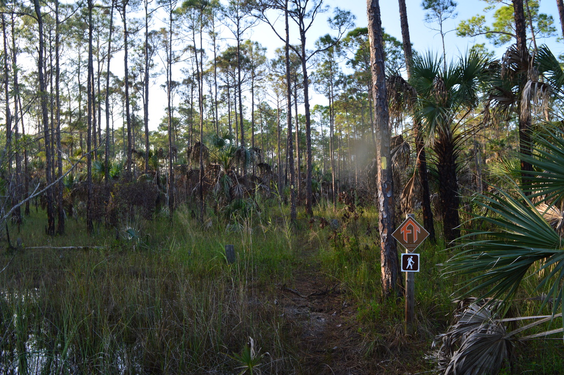
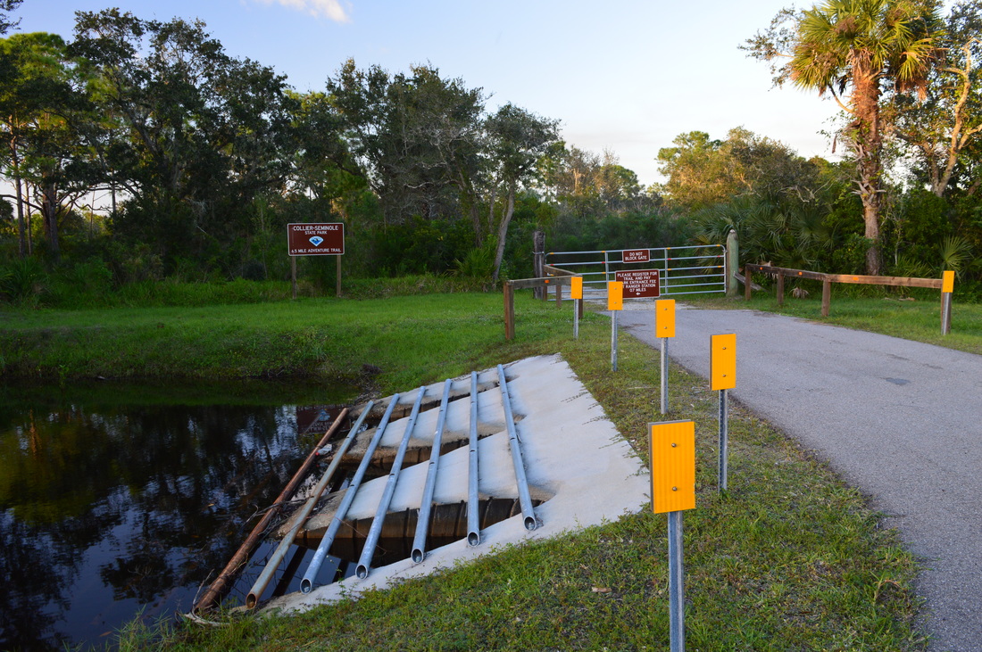
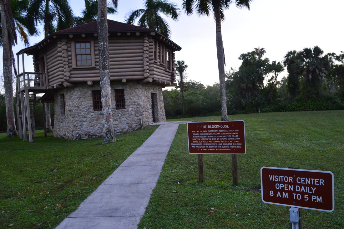
​You have probably wanted to see the famous swamp network known as the Everglades... from the safety of a wide, dry boardwalk. But have you wanted to see this enormous, wild swamp the hard way? Collier-Seminole State Park, on the western edge of the Everglades, protects a section of the swamp where black bears and Florida panthers abound. The primary focus on hiking in the park is the "Adventure Trail", a nearly 7-mile long slog across the dark swamp waters into one of Florida's most remote areas. This hike occurred on Thursday, November 26th, 2015 (Thanksgiving Day). My plan was to hike the Adventure Hiking Trail loop counter-clockwise, although by the time I was 2/3 of the way through, I was confident that the opposite direction would've been better.

Summary

R/T Length of Trail: 6.8 Miles
Duration of Hike: 4:30
Type of Hike: Loop
Difficulty Rating: 9 out of 10
Pros: In the east section of the loop, there are some dry areas
Cons: Deep mud along with deep water in the southwest section of the trail; you may need some navigational skills to navigate through the endless swamp and its maze of trees on the west side of the loop
Points of Interest: There's not really any points of interest on this hike - much of the hike is in the Everglades swamp network, and that is the main area of interest
Trail Blaze Color(s): Connector Trail to Main Loop - Blue; Adventure Hiking Trail (Main Loop) - Orange/Orange-Yellow; Spur Trail to Campsite - Blue
Best Season(s) to Hike: Winter; Early Spring​​​​​​​​
Beginning Point: Adventure Hiking Trailhead
Directions: From Naples, FL: Drive on US Route 41 South for 16.5 miles to the entrance of Collier-Seminole State Park to your right. At the ranger station or at the visitor center, pay your fee and obtain a code for the code to the gate at the road leading to the Adventure Trail. Then, return to US Route 41, and drive south on it for 0.8 miles. Then, turn left onto a dirt road. There is  gate at the beginning. Unlock the gate, open it, drive through, and make sure to close and lock the gate behind you. Continue on the narrow dirt road for 0.2 miles to a second gate and the signed trailhead. The trailhead is located near the upper end of a pond that is to the left of the road. The dirt road leading to the trailhead should be passable by most passenger vehicles as long as you exercise some carefulness.

Map

A map and some other information regarding this hike can be viewed here.

Details

Back when I added Florida to the list of states covered on this website, I never imagined a Florida trail report that would have a difficulty rating of 9. After all, a 9 is almost the highest difficulty rating, and in the mountains, it would mean a long (maybe hard-to-follow) hike with many miles of ascent. In Florida, there can't be much elevation change, so why a 9? The answer lies in the words "swamp slogging", a type of hiking that is fairly common in Florida. On this hike in Collier-Seminole State Park, you're going to be walking through water the better part of nearly 7 miles, and sometimes, it'll get as deep as waist-deep. The thing is, that's just one part of the problem. Much of the slog through the swamp will also involve scrambling and crawling  through a jungle-like forest that grows in these remote swamps. And don't forget the foot of mud under all the water in the southwest section of the loop - you'll have to just make sure you're not left barefoot. Even though this hike does have some unique scenery, you're going to have to feel really adventurous to enjoy it.

The hike starts on the short access trail from the dirt road that you parked on.​ The access trail begins across from the pond, on the right side of the road. It is well-marked by signs. The path is not very clear but there are frequent blazes. Nearly right away, you'll cross some seasonally wet areas. Pretty much every seasonally wet area was wet on this day, despite the fact that it was late November, the beginning of the dry season. At 0.2 miles, the beginning of the loop is reached. The "recommended direction" is counter-clockwise, but honestly, the clockwise direction is significantly better. If you hike the trail clockwise, you'll have the hardest part with the mud at the beginning, and from there, the farther you get into the hike, the easier it gets. The way I hiked it, it was a complete opposite. However, I'll describe the hike in the direction I hiked it (I still do not recommend that direction).

After turning right onto the main orange-blazed trail, things got wet rapidly. The trail entered a small cypress swamp. The water here is between ankle and knee-deep, although I've read that during the dry season, this area should be dry. Despite the water, it is easy to hike fast here, as the trail is clear, wide, and well-blazed. You'd better increase your pace here because no matter what, it's going to slow down later. After the first half-mile, the bulk of this small swamp is over, although it'll take a while before the trail fully dries out. The trail continues through open woods with rather long-reaching panoramas around you. Around 1.5 miles, the trail dries out, and at 1.7 miles, cross an old road that is a branch of the road leading to the trailhead. Continue across the road into a field with pine flatwoods all around. This may be a good spot to wait for a bear to stroll out of the forest. After this, the trail stays mostly dry before crossing another old road at 2 miles. This is the same road that you drove on your way to the trailhead. If you want to avoid the difficult section of the hike, you can use the road here for a shortcut. Otherwise, continue straight. You'll soon pass a bench to your right. The trail picks up an old roadbed that is still mostly dry. Savor this dry section - you won't see much dry ground for a while. At around 2.3 miles, the old roadbed disappears as the trail plunges into the swamp. It seems like this area is seasonally dry too, at least according to maps, although it's hard to imagine it. The trail narrows and the water is ankle to knee-deep. At 2.9 miles, the trail briefly dries out at a junction with the spur trail to the campsite. It is 0.4 miles to the campsite that is to your left. The main trail turns right and quickly turns wet again.

The trail continues to stay narrow - also, it steadily becomes more overgrown and less maintained. Keep an eye out for the orange blazes. As the trail heads deep into the swamp, cypress trees surround you as you slog knee-deep or deeper through dark waters. There will be a couple spots over the next couple of miles where the water gets close to waist-deep. Also, around 4 miles, the blazes suddenly become very intermittent. There is surveyor's tape that marks several key turns in the trail. Try to follow what looks like the widest route trough the water, and you should be able to make your way through the swamp. Once again, do not go here and do not hike this trail if you lack navigational skills. After several miles of swamp slogging, the trail finally hits dry ground at about 4.7 miles. One might hope that the swamp slogging is over, and in fact, the bulk of it is over, but there's some bad news - a really difficult section with mud is still coming up. The trail briefly becomes wet several times as it continues through this thick forest. At around 5.2 miles, you may be able to catch sight of the Miccosukee Indian Reservation through the thick forest your right. Even if you don't, there's no doubt you're going to become aware of their presence because of the trash on this section of the hike! The trail suddenly becomes wet again at around 5.7 miles, and this is the most difficult section of the hike. The trail crosses a large stretch of swamp, where the water was waist-deep when I did this hike. And below the deep water was a deep layer of... mud. Hiking poles are a must here to help keep your balance. Walk very slowly through the swamp, one step at a time, or you may slip or get stuck in the deep mud... or, you may be left barefoot, something that almost happened to me!

Out of nowhere, you will run into a well-built footbridge across one of the sloughs. Following this footbridge are two more. These three footbridges are the things you'd least expect to see on this trail, and they're the only footbridges on the hike. Well, at least you know the Florida Trail Association has tried to do something here. After these footbridges, the swamp slogging is still not over, and at 6 miles, you will make another plunge into the deep, muddy swamp. This is the final section of swamp, and it is as difficult as ever - continue going slowly. Then, the trail rises out of the deep swamp and passes through a seasonally wet area with the familiar pine flatwoods visible not far away. At 6.45 miles, reach the old road that leads to the trailhead. You can walk back along the road, but I chose to finish by trail. Cross the road and continue on a dry trail through flatwoods. At 6.6 miles, reach the end of the loop. Turn right onto the access trail, and return to the trailhead at 6.8 miles. Congratulations - you have completed successfully one of Florida's most difficult hikes. ​

Variations

​​Shortcut the hike using old road at 2-mile mark - 3.2 Miles

Bonus Stops

Possible bonus stops for this hike include the nature trail in Collier-Seminole State Park and the Hike/Bike Trail in the northwest section of the park.

Pictures

Videos

7 Comments
Pilot searcher (Brian)
12/22/2015 09:23:26 pm

This hike was made famous in 2007 when it became a 7-stage Geocache (Lemmings Loop)(GC11MA3), It has been done by 97 geocachers since then. I did it on 4/22/2010, If you do it as a geocachche, you hike it counter clockwise. There is another Geocache called "The Ghost Orchid" (GC112JY) that is nearby in the Fakahatchee Strand. It was created 2/21/2007. It has 5 stages and there are NO trails! It's all orienteering in the swamp. 82 geocachers have completed this geocache. I first did it on 2/28/2009 and have done it two more times since. To find out more, go to "Geocaching.com" and look for these two geocaches. I agree that Lemmings Loop is a great hike, but The Ghost Orchid makes it seem easy by comparison. I think that you would enjoy reading the logs from these two geocaches.

Reply
Mark Oleg
12/23/2015 10:26:07 am

I never knew that this hike has the name Lemmings Loop as well. As to the other hike, I'd certainly not be interested heading off-rail into the strand! The trails are bad enough already.

Reply
Geoff Jacobs
11/7/2016 01:10:52 pm

Haha! I can't believe you actually slopped through those water-filled trails and swamps! Oh well, that's Florida, right?!!
I camped with my family here as a young teenager, this was a beautiful, but lonely place. Not a lot to do unless you just want to get away and enjoy the peace & quiet & nature.
I did, however, climb to the top of the digging arm of that Walking Crane, hahaha! Teenage fun...

Reply
Pilot searcher (Brian)
11/7/2016 01:29:00 pm

If you ever get back to Collier Seminole State Park, you need to rent a canoe and do the Blackwater River. If you are really ambitious, try to do the Geocache called "Blackwater River" (GC1BTX6). It is a multi-stage cache that takes you on a 14-mile trip looking for answers to questions to get the coordinates for the final location. You will get to see another side of this great park. By the way, there is another geocache hidden under that "Walking Crane!"

Reply
Mark Oleg
11/7/2016 08:48:49 pm

I liked the pristine wilderness at Collier-Seminole State Park. I wasn't very accustomed to such wet hiking though, and I am not sure that it is something I will do again.

William Sease link
8/31/2023 02:47:32 pm

The thing is, that's just one part of the problem. Much of the slog through the swamp will also involve scrambling and crawling through a jungle like forest that grows in these remote swamps. Thank you for taking the time to write a great post!

Reply
Leahs Thoughts link
9/7/2023 01:17:03 am

Great bloog you have

Reply


Leave a Reply.

    About Me

    Mark Oleg Ozboyd
    I'm an avid outdoor explorer and a hobbyist landscape photographer. I'm 21 years old and have been hiking since 2011. Originally based out of Atlanta, Georgia, I started out by occasionally hiking short trails throughout well-known Georgia State Parks. During 2012 and 2013, I began to expand my trips into adjacent states, as well as into the wilder National Forest areas rather than just State Parks. Throughout the years that followed, as I slowly ran out of popular hiking trails in my area, I began to search for and hike in more seldom-visited areas. Today, you can find me out in the woods every weekend, whether it's on an official trail or bushwhacking through cross-country terrain without any paths. I now attend Washington & Lee University and am exploring Virginia and West Virginia. My other hobbies include chess, science, old music, and meteorology. I have 3 years of amateur weather forecasting experience, having studied a lot of meteorology basics over the years. I am also a student at European School of Music where I learned that music and nature have a lot in common. Listening to good music inspires me to capture nature's beauty on the camera in different aspects that also make me recall many beautiful music pieces that I've heard.​


    Dear readers: I have invested a tremendous amount of time and effort in this website and the Georgia Waterfalls Database the past five years. All of the work that has gone in keeping these websites updated with my latest trip reports has almost been like a full-time job. This has not allowed me to pick up a paid job to save up money for college, and therefore, I I've had to take out loans. If you find the information on this website interesting, helpful, or time-saving, you can say "thanks" and help me out by clicking the button above and making a contribution. I will be very grateful for any amount of support you give, as all of it will apply toward my college tuition. Thank you! 

    Enter your email address to subscribe for trail reports:

    Delivered by FeedBurner


    Picture
    Coming in 2022-2023?

    Other Hiking Websites

    DWHike's Adventures
    Florida's Natural Wonders
    Florida Trailblazer
    Meanderthals
    Mountain Images
    by Bernie Boyer

    North Carolina Waterfalls with
    ​Kevin Adams
    Take-a-Hike!
    Tennessee Landforms
    Waterfall Page
    Waterfall Adventurer
    Zach's Mild Adventures

    Miles Hiked

    Year 1: 540.0 Miles
    Year 2: 552.3 Miles
    ​Year 3: 518.4 Miles
    Year 4: 482.4 Miles
    Year 5: 259.9 Miles

    Archives

    March 2021
    February 2021
    January 2021
    November 2019
    October 2019
    September 2019
    August 2019
    July 2019
    June 2019
    February 2019
    January 2019
    December 2018
    November 2018
    October 2018
    August 2018
    July 2018
    June 2018
    May 2018
    April 2018
    March 2018
    February 2018
    January 2018
    December 2017
    November 2017
    October 2017
    September 2017
    August 2017
    July 2017
    June 2017
    May 2017
    April 2017
    March 2017
    February 2017
    January 2017
    December 2016
    November 2016
    October 2016
    September 2016
    August 2016
    June 2016
    May 2016
    April 2016
    March 2016
    January 2016
    December 2015
    November 2015
    October 2015
    September 2015
    August 2015
    July 2015
    June 2015
    May 2015
    April 2015
    March 2015
    February 2015
    January 2015
    December 2014
    November 2014
    October 2014
    September 2014
    August 2014
    July 2014
    June 2014
    May 2014
    April 2014
    March 2014
    February 2014

    Categories

    All
    Adel
    Adirondack Park
    Alabama
    Alfred A. Ring Park
    Allegheny Trail
    Amicalola Falls State Park
    Anniston Area
    Apalachicola Bluffs And Ravines Preserve
    Apalachicola National Forest
    Apalachicola/Port St. Joe Area
    Apopka
    Appalachian Trail
    Appling
    Art Loeb Trail
    Aska Trail System
    Bakersville
    Balm-Boyette Scrub Preserve
    Balsam Lake Recreation Area
    Bankhead National Forest
    Bartow County Parks
    Bartram Trail
    Basinger
    Beersheba Springs
    Benton
    Benton Mackaye Trail
    Berry College Trail System
    Best Hike
    Big South Fork National Recreation Area
    Black Bear Wilderness
    Black Rock Mountain State Park
    Blairsville
    Blakely
    Blood Mountain Wilderness
    Blowing Rock
    Blue Ridge
    Blue Ridge Parkway
    Boone
    Bradenton
    Bradenton Beach
    Brasstown Bald
    Brasstown Wilderness
    Brevard
    Bryson City
    Buchanan
    Bucks Pocket State Park
    Bulow Creek State Park
    Bulow Plantation Ruins State Park
    Caesars Head State Park
    Caladesi Island State Park
    Calhoun
    Camel's Hump State Park
    Cashiers
    Caspersen Beach Park
    Catfish Creek State Park
    Caves
    CC Putnam State Forest
    Cedar Point Environmental Park
    Chatsworth
    Chattahoochee National Forest
    Chattanooga
    Chattanooga Valley
    Chattooga National Wild And Scenic River
    Cheaha Wilderness
    Cherohala Skyway
    Cherokee
    Cherokee National Forest
    Chiefland Area
    Chillhowee Recreation Area
    Chipley
    Chunky Gal Trail
    Circle B Bar Reserve
    Citico Creek Wilderness
    Citrus Wildlife Management Area
    Clarkesville
    Clayton
    Cleevland
    Cleveland
    Cloudland Canyon State Park
    Cohutta Wilderness
    Collier-Seminole State Park
    Cordele
    Cornelia
    Covington
    Crestview Area
    Crew-land-and-water-trust
    Cullowhee
    Cumberland Trail
    Dahlonega
    Dalton
    Dawson Forest Wildlife Management Area
    Dawsonville
    Dayton
    De Soto National Memorial
    DeSoto State Park
    Dillard
    Double Springs
    Ducktown
    Duncan Ridge Trail
    Dunlap
    Eagle's Rest Park
    Eastpoint
    Econfina Creek Wildife Management Area
    Eglin Air Force Base
    Elizabethton
    Elkins
    Elk Knob Game Lands
    Elk Park
    Ellicott Rock Wilderness
    Ellijay
    Emerson Point Preserve
    Englewood Area
    Enota Retreat
    Erwin
    Falling Waters State Park
    Fayetteville
    Fires Creek Recreation Area
    Fire Tower
    Flint River
    Florence Area
    Florida
    Florida Caverns State Park
    Florida Trail
    Foothills Trail
    Fort Mountain State Park
    Fort Myers Area
    Fort Payne
    Fort Payne Area
    Fort Yargo State Park
    Franklin
    Franklin Delano Roosevelt State Park
    Franklin-Marion State Forest
    Frozen Head State Park
    Gainesville
    Gainesville Area
    Gatlinburg
    George Washington National Forest
    Georgia
    Georgia Veterans Memorial State Park
    Glasgow
    Gorges State Park
    Grandfather Mountain State Park
    Great Smoky Mountains National Park
    Greeneville
    Green River Game Lands
    Gruetli-Laager
    Grundy Forest State Natural Area
    GTM Reserve
    Guana River Wildlife Management Area
    Hayesville
    Helen
    Hiawassee
    High Falls State Park
    Highlands
    Highlands Scenic Highway
    Hillsborough River State Park
    Hinson Conservation & Recreation Area
    Historic Sites
    Honeymoon Island State Park
    Hot Springs
    Huntington
    Inverness Area
    Jackson
    Jasper
    Jefferson National Forest
    Joan M. Durante Park
    Jonathan Dickinson State Park
    Jones Gap State Park
    Joyce Kilmer Slickrock Wilderness
    Joyce Kilmer - Slickrock Wilderness
    Juniper Prairie Wilderness
    Kelly Park
    Keown Falls Recreation Area
    Kolomoki Mounds State Park
    LaFayette
    Lake City Area
    Lake George Wild Forest
    Lake June-in-Winter State Park
    Lakeland Area
    Lake Placid
    Lake Russell Wildlife Management Area
    Lake Wales Ridge State Forest
    Laurel Fork North Wilderness
    Leffis Key Preserve
    Leon Sinks Geological Area
    Lexington
    Lineville
    Linville
    Linville Gorge Wilderness
    Lithia Springs
    Little Frog Wilderness
    Little Manatee River State Park
    Little River Canyon National Preserve
    Longboat Key
    Long Trail
    Lookout Mountain
    Lookout Mountain Battlefield
    Lovingston
    Lula Lake Land Trust
    Lumpkin
    Maggie Valley
    Manatee Springs State Park
    Marianna Area
    Mark Trail Wilderness
    Marlinton
    Mccaysville
    McMinville
    Mentone
    Middlesex
    Mistletoe State Park
    Monongahela National Forest
    Montreat
    Mountain Bridge Wilderness Area
    Mountain City
    Mountains To Sea Trail
    Mountains-to-Sea Trail
    Mount Rogers National Recreation Area
    Myakka River State Park
    Myron B. Hodge City Park
    Nantahala National Forest
    Naples
    Naples Area
    Natural Bridge State Park
    Neal Preserve
    New Castle
    Newport
    New River Gorge National Park
    New York
    North Carolina
    Ocala Area
    Ocala National Forest
    Ocean-to-Lake Trail
    Oconee State Park
    Oconee Station Historic Site
    Okaloacoochee Slough State Forest
    Oldsmar
    Oneida
    Orlando Area
    Ormond Beach
    Oscar Scherer State Park
    Oxford
    Palatka
    Palmetto Trail
    Panama City Area
    Panthertown Valley
    Parrish
    Paynes Creek Historic State Park
    Peaks Of Otter Recreation Area
    Pigeon Crockford Mountain Wildlife Management Area
    Pigeon-Crockford Mountain Wildlife Management Area
    Pigeon-Crockford Wildlife Management Area
    Pine Mountain
    Pinhoti Trail
    Pinnacle Park
    Pisgah Civitan Park
    Pisgah National Forest
    Pittman Center
    Pond Mountain Wilderness
    Ponds/Lakes
    Prentice Cooper State Forest
    Providence Canyon State Park
    Pumpkintown
    Quick Point Nature Preserve
    Raven Cliffs Wilderness
    Reed Bingham State Park
    Reliance
    Rice Creek Conservation Area
    Riverview Pointe Preserve
    Robbinsville
    Robinson Preserve
    Rock Creek Gorge Scenic Area
    Rock Island State Park
    Rome
    Rosman
    Sale Creek
    Salem
    Salt Springs
    Saluda
    Santa Rosa Beach
    Sarasota
    Sarasota Area
    Savage Gulf State Natural Area
    Scenic Views
    Scottsboro Area
    Sebring Area
    Sewanee
    Sheltowee Trace Trail
    Shining Rock Wilderness
    Signal Mountain
    Sipsey Wilderness
    Sky Valley
    Smithgall Woods State Park
    Snowbird Backcountry Area
    Soddy Daisy
    Soddy-Daisy
    Sopchoppy
    South Carolina
    South Cumberland State Park
    Southeastern Cave Conservancy
    Southern Nantahala Wilderness
    Sparta
    Sprewell Bluff Park
    Spring City
    Spring Hill
    Springs
    Spruce Pine
    Standing Indian Backcountry Area
    St. Augustine
    St. George Island State Park
    St. Joseph Bay State Buffer Preserve
    St. Marks Area
    St. Marks National Wildlife Refuge
    Stone Mountain
    Stone Mountain Park
    Suches
    Sumatra
    Sumter National Forest
    Suwannee River
    Swallow Creek Wildlife Management Area
    Sweetwater Creek State Park
    Sylva
    Talladega National Forest
    Tallahassee Area
    Tallulah Falls
    Tallulah Gorge State Park
    Tampa Bay Area
    Tate City
    Tate's Hell State Forest
    Tea Creek Wildlife Management Area
    Tellico Plains
    Tennessee
    Thomaston
    Toccoa
    Topsail Hill State Park
    Torreya State Park
    Townsend
    Tracy City
    Tray Mountain Wilderness
    Trenton
    Triple Creek Preserve
    Troutdale
    Unaka Mountain Wilderness
    Upper Tampa Bay County Park
    Venice
    Vermont
    Virgin Falls State Natural Area
    Virginia
    Virginia Outdoors Foundation
    Vogel State Park
    Wakulla Springs State Park
    Waleska
    Walhalla
    Wartburg
    Water Features
    Waynesville
    Weedon Island Preserve
    Weeki Wachee Preserve
    Wekiwa Springs State Park
    West Palm Beach Area
    West Virginia
    Whitehall
    White Springs
    Winder
    Withlacoochee State Forest
    Young Harris

    RSS Feed

TRAIL REPORTS

Hikes in Alabama
​Hikes in Florida
Hikes in Georgia
Hikes in North Carolina
Hikes in South Carolina
Hikes in Tennessee
Hikes in Virginia

Hiking Resources

Alabama Resources
​
Florida Resources
Georgia Resources
North Carolina Resources
​South Carolina Resources
​
Tennessee Resources

Other

Contact
Map of Hikes
Alphabetical List of Hikes
Southeast Nature Society
© COPYRIGHT 2014-2024
​ALL RIGHTS RESERVED.
Important: I disclaim any responsibility for any damage or personal injury that may occur as a result of the activities and information found on this website. All outdoor activities, especially off-trail hiking, are done at your own risk. Never hike or head into that area that may be above your fitness or experience level.
  • Home
  • Trail Reports
    • Best Hikes
    • Hikes with Scenic Views
    • Hikes with Water Features
    • Alabama
    • Georgia
    • Florida
    • North Carolina
    • South Carolina
    • Tennessee
    • Vermont
    • Virginia
  • Map
  • Hike List
  • Testimonials
  • Resources
  • Contact Us
  • Southeast Nature Society
    • Our Team
  • Georgia Waterfalls Database