
Franklin-Marion State Forest is a large tract of conserved land on the southern Cumberland Plateau, totaling to nearly 8000 acres. An assortment of hiking trails circles the forest, leading to various vistas of the surrounding coves and several small waterfalls. Unfortunately, the trail system has been let down in recent years and now receives mainly horse traffic. The horse traffic makes this hike rather unattractive, but still, it has its rewards. This hike occurred on Saturday, September 19th, 2015. My plan was to hike the Cave Spring Trail to the West Rim Trail and then follow the West Rim Trail to its northern terminus. From there, I would do the North Rim Trail out and back. Finally, I would do the Sweden Cove Trail to TN State Route 156 and return to the trailhead via TN 156.
Summary
R/T Length of Trail: 16 Miles
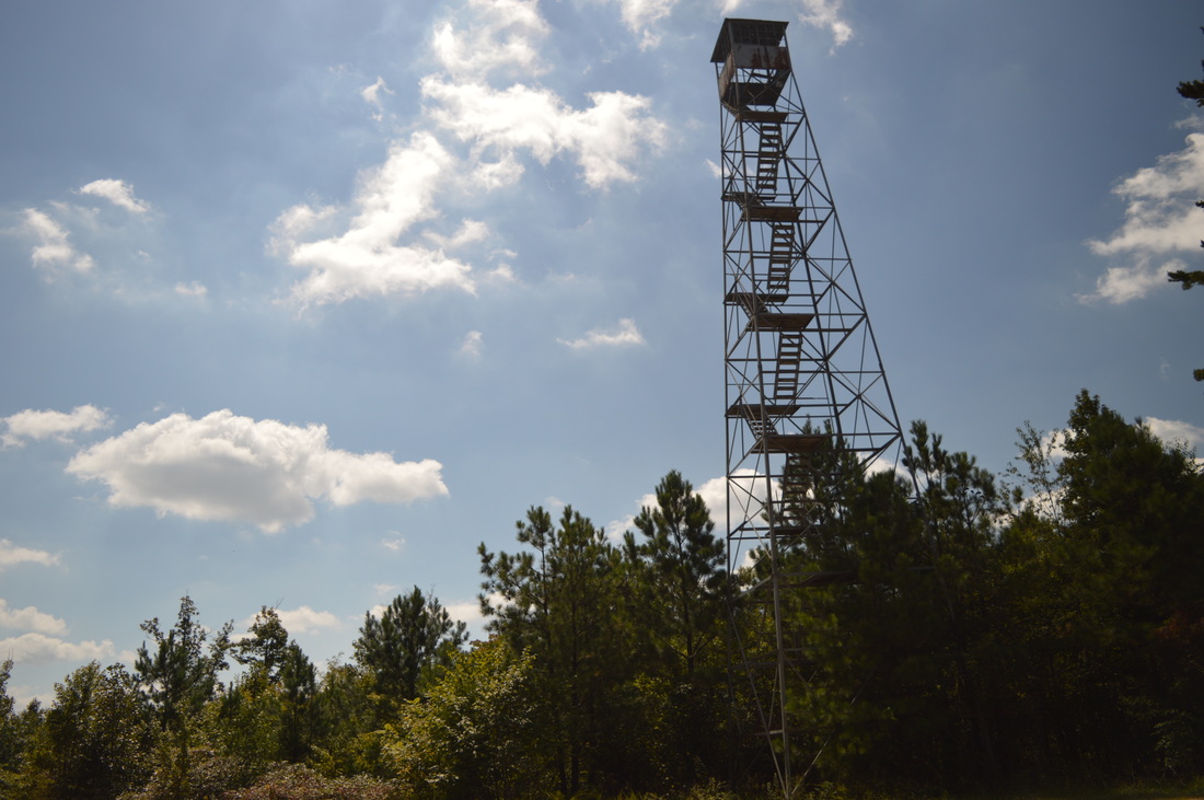
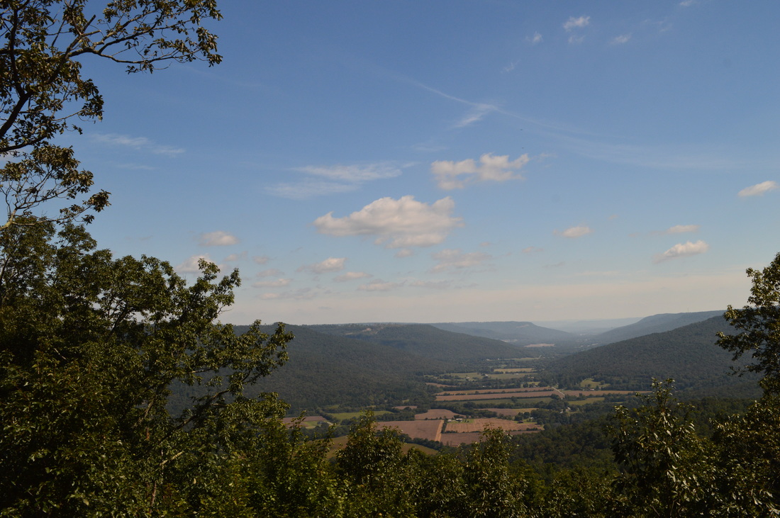
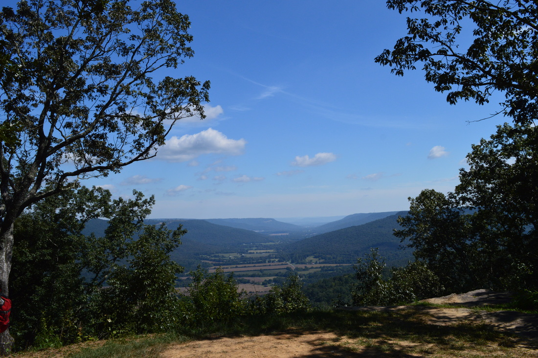
Duration of Hike: 8:10 Type of Hike: Loop Difficulty Rating: 5 out of 10 Pros: None Cons: Excessive horse usage of all trails; most trails are not very well marked and there may be problems finding the correct trail Points of Interest: Cave Spring; Stromeyer Overlook - 6 stars; First vista on North Rim Trail - 2 stars; Second vista on North Rim Trail - 5 stars; Third vista on North Rim Trail - 5 stars; Fourth vista on North Rim Trail - 3 stars; CCC Pond; Collins Cove Falls - N/A Trail Blaze Color(s): All trails are blazed white Best Season(s) to Hike: Winter Beginning Point: Cave Spring Trailhead Directions: From Sewannee, TN: Follow TN State Route 156 South for 11.4 miles. Then, turn left onto an unmarked gravel road. Nearly right away, reach a T-type intersection with a gravel road that runs parallel to TN 156. The Cave Spring Trail starts nearly straight ahead. You can park near the old firetower to the right or along the side of the gravel road to the left. MapDetails
Before I start describing this hike, I'd like to tell you about something. There's tons of chiggers on this hike. I'm not sure if it just happened to be a coincidence, or if it had to do with the horse traffic, but this was by far my worst chigger case. You've been warned, alright.
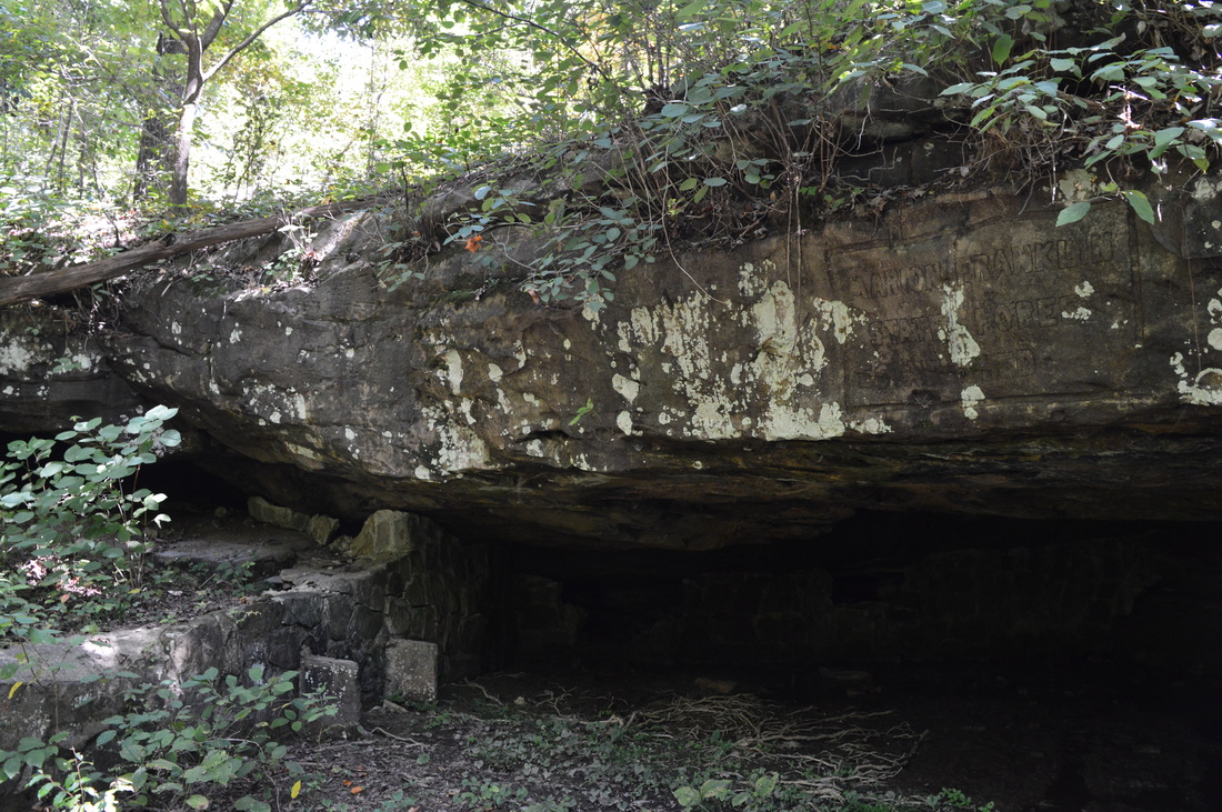
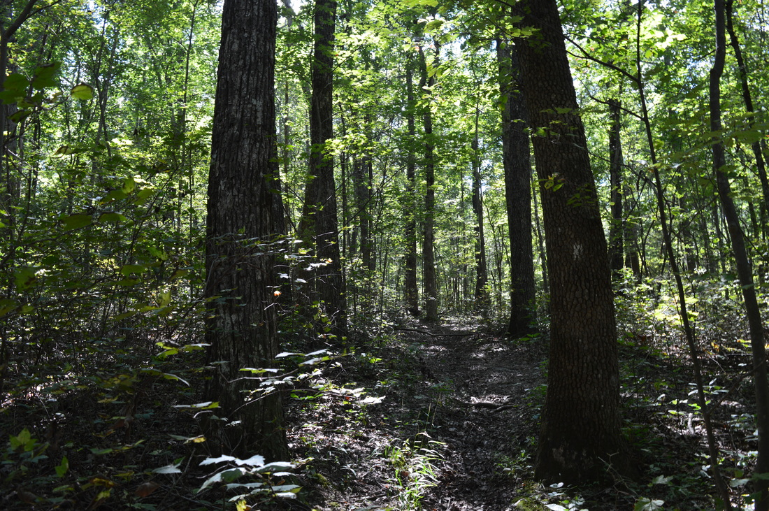
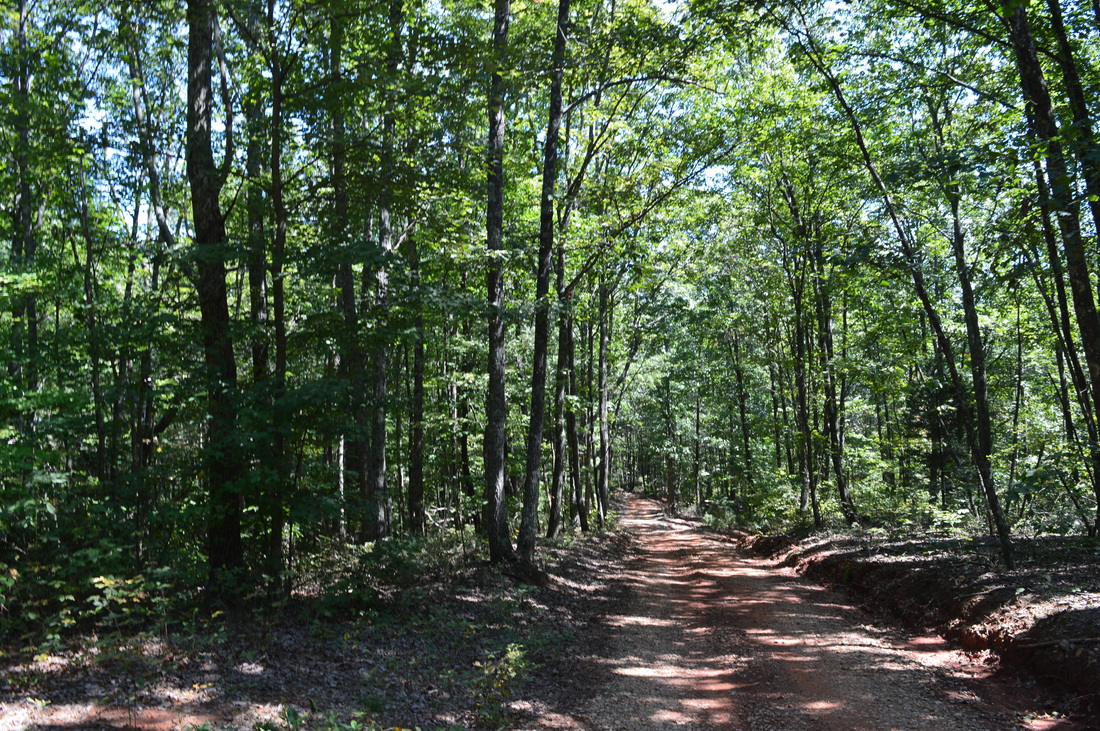
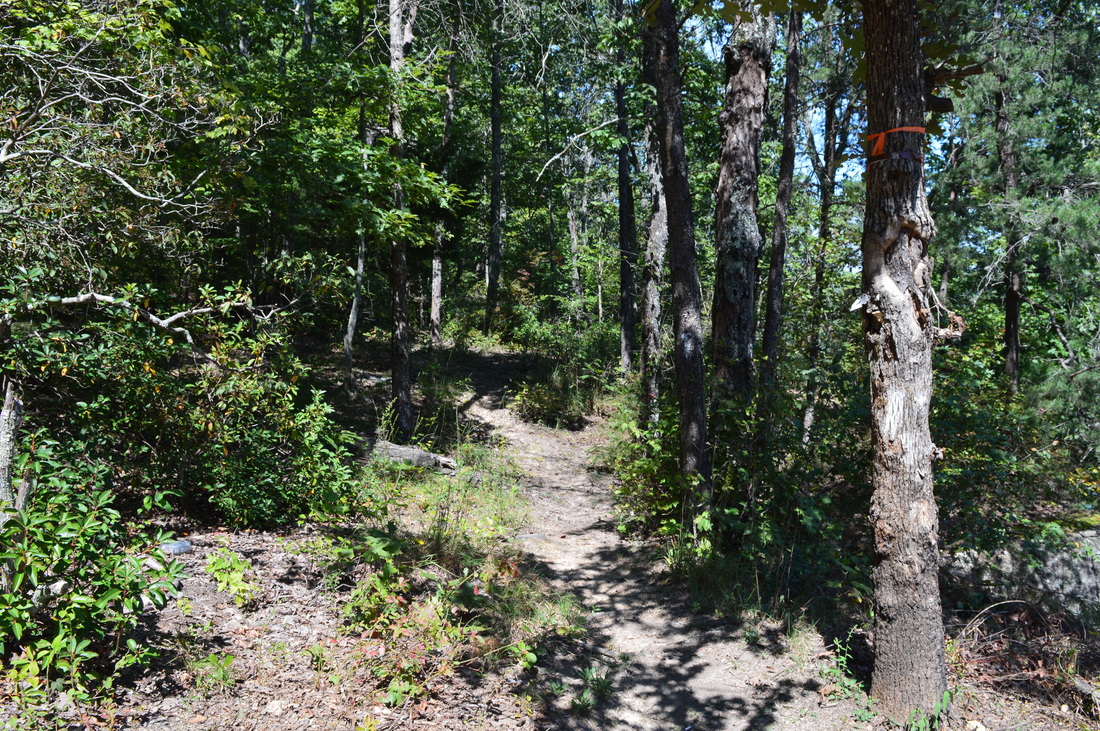
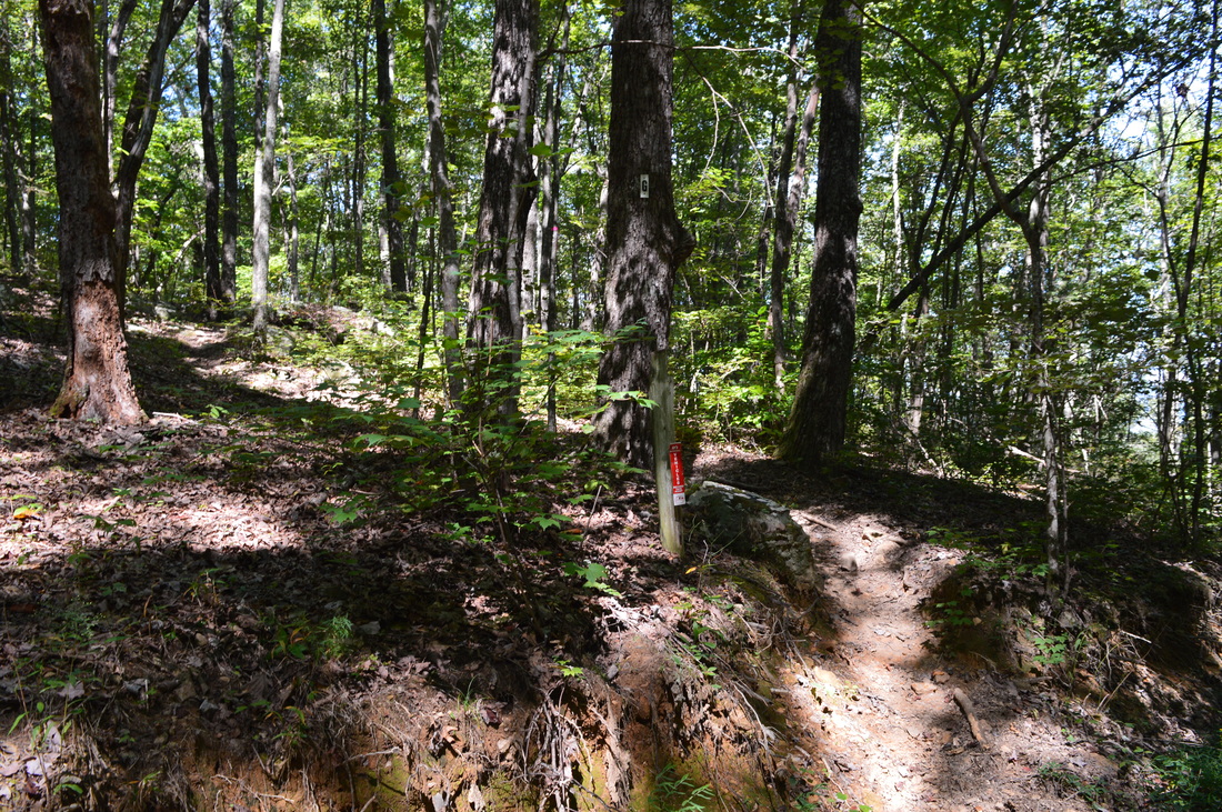
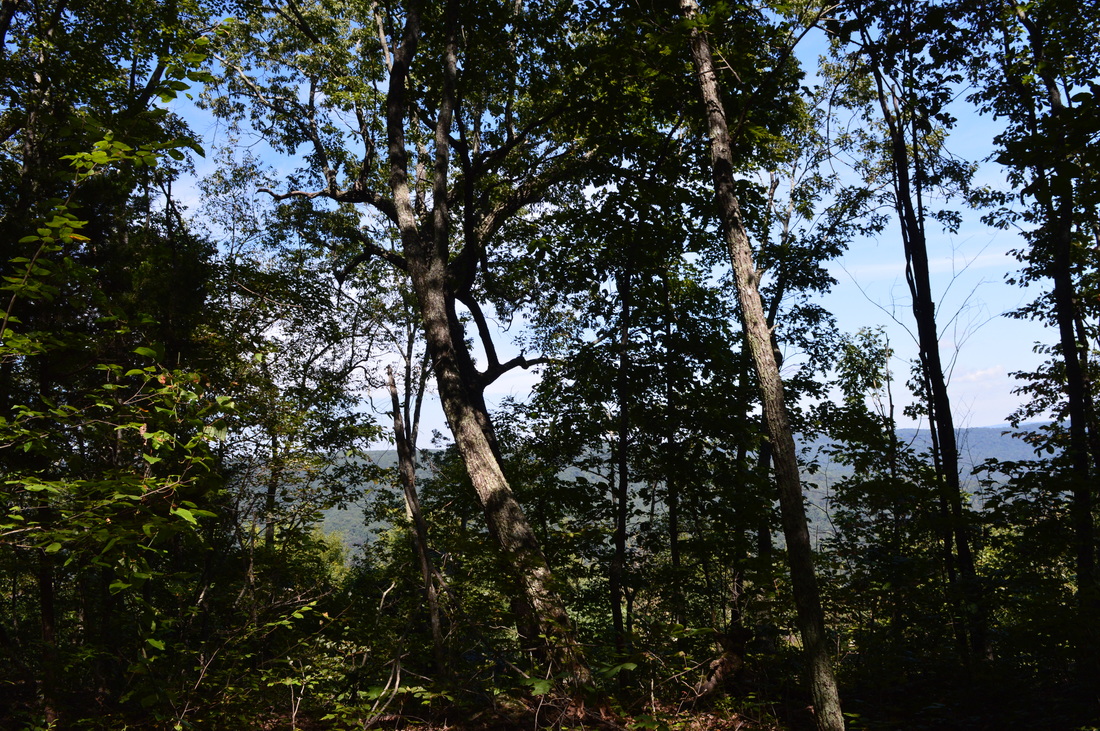
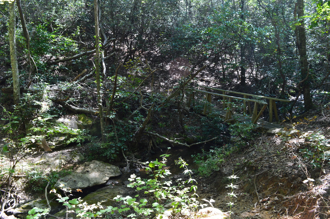
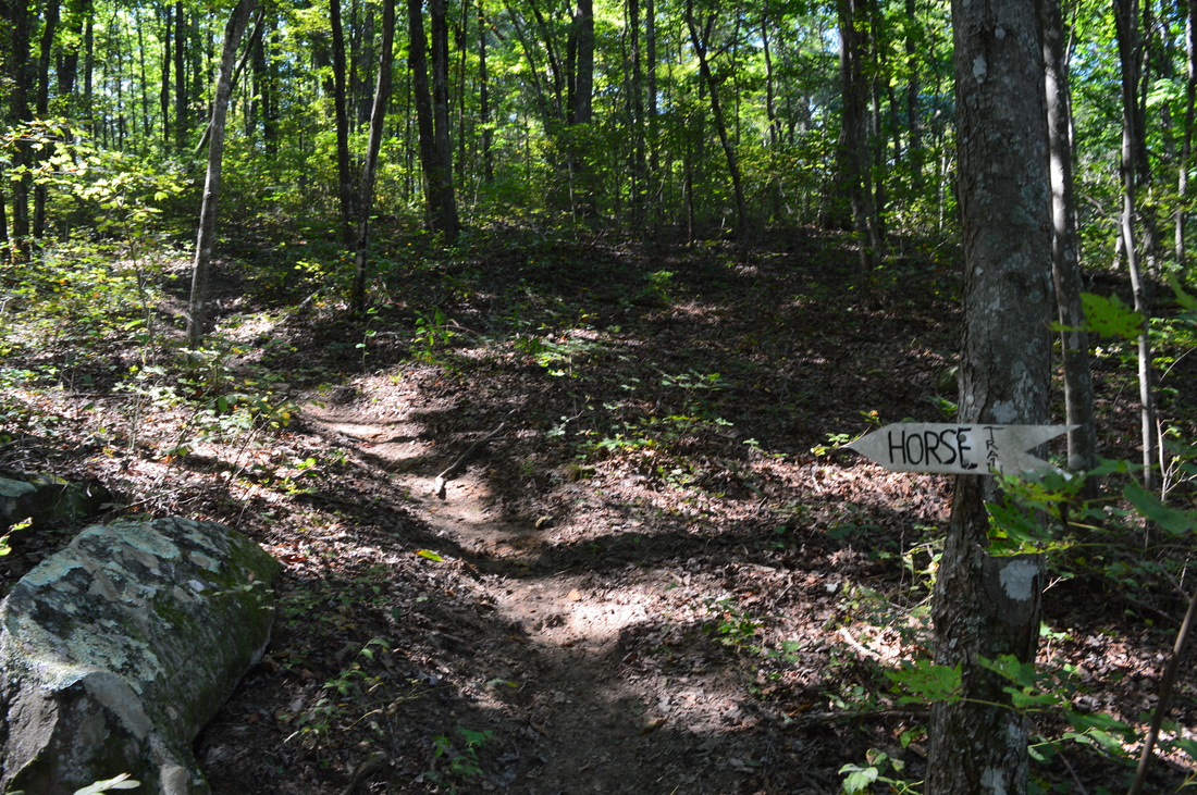
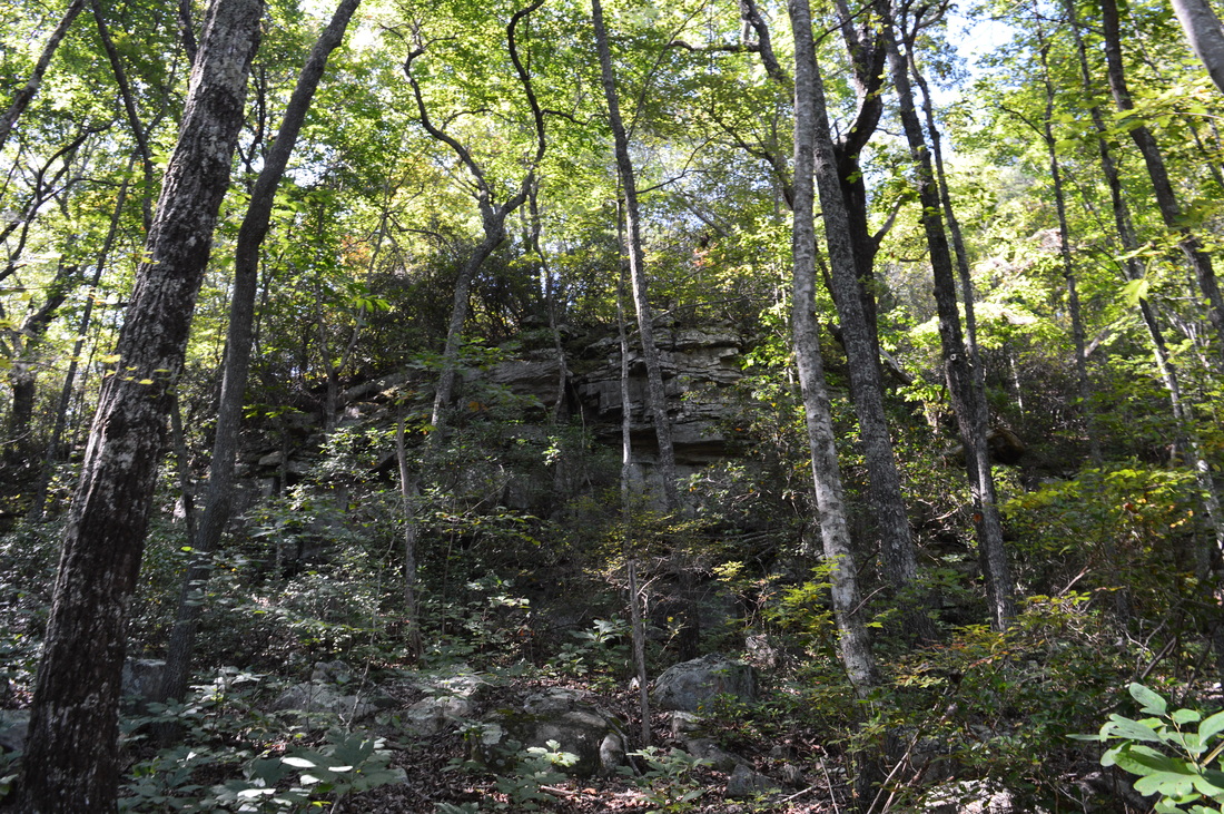
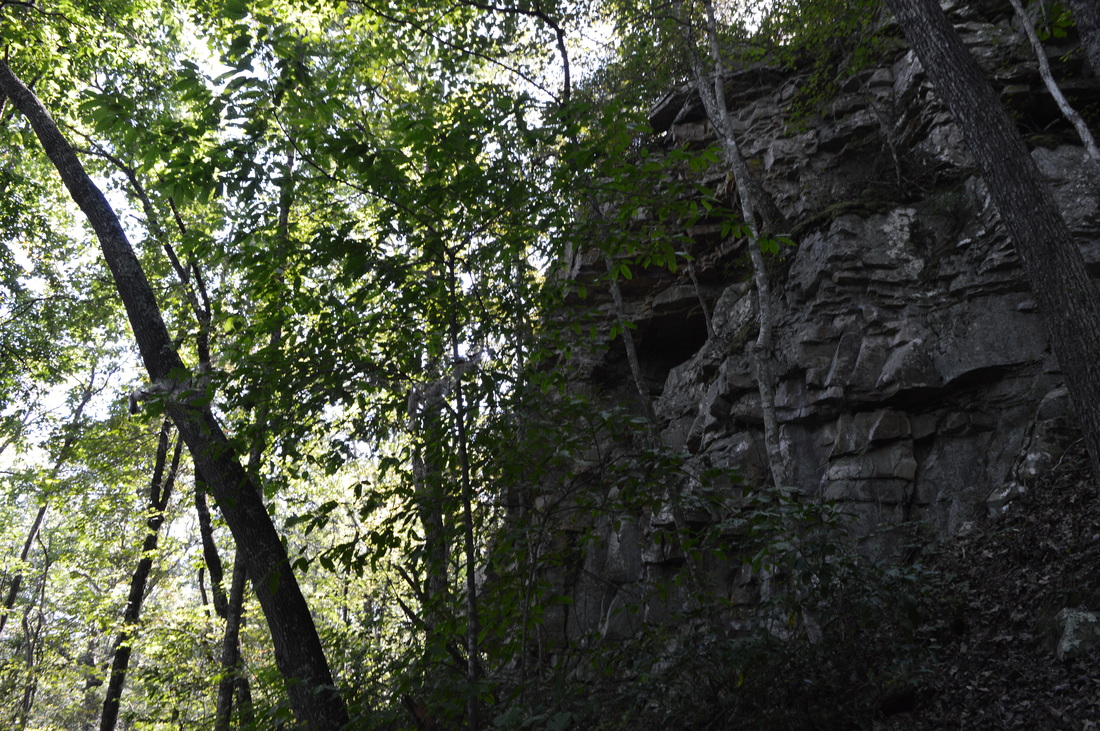
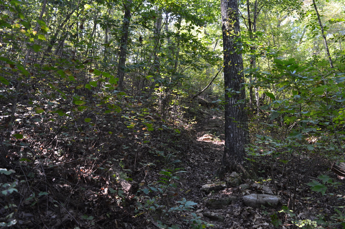
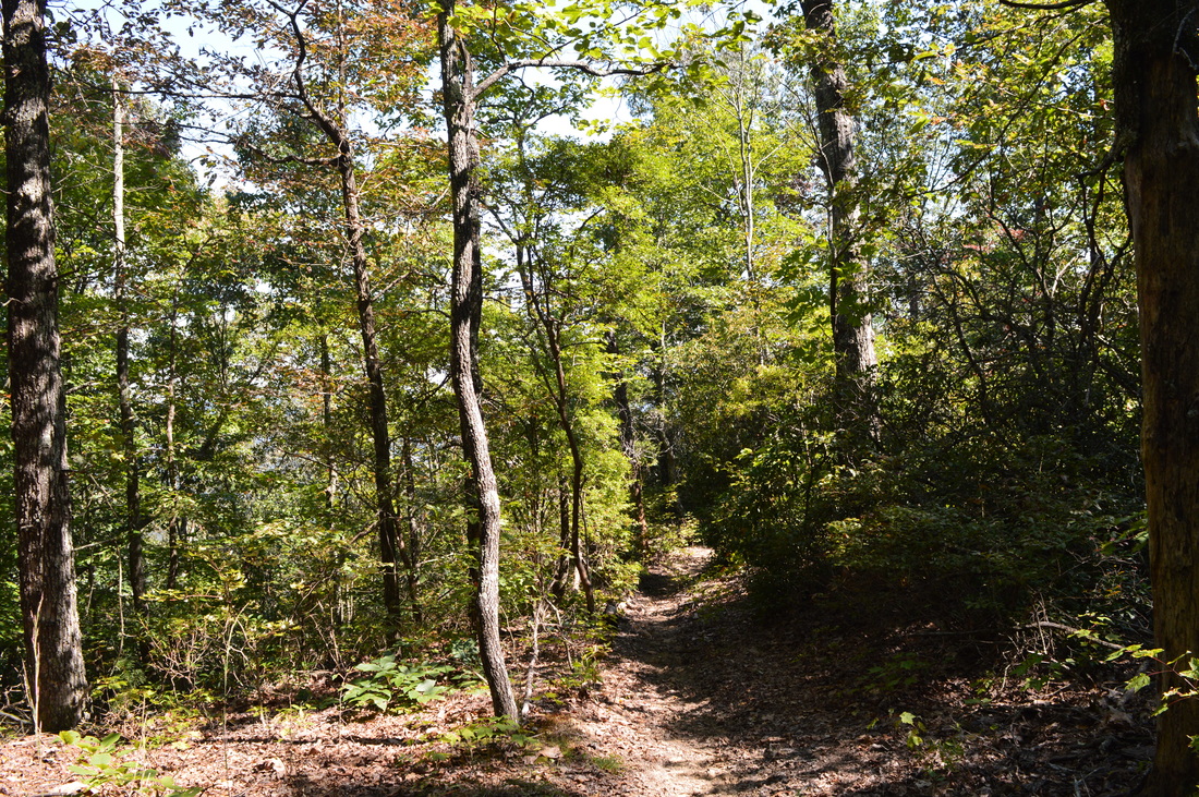
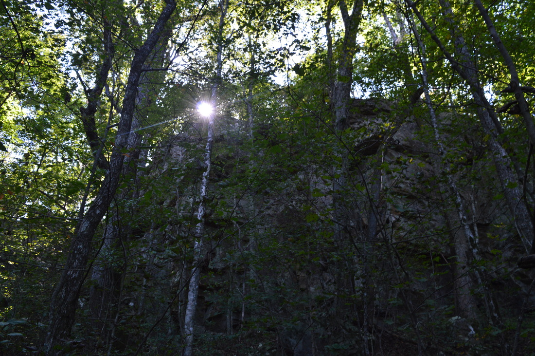
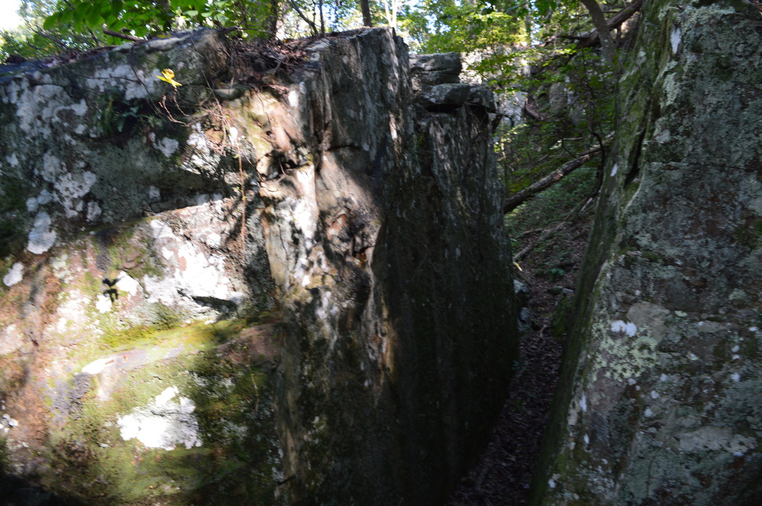
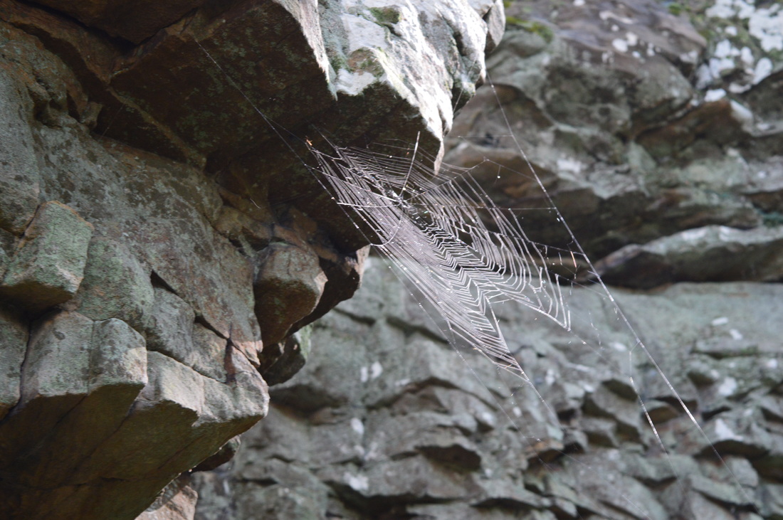
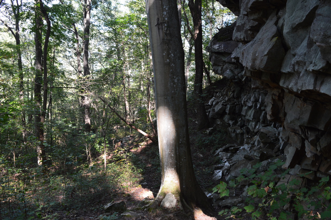
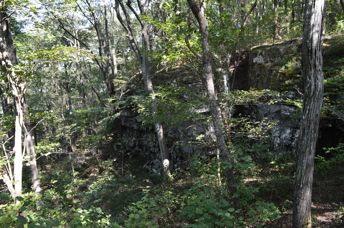
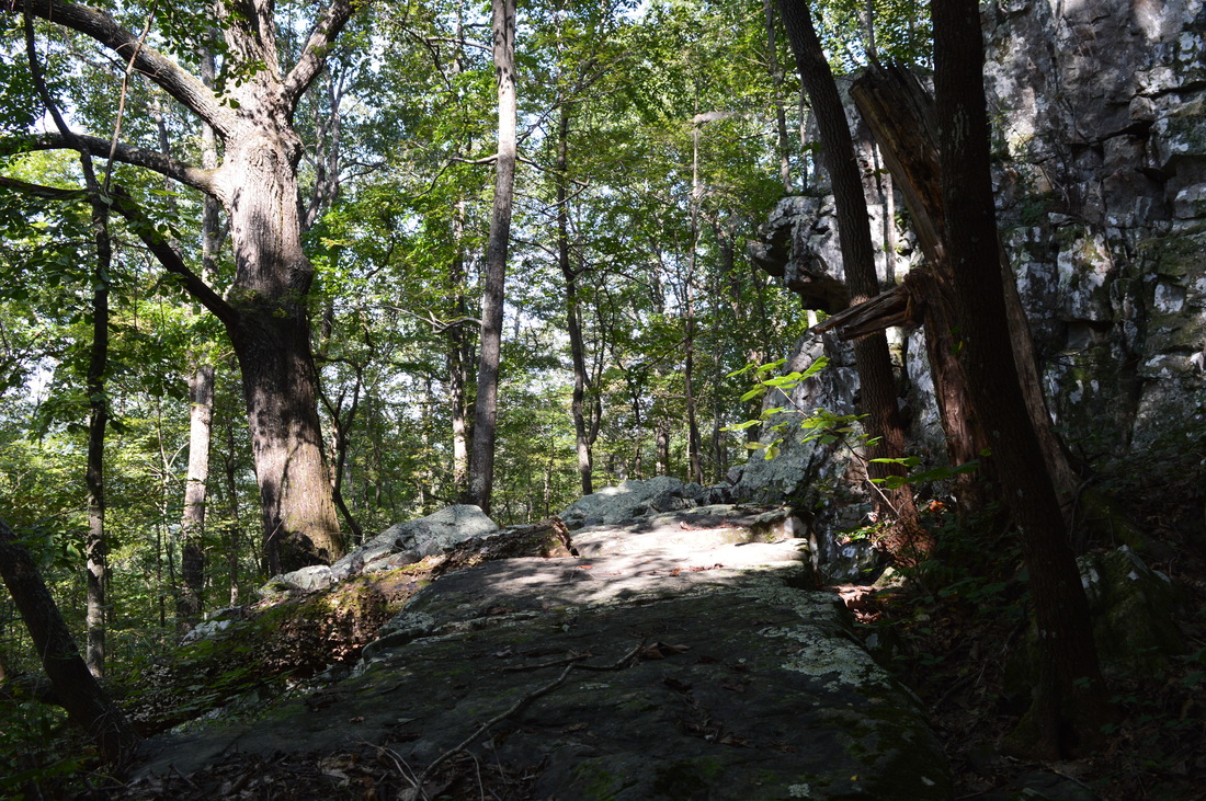
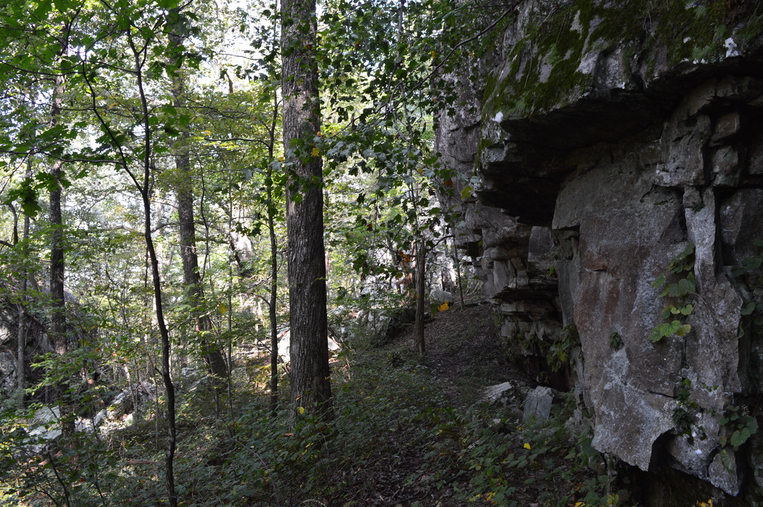
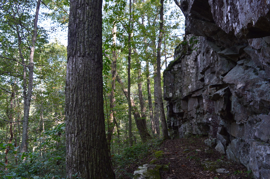
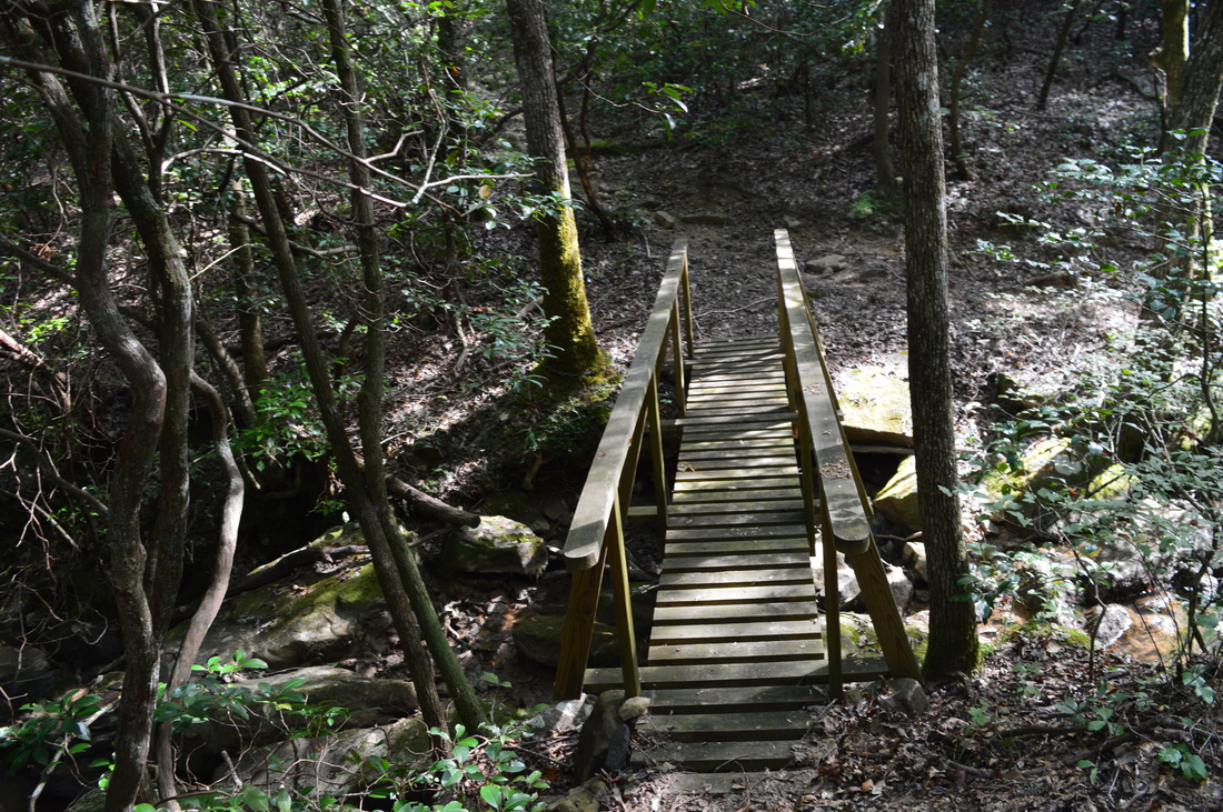
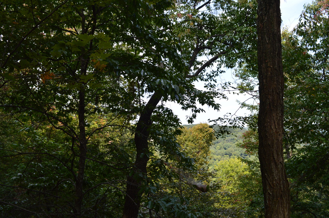
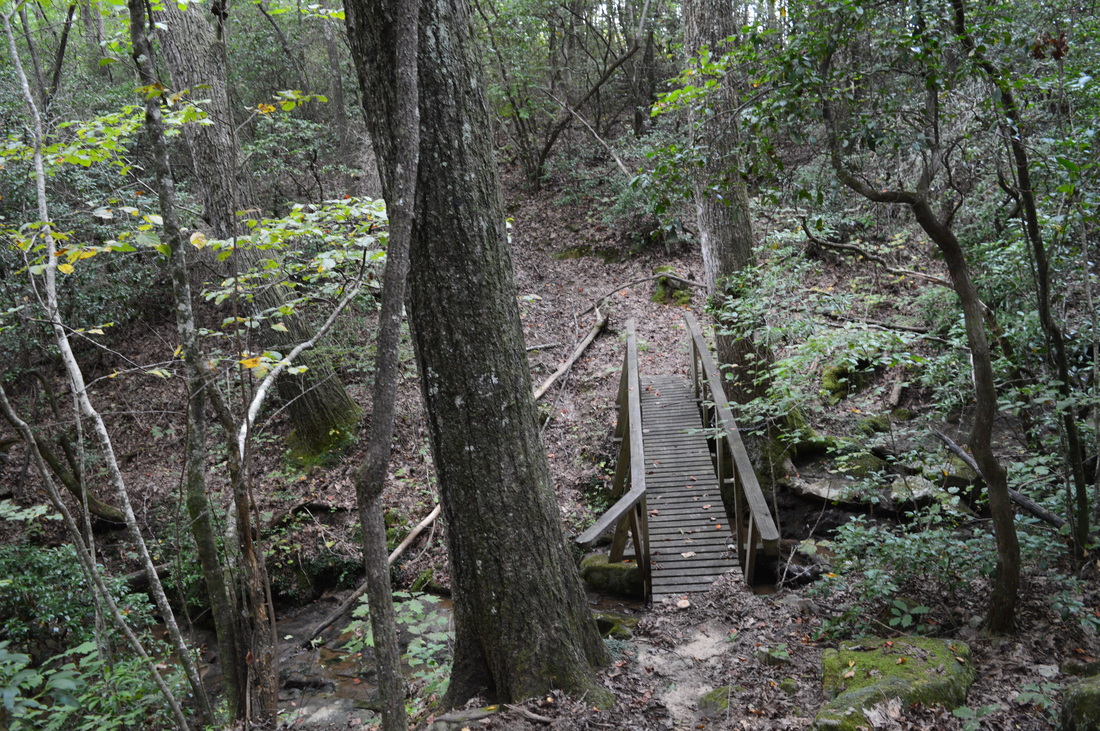
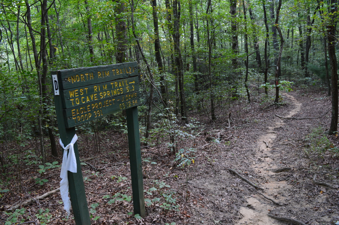
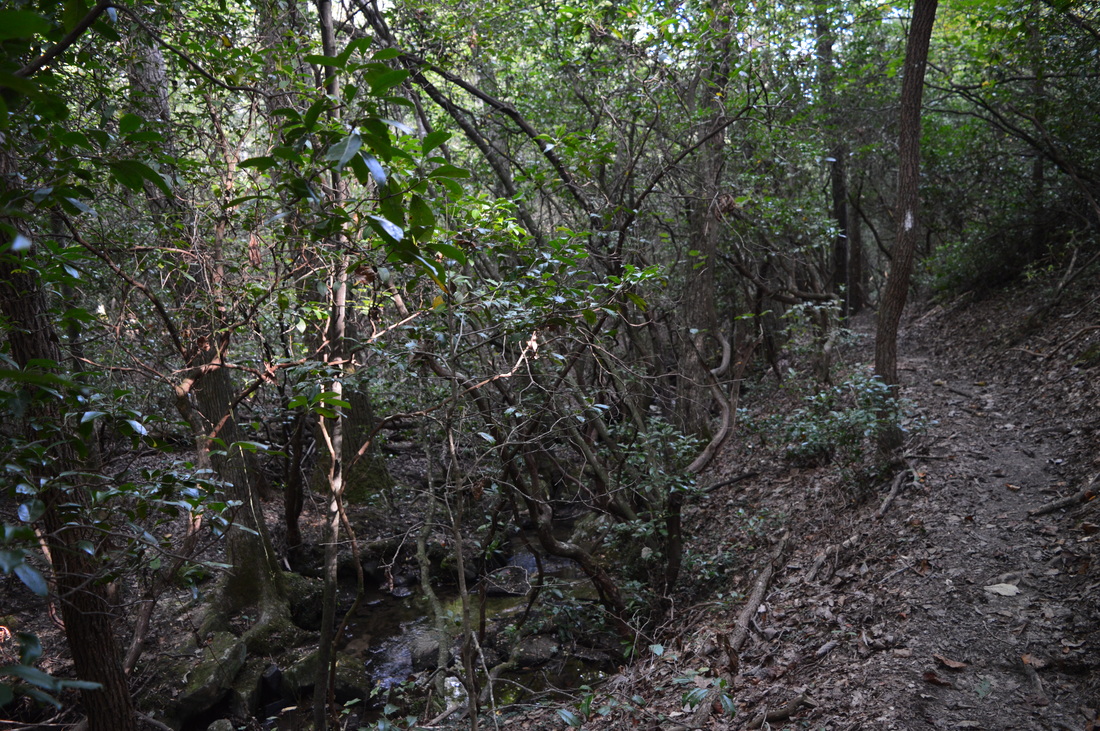
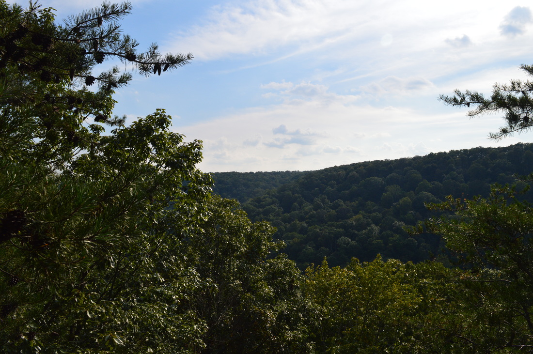
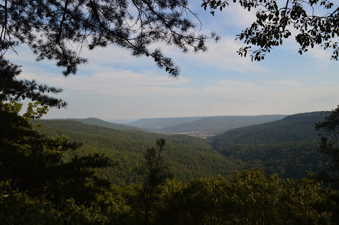
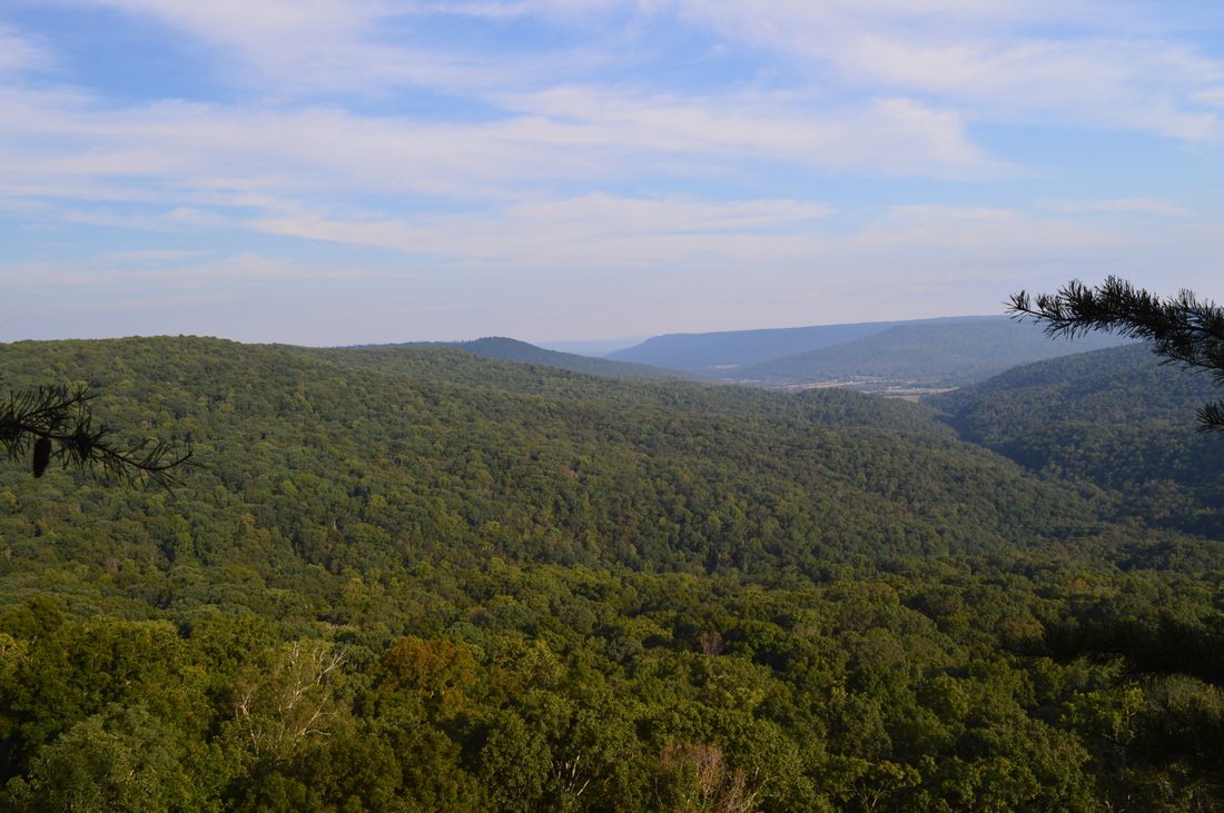
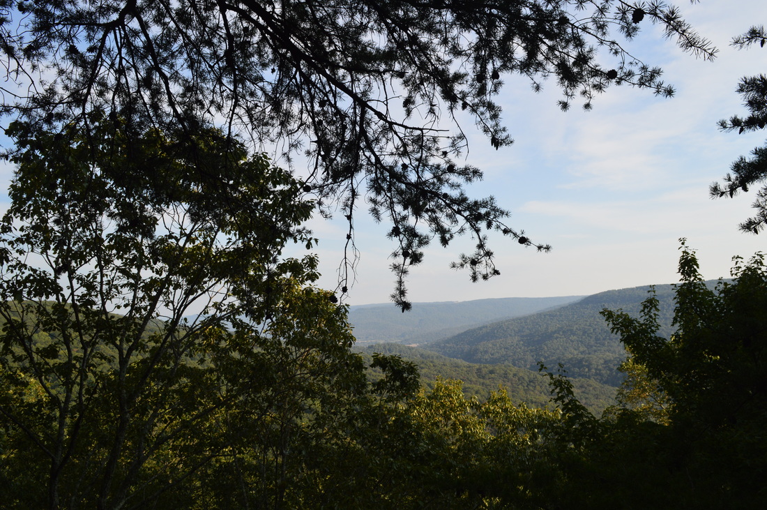
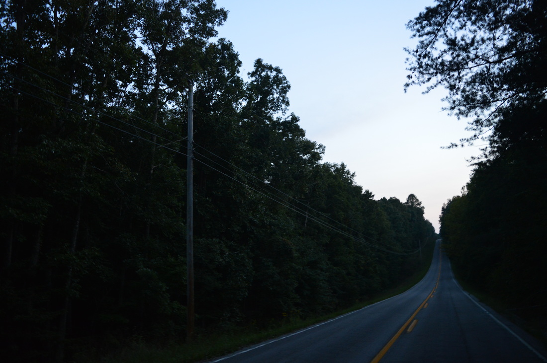
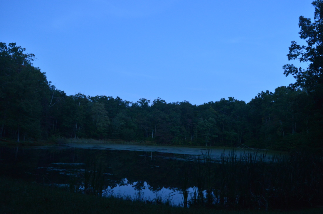
There are many trails throughout Franklin State Forest, but unfortunately, most trails have been dedicated to horse use. Hikers seldom travel these trails, and a lot of the older, more scenic sections of trail have been abandoned (although they're still passable and will be passable as long as they get some traffic). This hike covers the eastern section of the trail system in Franklin State Forest. Even though there are some trails on the west side of TN 156 as well, I currently do not have any plans to hike them, besides visiting Tom Pack Falls near the CCC Pond in the future. One of the primary trails of the trail system is the West Rim Trail, a south-to-north trail that travels the length of Sweden Cove's western rim. Much of this hike is along the West Rim Trail, but first, the hike starts on a little-used connector trail called Cave Spring Trail. The Cave Spring Trail starts just north of the old firetower (the tower is not open to public as the lower steps have been removed). The trail begins along an old road. There is a sign with mileages. 0.1 miles from the start, the trail turns left down a steep slope and makes two overgrown switchbacks before reaching Cave Spring. Cave Spring is a spring in a small cave - it gives birth to a small stream flowing to the east into Sweden Cove. There is also a picnic area at Cave Spring. Continue on the unmarked trail straight onto an old road. The old road gradually becomes an obscure footpath that descends to a valley where the outflow stream of Cave Spring flows. After you cross the streambed (it can be dry in summer and fall), ascend gradually on a very obscure goat path. Try to continue going straight. There are traces of a path here and there - you will eventually come out onto an ATV road at 0.5 miles. Turn right onto the ATV road, also known as Panther Hollow Road (the Cave Spring Trail and the road are one until the West Rim Trail). This road gets ATV traffic, so be on the lookout for it. At 1.3 miles, the road descends to Stromeyer Overlook, the best vista on this hike. Unfortunately, due to easy ATV access, the overlook area needs some clean-up. This vista provides an excellent view of Sweden Cove and its farms and fields. The road turns sharply left at the vista, but you do not have follow the road anymore. The West Rim Trail is reached here. The West Rim Trail parallels the road from this point. Turn left onto the West Rim Trail (it is right next to the vista). There are some white blazes that mark the trail. The West Rim Trail stays on the rim for now and parallels Panther Hollow Road for 0.3 miles. At 1.6 miles, there is another access point for the road, and then, the road veers away from the trail. In the winter, there are lots of great winter views on the West Rim Trail, as it stays on the edge of the rim much of its time. However, there are no other good year-round vistas on the section of West Rim Trail north of Stromeyer Overlook. At 1.8 miles, the trail crosses an old road. At 2.4 miles, cross a creek via a footbridge in Panther Cove. At 2.6 miles, there is a confusing intersection. According to a homemade-style sign, a horse trail leaves left (uphill). An unmarked trail bears right, downhill. It seems like the uphill trail is the new trail, but the more scenic old trail is the downhill trail - it goes below the bluff line. I took the downhill trail. Generally, the downhill trail is more scenic because you will see Cumberland-style rockhouses and rock formations that are not seen much on this hike. At 2.9 miles, make a steep ascent and regain the rim; the horse trail comes in from the left. Bear right. At 3.1 miles, reach an intersection of various trails and roads near the top of a small hill at the edge of the rim. There is a campsite at this intersection. From this intersection, a left would put you on an ATV road that leads to TN 156. If you continue straight, you'll be on the horse trail on the rim. The right turn is the continuation of the ATV road. However, there is a continuation of the old trail below the rim, if you turn right onto the ATV road, and then immediately turn left. That's what I did, as it's the more scenic route. The trail stays below the bluff line for 0.5 miles, and during these 0.5 miles, it traverses numerous boulder fields below the bluff. This trail, as opposed to the horse trail, gets a lot less use and is also more scenic, so I suggest hiking it. At 3.6 miles, following an ascent through a gap in the bluff line, rejoin the new trail. Bear right. At 3.7 miles, watch out for an obscure footpath leaving the main trail to the right. This is the third and final section of old trail below the rim. Go there, and quickly descend into a vast boulder field below the bluff line. At 4 miles, cross Pole Bridge Creek. This crossing is always dry, and when I did this hike, the creek was nearly dried up as well. After significant rainfall, there is a three-tier waterfall here, with the trail crossing the creek between the upper and middle section. However, most of the time, it is likely to be just a trickle or even totally dry. Right after Pole Bridge Creek, the trail reaches the top of the rim and rejoins the newer trail. From here on, the West Rim Trail will stay on the rim, occasionally crossing small creeks and with nearly continuous winter views to the east. The largest of these creeks is crossed via a footbridge at 4.1 miles. At 5.4 miles, after over-a-mile-long section of trail along the rim, reach an important trail junction. This is the northern terminus of the West Rim Trail. The Sweden Cove Trail turns left from here and heads for TN 156 and the ranger station. The North Rim Trail, a dead-end trail, turns right and follows the north rim of Sweden Cove, passing numerous vistas, and eventually ending at private property in the Collins Cove area. My plan was to first hike the North Rim Trail out and back, and then continue the hike on the Sweden Cove Trail. The trail will gradually descend into a stream valley. When the trail reaches the stream, it turns left and follows it upstream. At 5.7 miles, turn right, rock hop the stream, and ascend out of the valley. Much of the North Rim Trail is about the same - it undulates across rolling hills and small stream valleys near the rim of Sweden Cove. At 6.4 miles, the trail reaches an opening with a campsite. An old road comes in from the left here. The North Rim Trail continues straight through the opening and then bears left. A spur trail on the right leads to a rock outcrop with a view across the north end of Sweden Cove, looking at the west rim. After this, there is nothing of interest until a good overlook at 7.4 miles. This vista encompasses most of the upper reaches of Sweden Cove. Collins Cove is also visible to the left. At 7.5 miles, there is another similar vista. One more lesser vista is reached at 7.9 miles. The trail crosses over a stream at 8.2 miles and reaches a point which seems to mark the boundary of the Franklin State Forest. There is a bunch of blue blazes and other markings. However, if my maps are correct, this is not the true boundary of the forest, although it may be the end of the official trail. To reach Collins Cove Trail, I believe you need to continue a bit further, although I didn't succeed in finding it. I hiked just a bit further until Collins Creek. I turned around at Collins Creek and thoroughly searched the area for any signs of a path leading downstream towards Collins Cove Falls. I didn't find any signs of a path to Collins Cove Falls anywhere, and I still do not know the exact location of the falls. If you succeed in locating the falls, please let me know. Retrace your steps back along North Rim Trail, and reach the Sweden Cove Trail at 11.2 miles. Continue onto the Sweden Cove Trail. Pass over several hills, and at 11.6 miles, reach an ATV road. Turn right onto the ATV road, and shortly reach TN 156. You will return to this point later. For now, cross TN 156 and ascend gradually on the Sweden Cove Trail. Reach Lake Road at 11.8 miles. Even though Sweden Cove Trail is supposed to continue across the road, I did not locate the continuation. My destination was the "lake", a small CCC pond, so I turned left onto Lake Road. Then, keep right at the first fork in the roads. Reach the lake at 12.1 miles. From the lake, return to TN 156, reaching it at 12.6 miles. From here, unless you have a second car, you'll have to walk on TN 156 or adjacent ATV roads until the Cave Spring Trailhead, reaching the starting point at around 16 miles. Variations
Hike the Cave Springs Trail out and back to Stromeyer Overlook - 2.6 Miles
Do the hike without the North Rim Trail - 10.2 Miles Do the hike without the spur trail to the CCC Pond - 15 Miles Hike out and back to Collins Cove - 16.6 Miles Turn this hike into a shuttle hike with one car located at Cave Spring Trailhead and the other car at the CCC Pond - 12.1 Miles Bonus Stops
Tom Pack Falls near the CCC Lake is a good bonus stop. The falls is best seen after periods of rain.
PicturesVideos
7 Comments
Dana Koogler
12/4/2015 12:31:18 pm
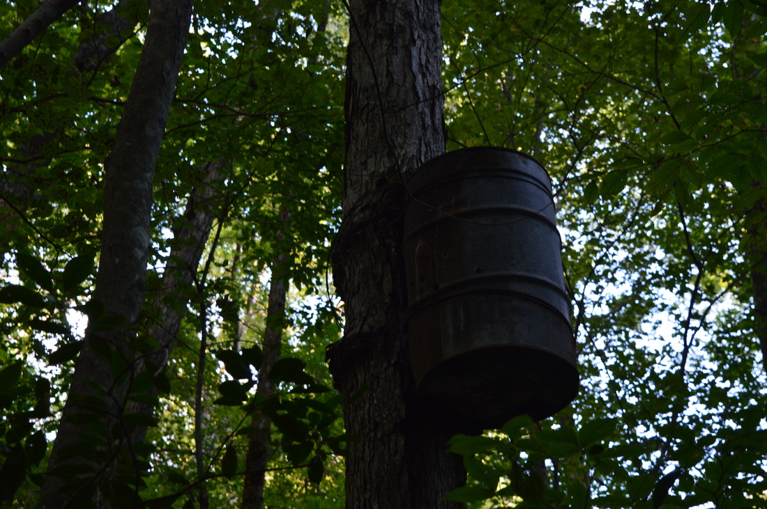
Excellent blog! One of the best yet. Laughed at ya for the chiggers thing. itch itch. scratch scratch! :-) Thanks for sharing. Have not ventured there yet, but now am jealous and want to go. Favorite photos of this set? Stromeyer Overlook.. wow! Gorgeous. And the fire tower. Not sure but that rock pile looks like it may have been the fire pit for under a moonshine still! Very cool indeed! Your blog is looking more appealing all the time. I am VERY proud of you! :-D grinning ear to ear.
David rowe
8/15/2016 07:26:45 am
Nice blog i live next to the franklin-marion forest on the side of collins cove.. collins falls was just down the slope a bit not really a trail to it.. and the rock stack you found is and old moonshine still site the mountain is riddled with them.. the barrel in the tree .. ya go figure
Mark Oleg
8/15/2016 10:24:58 am
Thanks for the info! One day, I might head back out there and do some more of the trails - during wintertime.
Randy Pass
4/23/2017 10:22:39 pm
Am very interested in these trails & when late fall or Winter gets here, would be very interested in doing the hike of these trails
Joy
9/25/2017 01:46:58 pm
Horse do not carry or spread chiggers or fleas. Of course ticks can get on anything, but most horsemen put a special bug spray on horses to repell insects.
Jay Hill
10/16/2018 05:33:03 am
The report on the chiggers is accurate and Is no coincidence. I hiked a part of the trail in mid October I wore pants and tall socks and I thought the trail looked not suitable for a chiggers infestation. However, I got them as a mild case and can't imagine how bad they could be during the summer months. The trail was fairly enjoyable but not sure if it's worth the after effects.
Bess Wall
11/29/2019 02:34:49 pm
Would it not be appreciated if horseback riders cleared the trails and made it nicer for everyone? Just thinking. Leave a Reply. |
About MeMark Oleg Ozboyd Dear readers: I have invested a tremendous amount of time and effort in this website and the Georgia Waterfalls Database the past five years. All of the work that has gone in keeping these websites updated with my latest trip reports has almost been like a full-time job. This has not allowed me to pick up a paid job to save up money for college, and therefore, I I've had to take out loans. If you find the information on this website interesting, helpful, or time-saving, you can say "thanks" and help me out by clicking the button above and making a contribution. I will be very grateful for any amount of support you give, as all of it will apply toward my college tuition. Thank you!

Coming in 2022-2023?
Other Hiking WebsitesMiles HikedYear 1: 540.0 Miles
Year 2: 552.3 Miles Year 3: 518.4 Miles Year 4: 482.4 Miles Year 5: 259.9 Miles Archives
March 2021
Categories
All
|


 RSS Feed