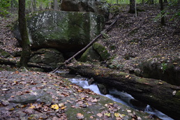
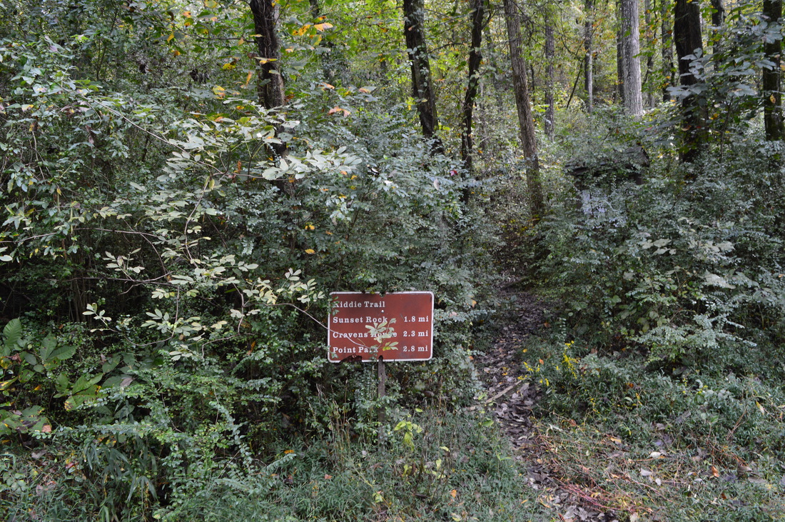
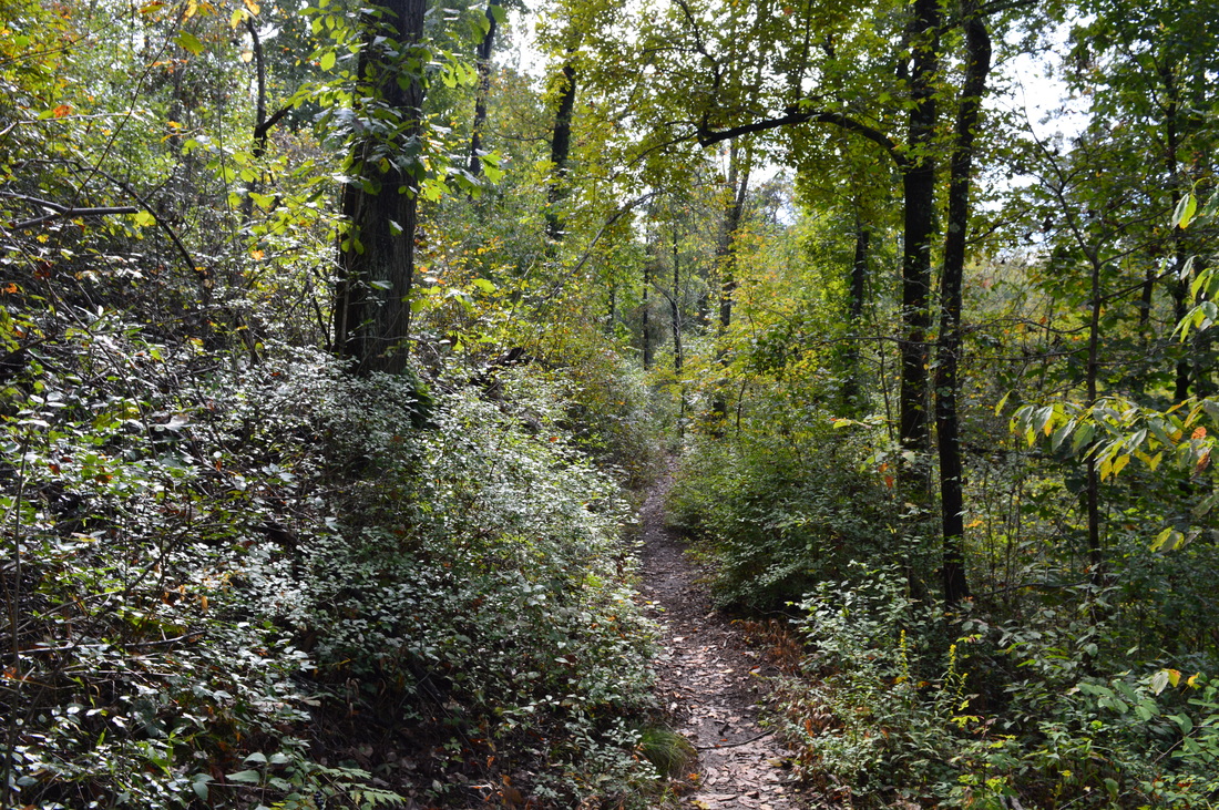
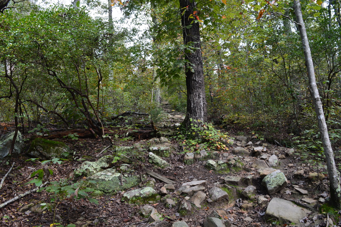
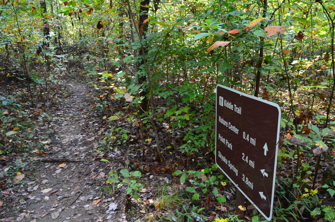
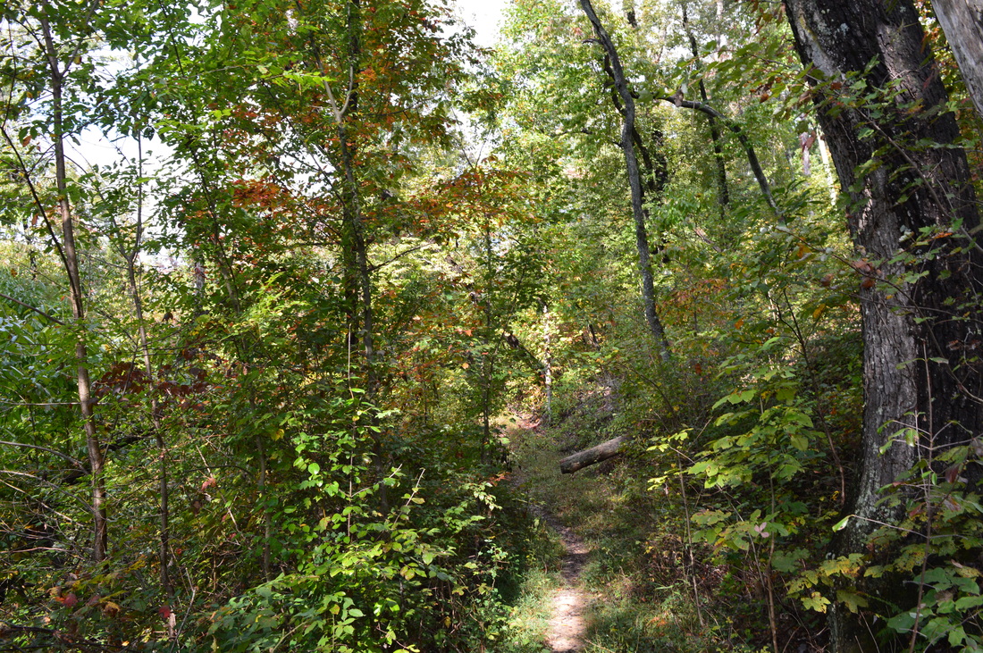
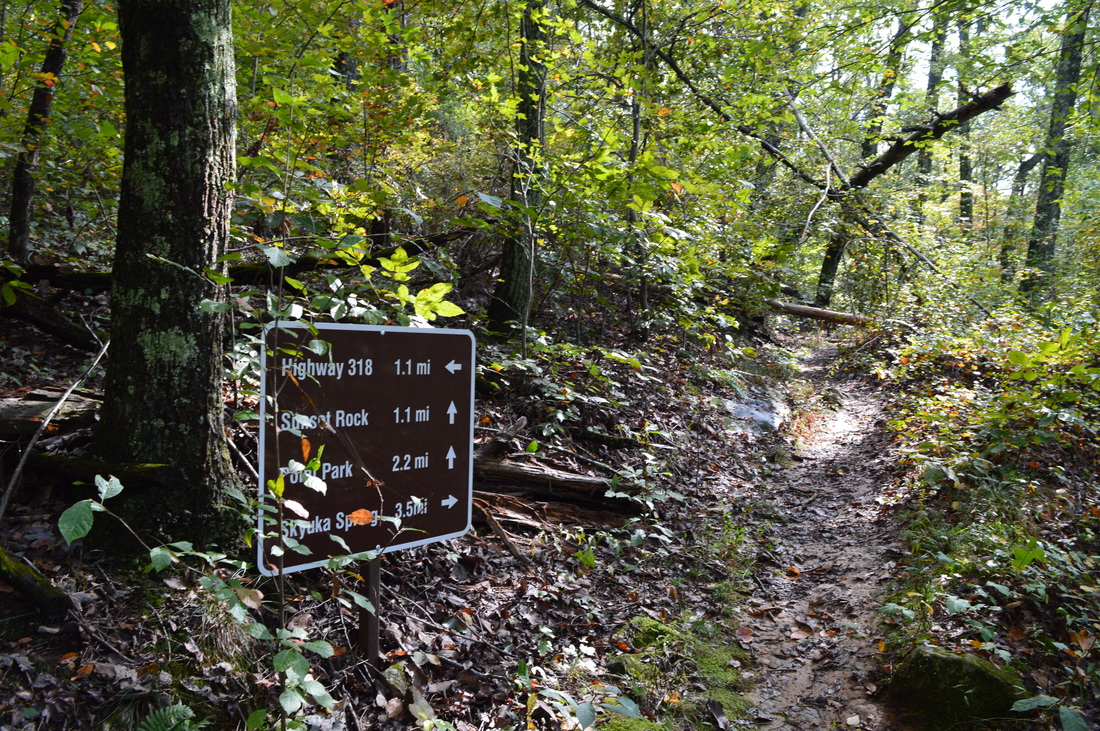
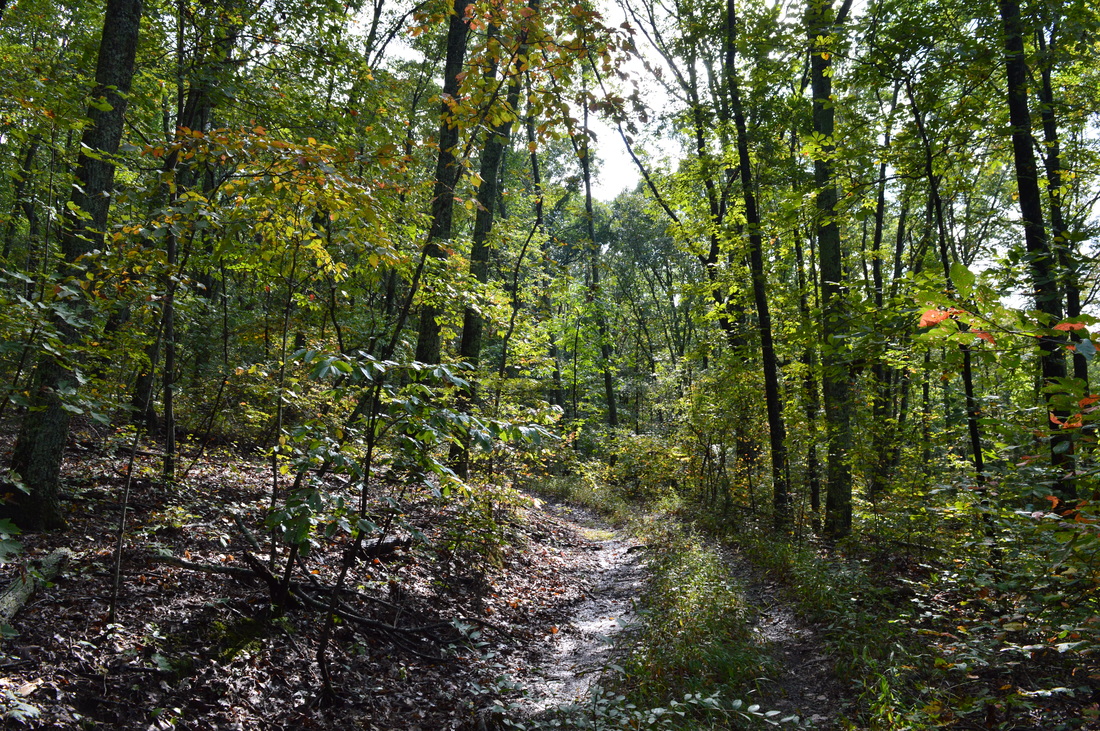
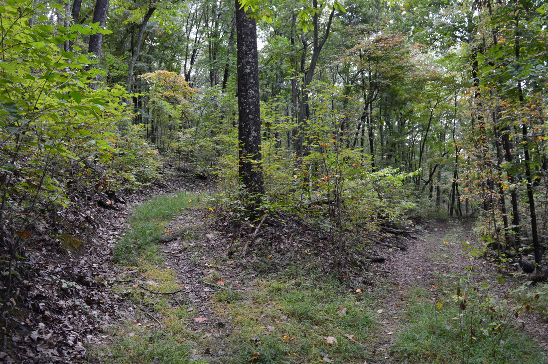
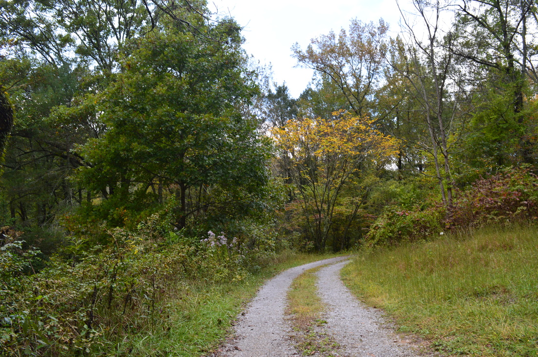
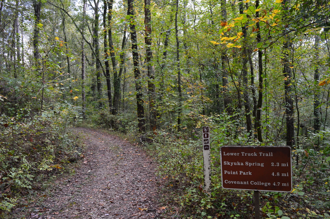
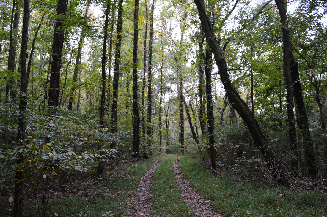
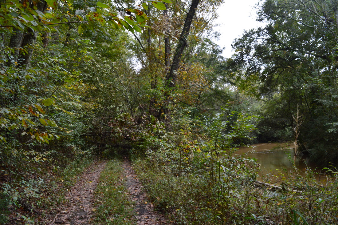
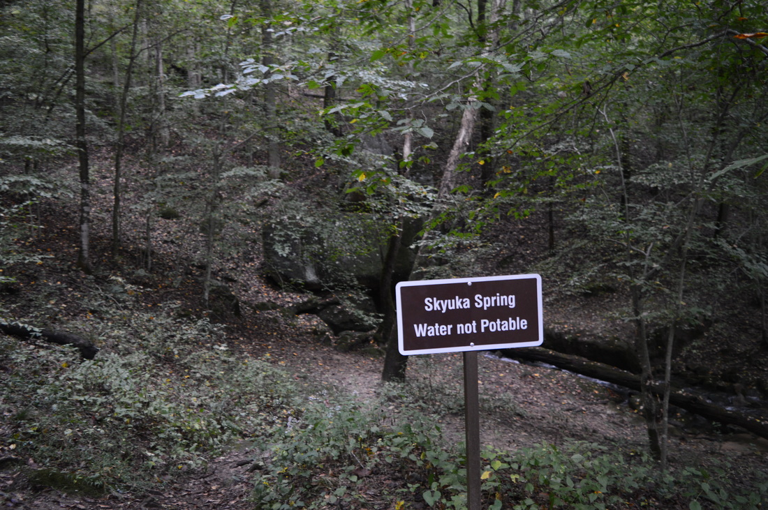
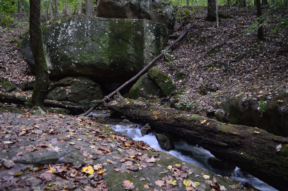
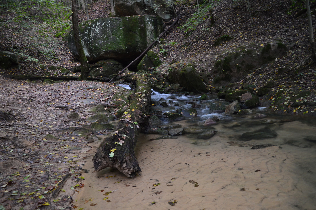
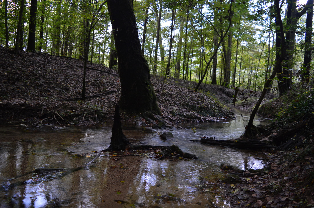
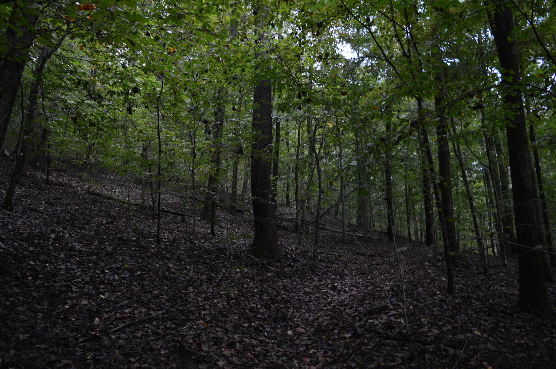
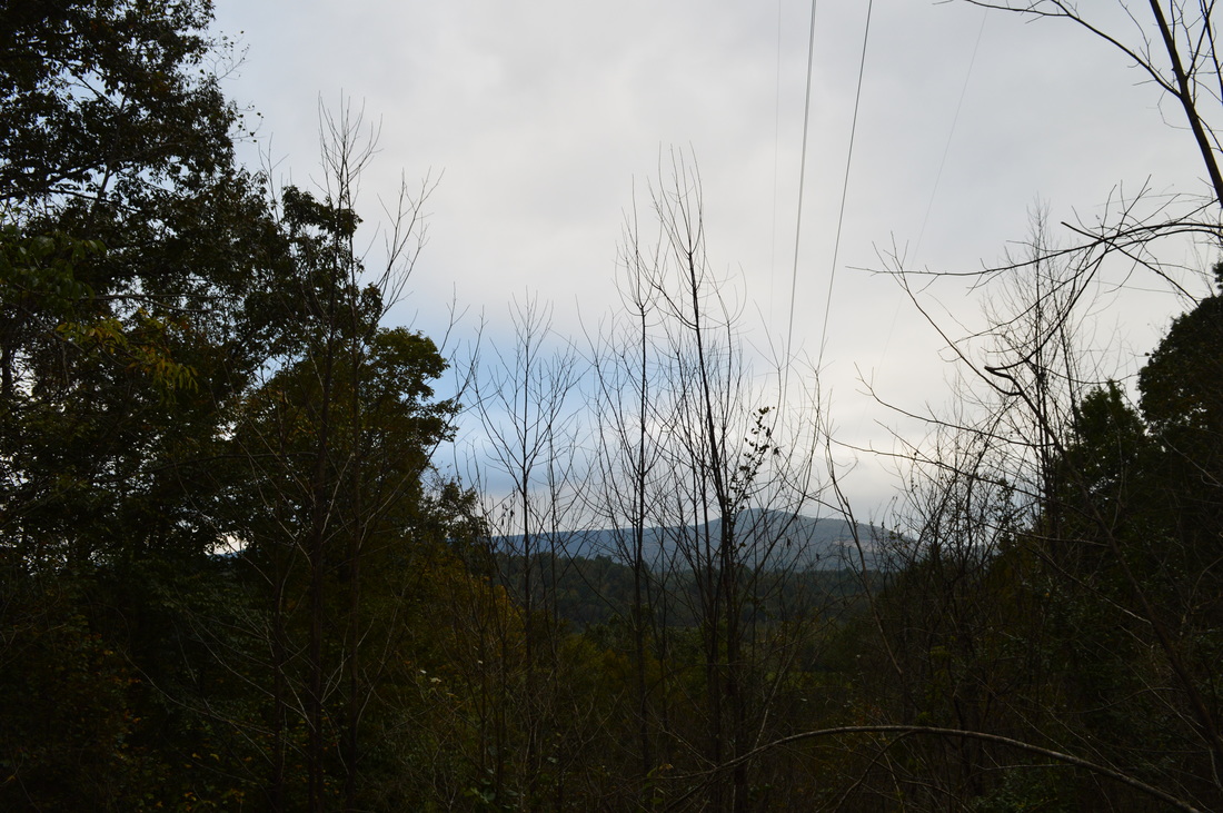
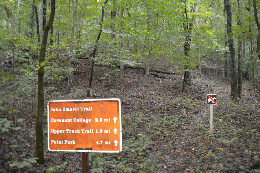
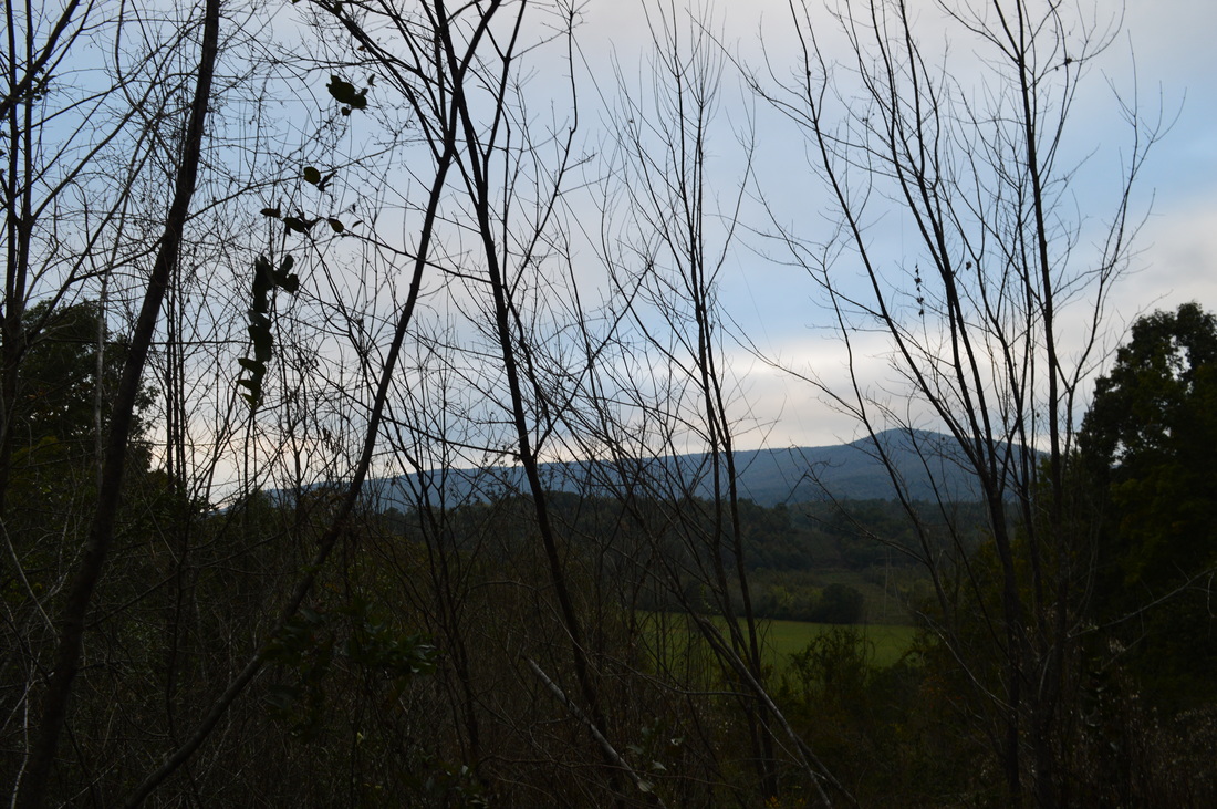
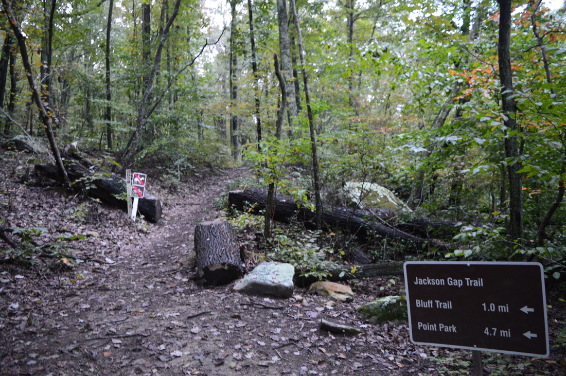
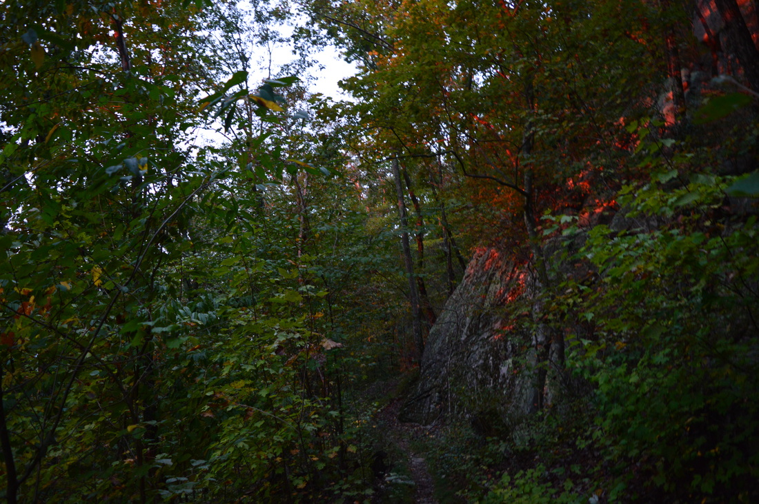
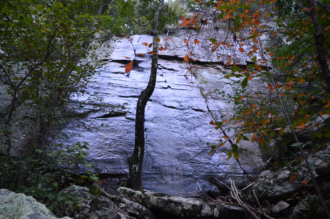
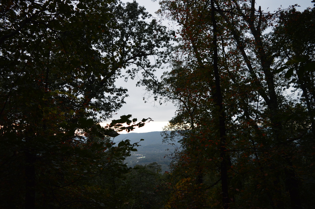
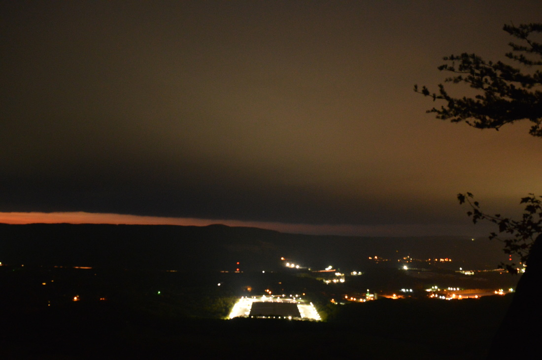
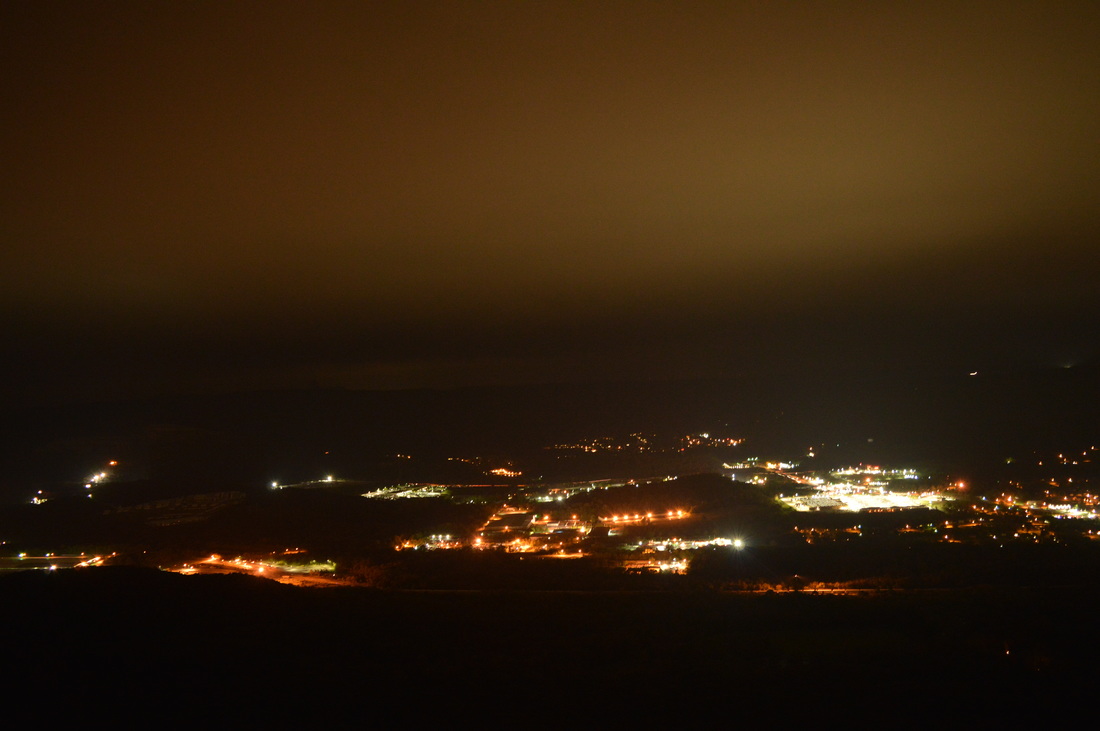
 The Lookout Mountain Battlefield is a large tract of conserved land that covers the better portion of Lookout Mountain's slopes. The area that this tract covers is the site of the Battle of Lookout Mountain (a battle that was a part of the US Civil War's Chattanooga Campaign). The area is home to an assortment of interesting sights, most notably several rather large springs, as well as many important historic sights and even some good vistas. The mountain is crisscrossed by trails, and there are many ways to create long day hikes on Lookout Mountain. This hike occurred on October 10th, 2015. My plan was to hike to a number of features on the west side of Lookout Mountain: Skyuka Spring, Sunset Rock, and Gum Spring, but due to some confusing intersections, the total mileage of the hike had to be increased to the point that only Skyuka Spring was seen in the daylight. My plan was to start on the Kiddie Trail. I would then take the Skyuka Trail to Skyuka Spring, and follow the John Smartt Trail and later the Jackson Gap Trail to the Bluff Trail. The Bluff Trail would be followed to Sunset Rock, and then using the Gum Spring Trail and Lower Gum Spring Trail, I would return to the trailhead. As you'll see below, this plan didn't quite work out. SummaryR/T Length of Trail: 12.5 Miles Duration of Hike: 7:30 Type of Hike: Loop Difficulty Rating: 5 out of 10 Pros: All trails are well-maintained and easy to follow Cons: Several trail intersections are poorly marked, creating confusion Points of Interest: Skyuka Spring; Gum Spring; Sunset Rock Vista - 7 stars Trail Blaze Color(s): None Best Season(s) to Hike: Year-round Beginning Point: Kiddie Trailhead near Chattanooga Arboretum & Nature Center Directions: From Chattanooga, TN: Follow US Route 41 North from Downtown Chattanooga for approximately two and a half miles until you reach TN State Route 148. Bear left onto TN 148 and in 0.3 miles, bear right onto TN State Route 318 (Old Wauhatchie Pike). In 0.6 miles, turn left to continue following TN State Route 318. In another 0.3 miles, turn left onto Garden Road. Drive for 0.8 miles. You will drive through a residential area, and then, just before you reach the Chattanooga Arboretum & Nature Center, you will see a small gravel parking lot on the right. The Kiddie Trail's signed beginning and trailhead kiosk is to the left, across the road from the parking lot. If you have reached the Chattanooga Arboretum & Nature Center, you have driven too far. MapA map and some other information regarding this hike can be viewed here. Details When one mentions Lookout Mountain, a picture of a wealthy community located on the edge of a mountain comes to mind. But the residential area on Lookout Mountain's flat top is just one part of the mountain. Starting with Point Park on the northern edge of the Lookout Mountain summit, where the west brow and east brow come together, a huge area of land belonging to the National Park Service is yours to explore. The slopes of Lookout Mountain offer many points of interest, in addition to the vistas you can see from the trail system's several access points atop the rim. On my first visit to Lookout Mountain a couple of years ago, I merely did a short hike from Point Park to Sunset Rock. On this visit, my goal was to hike deeper into Lookout Mountain's vast territory, but due to circumstances detailed further below, I was not able to see everything I had planned to. Thus, I will likely plan a return visit soon. The hike starts on the Kiddie Trail, an access trail that is used to connect the Chattanooga Arboretum and Nature Center to the main trails on Lookout Mountain. The Kiddie Trail is marked by a large sign. Signs like this one mark most major trail intersections in the park (key word: *most*). The Kiddie Trail starts off a narrow, slightly overgrown path that seems to get little use. But soon after, the trail makes a turn and begins a steep uphill with no switchbacks. While this uphill is only about a quarter-mile long, it provides a good warm-up. The uphill is pretty rocky, but there are some steps here. At 0.5 miles, level out and reach the end of the Kiddie Trail at the Skyuka Trail. The Skyuka Trail is the second of four trails, from west to east, that travel the entire western section of the park. The four trails are: Lower Truck Trail, Skyuka Trail, Upper Truck Trail, and Bluff Trail. All of these trails parallel each other, more or less, but they are at different elevations. The highest trail, the Bluff Trail, is by far the most scenic and likely the most scenic trail in the park. On this hike, you'll hike sections of three of these four trails, and you'll also use connecting trails. From the Kiddie Trail junction, a left on the Skyuka Trail would take you to TN 318 in 0.8 miles. However, to follow my route, turn right onto the Skyuka Spring Trail. The trail stays level for some time. At 0.7 miles, reach an intersection. Here was my first mistake of the day. A trail bears left, uphill, here and seems to be the Lower Gum Springs Trail or a connection to it. What I found out later, however, was that the Skyuka Trail turned left here, even though the sign didn't make it obvious as to which trail was the Skyuka Trail. I continued straight onto what turned out to be one of several "Reflection Riding" Horse Trails in the area (it is my understanding that you're allowed to hike them). A short while farther, after following an old road, I reached another confusing intersection. A couple of wooden signs were nearly indiscernible and didn't help to pick which trail was correct. Intuitively, I turned left, and this was the correct choice. This trail followed an old road too, and was generally ascending at a gradual pace. At 1.8 miles, a totally unsigned fork of old roads appears. If you wanted to return to the Skyuka Trail, this was your last chance by bearing left. However, I thought that the left fork led to the Upper Truck Trail, so I continued straight, and I ended up lengthening the hike rather significantly. The trail stopped ascending and stayed level for a brief time before descending very gradually using long switchbacks to the territory of the Chattanooga Arboretum & Nature Center. In fact, it appears like the Reflection Riding Trails may be maintained by the Chattanooga Arboretum & Nature Center, and that's why they are poorly signed by the National Park Service. At 2.8 miles, you will finally finish descending. You reach a gravel road. Turn left. At 2.9 miles, reach another road that leads to the nature center. Bear left on the road and shortly reach a gate at the start of the Lower Truck Trail. The Lower Truck Trail is the westernmost trail in the park. It is also the lowest. The entire trail follows an old road along Lookout Creek. The trail is open to equestrian and bike use in addition to hiking, although on my hike here, I saw neither equestrian riders nor bikers. At 3.3 miles, catch your first glimpse of Lookout Creek, flowing peacefully beside the trail. You will be seeing the creek on and off until you reach Skyuka Spring. At 3.4 miles, reach an intersection with a side trail on the left. This side trail connects to the Skyuka Trail. Continue straight on the Lower Truck Trail. The Lower Truck Trail continues for 2 miles along Lookout Creek with good views of the creek and its numerous bends. At 5.3 miles, reach an overgrown turnaround which marked the end of this old road. From here, bear left on a footpath and reach the end of Lower Truck Trail near Skyuka Spring at 5.4 miles. This is a confusing area and I ended up losing time here by taking the wrong trail. The Southend Trail continues across the outflow stream of Skyuka Spring. The Lower Truck Trail actually turns sharply left at the Skyuka Spring sign and reaches the Skyuka Trail and John Smartt Trail a bit farther up. The intersection with those trails is not visible from Skyuka Spring, and that tricked me into taking the dead-end Southend Trail. But first, let me tell you about Skyuka Spring. It is the highest capacity spring I've seen yet in the southern Appalachians, with a pretty swift stream flowing out of it. I assume that the water flow here is not always this good, but on this day, it was a pretty photogenic location. Because I did not see the sign for the John Smartt Trail, I ended up taking the Southend Trail first. The Southend Trail seems like a little-used trail. The reason I took the Southend Trail was because I couldn't remember the name of the trail that led to the Bluff Trail, and I forgot my map, so I thought this was the correct trail. There was also no Southend Trail on the map that I looked at before the hike. It didn't take long to figure out it wasn't. I hiked 0.2 miles and reached a very overgrown powerline crossing with an obstructed view across the Lookout Creek valley. At 5.7 miles, the trail began to disintegrate with numerous paths above Lookout Creek. The trail had no signs of turning east, so I realized that this wasn't the correct trail. Returning to Skyuka Spring at 6 miles, I decided to take the steps to the left of Skyuka Spring, the steps which I thought were the Skyuka Trail. Actually, these steps led to the junction with the Skyuka Spring and John Smartt Trail. At the top of the steps, the Skyuka Trail turns left, while the John Smartt Trail turns right. The John Smartt Trail is a mile-long trail that connects the Upper Truck Trail with the Skyuka Trail. Turn onto it. A gradual ascent begins. You will cross the powerline cut two times with fairly good views west across the Lookout Creek valley. At 6.9 miles, reach the end of the John Smartt Trail. To the left, the Upper Truck Trail begins its long journey to the Cravens House area. To the right, the Jackson Gap Trail continues east. Turn right. The ascent continues fairly gradually, and as the Jackson Gap Trail approaches the Bluff Trail, there are a couple of switchbacks that bring it up to the bluff line. At 7.8 miles, level out near the bluff line. The Jackson Spring Trail goes sharply right, while the Jackson Gap Trail bears left. The Jackson Spring Trail leads to Jackson Spring. Keep left. There is an excellent vista near the junction, providing a good view of the Lookout Creek valley. Reach the Bluff Trail at 7.9 miles. The Bluff Trail turns sharply right towards Covenant College and the Ochs Gateway Trailhead. This hike bears left onto the Bluff Trail towards Sunset Rock and Point Park. The Bluff Trail is the most scenic trail in the park. It follows the bluff line and there are many scenic rock formations and vistas. This is by far the most picturesque section of the hike. You will reach a junction at 10.4 miles. Here, the Gum Springs Trail turns left and descends down the mountain. You will take this trail later. But first, continue just a little bit farther and turn right onto the Sunset Rock Trail. Ascend up a long rock staircase to reach Sunset Rock at 10.6 miles. This spectacular vista is one of the best I've seen in the area. Even though due to the lengthening of the trail earlier I was here in the dark, I have seen this vista in the daylight before, and I got several good night pictures from the vista on this day. From Sunset Rock, backtrack to the Gum Springs Trail, and turn right onto it at 10.8 miles. The Gum Spring Trail descends, at first gradually then more steeply, reaching Gum Spring at 11.3 miles. This spring doesn't have such a high capacity as Skyuka Spring, but it is still a feature worth seeing. At 11.5 miles, reach the Upper Truck Trail. Turn right onto it. Just a bit farther, turn left onto the Gum Spring Extension Trail and continue rather steeply downhill. At 11.8 miles, reach the Skyuka Trail. Turn right. At 11.9 miles, keep right and close the loop. At 12 miles, reach the Kiddie Trail. Turn left, and descend steeply back to the trailhead, reaching the end of the hike at 12.5 miles. VariationsOut and back to Skyuka Spring - 8.2 Miles Out and back via Kiddie Trail/Gum Springs Trail to Sunset Rock - 3.8 Miles There are other ways to modify this hike. For more information, consult the Lookout Mountain Battlefield trail map. Bonus StopsCravens House and Point Park are sights that shouldn't be missed when you're in the area. Pictures
3 Comments
Geoff Jacobs
11/7/2016 04:37:02 pm
Sure would love to get back in those woods with my metal detector!! 3/1/2023 01:41:15 pm
The trail stopped ascending and stayed level for a brief time before descending very gradually using long switchbacks to the territory of the Chattanooga Arboretum & Nature Center. In fact, it appears like the Reflection Riding Trails may be maintained by the Chattanooga Arboretum & Nature Center, Thank you, amazing post! 4/8/2024 05:41:15 pm
The trail stopped ascending and stayed level for a brief time before descending very gradually using long switchbacks to the territory of the chattanooga arboretum & nature center. I’m so thankful for your helpful post! Leave a Reply. |
About MeMark Oleg Ozboyd Dear readers: I have invested a tremendous amount of time and effort in this website and the Georgia Waterfalls Database the past five years. All of the work that has gone in keeping these websites updated with my latest trip reports has almost been like a full-time job. This has not allowed me to pick up a paid job to save up money for college, and therefore, I I've had to take out loans. If you find the information on this website interesting, helpful, or time-saving, you can say "thanks" and help me out by clicking the button above and making a contribution. I will be very grateful for any amount of support you give, as all of it will apply toward my college tuition. Thank you!

Coming in 2022-2023?
Other Hiking WebsitesMiles HikedYear 1: 540.0 Miles
Year 2: 552.3 Miles Year 3: 518.4 Miles Year 4: 482.4 Miles Year 5: 259.9 Miles Archives
March 2021
Categories
All
|


 RSS Feed