HIKING THE APPALACHIANS AND BEYOND
  • Home
  • Trail Reports
    • Best Hikes
    • Hikes with Scenic Views
    • Hikes with Water Features
    • Alabama
    • Georgia
    • Florida
    • North Carolina
    • South Carolina
    • Tennessee
    • Vermont
    • Virginia
  • Map
  • Hike List
  • Testimonials
  • Resources
  • Contact Us
  • Southeast Nature Society
    • Our Team
  • Georgia Waterfalls Database

Chattahoochee National Forest: Emery Creek Trail, Ellijay, Georgia

12/2/2015

1 Comment

 
Picture
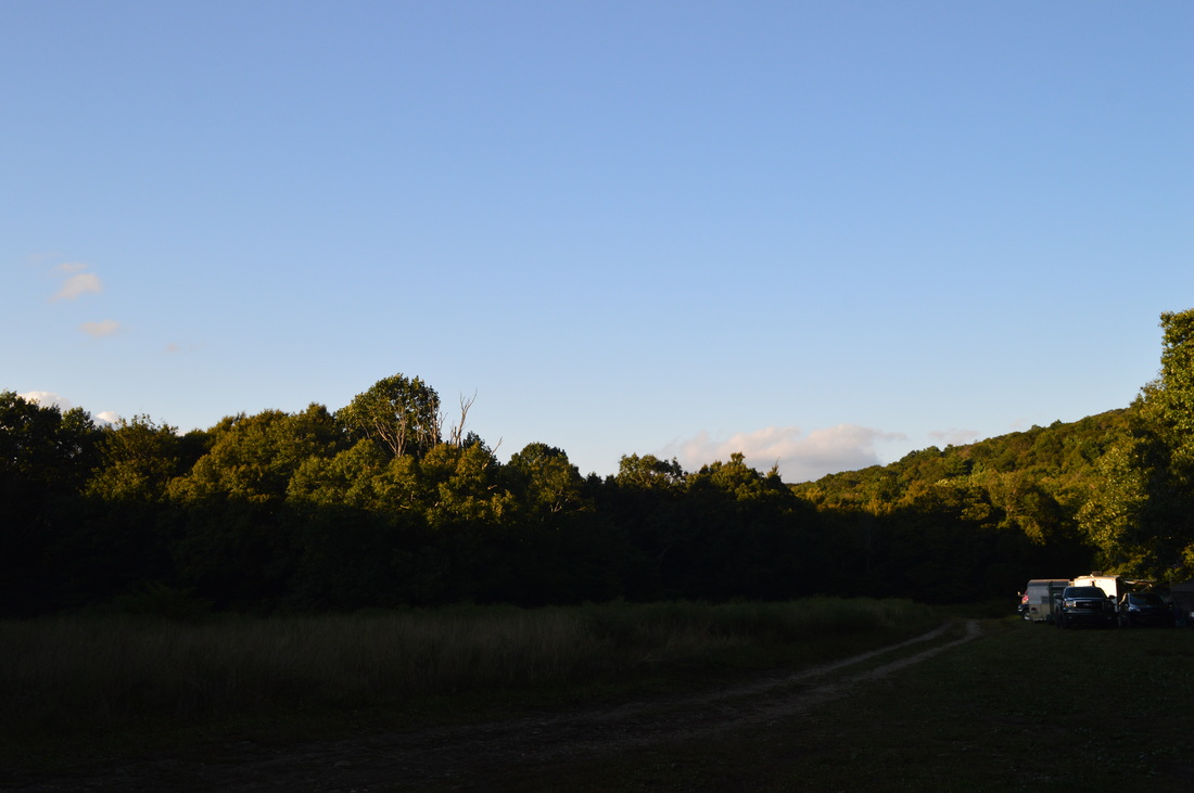
Emery Creek is a mountain stream located on the southern fringe of the Cohutta Mountains. The creek is full of waterfalls and cascades, with five waterfalls visible from near the trail and many more smaller cascades. To see all of the waterfalls on Emery Creek, you'll have to get a bit wet, with two dozen fords roundtrip, but it's worth it. Additionally, you can extend your hike to Little Bald Mountain, where in the winter, the views are extensive, and in the summer, the trail goes through whole fields of ferns.  This hike occurred on Saturday, September 12th, 2015. My plan was to hike the Emery Creek Trail out and back from the southern terminus near Holly Creek to the northern terminus near Little Bald Mountain.

​Summary

R/T Length of Trail: 13.6 Miles
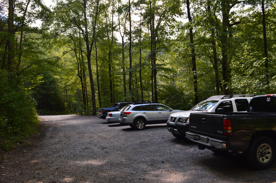
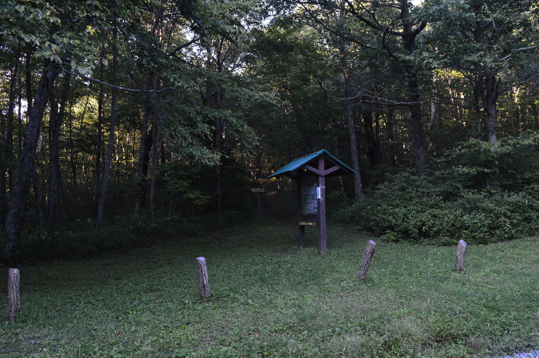
Duration of Hike: 8:00
Type of Hike: Out and Back
Difficulty Rating: 7 out of 10
Pros: Generally easy-to-follow trail; most fords are easy
Cons: None
Points of Interest: First Falls (Main Falls) - 6 stars; Second Falls - 4 stars; Third Falls - N/A (I didn't find a way to reach it); Fourth Falls - 5 stars; Fifth Falls - 3 stars; Little Bald Mountain Vista - 1 star
Trail Blaze Color(s): Emery Creek Trail - Green (although generally there are few blazes)
Best Season(s) to Hike: ​Spring
Beginning Point: Holly Creek Trailhead
Directions: From Ellijay, GA: Follow GA State Route 52 West for 9.3 miles. Then, turn right onto Conasauga Road. 1.2 miles from the turn, the road turns to gravel - continue straight. In another 2.1 miles, reach Old CCC Camp Road. Bear left. In 2.8 miles, the parking area for the Emery Creek Trail will be on the right at a switchback in the road. If you reach a bridge over Holly Creek, you have gone too far. All of the unpaved roads that lead to this trail are in good condition for most passenger vehicles.

​Map

​Details

The Emery Creek Trail has been on my "to-go" list for over a year, and all the time, it seemed like I had to do it. After hiking it, I could only have regretted that I haven't done it sooner - it's a beautiful trail that showcases one of north Georgia's most beautiful, cascade-filled creeks, in addition to some picturesque forest near Little Bald Mountain. Even though the only vista on this trail laves something to be desired, the other attractions make up for it.

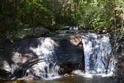
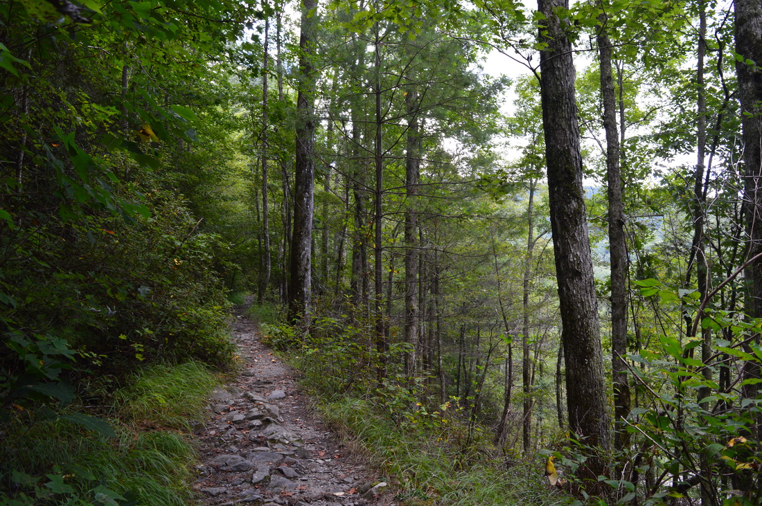
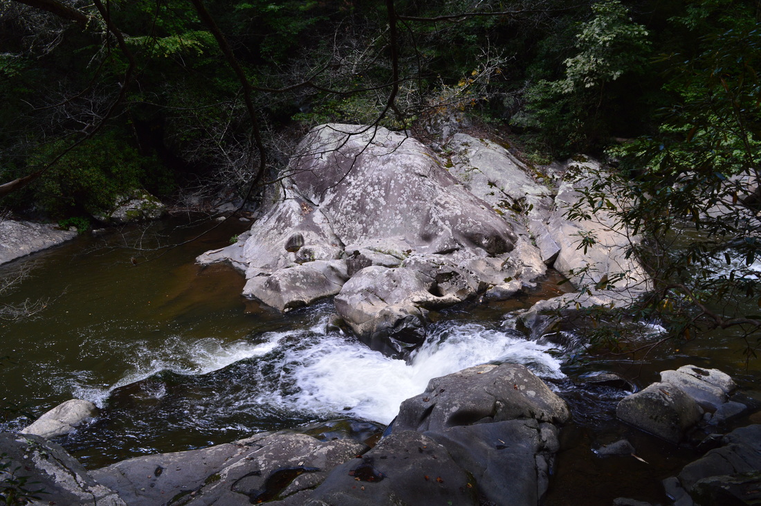
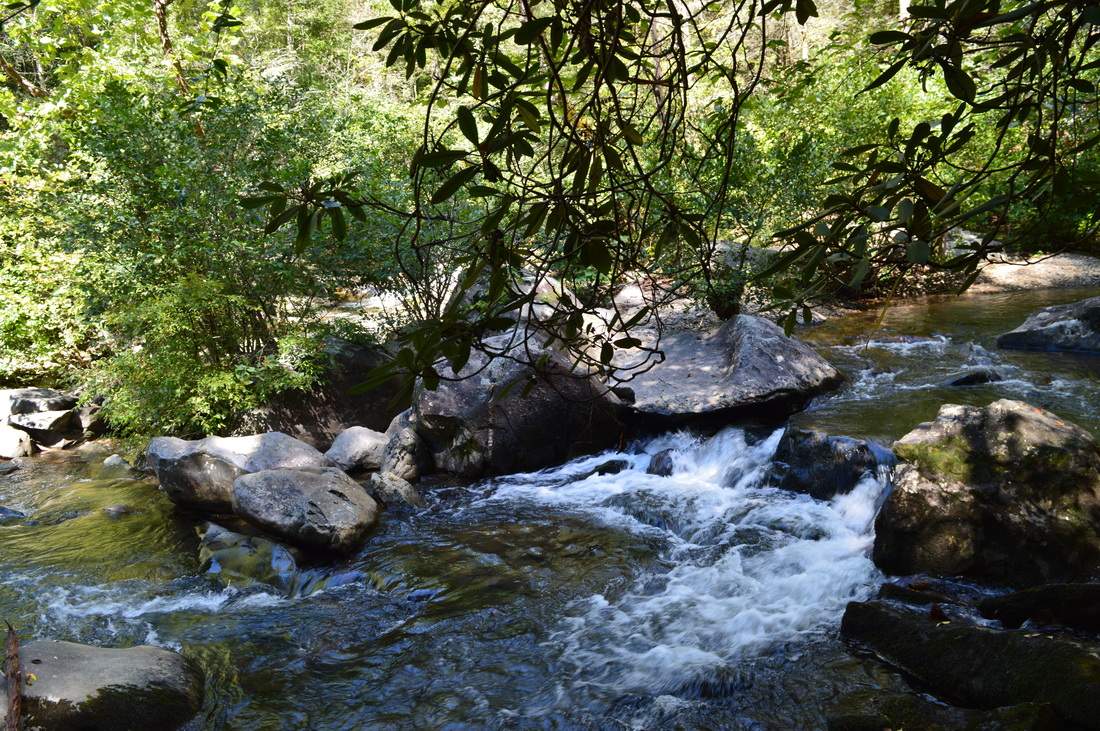
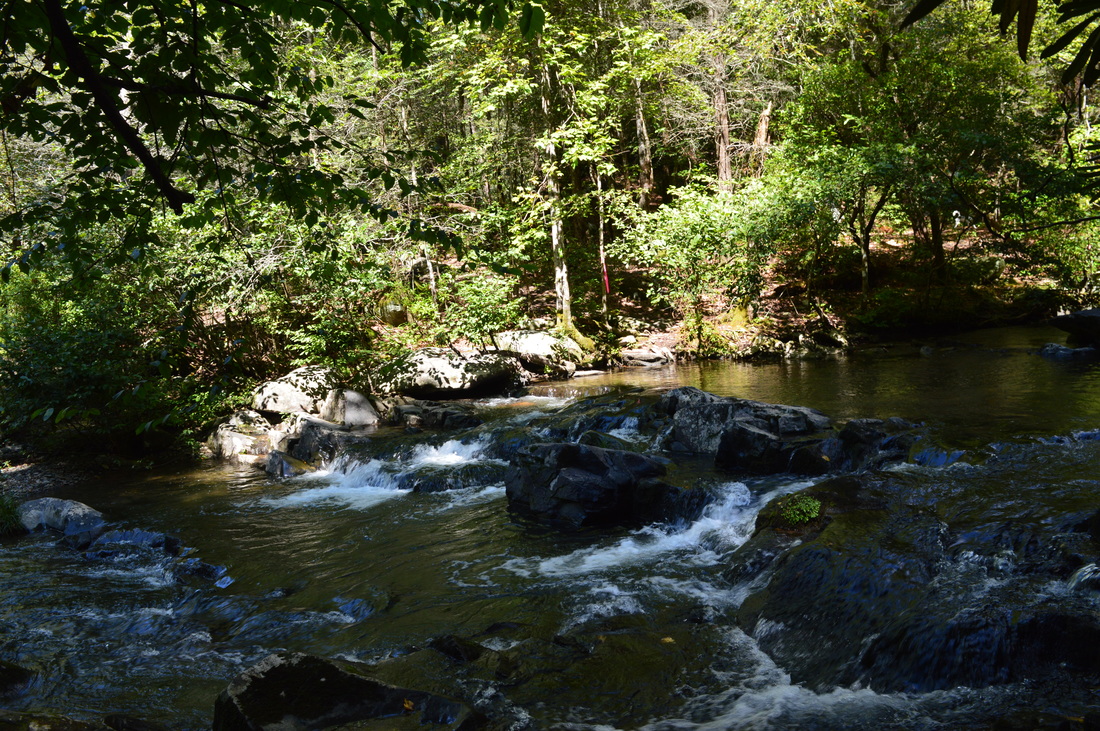
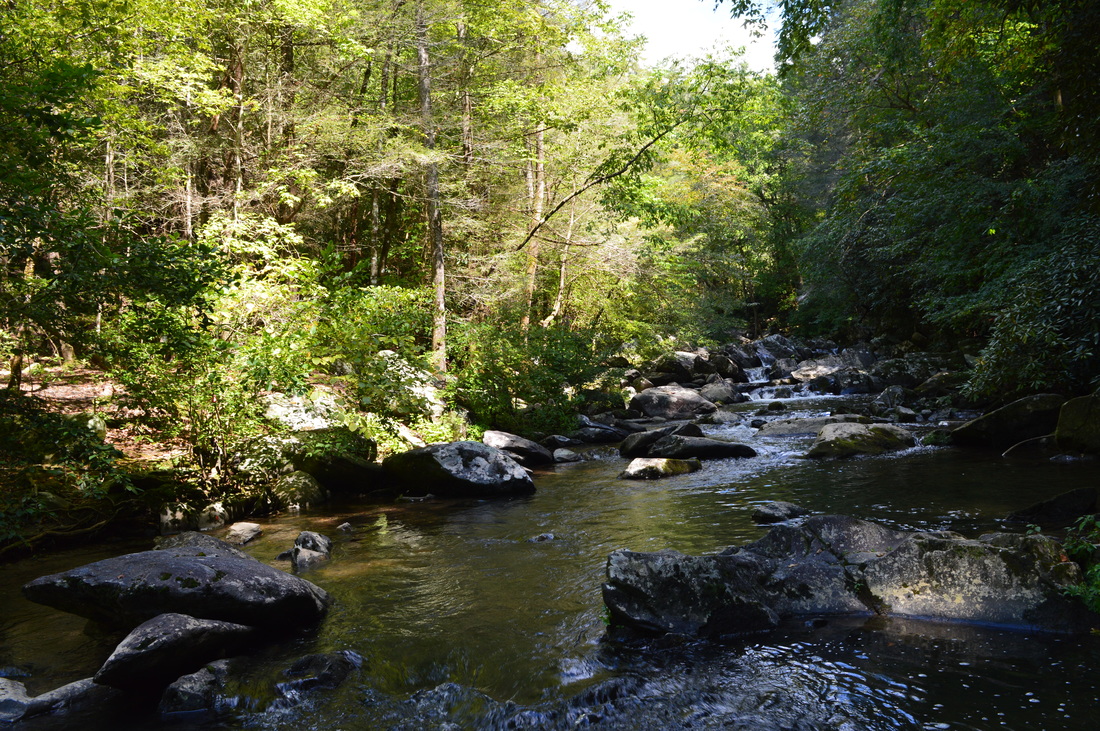
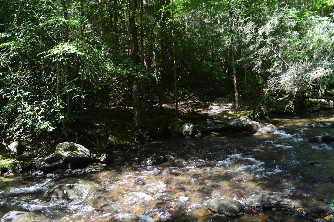
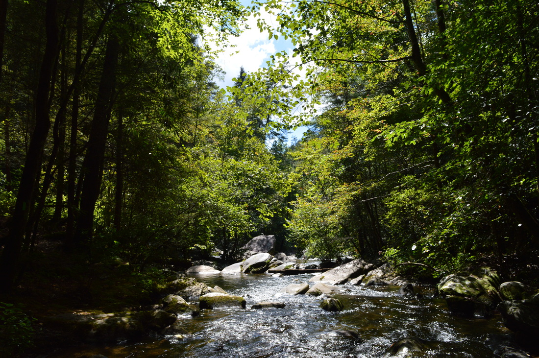
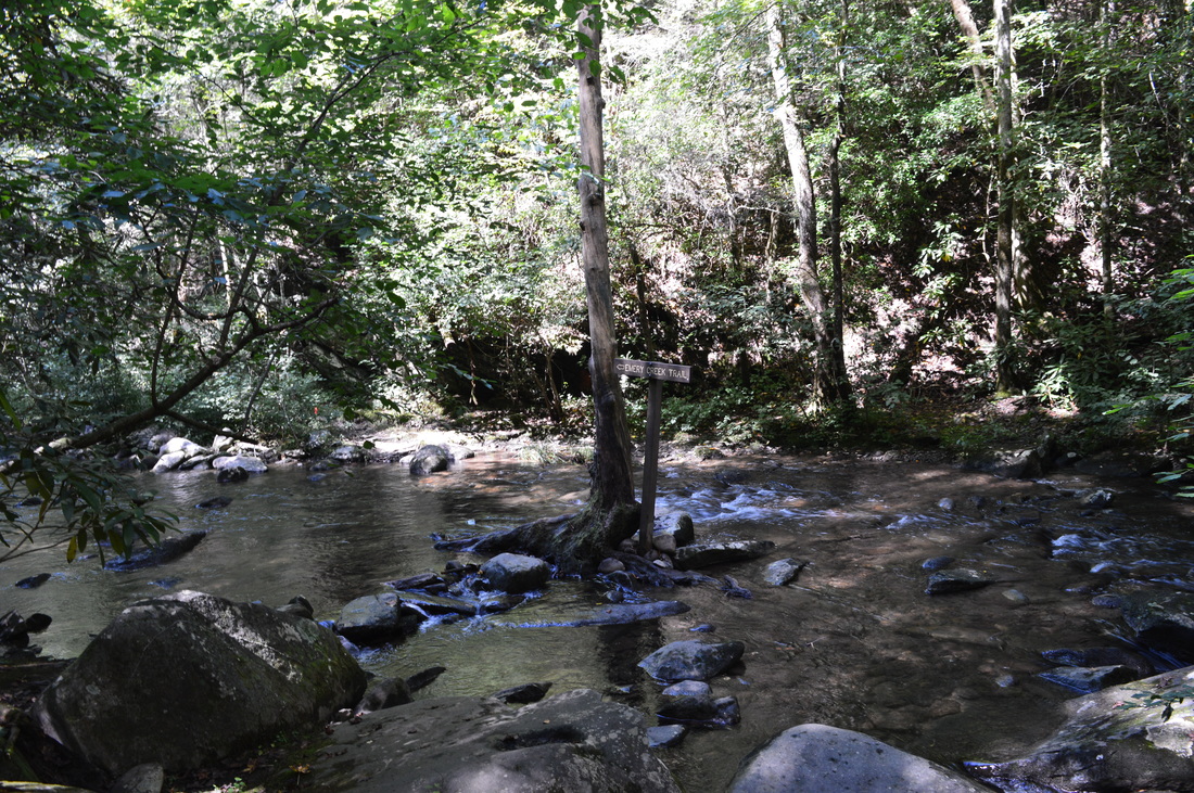
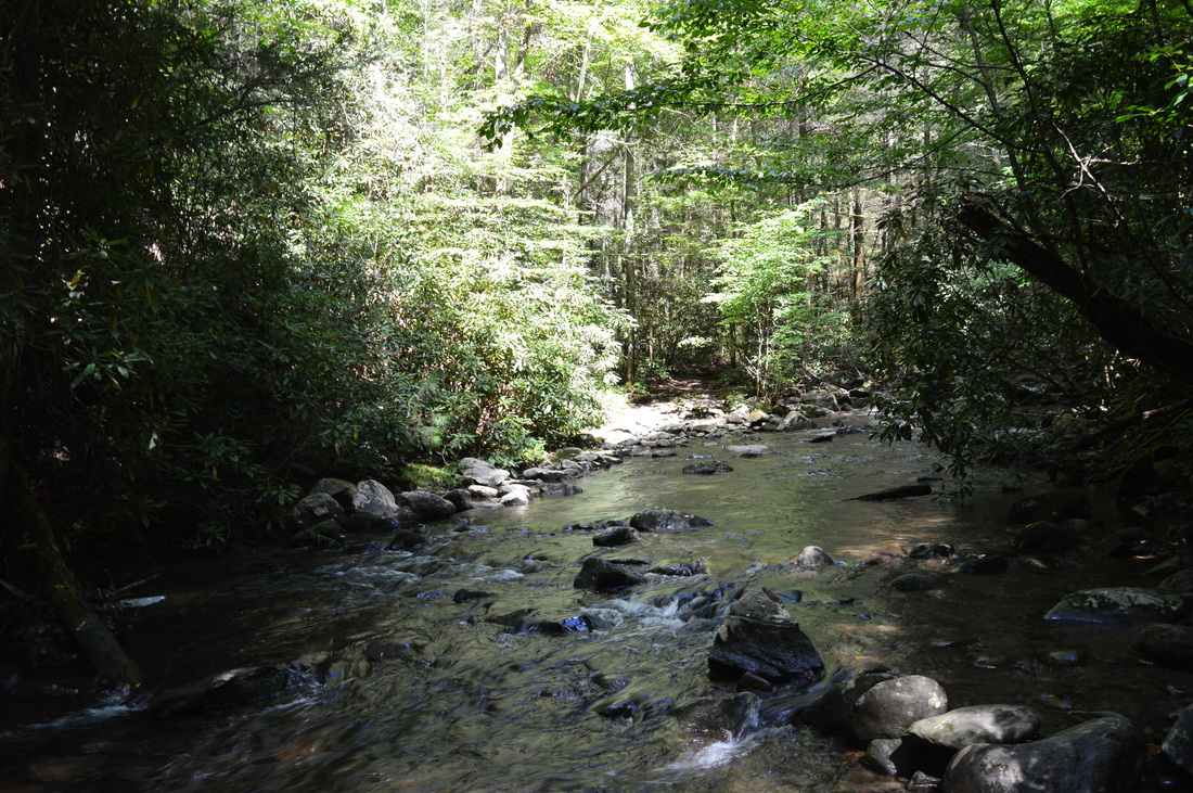
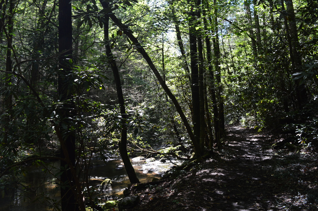
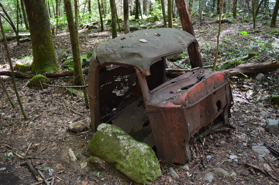
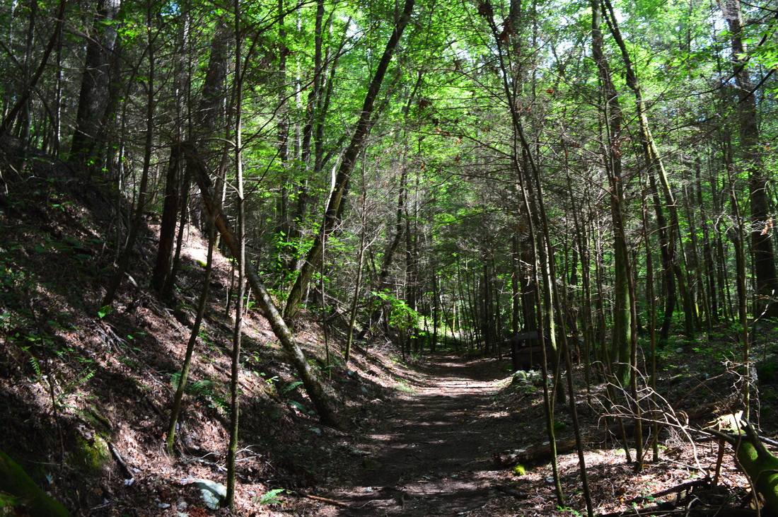
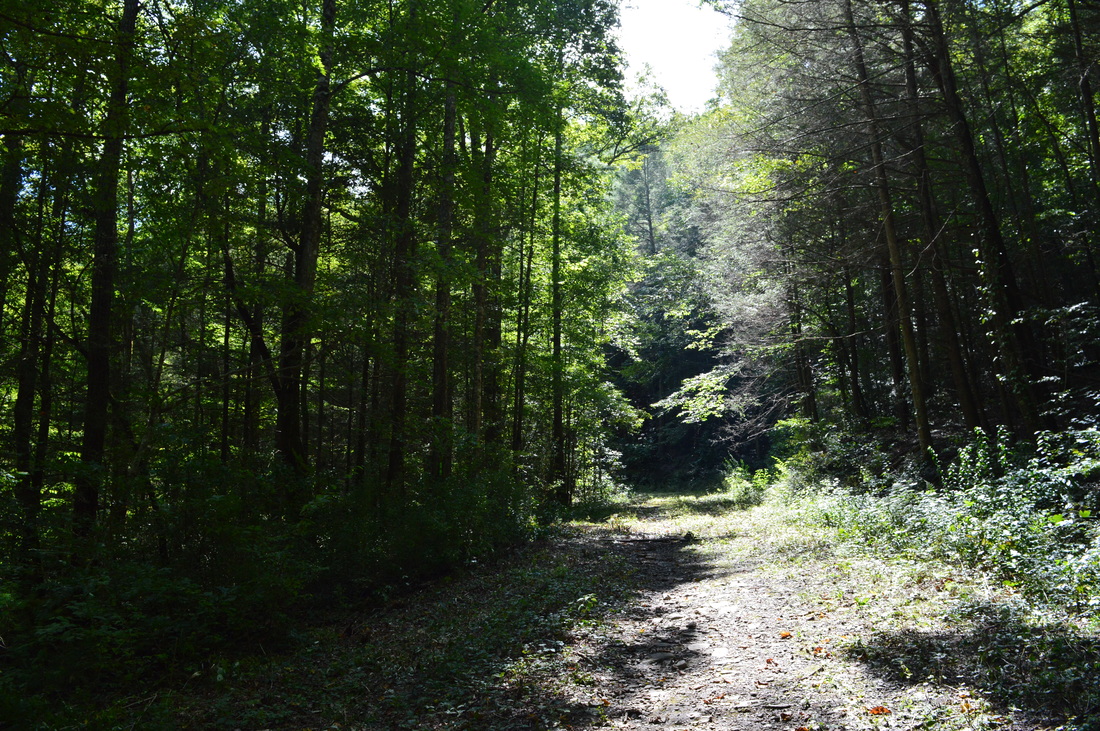
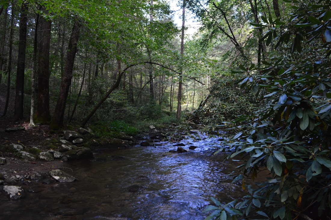
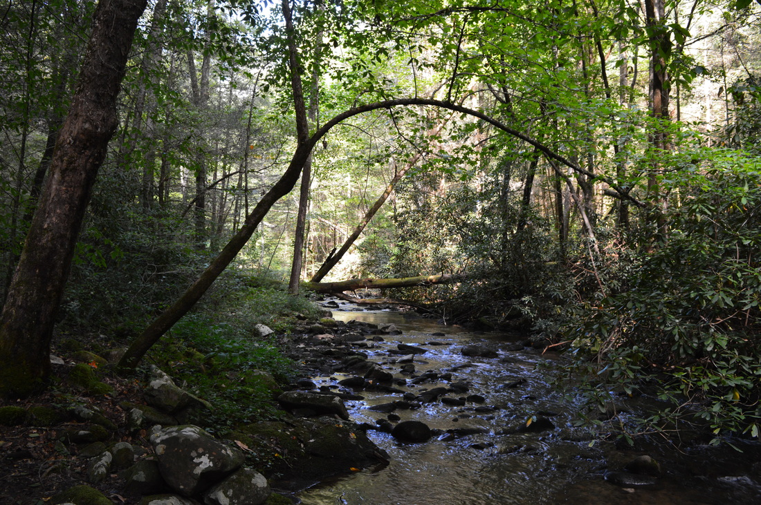
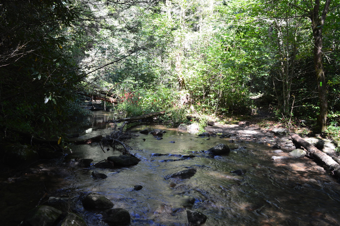
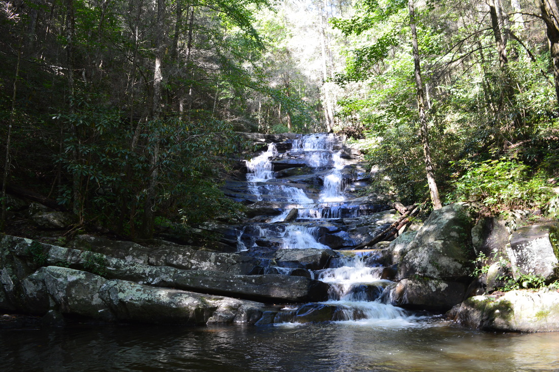
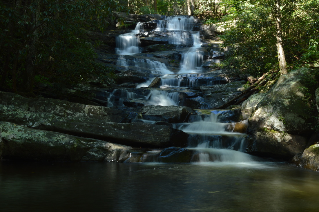
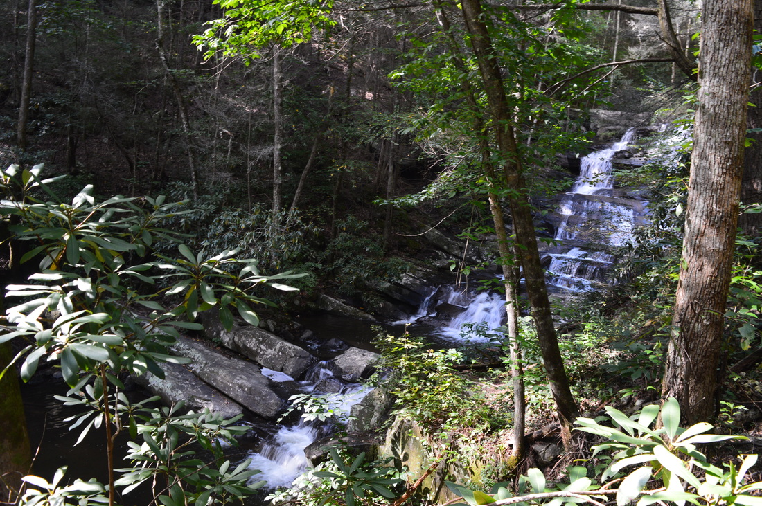
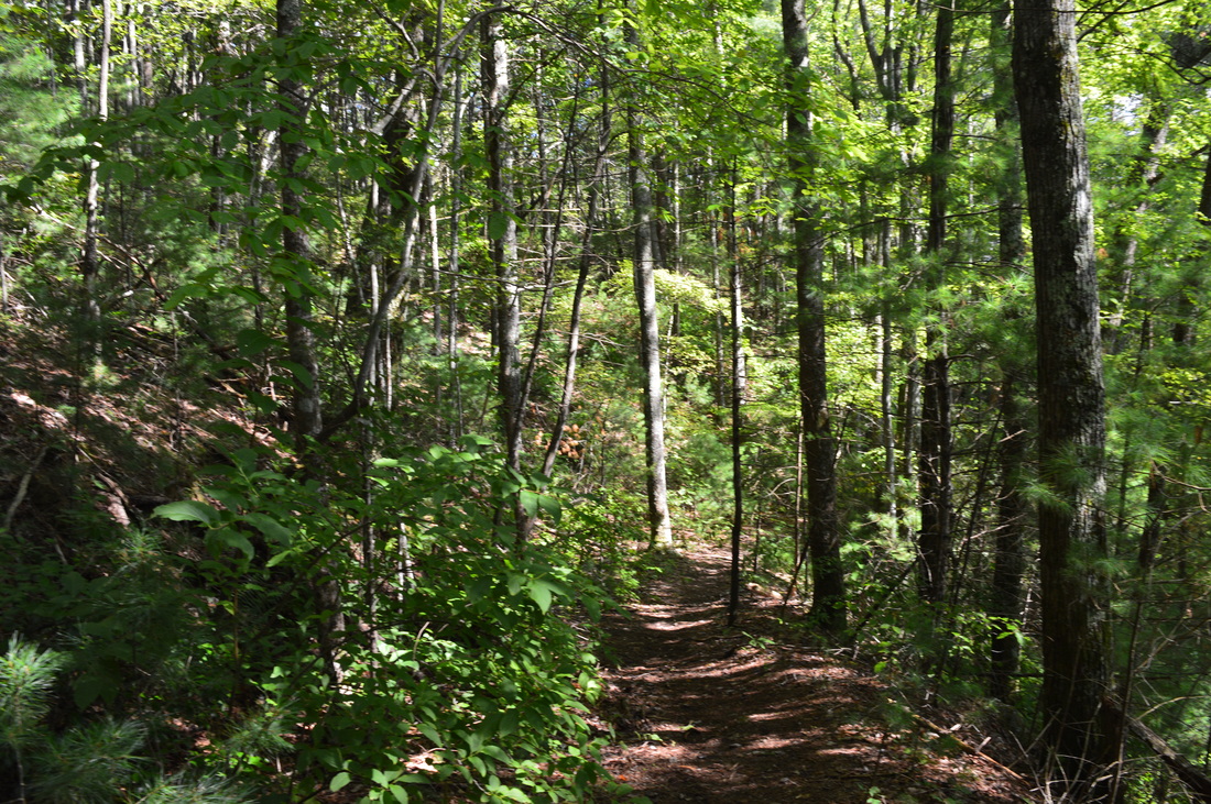
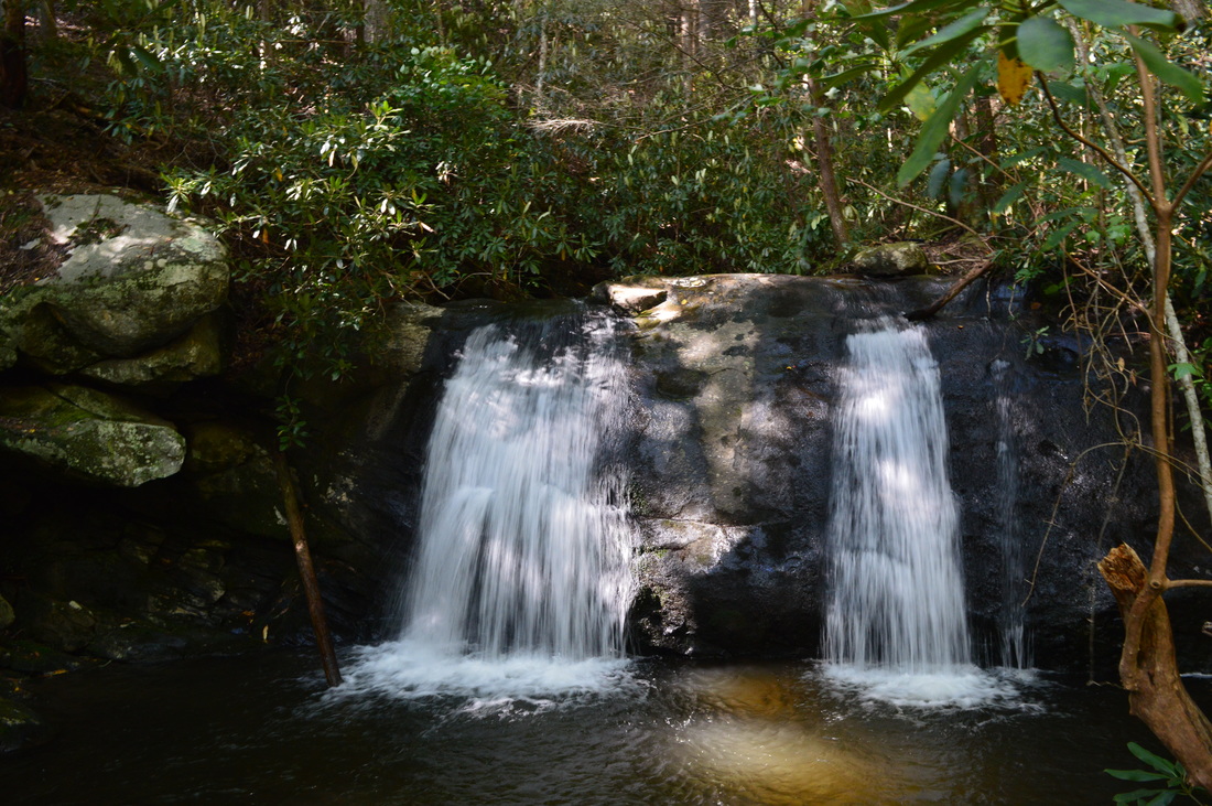
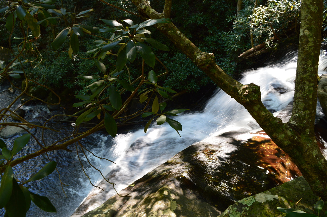
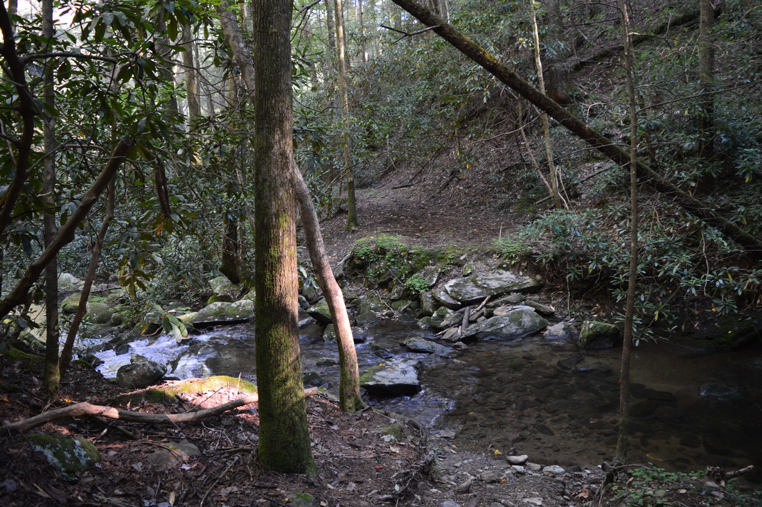
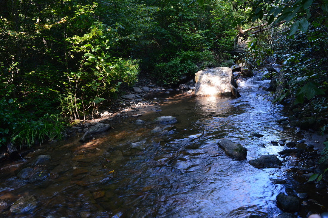
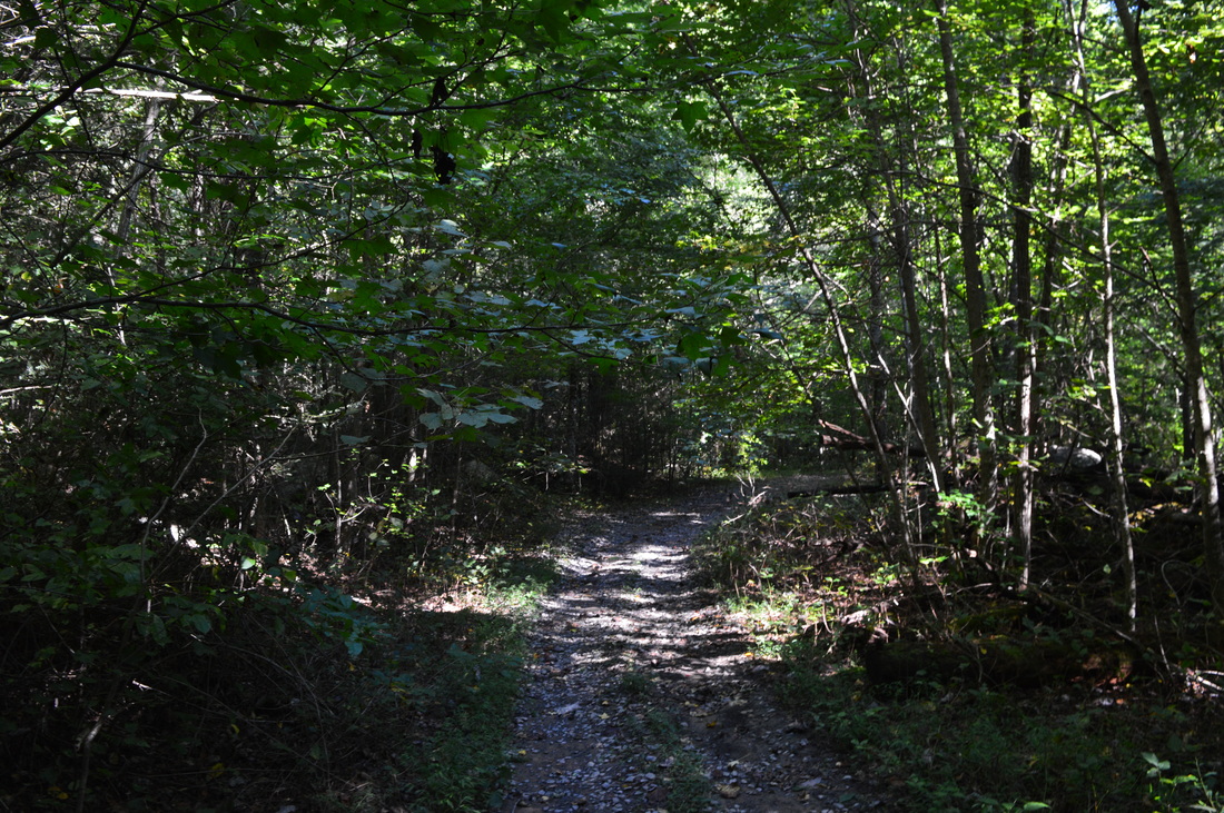
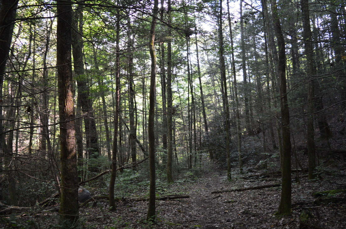
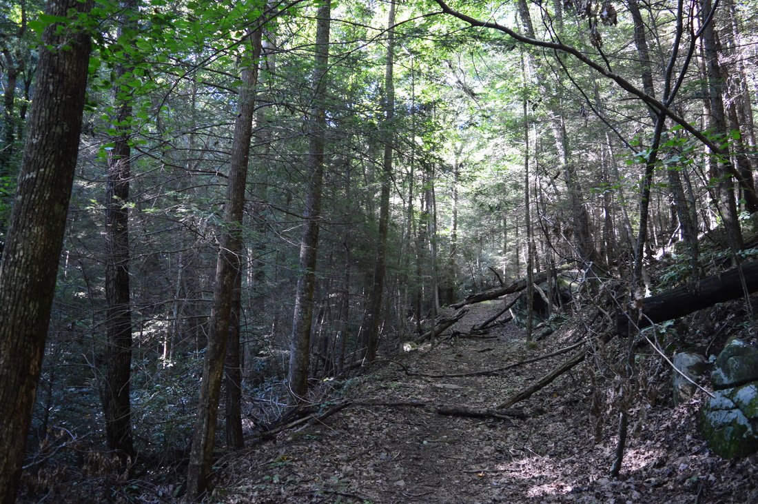
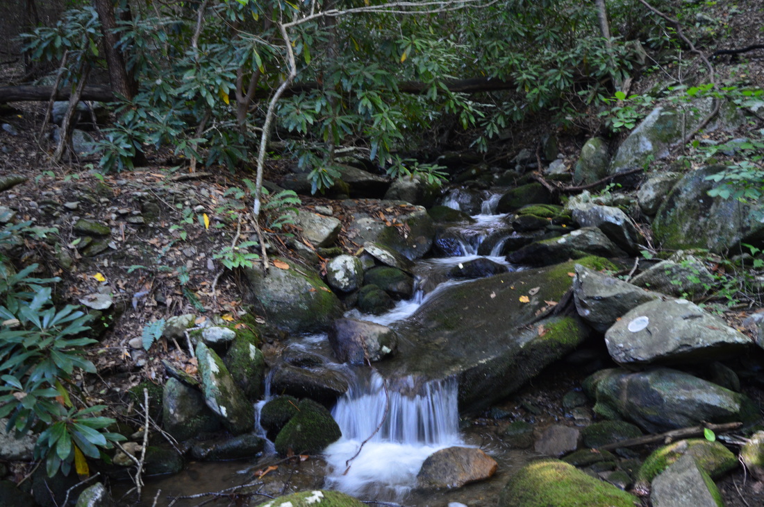
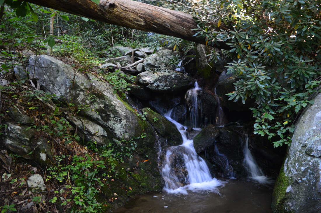
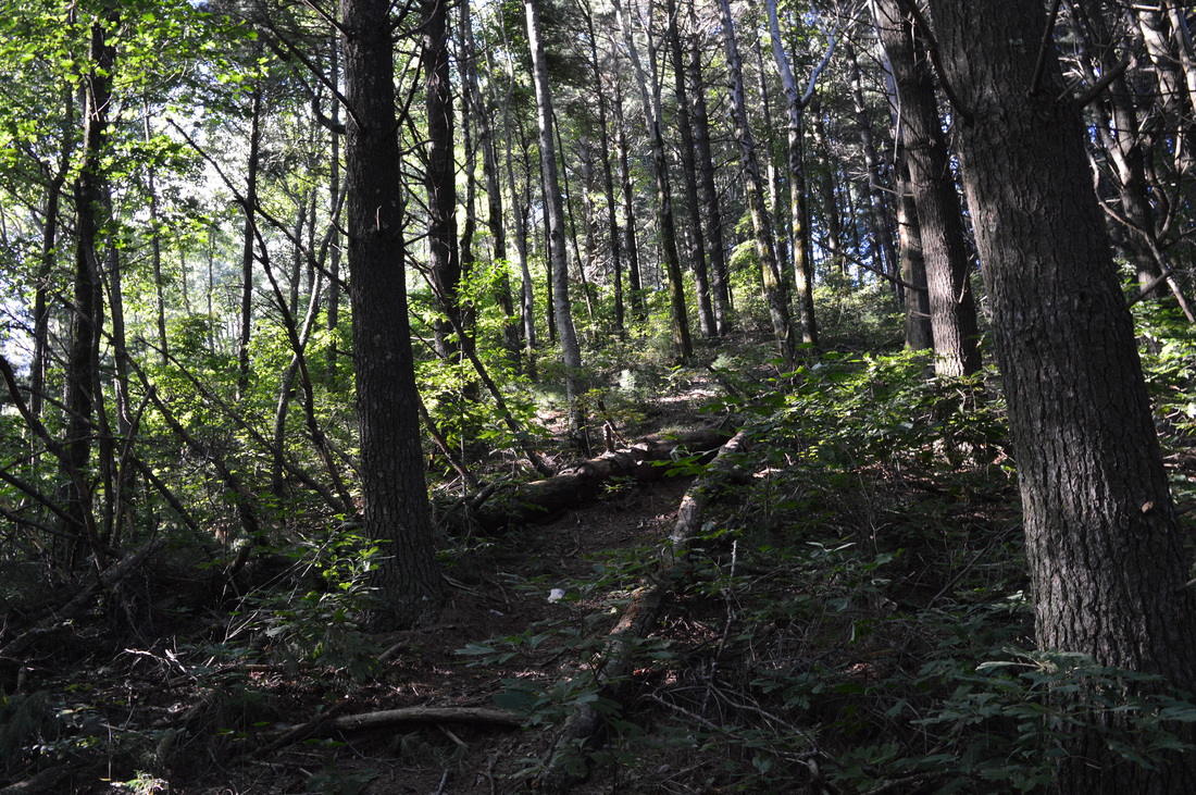
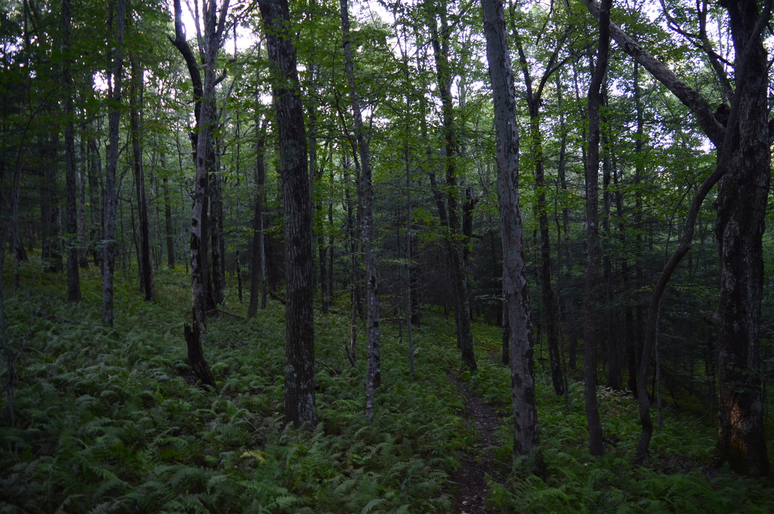
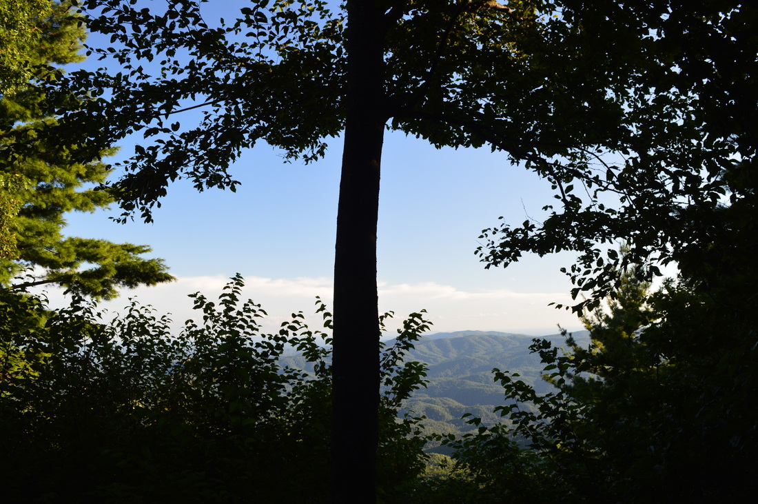
The Emery Creek Trail actually starts out above Holly Creek, and follows it for the first half-mile. Emery Creek is a tributary of Holly Creek. At 0.1 mile, the trail crosses a wet-weather stream and continues to stay parallel to Holly Creek, gradually descending to it. You will pass several steep side trails that lead to pools and cascades in the creek. At 0.4 miles, reach Holly Creek. The trail scrambles over a small boulder field at the creek and then up a rock outcrop. Here is the confluence of Emery Creek and Holly Creek. Continue on a narrow trail along Holly Creek to the first of 12 fords on this hike just above the confluence. This ford, the only ford of Holly Creek, is the deepest and most difficult ford on the hike. The ford is knee deep and has some slippery rocks, but if you will be careful, it will not be very hard. On the other side of Holly Creek, pass through a camping area and make the second ford, this time across Emery Creek (all other fords on this hike are across Emery Creek). All fords of Emery Creek are around ankle deep and quite easy. Following this second ford, the trail closely parallels Emery Creek along its west side. At the next ford, there is a sign on a small island in the middle of the creek. The sign indicates that you're headed toward Emery Creek Falls. You will soon pass the remains of a junk car near the trail. There is nothing much of detail as the trail crisscrosses the creek until the falls. Following the sixth ford, the trail will turn right on an old road at 1.5 miles, and then, at 1.6 miles (after a tributary crossing), the trail will leave the roadbed and turn left to continue following Emery Creek. Following the ninth ford, ascend up a steep bank and reach the spur trail to Emery Creek Falls at 2.5 miles.

Turn left onto the spur trail to Emery Creek Falls. At 2.6 miles, reach Emery Creek Falls. Emery Creek Falls is a beautiful multi-cascade waterfall with a large pool at its base. In my opinion, Emery Creek Falls is the most photogenic of the five waterfalls on Emery Creek. In summer, the pool at the falls is a popular swimming hole. Most hikers will turn around here and retrace their steps to the trailhead. However, many waterfalls lie farther ahead, and in fact, one of them is just 0.1 miles upstream. From the main falls, look for a narrow uphill path that seems to ascend along Emery Creek Falls on the right side of the creek. Follow this path for some good side views of Emery Creek Falls. At the top of Emery Creek Falls, the path ends at a campsite at 2.7 miles. The second falls is right in front of you, complete with its own pool. This is a small waterfall, more like a cascade, that is a precursor to the big falls just downstream. From the second falls, return to the main trail (the junction with the spur trail), reaching it at 2.9 miles. Continue north on the Emery Creek Trail. The trail begins a steady ascent along a small tributary of Emery Creek. You will soon switchback away from the tributary, and then ascend onto a dry slope high above Emery Creek. There are winter views to the south and west here. At 3.8 miles, the trail approaches Emery Creek again. There is a spur trail to the left that leads to the third falls, fourth falls, and the fifth falls. The fifth falls is a small cascade waterfall similar to the second falls. The fourth falls, just below the fifth falls, is a single-drop waterfall. It is difficult to reach the base of the fourth falls, and it involves some scrambling. The side view is easier to see. The third falls is located below the fourth falls, but I didn't find a way to reach it. I could only hear it. If anyone hikes this trail and reaches the third falls, please let me know how you got to it.

Following the third, fourth, and fifth falls, continue on the Emery Creek Trail upstream along Emery Creek. You will soon reach the tenth ford of the creek - notice that the fords keep getting shallower and easier. The eleventh ford sand the final twelfth ford come shortly afterward. After the twelfth ford, the trail reaches Forest Service Road 78E at 4.2 miles. Turn left onto the gravel road, and shortly afterwards, turn right and continue on an old roadbed that the Emery Creek Trail follows. After this, the trail begins to pick up an uphill trend as the Emery Creek valley steepens and the creek becomes smaller. The trail will cross a number of various streams that join Emery Creek. A moderate uphill commences along the old roadbed. Eventually, the trail will totally leave the creek and ascend up drier slopes on its way to Little Bald Mountain. The ascent up Little Bald Mountain is fairly difficult. There are steep sections mixed in with generally moderate uphill. At 6.3 miles, the trail passes through a large field of ferns and then traces a ridge that leads up to Little Bald Mountain. At 6.5 miles, reach a small westward vista. This vista is very grown-up and in summer, it provides only a small view. The view may be better in winter. After the vista, the ascent gradually ends as the trail bypasses the summit of Little Bald Mountain. You will pass a ladder on the left side of the trail that leads to a small deer-hunting booth. At 6.9 miles, reach the northern terminus of the Emery Creek Trail in a large grassy field/camping area near Forest Service Road 68. At the grassy field, turn right onto a dirt road. Follow the dirt road downhill through the camping area and reach Forest Service Road 68 at 7 miles, in a gap between Little Bald Mountain and Bald Mountain. The Tearbritches Trail starts across the road and continues over Bald Mountain and to Bray Field near the Conasauga River. This is your turnaround point. Retrace your steps back along the Emery Creek Trail. You will return to the starting point at 13.6 miles.

​Variations

Hike just to Emery Creek Falls and Second Falls and back - 5.4 Miles
Hike just to Third Falls, Fourth Falls, and Fifth Falls - 7.6 Miles

​Bonus Stops

Holly Creek Falls near FS 18, located on Holly Creek approximately 1 mile east of the Emery Creek Trailhead.

​Pictures

​Videos

1 Comment
Edirne ECA servisi link
8/3/2022 05:30:04 pm

Edirne ECA servisi hizmetlerimiz memnuniyet odaklıdır. Detayları incelemek için hemen web adresimize göz at! https://www.edirneklimaservisi.com/edirne-eca-servisi/

Reply


Leave a Reply.

    About Me

    Mark Oleg Ozboyd
    I'm an avid outdoor explorer and a hobbyist landscape photographer. I'm 21 years old and have been hiking since 2011. Originally based out of Atlanta, Georgia, I started out by occasionally hiking short trails throughout well-known Georgia State Parks. During 2012 and 2013, I began to expand my trips into adjacent states, as well as into the wilder National Forest areas rather than just State Parks. Throughout the years that followed, as I slowly ran out of popular hiking trails in my area, I began to search for and hike in more seldom-visited areas. Today, you can find me out in the woods every weekend, whether it's on an official trail or bushwhacking through cross-country terrain without any paths. I now attend Washington & Lee University and am exploring Virginia and West Virginia. My other hobbies include chess, science, old music, and meteorology. I have 3 years of amateur weather forecasting experience, having studied a lot of meteorology basics over the years. I am also a student at European School of Music where I learned that music and nature have a lot in common. Listening to good music inspires me to capture nature's beauty on the camera in different aspects that also make me recall many beautiful music pieces that I've heard.​


    Dear readers: I have invested a tremendous amount of time and effort in this website and the Georgia Waterfalls Database the past five years. All of the work that has gone in keeping these websites updated with my latest trip reports has almost been like a full-time job. This has not allowed me to pick up a paid job to save up money for college, and therefore, I I've had to take out loans. If you find the information on this website interesting, helpful, or time-saving, you can say "thanks" and help me out by clicking the button above and making a contribution. I will be very grateful for any amount of support you give, as all of it will apply toward my college tuition. Thank you! 

    Enter your email address to subscribe for trail reports:

    Delivered by FeedBurner


    Picture
    Coming in 2022-2023?

    Other Hiking Websites

    DWHike's Adventures
    Florida's Natural Wonders
    Florida Trailblazer
    Meanderthals
    Mountain Images
    by Bernie Boyer

    North Carolina Waterfalls with
    ​Kevin Adams
    Take-a-Hike!
    Tennessee Landforms
    Waterfall Page
    Waterfall Adventurer
    Zach's Mild Adventures

    Miles Hiked

    Year 1: 540.0 Miles
    Year 2: 552.3 Miles
    ​Year 3: 518.4 Miles
    Year 4: 482.4 Miles
    Year 5: 259.9 Miles

    Archives

    March 2021
    February 2021
    January 2021
    November 2019
    October 2019
    September 2019
    August 2019
    July 2019
    June 2019
    February 2019
    January 2019
    December 2018
    November 2018
    October 2018
    August 2018
    July 2018
    June 2018
    May 2018
    April 2018
    March 2018
    February 2018
    January 2018
    December 2017
    November 2017
    October 2017
    September 2017
    August 2017
    July 2017
    June 2017
    May 2017
    April 2017
    March 2017
    February 2017
    January 2017
    December 2016
    November 2016
    October 2016
    September 2016
    August 2016
    June 2016
    May 2016
    April 2016
    March 2016
    January 2016
    December 2015
    November 2015
    October 2015
    September 2015
    August 2015
    July 2015
    June 2015
    May 2015
    April 2015
    March 2015
    February 2015
    January 2015
    December 2014
    November 2014
    October 2014
    September 2014
    August 2014
    July 2014
    June 2014
    May 2014
    April 2014
    March 2014
    February 2014

    Categories

    All
    Adel
    Adirondack Park
    Alabama
    Alfred A. Ring Park
    Allegheny Trail
    Amicalola Falls State Park
    Anniston Area
    Apalachicola Bluffs And Ravines Preserve
    Apalachicola National Forest
    Apalachicola/Port St. Joe Area
    Apopka
    Appalachian Trail
    Appling
    Art Loeb Trail
    Aska Trail System
    Bakersville
    Balm-Boyette Scrub Preserve
    Balsam Lake Recreation Area
    Bankhead National Forest
    Bartow County Parks
    Bartram Trail
    Basinger
    Beersheba Springs
    Benton
    Benton Mackaye Trail
    Berry College Trail System
    Best Hike
    Big South Fork National Recreation Area
    Black Bear Wilderness
    Black Rock Mountain State Park
    Blairsville
    Blakely
    Blood Mountain Wilderness
    Blowing Rock
    Blue Ridge
    Blue Ridge Parkway
    Boone
    Bradenton
    Bradenton Beach
    Brasstown Bald
    Brasstown Wilderness
    Brevard
    Bryson City
    Buchanan
    Bucks Pocket State Park
    Bulow Creek State Park
    Bulow Plantation Ruins State Park
    Caesars Head State Park
    Caladesi Island State Park
    Calhoun
    Camel's Hump State Park
    Cashiers
    Caspersen Beach Park
    Catfish Creek State Park
    Caves
    CC Putnam State Forest
    Cedar Point Environmental Park
    Chatsworth
    Chattahoochee National Forest
    Chattanooga
    Chattanooga Valley
    Chattooga National Wild And Scenic River
    Cheaha Wilderness
    Cherohala Skyway
    Cherokee
    Cherokee National Forest
    Chiefland Area
    Chillhowee Recreation Area
    Chipley
    Chunky Gal Trail
    Circle B Bar Reserve
    Citico Creek Wilderness
    Citrus Wildlife Management Area
    Clarkesville
    Clayton
    Cleevland
    Cleveland
    Cloudland Canyon State Park
    Cohutta Wilderness
    Collier-Seminole State Park
    Cordele
    Cornelia
    Covington
    Crestview Area
    Crew-land-and-water-trust
    Cullowhee
    Cumberland Trail
    Dahlonega
    Dalton
    Dawson Forest Wildlife Management Area
    Dawsonville
    Dayton
    De Soto National Memorial
    DeSoto State Park
    Dillard
    Double Springs
    Ducktown
    Duncan Ridge Trail
    Dunlap
    Eagle's Rest Park
    Eastpoint
    Econfina Creek Wildife Management Area
    Eglin Air Force Base
    Elizabethton
    Elkins
    Elk Knob Game Lands
    Elk Park
    Ellicott Rock Wilderness
    Ellijay
    Emerson Point Preserve
    Englewood Area
    Enota Retreat
    Erwin
    Falling Waters State Park
    Fayetteville
    Fires Creek Recreation Area
    Fire Tower
    Flint River
    Florence Area
    Florida
    Florida Caverns State Park
    Florida Trail
    Foothills Trail
    Fort Mountain State Park
    Fort Myers Area
    Fort Payne
    Fort Payne Area
    Fort Yargo State Park
    Franklin
    Franklin Delano Roosevelt State Park
    Franklin-Marion State Forest
    Frozen Head State Park
    Gainesville
    Gainesville Area
    Gatlinburg
    George Washington National Forest
    Georgia
    Georgia Veterans Memorial State Park
    Glasgow
    Gorges State Park
    Grandfather Mountain State Park
    Great Smoky Mountains National Park
    Greeneville
    Green River Game Lands
    Gruetli-Laager
    Grundy Forest State Natural Area
    GTM Reserve
    Guana River Wildlife Management Area
    Hayesville
    Helen
    Hiawassee
    High Falls State Park
    Highlands
    Highlands Scenic Highway
    Hillsborough River State Park
    Hinson Conservation & Recreation Area
    Historic Sites
    Honeymoon Island State Park
    Hot Springs
    Huntington
    Inverness Area
    Jackson
    Jasper
    Jefferson National Forest
    Joan M. Durante Park
    Jonathan Dickinson State Park
    Jones Gap State Park
    Joyce Kilmer Slickrock Wilderness
    Joyce Kilmer - Slickrock Wilderness
    Juniper Prairie Wilderness
    Kelly Park
    Keown Falls Recreation Area
    Kolomoki Mounds State Park
    LaFayette
    Lake City Area
    Lake George Wild Forest
    Lake June-in-Winter State Park
    Lakeland Area
    Lake Placid
    Lake Russell Wildlife Management Area
    Lake Wales Ridge State Forest
    Laurel Fork North Wilderness
    Leffis Key Preserve
    Leon Sinks Geological Area
    Lexington
    Lineville
    Linville
    Linville Gorge Wilderness
    Lithia Springs
    Little Frog Wilderness
    Little Manatee River State Park
    Little River Canyon National Preserve
    Longboat Key
    Long Trail
    Lookout Mountain
    Lookout Mountain Battlefield
    Lovingston
    Lula Lake Land Trust
    Lumpkin
    Maggie Valley
    Manatee Springs State Park
    Marianna Area
    Mark Trail Wilderness
    Marlinton
    Mccaysville
    McMinville
    Mentone
    Middlesex
    Mistletoe State Park
    Monongahela National Forest
    Montreat
    Mountain Bridge Wilderness Area
    Mountain City
    Mountains To Sea Trail
    Mountains-to-Sea Trail
    Mount Rogers National Recreation Area
    Myakka River State Park
    Myron B. Hodge City Park
    Nantahala National Forest
    Naples
    Naples Area
    Natural Bridge State Park
    Neal Preserve
    New Castle
    Newport
    New River Gorge National Park
    New York
    North Carolina
    Ocala Area
    Ocala National Forest
    Ocean-to-Lake Trail
    Oconee State Park
    Oconee Station Historic Site
    Okaloacoochee Slough State Forest
    Oldsmar
    Oneida
    Orlando Area
    Ormond Beach
    Oscar Scherer State Park
    Oxford
    Palatka
    Palmetto Trail
    Panama City Area
    Panthertown Valley
    Parrish
    Paynes Creek Historic State Park
    Peaks Of Otter Recreation Area
    Pigeon Crockford Mountain Wildlife Management Area
    Pigeon-Crockford Mountain Wildlife Management Area
    Pigeon-Crockford Wildlife Management Area
    Pine Mountain
    Pinhoti Trail
    Pinnacle Park
    Pisgah Civitan Park
    Pisgah National Forest
    Pittman Center
    Pond Mountain Wilderness
    Ponds/Lakes
    Prentice Cooper State Forest
    Providence Canyon State Park
    Pumpkintown
    Quick Point Nature Preserve
    Raven Cliffs Wilderness
    Reed Bingham State Park
    Reliance
    Rice Creek Conservation Area
    Riverview Pointe Preserve
    Robbinsville
    Robinson Preserve
    Rock Creek Gorge Scenic Area
    Rock Island State Park
    Rome
    Rosman
    Sale Creek
    Salem
    Salt Springs
    Saluda
    Santa Rosa Beach
    Sarasota
    Sarasota Area
    Savage Gulf State Natural Area
    Scenic Views
    Scottsboro Area
    Sebring Area
    Sewanee
    Sheltowee Trace Trail
    Shining Rock Wilderness
    Signal Mountain
    Sipsey Wilderness
    Sky Valley
    Smithgall Woods State Park
    Snowbird Backcountry Area
    Soddy Daisy
    Soddy-Daisy
    Sopchoppy
    South Carolina
    South Cumberland State Park
    Southeastern Cave Conservancy
    Southern Nantahala Wilderness
    Sparta
    Sprewell Bluff Park
    Spring City
    Spring Hill
    Springs
    Spruce Pine
    Standing Indian Backcountry Area
    St. Augustine
    St. George Island State Park
    St. Joseph Bay State Buffer Preserve
    St. Marks Area
    St. Marks National Wildlife Refuge
    Stone Mountain
    Stone Mountain Park
    Suches
    Sumatra
    Sumter National Forest
    Suwannee River
    Swallow Creek Wildlife Management Area
    Sweetwater Creek State Park
    Sylva
    Talladega National Forest
    Tallahassee Area
    Tallulah Falls
    Tallulah Gorge State Park
    Tampa Bay Area
    Tate City
    Tate's Hell State Forest
    Tea Creek Wildlife Management Area
    Tellico Plains
    Tennessee
    Thomaston
    Toccoa
    Topsail Hill State Park
    Torreya State Park
    Townsend
    Tracy City
    Tray Mountain Wilderness
    Trenton
    Triple Creek Preserve
    Troutdale
    Unaka Mountain Wilderness
    Upper Tampa Bay County Park
    Venice
    Vermont
    Virgin Falls State Natural Area
    Virginia
    Virginia Outdoors Foundation
    Vogel State Park
    Wakulla Springs State Park
    Waleska
    Walhalla
    Wartburg
    Water Features
    Waynesville
    Weedon Island Preserve
    Weeki Wachee Preserve
    Wekiwa Springs State Park
    West Palm Beach Area
    West Virginia
    Whitehall
    White Springs
    Winder
    Withlacoochee State Forest
    Young Harris

    RSS Feed

TRAIL REPORTS

Hikes in Alabama
​Hikes in Florida
Hikes in Georgia
Hikes in North Carolina
Hikes in South Carolina
Hikes in Tennessee
Hikes in Virginia

Hiking Resources

Alabama Resources
​
Florida Resources
Georgia Resources
North Carolina Resources
​South Carolina Resources
​
Tennessee Resources

Other

Contact
Map of Hikes
Alphabetical List of Hikes
Southeast Nature Society
© COPYRIGHT 2014-2018
​ALL RIGHTS RESERVED.
Important: I disclaim any responsibility for any damage or personal injury that may occur as a result of the activities and information found on this website. All outdoor activities, especially off-trail hiking, are done at your own risk. Never hike or head into that area that may be above your fitness or experience level.
  • Home
  • Trail Reports
    • Best Hikes
    • Hikes with Scenic Views
    • Hikes with Water Features
    • Alabama
    • Georgia
    • Florida
    • North Carolina
    • South Carolina
    • Tennessee
    • Vermont
    • Virginia
  • Map
  • Hike List
  • Testimonials
  • Resources
  • Contact Us
  • Southeast Nature Society
    • Our Team
  • Georgia Waterfalls Database