Nearly 80 miles of the Florida Trail pass through Apalachicola National Forest, Florida's largest national forest. At the very northwest end of the forest is Camel Lake, a small natural lake with a campground and a developed recreation area. On its route through the forest, the Florida Trail passes near Camel Lake. Nearby, an alternate trail called the Trail of Lakes can be used to loop this section of the FT. On this loop hike, you will visit two lakes, pass several blackwater streams, and hike through miles of sandhills topped by rows of pine trees. This hike occurred on Sunday, April 17, 2016. My plan was to hike the Trail of Lakes Loop clockwise.
Summary
R/T Length of Trail: 9.6 Miles
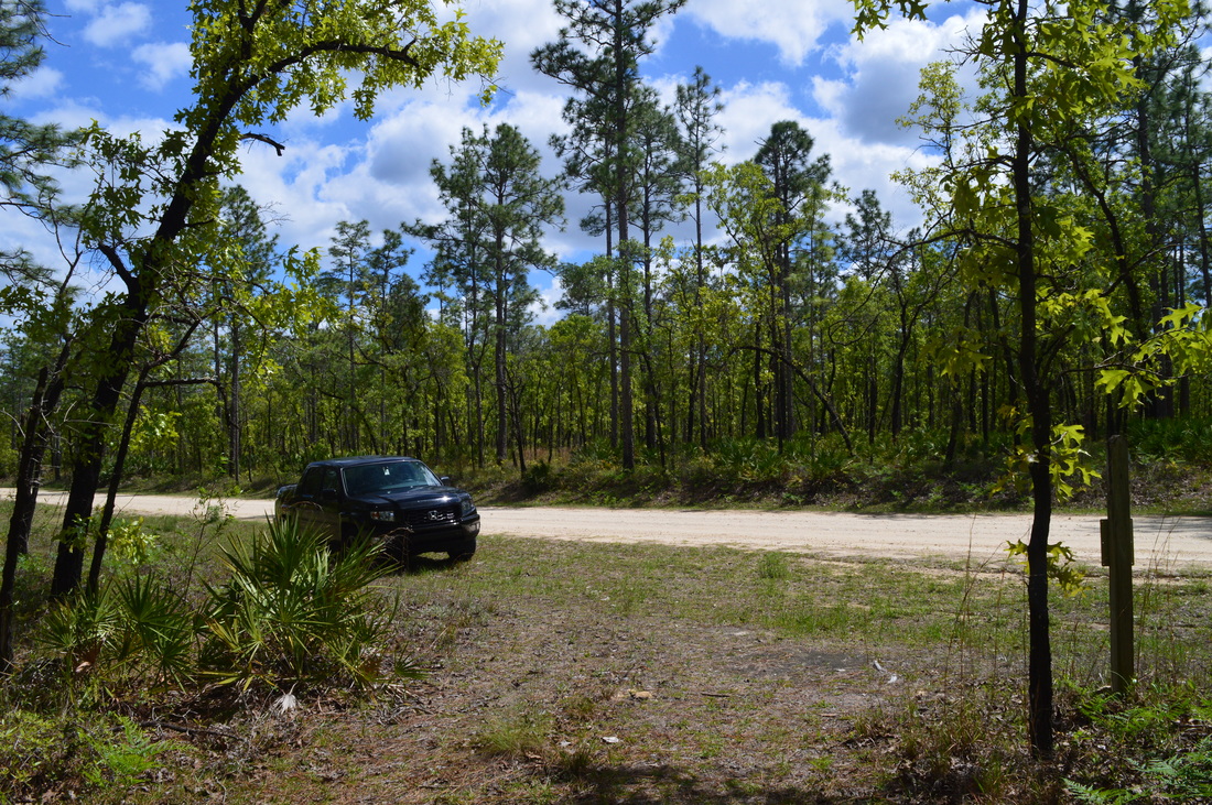
Duration of Hike: 4:35 Type of Hike: Loop Difficulty Rating: 2 out of 10 Total Elevation Gain: Minimal Pros: Nearly all creeks and marshes that are encountered on this hike are bridged well (there is an exception that will be listed in the details below) Cons: There is an area on the trail that has recently been under a controlled burn, causing that section of trail to become very confusing and nearly unrecognizable Points of Interest: Big Gully Creek area on Trail of Lakes; Sheep Island Pond; Bonnet Pond; Camel Lake Trail Blaze Color(s): Florida Trail - Orange; Trail of Lakes - Blue Best Season(s) to Hike: Spring Fees: There are no fees if you park on Forest Service Road 105 or any other forest service road that this hike crosses, but if you park inside the Camel Lake Recreation Area, there is a fee of $3 per vehicle per day. Beginning Point: The FS 105 crossing on the Florida Trail near Camel Lake Directions: From Bristol, FL: Follow County Road 12 South for 11.5 miles, entering Apalachicola National Forest along the way. Then, turn left onto Forest Service Road 105. This is a dirt road with a few slightly muddy areas, although it is generally passable by all passenger vehicles. Continue on FS 105 for 2.2 miles. Just after you pass the paved entrance to Camel Lake Recreation Area to your right, park on the shoulder of FS 105 where the Florida Trail crosses the road. A sign marks the trail where it leaves the road. Map
Click here for more information and to download this trail map to view in Garmin Basecamp.
Details
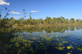
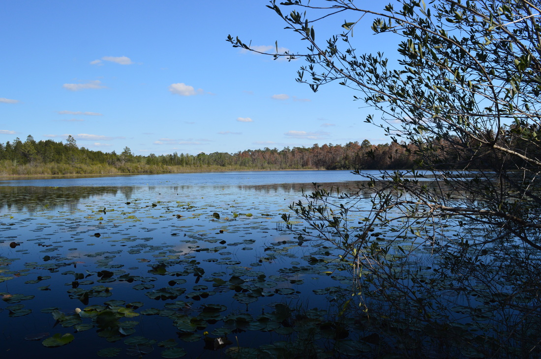
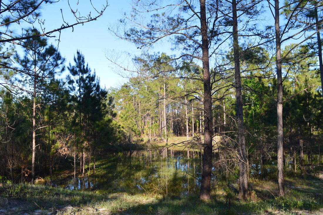
In Florida, a natural pond or lake is a typical destination on any hike. In the southern Appalachians, all lakes are dammed - this is nowhere near the case in Florida. These pretty woodland reservoirs often make up for the lack of destinations such as vistas or waterfalls. What made the Trail of Lakes Loop seem particularly attractive is that it visited not one but three such lakes. This was one of the main reasons I chose to complete this loop hike, and I cannot regret it - it is a great example of what hiking is like in Apalachicola National Forest.
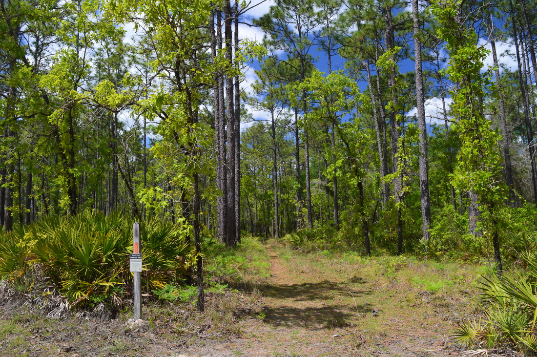
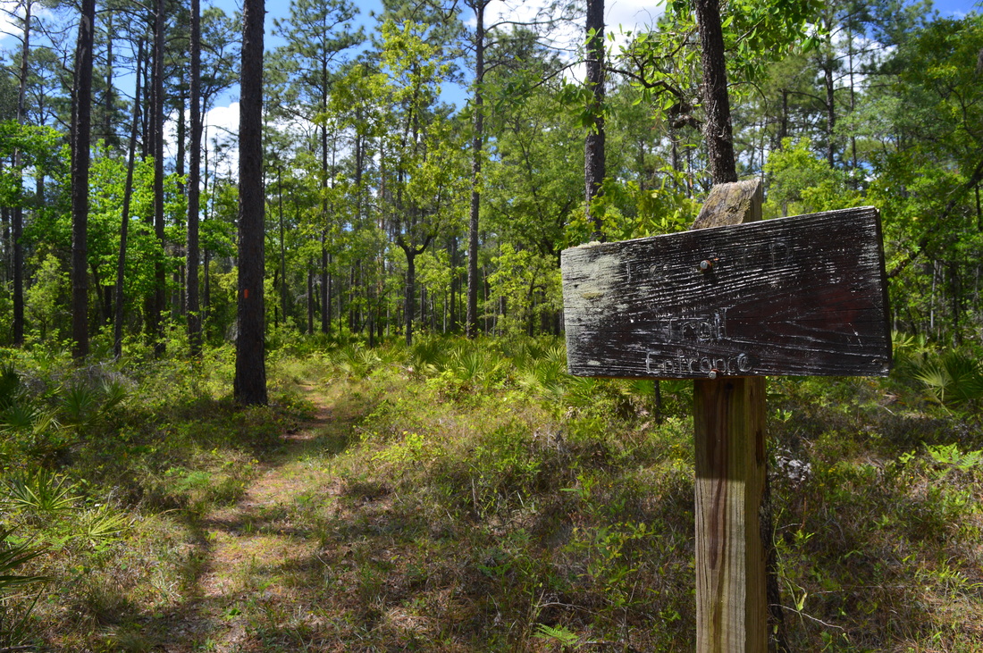
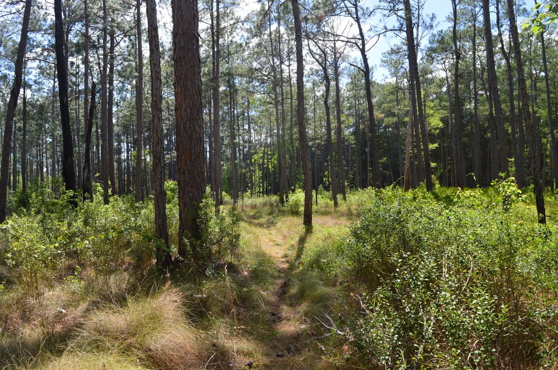
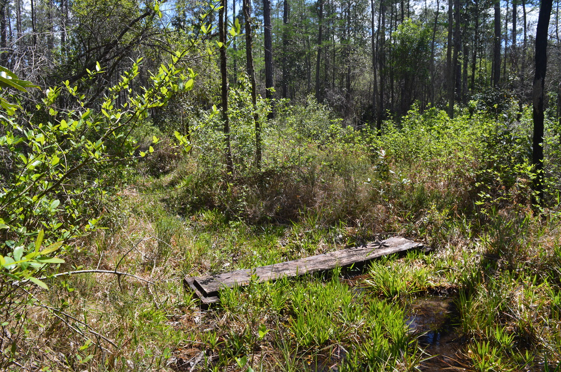
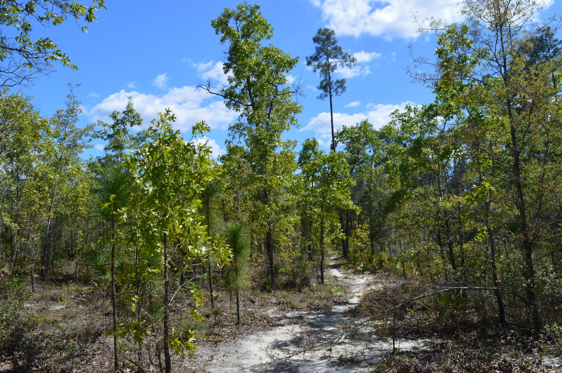
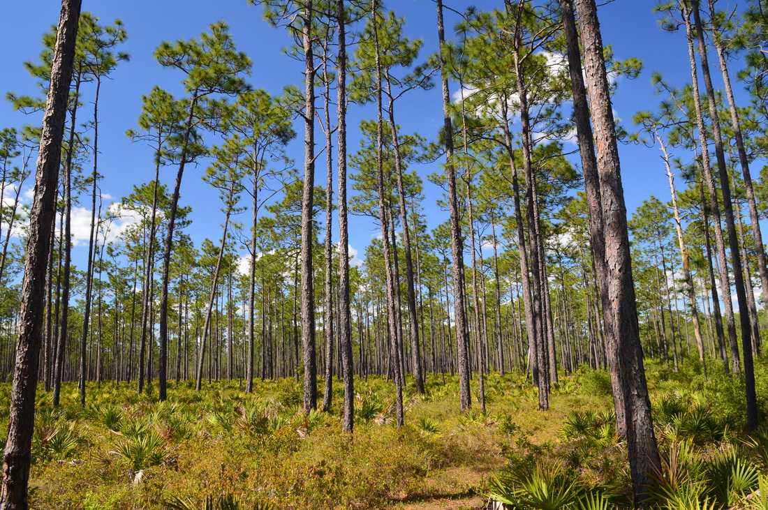
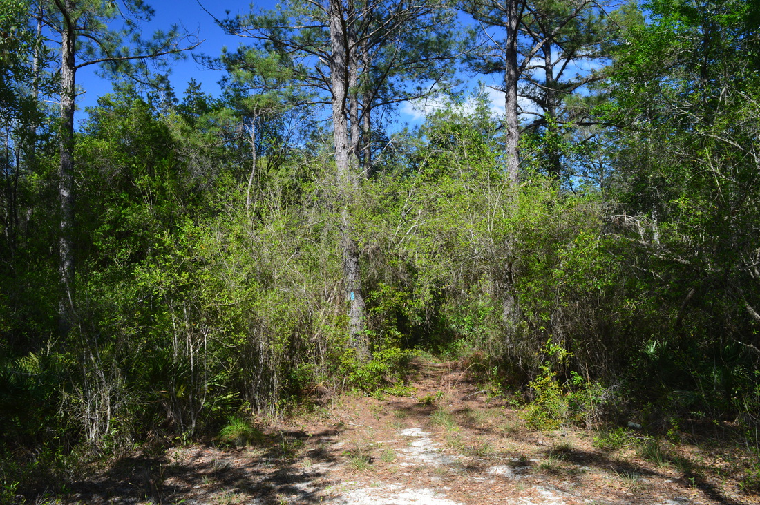
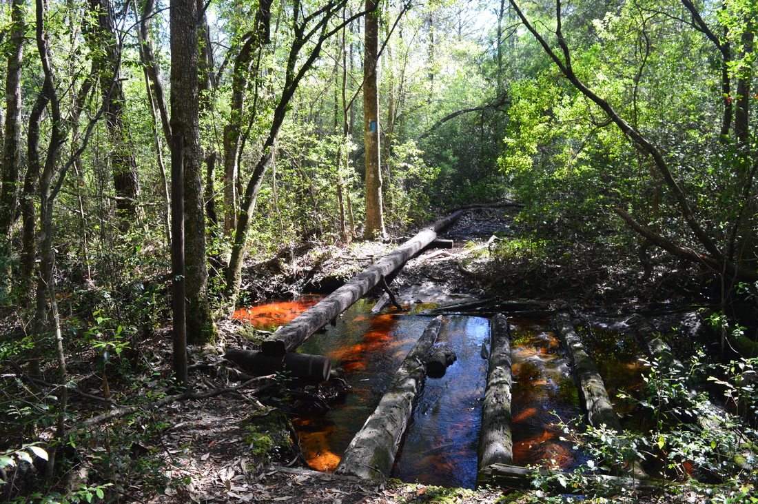
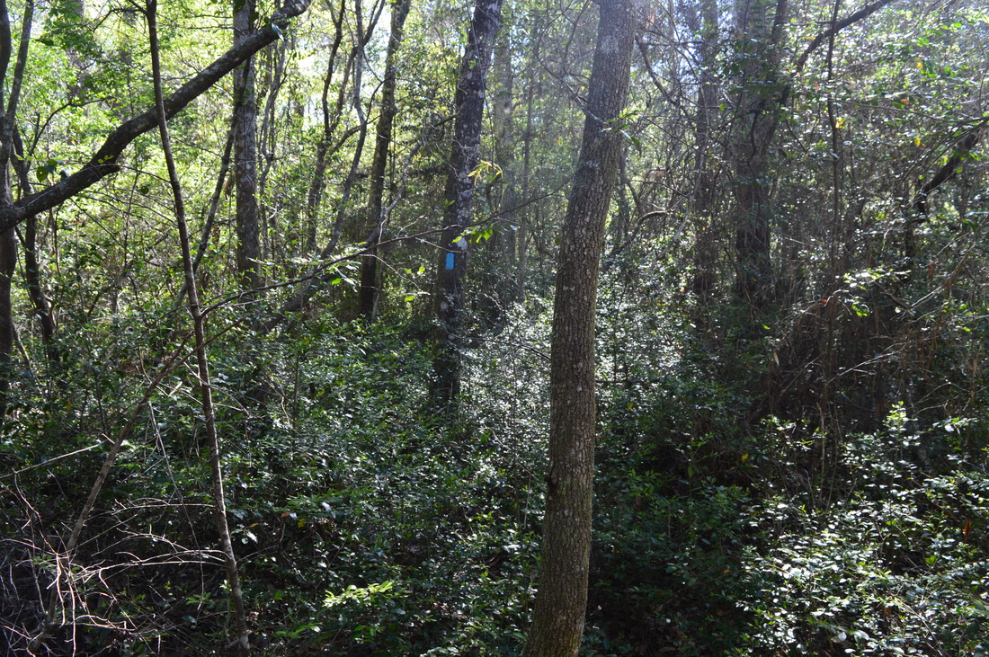
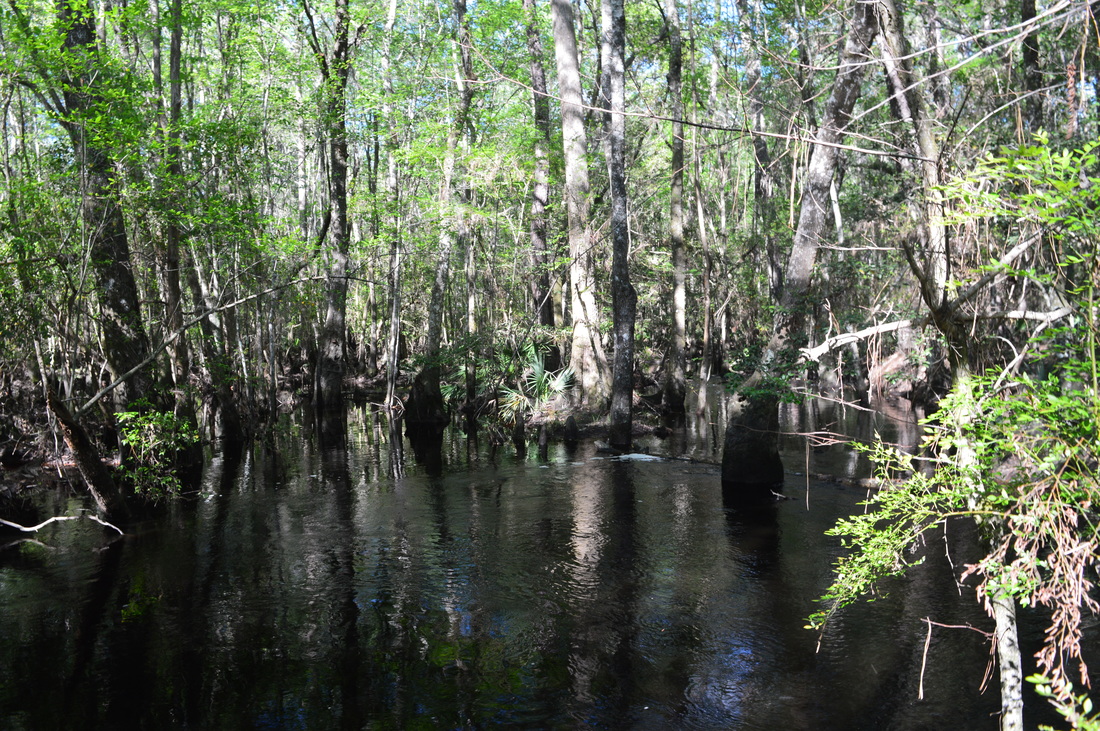
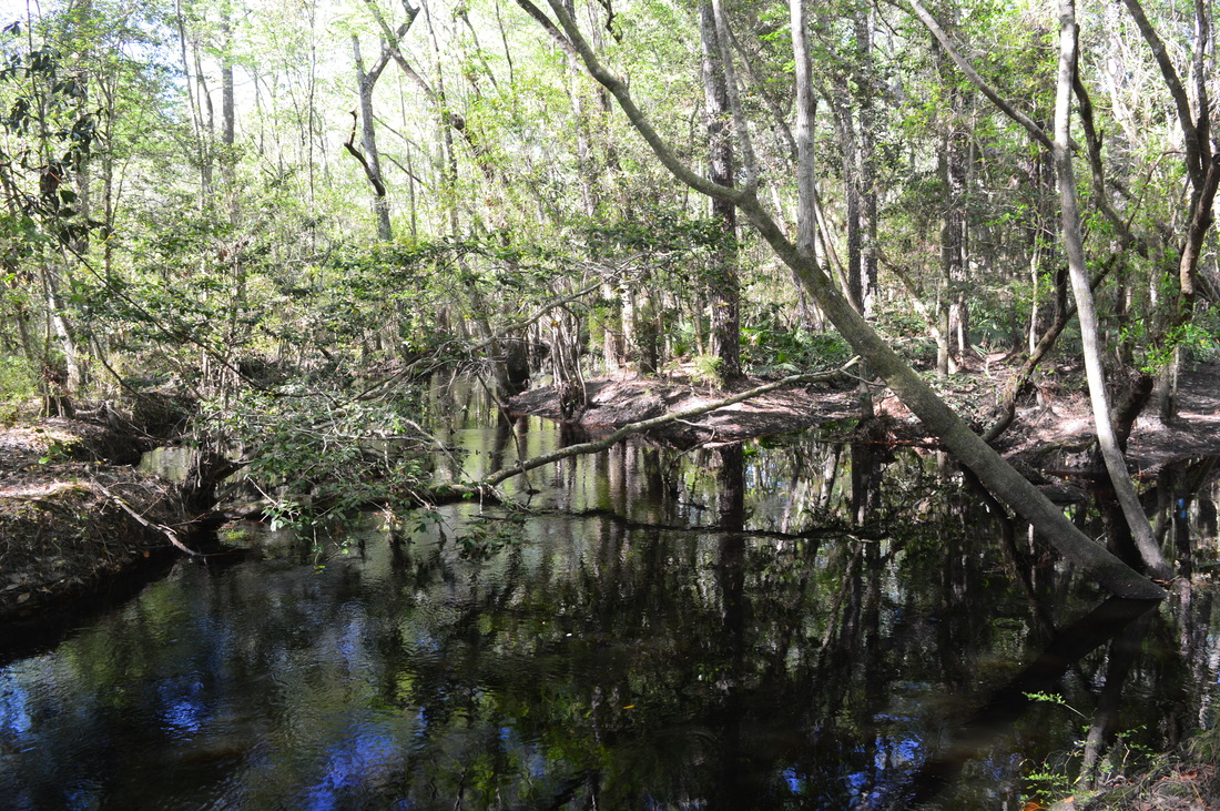
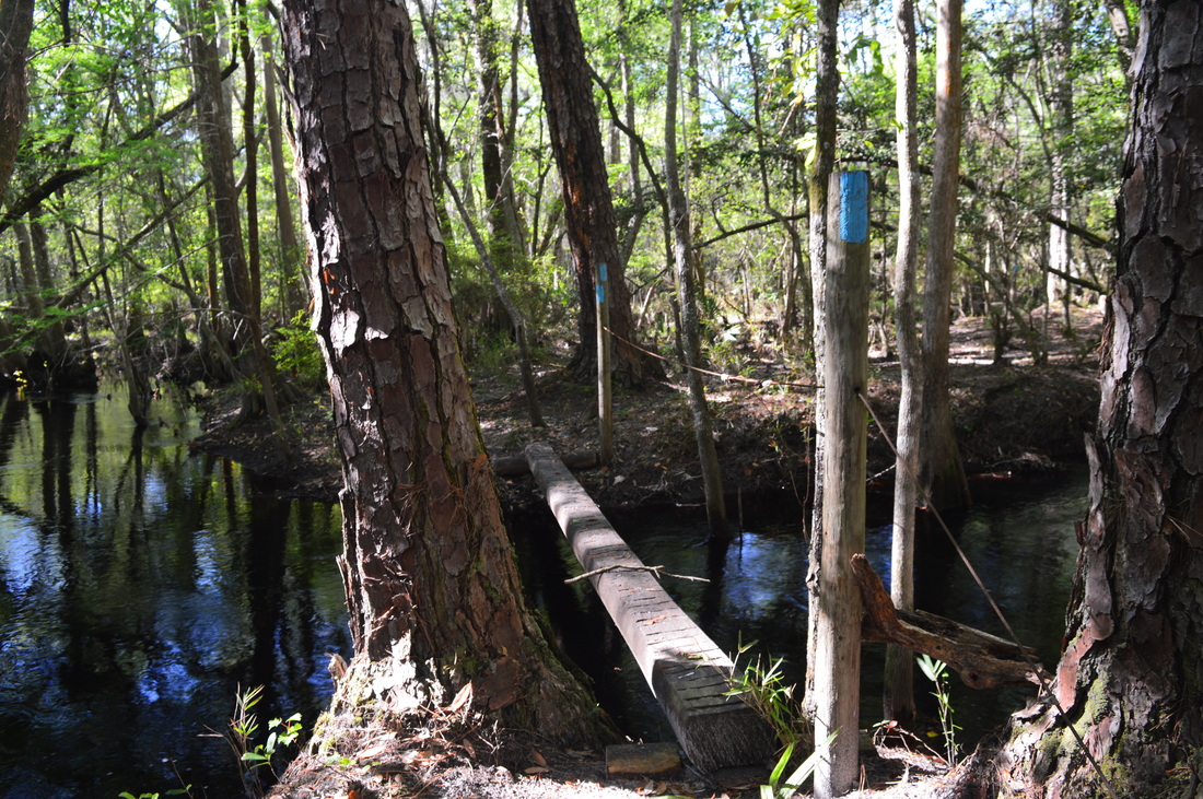
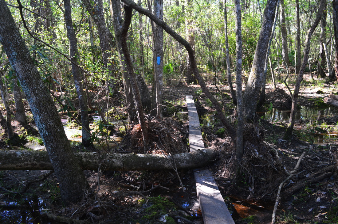
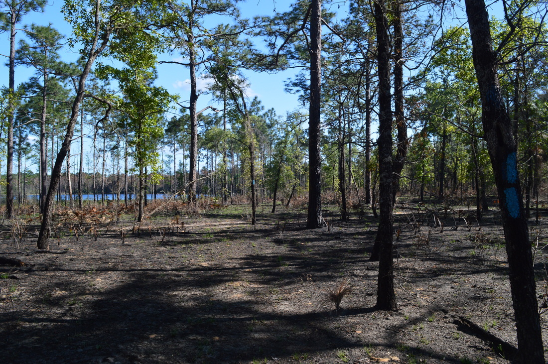
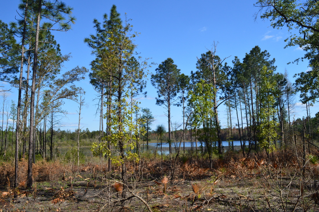
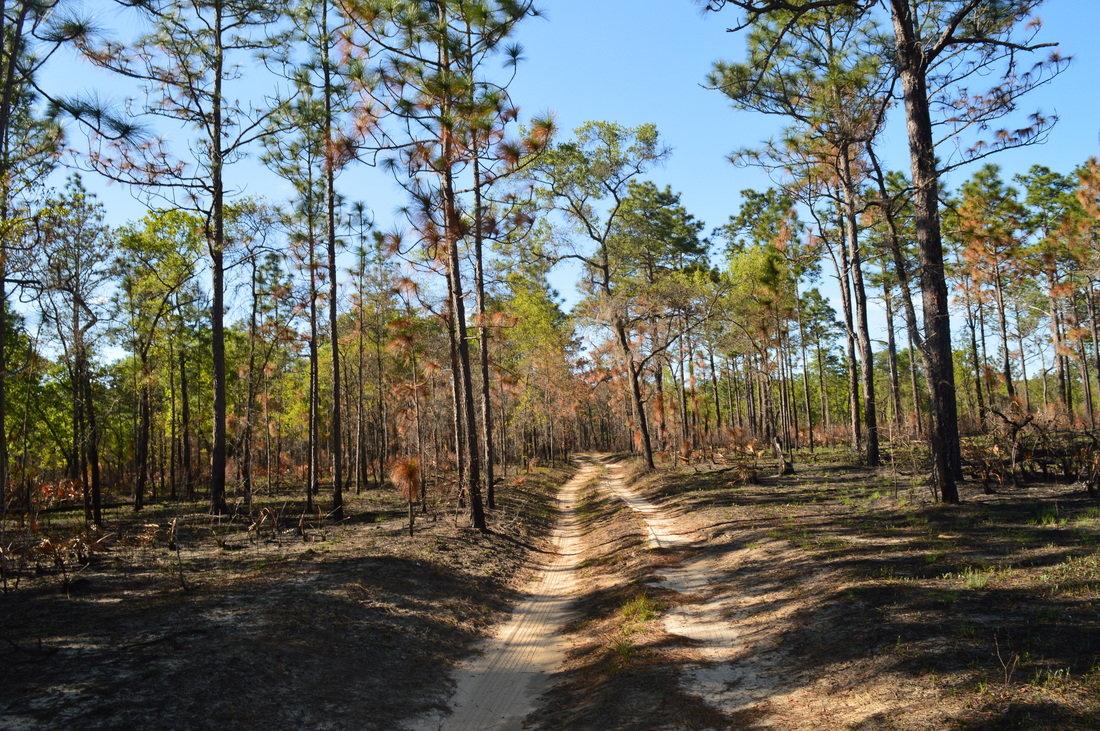
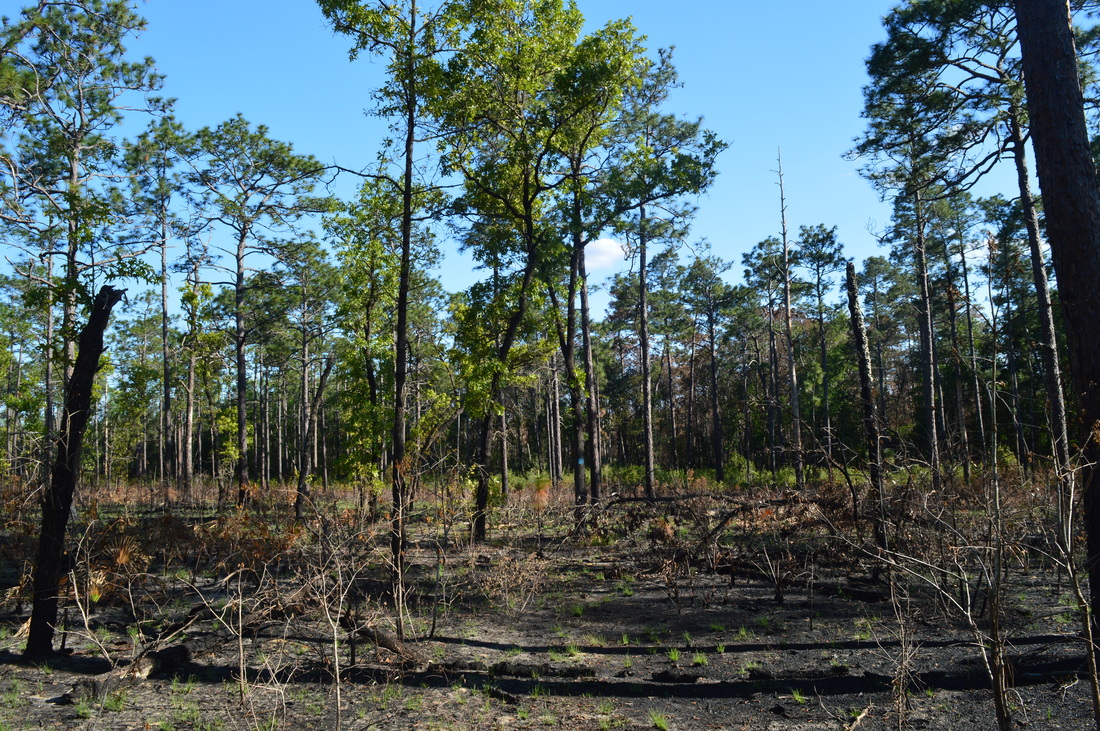
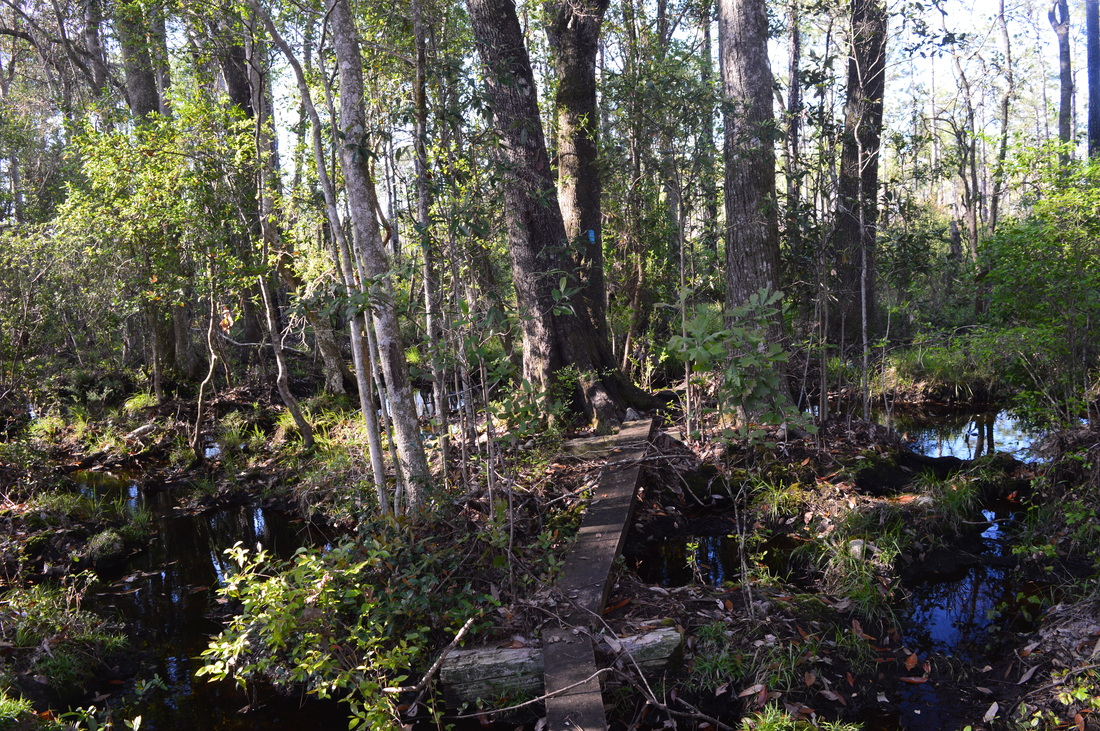
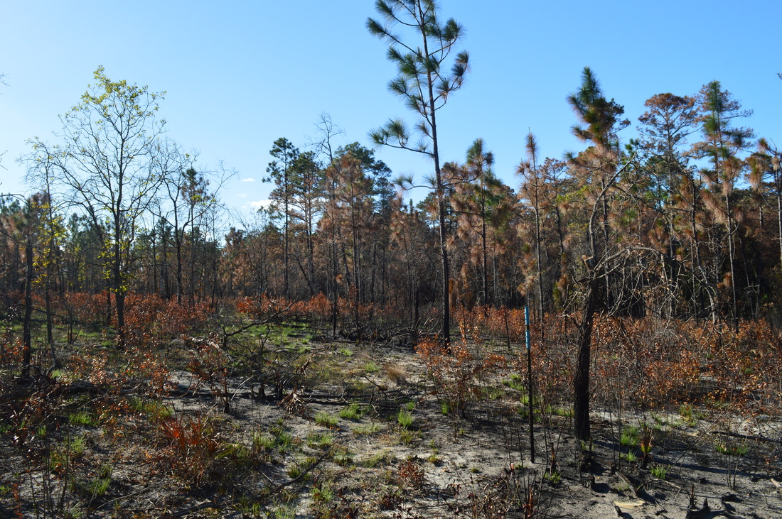
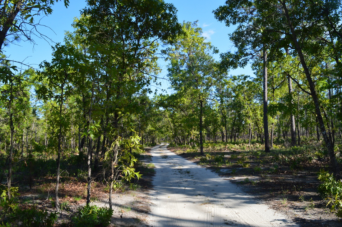
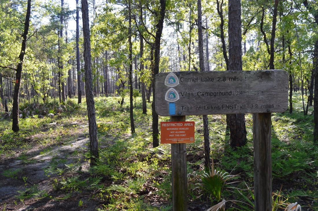
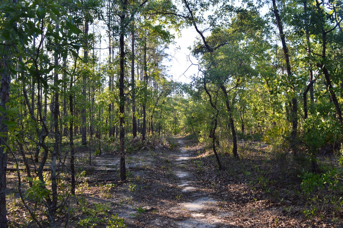
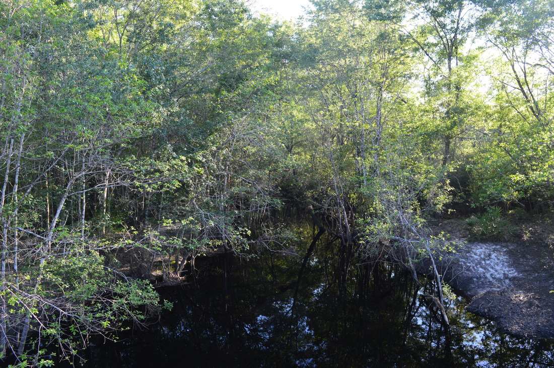
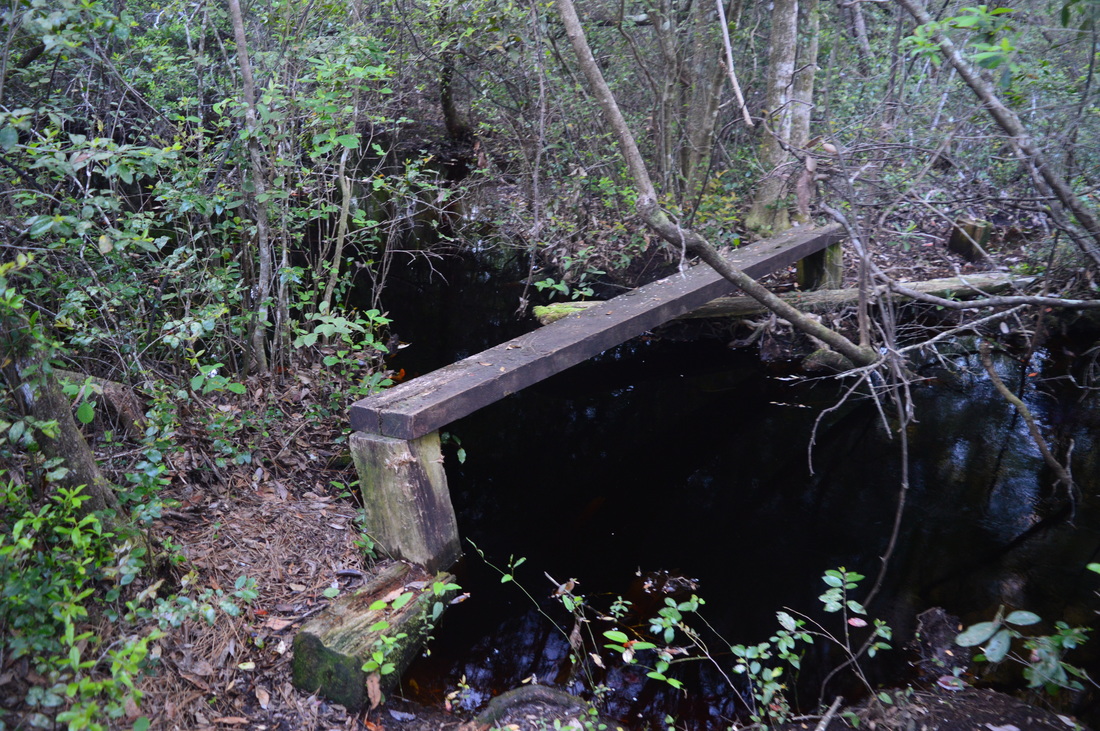
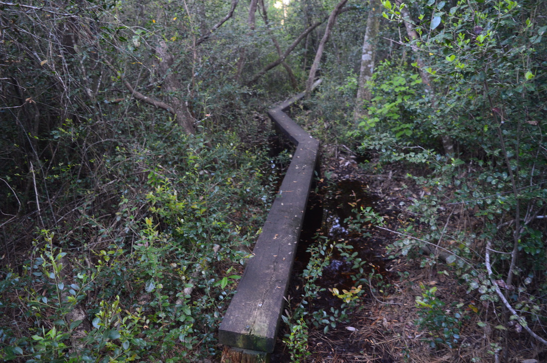
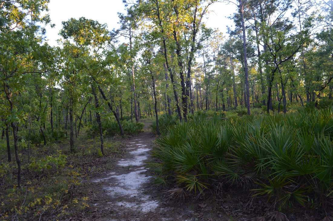
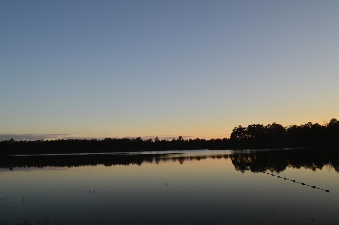
There are many different points from where you can begin this loop hike, due to the numerous road crossings, although the Camel Lake access point is generally used to hike this loop, because that access point is reached most easily. I chose to hike the loop clockwise to get the potentially wet section out of the way first. From the point where the Florida Trail crosses FS 105, head left (northward) into a pine forest with some deciduous trees mixed in. The understory is full of saw palmetto (something that will be very prevalent throughout this hike). At 0.1 miles, the trail bears right and dives down to a bridge crossing of a marshy area. According to topo maps, this is a narrow arm of the rather large Johnson Juniper Swamp. Most of the swamp is to the north and west of the Florida Trail, but the trail does pass through outskirts of the wetlands several times. The bridge that the trail uses to cross this narrow arm of the swamp is a balance beam plank bridge. You'll see many more of these bridges throughout the hike, and some are a bit more rickety than this one. Following the bridge, the Florida Trail turns left onto a singletrack pathway that follows the slopes of a small hill. A sign at the turn reads "Tree ID Trail Entrance". After the turn, you will pass a number of wooden signs next to the trail that identify certain types of trees. Also, these interpretive signs have some information regarding the mentioned trees. At around 0.4 miles, the trail briefly joins an old roadbed before bearing left off the road. Then, the trail descends from the hill, past a blowdown, and into a pine savanna where the ground becomes slightly soggy, depending on recent rainfall and the time of the year. I have read that it is possible to spot pitcher plants near the trail here, although I myself did not see any. In fact, potentially seeing a pitcher plant was one of my primary goals in hiking this trail. Pitcher plants begin to bloom during April and May, and they may last into the summer and early fall. It doesn't take long for the trail to turn wet, beginning at about 0.7 miles. The water is shallow and the trail is still easy, but you can work your way through the titi bushes around the trail to avoid getting wet. Before long, the forest opens up a bit, and I was able to walk on dry ground next to the watery trail. I suspect, though, that during summer, a lot more of this area will be underwater. After 0.9 miles, the trail reaches higher ground as it works its way through dry sandhills for nearly a mil. At 1.8 miles, the FT briefly descends to cross a small stream. I was able to keep my feet dry, but this crossing may get a bit tricky when the water table is higher. After this stream, you will reenter the sandhills. Follow the orange blazes to a junction at 2 miles at a sandy jeep road. This is where the Trail of Lakes leaves the Florida Trail to travel southward. The Florida Trail continues straight on the sandy jeep road for 3 miles to County Road 12. To hike the Trail of Lakes Loop, you do need to continue on the FT here. Instead, turn right onto the Trail of Lakes. This blue-blazed trail starts out by following the jeep road towards the southeast. At 2.5 miles, the jeep road ends at Forest Service Road 121. This is where the trail becomes not as obvious. Cross the wide sandy road and continue onto a faint path into a typical pine-palmetto forest. Over the next one and a half miles, the trail passes through mostly symmetrical forest, all the while paralleling FS 121. Much of this section of trail follows the ecotone between wetlands left to the left and pine forest to the right. Most of the time, the wetlands will be hidden behind a thick wall of growth. At one point, the trail will pass a marshy pond to the left. To me, this stretch of the hike seemingly stretched on forever due to the endless rows of pine trees and endless clumps of palmetto. At around 4 miles, the trail enters some brighter forest that is home to some deciduous trees and continues to follow the ecotone with a densely wooded swamp to the left. At 4.25 miles, the Trail of Lakes crosses a forest road that branches off from FS 121. Continue straight across the road onto an old roadbed. However, the trail doesn't stay long on this old roadbed - don't miss an important left turn at 4.3 miles. After the left turn, the trail finally leaves the ecotone and begins to dip into the depression through which flows Big Gully Creek. The forest is a lot denser here, and this causes the trail to be somewhat overgrown. The trail crosses a tannic tributary of Big Gully Creek on a balance beam footbridge. Next to the footbridge, a bizarre set of logs is placed in the stream. The way the logs look, I think they were placed here for some sort of erosion control, although it is hard to imagine what kind of erosion could occur here. Beyond the footbridge, the trail briefly becomes very overgrown. Pay close attention to the blue blazes. As you enter a bottomland full of cypress knees, Big Gully Creek comes into view to the right. This is where the trail enters an area that is very scenic, in my opinion - at 4.4 miles. This area is known as Fiddlestring Bay, and even though the trail itself was dry today, I suspect that there are times when this area is totally underwater. The trail crosses several balance beam bridges over waterways that are part of Big Gully Creek. These slow-moving blackwater streams flow past dozens of cypress trees in an area where the sun's rays barely penetrate the trees and bushes. Also, if you're not careful, you can lose the trail here as it zigzags between different branches of Big Gully Creek and tries to avoid the cypress trees and cypress knees - once again, don't take your eyes off the blue blazes. After passing over one last footbridge with a small tree fallen across it, the trail rises out of the depression. This is where the trail entered an area that had underwent a controlled burn not too long before my hike here. As you top out, cross a jeep road that leads from FS 105. A blue body of water comes into view straight ahead - this is Sheep Island Pond. The trail isn't very obvious here due to the recent burn, and blazes were not very frequent here either, so try to pick out the path that generally heads south between the jeep road and the lake. At 4.7 miles, reach a parking area next to the jeep road. To the left is what appears to be a kayak launch. Turn left and walk down the dirt road to the kayak launch for the best view of Sheep Island Pond. This large natural lake full of lily pads is approximately at the halfway point of the hike and is a worthwhile destination due to the pristine nature found here. Sheep Island Pond is where I decided to make my lunch stop, before continuing on to Bonnet Pond, As it turned out, the next section of trail was a lot more confusing than anything encountered up to this point, although the primary reason was the burned landscape. From the kayak launch, continue on the blue-blazed trail before reaching the jeep road again at 4.85 miles. Turn left onto the narrow track, and cross a tributary of Big Gully Creek via the road. Then, the trail turns left off the jeep road before crossing a different jeep road and leaving Sheep Island Lake behind. After this, pass through burned brush and enter a very overgrown pathway that leads to a marshy tributary of Big Gully Creek. Cross the creek on several balance beam bridges amidst tall cypress trees. The trail then rises out of the marshy area and continues to zigzag through burned terrain where there is no obvious visible path. Keep track of the blue blazes that are luckily plentiful here. At 5.5 miles, the trail reaches FS 105 where the jeep road that you saw at Sheep Island Pond ties in from the right. you could have followed the jeep road instead of the confusing trail, but it is likely that the the roadwalk would have been more boring. The Trail of Lakes crosses FS 105 and continues onto another jeep road that eventually connects to FS 108. Follow the blue blazes along the double-track route. At 5.9 miles, Bonnet Pond is seen through the trees to your right, although I never located any pathway that led to the shore of this pond. Bonnet Pond is similar to Sheep Island Pond, but it is noticeably smaller than the former. At 6 miles, you reach the end of the Trail of the Lakes at the Florida Trail. As you can now tell, the Trail of Lakes is an alternative route for a section of the Florida Trail. I have to admit that the Trail of Lakes is by far more scenic than this section of the FT - that may be one reason that the Trail of Lakes was created. If you continue straight on the Florida Trail (which continues to follow the jeep road), you'll reach Vilas Campground in 6.4 miles, according to the sign. Vilas is a ghost town with many ruins that give clues about its past. It was an active logging and turpentine center until around the 1940s. Vilas sounds like an interesting hike of its own, but I certainly didn't have any extra time today to add nearly 13 extra miles. If you're planning to simply continue to day hike this loop, turn right onto the Florida Trail. Also, note that an old roadbed heads to the right just past the Florida Trail junction. Do not follow the roadbed. Instead, locate and follow a slim path behind the sign that delves into a ferny understory. You will skirt Bonnet Pond, with more views of the reservoir to the right. At 6.4 miles, cross a jeep road that connects FS 105 to FS 108. The trail then continues into pine-topped sandhills. At 7.2 miles, the trail reaches a small pond to the right. Cross a dead-end jeep road, make a half circle that provides you a good view of this tiny body of water, and then bear left and away from the jeep road and pond. After more sandhills, the trail arrives at FS 105 at 7.6 miles. Turn left onto FS 105 and cross Big Gully Creek using the road culvert. This is the same creek that was encountered on the Trail of Lakes, but at this point, you're further downstream and the creek is just one rather wide blackwater stream. Just downstream from this point, South Creek joins Big Gully Creek and the area becomes known as Wilder Bay. Big Gully Creek eventually flows into the Apalachicola River. On the other side of Big Gully Creek, bear left onto a gravel road at a Florida Trail sign. This jeep road connects to FS 131. Immediately after the first turn, turn right onto an orange-blazed pathway. The trail passes through more sandhills, until it begins to descend into a marshy area at around 8.5 miles. After briefly following an overgrown pathway, reach a tall and rickety balance beam footbridge across blackwater wetlands. While I surveyed this structure, I heard a buzzing noise encompassing a vast area somewhere up in the tree canopy. A bee nest maybe? Nope - it didn't take me long to realize that the source of the buzzing noise was clouds of hundreds of mosquitoes waiting to attack me! Shakily snapping a picture of this rickety log bridge, I lost no time in moving across the structure and out of this stretch of wetlands to escape the mosquitoes. As I emerged back into the sandhills, I breathed a sigh of relief. The trail entered a hammock at 9 miles and crossed one last footbridge across a wet area before crossing FS 131 amidst pines and palmetto at 9.3 miles. Just after FS 131, the trail enters the Camel Lake Recreation Area. Some paths to the left lead to the campground that is positioned near the shores of Camel Lake. Continue following the orange blazes, reaching FS 105 and your car at 9.6 miles. Mileage
0.0 - Camel Lake, FS 105
2.0 - Turn right onto Trail of Lakes 2.5 - FS 121 4.4 - Big Gully Creek 4.7 - Sheep Island Pond 5.5 - FS 105 5.9 - Bonnet Pond 6.0 - Turn right onto Florida Trail 7.2 - Tiny pond to right 7.6 - FS 105 9.3 - FS 131 9.6 - Camel Lake, FS 105 Variations
There are really no sensible variations for this hike. The only variation that I can think of is to start at a different road crossing on this hike and hike out and back to Sheep Island Pond.
Bonus Stops
After completing the Trail of Lakes Loop, you might want to the blue-blazed Camel Lake Trail that circles Camel Lake. The Camel Lake Trail is 1 mile long.
Pictures
0 Comments
Leave a Reply. |
About MeMark Oleg Ozboyd Dear readers: I have invested a tremendous amount of time and effort in this website and the Georgia Waterfalls Database the past five years. All of the work that has gone in keeping these websites updated with my latest trip reports has almost been like a full-time job. This has not allowed me to pick up a paid job to save up money for college, and therefore, I I've had to take out loans. If you find the information on this website interesting, helpful, or time-saving, you can say "thanks" and help me out by clicking the button above and making a contribution. I will be very grateful for any amount of support you give, as all of it will apply toward my college tuition. Thank you!

Coming in 2022-2023?
Other Hiking WebsitesMiles HikedYear 1: 540.0 Miles
Year 2: 552.3 Miles Year 3: 518.4 Miles Year 4: 482.4 Miles Year 5: 259.9 Miles Archives
March 2021
Categories
All
|


 RSS Feed