
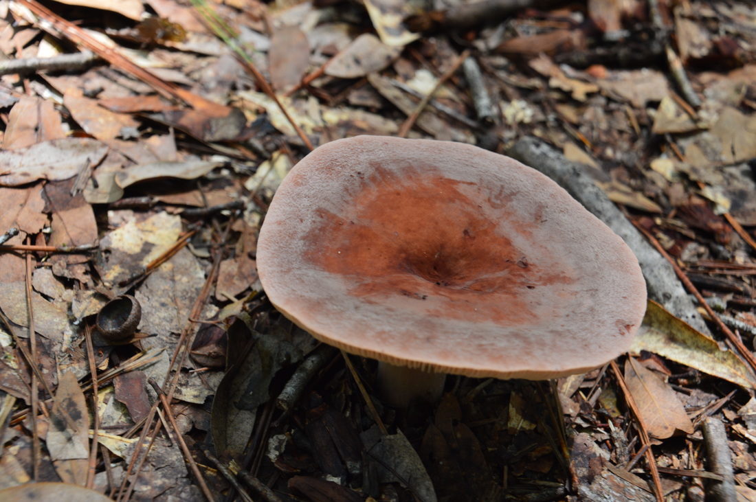
Traverse dozens of ravines, view fast streams and tumbling cascades, visit bluffs with excellent views of a a creek gorge - sounds like a perfect hike for your mountain vacation, right? Oh wait! It's right in Florida. The Econfina Creek segment of the Florida Trail is as unique as a hike could get in Florida, and you would barely be able to tell that you're in Florida, if the palmetto wasn't there. This spectacular section of the FT first descends into the Econfina Creek valley, passing some rapids on the creek, before following this waterway for many miles with a number of scenic sights along the way. This hike occurred on Friday, August 19th, 2016. My plan was to hike the Florida Trail out and back from Scott Road to Devil's Hole Recreation Area. Along the way, I would also hike the side trail to Trap Pond.
Summary
R/T Length of Trail: 18.7 Miles
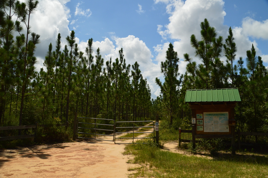
Duration of Hike: 10:30 Type of Hike: Out and Back Difficulty Rating: 6 out of 10 Total Elevation Gain: 1199 Feet? I hope my GPS is correct about this. There were numerous scrambles up and down ravines, but it is hard to imagine that they added up to over 1000 feet. Still, this is a more difficult hike by Florida standards. Its difficulty must not be underestimated by hikers who are used to flat terrain. Pros: The trail stays near Econfina Creek for much of its length, providing great views constantly Cons: Some of the bridges that do not have anti-slippery material on them can be quite slippery, especially after rain; during my summer hike here, there was an unfathomable amount of spider webs stretched across the trail Points of Interest: Numerous views of Econfina Creek, including rapids on the creek; Waterfall on Sweetwater Creek, visible from the Florida Trail; Trap Pond; The two suspension bridges across the creek (Two Penny Bridge and Fender Bridge); Econfina Creek Bluffs; Devil's Hole Trail Blaze Color(s): Florida Trail - Orange; Trap Pond Spur Trail - Blue; Devil's Hole Spur Trail - Blue Best Season(s) to Hike: Fall, Winter, Spring Beginning Point: Scott Road Trailhead Directions from Panama City, FL: From the intersection of US Route 231 and FL State Route 77 in Panama City, follow US Route 231 North for 30.9 miles. Then, turn left onto Scott Road. In 0.6 miles, bear right. The road becomes unpaved and can be muddy after rain. In another 2.0 miles, turn left onto the road to the trailhead parking at a sign "Econfina Creek Water Management Area". Follow the sandy entrance road for 0.2 miles to the trailhead parking area. Map
Click here for more information and to download this trail map to view in Garmin Basecamp.
Details
It seems to me that northern Florida has the best hiking trails in the state. Even though there are less hiking trails here than in other parts of Florida, I have found them to be very rewarding every time I hike in the area. Some of my favorite north Florida hikes include the Garden of Eden Trail and the trail system in Topsail Hill State Park. After this day, I added the Florida Trail along Econfina Creek to the list.
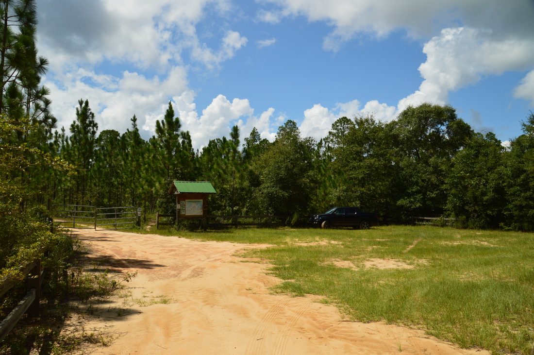
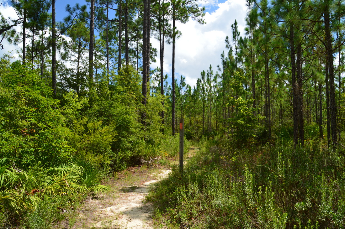
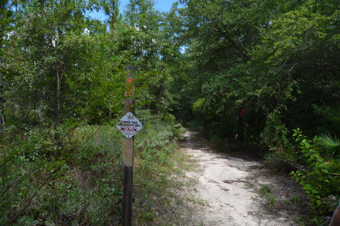
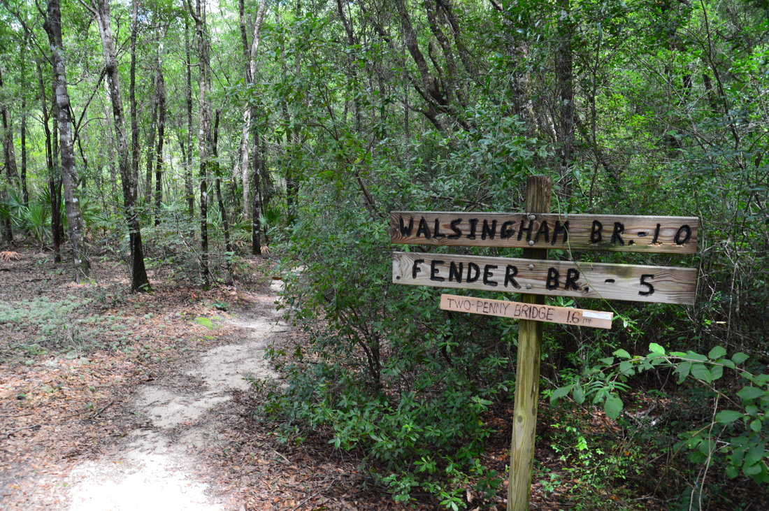
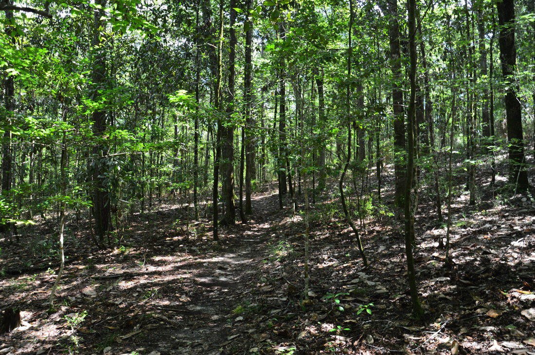
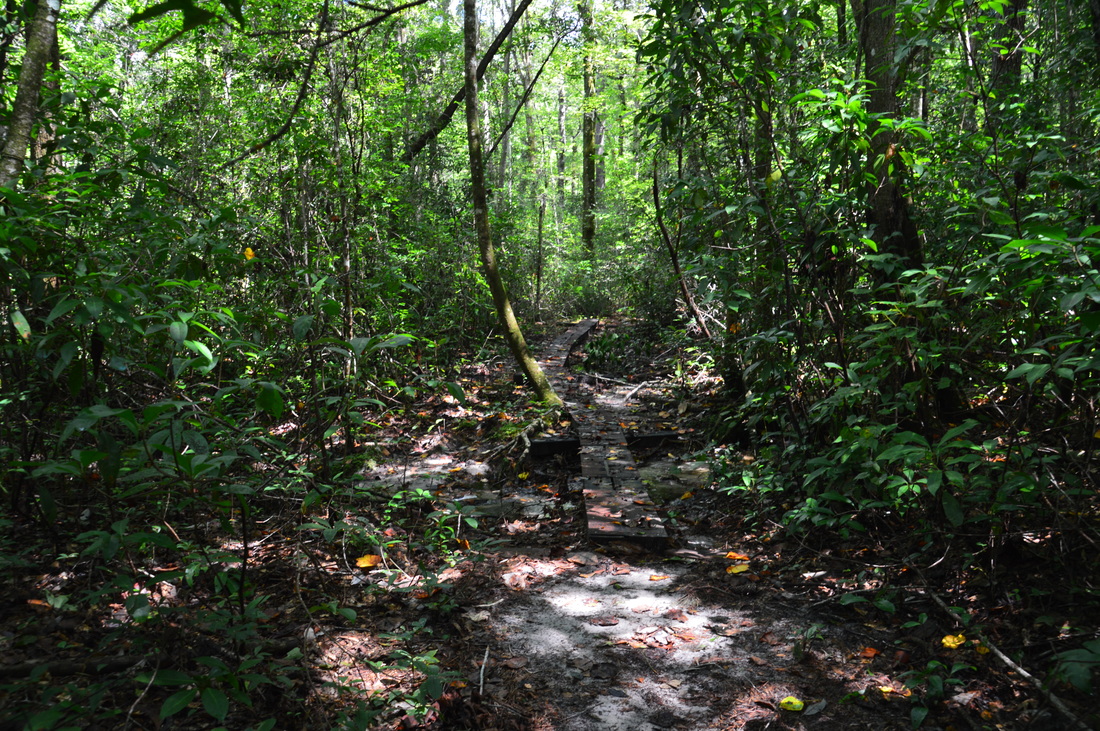
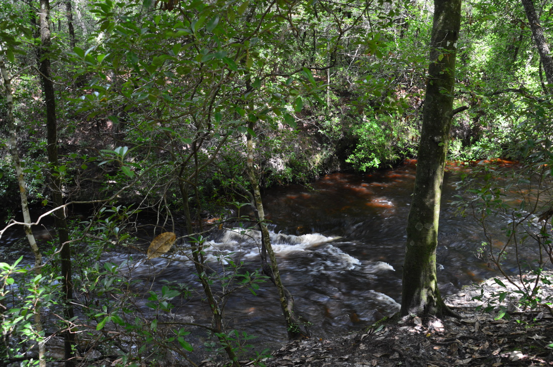
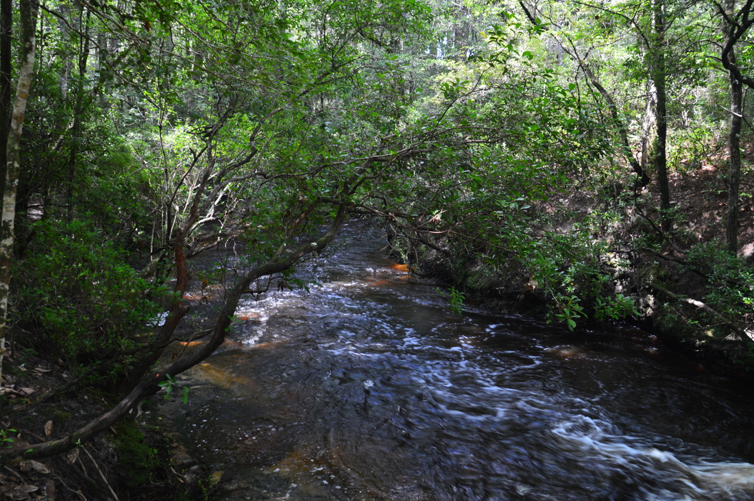
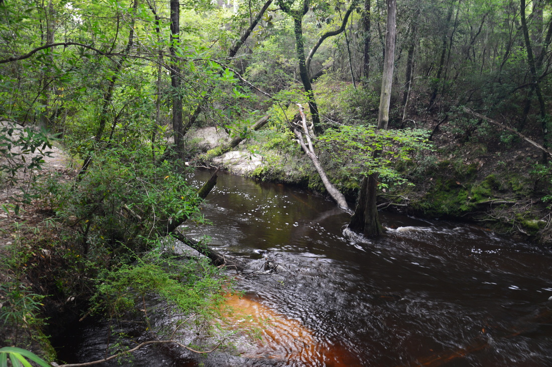
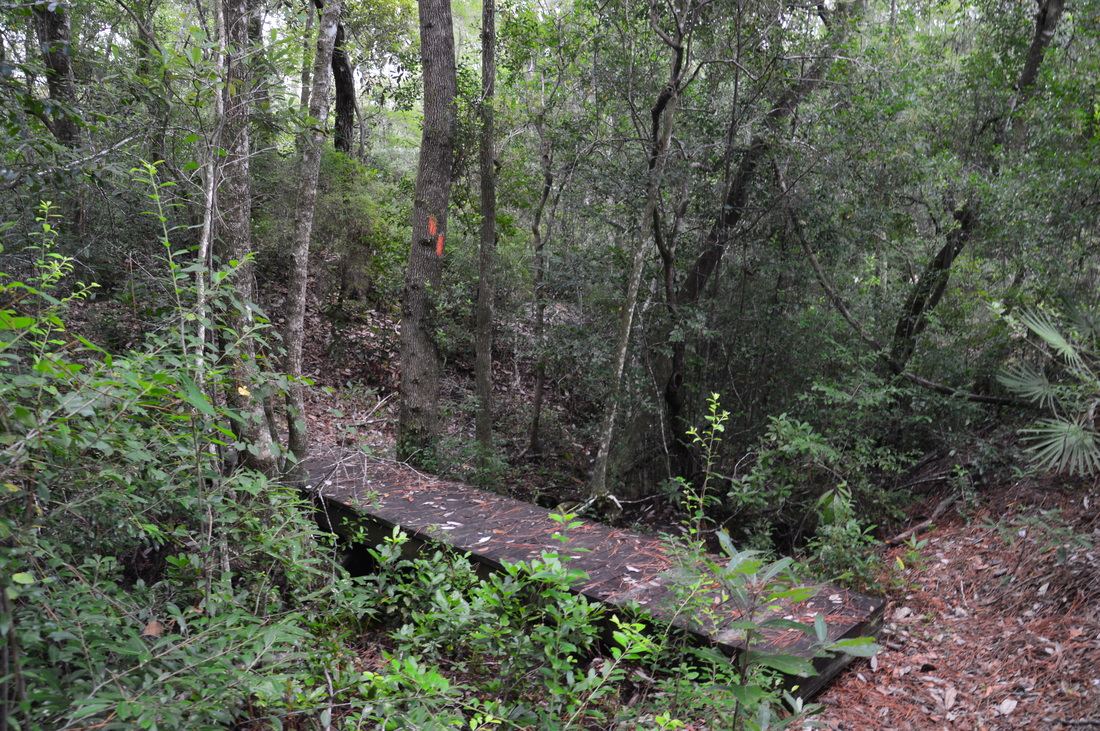
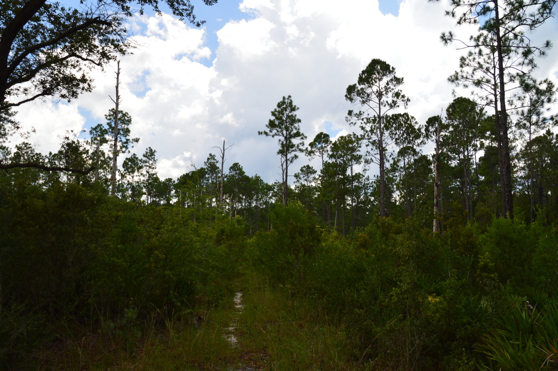
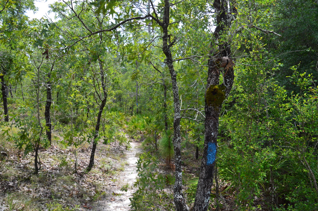
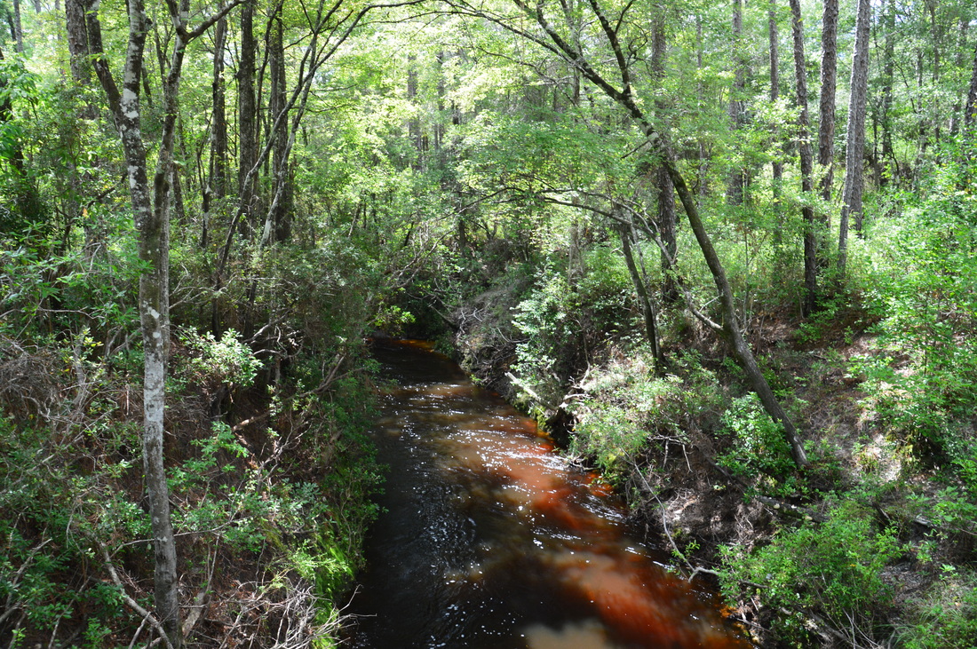
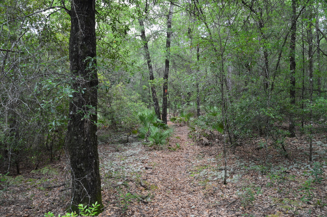
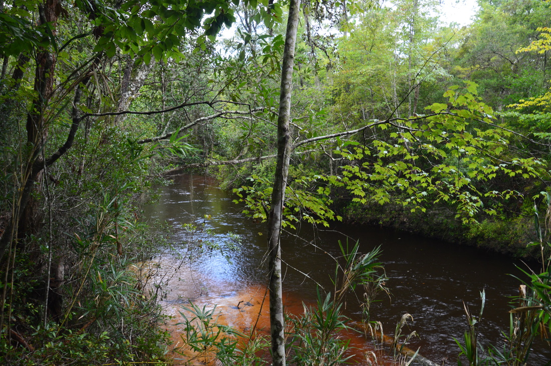
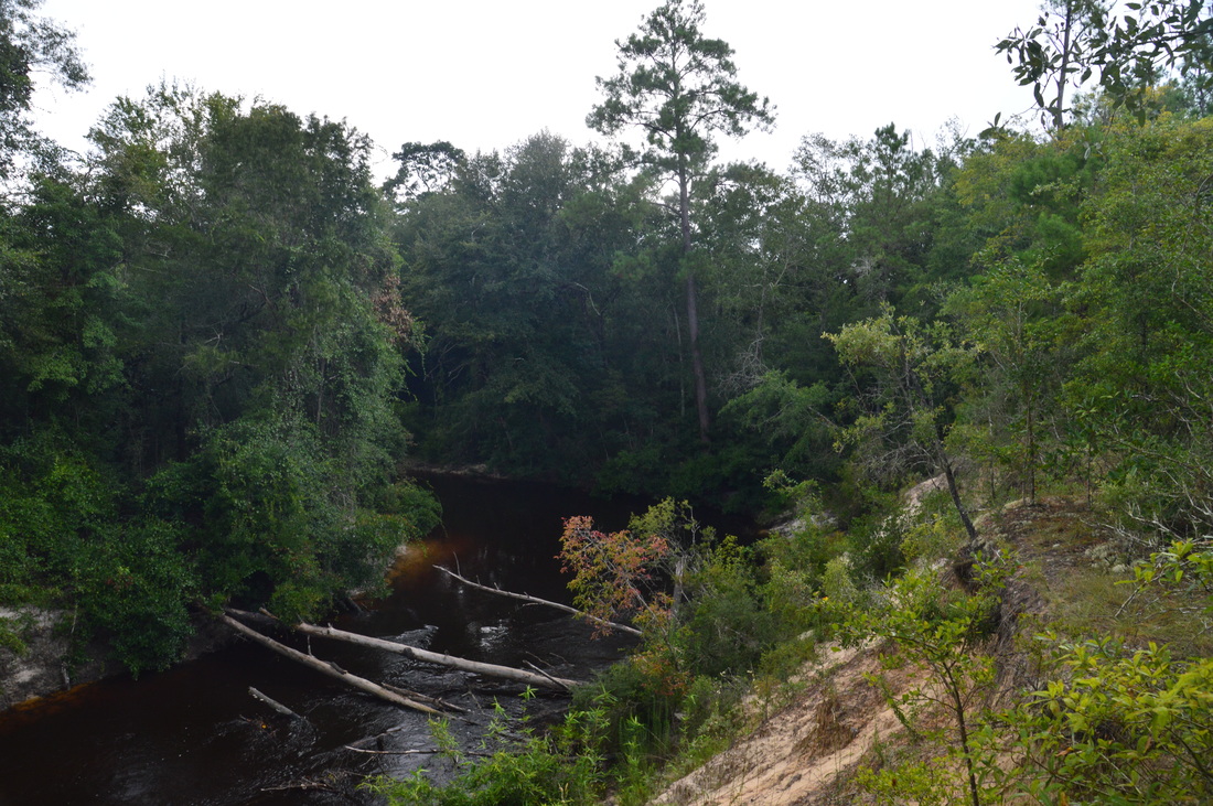
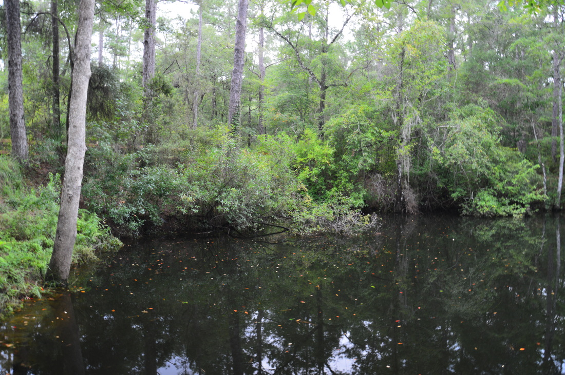
The entire segment of the Florida Trail along Econfina Creek, from Scott Road to Florida State Route 20, is actually around 18 miles long one way. On this day, my plan was to hike the supposedly most scenic part of this segment, from Scott Road to Devil's Hole. I had hoped to make it all the way to Walsingham Bridge, but unfortunately, the hike was slower than I had expected. From the Scott Road Trailhead, begin the hike at the trailhead kiosk. The orange-blazed Florida Trail enters pine flatwoods on a path just to the right of a gated forest road. Wooden posts mark the trail, as the path widens to the size of a jeep road. Initially, the trail remains flat, but soon, it begins descending into the Econfina Creek valley. At 0.2 miles, the trail leaves the jeep road, bearing right onto a single-track path. The downhill grade steepens. A sign lists the mileage to the three milestone bridges on this segment of the Florida Trail. Relative to Florida, the downhill grade continues to be steep, before leveling out at 0.45 miles. After this, the trail follows the slanted side of the valley and crosses numerous seasonally wet areas and small streams or ravines on plank footbridges. These footbridges have special anti-slippery material placed on them, which I found very helpful on my return trip following a period of rain. At 0.9 miles, another descent brings the trail to Econfina Creek. A side trail to the right leads to a view of some small rapids on Econfina Creek. This scenic stream has steep banks and a very swift current, both of which are uncommon for Florida. After the rapids, the Florida Trail follows Econfina Creek closely and continues to cross tiny side streams via footbridges. As you hike, you may notice something very unusual: mountain laurel lining the trail. This plant is common in the southern Appalachians, but in Florida, it is rarely seen. 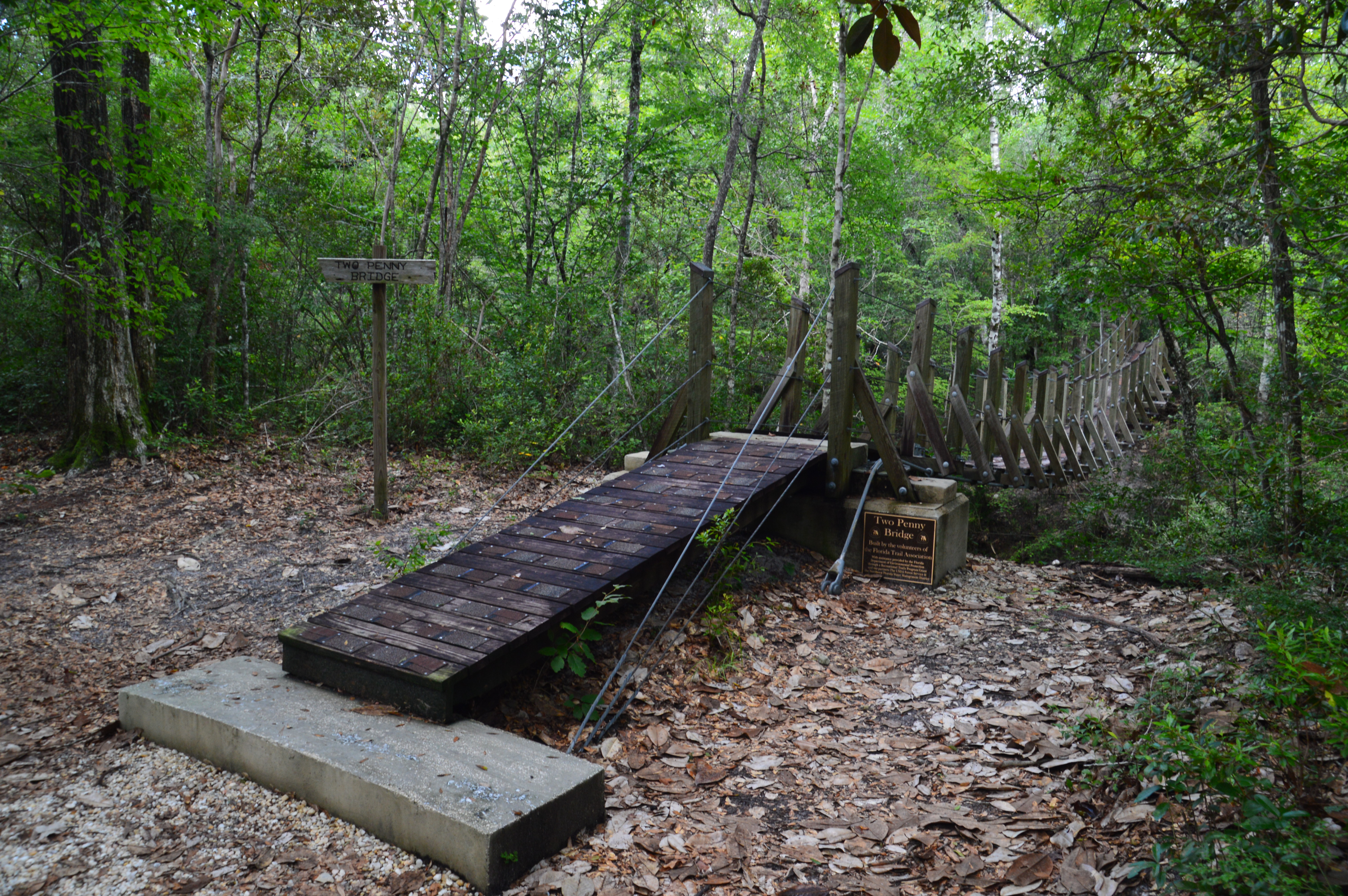
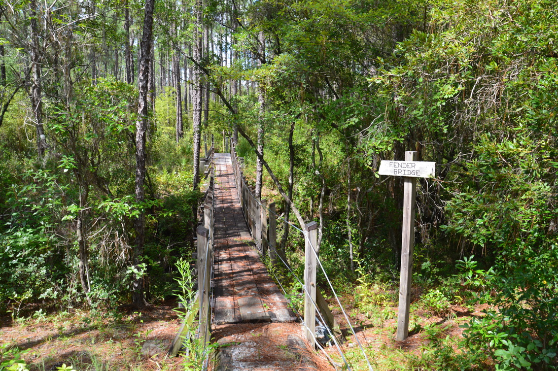
A suspension bridge known as Two Penny Bridge helps the Florida Trail to cross steep-sided Econfina Creek
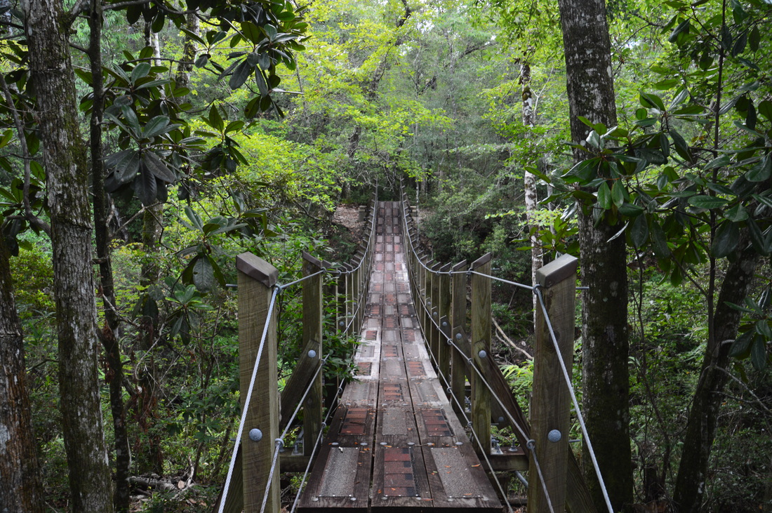
At 1.8 miles, the Florida Trail reaches Two Penny Bridge. This is a suspension bridge - and a beautiful one for that - that was built to provide a safe crossing across Econfina Creek. I read that before Two Penny Bridge and Fender Bridge were built, the Florida Trail crossed Econfina Creek on tall, log footbridges, which were less safe and more challenging to use than the new suspension bridges. From the middle of Two Penny Bridge, there is a great view of Econfina Creek in both directions. This is the turnaround point for many day hikers. However, the best is ahead. Cross the bridge and pick up the trail on the other side of Econfina Creek. One thing that I noticed was that from this point onward, the trail was slightly less maintained, and there were much fewer footbridges across the ravines that were formed by numerous side streams. By now, I was getting a bit annoyed by the countless spider webs that were stretched across the trail - the spiders probably felt quite safe, as very few people hike this segment of the FT in summer!
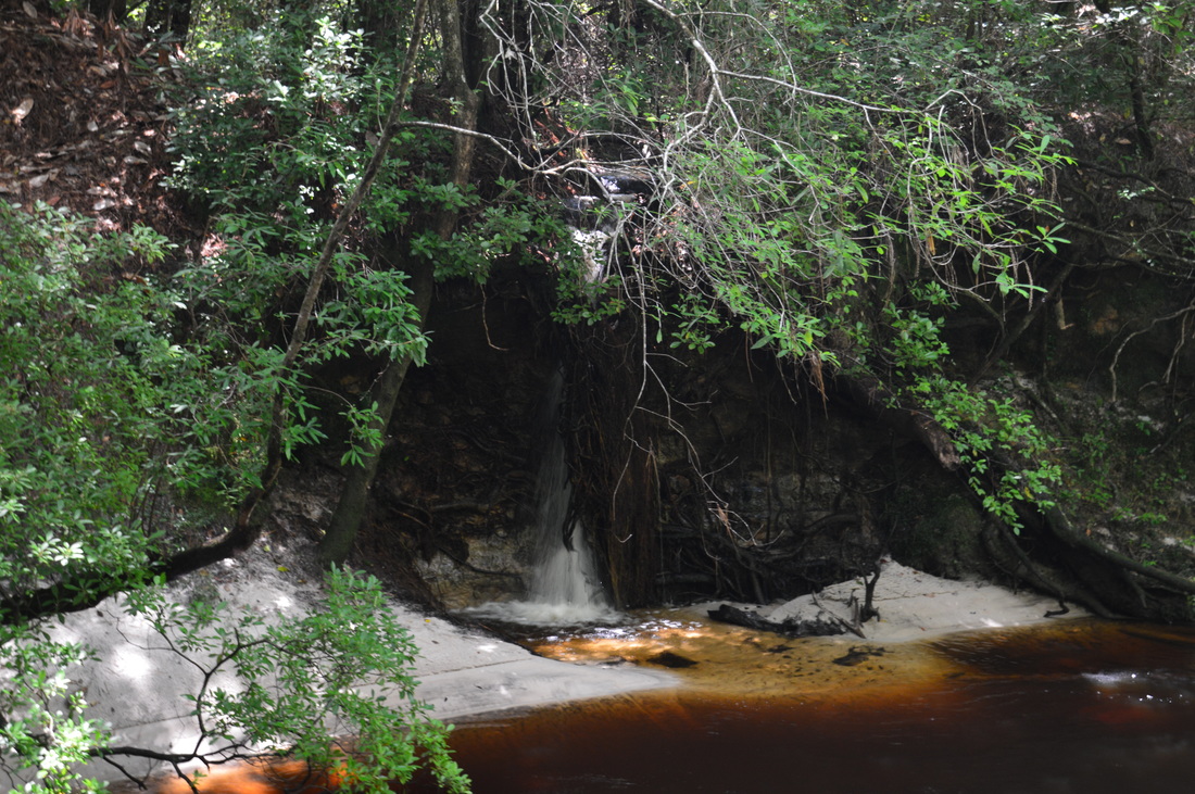
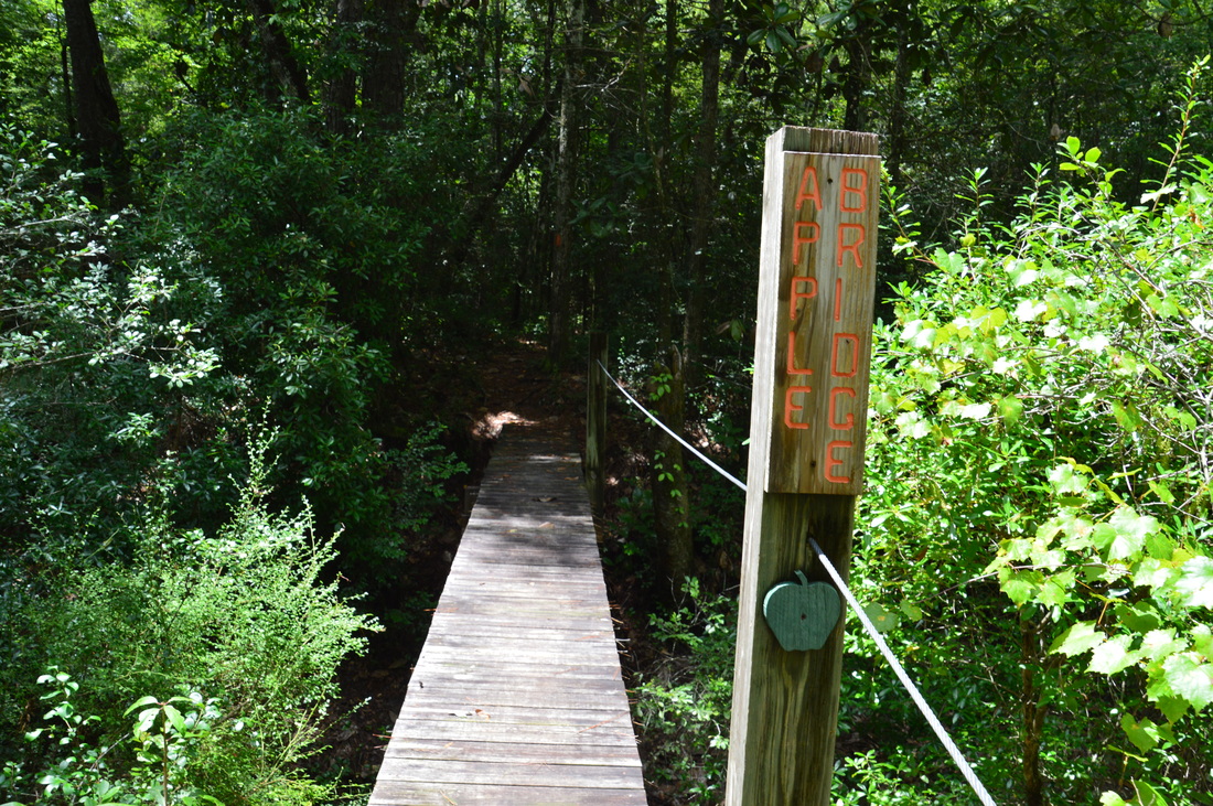
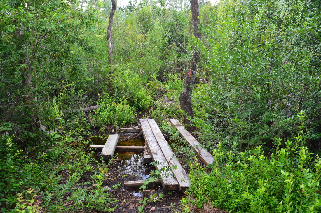
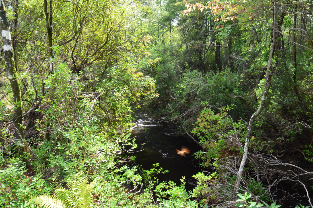
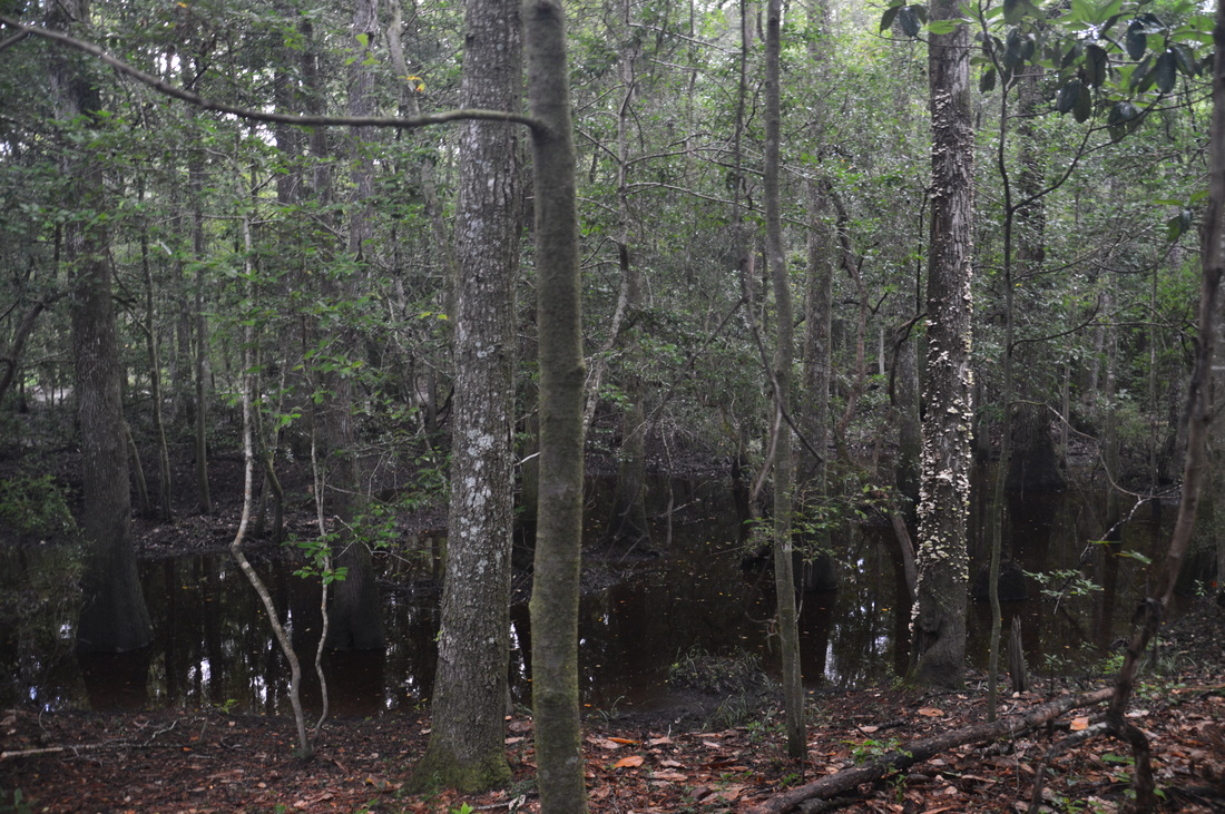
After Two Penny Bridge, the trail briefly leaves the creek but soon returns to it at a campsite at 2.1 miles. The campsite happens to be at a picturesque bend in the creek, and a cypress tree in the middle of the creek proved to be a great photo subject. At 2.25 miles, you may hear the sound of rushing water. Look for a steep side path to the left that leads to a small bluff overlooking Econfina Creek. On the other side of the creek, Sweetwater Branch drops down the steep bank of Econfina Creek, creating a picturesque waterfall as it joins the main waterway. This is one of the least-known waterfalls in Florida, and by mountain standards, it would not be considered a worthy hiking destination, but by Florida standards, it certainly is. Continue following the FT after the waterfall. At 2.6 miles, the trail crosses Banning Branch on a large footbridge that is signed as the "Apple Bridge". Banning Branch is a fairly large stream, and like Econfina Creek, it also has steep banks that would make a crossing complicated, if no footbridge was present. Over the next 1.6 miles, the trail closely follows Econfina Creek, with many views of the scenic watercourse. There is just one thing that I have to note about this section: there are many ravines that the trail constantly descends to and ascends from, and after a while, the hiking becomes steadily more tiring. I especially felt this on my return trip. Additionally, there are no footbridges along this part of the hike, so some of the crossings of Econfina Creek tributaries are a bit complicated, despite their small size. I was able to complete all of them with dry feet, however. For the most part, the trail is pretty obvious - just stay with the blazes. At 4.2 miles, the trail gradually leaves the creek and enters a more open area with pines towering overhead. The trail soon crosses a tributary of Econfina Creek via a footbridge in ruins. It is possible to cross using the remaining planks, but be careful and use your hiking poles for balance. Then, in another tenth of a mile, the trail passes through a boggy area, which is the only place on the entire hike, where you have a good chance of getting your feet wet. I managed to stay dry by staying on the very edge of the boggy area, but depending on the water levels, this might not be possible. Either way, the water is shallow and the boggy area is very short. At 4.5 miles, the Florida Trail arrives at an intersection with the blue-blazed side trail to Trap Pond. 
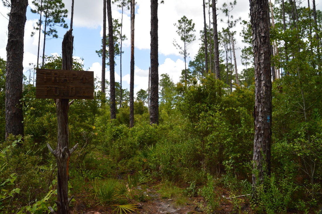
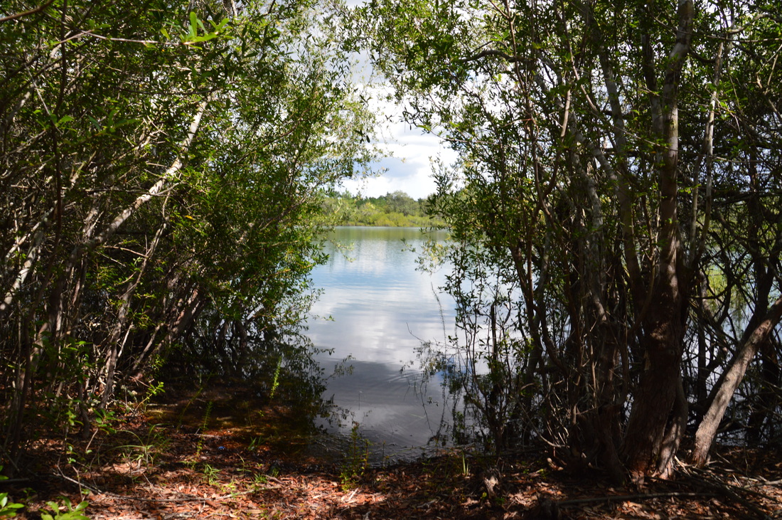
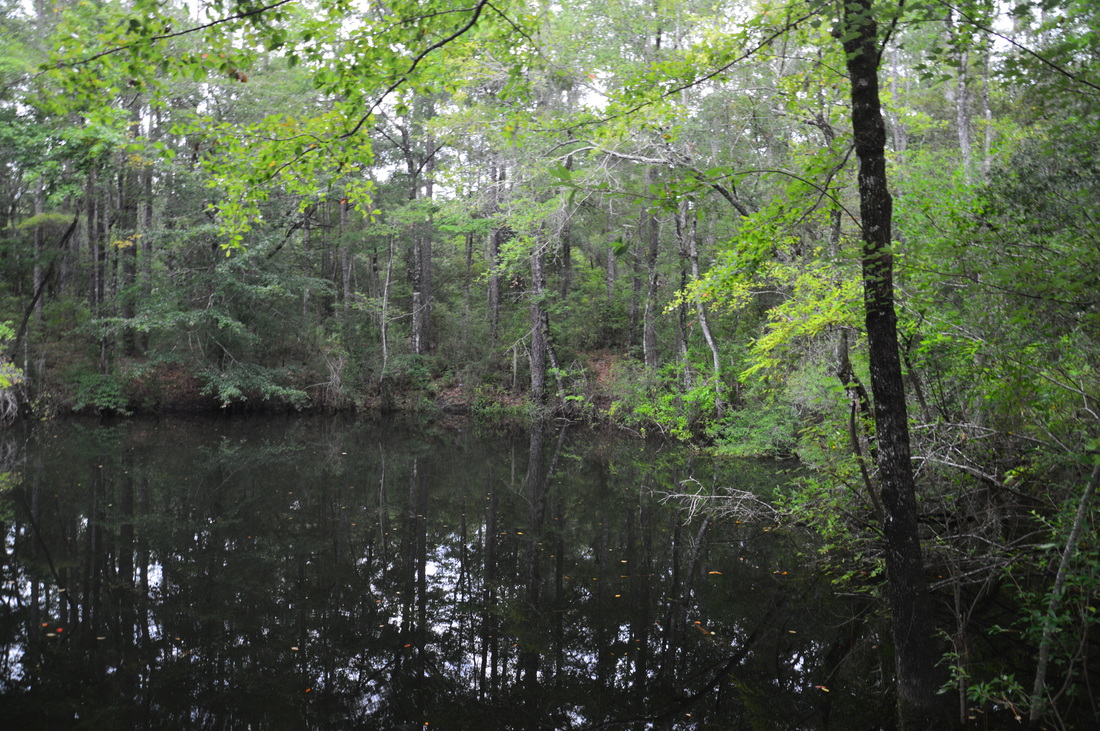
Trap Pond is a small pond located on a side trail from the Florida Trail on its Econfina Creek segment
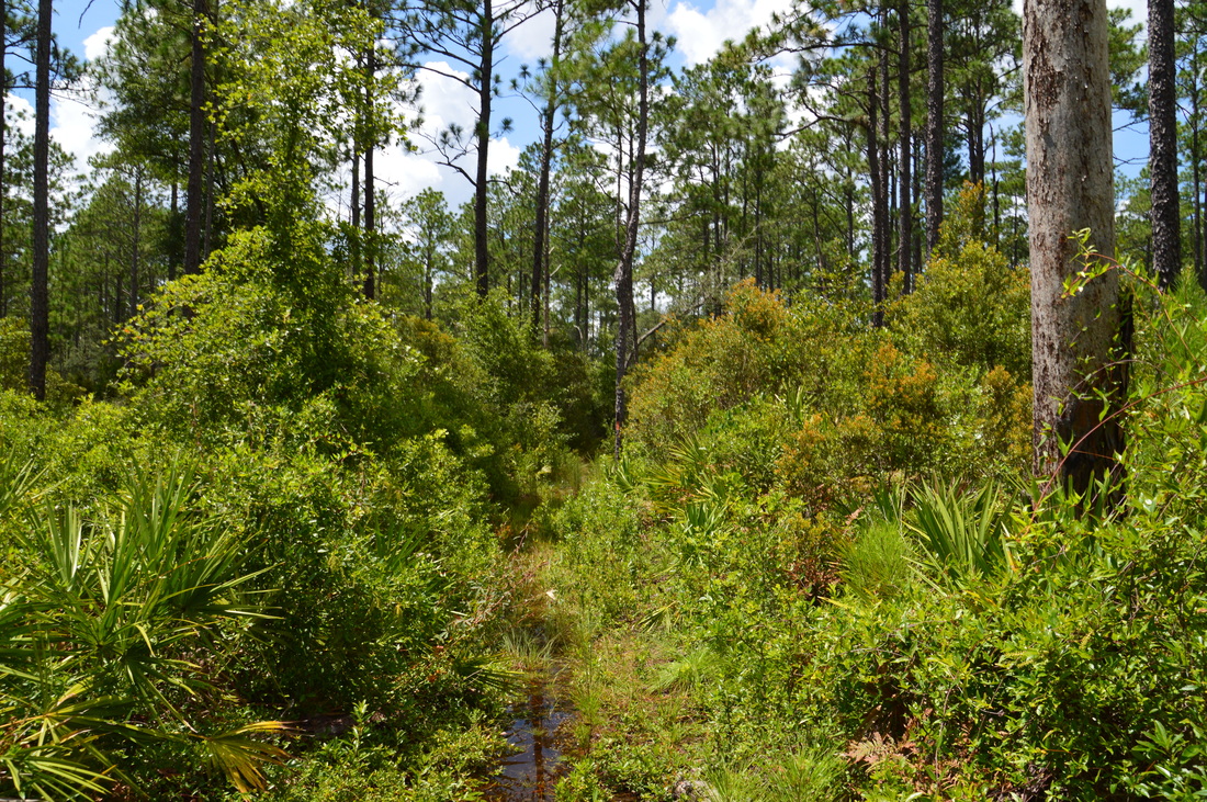
The main problem with Trap Pond is that it is surrounded by a dense wall of vegetation that makes it hard to get a good view of the pond. Despite this, I still recommend making the side trip to the pond. Thus, turn right onto the blue-blazed trail. This trail quickly leaves Econfina Creek behind and enters a sandhill ecosystem. At 4.6 miles, cross a forest road, and then, begin to ascend up a sandhill. To the left is an ecotone that marks the boundary between drier sandhill habitat and wetter hammock along a tributary of Econfina Creek. The easy, short ascent to the sandhill still reminded me just how long it had been since I had finished my last hike in the mountains: over two months. At 4.95 miles, the trail arrives at Trap Pond Campsite, complete with a picnic table, to the left. The pond is hidden behind vegetation to the trail's right. Continue following the blue-blazed trail, until it reaches a small opening at Trap Pond at 5.1 miles. This is the end of the side trail. It is still difficult to get a good view of the pond as a whole from here, but with some effort, you can see the greater part of it. If you scramble up the hillside behind the pond, you can get a decent view of the entire pond below.
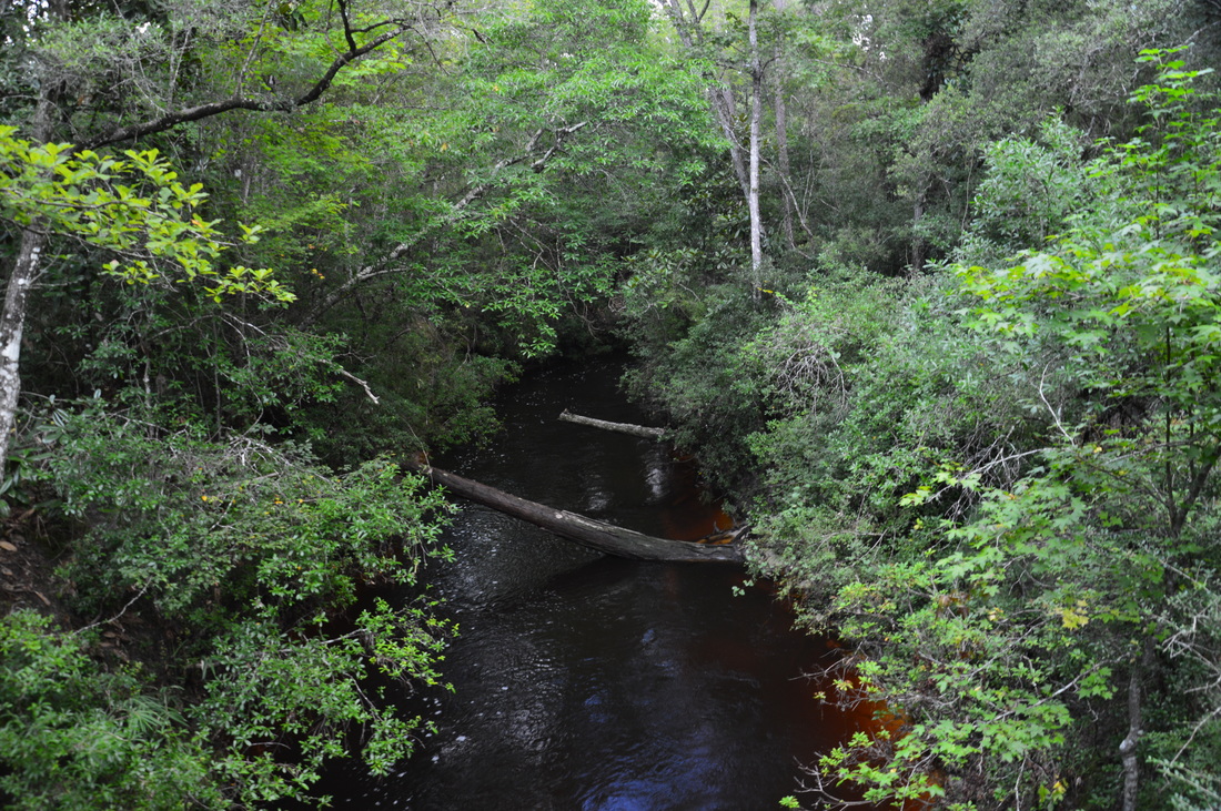
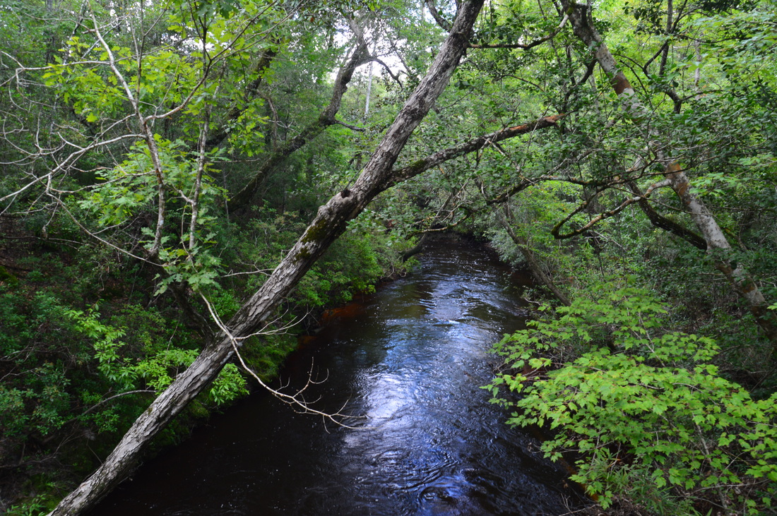
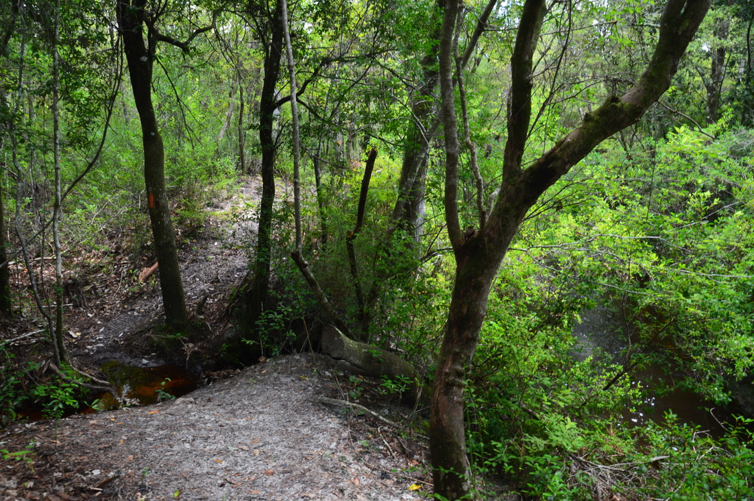
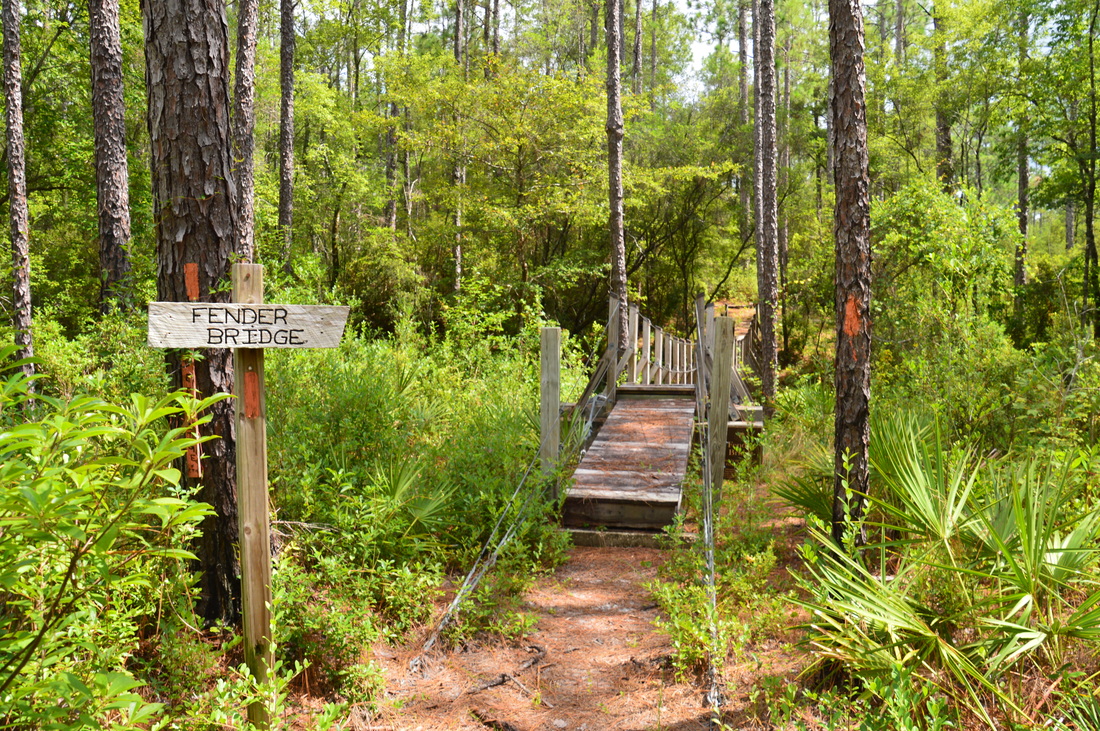
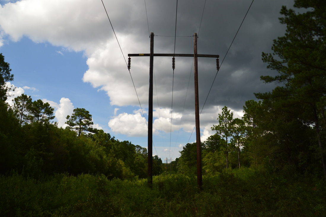
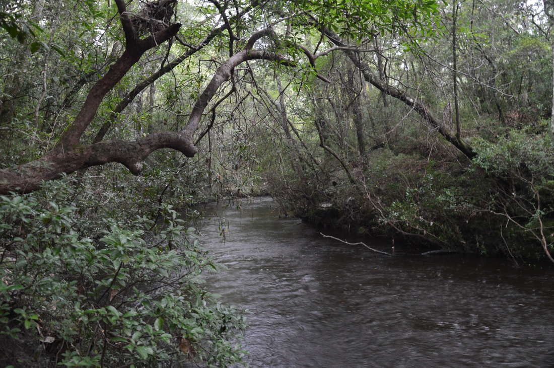
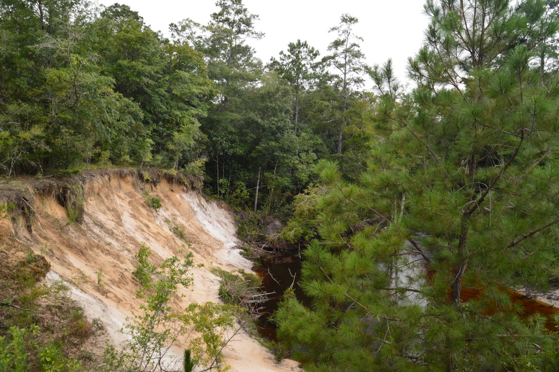
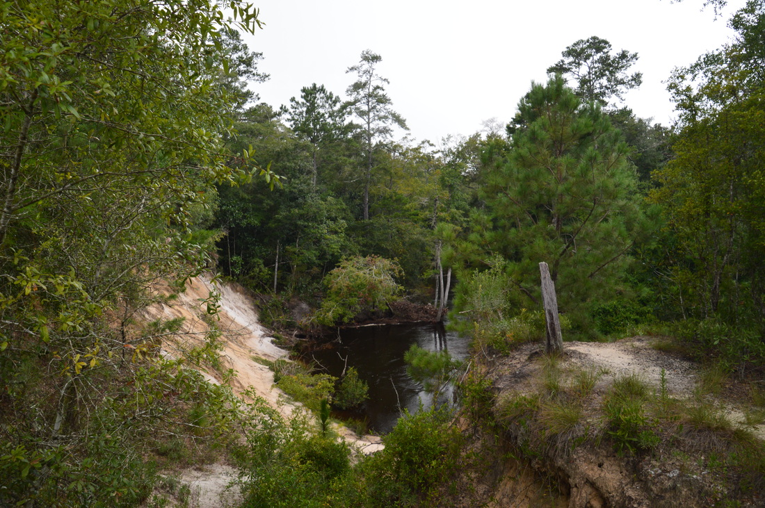
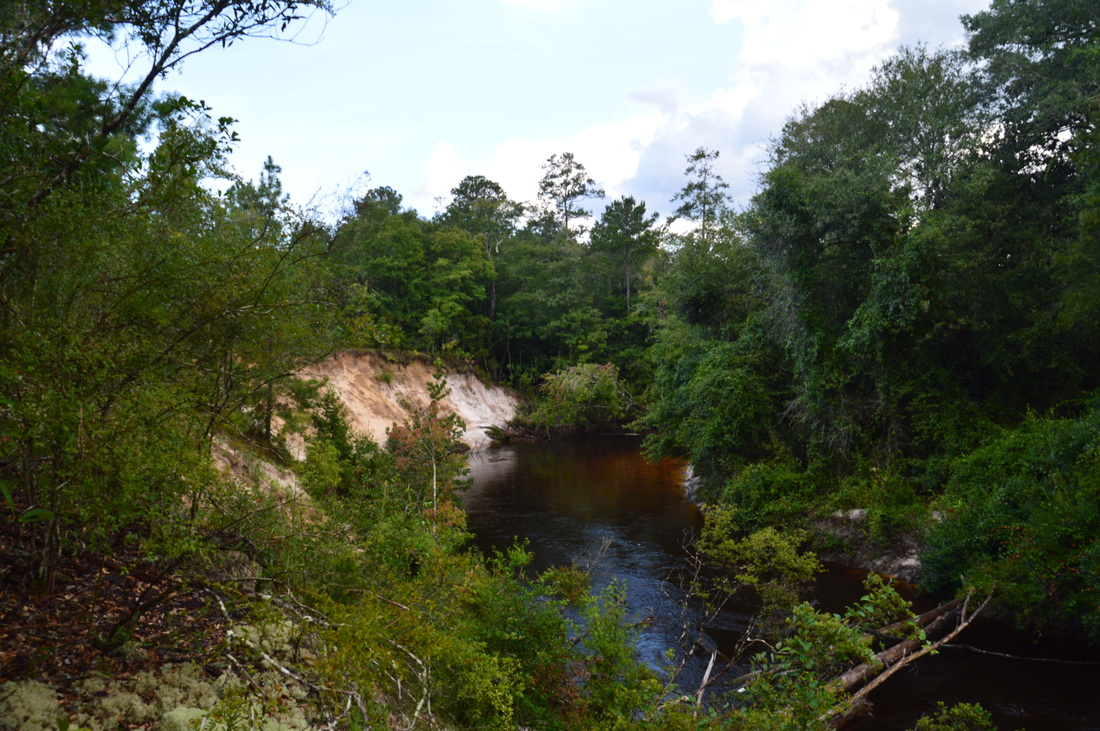
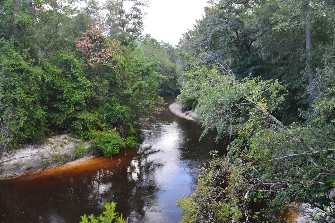
From Trap Pond, retrace your steps to the FT, arriving at it at 5.7 miles. Turn right onto the FT and continue your hike. The trail quickly arrives at Econfina Creek and the next point of interest - Fender Bridge - at 5.85 miles. Fender Bridge is a suspension bridge very similar to Two Penny Bridge, although Two Penny looked more impressive to me. Once again, there are great views of the creek from the bridge. Savor the views of the creek, as this is the last time you'll see it for a while. After Fender Bridge, the trail a large and swift but unnamed tributary of Econfina Creek via a footbridge. This tributary reminded me a mountain stream. Then, the trail worked its way into upland forest, which was a welcome change of scenery. This portion of the hike felt more remote, probably due to the silence that stood in the forest when the sound of rushing water wasn't present. At 6.15 miles, the trail crosses a powerline cut. After this, the trail gets slightly confusing, sometimes passing through sandhills at the top of the valley, while at other tiems dipping just barely into the steep-sided valley. Make sure to stay with the orange blazes. Eventually, the trail descends back into the valley and returns to Econfina Creek at 7.5 miles. Around here, it started to rain, so my pictures from the next section were limited. The trail continued a previous pattern, as it closely paralleled Econfina Creek, except there were even more steep ravines than before, and by now, my legs were getting pretty tired. I had not expected such a workout in Florida. There are a few footbridges along this section, but they did not have anti-slippery material on them yet (I saw it laying on the ground next to the bridges). This made for some very tricky traverses, due to the rain. At 8.7 miles, the trail suddenly leaves the creek and ascends to what is, in my opinion, the biggest highlight of this hike: the Econfina Creek Bluffs. These sandy bluffs provide spectacular views of the creek below. The best views are on a short side trail that leads to the right from the main trail. It ends at a vantage point at a bend in the creek, with more scenic bluffs visible to the left (downstream). 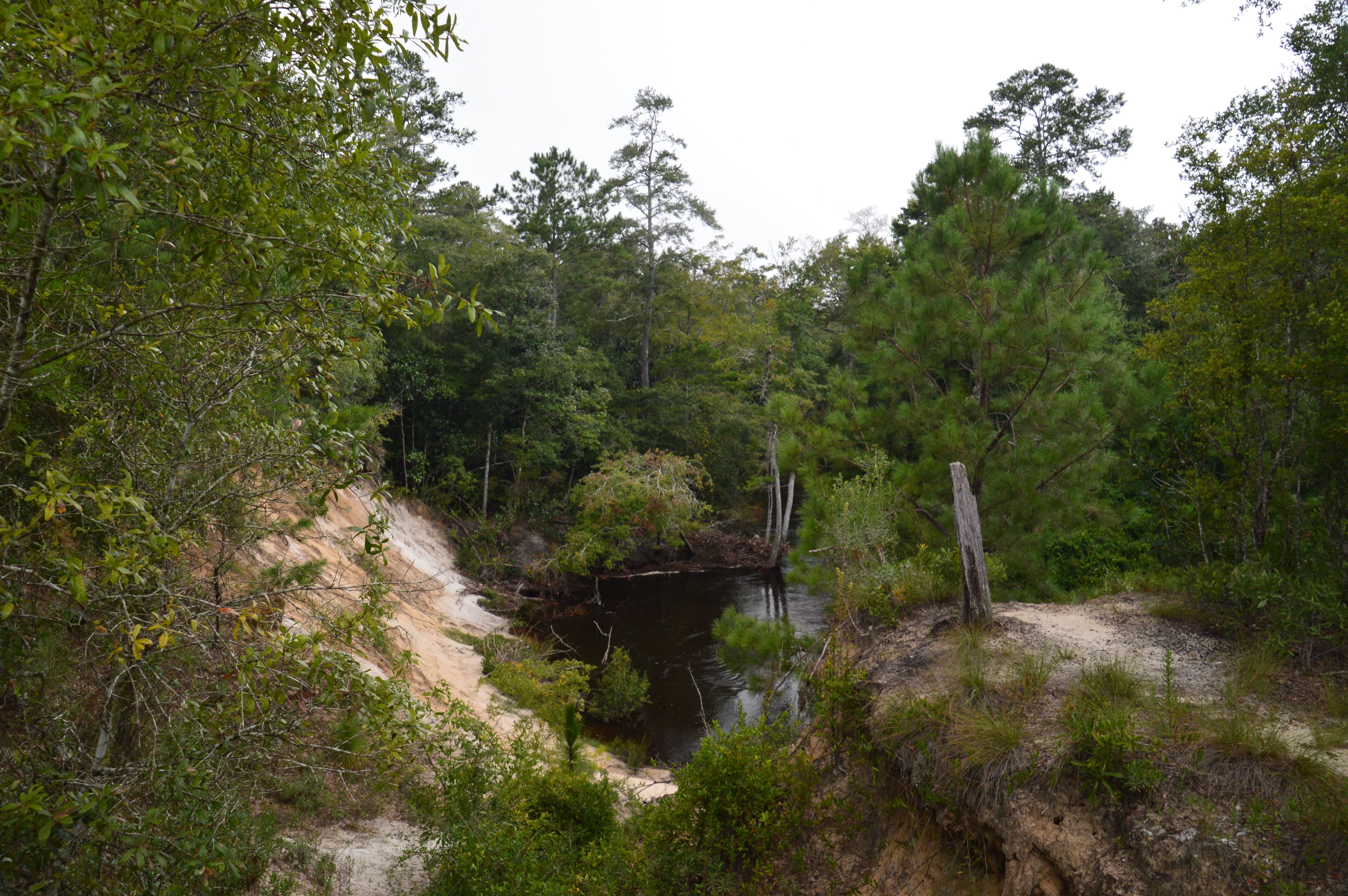
Shown here is a portion of the Econfina Creek Bluffs
The Econfina Creek Bluffs are certainly a good turnaround point. However, my goal was to push on as far as possible, and I was determined to make it to Devil's Hole, so I continued. Following the bluffs, the trail briefly stays on a level plateau above the creek, before descending back to the creek. The valley is much shallower now than it was earlier. At 9.4 miles, the trail leaves the creek again but stays in the broad valley, passing several swampy areas.
At 9.9 miles, reach an intersection with a blue-blazed trail to the left that leads to Devil's Hole. Leave the Florida Trail here and take the blue-blazed trail. Follow it to its end in the Devil's Hole Recreation Area, and reach Devil's Hole at 10.0 miles. A set of steps lead down to the edge of Devil's Hole, which is a small pond that is actually a water-filled sinkhole. Even though you can continue on the Florida Trail until Walsingham Bridge, Devil's Hole is a great turnaround point. From Devil's Hole, simply retrace your steps back to the Scott Road Trailhead. I found this increasingly tiring, as I had to walk through the countless ravines on the trail all over again. You will return to the Scott Road Trailhead at 18.7 miles, concluding the hike. If you follow this blog closely, you may have noticed that I have classified a lot of hikes in the Florida Panhandle as "Best Hikes", more than in other parts of the state. The truth is, many of the hikes that I have done in the panhandle have had numerous features that made the hikes better than most others I have done in Florida. On each one of my trips to the Florida Panhandle, I have been able to complete at least one "Best Hike", and after completing the Florida Trail along Econfina Creek, I decided to classify it as a "Best Hike" as well. All of the water features, the views from the Econfina Creek Bluffs, and the Trap Pond and Devil's Hole that are thrown in - so many different points of interest and picturesque scenes are hard to find on any single hike in Florida. Mileage
0.0 - Scott Road Trailhead
0.9 - First views of and rapids on Econfina Creek 1.8 - Two Penny Bridge 2.25 - Waterfall on Sweetwater Branch 2.6 - Apple Bridge 4.5 - Trap Pond Trail 5.1 - Trap Pond 5.85 - Fender Bridge 6.15 - Powerline 8.7 - Econfina Creek Bluffs 10.0 - Devil's Hole 18.7 - Scott Road Trailhead Variations
Hike out and back to Two Penny Bridge - 3.6 Miles
Hike out and back to Trap Pond - 10.2 Miles Hike out and back to Econfina Creek Bluffs (including Trap Pond side trip) - 17.4 Miles Eliminate Trap Pond side trip - removes 1.2 Miles from all variations Bonus Stops
Accessed from Highway 20, the Econfina Creek Nature Trail is a 2-mile hike that leads along the namesake creek to Williford Springs. It is not too far from the hike described on this page.
PicturesVideos
2 Comments
2/8/2017 11:35:46 am
My wife and I kayaked the Ecofina Creek. Our main purpose was to visit and snorkel the vast array of freshwater springs at the upper end of the creek. But we paddled all day to a take-out point where a shuttle waited to return us to our vehicle.
Mark Oleg
2/8/2017 11:55:57 am
Econfina Creek is indeed unique. The ravine that it is situated in is probably the deepest "canyon" in Florida (although there may be similar spots on the Aucilla River and on some of the tributaries of the Suwannee River). The vegetation is also kinda unique, and it is really great that the Florida Trail's route is along the creek for many miles. It provides the opportunity to experience this rare area slowly up close. Leave a Reply. |
About MeMark Oleg Ozboyd Dear readers: I have invested a tremendous amount of time and effort in this website and the Georgia Waterfalls Database the past five years. All of the work that has gone in keeping these websites updated with my latest trip reports has almost been like a full-time job. This has not allowed me to pick up a paid job to save up money for college, and therefore, I I've had to take out loans. If you find the information on this website interesting, helpful, or time-saving, you can say "thanks" and help me out by clicking the button above and making a contribution. I will be very grateful for any amount of support you give, as all of it will apply toward my college tuition. Thank you!

Coming in 2022-2023?
Other Hiking WebsitesMiles HikedYear 1: 540.0 Miles
Year 2: 552.3 Miles Year 3: 518.4 Miles Year 4: 482.4 Miles Year 5: 259.9 Miles Archives
March 2021
Categories
All
|


 RSS Feed