
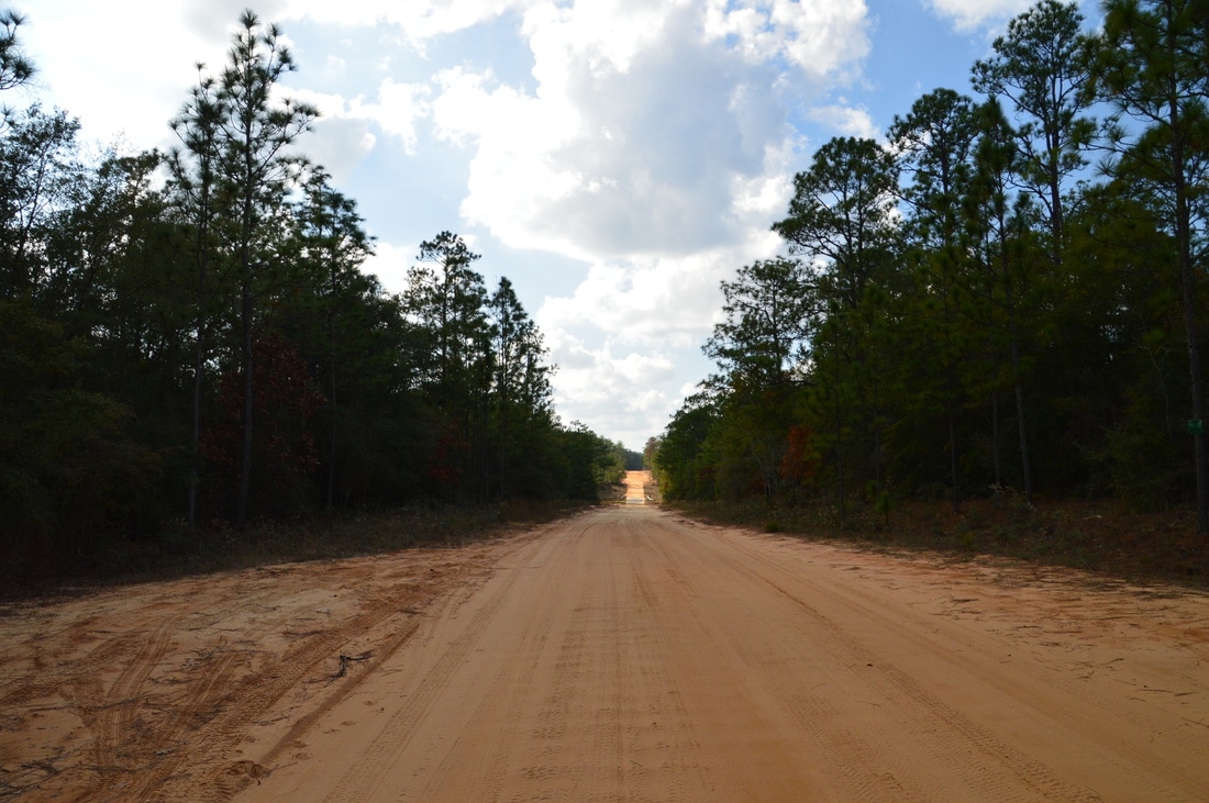
The Cimarron segment of the Florida Trail runs through the northern edge of the Eglin Air Force Base, in the vicinity of the Yellow River. While at the moment, this trail segment is not part of the official route of the Florida Trail - due to the lack of a bridge across the Yellow River - it is still maintained by the Florida Trail Association and often hiked. The Cimarron Trail passes through several miles of pine flatwoods and other upland ecosystems before dropping down into a Yellow River floodplain swamp, where there are multiple views of the river, a variety of sloughs to see, and a potential swamp slog depending on recent rainfall. This hike occurred on Saturday, December 24th, 2016. My plan was to hike the Cimarron Trail out and back from Highway 85 to the terminus of the trail at the Yellow River.
Summary
R/T Length of Trail: 17.6 Miles
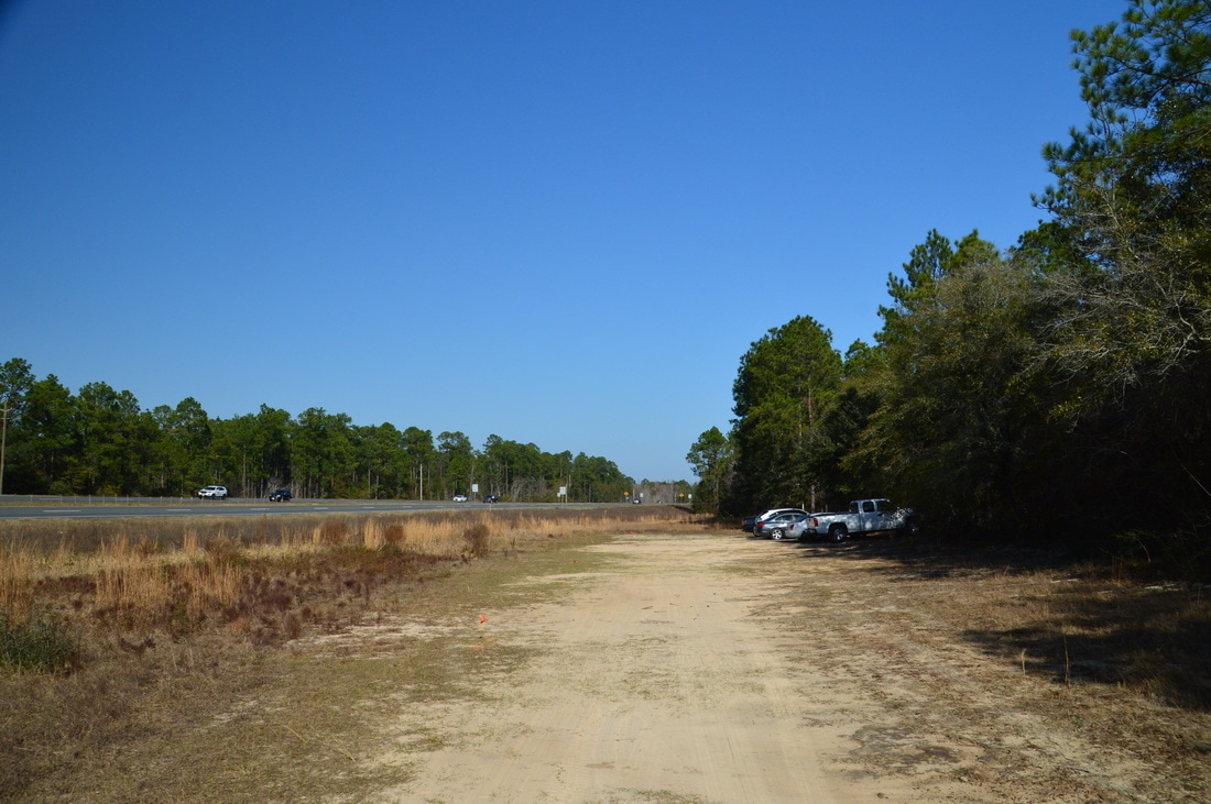
Duration of Hike: 9:00 Type of Hike: Out and Back Difficulty Rating: 5 out of 10 Total Elevation Gain: Minimal Pros: Most creek crossings throughout the hike (except Turkey Hen Creek) are equipped with footbridges Cons: The area of the trail west of Turkey Gobbler Creek Road is frequently inundated at least partially, as it is part of the Yellow River floodplain (and during flood conditions, this part of the trail may be impassable) Points of Interest: Crain Pond; Several views of the Yellow River; Scenic area in the Yellow River floodplain Trail Blaze Colors: Cimarron Trail - Blue; Florida Trail (not encountered on this hike but listed for reference) - Orange Best Seasons to Hike: Winter Fees: This hike is on the property of Eglin Air Force Base. To hike in Eglin AFB, you must have a recreational permit. The daily hiking permit costs $5 and the annual hiking permit costs $20. You can obtain the permit online at eglin.isportsman.net or buy one at the Jackson Guard Office located at 107 Hwy 85 North, Niceville, FL. Beginning Point: Highway 85 Florida Trail Trailhead Directions from Crestview, FL: From Exit 56 on I-10 in Crestview, take FL Route 85 South. The Florida Trail parking area will be on the east side (left side) of the highway in 2.7 miles, but there is no way to drive over to the left side of the highway here - because FL 85 is a divided highway with two lanes in each direction - so continue to the Rattlesnake Bluff Road intersection (3.1 miles from I-10). Turn around here, and drive north on FL 85 North for 0.4 miles to the parking area, which will now be to the right. Map
Click here for more information and to download this trail map to view in Garmin Basecamp.
Details
The Florida Trail is a 1400-mile footpath that stretches across the entire state of Florida, from Fort Pickens on Gulf Islands National Seashore to Big Cypress National Preserve. It is perhaps the most-traveled foot trail in the state of Florida. However, there are also several side trails that branch off from the Florida Trail, which are maintained by the Florida Trail Association, and these trails are much less popular, because they are not suitable for "thru-hikers" and "section hikers" who set goals to hike certain sections of the FT or the entire trail itself. The Cimarron Trail is one of these side trails. Nearly 9 miles long, this trail branches off from the Florida Trail in Eglin AFB and meanders among various upland habitats south of the Yellow River before passing through a very scenic area in the Yellow River floodplain. There are future plans to turn the Cimarron Trail into a part of the official Florida Trail route, as this would eliminate a lengthy roadwalk along FL Route 85 and US Route 90. The issue is that at the moment, there is no footbridge built across the Yellow River at the terminus of the Cimarron Trail, and since it is not safe to attempt to ford or swim across the Yellow River, the trail is currently a dead end. Nevertheless, it can still be hiked in multiple out and back sections from the several roads that the trail crosses, it can be shuttled, and it can even be hiked out and back from Highway 85 as a long day hike or as an overnight backpack.
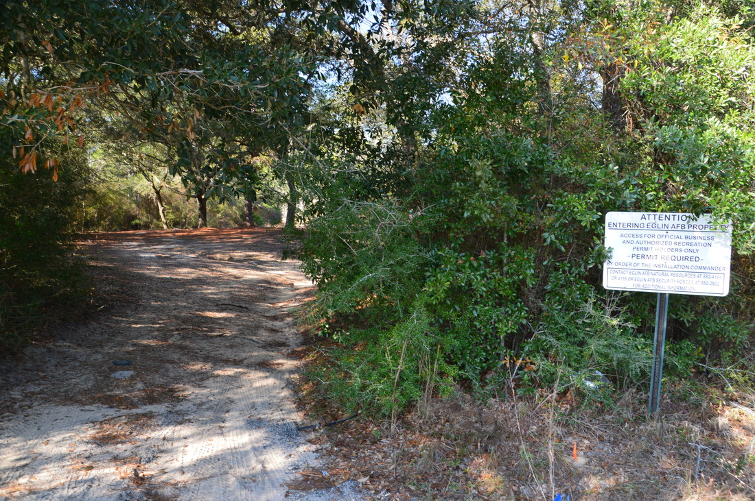
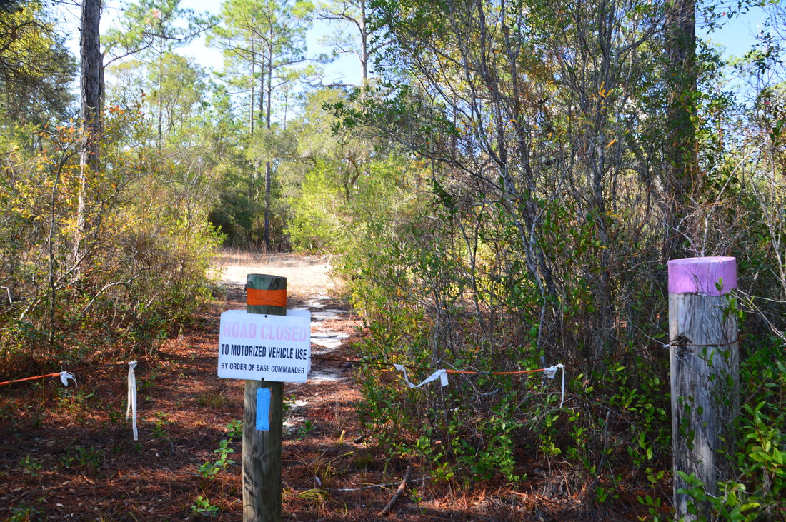
The more obvious trail at the Highway 85 trailhead is the Florida Trail, which heads eastward into the heart of Eglin's Jackson North Unit. The Cimarron Trail actually begins across the highway (I still wonder if you're allowed to park over there...). Take great care crossing over to the west side of the four-lane highway, as the speed limit on it is 65 MPH! Once on the west side, you should spot a dirt road, heading into the woods west, the entrance of which is marked by a "Permit Required" sign. Follow this dirt road for a short distance to a wide area at 0.25 miles that is like a turnaround (except there is a road coming out of the other end) next to Turkey Hen Creek. To reach the actual beginning of the Cimarron Trail, turn left and ford Turkey Hen Creek here. Turkey Hen Creek is the only unbridged stream on this hike, although there are several wet areas later on in the Yellow River floodplain. On this late-December day, the water was about ankle-deep and very clear. On the other side of a creek, there is a small muddy area, and then just beyond it is a post with a blue blaze and a sign that reads "Road Closed to Motorized Vehicle Use". This is the beginning of the Cimarron Trail. 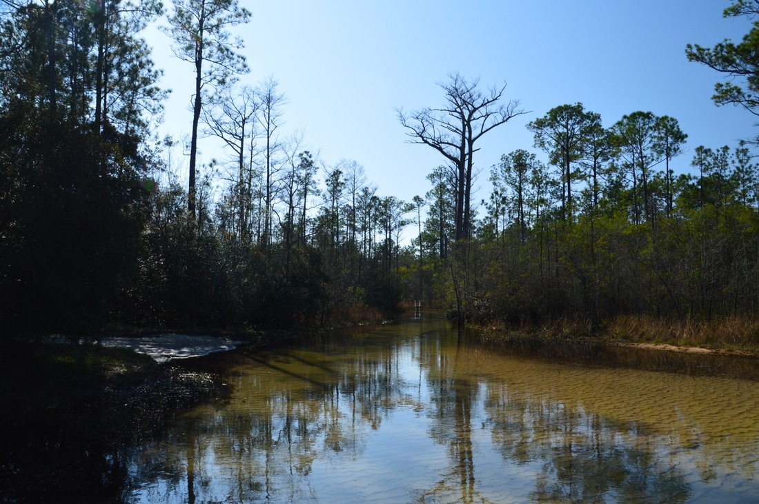
You must ford Turkey Hen Creek at the beginning of the Cimarron Trail.
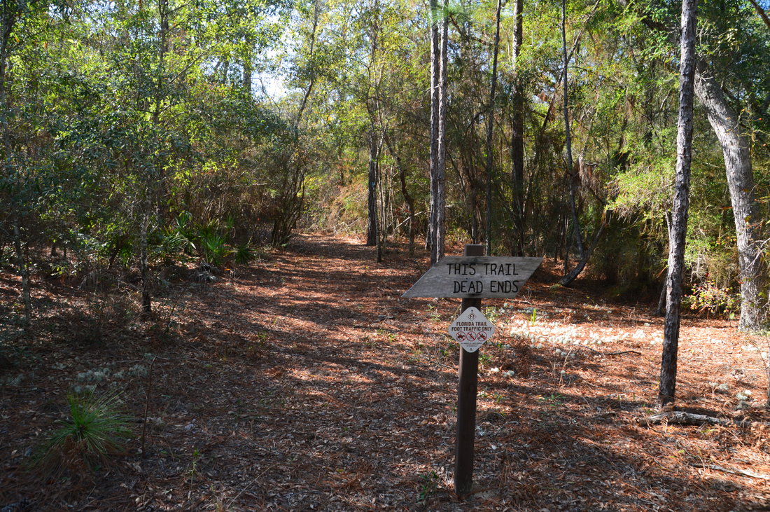
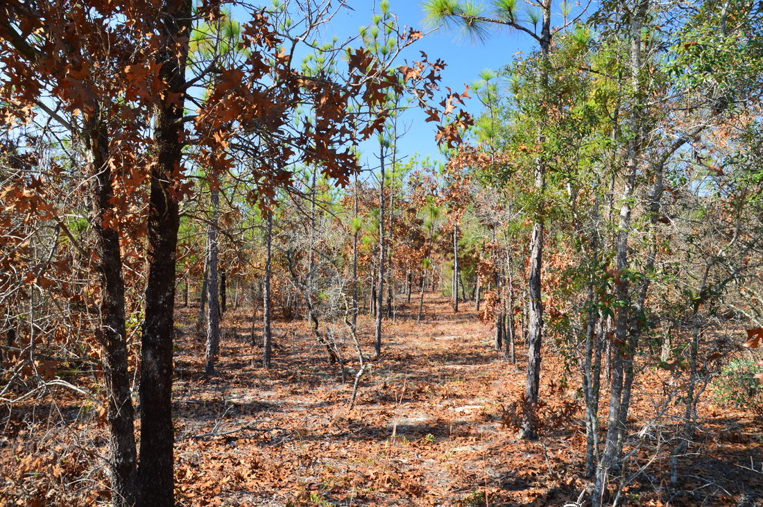
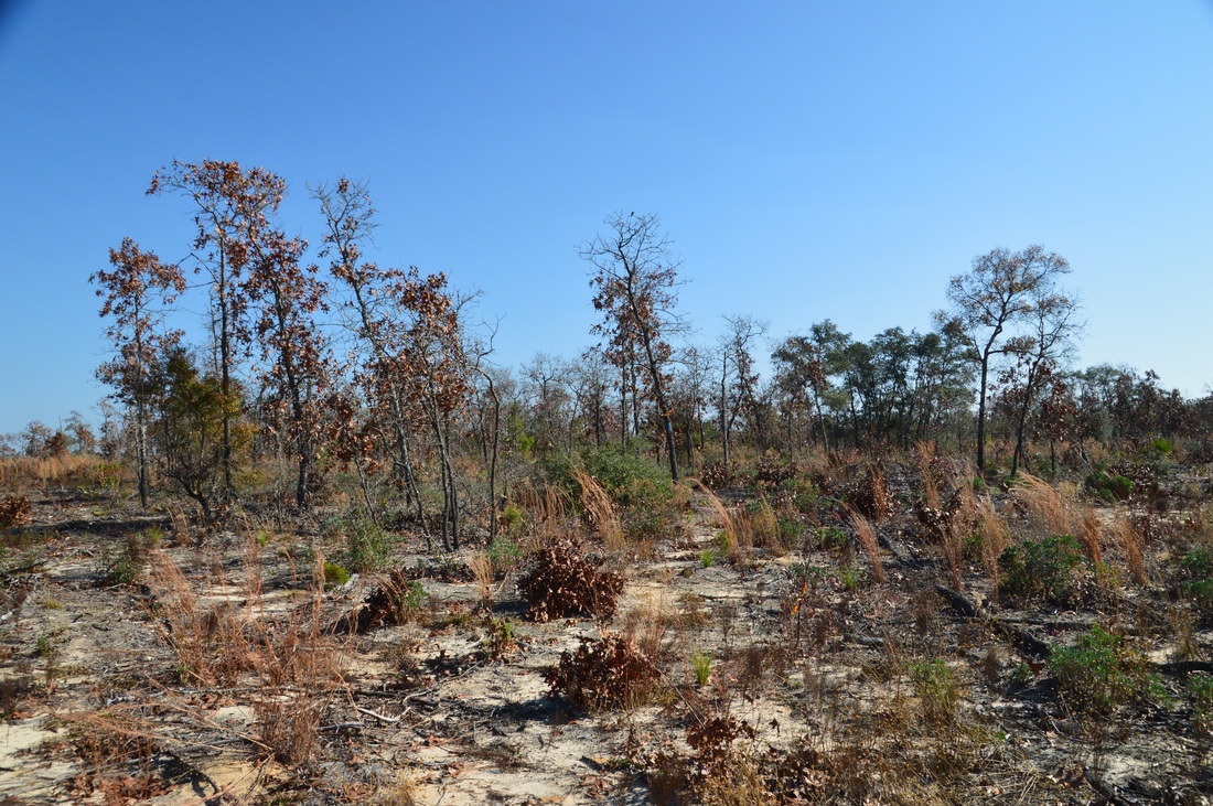
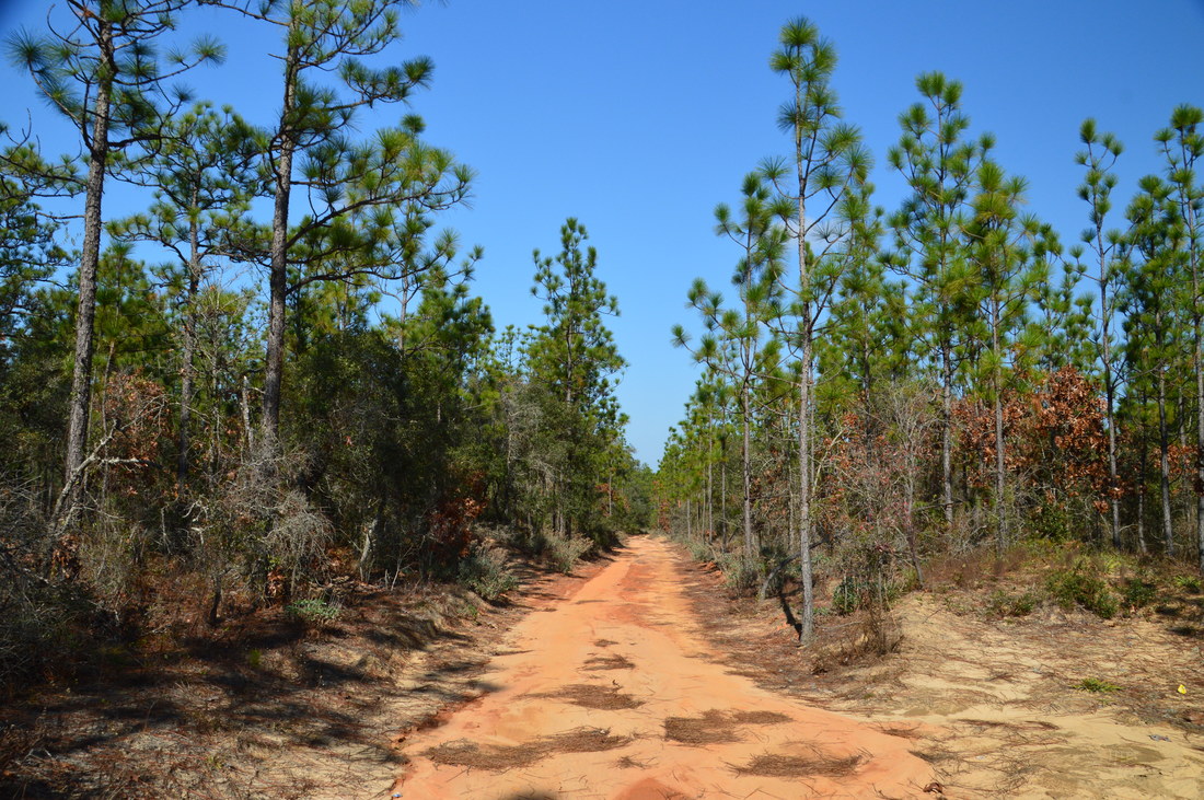
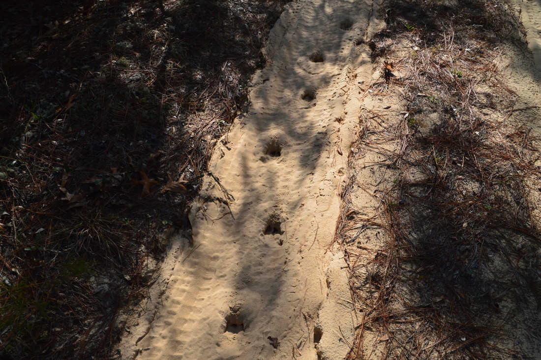
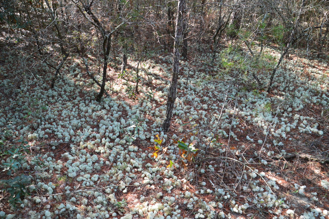
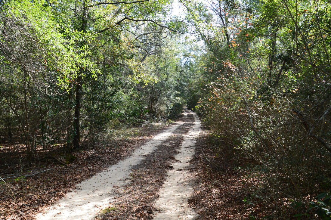
Crossing an old forest road, the Cimarron Trail quickly enters upland sandhill forest with young pines and oaks, where it will stay throughout much of its length. The entire trail is in the D. Metts Unit of Eglin AFB. Shortly after the beginning, a warning sign reads "This Trail Dead Ends" near a trailside kiosk. At 0.9 miles, the trail crosses a sandy forest road at a sign that reads "Entering Fuelwood Area". I wondered what this meant. Soon, I would find out. At 1.15 miles, the trail descended into a dry gully (although my topo map indicates that there is a seasonal stream here) and entered a long clear cut, which is the "fuelwood area". There are nearly no trees here, the trail is nearly non-existent, and there are few blazes. I have read that some maintenance of this trail was supposed to be done in late January, so perhaps by the time I write this, the trail in this area has been improved or will be soon. Regardless, try to pick the best route across the clear cut, generally heading westward toward the line of trees at the far end. Reach the west boundary of the clear cut area at 1.8 miles, at a forest road. Bear right here and pick up the blue-blazed footpath, which stays parallel to and just north of the road, before crossing it at 2.0 miles. The next forest road is at 2.15 miles, after which the trail descends into the Gopher Creek valley. Cross the signed and bridged creek at 2.4 miles. This is a scenic stream due to the trees that grow in the middle of the creek.
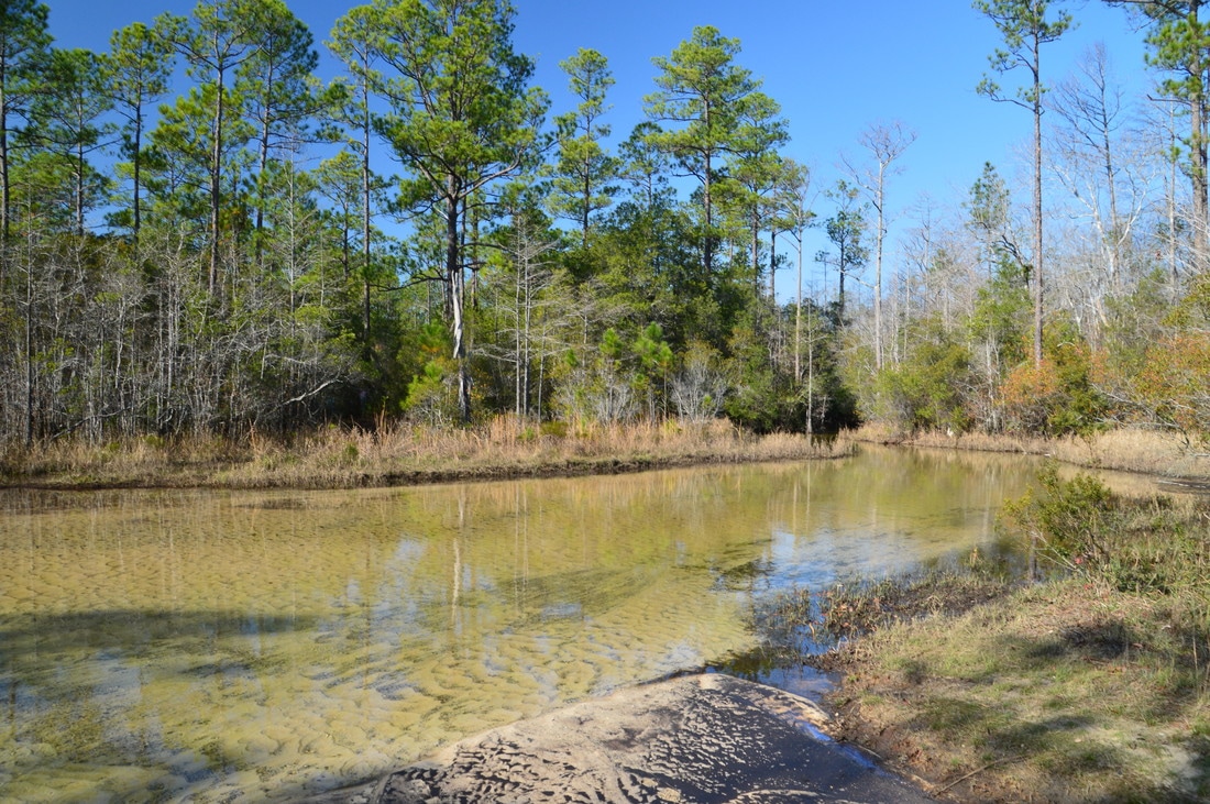
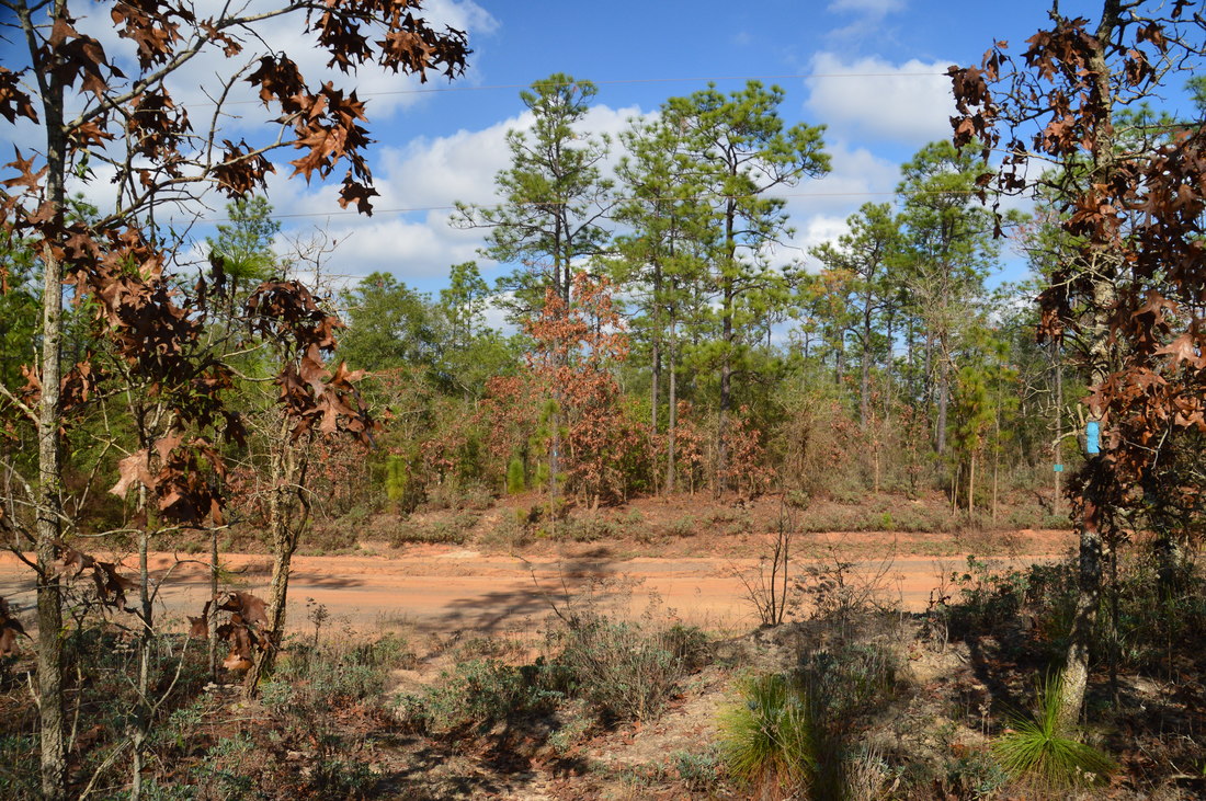
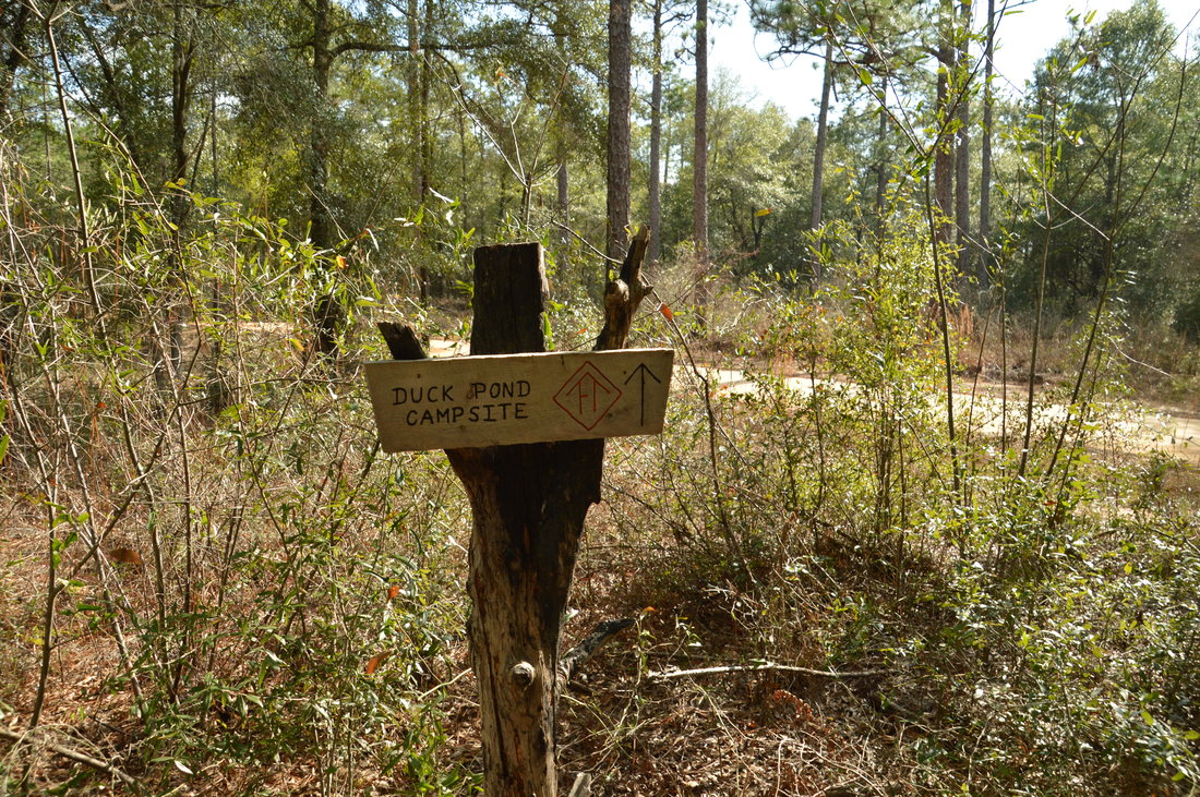
On the other side of Gopher Creek, the trail quickly ascends back into the uplands. However, the forest soon becomes denser as the trail crosses three sandy forest roads at 2.9 miles, 3.25 miles, and 3.65 miles. Then, the trail reaches a marshy area below Crain Pond and makes an abrupt left turn, staying at the edge of the marsh. At 4.1 miles, the trail crosses Rattlesnake Bluff Road (Range Road 211), which is one of the main roads in the Metts Unit. At this point, I began feeling some blisters. The wise thing would be to turn around and cut the hike short, but I hate to cut hikes short, so I decided to go ahead with the original plan, although I had to pay for it by enduring foot pain nearly the entire way back. At 4.3 miles, the trail passes Crain Pond, and a short side trail leads to the edge of the pond. although there is no clear view of the full pond. After this, the trail rises out of the depression with the pond and then crosses a pair of forest roads at 4.8 miles and then a wide road - Range Road 610 - at 5.7 miles. Here, a sign indicates that Duck Pond Campsite is 0.4 miles away to the left along this road. It is the only official campsite near the Cimarron Trail, and I believe that it is next to the road, although I did not do the side trip to Duck Pond so I cannot confirm. After this road, the trail descends into the Carr Spring Branch valley, although it never reaches the creek and instead turns west, staying above it but parallel to the creek. At one point, some cascades can be heard on the creek. At 6.15 miles, the trail ascends out of the valley and to the top of a hill where it crosses Rattlesnake Bluff Road again. 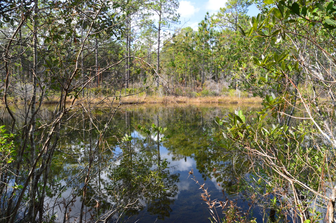
One of the highlights of the Cimarron Trail is Crain Pond.
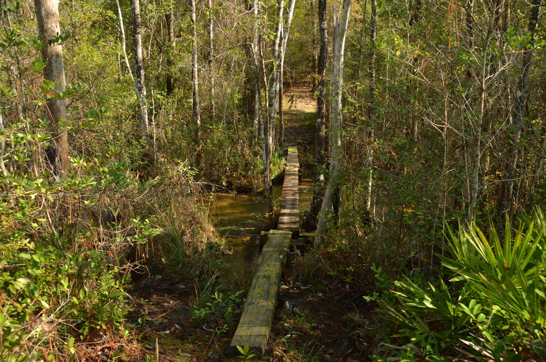
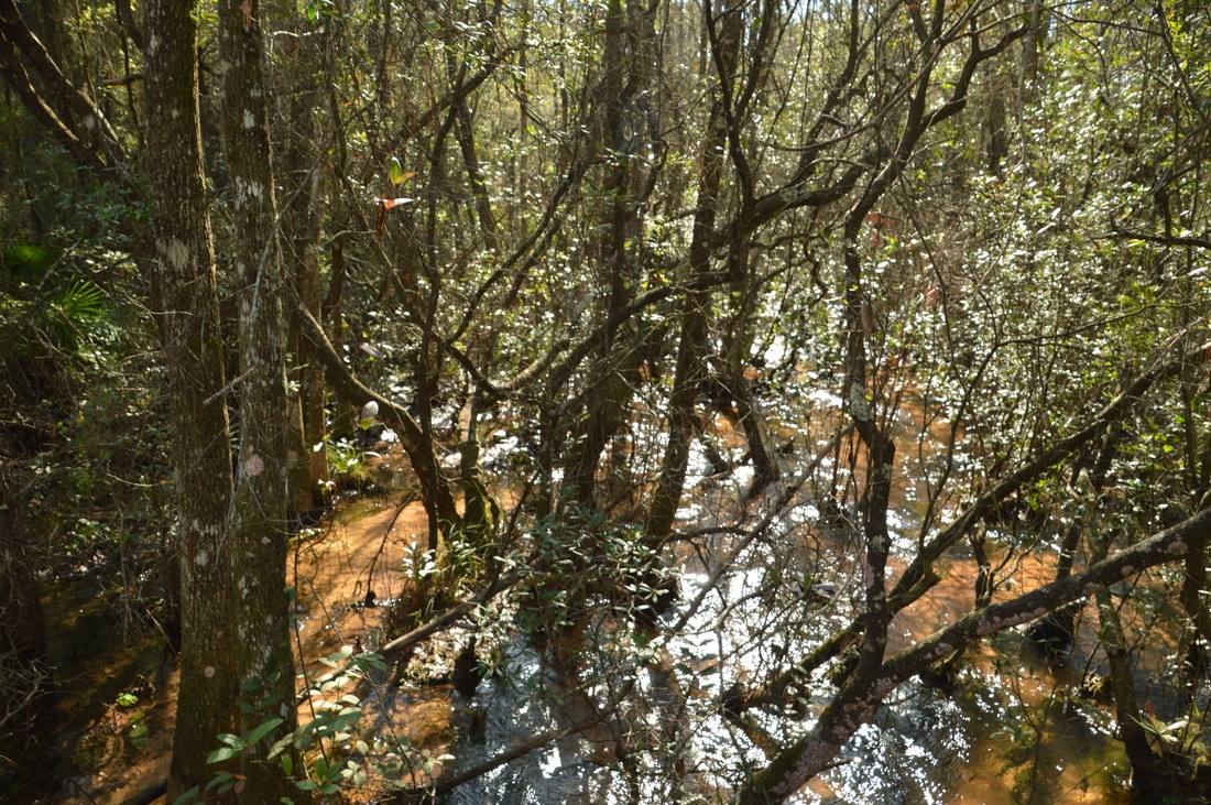
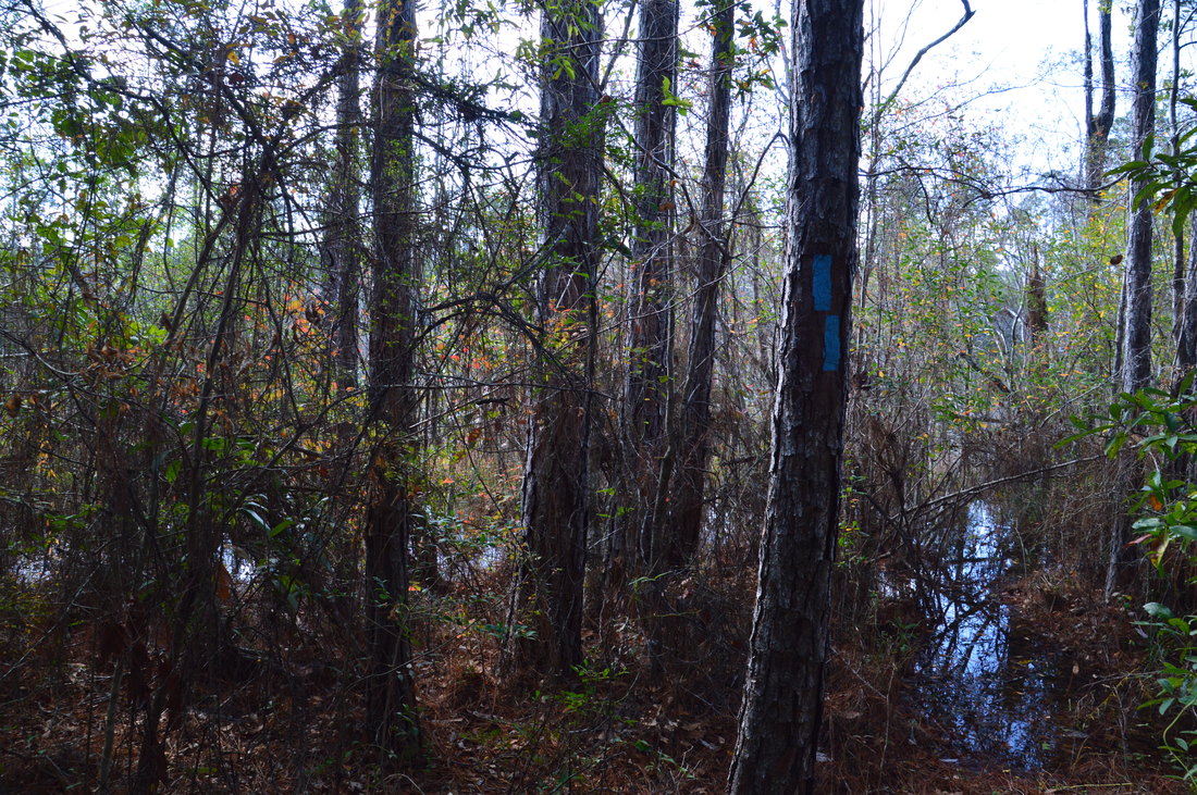
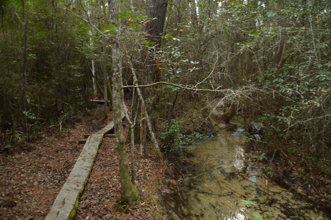
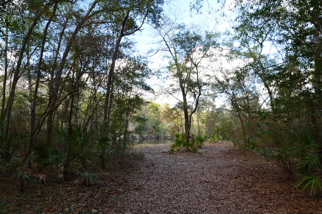
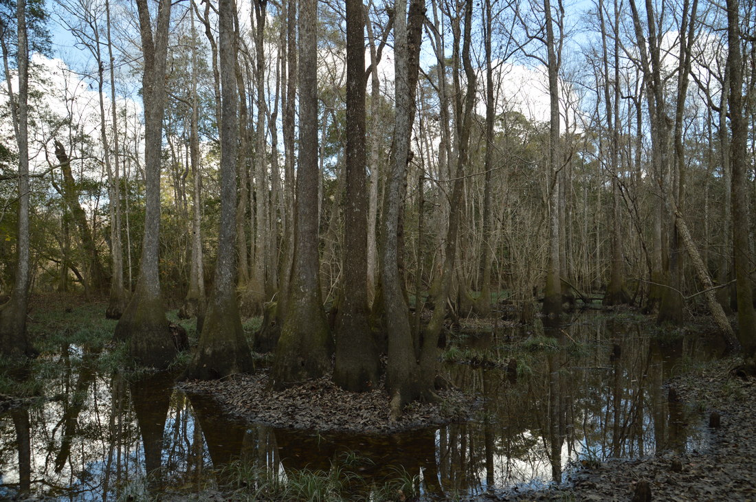
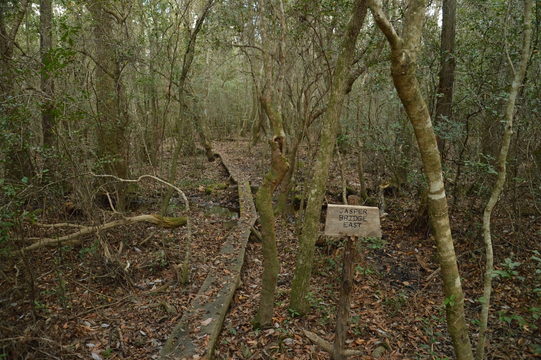
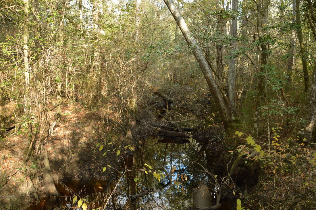
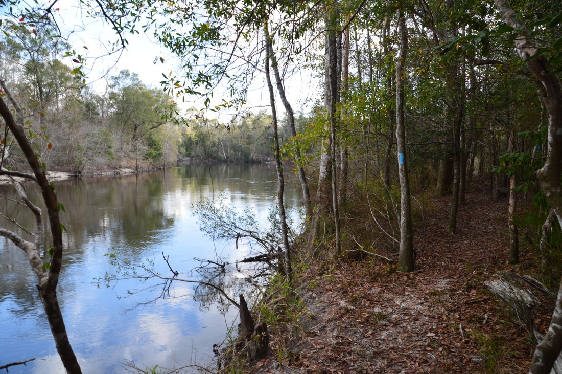
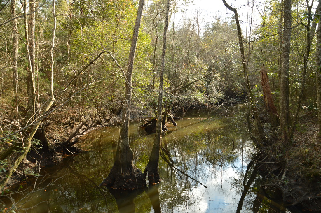
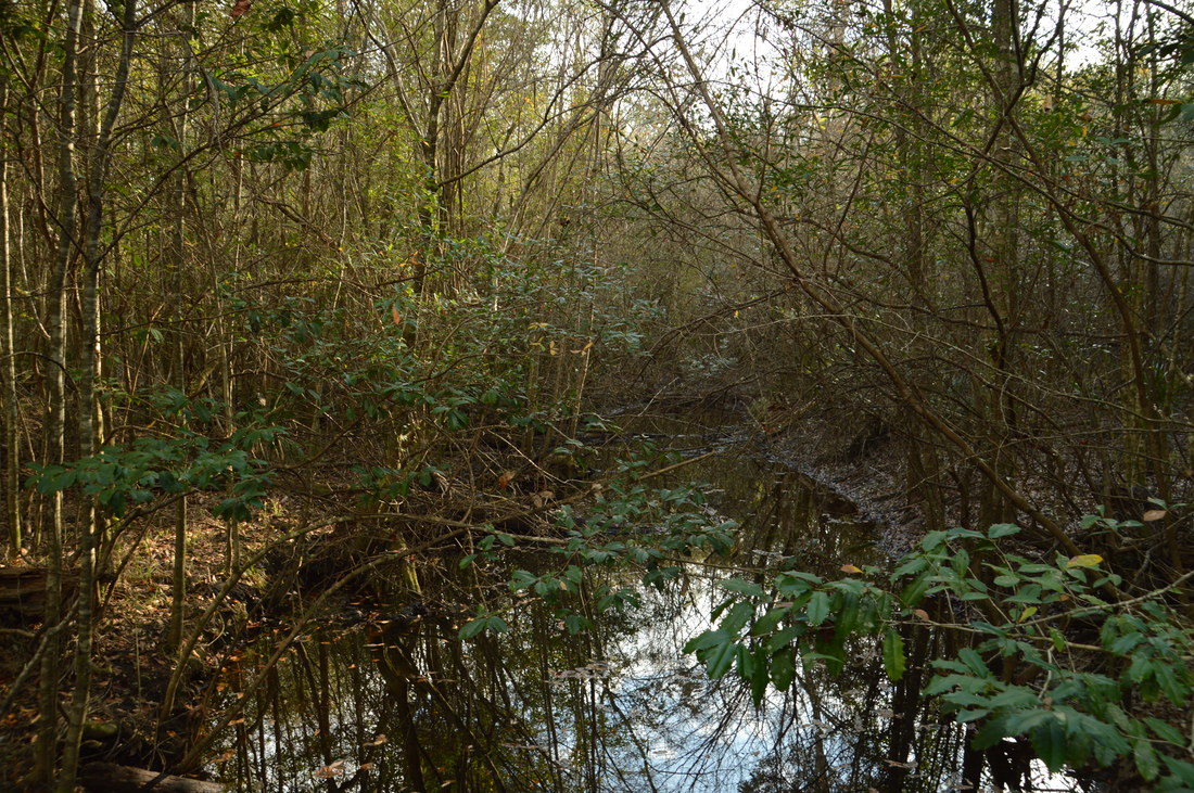
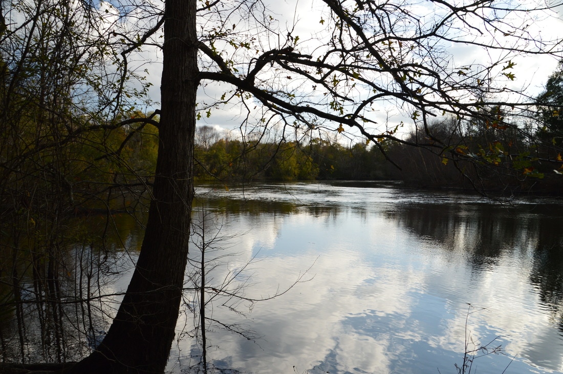
After the second crossing of Rattlesnake Bluff Road, the Cimarron Trail finally leaves the uplands and begins the descent toward the Yellow River. At 6.65 miles, the trail - after entering dense forest that is common in Florida in low-lying areas near water - crosses a forest road and then reaches Carr Spring Branch. The trail follows the edge of the creek along a plank boardwalk, as during the wet season, the creek may overflow its banks. Then, at 6.7 miles, the trail crosses Carr Spring Branch on a plank footbridge at a sign. This is a narrow but fast stream that also has clear water, similar to Gopher Creek and Turkey Hen Creek. At 6.75 miles, the trail crosses another forest road that leads to Little Gin Hole Landing on the Yellow River. At 7.0 miles, there is a cypress swamp to the right near the Yellow River, where the trail crosses a small footbridge across a seasonally wet area. At 7.15 miles, a very short side trail on the right leads to your first view of the Yellow River, and one of the best on the hike, atop a small bluff. At 7.2 miles, the trail crosses a footbridge across a small stream. At 7.3 miles, pass a large cypress swamp to the right that could be especially photogenic during high water levels. After passing over another wet-weather footbridge, the trail crosses the first of several named footbridges - Jasper Bridge East - at 7.5 miles. This low plank footbridge crosses a swampy area, although on this day, it was mostly dry. Just after Jasper Bridge East, the trail crosses a forest road that leads to Gin Hole Landing.
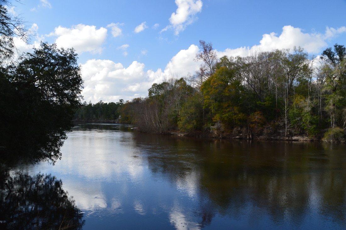
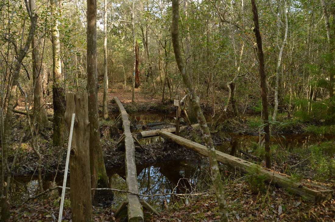
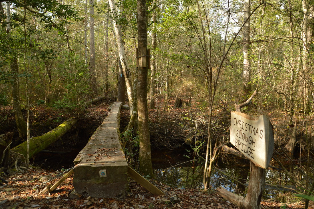
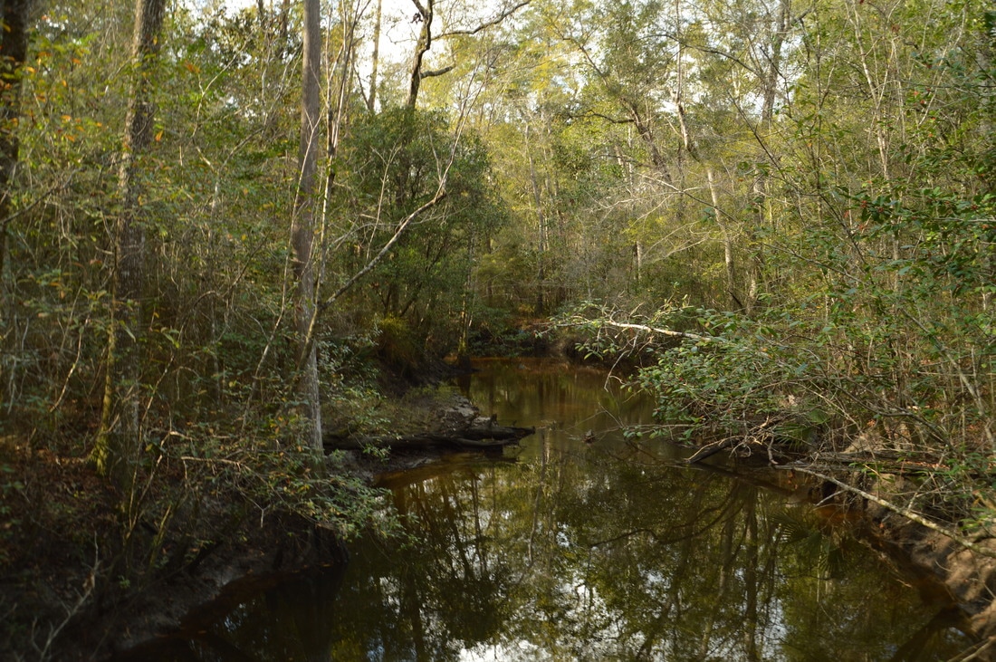
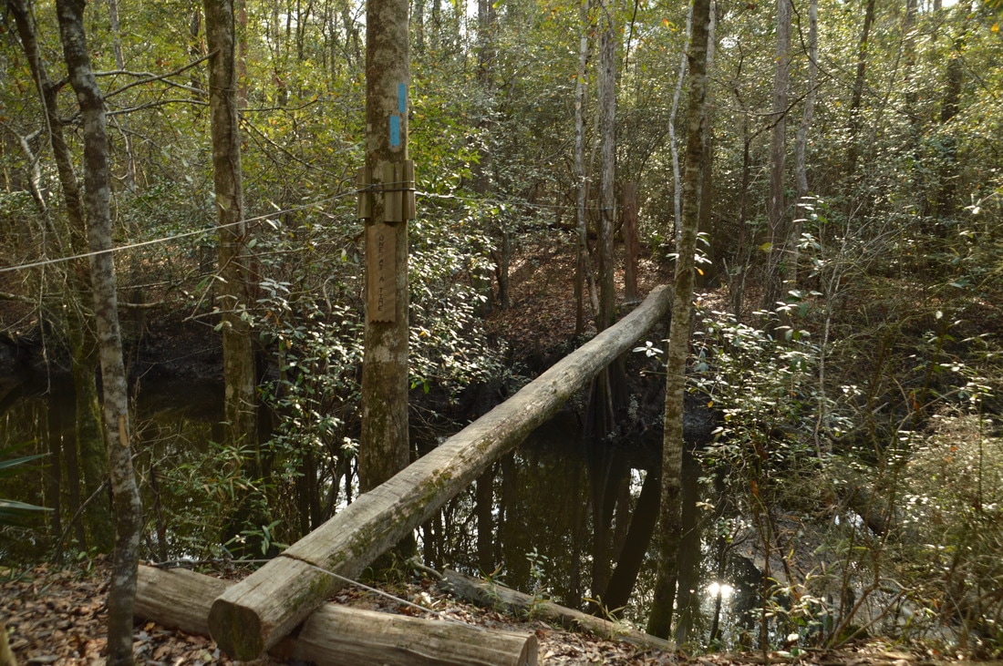
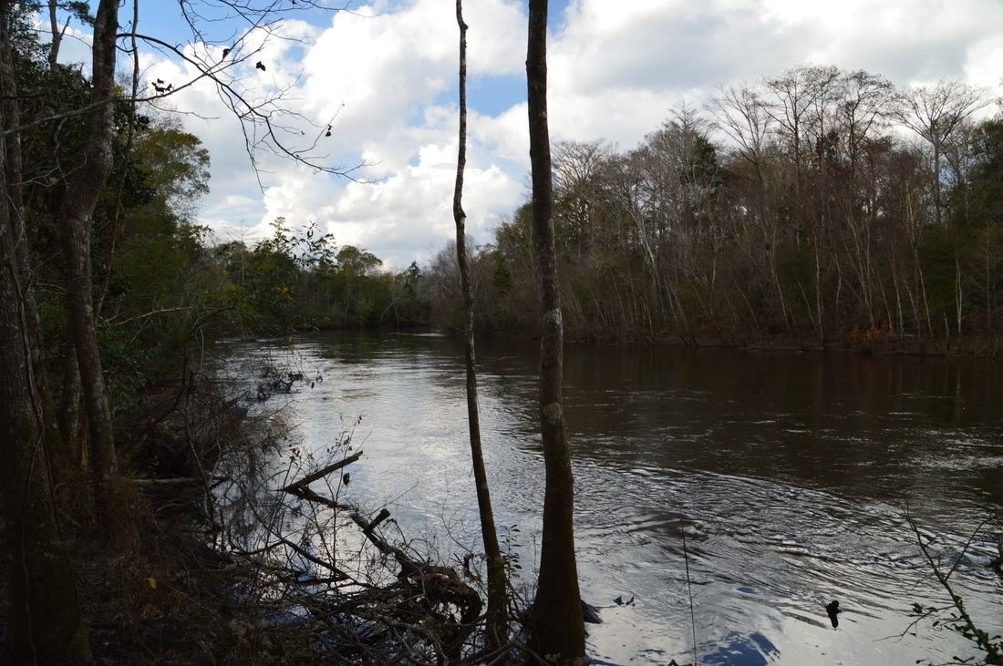
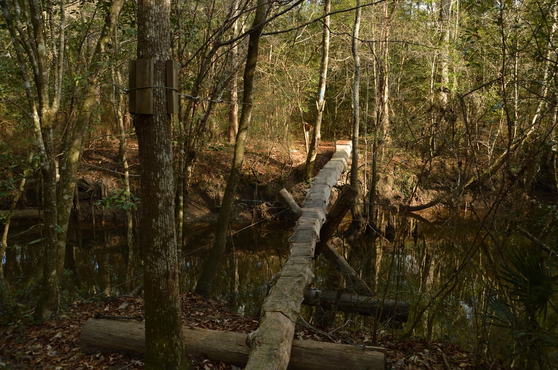
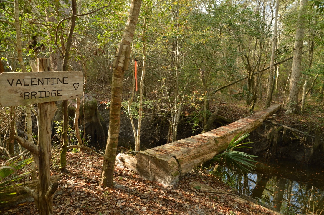
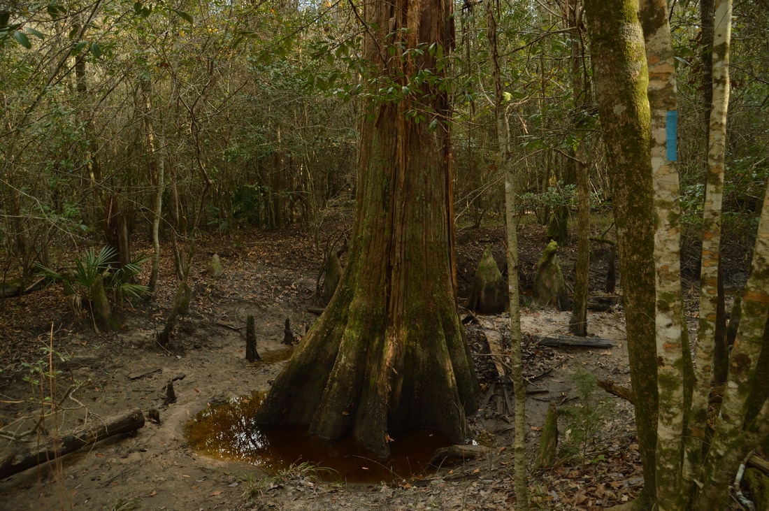
The forest road to Gin Hole Landing is the last road that the Cimarron Trail crosses. The rest of the trail is entirely in the Yellow River floodplain. When the Yellow River is at flood stage, it can be dangerous/impossible to continue on the trail past the road. However, during normal conditions, it is worth continuing, as in my opinion, this is the best and most scenic part of the hike. Just past the road, the trail crosses Jasper Bridge West across another swampy area. The next footbridge is the Christmas Slough Bridge is at 7.6 miles across a large slough. My topo map shows that this is Turkey Gobbler Creek, but I do not think that this is correct, as the Turkey Gobbler Creek Bridge was farther down the trail. All of the footbridges on this section of the trail are narrow plank/log footbridges, but they can be crossed without problems if one person at a time uses them. After a small unnamed footbridge, the trail reaches Turkey Gobbler Creek and the namesake footbridge at 7.7 miles. This is the most impressive footbridge on the hike, as it is the narrowest and it is also rather high above the steep-sided creek. There is a cable that you can hold on to while crossing the footbridge. Around 100 feet after Turkey Gobbler Creek, the trail crosses a new footbridge across a smaller slough and then arrives at and briefly follows the Yellow River at 7.8 miles. After several views of the wide, peaceful river, the trail dives back into the floodplain forest and crosses a pair of sloughs via the Cimarron Bridge at 7.85 miles and the Valentine Bridge at 7.9 miles. There is a huge cypress tree at the edge of the slough just above the Valentine Bridge. 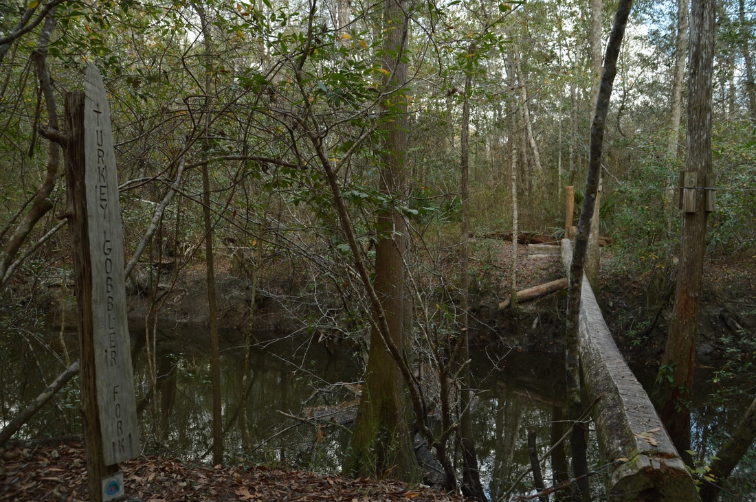
There are many wooden narrow footbridges that span sloughs in the Yellow River floodplain, and the Turkey Gobbler Creek Footbridge is the most formidable of them all.
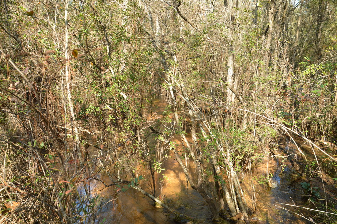
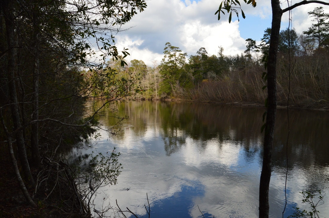
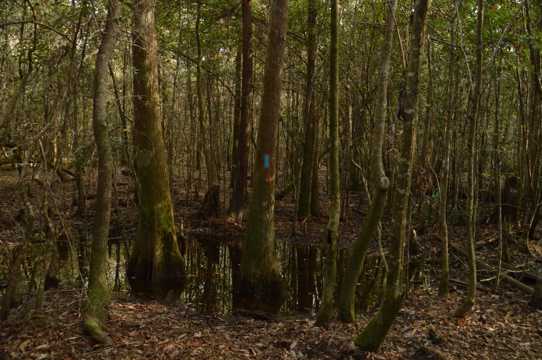
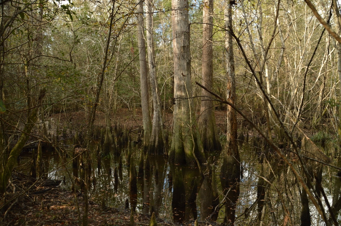
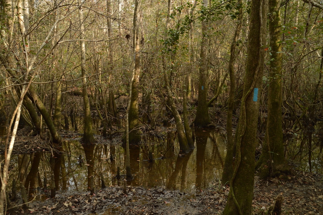
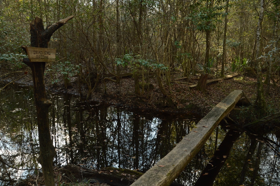
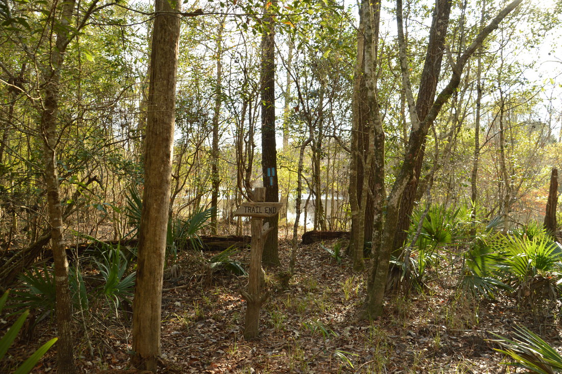
After Valentine Bridge, the trail briefly follows the Yellow River again before turning away from the river westward, cutting across a large bend in the river. This is where things get a bit "interesting". Much of this trail can be underwater during the wet season or after periods of rain, but even in dry weather, there are two unbridged wet swamp crossings. The first one is at 8.3 miles and was about ankle-deep on this day. Pay attention to the blue blazes as the faint trail meanders between wet patches and numerous cypress trees. The second, deeper swamp crossing is at 8.45 miles. The water here was nearly knee-deep on this day. At 8.5 miles, the trail passes across an area that looks like it could be wet often. There is a huge cypress tree right next to the trail here. At 8.75 miles, the trail crosses the final footbridge, aptly named the Dead End Bridge, across another slough. After this, reach the end of the trail at the Yellow River at 8.8 miles. There are great views of the river in both directions here. A sign "Trail End", along with a triple blaze, mark the end of the trail. This is the future location of a footbridge across the Yellow River. However, as there is currently no trail continuation, the only option is to turn around and retrace your steps back to the Highway 85 Trailhead. The end of the trail is a good place to take a break before beginning the long hike back. You should return to the Highway 85 Trailhead at 17.6 miles.
Mileage
0.0 - Highway 85 Trailhead
0.25 - Turkey Hen Creek 2.4 - Gopher Creek 4.1 - Rattlesnake Bluff Road 4.3 - Crain Pond 5.7 - Range Road 610 6.1 - Rattlesnake Bluff Road 6.7 - Carr Spring Branch 7.15 - Yellow River Overlook 7.5 - Jasper Bridge East 7.55 - Jasper Bridge West 7.6 - Christmas Slough Bridge 7.7 - Turkey Gobbler Creek 7.85 - Cimarron Bridge 7.9 - Valentine Bridge 8.75 - Dead End Footbridge 8.8 - Cimarron Trail Terminus 17.6 - Highway 85 Trailhead Variations
Hike out and back to Cimarron Trail Terminus at Yellow River from Rattlesnake Bluff Road Crossing Two - 5.4 Miles
Hike out and back to Crain Pond from Highway 85 Trailhead - 8.6 Miles Bonus Stops
In Niceville, the Turkey Creek Nature Trail includes a boardwalk along Turkey Creek with great views of the creek. Since it is a rather straight-forward drive down Highway 85 from the Cimarron Trail to Turkey Creek, this short trail can be added on to a hike on the Cimarron Trail.
PicturesVideos
1 Comment
roger ellliott
1/25/2024 03:45:18 pm
Curious about Little Gin Hole which is on Eglin AFB in Crestview, Fl. I'm trying to learn more about it and you text descriptions of its location are hard to follow. I live less than 5 miles from Rattlesnake Bluff Rd. But need help in finding out the easiest way to get to gin hole. Leave a Reply. |
About MeMark Oleg Ozboyd Dear readers: I have invested a tremendous amount of time and effort in this website and the Georgia Waterfalls Database the past five years. All of the work that has gone in keeping these websites updated with my latest trip reports has almost been like a full-time job. This has not allowed me to pick up a paid job to save up money for college, and therefore, I I've had to take out loans. If you find the information on this website interesting, helpful, or time-saving, you can say "thanks" and help me out by clicking the button above and making a contribution. I will be very grateful for any amount of support you give, as all of it will apply toward my college tuition. Thank you!

Coming in 2022-2023?
Other Hiking WebsitesMiles HikedYear 1: 540.0 Miles
Year 2: 552.3 Miles Year 3: 518.4 Miles Year 4: 482.4 Miles Year 5: 259.9 Miles Archives
March 2021
Categories
All
|


 RSS Feed