HIKING THE APPALACHIANS AND BEYOND
  • Home
  • Trail Reports
    • Best Hikes
    • Hikes with Scenic Views
    • Hikes with Water Features
    • Alabama
    • Georgia
    • Florida
    • North Carolina
    • South Carolina
    • Tennessee
    • Vermont
    • Virginia
  • Map
  • Hike List
  • Testimonials
  • Resources
  • Contact Us
  • Southeast Nature Society
    • Our Team
  • Georgia Waterfalls Database

Florida Trail: Bell Springs to Robinson Branch Falls and Big Shoals, White Springs, Florida

9/20/2015

2 Comments

 
Picture
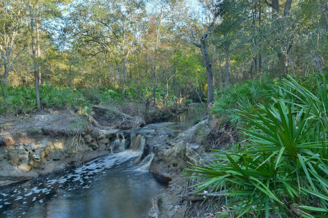
Have you ever wanted to see a waterfall in Florida? Here's your chance. The waterfall on this hike is not high at all, but it's interesting in other aspects, not to mention that it's pretty powerful. Besides the waterfall, you'll get to experience the beauty of the Suwanee River Valley. Additionally, the hike continues to an anomalous natural sight: one of only two Class III whitewater rapids in Florida.​ This hike occurred on Sunday, July 19th, 2015. My plan was to hike the Florida Trail from the trailhead at Bell Springs to at least Robinson Branch Falls. Depending on conditions, I wanted to visit the Big Shoals on the Suwannee River, but a deep-looking ford of Robinson Branch happened to be my turnaround point, as I didn't have the proper gear for fording at the time. On Saturday, November 4th, 2017, I returned to the Bell Springs section of the Florida Trail at a time of lower water conditions. This time, with proper gear for fording the creek, I hiked all the way to Big Shoals, and the trail report has been updated for the trail between Robinson Branch Falls and Big Shoals.

Summary

R/T Length of Trail: 2.9 Miles
Duration of Hike: 1:00
Type of Hike: Out and Back
Difficulty Rating: 2 out of 10
Pros: Well-defined, easy trail; great river views not far from the trailhead
Cons: Possibly deep ford on the way to Big Shoals
Points of Interest: Robinson Branch Falls; Big Shoals
Trail Blaze Color(s): Florida Trail - Blue
Best Season(s) to Hike: Year-round
Beginning Point: Bell Springs Trailhead
Directions: From White Springs, FL: Follow US Route 41 South for 3 miles. Then, turn left onto Lassie Black Street. Follow Lassie Black Street for 1.8 miles, and then, turn left onto Morrell Drive. Follow Morrell Drive for 1 mile to a cul-de-sac. The following is not very obvious: continue straight onto a dirt road that looks like a driveway to a house. There should be a sign for "Bell Springs Tract". Pass a house on the right and continue down the dirt road to a grassy parking area. This is the start of the hike.

Map

Click the link below to download a .GPX file with a track of this hike. 
florida_trail__bell_springs_to_robinson_creek_and_big_shoals.gpx
File Size: 102 kb
File Type: gpx
Download File

Details

This short hike turned out to be one of my favorites in Florida. This was my last hike there during the Summer 2015 trip, and I was debating whether to tack it on or not, and in the end I decided to. I'm glad I did. This hike is a must-do!

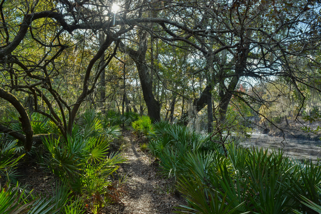
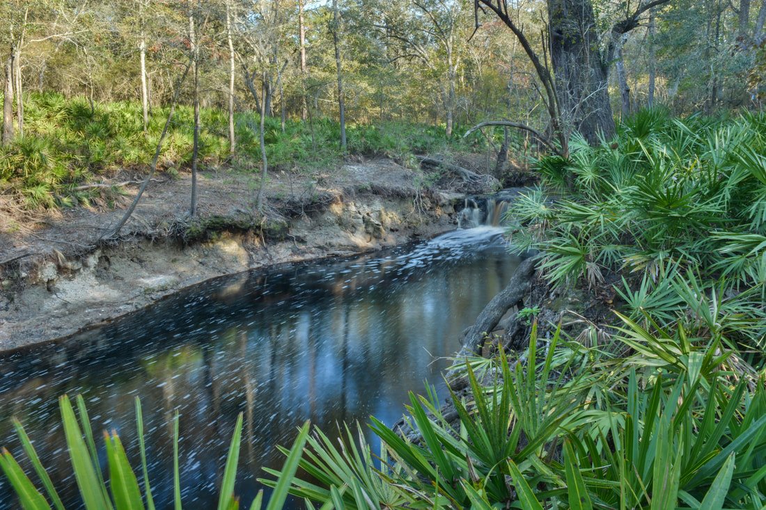
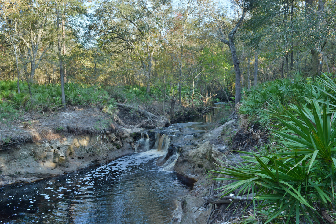
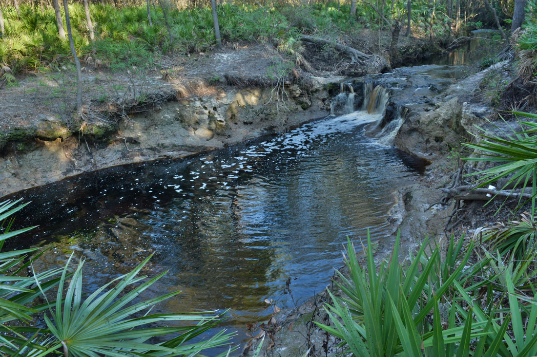
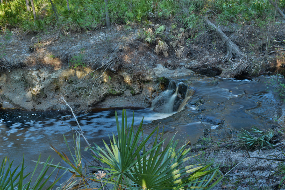
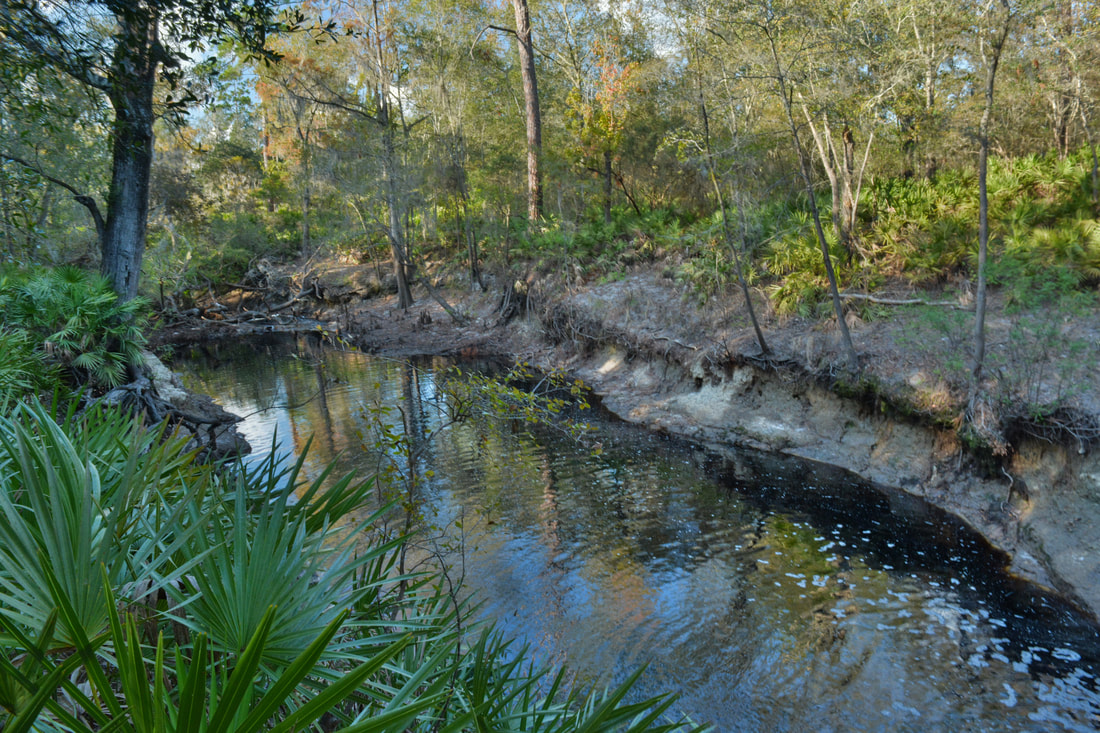
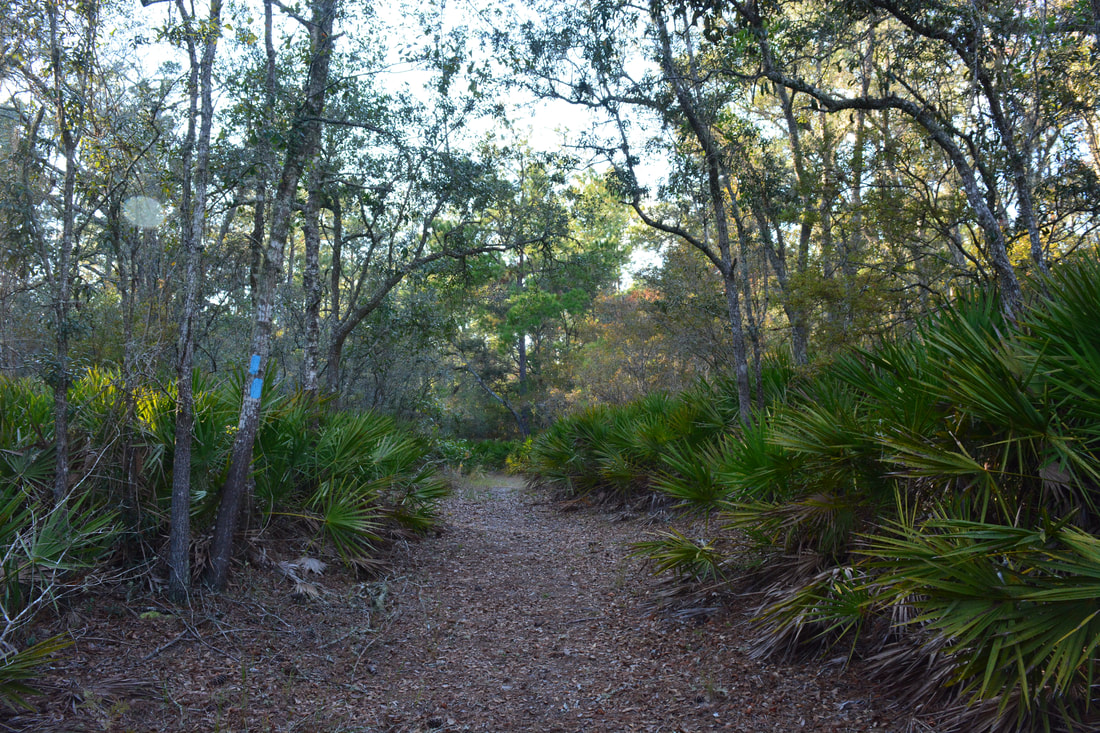
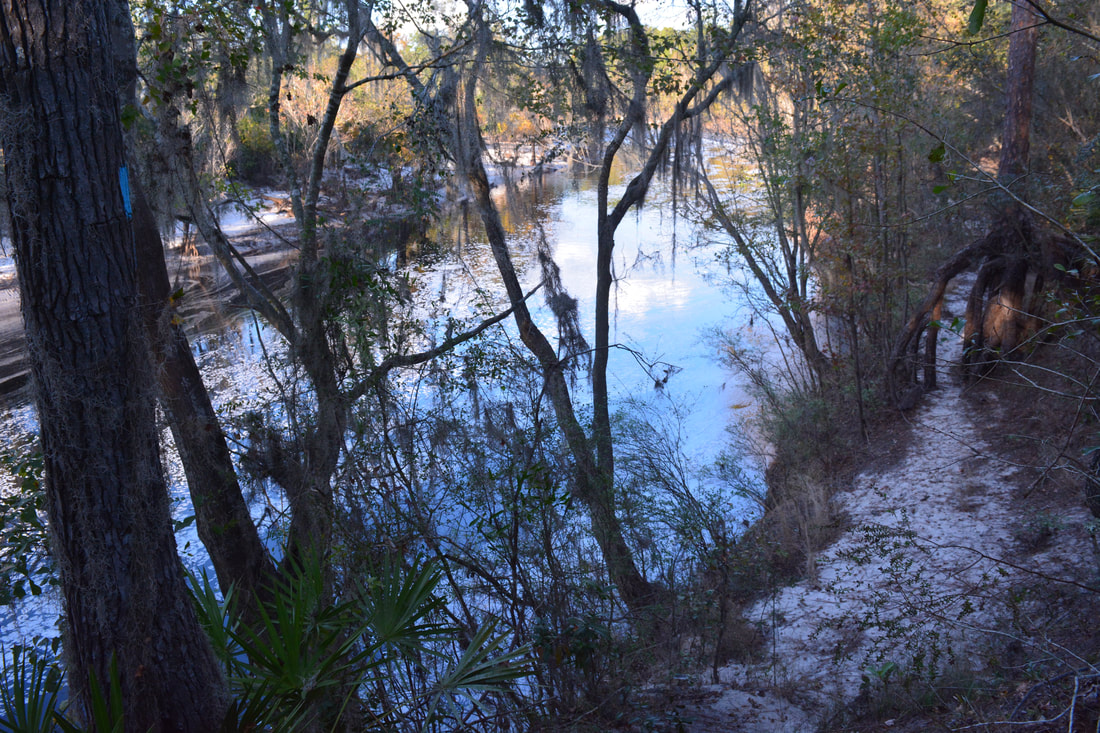
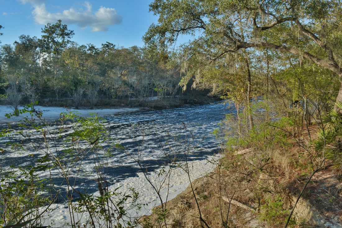
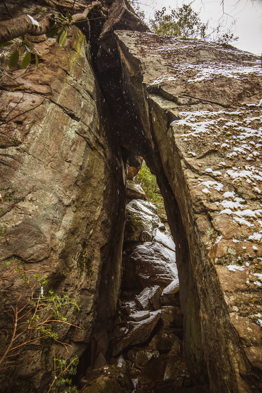
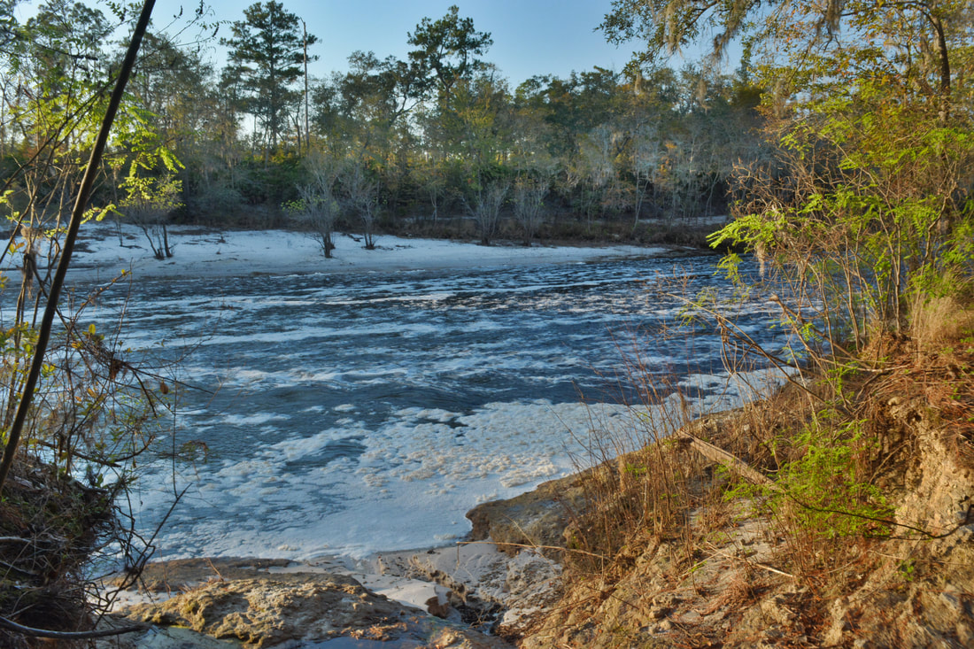
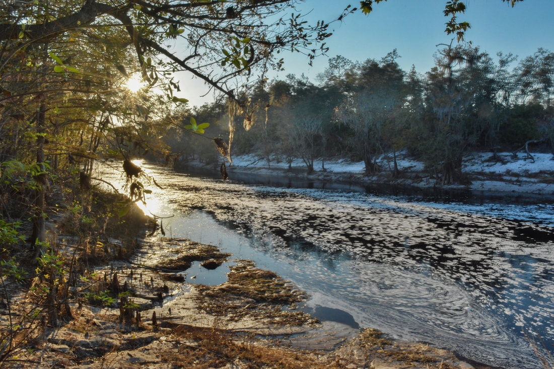
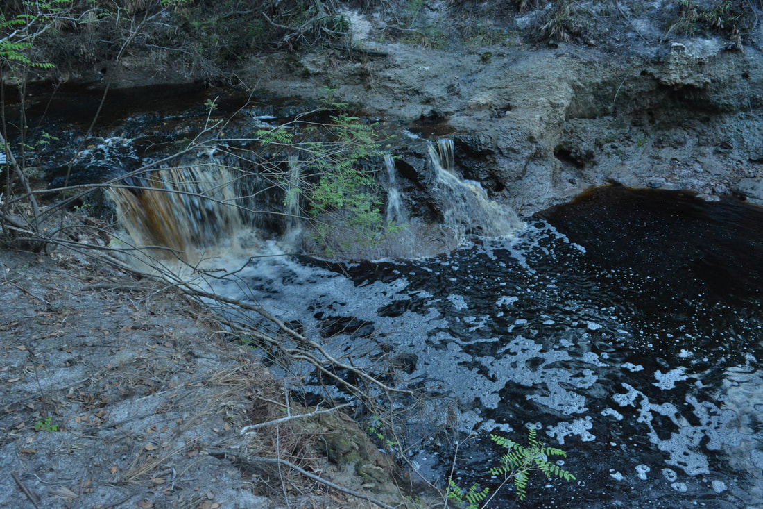
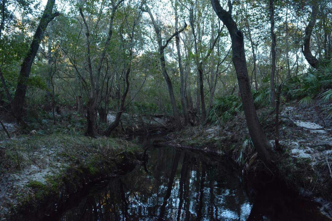
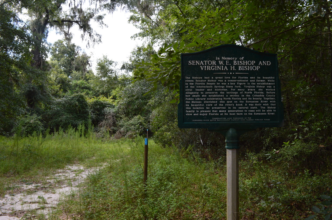
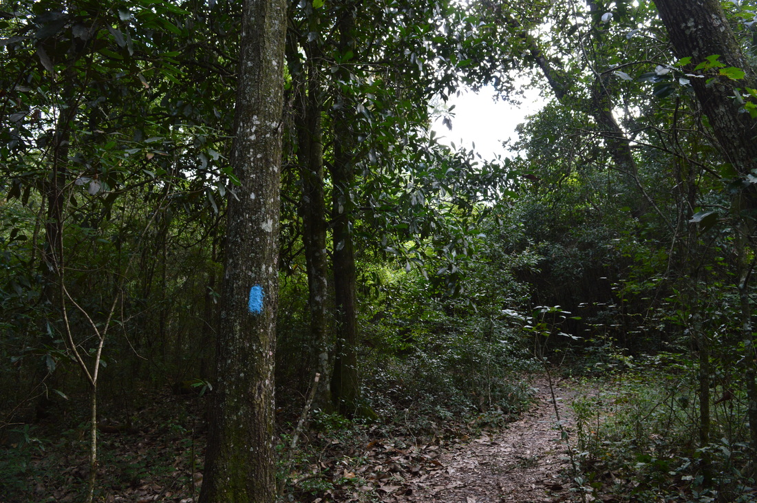
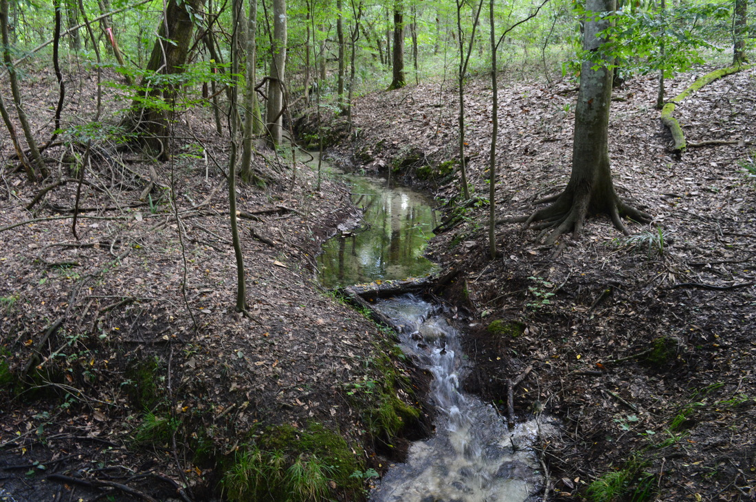
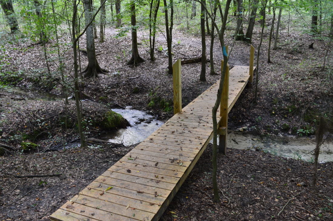
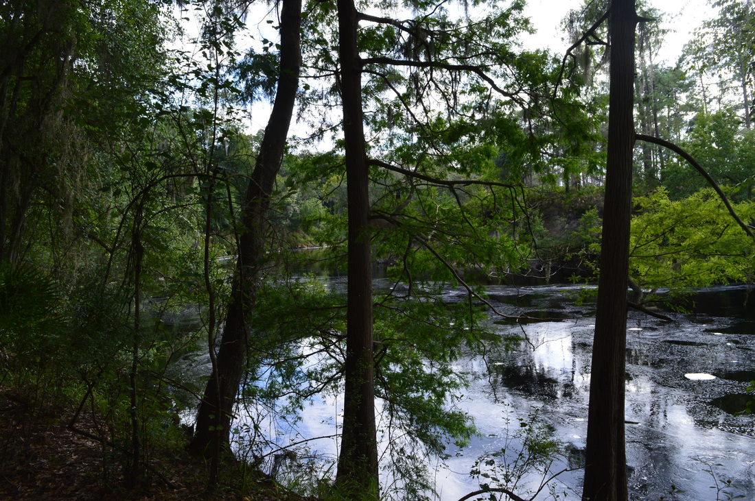
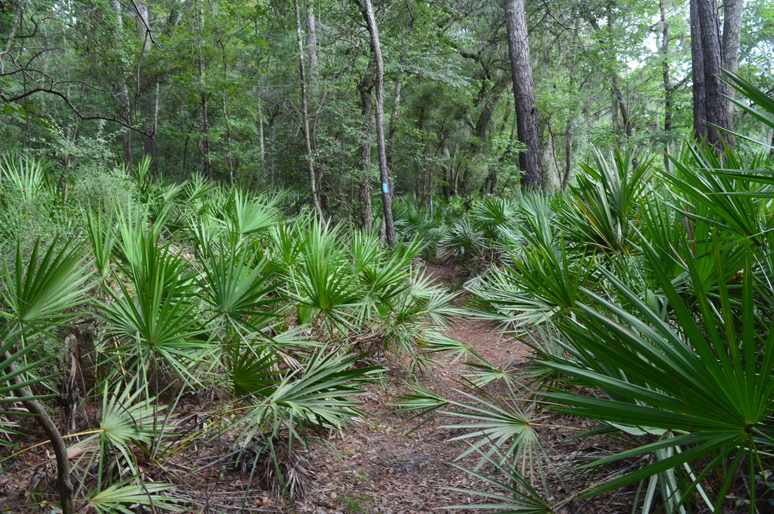
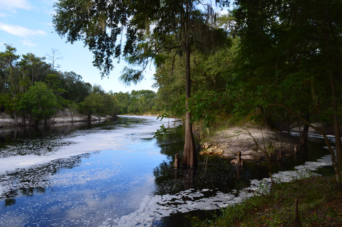
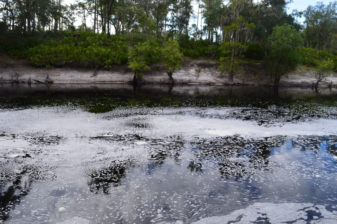
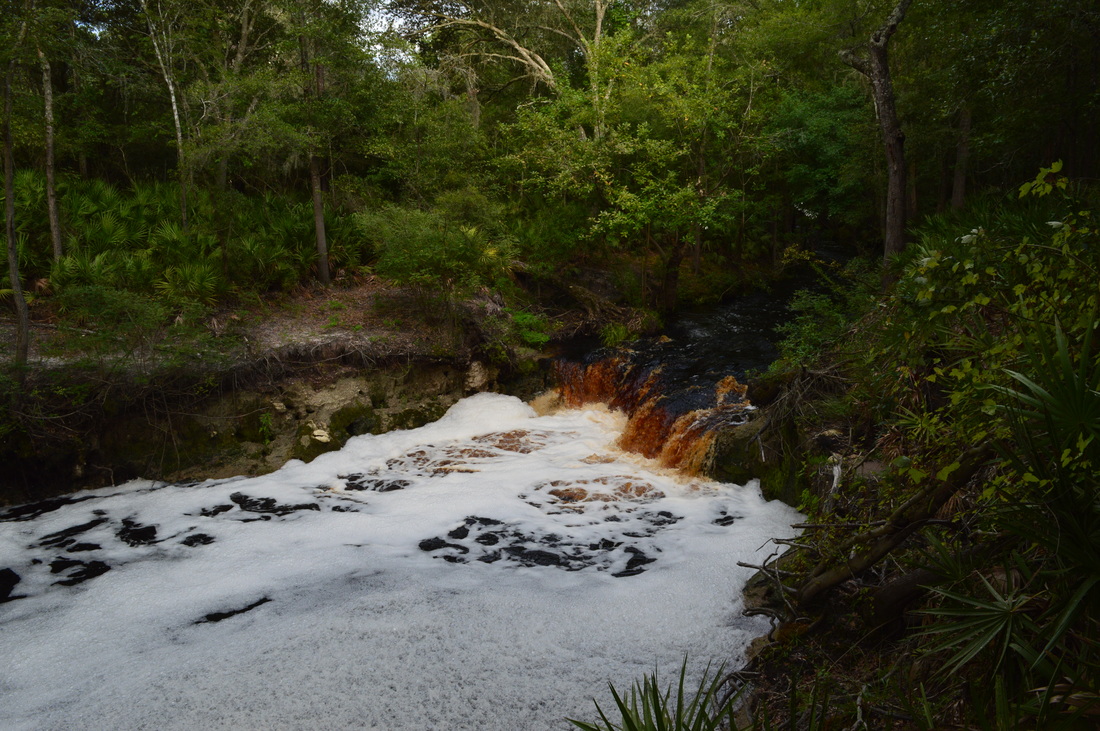
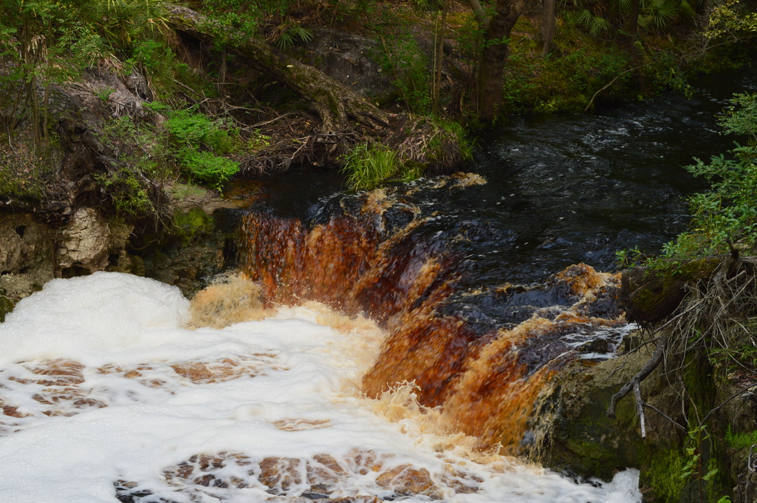
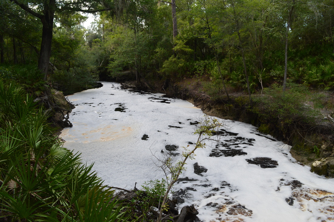
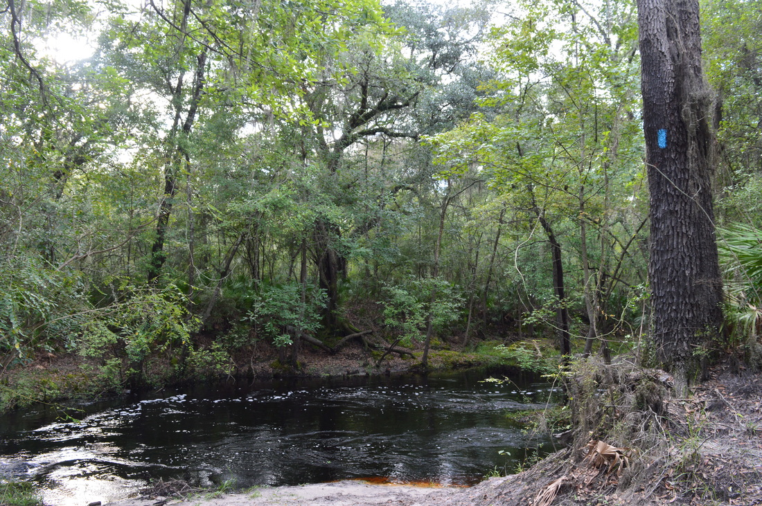
The trail starts out behind a gate going down an old forest road. There is a kiosk with useful photos and maps at the trailhead. At 0.1 miles, reach a junction that has a sign commemorating the people who helped to make this land protected. There's a trail that goes left here, marked by an orange blaze. To my understanding, this is the main route of the Florida Trail that continues west/northwest along the Suwannee River. To the right, a short spur trail leads to a fence surrounding a stream. This spur trail is worth taking, as at the fence, you'll see the outflow stream of Bell Springs. Unfortunately, you can't see the spring itself - it's located on private property just upstream from the opening. Back at the junction, the trail you need to take for this hike is straight ahead. This is the Florida Trail too, but at the moment, it is not part of the main route, and thus, it is known as a spur trail. Gradually descend following the blue blazes. At 0.15 miles, cross the stream from Bell Springs on a relatively new footbridge. Then, follow the stream downstream. Reach the Suwannee River at 0.25 miles at the bottom of a hill. There are great views of the river here. Throughout the hike, there'll be many views of the Suwannee River, progressively getting better. If the water levels are high enough, you'll be seeing bizarre foam in the river already that is brought by Big Shoals (and a little is contributed by Robinson Branch and its waterfall).

The trail bears right and parallels the river closely, passing through a series of scenic palmetto passages. At 0.6 miles, the trail rounds a low-lying marshy area and reaches Robinson Branch. The trail follows Robinson Branch upstream, but before you take it, turn left and walk down to the bank of Robinson Branch. Then, take a slim path downstream along Robinson Branch to its confluence with the Suwannee River. This is an absolutely gorgeous spot. Once you've seen the view, return to the main trail and continue upstream. After a short uphill, at 0.65 miles, reach an outcrop with a view of Robinson Branch Falls. Even though the waterfall is really more of a cascade, it is  interesting and impressive by Florida standards. Robinson Branch drops about 10 to 12 feet off a limestone shelf and into an extended pool. When there's a lot of water, the cascade attains a unique color of rust. From Robinson Branch Falls, the trail briefly ascends and stays above the creek before joining an old road at 0.85 miles. Keep left, and descend moderately to a ford of Robinson Branch at 0.95 mile. On my first hike in July 2015, this was my turnaround point. I had planned to continue to Big Shoals, but without proper footwear and hiking poles, I did not attempt the deep-looking ford. Because of the black water, you can't easily see how deep it is. Over two years later in November 2017, I returned to get all the way to Big Shoals and found the ford to be much shallower and easier - being only ankle-deep. Keep in mind that if you wish to see Big Shoals and keep your feet dry, then there's a different way to get to it via the Big Shoals Trail from Big Shoals State Park - just the view from that side of the river isn't as good. 
Picture
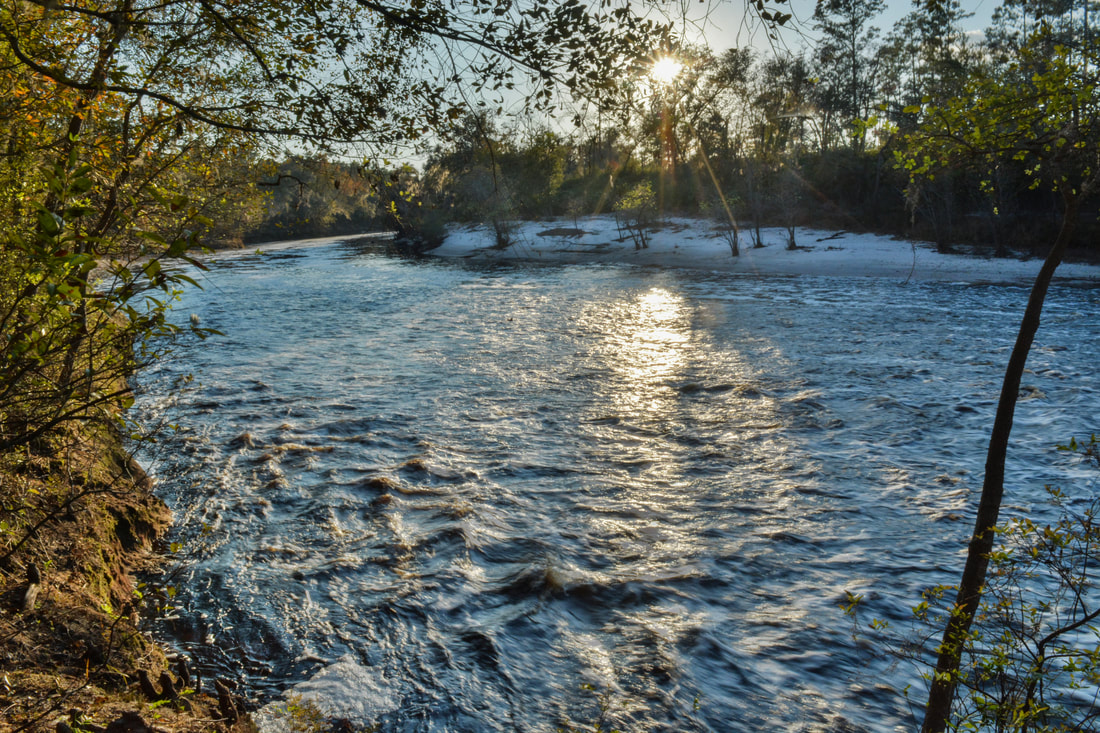
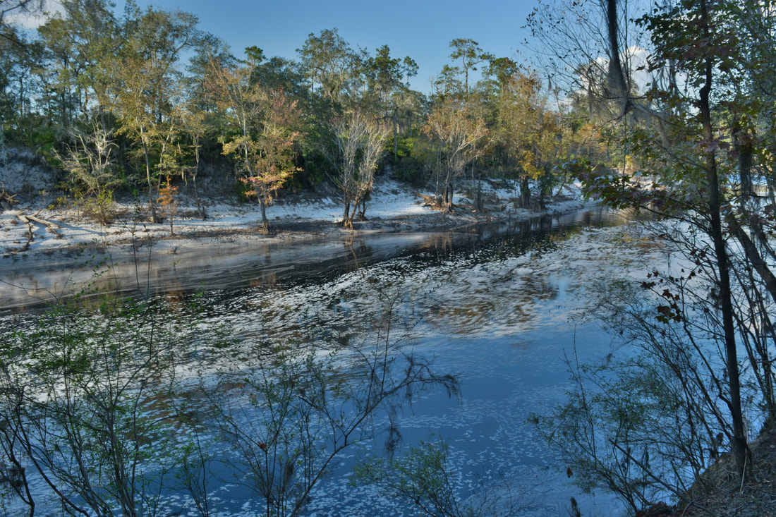
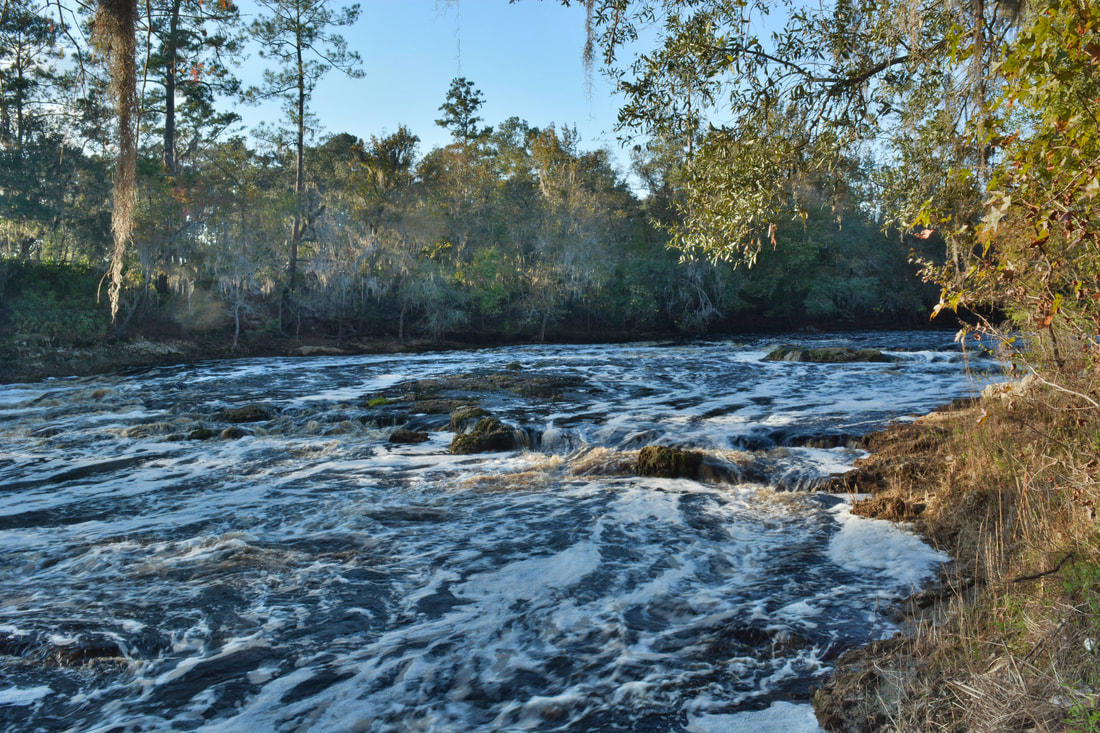
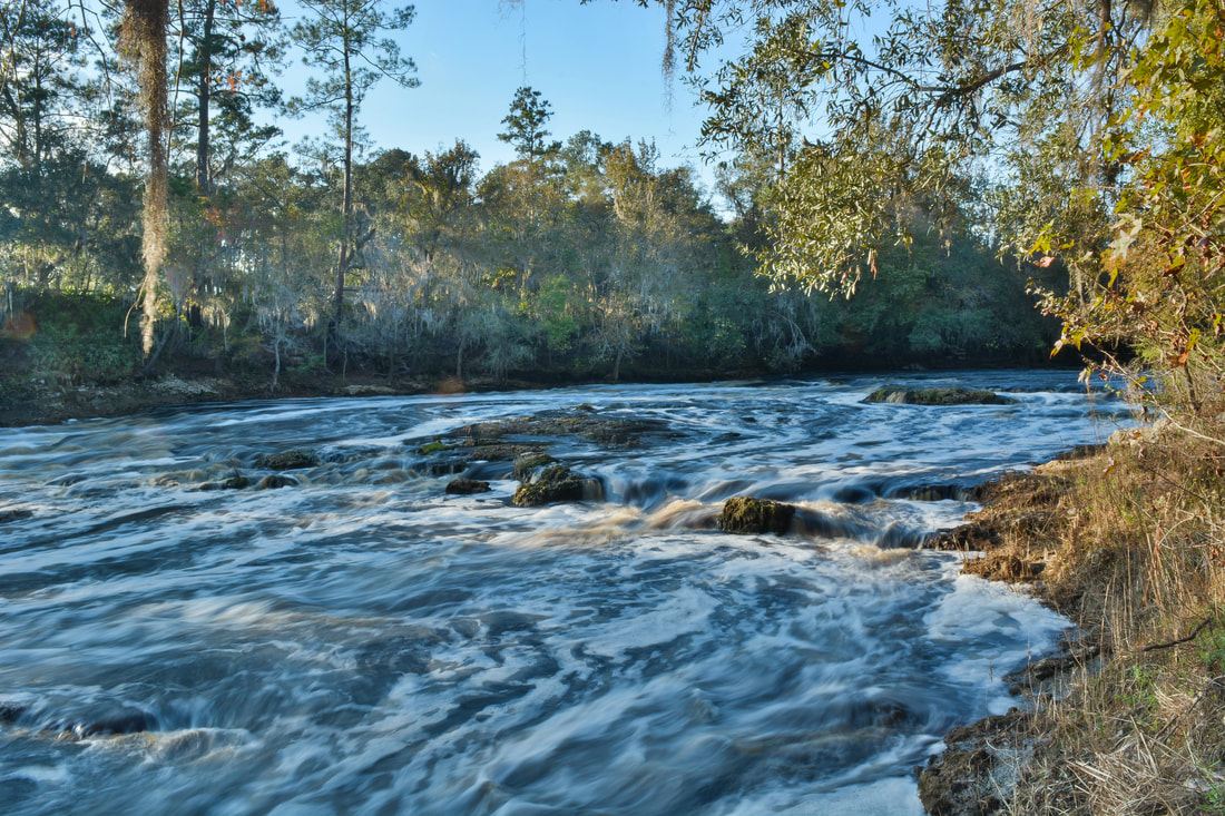
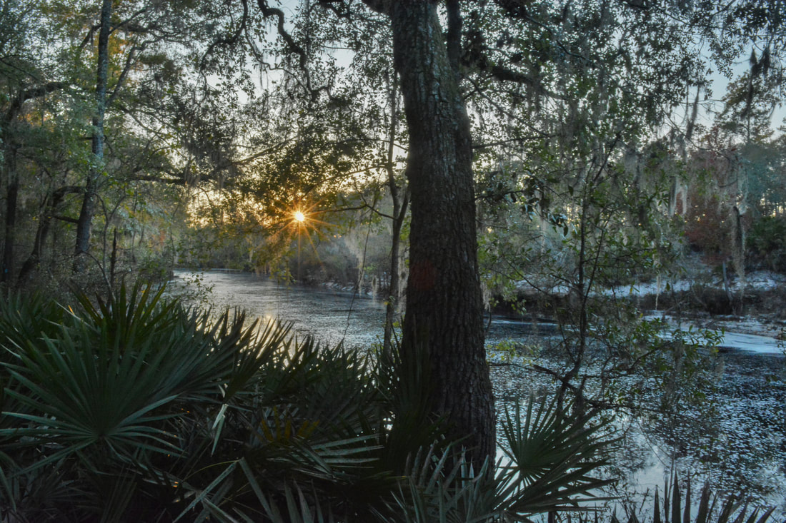
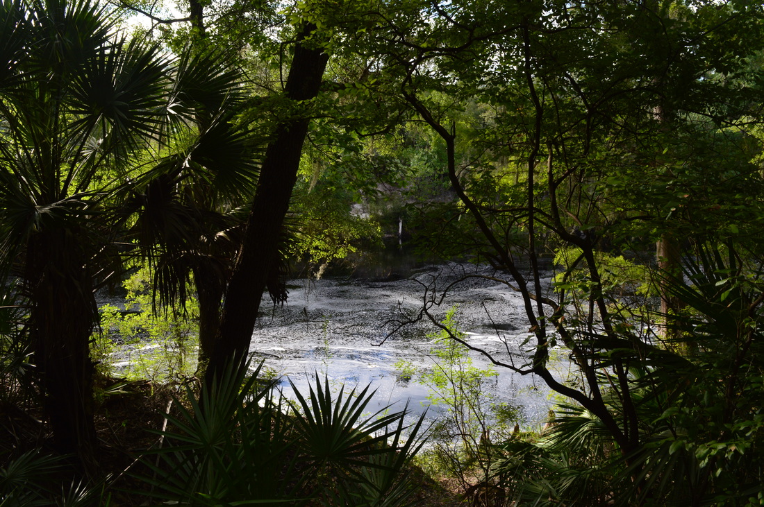
The beauty of the Suwannee River at Big Shoals is exceptional.
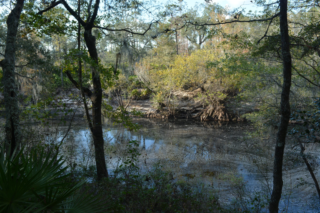
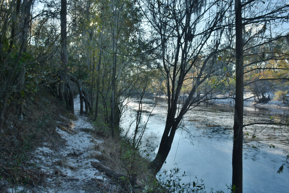
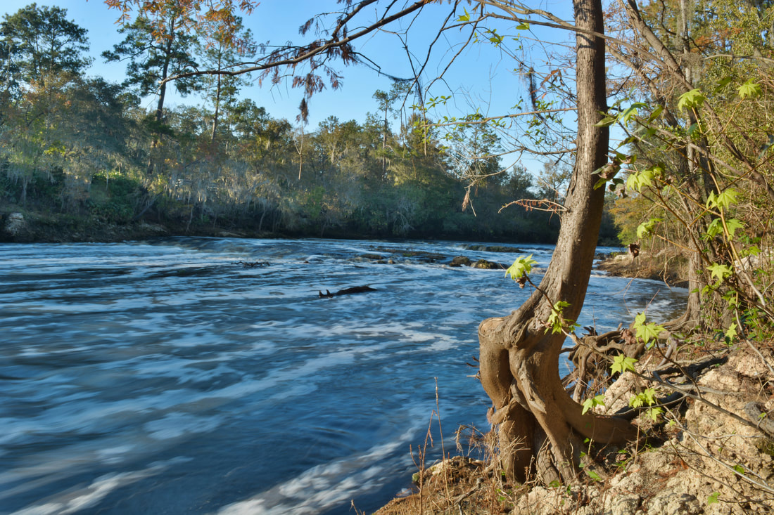
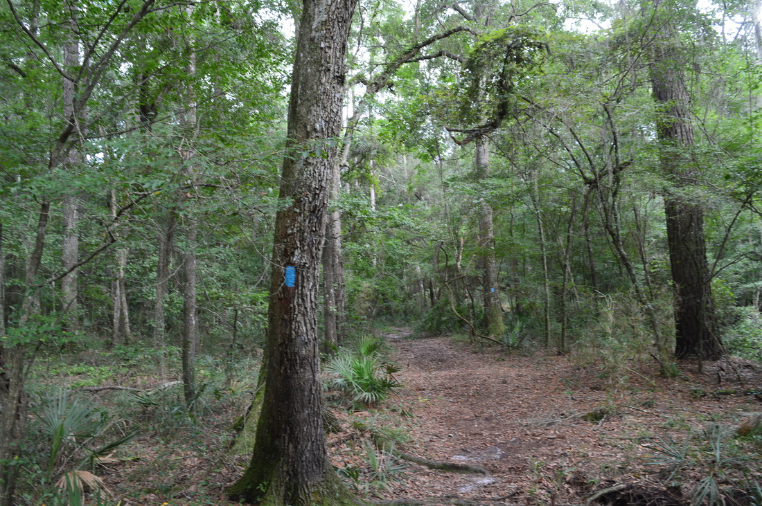
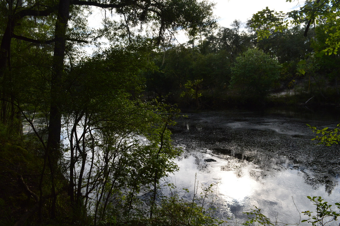
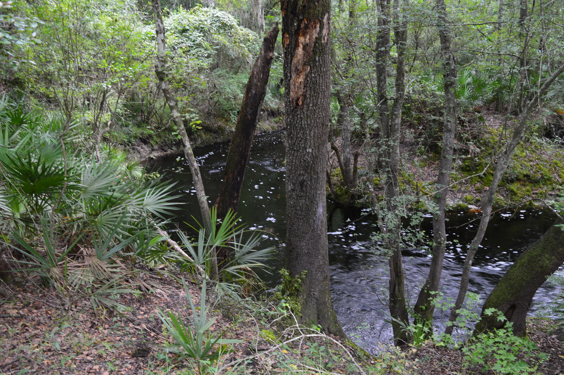
​​On the north side of Robinson Branch, a brown sign marks the trail's entry into Big Shoals Public Lands. The most confusing spot on the hike occurs at 1.0 miles, where the broad forest road continues straight while the blue-blazed trail dives into the forest via a slim pathway that splits left. I did not notice the double blazes and had actually continued ahead on the forest road before realizing my mistake about 5 minutes later. The narrower trail parallels Robinson Branch as it heads back toward the Suwannee River. At 1.15 miles, a 100-foot side path leads left to a different view of Robinson Branch Falls from the north side of the creek - I suggest taking it on the way back. Then, at 1.2 miles, the trail climbs a small hill and abruptly reaches the Suwannee River again. The river and its tall sandy banks are exceptionally beautiful in this area. 

The trail passes through a neat passage between the roots of a tree and closely follows the river as the roar of Big Shoals draws closer. At 1.4 miles, the trail makes a tricky crossing of a tiny tributary of the river - the trickiness comes from the steep sandy banks carved out by the tributary that you have to scramble down and back up. After this, the trail curves around a small depression guarded by tall cypress trees and then comes to a small opening in the forest above the main part of Big Shoals. I did not see any blazes past this point, so I believe this is where the trail ends - regardless of whether this is the official trail end or not, take the obvious path down to the left beneath a fallen tree and to the long flat area just above the Suwannee River at 1.45 miles that is the best spot to view the Big Shoals. 

Big Shoals is a really scenic location. The broad Suwannee River goes over several sets of limestone rock outcrops - some of which are above the water level (depending on the river flow) - and greatly increases its speed here, forming the Class III Rapids. The only other Class III Rapids in the state are on the much smaller Aucilla River west of Perry. I really liked the small wave effect that was produced by the underwater rocks throughout the river at the shoals. After viewing Big Shoals, begin heading back to the trailhead. Rather than returning to the main trail immediately, I suggest following the unofficial but broad pathway closer to the river, which provides a few more close-up views of the rapids. The path rejoins the main trail at the small tricky tributary crossing. From here, it's a simple matter of retracing your earlier steps to the Bell Springs Trailhead. You'll return to your car and conclude the hike at 2.9 miles. 

I have decided to rate this hike a "Best Hike" due to the great beauty of the Suwannee River combined with the unique (for Florida) sights of Robinson Creek Falls and Big Shoals. Despite its short length, it's hard to find a hike this diverse and scenic in Florida! 
Best Hike!

Variations

Hike out and back just to Robinson Creek Falls - 1.3 Miles

Bonus Stops

Big Shoals Trail at Big Shoals State Park is an easy hike that will give you a different aspect of Big Shoals and the Suwannee River. Visit the park's website or contact the park for more information on the park's various trails. It is easy to make a full hiking day by combining this hike with the trails in Big Shoals State Park. 

Pictures & Videos

11/4/17 Gallery: 
7/19/15 Gallery: 
11/4/17 Videos: 
7/19/15 Videos: 
2 Comments
Howard @ Backroad Planet link
11/2/2015 12:01:12 pm

Wow! I am so impressed with the quality of your blog, Mark, especially for someone of your age. While conducting research for an article on my site Backroad Planet, I came across this post and discovered there was another natural waterfall in Florida I knew nothing about. Keep up the great work and best wishes for continued success on your site!

Reply
Mark Oleg
11/2/2015 12:27:11 pm

Thank you!

Reply


Leave a Reply.

    About Me

    Mark Oleg Ozboyd
    I'm an avid outdoor explorer and a hobbyist landscape photographer. I'm 21 years old and have been hiking since 2011. Originally based out of Atlanta, Georgia, I started out by occasionally hiking short trails throughout well-known Georgia State Parks. During 2012 and 2013, I began to expand my trips into adjacent states, as well as into the wilder National Forest areas rather than just State Parks. Throughout the years that followed, as I slowly ran out of popular hiking trails in my area, I began to search for and hike in more seldom-visited areas. Today, you can find me out in the woods every weekend, whether it's on an official trail or bushwhacking through cross-country terrain without any paths. I now attend Washington & Lee University and am exploring Virginia and West Virginia. My other hobbies include chess, science, old music, and meteorology. I have 3 years of amateur weather forecasting experience, having studied a lot of meteorology basics over the years. I am also a student at European School of Music where I learned that music and nature have a lot in common. Listening to good music inspires me to capture nature's beauty on the camera in different aspects that also make me recall many beautiful music pieces that I've heard.​


    Dear readers: I have invested a tremendous amount of time and effort in this website and the Georgia Waterfalls Database the past five years. All of the work that has gone in keeping these websites updated with my latest trip reports has almost been like a full-time job. This has not allowed me to pick up a paid job to save up money for college, and therefore, I I've had to take out loans. If you find the information on this website interesting, helpful, or time-saving, you can say "thanks" and help me out by clicking the button above and making a contribution. I will be very grateful for any amount of support you give, as all of it will apply toward my college tuition. Thank you! 

    Enter your email address to subscribe for trail reports:

    Delivered by FeedBurner


    Picture
    Coming in 2022-2023?

    Other Hiking Websites

    DWHike's Adventures
    Florida's Natural Wonders
    Florida Trailblazer
    Meanderthals
    Mountain Images
    by Bernie Boyer

    North Carolina Waterfalls with
    ​Kevin Adams
    Take-a-Hike!
    Tennessee Landforms
    Waterfall Page
    Waterfall Adventurer
    Zach's Mild Adventures

    Miles Hiked

    Year 1: 540.0 Miles
    Year 2: 552.3 Miles
    ​Year 3: 518.4 Miles
    Year 4: 482.4 Miles
    Year 5: 259.9 Miles

    Archives

    March 2021
    February 2021
    January 2021
    November 2019
    October 2019
    September 2019
    August 2019
    July 2019
    June 2019
    February 2019
    January 2019
    December 2018
    November 2018
    October 2018
    August 2018
    July 2018
    June 2018
    May 2018
    April 2018
    March 2018
    February 2018
    January 2018
    December 2017
    November 2017
    October 2017
    September 2017
    August 2017
    July 2017
    June 2017
    May 2017
    April 2017
    March 2017
    February 2017
    January 2017
    December 2016
    November 2016
    October 2016
    September 2016
    August 2016
    June 2016
    May 2016
    April 2016
    March 2016
    January 2016
    December 2015
    November 2015
    October 2015
    September 2015
    August 2015
    July 2015
    June 2015
    May 2015
    April 2015
    March 2015
    February 2015
    January 2015
    December 2014
    November 2014
    October 2014
    September 2014
    August 2014
    July 2014
    June 2014
    May 2014
    April 2014
    March 2014
    February 2014

    Categories

    All
    Adel
    Adirondack Park
    Alabama
    Alfred A. Ring Park
    Allegheny Trail
    Amicalola Falls State Park
    Anniston Area
    Apalachicola Bluffs And Ravines Preserve
    Apalachicola National Forest
    Apalachicola/Port St. Joe Area
    Apopka
    Appalachian Trail
    Appling
    Art Loeb Trail
    Aska Trail System
    Bakersville
    Balm-Boyette Scrub Preserve
    Balsam Lake Recreation Area
    Bankhead National Forest
    Bartow County Parks
    Bartram Trail
    Basinger
    Beersheba Springs
    Benton
    Benton Mackaye Trail
    Berry College Trail System
    Best Hike
    Big South Fork National Recreation Area
    Black Bear Wilderness
    Black Rock Mountain State Park
    Blairsville
    Blakely
    Blood Mountain Wilderness
    Blowing Rock
    Blue Ridge
    Blue Ridge Parkway
    Boone
    Bradenton
    Bradenton Beach
    Brasstown Bald
    Brasstown Wilderness
    Brevard
    Bryson City
    Buchanan
    Bucks Pocket State Park
    Bulow Creek State Park
    Bulow Plantation Ruins State Park
    Caesars Head State Park
    Caladesi Island State Park
    Calhoun
    Camel's Hump State Park
    Cashiers
    Caspersen Beach Park
    Catfish Creek State Park
    Caves
    CC Putnam State Forest
    Cedar Point Environmental Park
    Chatsworth
    Chattahoochee National Forest
    Chattanooga
    Chattanooga Valley
    Chattooga National Wild And Scenic River
    Cheaha Wilderness
    Cherohala Skyway
    Cherokee
    Cherokee National Forest
    Chiefland Area
    Chillhowee Recreation Area
    Chipley
    Chunky Gal Trail
    Circle B Bar Reserve
    Citico Creek Wilderness
    Citrus Wildlife Management Area
    Clarkesville
    Clayton
    Cleevland
    Cleveland
    Cloudland Canyon State Park
    Cohutta Wilderness
    Collier-Seminole State Park
    Cordele
    Cornelia
    Covington
    Crestview Area
    Crew-land-and-water-trust
    Cullowhee
    Cumberland Trail
    Dahlonega
    Dalton
    Dawson Forest Wildlife Management Area
    Dawsonville
    Dayton
    De Soto National Memorial
    DeSoto State Park
    Dillard
    Double Springs
    Ducktown
    Duncan Ridge Trail
    Dunlap
    Eagle's Rest Park
    Eastpoint
    Econfina Creek Wildife Management Area
    Eglin Air Force Base
    Elizabethton
    Elkins
    Elk Knob Game Lands
    Elk Park
    Ellicott Rock Wilderness
    Ellijay
    Emerson Point Preserve
    Englewood Area
    Enota Retreat
    Erwin
    Falling Waters State Park
    Fayetteville
    Fires Creek Recreation Area
    Fire Tower
    Flint River
    Florence Area
    Florida
    Florida Caverns State Park
    Florida Trail
    Foothills Trail
    Fort Mountain State Park
    Fort Myers Area
    Fort Payne
    Fort Payne Area
    Fort Yargo State Park
    Franklin
    Franklin Delano Roosevelt State Park
    Franklin-Marion State Forest
    Frozen Head State Park
    Gainesville
    Gainesville Area
    Gatlinburg
    George Washington National Forest
    Georgia
    Georgia Veterans Memorial State Park
    Glasgow
    Gorges State Park
    Grandfather Mountain State Park
    Great Smoky Mountains National Park
    Greeneville
    Green River Game Lands
    Gruetli-Laager
    Grundy Forest State Natural Area
    GTM Reserve
    Guana River Wildlife Management Area
    Hayesville
    Helen
    Hiawassee
    High Falls State Park
    Highlands
    Highlands Scenic Highway
    Hillsborough River State Park
    Hinson Conservation & Recreation Area
    Historic Sites
    Honeymoon Island State Park
    Hot Springs
    Huntington
    Inverness Area
    Jackson
    Jasper
    Jefferson National Forest
    Joan M. Durante Park
    Jonathan Dickinson State Park
    Jones Gap State Park
    Joyce Kilmer Slickrock Wilderness
    Joyce Kilmer - Slickrock Wilderness
    Juniper Prairie Wilderness
    Kelly Park
    Keown Falls Recreation Area
    Kolomoki Mounds State Park
    LaFayette
    Lake City Area
    Lake George Wild Forest
    Lake June-in-Winter State Park
    Lakeland Area
    Lake Placid
    Lake Russell Wildlife Management Area
    Lake Wales Ridge State Forest
    Laurel Fork North Wilderness
    Leffis Key Preserve
    Leon Sinks Geological Area
    Lexington
    Lineville
    Linville
    Linville Gorge Wilderness
    Lithia Springs
    Little Frog Wilderness
    Little Manatee River State Park
    Little River Canyon National Preserve
    Longboat Key
    Long Trail
    Lookout Mountain
    Lookout Mountain Battlefield
    Lovingston
    Lula Lake Land Trust
    Lumpkin
    Maggie Valley
    Manatee Springs State Park
    Marianna Area
    Mark Trail Wilderness
    Marlinton
    Mccaysville
    McMinville
    Mentone
    Middlesex
    Mistletoe State Park
    Monongahela National Forest
    Montreat
    Mountain Bridge Wilderness Area
    Mountain City
    Mountains To Sea Trail
    Mountains-to-Sea Trail
    Mount Rogers National Recreation Area
    Myakka River State Park
    Myron B. Hodge City Park
    Nantahala National Forest
    Naples
    Naples Area
    Natural Bridge State Park
    Neal Preserve
    New Castle
    Newport
    New River Gorge National Park
    New York
    North Carolina
    Ocala Area
    Ocala National Forest
    Ocean-to-Lake Trail
    Oconee State Park
    Oconee Station Historic Site
    Okaloacoochee Slough State Forest
    Oldsmar
    Oneida
    Orlando Area
    Ormond Beach
    Oscar Scherer State Park
    Oxford
    Palatka
    Palmetto Trail
    Panama City Area
    Panthertown Valley
    Parrish
    Paynes Creek Historic State Park
    Peaks Of Otter Recreation Area
    Pigeon Crockford Mountain Wildlife Management Area
    Pigeon-Crockford Mountain Wildlife Management Area
    Pigeon-Crockford Wildlife Management Area
    Pine Mountain
    Pinhoti Trail
    Pinnacle Park
    Pisgah Civitan Park
    Pisgah National Forest
    Pittman Center
    Pond Mountain Wilderness
    Ponds/Lakes
    Prentice Cooper State Forest
    Providence Canyon State Park
    Pumpkintown
    Quick Point Nature Preserve
    Raven Cliffs Wilderness
    Reed Bingham State Park
    Reliance
    Rice Creek Conservation Area
    Riverview Pointe Preserve
    Robbinsville
    Robinson Preserve
    Rock Creek Gorge Scenic Area
    Rock Island State Park
    Rome
    Rosman
    Sale Creek
    Salem
    Salt Springs
    Saluda
    Santa Rosa Beach
    Sarasota
    Sarasota Area
    Savage Gulf State Natural Area
    Scenic Views
    Scottsboro Area
    Sebring Area
    Sewanee
    Sheltowee Trace Trail
    Shining Rock Wilderness
    Signal Mountain
    Sipsey Wilderness
    Sky Valley
    Smithgall Woods State Park
    Snowbird Backcountry Area
    Soddy Daisy
    Soddy-Daisy
    Sopchoppy
    South Carolina
    South Cumberland State Park
    Southeastern Cave Conservancy
    Southern Nantahala Wilderness
    Sparta
    Sprewell Bluff Park
    Spring City
    Spring Hill
    Springs
    Spruce Pine
    Standing Indian Backcountry Area
    St. Augustine
    St. George Island State Park
    St. Joseph Bay State Buffer Preserve
    St. Marks Area
    St. Marks National Wildlife Refuge
    Stone Mountain
    Stone Mountain Park
    Suches
    Sumatra
    Sumter National Forest
    Suwannee River
    Swallow Creek Wildlife Management Area
    Sweetwater Creek State Park
    Sylva
    Talladega National Forest
    Tallahassee Area
    Tallulah Falls
    Tallulah Gorge State Park
    Tampa Bay Area
    Tate City
    Tate's Hell State Forest
    Tea Creek Wildlife Management Area
    Tellico Plains
    Tennessee
    Thomaston
    Toccoa
    Topsail Hill State Park
    Torreya State Park
    Townsend
    Tracy City
    Tray Mountain Wilderness
    Trenton
    Triple Creek Preserve
    Troutdale
    Unaka Mountain Wilderness
    Upper Tampa Bay County Park
    Venice
    Vermont
    Virgin Falls State Natural Area
    Virginia
    Virginia Outdoors Foundation
    Vogel State Park
    Wakulla Springs State Park
    Waleska
    Walhalla
    Wartburg
    Water Features
    Waynesville
    Weedon Island Preserve
    Weeki Wachee Preserve
    Wekiwa Springs State Park
    West Palm Beach Area
    West Virginia
    Whitehall
    White Springs
    Winder
    Withlacoochee State Forest
    Young Harris

    RSS Feed

TRAIL REPORTS

Hikes in Alabama
​Hikes in Florida
Hikes in Georgia
Hikes in North Carolina
Hikes in South Carolina
Hikes in Tennessee
Hikes in Virginia

Hiking Resources

Alabama Resources
​
Florida Resources
Georgia Resources
North Carolina Resources
​South Carolina Resources
​
Tennessee Resources

Other

Contact
Map of Hikes
Alphabetical List of Hikes
Southeast Nature Society
© COPYRIGHT 2014-2018
​ALL RIGHTS RESERVED.
Important: I disclaim any responsibility for any damage or personal injury that may occur as a result of the activities and information found on this website. All outdoor activities, especially off-trail hiking, are done at your own risk. Never hike or head into that area that may be above your fitness or experience level.
  • Home
  • Trail Reports
    • Best Hikes
    • Hikes with Scenic Views
    • Hikes with Water Features
    • Alabama
    • Georgia
    • Florida
    • North Carolina
    • South Carolina
    • Tennessee
    • Vermont
    • Virginia
  • Map
  • Hike List
  • Testimonials
  • Resources
  • Contact Us
  • Southeast Nature Society
    • Our Team
  • Georgia Waterfalls Database