HIKING THE APPALACHIANS AND BEYOND
  • Home
  • Trail Reports
    • Best Hikes
    • Hikes with Scenic Views
    • Hikes with Water Features
    • Alabama
    • Georgia
    • Florida
    • North Carolina
    • South Carolina
    • Tennessee
    • Vermont
    • Virginia
  • Map
  • Hike List
  • Testimonials
  • Resources
  • Contact Us
  • Southeast Nature Society
    • Our Team
  • Georgia Waterfalls Database

Appalachian Trail: Three Forks to Springer Mountain and Loop via Benton Mackaye Trail, Dahlonega, Georgia

9/29/2015

2 Comments

 
Picture
Springer Mountain is not any regular mountain. It's a special place. Springer Mountain is the southern terminus of the famous Appalachian Trail. Every year, thousands of hikers start a journey here that will last many months. Other hikers finish their long thru-hikes at this point, and when they reach the summit of the mountain, after hiking in from Three Forks, they've achieved an accomplishment. On this day hike, you'll feel almost like those southbound thru-hikers as you make the southernmost climb on the Appalachian to reach the first (or last) white blaze on the Appalachian Trail. You'll return using a lesser-traveled route using the alternative Benton Mackaye Trail. This hike occurred on Saturday, August 1st, 2015. My plan was to follow the Appalachian Trail from Three Forks to the summit of Springer Mountain. I would return back to Three Forks via the Benton Mackaye Trail. 

Summary

R/T Length of Trail: 11 Miles
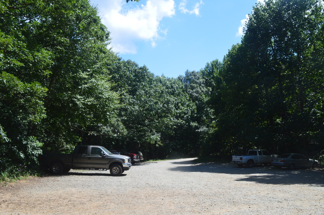
Duration of Hike: 6:30
Type of Hike: Triple Loop 
Difficulty Rating: 6 out of 10
Pros: Well-marked trails all the time
Cons: None
Points of Interest: Springer Mountain Vista - 3 out of 10; Ball Mountain Vista - 6 out of 10
Trail Blaze Color(s): Appalachian Trail - White Rectangles; Benton Mackaye Trail - White Diamonds
Best Season(s) to Hike: Year-round
Beginning Point: Three Forks Trailhead
Directions: From Dahlonega, GA: Follow GA State Route 52 West for 9 miles. Then, turn right onto Nimblewill Church Road. Follow Nimblewill Church Road for 2.3 miles, and then, turn right onto Forest Service Road 28-1. Follow Forest Service Road 28-1 for 2 miles, and then, keep left onto Forest Service Road 77. Follow Forest Service Road 77 for 5 miles, and then, take a soft left onto Frorest Service Road 58. Do not take a sharper left onto Forest Service Road 42 - this will take you to a completely different area. Follow Forest Service Road 58 for 2.7 miles to a bridge over Long Creek. There is a small parking area on the left, and you can also park along the road. Also, even though the drive to the trailhead involves a lot of driving on unpaved roads, all of them are in good condition. 

Map

Note: My GPS failed to record for the first couple of miles of this hike so some of the track is missing. If you would like to see a full map of the hike, comment or contact me and I'll point you to some sources. 

​Details

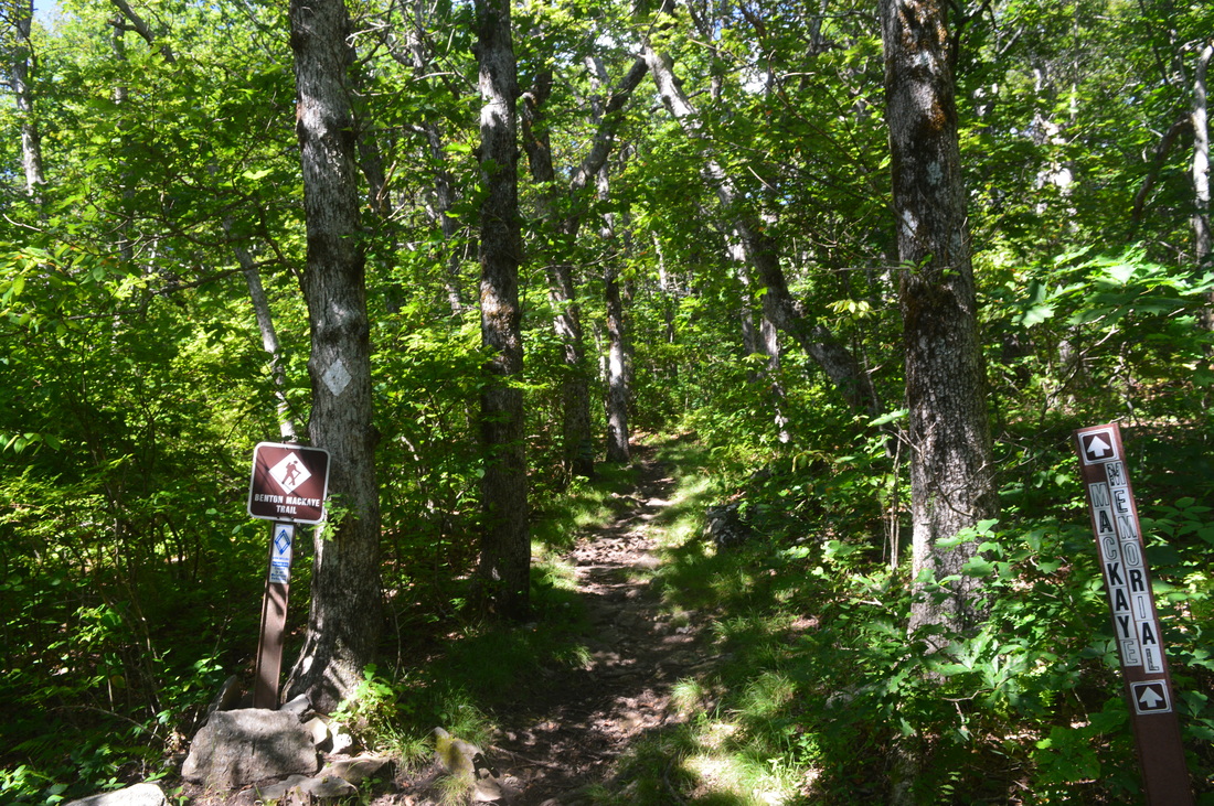
Most of the time, the Appalachian Trail and the Benton Mackaye Trail are far apart from each other. The Benton Mackaye Trail is considered an alternative route for the Appalachian Trail, and it is much lesser-traveled. It also hits generally more remote areas than the AT. However, near the southern terminus of both trails, the Benton Mackaye Trail stays close to the AT and creates several small loops. Thus, a possibility for a sort of hike consisting of three loops arises, going south along the Appalachian Trail and returning back north via the Benton Mackaye Trail. That was exactly what I planned to do on this hike. Both routes are not hard, but the Benton Mackaye Trail will undoubtedly present more solitude. 

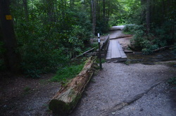
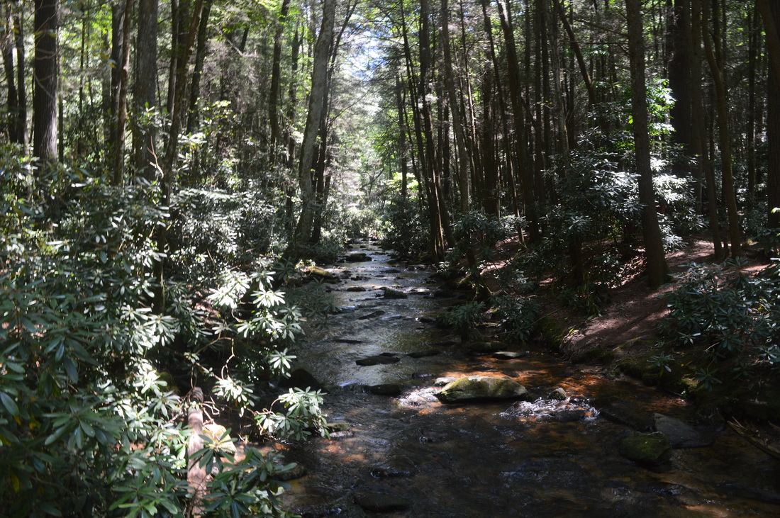
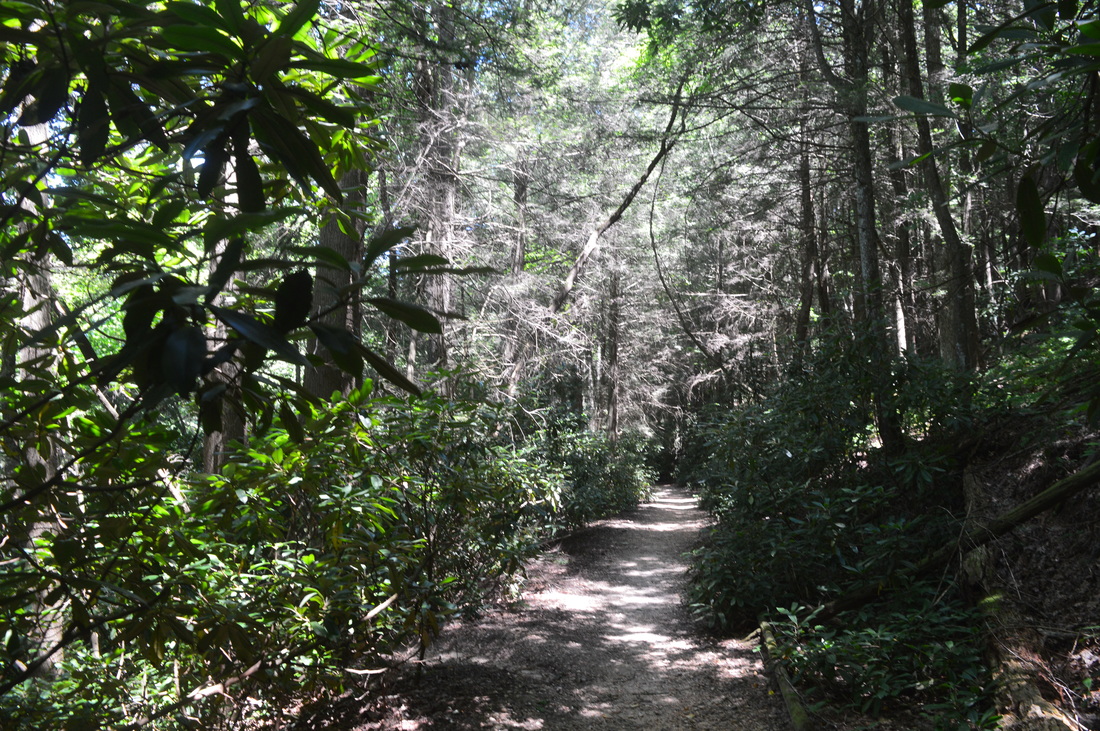
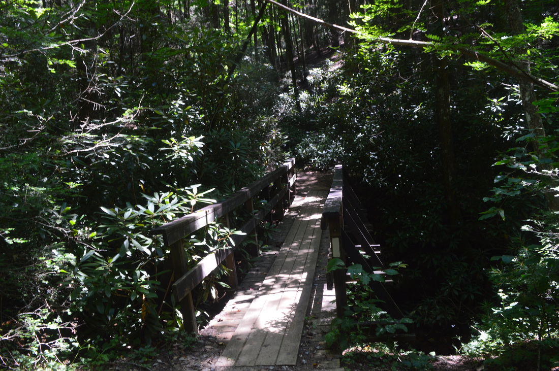
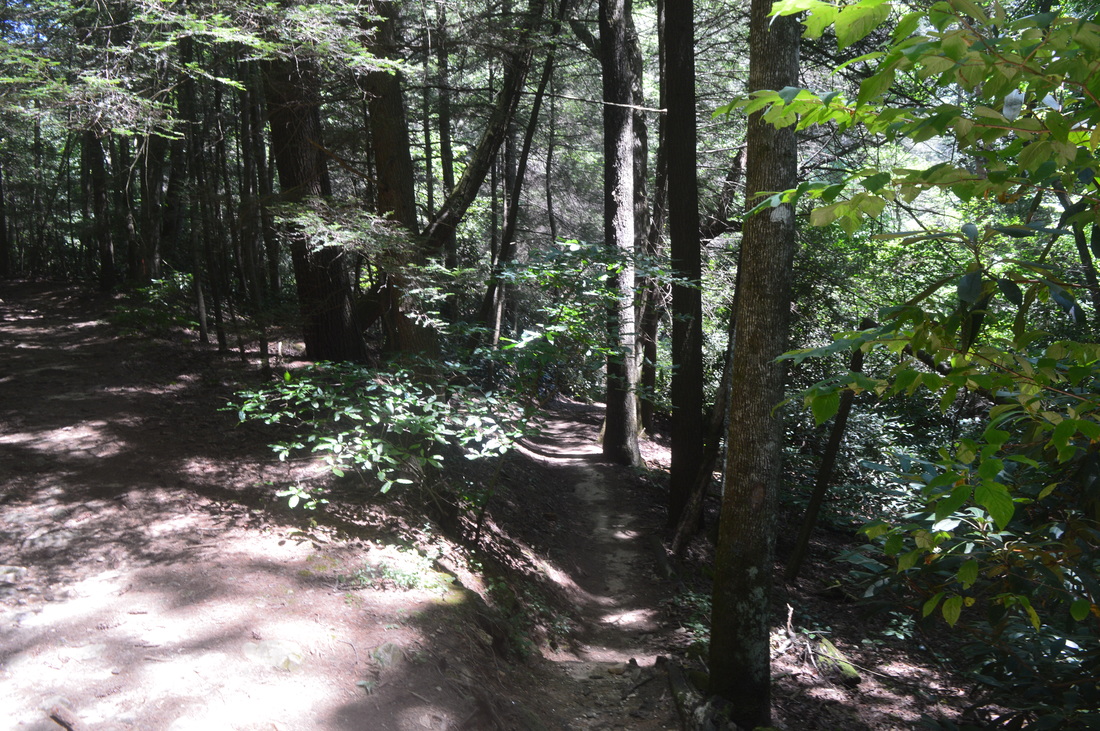
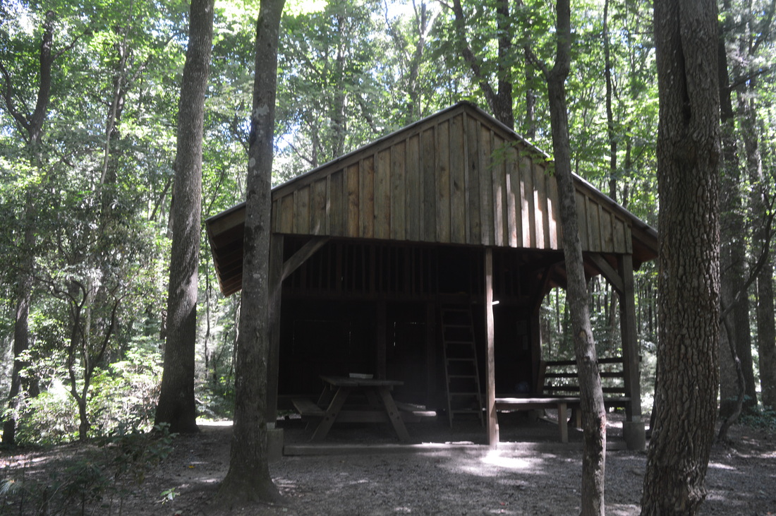
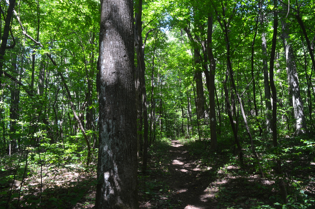
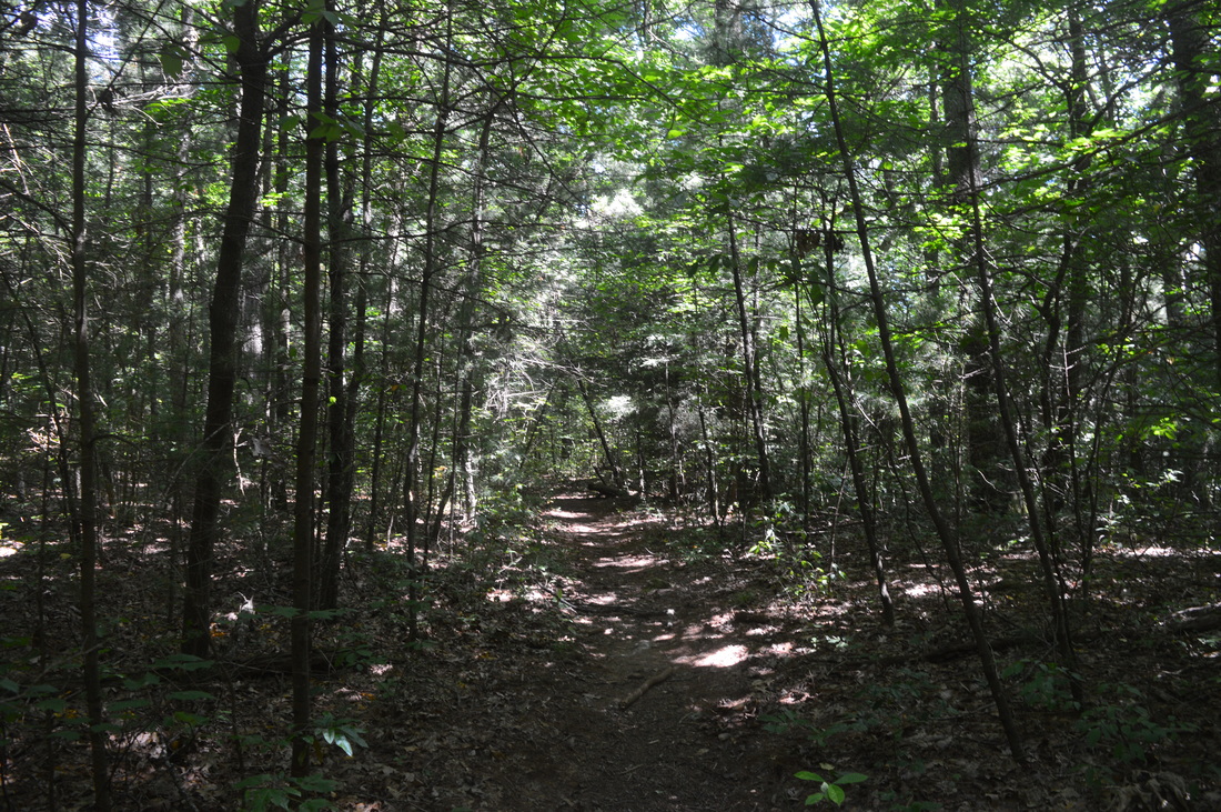
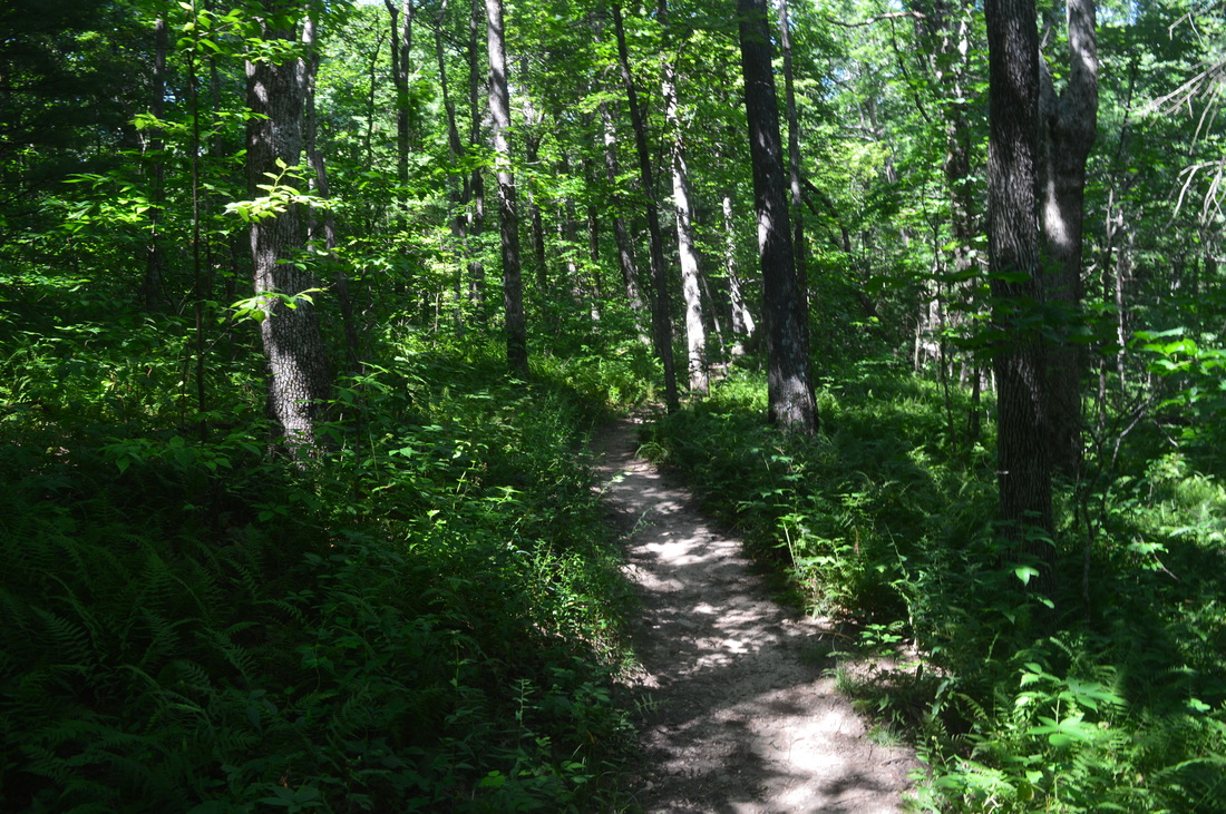
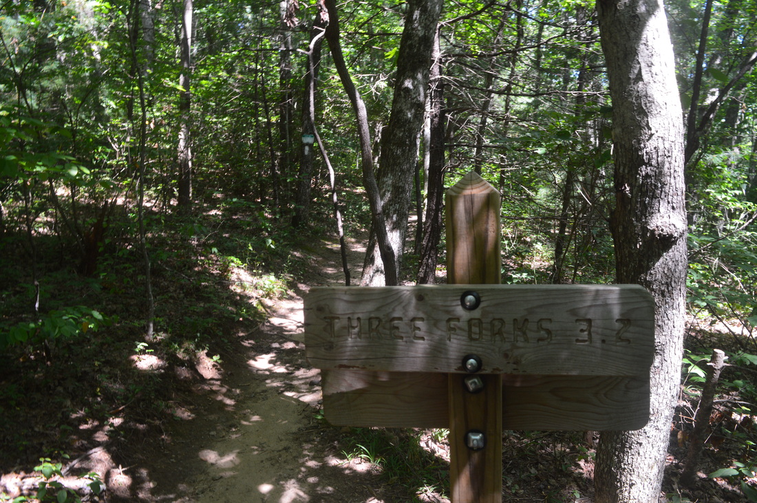
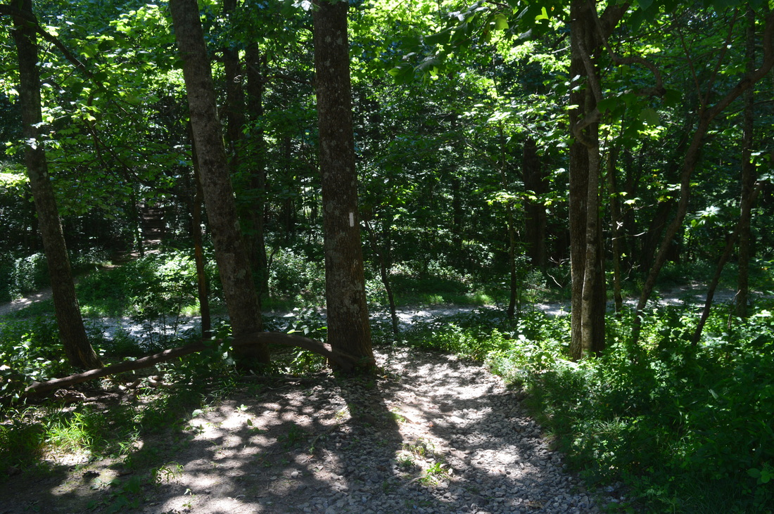
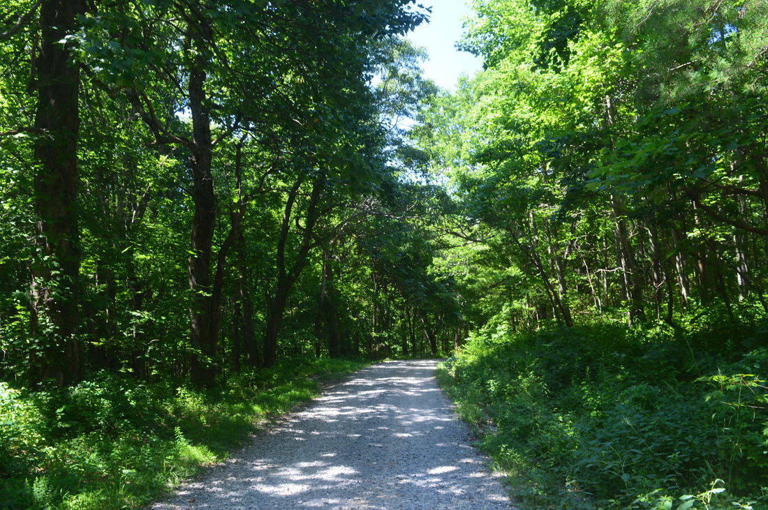
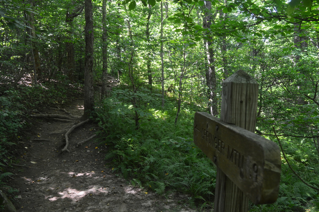
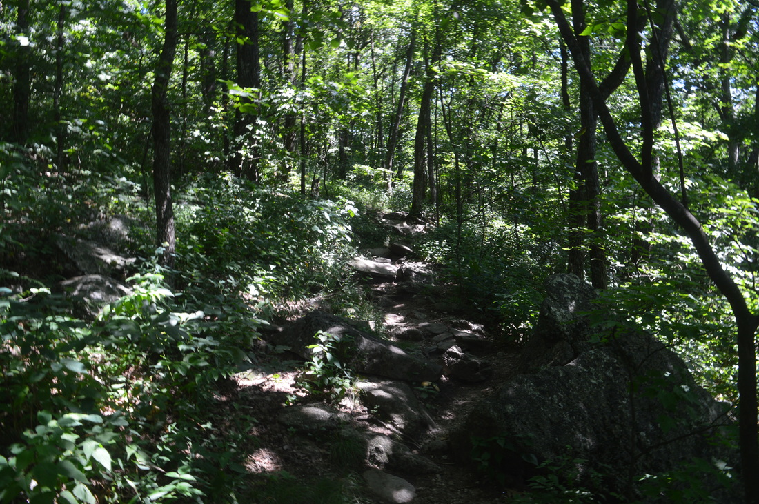
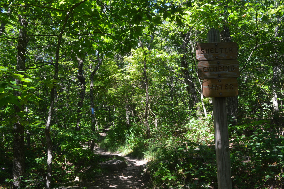
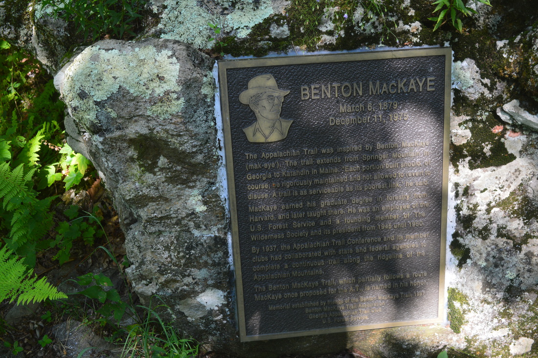
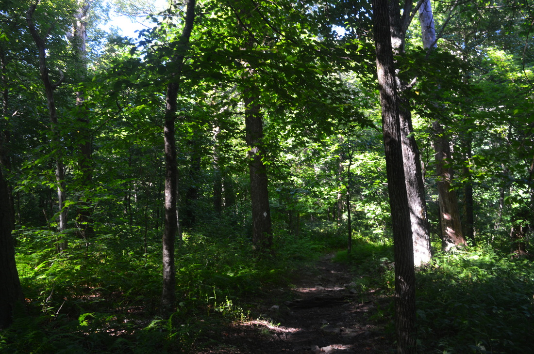
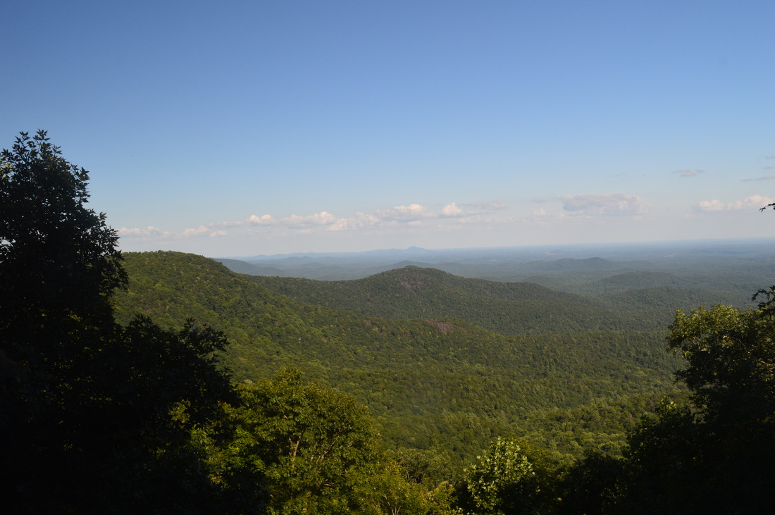
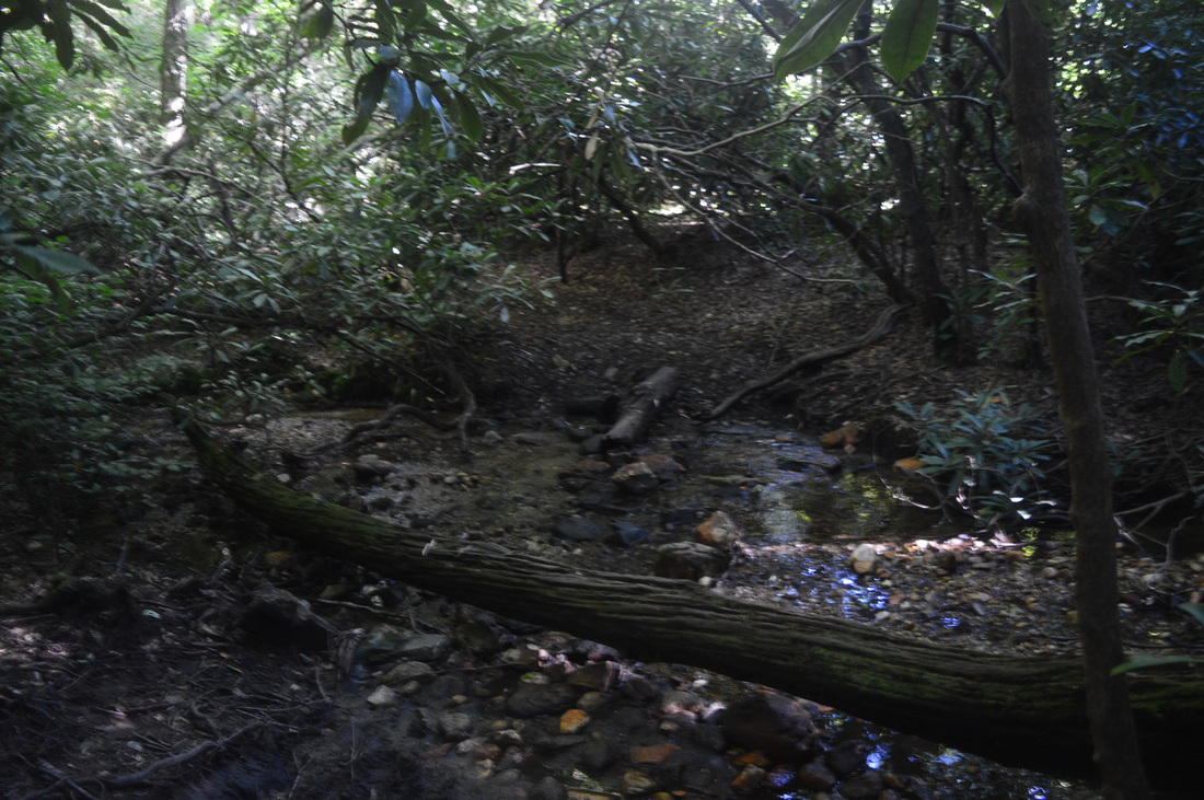
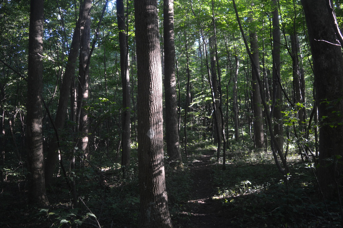
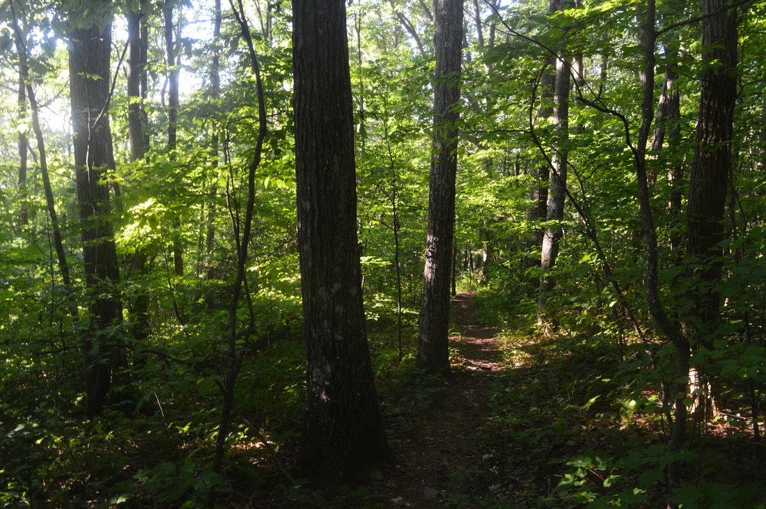
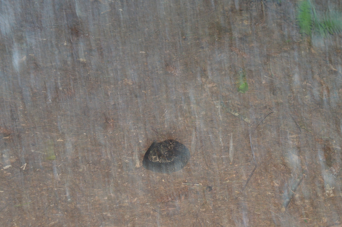
This hike starts at Three Forks, a popular destination for many local day hikers. However, most hikers take the Appalachian Trail north to Long Creek Falls. Very few people hike to Springer Mountain from Three Forks. Most folks hike from the upper parking area. 

The trail starts on the left (south) side of the road. Immediately, you cross a footbridge over Chester Creek just above its confluence with Stover Creek and Long Creek. Then, the trail curves left and passes some camping areas. At 0.1 miles, the Benton Mackaye Trail, which until now has followed the route of the Appalachian Trail, turns left. You'll return from the Benton Mackaye Trail to this spot later, but for now, continue uphill on the Appalachian Trail. The trail climbs a bit and then parallels Stover Creek, which can be seen below. The trail then levels out and crosses Stover Creek on a footbridge. After the footbridge, turn left onto an old roadbed. Keep following the old roadbed - you will pass through a couple muddy areas soon. Around 1.5 miles into the hike, you will make a sharp left turn off the roadbed. This turn is easy to miss - pay attention. The roadbed ahead is blocked by some tree branches but you can still miss the turn. After the turn, cross Stover Creek again on a footbridge, and shortly afterwards, reach the short spur trail to the Stover Creek Shelter. Unless you want to check out the shelter, turn right to continue on the Appalachian Trail.

The Appalachian Trail now starts ascending moderately out of the Stover Creek valley. Around 1.9 miles from the start, in the middle of the ascent, is when my GPS finally started recording. At 2.3 miles, reach a junction in a gap on Rich Mountain with the Benton Mackaye Trail. You'll be visiting this spot later on. Continue straight through the gap and head downhill for some time. At 2.7 miles, cross a branch of Davis Creek - it is an easy rockhop. Then, ascend gradually to another junction with the Benton Mackaye Trail at 3 miles. Once again, you'll be in this spot later, and once again, continue straight on the Appalachian Trail. At 3.2 miles, reach the Springer Mountain Trailhead. Cross the large parking area, descend to and cross Forest Service Road 42, and begin the final ascent up Springer Mountain. The grades on this one are a bit steeper than throughout the rest of the hike, but it is still not very hard. The terrain is also notably rockier. From the road crossing, it is 0.9 miles to the summit of Springer Mountain. At 3.9 miles, reach another junction with the Benton Mackaye Trail. This is the final junction with it, because this is the southern terminus of the BMT. The Appalachian Trail continues straight. At 4 miles, a spur trail turns left to Springer Mountain Shelter. The Appalachian Trail continues a rocky ascent before reaching the summit of Springer Mountain at 4.1 miles. This is the southern terminus of the Appalachian Trail, well-marked. Enjoy the westward view. This is your turnaround point, as it's time to head onto the Benton Mackaye Trail now. However, past the vista and the summit, the Appalachian Approach Trail continues around 8 miles to Amicalola Falls State Park. The Appalachian Approach Trail is at the top of my list of hikes to do this winter. 


From the summit, retrace your steps back to the most recent junction at 4.3 miles with the Benton Mackaye Trail (the one where the trail ends). Turn right onto the BMT. The BMT starts descending down a ridge, parallel to the AT's route. At 4.4 miles, a memorial on the right is about the Benton Mackaye Trail and Benton Mackaye, the person who the trail is named after. Benton Mackaye, a forester from Massachusetts, was the first person who came up with the idea of an "Appalachian Trail". 

After the memorial, the trail soon makes a right turn. You will cross a side ridge from Springer Mountain and then descend to a gap between Springer Mountain and Ball Mountain. The trail ascends moderately up Ball Mountain, but it bypasses the summit. At 5.4 miles, the trail begins descending again from Ball Mountain. The descent is moderate to sometimes steep. There are occasional winter views to your right. At 6 miles, a side trail, marked by the sign "View", heads out to the right. Don't miss this view - the spur trail is quite short, and the view is better than on Springer Mountain, in my opinion. The view is not very high up, but it still feels like you're higher than everything else, particularly with the deep valley just below. Following the view, continue descending and reach Forest Service Road 42 in Big Stamp Gap at 6.5 miles. There is a small parking area here. Cross the road, and continue briefly downhill, before turning west and beginning to ascend along a small stream. This stretch of trail is characterized by more uphill than downhill as you gradually make your way to Rich Mountain. Over the next mile or so, you'll also cross a bunch of small streams that are tributaries of Davis Creek, but all of them are easily rock-hopped. At 7.7 miles, after some easy uphill, reach a junction with the Appalachian Trail. Continue straight on the BMT. You will now descend gradually to a gap near Rich Mountain, reaching it at 8.1 miles. Turn sharply right here - an unmarked side trail continues straight and shortly ends at FS 42. After, the right turn, the trail passes through a grassy area and begins a steep ascent up Rich Mountain. At 8.5 miles, the ascent ends at the highest point in the area, although Rich Mountain is not just one summit - it's a ridge. From the high point, you'll descend steeply again to another junction with the Appalachian Trail at 8.8 miles. 

After this junction, you'll make one last ascent onto another knob on Rich Mountain, ending it at 9 miles. The stretch of the trail that follows is probably the most remote section of this hike with plentiful winter views. You'll be descending along a narrow ridge that is Rich Mountain. Around 9 and a half miles, the trail suddenly leaves the steepening ridge. The trail takes a right turn and begins descending more obviously to Chester Creek. In winter, there is a great panorama here of the Chester Creek gorge, and as you get closer to the bottom, the creek comes into view and so does FS Road 58. Then, the trail makes a sharp left turn and  stays parallel to Chester Creek, although rather high above it. Around here, I stumbled upon (literally, because luckily, I noticed it in advance) a rattlesnake stretched across the trail, apparently sleeping. It took around 10 minutes to safely get it off the trail. 

The trail continues descending to Three Forks. At 10.9 miles, reach the Appalachian Trail. Turn right onto the AT (you've been here earlier), and shortly reach the final footbridge over Chester Creek and FS 55 at 11 miles. 

Variations

Do just the lower part of the hike in a figure-8 loop - 6.3 Miles
Do just the upper part of the hike from the Springer Mountain Trailhead - ​4.7 Miles

​Bonus Stops

​Long Creek Falls, a mile north of Three Forks on the Appalachian Trail.

​Pictures

2 Comments
cindy Jamison
7/19/2018 07:39:05 pm

not sure the last time you traveled these directions...we traveled today and it is no longer maintained by the forest service....AND you shouldn't travel by car...talked to a lady at Amicalola Falls visitor center and she said that starting next year that was where people were going to start to get to Springer Mt....was really bummed that we couldn't get there and it was to late to start from Amicalola Falls...not blaming you for that...thought I would just give people a heads up

Reply
Edirne ECA servisi link
8/3/2022 05:41:29 pm

Edirne ECA servisi için hemen websitemize göz at! https://www.edirneklimaservisi.com/edirne-eca-servisi/

Reply


Leave a Reply.

    About Me

    Mark Oleg Ozboyd
    I'm an avid outdoor explorer and a hobbyist landscape photographer. I'm 21 years old and have been hiking since 2011. Originally based out of Atlanta, Georgia, I started out by occasionally hiking short trails throughout well-known Georgia State Parks. During 2012 and 2013, I began to expand my trips into adjacent states, as well as into the wilder National Forest areas rather than just State Parks. Throughout the years that followed, as I slowly ran out of popular hiking trails in my area, I began to search for and hike in more seldom-visited areas. Today, you can find me out in the woods every weekend, whether it's on an official trail or bushwhacking through cross-country terrain without any paths. I now attend Washington & Lee University and am exploring Virginia and West Virginia. My other hobbies include chess, science, old music, and meteorology. I have 3 years of amateur weather forecasting experience, having studied a lot of meteorology basics over the years. I am also a student at European School of Music where I learned that music and nature have a lot in common. Listening to good music inspires me to capture nature's beauty on the camera in different aspects that also make me recall many beautiful music pieces that I've heard.​


    Dear readers: I have invested a tremendous amount of time and effort in this website and the Georgia Waterfalls Database the past five years. All of the work that has gone in keeping these websites updated with my latest trip reports has almost been like a full-time job. This has not allowed me to pick up a paid job to save up money for college, and therefore, I I've had to take out loans. If you find the information on this website interesting, helpful, or time-saving, you can say "thanks" and help me out by clicking the button above and making a contribution. I will be very grateful for any amount of support you give, as all of it will apply toward my college tuition. Thank you! 

    Enter your email address to subscribe for trail reports:

    Delivered by FeedBurner


    Picture
    Coming in 2022-2023?

    Other Hiking Websites

    DWHike's Adventures
    Florida's Natural Wonders
    Florida Trailblazer
    Meanderthals
    Mountain Images
    by Bernie Boyer

    North Carolina Waterfalls with
    ​Kevin Adams
    Take-a-Hike!
    Tennessee Landforms
    Waterfall Page
    Waterfall Adventurer
    Zach's Mild Adventures

    Miles Hiked

    Year 1: 540.0 Miles
    Year 2: 552.3 Miles
    ​Year 3: 518.4 Miles
    Year 4: 482.4 Miles
    Year 5: 259.9 Miles

    Archives

    March 2021
    February 2021
    January 2021
    November 2019
    October 2019
    September 2019
    August 2019
    July 2019
    June 2019
    February 2019
    January 2019
    December 2018
    November 2018
    October 2018
    August 2018
    July 2018
    June 2018
    May 2018
    April 2018
    March 2018
    February 2018
    January 2018
    December 2017
    November 2017
    October 2017
    September 2017
    August 2017
    July 2017
    June 2017
    May 2017
    April 2017
    March 2017
    February 2017
    January 2017
    December 2016
    November 2016
    October 2016
    September 2016
    August 2016
    June 2016
    May 2016
    April 2016
    March 2016
    January 2016
    December 2015
    November 2015
    October 2015
    September 2015
    August 2015
    July 2015
    June 2015
    May 2015
    April 2015
    March 2015
    February 2015
    January 2015
    December 2014
    November 2014
    October 2014
    September 2014
    August 2014
    July 2014
    June 2014
    May 2014
    April 2014
    March 2014
    February 2014

    Categories

    All
    Adel
    Adirondack Park
    Alabama
    Alfred A. Ring Park
    Allegheny Trail
    Amicalola Falls State Park
    Anniston Area
    Apalachicola Bluffs And Ravines Preserve
    Apalachicola National Forest
    Apalachicola/Port St. Joe Area
    Apopka
    Appalachian Trail
    Appling
    Art Loeb Trail
    Aska Trail System
    Bakersville
    Balm-Boyette Scrub Preserve
    Balsam Lake Recreation Area
    Bankhead National Forest
    Bartow County Parks
    Bartram Trail
    Basinger
    Beersheba Springs
    Benton
    Benton Mackaye Trail
    Berry College Trail System
    Best Hike
    Big South Fork National Recreation Area
    Black Bear Wilderness
    Black Rock Mountain State Park
    Blairsville
    Blakely
    Blood Mountain Wilderness
    Blowing Rock
    Blue Ridge
    Blue Ridge Parkway
    Boone
    Bradenton
    Bradenton Beach
    Brasstown Bald
    Brasstown Wilderness
    Brevard
    Bryson City
    Buchanan
    Bucks Pocket State Park
    Bulow Creek State Park
    Bulow Plantation Ruins State Park
    Caesars Head State Park
    Caladesi Island State Park
    Calhoun
    Camel's Hump State Park
    Cashiers
    Caspersen Beach Park
    Catfish Creek State Park
    Caves
    CC Putnam State Forest
    Cedar Point Environmental Park
    Chatsworth
    Chattahoochee National Forest
    Chattanooga
    Chattanooga Valley
    Chattooga National Wild And Scenic River
    Cheaha Wilderness
    Cherohala Skyway
    Cherokee
    Cherokee National Forest
    Chiefland Area
    Chillhowee Recreation Area
    Chipley
    Chunky Gal Trail
    Circle B Bar Reserve
    Citico Creek Wilderness
    Citrus Wildlife Management Area
    Clarkesville
    Clayton
    Cleevland
    Cleveland
    Cloudland Canyon State Park
    Cohutta Wilderness
    Collier-Seminole State Park
    Cordele
    Cornelia
    Covington
    Crestview Area
    Crew-land-and-water-trust
    Cullowhee
    Cumberland Trail
    Dahlonega
    Dalton
    Dawson Forest Wildlife Management Area
    Dawsonville
    Dayton
    De Soto National Memorial
    DeSoto State Park
    Dillard
    Double Springs
    Ducktown
    Duncan Ridge Trail
    Dunlap
    Eagle's Rest Park
    Eastpoint
    Econfina Creek Wildife Management Area
    Eglin Air Force Base
    Elizabethton
    Elkins
    Elk Knob Game Lands
    Elk Park
    Ellicott Rock Wilderness
    Ellijay
    Emerson Point Preserve
    Englewood Area
    Enota Retreat
    Erwin
    Falling Waters State Park
    Fayetteville
    Fires Creek Recreation Area
    Fire Tower
    Flint River
    Florence Area
    Florida
    Florida Caverns State Park
    Florida Trail
    Foothills Trail
    Fort Mountain State Park
    Fort Myers Area
    Fort Payne
    Fort Payne Area
    Fort Yargo State Park
    Franklin
    Franklin Delano Roosevelt State Park
    Franklin-Marion State Forest
    Frozen Head State Park
    Gainesville
    Gainesville Area
    Gatlinburg
    George Washington National Forest
    Georgia
    Georgia Veterans Memorial State Park
    Glasgow
    Gorges State Park
    Grandfather Mountain State Park
    Great Smoky Mountains National Park
    Greeneville
    Green River Game Lands
    Gruetli-Laager
    Grundy Forest State Natural Area
    GTM Reserve
    Guana River Wildlife Management Area
    Hayesville
    Helen
    Hiawassee
    High Falls State Park
    Highlands
    Highlands Scenic Highway
    Hillsborough River State Park
    Hinson Conservation & Recreation Area
    Historic Sites
    Honeymoon Island State Park
    Hot Springs
    Huntington
    Inverness Area
    Jackson
    Jasper
    Jefferson National Forest
    Joan M. Durante Park
    Jonathan Dickinson State Park
    Jones Gap State Park
    Joyce Kilmer Slickrock Wilderness
    Joyce Kilmer - Slickrock Wilderness
    Juniper Prairie Wilderness
    Kelly Park
    Keown Falls Recreation Area
    Kolomoki Mounds State Park
    LaFayette
    Lake City Area
    Lake George Wild Forest
    Lake June-in-Winter State Park
    Lakeland Area
    Lake Placid
    Lake Russell Wildlife Management Area
    Lake Wales Ridge State Forest
    Laurel Fork North Wilderness
    Leffis Key Preserve
    Leon Sinks Geological Area
    Lexington
    Lineville
    Linville
    Linville Gorge Wilderness
    Lithia Springs
    Little Frog Wilderness
    Little Manatee River State Park
    Little River Canyon National Preserve
    Longboat Key
    Long Trail
    Lookout Mountain
    Lookout Mountain Battlefield
    Lovingston
    Lula Lake Land Trust
    Lumpkin
    Maggie Valley
    Manatee Springs State Park
    Marianna Area
    Mark Trail Wilderness
    Marlinton
    Mccaysville
    McMinville
    Mentone
    Middlesex
    Mistletoe State Park
    Monongahela National Forest
    Montreat
    Mountain Bridge Wilderness Area
    Mountain City
    Mountains To Sea Trail
    Mountains-to-Sea Trail
    Mount Rogers National Recreation Area
    Myakka River State Park
    Myron B. Hodge City Park
    Nantahala National Forest
    Naples
    Naples Area
    Natural Bridge State Park
    Neal Preserve
    New Castle
    Newport
    New River Gorge National Park
    New York
    North Carolina
    Ocala Area
    Ocala National Forest
    Ocean-to-Lake Trail
    Oconee State Park
    Oconee Station Historic Site
    Okaloacoochee Slough State Forest
    Oldsmar
    Oneida
    Orlando Area
    Ormond Beach
    Oscar Scherer State Park
    Oxford
    Palatka
    Palmetto Trail
    Panama City Area
    Panthertown Valley
    Parrish
    Paynes Creek Historic State Park
    Peaks Of Otter Recreation Area
    Pigeon Crockford Mountain Wildlife Management Area
    Pigeon-Crockford Mountain Wildlife Management Area
    Pigeon-Crockford Wildlife Management Area
    Pine Mountain
    Pinhoti Trail
    Pinnacle Park
    Pisgah Civitan Park
    Pisgah National Forest
    Pittman Center
    Pond Mountain Wilderness
    Ponds/Lakes
    Prentice Cooper State Forest
    Providence Canyon State Park
    Pumpkintown
    Quick Point Nature Preserve
    Raven Cliffs Wilderness
    Reed Bingham State Park
    Reliance
    Rice Creek Conservation Area
    Riverview Pointe Preserve
    Robbinsville
    Robinson Preserve
    Rock Creek Gorge Scenic Area
    Rock Island State Park
    Rome
    Rosman
    Sale Creek
    Salem
    Salt Springs
    Saluda
    Santa Rosa Beach
    Sarasota
    Sarasota Area
    Savage Gulf State Natural Area
    Scenic Views
    Scottsboro Area
    Sebring Area
    Sewanee
    Sheltowee Trace Trail
    Shining Rock Wilderness
    Signal Mountain
    Sipsey Wilderness
    Sky Valley
    Smithgall Woods State Park
    Snowbird Backcountry Area
    Soddy Daisy
    Soddy-Daisy
    Sopchoppy
    South Carolina
    South Cumberland State Park
    Southeastern Cave Conservancy
    Southern Nantahala Wilderness
    Sparta
    Sprewell Bluff Park
    Spring City
    Spring Hill
    Springs
    Spruce Pine
    Standing Indian Backcountry Area
    St. Augustine
    St. George Island State Park
    St. Joseph Bay State Buffer Preserve
    St. Marks Area
    St. Marks National Wildlife Refuge
    Stone Mountain
    Stone Mountain Park
    Suches
    Sumatra
    Sumter National Forest
    Suwannee River
    Swallow Creek Wildlife Management Area
    Sweetwater Creek State Park
    Sylva
    Talladega National Forest
    Tallahassee Area
    Tallulah Falls
    Tallulah Gorge State Park
    Tampa Bay Area
    Tate City
    Tate's Hell State Forest
    Tea Creek Wildlife Management Area
    Tellico Plains
    Tennessee
    Thomaston
    Toccoa
    Topsail Hill State Park
    Torreya State Park
    Townsend
    Tracy City
    Tray Mountain Wilderness
    Trenton
    Triple Creek Preserve
    Troutdale
    Unaka Mountain Wilderness
    Upper Tampa Bay County Park
    Venice
    Vermont
    Virgin Falls State Natural Area
    Virginia
    Virginia Outdoors Foundation
    Vogel State Park
    Wakulla Springs State Park
    Waleska
    Walhalla
    Wartburg
    Water Features
    Waynesville
    Weedon Island Preserve
    Weeki Wachee Preserve
    Wekiwa Springs State Park
    West Palm Beach Area
    West Virginia
    Whitehall
    White Springs
    Winder
    Withlacoochee State Forest
    Young Harris

    RSS Feed

TRAIL REPORTS

Hikes in Alabama
​Hikes in Florida
Hikes in Georgia
Hikes in North Carolina
Hikes in South Carolina
Hikes in Tennessee
Hikes in Virginia

Hiking Resources

Alabama Resources
​
Florida Resources
Georgia Resources
North Carolina Resources
​South Carolina Resources
​
Tennessee Resources

Other

Contact
Map of Hikes
Alphabetical List of Hikes
Southeast Nature Society
© COPYRIGHT 2014-2018
​ALL RIGHTS RESERVED.
Important: I disclaim any responsibility for any damage or personal injury that may occur as a result of the activities and information found on this website. All outdoor activities, especially off-trail hiking, are done at your own risk. Never hike or head into that area that may be above your fitness or experience level.
  • Home
  • Trail Reports
    • Best Hikes
    • Hikes with Scenic Views
    • Hikes with Water Features
    • Alabama
    • Georgia
    • Florida
    • North Carolina
    • South Carolina
    • Tennessee
    • Vermont
    • Virginia
  • Map
  • Hike List
  • Testimonials
  • Resources
  • Contact Us
  • Southeast Nature Society
    • Our Team
  • Georgia Waterfalls Database