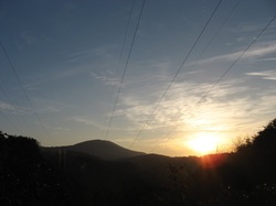
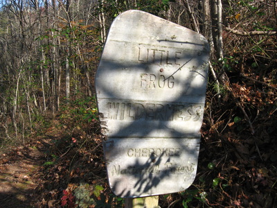
 Big Frog Mountain is the highest mountain in southeastern Tennessee, topping out at over 4000 feet. The mountain and surrounding areas are protected by the combined Cohutta - Big Frog Wilderness. The newest addition to the area, though, is the Little Frog Wilderness, a smaller tract of land across from Big Frog Wilderness and US Highway 64. This tract protects the Panther Knob area, the better portion of Dry Pond Lead, and Rock Creek/Pressley Cove. Two trails, the Dry Pond Lead Trail and the Rock Creek Trail, provide access to the wilderness area, and you won't regret hiking them. This hike occurred on November 15th, 2014. My plan was to hike through most of the Little Frog Wilderness by starting at the Rock Creek Trailhead and hiking the entire Rock Creek Trail to the junction with the Dry Pond Lead Trail/Benton Mackaye Trail. Here, I would turn south onto the Dry Pond Lead Trail and follow it to US-64 and Ocoee Powerhouse No. 3. Then, I would enter the Tanasi Trail System, and take the Thunder Rock Express Trail to the Chestnut Mountain Trail. Next, I would follow the Chestnut Mountain Trail east, before exiting onto the Bear Paw Paw Trail that would lead down to Ocoee Whitewater Center. I would close the loop by hitchhiking 0.8 miles of US-64 to Rock Creek Trailhead (something I wouldn't recommend you to do!). R/T Length of Trail: 13.4 Miles Duration of Hike: 6:30 Difficulty Rating: 7 out of 10 Type of Hike: Loop Pros: Great wintertime views on thinly-wooded slopes Cons: Few year-round overlooks; second half of hike is on multi-use trails; roadwalk or shuttle required Scenic Views: Big Frog Mountain Overlook on Dry Pond Lead Trail - 4 stars Water Features: None Best Season(s) to Hike: Winter Trail Blaze Color(s): Rock Creek Trail - White; Dry Pond Lead Trail - White (Both Rectangles and Diamonds); Thunder Rock Express Trail - Dark Green; Chestnut Mountain Trail - Beige (Pale Yellow); Bear Paw Paw Trail - Lime Green Beginning Point: Rock Creek Trailhead on US Route 64 Directions: From Ducktown, Tennessee: Follow US Route 64 West for about 5 miles. Then take a right at the sign for Rock Creek Trail onto a small road that leads shortly to the turnaround and parking area for Rock Creek Trail. I like to do megaloops sometimes. Instead of doing one or two trails, I prefer to encompass a larger area by connecting them all. This sometimes requires roadwalk, and in this case, roadwalk I wouldn't recommend. The best option for this hike would be a shuttle, leaving one car at Rock Creek Trailhead and the other at Ocoee Whitewater Center. The shuttle distance is fairly short, so it wouldn't be too big of a problem.
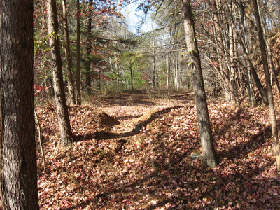
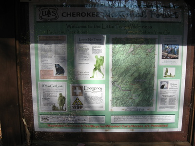
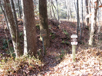
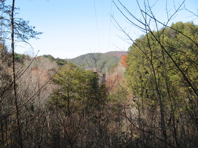
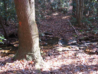
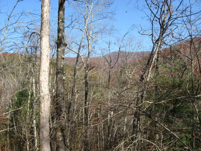
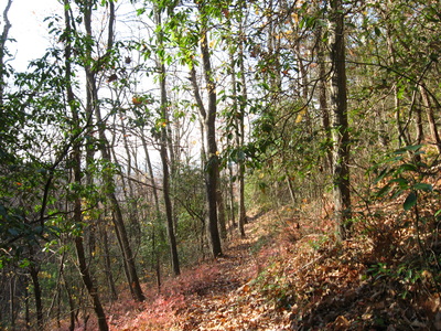
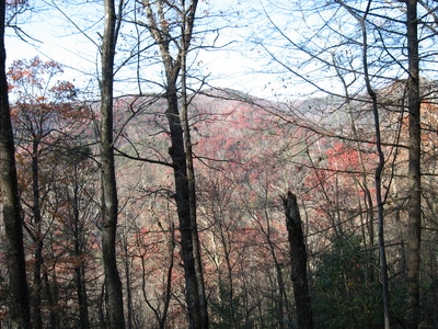
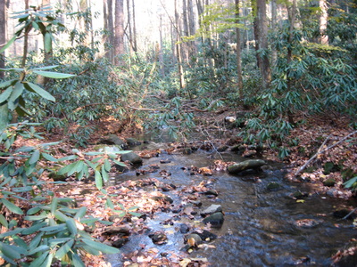
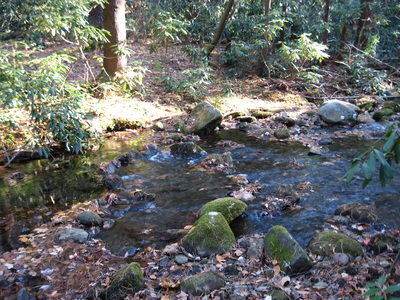
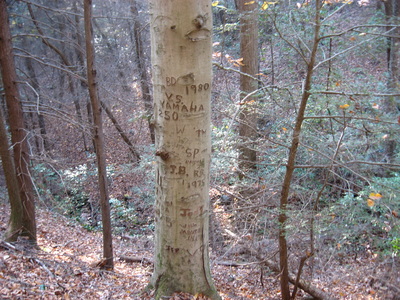
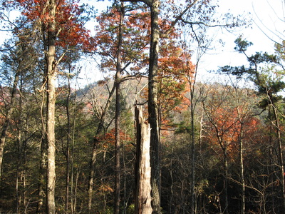
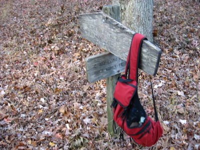
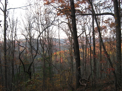
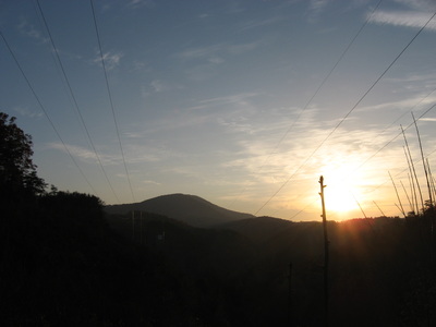
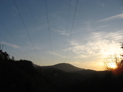
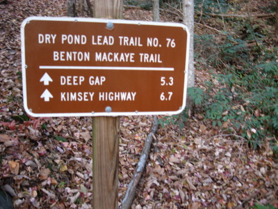
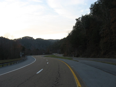
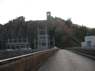
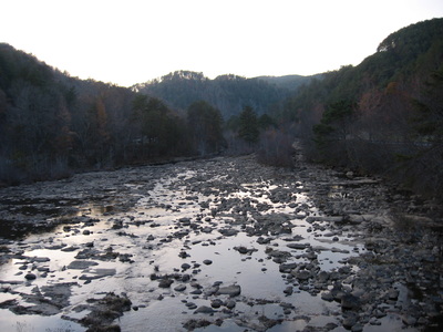
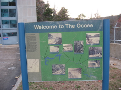
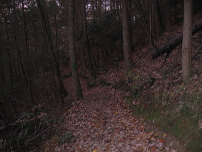
The Rock Creek Trail starts off behind the small parking area near US-64. The trail shortly reaches the old parking area, and then a trailhead kiosk with information about Little Frog Wilderness. The bleakly-marked entrance to the trail is to the left of the kiosk. The Rock Creek Trail is probably the trickiest part of the hike - it's often hard to see, and that feeling was heightened by the freshly-fallen leaves. At first, the trail winded down the slopes parallel to US-64, but it soon turned right, away from the sounds of the roadway. At 0.3 miles, reach a powerline cut with some views of Dry Pond Lead in the distance, as well as a well-marked boundary with the Little Frog Wilderness. You'll be in the wilderness for the next 5.2 miles! The trail continues descending to reach Laurel Creek at 0.5 miles. This is the signal that lets you know the ascent is about to start. The creek is crossed easily in all but the wettest of times. The ascent is long, but not very challenging. In winter, views are abundant through the trees. The trail first switchbacks up the slopes of the nearby ridgeline, and then briefly follows it, before continuing along the slopes of a longer lead that leads to Panther Knob. At around 2 miles, the trail winds around an unnamed knob, turns east, and continues climbing for some more. The trail changes slopes briefly, before reaching a high point in a gap below Panther Knob at 2.7 miles. There are no designated trails leading to the summit of Panther Knob. The trail turns left off the ridge and starts descending towards Pressley Cove. However, right after the descent starts, there is a confusing spot where the trail disappears completely for a short period of time. There is a faint path that goes steeply uphill towards Panther Knob. Don't take it - it's nothing more than a wet-weather trickle. Instead, go downhill following the trickle. There's only way that goes downhill, so that should not be too hard to figure out. You should see a clear path quite soon as the descent steepens. There are good views here off to the west towards Pressley Cove and Dry Pond Lead. The good views soon fade away as the trail enters the thick vegetation of Pressley Cove around 4 miles. The cool, mountain waters of Rock Creek and the surrounding scenery will prove your trek into Little Frog Wilderness worth it. The trail keeps descending toward Rock Creek, and finally reaches the Rock Creek ford at 4.3 miles. There's a few places upstream and downstream that could be places for crossing Rock Creek without wetting your feet during low or normal water, like on this day. During periods of high water though, all of the rocks that are barely sticking above the surface of the water will be submerged. Once on the other side of Rock Creek, the trail climbs a little bit and then follows Rock Creek. At 4.5 miles, cross a small tributary, and then come in view of some small cascades. There are no major waterfalls, but the entire stream is beautiful. At 4.7 miles, the trail begins the climb out of Pressley Cove. This one is both shorter and easier than the first one into the Panther Knob area. Shortly after the ascent starts, you will pass a tree completely stripped of its bark, with all kinds of carvings by people on it. That was interesting! The trail then rounds a couple of small hollows, with the upper section of Dry Pond Lead coming into sight around 5 miles. At 5.3 miles, the trail finally begins switchbacking up to the top of Dry Pond Lead, reaching the Dry Pond Lead Trail and the terminus of the Rock Creek Trail at 5.5 miles. The Dry Pond Lead Trail is also the current route of the Benton Mackaye Trail, which is why you will see some white diamonds as blazes on this trail as well. If you turn right onto the Dry Pond Lead Trail, it will take you towards Hiwassee River, which is another very beautiful section of the Benton Mackaye Trail. Meanwhile, turning left (the route I was going to take) leads to Ocoee Powerhouse No. 3, the Ocoee River, and US-64. This junction also marks the Little Frog Wilderness boundary (although the trail still was to follow the boundary for some time). Once you have turned left onto Dry Pond Lead Trail, it's all downhill to US-64. There are some great views through the trees as the trails follows the descending Dry Pond Lead. But where the lead ends, the trail sharply drops off the rim and beings to descend in earnest into the Ocoee River Gorge, also leaving the Little Frog Wilderness boundary line. The descent temporarily eases out at 6 miles, with better views to the northwest towards the Chillhowee Mountains as well. This trail is more evident than the Rock Creek Trail - you could tell it receives more foot traffic. At 6.6 miles, the trail reaches a powerline cut with a surprisingly nice view. The overlook is unusual, as it is located in a hollow and fairly close to the bottom of the Ocoee River Gorge. From the viewpoint, you can see the Ocoee Powerhouse No. 3, as well as Chestnut Mountain behind it and Big Frog Mountain casting its shadow into the entire area. After the view, the trail turns to follow the hollow, and the grade steepens approaching US-64. At 6.8 miles, there are several steep, eroded switchbacks, that terminate the Dry Pond Lead Trail at 6.9 miles at US-64. From here, you have to go across the highway and over the Ocoee River on the bridge across the road. Be careful crossing US-64, as it has two lanes each direction at this place. Once across the road, you have to go on the Ocoee River bridge leading to the Ocoee Powerhouse No. 3. The Ocoee River was very shallow on this day... you could probably cross it without getting your feet wet, if you are good at rock hopping. Normally, it's waist deep at least. On the other side of the river, there are some interpretive signs regarding the powerhouse. The huge pipe that leads up the mountain probably brings in water from some sort of reservoir nearby. There are lots of powerlines leading to the powerhouse, so it IS a big one! For the purposes of this hike, you need to keep following the road (Forest Service Road 45). FS 45B turns right towards Thunder Rock Campground (and also the Benton Mackaye Trail's route) - keep left here. At 7 miles, the Thunder Rock Express Trail takes off to the left. Take it. First, it briefly follows a steep service road for the powerhouse, but then it turns right at 7.1 miles. Don't miss this turn, as it is not marked. From here, the trail crosses a small footbridge over a gully, and begins a slow climb similar to the Panther Knob one, except shorter. There will be a couple of powerline cuts with some views along the way. The grades are never steep, ad the trail follows the contours of the hills and ridges, b eventually, it does terminate at the Chestnut Mountain Trail at 8.4 miles. The Chestnut Mountain Trail is a loop. Turning either left or right will take you to the same place eventually, but turning left is the shortest way to get to the Ocoee Whitewater Center, so that is the route of this hike. The Chestnut Mountain Trail circles Chestnut Mountain, although it never reaches the plateau-like summit. The 3-mile stretch that this route follows of the Chestnut Mountain Trail is pretty boring. It rises and dips down over a dozen times, with no significant elevation change, but lots of small elevation change. Most of the time it follows an old road, so the grades are easy. It's not the worst trail for biking. There are some powerline cuts on this trail too with some views, but generally, the only good powerline cut view was the one on Dry Pond Lead Trail. The others deserve a rating of 1 to 2. The 3 miles on the Chestnut Mountain Trail seem endless, but eventually, they do end, when you reach a junction with the Bear Paw Paw Loop at 11.4 miles. On the Bear Paw Paw Loop, you should be on the lookout for bears - no wonder why it's called that. No, just kidding! Not sure where the name originates, but it is a good trail to use to descend back to the Ocoee River. At 11.6 miles, 0.2 miles after turning left on the Bear Paw Paw Trail, you reach the first junction with the loop part of this trail. The longer way is to keep left,which would be a good idea, if you want to add some mileage. However, I already hiked a lot today, so I didn't have intentions of lengthening the hike. The Bear Paw Paw Trail gradually descends, reaching the second end of the loop at 12 miles. From here, the trail steepens slightly crosses a footbridge over a hollow, and passes some rock cliffs on the left near the bottom of the gorge. At 12.5 miles, the trail ends at the Ocoee River. Turn right here and cross the long footbridge over the Ocoee River, leading to the Ocoee Whitewater Center. On the other side of the bridge is the shuttle destination. If you do not have a shuttle, the only other option is to hitch-hike along US-64, by turning right onto US-64 at Ocoee Whitewater Center, and follow it all the way to the Rock Creek Trailhead, reaching it at 13.4 miles. It is mainly uphill, but the uphill is gentle, so it's not a big problem. The bigger problem is he amount of traffic along the roadway, which is why I recommend having two cars for this hike. In summary, this is a great route to acquaintance you with wilderness hiking. It's not hard, it's pretty long, it has some stream crossings, it has some views... just right enough! Below are some pictures.
0 Comments
Leave a Reply. |
About MeMark Oleg Ozboyd Dear readers: I have invested a tremendous amount of time and effort in this website and the Georgia Waterfalls Database the past five years. All of the work that has gone in keeping these websites updated with my latest trip reports has almost been like a full-time job. This has not allowed me to pick up a paid job to save up money for college, and therefore, I I've had to take out loans. If you find the information on this website interesting, helpful, or time-saving, you can say "thanks" and help me out by clicking the button above and making a contribution. I will be very grateful for any amount of support you give, as all of it will apply toward my college tuition. Thank you!
Coming in 2022-2023?
Other Hiking WebsitesMiles HikedYear 1: 540.0 Miles
Year 2: 552.3 Miles Year 3: 518.4 Miles Year 4: 482.4 Miles Year 5: 259.9 Miles Archives
March 2021
Categories
All
|

 RSS Feed