In many cases, a long hike through a swamp is a challenging hike that is not for the light-hearted. But the twelve-mile balloon loop through Bird Rookery Swamp is a mostly dry hike along old logging tramways that leads into the heart of the wild swamp without the hiker expending a lot of effort. On this hike, you will make a large loop through this remote corner of the Corkscrew Swamp Land and Water Trust, where alligators abound in great numbers, and hawks look down upon you from the dry canopy above the water. This hike occurred on Saturday, July 9th, 2016. My plan was to hike the Bird Rookery Swamp balloon loop counter-clockwise from the trailhead on Shady Hollow Boulevard.
Summary
R/T Length of Trail: 12.2 Miles
Duration of Hike: 5:15 Type of Hike: Lasso Difficulty Rating: 3 out of 10 Total Elevation Gain: Minimal Pros: Remote swamp hike with plenty of wildlife and few people Cons: You may get your feet wet on several slough crossings on the tenth mile Points of Interest: Bird Rookery Swamp boardwalk; Views of Saddleback Lake; Scenic blackwater slough on the fifth mile; Bird Rookery Swamp which in general lasts through the entire hike Best Season(s) to Hike: Summer (although it could get hot) Trail Blaze Color(s): None, although the Bird Rookery Swamp Trail does have occasional checkpoints, mileage markers, and "P^" signs. Fees: None Beginning Point: Bird Rookery Swamp Trailhead on Shady Hollow Boulevard Directions from Immokalee, FL: From the intersection of Main Street and 1st Street in Immokalee, follow 1st Street (which later turns into Immokalee Road, it is also County Road 846) for 17.9 miles. Then, turn right onto Shady Hollow Boulevard. Continue on Shady Hollow Boulevard for 3.1 miles until the large parking area at the Bird Rookery Swamp Trailhead to the right. The road will turn to gravel, but it is in excellent shape. Map
Click here for more information and to download this trail map to view in Garmin Basecamp.
Details
I classify hikes in Florida under several different categories: river hikes, prairie hikes, woods hikes, oceanside/island hikes, and swamp hikes. This hike falls into the last category. However, most swamp hikes involve miles of slogging through deep water. This one is mostly dry, as it follows old logging tramways for the entire route. On Thanksgiving Day 2014, I did a very challenging hike in Collier-Seminole State Park - it was primarily a slog through the vast swamp in the park. On this hike, you get to see similar scenery, but the hike itself will be much easier. The main things that makes this hike a tad more difficult than many Florida hikes are 1. the distance and 2. long stretches of tall grass on the tramways. By the end of the hike, your legs might be a bit tired, thanks to the tall grass, but otherwise - it's a great hike and a great way to get acquainted with the sounds and sights of the swamp.
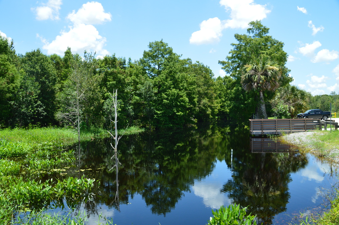
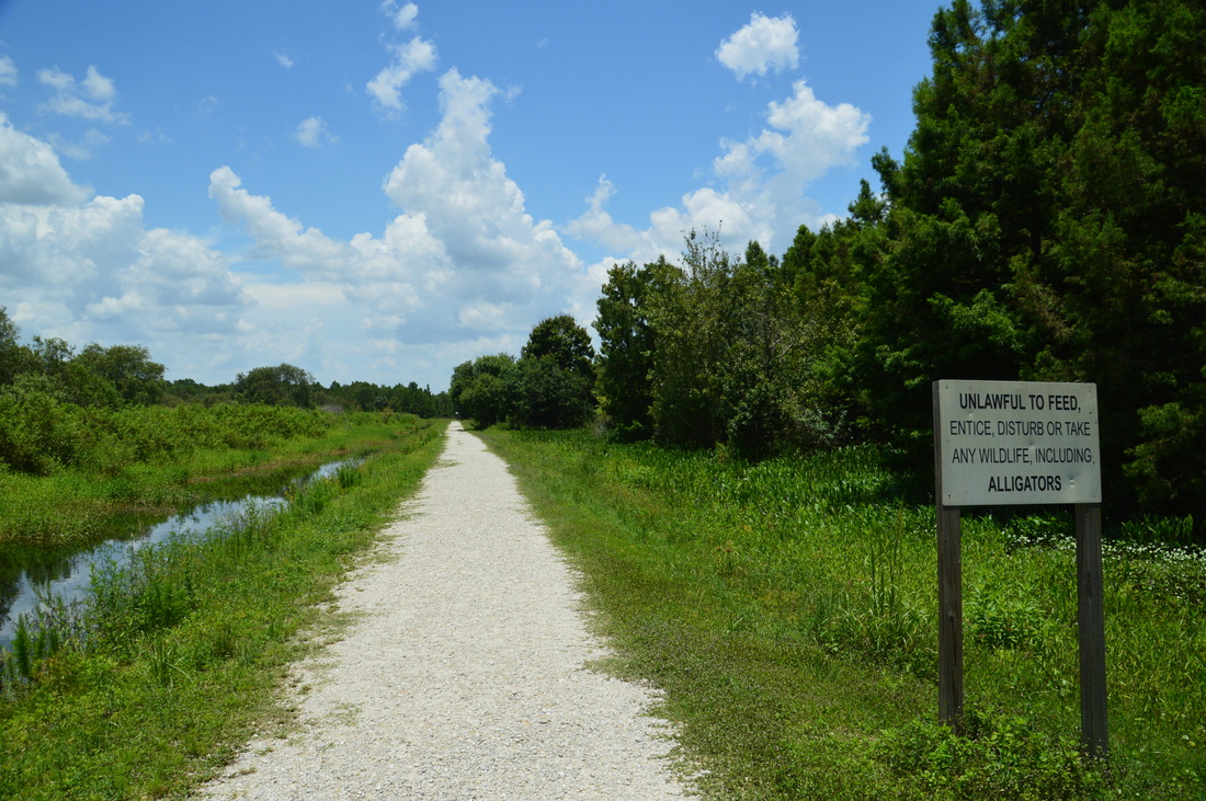
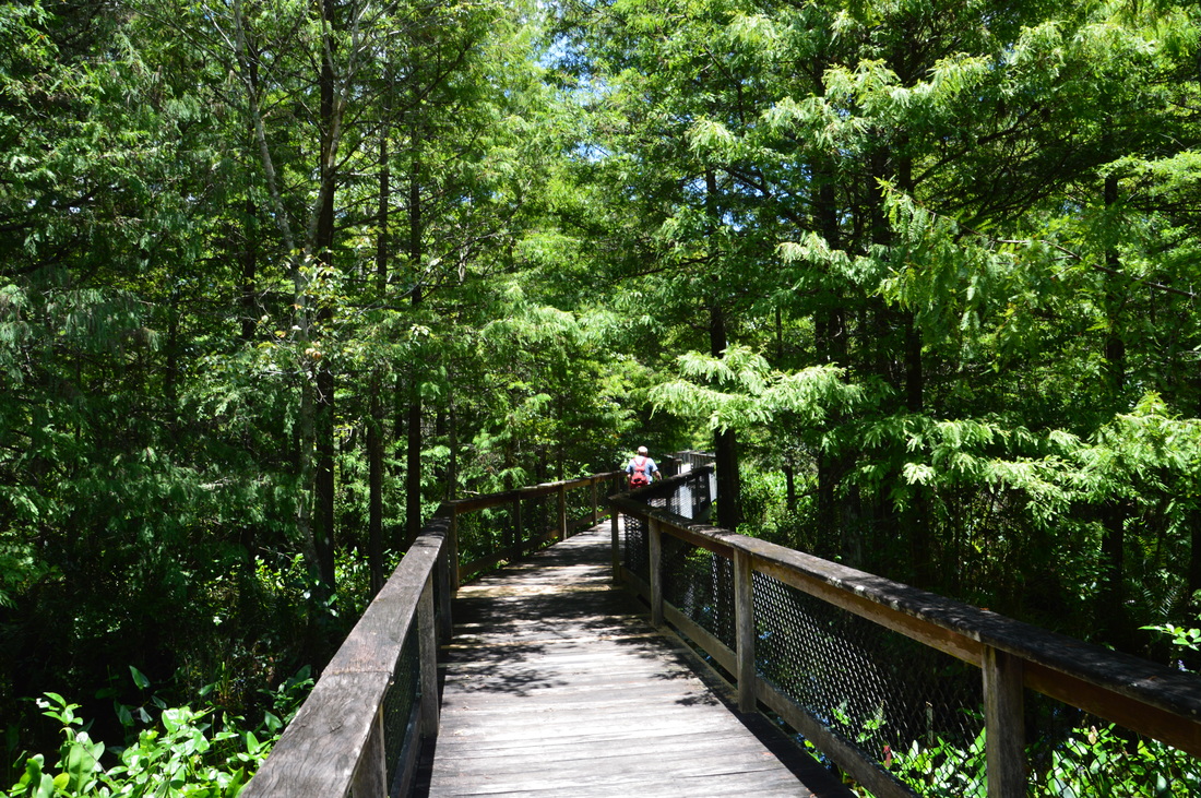
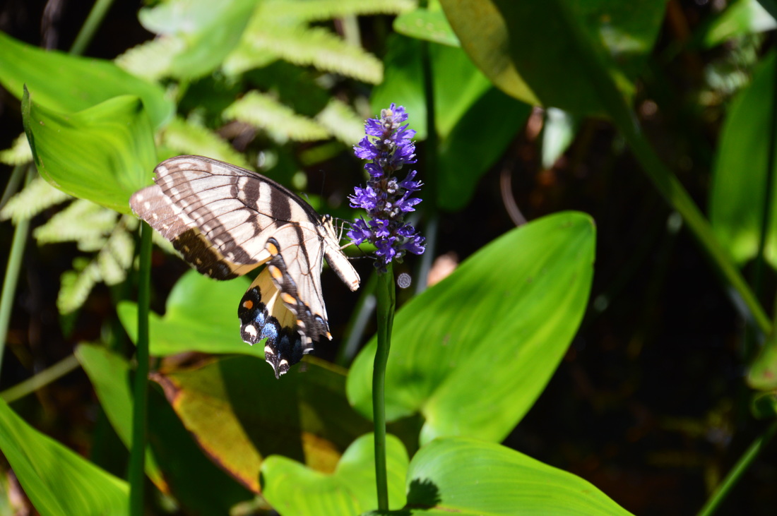
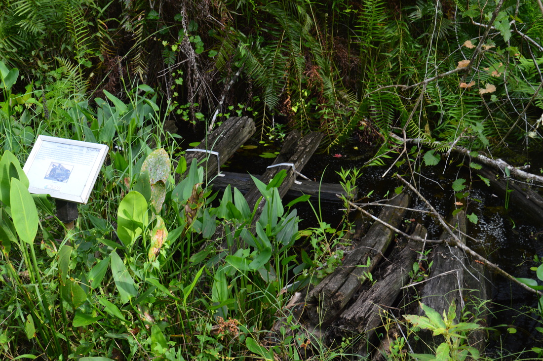
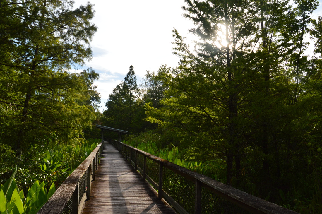
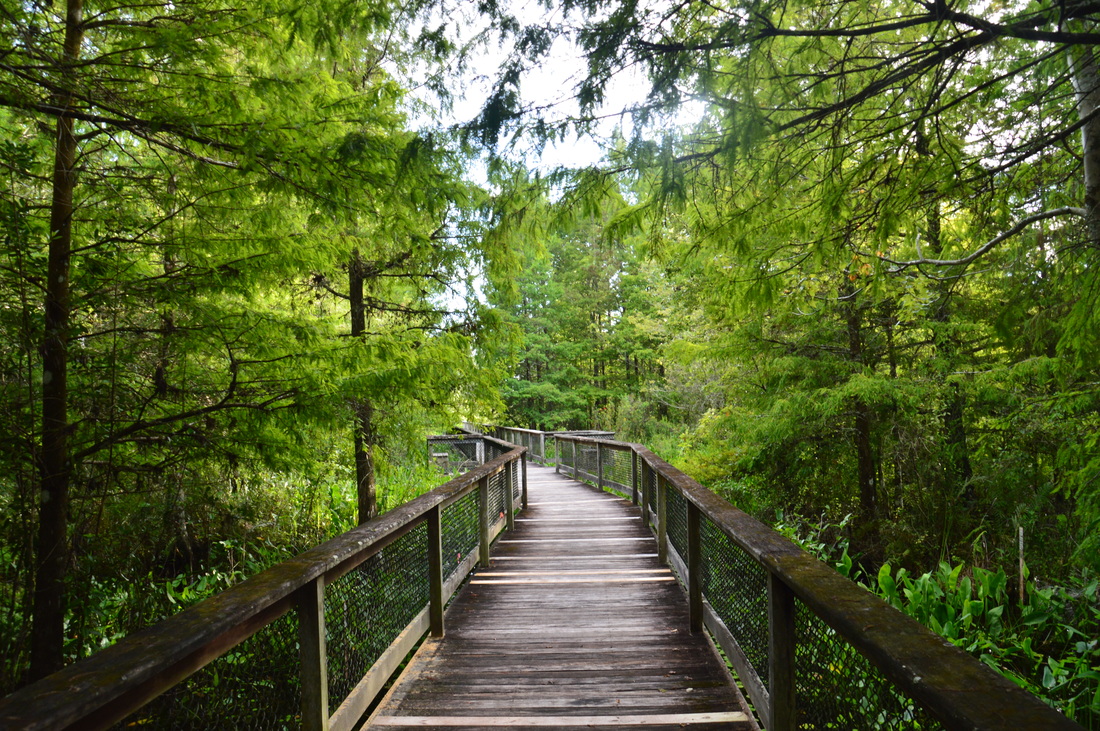
The only trailhead for the Bird Rookery Swamp section of CREW Land and Water Trust is off Shady Hollow Boulevard. This is a large relatively new parking area. An observation deck at the trailhead provides a view into a small cypress-framed lagoon directly in front of the parking area. This is just a sample of things to come. The trail begins at a trailhead kiosk at a gated gravel road on a dike. Begin following this gravel route northward, surrounded by canals. Pickerel weed blooms along the sides of the dike. 0.25 miles from the beginning of the hike, the trail laves the wide level dike, as the Bird Rookery Swamp boardwalk begins to the right. While this boardwalk is so close to the trailhead, it is one of the highlights of the hike for me, and even a simple, short stroll to the end of the boardwalk and back would be rewarding - for the swamp is very picturesque in this area. Turn right on the boardwalk. There are two rain shelters along the way, and one of them is right at the beginning. The boardwalk loses no time in heading into the densely-forested swamp. As I saw the cypresses looming along the boardwalk ahead, for a second I imagined myself walking through the spruce fir forests of the Great Smoky Mountains. Except the temperature here was nearly 100 degrees and there was water everywhere around besides the elevated boardwalk. While the boardwalk is scenic, it doesn't last long. At 0.5 miles, the boardwalk ends at a bench and an interpretive sign regarding alligators. This is where most casual visitors turn around, while only the true hikers (or bikers, for the trail is open for bike use) continue ahead. 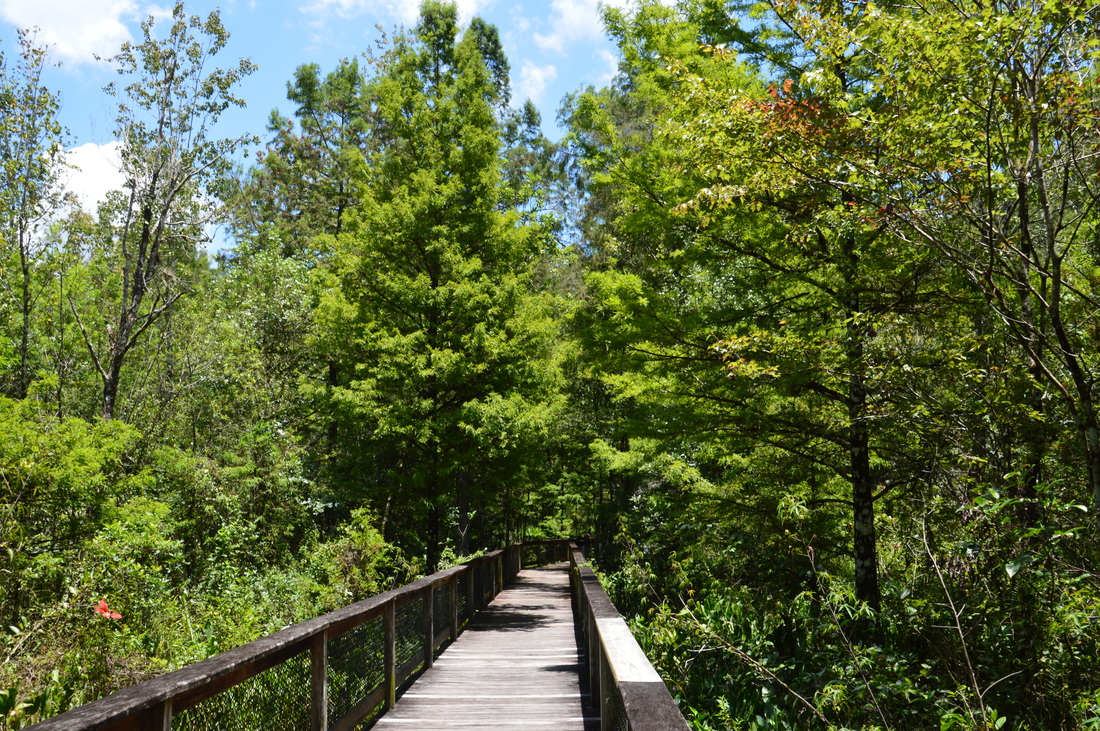
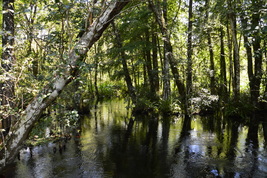
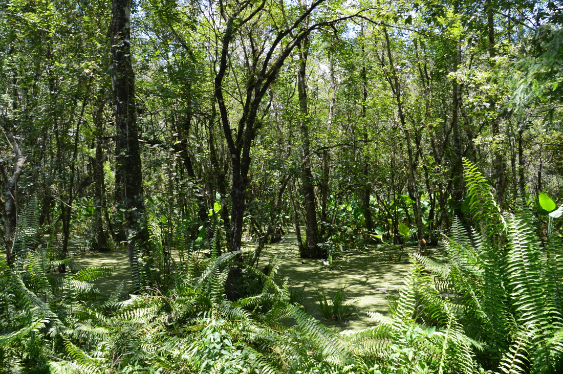
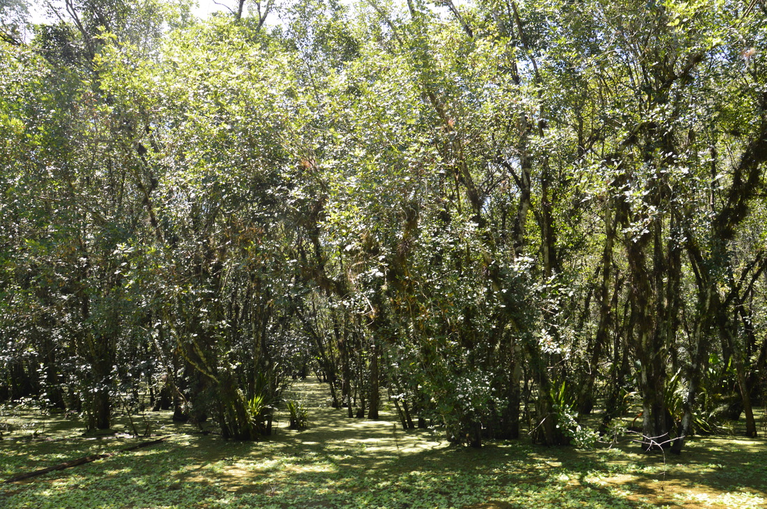
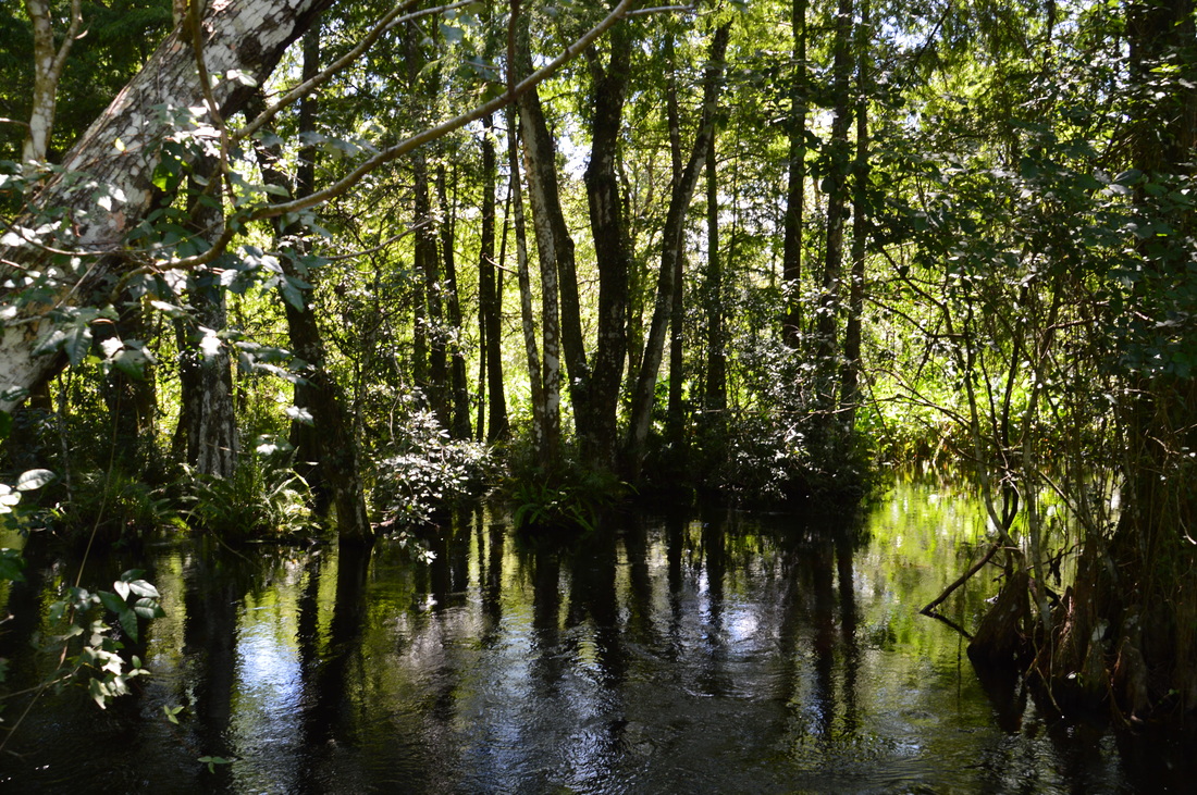
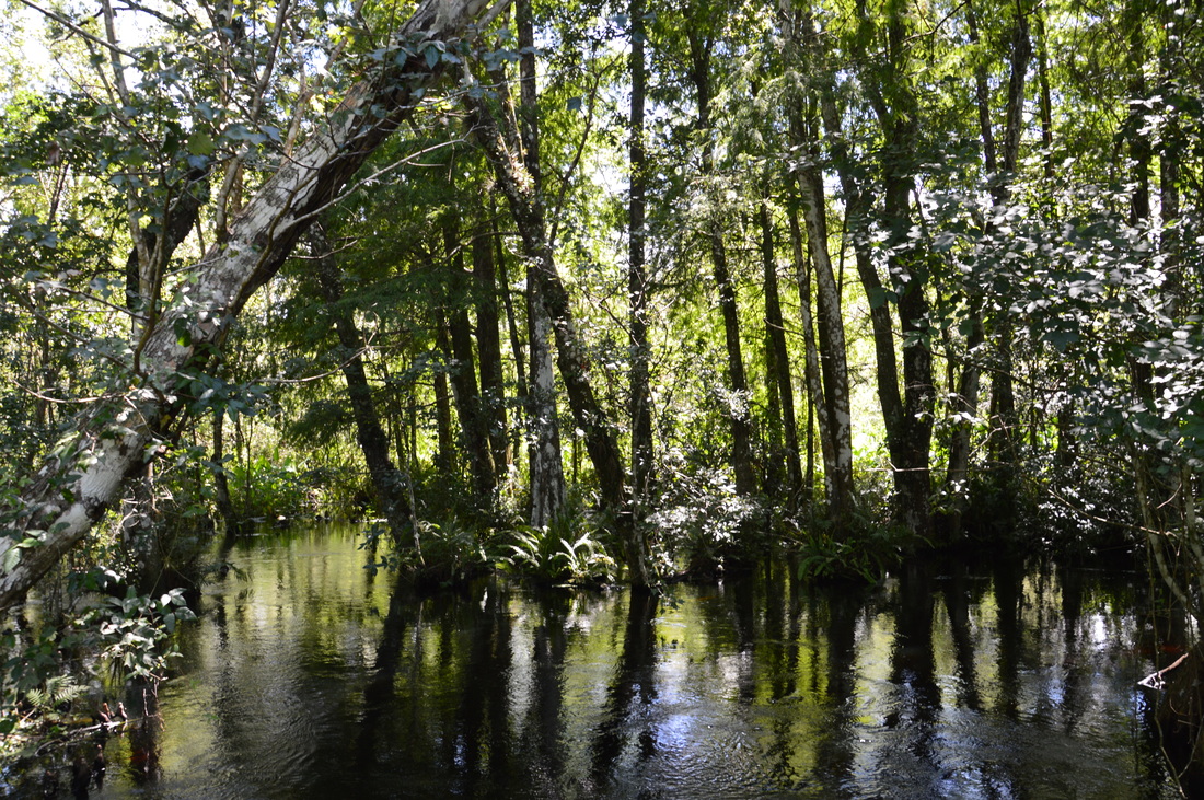
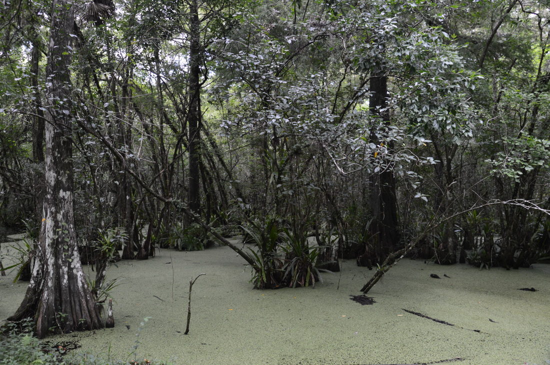
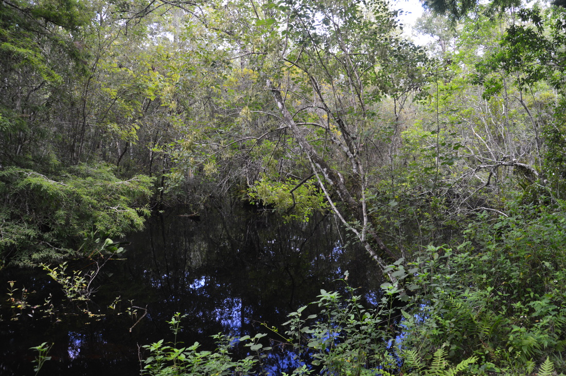
The Bird Rookery Swamp Boardwalk passes through a beautiful cypress swamp.
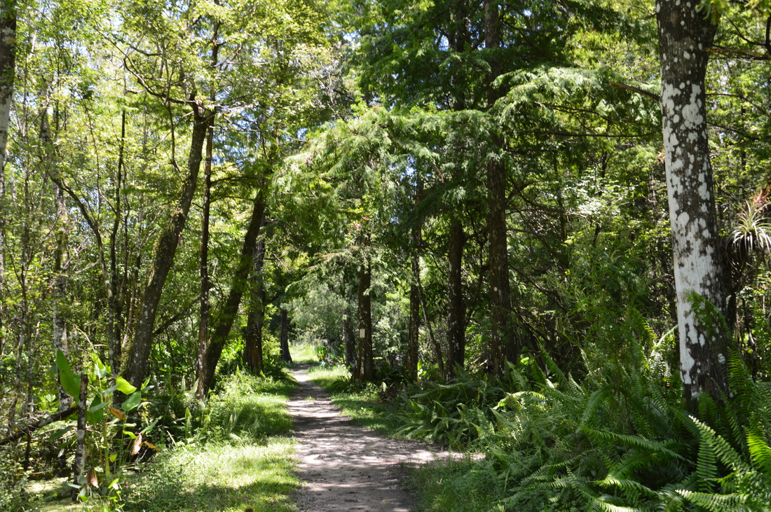
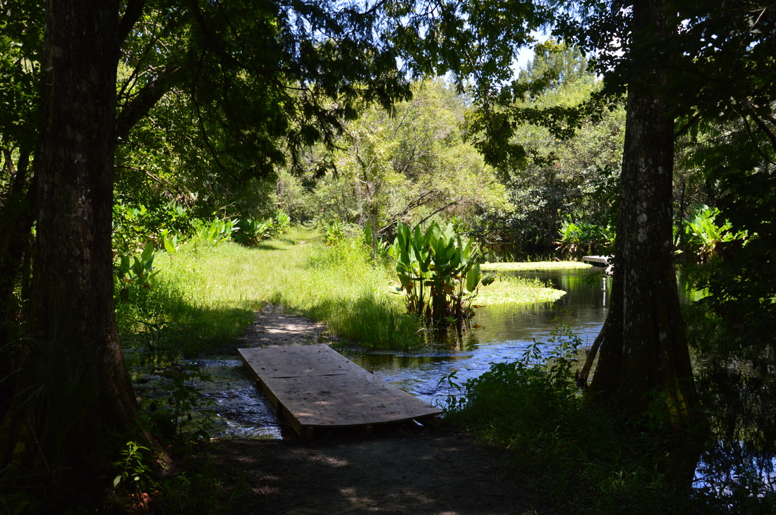
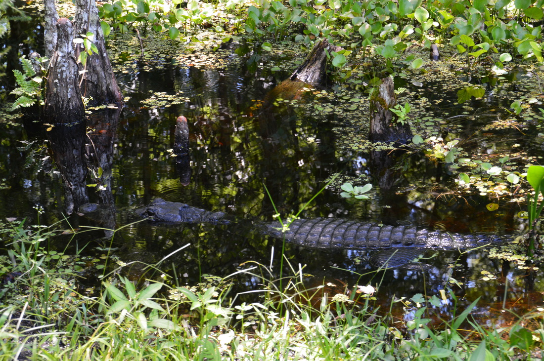
Following the end of the boardwalk, the trail jumps onto a broad levee surrounded by the swamp on both sides. The trail will follow similarly broad levees, more or less, during the hike, although there'll be sections that are slower than this one. All of the levees were logging tramways at one point, but the swamp has recovered nicely since the logging days. At 0.8 miles, the trail reaches a makeshift footbridge across a fast-slowing slough that empties into a wide, open lagoon to the right. I'm not sure if this bridge was always here, or if it's going to be replaced, but I was thankful that there was any bridge at all, allowing for a dry crossing. I was twice as thankful when I spotted my first alligator of the day, lying in the weeds at the edge of the slough just to the left of the bridge!
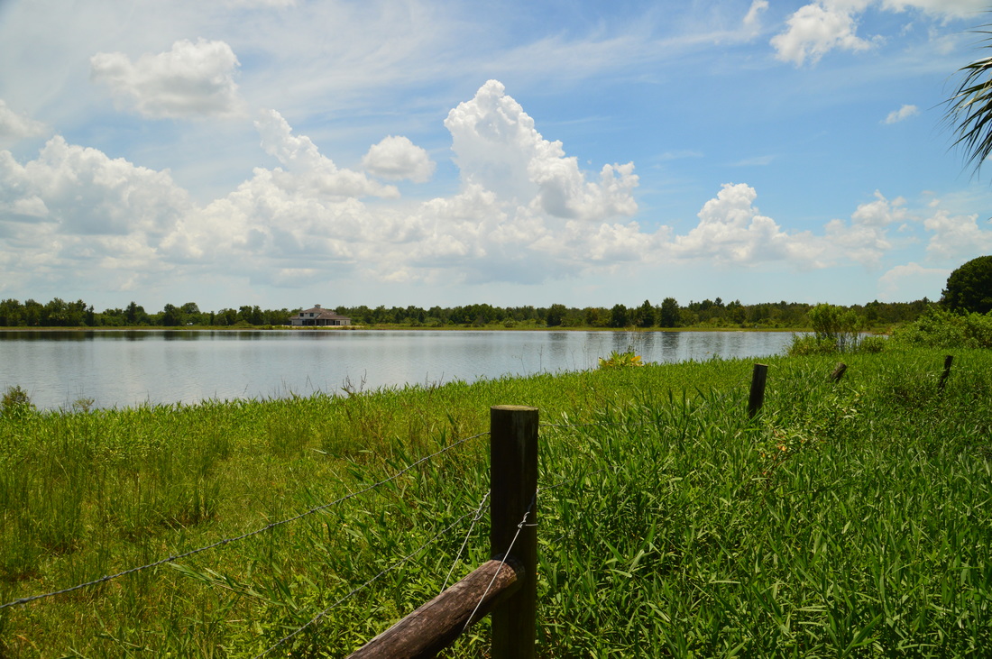
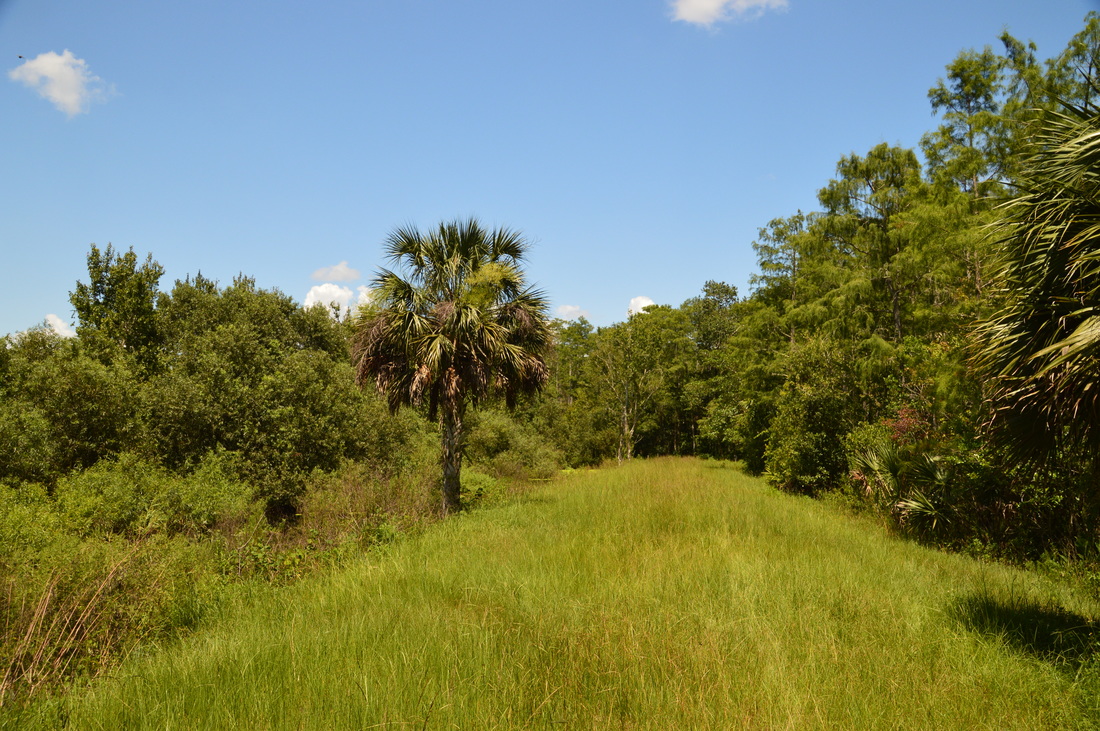
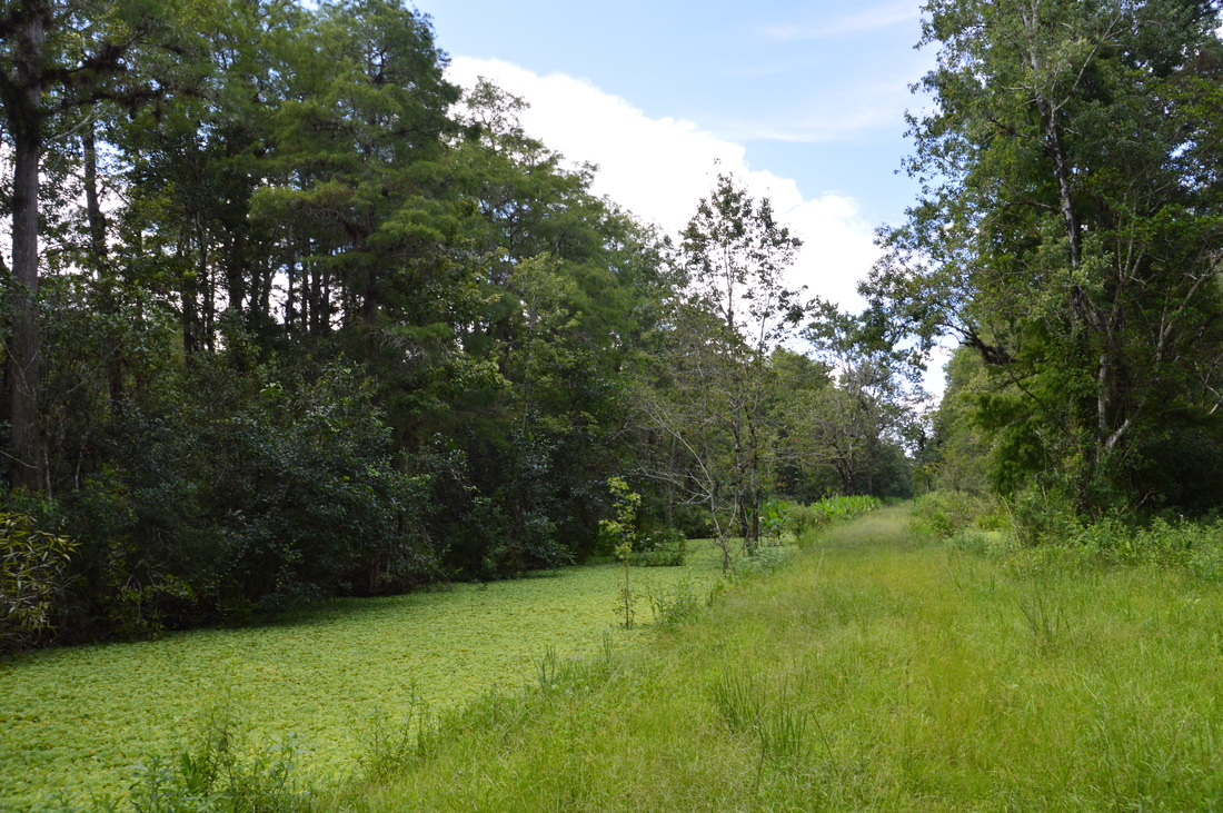
Following the bridge, there is a better view of the lagoon to the right. In the middle, there is a platform. It sort of looks like a footbridge. Perhaps this is the footbridge that used to be at the slough crossing, before it got washed downstream? Regardless, the trail continues past the opening and back into the forest. At 1.1 miles, the dike suddenly becomes very overgrown - in fact, it might have as well disappeared. Ahead, there was a large but very overgrown clearing, with slightly soggy ground underfoot. A lot of cabbage palms were dispersed throughout the long clearing, and their leaves rustled due to a slight breeze. I continued in a general straight line, and soon, I gained my first views of Saddleback Lake to the right. At 1.25 miles, the dike reappears as the trail reaches Saddleback Lake. This is where the trail makes an acute north turn. This is also Checkpoint 2, the second of six checkpoints on this hike. There is a rough trail map with mileage information and GPS coordinates shown at each one. The swamp opens up to the left as well, providing for a photo opportunity. To the right, a fence marks the private property boundary along Saddleback Lake, and houses can be seen on the opposite shore. After the turn, the levee - and the trail upon it - travel due north, and the track is as straight as an arrow line. There are a couple more openings to the right that provide fleeting glances of Saddleback Lake, before the trail leaves the lake altogether. The trail remains fairly open overhead, so it can get pretty hot during the summertime with the sun beating directly overhead. There's water on both sides of the trail much of the time, although it's not always very forested around. I saw many alligators around the trail starting from here, but all of them were in the water. Between Checkpoints 2 and 3, there are two picnic tables on the trail under the shade of the trees, providing opportunities for a brief break. At 2.15 miles, the trail arrives at Checkpoint 3. This is also an important junction and decision point. The loop section of the hike starts here, with one levee splitting off to the left while the main one continues straight. 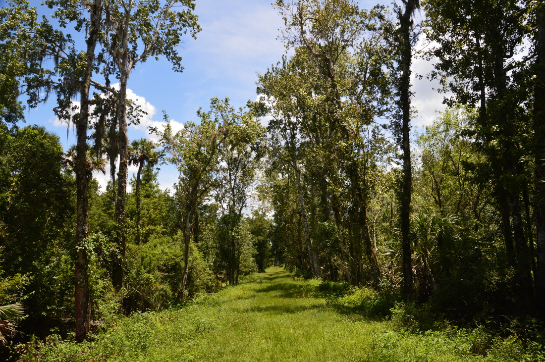
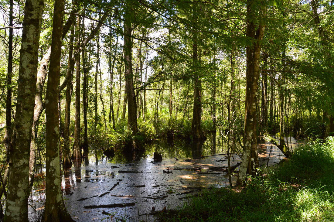
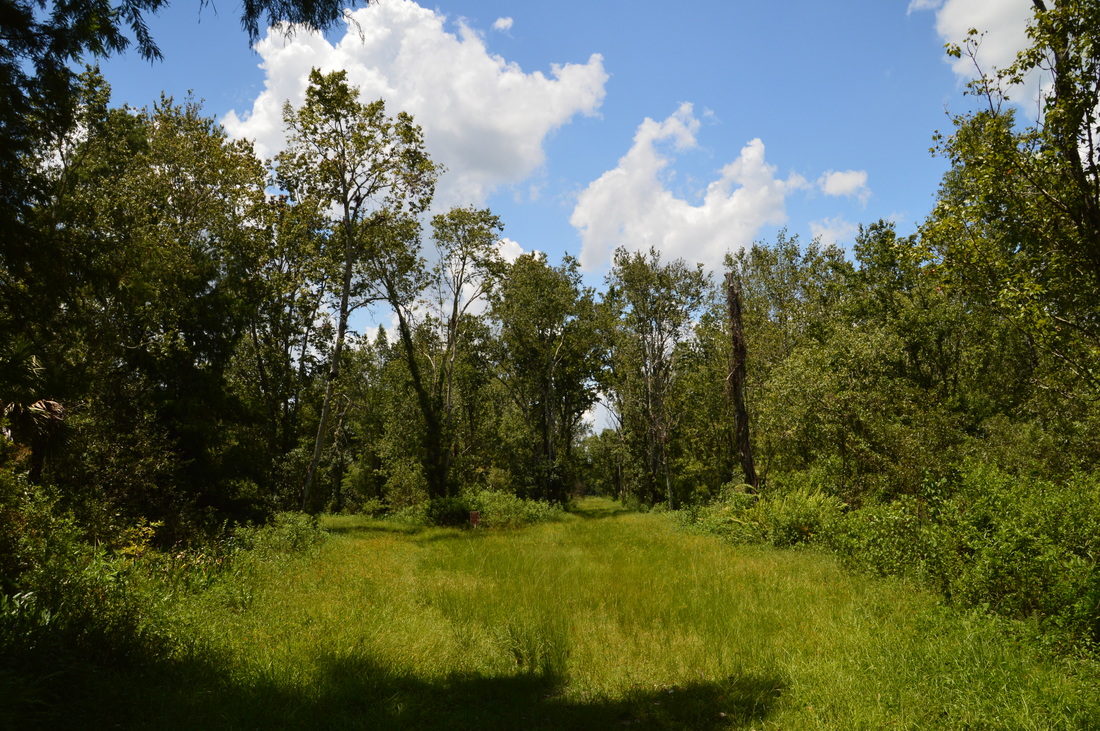
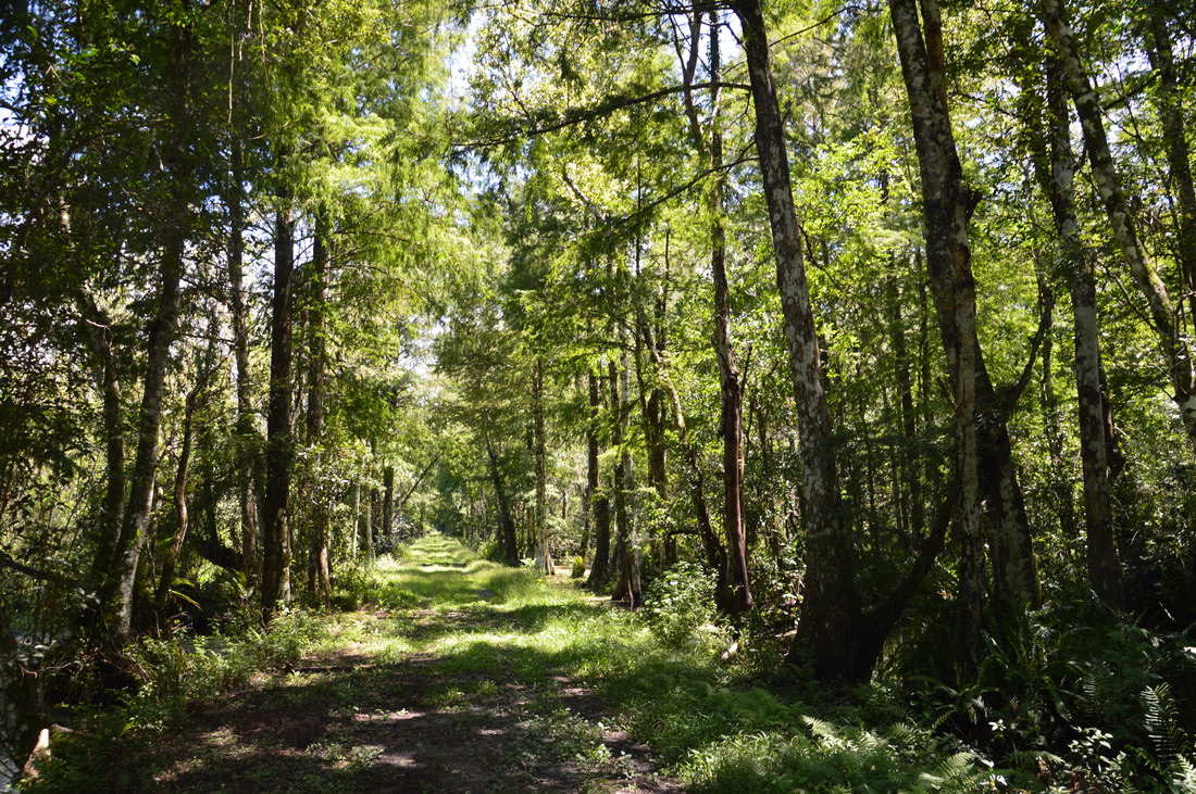
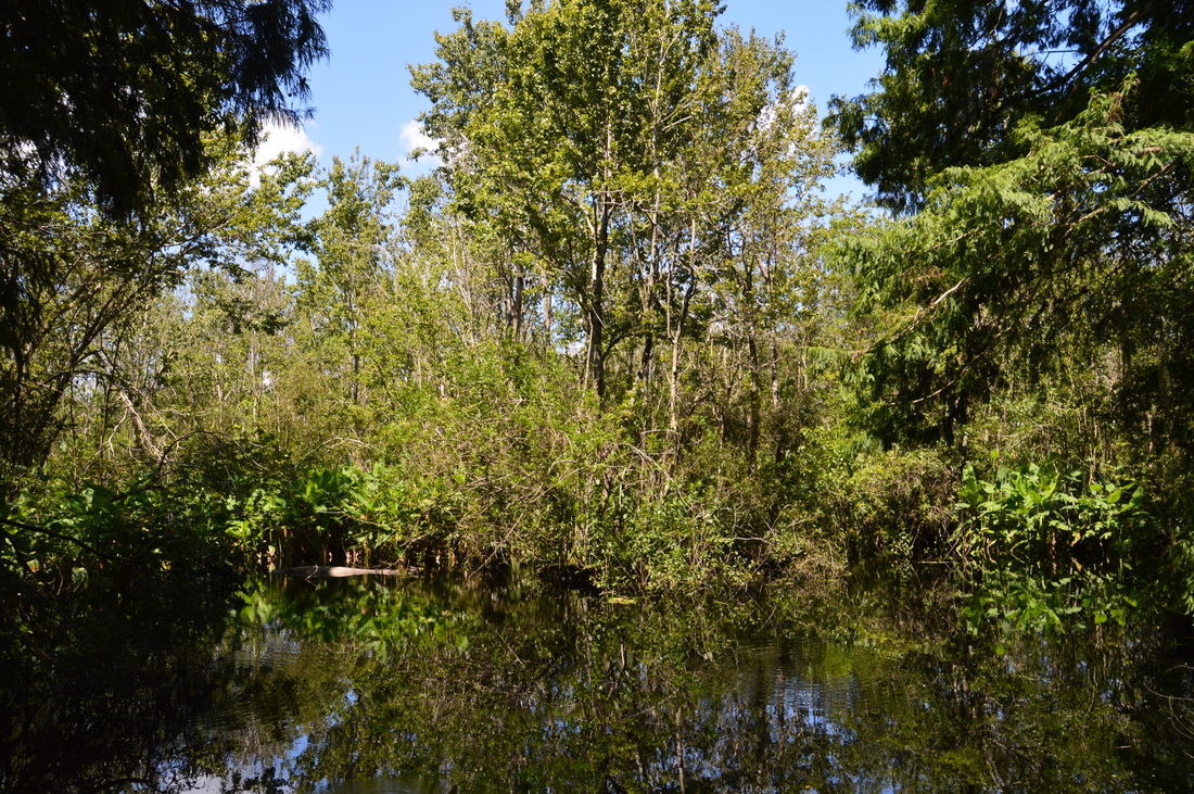
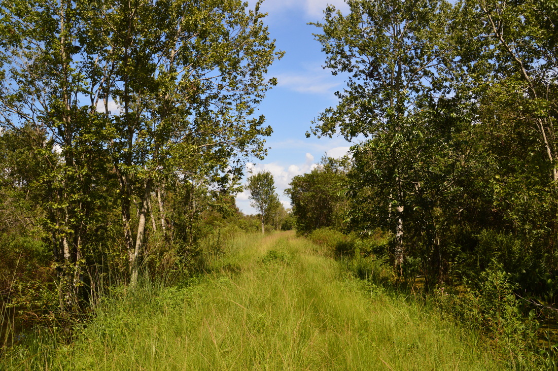
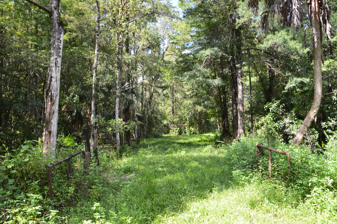
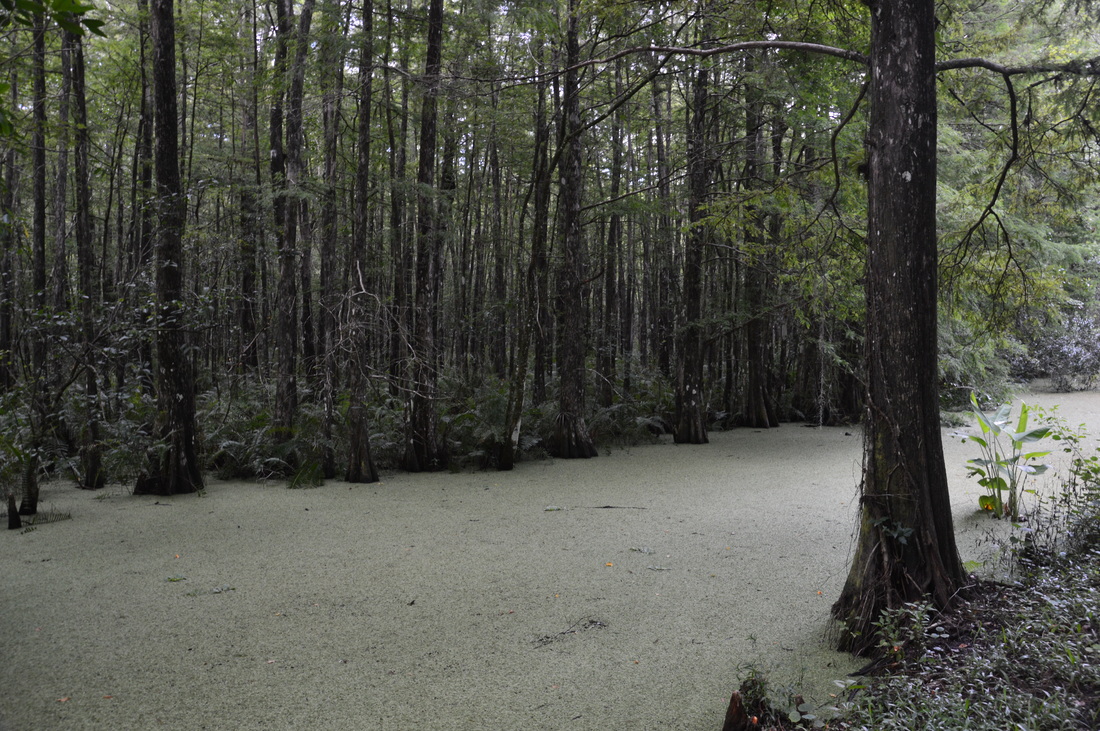
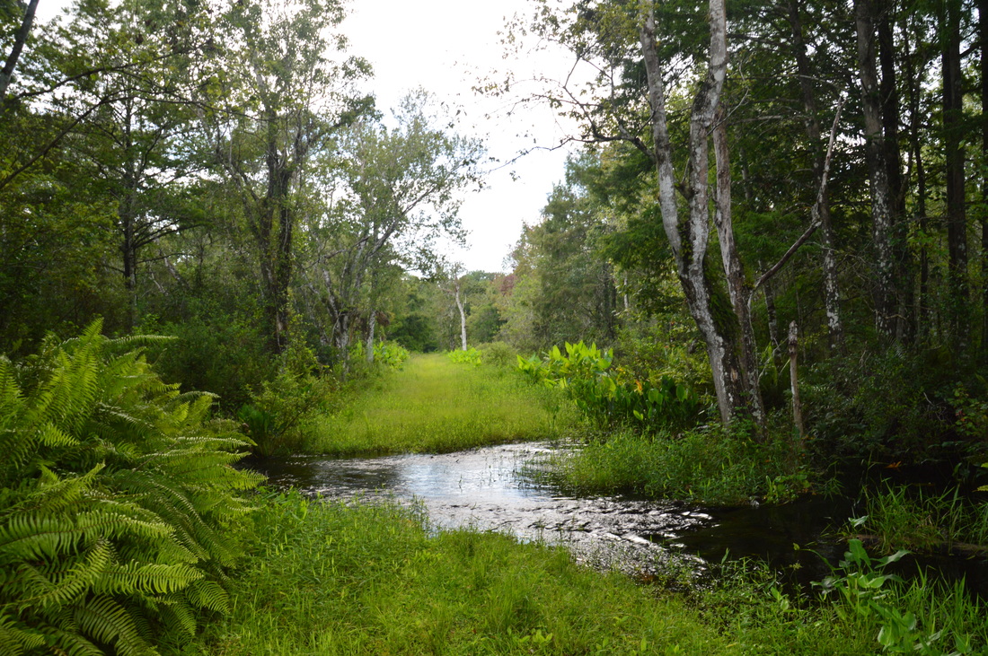
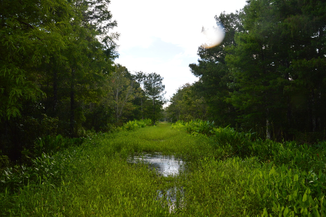
The Bird Rookery Swamp Trail follows levees that once served the purpose of being logging tramways.
If you choose to do the full loop, then the distance between this junction and the point when you will return to it is just short of 8 miles. That is a big loop, so if you feel like you're not comfortable with the distance, then this is a good place to turn around. However, I personally think that there are no challenges here, and that the hike is fairly easy (other than the tall grass and the slough fords). One suggestion of mine is that you continue straight at the junction, in order to hike the loop counter-clockwise. Do not hike the loop clockwise, because you're going to reach a series of wet slough fords nearly right away, while by hiking the loop counter-clockwise, you'll leave the wet section for the end.
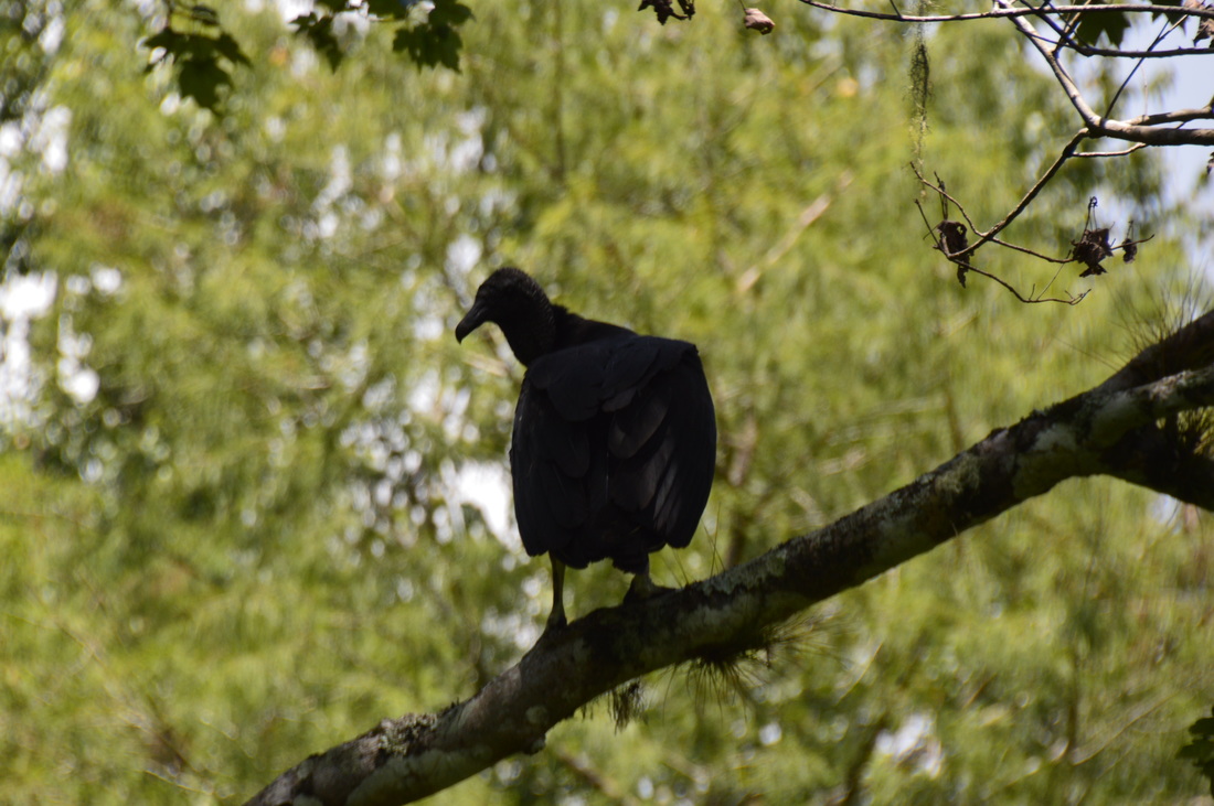
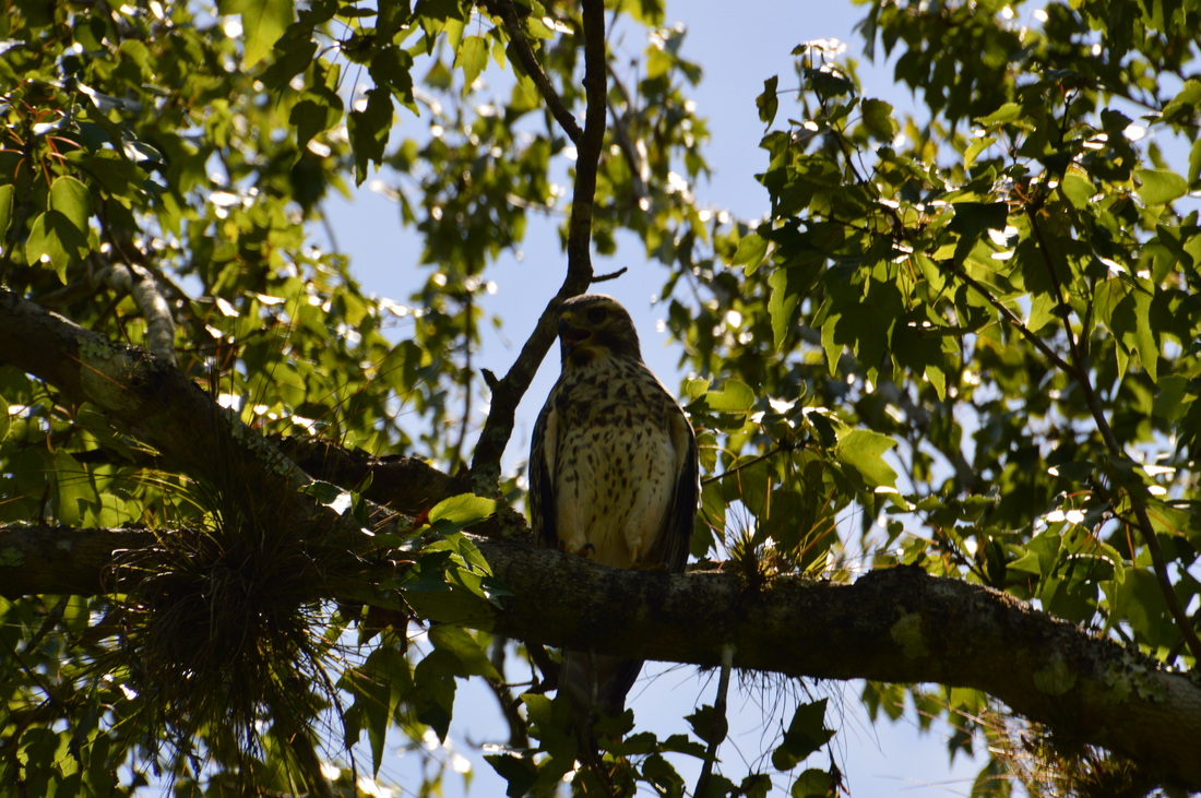
As I continued straight from the junction, I immediately encountered my first check: a small slough crossing. Luckily, some twigs were laid such that you can cross keeping your feet dry. As the trail moved northward, the swamp gradually got more remote, and most of my wildlife sightings were in this area, including many alligators, a red-shouldered hawk up close, and a pair of vultures. With time, the trail actually curved northeast, although this is hardly noticeable. At 3.95 miles, the trail arrives at Checkpoint 4. One of the old tramways ends here, and the trail makes a sharp left turn onto a broader and more elevated dike. This reinforced dike is overgrown with tall grass in many places, not allowing fast travel. This section is also more open overhead. Slowly hike along this dike now due west. The elevated dike soon ends as the trail returns to an older dike and turns northwest at 4.15 miles. The remains of a pipe lie to the right at the turn. The swamp continues on both sides. At 4.45 miles, the Bird Rookery Swamp Trail crosses a wide, sturdy wooden bridge across a scenic blackwater slough. The bridge seems to have been designed for vehicles to drive across. 
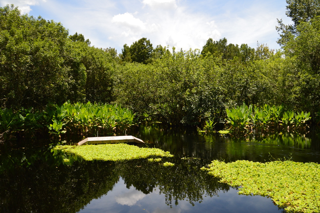
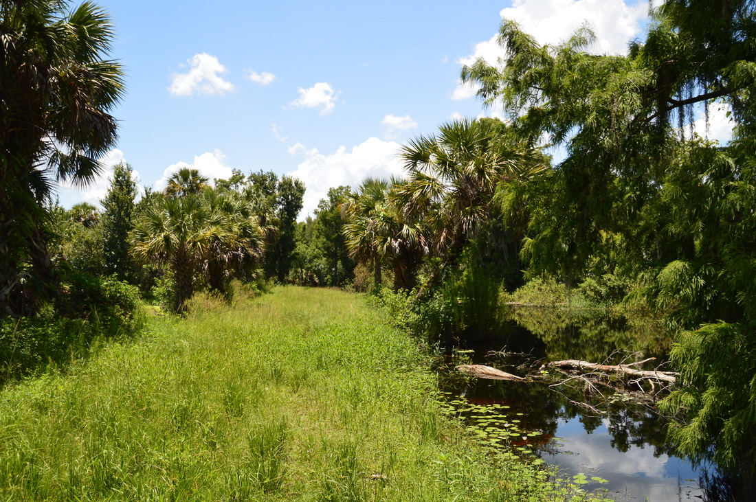
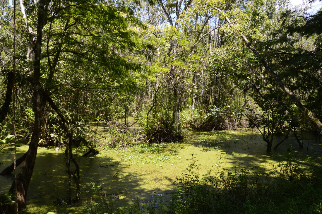
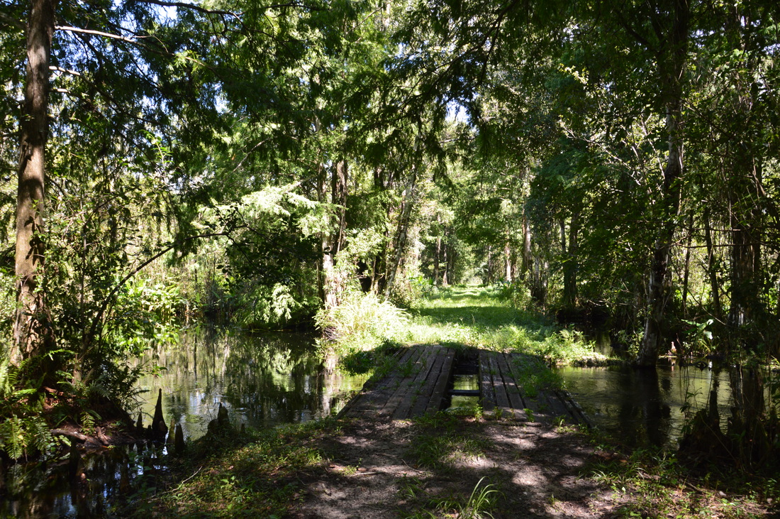
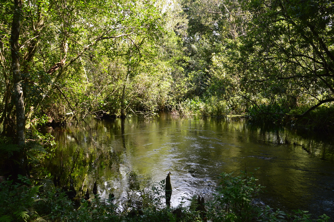
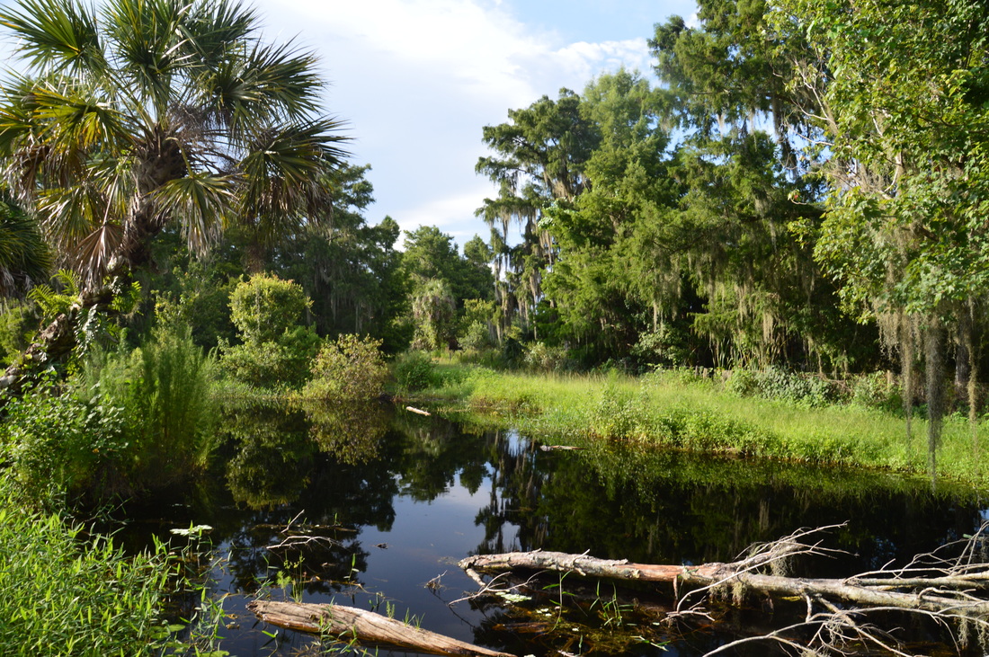
The Bird Rookery Swamp Trail crosses a photogenic blackwater slough via a double-track wooden bridge on the fifth mile.
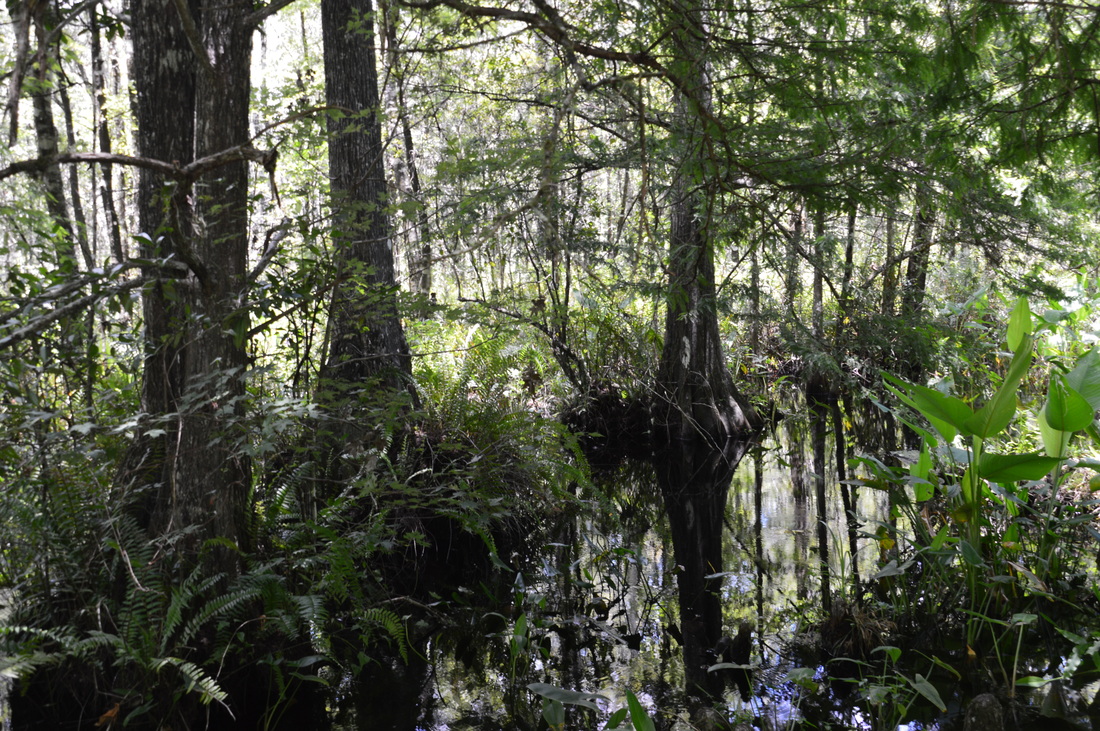
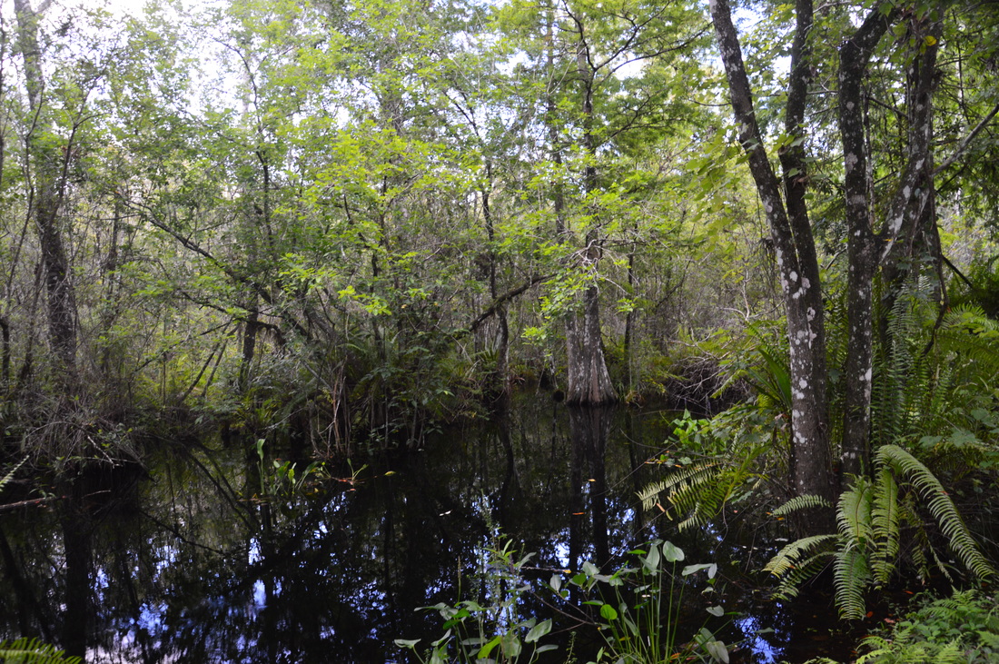
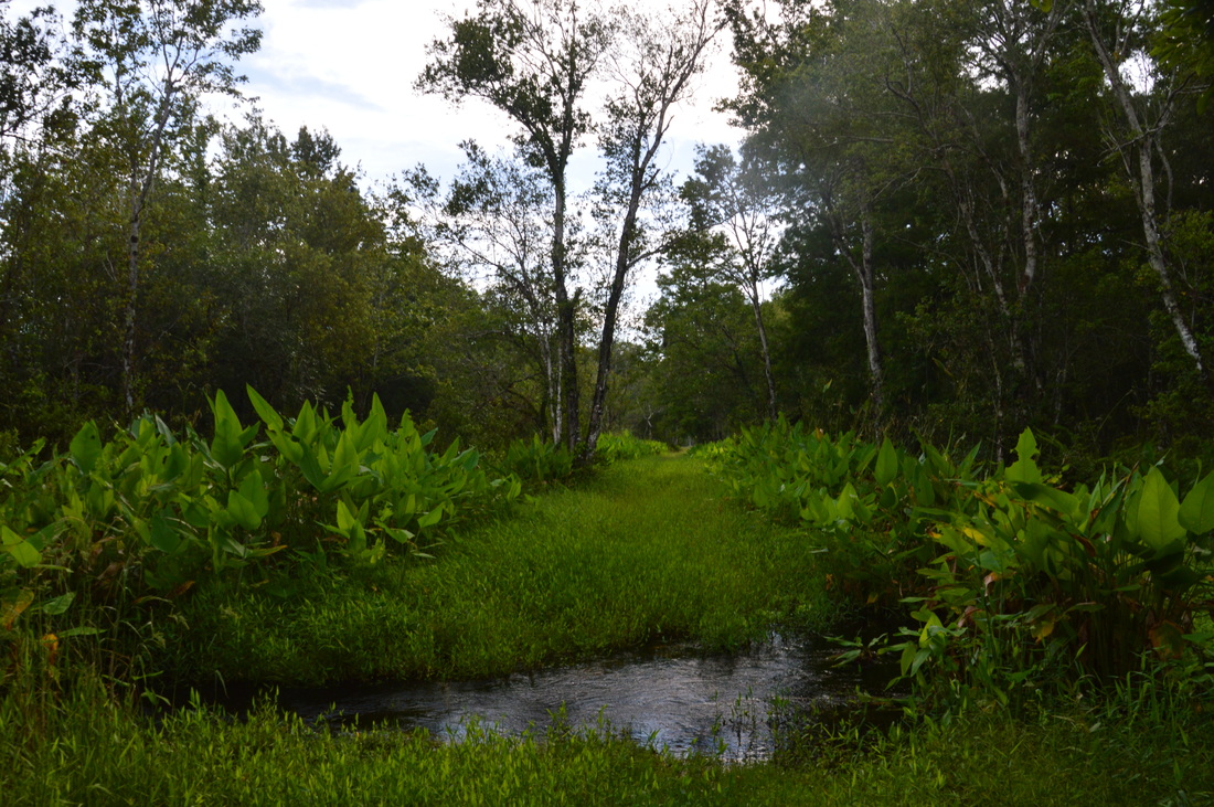
From the bridge, there are great views of this photogenic slough and the swamp waters around it. This is personally my favorite spot on the hike. The black water slowly flows south, disappearing from view behind a bend, while a canal continues to the right as a part of the swamp. To the north of the bridge, the swamp continues both to the left and to the right, and the dense undergrowth just ahead reflects in the slough at the bridge. The location is also shaded, so I chose this spot for my lunch break before continuing on.
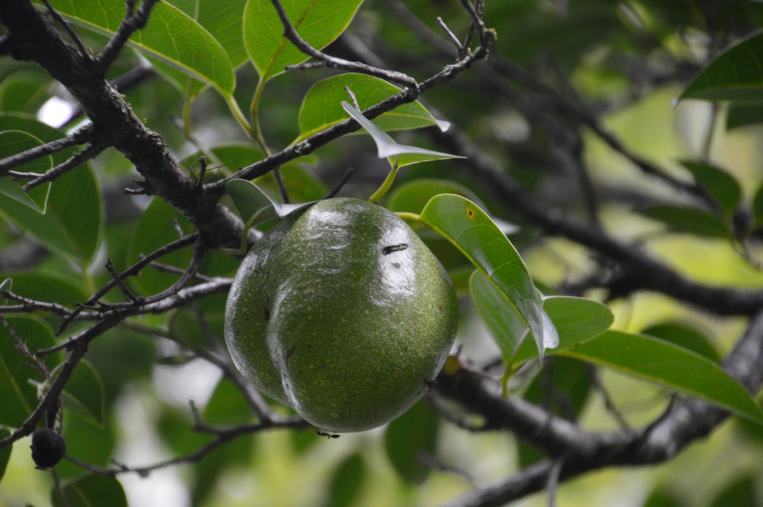
Beyond the slough, the trail continued northwest in a rather monotonous fashion amidst the swamp. With time, the trail gradually curves west. This area had a lot of baby alligators - I saw around a half dozen of them in under a quarter mile. There was no sign of the mother alligator though. The dike eventually becomes grassier again, causing slower hiking. At 6.0 miles, reach Checkpoint 5. There is an old iron gate here, and the trail gradually bends southwest and then south, in the direction of the trailhead. Nonetheless, the route to the trailhead isn't going to be so straight, because later on, you'll have to hike east to return to the beginning of the loop. Between Checkpoint 5 and 6, the trail is mainly southbound. Most of the time, there is a wide marshy canal to the left of the dike, and often, the trail is surrounded by swamp. There are some pond apple trees along the trail here. These were a first for me, and it took me a while to figure out what these trees were. Otherwise uneventfully, the trail reaches Checkpoint 6 at a gradual east turn at 8.0 miles. 
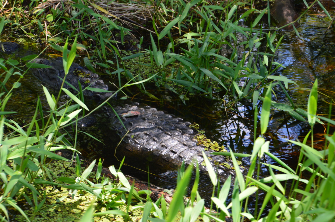
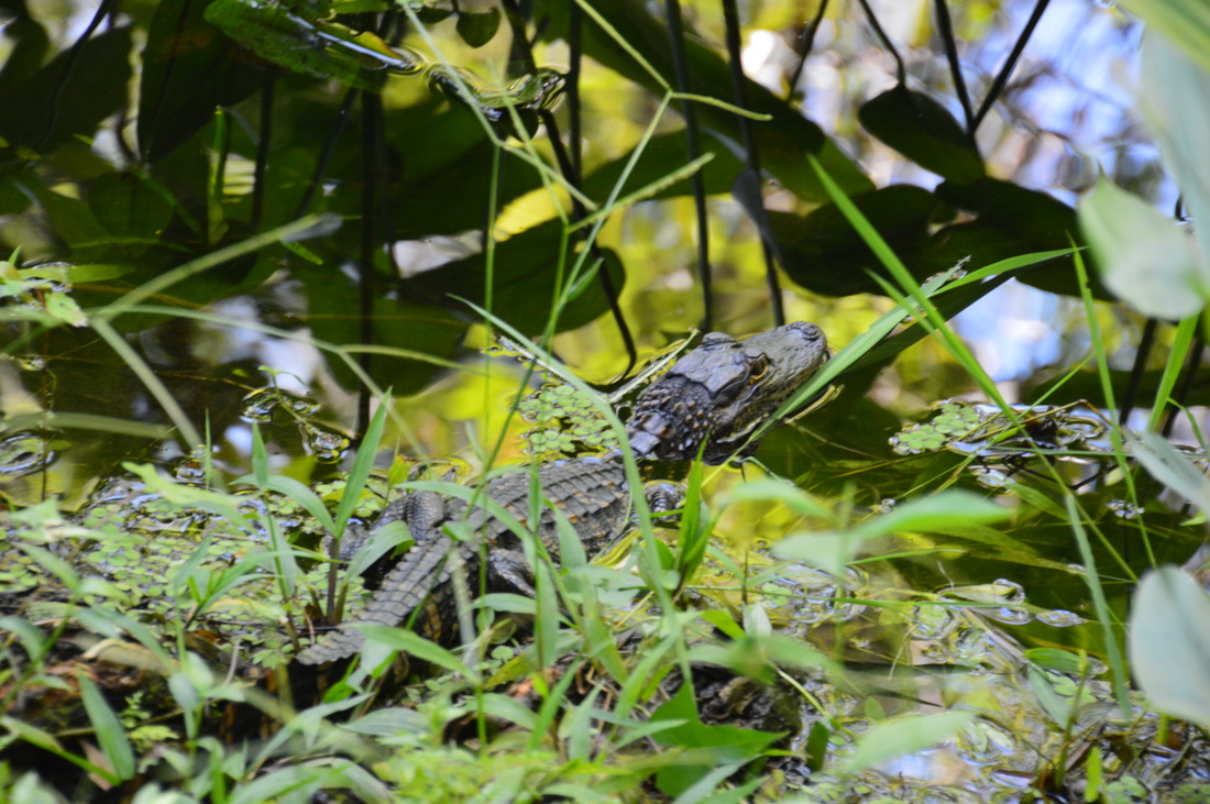
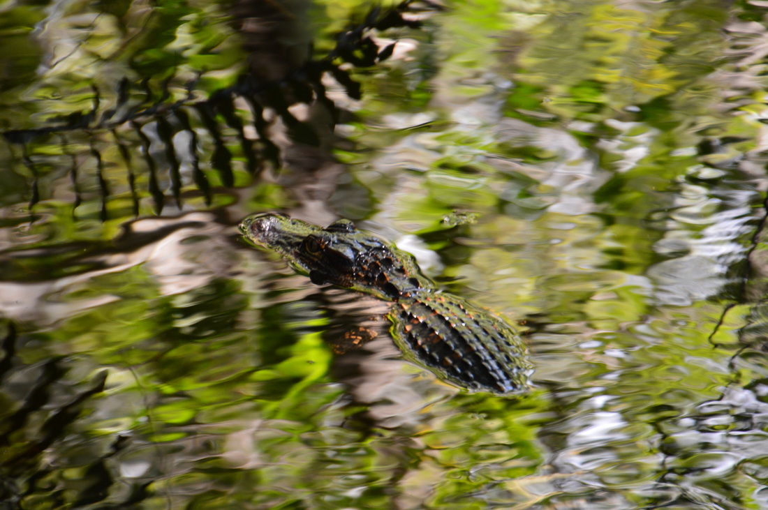
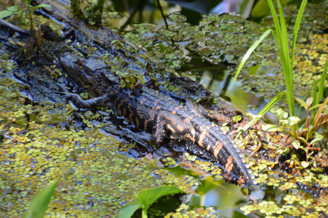
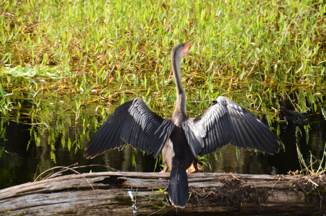
Alligators are frequently seen on the Bird Rookery Swamp Trail.
The trail turns east after Checkpoint 6. This is where the swamp was felt the best, I think, because most of the time you could see not just canals along the dike, but an overgrown watery expanse both to the south and north. During the ninth mile, the trail frequently crossed culverts that facilitated water flow from the part of the swamp north of the dike to the part of the swamp south of the dike. Just after the trail reached the end of the ninth mile and began the tenth mile, however, there came major changes to the character of the dike that the trail followed. I was very surprised with this outcome, as it did not resemble the rest of the hike.
Between mileage point 9.0 and 10.0, the trail fords seven sloughs that flow across the low dike. Most of these fords are easy, but a couple are nearly knee deep and some have a fairly fast current. The deepest ford, a double slough crossing, is also the first one, at 9.0 miles. However, after this, the slough fords come in quick succession, and the dike is generally lower and much more overgrown, with several damp areas underfoot. Having not known about this wetness, I was glad that it happened to be at the end of the hike and not near the beginning. This mile seemed to me to be by far the longest on the entire hike. Thankfully, at 9.8 miles, the trail began curving southeast, and at 10.0 miles, the loop section of the trail ended at Checkpoint 3. From Checkpoint 3, the rest of the hike is easy. Simply follow the Bird Rookery Swamp Trail back south to Checkpoint 2 and then west to the boardwalk and ultimately to the trailhead. Reach the trailhead and your car at 12.2 miles, concluding this remote and scenic hike. Due to the excellent views of Bird Rookery Swamp throughout the entire hike (without much effort needed) and the abundance of wildlife, especially alligators, I rate this hike a "Best Hike"! Mileage
0.0 - Bird Rookery Swamp Trailhead
0.25 - Beginning of boardwalk 0.5 - End of boardwalk 1.25 - Checkpoint 2; Saddleback Lake 2.15 - Checkpoint 3; start of loop 3.95 - Checkpoint 4 4.45 - Scenic blackwater slough 6.0 - Checkpoint 5 8.0 - Checkpoint 6 10.0 - Checkpoint 3; end of loop 12.2 - Bird Rookery Swamp Trailhead Variations
Bonus Stops
PicturesVideos
1 Comment
2/9/2024 06:59:22 am
This captivating narrative beautifully captures the serene and mysterious allure of the swamp and slough encountered on the hike. The vivid description of the black water slowly flowing, the dense undergrowth reflecting in the water, and the presence of baby alligators adds a sense of adventure and tranquility to the experience. The choice to pause for lunch at such a scenic spot not only highlights the beauty and peace found in nature's embrace but also invites readers to imagine themselves in this idyllic setting, reflecting and reconnecting with the natural world. The journey through the swamp, with its changing landscapes and the anticipation of wildlife encounters, exemplifies the wonders of outdoor exploration and the rewards of venturing into less traveled paths. This recount not only serves as an enticing invitation to fellow hikers but also underscores the importance of preserving these natural habitats for future generations to enjoy. Leave a Reply. |
About MeMark Oleg Ozboyd Dear readers: I have invested a tremendous amount of time and effort in this website and the Georgia Waterfalls Database the past five years. All of the work that has gone in keeping these websites updated with my latest trip reports has almost been like a full-time job. This has not allowed me to pick up a paid job to save up money for college, and therefore, I I've had to take out loans. If you find the information on this website interesting, helpful, or time-saving, you can say "thanks" and help me out by clicking the button above and making a contribution. I will be very grateful for any amount of support you give, as all of it will apply toward my college tuition. Thank you!

Coming in 2022-2023?
Other Hiking WebsitesMiles HikedYear 1: 540.0 Miles
Year 2: 552.3 Miles Year 3: 518.4 Miles Year 4: 482.4 Miles Year 5: 259.9 Miles Archives
March 2021
Categories
All
|


 RSS Feed