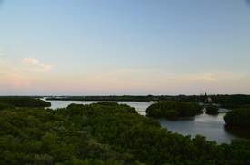
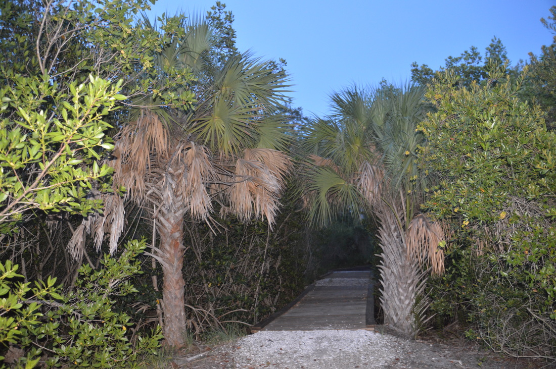
Once a state park, now a county park, Weedon Island Preserve is one of the greatest outdoor recreation destinations in the Tampa/St. Petersburg/Clearwater urban area. The park, which protects more than 3000 acres of a peninsula stretching out into Tampa Bay between Tampa and St. Petersburg, is home to an extensive trail system that leads over two boardwalks and past many views of lakes and mangrove channels. On the south end of the trail system, you'll find an observation tower with a grand view, where you can see the St. Petersburg skyline and the Tampa skyline at the same time. After the hike, you will have a chance to check out the Weedon Island Preserve Cultural and Natural History Center. This hike occurred on Wednesday, July 6th, 2016. My plan was to hike the entire extent of the main trail system at Weedon Island Preserve, as follows. I would first hike the north side of the Boy Scout Loop Trail, before hiking out and back along the Lookout Point Trail. Then, I would hike the Bay Boardwalk, before following the paved Upland Trail to the Tower Boardwalk and its observation tower. Lastly, I would return via the Upland Trail again and then along the south side of the Boy Scout Loop.
Summary
R/T Length of Trail: 4.5 Miles
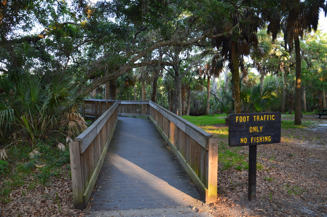
Duration of Hike: 2:00 Type of Hike: Triple Loop with Spur Difficulty Rating: 1 out of 10 Total Elevation Gain: Minimal Pros: Ample views of the Tampa Bay vicinity throughout the hike Cons: Poor views from Lookout Point; no good view of Boy Scout Lake; Upland Trail is paved Points of Interest: Lookout Point; Bay and lake observation areas on Bay Boardwalk; Lake observation area on Tower Boardwalk; Observation tower on Tower Boardwalk Trail Blaze Color(s): None Best Season(s) to Hike: Year-round Fees: None Beginning Point: Boy Scout Loop Trailhead on Weedon Island Directions from St. Petersburg, FL: From the intersection of 4th Street (US Route 92) and 5th Avenue (Alternate US Route 19 East) in downtown St. Petersburg, follow 4th Street/US Route 92 North for 5 miles. Then, turn right onto 83rd Avenue, which turns into San Martin Boulevard. Follow it for 1.3 miles, and then, turn right onto Ridgeway Drive. Enter Weedon Island Preserve and continue on Ridgeway Drive until the Boy Scout Loop Trailhead, passing the Progress Energy Bartow Plant to the left. Along the way, Ridgeway Drive turns into Weedon Drive. The trailhead parking area is to the left 1.1 miles from San Martin Boulevard. Do not continue all the way to the end of Weedon Drive, unless you want to do the hike in a different configuration. Map
Click here for more information and to download this trail map to view in Garmin Basecamp.
Details
Prior to my summer 2016 trip to Florida, I had bought several Florida hiking guidebooks, including "Best Easy Day Hikes Tampa Bay" by Johnny Molloy. This was where I had first learned about Weedon Island Preserve. I was surprised that I had never heard of this more than 3000-acre conservation area in the middle of a vast urban metro area. My interest was piqued by the multiple observation points on this multi-loop hike, so I decided to give it a try, and I wasn't disappointed, for on this hike, there are two lakes, two views of Tampa Bay, and an observation tower with grand views of the entire vicinity.
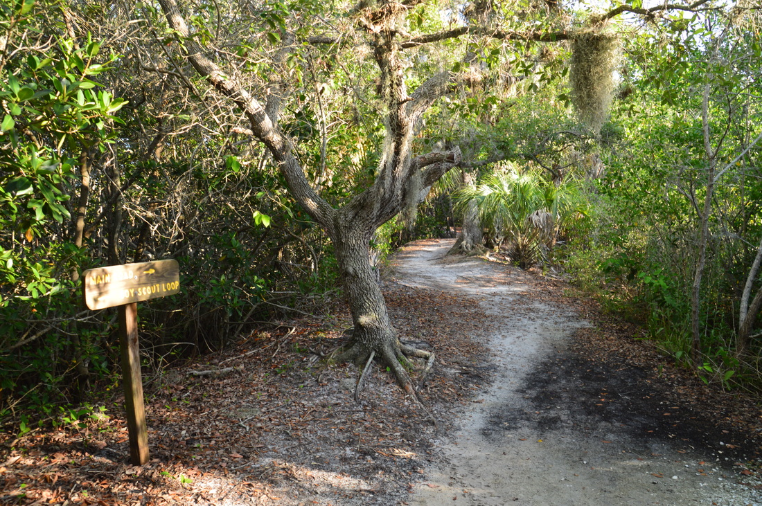
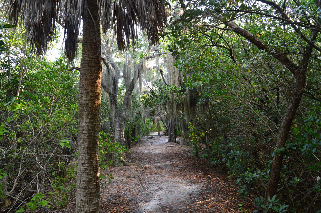
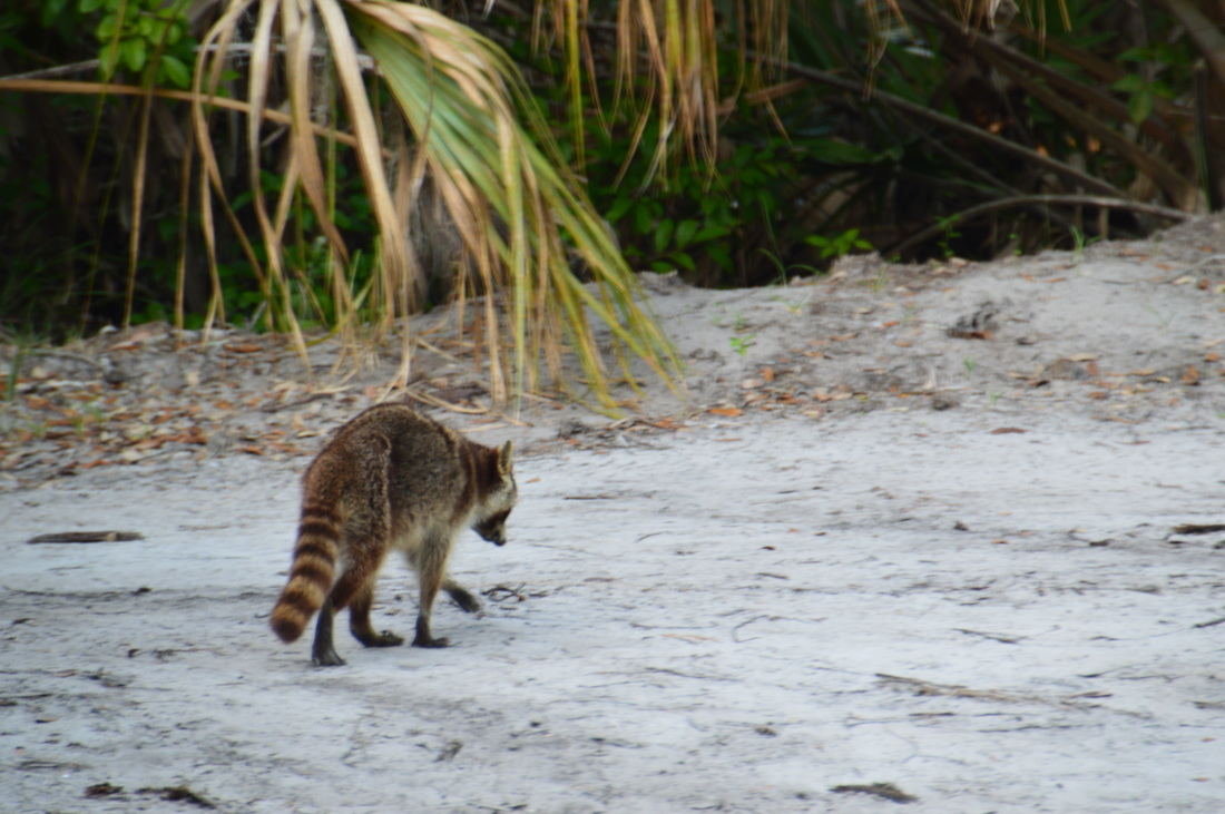
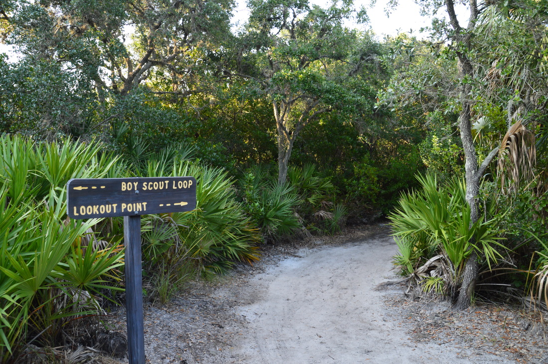
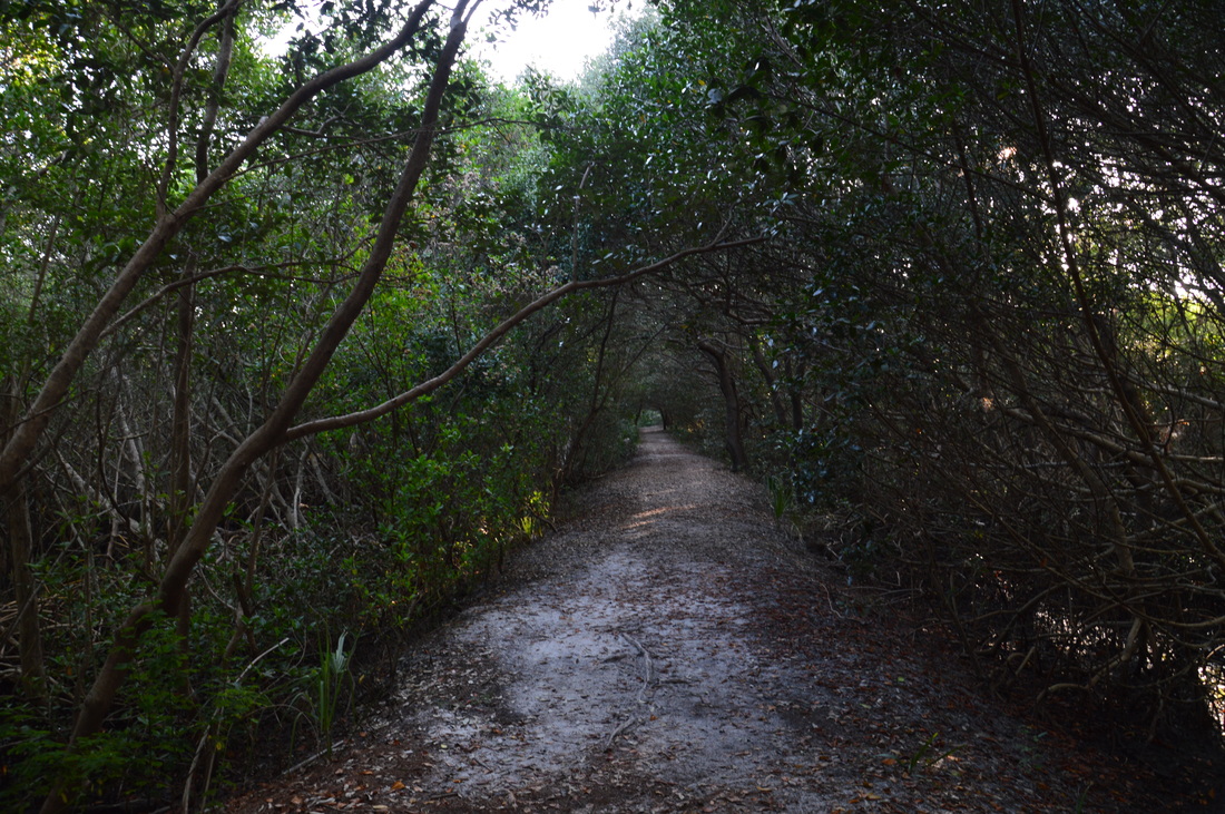
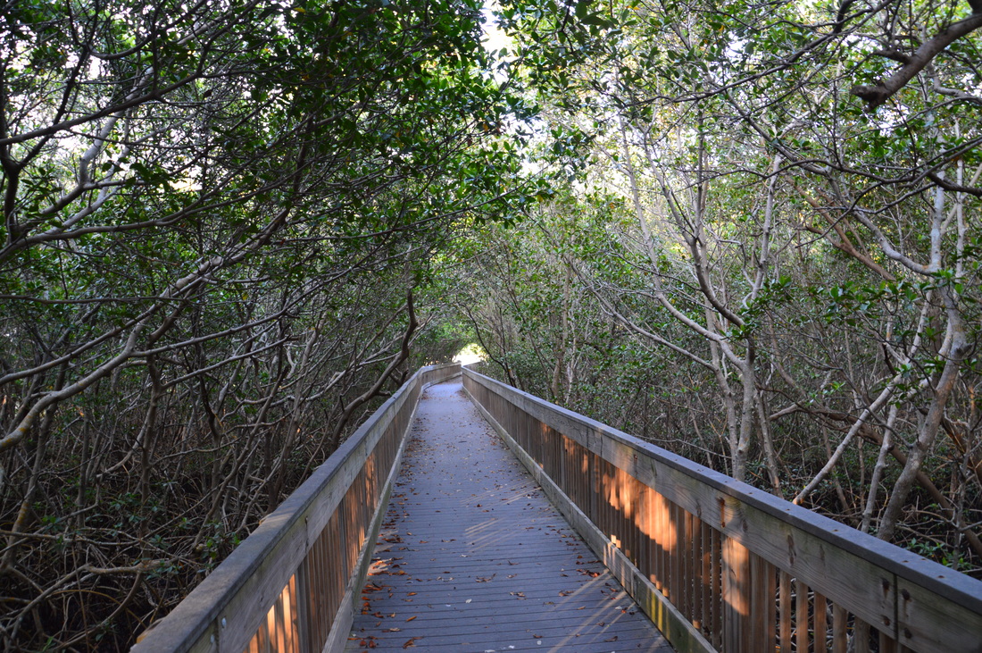
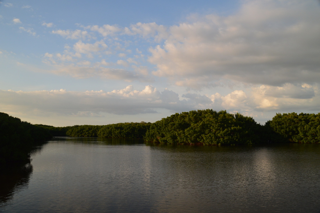
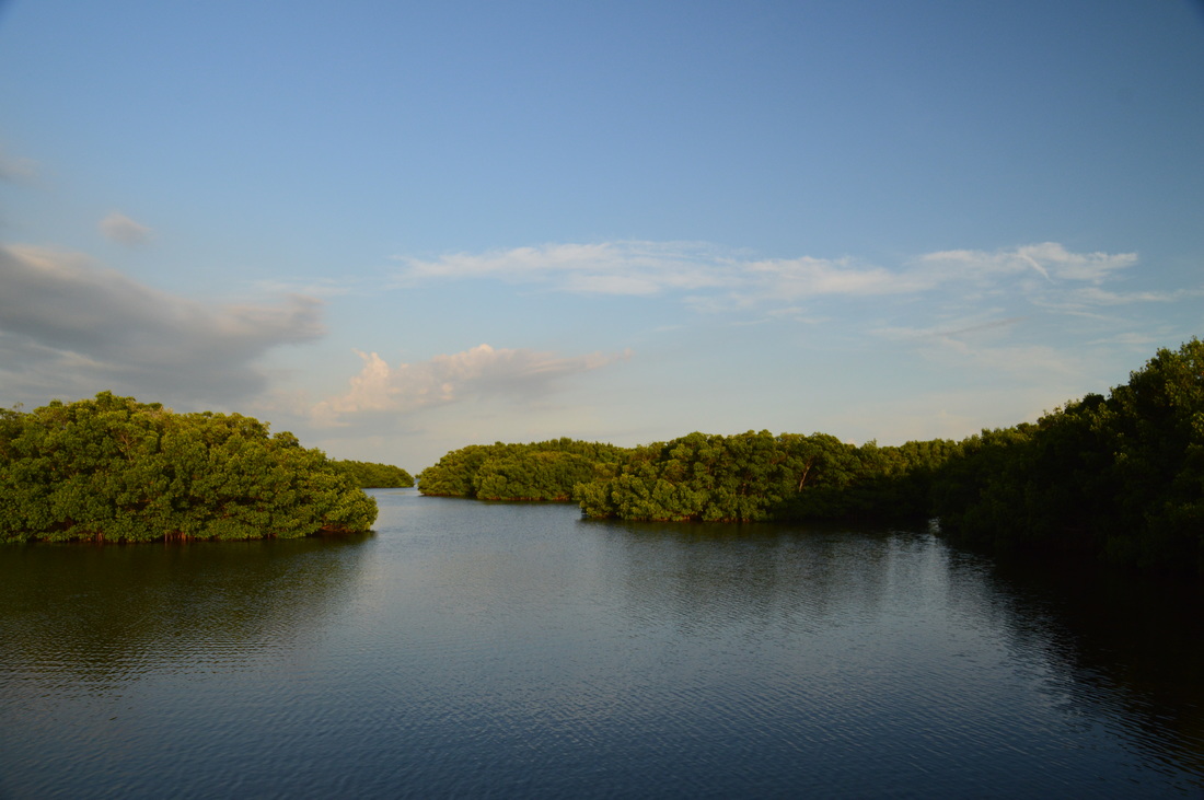
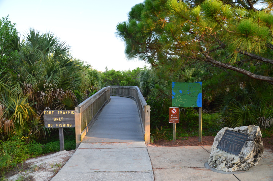
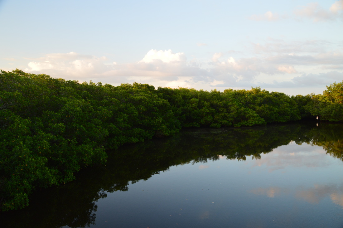
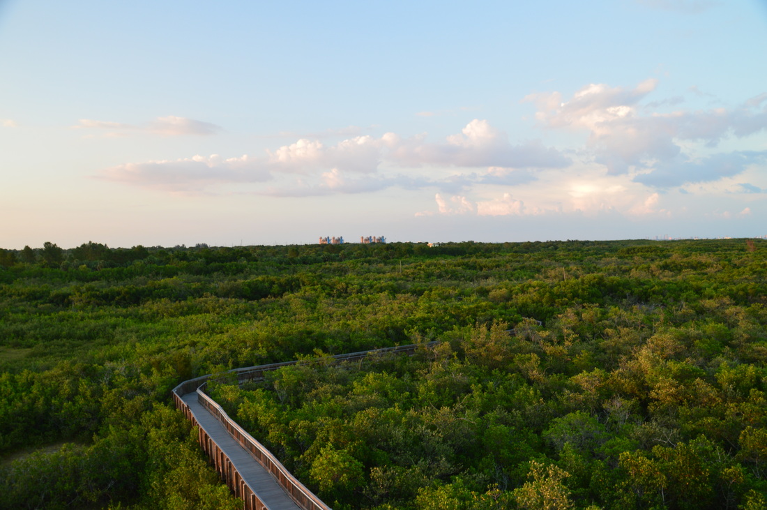
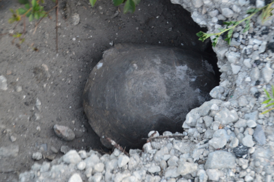
The hike begins on the Boy Scout Loop, one of the two dirt trails in the main trail system. It is actually a well-built trail, with many boardwalks and bridges across the swampy stretches. And yes, every bridge has its own name. A pair of signs at the parking area designate the trailhead. Start out on the wide sandy path. Immediately, there is a split. To the right, a shortcut leads straight to Boy Scout Lake. Maybe there is a good view of the lake there? I did not hike the shortcut, and I was sure that there would be a good view of the lake later on, so the idea did not occur to me. Regardless, bear left on the main trail, which leads into an area of uplands. After crossing the Long Bridge across a mangrove channel, arrive at the other end of the shortcut at 0.15 miles. Here, a sign marks the continuation of the loop. Turn left and continue following the main trail, with Boy Scout Lake to the right behind a screen of mangroves. The trail follows an elevated pathway flanked by cabbage palms and live oaks, with mangroves on both sides. The trail will cross three bridges in this section: the Palm Bridge, the Lighter Knot Bridge, and the Cactus Bridge. The best view of Boy Scout Lake is at about 0.35 miles, although there still is no good opening. Shortly thereafter, the trail crosses the Oak Bridge and at 0.4 miles arrives at a junction with a spur trail to Picnic Area #4. This 0.1-mile spur trail heads off to the left, but I had no interest in it, so I turned right onto the sandy trail, heading into the uplands away from the lake. Just after the 5 Feet Over Bridge, there is a junction with the south side of the Boy Scout Loop at 0.55 miles. The palmetto-lined loop trail continues to the right. You'll hike the south side of the Boy Scout Loop on your way back, but for now, continue straight on a connector to the Lookout Point Trail. At 0.65 miles, the connector ends at the signed junction with the Lookout Point Trail. Here, turn left to do the out and back hike to Lookout Point. As I turned onto the trail, I saw an old-looking raccoon trotting off slowly into the undergrowth. I got a good picture of him, and on the way back, he was still there! Rounding the corner, I also a yellow-crowned night heron standing nearly perfectly still on the side of the trail,not paying attention to me. I snapped its portrait and continued on my way to Lookout Point. The side trail to Lookout Point follows a berm that keeps the trail dry above the mangrove swamp on both sides. This maze of mangroves is literally huge! It might be one of the biggest mangrove swamps I've seen. 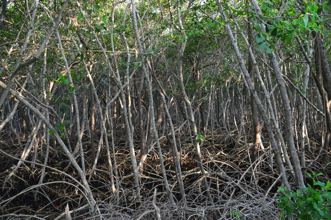
The huge mangrove maze along the Lookout Point Trail.
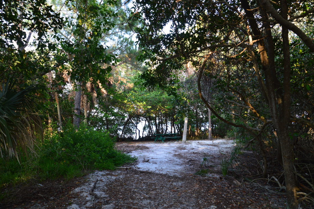
At 1 mile, the Lookout Point Trail ends at Lookout Point. Lookout Point is at the end of a small peninsula that extends out into Tampa Bay. However, the view from here was rather disappointing, for due to the mangroves everywhere, you couldn't see much without getting muddy. Still, you can make out the small bayou to the left and the main bay that lies ahead past the mangrove guardrail. Picnic Area #3 is also on Lookout Point, providing for a place to take a brief break before continuing the hike.
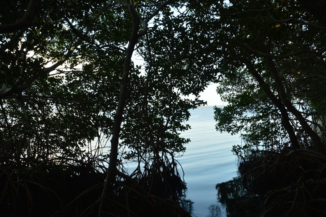
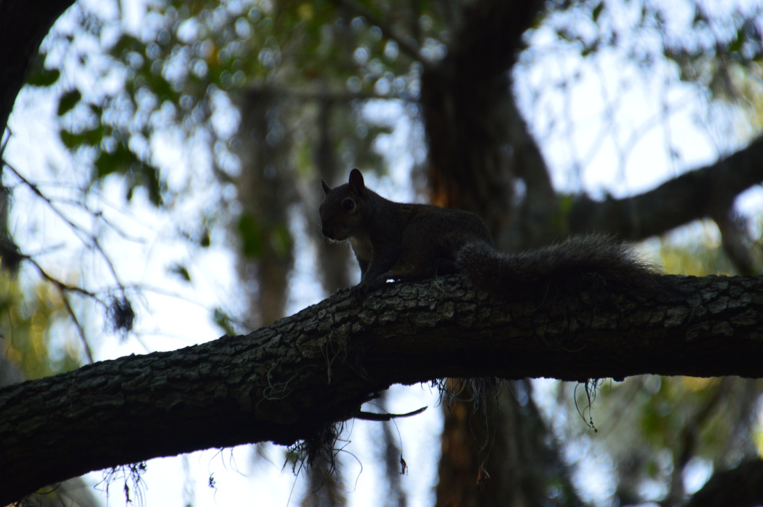
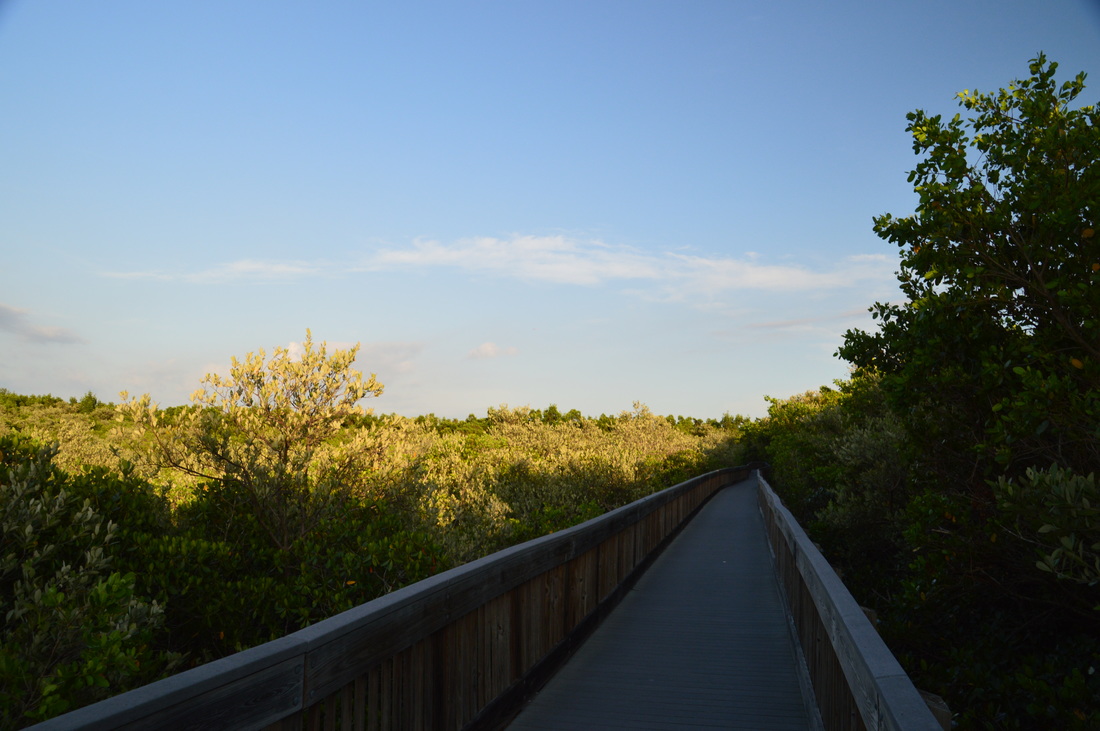
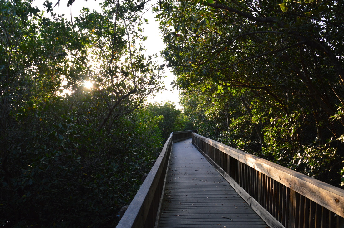
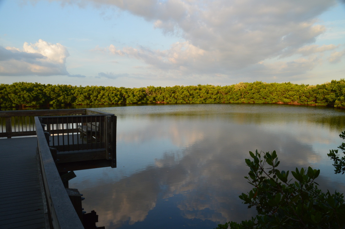
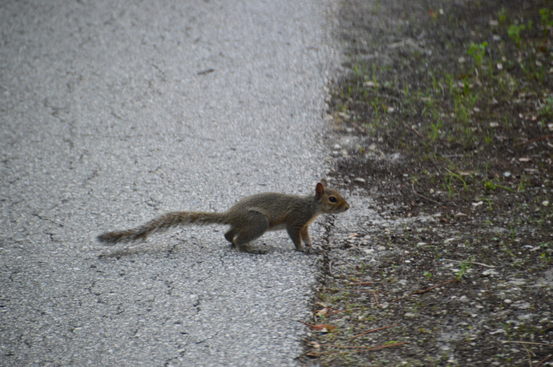
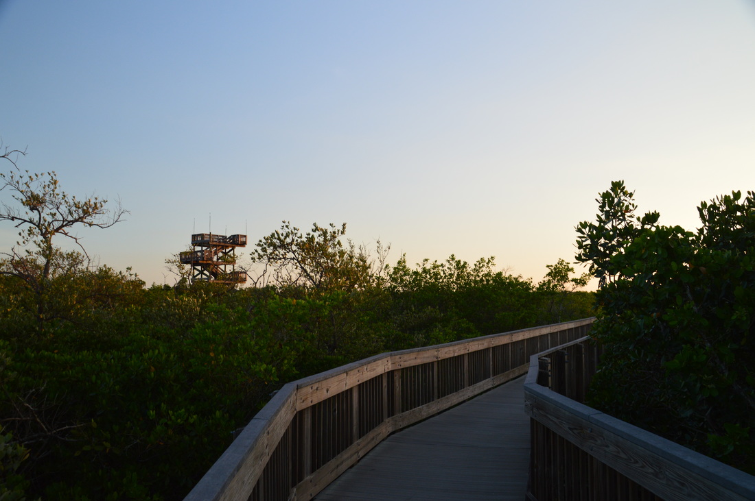
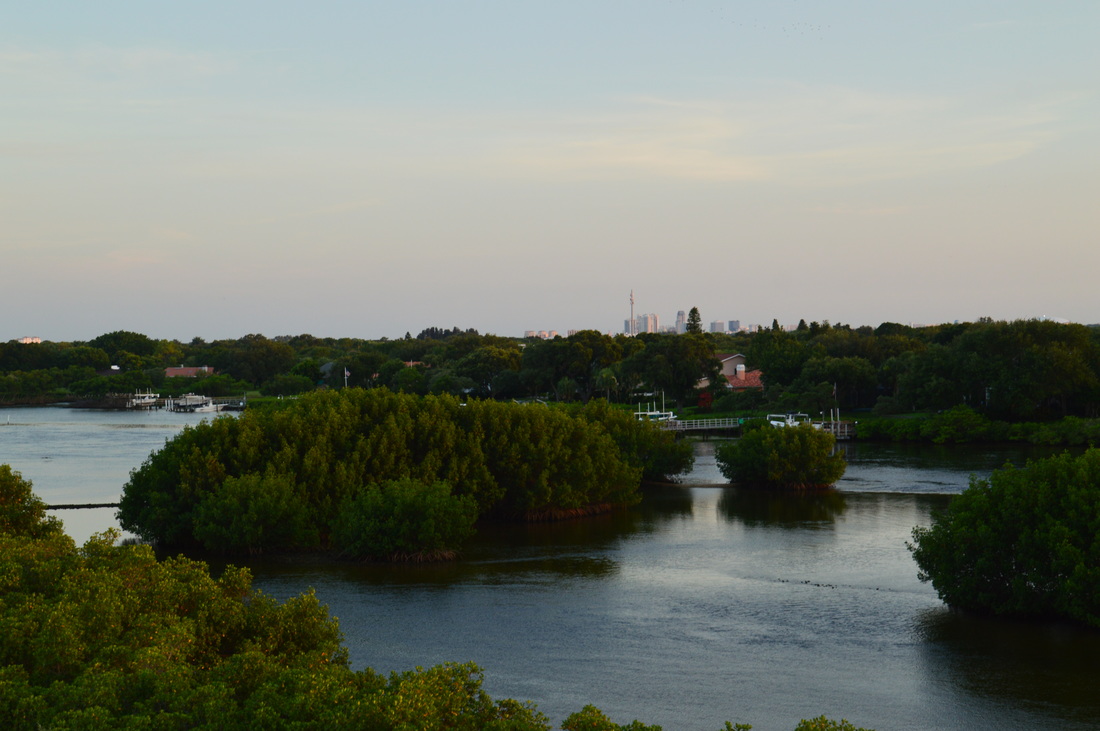
From Lookout Point, retrace your steps along the Lookout Point Trail, but this time, don't turn onto the Boy Scout Trail connector. Instead, continue south on the Lookout Point Trail, in the direction that the sign "<--- Center <--- Boardwalk" points you. This part of the trail is entirely in the sunny uplands, where palmettos and moss-draped live oaks abound. For some reason, the squirrels here were not as afraid of people as in many other places. I managed to get a good picture of one of them watching me from an oak limb. Passing a service road to the right, the Lookout Point Trail ends at Picnic Area #2 at 1.45 miles, where there is an intersection. Straight continues the paved Upland Trail, but the Bay Boardwalk (one of the preserve's two boardwalk systems) begins to the left. Both of the preserve's boardwalk systems are very impressive, as each one is more than a half-mile long! Turn left onto the Bay Boardwalk, which quickly rises well above the level of the mangrove swamps down below. At 1.65 miles, a branch of the boardwalk splits off towards the left in the direction of the bay observation area. Don't miss the side trip, as it leads to the best view of the bay on this hike (except for the observation tower, of course). The spur boardwalk ends at a large observation deck at 1.8 miles. Here, there is a great view of a portion of the bay's different mangrove channels twisting between the small islands on the western edge of Tampa Bay. The largest island, Benjamin Island, lies directly ahead of the observation deck. Looking to the right, you can see where the channel leads out into the main bay. When I was here, I found mullet jumping out of the water in incredible amounts. There was a splash every couple of seconds, and sometimes, there was more than one jumping at the same time. It is not known for sure why mullet have to jump out of the water, but one of the scientific guesses is that mullet can breathe in oxygen from the air, because they have a cavity for trapping air that other fish don't have. One downside of the Bay Boardwalk is that the boardwalk never actually passes along the bay itself, except for the observation area. Still, it's a worthy walk. From the observation area, return to the main boardwalk, and turn left to continue following it. At 2.1 miles, a small lake comes into view to the right. 
The Bay Boardwalk in Weedon Island Preserve.
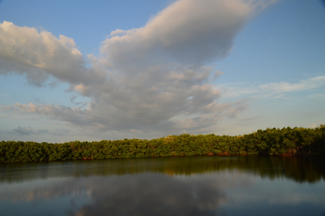
At 2.2 miles, reach an observation deck with views of the small lake. On this day, small clouds drifting overhead, the rays and reflections of the evening sun, and the still surface of the water made for a good photo opportunity.
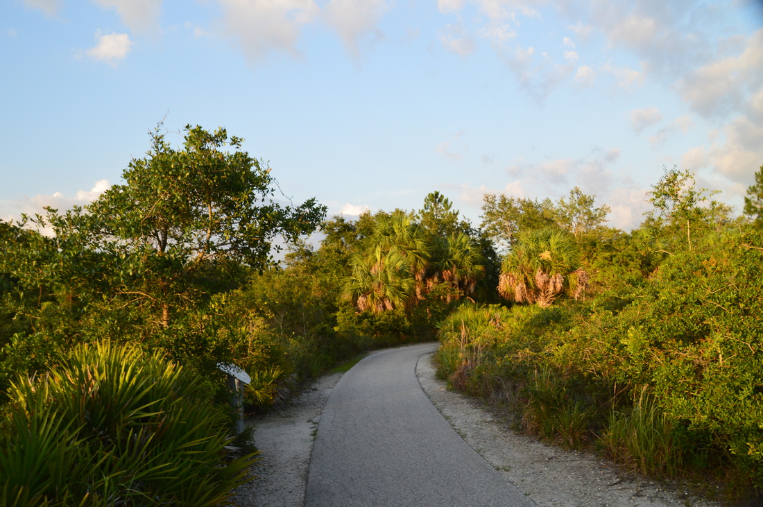
From the observation deck, continue on the main boardwalk. At 2.35 miles, the boardwalk ends at the Upland Trail. On your way back, you'll simply continue on the Upland Trail to the right to shortcut the boardwalk. But at the moment, turn left onto the paved path to continue towards the Tower Boardwalk. At 2.6 miles, reach the Weedon Island Cultural and Natural History Center. There is a large parking area to the right. This is the main trailhead in the park, but if I started here, then I would head in two different directions from the same parking area, and I personally do not like doing hikes like that. Slightly farther, at 2.65 miles, the Tower Boardwalk begins to the left. Here, there is a map of the entire trail system, as well as a sign about the Paul L. Getting Memorial Trail. Apparently, the entire trail system bears that name. Regardless, continue onto the boardwalk. At 2.75 miles, there is another lake with its own observation deck to the left, but this lake is smaller and not as photogenic as the one on the Bay Boardwalk, in my opinion. After this, the boardwalk gradually curves southwest, and at 2.9 miles, the spur boardwalk to the observation tower is on the left. The observation tower can be seen ahead. Turn left onto the side trail to the tower, for this is the main highlight of the entire hike. As the boardwalk approaches the tower, take note of the salterns to the right. Occasionally, a very high tide will engulf this area with salt water, causing the salterns to form. At 3.0 miles, the boardwalk ends at the observation tower. 
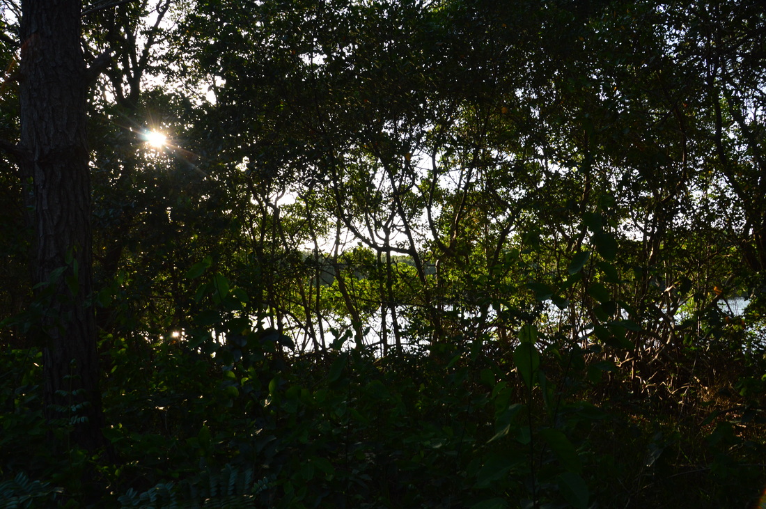
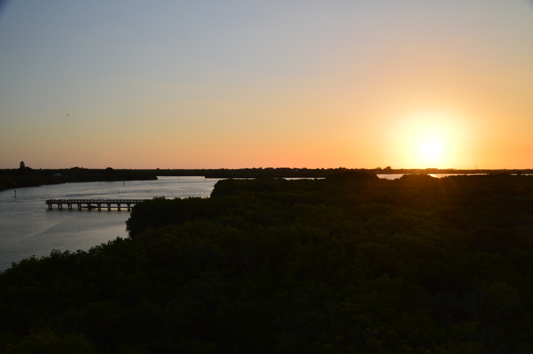
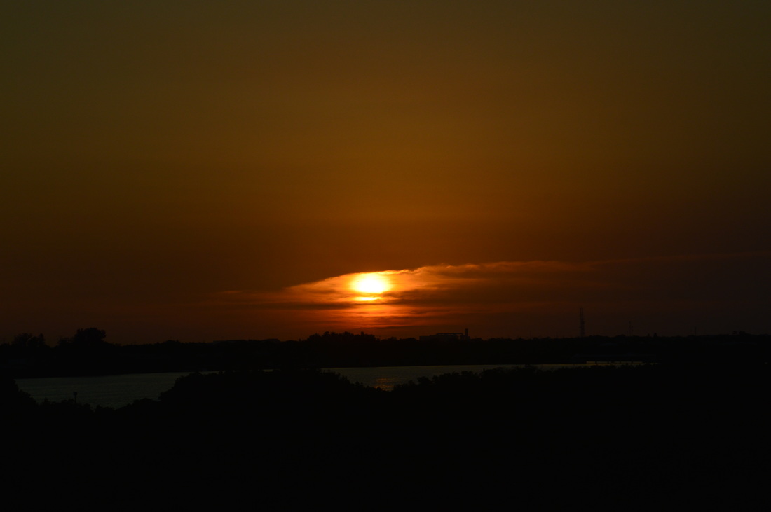
As seen from the observation tower, the sun sets over Riviera Bay.
Three flights of steps bring you to the top of the tower, and wow.... what a view! The panorama of the Riviera Bay area and of Weedon Island is unparalleled. To the west, the Weedon Island fishing pier is visible in Riviera Bay, and the farthest extent of the bay is near the end of the visibility range. To the north, vast woodlands stretch up to the Bartow Plant. The Tampa skyline is on the northeast horizon. To the east, more of Weedon Island is visible, and to the south, you can see all of Riviera Bay's southern extent, with the St. Petersburg skyline on the horizon and many residential buildings lining the shore of the bay. It was indeed hard for me to draw myself away from this spectacular vista, but time was pressing - it was almost sunset, and I needed to be back at the trailhead before dark.
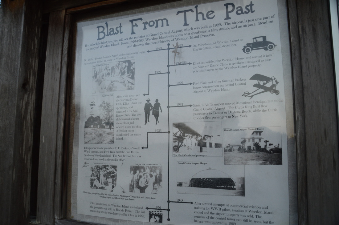
From the observation tower, return to the main boardwalk, and turn left. The boardwalk ends at 3.2 miles, giving way to the paved Upland Trail. At 3.35 miles, there is a historic site to the left: the remains of the Grand Central Airport, one of the several constructions that had been on Weedon Island in the mid-1900s. In addition to the airport, Weedon Island also had a film studio and a speakeasy! Aviation ended on Weedon Island in 1948, and in 1956, film production ended too, after which the property was sold to Florida Power. An informational kiosk at the spot describes in detail the history of Weedon Island. The rest of the way back is fairly simple, without any side trips. Continue on the Upland Trail all the way to its end at 3.8 miles. From here, continue on the Lookout Point Trail, and then, turn left onto the Boy Scout connector. At 4.05 miles, reach the junction with the Boy Scout Loop's south side. Turn left here. The trail soon leaves the uplands, and after crossing the Mound Bridge, it passes through a low spot with a field of ferns - a first for me in Florida. After this, crossing the Fern Bridge, the trail passes near Boy Scout Lake again, but in the gathering darkness, I did not see much of a view anywhere. The trail crosses over two more bridges - the Floating Bridge and South Bridge - before ending at Weedon Drive at 4.5 miles. Turn right onto the road, and walk a couple dozen yards to the trailhead parking area and your car, concluding the hike. Mileage
0.0 - Boy Scout Loop Trailhead
1.0 - Lookout Point and Picnic Area #3 1.4 - Picnic Area #2 1.8 - Bay observation deck on Bay Boardwalk 2.2 - Lake observation deck on Bay Boardwalk 2.6 - Weedon Island Cultural and Natural History Center 2.75 - Lake observation deck on Tower Boardwalk 3.0 - Observation tower 3.35 - Weedon Island historic site 4.5 - Boy Scout Loop Trailhead Variations
Bonus Stops
PicturesVideos
0 Comments
Leave a Reply. |
About MeMark Oleg Ozboyd Dear readers: I have invested a tremendous amount of time and effort in this website and the Georgia Waterfalls Database the past five years. All of the work that has gone in keeping these websites updated with my latest trip reports has almost been like a full-time job. This has not allowed me to pick up a paid job to save up money for college, and therefore, I I've had to take out loans. If you find the information on this website interesting, helpful, or time-saving, you can say "thanks" and help me out by clicking the button above and making a contribution. I will be very grateful for any amount of support you give, as all of it will apply toward my college tuition. Thank you!

Coming in 2022-2023?
Other Hiking WebsitesMiles HikedYear 1: 540.0 Miles
Year 2: 552.3 Miles Year 3: 518.4 Miles Year 4: 482.4 Miles Year 5: 259.9 Miles Archives
March 2021
Categories
All
|


 RSS Feed