
Anhingas. Egrets. Alligators. You'll see them all on this spectacular hike through a ranch-turned-preserve near the shores of Lake Hancock and just outside of the Lakeland city limits. Circle B Bar Reserve, renowned throughout Florida for its spectacular photo opportunities, attracts flocks of hikers every day to see the wildlife on its trails. The hike begins in a hammock with huge live oaks, before following the shore of Lake Hancock, where alligators shuffle into the water to the left and right. The hike then passes through wetlands where wading birds are in abundance (as well as more alligators) before passing an old windmill and returning to the trailhead. This hike occurred on Saturday, July 2nd, 2016. My plan was to make an outer loop through Circle B Bar Reserve's Trail System, as follows. First, I would take the Shady Oak Trail to Lake Hancock, where I would follow the Alligator Alley Trail past a lake observation area and along the shores of the lake. Then, after leaving the lake, I would take the Eagle Roost Trail along the southwest boundary of the preserve. There, I accidentally did the out and back along the Circle B Bar Connector Trail, although I didn't regret it. Lastly, I would take the Wading Bird Way to the Windmill Whisper Trail, before using the Treefrog Trail to finish the hike.
Summary
R/T Length of Trail: 6.1 Miles
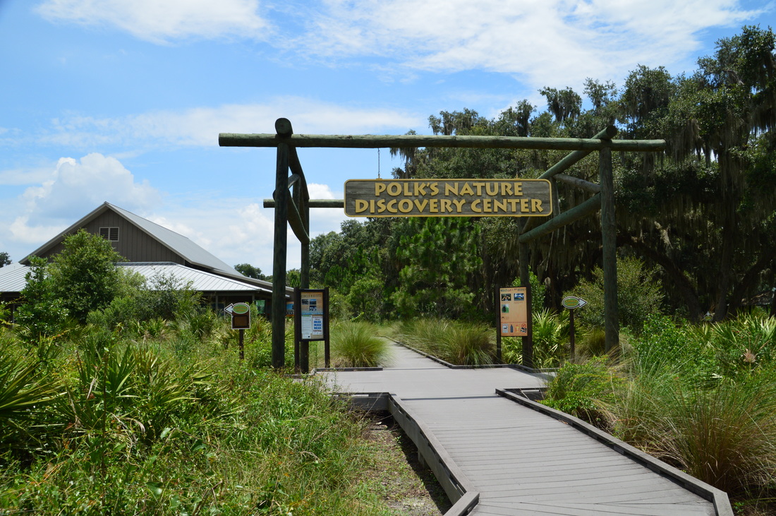
Duration of Hike: 2:30 Type of Hike: Loop Difficulty Rating: 2 out of 10 Total Elevation Gain: Minimal Pros: Excellent wildlife viewing opportunities Cons: None Points of Interest: Views of Lake Hancock; Marshes on Wading Bird way; Old windmill; Most of your interest on this hike will be occupied by the huge amounts of wildlife! Trail Blaze Color(s): None Best Season(s) to Hike: Year-round (winter could be better for birding and summer could be better for seeing alligators) Fees: None Beginning Point: Polk's Nature Discovery Center at Circle B Bar Reserve Directions from Lakeland, FL: From the intersection of Bartow Road (US Route 98) and Florida Avenue (FL Route 37) near downtown Lakeland, follow Bartow Road East/US 98 East for 5.3 miles. Just after passing under the Polk Parkway overpass, turn left onto Winter Lake Road (FL Route 540). Follow this road eastward for 2.1 miles, when you will see the entrance to Circle B Bar Reserve to your right. Turn right onto the entrance road, and follow it for 0.7 miles to the turnaround and parking area at the Nature Discovery Center. Map
Click here for more information and to download this trail map to view in Garmin Basecamp.
Details
I've heard a lot about the photography and wildlife-viewing opportunities at Circle B Bar Reserve. It seems to be one of the most popular destinations for hiking in central Florida or even all of Florida, and for good reason - for I have never seen so many birds anywhere in my life, and I also had my first alligator sighting on this hike. In fact, I had not one alligator sighting, but a good six! Unfortunately, the alligators that were in land sped away in the blink of a second, not allowing any photo opportunities, and the alligators in water were not as well-seen (although I did take a picture of one).
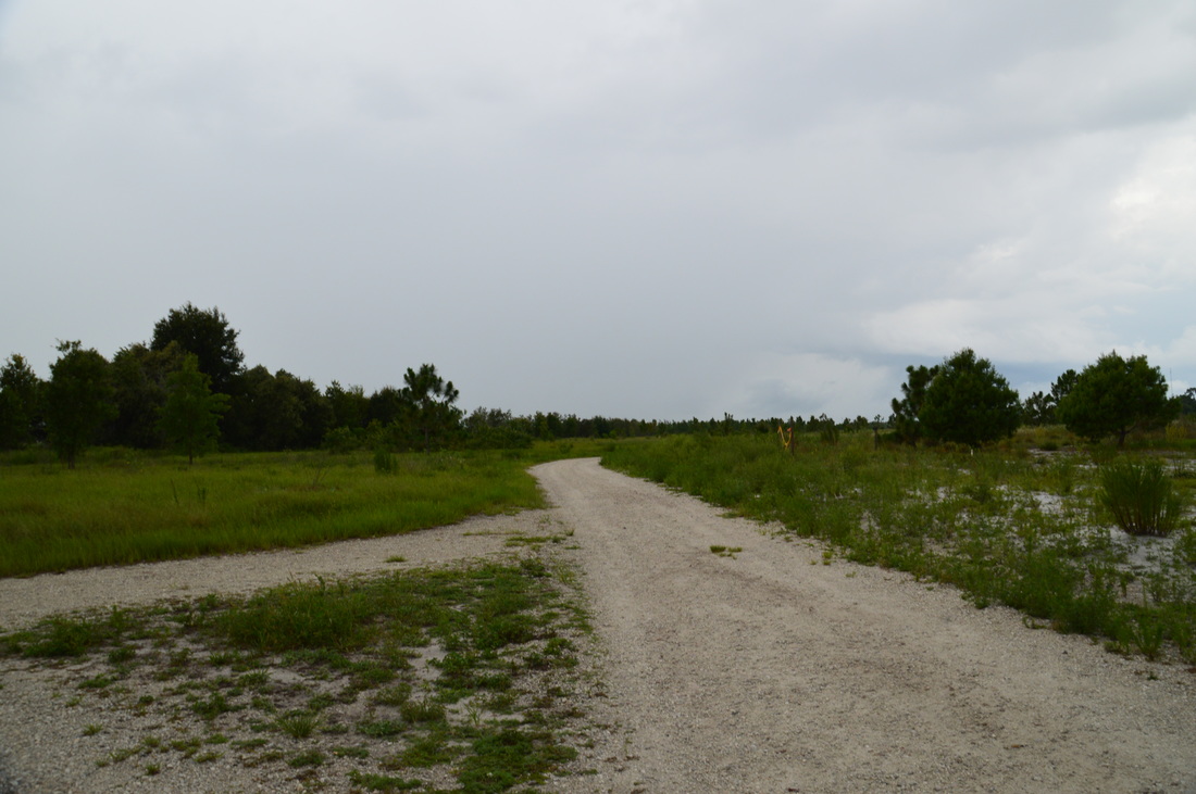
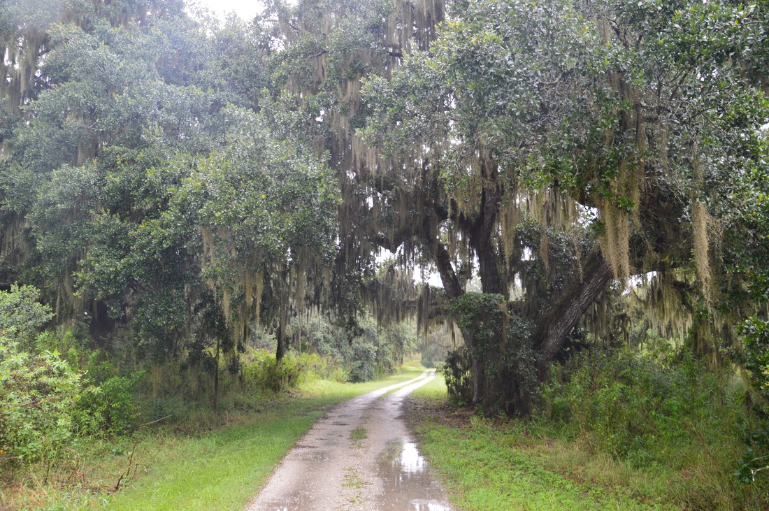
Most people begin their hike at the Nature Discovery Center and pick one of the four trails that leave the parking area: Shady Oak Trail, Lost Bridge Trail, Heron Hideout Trail, or Treefrog Trail. My plan was to start with the Shady Oak Trail and end with the Treefrog Trail, although I regret not hiking the Lost Bridge Trail, which is just a slightly longer alternative to the Shady Oak Trail. From the parking area, walk on a boardwalk towards the Nature Discovery Center. To get to the trail system, however, don't go to the building - instead, turn right at a sign "Trail Maps -->" and "Trail Starts Here". This is the beginning of the Shady Oak Trail. The trail is named after the incredible live oak hammock that the path winds through. The oaks here are quite large, and the gigantic limbs with drooping Spanish moss is not a sight that you'll see on any hike. At first, the trail is paved, but it turns to a dirt and sand path shortly, where you can admire the oaks. 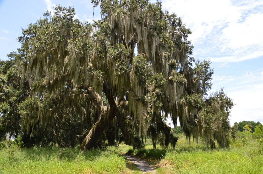
One of the massive live oaks overhanging the Shady Oak Trail.
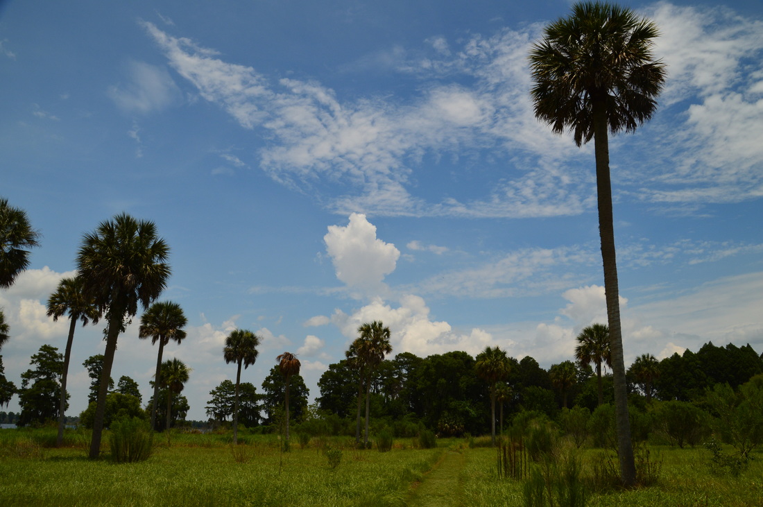
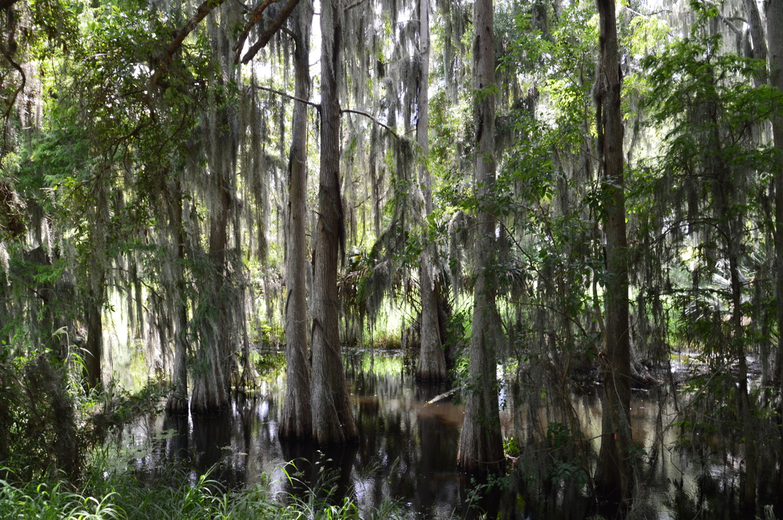
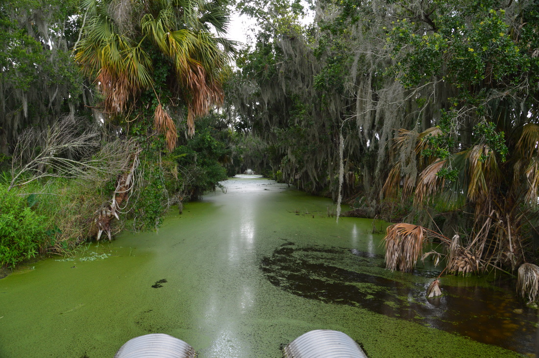
As the trail moves eastward toward Lake Hancock, the oak forest begins to thin, with grassy prairies opening up on either side, until the trail leaves all oaks behind and moves into one of the small prairies. Tall palms line the trail, and the first glimpse of the lake appears off to the left. At 0.65 miles, the Shady Oak Trail ends at a service road. here, the service road goes to the left back to the discovery center, while the Alligator Alley Trail begins diagonally to the right. Bear right onto the Alligator Alley Trail, entering lush lakeside forest full of palms, palmetto, and cypress trees. Shortly, the Alligator Alley Trail reaches the thickly wooded shore of Lake Hancock. Straight ahead is a SWFWMD (Southwest Florida Water Management District) water gauging station - its goal is to measure the water level in Lake Hancock.
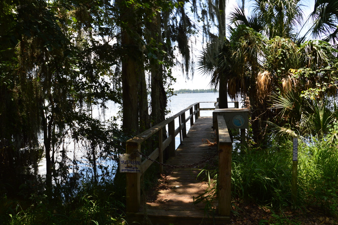
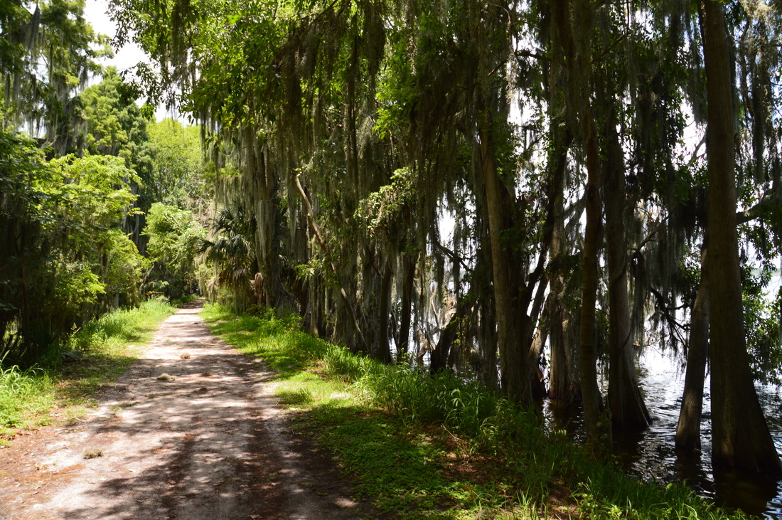
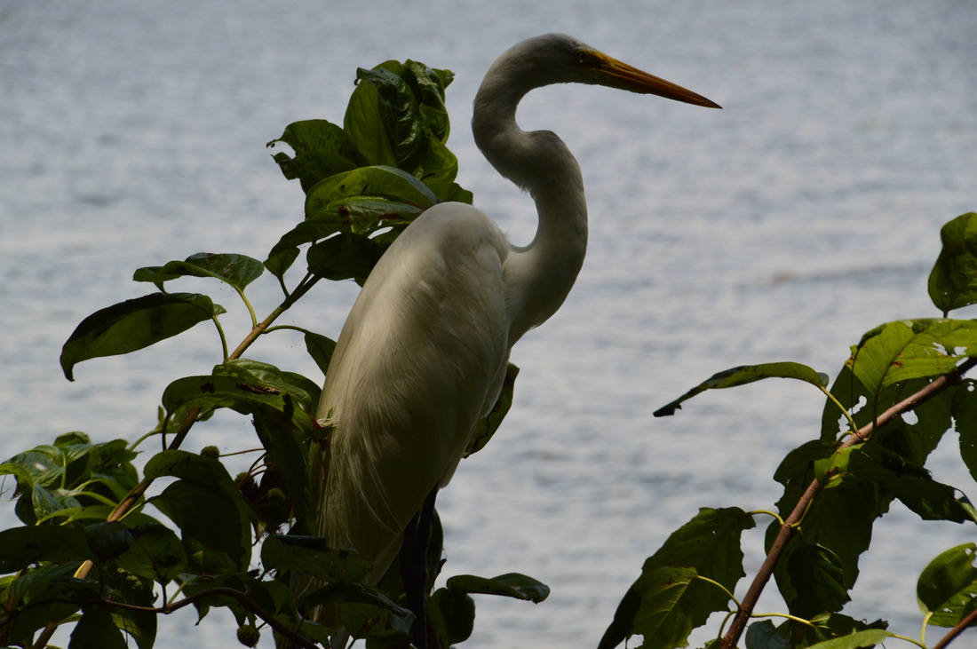
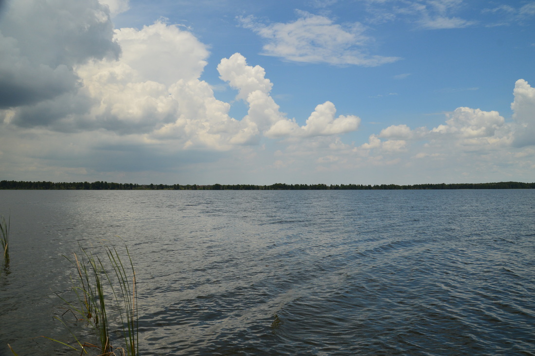
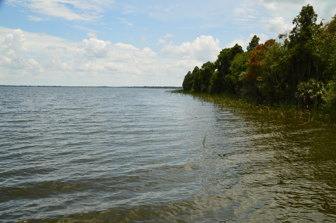
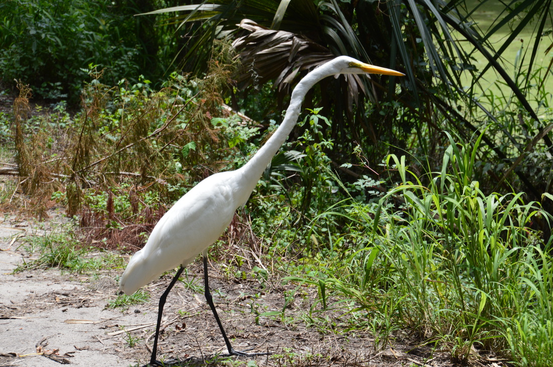
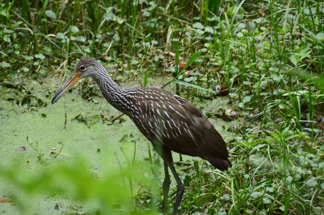
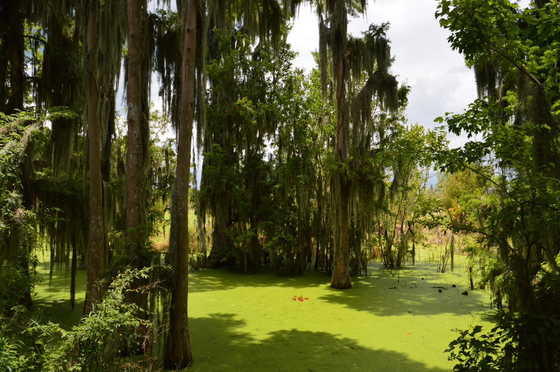
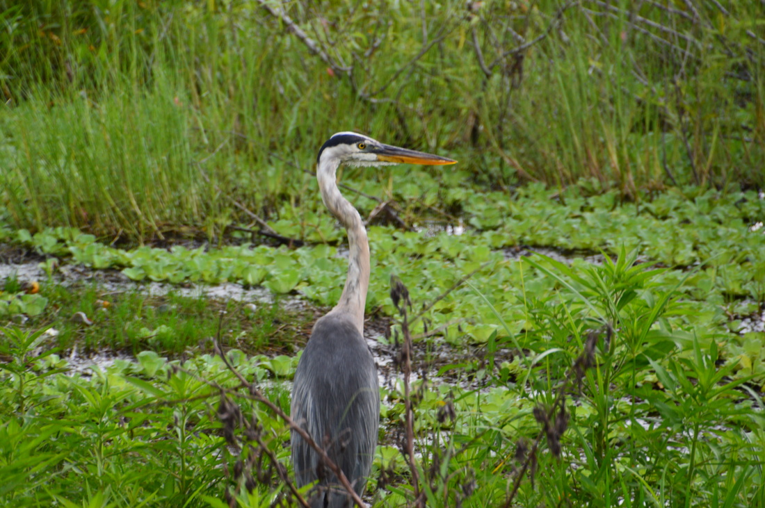
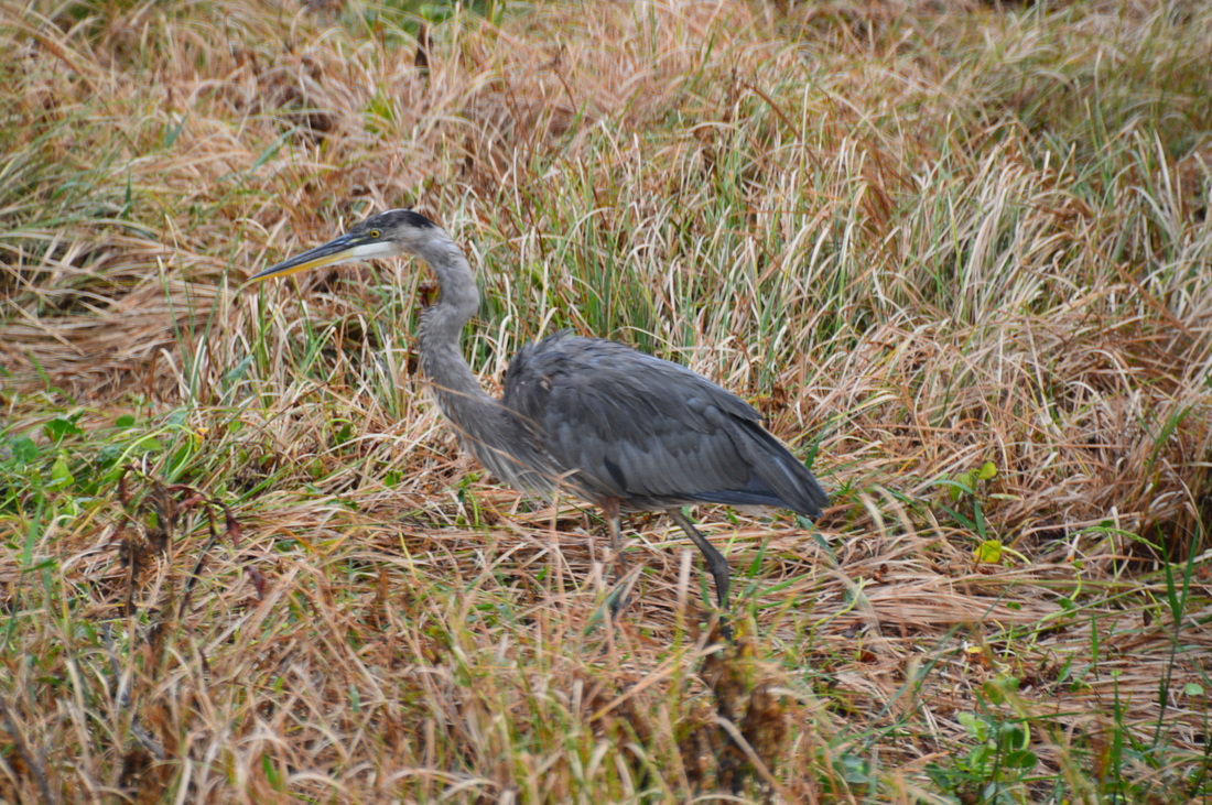
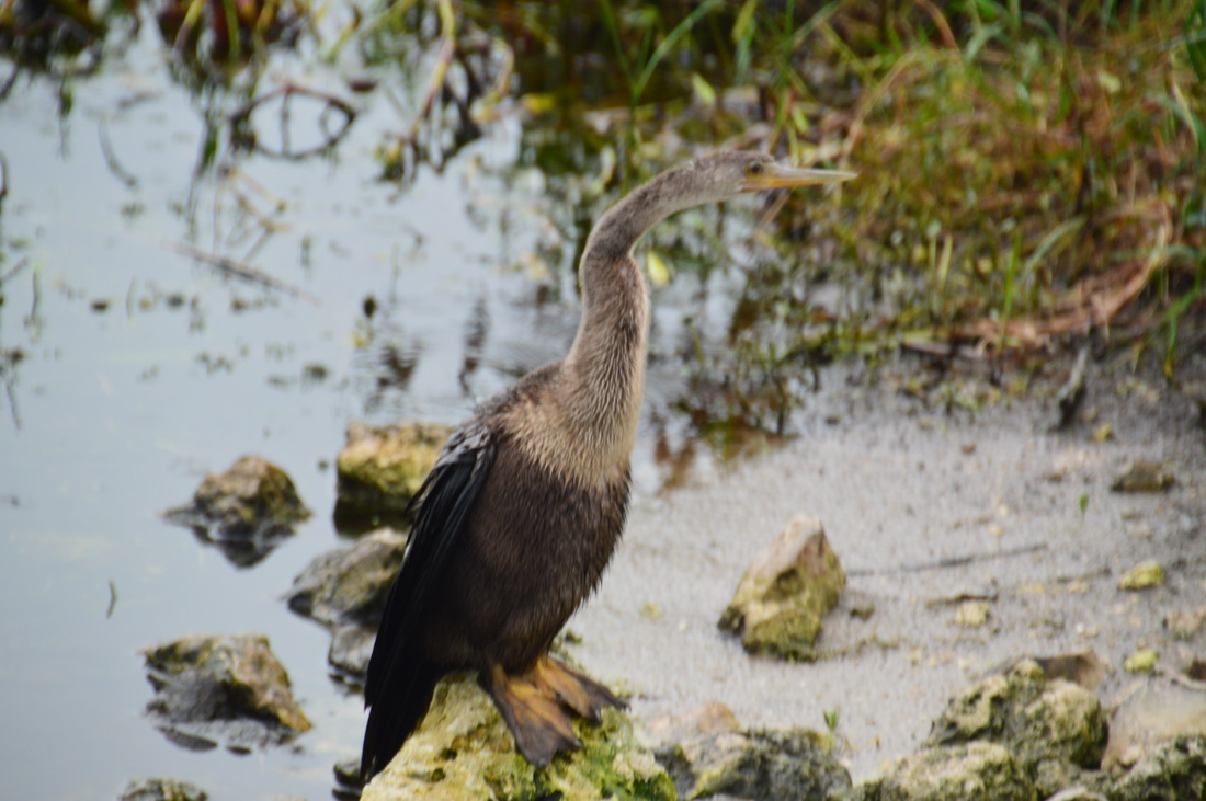
At the lake, turn right to continue following the Alligator Alley Trail, which now moves south along the lakeshore. A screen of cypress trees prevents any good views of the lake at the moment, but there is a scenic cypress swamp to the right. This is the beginning of the section of the hike where you may see a lot of birds of various types. I saw my first great egret of the day here hidden in a small tree by the side of the lake. At 0.9 miles, the Alligator Alley Trail reaches the main observation deck for Lake Hancock, positioned to the left. This observation deck is well out in the lake, providing a commanding view of the water and the cypress-lined shore. Watching from the observation deck, I noticed what looked like a snake sticking its head out of the water. Upon further examination, I noticed that the "thing" was moving. It was an anhinga! Anhingas can swim underwater, keeping only their neck above water. I soon noticed another anhinga perched on a tree, and I lost no time in taking its picture. As for alligators, I heard that there is a decent alligator population in the lake, although I didn't see any here. I did see alligators further down the trail. More on that later. From the observation deck, the Alligator Alley Trail continued along the lake. This was my favorite section of the hike. I have never seen so many birds in any one area as I did here. They were literally flying away in dozens to the left and right, while others were walking along or next to the trail. I got a shot of a vulture, another great egret, and a limpkin, who were all quietly standing near the trail and not taking heed to my movements. As I continued walking, I took notice of the beautiful cypress swamp to the right. And then, I saw it. An alligator was slowly crossing the trail, although by the time I had actually noticed, I could only see the tail slowly moving into the growth on the right side of the trail. By the time I reached the spot, I saw a trail left from the alligator, but there were no signs of life. At 1.4 miles, the trail reached a good view of Lake Hancock. This is the place where the trail leaves the lake and turns west-northwest. To the right, Spanish moss hung low over a marshy pool. 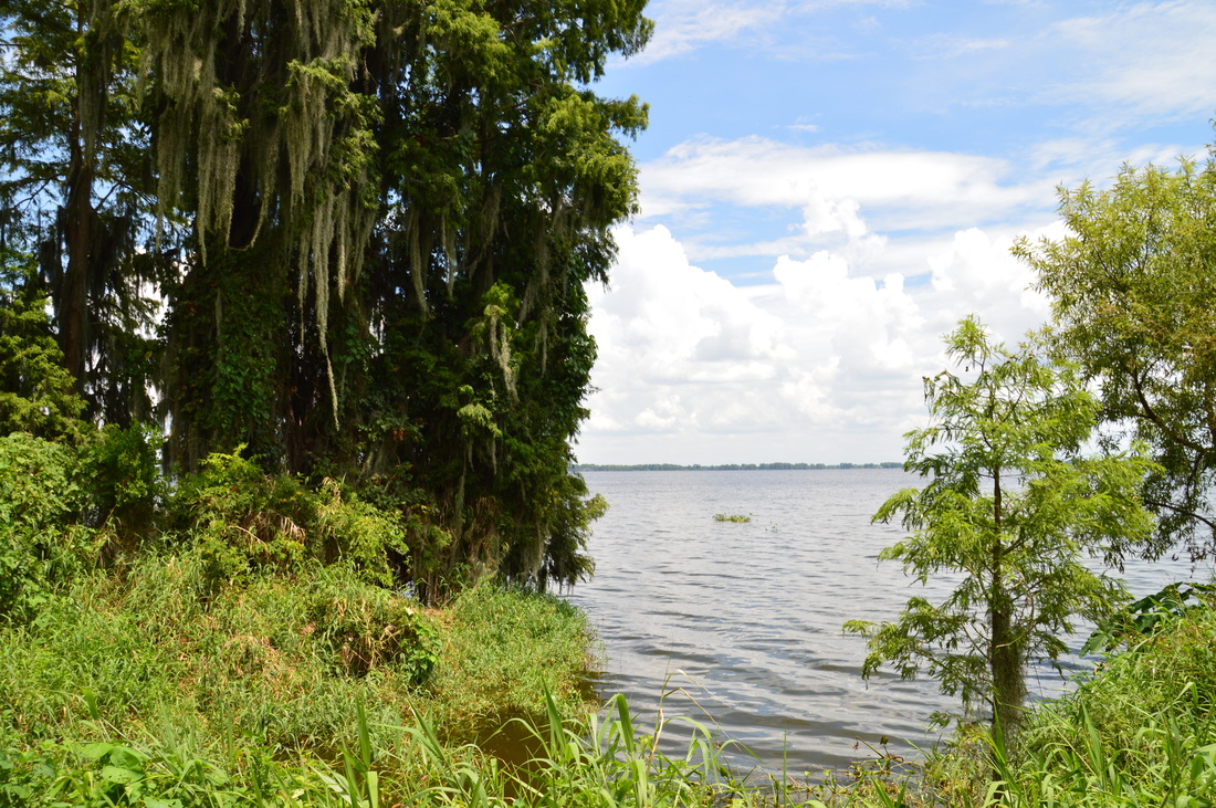
A view of Lake Hancock from the Alligator Alley Trail.
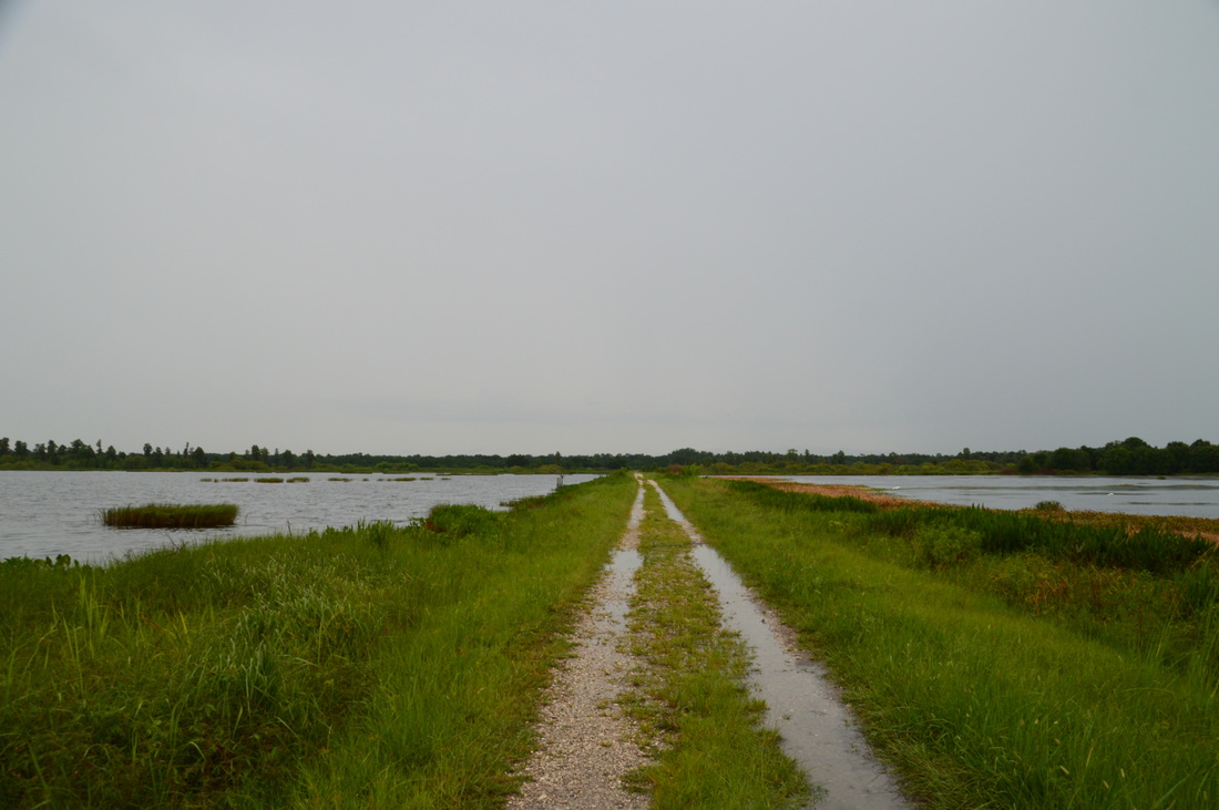
Upon leaving the lake, the trail began to follow a slightly elevated like through the heart of the marshes and swamps, which stretched out on either side of the trail. This is a fairly remote area, especially if there are no people. At one point, as I was walking up the dike, there was a sudden splash to my right and I only saw the tail of an alligator disappearing into the murky swamp water. Just a little bit farther, I was trying to figure out what was the dark object on the trail, when it suddenly sprang up and disappeared in the blink of an eye, making it the third alligator sighting of the day! So far, I wasn't able to snap any alligator pictures.
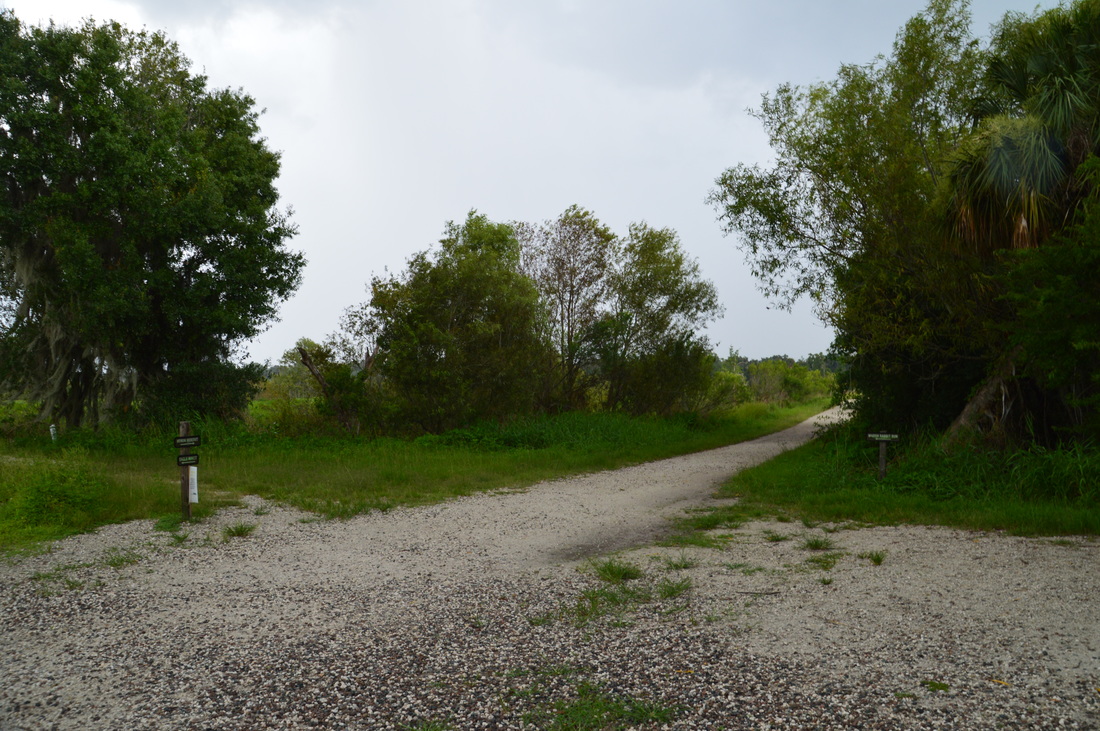
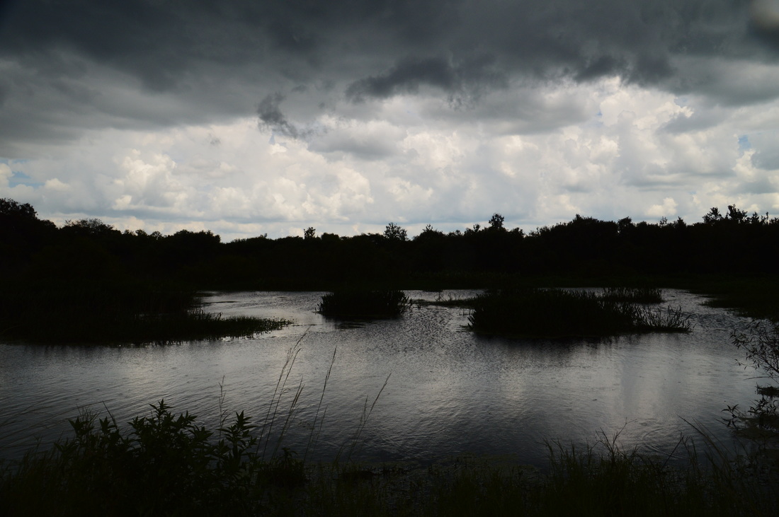
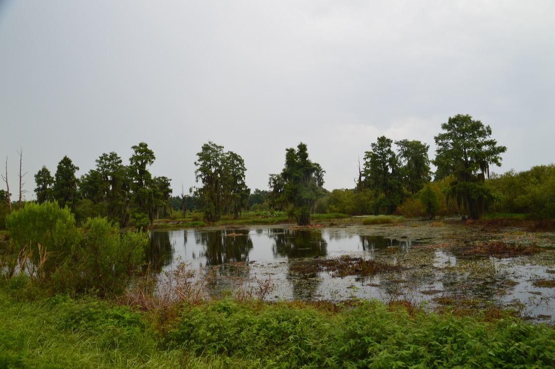
As I approached the four-way junction in the heart of the preserve, I heard approaching rumbles of thunder. This wasn't a good sign, for I knew that the upcoming section of the hike would be through open land (that was not too long ago a cattle ranch) and amidst wetlands and lagoons. Well, there was little option for escape, for I did not want to shortcut my hike in any way. The Alligator Alley Trail ends at an important four-way junction at 2 miles. This can be considered as the center point of the preserve. To the right, the Heron Hideout Trail is the shortest way back to the trailhead, although it misses some of the best scenery. Straight ahead, the Marsh Rabbit Run is a little-used connector trail that follows the lagoons and the Banana Creek Marsh. It leads to the Wading Bird Way. My plan was to do the outer loop of the trail system, so I turned left onto the Eagle Roost Trail, although actually, the Marsh Rabbit Run may have been more scenic. The Eagle Roost Trail first passed between two lagoons, and a culvert allowed the two to be connected. As the skies rapidly darkened, I snapped one quick shot of the wetlands before the rain started. Luckily, the storm hit during the least interesting part of the hike, so there was not that much to see or take pictures of. The Eagle Roost Trail is a wide gravel track that goes through a restoration area, with planted wiregrass and longleaf pines around the trail. At one point, I saw a construction to the left that appears to have served as a container for drinking water for the cattle that once roamed the ranch here. At 2.7 miles, the Eagle Roost Trail inconspicuously ends at a junction with the Circle B Bar Connector Trail and Wading Bird Way. With wind-blown raindrops hitting me straight in the face, I somehow missed the several signs that stated the different trails at this intersection, and I simply continued straight on what I later realized is the Circle B Bar Connector Trail. I had not planned to hike this connector trail, but it wasn't that bad of an extension. This trail moved westward towards the boundary of the reserve, and at about 3.25 miles, there was an interesting swamp to the right (it was still raining hard, so no picture). The swamp had rows of coniferous trees - perhaps a type of cypress, although they looked different. At the same time, the trail began following a fence to the left that marked the boundary of the preserve. A flock of vultures, having been perched on the fence, flew off upon my arrival. The connector trail ends at the park boundary at 3.5 miles. Here, there is a gate, and on the other side of the gate, the paved Fort Fraser Connector Trail continues on to the Fort Fraser Trail (a greenway) at US 98. However, since this is the end of the preserve, this is a good turnaround point. Return to the Wading Bird Way junction at 4.3 miles. Turn left onto the Wading Bird Way. The rain had tapered off by now, so I was able to take pictures again. The Wading Bird Way heads straight into the central wetland lagoon area, where wading birds are aplenty, as the name suggests. 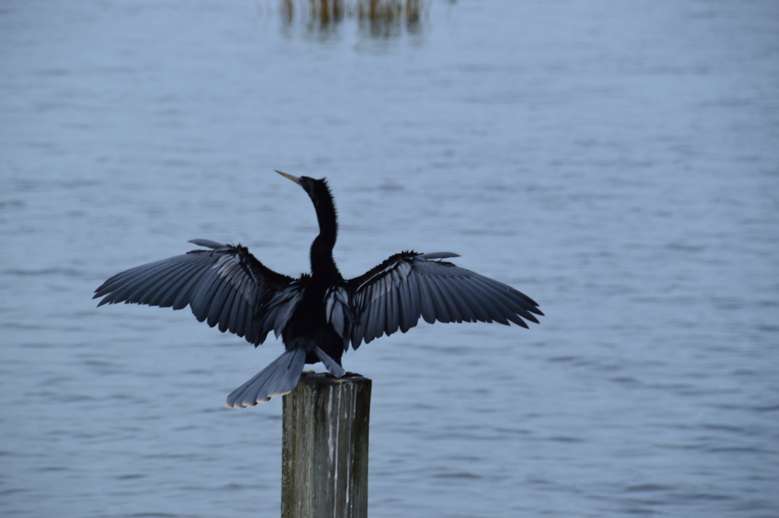
An anhinga dries its wings after an afternoon storm.
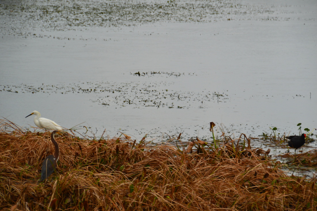
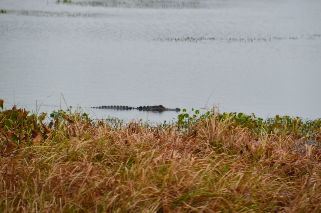
As I headed out onto the dike between the lagoons, there was great activity around. An anhinga, perched on a post, was drying its wings after the rain. A great blue heron (I think) was watching warily from the shore of the lagoon. In the lagoon on the trail's right, there was great alligator activity. At first, I saw one alligator, its scales showing up above water, slowly swimming across the lagoon. Then, I spotted two more alligators, one of them swimming very close to the shore. I was able to get a close-up shot of the portion of the alligator that was above water, including some of its scales and a part of its head.
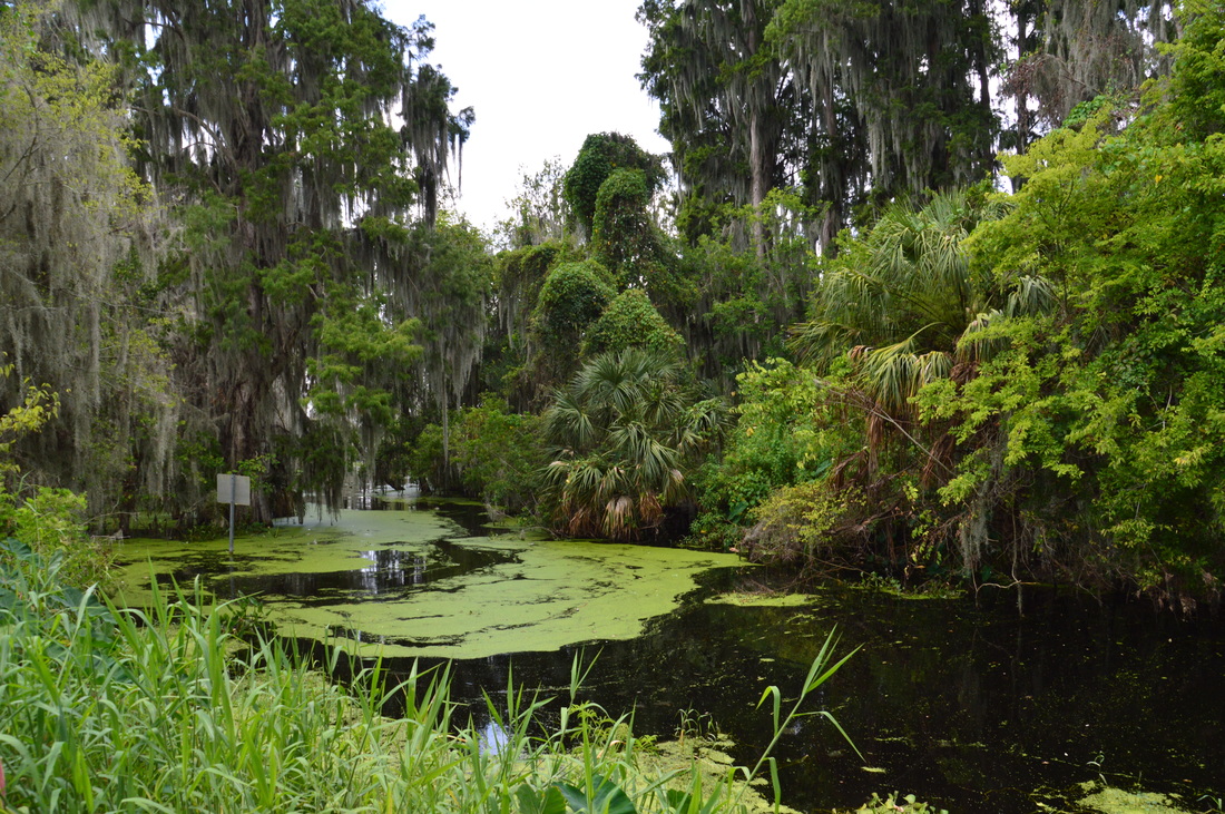
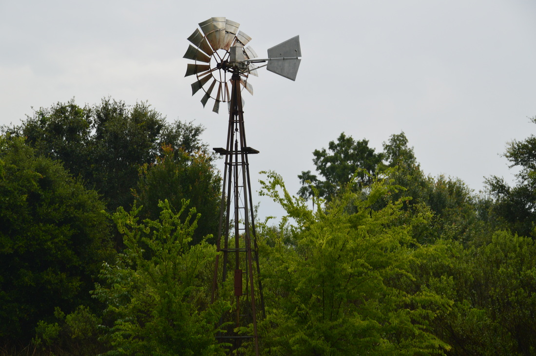
Crossing a culvert, the trail reached a photo blind at the edge of the right-hand side lagoon. This is a good spot to quietly try to focus on one of the numerous birds and alligators in the vicinity of the lagoon. There was just so much wildlife on this hike and in this spot especially. I've never quite seen anything like it. At 4.7 miles, the Marsh Rabbit Run, which you saw earlier, comes in from the right. Continue following the Wading Bird Way, which passes a photogenic swamp to the right. This is part of the Banana Creek Marsh. A raccoon darted across the trail far ahead, although it was way too far for any picture opportunity. At 5.1 miles, the Wading Bird Way ends. To the left, a service road leaves, while to the right, the Windmill Whisper Trail begins. There is an old windmill at this intersection, left over from the days of the cattle ranch, although I do not know the exact purpose that the windmill served. The Windmill Whisper Trail heads eastward back into the drier forest north of the swamps. Passing under some live oaks, the trail ends at the northern trailhead in the reserve at 5.4 miles. Here, bear right and start the Treefrog Trail, which leads to the Nature Discovery Center. I was not taking any more pictures here, as I was hurrying to finish the hike in time to do my next hike of the day. The forest that the trail passes through is similar to the one encountered throughout the Shady Oak Trail. There were many slightly wet areas and puddles on this trail after the day's rain. At 6.1 miles, the tree Frog Trail ends at a junction. The Lost Bridge Trail heads off to the left and passes through a swampy area to the north of the Nature Discovery Center. The Heron Hideout Trail turns right towards the center of the reserve, where you were earlier. The Nature Discovery Center and the parking area with your car lie straight ahead. Walk several dozen more yards to your car, concluding this hike. I rate this hike a "Best Hike", due to the incredible wildlife-viewing opportunities. There are not many places so diverse with all kinds of birds as this one. In my opinion, this is a must-do hike for anyone who lives in or travels to central Florida. This is also a great hike for birders and photographers. Mileage
0.0 - Polk's Nature Discovery Center
0.9 - Main observation deck with views of Lake Hancock 1.4 - Another good view of Lake Hancock 2.0 - Four-way junction in the center of the reserve 3.5 - End of the Circle B Bar Connector Trail at the reserve boundary 4.7 - Photo blind with views of lagoons that are teeming with wildlife 5.1 - Old windmill 5.4 - Northern trailhead 6.1 - Polk's Nature Discovery Center Variations
Bonus Stops
Another great hike is to the east of Lakeland, near the town of Lake Wales, in the town of Tiger Creek Preserve. Owned by The Nature Conservancy, much of the Tiger Creek trail system is maintained by the Florida Trail Association.
Pictures
0 Comments
Leave a Reply. |
About MeMark Oleg Ozboyd Dear readers: I have invested a tremendous amount of time and effort in this website and the Georgia Waterfalls Database the past five years. All of the work that has gone in keeping these websites updated with my latest trip reports has almost been like a full-time job. This has not allowed me to pick up a paid job to save up money for college, and therefore, I I've had to take out loans. If you find the information on this website interesting, helpful, or time-saving, you can say "thanks" and help me out by clicking the button above and making a contribution. I will be very grateful for any amount of support you give, as all of it will apply toward my college tuition. Thank you!

Coming in 2022-2023?
Other Hiking WebsitesMiles HikedYear 1: 540.0 Miles
Year 2: 552.3 Miles Year 3: 518.4 Miles Year 4: 482.4 Miles Year 5: 259.9 Miles Archives
March 2021
Categories
All
|


 RSS Feed